Caliente, NV 2004
In the Fall of 2003, I did a reconnaissance, with my father (Patrick Lindsay), of major “calderas” on the southern Nevada & Utah border. Later, in the spring of 2004, I took a group of students there to explore & tour the many geological wonders I found there.
My father, (Patrick Lindsay passed away in 2012), and I started our reconnaissance in Modena, Utah. Modena, (almost a ghost-town) is a former railroad town off of state Route 56 about 97 km west of Cedar City just a few kilometers east of the Utah/Nevada state line.
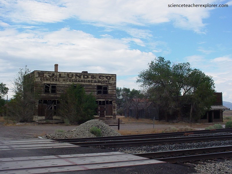
Modena was born in December of 1899 when tracks from the Utah and Nevada Railroad reached the area. Located west of the iron mines at Iron City, Utah, Modena grew into an important shipping and supply center, as well as a water stop for the steam engines of the railroad. Brigham Lund established a freighting business, serving the region and based in Modena. Pictured above, he opened a successful mercantile/hotel in the town, (still standing in 2003).
In 1903 a U.S. government Weather Station was established in the town. By 1905 the Los Angeles and Salt Lake City Railroad routed its line through Modena and brought more commerce to the town. Today Modena is largely abandoned or vacant, a few residents remain in the residential section of town, but the old business district is vacant.
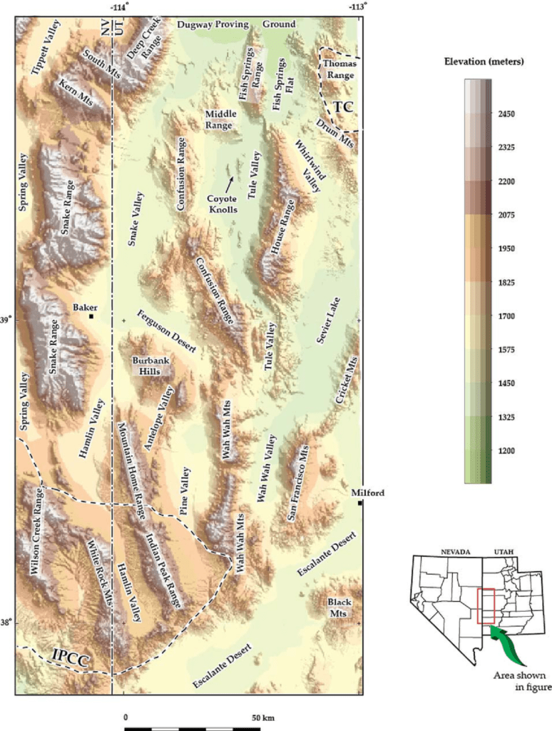
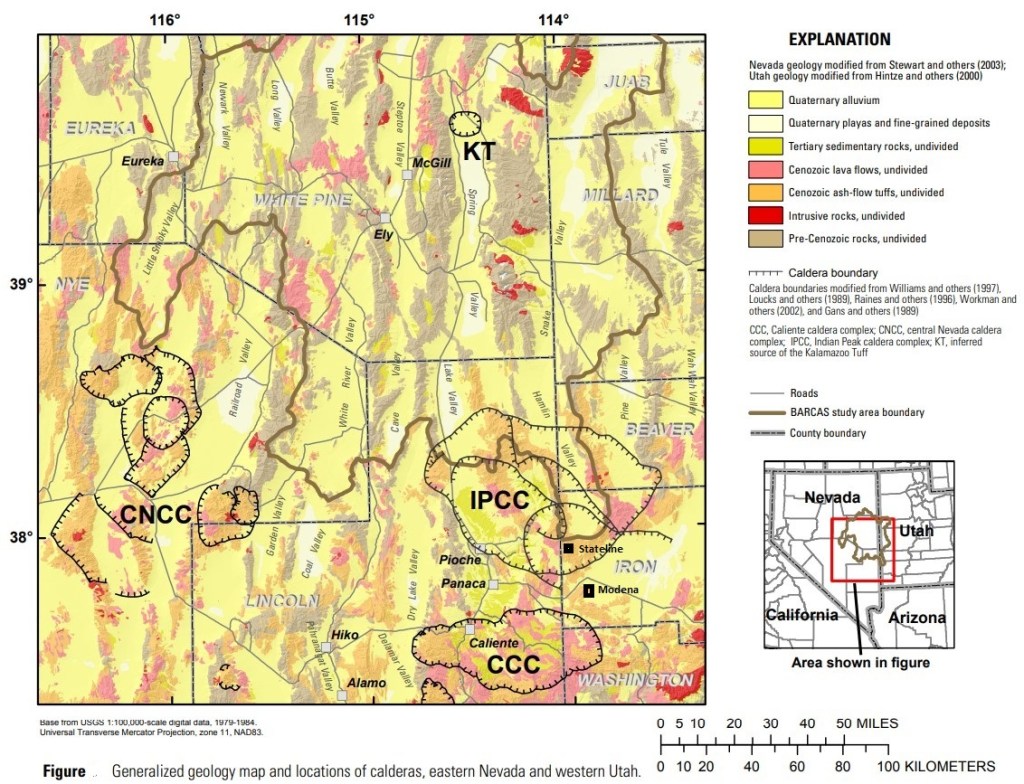
From Modena, dad and I headed north across state road 56 to the “Hamlin Valley”. This was ground zero for our objective, the “Indian Peak Caldera Complex”, (IPCC). The dirt road was passable for our 2WD dodge pickup.
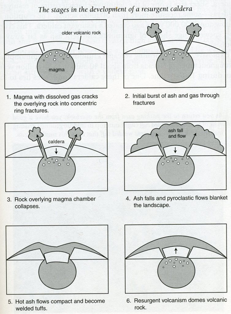
Calderas form when large volumes of magma are nearly instantaneously erupted from shallowly emplaced magma reservoirs in the form of a volcano. As an eruption of this type ensues, the associated magma reservoir is partially evacuated by the eruption of frothy magma, and the central block of roof rock that lay above the reservoir collapses downward along a series of faults. The resulting system of faults forms a generally circular system of normal faults that constitute the caldera’s structural margin.
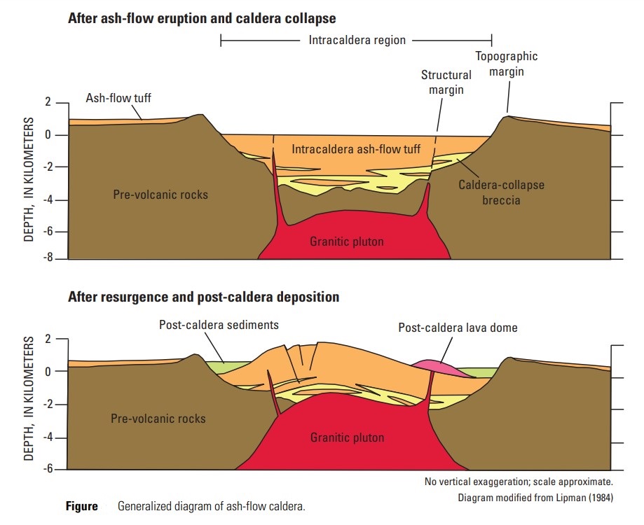
Imaged above, the outward retreat of the caldera boundary by subsequent land-sliding forms a second, more gently inclined concentric discontinuity above sedimentary layering, known as the topographic margin. Simultaneous with central collapse and landslide formation, the evolving central depression begins to be filled by the volcanic products derived from the ongoing eruption. This rapidly evolving intra-caldera environment is usually filled by a kilometers-thick accumulation of ash-flow tuff and interleaved landslide materials throughout the area, (imaged below).
The overlying discontinuity across the caldera’s topographic margin, between intra-caldera tuff and the country rock that host the caldera, can be at least as profound as that across the structural margin and several kilometers thick in the surrounding area. The Cenozoic geologic evolution of the area we were exploring is dominated by essentially calc-alkaline volcanic-rocks, especially ash-flow welded-tuffs, deposited during caldera-forming eruptions, (imaged below).
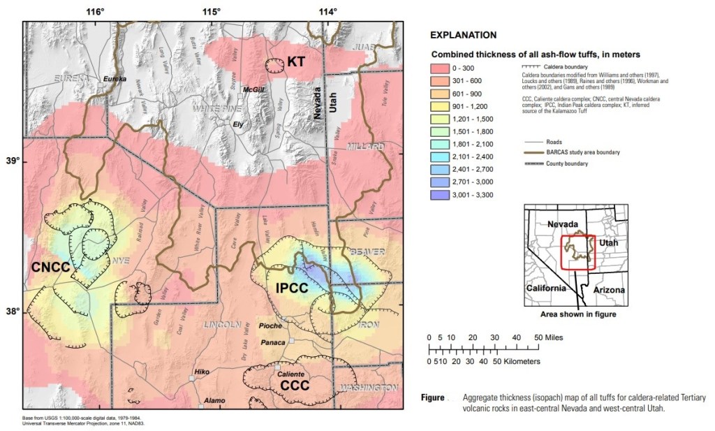
Imaged above, between about 30 and 25 million years ago, caldera-related eruptions from two major centers, the “Indian Peak Caldera Complex” and the “Central Nevada Caldera Complex”, formed a broad zone of voluminous upper Oligocene–lower Miocene volcanic rocks that extended across southern Nevada and Utah. The “Caliente Caldera Complex”, about 80 km to the south, erupted several thousand cubic kilometers of volcanic material between about 23 and 19 million years ago. A smaller volume, not important our exploration area, an ash-flow tuff formed called the Kalamazoo Tuff.
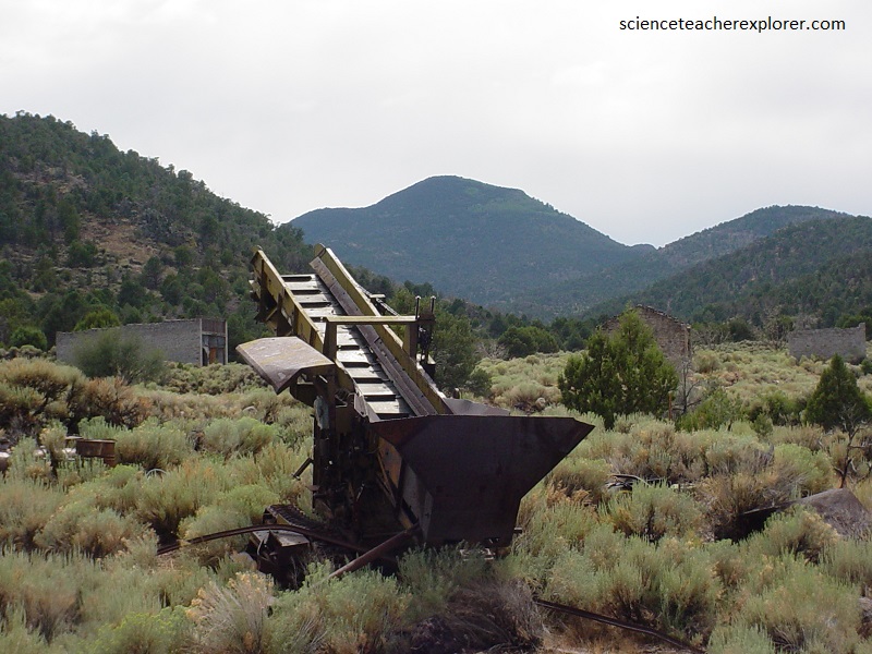
Any “Caldera Complex” is important to mining for valuable minerals such as gold, silver, and copper. This is why my father and I were exploring these areas.
Gold an Silver were discovered in Hamlin Valley, (on the Indian Peak Caldera Complex) in 1894 and soon a town sprung up called “Stateline”. In 1896 the Ophir mine was basically discovered and this touched off a small stampede to the area and other major outcroppings were found to contain paying quantities of both silver and gold. The major mines in the area included the Ophir, the Johnny, and Creole. The ore coming out of the Creole in 1899 was so rich that the ore dump was successfully panned by the company.
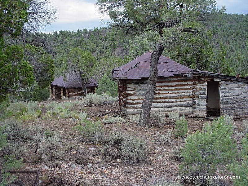
Pictured below, “Stateline” grew quickly from a small tent camp to a full fledged mining town. In 1896, the Intermountain Mining Review reported on that a new town site had been established and that town lots were being sold for $100 apiece. By the end of the year, it was reported that a post office had been established and over 180 men were working in the mines with more coming in daily.
Pictured above, enough families lived at “Stateline” in 1900 for a school to be started. “Stateline” flourished for several years as a mining town, complete with stores, hotels, school, a newspaper named the Stateline O’ Racle, and a medical doctor. The population was 118 in 1900 and peaked about 1903 with between 200 and 300 residents.
Ore values dropped in 1905 and most miners moved on. The names of many Stateline families filled the delinquent tax lists over the next few years. There were only 35 people in the Stateline precinct in 1910.
Extensive mining continued until about 1910 when many of the mines started closing because of a lack of high quality ore. Miners and business gradually drifted always until in 1918 there were only about18 individuals left in town carrying on small time mining in some of the lesser claims. Since about 1920 some mining has continued in the area with minor upswings in activity in the 1930s and 1940s. As late as early1980s limited mining was being done.
Our next point of interest was across the Utah/Nevada border to Caliente, Nevada. Heading west across the border on S.R. 56, we hit small farming community called Panaca, Nevada. We then turned south, on U.S. 93, and traveled few kilometers, to Caliente, Nevada.
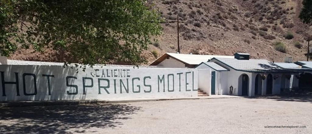
Pictured above, Caliente was founded in 1901 on the Culverwell Ranch. The town was initially given the name of “Calientes”, due to the hot springs present in the area, but later in the year a post office was erected and workers removed the “s” from the name of the town.
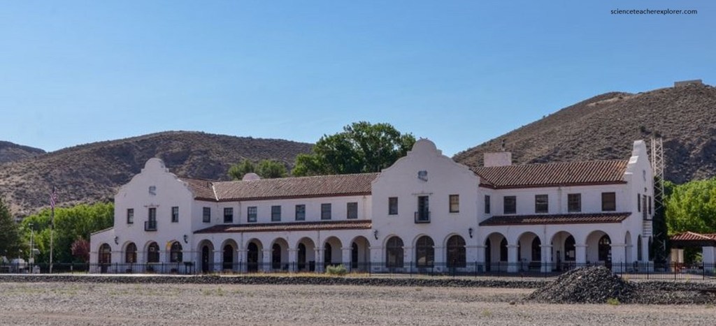
In 1905, the Union Pacific Railroad was completed, followed by the construction of the train depot in the style of Spanish mission architecture. The train depot, built in 1923, is now home to some city and Lincoln county offices and a museum that exhibits historical information. We were there, looking for any information on a lost family-relative name “Samuel Kershaw”. He seems to have settled in this area but they directed us to Kershaw Canyon, 3 km south of Caliente.
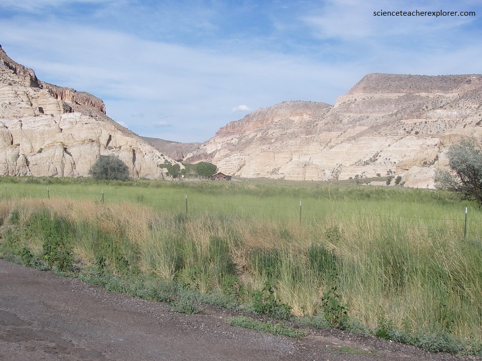
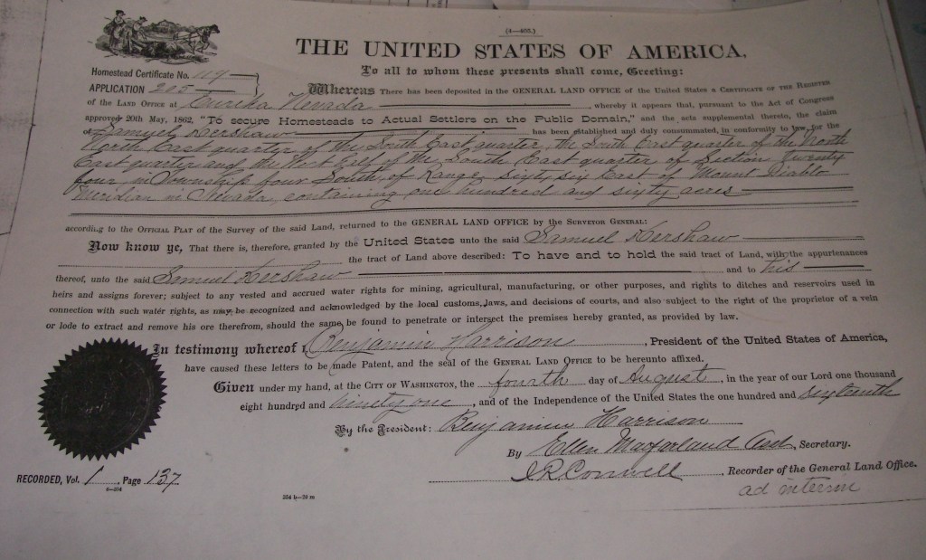
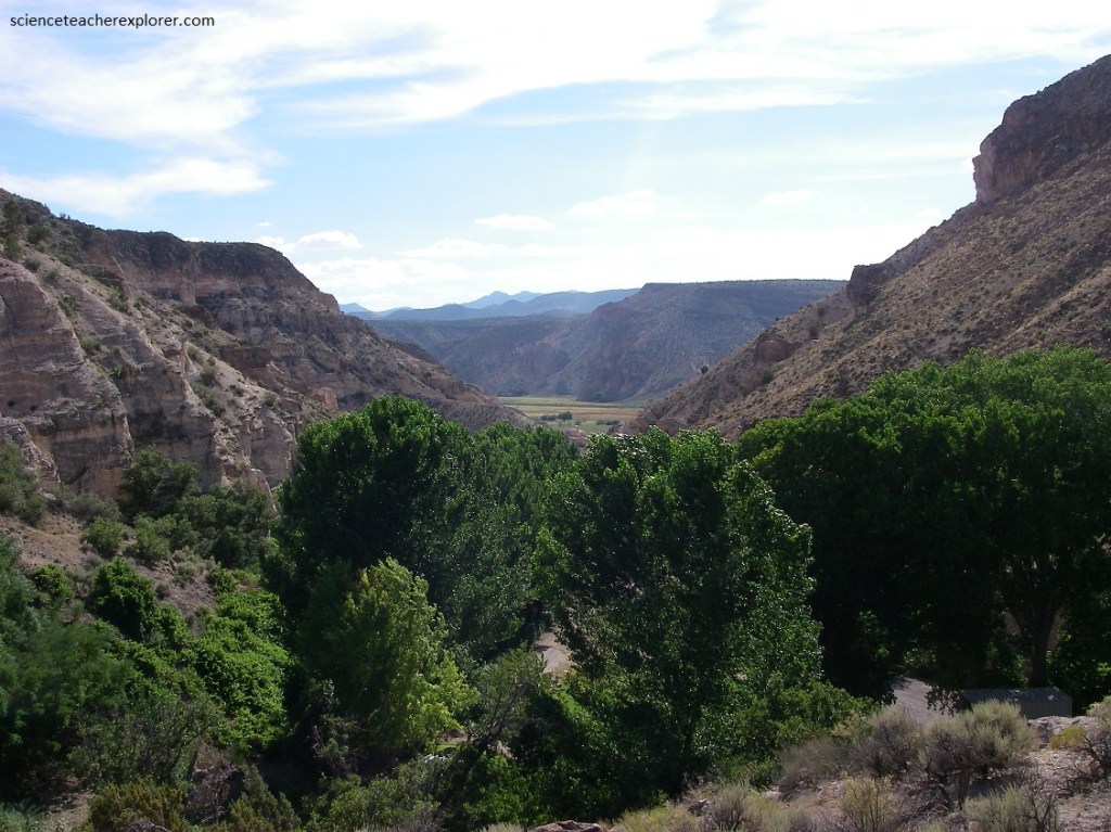
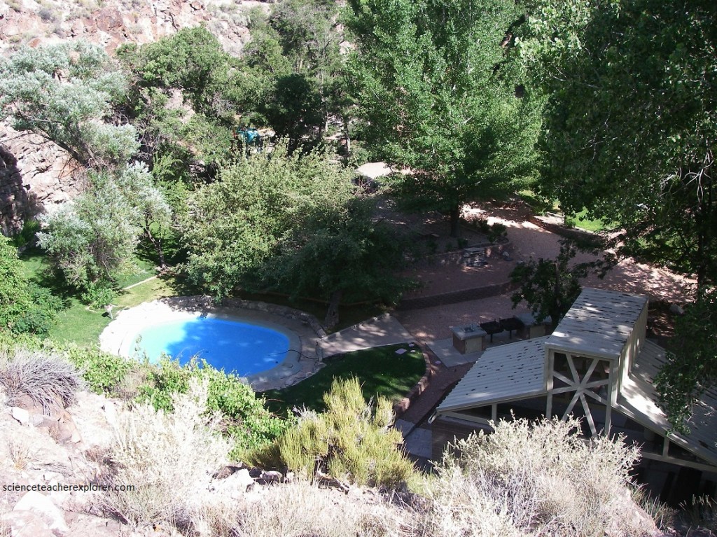
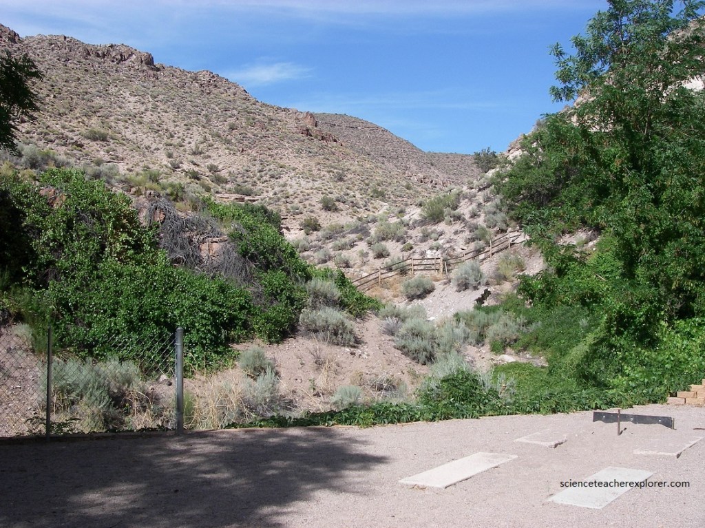
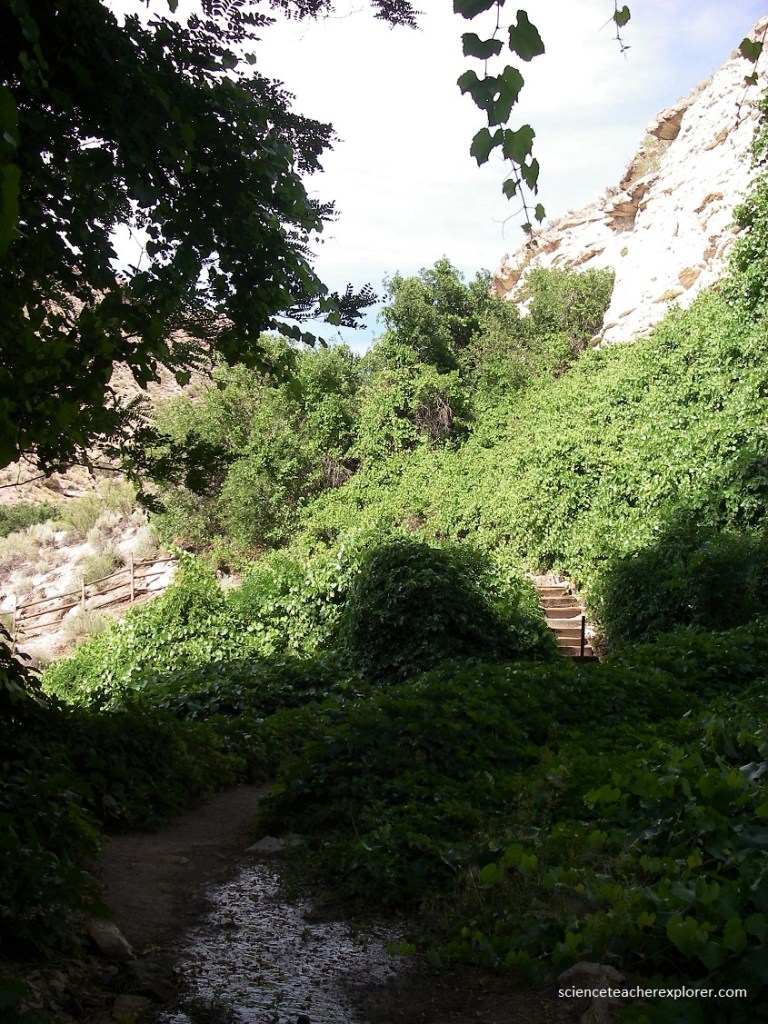
Apparently, Kershaw Canyon was named for Samuel and Hannah Kershaw who homesteaded the canyon in the 1870s. It is situated in a colorful, scenic canyon at the northern limit of Rainbow Canyon. The Kershaws’ cultivated a garden of grape vines, trees, and grassy lawn surrounding a spring-fed pond, providing a sharp contrast to the rugged landscape. It was an Oasis in the desert, (pictured above).
Pictured above, in 1904, the property was sold to James Ryan of Caliente, and in 1926, the Ryans donated the “Kershaw Gardens” as a public park. Soon after, the Civilian Conservation Corps developed picnic sites and a small wading pond. Finally, in 1935, the State created Kershaw-Ryan State Park.
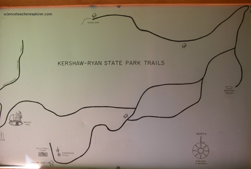
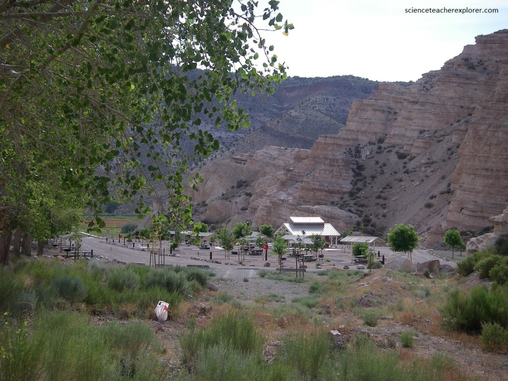
Imaged above, in 1935, the State created Kershaw-Ryan State Park. A campground, group ramada, water system, restrooms and trails were subsequently constructed by the Civilian Conservation Corps.
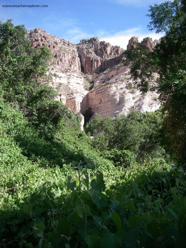
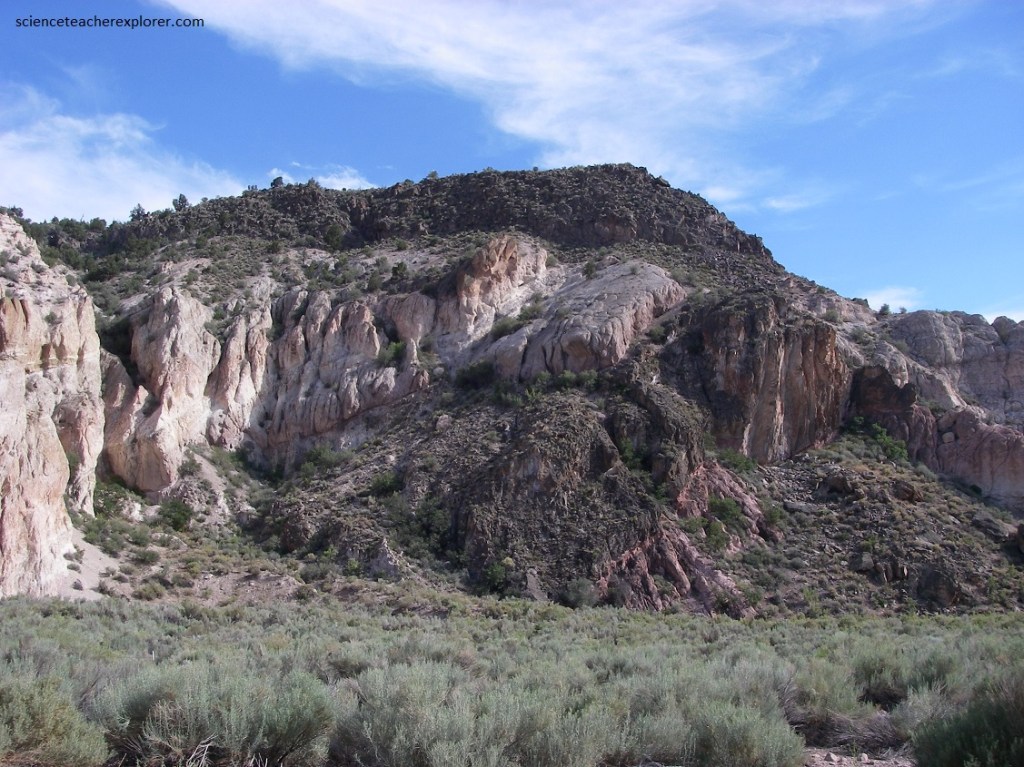
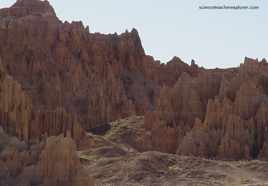
Pictured below, the deep canyons of Rainbow Canyon and Kershaw Canyon were created by water eroding across the terrain, carving deep channels into the volcanic-bedrock. As recently as 10,000 years ago, vast lakes engulfed the Meadow Valley Wash south of Rainbow Canyon. As the lakes drained and the land uplifted, the flowing water created deep canyons. In the Caliente area, this erosion removed more than 350 m of older sediments and gravels from the volcanic plateau that once existed.
Pictured below, the pinkish, crumbly rock unit that we see on the cliffs are the volcanic tuff mentioned before. It is a type of volcanic rock known as an ignimbrite, or ash-flow tuff, born of a particular violent style of volcanic eruption. The eruptions resemble the 1980 eruption at Mount St. Helens, but on a much grander scale, (2,000 times the volume).
The amount of gas within a batch of magma determines how explosive the eruption will be. When the magma is deep beneath the earth’s surface, the gas is compressed under a lot of pressure. As the magma rises toward the surface, the gas expands. If the magma contains a lot of gas, it erupts explosively, sending forth hot, glowing churning clouds of volcanic rock fragments and ash that can blanket a whole landscape. Magma that form ignimbrites are very gas-rick and hence, very explosive. The ignimbrites spread out laterally across the terrain at high speeds, so they tend to be thickest in pre-existing valleys, and form only a thin veneer on ridges. This contrasts with typical ash-fall deposits that fall like snow, covering the landscape with a similar thickness of ash everywhere.
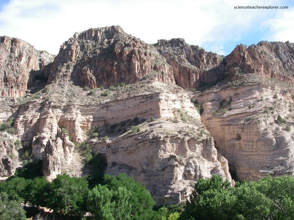
Pictured above, in these ignimbrites, hot pumice fragment clasts, flatten out under the weight of overlying volcanic deposits and weld together. This forms a dense, more coherent rock called welded tuff. The most densely welded ignimbrites consist exclusively of glass and crystals, The welded tuff at the summit here is a deep brown and very hard. The resulting banded or streaked texture exists only in ignimbrites and is a valuable feature used to identify this rock type.
Pictured above, the cliff face consists of a nonwelded basal portion that grades upward into a cliff of densely welded tuff. The rock is generally pinkish with many dark brown to black chunks supported in a finer matrix.
A mistaken idea sometimes surfaces that a caldera is simply a volcano that blew its top off. However, calderas form in a somewhat more complex process. Generally, a caldera-forming eruption consists of two distinct phases: (1) A single vent sends a column of ash high into the air getting larger and larger. Eventually the ash column becomes unstable and begins to collapse on itself. The ash and pumice spread out laterally as a pyroclastic flow. (2) So much material has erupted out of the magma chamber that its roof begins to cave in. The collapsed roof becomes the caldera floor. A number of vents open up along ring fractures that form the boundary of the caldera. These vents discharge more pyroclastic flows. Some of the pyroclastic flows pool deeply, while the others travel far beyond the caldera, spreading as layers of hot ash across the countryside.
Explosive, caldera-forming volcanic eruptions were commonplace throughout much of this portion of Nevada from 30-19 million years ago, during Tertiary time. With regular, violent eruptions like this one near Caliente, this would of been a truly inhospitable place during the Tertiary time.
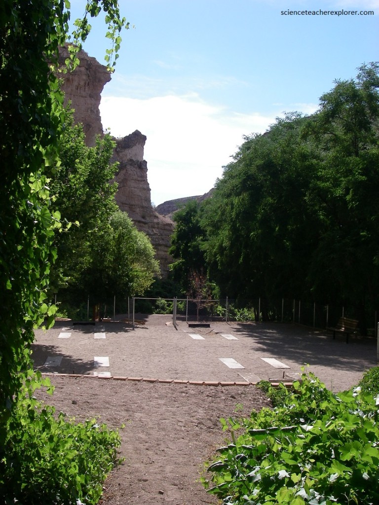
Pictured below, the Kershaw-Ryan State Park hosts four distinct plant communities. Riparian species like cottonwood, dogwood, willow, wild grape and reeds are found along the cool, canyon floor. The mountain brush community is found in isolated pockets on the escarpment and canyon floor. Serviceberry, snowberry and current are found here. Sagebrush, rabbitbrush, and Indian rice-grass make up the cool desert shrub community outside and above the canyon, (picture above).
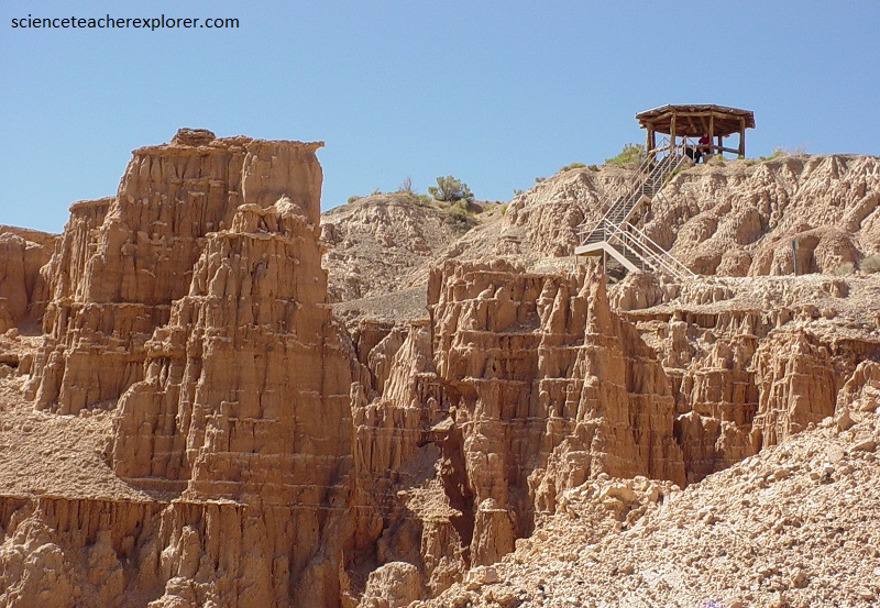
In the Fall of 2004, I did not take my students into Kershaw-Ryan State Park. Instead, we headed north, on U.S. 93, from Panaca, Nevada. I took them to the Cathedral Gorge State Park, where it lies 38 km north of Caliente, Nevada and 16 km south of Pioche, Nevada on U.S. 93.
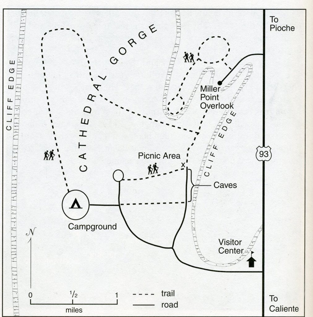
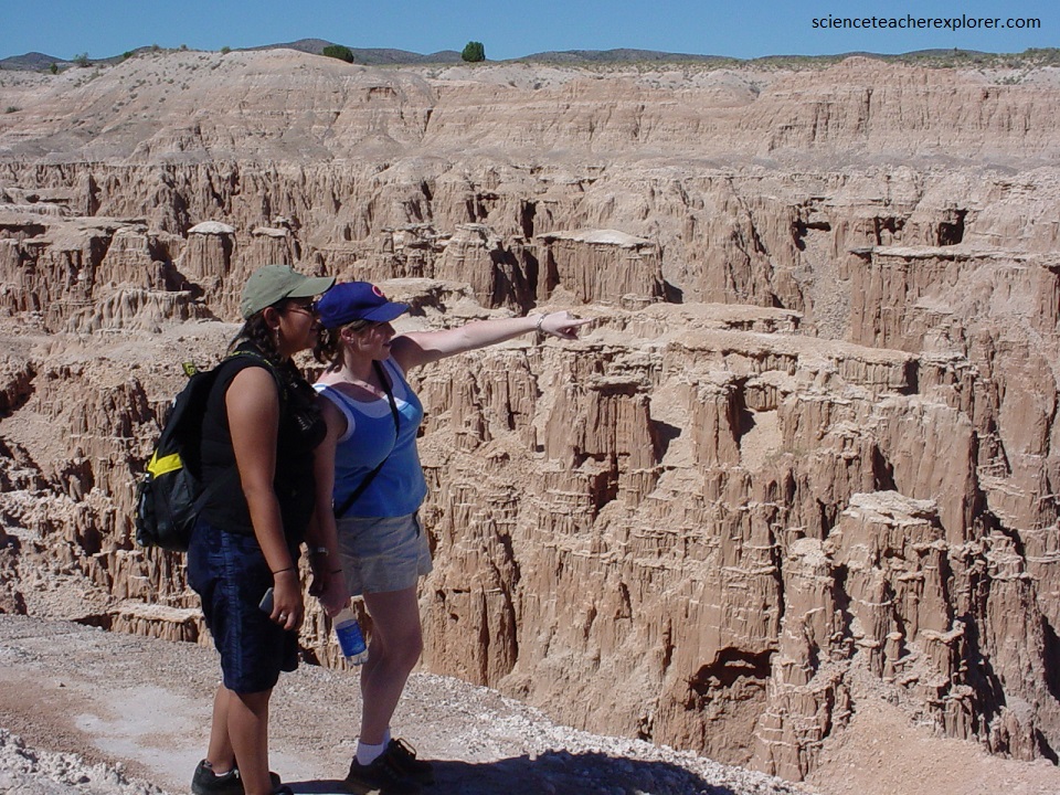
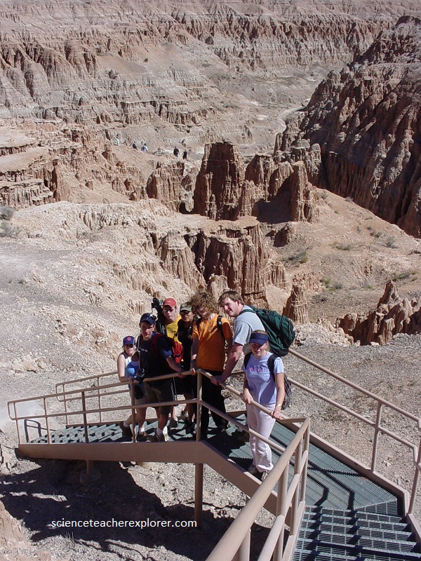
Cathedral Gorge’s story encompasses volcanism, structural upheaval, and water as both a depositional and erosional agent. Modern erosion shaped these badlands into sculpted cliffs, spires, and deeply incised canyons. Imaged above, Miller Point Overlook was a great place to start and get a panoramic view of Cathedral Gorge. From there, the trail is 1.6 km long and has very little elevation change. Stairs lead off of the overlook, which is also accessible by vehicles from U.S. 93. The trail took us south along the base of the cliff, and then moves into an incised canyon.
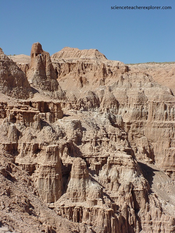
As mentioned above, during the middle Cenozoic time, (beginning about 40 million years ago), a wave of violent volcanism spread across this area, each eruption laying down a layer of ash hundreds of meters thick and covering thousand of square kilometers. For tens of millions of years, one explosive eruption followed the other, burying this landscape beneath fused ash, or ignimbrites. The source of the volcanic ash in this part of Nevada was the Caliente Caldera Complex, which lies just south of Cathedral Gorge.
Pictured above, about 17 million years ago, block faulting broke Nevada’s surface into the alternating mountains and valleys that characterize the Basin and Range province. One of the depressions this faulting created was Meadow Valley, (where Cathedral Gorge is located).
Pictured above, Meadow Valley became a closed depression about 5.3 million years ago and began to fill with water as a lake. Streams carried the eroded ignimbrite-sediment downslope and deposited it into the newly formed lake. The light tan cliffs, pictured below, are remnants of that lake.
Pictured above, the rock is very loosely cemented and crumbles easily. Some of the thin layers, (about 3 cm thick), are clearly more resistant to erosion than the other layers. These are lenses of limestone, (a carbonate rock found in the deeper sections of a freshwater lake).
Pictured below, the water level of this lake periodically changed during Pliocene time. As the level fell, streams flowed over lake deposits, carving channels and depositing coarse sand and gravel. The gravel crescents are cross sections of stream channels. When the lake level rose again, the lake deposited silt and clay on the channel, essentially encasing the stream gravel. [These channels at various elevations within the cliffs record sequences of change in lake levels.]
The underlying rock at Cathedral Gorge is the “Panaca formation”. The Panaca formation contains much montmorillonite clay, (a mineral derived from the alteration of volcanic ash). This type of clay mineral absorbs moisture from rainfall and swells. Upon drying, the clay surface crumbles and shrinks, leaving characteristic mud cracks behind. These cracks are natural pathways for water, and they further enhance erosion.
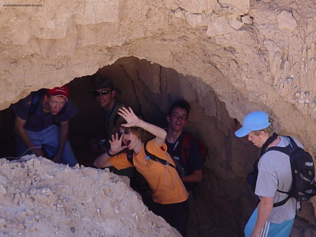
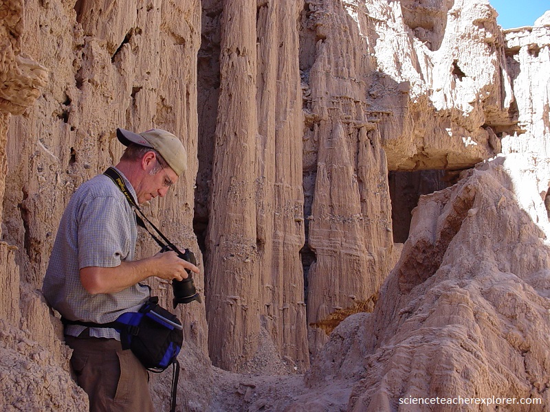
Pictured above, thousands of channels, ranging from very large to very small, dissect the cliffs. Run-off from heavy rains concentrates in these channels and carves away the soft rock forming cave-like tunnels. While they certainly are dark and cool, (like caves), they are deeply incised channels that are a couple meters deep and a meter wide.
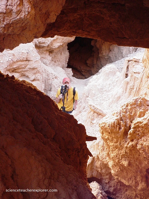
Pictured above, these small canyons serve as conduits for large quantities of sediment during storms. The upper end of each of these channels is a vertical wall, a cliff face over which water pours. At the base of each canyon’s headwall lies a plunge pool that falling water excavates (pictured below).
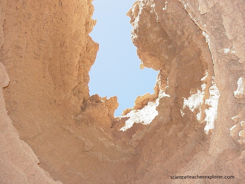
Pictured above, the streams that intermittently flow within these deeply incised channels often disappear into or reappear from holes in the floor or ceiling. This is a process called piping. Pictured above is a hole that is about a meter in diameter, through which water has flowed. Water percolating through the Panaca formation follows natural cracks of weakness and erodes sediment, carving small tunnels. Flowing water then enlarges the passageways, undermining portions of the rock. Eventually piping causes the wall to collapse, further exacerbating the already rapid erosion.
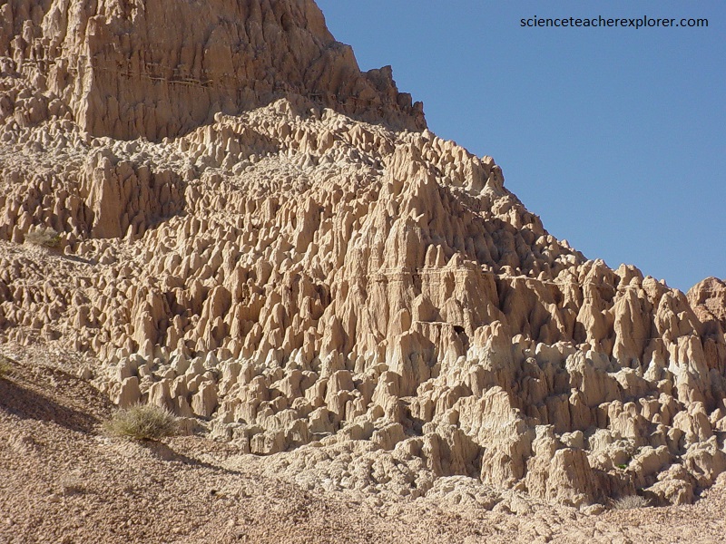
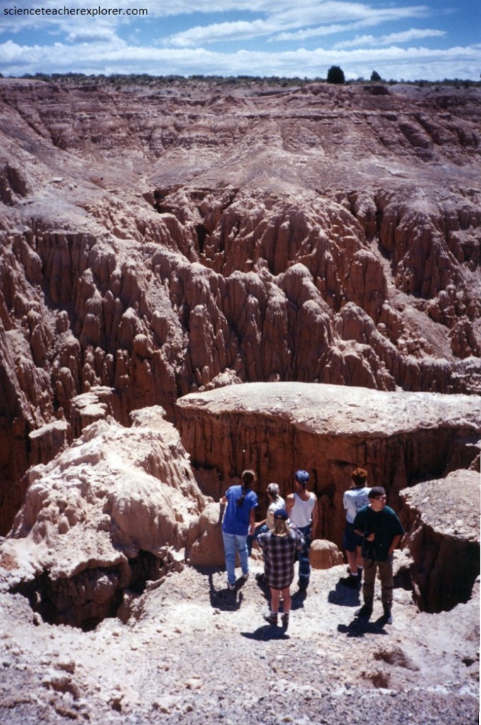
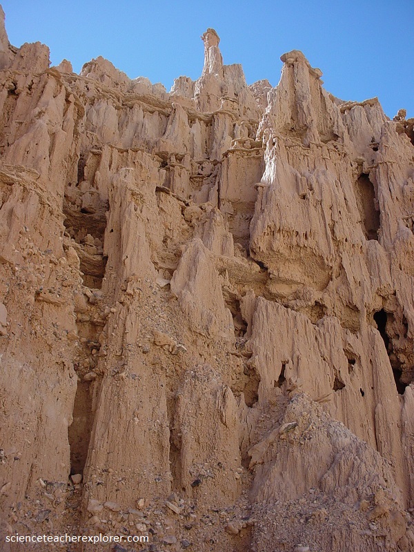
Picture above are a grouping of prominent spires or hoodoos. Some are tall with steep sides; others are smaller and more rounded. A layer of more resistant rock, such as limestone, shields the poorly cemented sedimentary layers beneath it and allows the column to stand alone as the rock around it wastes away.
Some newly form spires are still connected to the wall. Other spires stand alone, marking the former position of the wall before erosion removed it. Still others are no more than small mounds, remnants of tall towers that once stood here. Hoodoos waste away rapidly once the caprock erodes. The small mounds are dwindling remnants of once-tall spires.
Pictured above, badlands rim the valley where erosion eats away the poorly cemented Panaca lake deposits to rapidly for stabilizing vegetation to gain a toehold. Adjacent to the cliffs stand tall and short hoodoos that are remnants of older spires. Cathedral Gorge records a history of dynamic events: volcanism, lakes, channels, weathering and erosion.
We later left Cathedral Gorge and continued north on U.S. 93 to Pioche, Nevada, (pictured below).
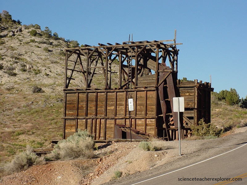
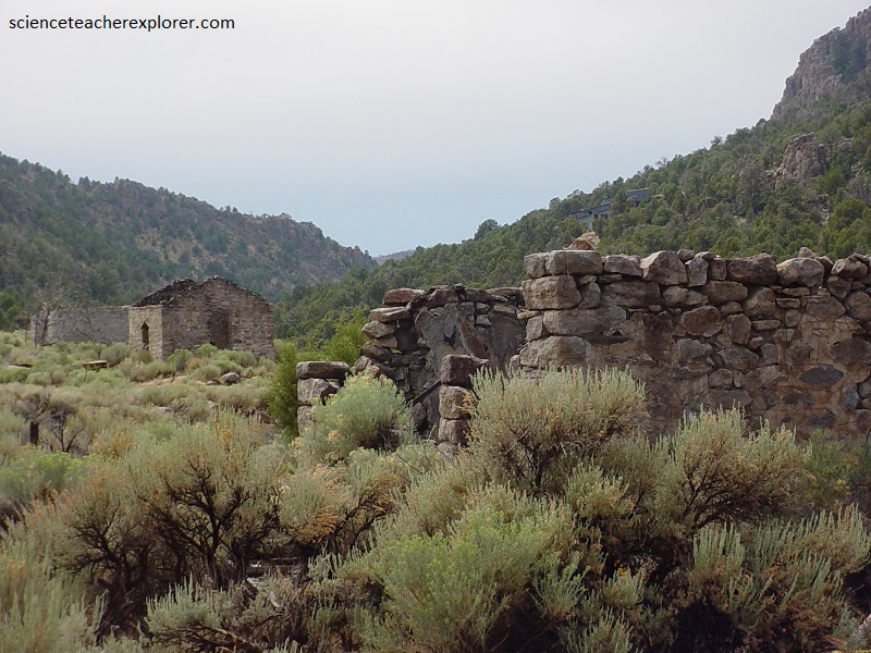
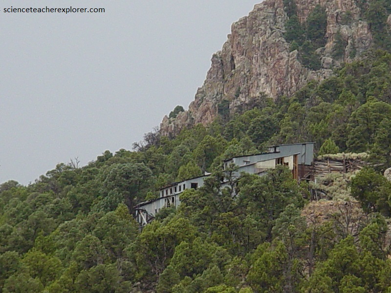
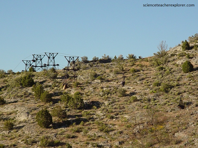
Pioche Mining area is considered to be on the rim of the Indian Peaks Caldera Complex. As mentioned above, calderas are valuable mineral sources such as gold and silver. The area contains deposits of a deeply eroded epithermal fissure-vein system. The heat source that led to the transportation of most valuable metals was provided by the volcanic core stock, which underlies the caldera. Metals most likely were leached from country rocks, then precipitated during convective overturn of groundwater heated by the volcanic-stock; some metals, however, may have been derived from hydrothermal solutions from the intrusion itself. The volcanic stock may represent an early magmatic event in the adjacent Caliente caldera complex, although it predates the known main episode of magmatism in the complex, which has controlled mineralization of other epithermal gold districts.
The tectonic control on the location of the stock and the caldera complex is not well constrained but may result partly from an east-trending grain in underlying rocks, perhaps the result of pre-middle Tertiary east-striking faults, some of which were reactivated, and partly from the Miocene episode of faulting. This is because, most orebodies of gold and silver are in brecciated fault zones of the Tertiary detachment system. The detachment in the limestone country rock, was active prior to the Oligocene volcanism, and well before the mineralization.
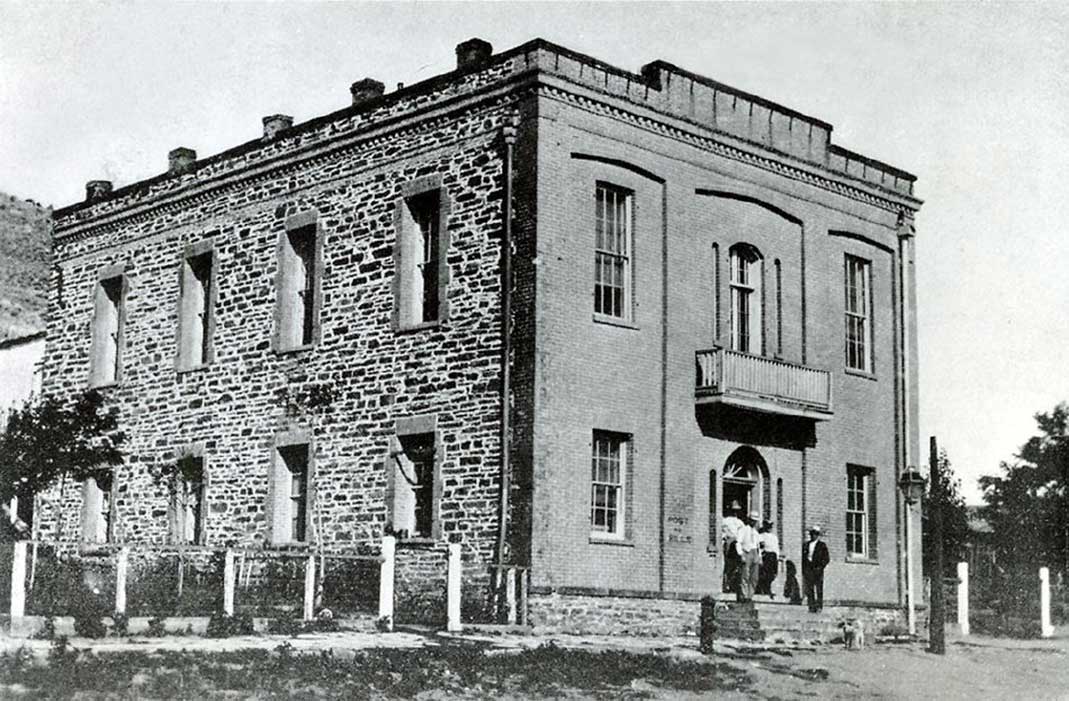
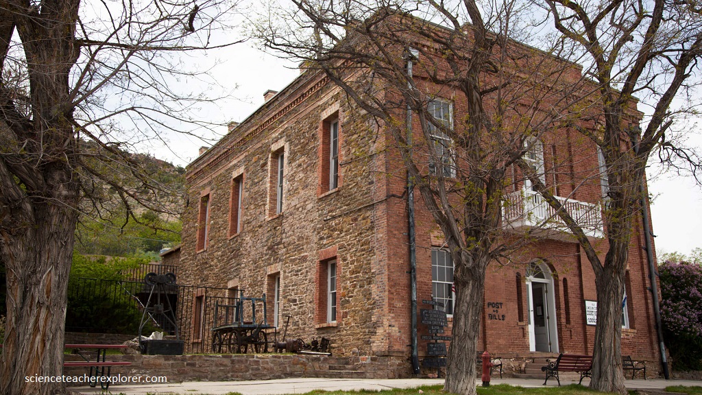
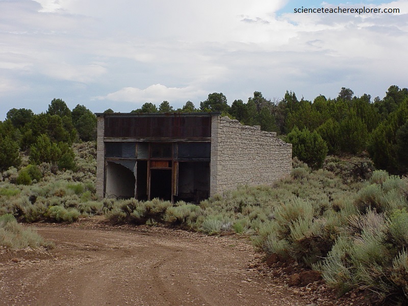
Pioche is known for its “Million Dollar Courthouse” built in 1872. The original cost of $88,000 far exceeded initial estimates and was financed, and refinanced with bonds totaling nearly $1 million. Pioche was the first modern settlement of the area occurred in 1864 with the opening of a silver mine. By the early 1870s, Pioche had grown larger, to become one of the most important silver-mining towns in Nevada. Because of the town’s remoteness which had earlier allowed the Indian raids to occur, Pioche had a reputation for being one of the roughest towns in the old west. It was reported that nearly 60 percent of the homicides reported in Nevada during 1871–72 took place in and around Pioche.
