Colca Canyon, Peru
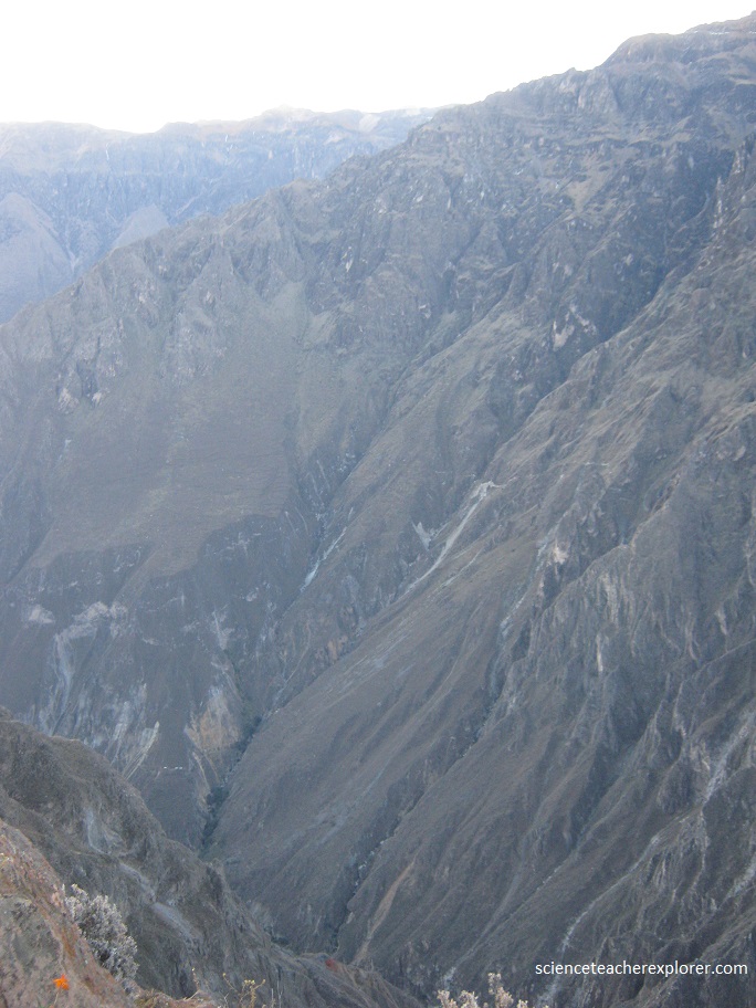
While trekking Peru, I had the opportunity to drive into a remote area called Colca Canyon. The Colca Canyon is located in the north-eastern side of Arequipa, about 4 hours north of the city of Arequipa. This canyon reaches depths of 4160 meters and is more than 120 kilometers long. Slicing through the High Andes like a giant fissure, Colca is the world’s second deepest canyon. This is two times deeper than the Grand Canyon in the United States.
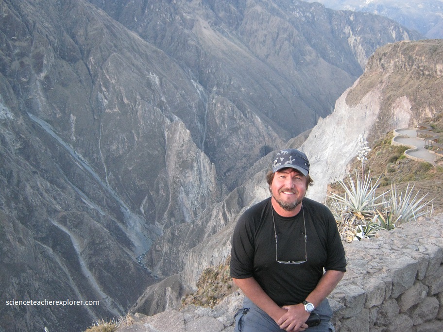
To get to Colca Canyon, Kathy Stoker, (my trekking buddy) and I rented a car and took the spectacular 154km drive from Arequipa to Chivay, Peru. This route made a half circle around the Chivay’s two sentinel volcanoes, El Misti (5,822m) and Chachani (6,075m), before traversing the high plains of the vast, barren Salinas and Aguada Blanca National Reserve.
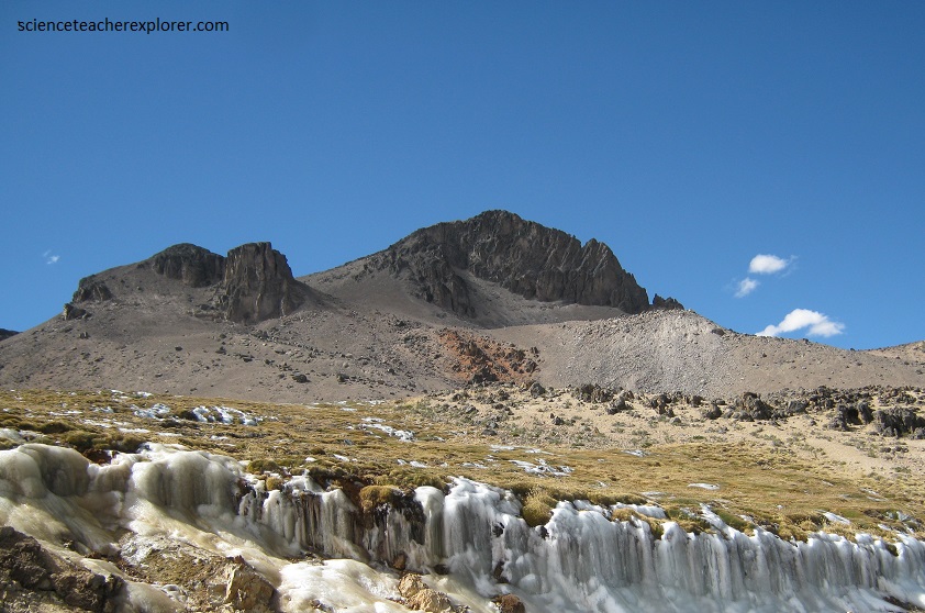
This route to the small village of Chivay, required us to pass over the Patopampa Pass (4,910m). The altitude was extremely high and the rarefied air caused the temperature to drop below freezing. There at Patopampa Pass, we could see a couple of kilometers of frozen waterfalls next to the road. After tasting the rarefied air of the Patopampa Pass (4,910m), we dropped sharply into Chivay (3,630m).
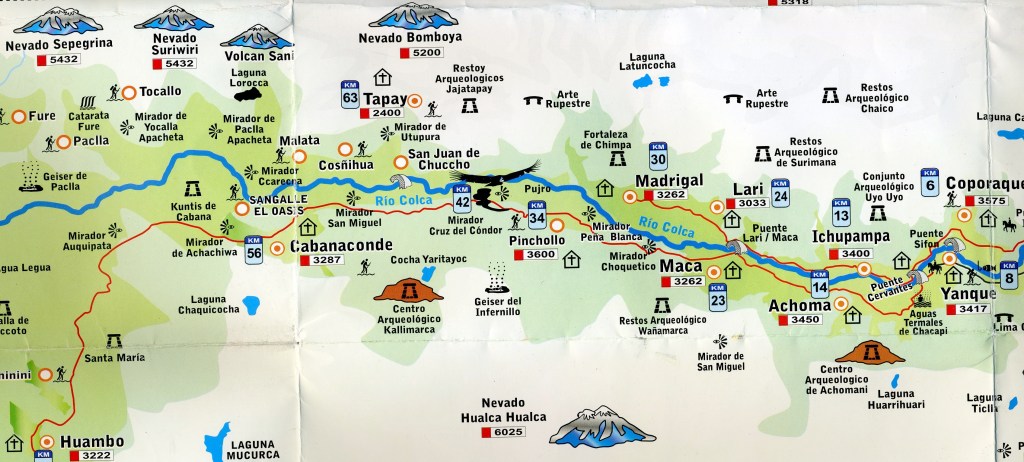
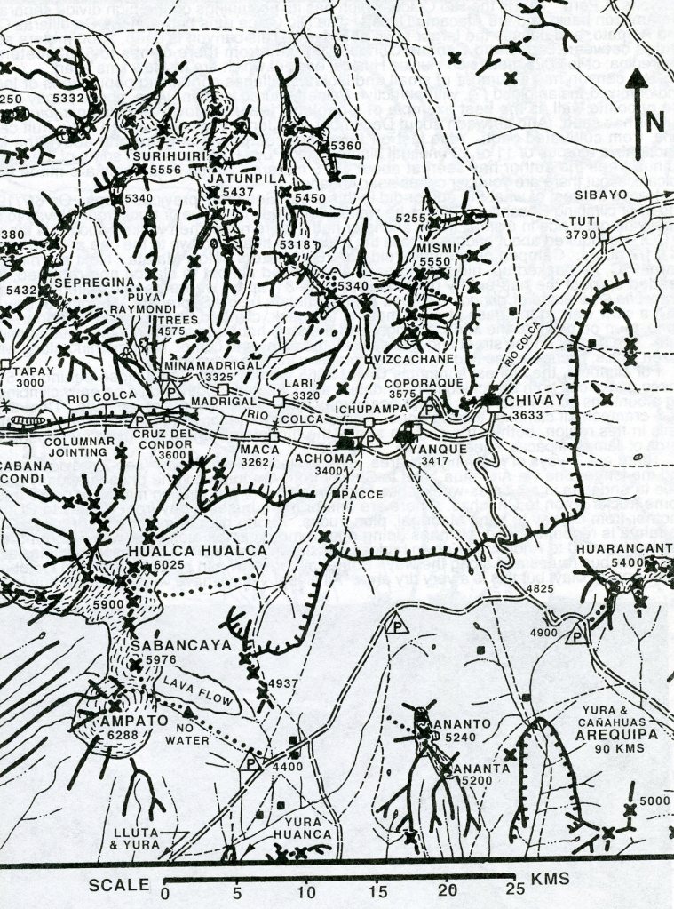
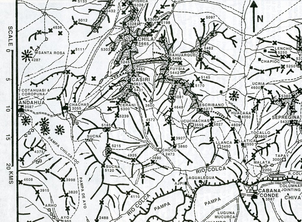
The Colca River originates in the Andes, in the high Condorama Cruise and descends to the town of Chivay located at 3600m where the famous canyon starts. Once we got to Chivay, we continued on a very rugged dirt road to Yanque, Achoma, Maca, Pincholle & to the Cruz del Cóndor cliff top lookout, 42km west of Chivay, where huge Andean condors glide majestically above the steep canyon walls using the thermal uplifts that rise from Colca’s shadowy depths.
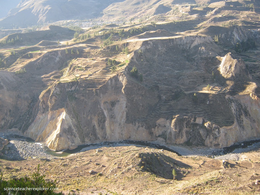
Just passed Yanque we got your first glimpse of Colca’s manmade terraced fields stacked up like gigantic staircases on the steep canyon slopes, (pictured above). Many of the terraces date back to Inca times and most are still tended to by local farmers who grow crops such as potatoes, barley, beans and quinoa.
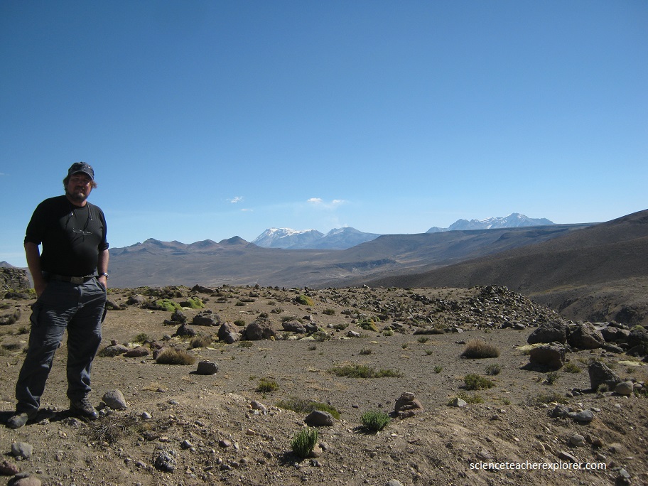
This canyon is part of the Volcanic chain of the western Andes, where there are spectacular views of the combination of mountains and volcanoes, such as Hualca Hualca, Ampato and Sabancaya that is still active. Sabancaya is a stratovolcano and is the youngest active volcano in the Andes. It is 5980 m high and consists of three volcanoes: the Sabancaya the Ampato volcano (6.288m) and Hualca Hualca (6025m).
Pictured above, the Colca Canyon is an amazing geological formation created by erosion from the Colca River over thousands of years in which the abrasive affect of the water that flows through the mountains carved the rock and gradually turned into one of the deepest natural canyons on the planet. These rock formations are isolated and stick out of the landscape. They look to be caused by volcanic explosions or erosion from both wind and water.
Since we got to the Cruz del Condor cliff top lookout in the late afternoon we continued to the village, Cabanaconde 12 km away to spent the night. Besides, to get a look at any Condors, we had to view them in the morning. Cabanaconde sits on the canyon’s rim and, it is possible to descend, via a precipitous zigzagging path, to an oasis of fruit trees aside the narrow Colca River 4km and 1,200 vertical meters below to Sangelle, a natural oasis. We decided not to, because of the hike-out would of been too time consuming and we would of missed the morning Condor flights again.

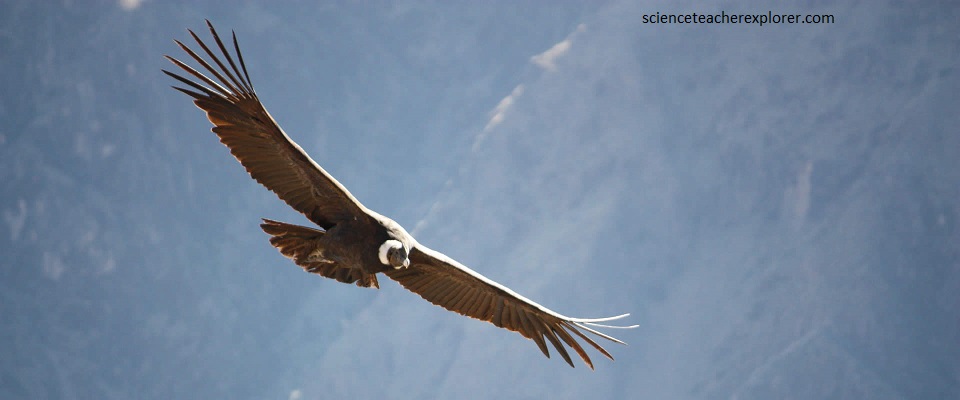
The next morning, Kathy and I visited the Cruz del Cóndor cliff top lookout point on our way back out of Colca Canyon toward Arequipa. The viewpoint was invariably packed with camera-clicking tourists between 8 am and 10 am when the condors are most active. Picture below, I got some amazing pictures of the world famous condors.
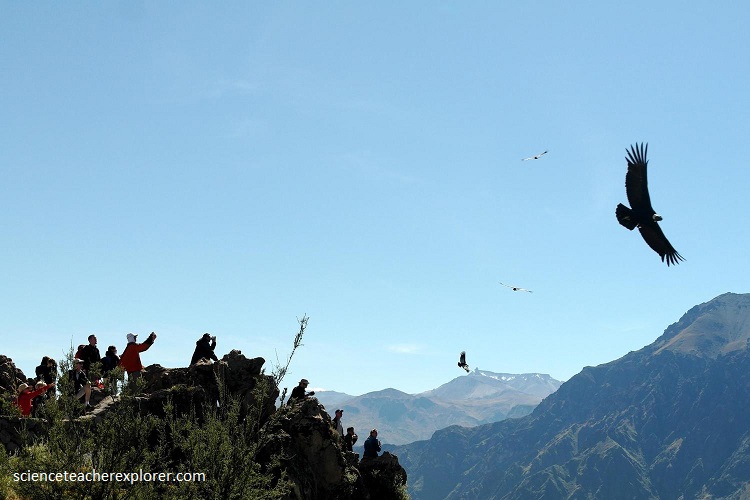
A species considered as representative of the Andes is the majestic Condor(Vultur gryphus), known as the king of birds, it is here in this deep canyon where this scavenger bird is flourishes given the ideal conditions it finds.
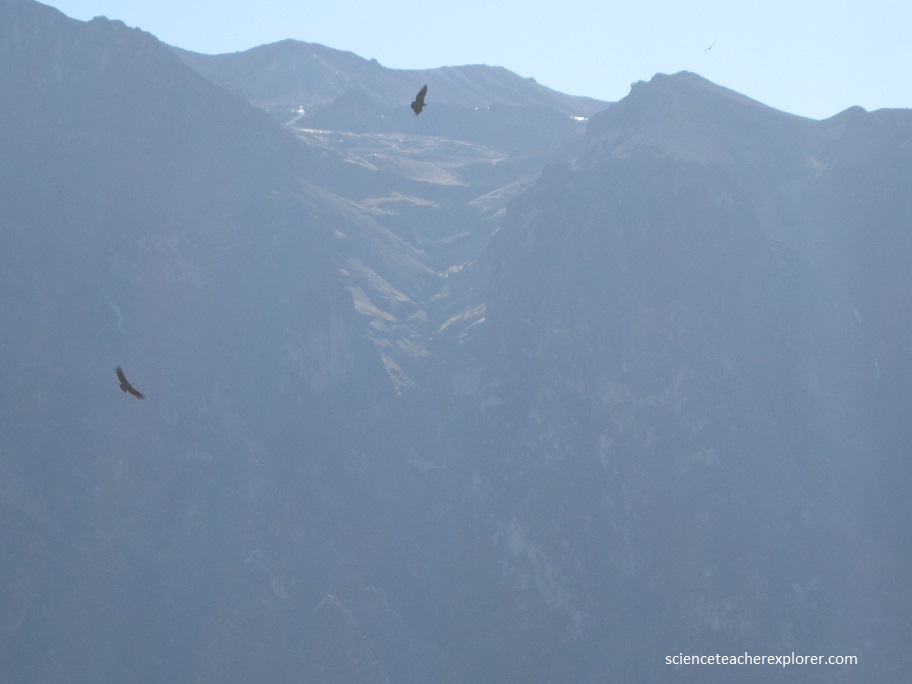
The Andean condor lives in South America at the highest Andean mountains, distributed along the Andes from Venezuela and Colombia to Tierra del Fuego. It can fly over 7000 m high and plan for hours without moving their wings. It is characterized by being a sedentary and monogamous bird. Its habitat is mainly composed of open grasslands and alpine areas up to 5,000 m in elevation. It prefers relatively open, non-forested areas which allow it to spot carrion from the air. Known as the largest flying bird on the planet, the Andean condor is a bird of great importance for the Andean countries, symbolizing greatness, strength and freedom. The Colca Canyon is one of the worldwide recognized sites as the condor habitat where you can observe the flight of this magnificent bird.