Red Rock Cyn., NV 2006
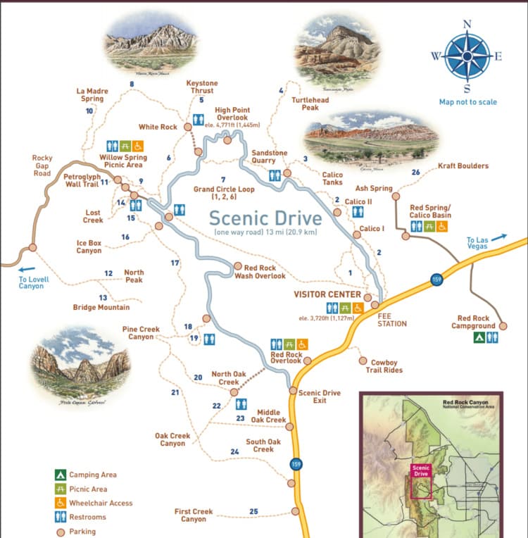
Becky (my wife) and I went on vacation in Las Vegas, Nevada during the Spring-break of 2006. While visiting there, we decided to explore the Red Rock Canyon National Conservation Area 24 km west of the Strip in Las Vegas, (easily seen from the Strip). A one-way loop road, 21 km long, provides vehicle access to many of the features in the area, (imaged below).
The Red Rock area was under an ocean basin during the Paleozoic Era 600 million years ago. Up to 2,700 m of limey sediments were deposited and eventually lithified to limestone During the Mesozoic Era, 250 million years ago, the earth’s crust started to rise due to tectonic shifts, and marine shales and sandstones were deposited. As the basin became isolated evaporite formations of salt and gypsum were deposited & (mined today). Oxidation of the iron minerals in the sediments resulted in the red colors of some of the rocks.
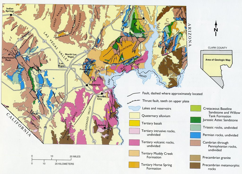
By 180 million years ago, the climate continued to change and the area became a desert with vast expanses of huge shifting sand dunes. These dunes accumulated over a broad area, up to 0.80 km thick, and were lithified into the colorful Aztec Sandstone.
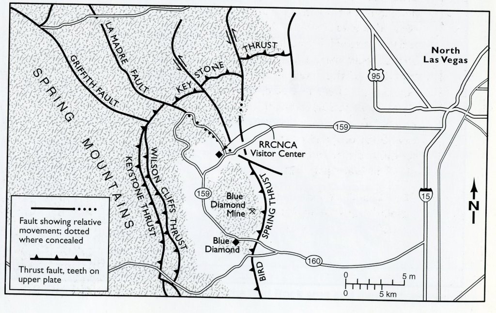
During a mountain-building period of the Cretaceous Period, called the Laramide orogeny, around 66 million years ago, the Keystone Thrust Fault System developed. The Keystone & companion “Wilson” is part of a series of thrust faults which ran through much the Red Rock Conservation Area. The movement of this fault forced the older gray Cambrian sedimentary-rock over the younger red Jurassic sedimentary-rocks, forming the varicolored landscape that can be seen in the mountain today. The thrust is exposed over a distance of 21 km along the Red Rock escarpment.
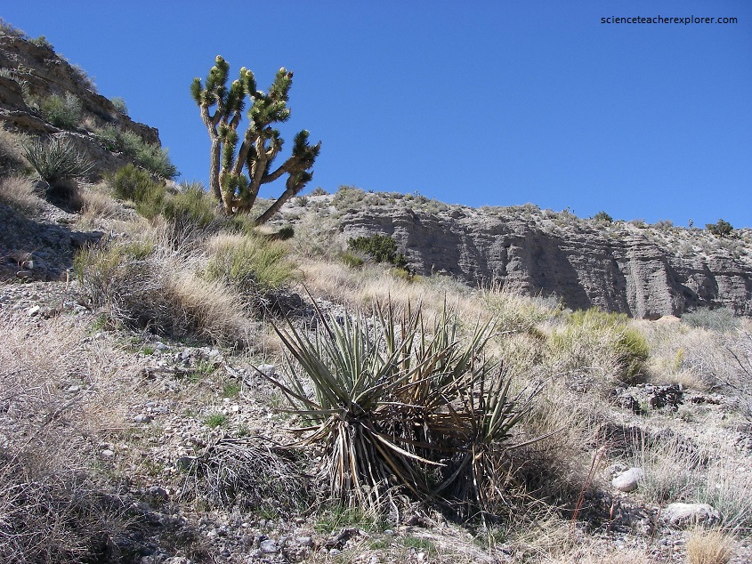
The Aztec sandstone in the area is composed of well-rounded grains of almost pure quartz sand with no clay or silt, (deposition of wind currents). This formation suggests that it was deposited in a vast desert sand dune environment much like the present-day Sahara Desert in north Africa.
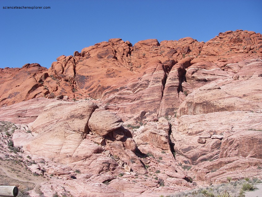
Note that the sandstone varies in color from white or light tan to red and that these color changes do not coincide with specific layers or beds within the sandstone, but appear to occur independently of layering. The ultimate origin of these color bands is not known, but they were probably caused by the movement of groundwater through the rock after it was formed. Upon prolonged exposure to oxygen and water in the subsurface, minerals that contain even small amounts of iron undergo oxidation. The result of this process is a red discoloration; perhaps groundwater moved through the subsurface in a irregular fashion (pictured below).
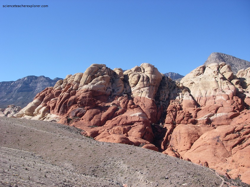
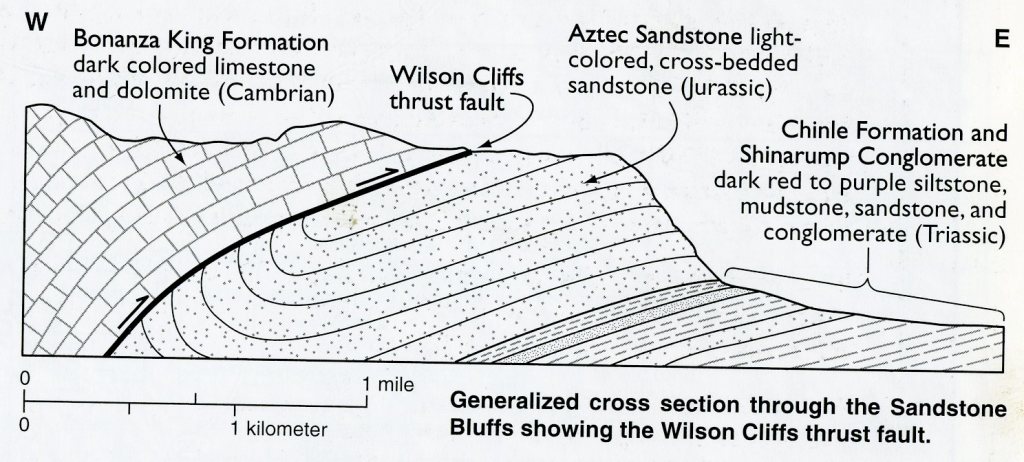
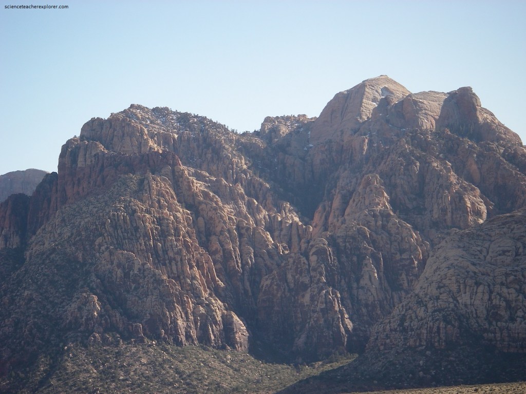
Pictured below, a good view of the Wilson Cliffs thrust. The grey rocks on the horizon are Bonanza King limestones that form the upper plate of the thrust. The red and white Aztec Sandstone is in the lower plate. The thrust contact is to the left, behind the Red Rock escarpment. The contact then swings around to the north and crosses the valley, behind the two points of red rock.
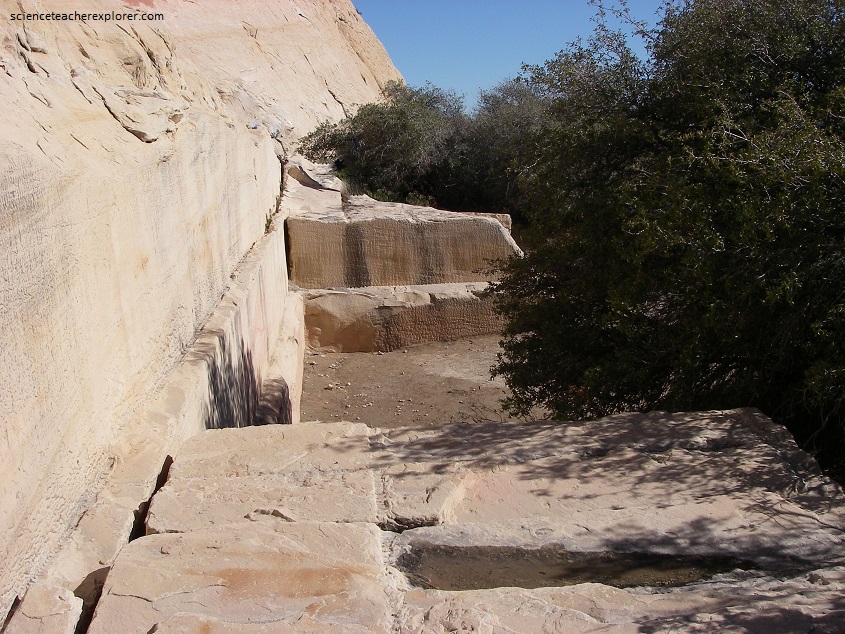
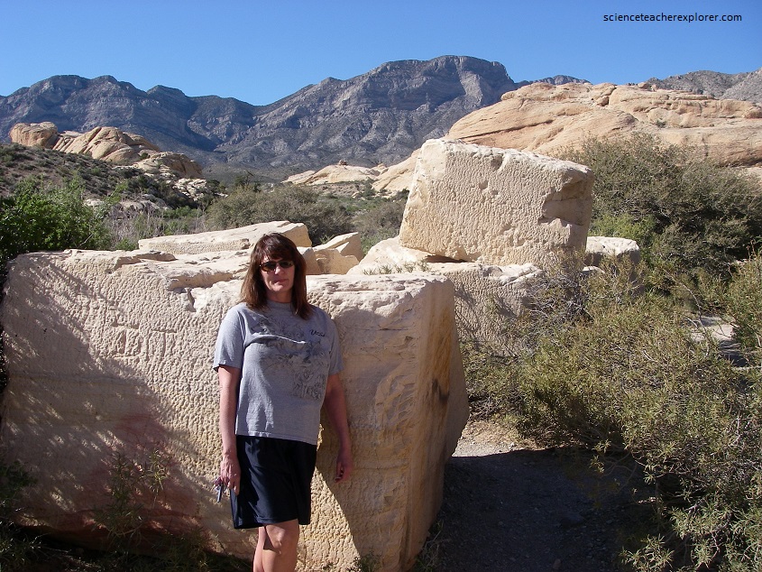
Picture below, one of the first industries established in the Las Vegas area after 1905 was this quarry, which produced very hard, (due to the presence of calcite or quartz cement between the sand grains), red and white sandstone for buildings in Las Vegas, Los Angeles, and San Francisco. A huge steam traction engine hauled the cut blacks to the railroad in Las Vegas. The quarry closed in 1912 due to competition from a new quarry closer to the railroad.
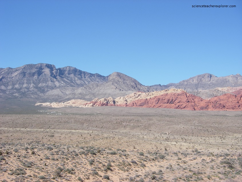
Pictured above, the Aztec Sandstone Formation is actually present throughtout much of the southwestern United States. In Zion National Park of Utah, this rock layer is called the Navajo Sandstone. In the northern parts of Colorado and Utah, it is called the Nugget Formation. The Nevada outcrops of Atec Sandstone represent the westernmost extension of this widespread rock unit. I addition to the spectacular cliff-face exposures that you in the above photo, you will see more Aztec Sandstone in the “Valley of Fire National Monument”.
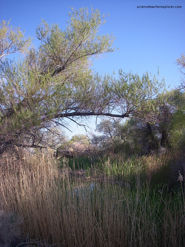
After exploring the Red Rocks Canyon National Conservation Area, Becky and I drove north on Rancho Drive, to explore Tule Springs at the Floyd Lamb State Park. Tule Springs today is a large park complex developed around several formerly spring-fed pools, (pictured below).
Between about 15,000 and 9,000 years ago, Tule Springs alternated between stream and marsh environments. Springs like Tule Springs provided water for a wide variety of native plants. Along he hiking trails within the Floyd Lamb State park are signs with the name of various planted trees and shrubs. Pictured below are some of the plants seen here:
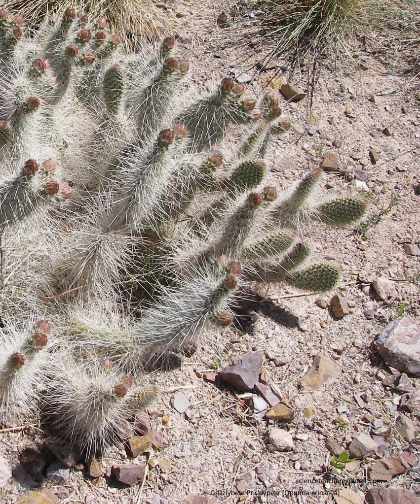
Pictured above, this Grizzlybear Pricklypear cactus forms small, low clumps with erect branches. The pads are thickly covered with long, gray, downward-pointing spines. Flower color varies from rose to yellow depending on variety and the fruit is dry and spiny.
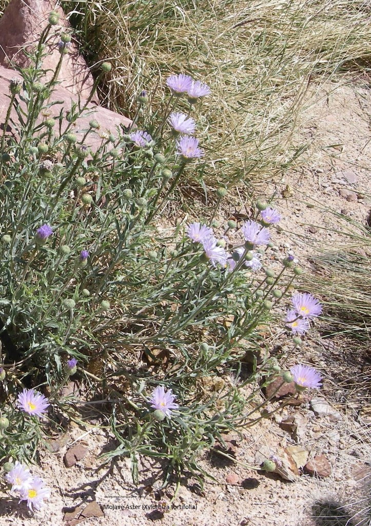
Pictured above, this member of the Sunflower Family is a shrubby perennial growing up to 76 cm high. The Mojave Aster contains many long, gray-green stems with lanceolate, hairy, 7 cm leaves growing from the base. The stems tend to remain leafless near the top. Each plant may bear as many as 20 flowers.
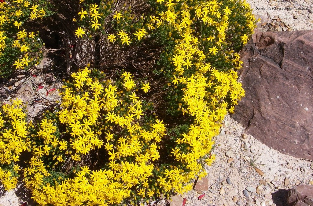
Pictured above, from April to September damianita is covered with a profusion of bright, golden-yellow flowers. A small evergreen shrub with dark green, highly aromatic needle-like leaves, it grows on rocky limestone soils and is extremely heat and drought tolerant.
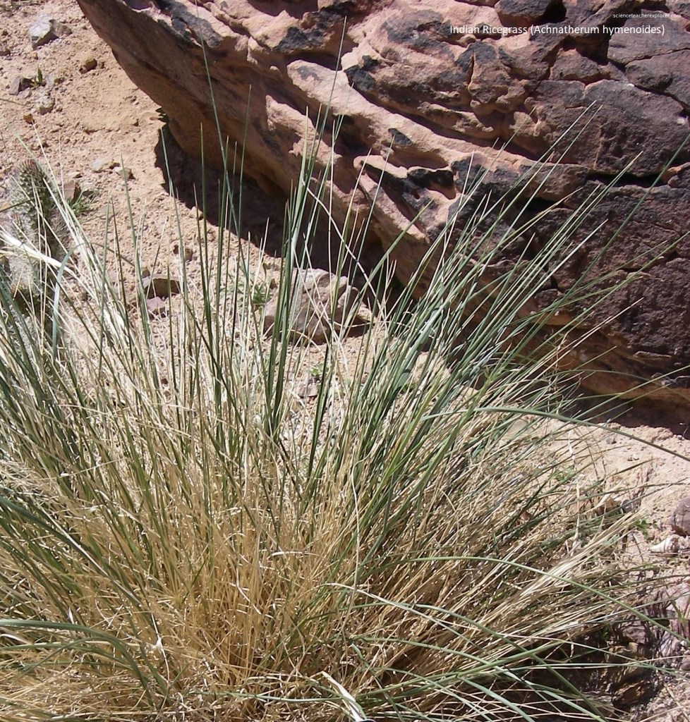
Pictured above, Indian rice grass is a 6 cm tall, perennial bunchgrass. The sage-green, wiry foliage and ivory-colored seed-heads give the grass an overall light, airy appearance. Foliage turns tan when dormant. This beautiful grass often dominates sand dunes. It is a highly palatable species for many animals including livestock.
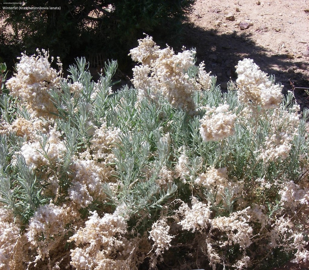
Pictured above, Winterfat is a low-growing, long-lived (up to 130 yrs old) subshrub with a woody base and numerous annual branchlets, growing 1 to 90 cm tall. Herbage is hairy giving the plant a silvery white appearance. It flowers April to September and reproduces from seed and sprouting. Sprouting of the buds near the plants base occurs when the plant is browsed or damaged.
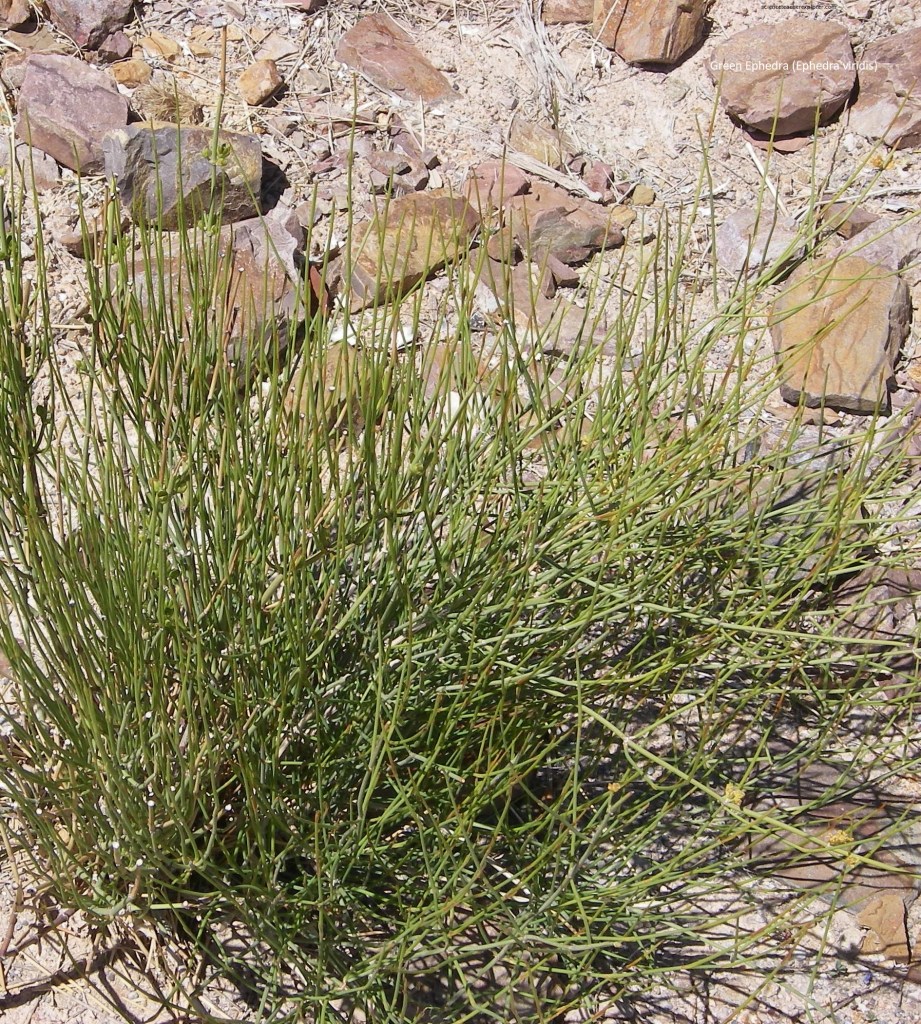
Pictured above, Green ephedra is found on dry, rocky, open sites in valleys and washes, and on slopes, alluvial fans, mesas, and foothills. It is typically found at elevations ranging from 3,000 m – 1,000 m. Sometimes called “Mormon Tea” it is drought resistant and winter hardy. The stems of green ephedra were traditionally brewed by Native Americans to make a nonmedicinal beverage as well as a medicinal tea considered to be a remedy for a backache. Native Americans also made flour and a coffeelike beverage from the seeds.
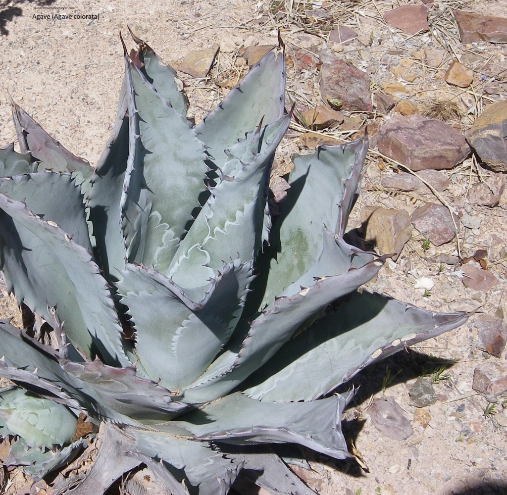
Pictured above, Agave is a very large, handsome evergreen lily-like blue-green foliage. Xeric qualities and a stunning bloom stalk with maturity at ten years or more.
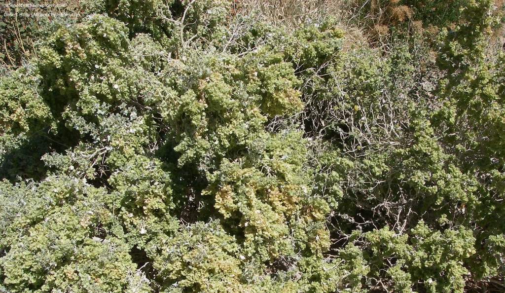
Pictured above, the Desert Holly is a silvery-whitish-gray shrub in the family Amaranthaceae, native to deserts of the southwestern United States. It is the most drought tolerant saltbush in North America. It can tolerate the hottest and driest sites in Death Valley, and remains active most of the year.
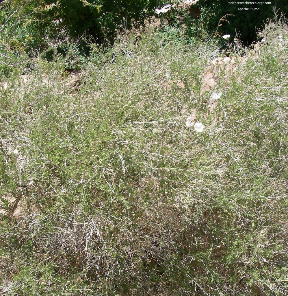
Pictured above, Apache Plume is native to the southwestern United States and northern Mexico, where it is found in arid habitats such as desert woodlands and scrub. Beginning in late spring and continuing through summer the plant blooms with single white flowers that set fluffy pink seed heads.
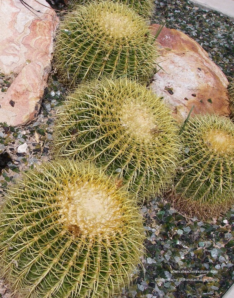
Pictured above, the golden barrel cactus has a globe-like appearance and is recognized by its magnificent color that comes from vertical yellow ribs that line its edges. The golden barrel is considered a rare and endangered species. It grows slowly to three 90 cm and spreads 60 cm wide. At maturity, yellow blossoms appear at the top of the plant in spring, followed by fruit.
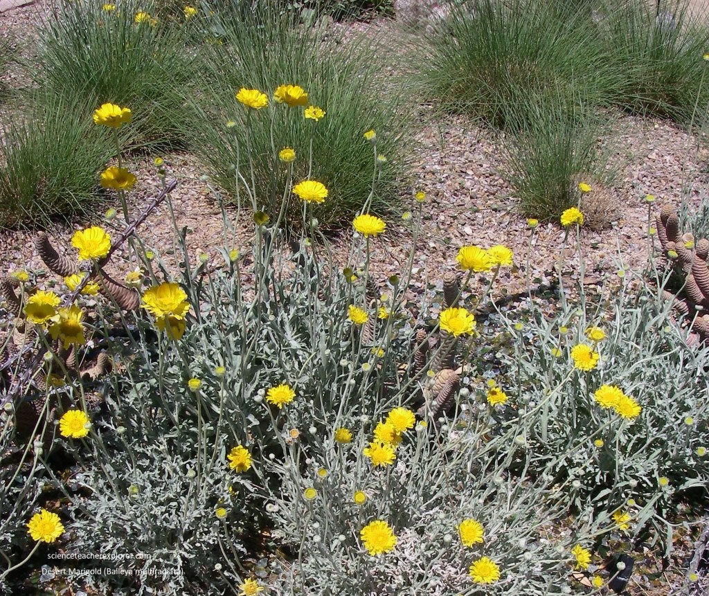
Picture above, the Desert marigold are characterized by individual florets arranged in dense heads making the floret group look like one single flower. On the marigold the clusters form a head 5 cm in diameter and are bright yellow in color. The leaves are green with silver-white hairs, lobed, and grow very low on the thick stems.
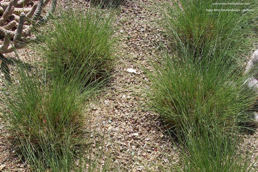
Pictured above, Regal mist is a small clumping grass that sits quietly and unobtrusively until it explodes with plumes of airy pink flowers that rise well above its finely textured foliage in late summer and early fall.
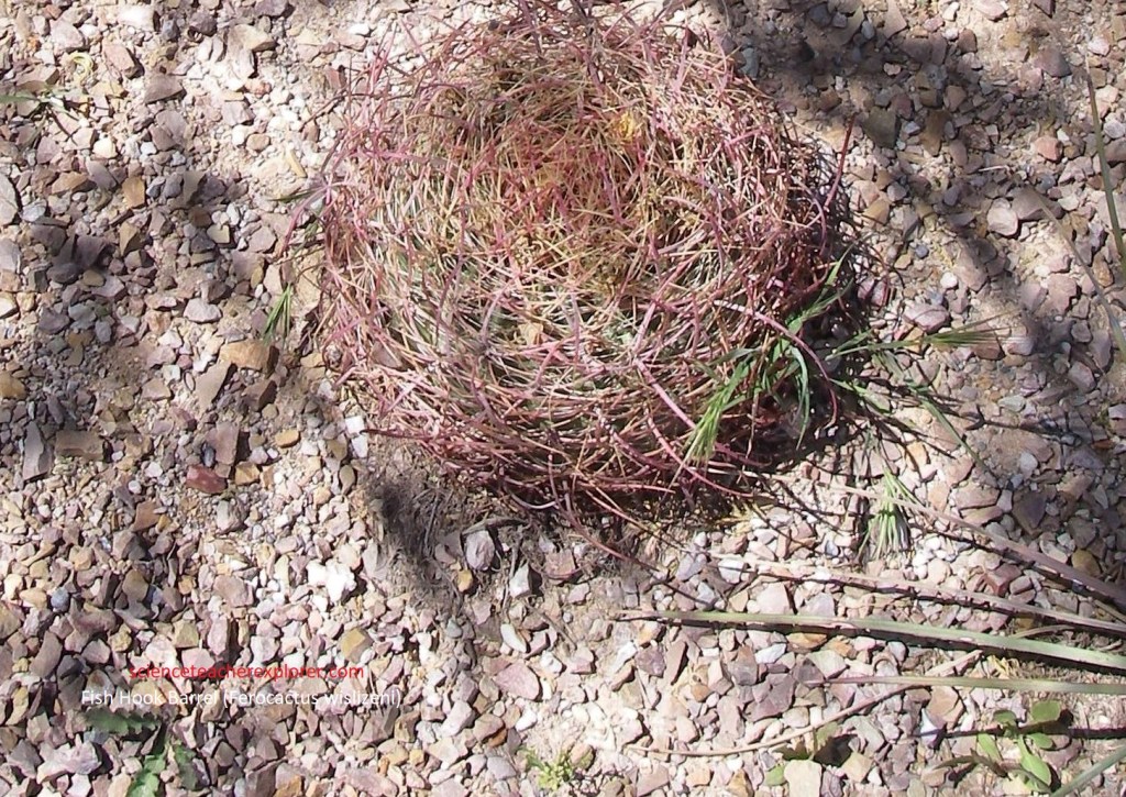
Pictured above, the fishhook barrel cactus can be identified by its thick (60 cm), barrel shaped body and long hooked spines. Fishhook barrel cactus grow along desert washes and gravelly bajadas. It is less likely to occur on valley floors or rocky slopes. This cactus does contain water, but the water contains oxalic acid and is likely to cause diarrhea if ingested when the stomach is empty.
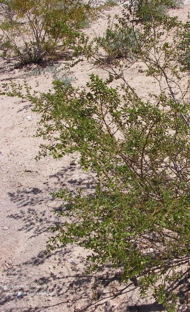
Pictured above, the Creosote bush is the most characteristic feature of North America’s hot deserts. It is one of the best examples of a plant that tolerates arid conditions simply by its toughness. It competes aggressively with other plants for water, and usually wins, accounting for its prevalence in many arid locations of the southwest. This medium-to-large evergreen shrub has numerous flexible stems projecting at an angle from its base. It is usually less than 1 meter high, but can grow to 30 cm heights with abundant water. Its small (2 cm), pointed, yellow-green leaves have adapted to conserve water and dissipate heat.
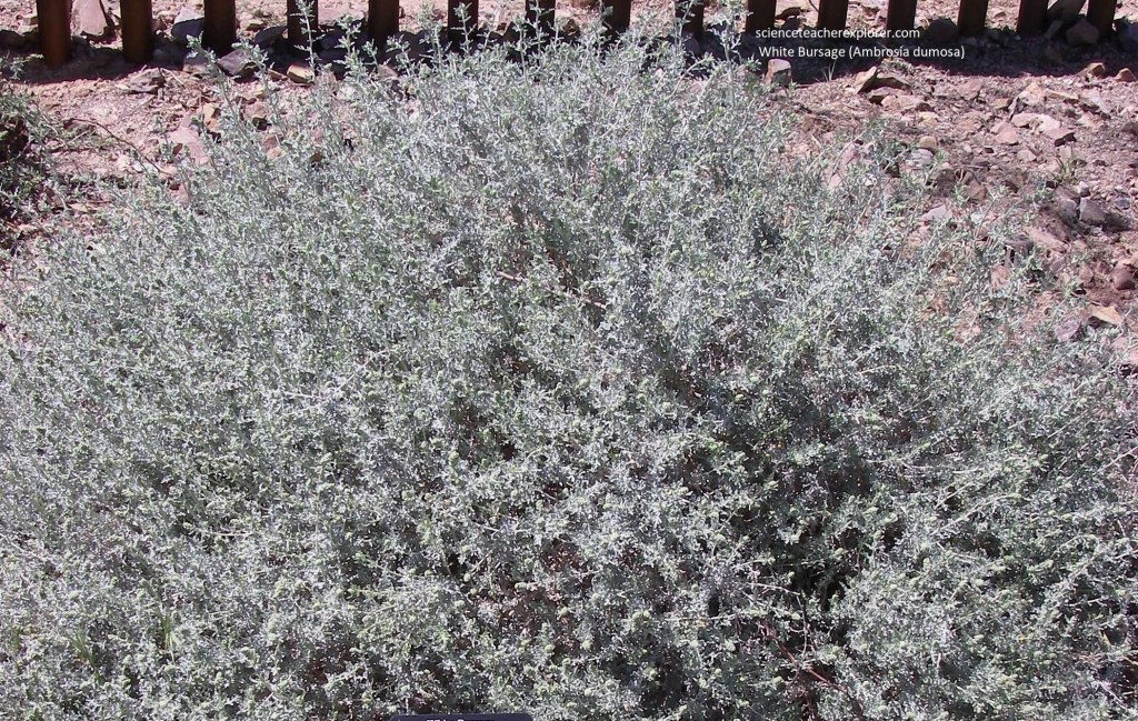
Pictured above, White Bursage is a short, rounded shrub that often looks like a low mound of white, lifeless twigs. In the spring, however, it puts on a dense covering of short, lobed leaves and inconspicuous flowers. The flowers are green and spike-like, and the fruits are spiny.
Pictured above, Tule Springs is but one of a series of springs that follow the center of Las Vegas Valley from Indian Springs on the northwest to Las Vegas Springs in what is now the center of Las Vegas on the southeast. The springs are fed by runoff from the high mountains on each side of the valley flowing down into the deep alley travels where it then moves up along fault structures, perhaps associated with the Las Vegas Valley shear zone, to the surface as springs and seeps.
Becky and I then, drove up onto the Spring Mountains through Kyle Canyon. Deposits of the Pleistocene Kyle Canyon alluvial fan are evident above the road, (picture above). The Kyle Canyon alluvial fan, (actually composed of 6 distinct alluvial fan deposits), consists of large aprons of debris that were shed off the high Spring Mountains into stream drainages an deposited near the lower reaches of the range. The modern day drainage system has cut down into these earlier alluvial fan deposits exposing their internal stratigraphy. The large amount of debris in the Kyle Canyon alluvial fan dwarfs the volume of material that is presently being eroded from the Spring Mountain. This is probably due to the climate change from the Pleistocene to present.
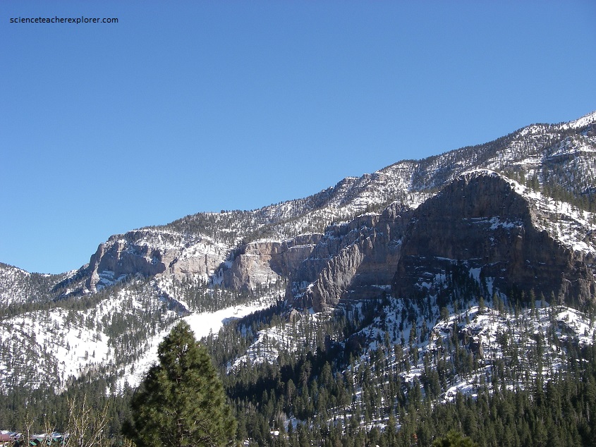
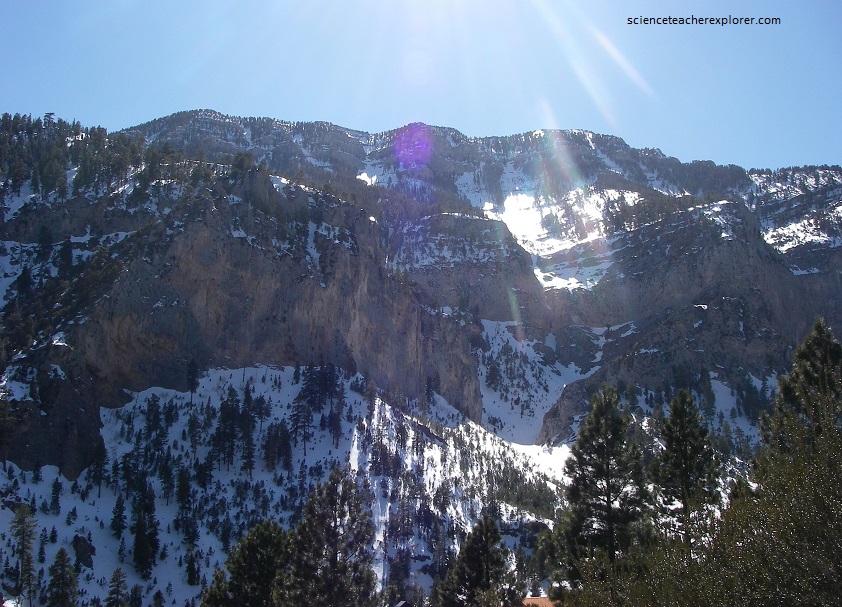
Pictured above and below, the prominent cliffs of Kyle Canyon are composed of Devonian and Mississippian dolomite and limestone situated in the upper plate of one of the regional thrust faults. At this location, these older rocks are thrust over Bird Spring Formation, (most of the tree and shrub covered slopes on both sides of the highway are underlain by Bird Spring Formation).
Pictured above is the 3,632-meter Mount Charleston, the Spring Mountains highest peak. Mount Charleston is composed of a thick pile of limestone that accumulated in a westward-deepening sea between about 520 million and 280 million years ago. The fossilized remains of brachiopods, sponges, corals, crinoids, gastropods and other marine organisms are still visible in limestone outcrops throughout the Spring Mountains, including on Mount Charleston.
Note: I climbed Mount Charleston in the early 1980s while working for the Forest Service. I was fighting a large forest fire on the western slope of Mount Charleston when the Fire Boss asked for volunteers to climb to the top and cut a helicopter landing-spot in the trees. Since I was a “Sawyer” with a friend Pat Joseph, (from Beaver, Utah) on the fire-crew, we both volunteered. At the time, I noticed the spectacular fossils in the limestone. Of course, this was very dangerous because the fire was below us and fire has a tendency to climb uphill, in our direction.
