Saguaro N.P., AZ 2010
During December of 2010, I found myself driving through Tucson, Arizona. I took the opportunity to visit the Saguaro-East National Park and the nearby Colossal Cave.
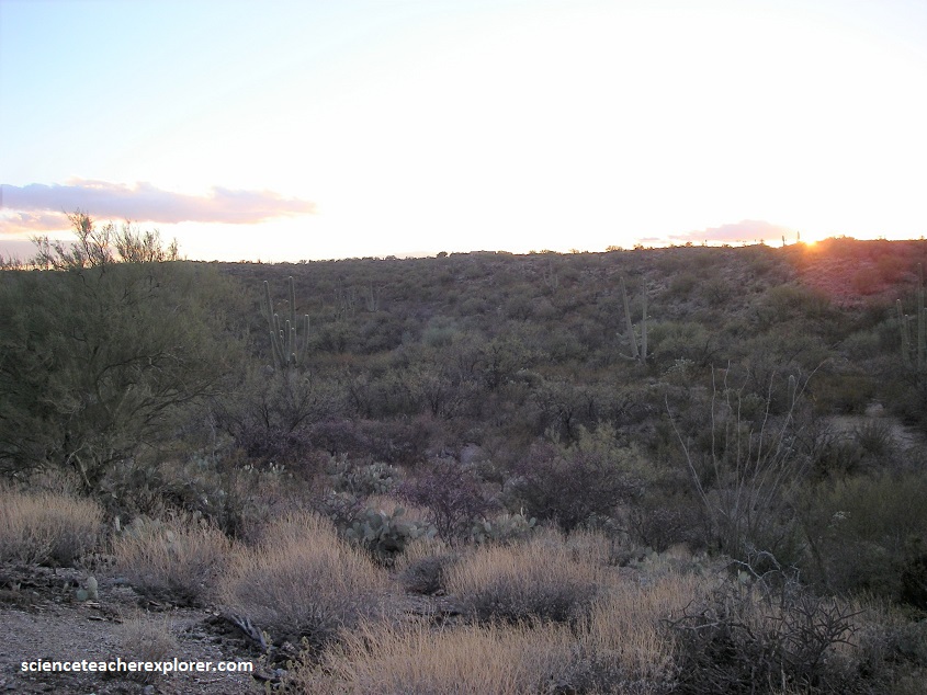
The Saguaro National Park is part of the Sonora Desert that covers much of southwest America and northwest Mexico.
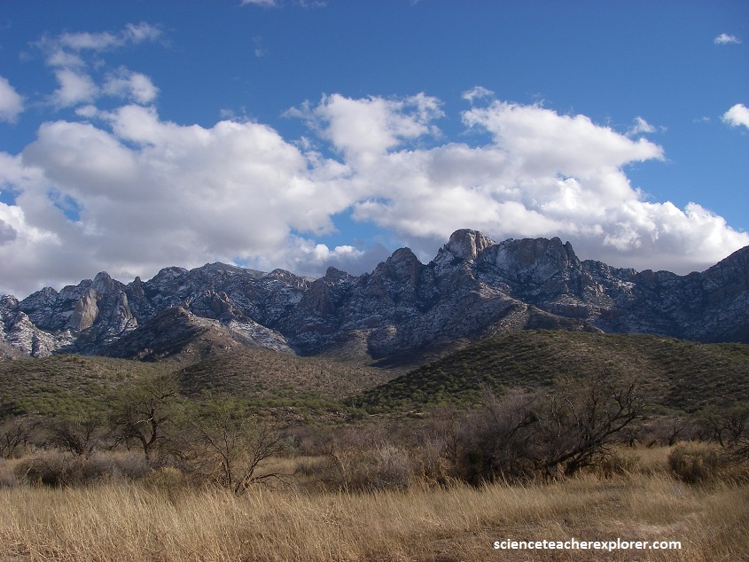
Tucson, Arizona actually splits the Saguaro National Park into two separate districts. The geological history of the park is actually a large part of the geological history of the Tucson Basin. The northeastern boundary of the Tucson Basin is formed by the Santa Catalina and Rincon Mountains. Pictured above, the Rincon Mountains have a maximum elevation of just over 3000 m.
The Rincon Mountains are encompassed by the Coronado national Forest and the Rincon Mountain District. They are composed of foliated and folded banded gneiss, as well as schist and the granite which can be dated back to the Precambrian age, with younger colluvial and alluvial deposits draped over the base, often forming a thin cover. However, to the west, we could see the path of the Catalina Detachment Fault crossing low ridges, where it separates light-colored limestones of late Paleozoic age in the upper plate from darker, brownish rocks in the Precambrian lower plate.
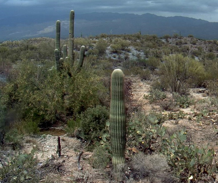
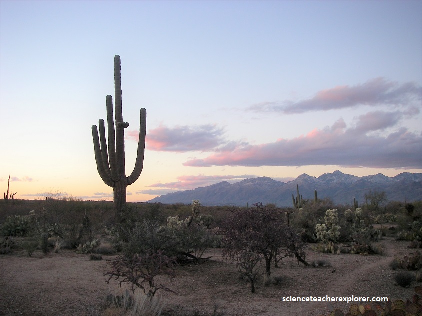
Saguaro National Park is home of the iconic Saguaro cactus, which has an incredibly slow growth rate. It can grow to a height of 15 meters and weigh over 10 tons. The Saguaro Cactus can live up to 200 years, and dominates the scenery of the National Park that bares its name.
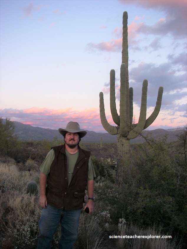
Without doubt, the long arms of the Saguaro cactus are the plant’s most distinctive feature.
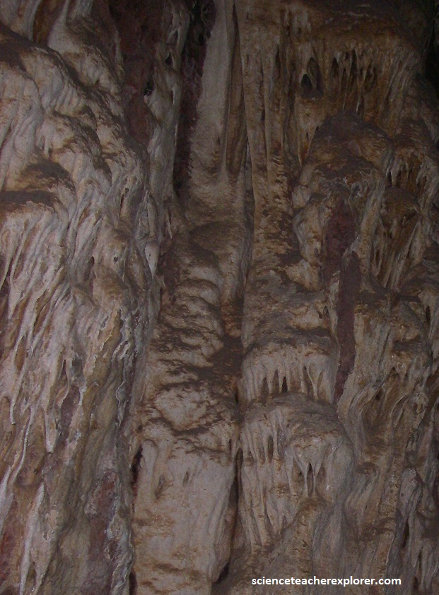
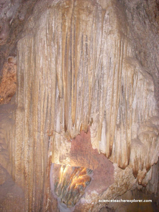
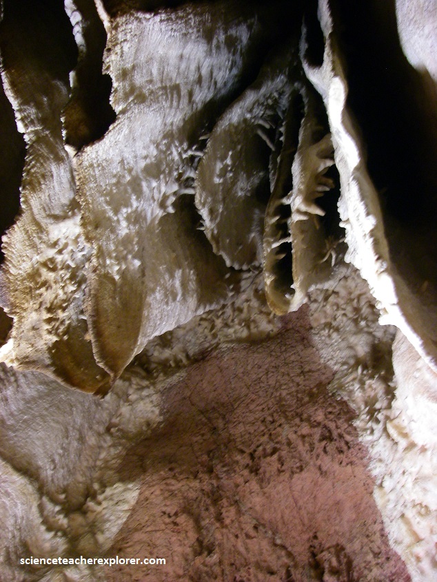
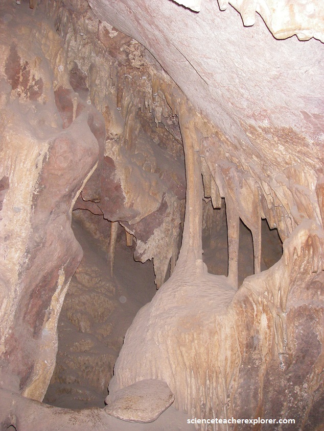
Nearby and 20 km south of Saguaro-East N.P., I explored the Colossal Cave. Colossal Cave is a large cave-system that contains about 5.6 km of mapped passageways. Temperatures inside average 70 °F (21 °C) year-round.
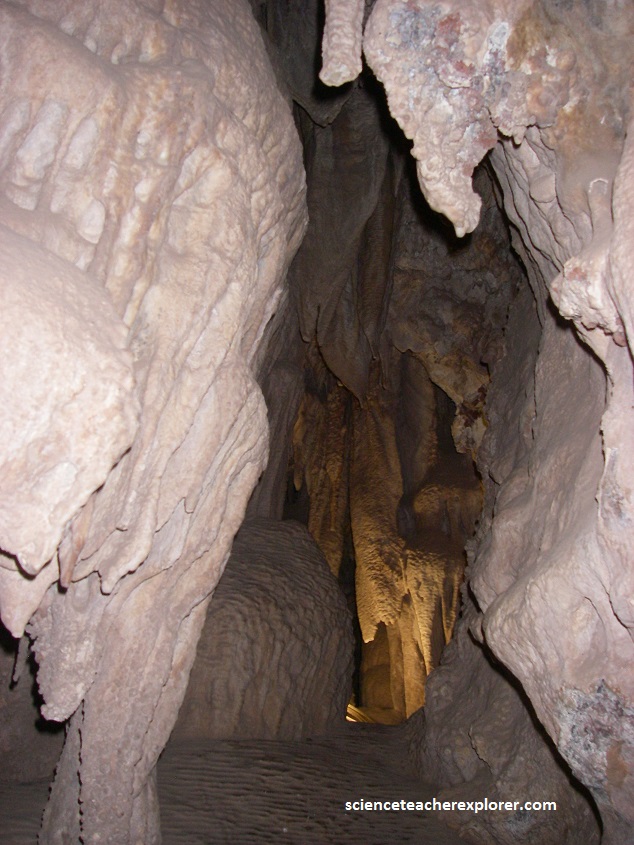
The Colossal Cave is an ancient karst cave, classified as “dry”. The meaning of this is that its formations are completely dry, or “dead”, and do not grow. This is because the cave was formed by water depositing limestone, but this source has disappeared.
About 300 million years ago much of the American Southwest was covered by a vast sea populated by giant sharks, tetrapods and other primitive amphibians. Eventually the waters receded. Organic material left behind dried out and was compressed to form the limestone. Then 80 million years ago the heaving earth thrust limestone and granite together to create new landforms such as the Rincon Mountains where Colossal Cave is located. After eons of water erosion, the Cave reached a dry state, and today Colossal Cave is one of the largest dry caves in north America.
The earliest inhabitants of the region were the Hohokam, a prehistoric culture who called Arizona home for more than 1,200 years. Subsistence farming was made possible through their highly advanced network of irrigation canals that at its apex stretched more than 150 miles. Archeologists have discovered evidence that the Hohokam used Colossal Cave as temporary shelter as early as 900AD.
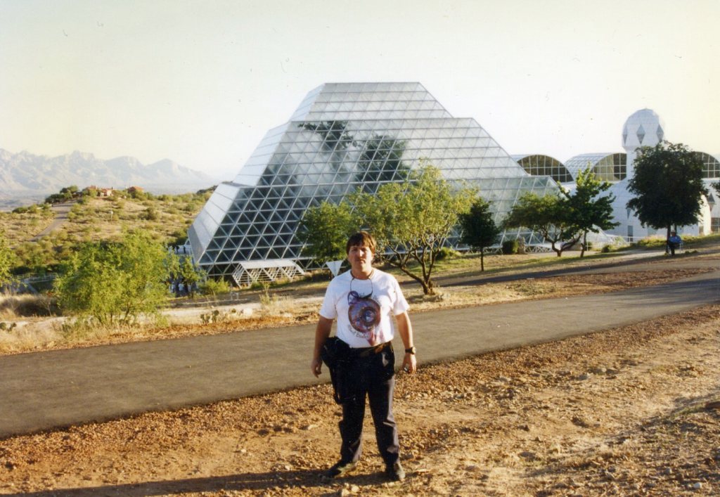
Nearby, is the infamous Biosphere 2 facility. Constructed between 1987 and 1991, Biosphere 2 was originally meant to demonstrate the viability of closed ecological systems to support and maintain human life in outer space as a substitute for Earth’s biosphere. It was designed to explore the web of interactions within life systems in a structure with different areas based on various biological biomes. In addition to the several biomes and living quarters for people, there was an agricultural area and work space to study the interactions between humans, farming, technology and the rest of nature as a new kind of laboratory for the study of the global ecology. Its mission was a two-year closure experiment with a crew of eight humans (“biospherians”). Long-term it was seen as a precursor to gaining knowledge about the use of closed biospheres in space colonization. As an experimental ecological facility it allowed the study and manipulation of a mini biospheric system without harming Earth’s biosphere.
Biosphere 2 was only used twice for its original intended purposes as a closed-system experiment: once from 1991 to 1993, and the second time from March to September 1994. Both attempts ran into problems including low amounts of food and oxygen, die-offs of many animals and plants included in the experiment (though this was anticipated since the project used a strategy of deliberately “species-packing” anticipating losses as the biomes developed), group dynamic tensions among the resident crew, outside politics, and a power struggle over management and direction of the project. Nevertheless, the closure experiments set world records in closed ecological systems, agricultural production, health improvements with the high nutrient and low caloric diet the crew followed, and insights into the self-organization of complex biomic systems and atmospheric dynamics.
