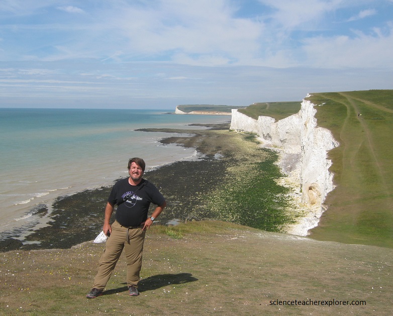
Seven Sisters, England
July 26 & 27th, 2016; I explored the South-eastern coastline of England. There, I chose to hike along the Seven Sisters ridge.
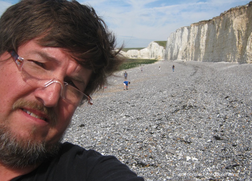
The Seven Sisters is the name given to a line of majestic undulations in the chalky cliffs.
The calcareous parts of tiny marine algae and seashell fragments formed white chalk ridges under the sea some 130-60 million years ago.
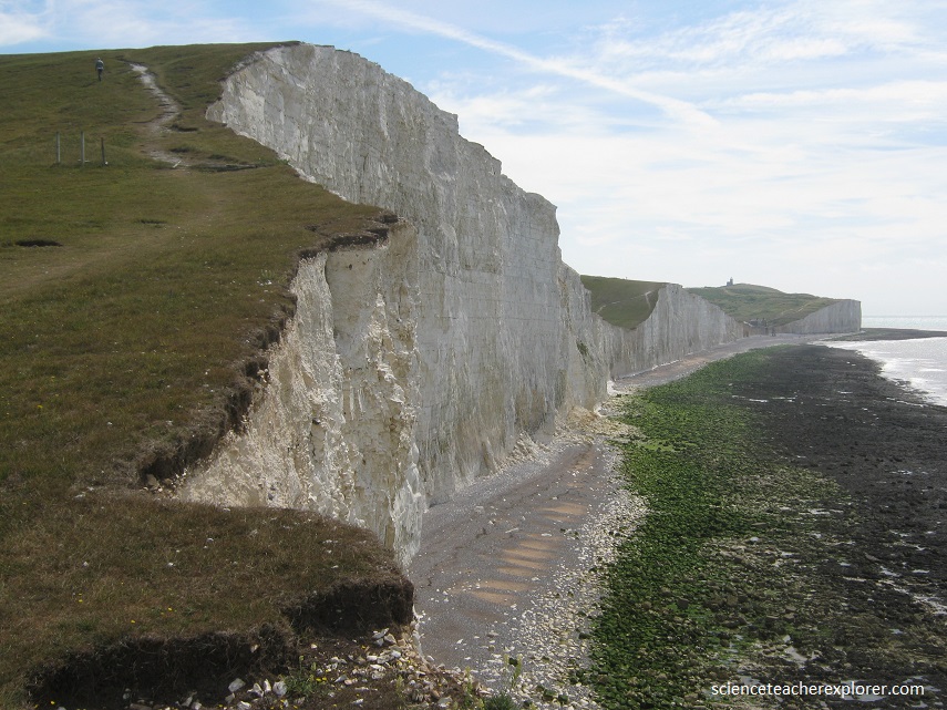
The sea constantly chaffs the chalk, undercutting the cliffs and leading to regular rockfalls. As a result, the cliff faces are continually refreshed, revealing a never-ending treasure of fossils. The land here was originally joined to France until sea levels rose and the English Channel was formed. Waves, wind, rain and ice continually erode the cliffs which keeps their edges sheer and maintains their brilliant white color, feeding the beach with flints washed from the bands found in the cliffs. The cliffs are receding by an average of 70 cm each year, but in stormy periods the loss may be greater.
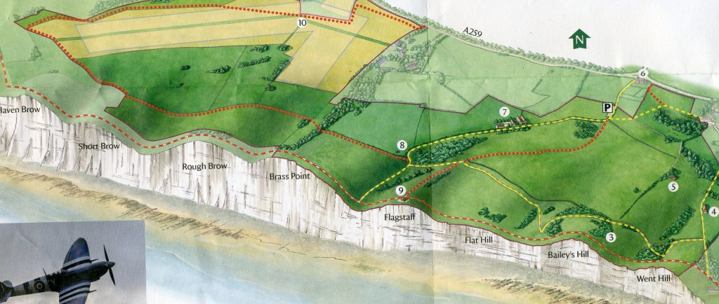
Birling Gap and the Seven Sisters is internationally important for its geology, wildlife and landscape.
After the morning walk along the Seven Sisters, I continued exploring the area by visiting the Dungeness Mirrors, 60 km northwest away. The Dungeness Mirrors are three concrete structures that act as Sound-Mirrors or Listening Devices. They were built around 1930 for experiments to detect enemy aircraft. The concave shape of the mirror collected and amplified sound from aircraft engines and could also indicate from which direction the noise was coming. The structures were intended to provide air aid warnings and to assist interception of an attack. This system was never fully operational and was made obsolete by methods of detection based on radio waves that were introduced from the late 1930s. This system became radar.
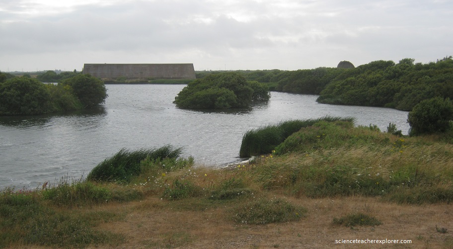
A Government Acoustic Research Station was established at Hyene in 1922. The first mirror built here at Denge in 1928 was part of a chain linked to this site. Subsequent experiments with size and shape of mirrors led to construction of the other two structure by 1930. These mirrors are thus a unique group demonstrating the different mirror types. When the structure were built the lakes form by gravel extraction did not exist and the experimental mirrors stood in isolation on the Dungeness shingle, served by a narrow gauge railway. The Sound Mirrors were sited to isolated places to avoid extraneous noise, and experimental target aircraft were provided by commercial flights over the channel and also by RAF aircraft during Air Defence of Great Britain exercises in the 1930s.
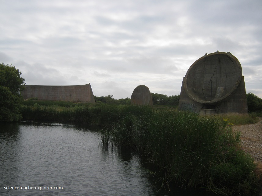
The right hand structure is the 10 m diameter mirror, completed in 1930. It’s bowl construction is unique. Beneath this can be seen the chamber in which the operator sat, listening to sound collected from the mirror surface by rotating the still visible detector and conveyed to the ears by an arrangement resembling a stethoscope. The smallest structure in the center of the group is the 7 m mirror of 1928. It originally had a concrete pillar in front of the mirror surface, supporting a movable sound detector. The largest structure is the 67 m mirror. The curved wall concentrated sound waves that were detected by a row of microphones positioned on the concrete forecourt of the structure. Only one other mirror of this design exists on the “White Cliffs of Dover”.
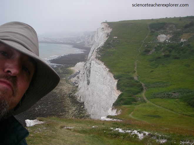
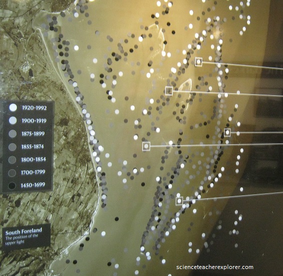
The next morning, I found the mirrors on top of the “White Cliffs of Dover”. I’m standing just above the cliffs near South Downs of Sussex, looking across the English Channel towards France. The wind and rain was very bad. I took refuge in a nearby light-house. There, they had a small museum honoring Marconi’s attempt to shoot Radio waves across the English Channel for the first time and the multiple ship-wrecks in the English channel nearby, (pictured below).