Les Cirques, Reunion
While trekking South Africa in April of 2023, I decided to fly over to Reunion Island and explore the volcanic terrain.
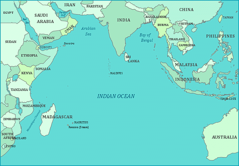
Reunion Island, located in the western Indian Ocean (22 o S and 55o E), has a subaerial extent of around 2,500 km2, composing an elliptic island shape (60km x 70km). The island is a volcanic complex composed of two edifices that are currently visible in the landscape (the Piton des Neiges, (3,070m elev.), and the Piton-de-la Fournaise, (2,631m elev.).
The Piton des Neiges volcano, located on the north-western part of the island, has been inactive since 12,000 years ago. However, the Piton de la Fournaise, on the souteastern part, is considered one of the most active volcanoes in the world with an average of 0.8 eruptions per year since 1998.
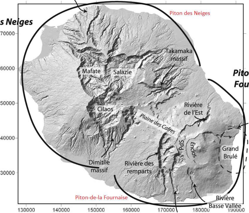
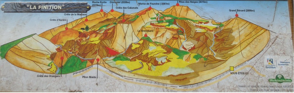
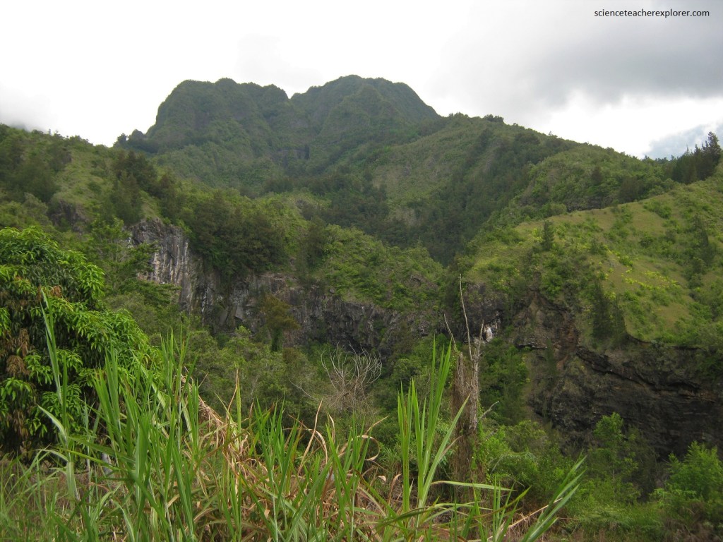
Pictured above, as a volcanic island, the topography of Reunion Island is unique with the island’s most enticing natural formations being its three cirques, formed as the inside of Piton des Neiges, (the volcano that gave birth to Reunion Island).
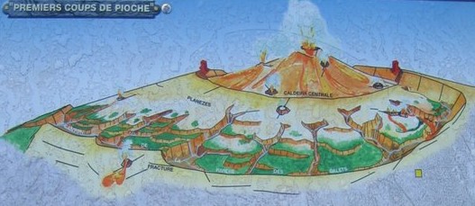
The cirques of the Piton des Neiges volcano result form a complex history. Imaged above, the starting event was the formation, around 150,000 years ago, of a large summit caldera. This one, formed in alkaline context, and constitutes the originality of Piton des Neiges.
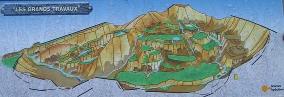
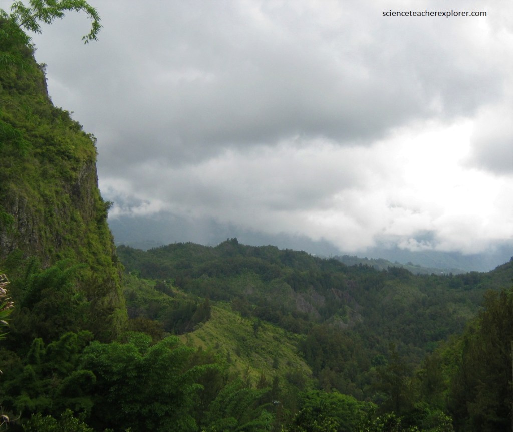
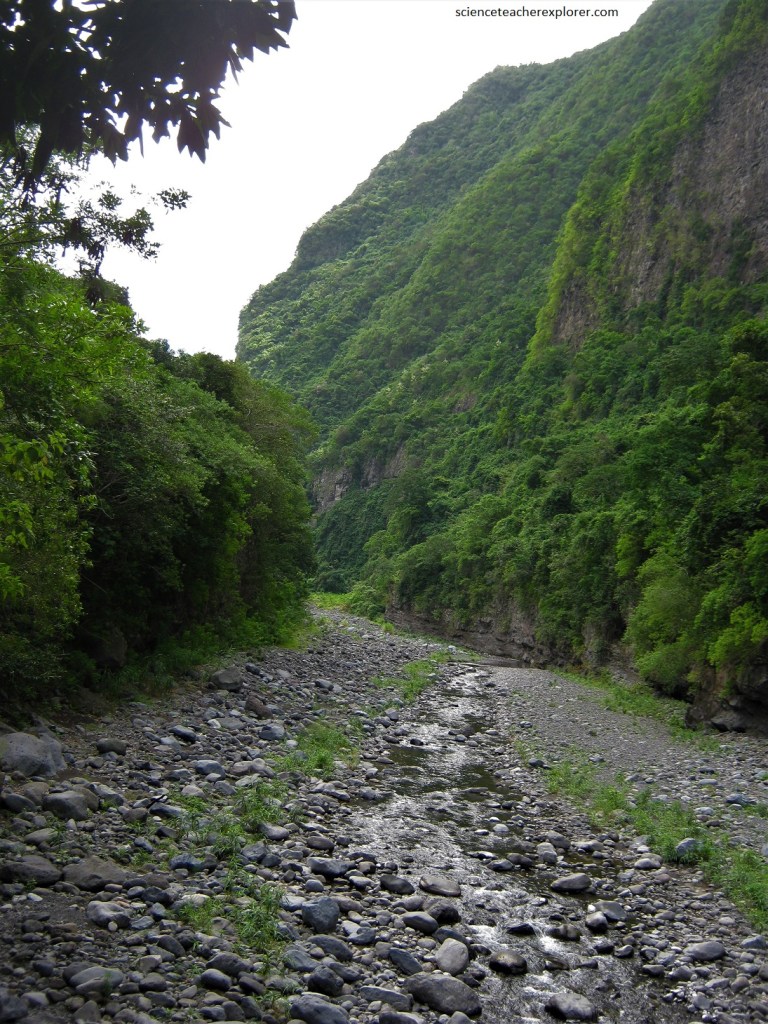
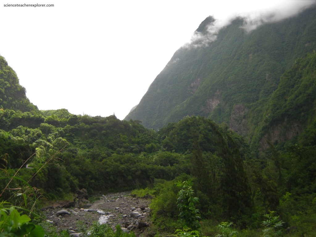
Imaged above, Reunion Island is situated in the tropics, just north of the Tropic of Capricorn. This intertropical, oceanic setting gives the island a humid tropical climate, with an annual average humidity of between 70-80%. Significant quantities of rainfall had dramatic implications for soil erosion and sediment transport by the island’s rivers. With Reunion’s high rainfall, steep slopes and young reliefs, rates of erosion and sediment transport are huge and often considered some of the highest in the world.
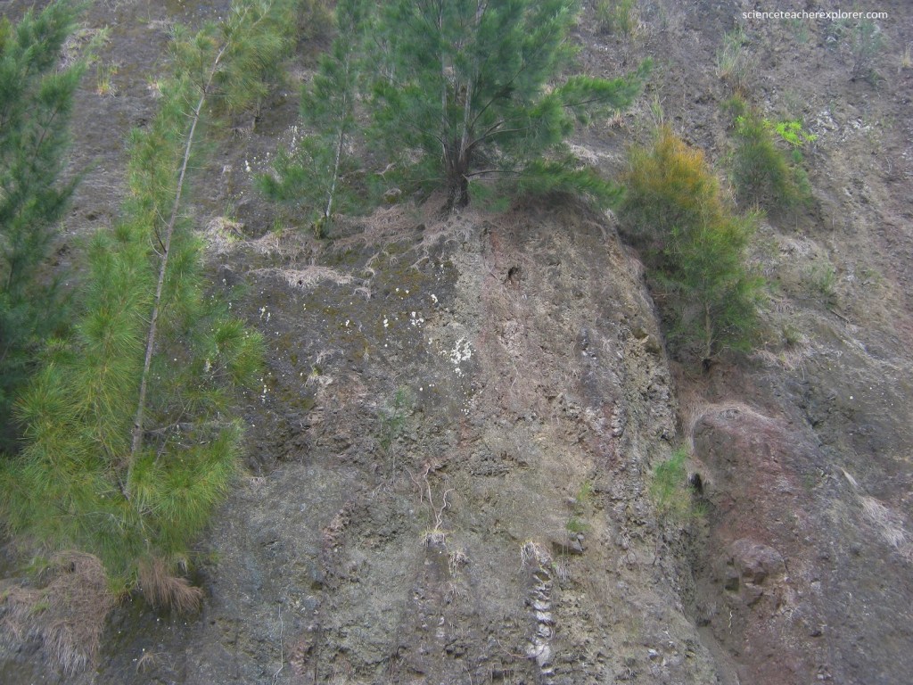
Imaged above, this extensive erosion was due to the aggressiveness of the climate, the steepness of the slopes and the weakness of the old material laying beneath the piles of the recent phases of activity lava flows. In fact, the major effect of erosion in the cirques carving process appears to have occurred after the ultimate eruptions, that is to say within about 20,000 years.
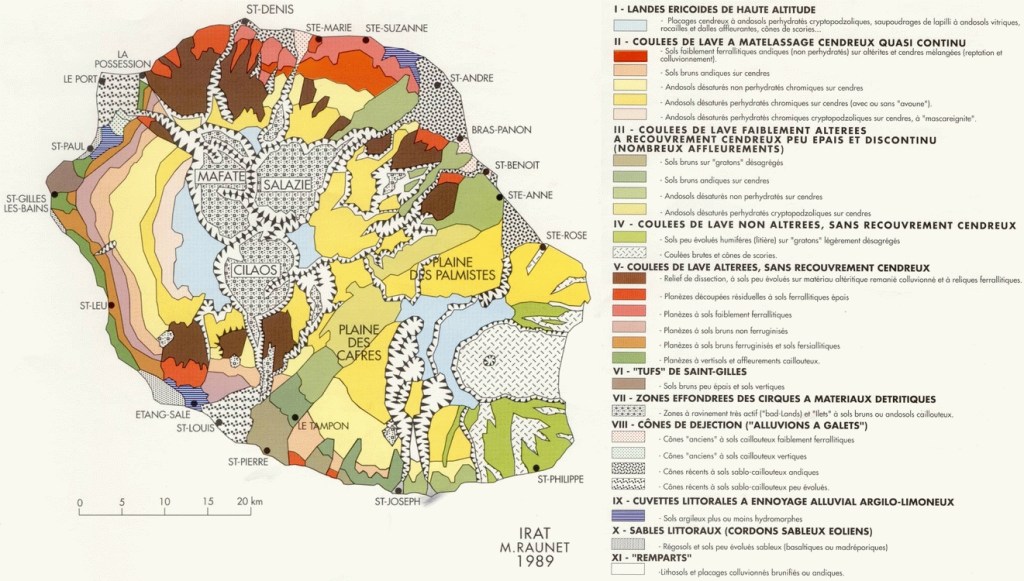
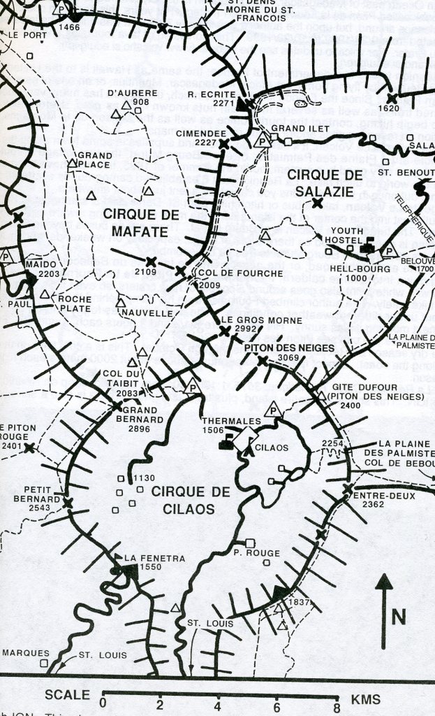
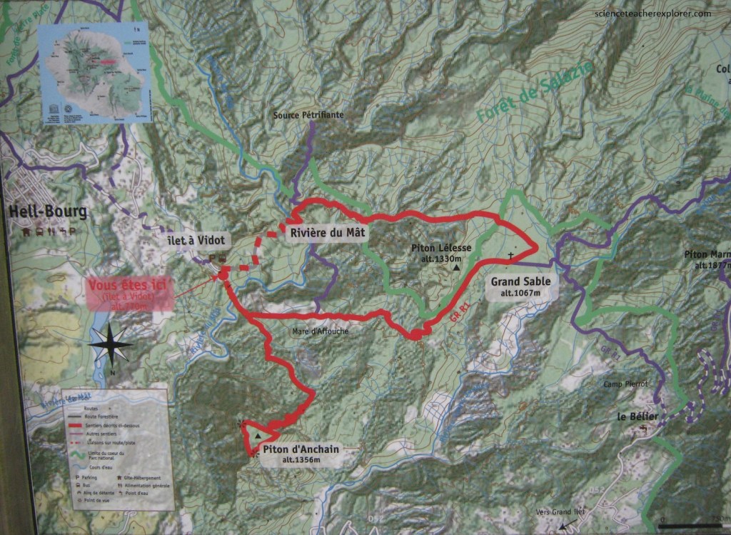
In terms of emerged surface extent, the Piton des Neiges volcano represents 2/3rds of the total island area. At the core of Piton des Neiges, three large depressions, (locally known as ‘Cirques”) exist, namely, the Cirque de Salazie drained by Riviere du Mat to the northeast, the Cirque de Cilaos drained by Riviere St-Etienne to the south and the Cirque de Mafate drained by Riviere des Galets to the northwest. They are the main and the most spectacular features of the Piton des Neiges edifice. The three cirques, (Cilaos, Salazie, and Mafate), surround the highest mountain on the island, Piton des Neiges.
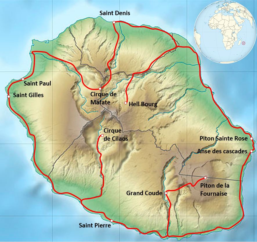
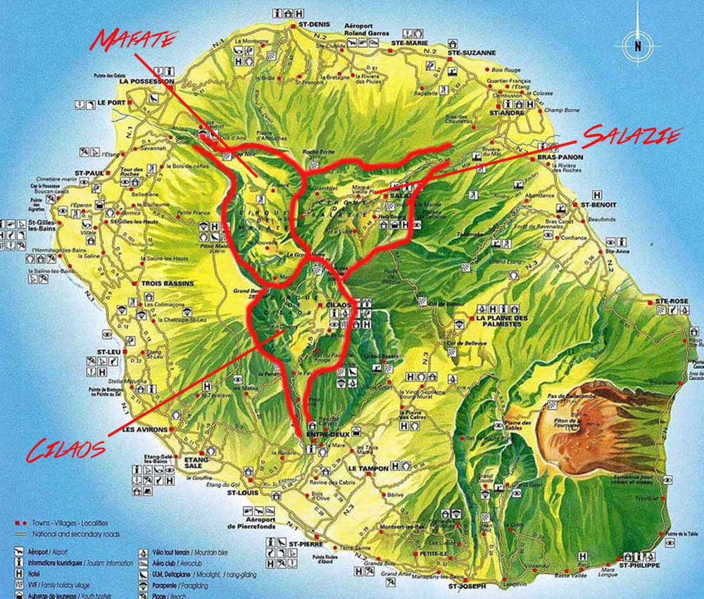
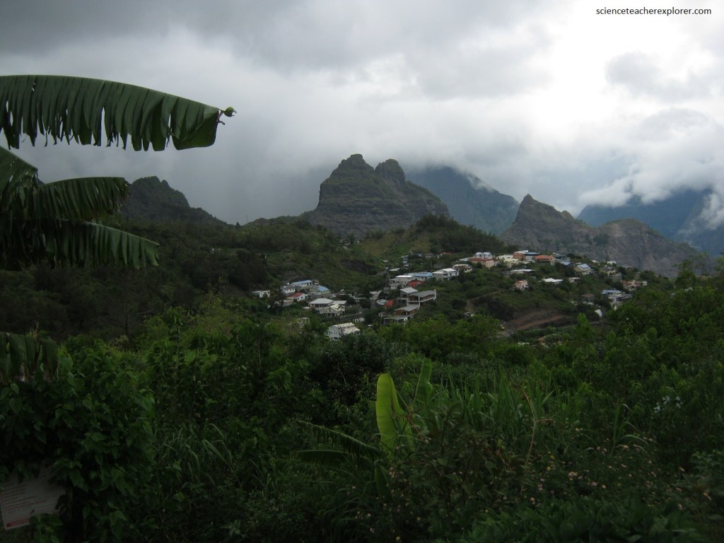
Imaged below, the wild and remote Cirque de Mafate is inaccessible by road with the exception of the Camp Noir viewpoint from Saint Denis. It is surrounded by the peaks of Gros Morne, Piton des Neiges, Grand Benare, and Roche Ecrite.
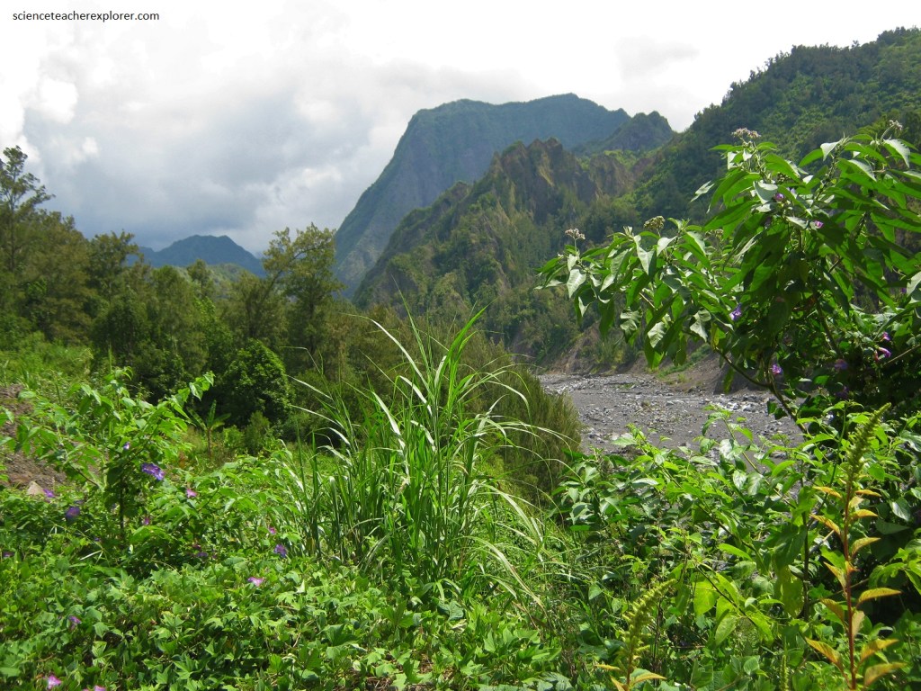
Picture below, the Cirque de Salazie, to the east of Mafate, has two main villages, Salazie and Hell-Bourg.
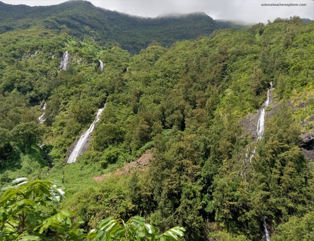
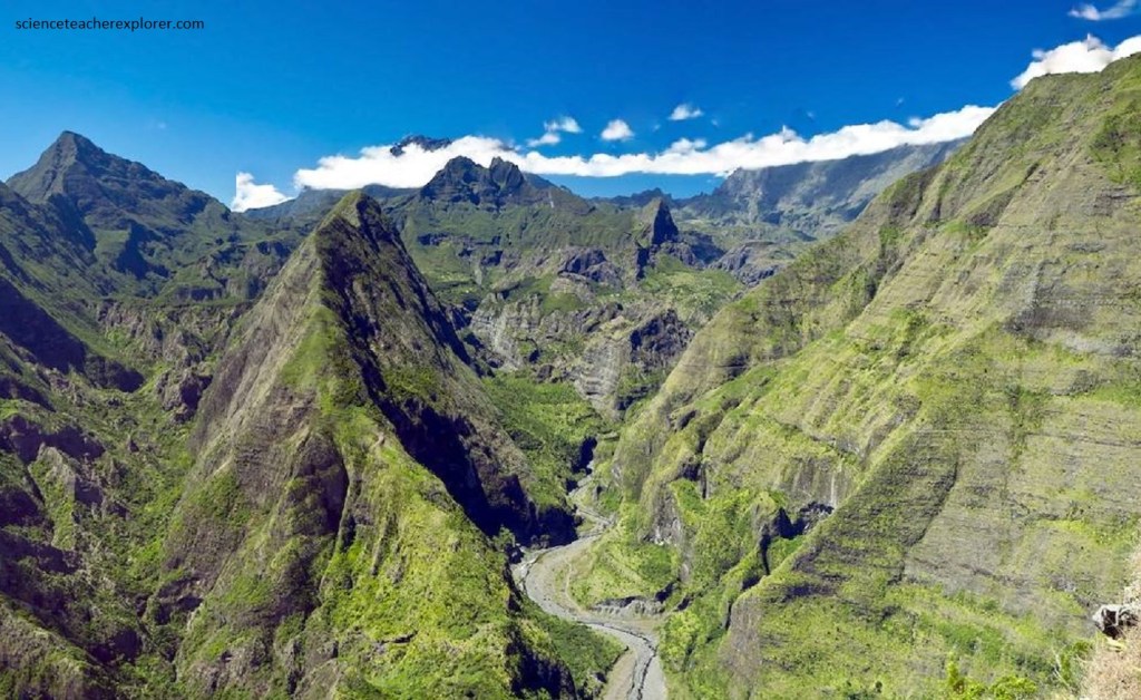
Pictured above, the wettest of the three cirques, Cirque de Salazie has spectacular waterfalls such as the “Cascade du Voile de la Mariee”.
Pictured above, the whole of the Cirque of Salazie is listed as a world heritage site by UNESCO, and the rugged terrain here has been shaped by erosion over the years. The heavy rainfall in the region feeds the many waterfalls rushing down from the surrounding cliffs. The abundance of water means the vegetation here is particularly lush, and allows some very specific species to flourish here: cress, chayote, etc.
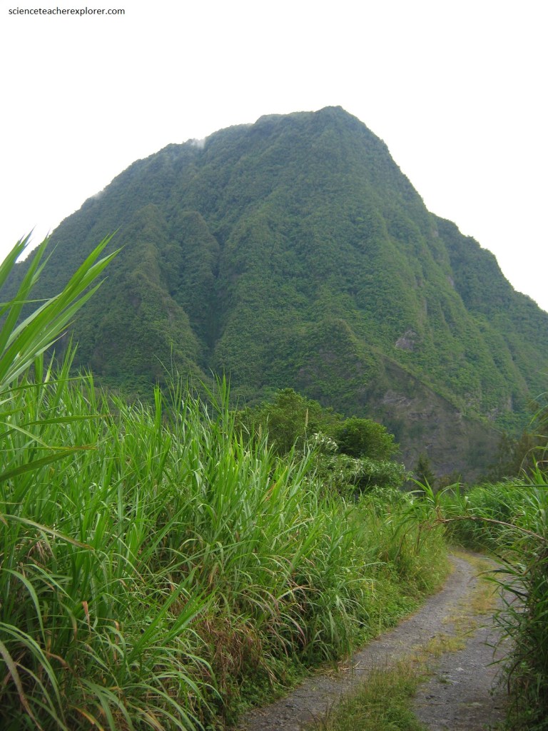
Pictured below, the center of the Cirque of Salazie, I found the impressive Piton d’ Anchaing (1,352m), which appeared as a result of an original geological event, earning it its place as a World Heritage site. Its name comes from a slave who fled a life of slavery and took refuge on this isolated headland.
Located about 45 kilometers from Reunion’s capital city of St-Denis, Cirque de Salazie is the largest and greenest of the island’s three natural amphitheatres. This cirque is both rugged and beautiful, best described as a long, deep canyon, lined with more than 100 magnificent waterfalls and full of hills and valleys ripe for exploration.
Pictured below, Cilaos is the most southerly of the cirques. However, it becomes centrally located on the Island of Reunion and the name of this cirque or “caldera” is said to have its origins in the Malagasy word Tsilaosa, which means “the place one never leaves”. Some believe, on-the-other-hand, that the name resembles that of a runaway slave names Tsilaos, who took refuge here. The runaway slaves, otherwise known as “black-browns” believed that at Cilaos’ high altitude, they were safe from capture.
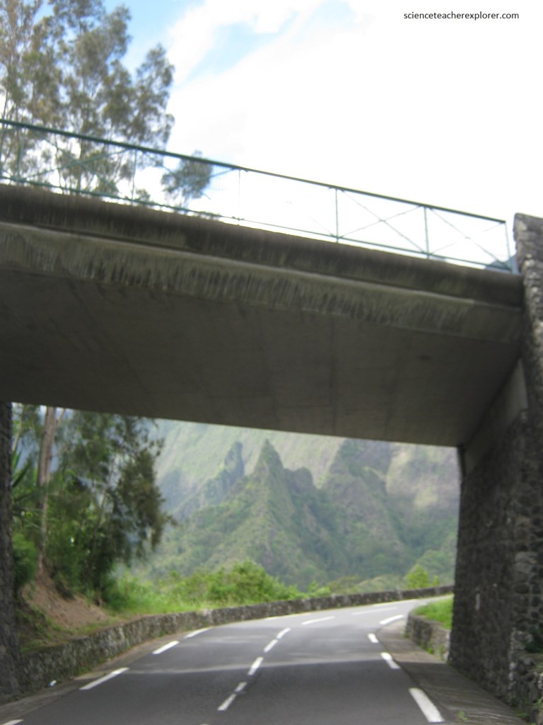
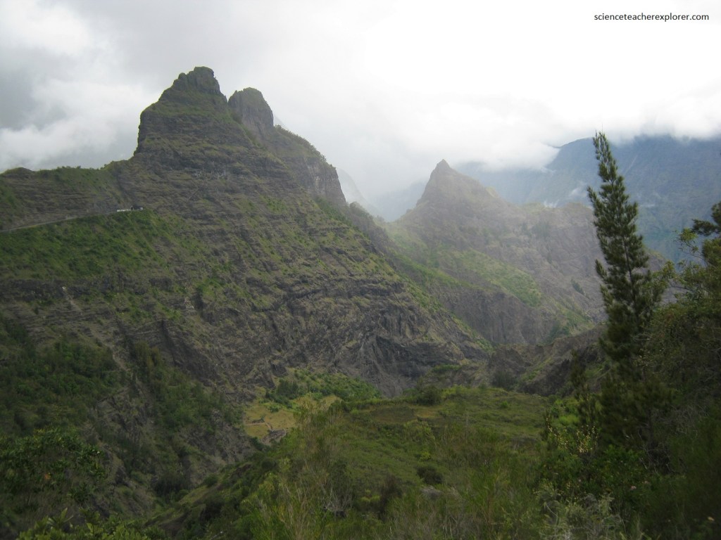
Pictured below, the dramatic Riviere St-Etienne was a natural wonder and we loved the memorable drive that led us toward the stunning cirque, with all its twists and turns and numerous tunnels.
Pictured above, the nail-biting drive into the Cirque Cilaos was well worth it! When we reached the cirque itself, we were treated to colorful fields of flowers, forests of unique indigenous trees, and soaring walls and pounding waterfalls that blew us away.
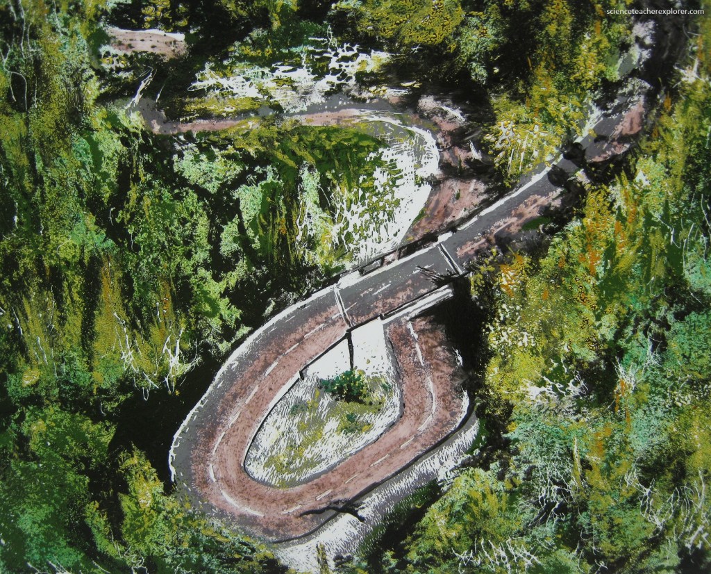
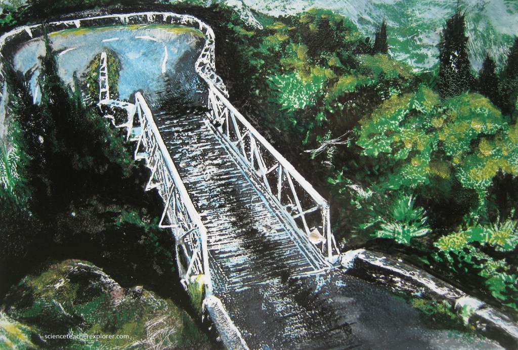
Pictured above, with 400 bends, the road winds through a deep valley of Riviere St-Etienne, lined with ravines and vertical cliffs. It zigzags upwards tirelessly, bypassing and crossing tunnels, revealing awe-inspiring views from the heartland of nature to the village of Cilaos.
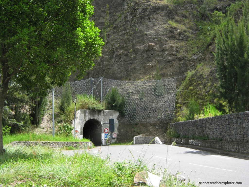
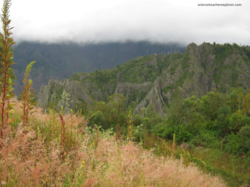
Pictured below, the tricky road had 3 one-lane tunnels where the first vehicle to approach had priority. We had to beep our horn to let other vehicles know we were there.
Pictured below, Cilaos stands out from the Cirque of Salazie and Mafate because it is much more sunny and dry, not-to-mention its Pitons, Cirques and Ramparts that are listed as world heritage sites by UNESCO.
Inside the Cirque, there are canyons and deep ravines (Gobert, Bras Rouge & Fleur Jaune), pitons (Piton de Sucre, Bonnet de Prêtre & Morne de Gueule Rouge), all forming a spectacular landscape and an unforgettable experience.
Pictured above, the village of Cilaos is a spa resort whose sources thermales are claimed to cure ailments such as rheumatism.
The scenery was spectacular here and and much of the rock inside the cirque is a volcanic tuff. Laumontite is found along wall rocks of dykes and sills in oceanites. Laumontite has been deposited through the action of Si-rich hydrothermal circulations accompanying the intrusion of quartz syenite sills, (pictured below).