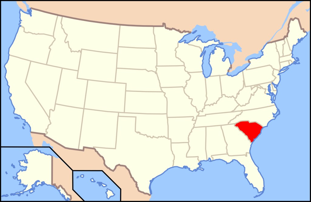
Cherokee Foothills, SC
While trekking/exploring the Southern Appalachian Mountains in August of 2023, Becky (my wife) and I decided to drive the Cherokee Foothills Scenic-Byway in South Carolina, USA.
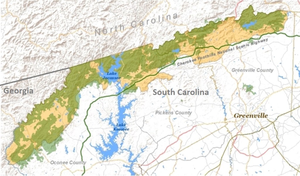
The Cherokee Foothills Scenic-Byway climbs across the slopes of the Blue Ridge foothills, forming a 209 km arc in the northwestern part of South Carolina.
Along the way the drive invited Becky and I to walk woodland trails to tumbling waterfalls, enjoy the solitude of mountain brooks, and gaze at highlands rolling to the horizon. The Cherokees, (native Americans), called this land Sah-ka-na-ga, or “Great Blue Hills of God”.
Most of all the Cherokee Foothills Scenic-Byway followed South Carolina Route SC11. Of course this gave me an excuse to explore the “Blue Ridge Escarpment”. The “Blue Ridge Escarpment” is the geographic-line at which the quiet majesty of the Blue Ridge Mountain Range plunges down towards the rolling foothills of Upstate South Carolina. This sheer geographical-drop, created by the movement of tectonic plates and the erosive force of water, is home to a mountainous biome of unique beauty.
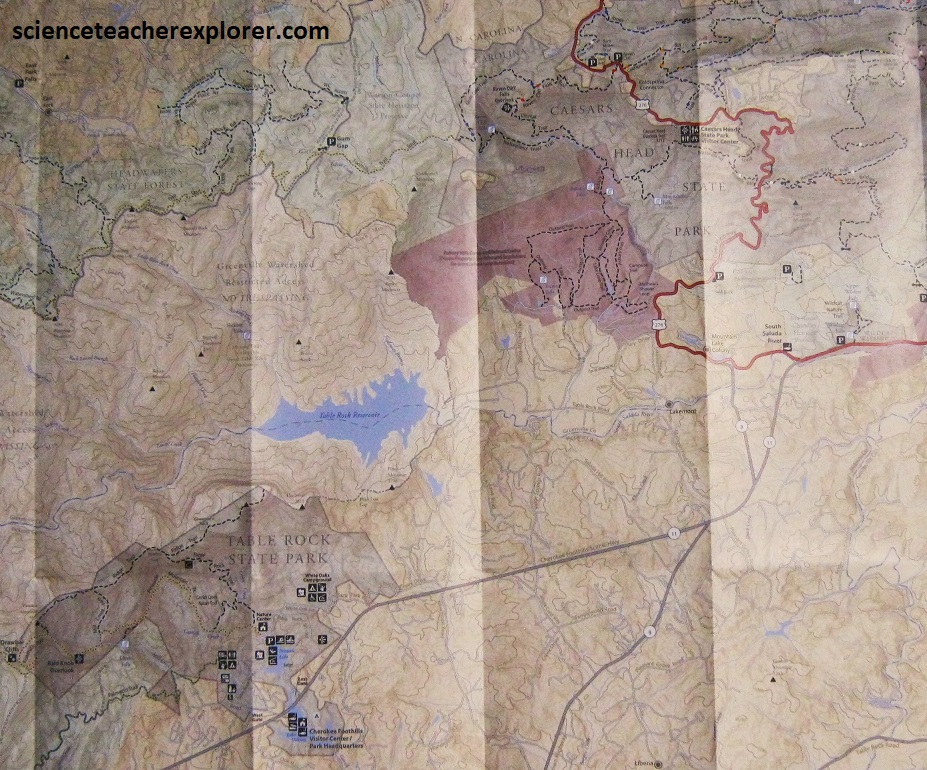
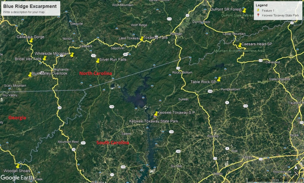
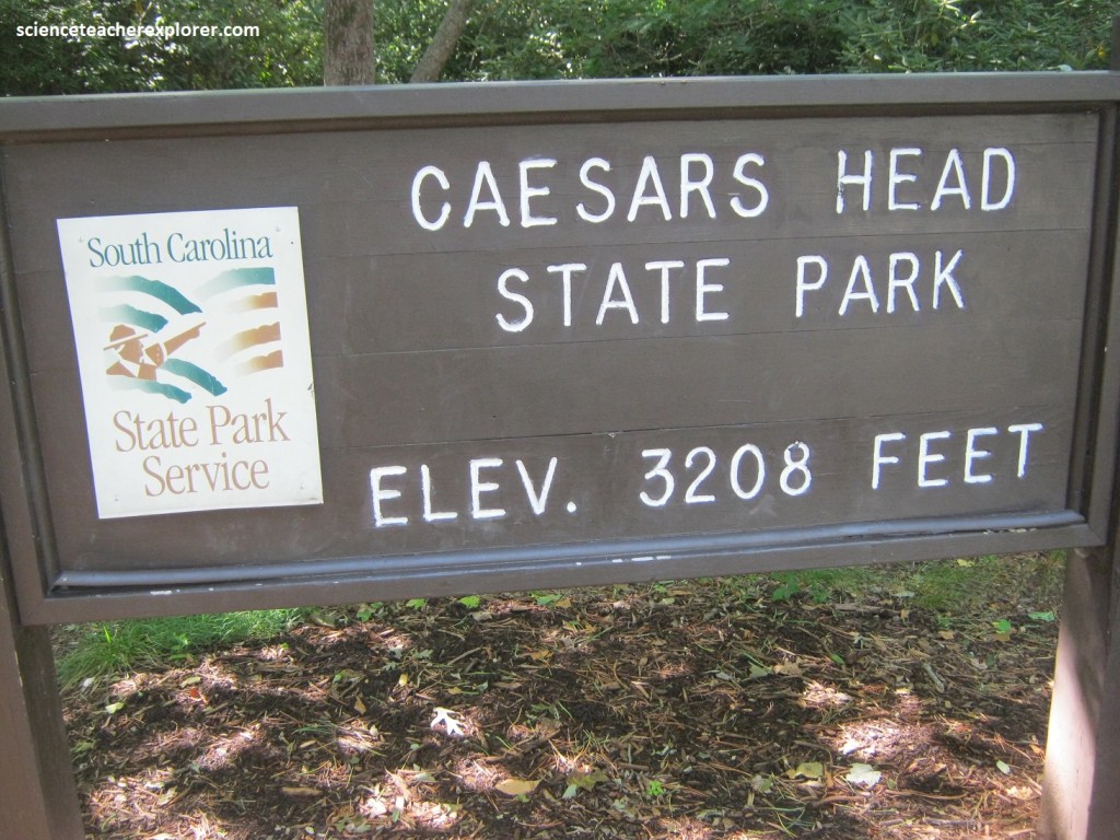
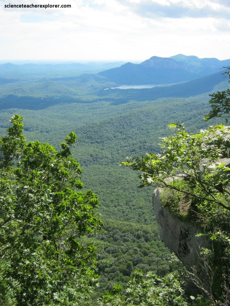
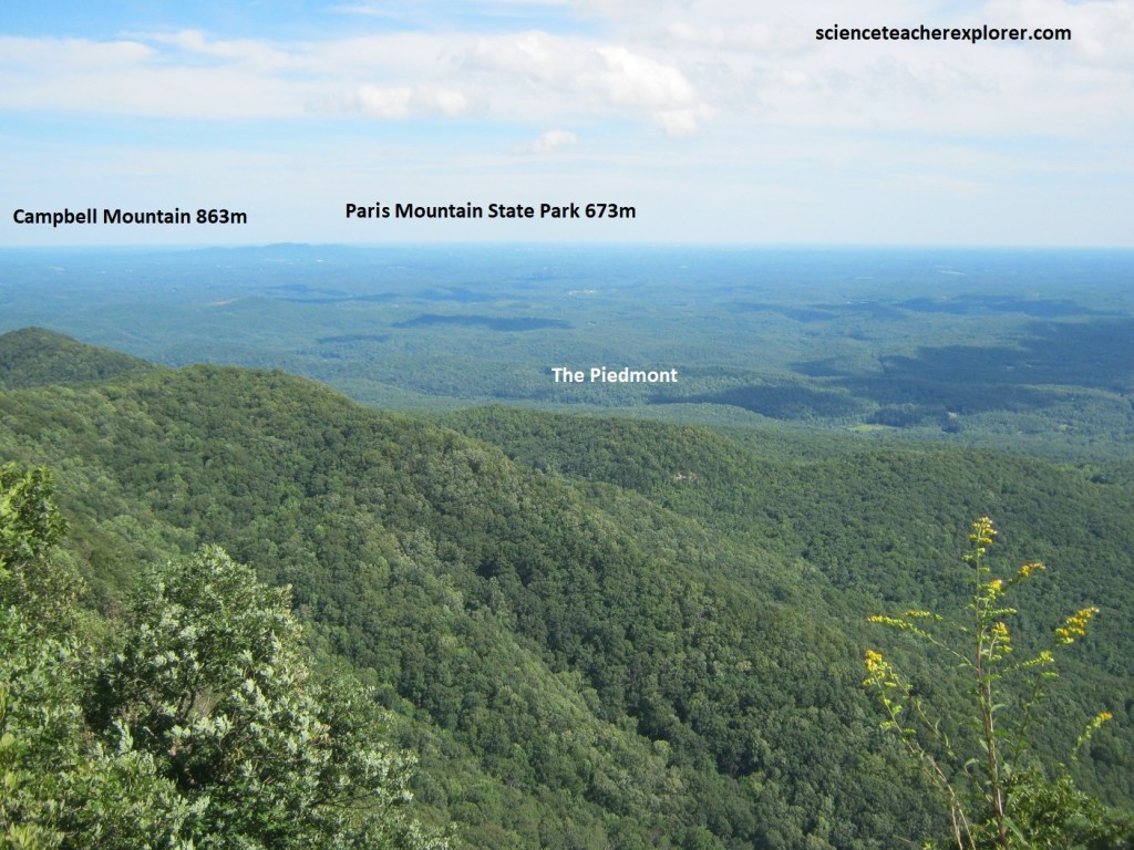
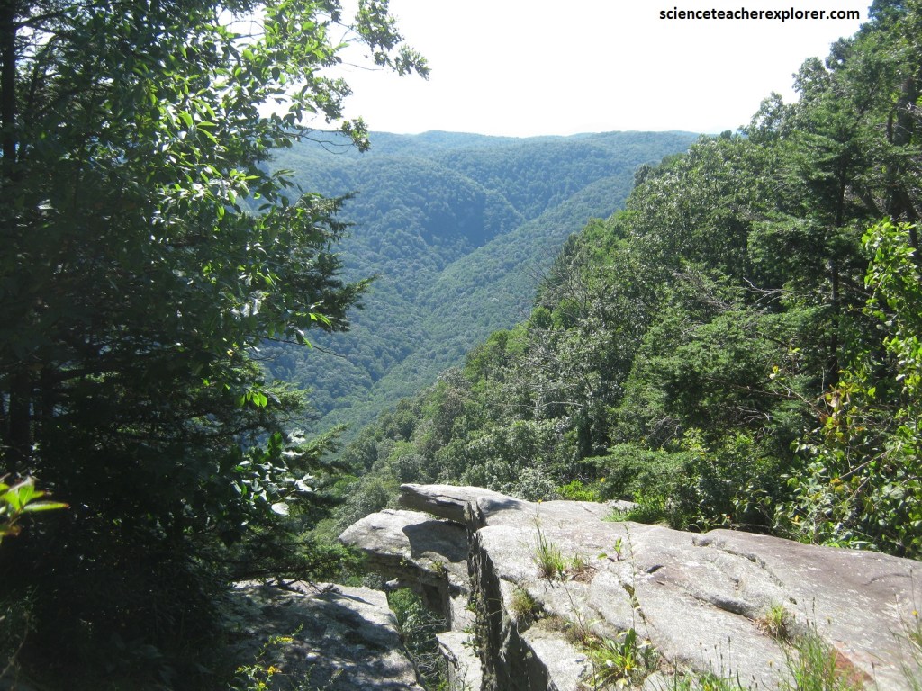
Becky and I started our tour of the Cherokee Foothills at the Caesar’s Head State Park. We drove past Jones Gap State Park on the way to Caesar’s Head State Park, situated just to the north via Rte. US276. The two parklands, linked by an 8 km trail along the Middle Fork of the Saluda River, rank among South Carolina’s finest wild places. Pictured above, the road up to Caesars Head, a mountaintop monolith, rewards visitors with a panorama of the Blue Ridge foothills, their green crest disappearing in the distance. At the overlook’s edge, seer cliffs drop a total of 400m.
At the top of Caesars Head in Greenville County, South Carolina, we were standing on a cliff 1089m above sea level with a view on the edge of the Blue Ridge escarpment, (the topographic divide-line between the Piedmont and Blue Ridge). Pictured above, this escarpment is an abrupt change in elevation of up to 667m that runs from Virginia through North Carolina into South Carolina. In some places, such as Caesars Head, the escarpment is essentially vertical. In other places, it is not a cliff, but rather a steep slope.
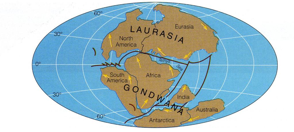
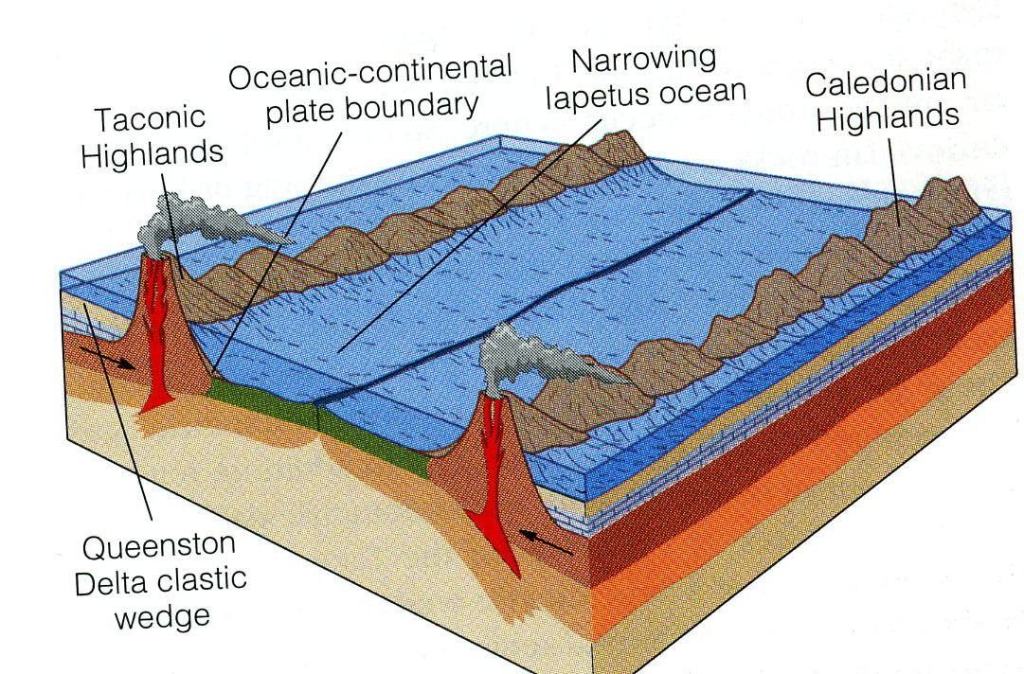
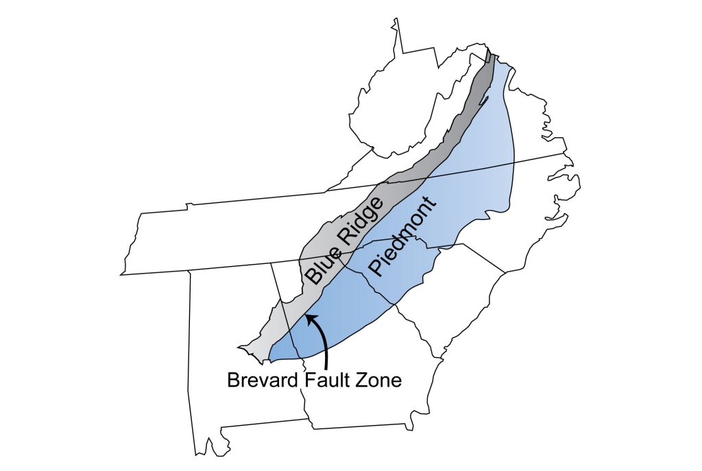
The origin of the Blue Ridge escarpment is a bit of controversy. {Even though the famous Brevard Fault is nearby and an obvious candidate, it still is 8 km away and does not correlate to the cliff-face at Caesars Head}. The most accepted hypothesis for the development of the Blue Ridge Escarpment is that it began as a feature known as a rift-flank uplift in the Triassic period, about 220 million years ago, when Gondwana (Africa) began to pull away from Laurasia (North America), {imaged below} .
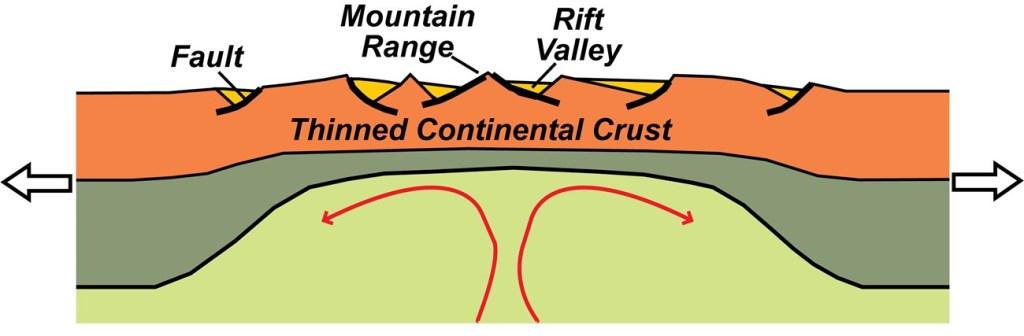
Rift-flank uplifts are long ridges of slightly higher elevation that run along the edges of continents that have rifted apart. When continents begin to rift, the crust gets stretched out and thinned. The edges of the two new continents rise as a result of buoyancy-rebound, and mantle upwelling, (imaged below).
When Pangea split up in the Early Triassic, a rift-flank uplift would have developed along the eastern edge of North America. This uplift would have been far to the east from where the Blue Ridge escarpment is now, but over the past couple of hundred million years it could have retreated to the west as a result of erosion.
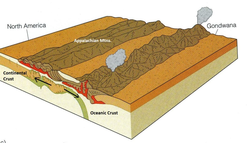
During the Cretaceous period, about 90 million years ago, sea level was the highest it had been in the past 600 million years. The climate was warm and all the glaciers and the ice caps had melted. Warm temperatures also caused the ocean waters to expand. With sea level so high, the eastern part of the Carolinas would have been flooded, and ocean waves would have been battering rocks at the foot of the rift-flanking uplift, eroding it back and keeping it steep, (imaged below).
Caesars Head, located between the Blue Ridge escarpment and the Brevard fault, is in an area that would be classified as Piedmont according to its bedrock and as Blue Ridge according to it’s topography. However, Caesars Head is made of highly resistant gneissic granitoid or a non-banded biotite granitoid gneiss. This was an igneous granite that crystallized from magma 450 million years ago. Later, the granite was metamorphosed from compressional forces.
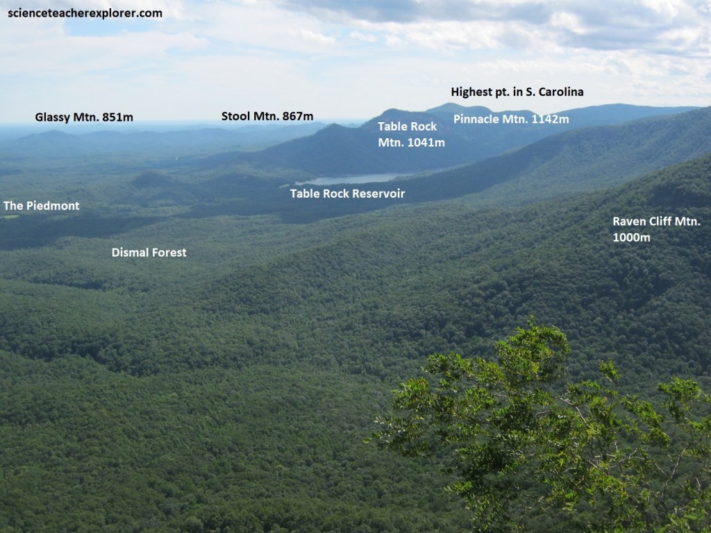
Pictured above and below, the overlook from Caesars Head views the stunning panoramic site of the Mountain Bridge Wilderness Area, Appalachian Foothills, and the Upper Piedmont of South Carolina. Table Rock, Pinnacle Mountain, Paris Mountain, and even a large rock outcropping known as “The Cathedral” can be viewed from this scenic observation overlook.
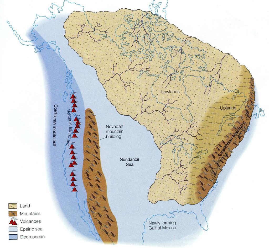
About 460 million years ago, a fragment of crust with volcanoes on it was colliding with Laurentia in an event called the Taconic orogeny & produced most of the Appalachian Mountains, (imaged below).
The granite that turned into the gneiss of Caesars Head may have started out in a magma chamber feeding the volcanoes on this Piedmont-terrane crustal fragment. However, it is 10 million years too young to be involved with the Taconic Orogeny. Maybe, new volcanoes arose in the Piedmont terrane after it had been added to Laurentia, (North America). The granite was then metamorphized when another fragment of crust hit Laurentia behind it, during the subduction of the ocean crust.
Pictured above, near the Caesars Head overlook, the gneiss is weakly metamorphosed and looks very much like granite, (speckled with minerals of different colors distributed evenly throughout and not banded). The more banded appearance of the gneiss, the more metamorphized.
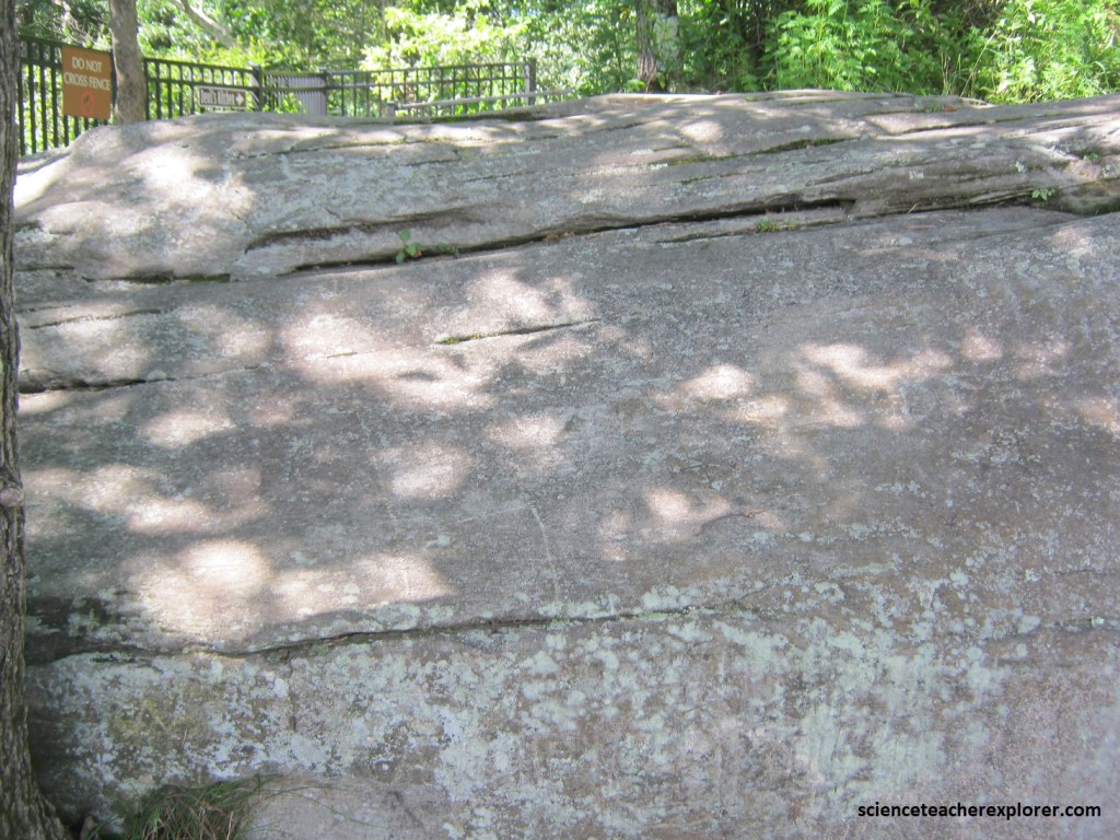
Pictured above, Caesars Head has some pretty impressive cracks in the gneissic granitoid, called joints. [A joint is a crack in rock along which no significant movement has taken place, whereas a fault is a crack along which movement has taken place]. One of the joints near the top of Caesars Head has been eroded into a narrow passageway called the Devil’s Kitchen, (pictured below).
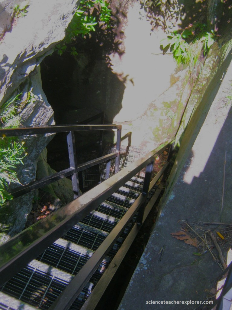
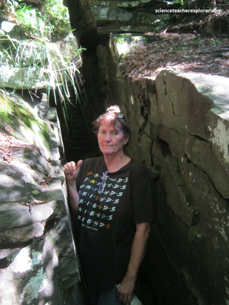
Pictured above, when the “Raven Cliff ” trail reaches Devils Kitchen, a set of stairs descends deep down into the rocky gap, which is just wide enough for a person to pass through.
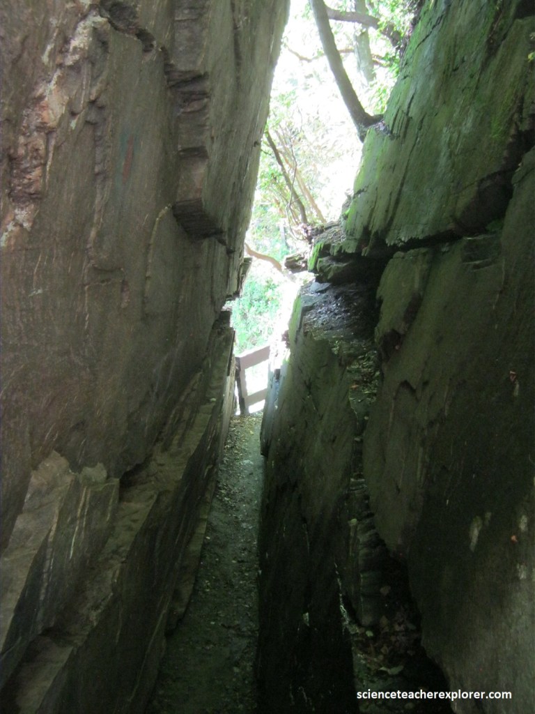
The joint-formation was created thousands of years ago, as water on the mountain froze and expanded, causing the rock to crack open from the pressure. The granitic gneiss, breaks at a 90-degree angle when it cracks, which formed the narrow passage flanked by tall rock walls.
The name of the geological formation comes from a myth dating back to the days when the area was settled by Scots-Irish immigrants who enjoyed brewing their own alcohol. According to the story, the Devil himself made a particularly hot brew here, and spilled a drop of it on the rock, splitting the rock open on the spot.

Pictured above, shortly after passing through the Devil’s Kitchen, Becky and I arrived at a small overlook offering another panoramic view of the eponymous Caesars Head rock formation.
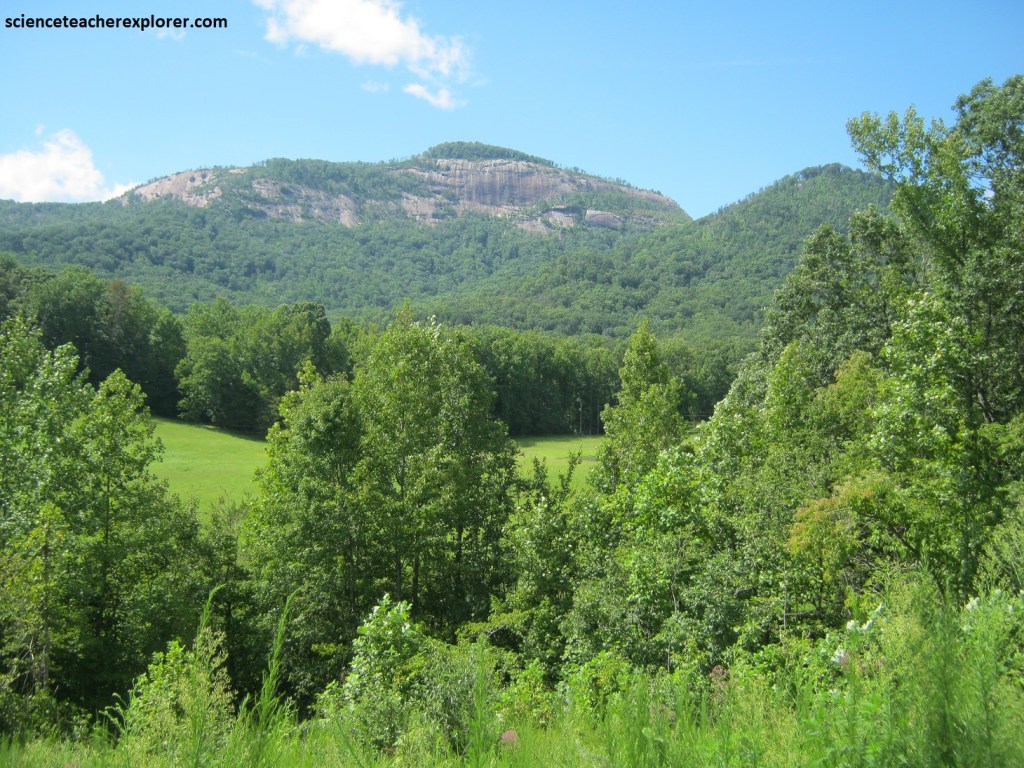
After exploring/trekking Caesars Head State Park, Becky and I head back (south) down the hill on US 276. At the bottom of the mountain, we turned right (southwest) on Rte. SC11. Within 7 km, we turned off to get a look at Table Rock Mtn., (pictured above & below). The geology of Table Rock is identical to Caesars Head. With the exception that the granitic rock is more metamorphized and banded.
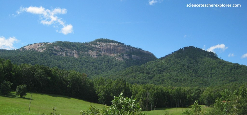
Pictured above, Table Rock is reached by a 11 km hike on a trail within the State Park Boundaries. The towering mountain, which gives the park its name, serves as a backdrop for the 3,000 acre park and its facilities. The Native-American Cherokee tribe called the area, “Sah-ka-na-ga,” the Great Blue Hills of God, and they established many hunting camps in the area. According to folklore, Table Rock Mountain received its name from a Cherokee legend in which the flat-topped mountain served as a table from which the “Great Spirit” ate his meals.
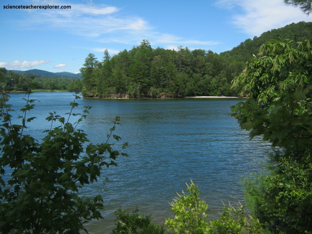
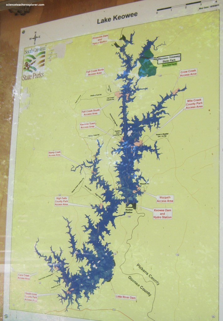
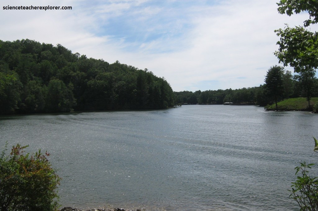
Becky and I continued driving west on SC 11 when we came upon the interpretive center for Keowee-Toxaway State Park. Keowee-Toxaway State Park was a hidden gem in South Carolina’s Jocassee Gorges area. The interpretive center was situated on Lake Keowee with beautiful views of the Blue Ridge Mountains. Here in South Carolina and in North Carolina, they call the Appalachians, “Blue Ridge Mountains”. Actually, the Keowee-Toxaway State Park is in the upper Piedmont, (an area of rolling hills with an average height of (267 – 330)m above sea level).
However, the Blue Ridge Mountains has certainly affected the plants and animals that live there. The mountains are one of the wettest places in North America and average over 200 cm of rain a year! All that rain makes the Blue Ridge Mountains and Keowee-Toxaway one of the most diverse places in the world.
Jocassee Gorge was never covered by ancient seas or glaciers, allowing an extraordinary variety of life to evolve here over millions of uninterrupted years. Additionally, as warm, moist air from the Gulf of Mexico collides with the Blue ridge Escarpment, it funnels into deep ravines, creating one of highest annual rainfalls of any site in the eastern U.S. Steep slopes cast lingering shadows, and trees crowed together keep the forest floor in shade. The result is almost like a rainforest where plentiful plant and insect life promotes bountiful populations of small vertebrates, which support larger animals.
European pioneers encountered a thriving Cherokee culture to these rugged hills. For a time the two peoples lived in peace, but as more and more settlers came, the Cherokees, like other eastern indigenous-tribes, were forced to leave their homeland for points west.
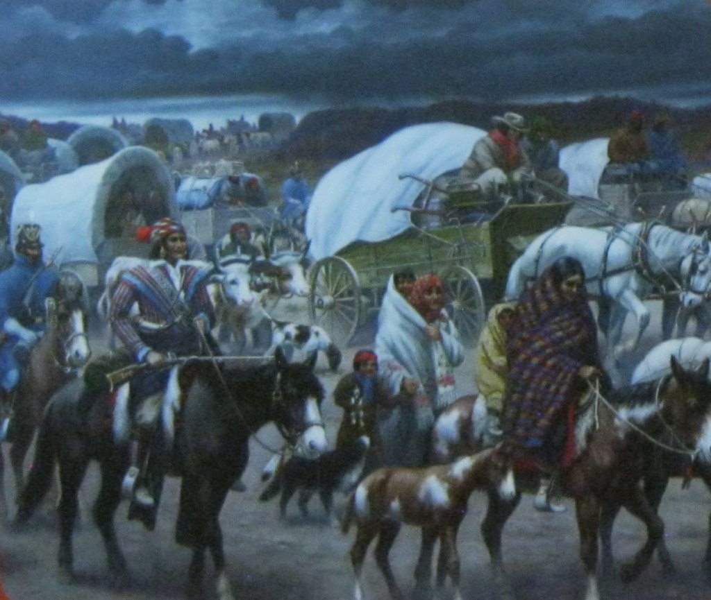
Imaged above, the 1830, Indian Removal Act authorized the forcible relocation of American Natives east of the Mississippi River to the Indian Territory in Oklahoma. The federal government, under pressure from the white settlers, forced more than 16,000 Cherokees to move to Oklahoma. 4000 Native Americans died from exposure, exhaustion and starvation along the “Trail of Tears”.
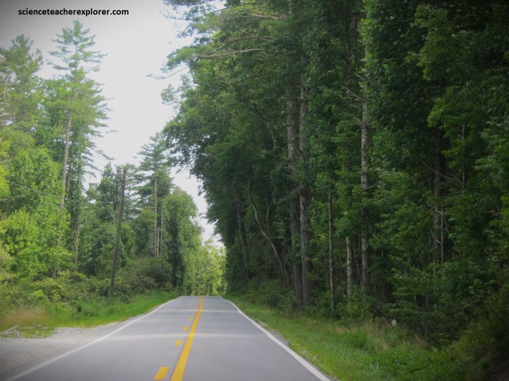
Back on Rte. SC11, it veers toward the south, following the South Carolina and Georgia border. Meandering through pines, oaks, hickories, and hemlocks, the highway is the gateway to many of the Upcountry’s most appealing sites. Rte. SC11 eventually makes it through Walhalla, (a pretty town amid orchards), and joins US76 (at Westminster) where Becky and I turned right onto it to head northwest through the mountains of Sumter National Forest. US76 marks the entrance to the Ellicott Rock Wilderness, a rugged realm of waterfalls and woodlands that boasts on the America’s most renowned white-water rivers: the Chattooga. Our goal-destination was the Woodall Shoals of the Chattooga River.
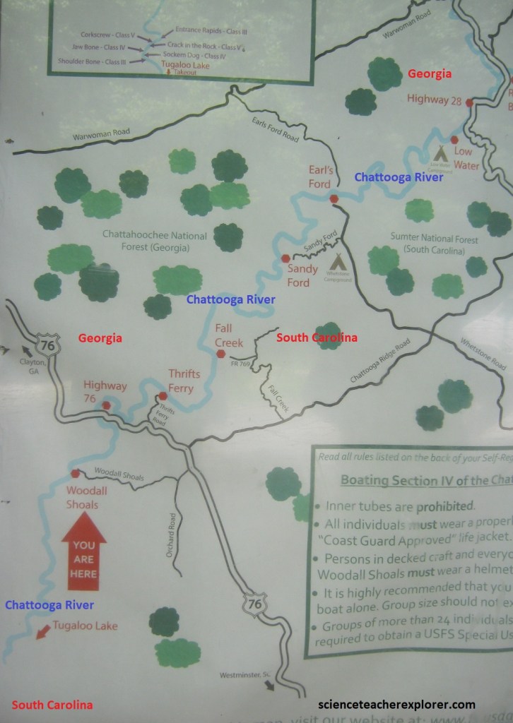
Imaged above, Woodall Shoals was at the Woodall Shoals Boat Launch on the Chattooga River in the Sumter National Forest. The boat launch was at the end of U.S. Forest Service Road 757, a gravel road that branches off of US76 near the South Carolina and Georgia border. [It should be noted that the movie “Deliverance” was filmed near hear on the Chattooga River where it offers some of the wildest white water in the country].
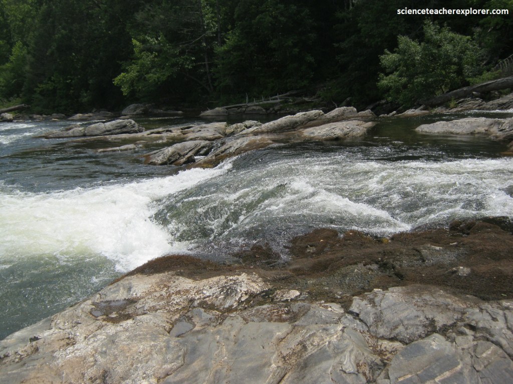
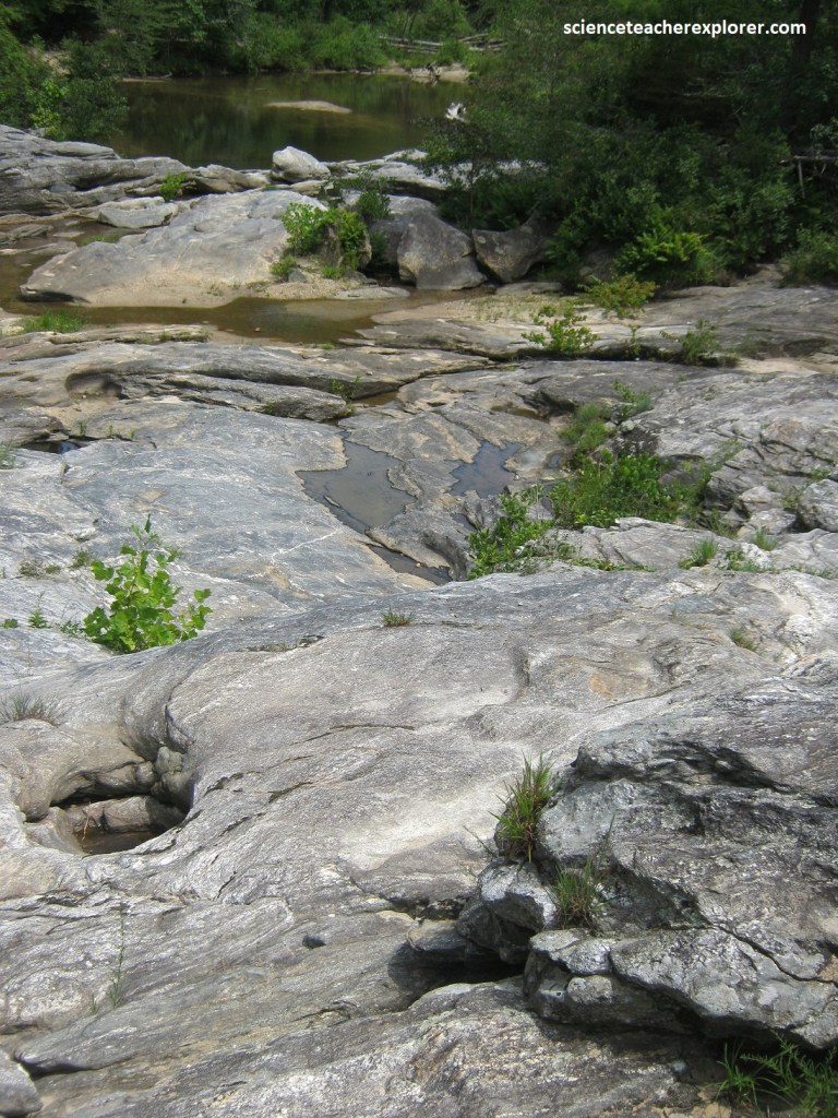
Pictured above, the Woodall Shoals is on the Chattooga River, almost due west of Walhalla, South Carolina. Located there is a set of rapids running over and along a fascinating outcrop of rock that may contain a record of three important geologic events that have affected the Carolinas during the past 460 million years.
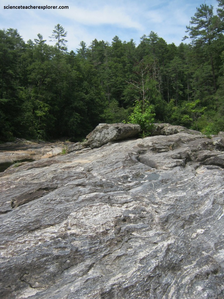
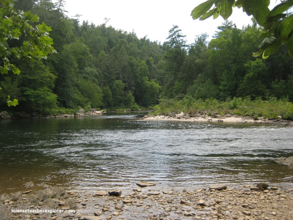
Pictured above, the Woodall Shoals outcrop is an 8,000 ft2 broad, flat area of rock in the streambed, about a half a kilometer walk from the Woodall Shoals recreation site parking lot.
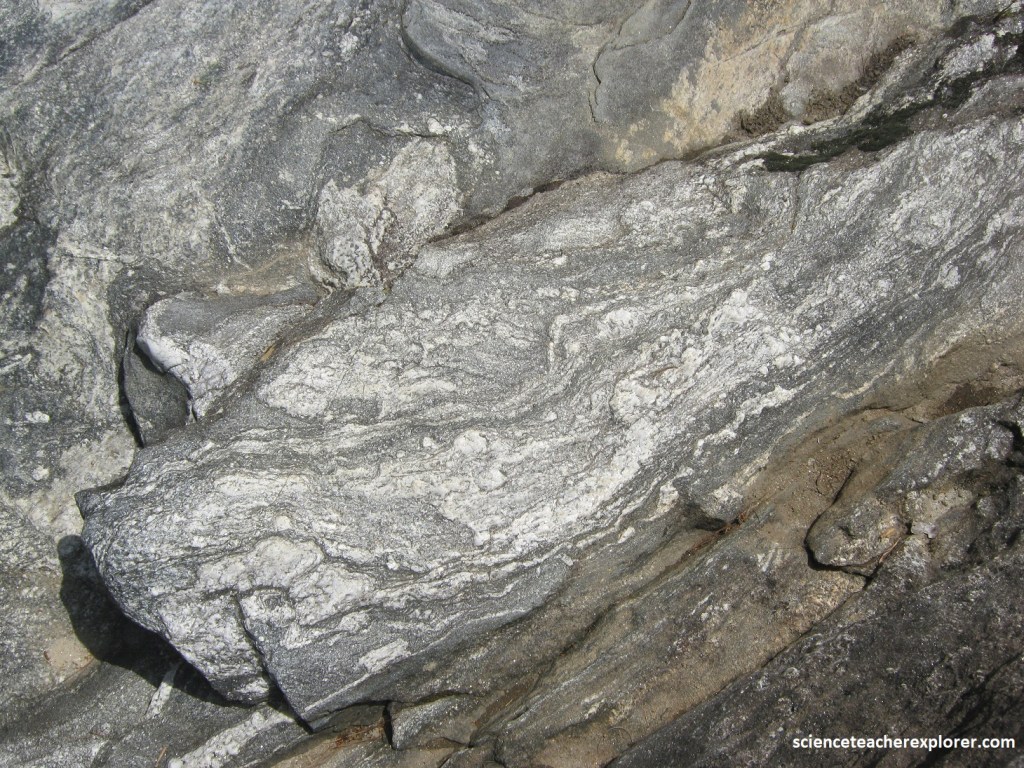
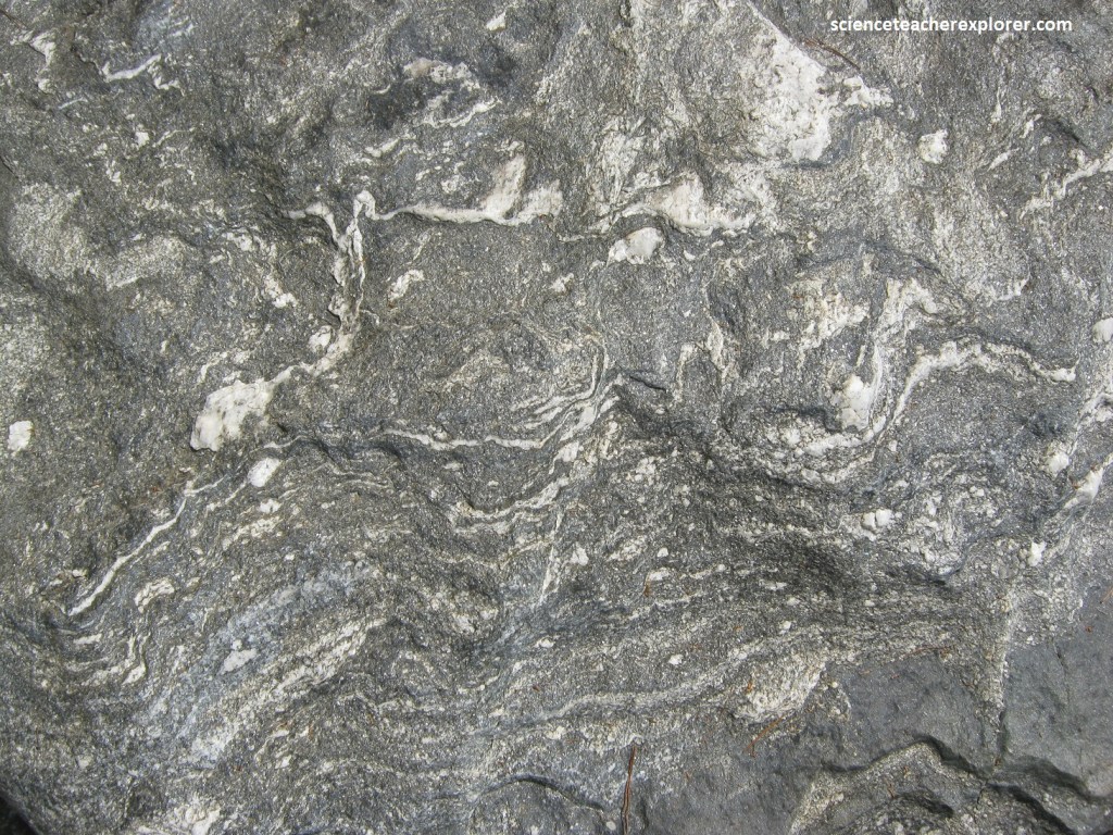
Pictured above, at Woodall Shoals, Becky and I could see light and dark layered rocks that were folded and squished together. There were simple U-shaped folds and more complicated zigzag folds. Some folds were smaller than my hand; others were bigger than my car.
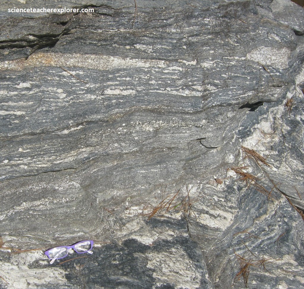
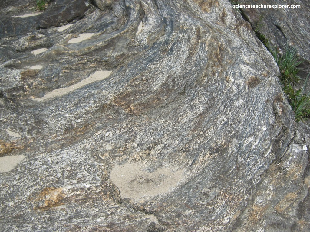
Pictured above, some of the layers seemed to have been stretched apart so that they looked like strings of sausages. These were called boudins, a French word for sausages.
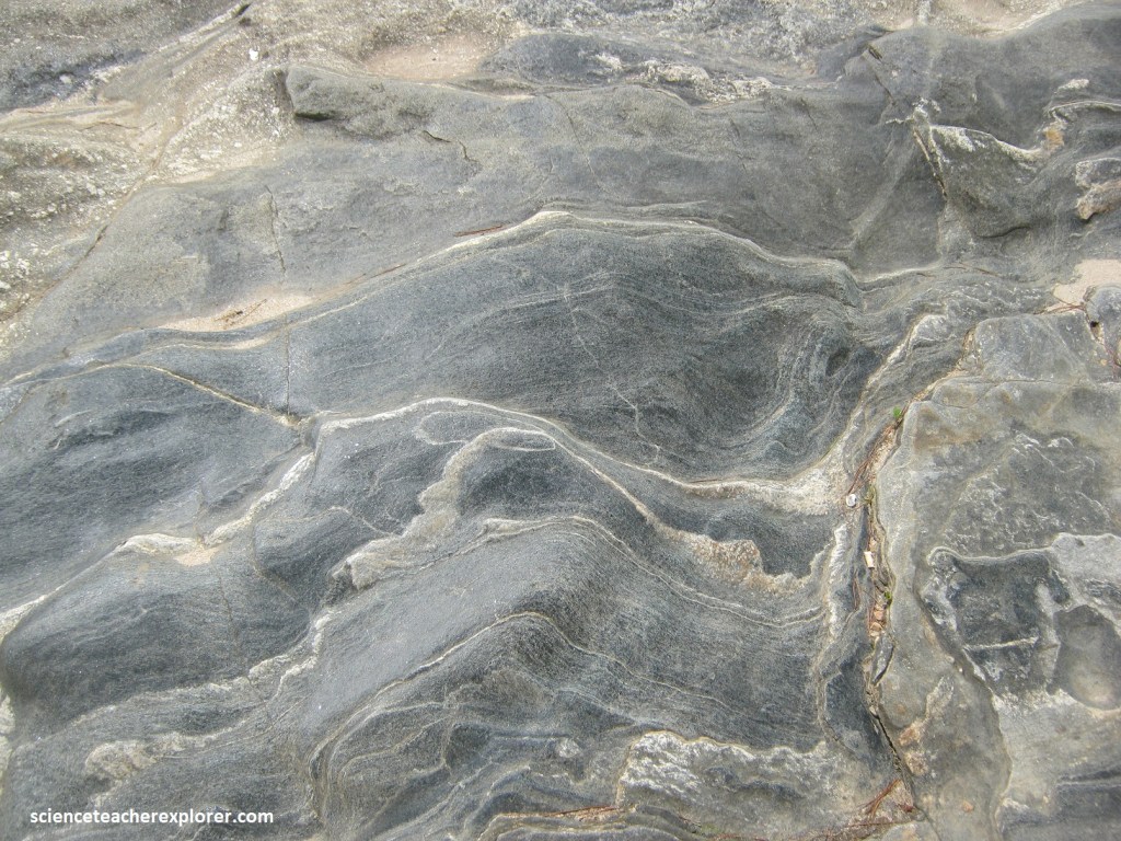
Pictured above, the deformed rock at Woodall Shoals is metamorphic rock; it was the metamorphism that produced the layers, folds, and boudins. Metamorphism is the result of increased temperature and pressure, an the high pressure squeezed the rock into the contorted shapes that I could see at Woodall Shoals. There was schist (fish like scaling), gneiss (light and dark banding), and amphibolite (completely dark).
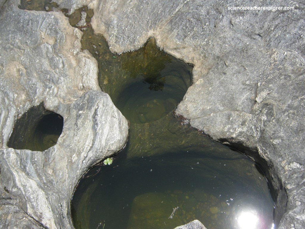
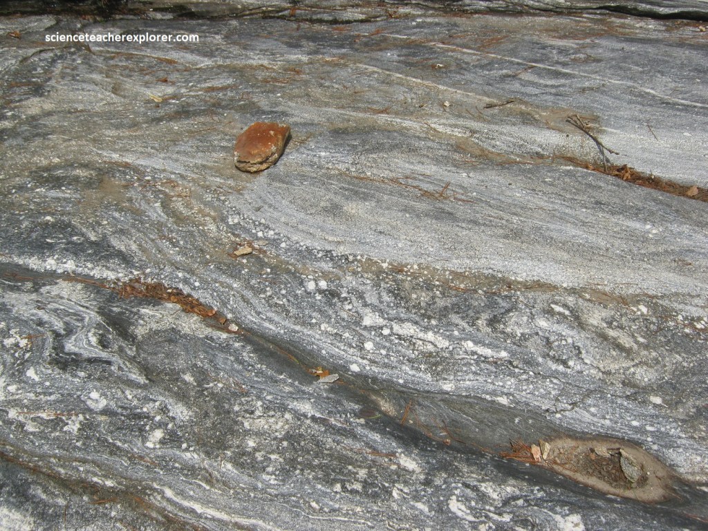
Pictured above, Becky and I found a number of potholes in the rock at Woodall Shoals. These are smooth, circular, deep holes scoured out by waterborne sand and pebbles. Some of the potholes had water in them and others were dry. Most had sand and pebbles in them. When the Chattooga River was high and flowing over these potholes, eddies caused the sediment to whirl around, scouring the holes still deeper.
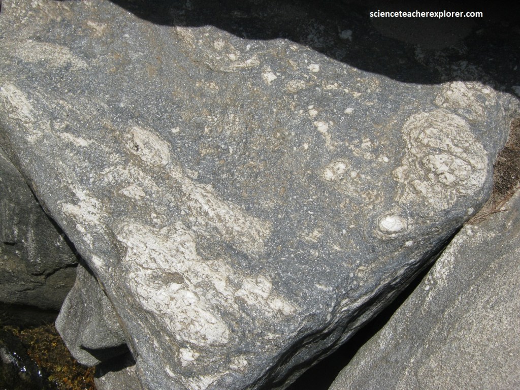
Pictured above, the highly deformed metamorphic rocks at Woodall Shoals had been intruded in places by some very coarse-grained quartz pegmatites. These pegmatites form by the crystallization of magma that contains water as well a other elements and compounds that inhibit the nucleation of mineral crystals that cool at a different rate than surrounding magma.
Pictured above, the folds and other structures at Woodall Shoals could tell geologists about events that happened millions of years ago. For instance, the hinge of a fold is commonly perpendicular to the tectonic forces that produced it. Geologists have spent a lot of time at Woodall Shoals, measuring the orientation of folds, layers, and fractures, in order to find out more about the geologic history of the area.
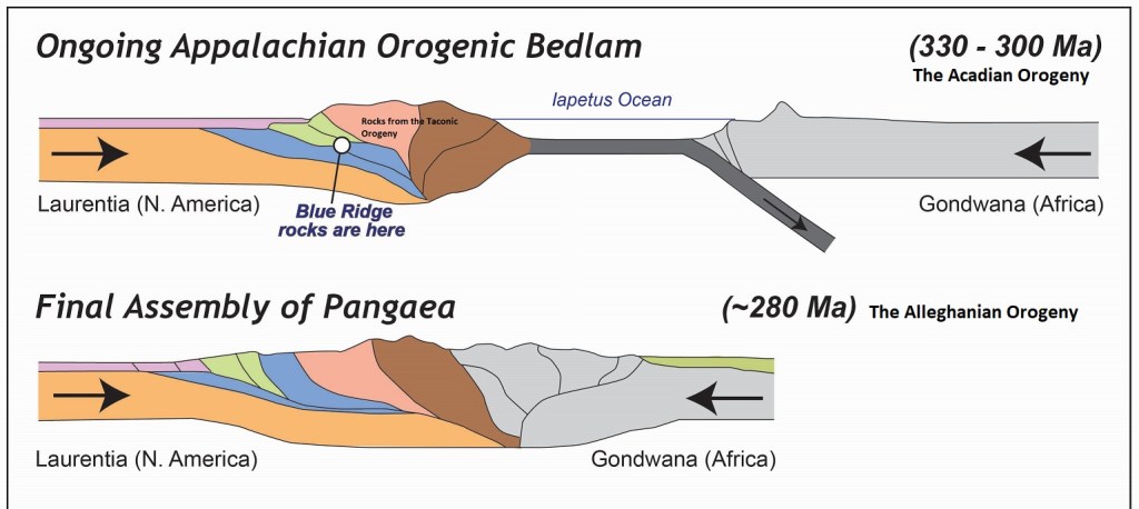
Between 600-500 million years ago, the rocks at Woodall Shoals started out as horizontal layers of sediments interspersed with an occasional layer of basalt from a lava flow. These layers were deposited on the floor of the Iapetus Ocean between Laurentia (North America) and Gondwana (South America & Africa).
About 500 million years ago, Laurentia and Gondwana began moving toward each other, as if on a slow-motion conveyor belt. They came together in a series of three collisions. First, a strip of crust with volcanic rocks on it, (the Piedmont terrane), collided with Laurentia during the Taconic Orogeny (460 million years ago). [Note that the sandy sediments became quartz-rick gneiss, the muddy sediments became schist, and the basalt layers became amphibolite]. Next, a piece of Gondwana broke off and collided with Laurentia during the Acadian Orogeny (330 million years ago). Finally, Gondwana itself collided with Laurentia, creating the supercontinent Pangea during the Alleghanian Orogeny (280 million years ago).
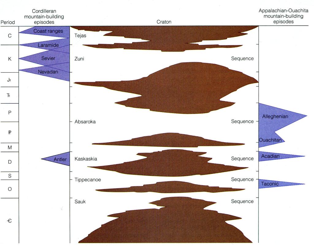
Geologists who have studied Woodall Shoals have concluded that there were at least 5 different generations of folds, which they have interpreted to be related to all 3 Orogenies.
Pictured above, the Woodall Shoals was the perfect spot to study the folds, crenulations, boudins, pegmatites, potholes and metamorphic rocks that all have stories to determine the amazing history of the Blue Ridge escarpment. It should be note that the Woodall Shoals are the location of the famous Brevard Fault Zone. Therefore, this was the primary location of the transition zone between the Piedmont and the Southern Blue Ridge Mountains. Another reason why the Chattooga River was located here at the Woodall Shoals. This makes the location a particularly beautiful place to end our tour of the “Cherokee Foothills”.
