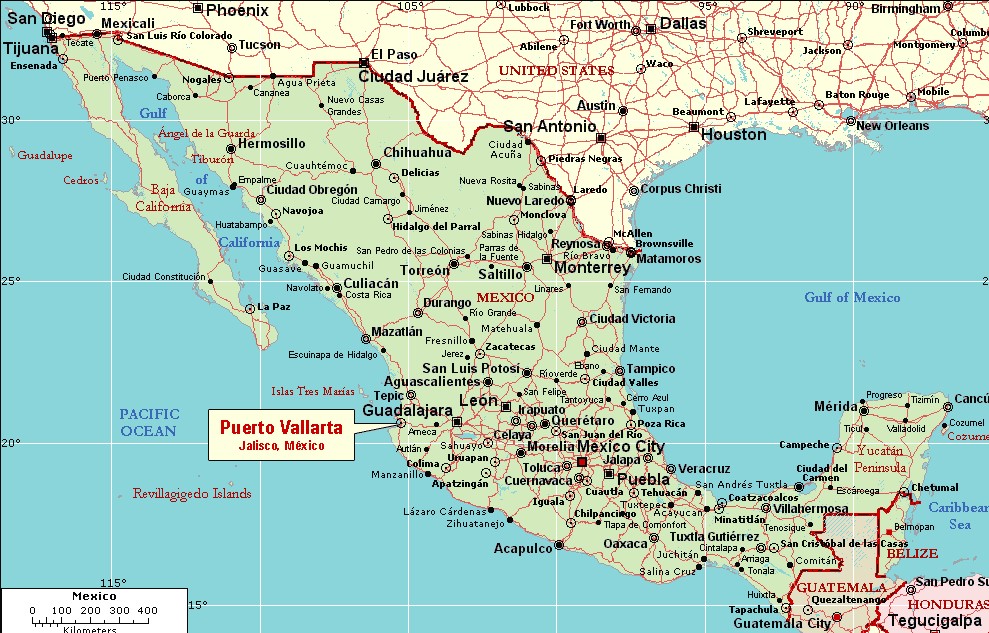
Puerto Vallarta, Mexico
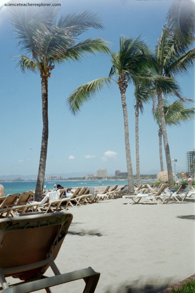
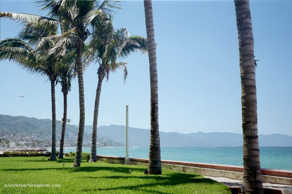
In 2005, Becky (my Wife) and I took spring vacation to Puerto Vallarta, Mexico. Puerto Vallarta (or simply “Vallarta,” as it is often called by locals) is located on the Pacific Coast of Mexico in the State of Jalisco within a large bay called Bay of Banderas (Bay of Flags) or Bahía de Banderas. Sitting at just 2 meters above sea level and at the same latitude as Hawaii, Puerto Vallarta enjoys a warm, tropical climate year-round.
Puerto Vallarta was made famous with the film, “The Night of the Iguana”, entirely produced on location in 1963, (one of my favorite movies). For the first time, Puerto Vallarta received big Hollywood stars, national celebrities and American intellectuals. Deborah Kerr, Ava Gardner, Sue Lyon and Richard Burton led the cast. Tennessee Williams, author of “The Night of the Iguana”, visited the set frequently. Elizabeth Taylor’s romance with Richard Burton was unveiled in Puerto Vallarta during this time. Charmed by Vallarta’s magic, Richard and Elizabeth purchased a house, Casa Kimberley. John Huston built a house in the small cove of Caletas where he lived until his death.
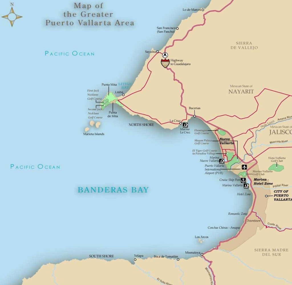
Pictured below, Banderas Bay is considered one of the most beautiful bays in the world, and the underwater version of it may even be more impressive and full of beauty.
Besides being one of the most beautiful bays in the world, Banderas Bay also happens to be one of the deepest bays in the world at close to a kilometer deep. In addition to being one of the deepest, it’s also one of the biggest. Stretching over 42 kilometers, it’s the largest bay in Mexico.
General tectonic setting of Banderas Bay and Puerto Vallarta involves four lithospheric plates that act in the area: Pacific, Rivera, Cocos and North American. The theory of plate tectonics suggests that the earth’s crust or lithosphere is from 5 to 65 km thick and divided into about a dozen large tectonic plates, tabular blocks that drift across the Earth in different directions and at various speeds (up to a few centimeters), probably as a result of thermal convection currents in the Earth’s molten mantle. Most plates consist of a combination of both ocean floor and continent, though some are entirely ocean floor.
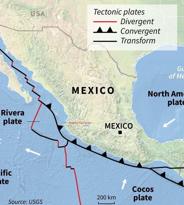
Imaged above, there are 3 kinds of boundaries between plates. At divergent boundaries, along mid-ocean ridges, plates are being steadily pushed apart, with new crust being added by volcanic activity to the rear of each plate as it moves. At convergent boundaries, plates collide and parts of the plates either buckle or fracture or are subducted back down into the molten mantle. The third kind of boundary is where plates are neither created nor destroyed but are moving side by side in a transform fault way. The resulting friction as they rub against each other can produce large earthquakes.
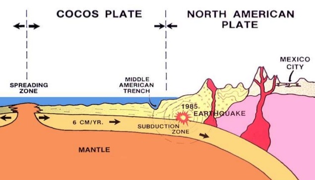
Imaged above, the Baja California Peninsula is on the gigantic Pacific plate, which is moving northwest and under the North American plate, (Mexico). The intersection of these plates under the Gulf of California causes parallel faults which are part of the famous San Andreas Fault system. Thus, the Gulf of California is an area of heavy seismic activity. While most of Mexico rests on the North American plate, it is also influenced by several other smaller plates. The small Rivera plate, between Puerto Vallarta and the southern tip of Baja California, is moving in a southeasterly direction and rubbing against the Pacific plate and moving under the North American plate. The collision & subduction of the Cocos plate and the North American plate has had several far-reaching consequences, including both the disastrous 1985 earthquakes that caused such severe loss of life and damage in Mexico City. {And the much more recent 2012 earthquake that, fortunately, was far less destructive} (imaged below).
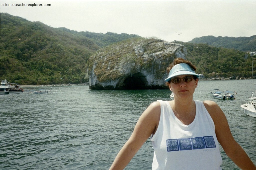
Our first exploration exploration destination was in the southern portion of Bandara Bay. The Los Arcos de Mismaloya rock formations erupt from the Pacific Ocean and tower over the coastline near Mismaloya, and are a nature reserve & National Marine Park. Caves, tunnel systems, and arches snake through and around the islets there, (pictured below).

The Los Arcos de Mismaloya rock formations are a beautiful group of five rocky granite islets that protrude from the sea surface south of Vallarta, (it also happens to be the deepest part of the Banderas Bay).
The arches and islets did not exist several thousand years ago, they were hills that were part of the mountainous coastal range we have today. The sea with the passage of time wore down these hills and mountains that included a solid granite core. Erosion gradually exposed these granite headlands in the shape of rocks or islands, as we see them today, and also separated them from the mainland, (pictured below).
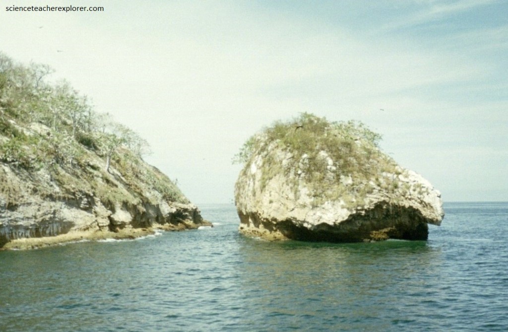
Pictured above, the constant erosive power of the sea over thousands of years has also opened a series of arches, which are what give it its name. Some are quite large and long, so much so that you can even navigate through them in a small motorboat. They also continue below the surface of the sea, so you also find incredible underwater tunnels and arches.
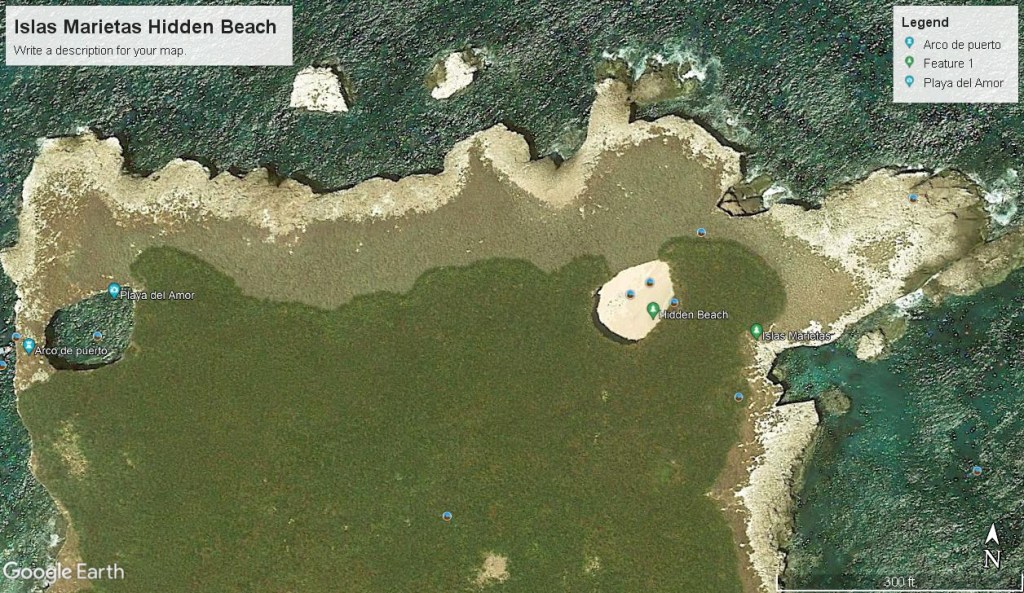
Becky and I also explored a small and strange group of islands at the northern mouth of Bandaras Bay. They were called, “Islas Marietas”. The Marietas are two uninhabited islands several kilometers off the north coast of the Banderas Bay in what is called the Riviera Nayarit. There are two islands 900 meters from each other that are around 60,000 years old, created by volcanic activity. To the east is the smallest one, called Isla Redonda (Round Island). It’s some 1000 meters long and 500 meters at its widest point. It is also the one closest to land and offers the underground crater beach on the northern end of the island. The largest island is the one to the west, Isla Larga (Long Island), some 900 meters long and 400 meters wide.
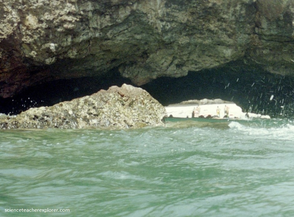
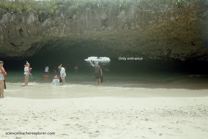
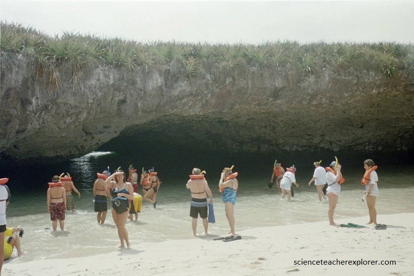
Pictured above, these islands are a real ecological treasure, at least what was left of them, as in the early 1900’s they were used as targets in military bombing exercises, plus they were a rich fishing ground for the locals. These damaging activities would have continued had it not been for the intervention of, Jacques-Yves Cousteau in the 1960s. Since then, they have been protected from overfishing and human activities, including bombshell. We were not allowed to go on the island. But, we could swim under the island in a tunnel and explore the “Hidden Beach”.
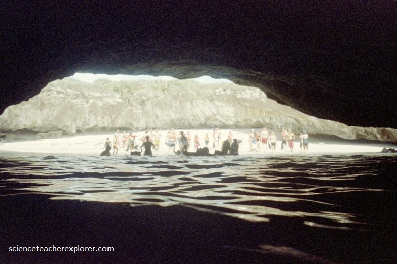
Pictured below, “Hidden beach” or ‘Lovers’ Beach (Playa del Amor), is a unique beach that can easily be spotted from the air through a crater of Round Island/Isla Redonda. From the sea, it’s not that obvious and there’s only a small tunnel when the tide is low.
Pictured above, ‘Lovers’ Beach is a misnomer. As you can see above and below, the only way we could see this amazing site, is to book a tour with alot of other people.
However, Becky & I were in the cave/tunnel exploring when our tour group left and went back to the boat. We were left alone on the “Hidden Beach” (with the exception of another female state-senator from Utah), for about one hour before they came back to pick us up. So,,,maybe we could officially call it Playa del Amor.
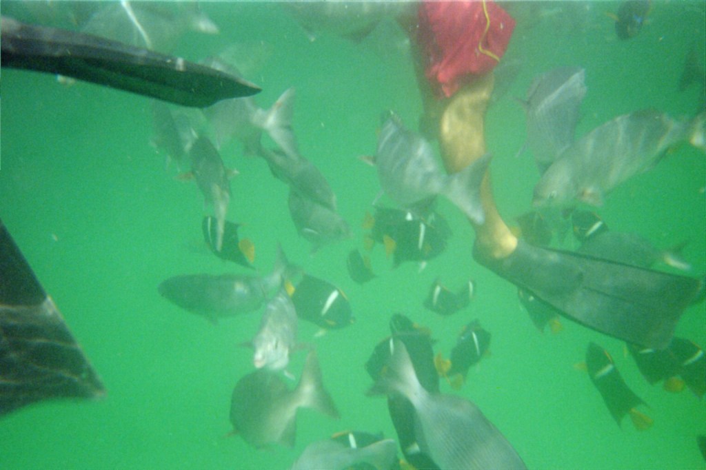
Pictured above, some of the reef fish species that enjoy the protection provided by the corals of the Islas Marieta and the abundance of food in these waters offer the black King Angelfish (Holacanthus passer), and the silver Cortez Chubs (Kyphosus elegans).
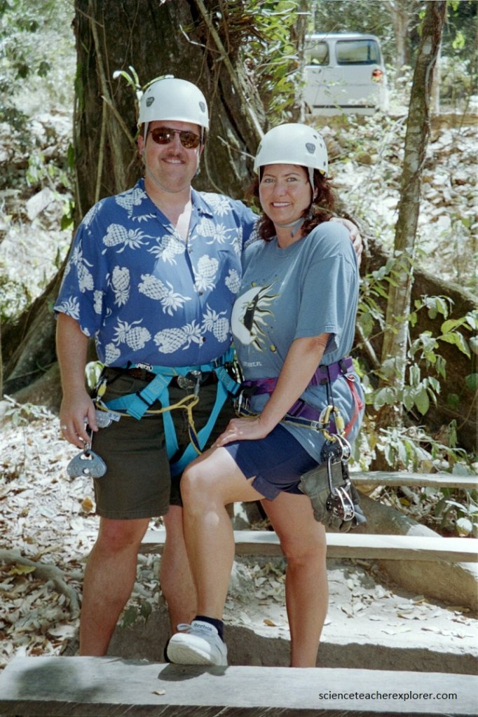
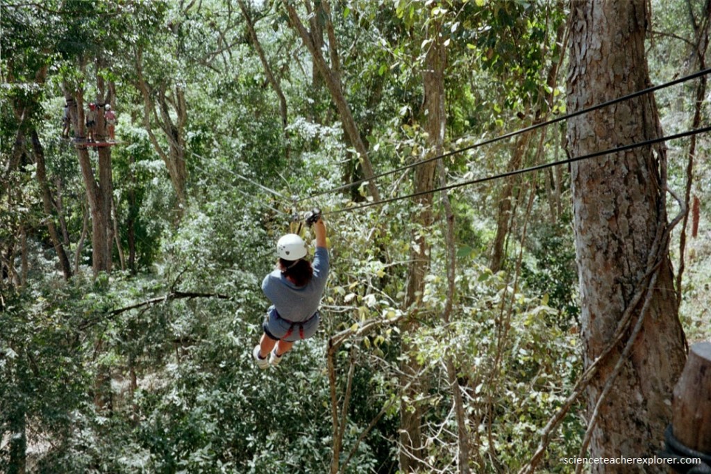
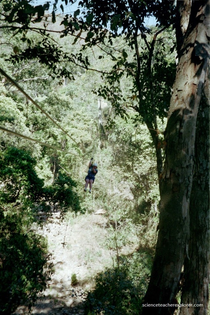
Later that week, Becky and I drove into the heart of the Sierra Madre mountains to try our hand on “Zip-lining”. Zip-lining is riding a cable from one point to another using a harness, helmet, and a trolley (or pulley). You control your speed with a gloved hand and friction.
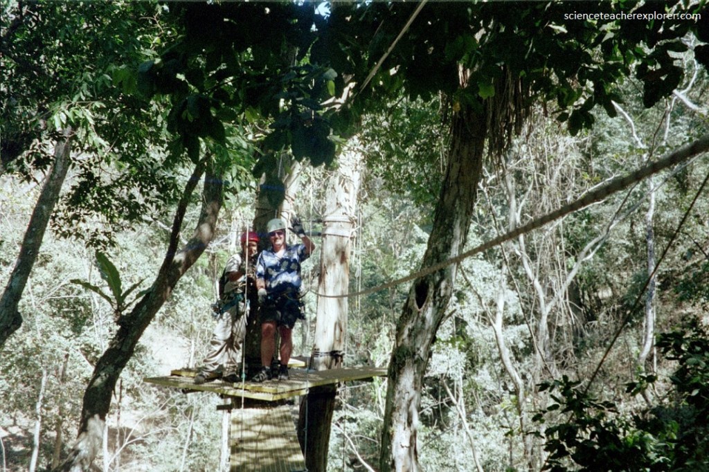
Pictured above, nestled in the heart of a tropical forest within the Sierra Madre mountains , our extreme canopy adventure combined the fun and enjoyment of zip-lining with the beautiful vistas. In 2005, this was a fairly new concept of fun in Mexico.
After spending a day at Zip-lining, it gave me an idea. I decided to make an educational video on friction, (included below).
