The Mitt; MI 2022
Becky Lindsay, (my wife), and I went to Michigan for a wedding of a cousin in August of 2022. While we were there, we explored the upper edge of the “Mitt” along the coasts of Lake Michigan and Huron. We started at Grand Rapids and headed north.
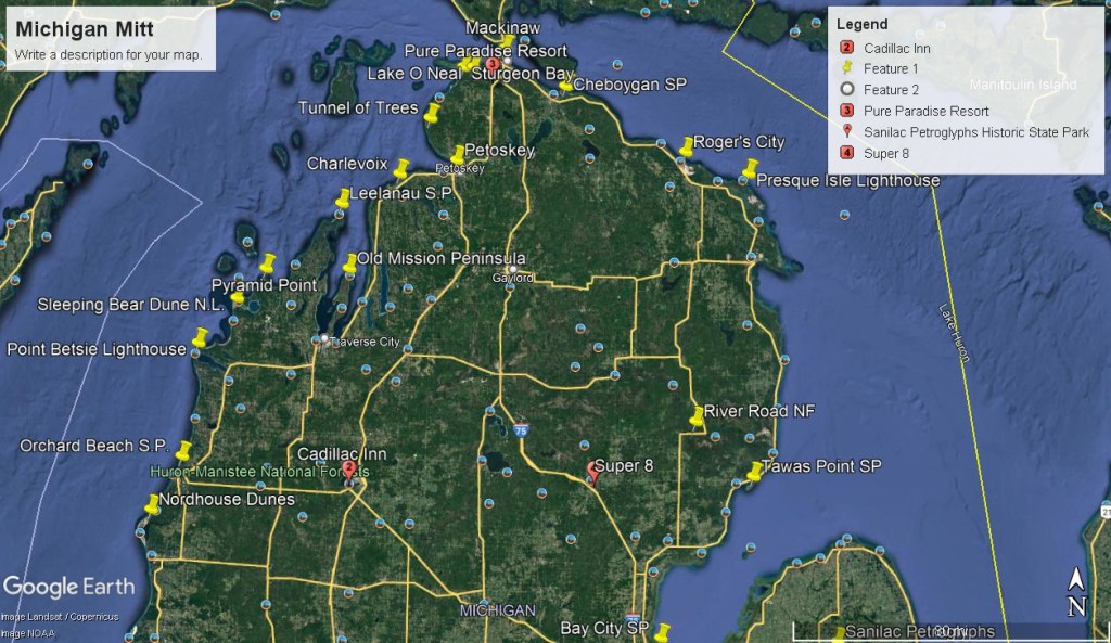
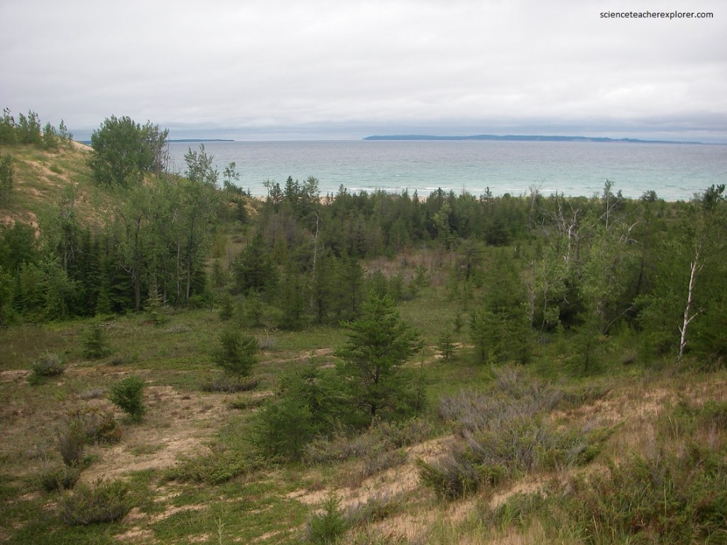
Our first stop and our first look at Lake Michigan was at the, “Lake Michigan Recreation Area”. Picture below, the adjacent 3,500 acre Nordhouse Dunes Wilderness, is a glorious untouched mile of rolling sand dunes, interdune wetlands, and mixed stands of juniper, jack pine, and hemlock.
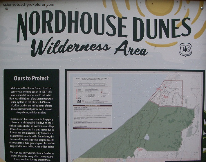
Pictured below, the Nordhouse Dunes are part of the Ludington Dune ecosystem, a series of U-shaped , or parabolic, depressions in a sand dune created when wind destabilizes the dune. The Ludington Dune Ecosystem also includes Lake Michigan Recreation Area and Ludington State Park.
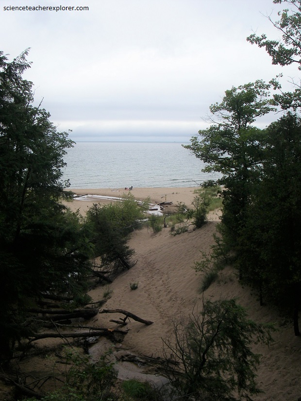
Our next stop was a brief visit to the “Orchard Beach State Park. It is a public recreation area covering 201 acres (81 ha) on the shore of Lake Michigan within the “Manistee Township”.
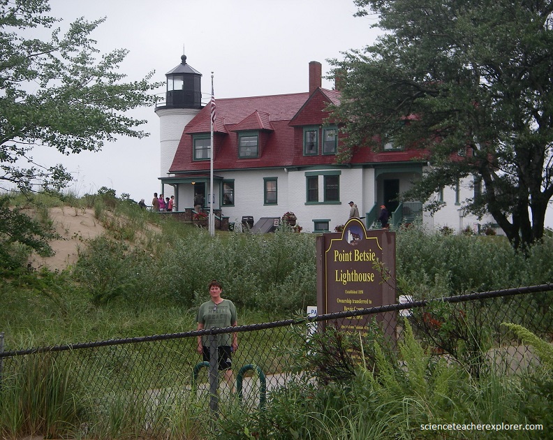
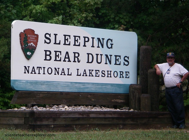
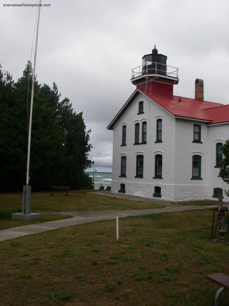
Pictured below, one of the oldest and most photogenic beacons on the Lower Michigan Peninsula is “Point Betsie Lighthouse”. From here, the dunes, lakes and rivers of “Sleeping Bear Dunes National Lakeshore” dominate the coastline for the next 56 kilometers.
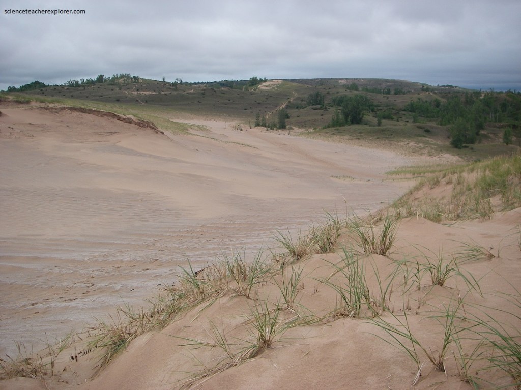
As recently as 16,000 years ago, glaciers covered the shoreline along what is not Lake Michigan. When the glaciers melted, they left behind a mess of boulders, sand, clay, gravel and other materials. Over time the rocks and boulders were eroded, leaving behind sand.
Pictured above and below, the sand was moved around by wind, creating small mounds, called hummocks. As the wind pushed more sand around, the mounds grew until dunes were formed. The dunes along the Lake Michigan shoreline are the largest collection of freshwater dunes in the world.
The Chippewas Native-Americans tell the tale of a mother bear who swam across Lake Michigan with her two cubs to escape a Wisconsin forest fire, only to watch her weary youngsters drown before reaching shore. In pity, Manitou (the great spirit), turned the cubs into the Manitou Islands and the mother bear into “Sleeping Bear Dunes”.
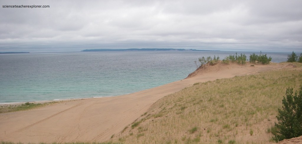
Pictured below, 6,000 acres of cream-colored dunes tower high above the waters of Lake Michigan; inland lakes and birch-lined streams teem with pike, trout, and bass; and maple-beech forests echo with the tuneful trills of the wood thrush.
Called “perched dunes” because of their position atop high bluffs, the “Sleeping Bear Dunes (some of which reach up to 160 m in height)”, are among the tallest in the world, (their shifting sands barely stabilized by beach grass, sand cherry, and other pioneer plants (pictured below).
Wind erosion of a plant-covered dune produces a blowout. The intense erosion of the windward side results in a bowl-shaped dune with stabilized arms pointing windward and sand overflowing on the leeward slope. The Sleeping Bear Dune illustrates this shape, but it was not always this way. Old photographs of the dune show a densely vegetated mound, vaguely resembling a sleeping bear. As wind erosion destroyed the original shape and much of the vegetation, the interior of the dune was revealed.
Our next stop was the “Leelanau Peninsula”. The little finger of Leelanau Peninsula crooks protectively around the mount of Grand Traverse Bay as the highway 22 ambles to Northport, (a picturesque hamlet chock-full of boutiques, restaurants and inns). Pictured below, with its abundant orchards, award-winning wineries, and fine swimming beaches, Leelanau lives up to its name, a Chippewa word meaning “land of delight”.
At Leelanau’s fingertip, we found the Grand Traverse Lighthouse, part of 1,300 acre Leelanau State Park. Pictured below, the historic beacon still guards rocky shoals one so intimidating to French fur trappers that the christened the bay “Le Grand Traverse”, (the big crossing).
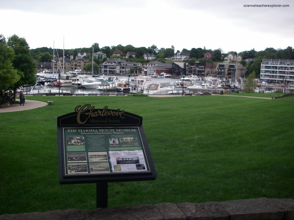
We continued on route 31 north where it wends its way around the east bay toward the prosaically named town of Charlevoix. Pictured below, Charlevoix has a main street that is flanked by two pretty shores, (one on Lake Charlevoix and the other on Lake Michigan. Charlevoix is the departure point for ferries to Beaver Island some 51 km offshore. Dubbed the Emerald Isle by homesick 19th-century Irish settlers, this charming island once sheltered a breakaway group of Mormons who were driven from Illinois in 1847. Their leader, James Strang, was brutally murdered in 1856.
After a brief stop at Charlevoix, the road to Petoskey wound through a pastoral setting reminiscent of England’s lovely Lake District, which may be why Ernest Hemingway’s family chose “Windemere” (after the larges of those lakes) as the name for their summer cottage on nearby Walloon Lake. Still, the jewels of Petoskey are not lakes but stones, [350 million-year-old polished pebbles adorned with fossilized saltwater-coral that the lake dredges up from its bottom every spring and which beach-combers quickly pocket].
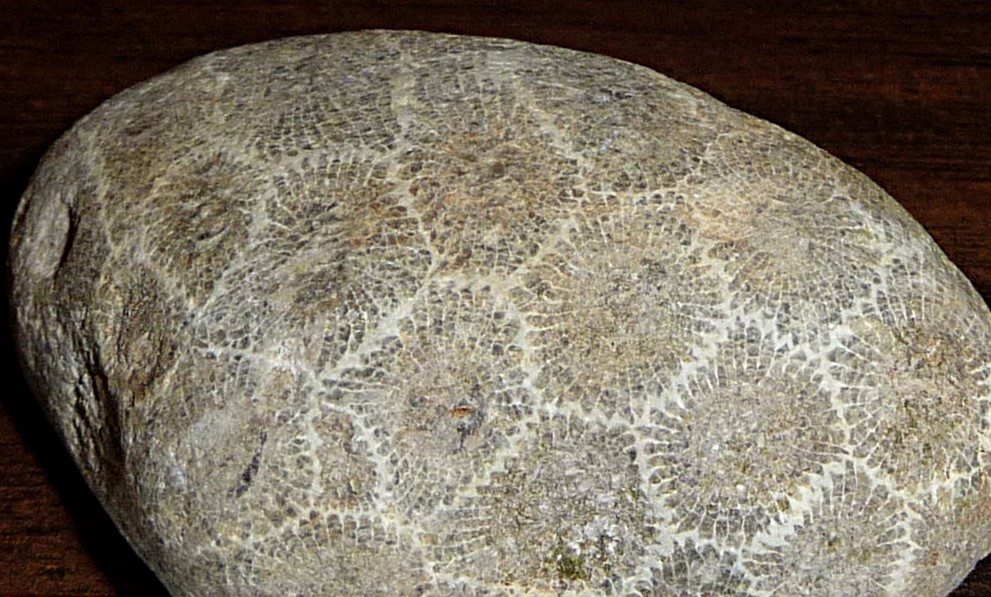
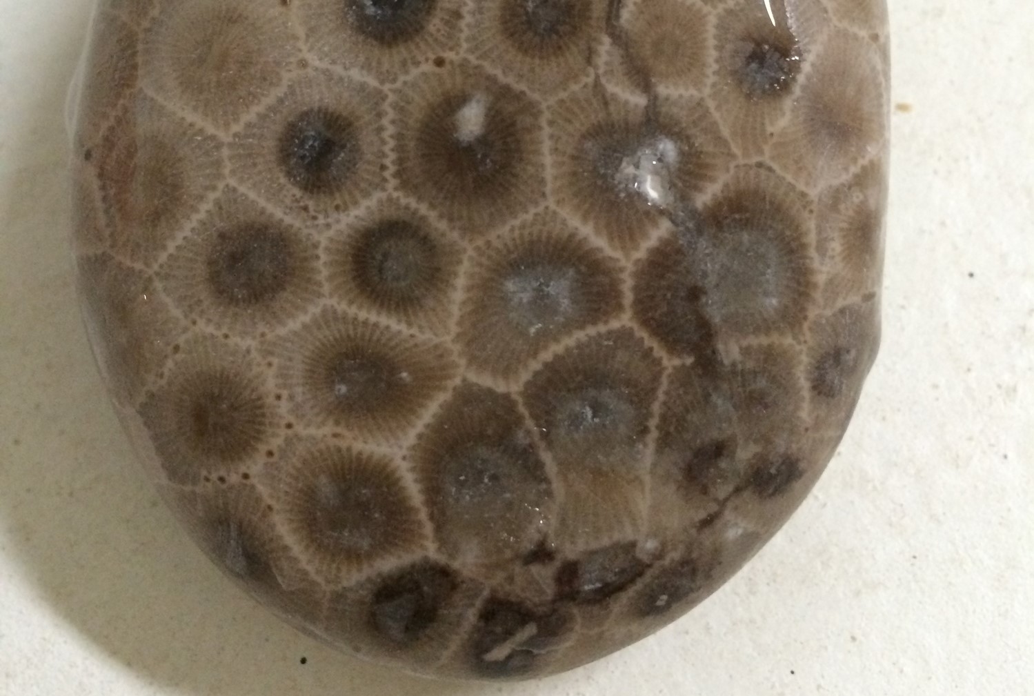
Pictured above, the Petoskey Stone (Hexagonaria percarinata) has been the state stone of Michigan since 1965. In each colony lived many coral organisms still visible in the stone today. The dark centers were the mouths of the corals; the lines surrounding the eyes were tentacles.
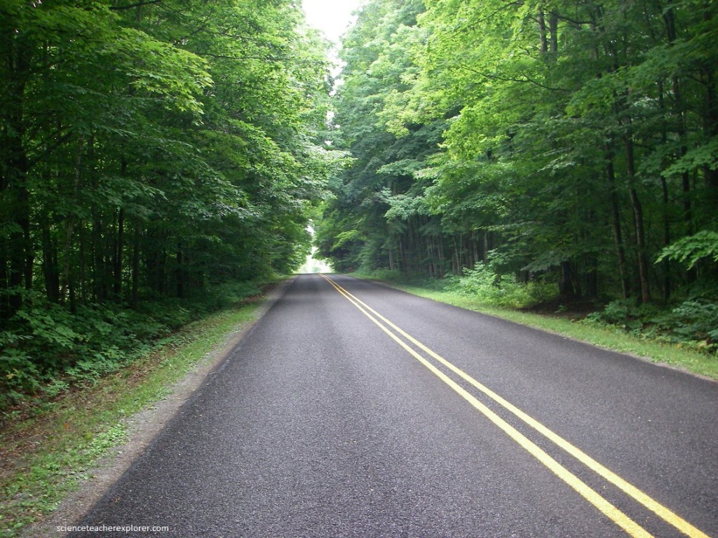
Across tranquil Little Traverse Bay glitters the fashionable enclave of Harbor Springs, Michigan. Just north of town on Route 119, nature puts on a show. The highway twists and turns for the next 21 km, through a landscape that provides stunning views of Lake Michigan. Occasional corridors of hardwoods and hemlocks give this stretch of the drive it’s name, (the Tunnel of Trees). At the end of Route 119 sprawls Cross Village, an old Native-American community settled by the Chippewa and Ottawa tribes. From Cross Village, we headed north along Sturgeon Bay to Lakeview Road and to “Wilderness State Park”, (pictured below).
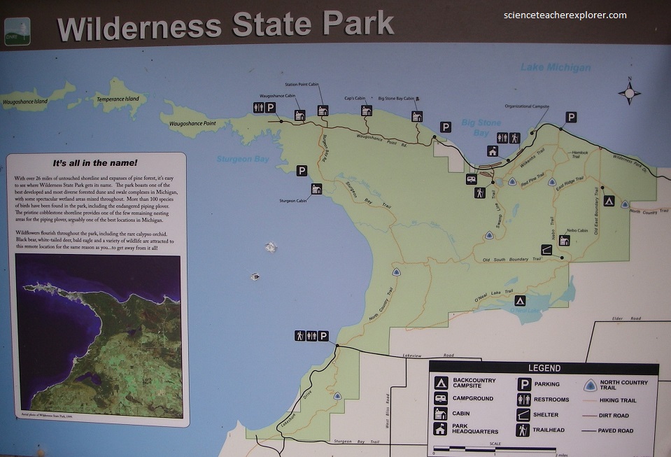
Pictured above and below, the Wilderness State Park is 10,512 acres, (including 26 miles of shoreline), diverse in forested dunes and swale complexes. Wilderness State Park contains a diverse population of local and migratory birds. The shoreline and forest are home to abundant wildflowers and tall grasses. The park is also host to bigger game, including black bears, beavers, bobcats, mink, muskrats, and otters.
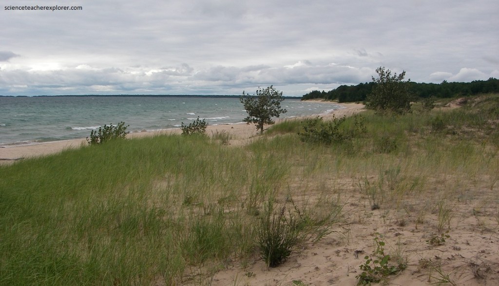
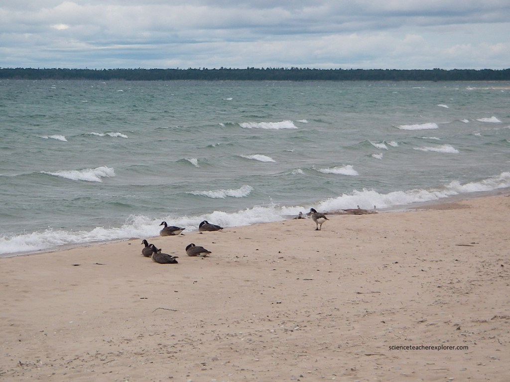
In the spring, nesting piping plovers sequester among the dunes and marshes of Wilderness State Park. Pictured below, dabbling wild geese and other waterfowl glide through the wetlands.
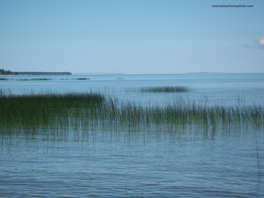
Beyond Wilderness State Park, on the north-east horizon, looms a man-made wonder that magnificently complements those of nature. Spanning the Straits of Mackinac, (the meeting place of Lake Michigan and Lake Huron), the Mackinac Bridge, (one of the world’s longest suspension bridges), links Mackinaw City with Michigan’s Upper Peninsula, (pictured below).
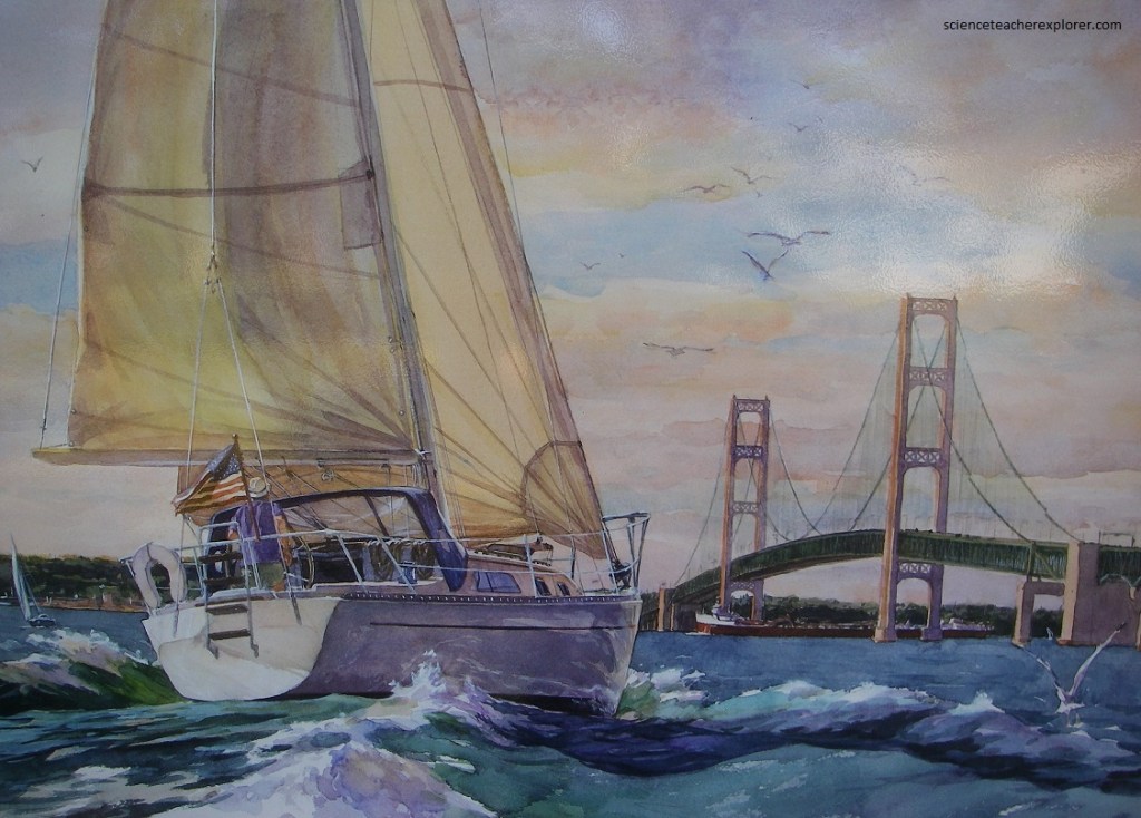
The “Mighty Mac”, (the Mackinac Bridge), one of the world’s longest suspension bridges. Spanning the swirling Straits of Macknac, it proides an impressive gateway to the wooded silds that spread across Michigan’s Upper Peninsula.
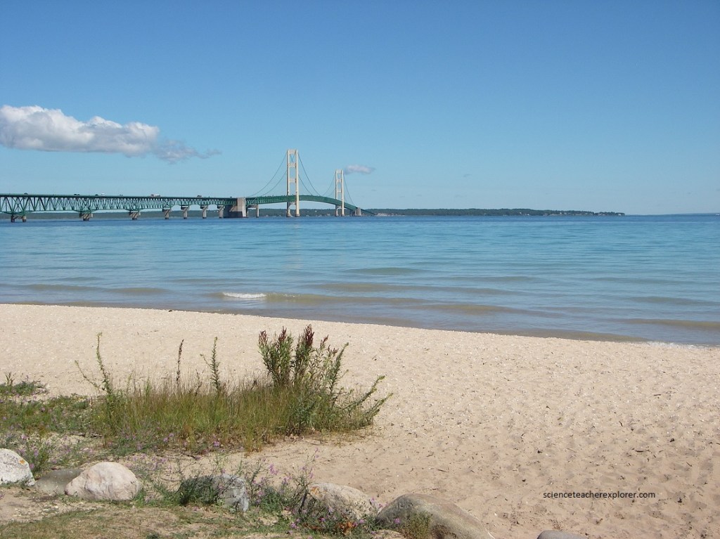
Pictured above, Mighty Mac was designed to withstand crushing ice and at least 632 mph winds. It was a construction triumph, built for $99.9 million between 1954 and 1957, on time and within budget. The 4.5 million vehicles which safely cross each year pay tribute to those who built and maintain the bridge, especially during the harsh winters and the strong winds of the Straits.

Pictured above, the Mackinac Bridge is constructed of segments: a truss bridge approach on each end and a center suspension portion of three parts. Two massive anchor blocks, the big wide concrete pads shown above in re, are each edge of the deep water, the point of transition between truss and suspension. Cables are stretched between these two blocks across the chasm. The cables are propped up by the towers firmly anchored into the bedrock. The roadbed, carrying all the vehicles, hangs from the cables. The roadbed is 49 meters minimum above the water allow for the passage of freighters and tall sailing vessels. It is important to note that the cables are not hooked to the towers, and are merely draped over them though saddles. The cables and towers move with the weight load on the bridge and temperature changes.
Pictured above, the curving wooded shoreline and the expanse of Lake Huron form panoramic patchworks of green and blue all the way on Route 23, to Cheboygan, Michigan. The town sits on the banks of the Cheboygan River, which is part of Michigan’s Inland Waterway.
Pictured above, Cheboygan boasts of trail-laced parks and historic sites, including light-houses and an old-time opera house, (an elegantly restored music hall dating from 1877).
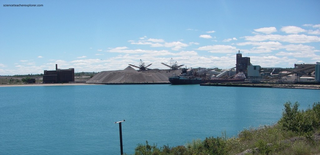
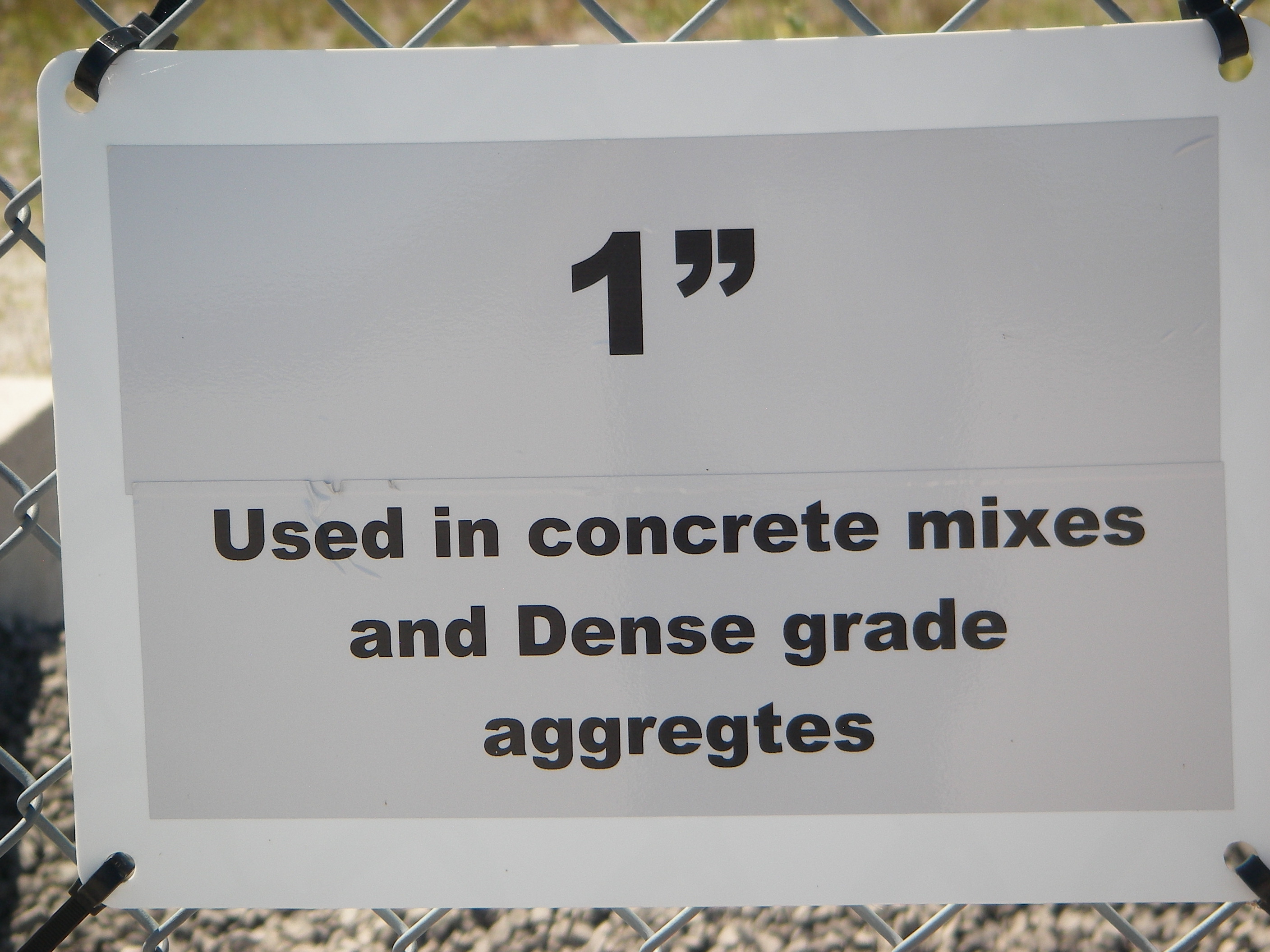
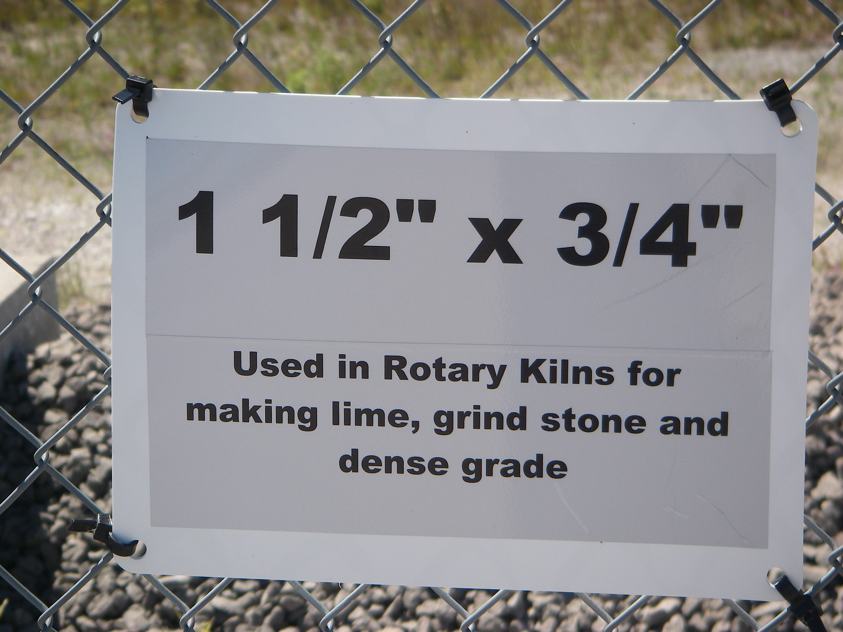
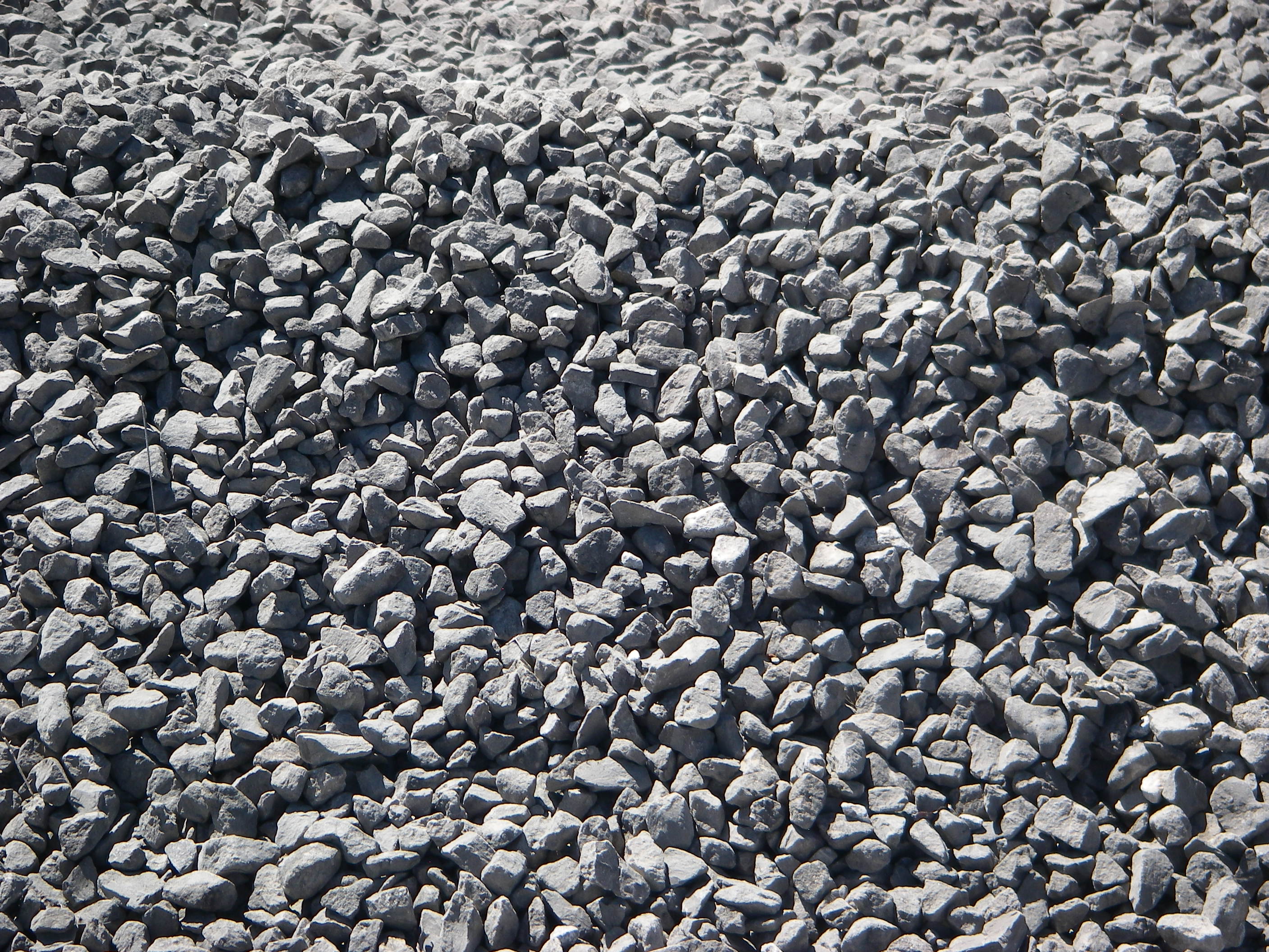
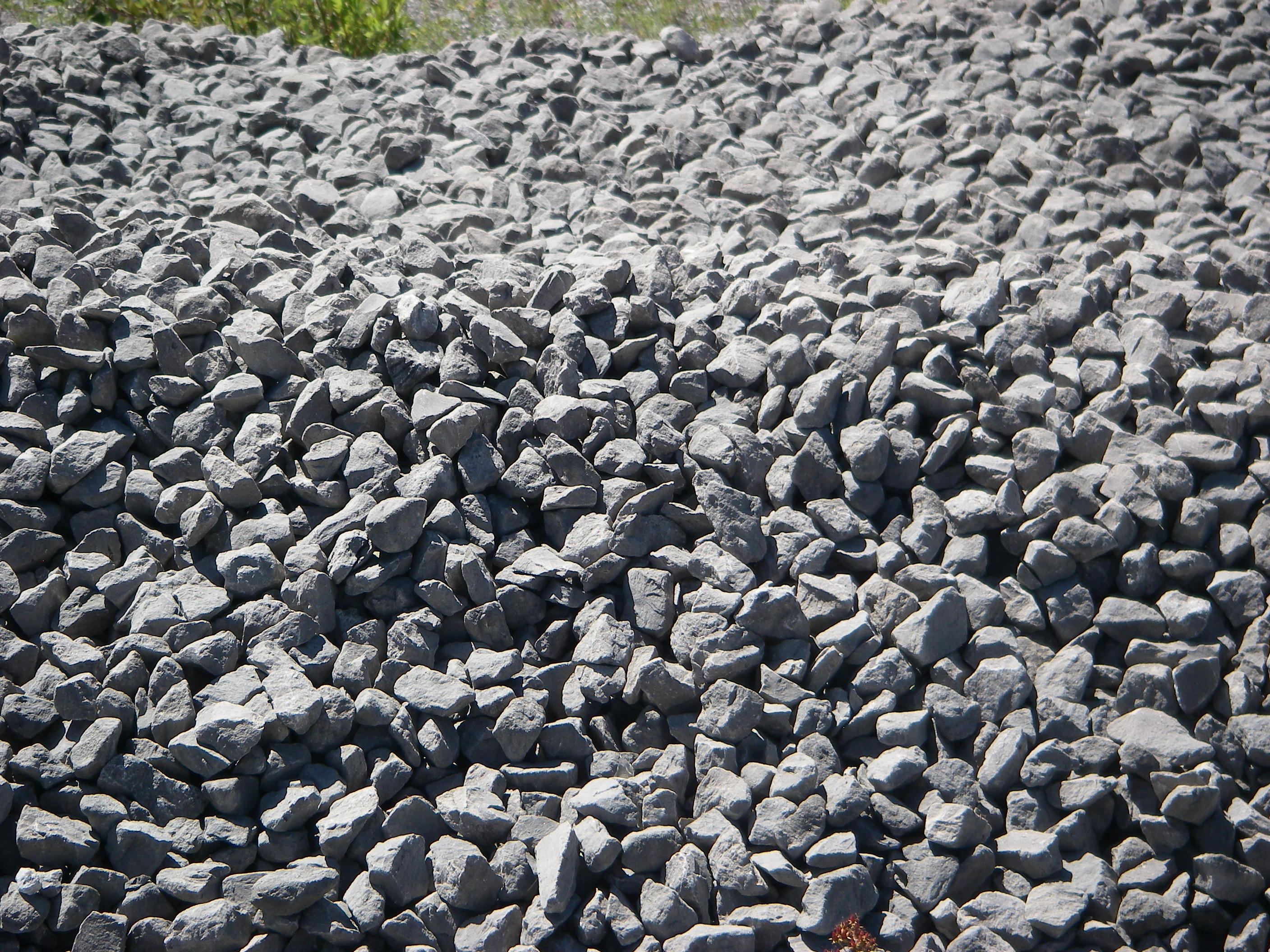
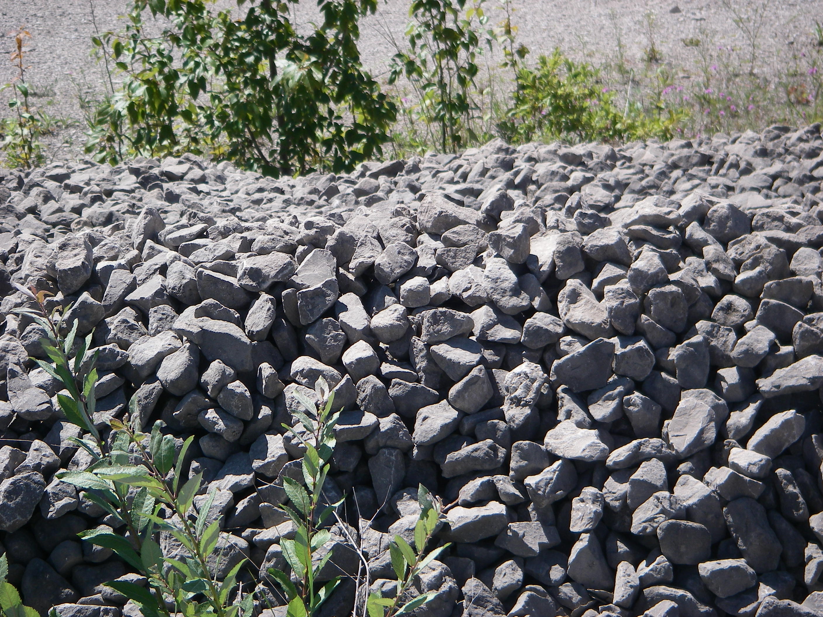
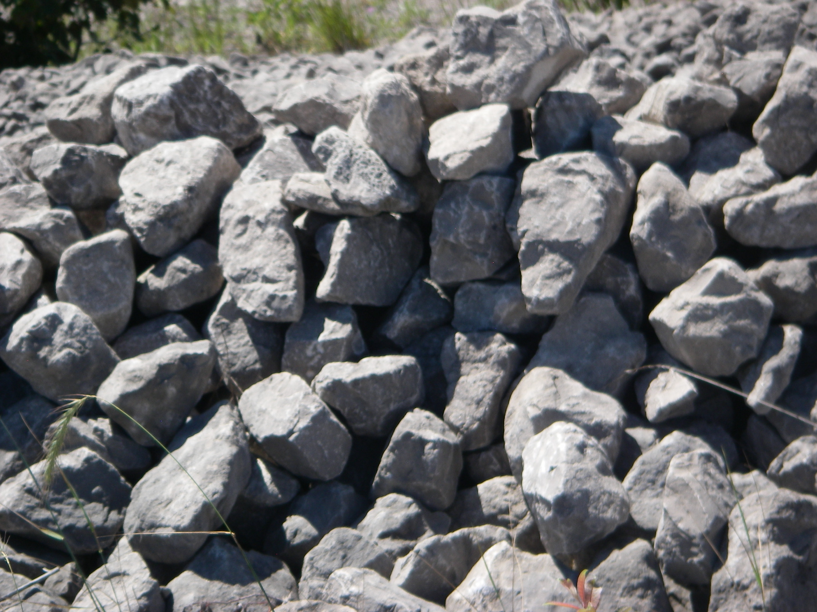
Pictured above, though the drive passes through forest as it leads southwest on Route 23, the economy in these parts is fueled not by lumber but by rocks: one of the world’s largest limestone quarries has been carved into the earth at Rogers City. From the time production began at Rogers City’s Calcite limestone quarry in 1912 until 1967, the company operated their own fleet of ships. During most of that period, the fleet operated as the Bradley Transportation Co., named for the man who served as the company’s president from 1920-28.
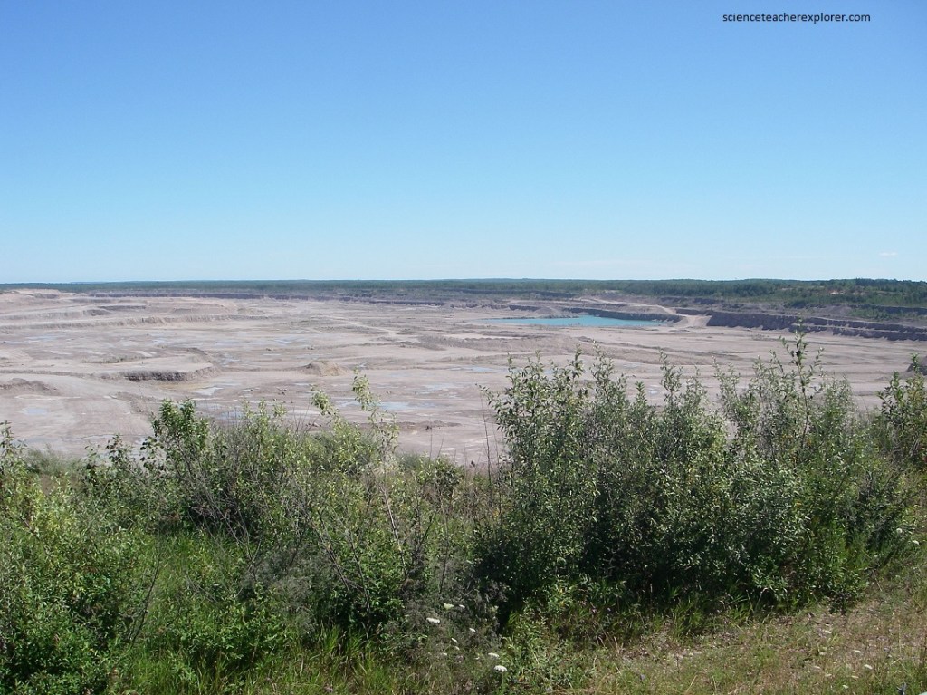
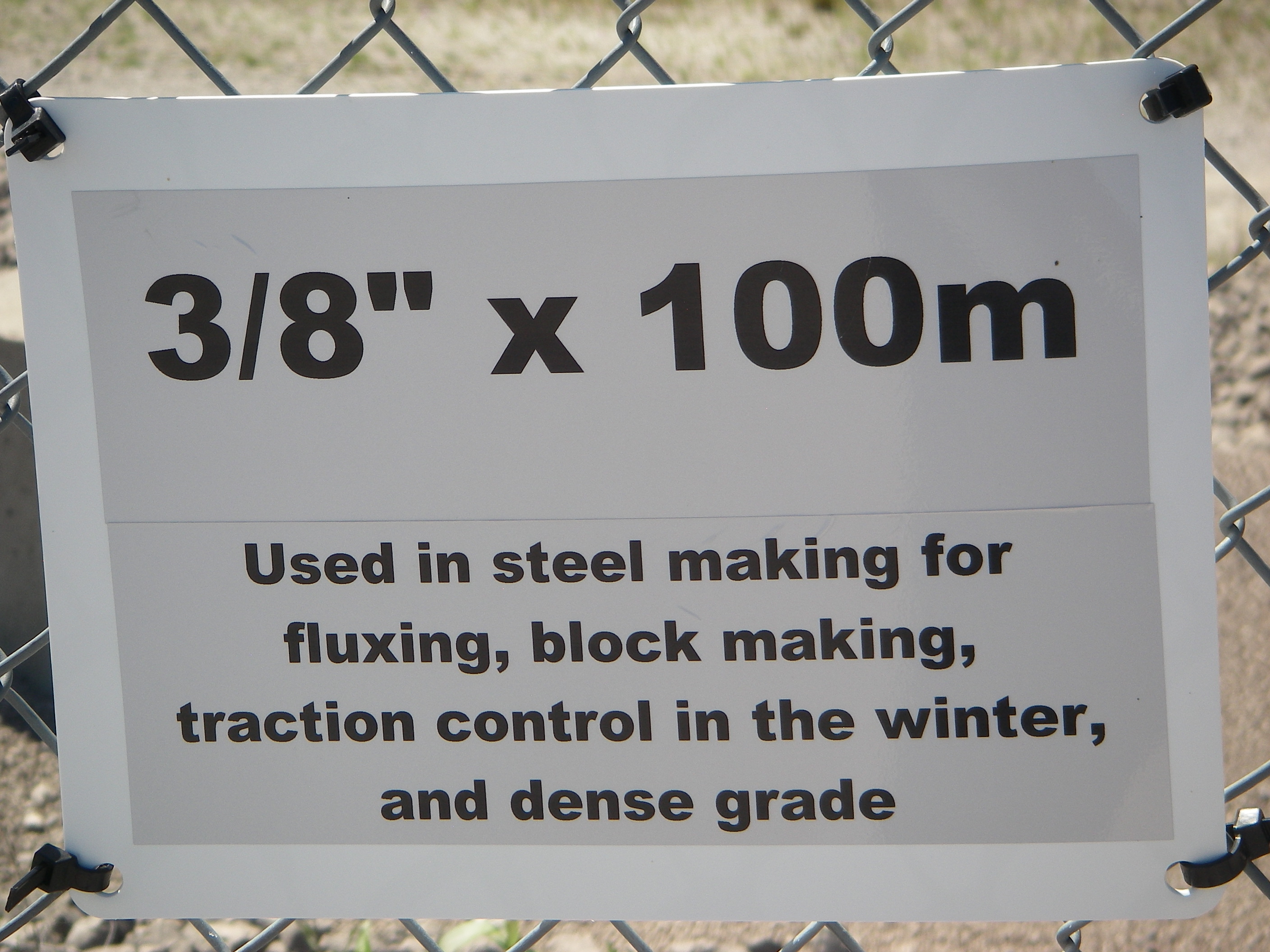
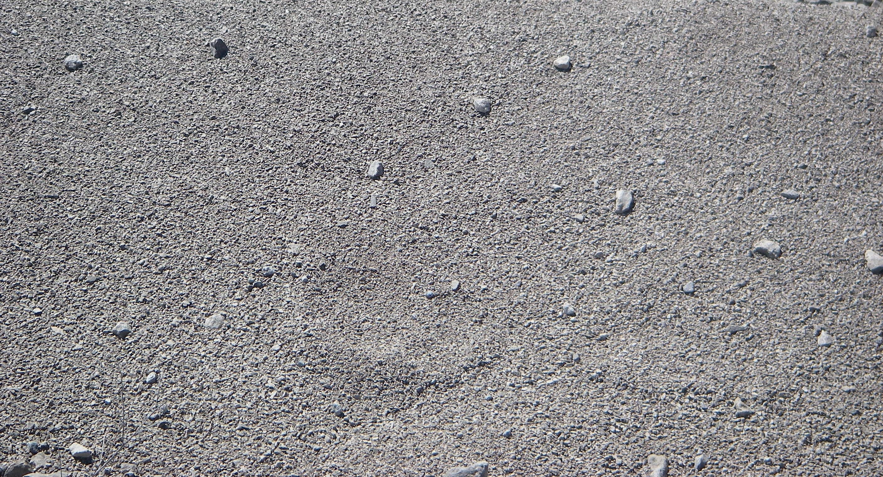
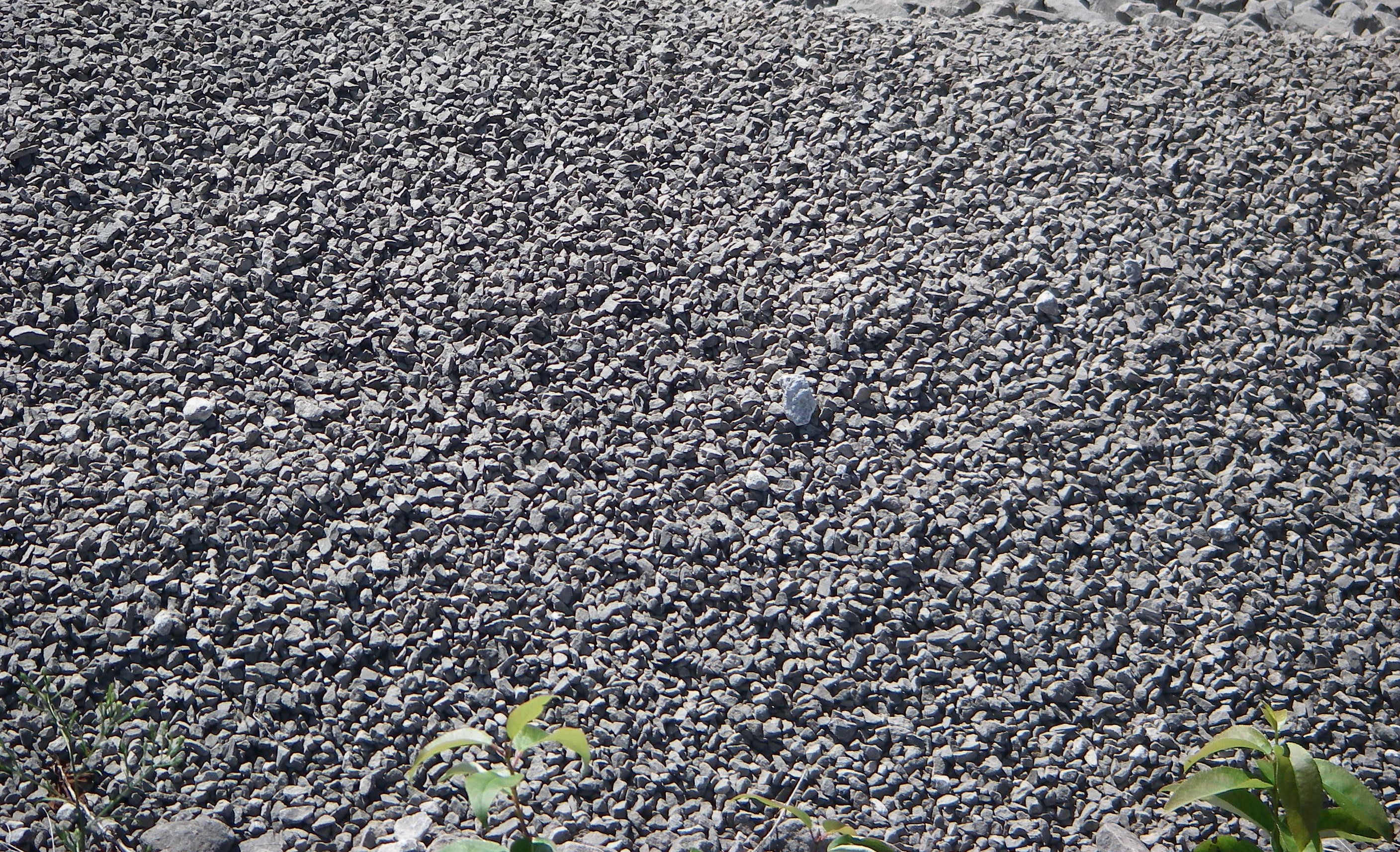
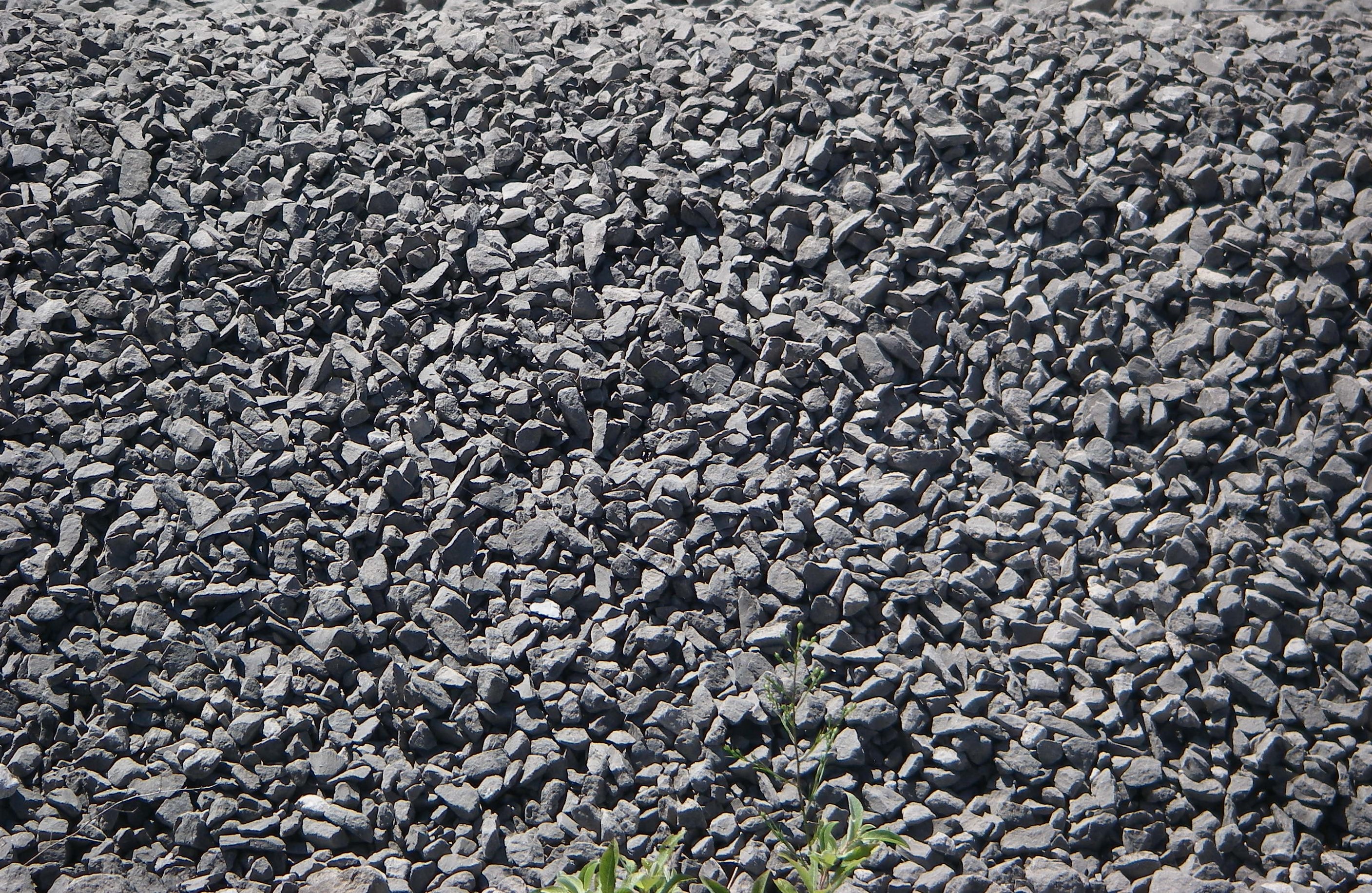
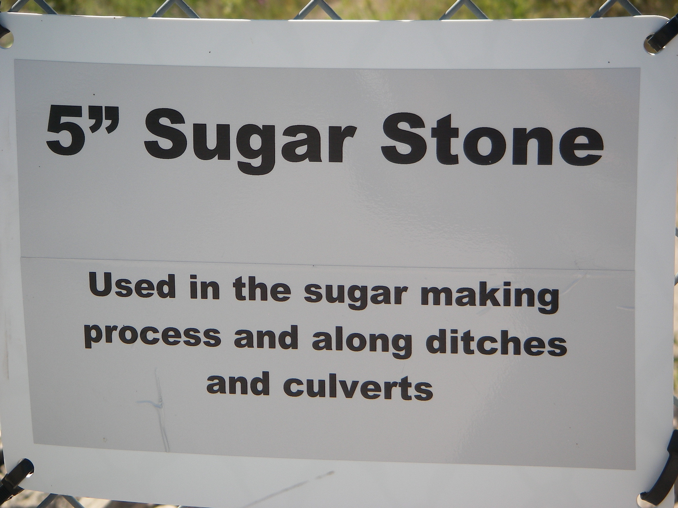
Pictured above, at the Quarry View we took a look at the action in the immense pit, (5 km long and 3 km wide). Below is a classification and uses of the limestone:


Continuing southward on route 23, the drive skirted Grand Lake, whose limestone floor caused the water to sparkle like a translucent green jewel. Pictured below, Presque Isle, (its harbor long a haven for ships plying Huron’s trade routes), is located on the neck of land separating Grand Lake and Lake Huron.
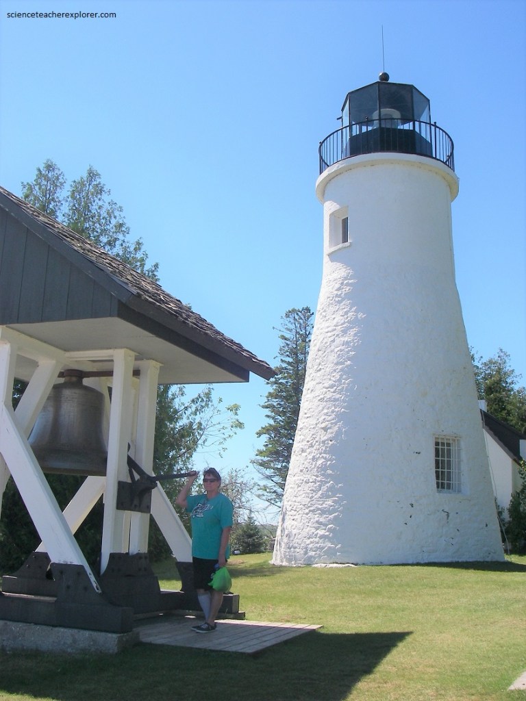
Pictured below, the Old Preque Isle Light, now a 39 stair museum, began guiding mariners into the harbor in 1840. In 1870 a larger structure, the Presque Isle Light, was erected about a kilometer to the north, putting the older lighthouse out of commission. However, the current caretakers report that a light burns in the old tower, despite the fact that there is no power. “Every day the light comes on at dusk and goes off at midnight”.
Many people have witnessed the ghost light, and it has actually guided at least one boat into safe harbor during a storm, but no one has been able to figure out how it occurs. According to local legend, one Presque Isle light keeper regularly locked his wife in the tower while he pursued a tryst in the neighboring town. Eventually, the keeper got tired of hearing her enraged screams, so he did away with her. Apparently, her angry cries are still heard on very windy nights and maybe her ghost is responsible for the light. Who knows….For me, it is part of the lore of Presque Isle.
The Old Presque Isle Lighthouse translates from French as “almost an island”. Native Americans and Frenchman portaged across the peninsula to avoid several kilometers of open lake. When vessels came to the harbor in increasing numbers, Congress in 1838 appropriated $5,000 for a lighthouse. Jeremiah Moors of Detroit in 1840 completed this lighthouse, which today is one of the oldest surviving lighthouses on the Great Lakes. Pat Garrity, the last keeper of this lighthouse, was appointed by President Lincoln.
[According to the Native-American lore, two rival braves, (each courting the same maiden), were out on Thunder Bay in canoes when they fought a duel. One fired an arrow that accidentally struck the girl, who fell from her boat and drowned. Outraged, the gods churned up turbulent currents and frothy wave that roil unpredictably to this day]. Pictured above, no matter how one explains the treacherous conditions on Thunder Bay, its water have long been a hazard for sailors. About 80 ship-wrecks lie on its murky floor, all of them protected in the Thunder Bay Underwater Preserve.
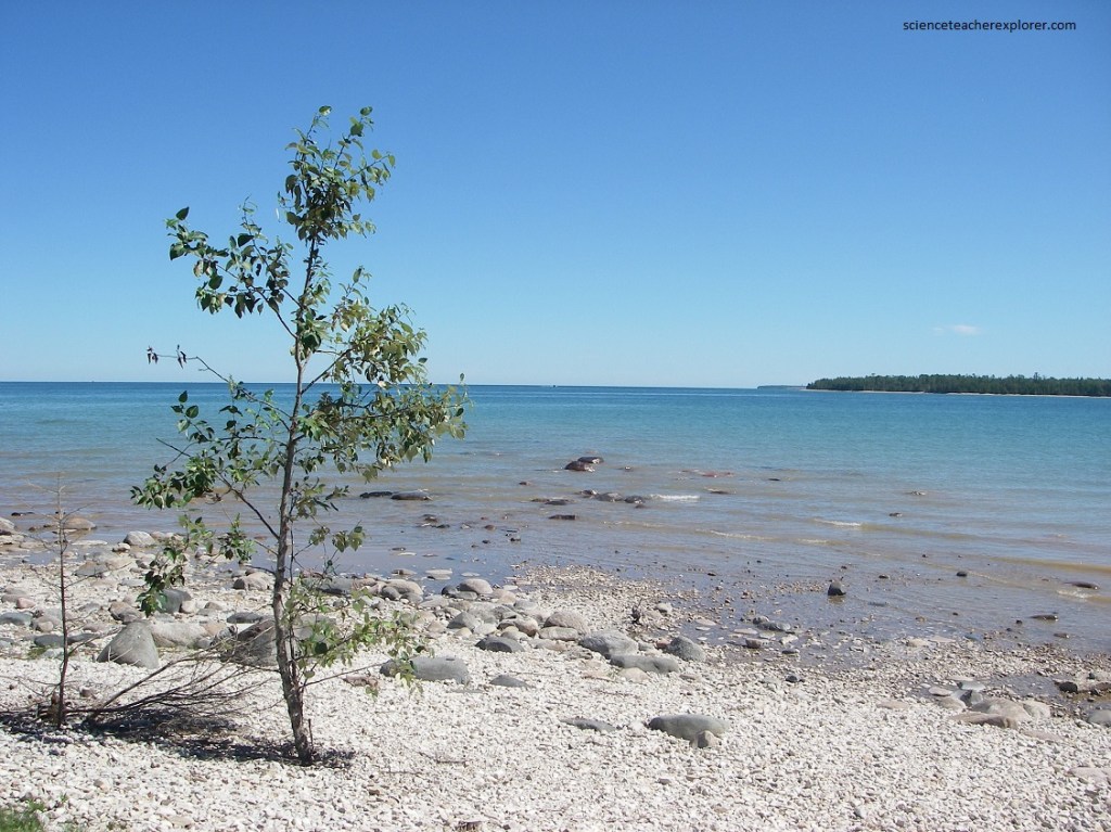
Pictured above, Negwegon State Park has a short path that leads to 11 km of remote, unspoiled beach and marsh areas, where birds soar overhead and small, smooth stones cover parts of the shore.
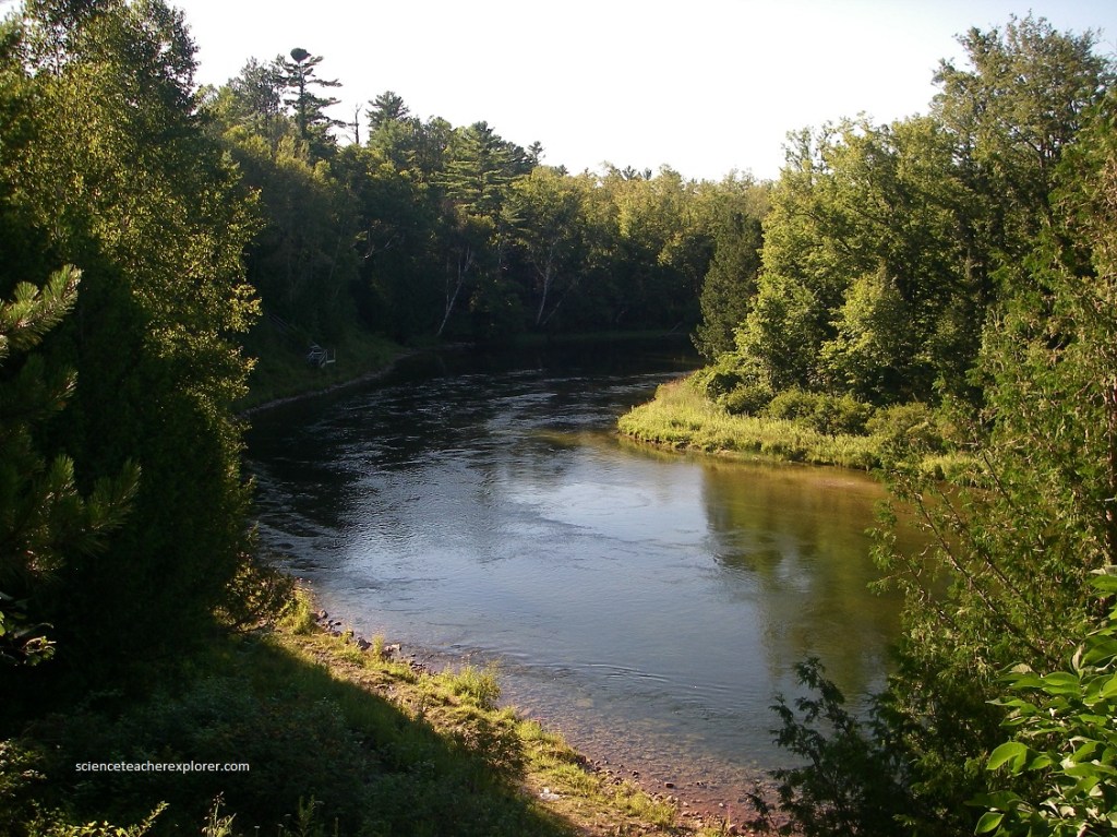
Once so dense with white pines that only the slimmest of sun-beams penetrated to the forest floor, the woodlands of eastern Michigan were severely depleted by the late 1800s, (the trees felled to supply the lumber that built the West). Par of an effort to replant and protect the woods, Huron National Forest was created in 1909. Today its landscape is once again lush, with majestic pines, maples, cedars, and birches fanning away from the banks of the Au Sable River. To sample the legacy of this early conservation effort, we took a drive on the River Road National Forest Scenic Bywater, a 35 km sylvan odyssey that accompanies the river westward from Oscoda, Michigan, (pictured above).
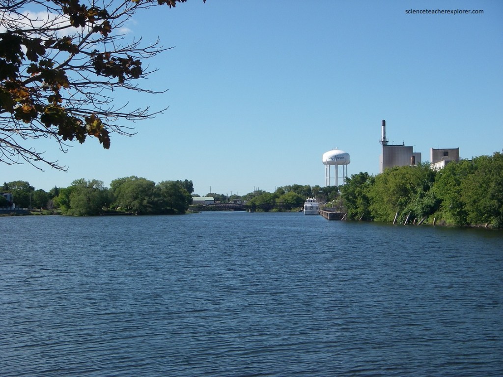
In the late 1800s the fortunes of Bay City, like those of many other towns in Michigan, were closely tied to the timber industry. We decided to view the area from Bay City State Park, (8 km north of the city). Just east of the park, Saginaw Bay derives its name from the Sauk Native-Americans who once dwelt by its shores. Adrien Jolliet, on his voyage down Lake Huron’s western shore in 1660, first made it know to the white man. In the late 1800s an immense lumber industry flourished in the region. Schooners by the scores daily passed through the by bringing to the sawmills more logs and hauling off cut lumber.
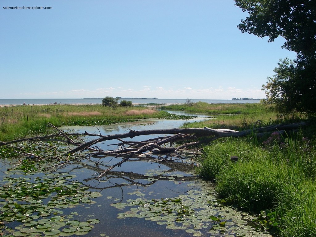
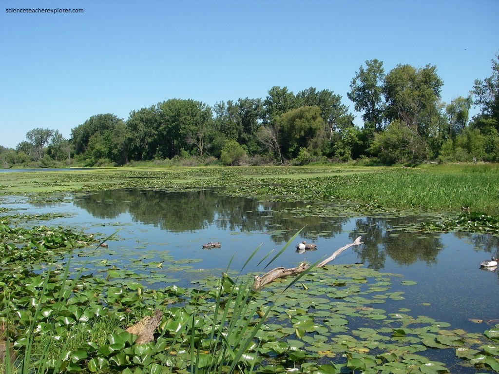
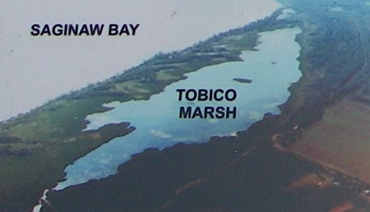
Pictured above and below, nestled on the curving shore of Saginaw Bay, the Bay City State Park, not only has lovely beaches, but also contains Tobico Marsh, (a 1,700 acre wetland where two observation towers provide opportunities for spying on mink, deer, waterfowl, and other wildlife).
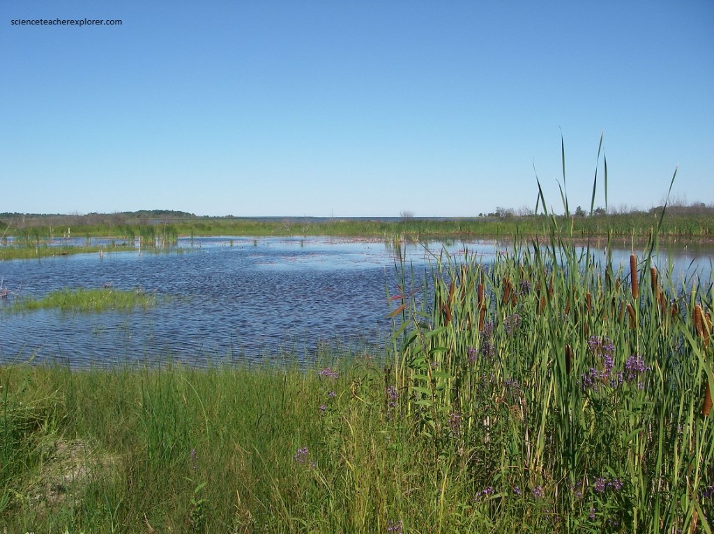
Pictured above and below, the Tobico Marsh was formed from sand spits, (a unique geological feature of the Saginaw Bay at Tobico Point), that hooks out into the Saginaw Bay from longshore currents from the north.
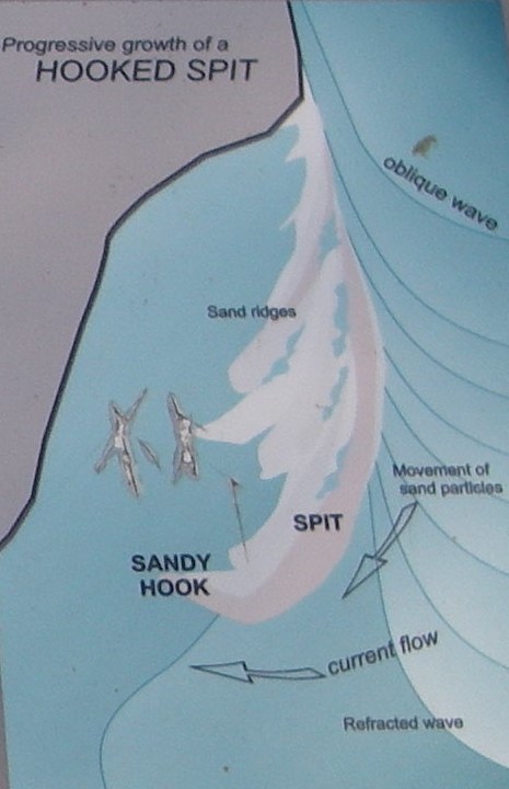
Imaged above, the growth of a classic hooked spit, like that of Tobico Point, is the result of current flow and gradual transport of sand. Remnants of former hooked spits are now interior dune ridges. Former embayments of old spits are now interior ponds. Eventually, the inside of the present “hook” will also become an interior pond as it too, becomes cut off from the lake by sand deposition.
Eventually the tiny bay becomes sealed off from the Saginaw Bay. The tiny bay’s shallow water gradually fills in from sediment, which is deposited by rivers and streams, which drain the adjacent land. Emergent plants, like cattails, sedges and rushes begin to grow in the still waters. A marsh is born. This is Tobico’s Story. It is the future story of other spits north of here, which will be formed in the Saginaw Bay. The story spans hundreds of years. The story of a changing shoreline on Lake Huron.
