Chaco Canyon, NM 2011
The hub of Chacoan Anasazi culture (Ancient Pueblos) was Chaco Canyon, [now a part of the Chaco Culture National Historical Park], situated nearly in the center of the high, treeless, arid Chaco Basin of northwest New Mexico. Becky (my wife) and I explored this location in October 2011, while on Fall Break. To visit Chaco Canyon, turn onto County Road 7900 from US 550, 4.83 km east of Nageezi or 80.5 km west of Cuba, and follow the sign to the Chaco Culture National Historical Park. It is 33.8 km to the park from the turnoff, including 21 km of very rough graveled road in 2011.
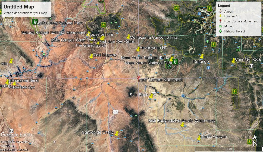
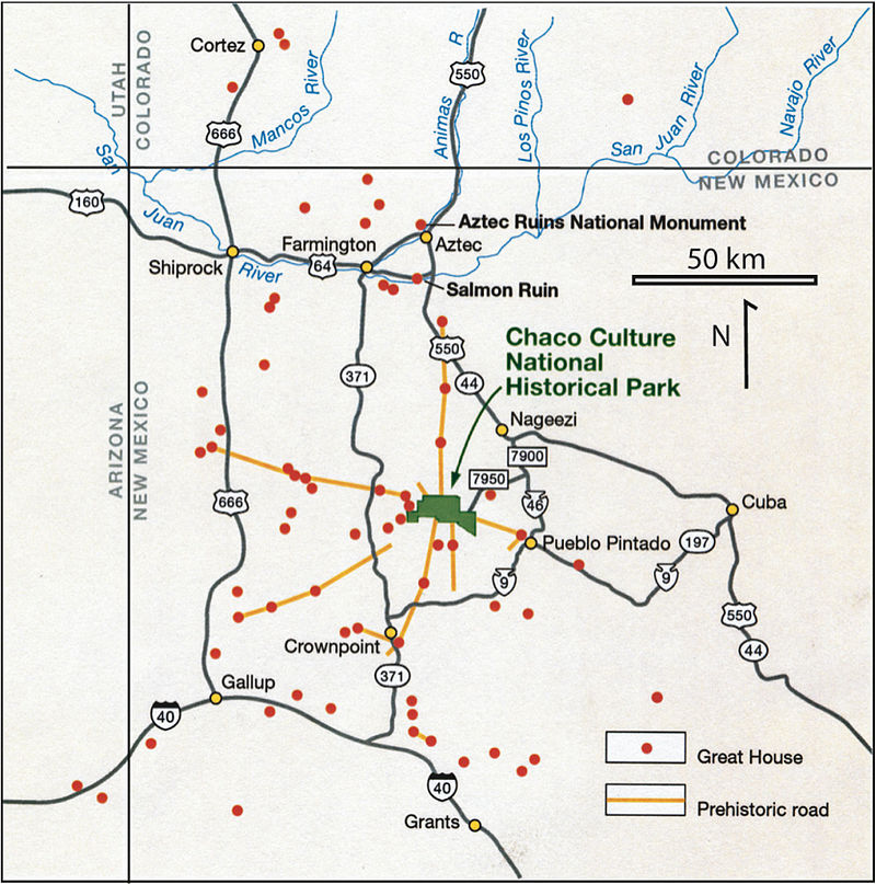
From the hub of Chaco Canyon ancient roads ran like spokes of a wheel to settlements occupied contemporanously with Chaco that are referred to as outliers.
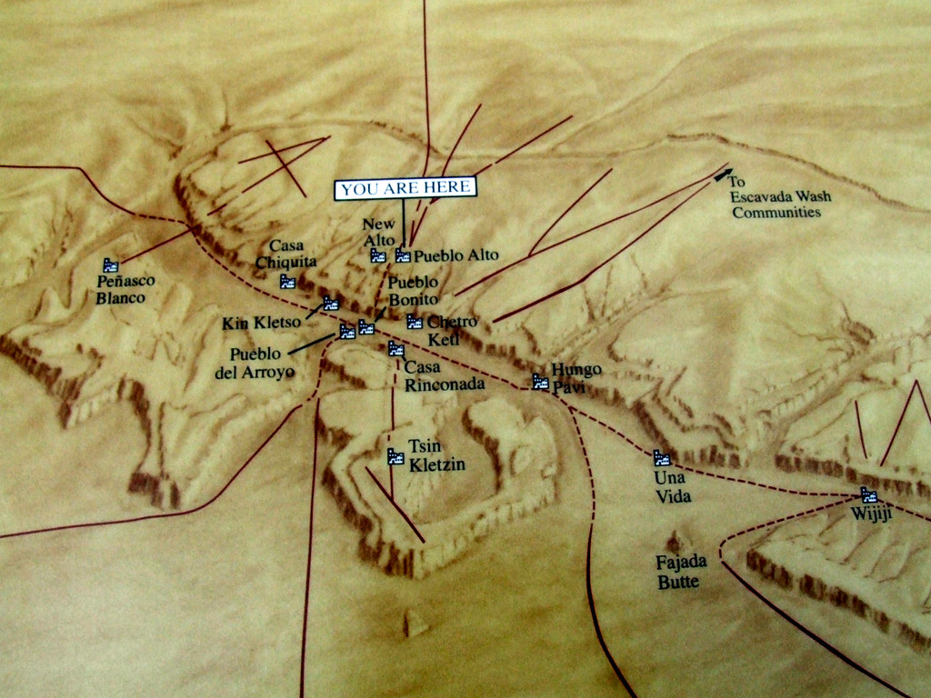
The historical park includes the magnificent world-famous ruins of Pueblo Bonito, Casa Rinconada, Chetro Ketl, and others , as well as Fajada Butte, on top of which is the well-publicized Sun Dagger site. Chaco River drainage is a 24km long canyon that is 700m wide and 167m deep, but it was once about 33m deeper. A thick layer of sediment fills the bottom of the canyon. Long-term climate cycles have resulted in numerous periods of sediment deposition and erosion. Chaco wash, an intermittent stream today, joins the main drainage of the Chaco River at the west end of Chaco Canyon, which flows north into the San Juan River.
Chaco Canyon lies near the center of the San Juan Basin of New Mexico, which is near the southeastern edge of the much larger Colorado Plateau. This region has broad exposures of horizontal sedimentary layers that have eroded into plateaus, mesas, buttes, and canyons. The rocks exposed in Chaco Canyon record an interval in the Earth’s history during the Late Cretaceous Period, approximately 75 to 80 million years ago. During this time, Chaco was part of the migrating coastline of an ancient inland sea. In the Late Cretaceous, much of the Southern Rocky Mountain Region was characterized by a subtropical climate which supported lowland forests of conifer, eucalyptus, ebony palm, cypress, and magnolia. Upland areas supported hardwood forests of oak, walnut, ash, and birch. The landscape of late cretaceous Chaco Canyon resembled modern day coastal areas, such as those found on the southeastern Atlantic and Gulf coast of the United States. These mainland beach, coastal plain, and barrier island environments consist of marshes, swamps, river deltas and lagoons adjacent to beach and relatively shallow coastal waters. The two main rock units at Chaco Canyon are the Menefee Formation and Cliff House Sandstone, both part of the Mesaverde Group. The late Cretaceous coastal environment preserved in the Mesaverde was teeming with a variety of life. The Menefee Formation, which erodes into shaly badlands, is particularly fossiliferous, including petrified wood as well as the remains of turtles, dinosaurs, and crocodilians. The Cliff House Sandstone includes fossil bivalves and ammonites, as well as rare vertebrate fossils of mosasaurs, plesiosaurs and sharks.
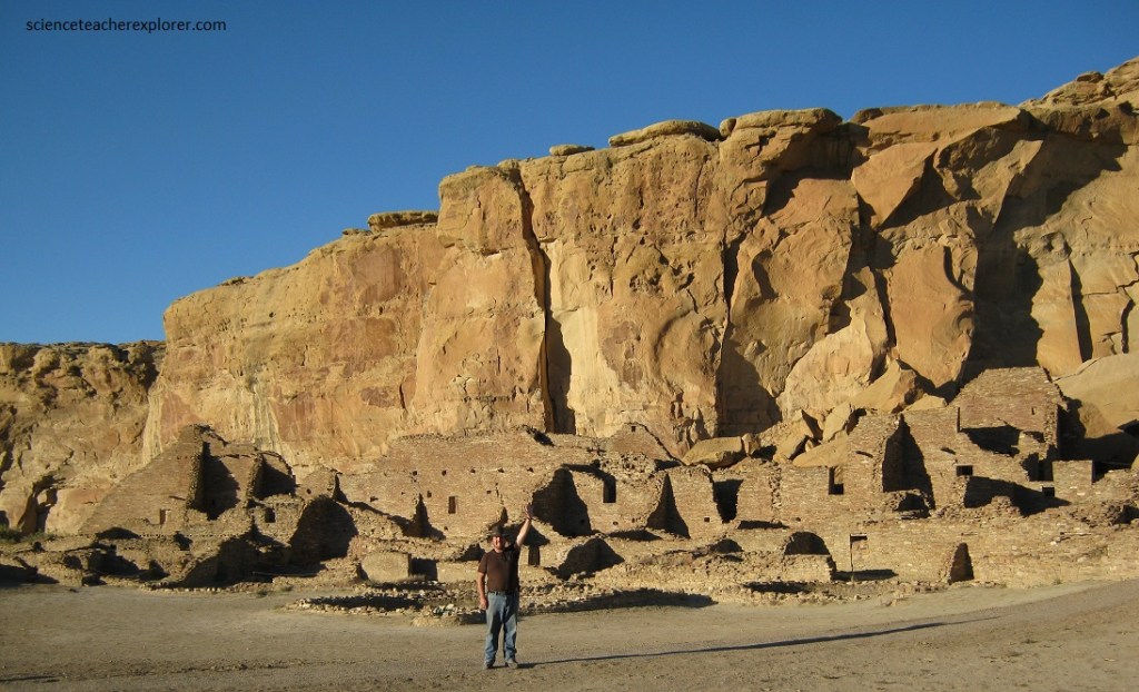
People likely settled around Chaco Canyon as early as 13,000 years ago, but the earliest well-dated human occupation was around 900 B.C. Early inhabitants may have been attracted to the canyon by the rock shelters that form at the base of cliffs at the contact between the easily eroded Menefee Formation and the cliff-forming Cliff House Sandstone. At Chaco Canyon, isolated pit-houses appeared around 200 A.D., and about 300 years later villages of pit-houses were built. Around 700 A.D., pueblo building began, and Chaco emerged as a major center of Ancestral Puebloan Culture around 850 A.D.. Classic Pueblo times (between 1050 and 1100) Pueblo Bonito could have housed perhaps 1,000 Natives in some 600 rooms. It was the largest and one of the most spectacular buildings constructed by the Anasazi, (Ancient Pueblo).
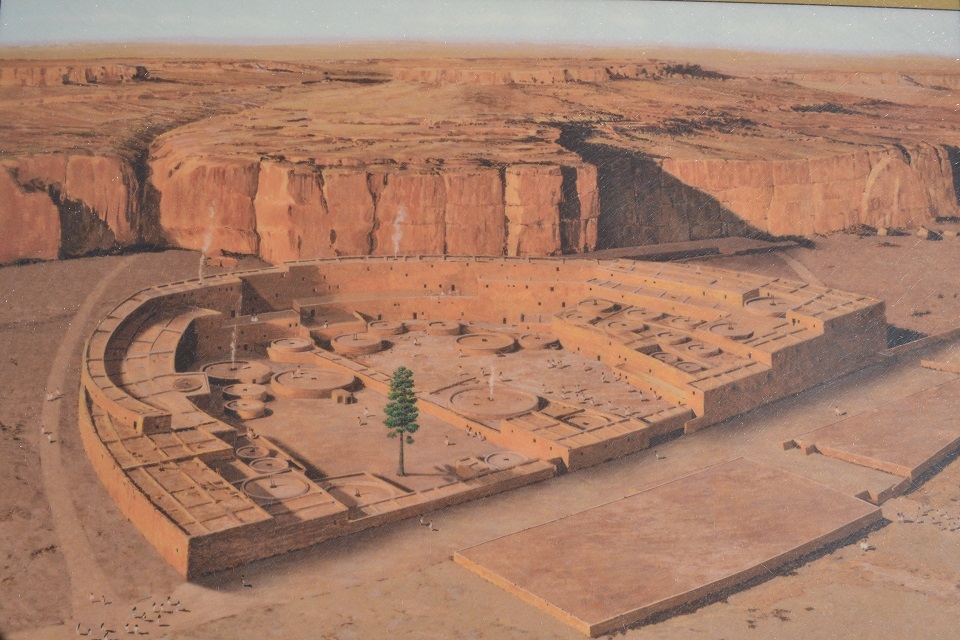
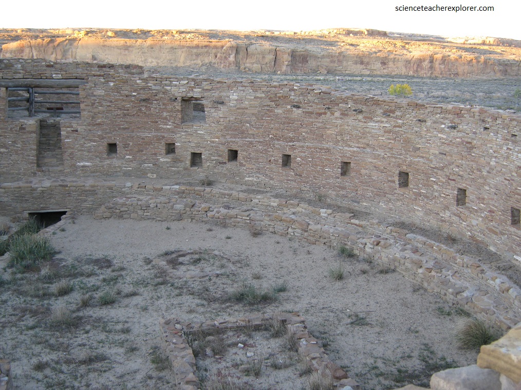
Pueblo Bonito in Chaco Canyon stood five stories high along the rear wall and was occupied for more than 200 years. During four construction periods some 800 rooms and 37 kivas were built. [in 1941, a large piece of Cliff House Sandstone collapsed and destroyed 30 rooms of the pueblo. Debris from this event can be seen at the base of the cliff. Note: the design and placement of Pueblo Bonito make it an excellent solar collector and passive storage structure.
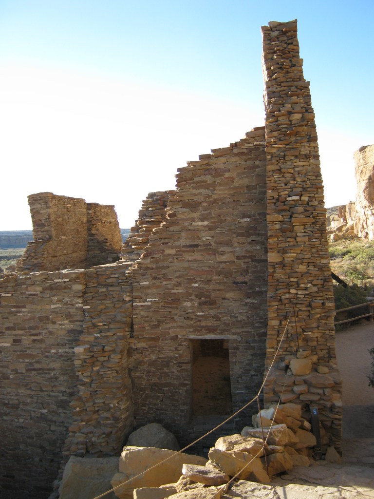
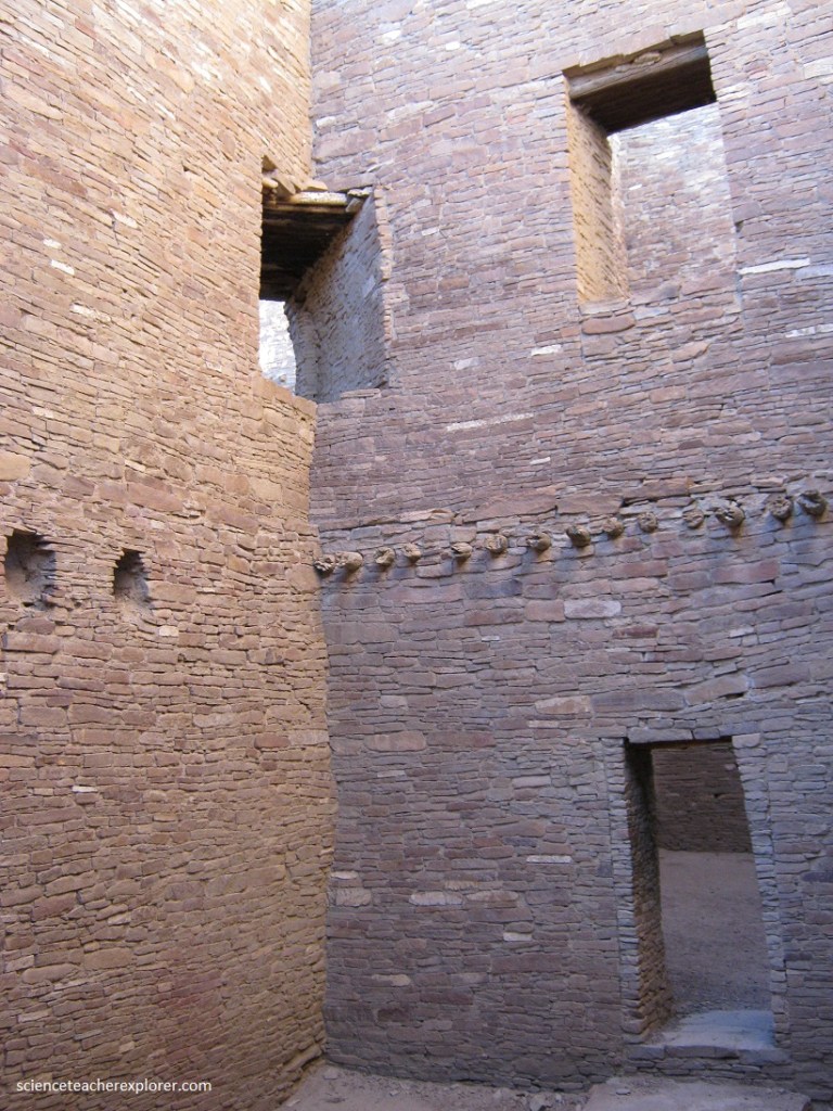
Part of the evidence for a general construction plan for Pueblo Bonito my be seen in the way the curving rear (north) wall of the pueblo was built thicker at its base and tapering toward the upper stories, (pictured above). This also represents a good example of the masonry-veneered, rubble-cured was construction found in the large Chaco ruins.
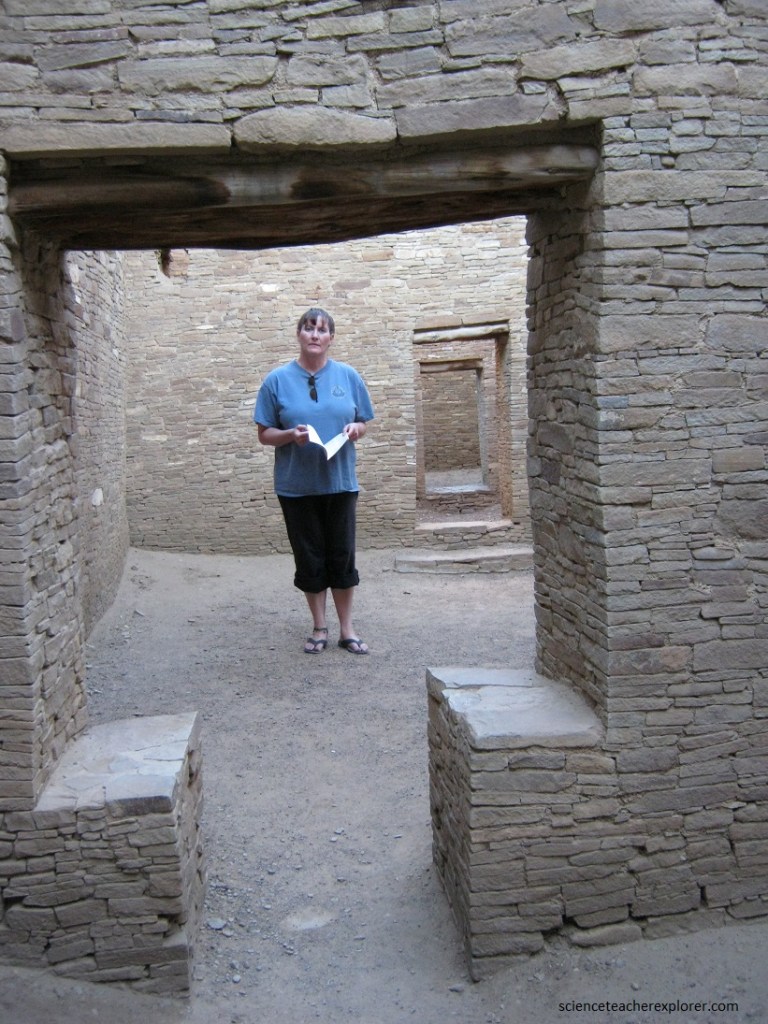
The living rooms at Pueblo Bonito were quite large by Anasazi (Ancient Pueblo) standards, and they were built of unusually fine sandstone masonry from local sandstone.
Several different styles of banded and unbanded masonry in the above photograph mark the work of individual stone masons. The horizontal grooves in the walls held the ends of roof-support beams separating the different floor levels, at least three of which are clearly visible. The timber was hauled here from the Zuni and Chuska Mountains over 72.5 km away.
The full extent of Chacoan astronomical sophistication is as yet unknown. Certainly they were aware of the seasonal movements of the sun and could determine the equinoxes and solstices by observing the sunrise with respect to specific points on the points on the canyon cliffs.
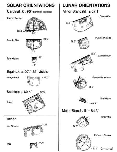
There are 14 buildings at Chaco, of which 12 appear to be astronomically oriented: Three are oriented on the cardinal points (Pueblo Bonito, Pueblo Alto, and Tsin Kletzin), of which Pueblo Bonito, the largest building, is oriented with great accuracy; the wall that divides the half-circle is oriented within 15 minutes of a degree. of true north, and the western half of the south wall runs straight on the east-west line within 8 minutes of a degree.
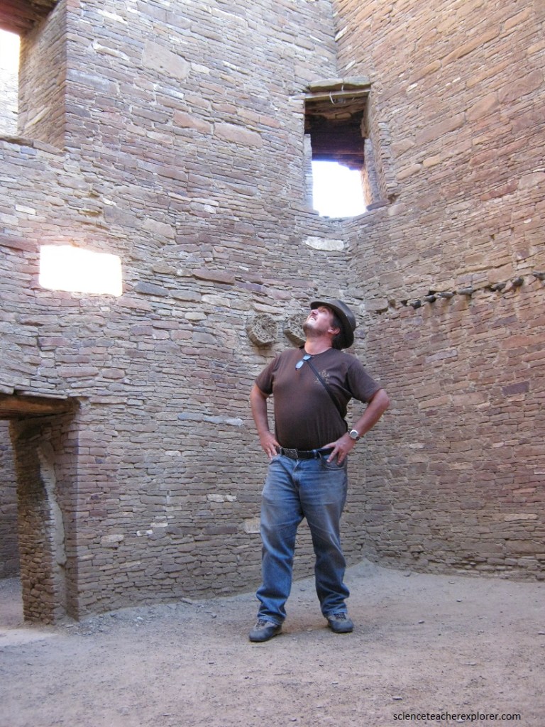
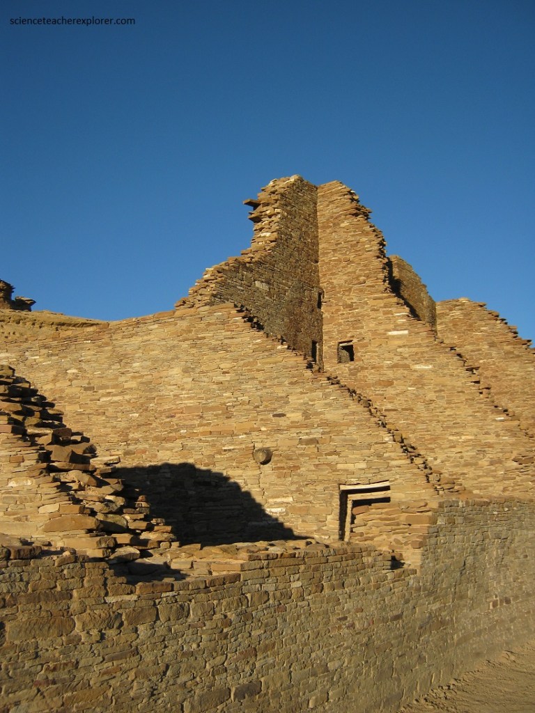
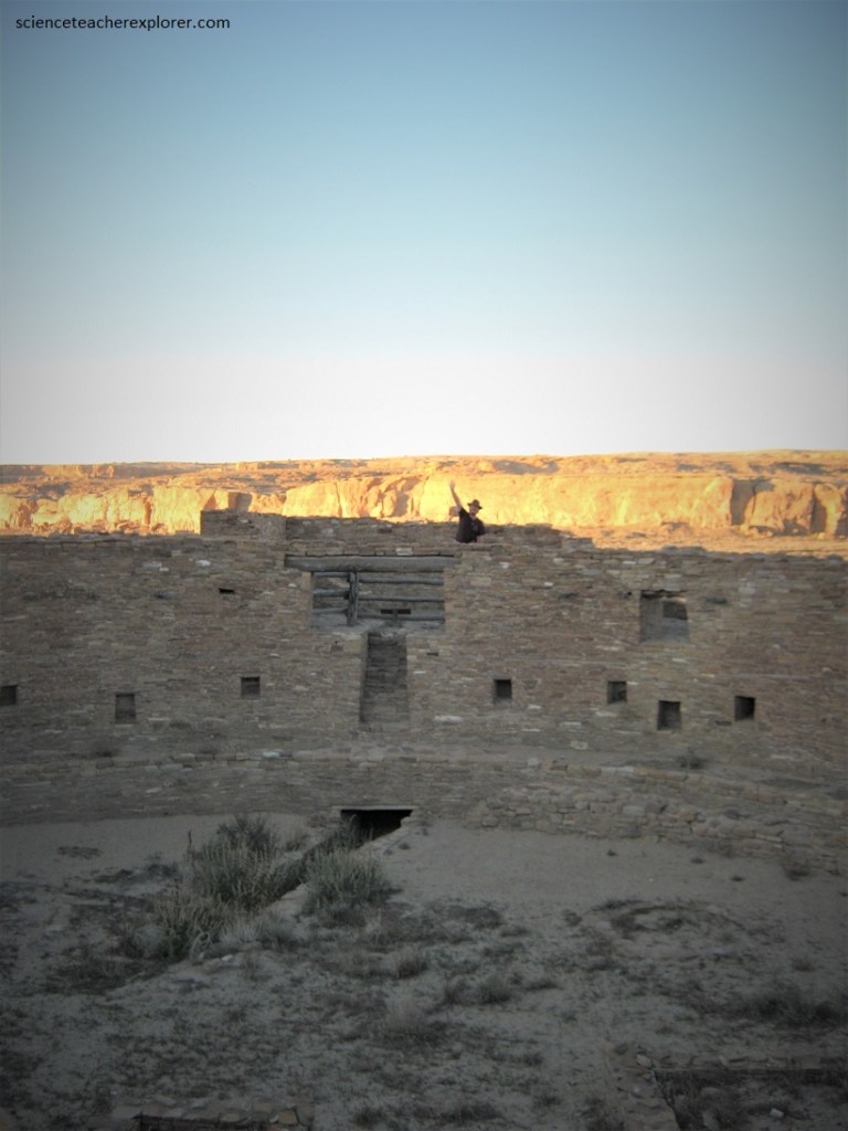
Pictured above, at Pueblo Bonito, the winter solstice could be determined by the alignment of two third-story windows with the sunrise point on the cliff on that day.
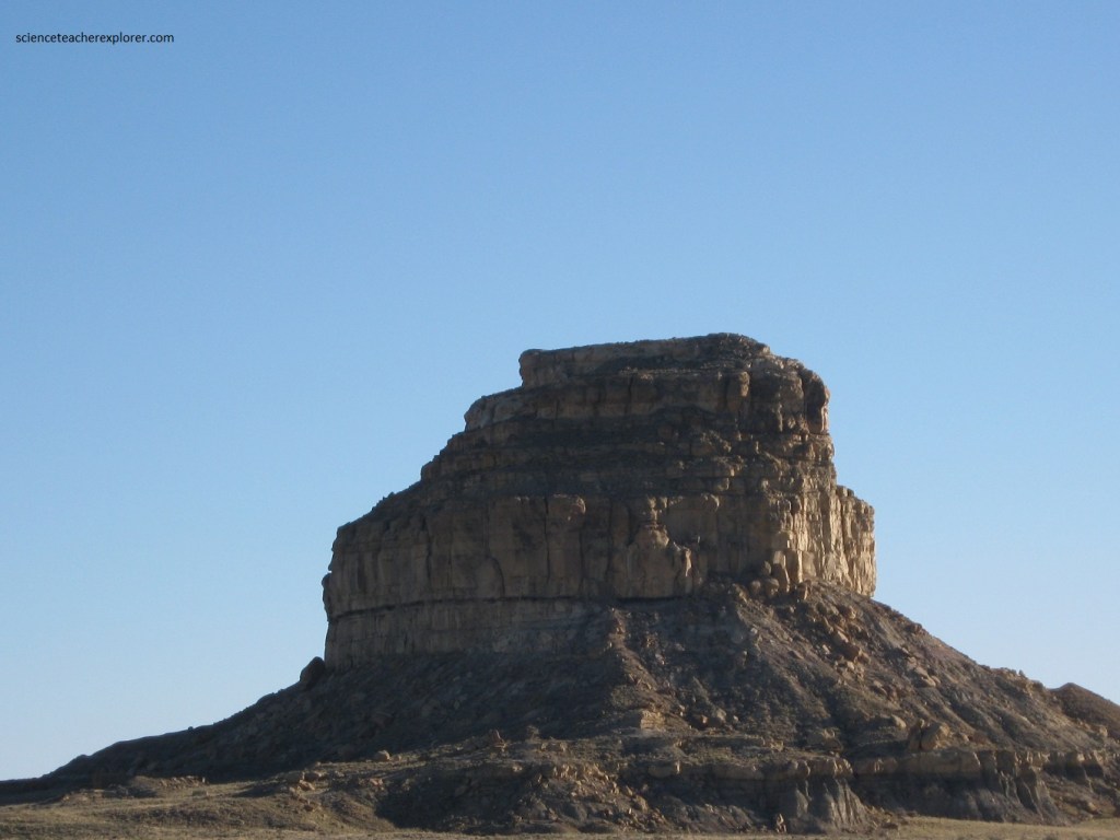
Evidence of the Chacoans’ interest in lunar and solar cycles is further seen throughout Fajada Butte, a 135-meter-high rocky peak 7 kilometers southwest of Pueblo Bonito. There are numerous petroglyphs, that is, drawings carved onto rocks. One is a few meters from the top; it is a semicircle crossed by a radial line perpendicular to the diameter of the base, with a circle placed to the left of the line itself. Thus it is a stylized plan of the Pueblo Bonito complex, which has a large kiva set to the left of the dividing wall. An arrow is drawn outside the figure of the semicircle.
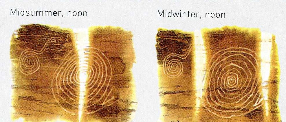
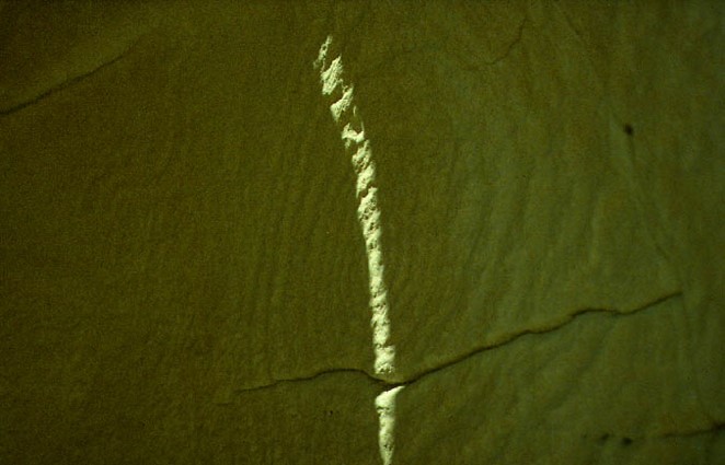
On Fajada Butte there are also carvings used as lunar-solar calendars. The most interesting, example is the so-called petroglyph of three slabs, placed in the vicinity of the summit. This is a drawing made up of two spiral figures; three great slabs of stone are propped on the same rock, over 2 meters high and weighing about a ton each. They cast a shadow over the whole surface on which the drawing is traced.
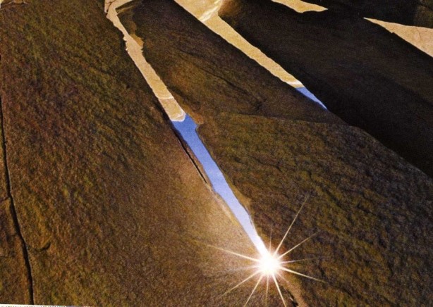
The light can illuminate the figures only through the two openings between the three slabs; the passing of the “blades” of light thus created will vary day by day. However, at 11:05 local solar time, a small spot of light forms above the center of the spiral. It soon lengthens into a dagger shape and begins to move slowly downward through the cent of the spiral. Eighteen minutes later, the streak has moved completely through the spiral and faded away. A few days before and after the solstice, the sun dagger falls to the east of the spiral, a progression in space that allows one to determine the solstice within several days. Note: Because the sun enters the Fajada Butte site near noon every day of the year, it can be used to follow the full scope of the year.
Pictured above, at the summer solstice the blade of light crosses the center of the largest spiral. On subsequent days the “arrow” shifts to the right and a second “arrow” appears to its left. At the equinox this second blade of light reaches the center of the smallest spiral. The movement of both proceeds to the right to the point of illuminating tangentially the largest spiral at the winter solstice.
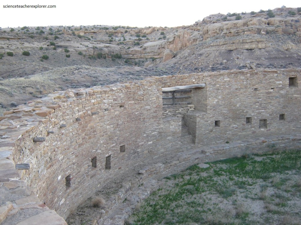
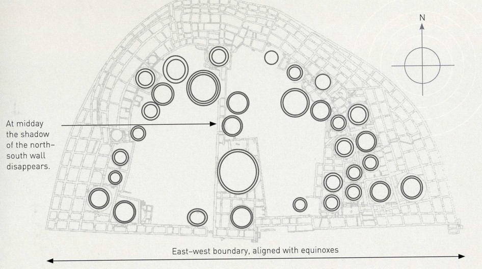
Pictured above, unlike the vast majority of kivas, Casa Rinconada is not embedded in a large building complex, but stands on top of a small hill a good distance away from large buildings and a couple of kilometers south of Pueblo Bonita.
Casa Rinconada stands partly above ground, unlike most kivas in which the roof is at ground level. It is a little over 20 meters in diameter and 4-5 m deep, making it one of the largest known great kivas.
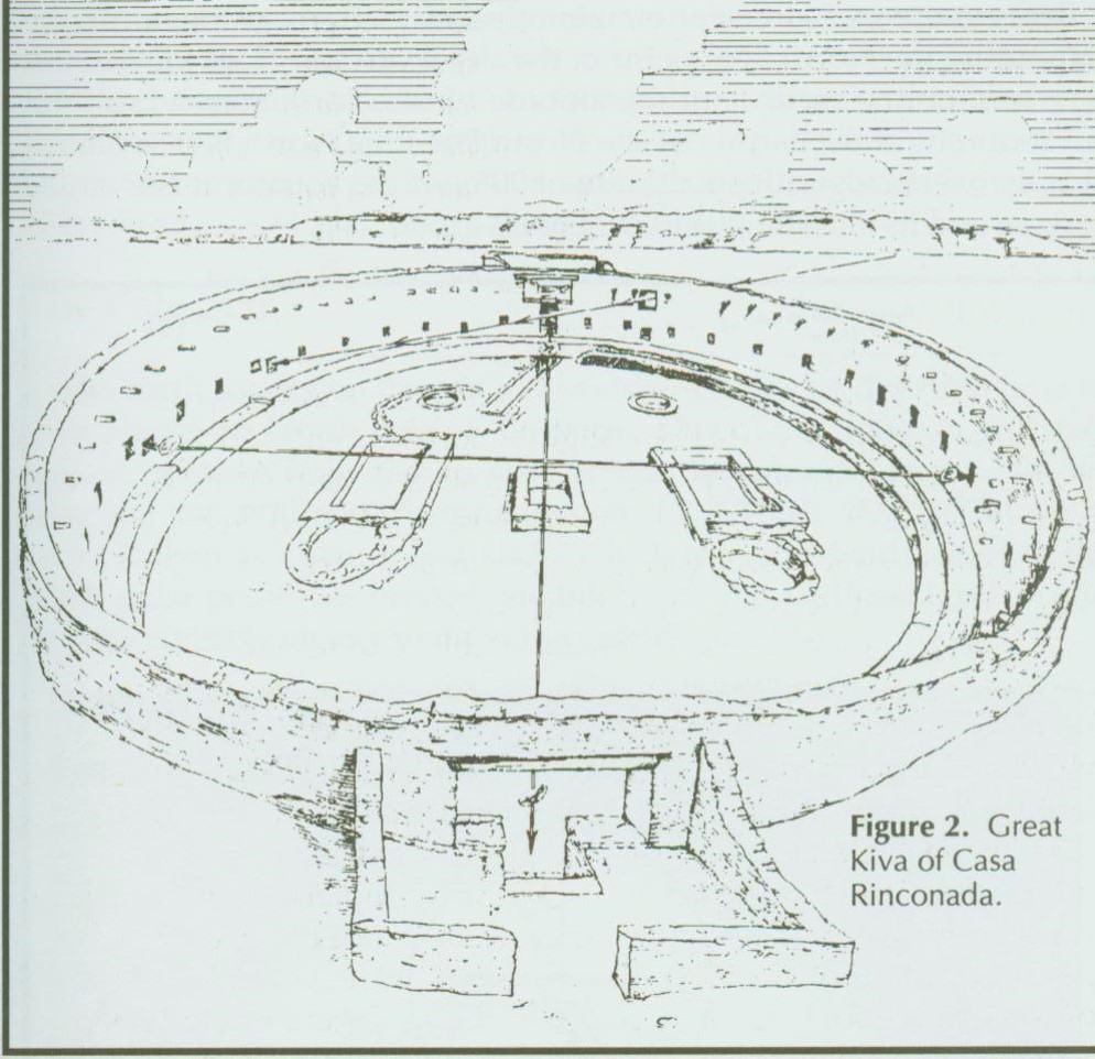
The geometrical care put into planning and building Casa Rinconada goes beyond anything else encountered in Chaco Canyon. The symmetrical axis defined by the two T-shaped doors is aligned with the North-South line to within 20 minutes of a degree. The small niches lining the interior wall are equally spaced and positioned so that lines defined by opposing pairs of niches all have their center within 10 cm of the kiva center, which also indicates that the kiva walls depart very little from a perfect circle. In addition to 2 T-shaped doors, the circular wall also contains 28 small niches set at regular intervals around the kiva and 6 larger but lower niches, 4 symmetrically placed on the west side of the kiva and 2 on the east side. The kiva has an opening that could be a window or small doorway in the northeast quadrant, and a large high shallow wall-niche directly opposite it across the kiva. (There is an ambiguity about the function of the opening into the kiva, {sometime in its use, the kiva had an exterior room just outside that opening}).
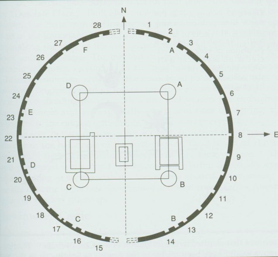
The circular masonry foundation sockets for the four roof posts on the kiva floor, easily seen on the above image, form a square also centered on the kiva center within 10 cm, with sides oriented to within 30 minutes of a degree of either the N-S or E-W directions. In addition to the large fireplace south of the kiva center, the floor vaults, and the low bench along the kiva wall, one important kiva feature needs to be mentioned. Below the staircase that leads into the kiva by the north entrance is a second narrow staircase that terminates in a long narrow trough. (This is not seen in any other kiva).
Casa Rinconada is thought to have been designed as a physical representation of the Anasazi cosmos, and was likely used for important religious ceremony involving the larger Chacoan community. Note: On and near the summer solstice, the light of the rising sun enters the northeast opening and falls against the opposite wall. Shortly after sunrise, it lights up the wall above small niche 24 then moves slowly down the wall across the niche to settle for a short while in niche E, on of the large, special niches lower down the wall, (imaged above). Additionally, at dawn near the equinoxes the mesa edge east of Casa Rinconada casts a shadow across half the kiva, the shadow line falling roughly along the line between niches 8 and 22.
Pictured above, Casa Chiquita is a small village of fifty rooms and three kivas, originally standing two or three stories high, is located just to the right of the point where the modern road enters Chaco Canyon.
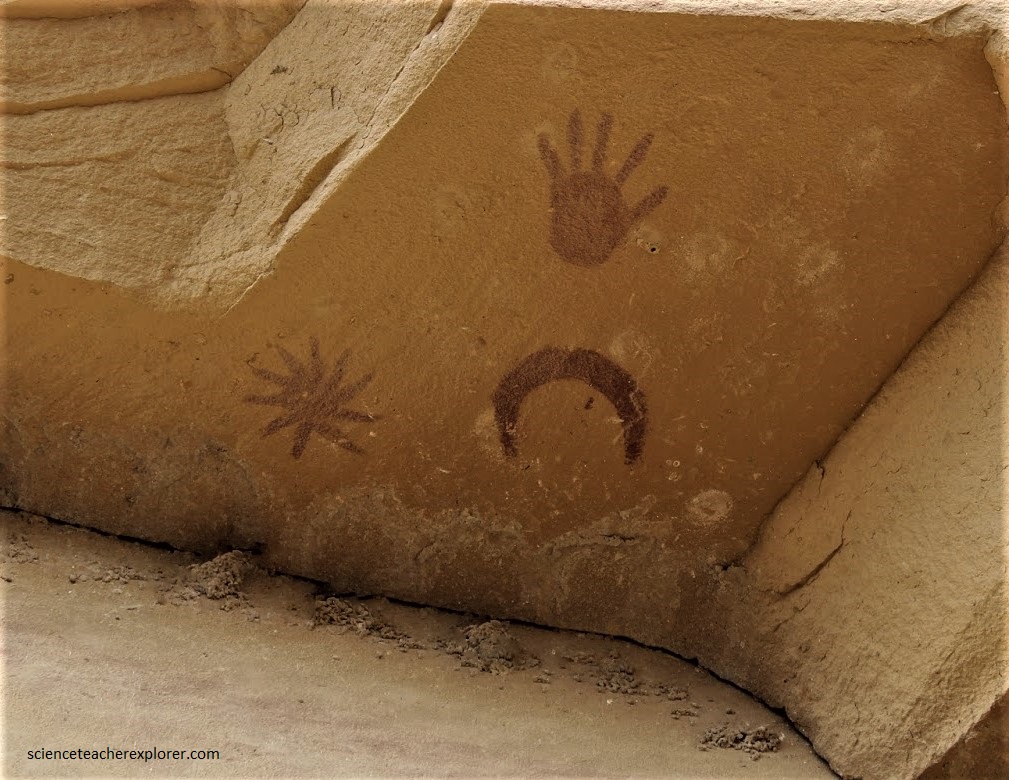
Along the Penasco Blanco Trail, about 1 km from Casa Chiquita, the Ancient Pueblos artists pecked out a cluster of petroglyphs. Across the Chaco Wash on the canyon wall a pictograph complex shows a crescent moon, bright star, and human hand, painted beneath the over hang, (pictured above). Somewhat below and to the left are three re circles on a yellow background that probably represent the sun. This cluster may portray a supernova that was visible in Chaco and worldwide in 1054 AD. It could equally well represent Venus in the morning sky. Note: Venus (or the supernova), and the crescent moon as they appear to the viewer looking westward are astronomically impossible, however, with one’s back to the wall, looking upward, as if seeing the moon and Venus rising in the eastern sky, the display is astronomically correct, either for the rising Venus or the supernova. The hand points toward the moon and star as they would appear in the eastern sky just before sunrise, and the sun lies just below the horizon.
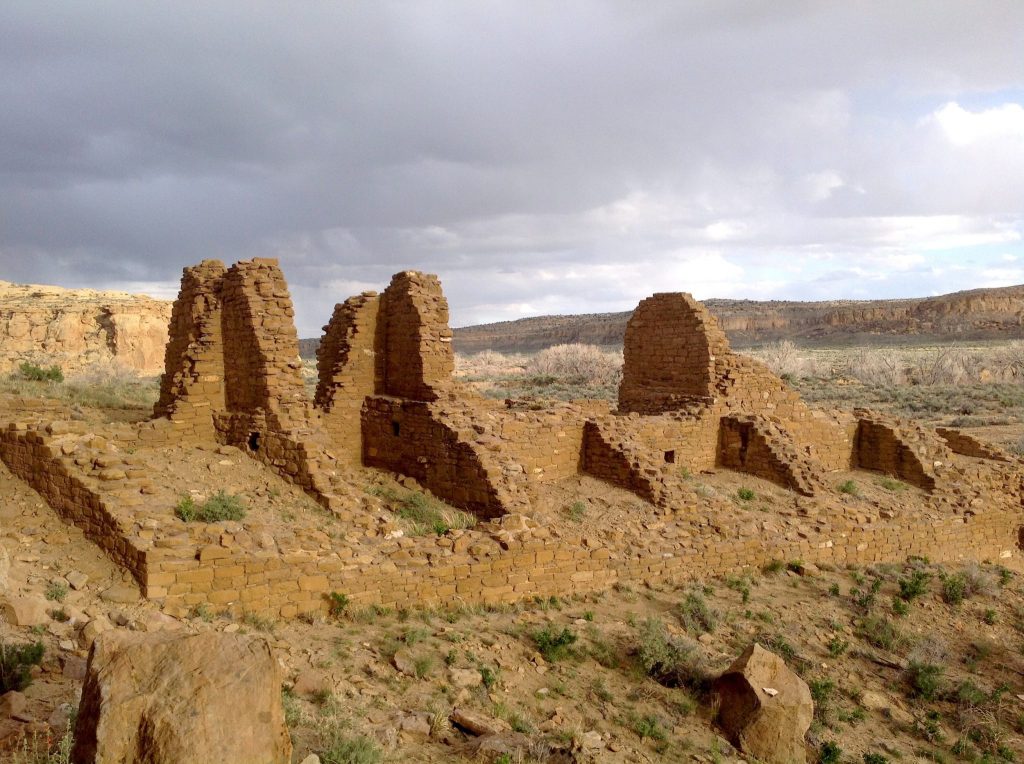
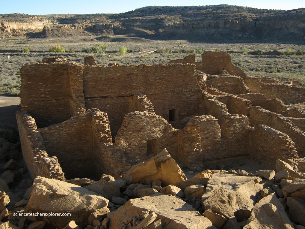
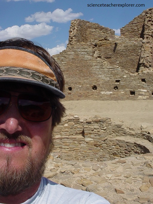
Just east of Pueblo Bonito, Chetro Ketl have known construction dates from 1010 to 1117. Chetro Ketl contained over 500 room and 12 kivas with a great kiva, (which I’m standing next to). Only a small portion of the ruin has been excavated. It has been suggested that the niches in the great kiva of Chetro Ketl were designed to observe the phases of the moon and even the heliacal risings of Venus.
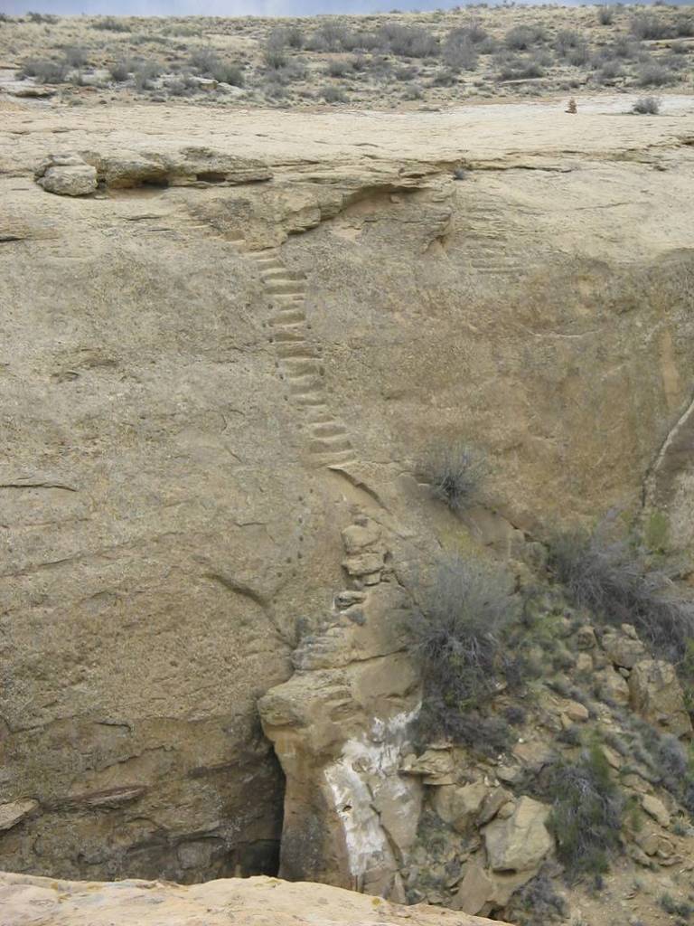
The most unique and technically advanced aspect of the Chaco culture was the road and signal communication system. The line-of-sight communication network developed by the Chacoans may have linked communities throughout the Chaco Basin by use of fires at night. The roads linking the outliers ran north, south, southeast, and southwest from Chaco Canyon. Pictured above, the ancient Jackson Stairs lead to the mesa top at the head of the canyon northeast of Chetro Ketl. This Great North Road reached Salmon Ruin and probably extended beyond. These roads and stairways joined Pueblo Bonito and Chetro Ketl with Pueblo Alto. Pueblo Alto was the terminus for several roads from the north and northwest. The primary purpose of this extensive roadway network, in addition to the transportation of goods, building materials, and individuals in and out of Chaco Canyon, must have been to hold Chaco Canyon and its outliers together as a social and economic network.
However, it should be noted: The Pueblo cosmology is full of roads. Life is a road, and the spirits of the ancestors are custodians of the various roads that branch off from it. When humans first emerged from the “sipapu”, the hole in the floor of a “kiva”, they remained close by. But the site was so sacred that they were eventually asked by the gods to move further south. Consequently, when they died their spirits would travel northward, returning to the “sipapu” and back into the womb of the earth. The spirits then return each year to visit the living, using the roads that had led them north, and these roads are often described as being straight. When a person dies, a holy man places offerings for him in a canyon to the north of the village on the road toward the “supapu”, including containers of food for his final journey. The Pueblo are also well documented as undertaking what we would call pilgrimages to sacred sites. Often these journeys are as long as 500km and can last for months, a specific example being that of the Pueblo who live near Chaco, whose pilgrimage takes them northward from Chaco proper to a “sipapu” in the form of a small lake in the San Juan Mountains.
Pictured above, Hungo Pavi, at the junction of Mockingbird Canyon and Chaco Canyon, (just below a prehistoric stairway ascending to the mesa), was a medium-size site with 73 lower-story rooms and 2 kivas with tree-ring dates from 943-1047 AD.
Between 1130-1150 A.D., Chaco Canyon’s prominence faded. Archaeologists debate the reason, which likely included a major drought in the region as well as cultural changes.
