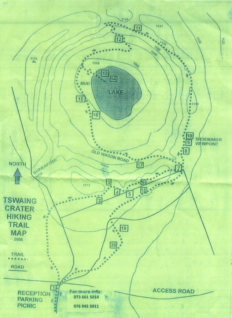
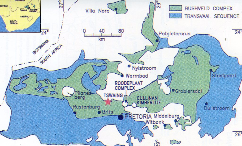
Tswaing Crater, S. Africa
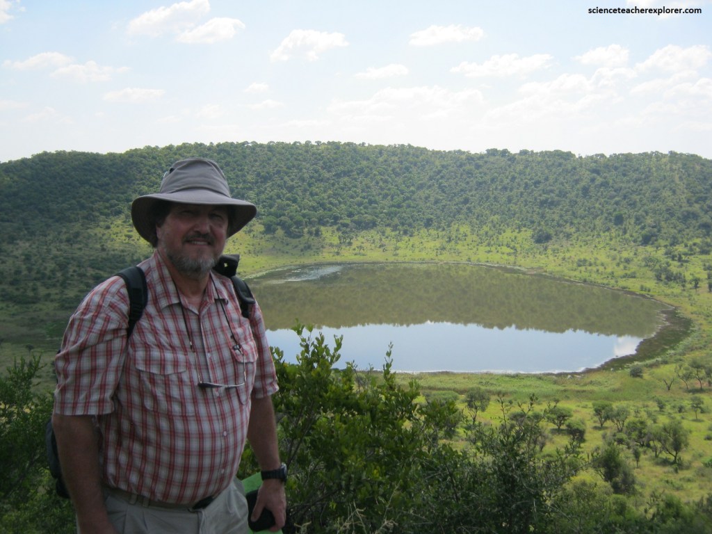
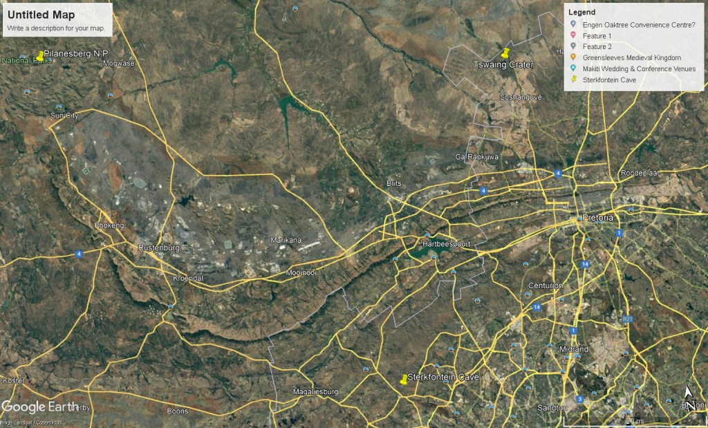
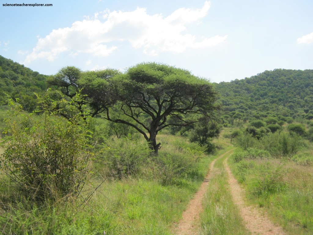
In March of 2023, I explored the Tswaing Crater, 40 km north-northwest of Pretoria, South Africa, near the major settlement of Winterveld, and within a 1.946 ha conservation area managed by Ditsong Museums, (pictured below).
The Tswaing Crater was formerly known as the Pretoria Salt Pan. For many years it was considered to be a volcanic cone with a sunken floor containing a soda lake.
The crater consists of a ring of rock rising some 60 meters above the surrounding land surface, and it was presumed that the hills were formed by volcanic rock pushed out of the central neck, with the subsequent collapse of the center into the magma chamber.
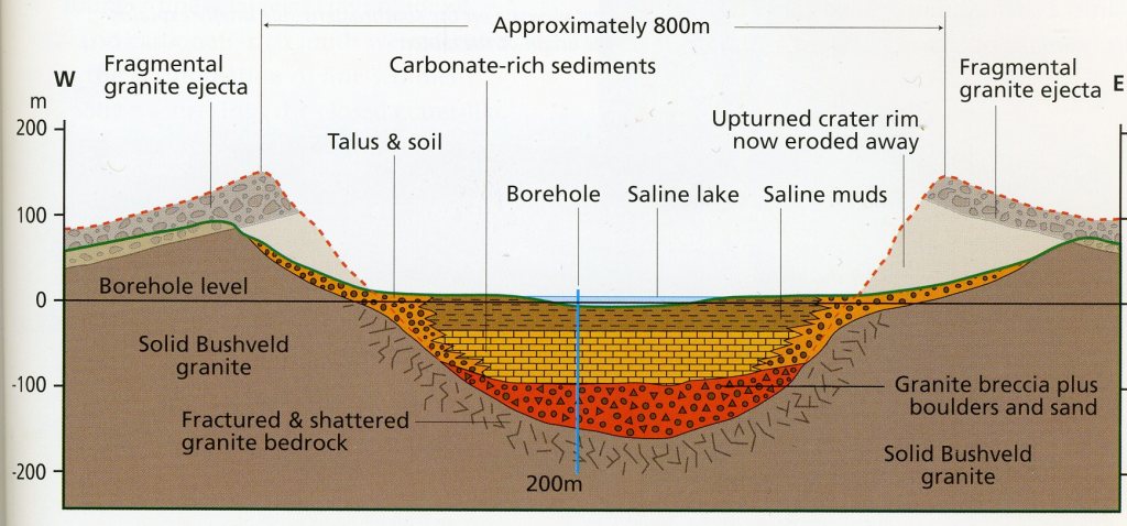
However, the rocks forming this ring are granite, a deep-seated intrusive rock approximately three million years old, and not volcanic rock that has erupted at the surface. This crater is unique in South Africa: the central floor lies about 60 meters below the level of the surrounding land surface, and underlying the soda lake area variety of fine-grained muds which contain fragments of rock, some containing magnetite, (an iron oxide).
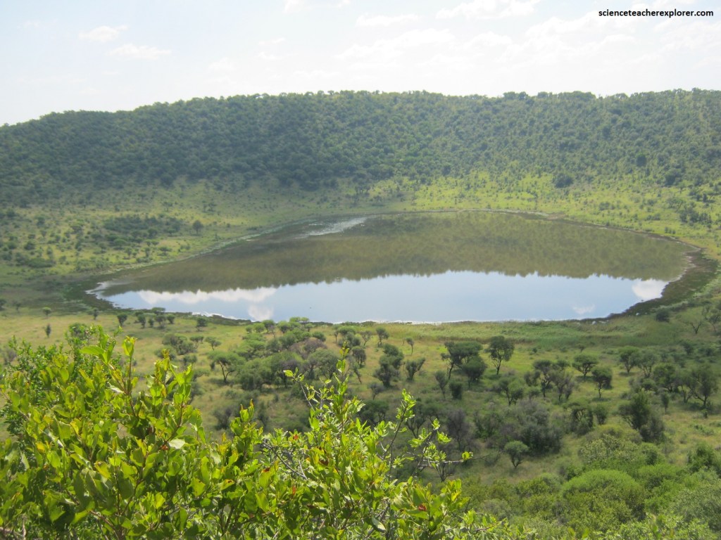
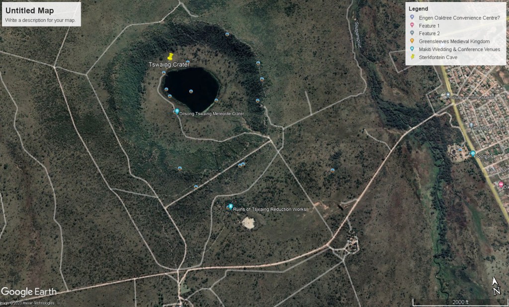
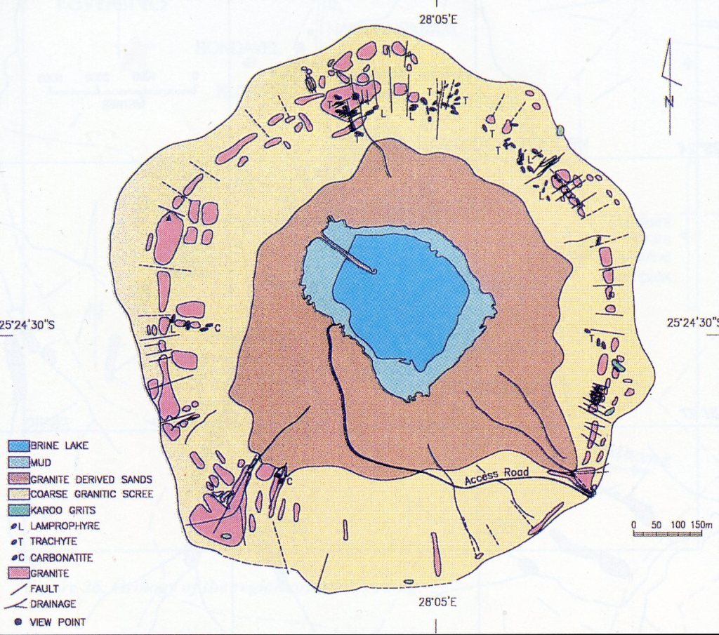
Pictured above, the near-circular Tswaing Crater has a 1.13 km, (from rim to rim) diameter. From this “Shoemaker Viewpoint” the picture is taken 60 m higher than the surrounding landscape and 100 m above the crater floor. The rim is well preserved and consists of a up-tilted granite from the 2.050 million old “Bushveld Complex” or the Nebo Granite.
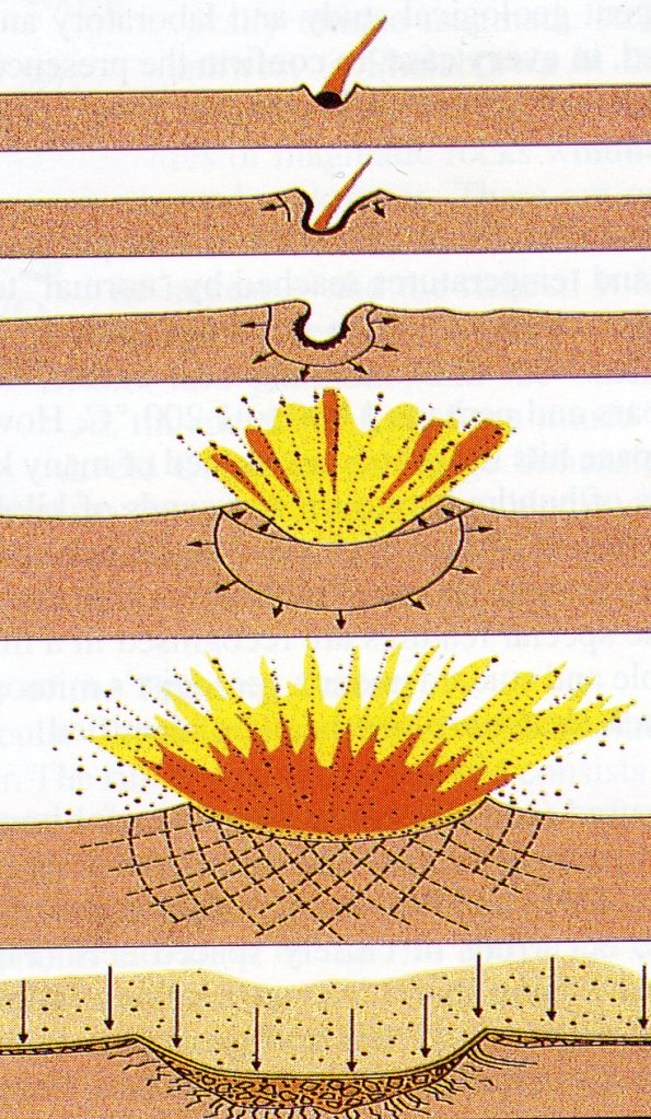
It is now concluded that this bowl-shaped geological feature, (The Tswaing Crater), is caused by the impact of a 50 m chondrite, (stony meteorite), 220,000 years ago, which exploded and vaporized on impact (imaged above). Rocks and gravel were thrown outwards and deposited around the hole, forming the crater rim. Originally the crater floor was about 150 m lower than the present level, however, the past 220,000 years the crater has been gradually filled in by deposits of sand and gravel, coming from the rim due to weathering. The water of the lake is derived from groundwater and rainfall.
The Tswaing Crater and the surrounding area consists predominantly of the pinkish Nebo Granite, which is the main granite type of the Bushveld Complex. Large parts of the surrounding countryside are covered by coarse sands and grits derived from recent weathering of the underlying Nebo Granite.
The Bushveld Complex is very important in its own right. It is a magmatic structure stretching from Pretoria in the southwest to Phalaborwa in the northwest, and from Middelburg in the south to Potgietersrus in the north. It contains a fill of several kilometers of magmatic rocks which form a sequence of near-horizontally layered rock types. The Bushveld Complex hosts some of the world’s most important ore reserves, including much of the world’s chromium, vanadium, platinum, silver, and tin.
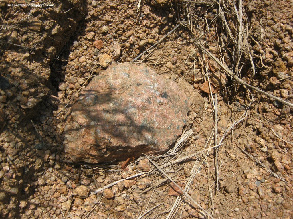
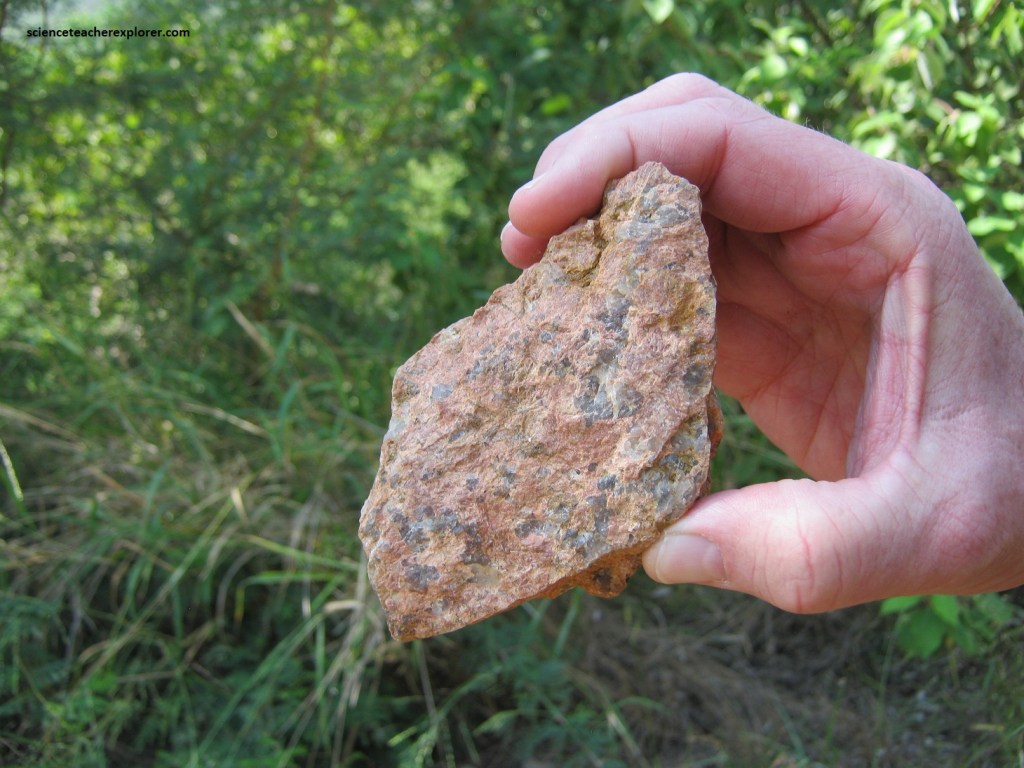
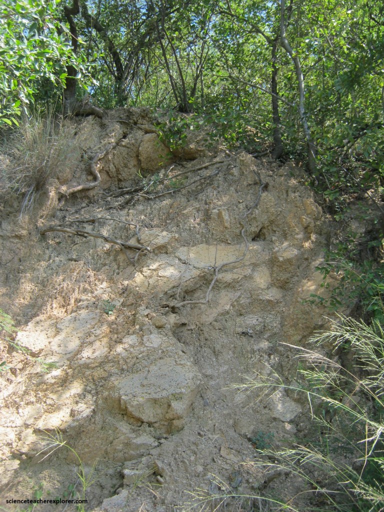
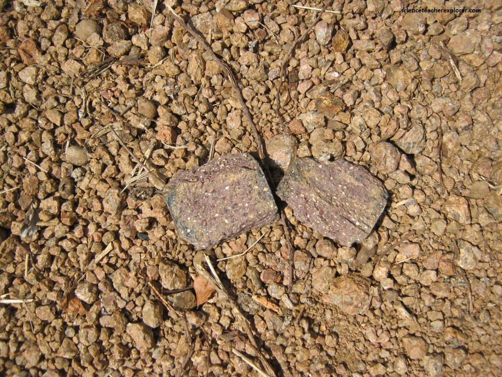
Granite is found on the higher areas of the inner and outer rims of the crater. In hand specimens, the fresh granite appears as a coarse grained, pink rock. The largest grains which are pink or light brown consist of the mineral K-feldspar and are interlocked with large quartz grains of milky white of light-grey appearance. Minor amounts of the minerals hornblende and biotite appear as dark specks, (pictured below).
Highly altered granite is also common in the crater and is particularly abundant in parts of the crater rim. It is recognized by its typical whitish to greyish parts of the crater rim. The weathering of rock of the crater rim is the result of surface waters penetrating the granite along fractures and joint planes. The fractures, which are very common in the granite rim, allow easy access for the surface water, (pictured below). At the top of the rim the granite dips outwards at varying degrees, indicating that the rim granite had been tilted upwards. The upper, steepened granite and the Karoo sediments, (younger 220 million year old sedimentary-rocks that are gritty in texture), overlying the granite are also broken by a number of small, nearly vertical, radial faults, which have caused the numerous depressions seen along the rim crest trail.
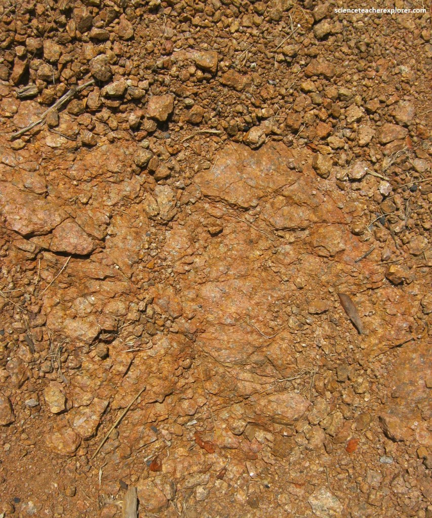
At the crater’s rim, the granite weathers into large, rounded boulders or into smaller, angular, crumbly fragments of feldspar and quartz, (pictured below).
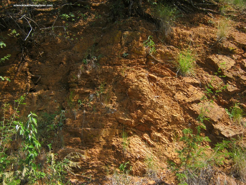
The mid-section of the rim consists of buckled or folded granite. This fold has been locally fractured and displaced along some small-scale faults. This folded structure, also known as an anticline, is clearly exhibited along the road entering the crater. Folds, like this one, result from initial outward motion: the granite is first driven outwards in a horizontal direction and then deflected upwards towards the surface, (pictured below).
Intrusive magmatic rocks are present in many places along the crater rim and are particularly abundant in the northern sector of the rim, with only a few occurrences elsewhere. These igneous rocks include lamprophyre, trachyte, phonolite, and carbonatite. They occur in the form of thin dikes or sills that are fractured and are displaced by small faulting during the cratering event. The intrusive rocks are approximately 1.3 million years old, which are much older than the cratering event, (pictured below).
Gradually descending under a canopy of lush vegetation, the access road reaches the crater floor and turns towards a narrow strip of land that stretches into the crater lake.
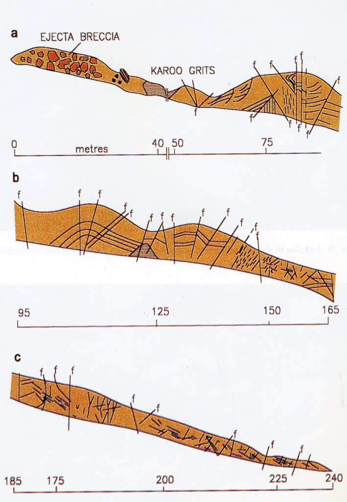
Of particular interest here are the research boreholes, near the center of the lake. It was information that was obtained from this 1988/1989 borehole that led to the conclusion that the Tswaing Crater is an impact, and not of volcanic, origin, (pictured below).
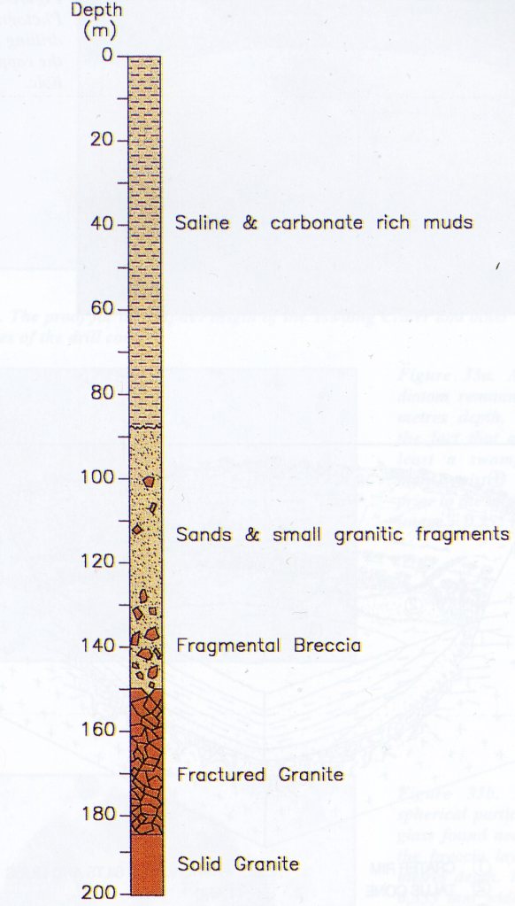
Pictured above, the drill core obtained from this borehole showed about 90 meters of crater-fill sediments overlying tens of meters of loose suevitic material and fragmented granitic rock. The fragmented rock in the drill core passes gradually downwards into less affected and, finally, non-fragmented rock. In the lower portion of the core, below the crater-fill breccia, only blocks separated by fractures were observed. Many diagnostics of shocked metamorphic-effects were observed, (which are uniquely associated with meteorite impact craters, in material recovered between the 90 and 150 meters depth.
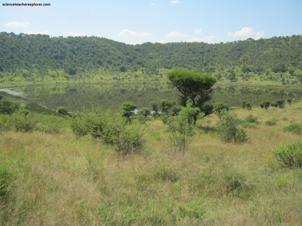
Pictured above, the crater lake is saline, as the water entering the crater, (both as run-off from the slopes and from the boreholes (groundwater)), picks up various minerals from the rocks and carries them to the lake where they are concentrated by evaporation. It is the organic material, (fine weathered material and the minerals in the water), that give the lake its dark color and strange odor.
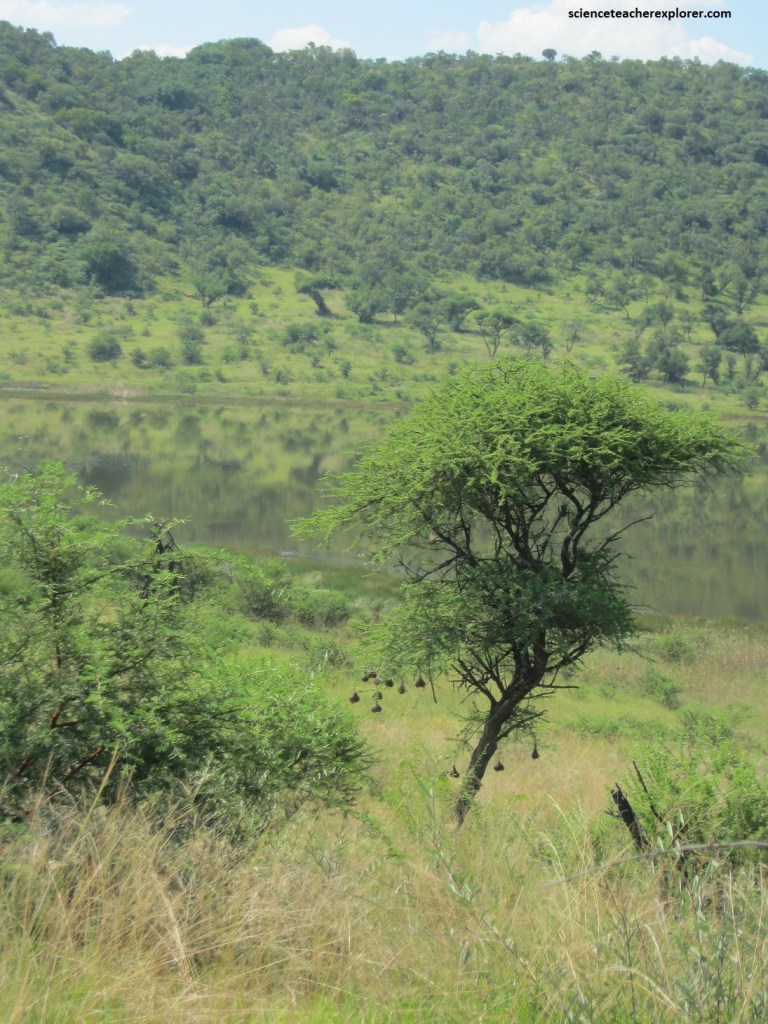
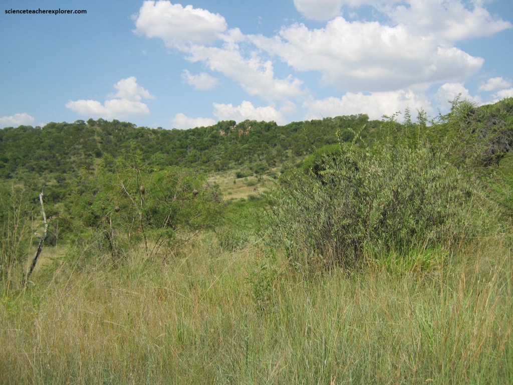
There is a very large diversity of trees, shrubs, grasses and other floral species, (some 480 plant species), that have been identified so far in the Tswaing Crater. The upper parts of the crater rim are covered by broadleaved woodland, (mainly Combretum trees), and the lower parts by thorny trees, (mainly Acacia woodland). These variations are related to differences in the slope angles at various levels of the crater rim and the types of soils of the crater interior.
Tswaing Crater is one of the world’s best preserved and best studied meteorite impact craters. It is quite clear that the Tswaing Crater is an important geological heritage-site. It has not only been proposed as a National Monument, but has also been selected to become a site museum.