Kruger N.P., S. Africa
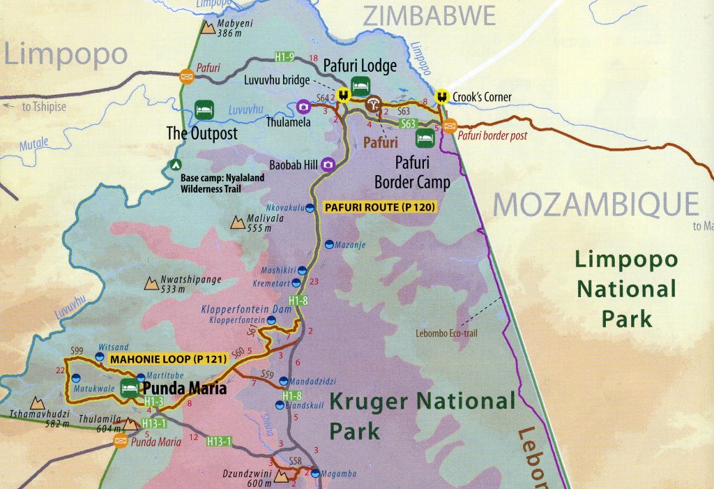
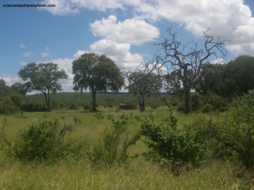
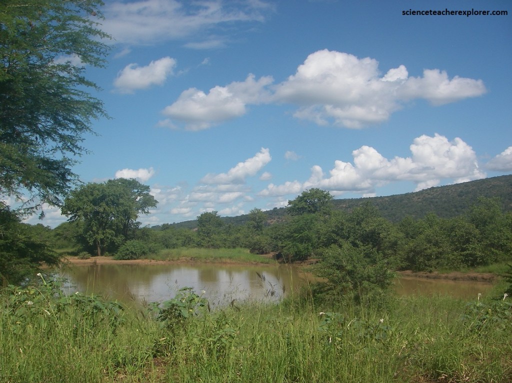
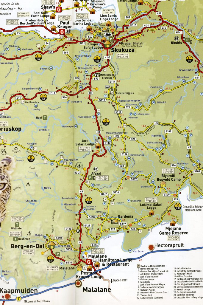
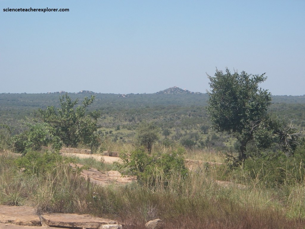
I spent 4 days in Kruger National Park, South Africa during March of 2023. Proclaimed by South African president Paul Kruger in 1898, this jewel in the National Parks Board crown stretches 381 km from the banks of the Crocodile River in the south to the Limpopo River in the north and covers about 2.5 million hectares in the northeastern corner of South Africa, (image below).
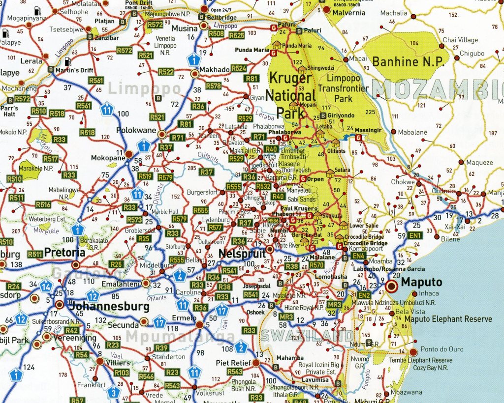
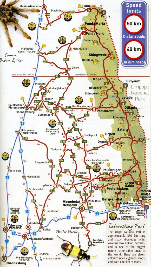
Kruger National Park has 9 different gates-of-entry from South Africa, (2 more are from Mozambique). All of the gates are a 5- to 6-hour drive from Johannesburg or Pretoria. My trekking buddies, (the Mike Stevens family), and I, had decided to start our exploration of the park at the northern Punda Maria Gate (581 km from Johannesburg). The remaining gates that we entered in the next three days were, consecutively, Phalaborwa, Orpen and Malelane. We chose to stay the nights within the small cities of Tzaneen & Nelspruit.
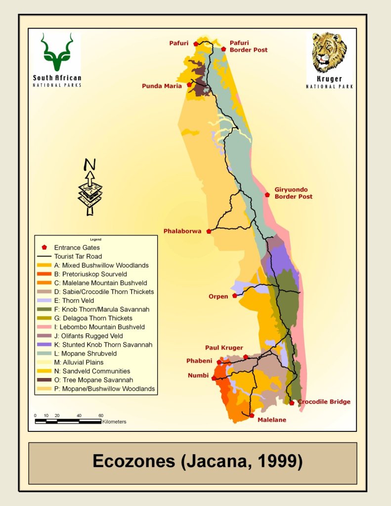
Even more impressive than its size, however, is the diversity of life the Kruger sustains 16 ecozones (each with its own geology, rainfall altitude, and landscape) are home to more than 500 bird species and 147 mammal species. The rich plant life varies from tropical to subtropical, almost 2,000 have been identified, including some 450 tree and shrub species and 235 grasses.
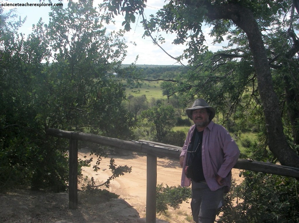
Our first morning was to enter the Punda Maria Gate, (pictured below).
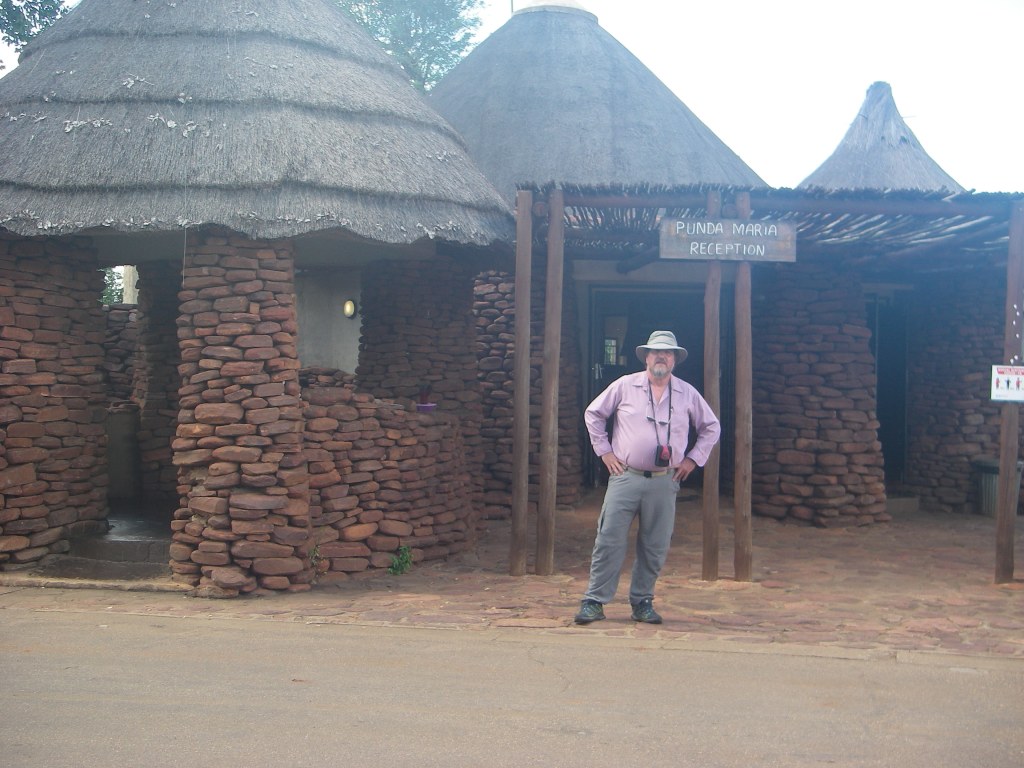
Punda Maria Gate is the direct access point into the far northern Kruger from Gauteng. The name Punda Maria is a bastardisation of the Swahili word for zebra, which is punda miliya. The name of the camp was coined in 1919 by the first ranger in charge of the area, JJ “Ou Kat”Coetser, who named it after his wife, Maria.
Punda Maria is the most accessible entrance to the Pafuri area of the Park. Punda Maria offers the thickest stands of the Mopane Tree in the country due to the heavy rainfall in this region.
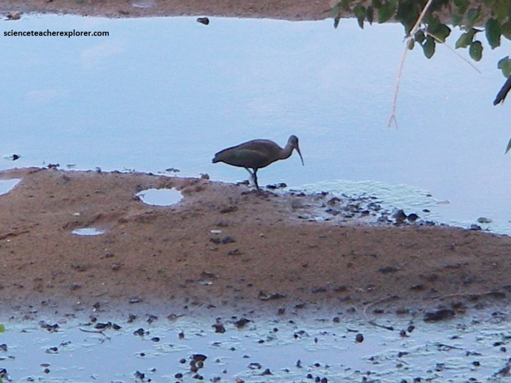
Pictured above, the thick crest and strong bill gave rise to it’s common name, “Hamerkop” Scopus umbretta. It usually forages in shallow water, but we found it hear in the forest of Mopane trees. I figured that it had a nest, close-by, of sticks and grass.
Pictured above, the white chin and forehand with the red throat is diagnostic to the White-fronted Bee-eater Merops bullockoides. The wings and tail were green and the vent and rump bright blue.
The area from Punda Maria to Pafuri is often described as the “Botanical Garden of Kruger” and besides the lovely and wide variety of fauna, this habitat creates one of the world’s premier birding areas.
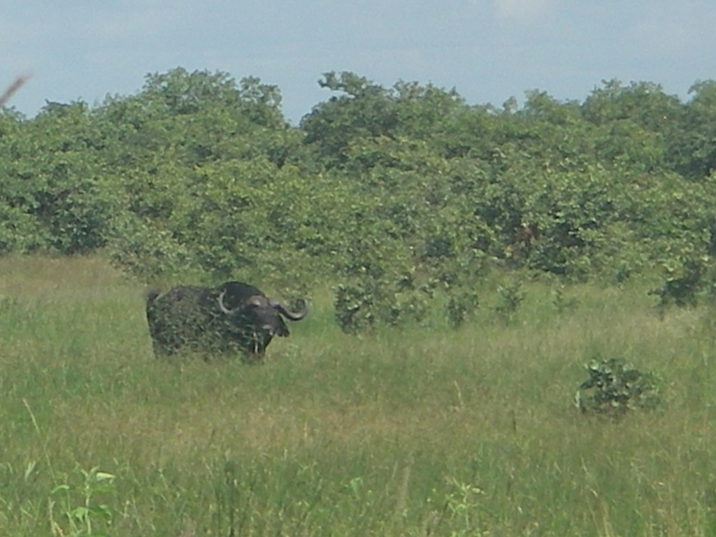
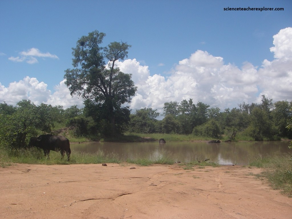
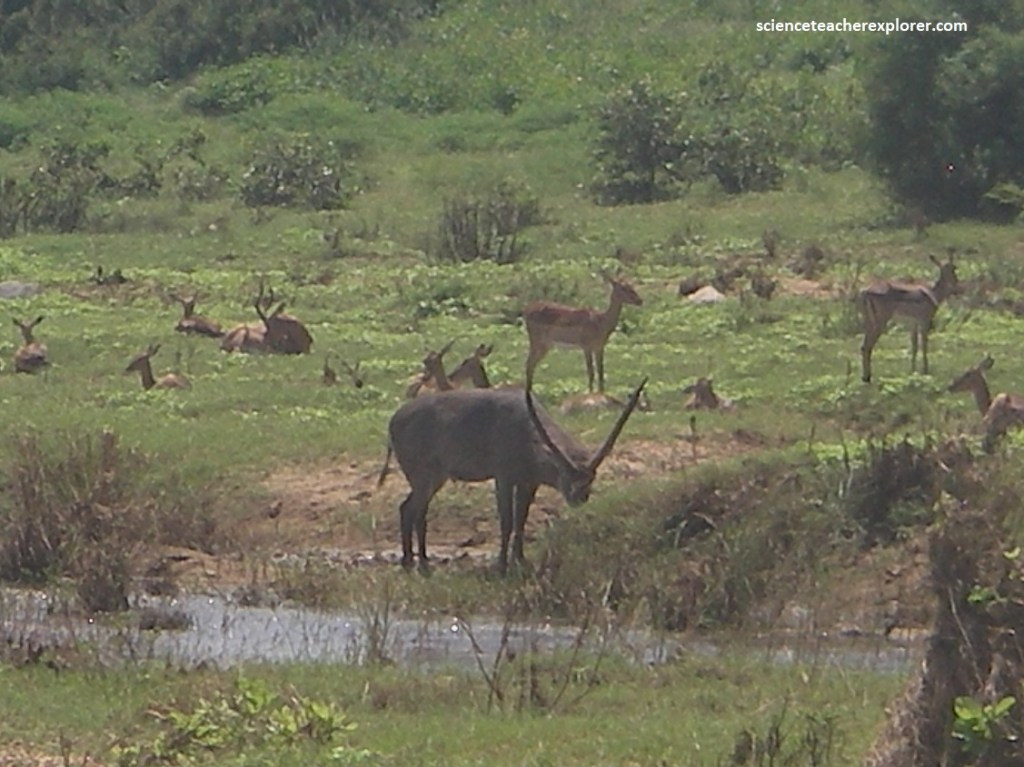
Pictured above, the African Water-Buffalo Syncerus caffer is a large cattle-like animal that has a reputation for tremendous strength and determination. This one was grazing in tall grass. They are usually dependent on water and I suspected that a water-hole was nearby.
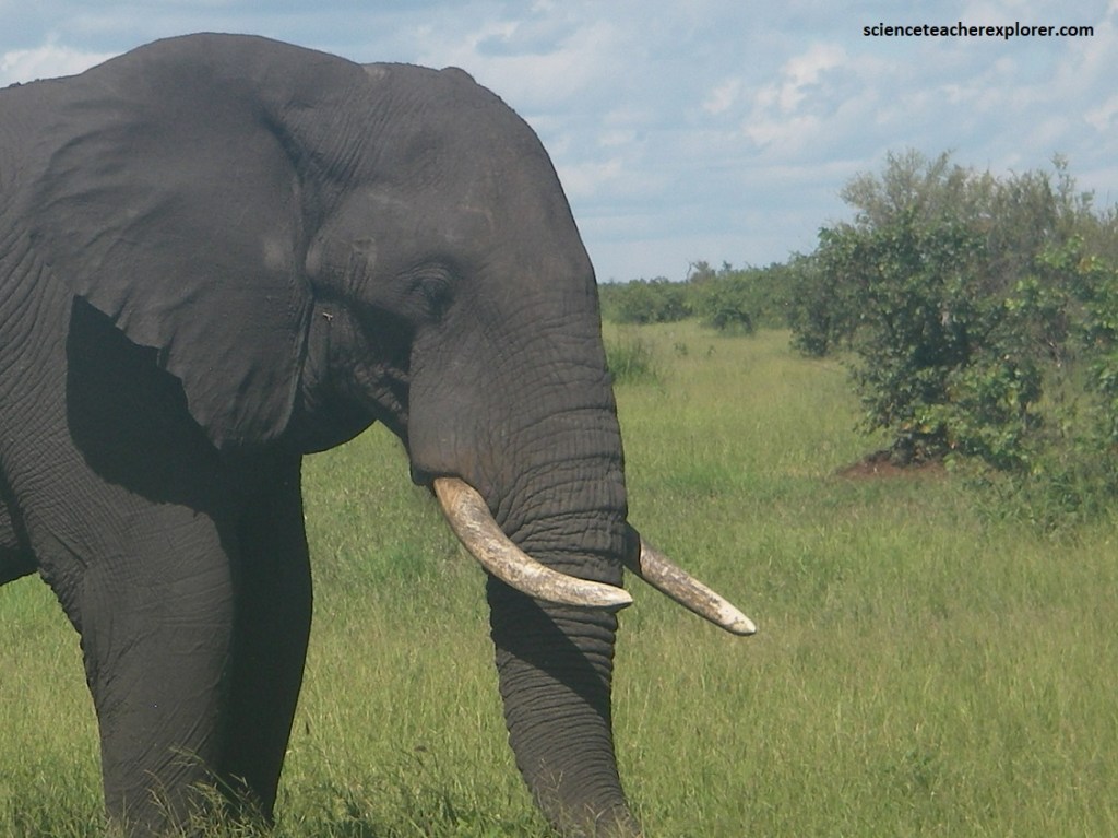
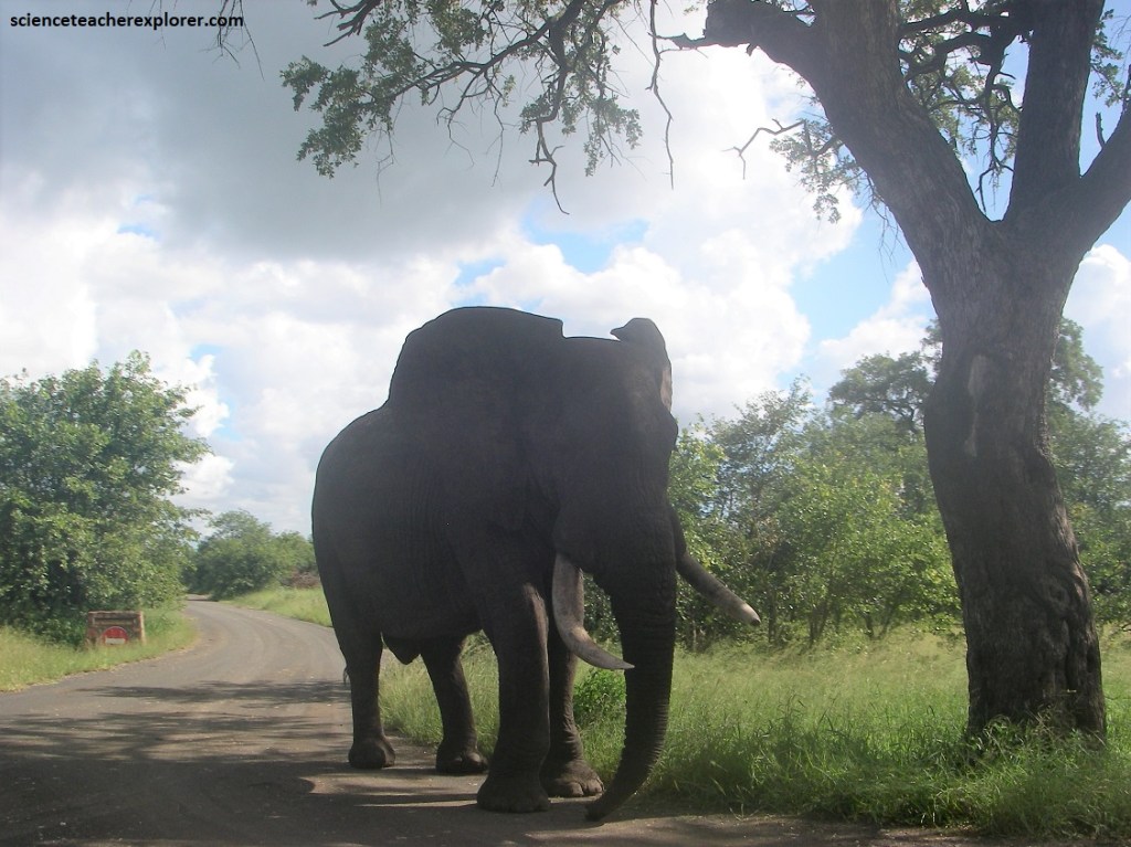
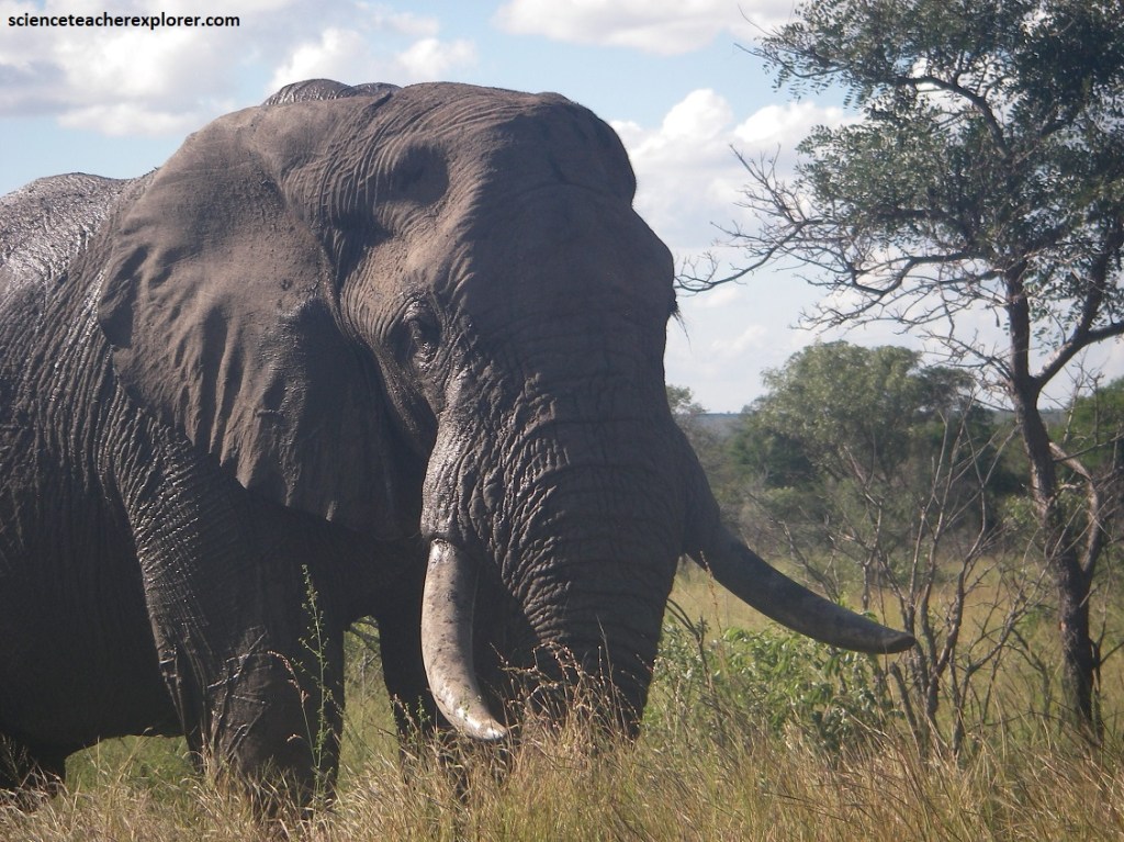
Pictured above, this African Elephant Loxodanta africana was a gigantic animal with large ears, long legs, prominent tusks and a versatile trunk. This one seemed to be a solitary bull.
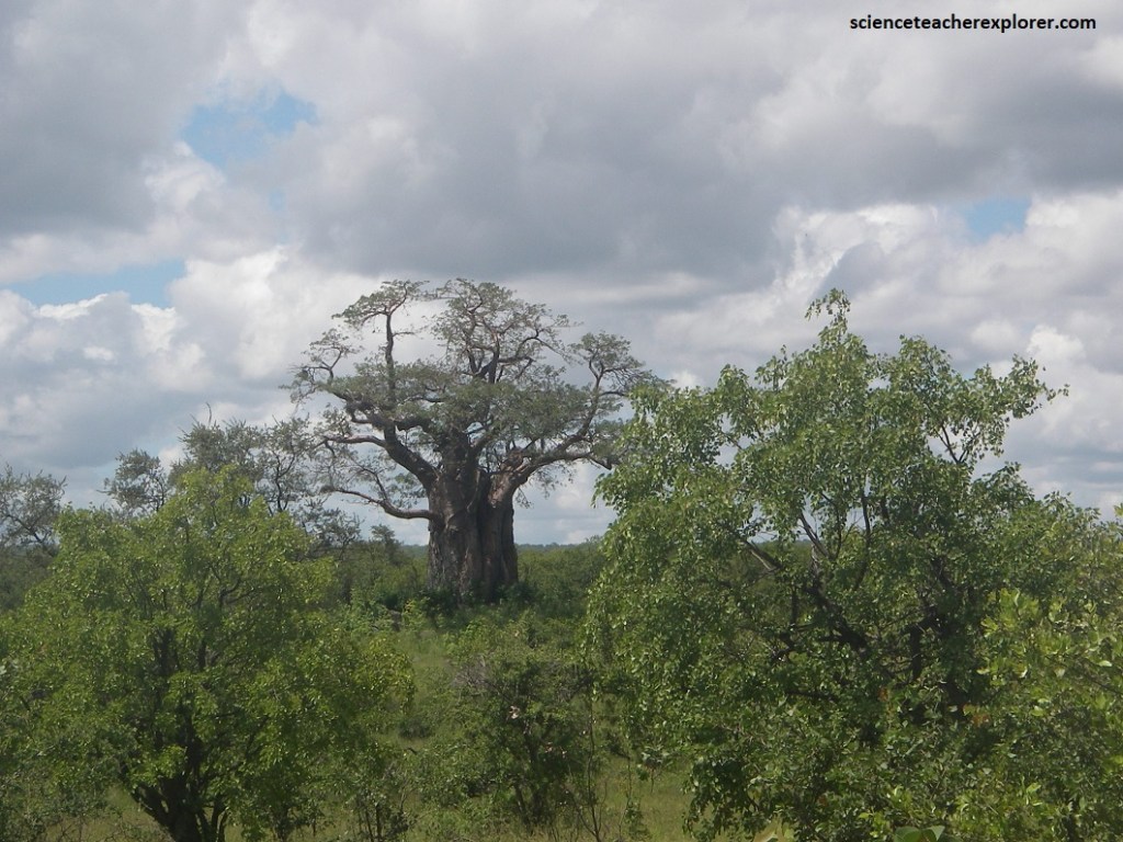
Pictured above, the Baobab Adansonia digitata is a large tree with a hugely swollen, barrel-shaped trunk. A noticeable characteristic of the Baobab is its bark, which often appears in smoot folds. The leaves appear glossy, with 3-9 leaflets in mature plants. The flowers are large, pendulous and white. The fruit is oval in shape, about 120 mm long, with a hard woody shell. The Baobab tree stands tall here in Kruger National Park. The colossal form of these trees goes hand-in-hand with their usefulness, as they provide shelter shade, water, food and shelter for a wide variety of animal species. It is thought that Baobabs may be the oldest life forms on the continent, with carbon dating calculating that some found are as old as 3000 years.
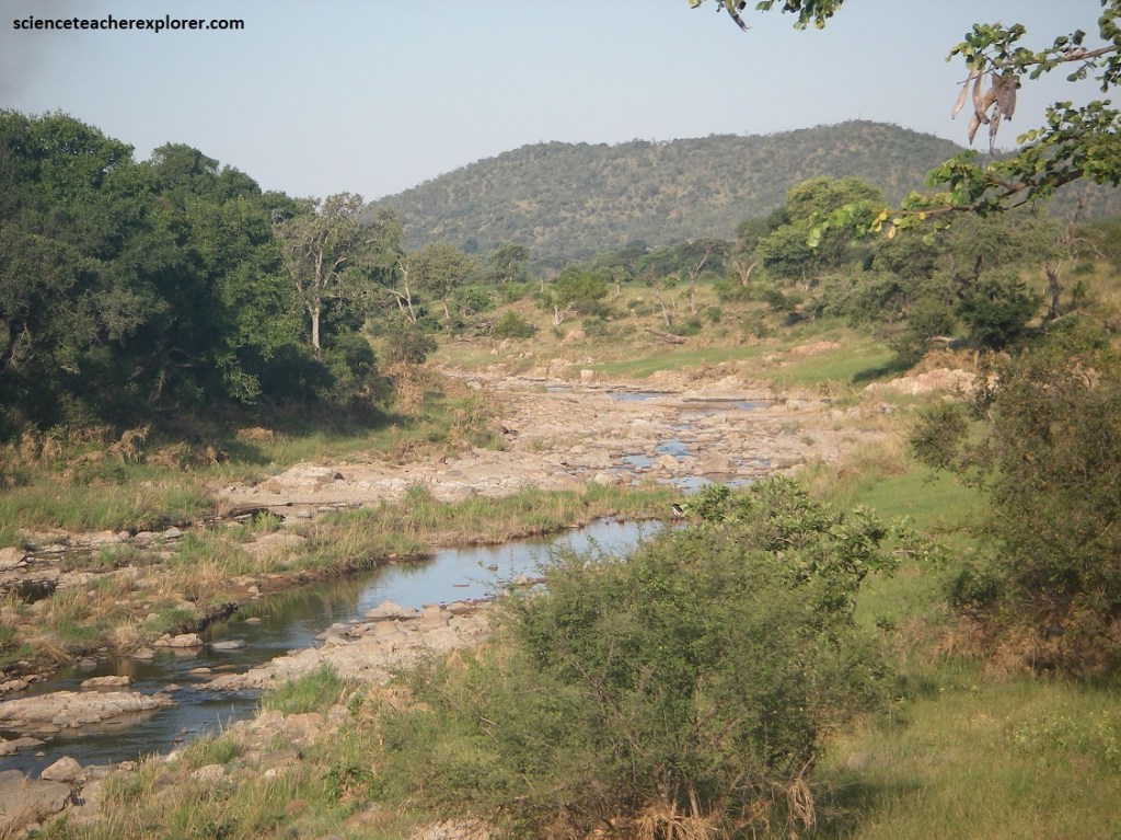
The Limpopo is the northernmost river of the Kruger National Park. The Krokokil is the name for the upper Limpopo, which flows in a great arc, first north, (forming the South Africa-Botswana border), and finally southeast through Mozambique to the Indian Ocean. In addition to these rivers, the Sabie, Letaba, Olifants, Luvuvhu, and Shingwidzi rivers provide the interior of the park with water. These rivers are essential sources of water for the thousands of animals living in Kruger.
Pictured above, the river lines are the most fertile, productive, and wettest parts of Kruger, and as such contain incredibly important habitats. Our group could always see a great diversity of wildlife: riparian woodlands grow along the rivers, almost forest-like in places.
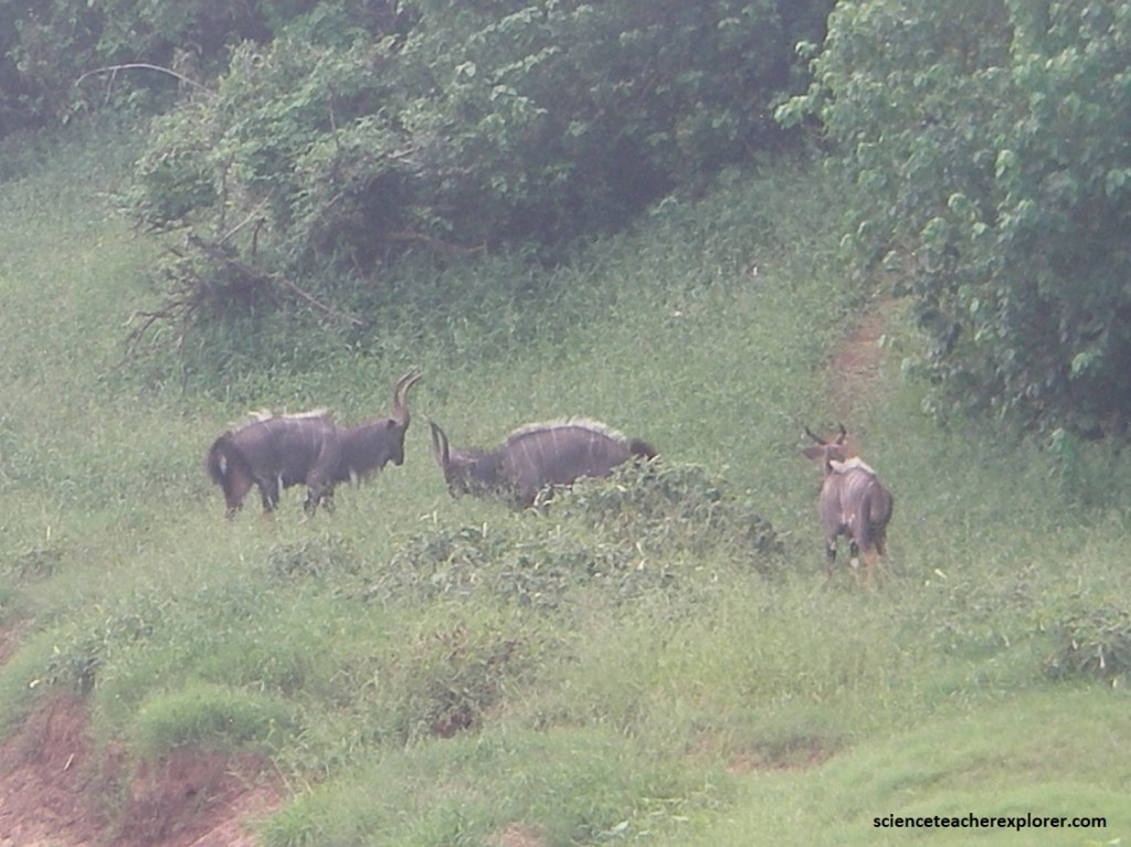
Large trees, such as sycamore figs that can reach up to 21 meters, provide nesting sites for birds and food for a huge variety of animals, such as the Nyala, and insects. Pictured above, the Nyala Tragelaphus angassi have long hair hanging from their bellies, white-tipped mane and yellow-brown “socks”. The males have horns and females are reddish in color and smaller. Additionally, the males are dark brown with a white mark between the eyes.
The next day, we entered through the Phalaborwa gate, to explore northward to the Mopani Lodge. We first traveled westward 6.4 km on the H9 and then turned northwest on the H14. Eventually we reached the intersection of H1-6 and turned north to the Mopani Lodge.
Phalaborwa was settled by Sotho-speaking iron-working communities in the 16th century. The name literally means “Better than the south” because of the rich mineral profile of the area. Between 1800 and 1850, the baPhalaborwa were at the peak of their power under the chief Malatji, controlling a vast swathe of land between the Oliants and Letaba Rivers.
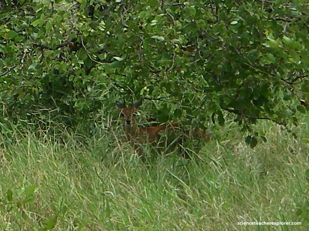
Pictured above, the Steenbok Raphicerus campestris has orange-brown with white under-parts and large ears. The inside of the ears is white with dark stripes. This is a solitary male because it has horns.
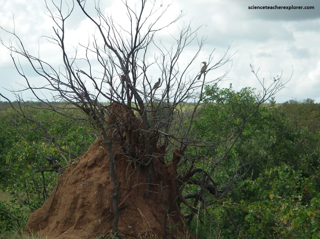
Pictured above, these two African Grey Horn-bills Tockus nasutus have found a place to perch above this massive termite mound. They both had whitish under-parts. However, the male to the right had a dark grey bill with a creamy stripe at the base. The female in the back had a pale upper bill and casque with a red tip.
There seems to be an extraordinary number of termite hills in this part of the Park. We noticed that the termite hills are at least 50m apart, because these insects are fiercely territorial. In Kruger termites are believed to eat about 20kg of plant material per hectare per year. In northern Kruger there are an estimated 1,1 million active termite mounds, or approximately a mound every hectare. The bigger termite mounds in Kruger have populations of over 200 000 termites. Besides their role in recycling energy, they are an important food source for many animals.
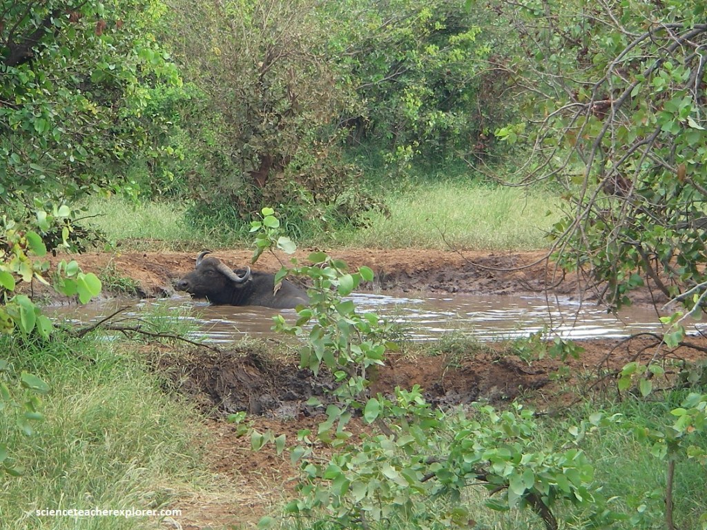
The H14 tracks the seasonal Ngwenyeni stream (“place of the crocodile”) and follows the riverine bush through the flat mopane bushwillow woodlands. There is usually animal activity, (like these Water-Buffalos), around Nandzane Water Hole, which marks the confluence of the Ngwenyeni and Shicindzwaneni (“place of the ilala palms”) watercourses. Nandzane is the Shangaan name for the caracal or rooikat, (a medium-sized hunting cat with distinctive long and fluffy ears).
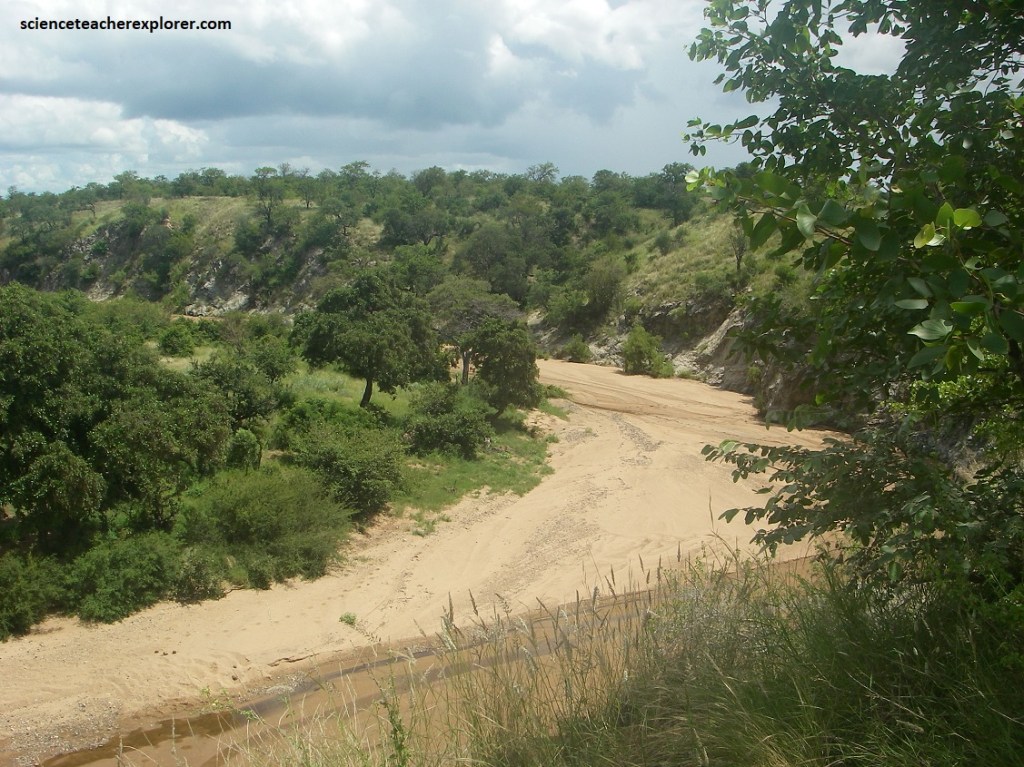
Pictured above, the Shingwenitana River is a left hand tributary of the Shivulani River and the northernmost river of its catchment area, joining it at the lower end of its basin. The Shingwenitana is a seasonal river whose riverbed is dry for prolonged periods. The transition zone between north and south is a unique habitat known as Olifants rugged veld, a broken landscape of black rocks with pockets of dense thorn and a tangled mixture of woodland trees.
Pictured above, the Letaba River is a major watercourse running in a south-easterly direction through Kruger National Park. The name of the river translated from the local Sotho language, means “sandy river”. Once we saw its wide sandy banks, we found how it appropriately got it’s name, (pictured below).
The Letaba River is situated on Mopane shrub-veld surrounded by mixed grass plains and apple leaf trees. Although the Letaba River is similar to the other rivers in the Kruger National Park in that it displays some bedrock influenced channel features, increased sediment delivery from the degraded catchment upstream has resulted in extensive alluviation within the channel. There is far less game here than in the central grasslands and most of the animal activity takes place close to the rivers. Elephants are dominant. Pictured below, Waterbuck are particularly prolific around Letaba.
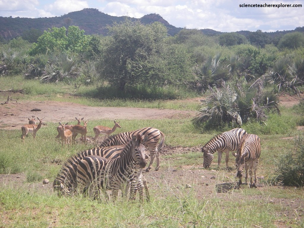
Pictured above, a large antelope Water-buck Kobus ellipsiprymnus is seen along the Letaba River bank with long greyish brown hair. The white collar under the throat and white circle around the tail was characteristic of the Water-buck. This male had forward curving horns and was larger than the females seen nearby. However, the animals in the background of the photograph above are Impalas.

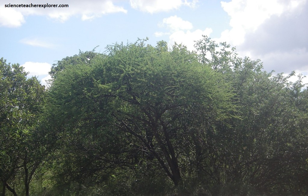
The northern half of Kruger National Park, (north of the Olifants River), is predominantly mopane veld. The mopane tree dominates large tracts of relatively flat country between the river valleys. Most areas have short trees, (often no more the 1.5 m high). However, there are some place of true woodland where the tree crowns are 10 meters from the ground, (pictured above).
Pictured above, taller mopane trees have numerous holes, which are important breeding sites for birds, bats, and small mammals such as hares and rodents.
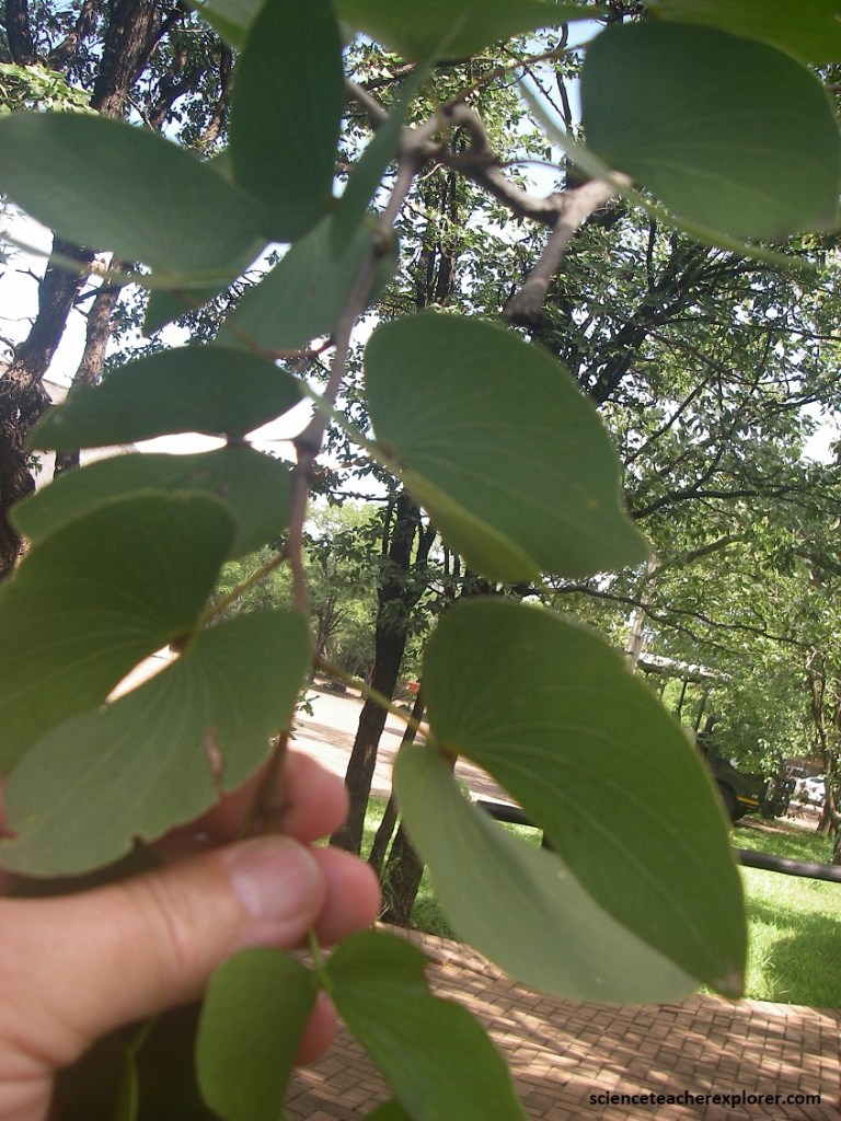
Pictured above, two leaflets, (mirror images of each other), on a common petiole, creating the look of butterfly wings. The wood is hard, heavy and mainly dark brown to nearly black, (pictured below).
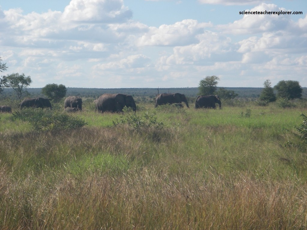
The shorter Mopane trees were once dwarfed by bull elephants, (it was among the mopane that many of the legendary huge bulls of Kruger were to be found). Although most of the original giant bulls have died, there are still many large bulls to see. They are growing and have started to become legends in their own right, (pictured below).
Pictured above, elephants occur in small groups of three to seven individuals, usually dominated by one particularly large bull with enormous tusks. Fortunately there are still plenty of large bulls in the area as well as breeding herds of elephants.
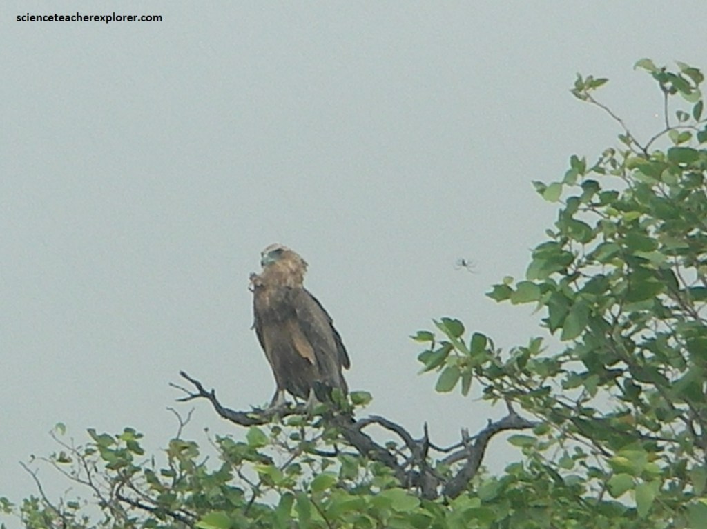
Pictured above, the Steppe Eagle was tawny-brown. It was very similar to the Tawny eagle, but it’s gape was more prominent and extended beyond the center of the eye.
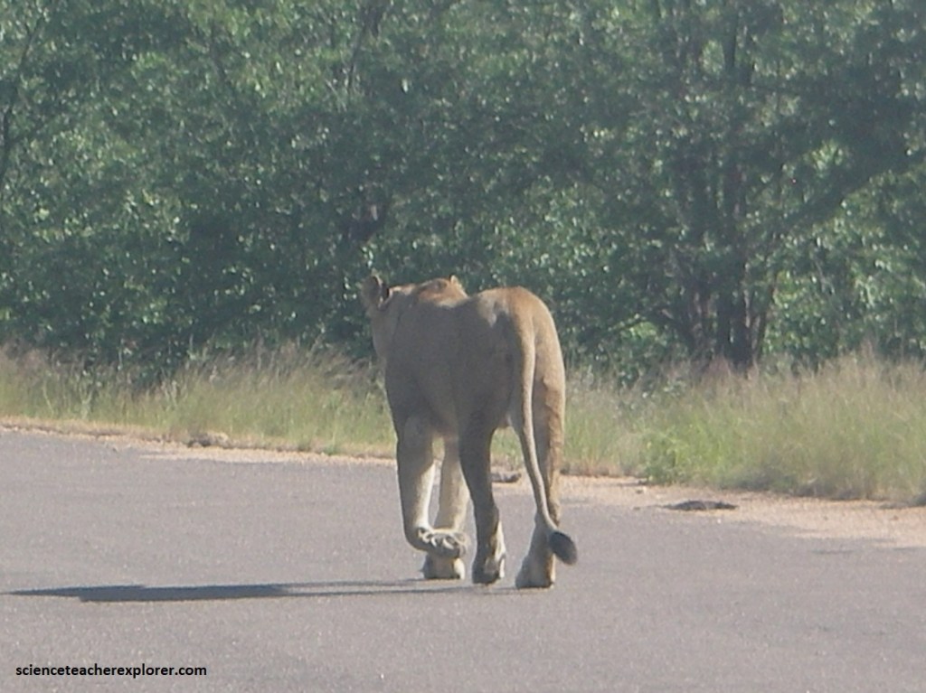
Pictured above, a Lion Panthera leo was walking on the road of H1-6 towards Letaba while we were returning back towards the Phalaborwa gate. The largest cat in the park and the only one to live in prides. This female lion is usually nocturnal, but walking around in the day does happen. The huntresses prefer larger prey such as impalas or blue wildebeests.
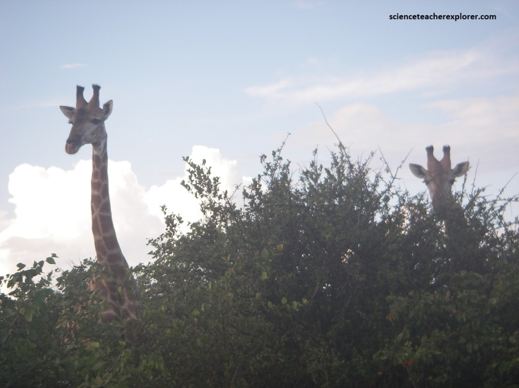
Pictured above, the Giraffes Giraffa camelopardalis were looking above the mopane veld on the H9, while we were leaving out the Phalaborwa gate for the day. Giraffes have the unmistakable long legs and neck. Both sexes have two short horns and made it hard to tell the difference.
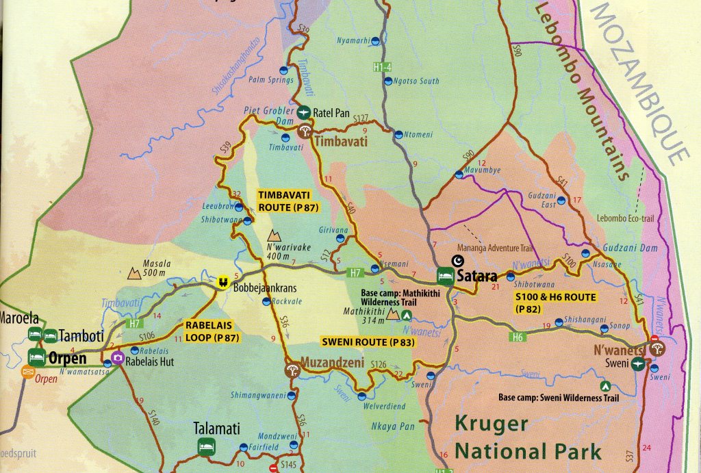
Imaged above, on our 3rd day exploring the Kruger National Park, we entered through the Orpen Gate and followed the H7 towards Satara. It seems that Orpen sat on the edge of a continuous band of sweetveld that stretches from east to west across Kruger. This Orpen sweetveld sits on gabbro rock, which forms intrusions such as Masala Koppie (500m) some 14km from the gate. The gabbro is similar to basalt in that it retains water and doesn’t leach easily. The mineral-rich soils support nutritious grasses which are favored by buffalo, zebra, wildebeest, impala and warthog. Because the grazing is good all year round, there are almost always animals visible from the road in the Orpen area.
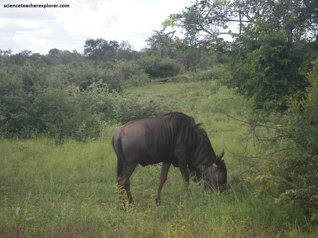
Pictured above, we immediately saw this Blue Wildebeest Connochaetes taurinus. It is a blue-grey cattle-like animal with dark vertical stripes on the neck and flanks. This one had a black face, mane and tail. Both sexes have horns, but the males are larger.
Pictured above, in a Sweet thorn tree on H7, we saw this Yellow-billed Hornbill Tockus leucomelas. Obviously, the bill was yellow along with the its eyes. It’s facial skin seemed to be redish pink. The upperparts were black with stripes and spots.
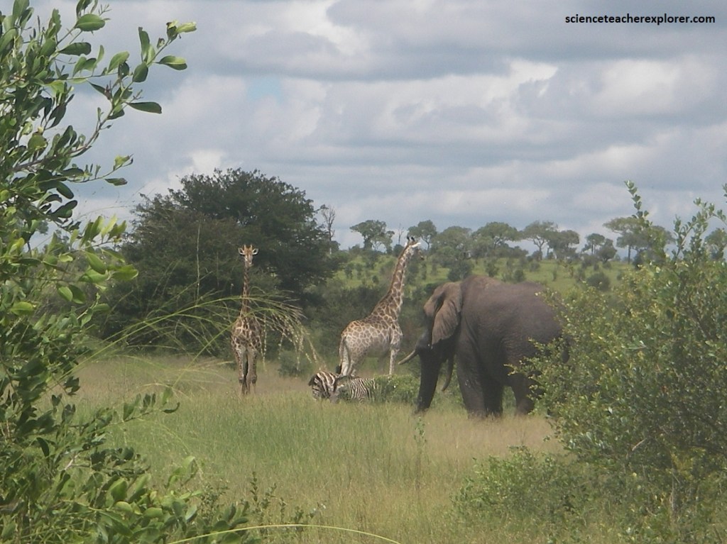
The Orpen-Satara Road (H7) usually had plenty of game in the pockets of thornveld within the mixed marula and knob-thorn woodlands. Thornveld is often an indicator of sweet grazing and there are usually herds of giraffes, zebra, wildebeest and elephants along the road.
Knob-thorn and buffalo-thorn are the most common acacias in the Orpen thornveld. There are also marula, round-leaved bloodwood and magic guarri in the woodlands, which become thicker along the drainage lines where large jackal-berries and sycamore figs occur.
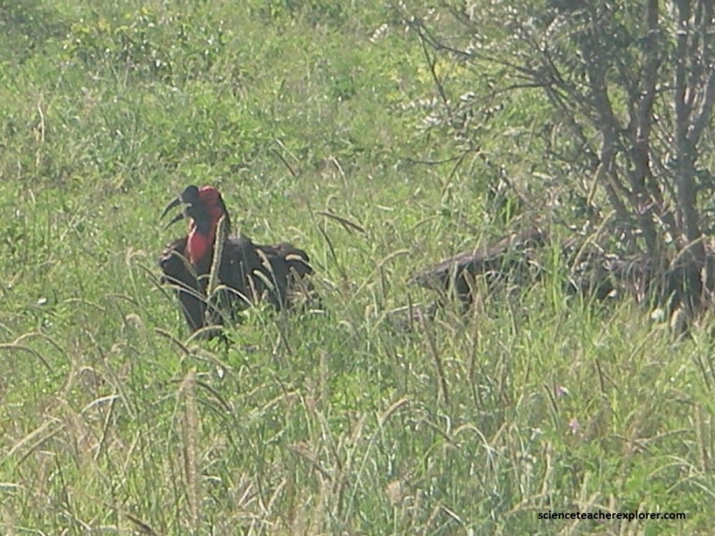
Pictured above, we were lucky to see these Southern Ground-Hornbills Bucorvus leadbeateri along the H7. It was a very large turkey like black bird with a very large bill. The bare face and throat skin was red. There was a small flock of them that seemed to be foraging on the ground.
The Orpen Gate was named in honor of a major Kruger benefactor, Eileen Orpen, the wife of National Parks Board member JH Orpen, who purchased seven private farms in the area, totaling more than 24 000ha and then donated them to the Parks Board.
The Timbavati River is a right bank tributary of the Olifants River in the Kruger National Park, Mpumalanga, South Africa. Its origin is at the eastern outskirts of Acornhoek near the Mpumalanga-Limpopo boundary, and it flows through the Andover Nature Reserve and Timbavati Game Reserve before entering the Kruger Park north of the Orpen Gate. Five seasonal rivers meander across the Central Region and, as wildlife is abundant, during intense dry cycles water supplies are often depleted. The Timbavati River was perennial in the early days, but forestry, agriculture and habitat degradation beyond the Park’s boundaries drastically reduced its flow. Despite these factors, large pools still occurred in the river and for a time two were deep enough to support herds of hippos. But runoff from overgrazed lands upstream silted up the pools in the mid-1960s, and the river ceased to be a reliable source of water.
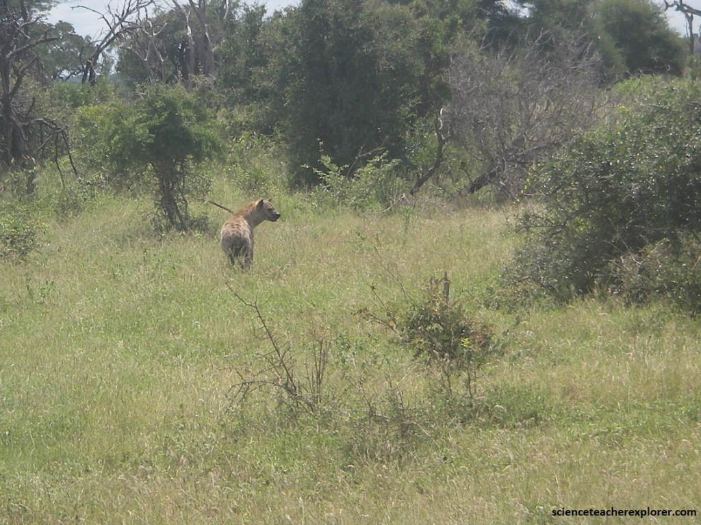
Pictured above, we saw a Spotted Hyaena Crocuta crocuta leaving a den of Wild Dogs near the H7 road. It was distinguished from the less common Brown Hyaena with dark spots. What it was doing in a den of Wild Dogs is unknown, but their known to be efficient scavengers. Hyaena clans are strongly territorial and show evidence of a robust female-dominated hierarchy. In this Central Region they do not attack large mammals, as is the case in East Africa, and are able to survive adequately by preying on small animals and scavenging the remains of lion or wild dog kills.
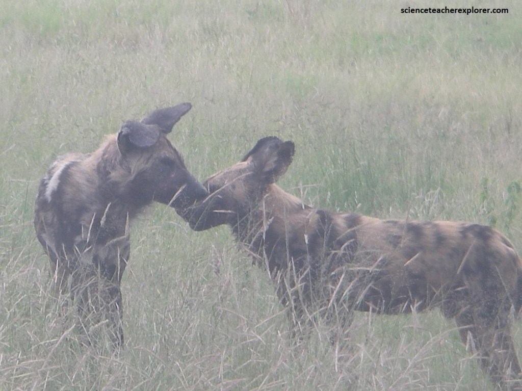
Pictured above, A couple of Wild Dogs Lycaon pictus seen along with a den of several on the H7 road near Satara. These were gregarious, animals with characteristic large rounded ears. Their coats were blotched yellow, black and white with the tip their tail white. They seem to hunt in packs and tears their prey apart. They were feeding off of a recent kill with a Spotted Hyaena nearby.
Pictured above, the best game spot on the H7 is probably around the Nsemani Pan, 7km west of Satara. Nsemani is on a narrow strip of shale which divides the granite woodlands of the west from the eastern basalt plains. The landscape is one of broken thornveld with rocky outcrops. A great place for Hippos.
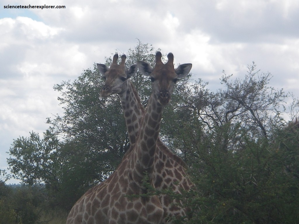
Pictured above, the giraffe is the tallest animal in the world, (attaining a height of 5.5m), its incredibly long neck accounting for much of its height. The long neck has resulted in a complex blood circulatory system, which is not yet fully understood by zoologists. Big males can weigh a massive 1 200 kilograms while females usually weigh some 800 to 900 kilograms. Because of their very long necks, Giraffes are able to feed on the foliage of trees that is not accessible to other herbivores. The long prehensile tongue is used to pull pods and leaves into the mouth which are then stripped from the stems with the spatulate incisor teeth.
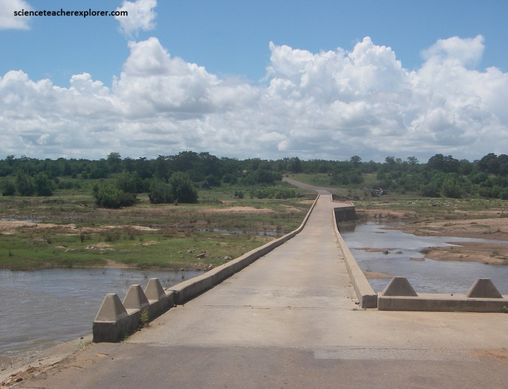
Imaged above, on our fourth and final day of exploring Kruger National Par, we chose to enter through the Malalane Gate and drive to Skukuza on H3. The Malelane Gate is on the Crocodile River, about 50km upstream from Crocodile Bridge, (pictured below). The Malelane Gate has been a river crossing for hundreds of years and takes its name from the Malelane Regiment of King Mswati II of Swaziland which was stationed here in the 1850s when the area was under Swazi control. Many of the names in southern Kruger are Swazi in origin.
Pictured above, the Crocodile River in Mpumalanga has a catchment area of 10,446 km2. It flows through the Nelspruit industrial area, the Lowveld agricultural area and borders the southern edge of Kruger National Park.
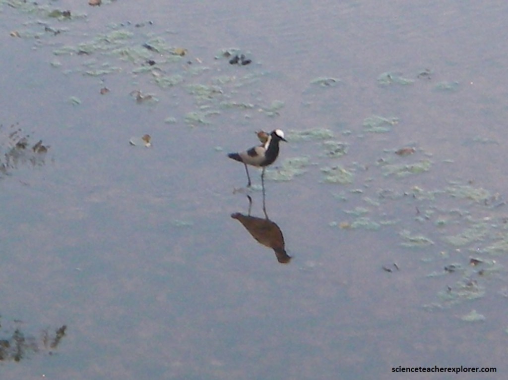
However, our first side-trip was to explore Berg-en-Dal Rest Camp, (just 10 km west of Malelane). The Berg-en-Dal camp was built on the Matjulu River within the protective ring of the Malelane mountains. There was a very attractive walk around the perimeter of the camp from the causeway past the Matjulu Dam up the river, where we viewed a number of birds. One of the birds we saw was the Blacksmith Plover, (pictured above). The Blacksmith Plover Vanellus armatus is of the Lapwing spcies. Blacksmith Plovers are very boldly patterned in black, grey and white, possibly warning colors to predators. The portions of the bird’s body bare to plumage average a black coloration for the bill, and either a black or white-grey dappling on the legs.
Pictured above, Hadeda Ibis Bostrychia hagedash on the Matjulu River at Berg-en-Dal was grey brown with a iridescent green sheen on the wings. The long dark bill had a red ridge on the top. The characteristic “Ha-ha-hadeda” call was very loud.
Once we explored Berg-en-Dal on H110, we continued on H3 towards Skukuza. There was a high diversity of plant and animal species to be seen along the H3 road because of the number of different habitats that co-exist within a confined geographical area that enjoys some of the highest rainfall in the Park.
The southern part of Kruger is quite unlike the other areas of Kruger National Park in that it is very “hilly”. Intrusive granite is the main type of rock and it shows the effects of exfoliation, (the splitting of rocks into a series of concentric shells), which has produced a landscape of hills and valley covered by tall, but sparse, woodland.
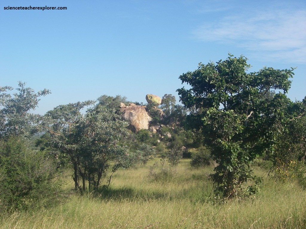
Pictured above, some of the hills are small bare rock domes, while many more have rock slopes that are more or less covered with woodland. The locals call these domes, “granite koppies”.
Pictured above, this part of Kruger is noted for its winding roads that offer dramatically changing landscapes quite different to the flat lands to the north. The alternation of hills and valley has created a habitat in which game can thrive, (particularly in the lower Mlambane River).
Pictured above, the granite koppies adorned with large-leaved rock figs and bushwillows, and the valleys graced by jackal-berries, magic guarries and tambotis, lie in stark contrast to the agribusiness that has taken root on the other side of the Mlambane River.
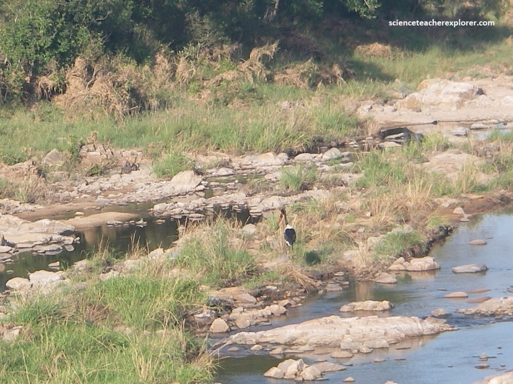
Pictured above, the Saddle-billed Stork Ephippiorhynchus senegalensis on the Mlambane River is a very large black and white stork. The yellow saddle at the base of the large black and red bill, is characteristic.
Pictured above, north of Afsaal, the road descends into the woodlands of the Biyamiti River basin, winding through dense riverine woodland in the flood plains near Jock’s Camp. During the dry season animal life becomes more concentrated along the watercourse, whereas in wetter times the game disperses more widely over the veld. North of the Biyamiti valley, the landscape opens up into stretches of grassland savanna which are a favorite grazing ground for zebra, (pictured below).
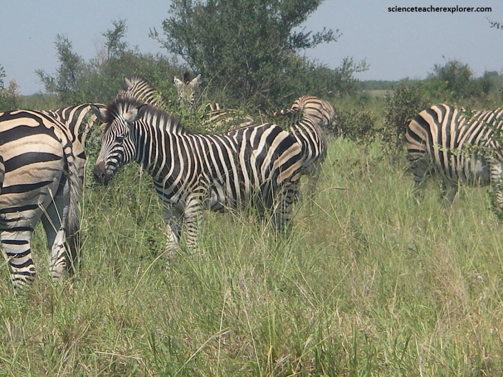
Pictured above, a herd of Zebras Equus quagga are horse-like animals with black and white stripes that extend to the belly. The stripe patterns serve as a “fingerprint” to each individual in the herd. Zebras never stray too far from water, but they never swim in it either. They prefer dust baths to clean themselves. Zebras can drink up to 14 liters of water a day,
Nearby, The giant granite-dome of Mathekenyane is one of a series of inselbergs that run from west to east across the lowveld floor. It is a perfect vantage point for the whole of southern Kruger. To the west are the clearly identifiable koppies of Legogote, Ship Mountain and Pretoriuskop, (pictured below).
From the Mlambane River nouthwards the geology is dominated by a unit called the Nelspruit Granite Suite, which comprises a range of basement rocks (mostly various types of granites and gneisses) over 3 billion years old. We stopped at the Mathekeyane viewpoint to observe the rocks.
Pictured above, The rock exposed on Mathekenyane is a grey granitic gneiss cut by paler granite veins, interpreted as produced by partial melting of the hot gneiss complex during migmatisation. The above image shows how these veins vary greatly in their texture and mineral content: most of the veins are pink with relatively small crystals, although in places there are patches of coarse crystals of translucent grey quartz and pale feldspar (“pegmatite”: lower right), and areas rich in black biotite-mica. Note the large, rectangular crystals of white feldspar in the grey gneiss, giving it a porphyritic texture. Feldspar, like most minerals that form rocks on Earth, is a silicate, as well as being the commonest mineral in the Earth’s crust.
The granitic veins intruding at the Mathekenyane gneiss were not all produced at the same time. Older veins have been deformed into folds which are cut by younger, undeformed veins. This is a “polyphase intrusive and deformation history” and is typical of basement gneisses.
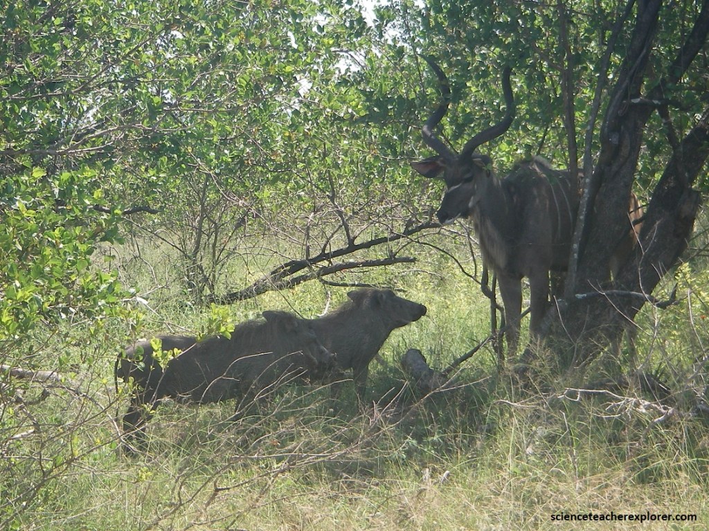
Further north on H3, we found a Kudu Tragelaphus strepsiceros. This was a large, elegant antelope with white stripes on his body. He had rounded ears and impressive, spiral-shaped horns. I’ve heard that Kudus were renowned jumpers that were capable of jumping as high as 2m. The Bushpigs’ Potamochoerus larvatus bodies were cover with long brownish hair with a lighter mane. I’ve been told that they are aggressive when threatened or cornered.
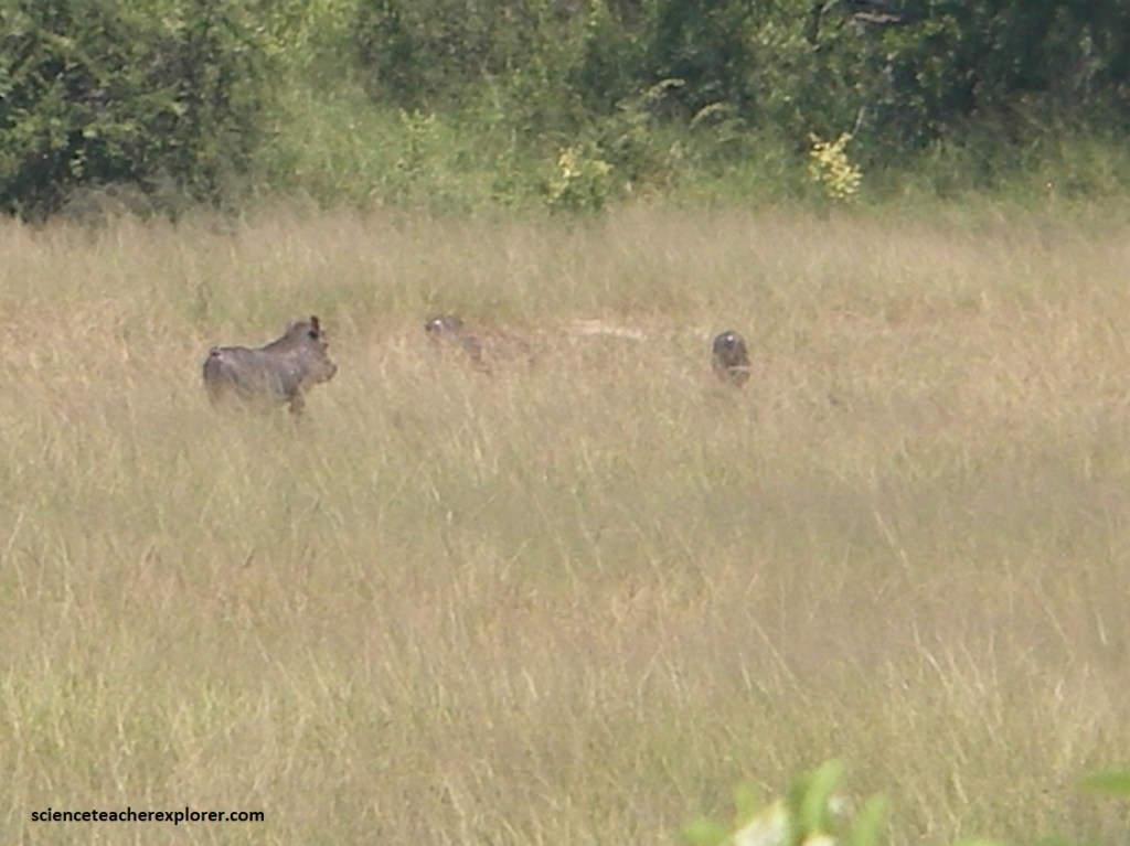
Pictured above, near the Kudu were a small family of Warthogs Phacochoerus africanus. They were grey with little body hair. The male had longer canine teeth. I noticed that their tails were held-up while running away.
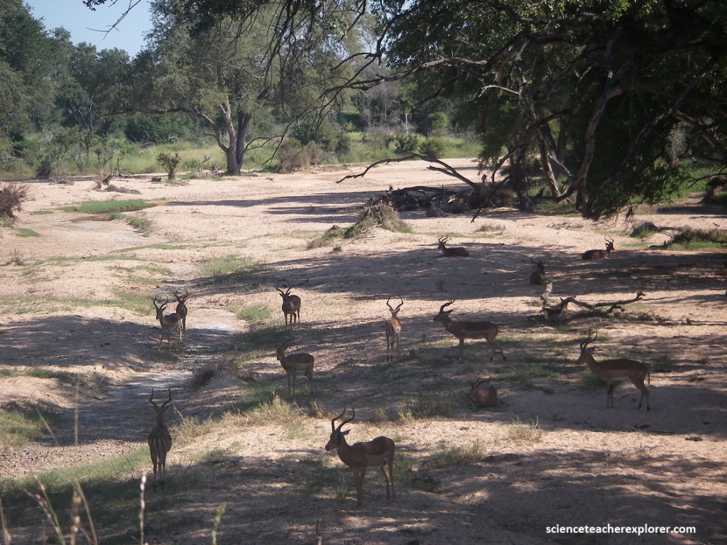
As we headed north, we came across the H1-1 intersection before Skukuza. The Skukuza Rest Camp in Kruger National Park is named after the Tsonga name for James Stevenson-Hamilton, the first warden of the park. Literally translated it means ‘he who sweeps clean’, a reference to his removal of all the local people to make way for the establishment of the Park. Just before we approached the camp, we came across a ravine called Msimuku, full of Impalas Aepyceros melampus. The Impala is a reddish-brown, medium sized antelope with a white belly. It has characteristic black bands on the tail and buttocks. Patches of black hair occur above their ankles and the males have horns.

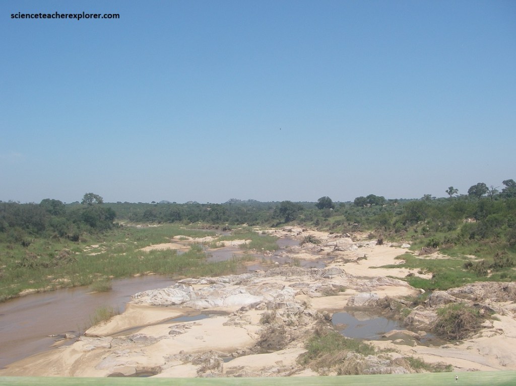
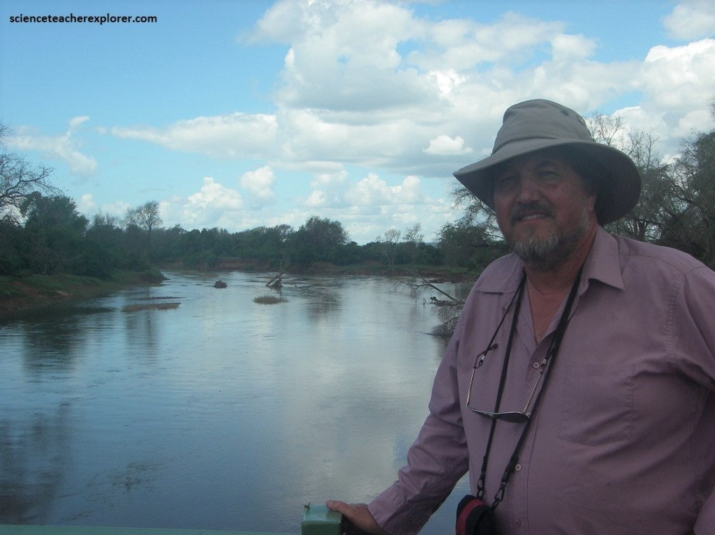
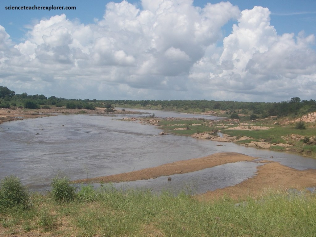
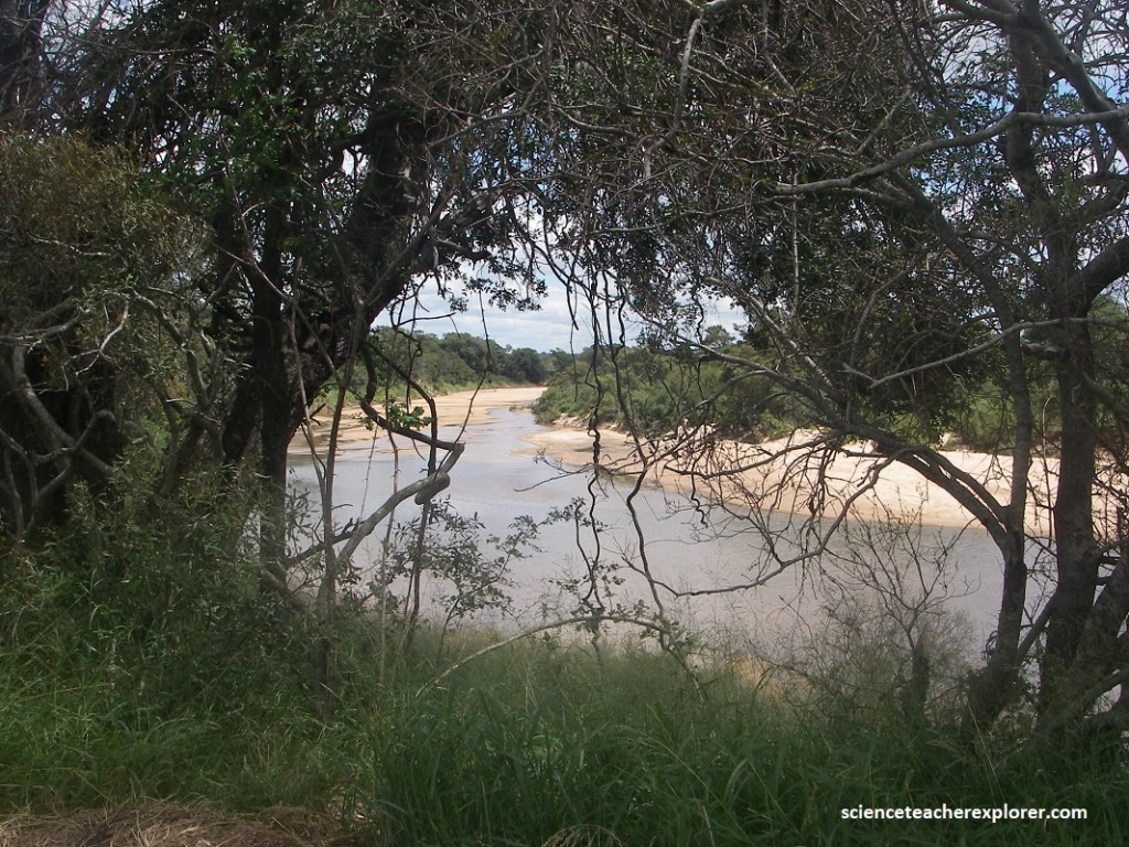
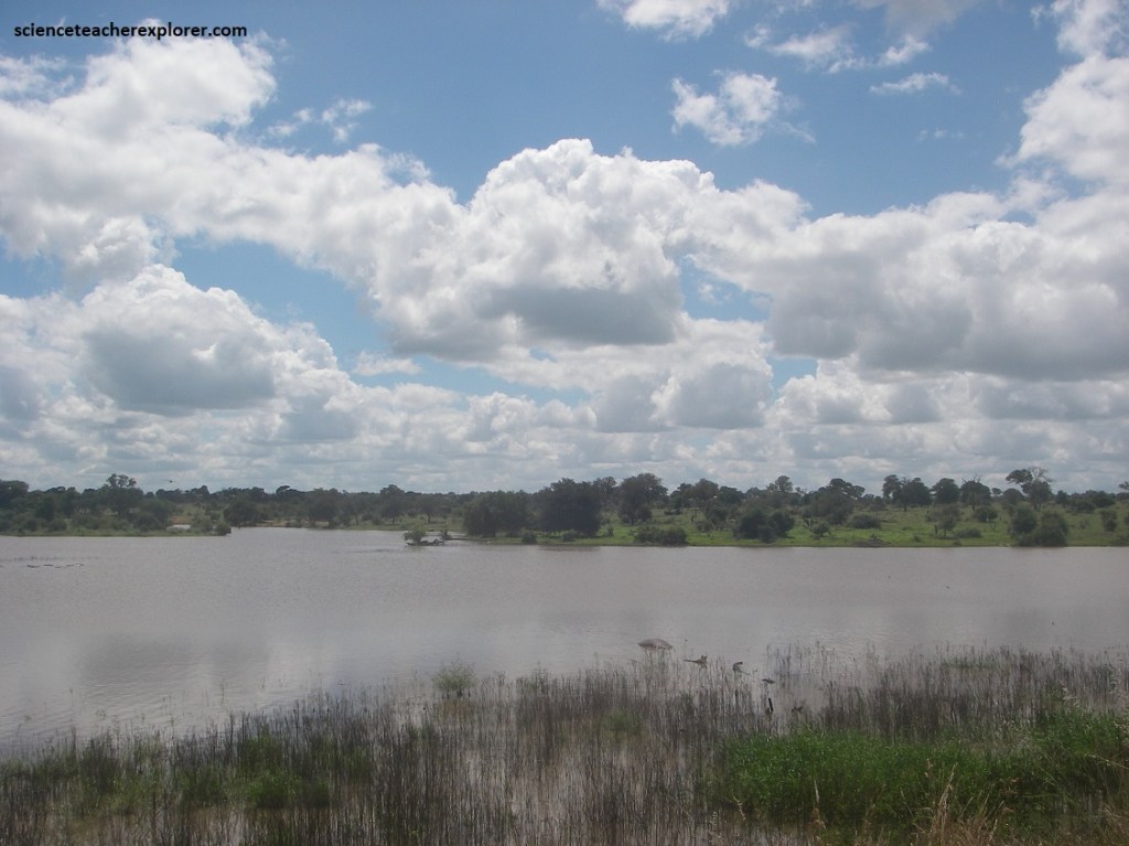
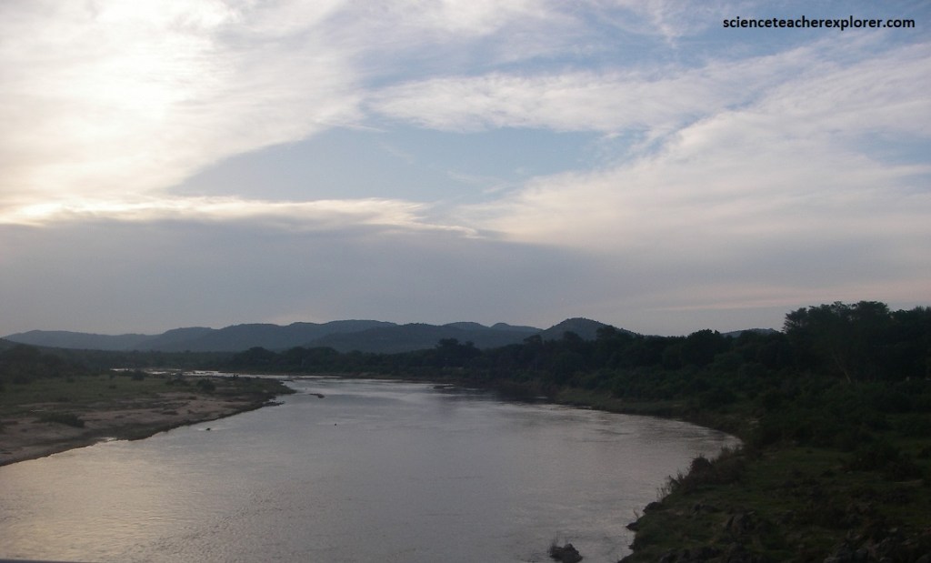
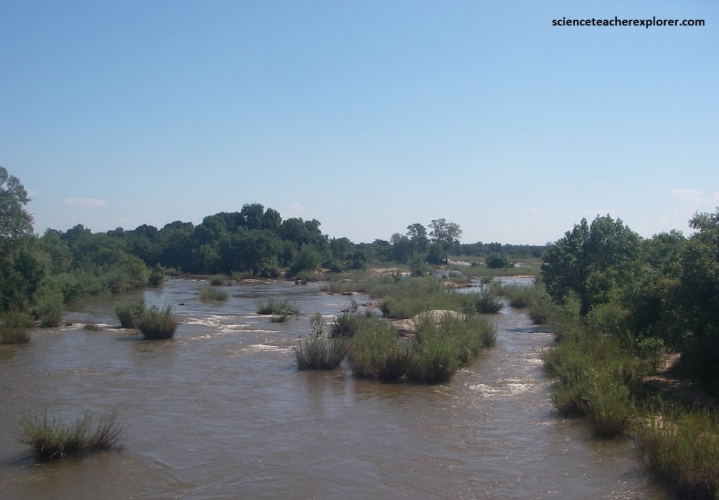
Pictured above, our 4 day tour ended at the Sabie River near Skukuza. The Sabie River’s name is derived from the Swazi word “sabisa” which means “to be careful” – apparently in reference to crossing the river because of the slippery rocks and resident population of crocodiles.