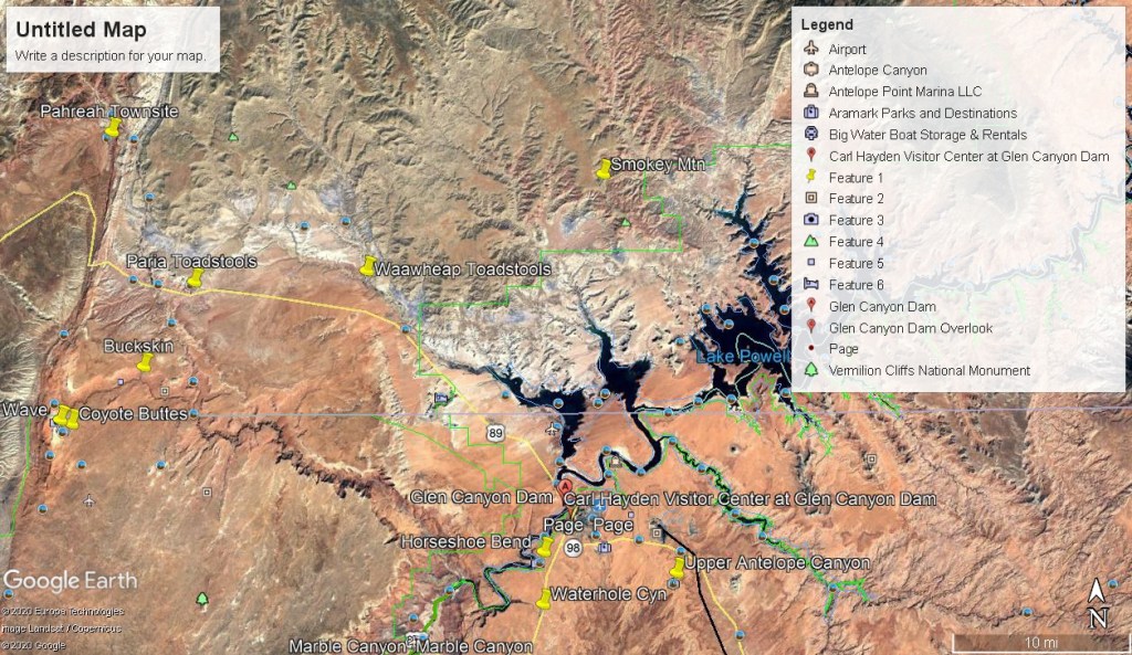
Antelope Cyn. AZ 2012
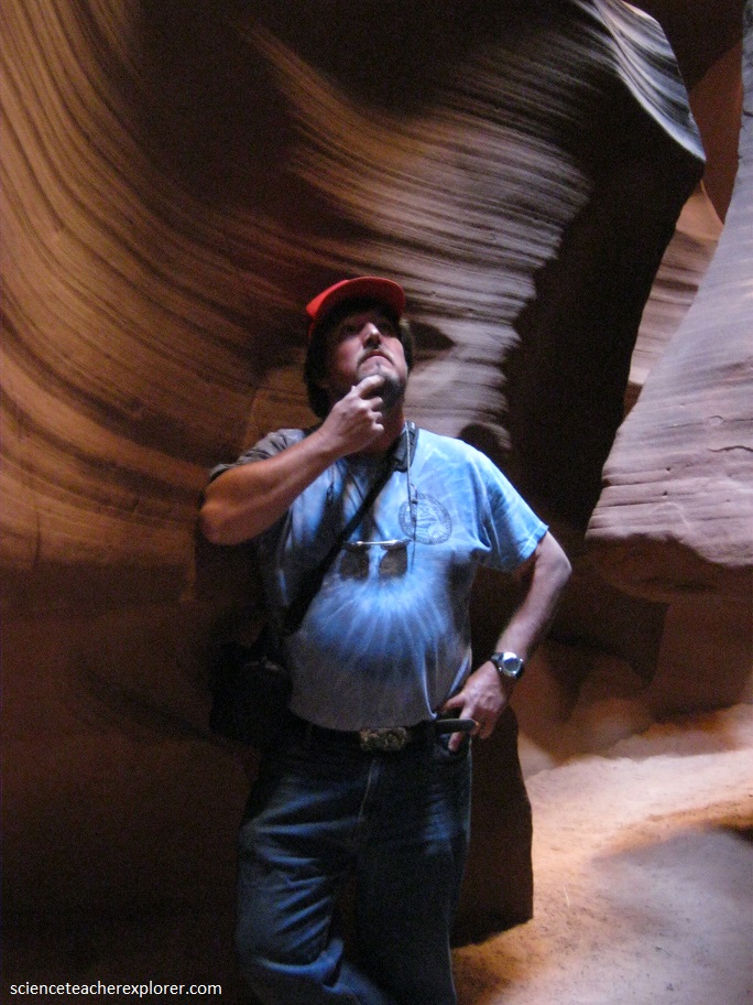
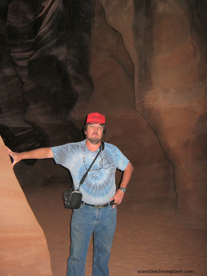
In May of 2012, I took a group of students and faculty to Page, Arizona for the Eclipse. While there, I took a small group into Antelope Canyon.
Antelope Canyon is a slot canyon in the American Southwest, on Navajo land east of Page, Arizona. It includes two separate, scenic slot canyon sections, referred to as Upper Antelope Canyon (or The Crack), and Lower Antelope Canyon (or The Corkscrew). I visited the Upper Antelope Canyon.
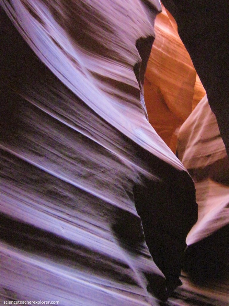
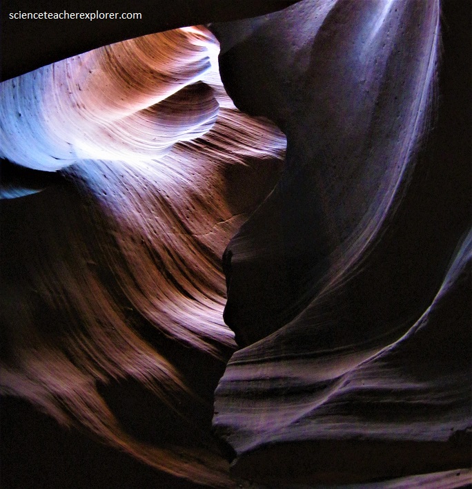
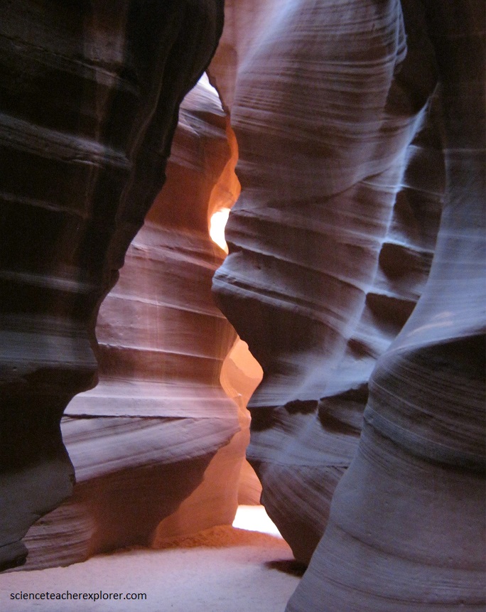
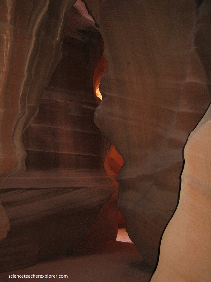
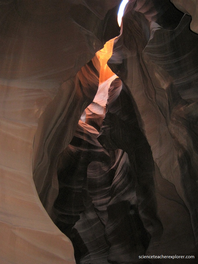
The spectacular Antelope canyon is a place of celebration for the eye, mind, and spirit. This Navajo canyon of sandstone is a natural work of art where light, color, and shape intermingle in an awesome display of exquisite beauty that changes throughout the day.
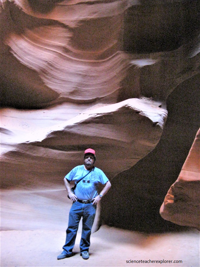
The effect of light playing on the canyon walls is staggering.
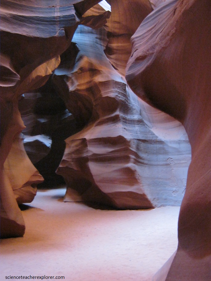
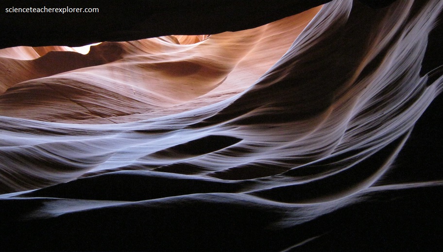
Strong orange and yellow colors brighten the upper reaches, but as the light diminishes, the lower walls turn to shades of purple and blue.
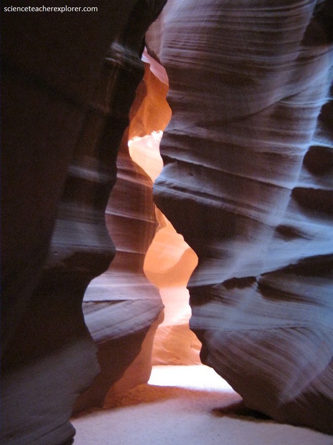
The contrast of light and shade emphasize the canyon’s rounded contours in a harmonious feast for the eyes.
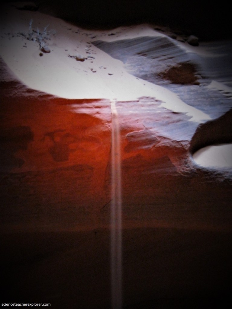
The best time to visit was at midday when the sun was directly overhead, and single beams of light shine right down to the canyon floor.
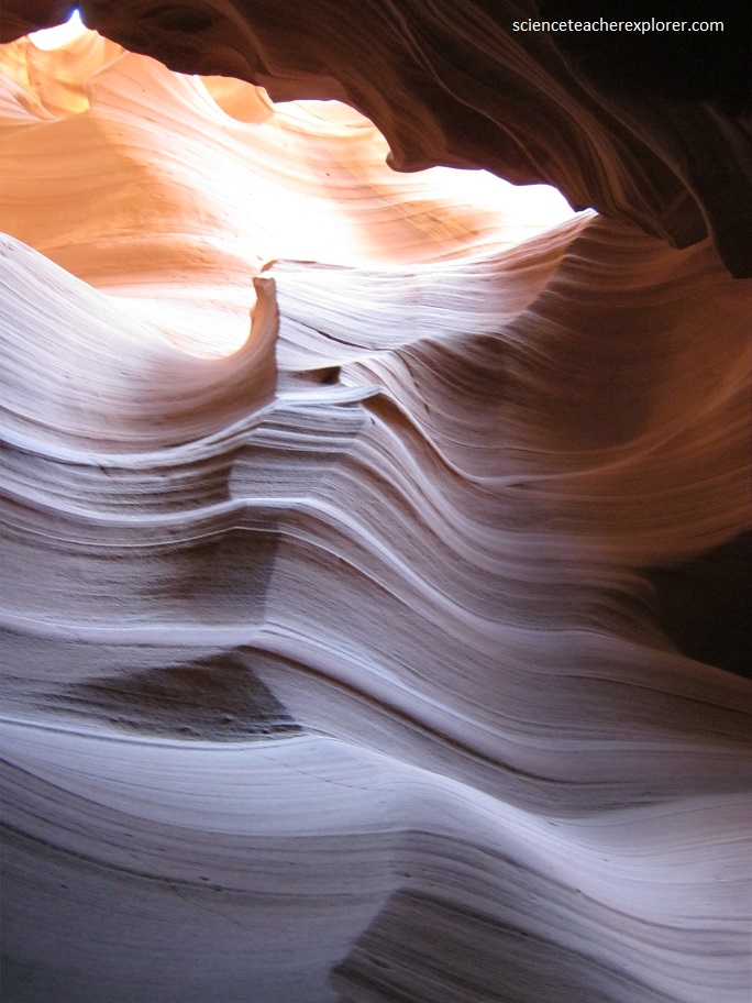
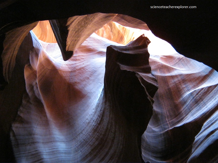
Antelope Canyon is known as a “slot canyon,” which normally start as narrow fissures on the surface of a sandstone plateau.
If the fissure is on a slope, the powerful erosive force of flowing water can turn the fissure into a drainage channel, carving down into the sandstone, (imaged below).
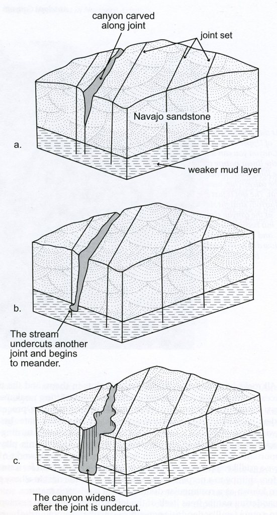
Joints favor slot canyon development because they act like guide grooves for a crosscut saw, focusing the flow of water and its abrasive load of sand and gravel. Joints concentrated the erosion as long as the host rock is strong, thick, and uniform enough to contain the river.
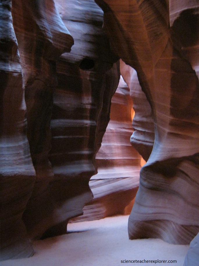
The result at Antelope Canyon is a narrow, deep channel with wild, undulating contours and hollows that range from one to three meters wide and up to 50 meters deep.
To really appreciate the wonder of this place, I tried sitting in one of the canyon’s darkened chambers in the morning and watch it come to life in a blaze of color, light, and shadow as the sun passed overhead.
Antelope Canyon lies within the Navajo Nation, (native American).
Access to the canyon is only permissible with a guide and the Navajo Nation since flash floods can strike suddenly, even in apparent good weather.
Rain does not have to fall on or near the Antelope Canyon slots for flash floods to whip through; rain falling dozens of kilometers away can funnel into them with little notice.
n August 12, 1997, eleven tourists, including seven from France, one from the United Kingdom, one from Sweden and two from the United States, were killed in Lower Antelope Canyon by a flash flood. Very little rain fell at the site that day, but an earlier thunderstorm dumped a large amount of water into the canyon basin 11 km upstream. The lone survivor was tour guide Francisco “Pancho” Quintana, who had prior swift-water training. At the time, the ladder system consisted of amateur-built wood ladders that were swept away by the flood.
Additionally, on July 30, 2010, several tourists were stranded on a ledge when two flash floods occurred at Upper Antelope Canyon. Some of them were rescued and some had to wait for the flood waters to recede. There were reports that a woman and her nine-year-old son were injured as they were washed away downstream, but no fatalities were reported.
Antelope Canyon was formed by the erosion of Navajo Sandstone due to flash flooding and other sub-aerial processes. Rainwater, especially during monsoon season, runs into the extensive basin above the slot canyon sections, picking up speed and sand as it rushes into the narrow passageways. Over time the passageways eroded away, deepening the corridors and smoothing hard edges to form characteristic “flowing” shapes. Flooding in the canyon still occurs. A flood occurred October 30, 2006 that lasted 36 hours, and caused the Tribal Park Authorities to close Lower Antelope Canyon for five months.
