Hua Shan, China 2008
In July of 2008, I had the opportunity to climb Hua Shan while trekking northwest China. I was traveling with a small group from Utah in the Xi’an area. Hua Shan is one of five sacred Taoist mountains of China. This one is located on the main rail line running between Xian and Luoyang, and very near where the Huang He (Yellow River) makes its eastern turn after running south. The main city at the foot of Tia Hua Shan is Hua Yin City of the Shanan Xi Province. To the east is the Guan Zhong Plain. The are intersects the Qin, Jin and Yu Provinces.
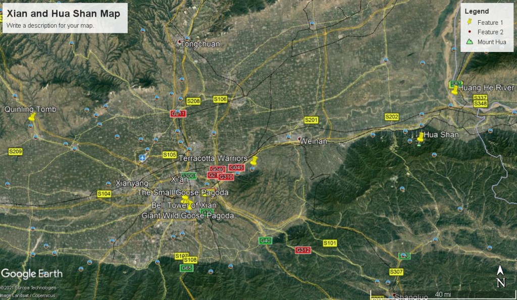
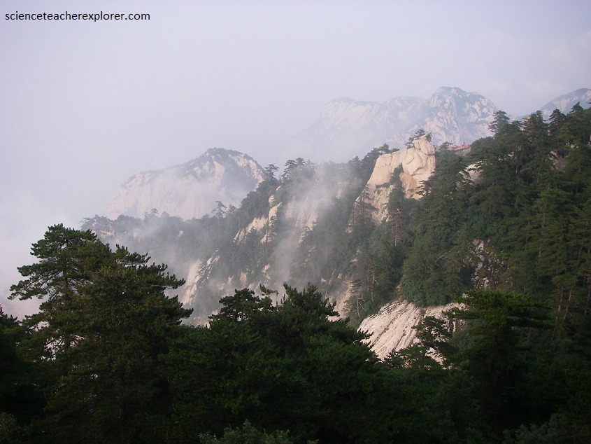
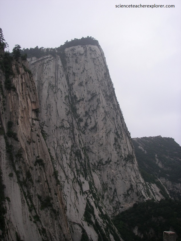
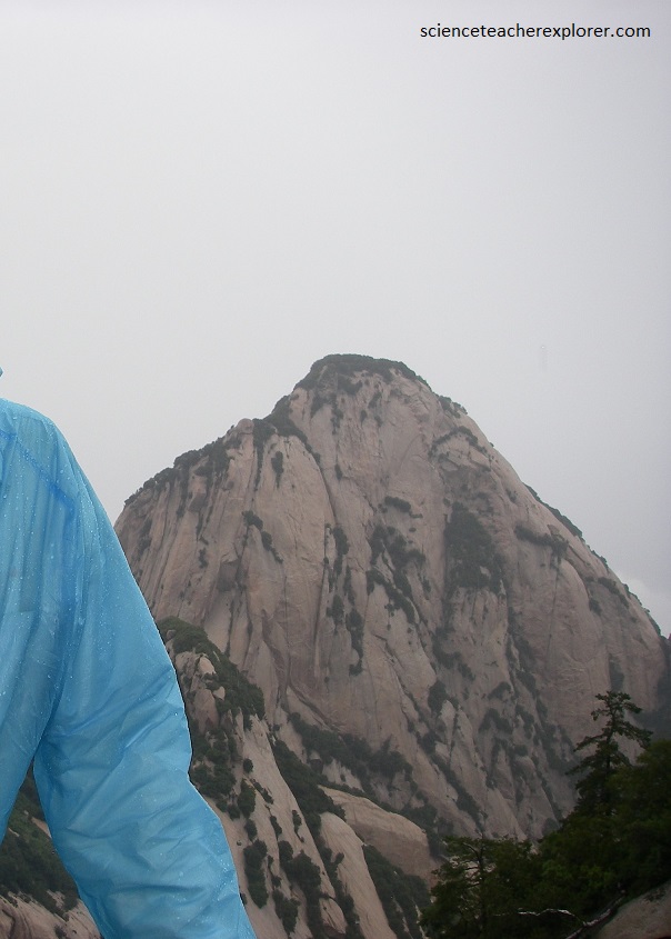
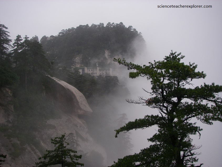
Pictured above, some 120 km east of Xi’an, the capital of Shaanxi province in central China, Hua Shan seems to rise straight off the plain and into the clouds.
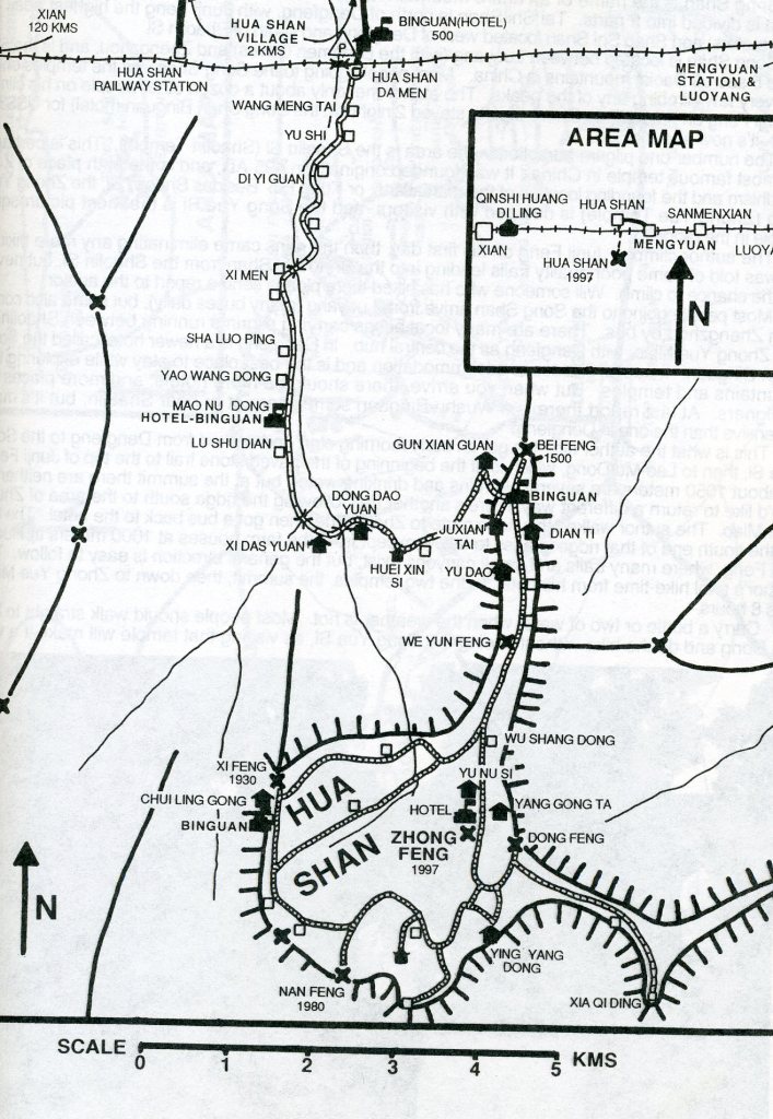
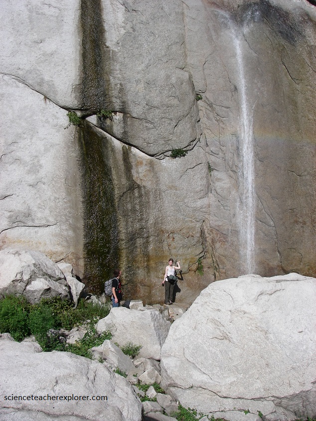
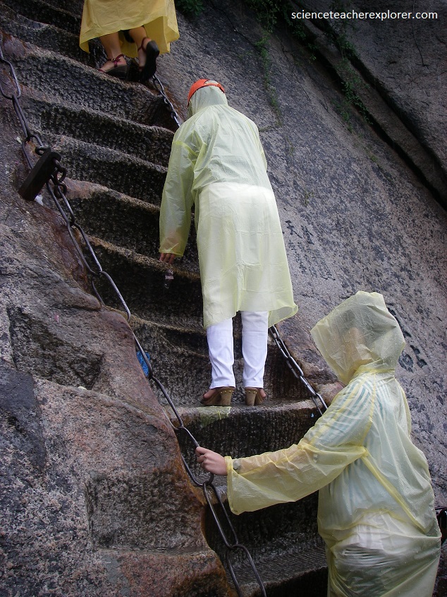
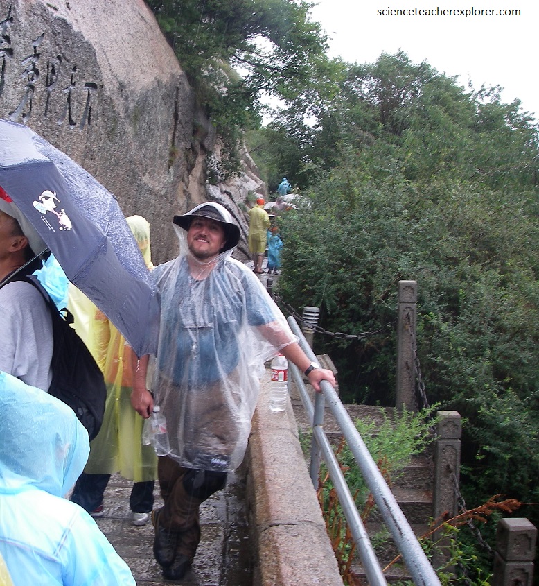
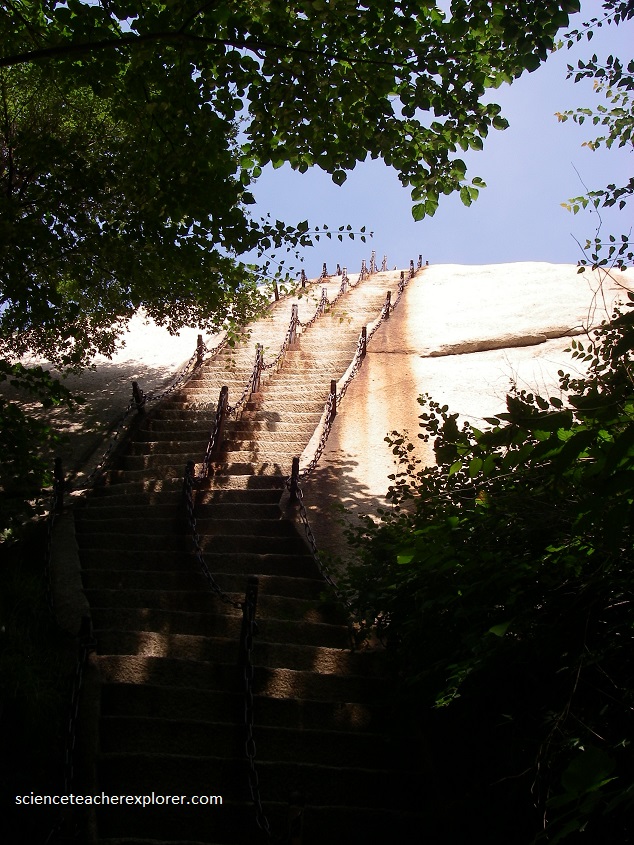
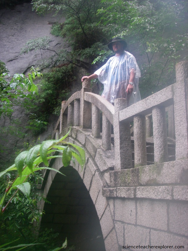
Pictured above, an ancient path, 12 km long, winds fom the bottom to the top by way of sheer cliffs and ledges with hear-stopping drops and breathtaking views. In 2008, it was officially closed to foreigners of European ancestry. Hong Kong and other tourists of Chinese ancestry were allowed. The reason being presumably, is that there have been accidents on the mountain. In some places rock steps have been cut into the vertical granite, and chain hand holds installed, but in cold weather it can be icy and dangerous, thus the discrimination. So, my trekking group was determined to climb the mountain and we started our attempt in the morning darkness, and skirted the gate of the cable car. We started by climbing the initial 3999 steps cut into the granite by way of darkness, (pictured below).
Hua Shan is a remarkable mountain. As with about all of the sacred mountains of China, it too is a mass of solid granite, at least the central portion.
Hua Shan’s height is 2,200 m, but the feature that makes it one of “the five great mountains of China” is its precipitous nature. It’s probably the most beautiful of the five, and in many ways is similar to Huang Shan located in the Anhui Province.
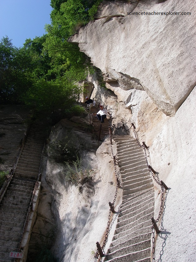
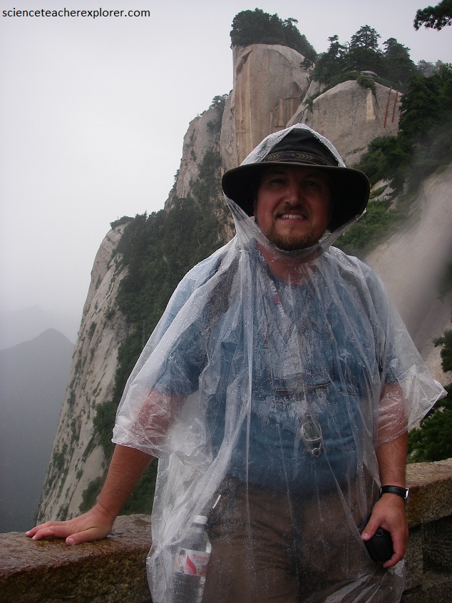
China’s Hua Shan Mountain is not among it’s highest, but this is difficult to believe when edging along the path at the face of Ear Touching Cliff.
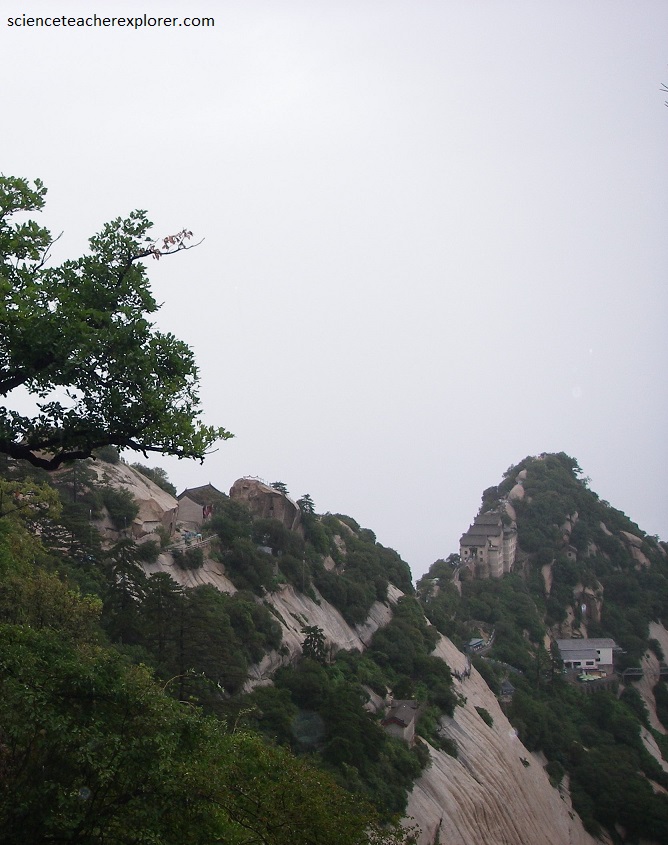
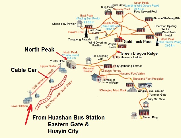
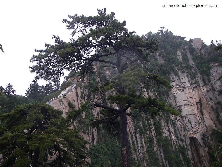
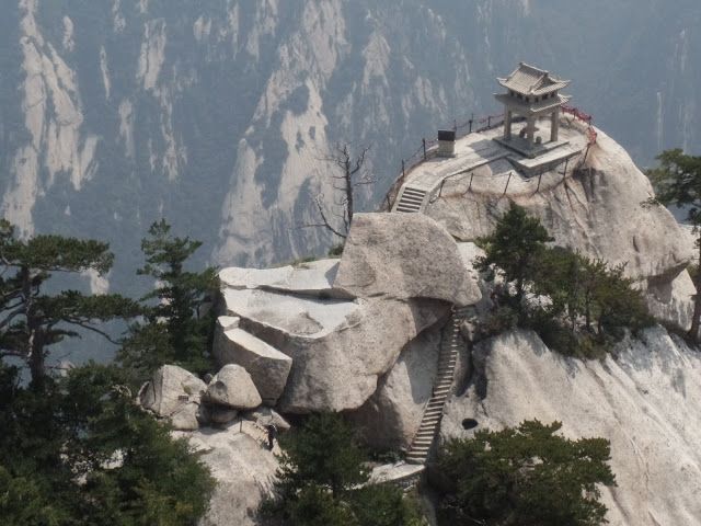
Pictured above, at the top are the five peaks that give the mountain its name, (Huashan means “Five Flowers”), and along the way are Buddhist and Taoist temples and pavilions, as well as ruins of palaces.
Although the mountain is undoubtedly a phenomenal natural specimen, it is more well-known in China for its spiritual and religious significance. Each of its five peaks has an intricately woven folktale behind it, which is intertwined with the Chinese mythology that is now known to be part legend and part historical fact.
Mount Hua has an unmistakably mystical feel about it. If you’re looking for somewhere where you can embrace your spirituality and discover more about the fascinating schools of thought behind Chinese philosophy, then this is the place.
The five main peaks of the mountain are simply named East Peak, South Peak, West Peak, Central Peak, and North Peak, with South Peak being the highest and North Peak being the lowest.
Mount Hua | China & Asia Cultural Travel
North Peak is rather simply named Cloud Terrace Peak because the clouds that accumulate around the peak look like a flat terrace. It looks so uncanny that you might get the impression you could almost step out onto the clouds. On one side of the peak is the Ear-Touching Cliff, which is so narrow that you supposedly have to press your ear to the cliff-face to climb it, (pictured below). Also the North Peak is sometimes called Jade Lady Peak.
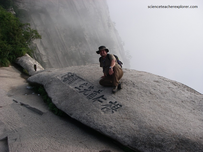
Pictured above, Hua Shan has over 300 pieces of stone tablets and about 570 rock inscriptions. The tradition of making stone tablets began to appear in the second century, and the carving of inscriptions on the rock started in the Song Dynasty approximately 1000 years ago.
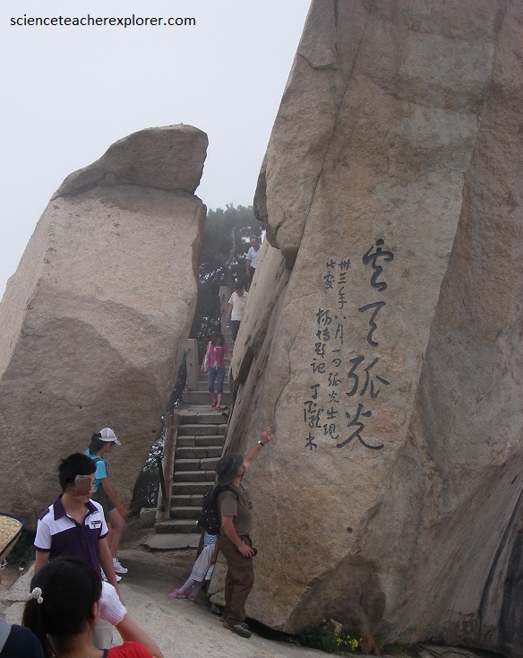
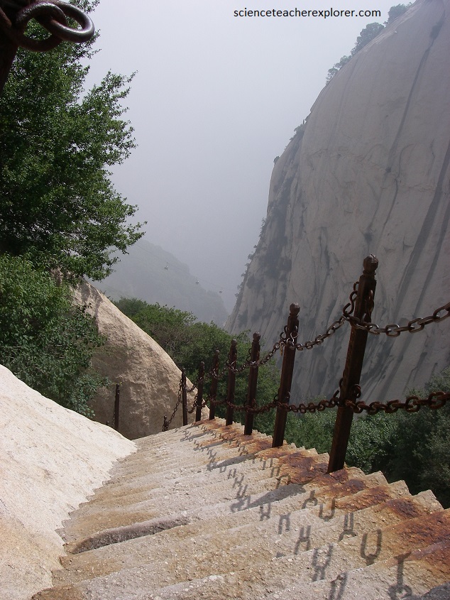
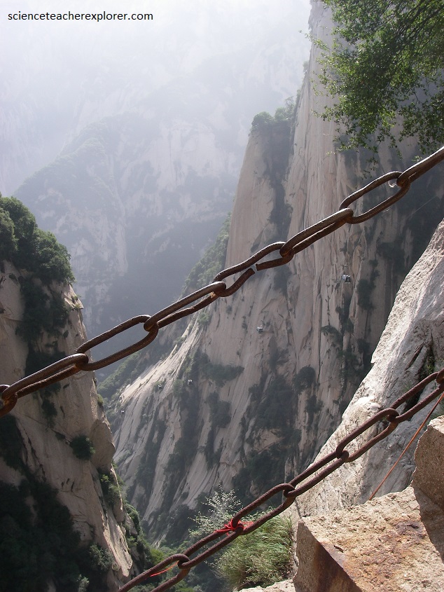
Although Hua Shan takes no climbing expertise to ascend, it is considered the most dangerous hike in the world. To reach the North Peak, stone steps have been carved from the mountain at an impossibly steep incline. Although technically a set of steep stairs, the way up the peak is more akin to a ladder, requiring a slow and deliberate climb. On both sides of the treacherous steps are chains, which are the only safety precaution available to climbers.
Hua Shan began to form about 70 million years ago from granite of the Mesozoic Era. The rock strata and the geographical formation of Hua Shan indicate the evolution of the solid earth in the last 300 million years form the late Archean Era to the present geological period.
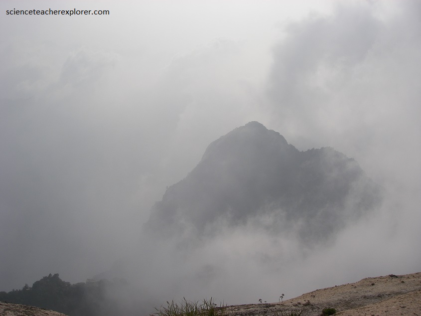
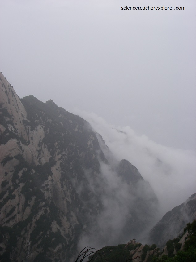
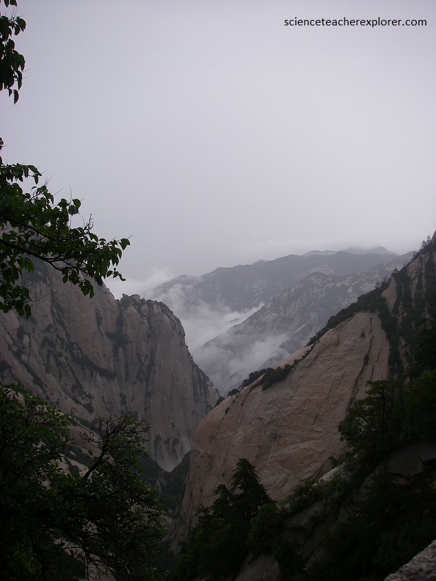
In front of Hua Shan, there is a fault line extending East-West. It separates Hua Shan form the Wei River Basin nearby. This fault structure was formed about 100-200 million years ago and not only served as the boundary beyond which Hua Shan was lifted and the Wei River Basin subsided, but also explained the present geographical landforms of the mountain, (pictured below).
The vegetation on Hua Shan has a typical vertical distribution due to the steepness of the mountain. Its diversity has made Hua Shan an ideal site for the study and research of biological evolution and the geographical distribution of plants. The complexity and uniqueness of Hua Shan’s environment is very favorable to the differentiation and the development of new species.
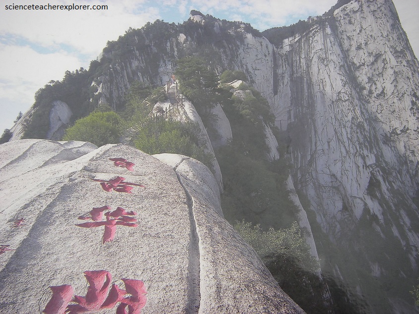
Pictured above, the West Peak is called the Lotus Flower Peak because there is a Taoist Temple there called Cuiyun Palace which has a huge rock in front of it that looks like a lotus flower. There are seven other rocks by Cuiyun Palace that are supposedly the site where the legendary hero Chenxiang ripped the mountain apart to save his mother, the Heavenly Goddess San Sheng Mu, in the folktale “The Magic Lotus Lantern”.
Hua Shan is an ideal place for the study of plants and soil. Due to the joint landform of granite, the plants on Hua Shan show the full process of the evolution from lichen-moss-shrubbery-trees. And the soil illustrates the changes from rock-sand-soil forming parent material-soil.
Pictured above, there are a large number of ancient trees on Hua Shan. Some of them are very rare and are of considerable value in terms of appreciation of nature. The joint landform of granite has contributed to the fascinating scenery of trees growing from rock and the rock blossoming with moss on the mountain.
The area around Hua Shan is one of the key regions where Chinese history began. It was a place of sacrifice from the earliest times, and as the nearby city Xi’an was made capital to 13 dynasties in Chinese history, it was the main site of sacrifice for most Chinese emperors who wanted to lessen the hardships of travelling. In the spring and autumn and Warring States periods (770-221 BC) many kingdoms fought for control of this mountain, and after the unification of the country, the First Emperor Qinshihuangdi made Hua Shan the sacrificial site of the state.
The Emperor Xuandi in the West Han dynasty made it a rule to undertake regular pilgrimage to the five Taoist Mountains and this practice was continued until the late Qing dynasty.
Hua Shan is increasingly well known all over the world for its profound Taoist culture. Records show that Taoist activities began to appear on Hua Shan about 1800 years ago in the late East Han dynasty. After that many Taoists flocked here to pursue the Taoism. Hua Shan is unique amongst the five great Taoist Mountains in that it is the only absolutely pure Taoist Mountain, free from the intrusion and presence of any other religions.
Across the whole mountain are scattered 72 caves and 21 remains of Taoist buildings. The caves are the ideal places for the Taoists to meditate since they are completely inaccessible to ordinary people. Taoism believes that the tranquility is an essential prerequisite to the exploration of the Tao.
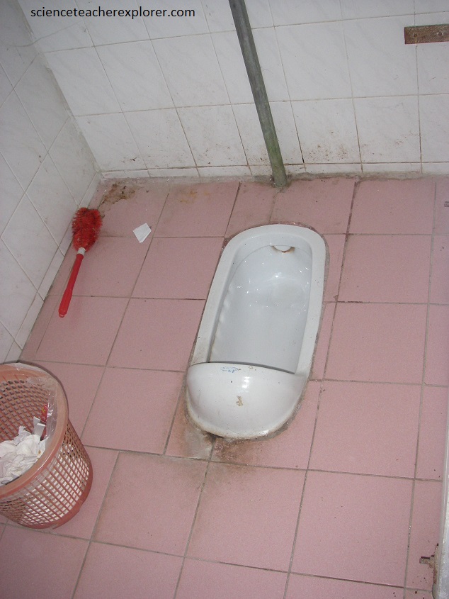
Pictured above, my trekking group had decided to stay the night at the “West Peak Hotel”. The climb was a long climb and the sun was getting ready to set. We barely made it in time before it got dark. Pictured below is a “Chinese Toilet” from the West Peak Hotel. This type of toilet was a challenge to use for a foreigner not used to squatting. Notice how there was nothing to hang onto.
Hua Shan houses some relatively large Chinese ancient buildings and their remains. They are good examples for study of the history of Taoism, the art of Chinese ancient architecture and the art of Taoist architecture. The Western Mountain temple, first built in the spring and autumn period, is the largest one in this area. The temple covers an area of 12000 square meters and is one of the biggest and earliest temples for sacrifice in mountain areas. It was built according to the scale of the second category of the imperial architecture.
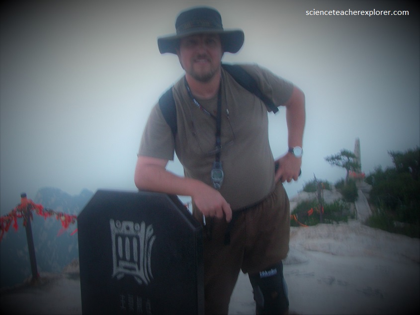
Pictured below, I’m standing on the top of the “Central Peak”. Notice the orange clips and locks from the locals that indicates their climb. The “Central Peak” is known as Jade Maiden Peak. There is a Taoist Temple at the top of this peak called the Jade Maiden Temple. Legend has it that the daughter of Duke Mu of Qin (569 – 621 BC) loved a man who was talented at playing the tung-hsiao. In order to avoid this temptation and cultivate her spirituality, she gave up the royal life to become accustomed to and became a hermit, secreting herself on the Central Peak of Mount Hua. From then on, the temple was established and the peak was named Jade Maiden Peak after the Duke’s daughter.
Pictured below, the next morning, I made an attempt alone to visit the East Peak to see the sunrise, (my trekking group chose to sleep in). The East Peak, also known as Facing Sun Peak, is the best place to watch the sunrise and takes approximately It is home to the famous Immortal’s Palm. Immortal Palm’s Peak is ranked as one of the Eight Scenic Wonders of the Guanzhong Area.
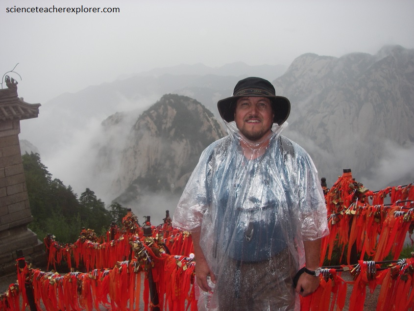
I continued along to the “South Peak”. The South Peak (2160 m elevation) is called Landing Wild Geese Peak simply because, according to legend, geese returning from the south often landed on this peak. It is home to the beautiful Jintian Palace, a Taoist Temple that is nationally considered the host temple of the deity Shaohao. I didn’t get a picture of the Jintian Palace.
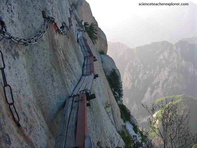
Pictured above, the South Peak trek was also the site of the infamous Plank Road, a plank path built, (by the ancesters of the Huaxia Nation), along the side of a vertical cliff that is only about 0.3 m wide and forced me to look down at the almost bottomless gulf below. This section, truly scared the daylights out of me. I took few pictures because of my extreme focus on the trail. Actually, I didn’t make it to the Jintian Palace. I finally chickened out and turned back. Pictured below, is the point where I turned back.
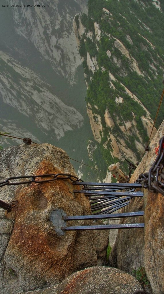
Although there was a chain running along the cliff-face that explorers could clip themselves on to, the experience of creeping along the narrow path and having to constantly hook and unhook yourself from your only safety net, so to speak, was a bit too intense for me alone. Besides, I didn’t bring a harness and clip with me. I was doing it, without. Dangerous! and Crazy!!
