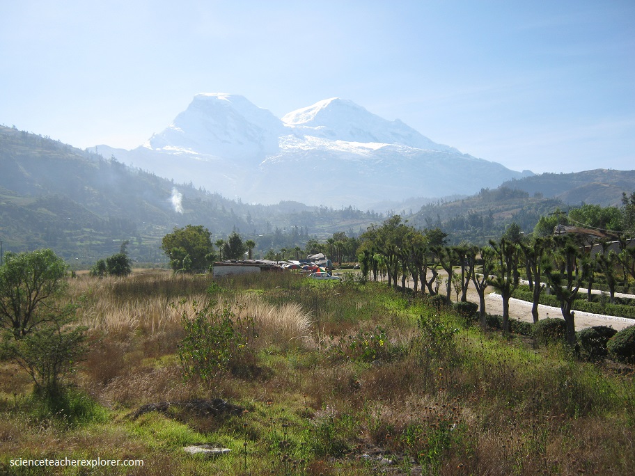
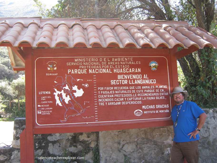
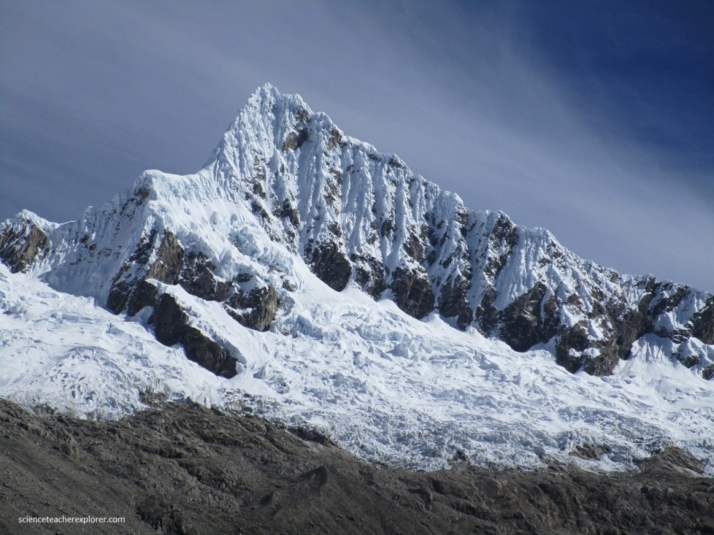
Huascaran, N.P.; Peru
In June of 2014, Kathy Stoker (my trekking buddy) and I started our trek of Peru exploring the Huascaran National Park just east of Huaraz. Situated in the aptly named Cordillera Blanca (“White Mountains”), Huascaran National Park protects the heart of the World’s highest tropical mountain range in the central Peruvian Andes. The property of 340,000 hectares covers a diverse mountain landscape culminating in 27 snow-capped peaks above 6,000 m. It includes the spectacular Nevado Huascaran (Mount Huascaran), Peru’s highest peak at 6,768 m, as the property named after the 16th Century Inca leader Huascar. The snow-covered peaks, the numerous tropical glaciers and glacial lakes, the high plateaus intersected by deep ravines with torrential creeks and the variety of vegetation types form a spectacular landscape of rare beauty.
Kathy and I had decided to tackle the Cordillera Blanca by booking a tour with donkeys on the spectacular 4 day Santa Cruz Trek.
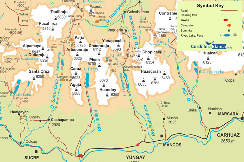
(map taken from the CordilleraBlanca.info site)
We had researched that is was one of the best-known trekking trails in the Cordillera Blanca and the Andes of Peru, and is located in the northern part of the Cordillera Blanca. The circuit includes the route of three valleys: Santa Cruz, Huaripampa and Llanganuco. The Santa Cruz Trek crosses two passes above 4700m, during the trek always observing snow-covered peaks exceeding 5000m, such as: Huascarán, Huandoy, Alpamayo (south face ), Tocllaraju, etc.
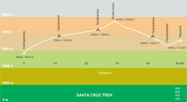
(x-section taken from the CordilleraBlanca.info site)
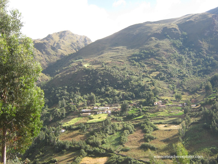
Kathy and I started our trek in Yungay, pictured below, in a truck driving up a dirt road towards the east into Ranrahirca Canyon. We had to drive over the Portachuelo (4767 m) pass to get to the start of our hiking point, Vaquerlo (3700 m). While driving through Yungay village, (pictured below), our guide had pointed out where is house was destroyed and his family was killed by a massive landslide.
On May 31, 1970, an undersea earthquake off the coast of Casma and Chimbote, north of Lima, triggered one of the most cataclysmic avalanches in recorded history – wiping out the entire highland town of Yungay and most of its 25,000 inhabitants. The quake destabilized the glacier on the north face of Mount Huascarán, causing 10 million cubic meters of rock, ice and snow to break away and tear down its slope at more than 193 kilometers/hour. As it thundered down toward Yungay, and the town of Ranrahirca on the other side of the ridge, the wave of debris picked up more glacial deposits and began to spit out mud, dust, and boulders. By the time it reached the valley – barely three minutes later – the 914 meters-, or 3,000 feet-wide wave was estimated to have consisted of about 80 million cubic meters of ice, mud, and rocks.
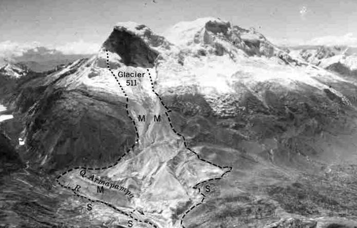
Within moments, what was Yungay and its 25,000 inhabitants – many of whom had rushed into the church to pray after the earthquake struck – were buried and crushed by the landslide. The smaller village of Ranrahirca was buried as well. Some 350 people survived, including the few who were able to climb to the town’s elevated step-like cemetery. Among the survivors were 300 children, who had been taken to the circus at the local stadium, set on higher ground and on the outskirts of the town. Apparently our guide was one of those survivors, but lost his entire family. Because the Peruvian government has forbidden excavation in the area, crosses and tombs mark the spots where homes once stood, engraved with the names of those never found.
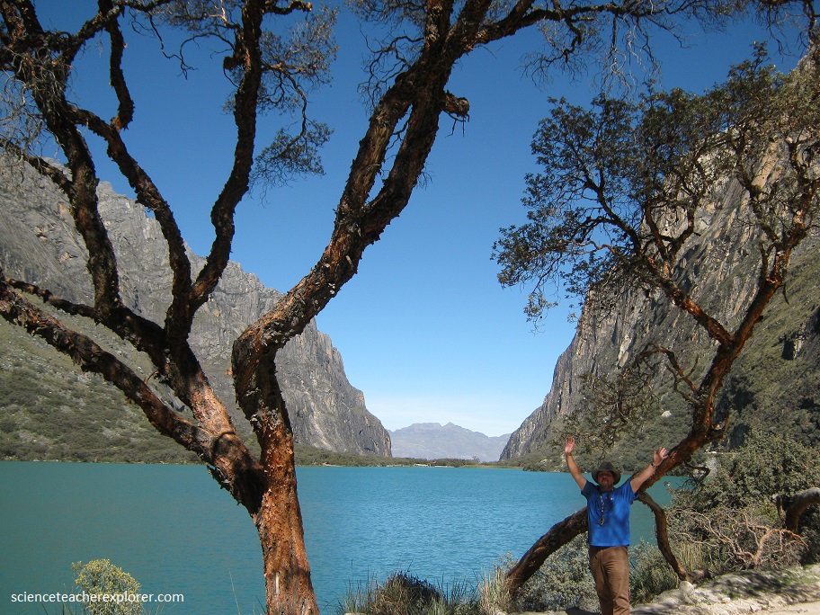
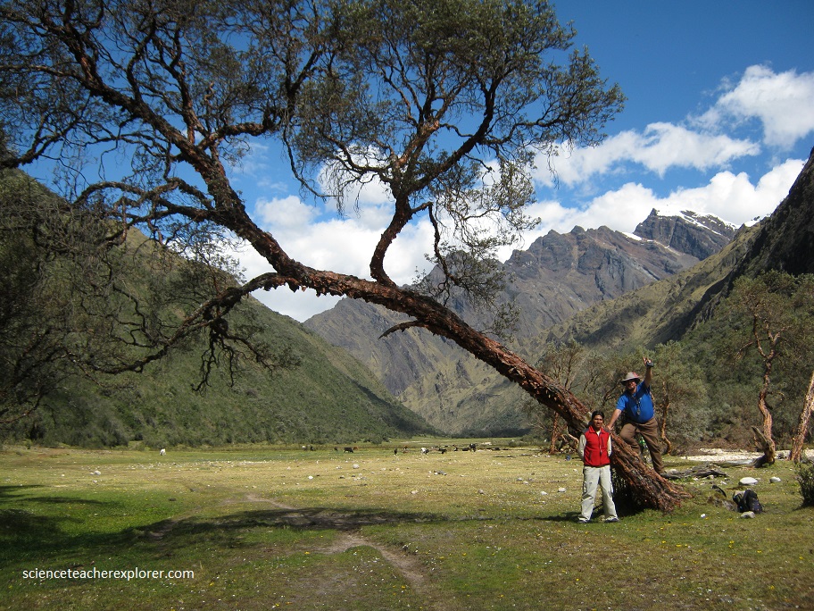
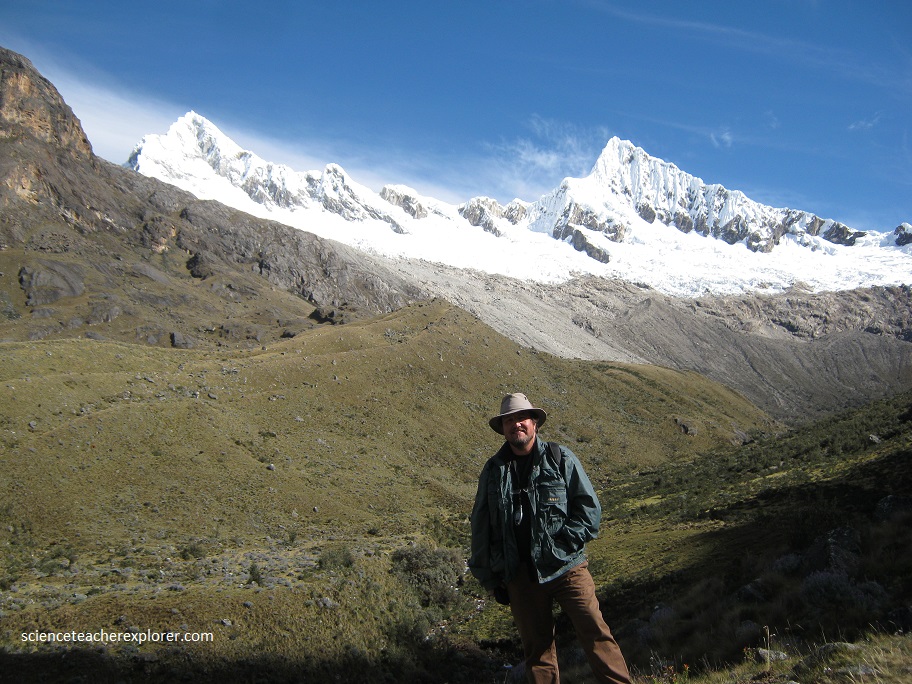
The dirt road from Yungay passes the Llanganuco Lagoon (pictured below) en route to Portachuelo, a high pass at 4,767 meters, and leads to the village of Vaquería. The turquoise-green color waters run in 910 meters long, 368 meters wide and 7 meters deep. The Llanganuco Lagoon was formed due to melting of glaciers Huascaran, Huandoy, Pisco, Chopicalqui and Yanapaccha, with the water temperatures averaging 7 ° C on the surface. I’m standing near a Buddleja Tree. The Buddleja coriacea is a variable species endemic to the high Andes of the Cordillera Blanca. It grows on dry to semi-humid rocky soils at elevations of 3,000–4,350 m. These are high-altitude Andean trees with orange flaky bark and twisted limbs.
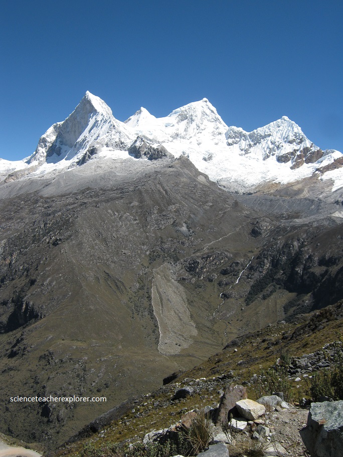
It was a beautiful drive up the harrowingly sharp switchbacks to the Portachuelo viewpoint (4700m). Along the way we were introduced to the first five giants of the Cordillera Blanca range: Mt. Huascaran (6768m), Huandoy (6395m), Chopicalqui (6354m), Chacraraju (6112m), and Pisco (5752m). Pictured below is Huandoy peak. It is the second-tallest peak of the Cordillera Blanca section of the Andes, after Huascarán. These two peaks are rather nearby, separated only by the Llanganuco glacial valley of which we drove through. Huandoy peak is a snow-capped mountain with four peaks arranged in the form of a fireplace, the tallest of which is 6,395 m.
Kathy and I actually started hiking at the Vaqueria Village ascent. The village seemed to be a small farming village.
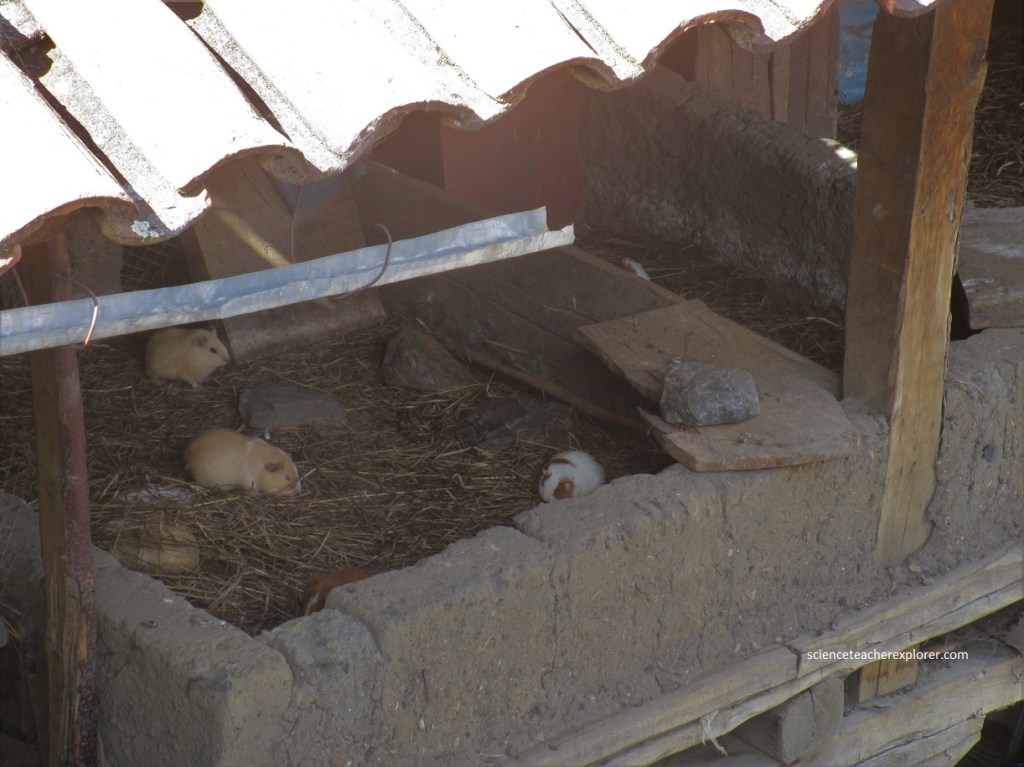
One of the strange things we saw at Vaqueria was this small guinea pig farm. Guinea pigs seem to be a delicacy in Peru. Commonly seen roasted in many restaurants in Peru. Pictured below, is an elevated guinea pig farm.
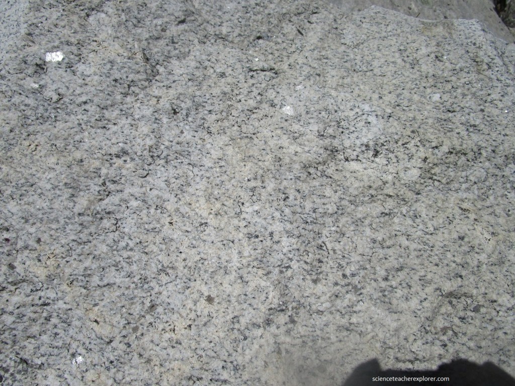
The geology of the Cordillera Blanca and Sante Cruz Trek, nowadays mainly consists of three different units: the continental plate, some Jurassic phyllites, and Cretaceous sediments (from bottom to top). In the subduction area where the Nazca Plate dives under the continental plate the rock was melting, so that a magma chamber formed beneath the continent. The density of molten rock (or magma) is lower than the density of the surrounding rock, so it tends to rise. This process can be considered the beginning of the formation of the Cordillera Blanca.
As the magma rose, it intruded the existing rock and lifted the surface. At some point, part of the magma reached the surface and formed volcanoes which deposited some pyroclastic material in the surroundings. However, volcanism does not play a major role when it comes to the geology of this area. Most of the magma cooled down and solidified before it reached the surface. A so-called batholith was born!
In the next phase of the development of the Cordillera Blanca the Cretaceous sedimentary rocks, which covered the batholith, started to slip down the mountainside along a tectonic fault. This process is combined with a still ongoing uplift of the batholith along with parts of the Jurassic phyllites. Therefore we can still find some phyllites on the top of the batholith nowadays. The fault zone between the batholith and the Cretaceous sediments is the so-called Cordillera Blanca Fault Zone and can be nicely seen in some areas at the base of the mountain range. It forms the border between the steep landforms associated to the batholith and the softer features of the surrounding rocks.
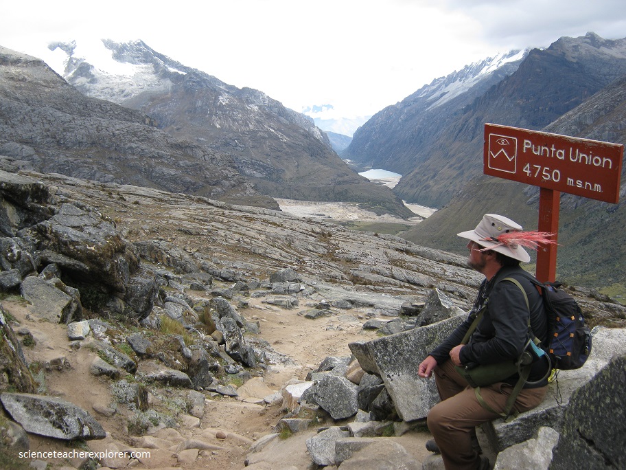
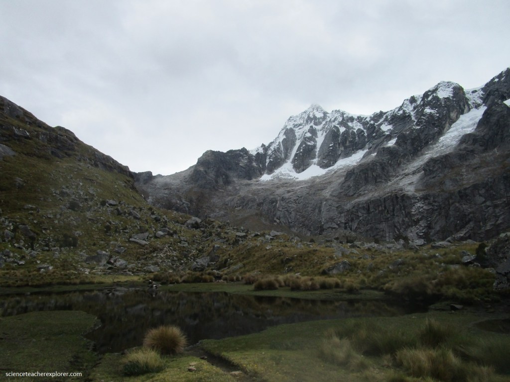
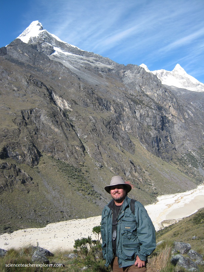
Above is where Cathy and I reached Punta Pass at an elevation of 4750 m . Here an Inca road passes from the Pacific side to the Atlantic side of the continent, (into the Amazon Basin). This is rare Inca Trail.
The Taullicocha laguna far below on the other side of the pass is a beautiful turquoise hue,(pictured above). After enjoying the views set off downhill to camp in the meadow of Taullipampa (4254 m).
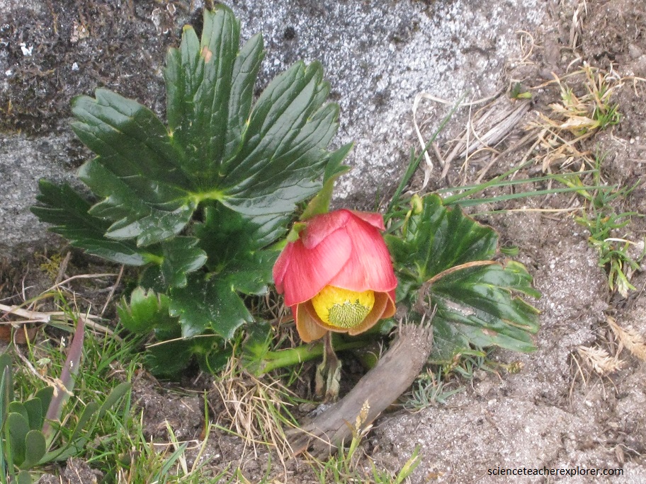
Pictured below is the Taullipampa (4254 m) camp. Note the endemic plant found only here near the Santa Cruz river called the Lupinus Weberbaueri .
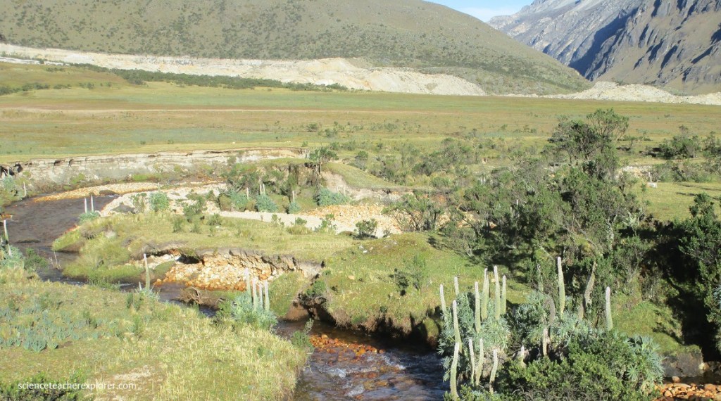
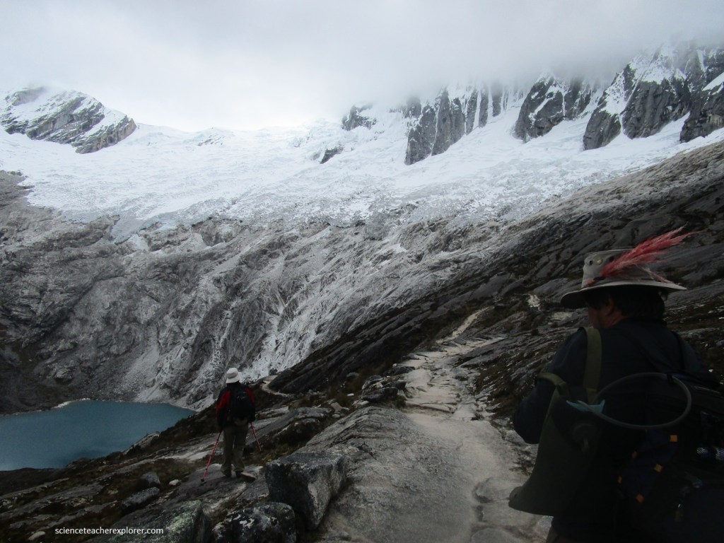
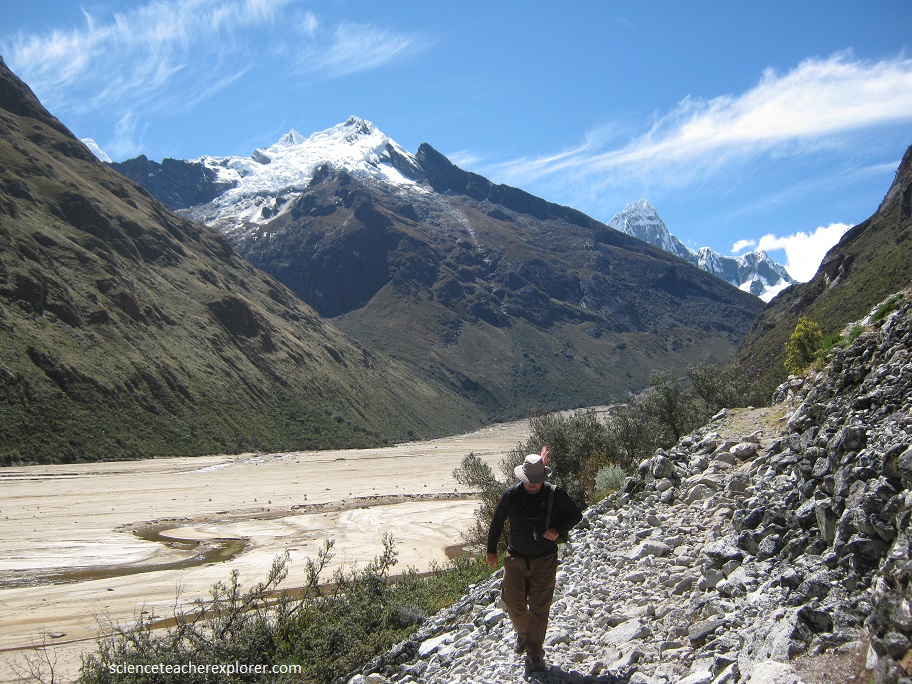
From here the trail continues along an area of loose sand and rock — the result of recent floods. An avalanche in recent years broke an ice dam that held back the waters of the small Laguna Arteson Bajo. The resulting flash flood wiped up the trail, so the path has been altered in some parts.
Our Santa Cruz Trek ended at Cashapampa, Peru
