Tintic Mining District
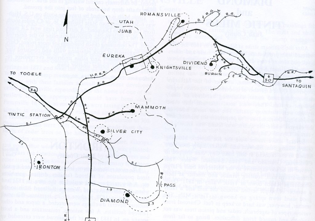
When silver ore was discovered in the East Tintic Mountains of Utah by George Rush in 1869, it ignited a stampede of mining claims that spread throughout these mountains. New deposits were soon located and claimed, and the ore was assayed to be rich in silver, gold, lead, zinc, copper, and other minerals, usually in the form of metal sulfides. The sites near the mines quickly grew into the towns of Eureka, Mammoth, Silver City, Diamond, Knightsville and Dividend. I explored these sites in 2007.
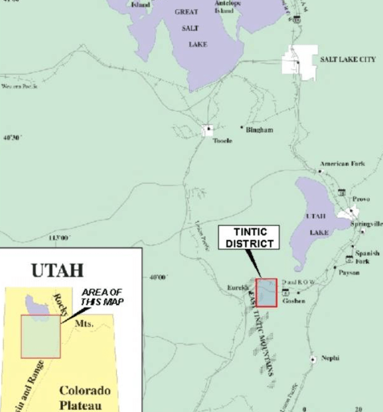
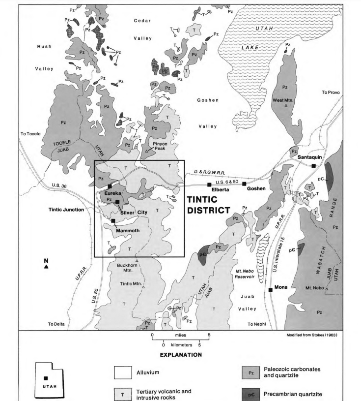
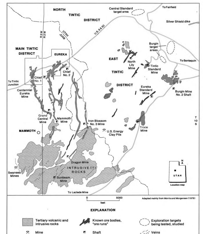
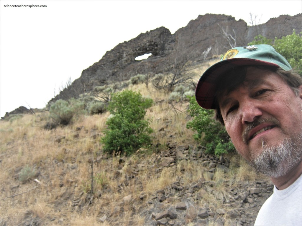
Imaged above, The Tintic Mining District is some 100 km south west of Salt lake City, Utah and is accessible by paved road. Initially south on Interstate 15 from Provo to Santaquin (near Payson) , a distance of 20 km, then west on Highway 6 (which bisects the area) a distance of approximately 35 km.
The East Tintic Range is a north trending fault block range near the eastern border of the Basin – range province. Its shape and orientation is controlled by northerly trending Basin-range normal faults, formed late in the geological history of the range.
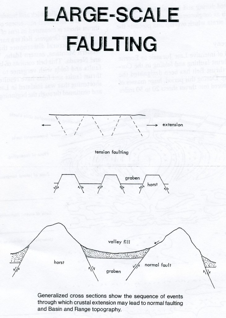
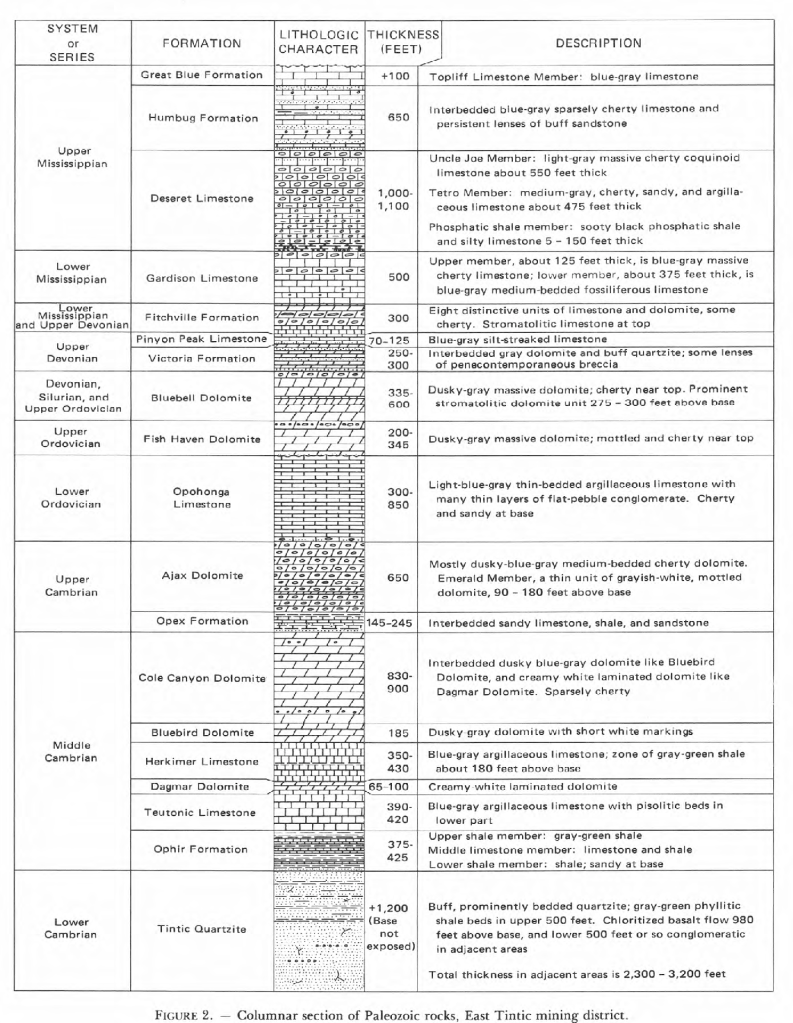
The mountains are underlain by Precambrian and Paleozoic strata that underwent complex folding and faulting during the Sevier orogeny of Cretaceous age. In Oligocene and Miocene time the deformed strata were intruded by intrusive volcanic stocks and volcanic rocks buried the youthful land forms. The Paleozoic rocks which range in age from Cambrian (Tintic Quartzite) to Mississippian unconformably overlie the Precambrian. Overlying the Tintic Quartzite is the Ophir Formation of limey shales and limestones of the Middle Cambrian to Upper Mississippian. The Ophir is an important ore host in the East Tintic district. Above the Ophir Formation, sandstones and shale are distinctly subordinate to carbonate rocks. All of the units above the Ophir, host at least small replacement deposits, but most of the mineral production came from five units as follows: $35 million from the Tintic Quartzite ;$200 million from the Ophir Fm.; $135 million from the Blue Bell Dolomite; $60 million from the Ajax Dolomite; & $47 million from the Deseret Limestone (Mississippian)
The mined ore-bodies occur as; replacement deposits, replacement veins and fissure veins, as well as volcanic stock works and disseminated deposits. Replacement deposits have been the source for more than 90% of the ore produced in the district. They occur predominately, in carbonate rocks and may be described as pods, pipes, columns and irregular masses controlled by localized faulting, (imaged below).
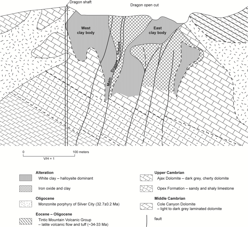
Replacement veins were mined most commonly in the pyrometasomatic rocks near the margin of the Silver City Volcanic Stock, where ore replaced the fault gouge and breccia and locally replaced reactive beds. Fissure veins occur in a myriad of short faults typically cutting massive siliceous rock units including quartzite, quartz monzonite, monzonite porphyry, latite, silicified tuff and agglomerate (imaged below).
The ores in the district consist largely of galena and sphalerite with variable amounts of argentite, tetrahedrite, enargite, proustite, native gold and silver and a wide variety of uncommon copper, lead, silver and bismuth sulfosalt minerals (imaged below).
The original discovery of silver at the Tintic Mining District was made by a Mormon shepherd in 1865. As the Mormons were discouraged from prospecting, his find was forgotten until 1869, when a non-Mormon cowboy herding cattle rediscovered the rich ledge. He and his partners took samples and showed it off. The rush was on. Mines were staked and mining camps popped up all over the district, which was named after the Ute Native, Chief Tintic.
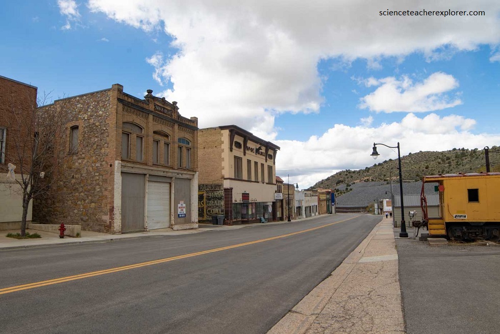
The Mainstreet for Eureka, Utah of the Tintic Mining District 2022
Pictured above, my exploration to the Tintic Mining District began at the little town of Eureka. Other than Mammoth, Eureka is the only still-living town in the Tintic Mining District. There are several still-in-use churches and the city hall, built in the 1890s. Most of the businesses string out along Ruby Gulch, now the route of US 6. This sleepy old mining town still dreams of the days when it was Utah’s ninth largest city.
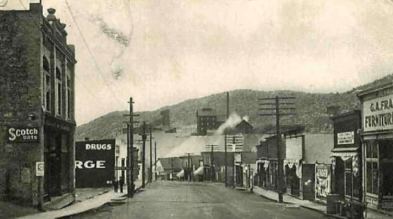
The Mainstreet for Eureka, Utah of the Tintic Mining District from the 1900s.
The mines that started Eureka were part of the original Tintic discovery of 1869, when a cowboy name George Rust found a rock with silver ore. He showed it around, which created interest in the mountains to the east of the grazing land where he worked. The next year several settlers found rich ore a little further north in a little valley. They sold to a Captain E.B. Ward, who named his mine the Eureka Hill Mine. By 1871, over 500 mining claims had been filed, and a mining camps were throughout Ruby Hollow. It called itself Eureka, and the main street followed the bottom of the gulch. By the early 1890s, Eureka was a small city. The 1910 census counted 3400 people in Eureka. The mines were worked through the 1930s, but in 1942 were closed down by government order. The last mine shuttered its portal in 1957. With higher mineral values today, there is some activity still going on.
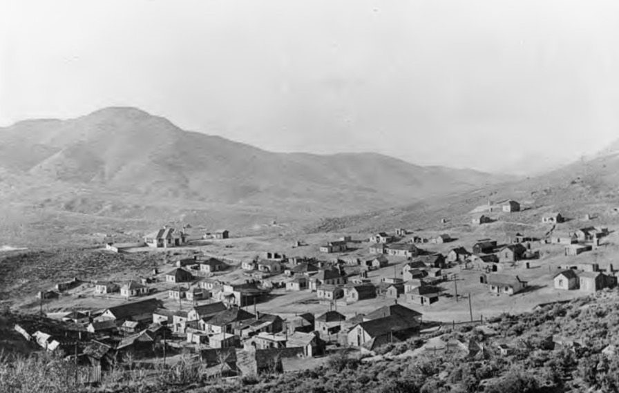
Knightsville, Utah of the Tintic Mining District in the early 1900s; (image provided by the Utah State Historical Society) {Jessie Knight’s house is the big house on the mid-left of the photo}
In 1896, Jessie Knight had a vision from a dream to find gold. A mining engineer retorted, “Humbug” to the location. Jessie Knight desregarded the wisdom of experience and sank his shaft and actually struck a rich ore body which he immediately and “appropriately” name the Humbug mine. The Humbug was discovered in the hills two kilometers east of Eureka. Knight would go on to own several mines and become one of the district’s wealthiest people.
Pictured above, the town of Knightsville was built approximately two miles east of Eureka. The camp had sixty five homes, two boarding houses, a church, a post office, a school, and many other businesses. What Knightsville did not have were saloons, making it one of the only saloon-free towns in the West. Knight was a devout Mormon, and he expected his miners to abstain from alcohol and tobacco, which would explain why there were no saloons in the town. Knightsville peaked during the first decade of the 1900’s with around a thousand residents. By 1915 the mines were in decline and the town began its inevitable slide into ghost town status. By 1940 little was left of Knightsville.
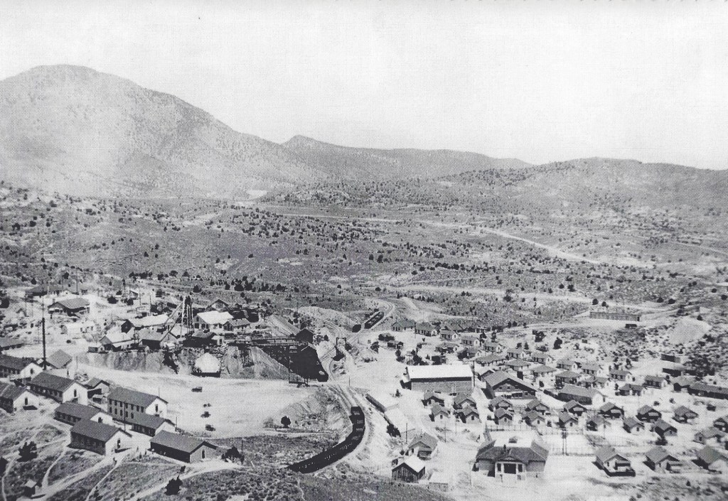
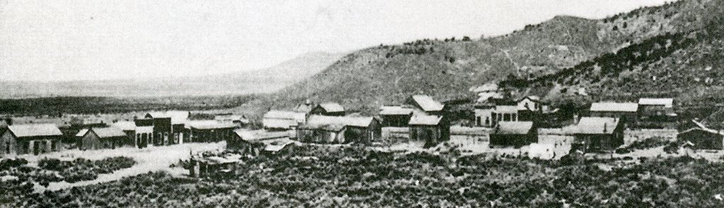
As the rush to Eureka ensued in 1870, the Mammoth Mine was discovered just over the hill to the southeast of Eureka. In 1873 the discoverers sold out to the McIntyre brothers, who basically swapped the mine for the herd of cattle they were driving towards Salt Lake City. Not too long after the McIntyres started mining, they hit an ore body that created another boom-town. Other mines quickly developed, and the town of Mammoth grew up on the upper end of the alluvial fan that leans against the head of the valley (pictured above and below).
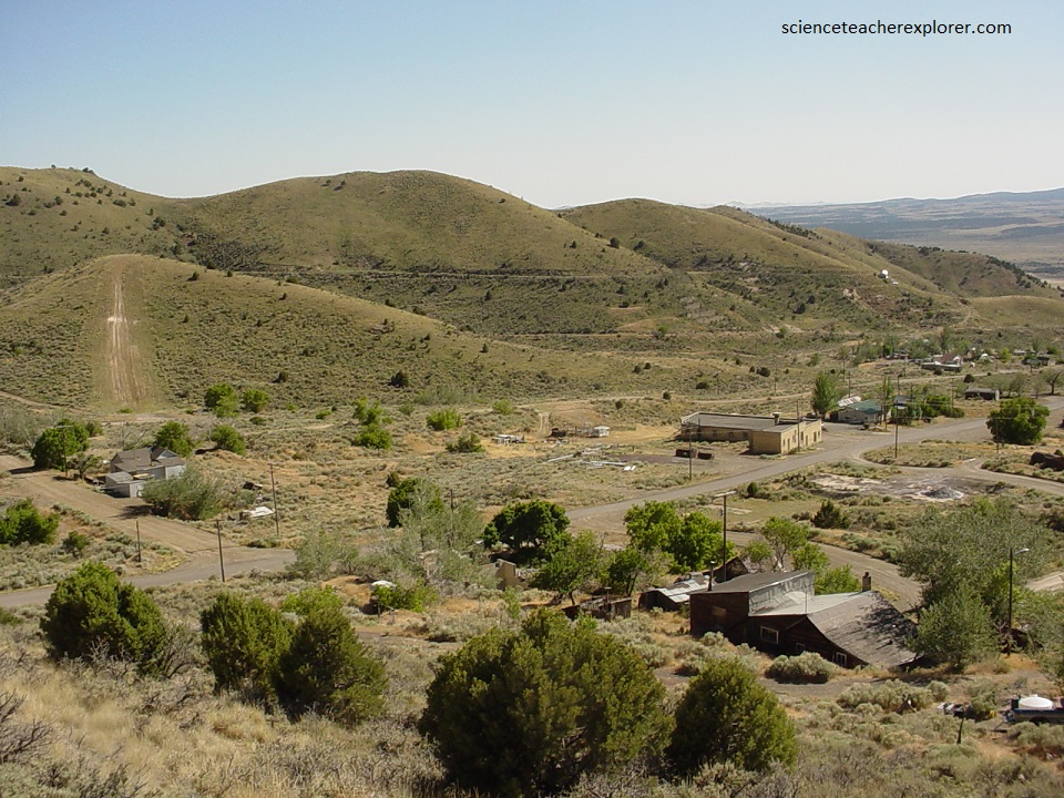
The Mammoth Mine produced silver, gold, lead, copper and bismuth, while the town of Mammoth grew. Mammoth at the head of the valley grew into the residential district, while “Lowertown Mammoth” or “Robinson” developed into a commercial district which included a number of saloons. In 1910, Mammoth had 350 homes along with enough businesses to serve a population of 2500. The Mammoth mines produced around $20 million in silver. In 1930 its population still stood at 750, but it disincorporated, and continued to fade. In 2007, a few houses remain and a few mines are still being worked.
Pictured above, Silver City was the original mining camp in the Tintic Mining District. The Sunbeam Mine, the first mine in the Tintic district, was discovered by Mormon prospectors in 1869. By 1870 other deposits had been located and once word got out a rush was on to the new mines of Utah. Silver City, located at the mouth of Dragon Canyon, was the first town established. Silver City was the premier camp in the district during the early 1870’s. The district’s telegraph, express, and recorder’s offices were all located in the town.
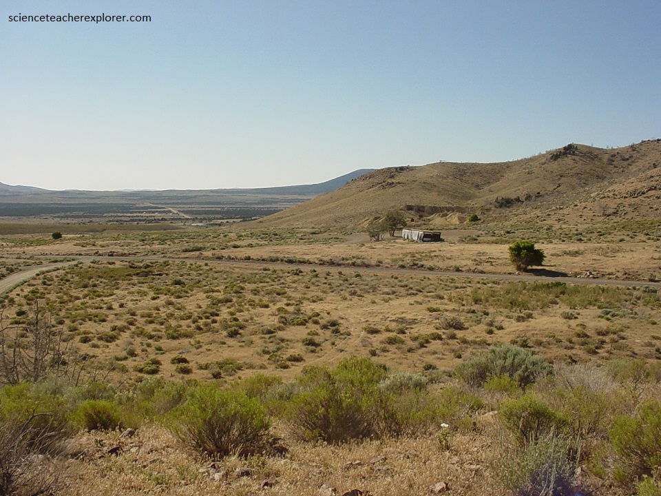
By the late 1870’s Silver City was already experiencing a decline. The mines were becoming flooded and miners were moving on to other districts. Despite the downturn in the mines, Silver City continued to be an active mining community throughout the 1880s and early 1890’s. In 1896 rich new silver discoveries were made and Silver City once again became a boom town. A large ore sampling and smelting facility was built west of Silver City, and around 100 homes were built to serve as company housing at the new facility. Silver City peaked in 1908 with around 1,500 residents. The town enjoyed prosperity for a number of years but eventually declined as it became more economical to ship ore to distant smelters. By 1930 the town was a ghost town.
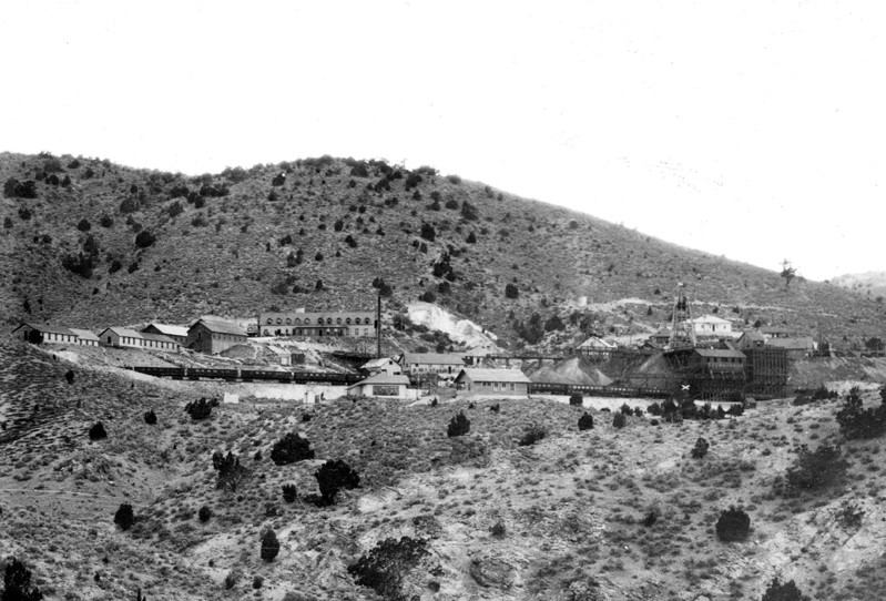
In 1907, Emil Raddatz bought up several old unworked claims on the eastern-side of the Tintic Range and organized the Tintic Standard Mining Company with over a million shares of stock outstanding. By 1915 funds began to run low. Finally, in 1916 a rich body of ore was struck. The town was named Dividend because of the profits payed out to stock holders. By 1922 over $1 million dollars had been payed out in dividends. In 1949 the mine closed. It had payed out over 19 million dollars in dividends (pictured below).
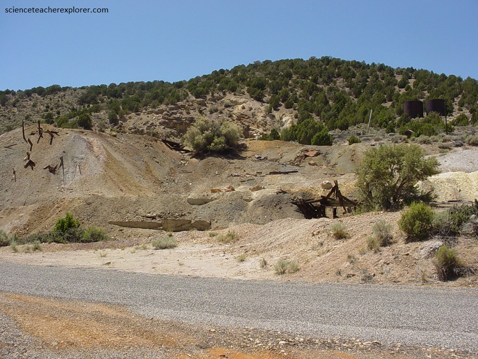
Since the late 1950s the great mining giants such as Anaconda and Kennecott have taken over most of the leases of the properties in Dividend, Mammoth, Silver City, and Knightsville. Although old Dividend is quiet, a recent operation at Burgin, just a kilometer east of Dividend, is very active in mining low grade ores. Several old mine buildings are still present up on the hill to the west, but was enclosed within a fence.
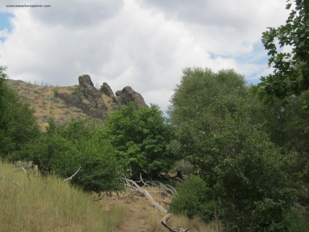
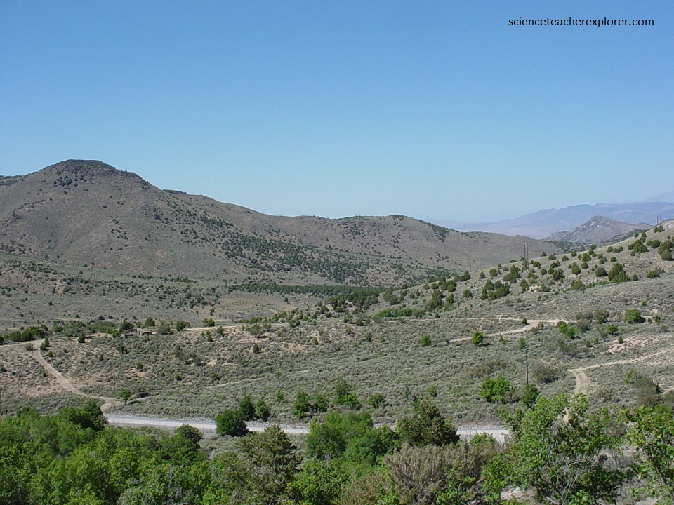
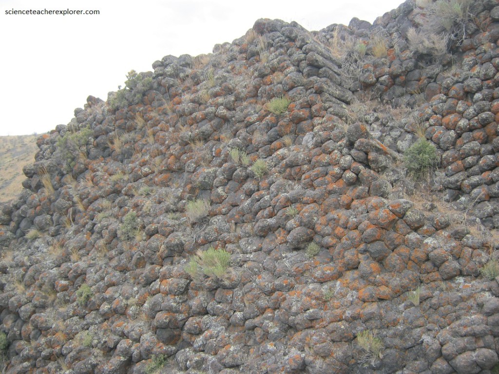
On the southern Tintic Mountain Range, (15 km south of Mammoth, Utah on Hwy 6), is the Paul Bunyan’s Woodpile. A geological curiosity, (rare in Utah), the “Woodpile” is a cluster of Lava logs formed about 30 million years ago during the Eocene Period.
The “Logs” were formed when a lava flow cooled into orderly columner joints having 3 to 6 sides. The columns measure about 30 centimeters diameter and up to 3 meters in length.
This formation was on the rim of the caldera that collapsed due to a void left when lava flowed out from under the caldera. Basin and range faulting caused the formation to tilt onto its side. Erosion has exposed the formation we now see.
Recent work conducted by Brigham Young University indicates that the Woodpile may be a series of numerous dikes, probably the result of this later volcanic activity. Dikes are composed of an igneous rock and are oriented vertically. They form when magma is injected into preexisting cracks or fissures and later cools under the ground surface. However, the rock in this formation is a vitrophyre and not a basalt, (pictured below).
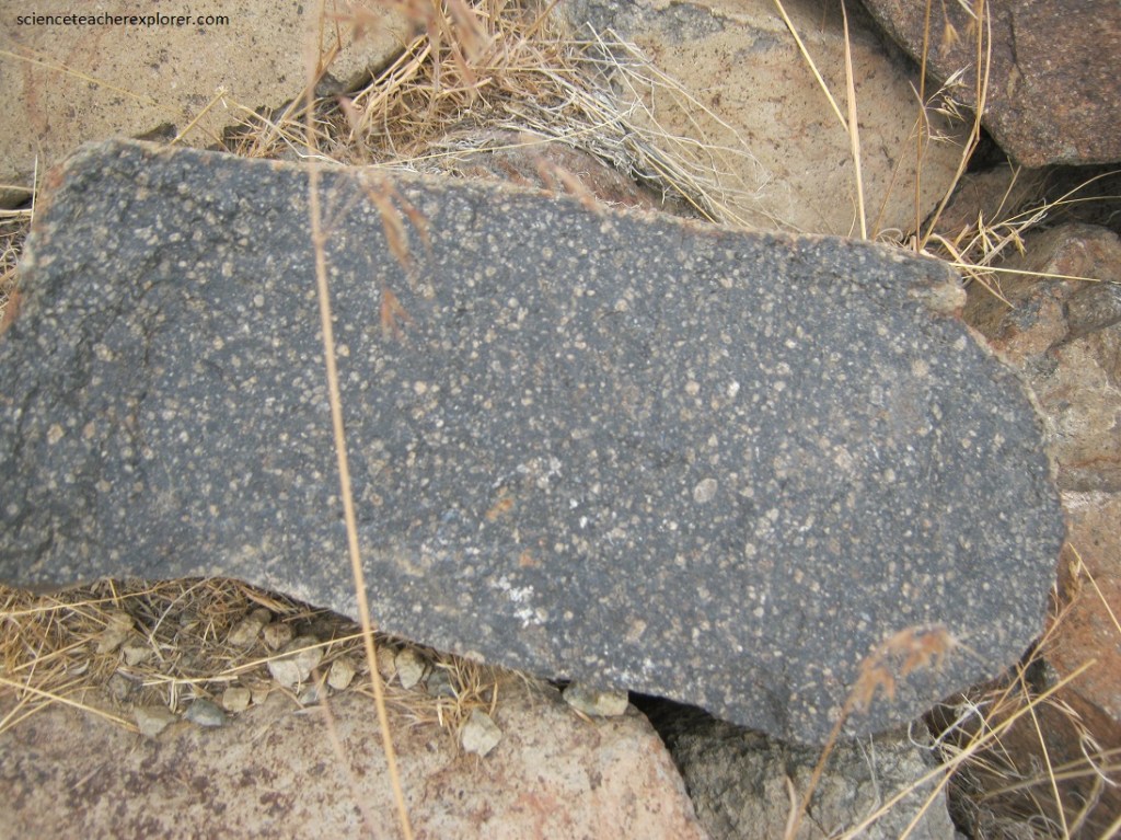
Pictured above, a Vitrophyre is a volcanic rock with a porphyritic texture in which larger crystals (phenocrysts) are embedded in a glassy groundmass. A Vitrophyre form when there is a sharp temperature gradient, resulting in a rapid cooling or quenching from water and forming a glassy basal vitrophyre. So the dikes was probably subjected to water during cooling.
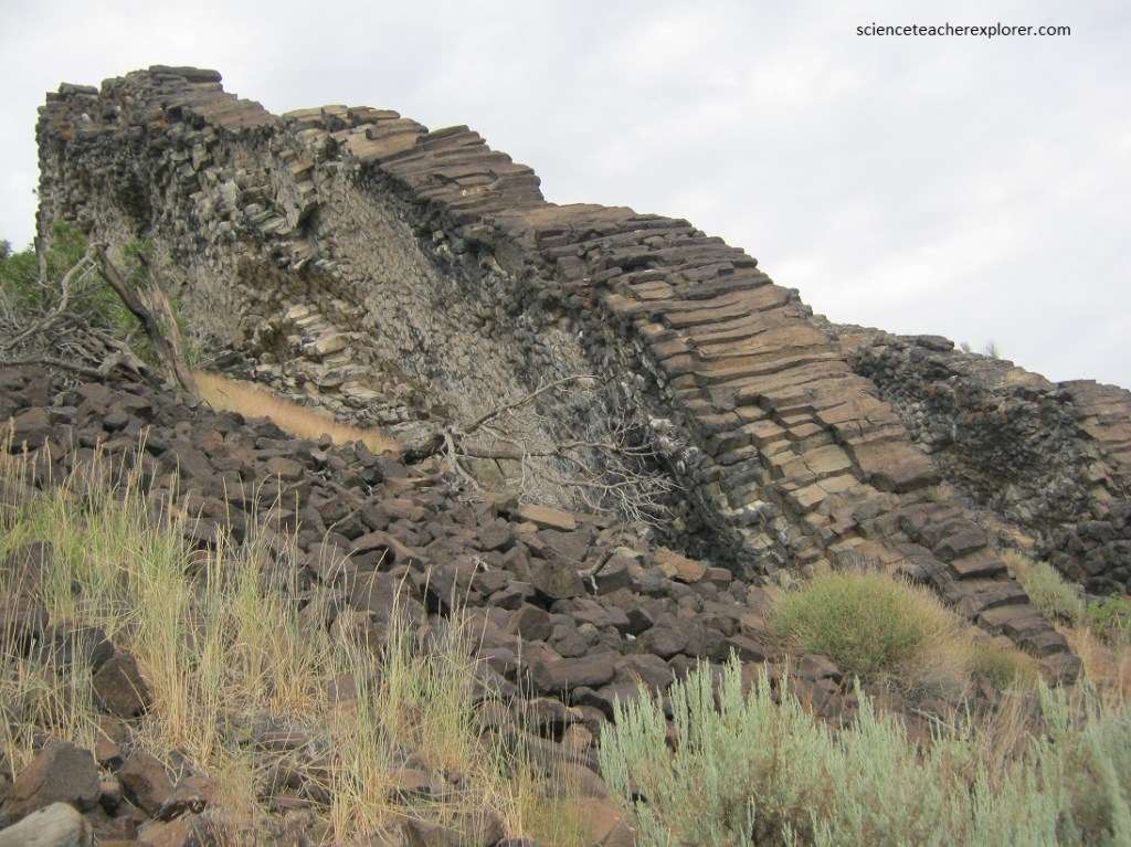
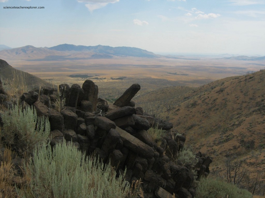
Pictured above, the “Woodpile” is a classic example of columnar jointing where the rock fractures in prismatic patterns, producing parallel columns. These columns formed when cooling magma within the dike contracts, forming cracks similar to those on the surface of a cooling cake. Once a crack forms, it continues to grow from subsurface cooling, thereby forming longer and longer columns.
Usually columnar jointing is associated with lava flows with the joints oriented vertically. However, the horizontal orientation at Paul Bunyan’s Woodpile, appears to be the result of subsurface cooling horizontally from the sides inward to the middle of the dikes. Then erosion took away the overburden, leaving the dikes behind.
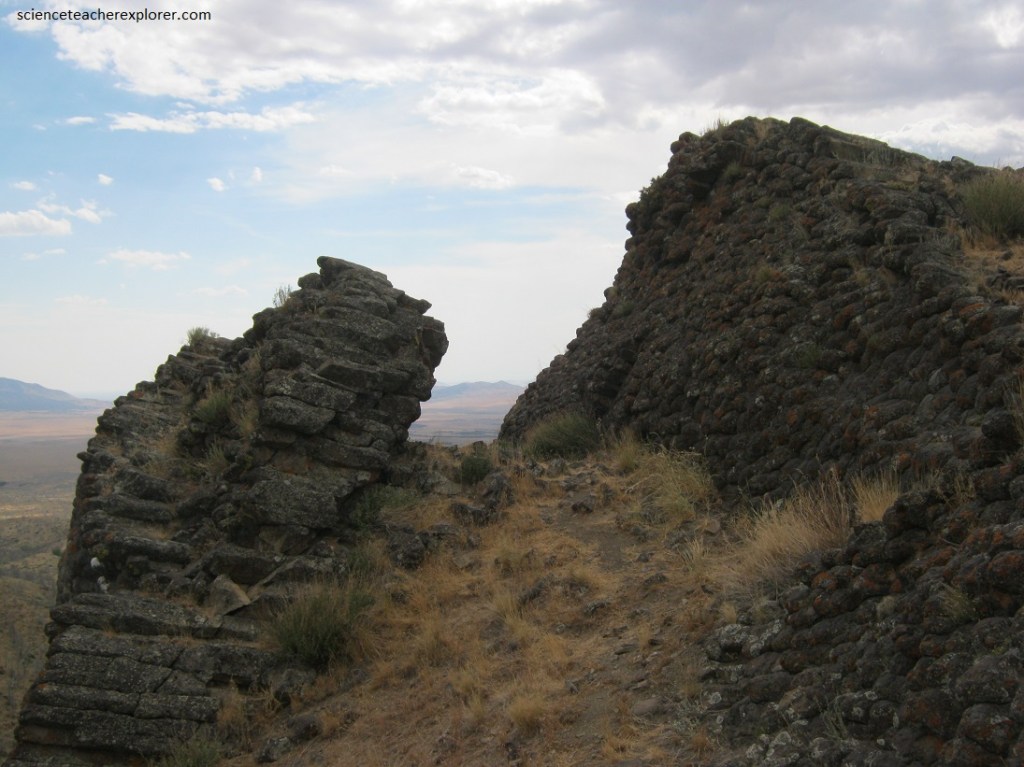
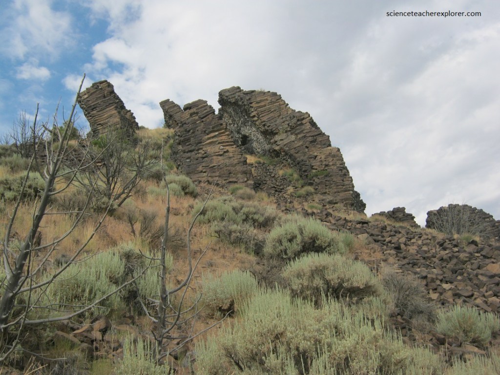
Pictured above, the “Woodpile” contains an arch. This arch was created by a process known as frost action, which involves expansion and contraction associated with repeated cycles of freezing and thawing. In this process, water enters cracks in the rock and freezes; the expanding ice creates separation along the cracks. Eventually the rock will break off, creating holes in a rock outcrop and the arch. The estimated span of the arch is 7 meter long by 1.2 meters high.
