Lindsay Sites, Scotland
In the summer 2001, my Father (Patrick M. Lindsay 1924-2012) and I explored the Highlands of Scotland in the United Kingdom with a small group of teachers from my school.

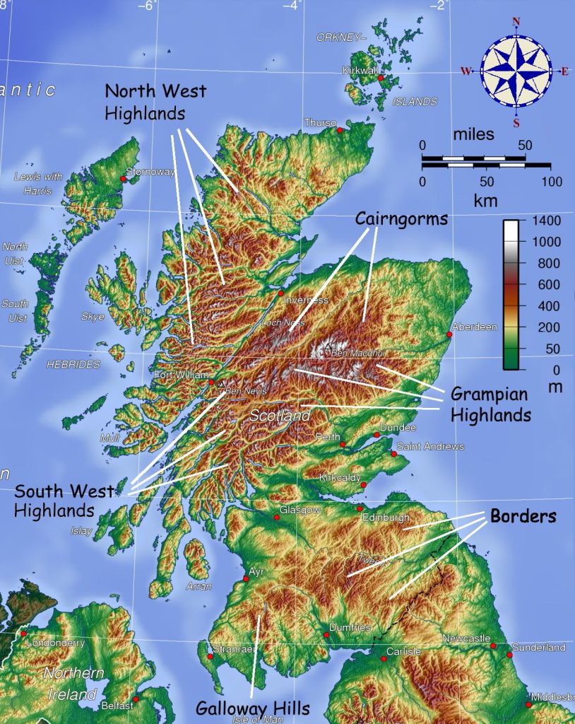
We spent several days trekking the South Western Highlands of Scotland and then a couple of days in the Grampian Highlands.
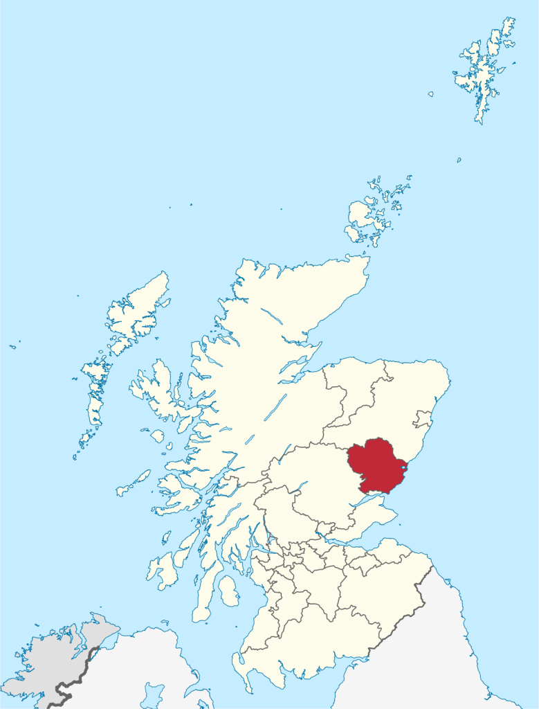
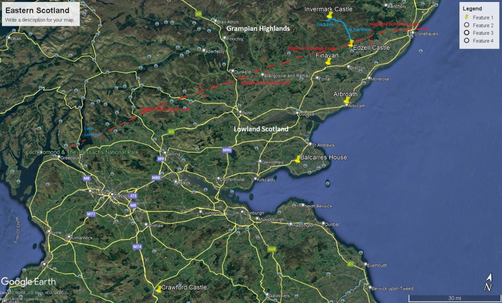
Our main focus was to explore the “Lindsay Castles” in and around Angus County of Eastern Scotland. Angus County is located within 2,184 square kilometers of the East Coast of Scotland, boasting a varied landscape of expansive mountains, valleys and glens, to prime agricultural land with historic towns and villages along a varied North Sea coastline.
Imaged below, the north-western part of Angus County consists of the Grampian Central Highlands that are composed of durable, old metamorphic rocks and are separated from the rest of the area by the Highland Boundary Fault, a great fracture running south-westwards right across Scotland from Stonehaven to Loch Lomond, (from which we were staying).
However, our focus on the webpage is to visit the “Lindsay Castles” in 2001. Our first visit was the “Crawford Castle”. Pictured below, Crawford Castle was in ruins in 2001. It was located on the north bank of the River Clyde, around 800 meters north of Crawford, South Lanarkshire, Scotland. The castle is also known as the “Lindsay Tower”, after its former owners, the Lindsay family.
The Lindsay family inherited this barony-of-Crawford when William Lindsay married the younger daughter of Thor in 1154 AD, and granddaughter of Sveinn, Lord of Crawford or following the death of Thor in about 1165. It was probably William Lindsay who built the stone castle by 1175. The Lindsays only held the castle until the late 15th century, but it was clear that the legacy of our family lived-on at the site of these ruins.
Our next site to visit was the Balcarres House. However, the security at this site was too difficult to breach, so we were not successful at getting a picture. The Balcarres House was built by John Lindsay of Balcarres in 1595 and the current chief of the Clan resides there today. This house became the seat of both the Earl of Crawford and of Clan Lindsay, who were one in the same. Our next visit was the Arbroath, Scotland.
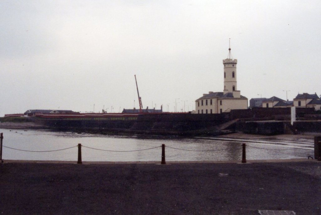
There isn’t actually a “Lindsay Castle” at Arbroath, but it happened to be a significant site for the “Lindsays”. The Battle of Arbroath was fought on 24 January 1445 in the pictured field below at Arbroath, Scotland. The conflict began after the monks of the Abbey of Arbroath appointed Alexander Lindsay, (Master of Crawford), as the “Bailie of the Regality”, a position charged with dispensing justice throughout the jurisdiction of the monastery. However, the monks changed their mind and appointed, Alexander Ogilvy, 2nd Baron of Inverquharity. Lindsay disputed the rights which Ogilvy claimed. When unable to reconcile the dispute, rather than arbitrate, they went to battle. It should be noted that, the Master of Crawford, who would become the 4th Earl of Crawford, was the son of David Lindsay, (3rd Earl of Crawford), and son of Marjory Ogilvy, daughter of Alexander Ogilvie.
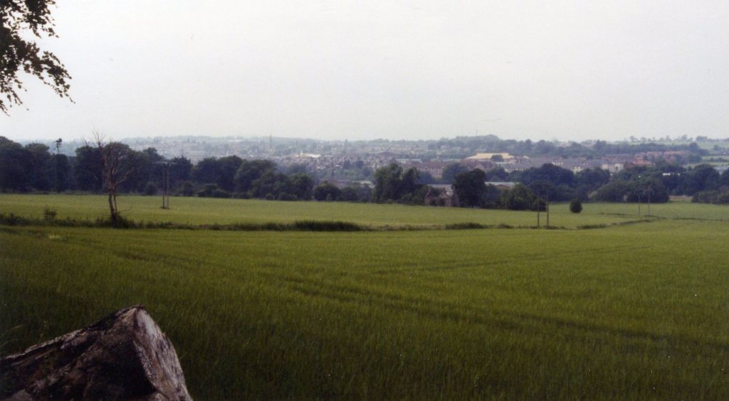
Lindsay arrived at the gates of the abbey with over one thousand men, (mostly from clan Lindsay, but also a group of clan Hamilton from Clydesdale). Lindsay rode across the center of the battlefield, between the two armies, in order to confer with Ogilvy. However, one of Ogilvy’s infantry, mistook the Earl’s approach for hostilities, and threw a spear, striking the Earl in the mouth, and piercing his neck, killing him instantly. Although an accident, this ended any chance for a peaceful resolution. The battle began. Though the battle ended in Clan Lindsay’s favor, they lost a disproportionate number of men, and the Earl of Crawford. The graves of the dead from this battle have from time to time been found below the surface of the ground in the field pictured above.
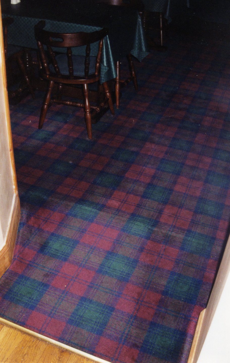
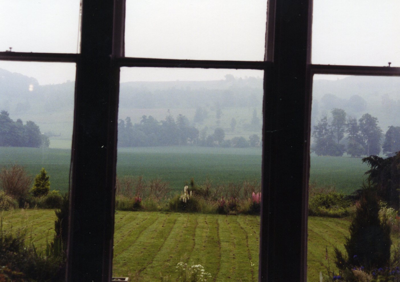
[Pictured below is the Finavon Hotel with it’s Lindsay-Plaid Carpet and view out it’s window].
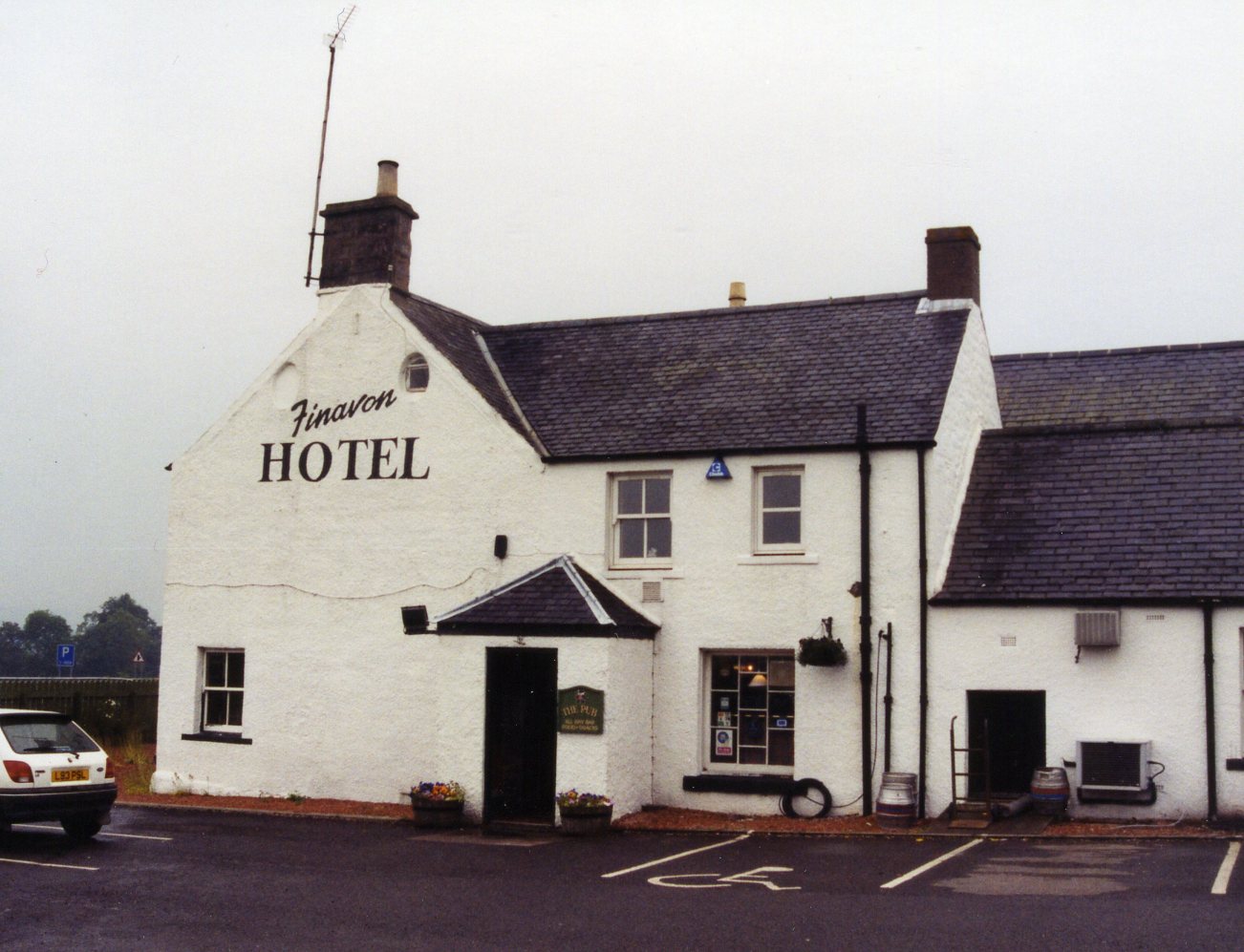
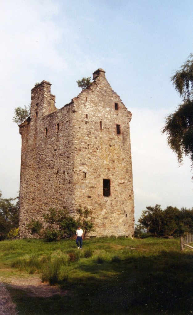
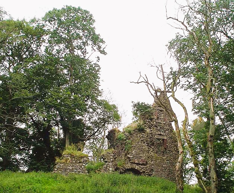
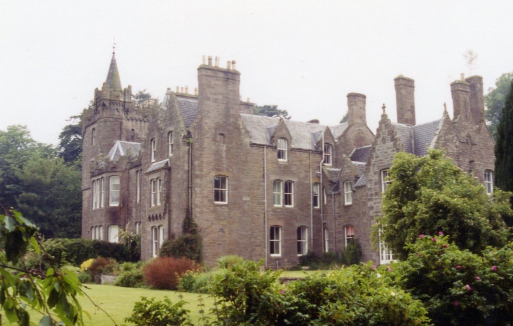
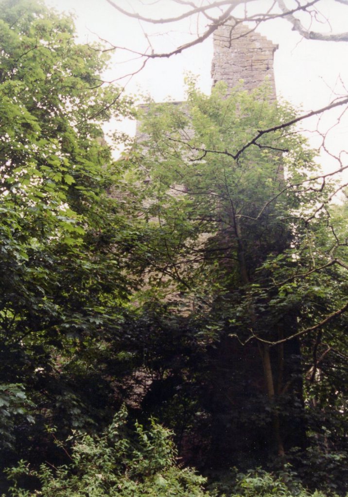
Pictured above, our next stop was the small hamlet of Finavon, 35 km northwest of Arbroath and in the center of the County of Angus. Lying within the fertile Vale of Strathmore, Finavon was surrounded by glorious open farmland and stunning countryside. Pictured below, Finavon comprised of a castle and a country house; (the ruined 14th century castle was found just to the east of the 19th century country house). The castle was built by the Lindsay Earls of Crawford on the family estate that they had owned since 1375.
We found the Finavon Castle in a forest on the River South Esk, about 0.4 km south of the Milton of Finavon village and 8km to the north-east of Forfar in Angus, Scotland. It was about 130m east of the Finavon House.

The estate was the property of the “Lindsay: Earls of Crawford”, from 1375, who built the now-ruined castle, (pictured below). David Lindsay, 10th Earl of Crawford, married Margaret, the daughter of Cardinal David Beaton, at Finavon in 1546.
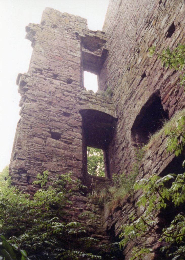
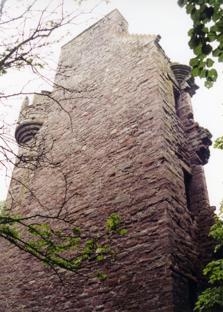
Pictured above, the Finavon Castle was an L-plan tower-house of five stories, with a garret and a courtyard. The tower was visible in 2001 and dates from about 1600. Excavations have revealed that the tower is an adjunct tacked onto the north-east corner of a much older, more extensive structure.
In 2001, it no longer looked like an L plan tower house as the west wing had been demolished to foundation level. Three walls of the main block still stood five stories high. On the northeast angle one could see the remains of a corbelled angle tower with double shot-holes. The remnants of a courtyard could be discerned by portions of walling, including a fragment with shot-holes running north.
The old castle was replaced by the country house, built in 1856. The Finavon Doocot, which is maintained by the National Trust for Scotland is located across the A90 trunk road to the northwest.

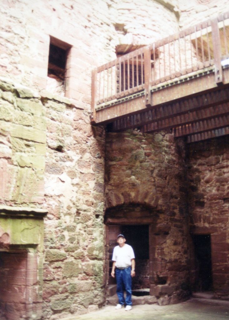
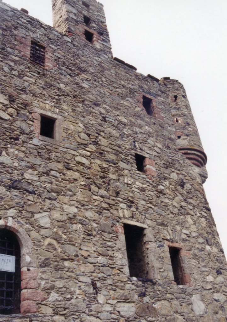
Pictured above, our next Lindsay location to explore was 21 km northeast of Finavon at the Edzell Castle. It was located close to Edzell, and was around 8 km north of Brechin, in Angus, Scotland. We found it near the head of the North Esk River and practically on the Highland Boundary Fault, that separates the Grampian Highlands and the Lowlands of Scotland.
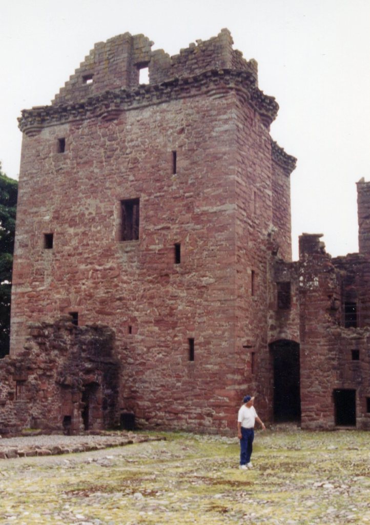
Pictured above, the Edzell Castle was started around 1520 by David Lindsay, 9th Earl of Crawford, and expanded by his son, Sir David Lindsay, Lord Edzell, who also laid out the garden in 1604.
In 1358 the Lindsay family married into the Stirling family, (Sir Alexander de Lindsay), and the Edzell area became a Lindsay possession. David Lindsay, the 1st Earl of Crawford, tore down the timber buildings around the Edzell area and erected a new stone castle. Over the ensuing centuries, the Lindsay’s transformed Edzel into a comfortable fortified residence suitable for one of Scotland’s leading families.

Pictured above, the four-story tower house was named the Stirling Tower after the original lords of Edzell, the Stirlings of Glenesk. It was 16m high, and measured 13m by 10m on plan. The walls were over 2m thick at the basement, narrowing to 1.5m on the first floor. The tower house was entered from the north, via a door protected by “inverted keyhole” shaped gun holes. A slot adjacent to the door would have held a draw-bar, to reinforce the entry, and several mason’s marks remained around the door.
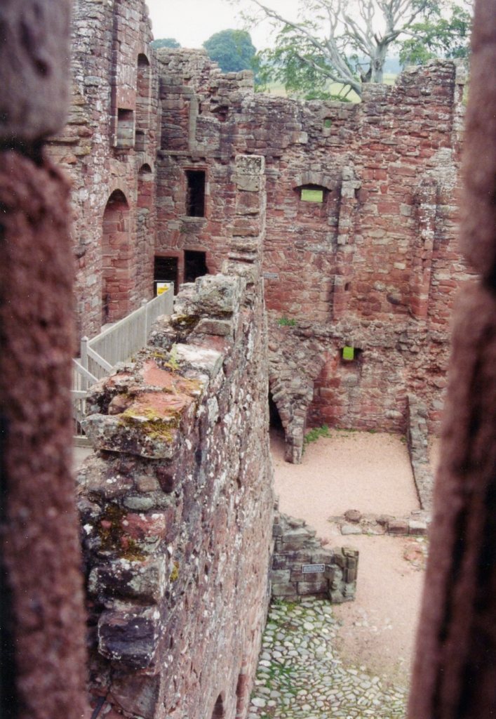
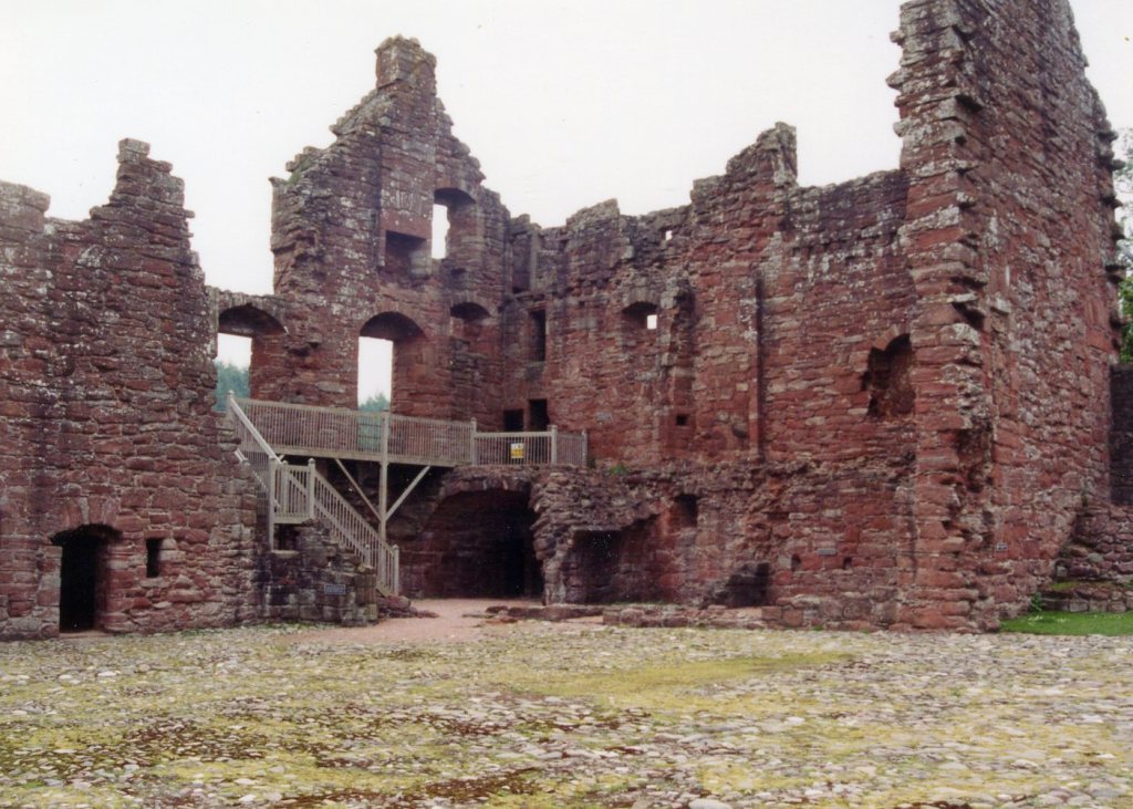
A broad main spiral stair led up to three further stories of private chambers, before reaching a cap-house, (a small rooftop chamber giving access to a parapet walk). The two-story west range contained the main entrance, which entered the courtyard via an arched passage.
In addition to extending the castle, Sir David Lindsay also created Edzell’s most unusual feature, the walled garden, or “Pleasaunce”. The garden would have provided a retreat from the castle, and was intended to delight, entertain, and instruct Sir David’s distinguished guests. It was started around 1604, and shows signs of being hastily completed at his death in 1610.
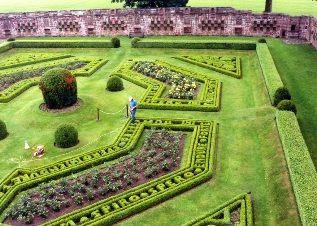
Pictured above, the walled garden was a rectangular enclosure some 52m north to south, and 43.5m east to west, surrounded by a 3.6m high wall. The north wall was part of the castle courtyard, but the remaining three were intricately decorated. The stone walls were decorated with beautifully carved, though worn, panels depicting the cardinal virtues, seven deadly sins, the liberal arts, and the planetary deities. The floral arrangements were designed to depict heraldic devices associated with the Lindsay family. The hedges and flowers spelled out two mottoes used by the Lindsay family, ‘Dom spiro spero‘ (while I breathe, I hope), and Endure Forte (endure strongly).
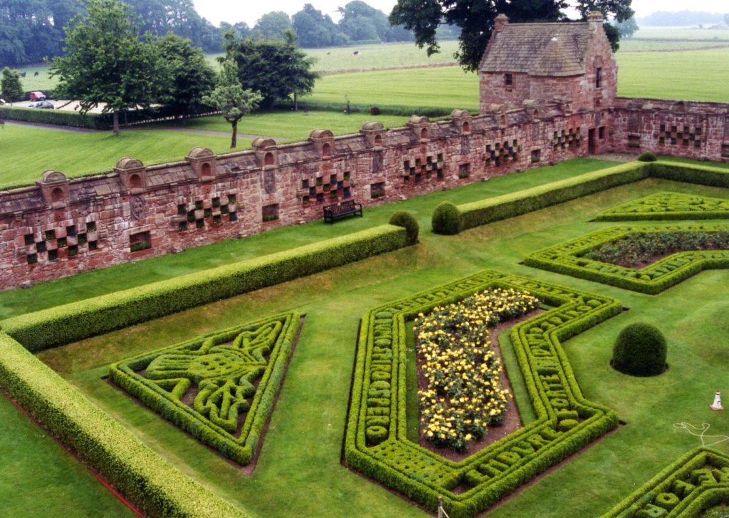
To complement the garden, a bath house and summer house were constructed at the corners of the garden furthest from the castle. The bath house was ruined, but the two-story summer house survived intact. It comprised a groin-vaulted lower room, with an upper chamber, containing the only surviving example of the castle’s carved-oak wall paneling.
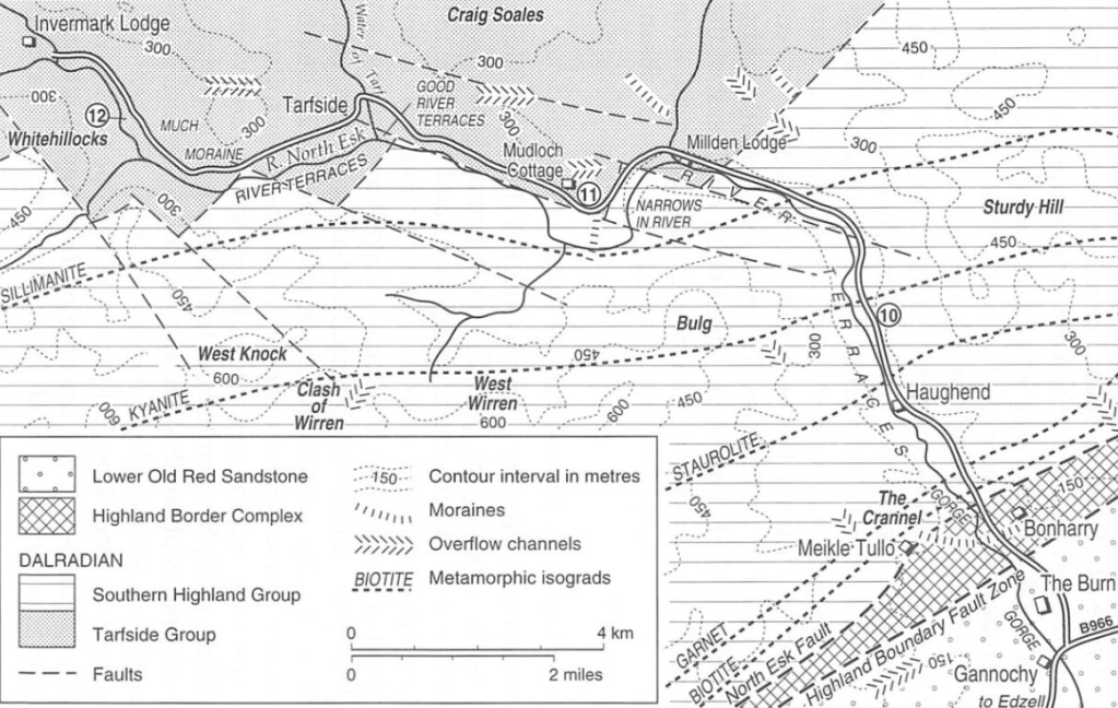
After leaving the “Edzell Castle” we drove north to the “The Burn” and continued into the Gorge for the North Esk River, (pictured below). This caused us to cross the Highland Boundary Fault Zone, into the spectacular Grampian Central Highlands. Our destination was the Invernmark Castle, west of Loch Lee. Much of the area around Edzell Castle contained sedimentary rocks of the Dalradian Supergroup, (Cambrian to Ordovician age). Once we crossed the Highland Boundary Fault Zone, we entered into a canyon with rocks that were metamorphized by the Grampian Orogeny of 490-475 million years ago.
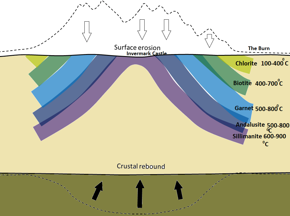
Identical to the Loch Lomond area, the Scottish Highlands were regionally metamorphosed during the Grampian Orogeny (around 470-430 Ma), when the two small continental-blocks of Avalonia (England) and Baltica (Scandinavia) was pushed up against the existing eastern margin of Laurentia. As shown in the image above, clastic sedimentary rocks of the Dalradian Supergroup, within this terrane were variably metamorphosed, with the strongest metamorphism in the northwest (the sillimanite zone), and progressively weaker metamorphism toward the east and south. The rocks of the sillimanite zone were likely heated to over 800°C, and therefore must have buried to depths between 20 and 25 kilometers. The surrounding lower-grade rocks were not buried as deep, and the rocks within the peripheral chlorite zone were likely not buried to more than about 5 kilometers. The Grampian Mountains were eventually eroded (over tens of millions of years), allowing the crust to rebound upward, thus exposing the metamorphic rock to the surface, as we drove up the North Esk Gorge.
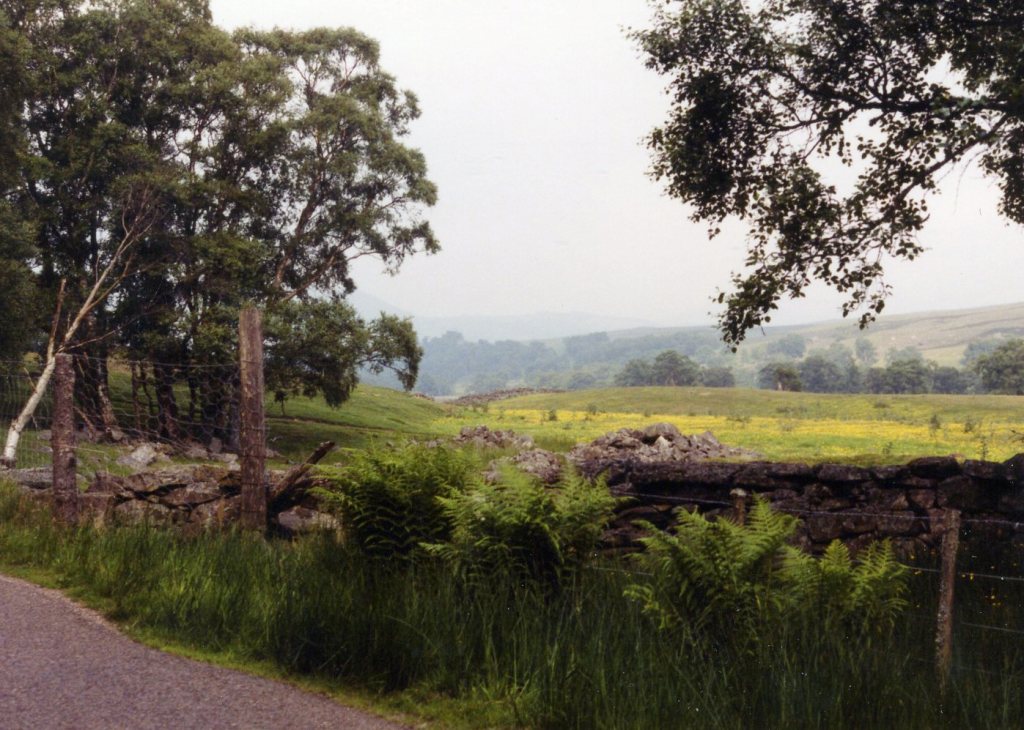
Pictured below, the Invermark Castle stood beside the North Esk River in a picturesque location near the eastern end of Loch Lee. The location defended the southern end of the pass from Deeside, at the point where Glen Mark and Glen Lee join to form Glen Esk, (imaged below). {An interesting side note: the road up the North Esk River Gorge was slippery due to the blood of great number of Cottontail Rabbits killed on the road in June 2001}.

The Invermark Castle was built around 1526 by the Lindsay family, making use of an existing 14th century keep. It was here that David Lindsay, 9th Earl of Crawford died in 1558. The present castle was built in the 16th century, and heightened in the early 17th century. The castle was abandoned in 1803.
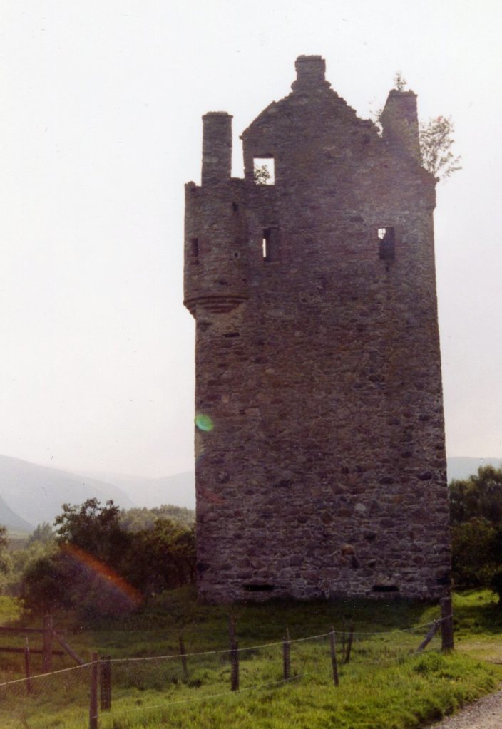
Pictured above, the Invermark Castle was neither as large nor as impressive as the Lindsays’ main residence of the Edzell Castle, but it is still an impressive fortified tower, rising 21.6m high, on a rectangular plan measuring 12.6m long by 9m across. The 16th-century castle was a three-storey structure, having a corbelled parapet and parapet walk. The additions were another story and a garret, and a two-story angle-tower. The castle walls had rounded corners. Two massive chimney-stacks had window-openings giving the garret light.
The entrance, at first floor level, was apparently reached by a movable timber bridge or stair. The entrance, a rounded arch, which still had an iron yett, led to the hall, to which a small room is attached. A wheel stair was the only access to the vaulted basement. The entrance to the castle was barred and well above ground level, making the interior virtually inaccessible to us as visitors.