Kaibab Trail, AZ 2009
On October 1st, 2009; I had decided to hike from Rim-to-Rim of the Grand Canyon in Arizona. The best route for this, is to take the Kaibab Trail from the North Rim, (or North Kaibab Trail) to the South Rim,(South Kaibab Trail) of the Grand Canyon. My hiking buddy was Dave Fillerup. This epic hike was about 34 km and involved steep down and up trails. We had to have La Rue Fillerup, (Dave’s wife), drive around to the South Rim to Pick us up at the end of the trek. My plan was to trek all day from the North Kaibab Trailhead to Phantom Ranch, rest and then start the hike to the South Kaibab Trailhead as the sun goes down. I didn’t expect to complete the trek, until 2 o-clock in the morning of the next day under the full moon.
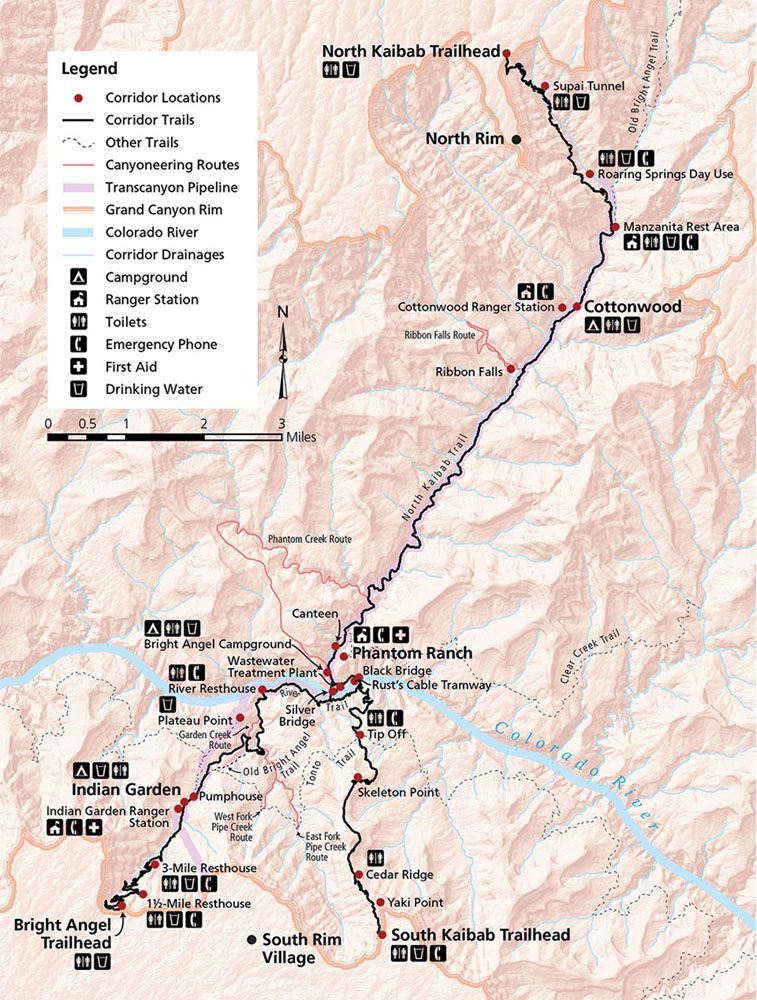
To reach the North Kaibab Trailhead, we drove to Page, Arizona from Salt Lake City on US 89. From S. Lake Powell Blvd. and US 89 in Page, AZ, we continued southwest on US 89. In 37 km, we turned right onto US 89 ALT. Then in 89 km, we turned left onto AZ 67/North Rim Pkwy. Lastly, we drove the final 57 km from Jacob Lake to the trailhead parking.
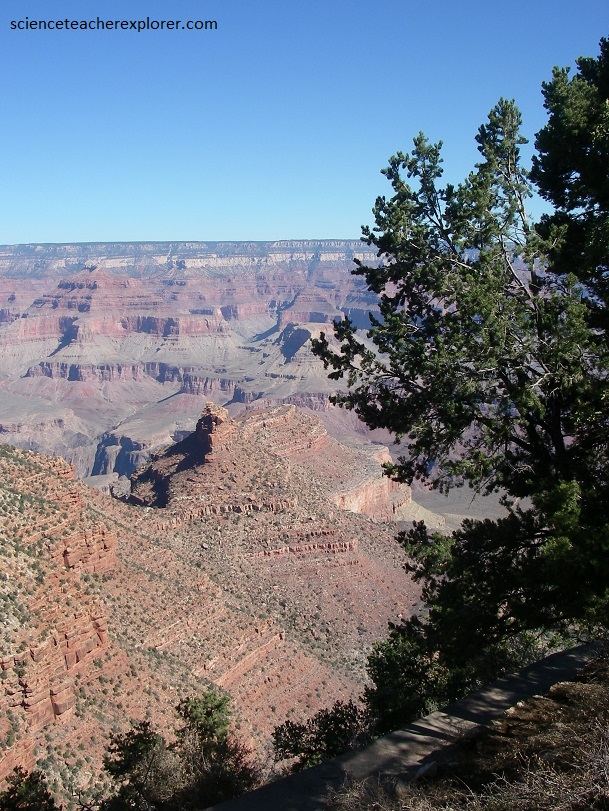
The Grand Canyon in Arizona, USA is simply one of the world’s greatest natural wonders. Hiking into and out of it is a unique experience by far. The geology is immediately apparent: a sedimentary cross-section like no other, readily available for study. This is the ultimate “hike through time”. It’s estimated that each step averages a 20,000 year leap through history.
Around 17 million years ago, pressures deep within the Earth uplifted the land mass known today as the Colorado Plateau. this rising of the plateau, combined with five million years of erosion, created one of the world’s deepest gorges, producing the breathtaking natural spectacle we see today and pictured below.
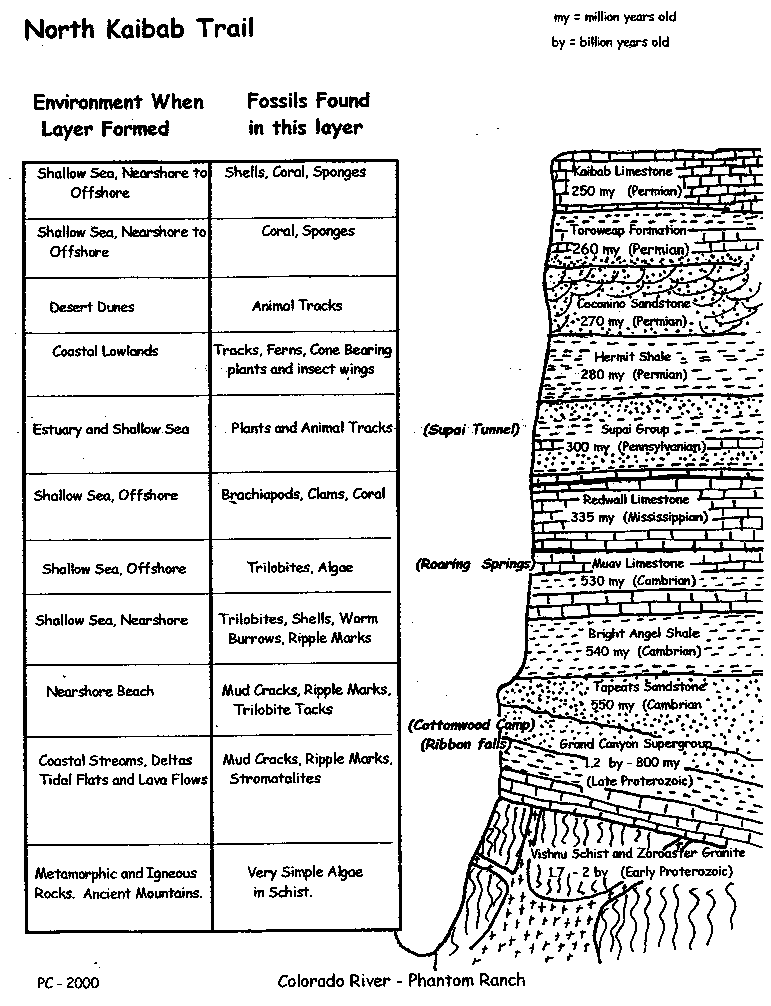
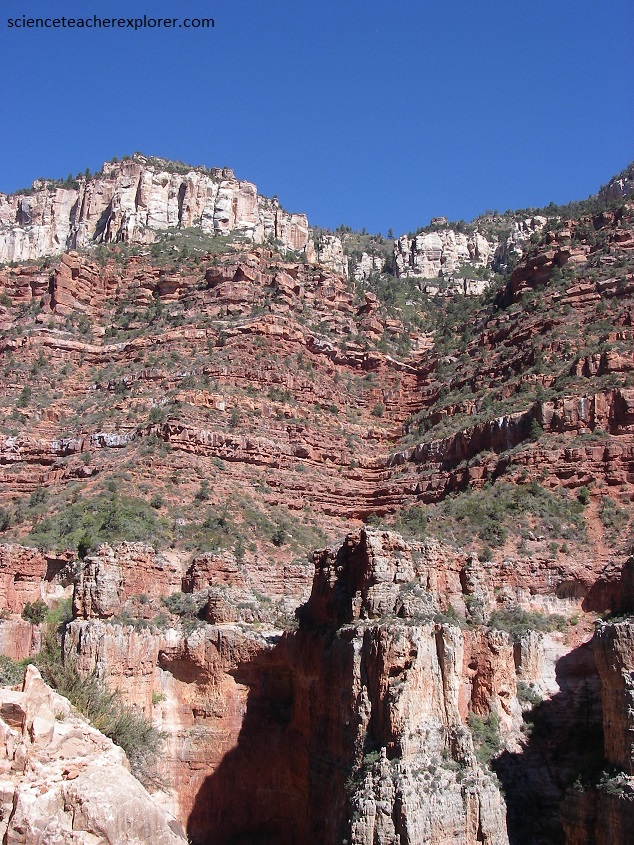
The Grand Canyon is about 1.6 km deep and 15 kilometers wide, and it runs for a staggering 450 km across two states. It’s striped walls change color with the passing day, (silver-gold in the morning, muted browns at midday, deep crimson at sunset, and a cool indigo in moonlight). So we were in for a visual treat. Pictured above on the rim, the Kaibab Formation averages about 250 million years old and forms the surface of the Kaibab and Coconino Plateaus. It is composed primarily of a sandy limestone with a layer of sandstone below it. In some places sandstone and shale also exists as its upper layer. The color ranges from cream to a greyish-white.
Pictured above, below the Kaibab Formation is the Toroweap Formation layer that averages about 255 million years old and is composed of pretty much the same material as the Kaibab Limestone above. It is darker in color, ranging from yellow to grey. Below that, is the Coconino Sandstone layer that averages about 260 million years old and is composed of pure quartz sand, which are basically petrified sand dunes. Wedge-shaped cross bedding can be seen where traverse-type dunes have been petrified. The color of this layer ranges from white to cream colored. Lastly seen in the photo is the “Hermit Shale layer that averages about 265 million years old and is composed of soft, easily eroded shales which have formed a slope. As the shales erode they undermine the layers sandstone and limestone layers above which causes huge blocks to fall off and into the lower reaches of the Canyon. Many of these blocks end up in the side drainages and down on the Tonto Platform. The color of this layer is a deep, rust-colored red and found at the bottom of the picture.
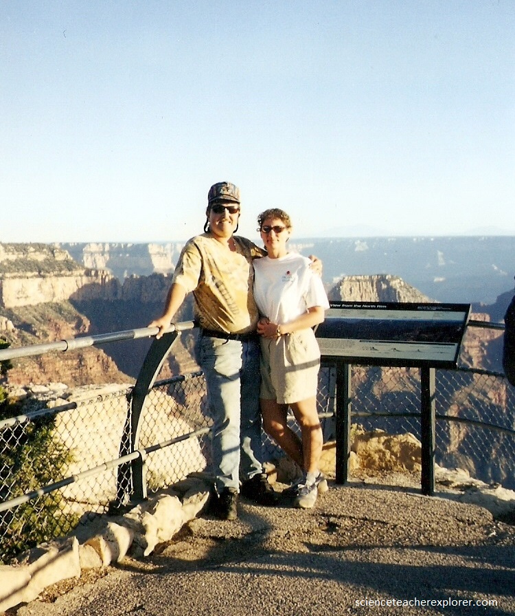
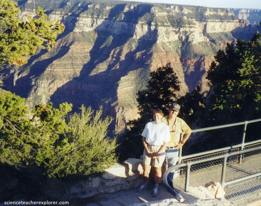
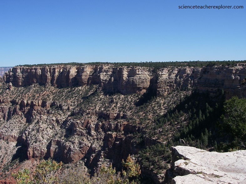
Our first view of the Grand Canyon from the North Rim is astonishing, (multi-colored rock towers, buttresses, and terraces drop into the hidden depths, then rise again in an even greater tangle to the dark edge of the South Rim, a long, long way away), to either side the twisting chasm stretches out to the hazy horizon, (pictured below).
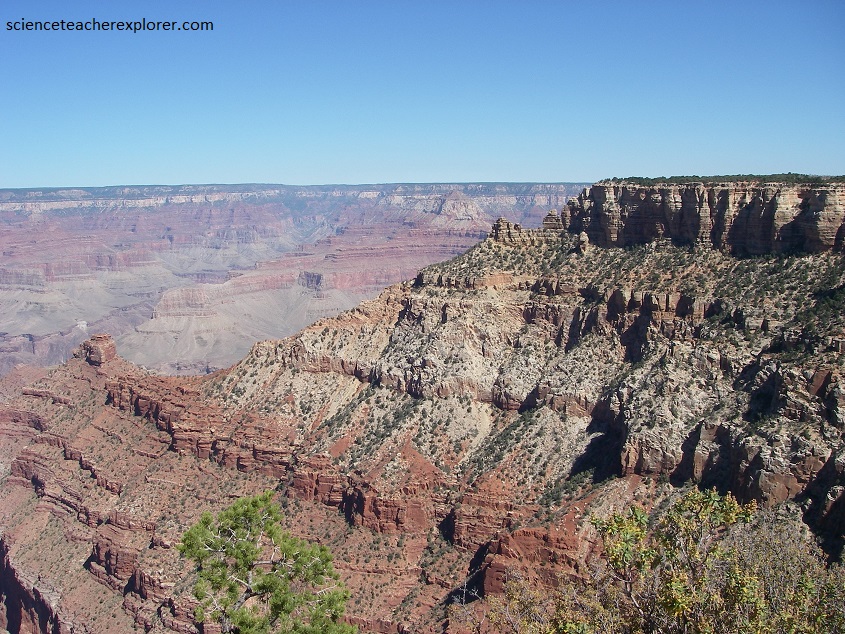
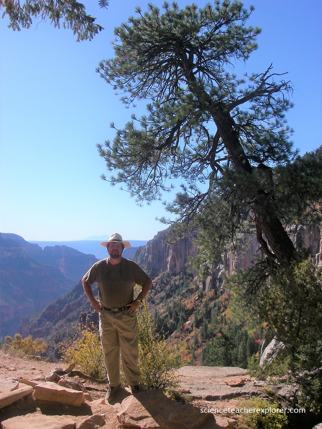
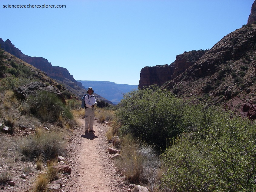
Pictured above, from the Kaibab Plateau, (kaibab is a Piute word that means mountain lying down), at the Coconino Overlook, we could look down Roaring-Springs Canyon to its junction with Bright-Angel Canyon. These were the last twists and turns of the trail through the forest of pine, spruce, fir, and aspen. As the trail descended, trees started to disappear and the environment gradually changed from a cool mountain-forest to a desert. Far beyond lies the destination of the South Rim.
Pictured above, the trail eventually passed through Supai Formation. The Supai Formation layer averages about 285 million years old and is composed primarily of shale that is intermixed with some small amounts of limestone and capped by sandstone. The limestone features become more and more prominent in the western regions of the Canyon, leading one to believe that that region was more marine. The eastern portions were probably a muddy river delta that fed into an ancient sea. The color of this layer varied from red for the shale to tan for the sandstone caps.
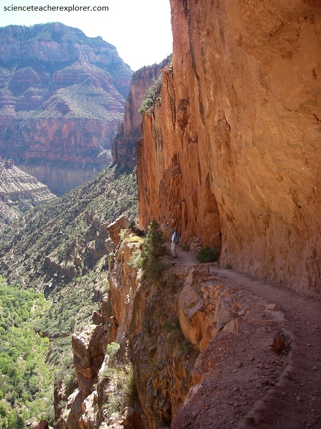
Pictured above the trail passes through the Redwall Limestone. The Redwall Limestone layer averages about 335 million years old and is composed of marine limestones and dolomites. This is probably the most prominent rock layer in the Canyon as it usually forms a sheer cliff ranging from 400-500 feet in height, which has become a natural barrier between the upper and lower regions of the Canyon. The only way though this barrier is in areas where the rock has faulted and broken apart to form a slope which can be climbed upon. The deep reddish color of this layer is caused by iron oxides leaching out of the layers above it and staining its outward face. Behind the reddish face the rock is a dark brownish color.
Eventually, the trail weaved it’s way down through the Redwall Cliffs, and reached the creek, where it crossed byway, of the Redwall Bridge. From there, the trail started to drop steeply, switch-backing downward above the Roaring-Springs Creek, while running along the base of the Redwall Cliffs.
After the Redwall Bridge, we entered the Mauv Limestone Formation. The Mauv Limestone layer averages about 515 million years old and is composed primarily of limestone that is separated by beds of sandstone and shale. The Mauv Limestone layer is much thicker in the western areas of the Canyon than it is in the east. Its color is grey with an occasional trilobite fossil.
The sound of water rushing out of the springs at the base of Roaring Springs cliffs grew louder as we approached. Pictured below, Roaring Springs is the source of water for both North and South Rim. We passed a pump-house soon before the trail turns South into Bright Angel Canyon.
The Roaring-Springs Canyon widened as we left the huge jutting ramparts of the Roaring-Springs cliffs and the falls on our left. Eventually, we reached the junction, where the Kaibab trail turns right down Bright-Angel Canyon. The original Kaibab Trail, (now known as the Old Kaibab Trail), first traveled in 1902, continued down Bright Angel Canyon from the North Rim on the left of the confluence. This trail is not maintained. At the junction, we continued south for 3 km, slowly dropping beside Bright Angel Creek to Cottonwood Campground. Looking forward, we had an excellent view right down the Bright-Angel Creek Valley and then back up to the South Rim, (pictured below). From the junction to Cottonwood Campground, we passed through the Bright Angel Shale. The Bright-Angel Shale layer averages about 530 million years old and is composed primarily of mudstone shale. It is also interbedded with small sections of sandstone and sandy limestone. The valley floor is much wider in this portion of the Canyon where the Bright Angel Shale contains less sand and is more easily eroded. The color of this layer varied with its composition but it is mostly various shades of green with some grey, brown and tan thrown in here and there.
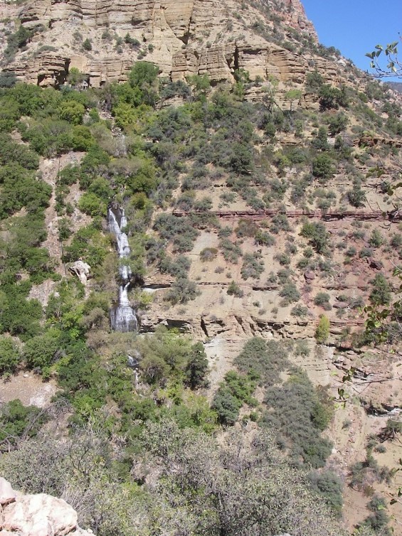
After taking a break at Cottonwood Campground, we trekked another 1.5 km, where a cairned trail branched off to Ribbon Falls, (a highly recommended diversion). Pictured below, the falls made a delicate tracery over a bright green, moss-covered cone of soft travertine rock below the cascade, built up by the time-rich waters of Ribbon Creek. Pictured below, it was possible to climb the side of the falls and pass behind them on a wide terrace where the upper fall tumbles into a small pool of the lip of the cone.
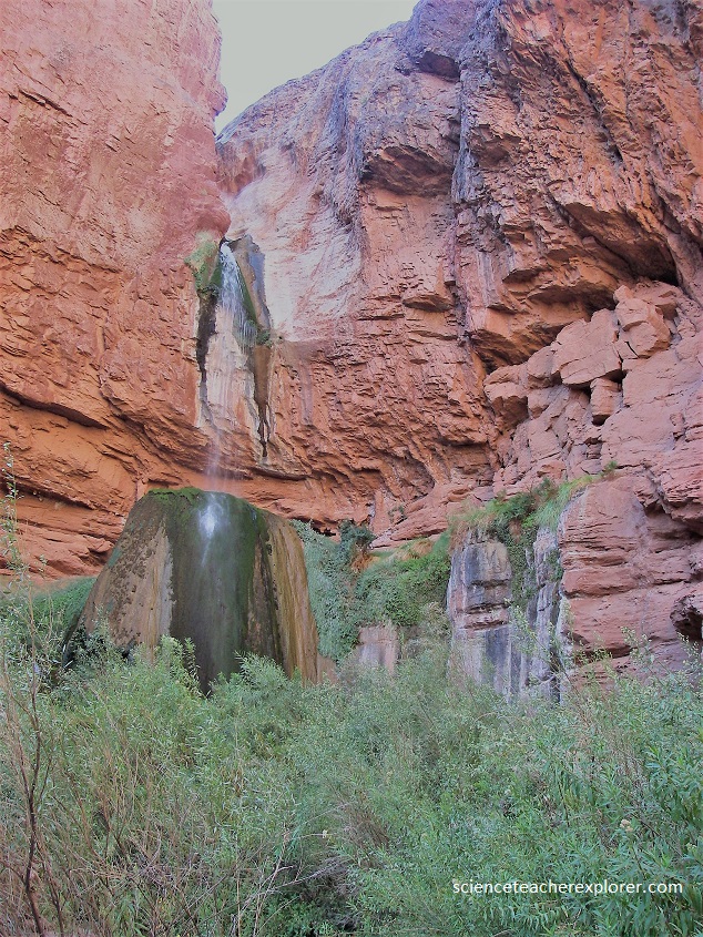
Above the Ribbon Falls, the rock is part of the Tapeats Sandstone. The Tapeats Sandstone layer averages about 545 million years old and is composed of medium-grained and coarse-grained sandstone. Ripple marks formed by ocean waves of an early Cambrian sea are common in the upper part of the layer. The Tapeats is similar to the Redwall in that it forms a barrier between upper and lower reaches of the Canyon that can only be traversed where a fault has caused its collapse. The color of this layer is dark brown, (pictured above). These falls are found at the bottom of the Tapeats Sandstone and at the “Great Unconformity”. This non-layer indicates an age in which no sediments can be found. It is indicative of a time when an advancing sea eroded away the sediments that should be here.
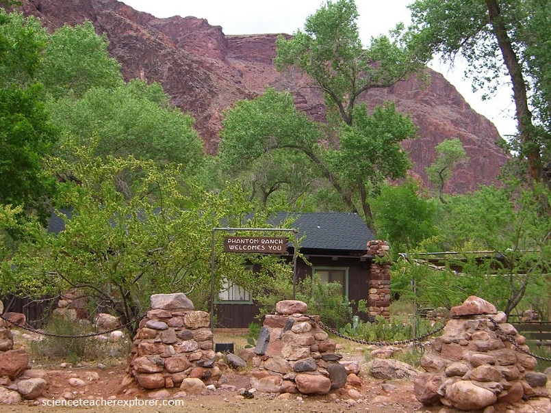
Trekking down Bright-Angel Canyon for 10 km from Ribbon Falls to Phantom Ranch, the trail drops gently beside a gurgling creek. There were superb views of red and yellow rock buttes rising high above. Lush vegetation lined the creek, in stark contrast to the sparse desert plants not far away. Much of the rock that we trekked over were Pre-Cambrian, (1.1 billion years old) and are found below the “Great Unconformity” of the Cambrian time. Just before we got to Phantom Ranch, the Kaibab trail wound through a narrow gorge, 370m deep, called “The Box”, where the trail was built by blasting away the Pre-Cambrian Igneous-Rock to avoid myriad creek fords. Pictured above, Phantom Ranch was set among the leafy cottonwood trees beside the sparkling waters of the Bright-Angel Creek, (a welcome shady spot after the harsh brightness of the desert).
After a major rest at Phantom Ranch, we continued down the Bright Angel Creek, (the name was given by John Wesley Powell, who stopped here during the first descent of the “Grand Canyon” in 1869), to the Colorado River.
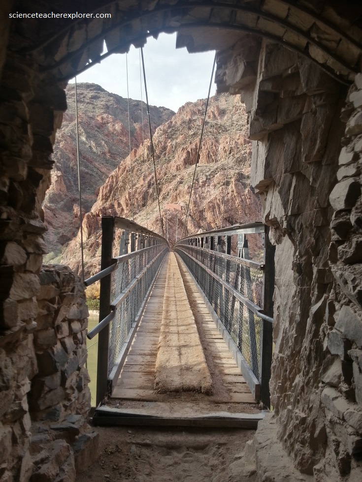
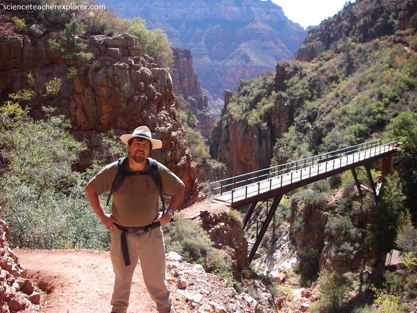
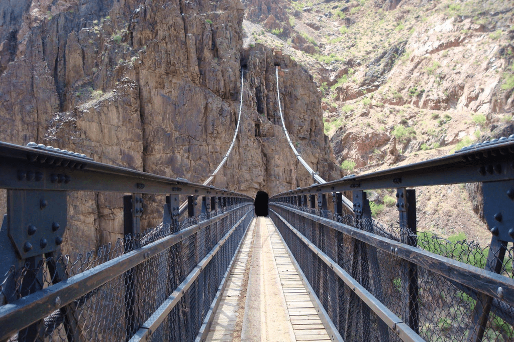
At the river, (late in the evening), we crossed the Kaibab Suspension Bridge, one of only two bridges across the Grand Canyon. This part of the trail was used primarily by mule trains taking supplies and guests to Phantom Ranch. Most other trekkers took the longer, less steep Bright-Angel Trail.
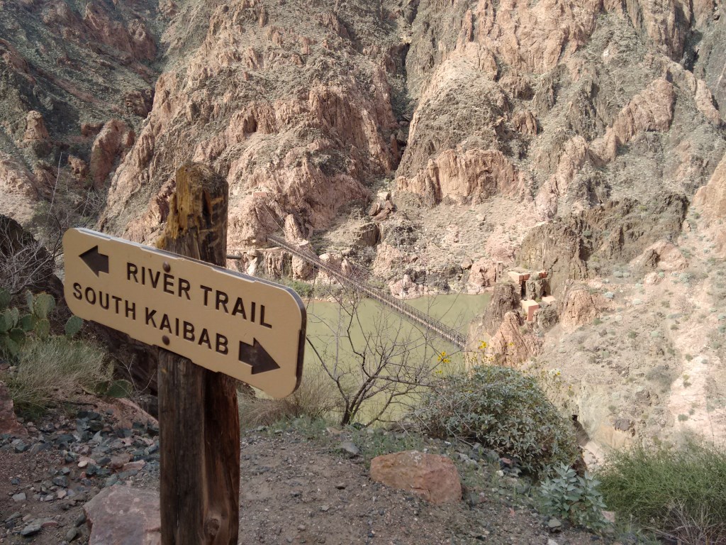
Pictured above, is the Tipoff point, the abrupt ascent from the Colorado River is located. For us, it was getting dark and we would finish our trek to the South Rim in the dark. When it finally got dark, we were below the Redwall Formation, where we reached the Tonto Platform, (a gently sloping shelf about one third of the way up the canyon). The Tonto Trail ran along the shelf, providing a link between rim to river trails. The South Kaibab Trail, built in 1924, is one of the few trails out of the canyon that followed ridges rather than side canyons, which means there were excellent views during the Full Moon of night.
Overall, we started in the cool forest of the North Rim, then descended through steep tiers of rock to the hot desert below, crossed the Colorado River, then climbed back to the flatlands above. All in one day. In doing so, we went through all the life zones from Mexico to Canada.
