W. Uinta Mtns., UT
In the late 1990s and 2000, I spent a time exploring and trekking the Western Uinta Mountains of Utah.
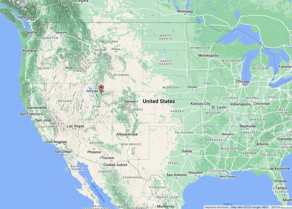
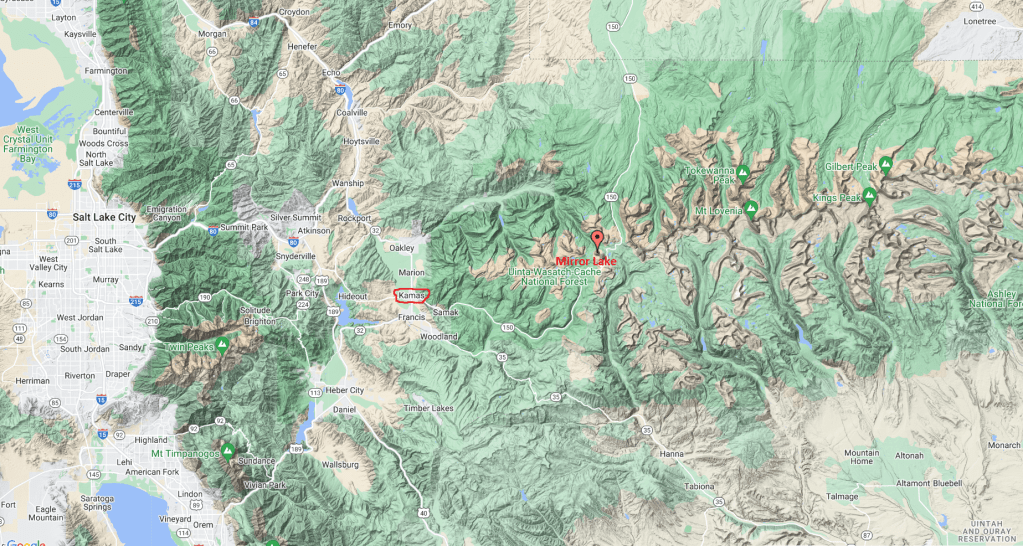
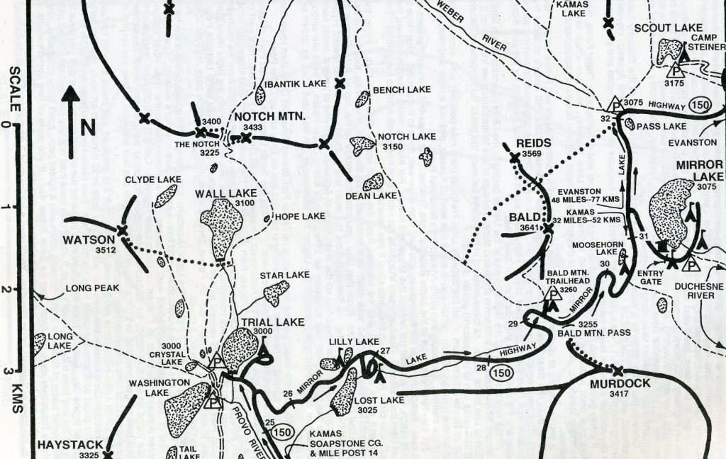
Most of my trekking-destinations in this area were peak-bagging related. To gain access to this area, I drove east 71 km on I-80 from Salt Lake City to Kamas, Utah. Then from Kamas, I drove an additional 51 km on Hwy 150 to the Mirror Lake turnoff where I had a base-camp throughout the those years.
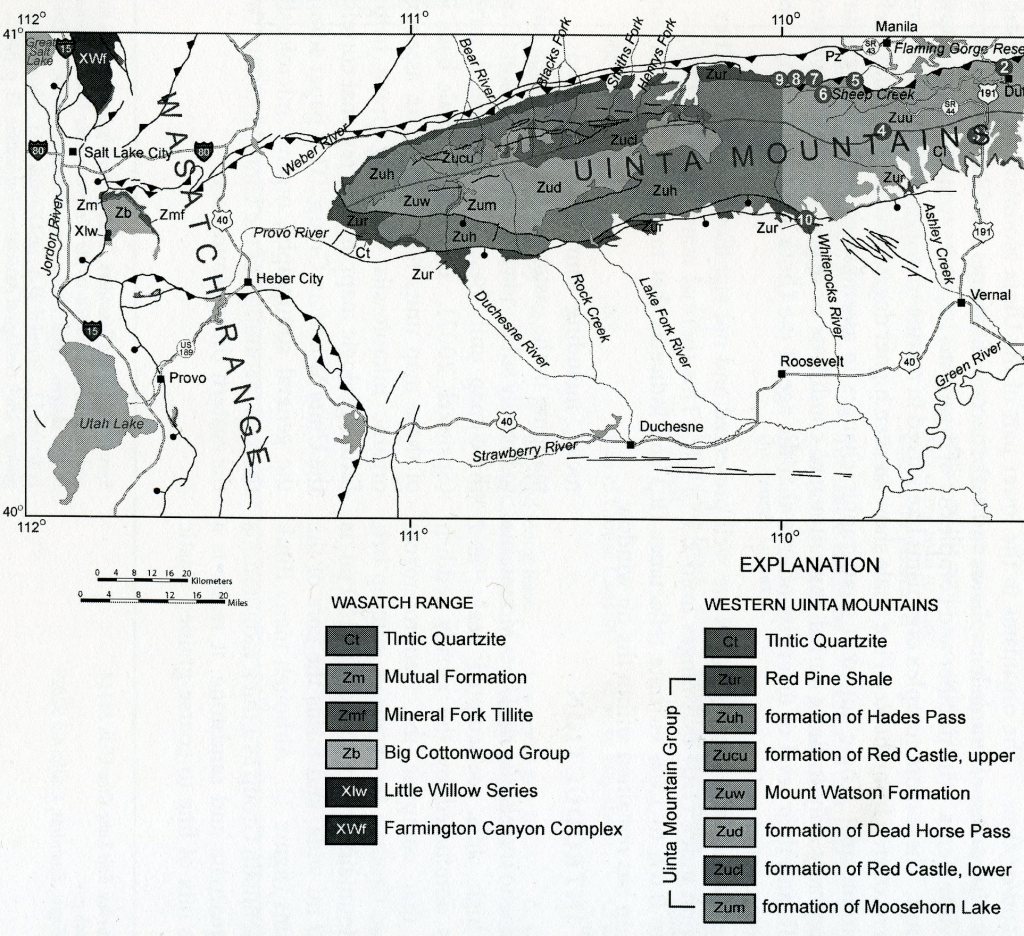
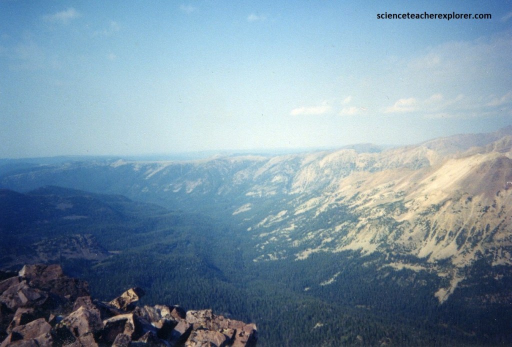
The Uinta Mountains have an overall length of about 242 km and a mean width of about 56 km. The Uinta Mountains have been carved from an immense anticlinal uplift that seems to bulge in the west and again in the east like a peanut. Down through countless centuries, the fold has been attacked and dissected by the elements, and in its present eroded form, it is largely responsible for the overall character of the range, (imaged below).
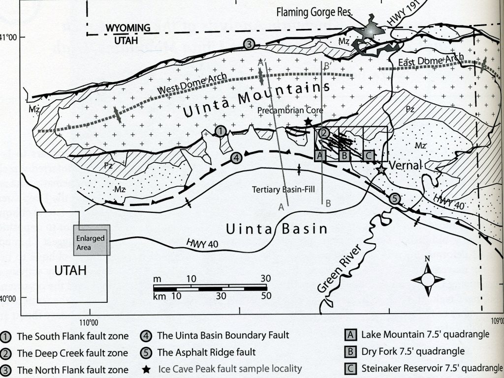
Imaged above, the uplift of the Uinta Range dates to the Laramide orogeny, about 70 to 50 million years ago, when compressive forces produced high-angle reverse faults on both north and south sides of the present mountain range, (north & south flank zones). The east-west orientation of the Uintas is different compared to most of the ranges of the Rocky Mountains; it may relate to changing stress patterns and rotation of the Colorado Plateau. The Green River used to flow into the Mississippi River to the Gulf of Mexico, but changed to the Colorado River by going through the Uintas in ways not fully understood today.
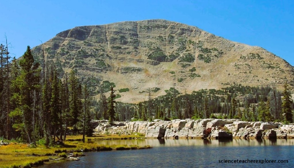
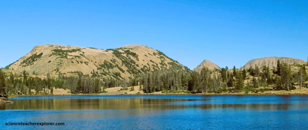
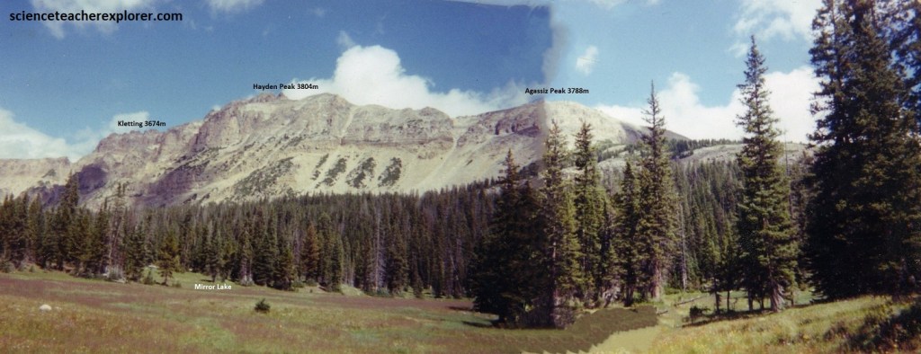
Pictured above, the timberline in the Uinta Mountains is at an altitude of about 3,667m. All the high peaks and ridges above that altitude, from Bald Mountain on the west to Marsh Peak on the east, are in the west half of the range. The range, in fact, can be divided topographically as well as structually into west and east counterparts, referred to as the Western and Eastern Uintah Mountains. The often-used name “High Uintas” is synonymous with the Western Uinta Mountains. [A broad low pass north of Vernal, Utah, drained by Cart Creek on the north and by a tributary of Brush Creek on the south, separates the two parts of the range]. In 1995, I spent a week trekking around the Mount Watson & Notch Peak region of the High Uintas, (imaged below). I also climbed Bald Mountain at that time.
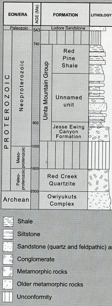
Pictured below, all the rocks making up the higher peaks in the Uintas belong to the pre-Uinta Mountain Group which is almost all quartzite, but with shale and slate intermingled. The age of this formation ranges from about 2.3 billion to one billion years of the Pre-Cambrian time. All lose material in between the peaks and the valley is Holocene or Recent (10,000 years ago to the present) glacier deposits.
The Uinta Mountain Group from oldest to youngest includes Uinta Mountain undivided quartz arenite, overlain by the Moosehorn Lake, Mount Watson, Hades Peak, and Red Shale formations. The flanks of the east-west trending Uinta Mountains contain a sequence of Paleozoic and Mesozoic strata ranging from the Cambrian Lodore Formation to the Cretaceous Mancos Shale, all of which have been tilted during the uplift of the mountain range.
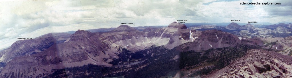
The Uinta Mountains contain meta-sedimentary rocks deposited in an intra-cratonic basin in southwest Laurentia during the time of the breakup of the supercontinent Rodinia, (imaged below).
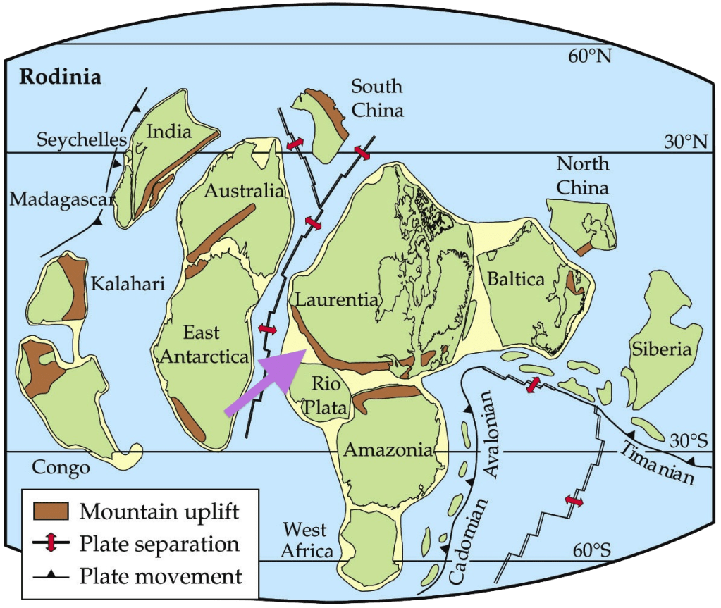
The marine and fluvial meta-sedimentary rocks of the Uinta Mountain Group, is the core of the Uinta Mountains that is 700-760 million years old and reaches thickness of 4.0 to 7.3 km. Most of the high peaks in the Western Uinta Mountains are outcrops of the Uinta Mountain Group. Many of these peaks are ringed with bands of cliffs, rising to form flat-shaped tops.
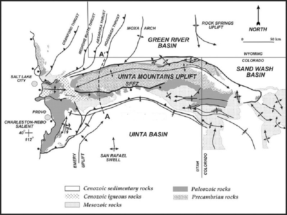
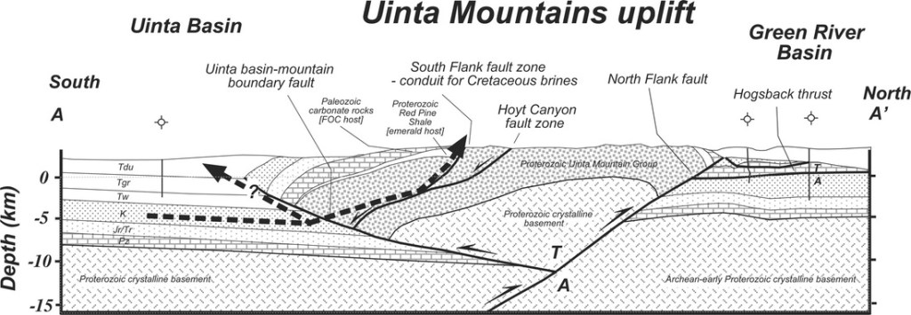
As mentioned, the Uinta Mountains are bounded to the north and south by reverse faults that meet below the range, on the north by the North Flank fault and on the south by the Uinta Basin boundary fault.
Pictured below, the backbone of the Western Uinta Mountains is a narrow sinuous ridge more than 97 km long and as much a one kilometer across, extending from Hayden Peak on the west to Leidy Peak on the east. This ridge stands near timberline to 4,000m above sea level. The crest is 300-700m higher. North and south from the main divide are many subsidiary spurs and ridges, most of them equally narrow, equally sinuous, and as high or higher than the main divide. There are 26 individual summits, including some subordinate peaks, that stand more than 4,330m above sea level; however, only nine of these are on the main divide.
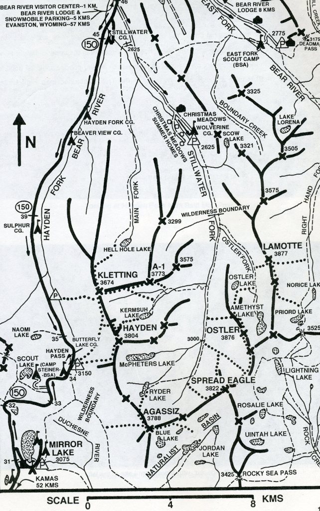
Pictured below, in the summer of 1996, I climbed Hayden, Kletting and A-1 peaks from the Hayden Pass parking lot. Near the crest of the Uinta Range, the summit ridges are mostly steep-sided. Exposed ledges of bedrock, mantled here and there by talus, are surmounted by little or not flat space at the ridgeline.
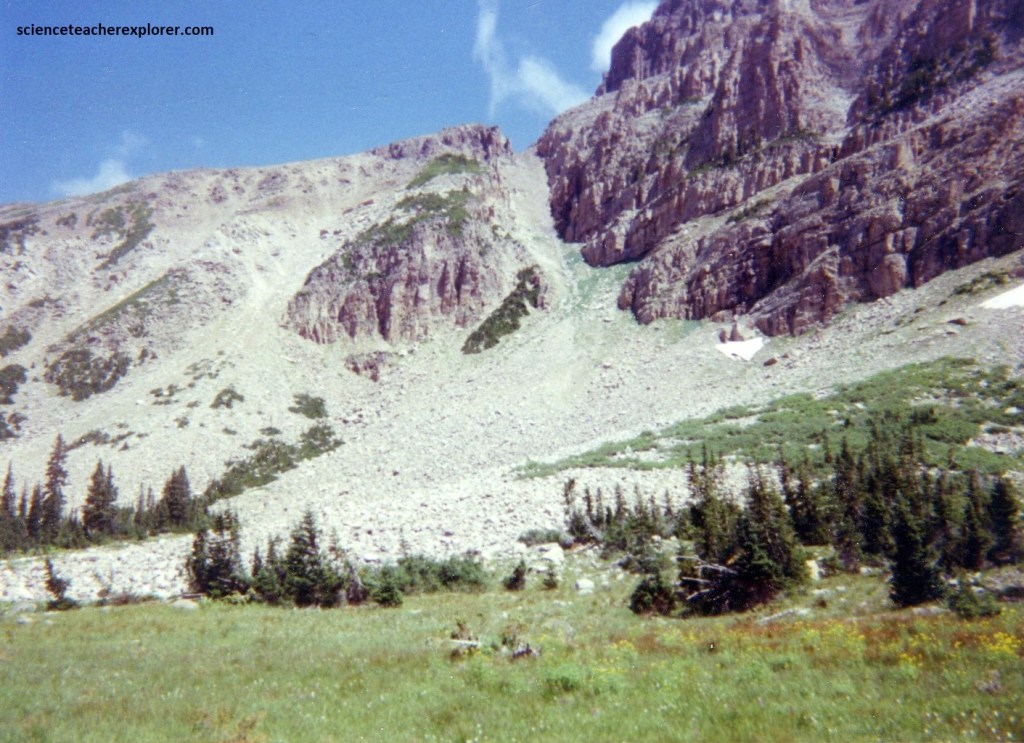
Subordinate ridges between canyons, on the other hand, commonly broaden away from the crest into loft plateaus 3,330-4,000m above sea level. These ridges, and wide places along the crest itself, are covered with loose angular rubble or “block field”, subjected since Tertiary time to the relentless attack of frost and water. Perhaps most of this rubble is a product of the past severe climate of the Pleistocene (Ice Age) Epoch, (10,000-2 million years ago). At that time, the valleys below were buried repeatedly under great accumulations of moving ice, which swept away all loose rock and redeposited it downstream. But the exposed ridges, standing high above the ice, were under almost continuous attack by frost. Many of times, I have fallen with my back-pack, crossing these rubble fields while climbing in the Uinta Mountains. It makes trekking in the Uintas a rather hazardous adventure.
The effect of the process of ice-erosion is to soften the sharp outlines left b the ice, (the aretes, headwalls, and cirque basins are all being modified by frost, snowmelt, gullying and wind). In the far future, the steep-sided ridgelines will eventually become mere rubble-covered mounds, buried in their own debris.
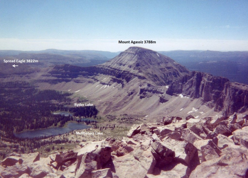
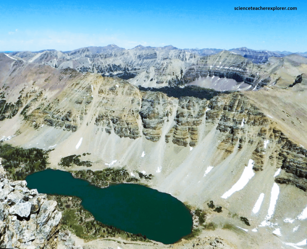
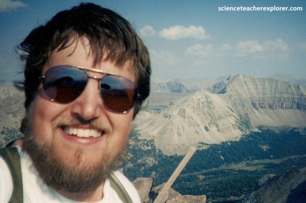
In 1997, I returned to climb Mount Agassiz from the Ryder Lake side, (picture above). To reach Ryder Lake, I continued north on Hwy. 150 from Mirror Lake to milepost 46, and turned south toward Christmas Meadows. At the southern end of that road are private summer homes, a campground and trailhead. From there I trekked up the Stillwater Fork trail 12 km to set up my base-camp. The Stillwater Fork is one of the many drainage basins of the Bear River. The main-crest summit-ridges of the Western Uintas form the watersheds of several major drainage basins. Water falling on the north flank drains to the Great Basin via the Weber and Bear Rivers, which empty into the Great Salt Lake, and to the Green River Basin via Blacks Fork of the Green, Smith Fork, Henrys Fork, Beaver Creek, Burnt Fork, Sheep Creek, and Carter Creek. The south flank is drained by the Provo, which flows to the Green River in the Uinta Basin, and by such tributaries of the Duchesne as Rock Creek, Lake Fork, Yellowstone Creek, the Uinta river, and the Whiterocks River. Ashley Creek and Brush Creek, near Vernal, flow independently to the Green River in the Uinta Basin.
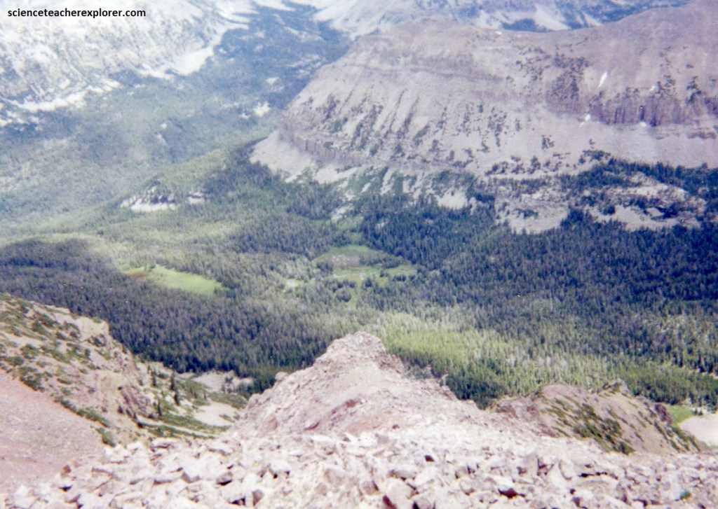
Pictured above, these streams head near the crest of the Uinta range in broad amphitheater-like basins, (cirques), scoured out by now-extinct Pleistocene glaciers. Lying near timberline, most of these basins are floored by glacially abraded bedrock mantled only in part by soil and vegetation. The basins contain hundreds of lakes and ponds, (some in hollows eroded from solid rock, others dammed by glacial moraines. Many lakes are arranged in stair-stepped fashion, one above another. [Stillwater Fork is an example]. In a setting of deep forests and alpine meadows the beauty of these lakes enhances the splendor of the Western Uinta Mountains.
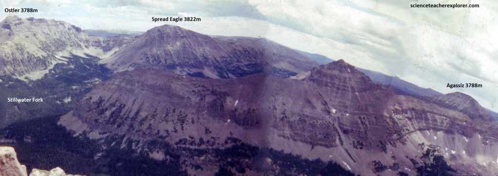
In 1998, I returned to Stillwater Fork Basin to climb Spread Eagle Mountain and Ostler Peak. This time, I approached Ostler Peak from Ostler Fork, (pictured below). This year was very windy. While calling my wife on a brick-cellular-phone, the wind picked up my pack and took it over the southern cliff-edge. I estimated that the northerly wind was going about 100 km/hr.. It took an extra day to retrieve it and walk around to my camp near Ostler Lake. Meanwhile, my gear inside the pack was entirely destroyed with my camera. I was lucky to retrieve this photo.
July through mid-September was the warmest and best season for me to trek the Western Uintas. Early in the season (July) the upper basins may be wet with snow. Mosquitos are also a problem in July. August has mosquitos too, but not as many as July. From mid-August to mid-September some streams dried up but finding water was not a problem on most trails. August did have very heavy thunderstorms. Throughout all the area above 3,330m elevation, it was usually cool to cold weather, especially at night. As mentioned already, the ridge tops were usually quite windy. Snow banks stayed on the highest peaks throughout the summer in wetter years, but were gone sometime in August in drier years.
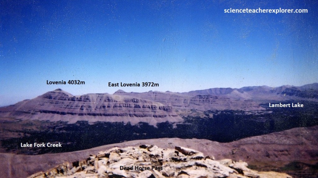
In 1999, I climbed Yard Peak, by way of the East Fork of the Bear River & through the Left Hand Fork. My Base-Camp was at Allsop Lake. My approach to Yard Peak was up to Alssop Pass and over to the main crest of Dead Horse Pass & then back to the south to Yard Peak. I was tempted to do Cathedral Peak, but I decided it was way too technical and dangerous for me. Another tempting climb nearby was Mount Beulah, but I never got around to it yet. Maybe in the future.
The Mountain Brush or Transition Zone covers the lower slopes of the Western Uintas from the base of the mountains to about 2,330m high on north facing slopes and 2,660m high on south facing slopes. Oaks, maples, mountain mahogany, sagebrush, pinion-pine, junipers, and ponderosa pines dominate this zone.
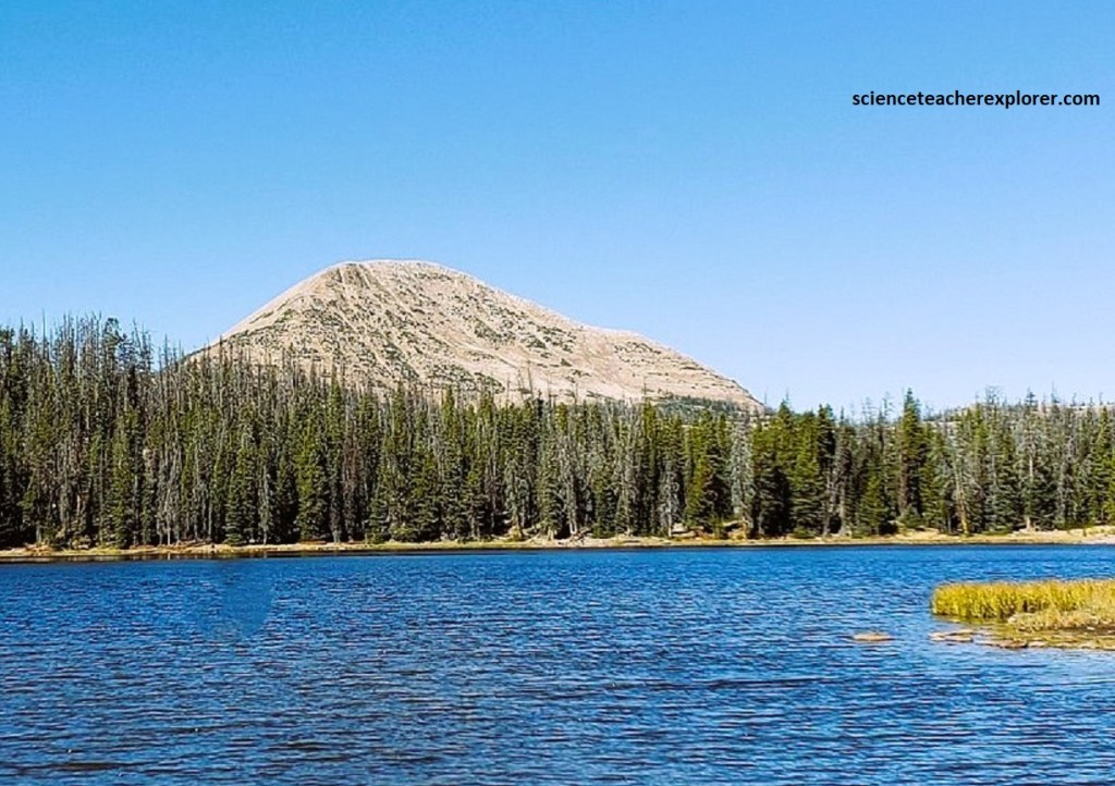
The Montane or Canadian zone covers the slopes of these mountains from 2,330 or 2,660m up to about 3,170m. Lodgepole pine was the most common tree found in this zone. Large stands of Douglas fir, white fir, blue spruce, and aspen are scattered throughout the zone, (pictured above).
The Subalpine or Hudsonian Zone covers a region from about 3,000m up to about 3,670m depending on the location. This cold region is dominated by Engleman spruce and subalpine fir. An occasional limber pine may also be found in this area. In the upper ramparts of this zone, the short growing season prevents the trees from reaching their full size. Marshlands and meadows are found throughout this zone. Most of the lakes in the Western Uintas are found in this zone, (pictured above).
The Alpine or Tundra Zone covers the region over about 3,370m. Snowstorms and freezing weather occur here throughout the year, even in summer. Lichens cover the rocks and wildflowers and small plants form a cushion throughout the meadow in this zone. Stunted conifers called krummholtz survive in sheltered areas of the lower region of this zone, (pictured above & below).
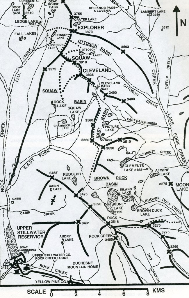
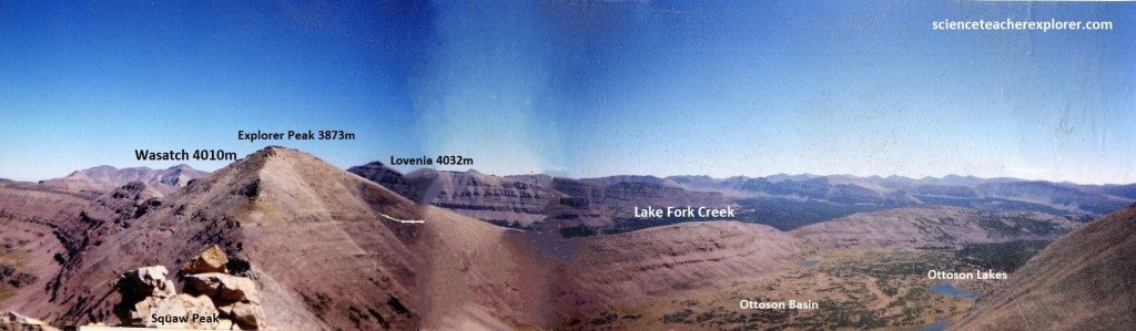
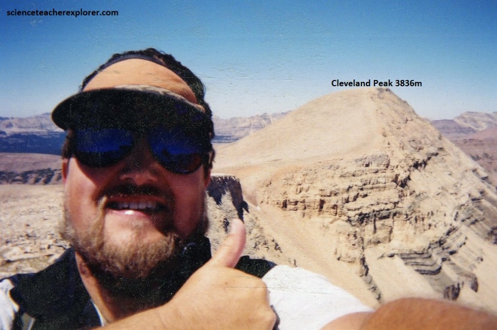
In the year 2000, I returned to the main crest of Dead Horse Pass to climb Cleveland, Squaw & Explorer Peaks. However, this time, I approached the Main Crest of the Western High Uintas from the south by camping a Moon Lake and trekking up the Lake Fork Creek trail to Ottoson Basin & Cleveland Pass. I drove to Moon Lake from Provo, Utah on Hwy 40 to Duchesne, Utah. I then turned onto Hwy 87 north to Mountain Home and continued north 19km to the Forest Boundary byway of Forest Road 131.
When visiting the Western Uintas, two animals I saw everywhere were chipmunks & squirrels. Other small rodents to inhabit these mountains in Mountain Brush and Montane Zones are mice, voles, muskrats, and gophers. Some of the larger rodents to inhabit these mountains in the Mountain Brush and Montane Zones are beaver and porcupines. Marmots and pikas inhabit the rocks in the Subalpine and Alpine Zones. As a matter of fact, I’ve seen pikas on the highest peaks of the Alpine Zone. Deer are found throughout these mountains up to the Subalpine Zone. A large population of elk is also found throughout this area. Moose inhabit this region in the Montane and Subalpine Zones, especially in the upper basins. I’ve seen these huge animals spend most of their time along the streams and in the wetlands of the upper basins. Even though I’ve never seen any: Black bear, cougars, bobcats, skunks, weasels, mountain goats and badgers have been reported by other trekkers. However, I’ve seen & heard a great number of Coyotes camping in the High Uintas.
Fishing is a common past-time and staple-diet for trekkers of the High Uintas. A Utah State Fishing License is required to fish anywhere in the Western Uintas. Fish that are found in the Western Uintas include arctic grayling, brook trout, brown trout, cutthroat trout, golden trout, and rainbow trout.
The Western Uintas have outstanding scenery that consists of forested canyons, large basins containing beautiful meadows and fishing lakes, and spectacular ridges and peaks all with wilderness quality. I highly recommended it as an explorer & trekker.
