Canyon de Chelly, AZ
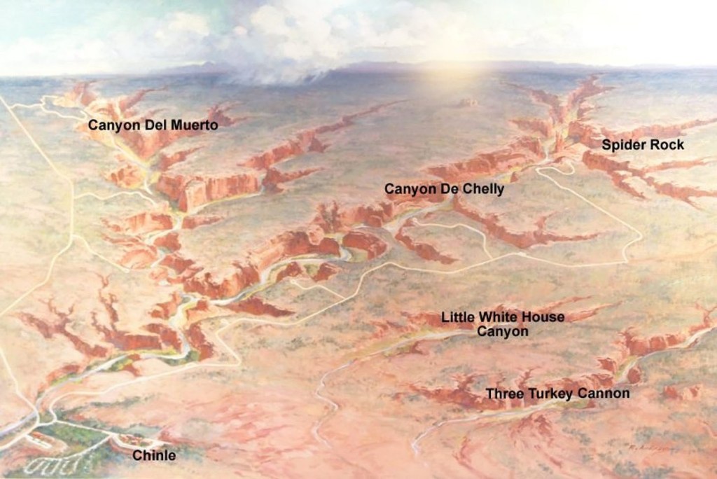
On New Years Day of 2011, I visited Canyon de Chelly National Monument. Canyon de Chelly National Monument is located within the Navajo Reservation in the northeastern Arizona region of the Colorado Plateau. The Monument includes Canyon del Muerto, Monument Canyon, and Canyon de Chelly.
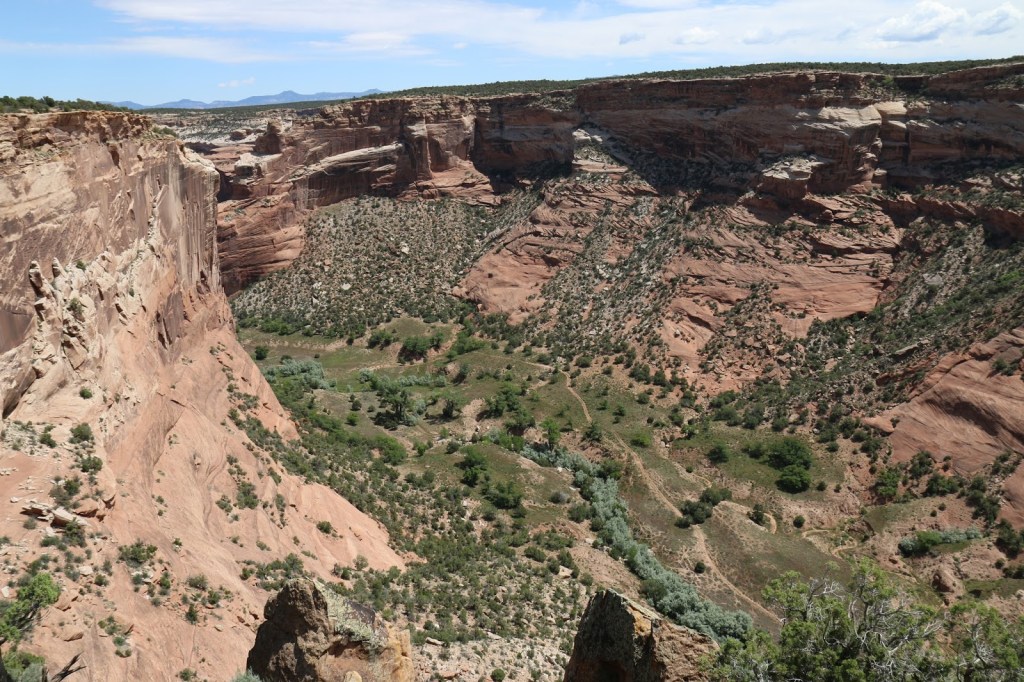
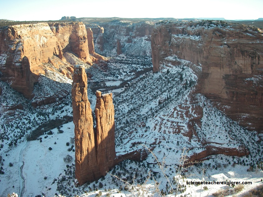
On this New Years Day, I had decided to visit Spider Rock. The dominant geologic feature in Canyon de Chelly is the Lower Permian De Chelly Sandstone.
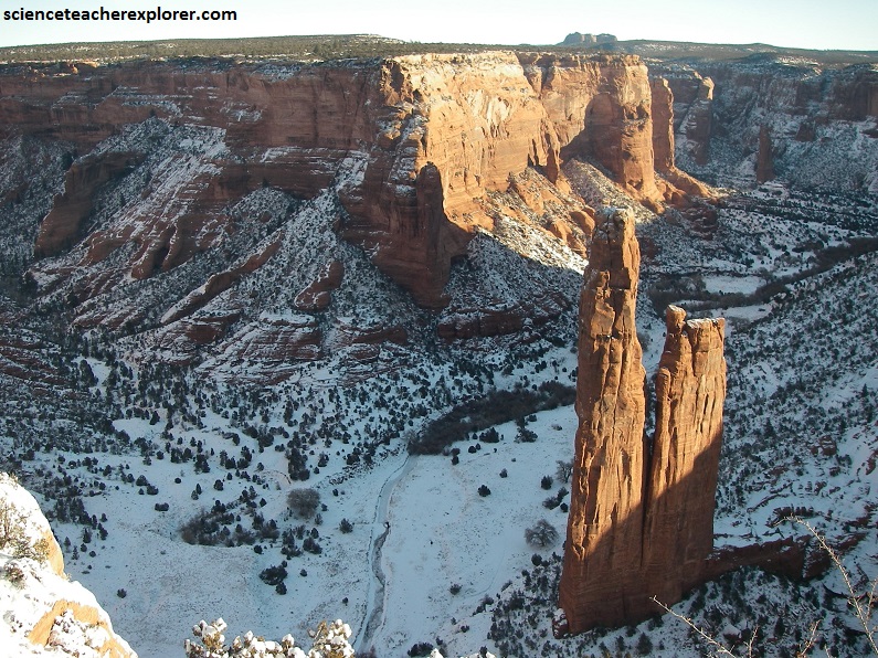
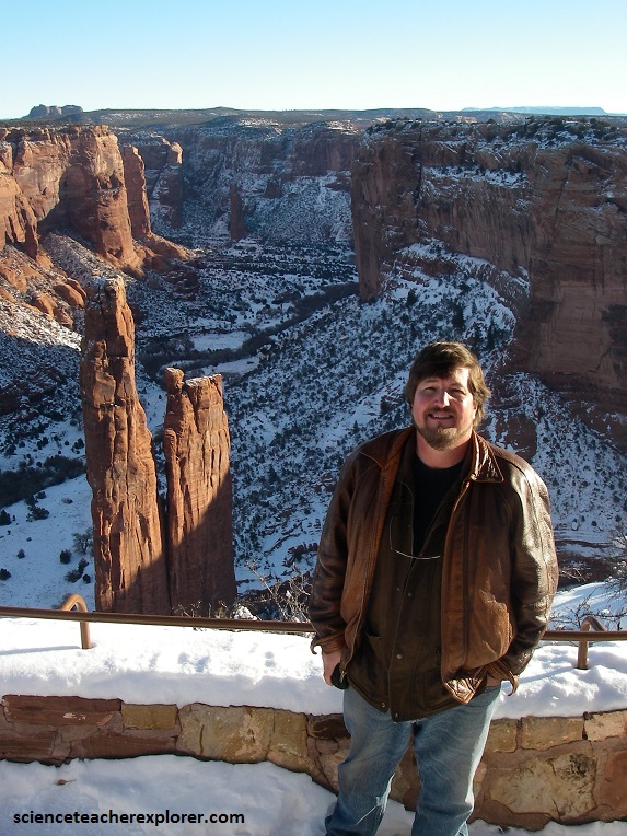
The De Chelly Sandstone is an aeolian sandstone with observable large-scale cross-stratification. The aeolian features observed in the canyon strongly support the inference that the paleo-environment was that of a large desert. Pictured above and below, “Spider Rock”, is a sandstone spire that rises 229 m from the canyon floor at the junction of Canyon de Chelly and Monument Canyon. I was able to see Spider Rock from South Rim Drive. Spider Rock has served as the scene of a number of television commercials. According to traditional Navajo beliefs, the taller of the two spires is the home of Spider Grandmother.
The beautiful Canyon de Chelly was made possible by the rise of a large highland area known as the Defiance uplift, which forms the core of the Navajo homeland. The Defiance uplift is a broad dome that combines the Defiance Plateau, where Canyon de Chelly is located, with the Chuska mountain range to the northeast. Here on its western side, the dome slopes gently. It is bordered on the east by a step-like fold called the Defiance monocline, which abruptly drops the area’s colorful sedimentary layers into the valleys of western New Mexico. After the dome was uplifted, erosion carved Canyon de Chelly out of the top two sedimentary layers still present on the western plateau. It should be noted that the Defiance Plateau rose to its prodigious height between 70-40 million years ago during a mountain-building episode known as the Laramide Orogeny.
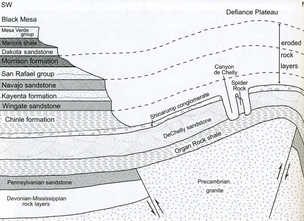
Located above the De Chelly Sandstone is the Upper Triassic Shinarump Member of the Chinle Formation. The Shinarump is a coarse grained conglomerate that is mostly lenticular shaped. A vertical contact between the De Chelly Sandstone and Shinarump Member can be observed on the canyon wall towards the top of the rim, (picture above and below). Pictured below, we should be able to distinguish Spider Rock’s slightly darker cap of Shinarump conglomerate shielding the 275m of softer DeChelly sandstone below. At the spire’s base, we can get a glimpse of a third layer, 280 million year old Organ Rock shale.
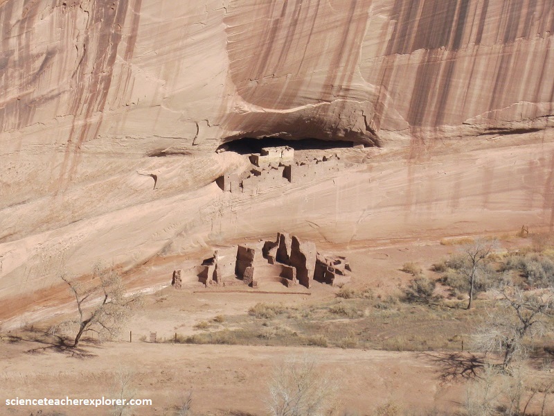
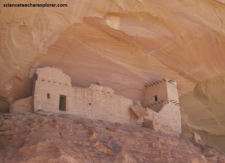
Pictured below, is a view of the “White House Ruins” from the rim of Canyon de Chelly during my New Years visit. These are ruins of the Ancient Pueblo natives. The Navajo tribe are not considered the descendants of the Ancient Pueblos. Mummy Cave Overlook The Mummy Cave complex looks like a miniature city clinging to the cliffs, 300 feet above the valley floor, opposite of the overlook. The cave was occupied until about 1300 when Puebloan life in Canyon de Chelly abruptly ended. A severe drought that began in the 1200’s is thought to have led to its abandonment.
Earlier, in the summer of 2010; I visited Canyon de Chelly to hire a Navajo Guide and hike into Canyon del Muerto to see “Mummy Ruins”. I was interested in the Mummy ruins, because in 1880 archaeologists discovered two well-preserved mummies there. This led them to call the site ‘Mummy Cave’. However, the mummies ended up back east at the Smithsonian Institute and the DNA has been collected from these Mummies. This would enable verification for the descendants if the local Native Americans would give up there DNA code to compare with.
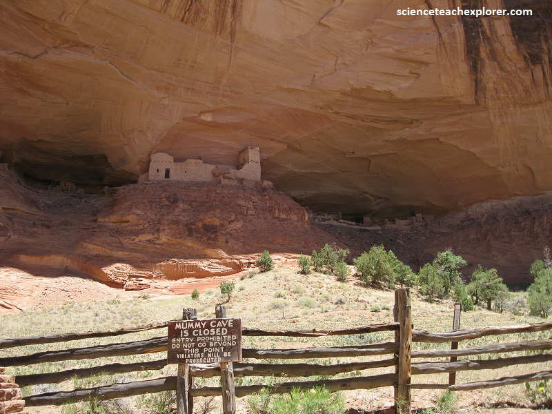
Pictured below, the central tower is said to be Mesa Verde in style and appears to have been constructed at a later date than the rooms in the alcoves. Timbers can still be seen protruding from the walls. This alcove complex contains cliff dwellings that shows evidence of having been occupied for nearly a thousand years. With over 70 rooms it is the largest Puebloan village that is preserved in Canyon de Chelly National Monument.
Pictured below, my guide pointed out the pictograph of the depiction of the Spanish Invaders to the area.
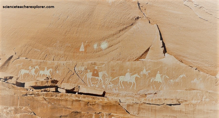
My Navajo guide pointed out the ledge where a native woman grappled with a Spanish Soldier and both fell to their death. This was the site of the infamous “massacre” of 1805. The Spanish soldiers, from an expedition, were firing upon a group of Navajos, that were huddled across the canyon in an alcove. Spanish accounts describe a day-long battle against the Navajos…entrenched in an almost inaccessable point….. and the killing of 90 warriors, 25 women and children. The Navajo, however, say that many men were away hunting at the time. Thus the dead were mostly women, children and old men who had sought refuge from the invaders. The Navajo call the alcove ADah Aho’ doo’nili—Two Fell off—-referring to a brave Navajo woman who grappled with a soldier and tumbled to her death, dragging the enemy with her.