Crystal Peak, Utah 2009
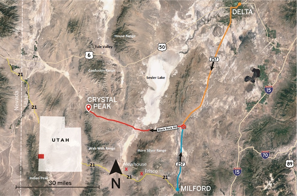
In the summer of 2009, I had decided to explore Crystal Peak, Utah byway of Frisco and Newhouse Ghost-towns. Starting in Milford, Utah, I started driving west on Hwy. 21. The Frisco Ghost-Town, is just off Hwy 21, 24 km west of Milford.
Frisco’s story starts with two prospectors by the names of James Ryan and Samuel Hawks in September 1875. The pair worked at the Galena Mine in the San Francisco Mining District near Milford, Utah. One day while on their way to work, they stopped to test a large outcropping for ore. When they found a solid ore body, they immediately staked a claim. Fearing that the mineral body was not very large, they decided to sell their claim for $25,000, rather than work it, to Allen G. Campbell, Augustus Virum, Dennis Ryan and Matt Cullen. Sadly for Ryan and Hawks, the new owners extracted some 25,000 tons of ore with high silver content by the end of the 1870s and called it the Hornsilver Mine. As of March 1879 the Horn Silver produced 10,352 tons of lead and 1,293,250 ounces of Silver. Soon the Frisco Mining Camp sprang up.
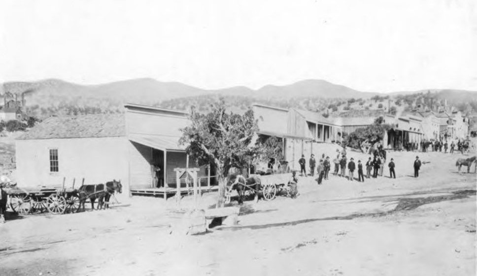
During the late 1880’s there were 6,000 residents of Frisco and many businesses, (4,000 residents worked for the mining operations with 500 men working inside the actual mines). During the bonanza era of Frisco and the Horn Silver mine, Frisco was known as one of the wildest places in the west. Lawlessness was abundant and nightly killings were more than common. Frisco had a very high crime rate according to newspapers and journals. December 28, 1880 “a lawman known only as Marshal Pearson was hired from Pioche, Nevada, to enforce the law. It was said that the marshal shot criminals rather than bringing them before a judge or to jail.
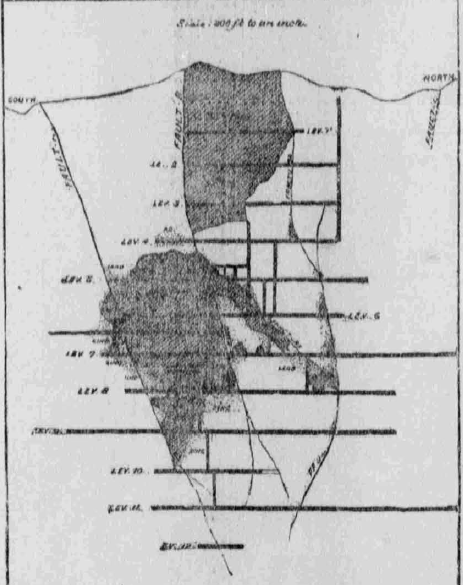
In 1885 there was a huge mine collapse at the Horn Silver which stopped production for a number of years. The collapse was due in part to the poor timbering in the time. The mine was set up as a Stope and Cut tunnel system. The Horn Silver mine was gigantic and had 16 levels worth of tunnels and shafts. The main shaft drops 533 m.
The mine collapse happened during a shift change so no one was injured or killed. The foreman thought he heard some tremors or rumblings underground so he didn’t allow the next shift to go down the mine. Then, an even bigger collapse was heard and felt all the way at Milford!
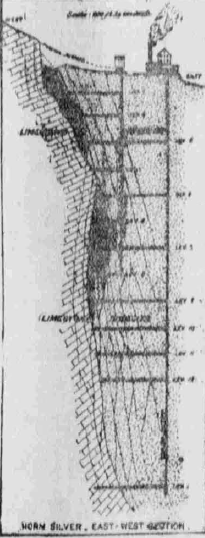
The mine eventually re-opened and major production was again underway after a number of years. Many of the collapsed tunnels were cleared. During a large part of its lifetime, the Horn Silver gave the United States more than half of its total silver production. Close to $60,000,000 and reports of up to $70,000,000 worth of ore were extracted from this mine alone. It continued to produce into the 1940s during WWII.
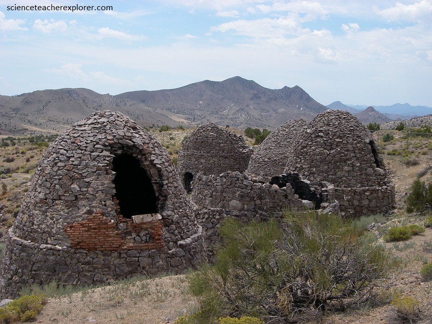
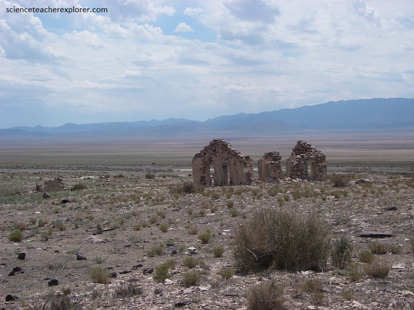
Picture below, these 5 kilns are just some of the many scattered around the greater area. These were used for a multiple of purposes such as charcoal and smeltering. There is a chain link fence that surrounds the kilns but someone has since destroyed part of it so you can walk right up to them. The kilns were staffed by one man per kiln and they would operate in a 24 hour shift.
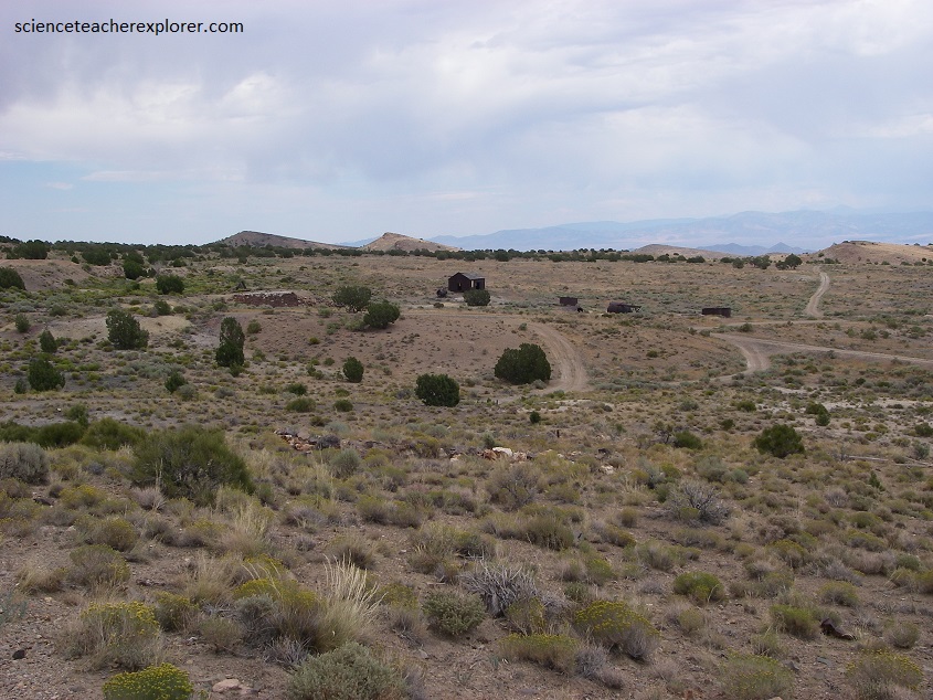
On the other-side of Grampian Hill, (west side), Sam Newhouse purchased the nearby Cactus mine in 1900 and a camp was established, then called Tent Town. Newhouse had a clear vision of how he wanted the city for his miners and their families to live in. By his orders, the town had no red light district, no saloon, no gambling. Exactly opposite of it’s neighbor, Frisco. Later, in 1904 when a hospital, hotel and other businesses sprang up the town was re-named Newhouse.
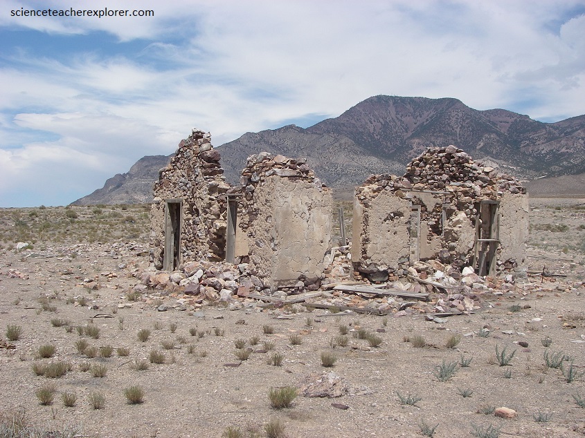
When the Cactus mine played out in 1910, the town continued for a few more years until the mill was torn down in 1914. By 1921 only a single café remained open at Newhouse, then it burned down. The townsite was used for sometime as a movie set, the movie “Covered Wagon” was filmed here.
The Cactus Mine had opened into one of the greatest mines of the world at this time.” By 1906 there were almost 700 miners employed at the Cactus Mine with 100-150 more arriving in 1907. The mine itself had incredible wealth but the ore dumps outside the mine were said to have millions of dollars in them. In 1906 the Cactus Mine produced 2,000,000 pounds of copper.
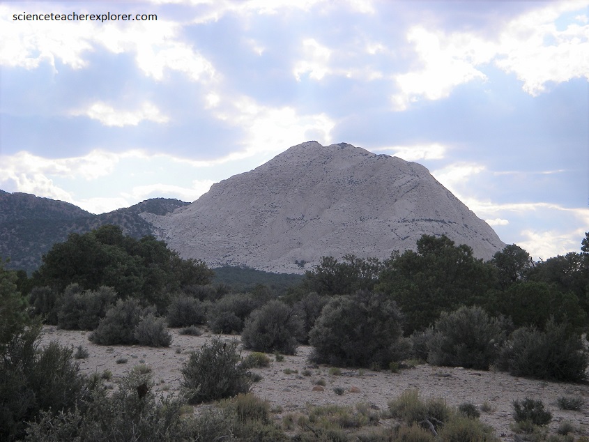
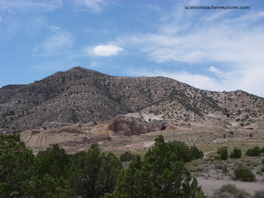
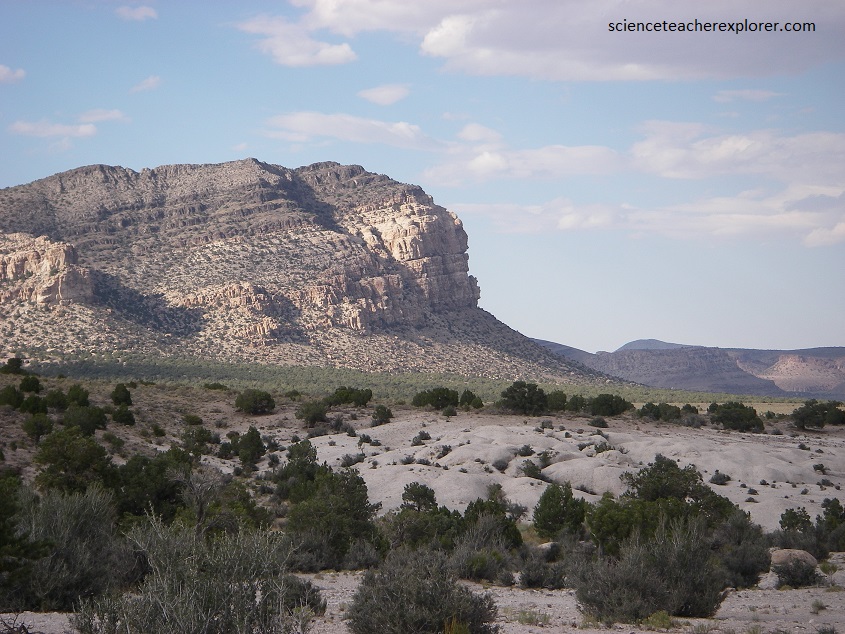
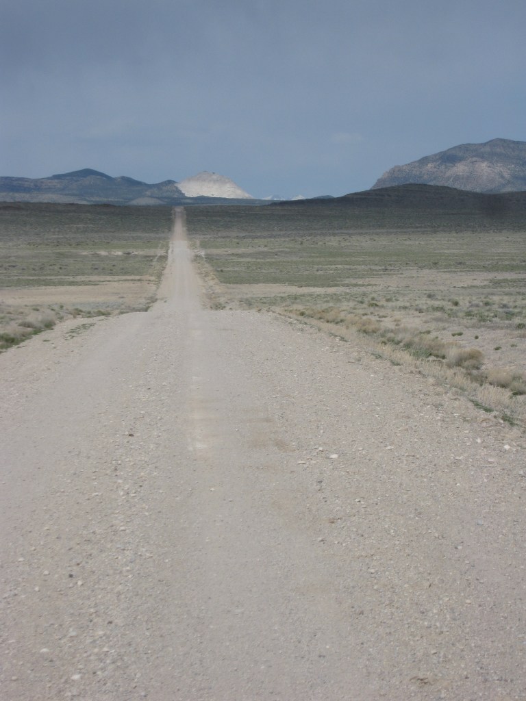
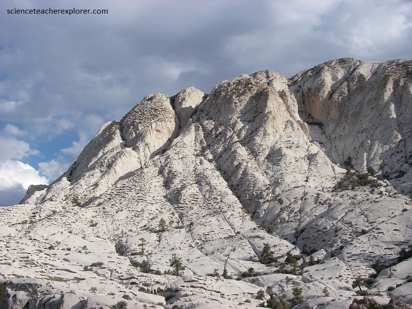
Just 48 km, (30 miles), northwest from the Newhouse Ghost-Town and across Wah Wah Valley, is a spectacularly bright-white, glowing mountain nestled between brown, red, and gray cliffs, called Crystal Peak. It sticks out in Utah’s western desert as a true natural phenomena (pictured above and below).
The white, sparkly rock of Crystal Peak is called the Tunnel Spring Tuff. It is a rhyolitic ash-flow tuff made of pyroclastic debris from an explosive volcanic eruption. The composition of the tuff is a mixture of ash, pumice, glass shards, minerals, and abundant rock fragments of limestone, sandstone, shale, and dolomite. The white color of the rock comes from its concentration of ash and pumice. The mountain’s name derives from the abundance of crystals mainly double-terminated quartz, sanidine, plagioclase, and minor biotite— that cause the mountain to sparkle in the surrounding desert.
The geologic history of Crystal Peak starts with the erosion of Paleozoic-age sedimentary rock layers called the Pogonip Group. The formations in the Pogonip Group consist of limestone, sandstone, shale, and dolomite. They range from 382 to 485 million years old and collectively are about 1,000 meters thick.
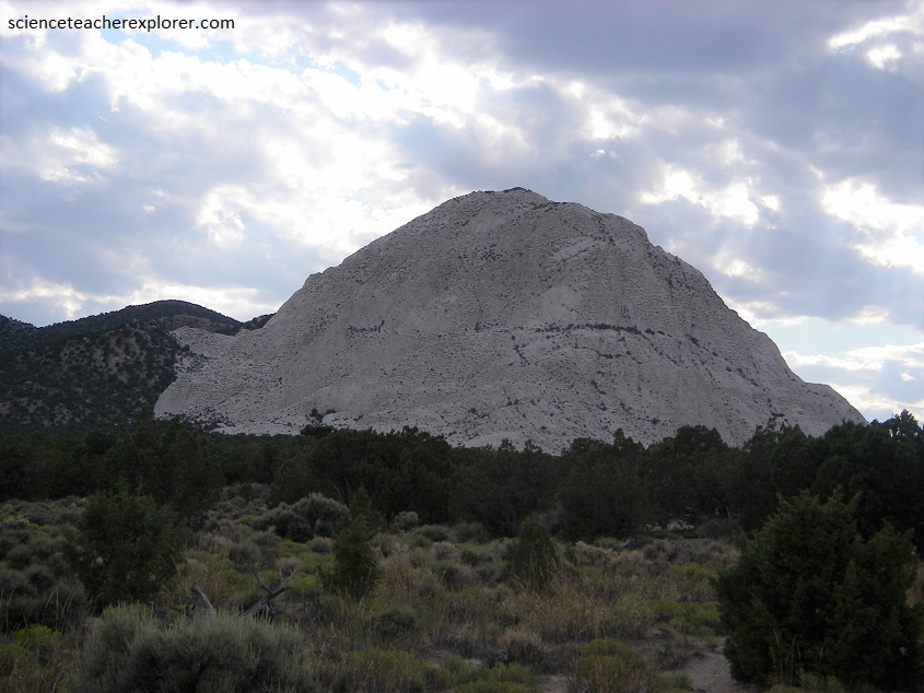
About 33 million years ago, an explosive volcanic eruption threw large amounts of ash, pumice, and rock into the air that rained down covering large areas of land. The volcanic ash and other material settled in topographic low areas like the stream valley eroded into the Pogonip Group, eventually forming the Tunnel Spring Tuff, (imaged below).
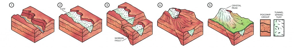
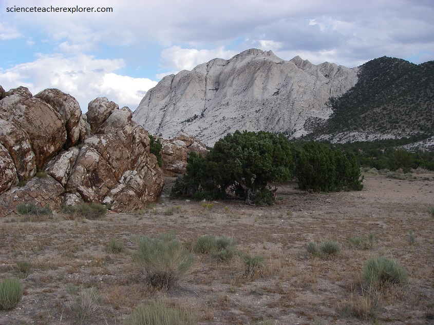
Pictured above, eventually north-south trending normal faults, associated with Basin and Range extension, cut the landscape. As the crust was extending, uplifted fault blocks (horsts) and down-dropped fault blocks (grabens) broke apart the former Pogonip stream valley now filled with the Tunnel Spring Tuff. Sections of the former stream valley were uplifted while neighboring areas were dropped down.
Overtime, a ridge of Tunnel Spring Tuff formed while the sedimentary rocks of the Pogonip Group are eroded away. The slightly-welded rhyolitic ash-flow tuff erodes more slowly until only a single dome-like peak—Crystal Peak—is left, (pictured below).
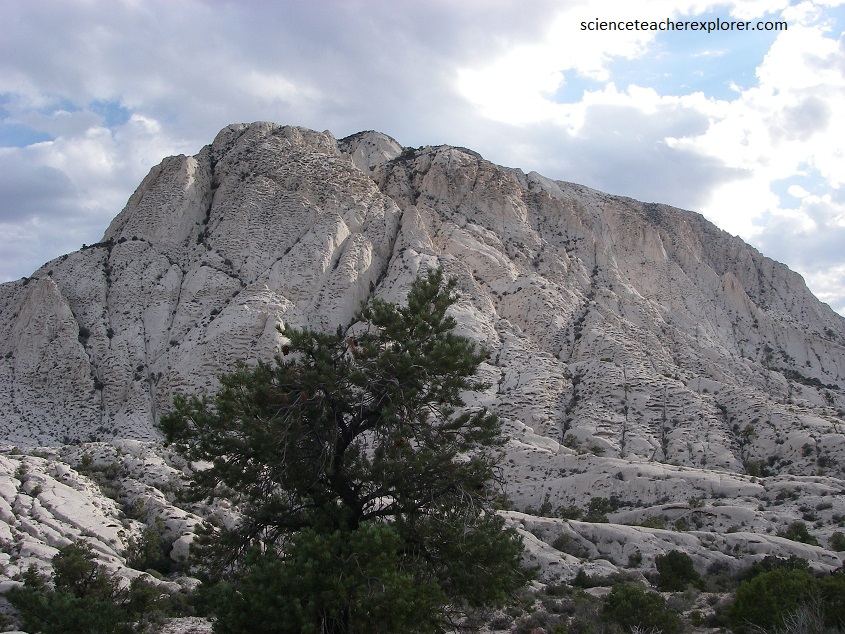
Pictured below, Tafoni or honeycombs, covers the surface of Crystal Peak. They are characterized by clusters of holes and recesses formed from cavernous weathering. The tafoni on Crystal Peak completely cover the steep sides, creating a “swiss cheese” texture on the surface.
The composition of the rock plays the most important role in tafoni creation. The Tunnel Spring Tuff is poorly welded and thus somewhat porous and permeable. As weathering occurs, rainwater containing carbonic acid (H2CO3) infiltrates the tuff and travels through the pore spaces. This acidic water in the pore space dissolves limestone and dolomite rock fragments as it moves through the rock, creating Calcite crystallization. This crystallization generates a pressure strong enough to break rock grains and walls of the pore spaces, expanding the open area in the rock. The pore spaces grow into cavities and continue to increase in size, (pictured below).
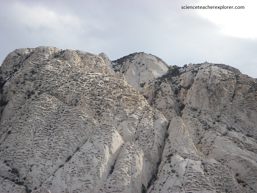
Strangely, the width of the cavity increases faster than the height and depth. They become elongated cavities. After climbing Crystal Peak, I found that the average width of the tafoni at Crystal Peak is 2 meters, but varies considerably. The spacing of the tafoni is a mystery as they do not follow any significant pattern or condition for their placement on steep rock faces.
