City of Rocks N.Pres., ID
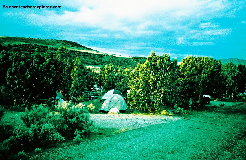
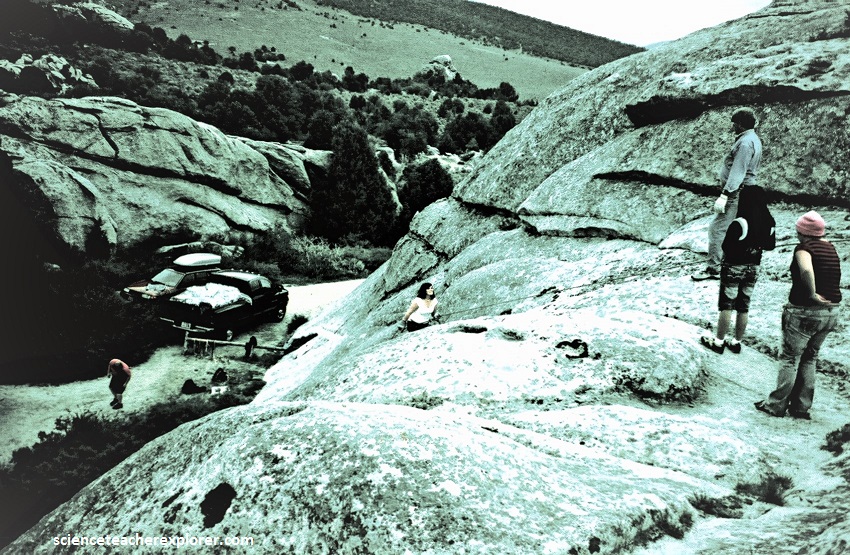
In May of 2009, I took a small group of students to camp at Massacre Rocks, Idaho. Massacre Rocks State Park is located 16 km west of American Falls, Idaho. Our plan for the trip, was to give the students a first experience with repelling in the close-by “City of Rocks”. Assisting me were two wonderful adult-assistants and trekking buddies named LaRue and David Fillerup.
When wagon trains heading west in the mid-19th century approached the break in the rocks ahead of their trail, they were ready for attacks by the local Shoshone Natives. On August 9-10th, 1862, 10 emigrants were killed, and so the natural thoroughfare became known as the Gate of Death or Devil’s Gate, and the rock hills became “Massacre Rocks”.
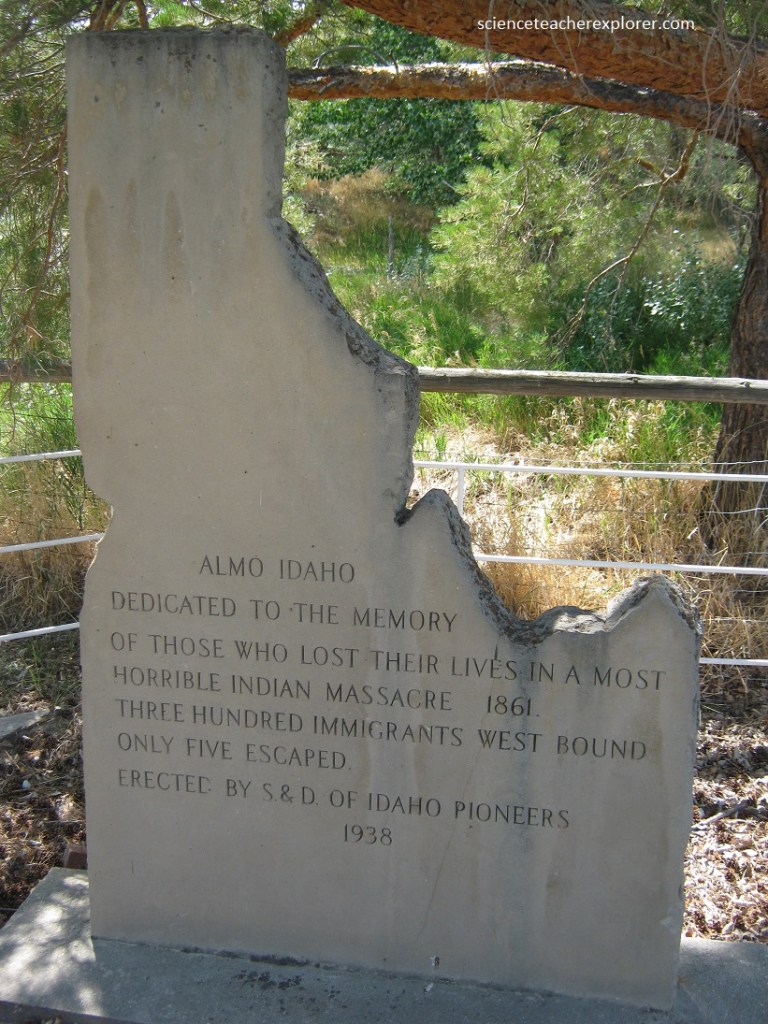
Pictured above, the Almo Massacre Monument (nearby Massacre Rocks within the town of Almo). An organization named “The Sons of Daughters of the Idaho Pioneers” paid to have this memorial erected in 1938. The Idaho-shaped stone describes how only five survived on 300 westward-bound immigrants who were ambushed and slaughtered in their circle of wagons, (supposedly by a band of Northern Shoshoni). But historians today can’t find any 1861 reports of news stories that mention the incident…..(Therefore, it probably never happened).
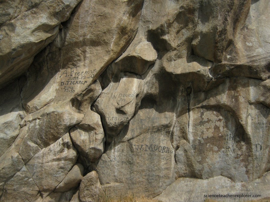
Pictured above, the area is in the plain of the Snake River, and was once part of the Oregon Trail. Nearby Register Rock was a natural “rest stop” for travelers, and the names of these pioneers are carved into the stone.
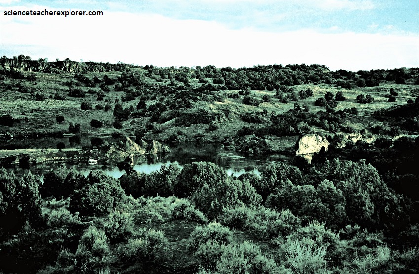
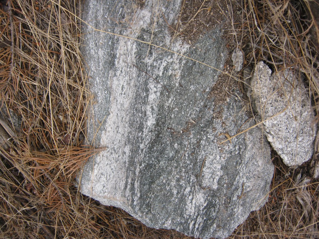
Pictured above, Devil’s Gate Pass is all that remains of a basaltic volcano. The pass itself was carved out at the time of the Bonneville flood about 15,000 years ago, when water from Lake Bonneville, (which covered most of Utah), burst through the pass ad along what is now the channel of the Snake River. The flow of water was thought to be four times that of today’s Amazon, making it one of the largest and most violent floods in history. The basalt boulders it broke away and carried are now scattered around the local landscape.
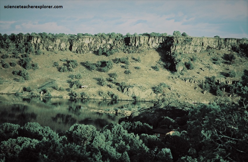
Pictured above, the flood carved numerous natural box canyons and ‘alcoves’ leaving steep rock walls ranging from 10 to 67 m in height. Massacre Rocks State Park was a large natural-area of sagebrush, ancient cedar trees, sand dunes, and box canyons sculpted by the flood. The cliffs seen above the river contains outcrops of basaltic tuff and breccia formed by the hydrovolcanic eruptions of the Massacre Volcanic Complex during the Pliocene and Miocene Epochs.
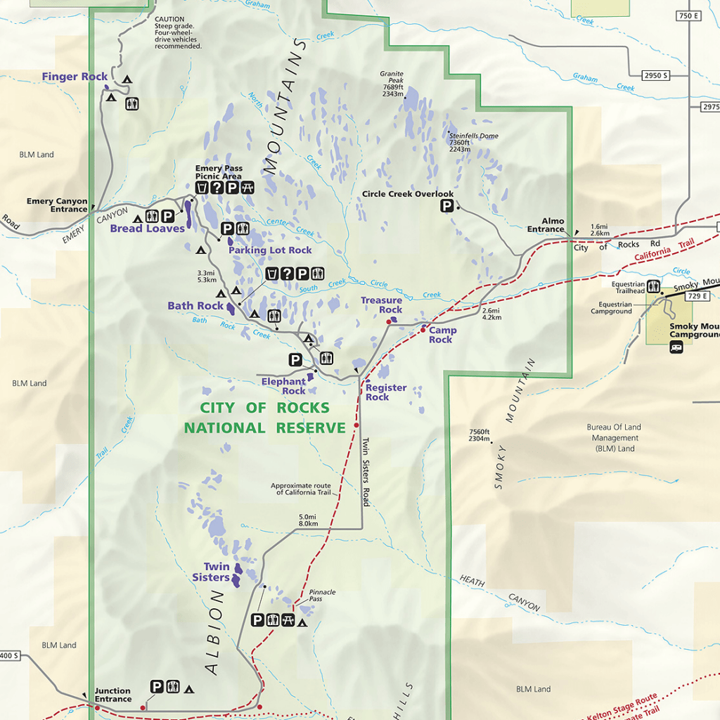
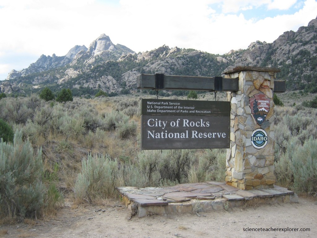
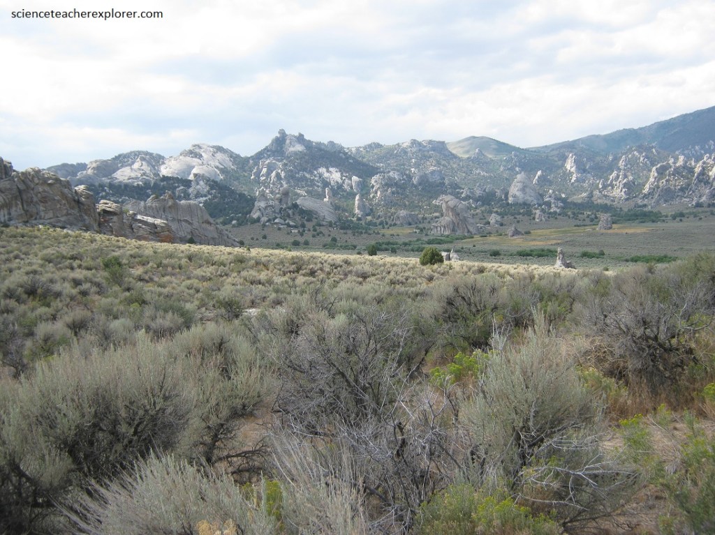
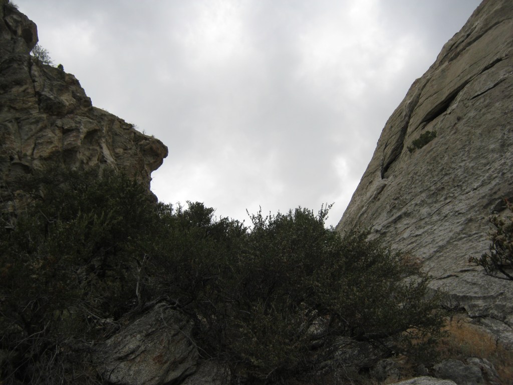
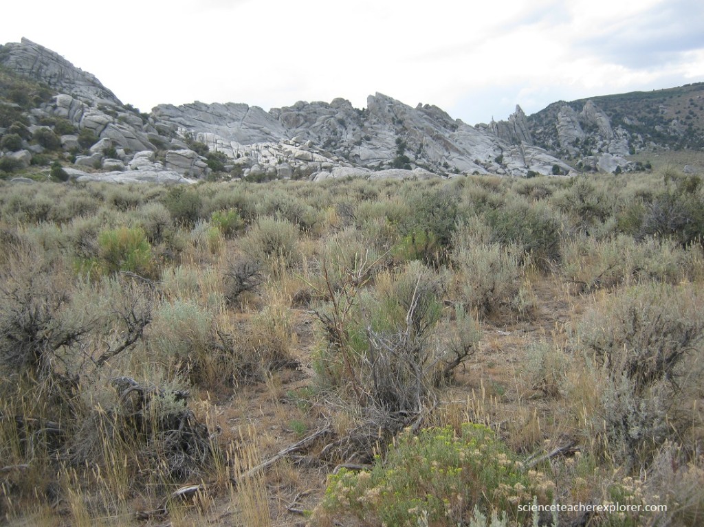
Our main destination to explore and instruct the students to repel was the “City of Rocks National Reserve”, 111 km southwest of Massacre Rocks State Park. The “City of Rocks National Reserve”, also known as the “Silent City of Rocks”, is approximately 3.2 km north of the border with Utah. It is widely known for it’s enormous granite rock formations and excellent rock climbing.
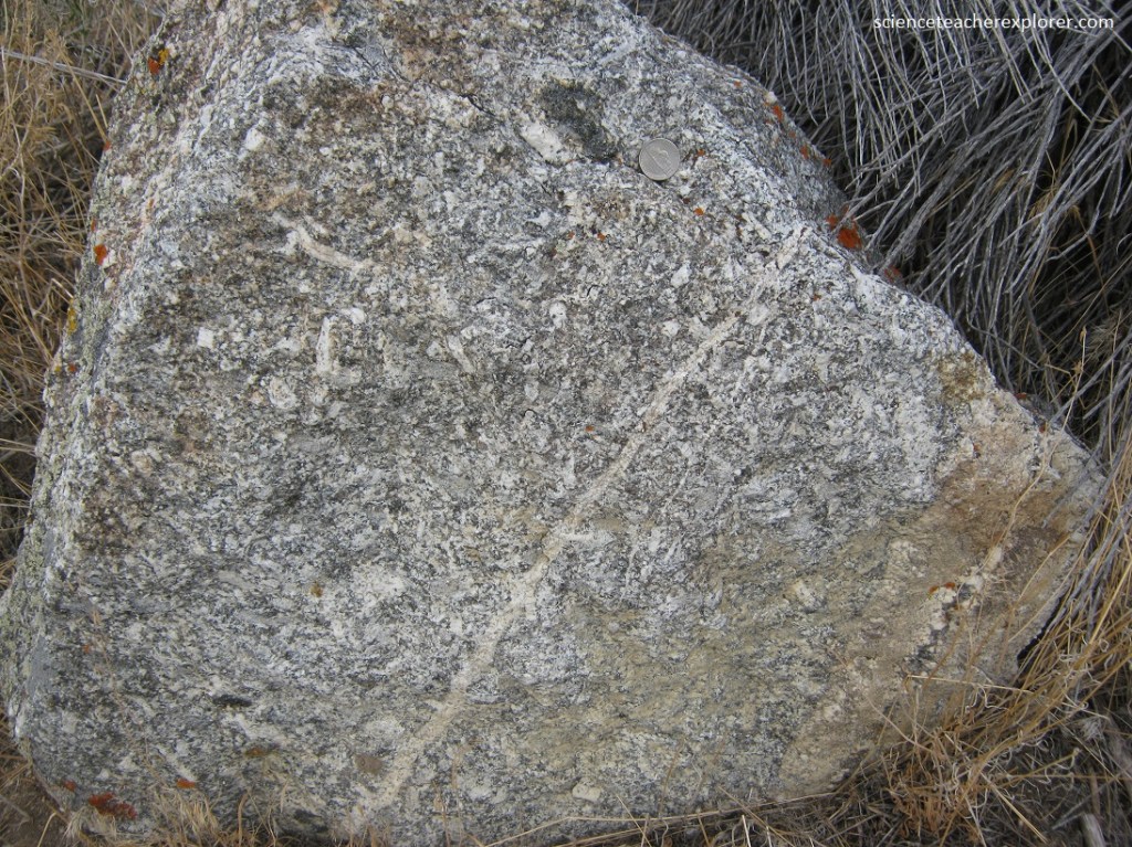
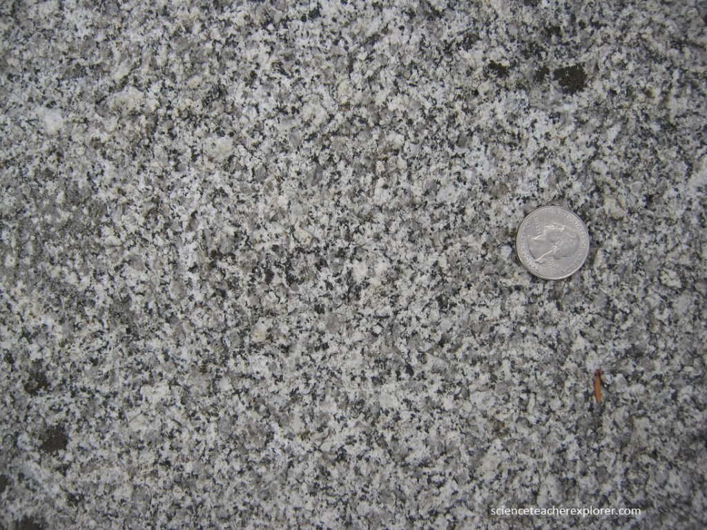
The rock spires in the City of Rocks are largely composed of granitic rock of the Oligocene “Almo Pluton” and “Archean Green Creek Complex”.
The landscape of City of Rocks has been sculpted from granite that was intruded into the crust during two widely spaced times. The granite that composes most of the spires is part of the 28-million-year-old “Almo pluton”. However, some of the spires are made of granite that is part of the 2.5 billion-year-old “Green Creek Complex” that contains some of the oldest rocks in the western United States. The granite has eroded into a fascinating assortment of shapes.
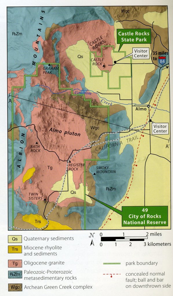
The “Almo Pluton” is made of igneous rock formed by the slow cooling of magma that intruded into older rock. Granitic rock of the Almo pluton makes up most of the spires in the City of Rocks. The Almo pluton is cut in many areas by dikes of younger intrusive rocks. Pegmatite dikes in the Almo pluton commonly contain very large crystals.
The granitic magma of the Almo pluton intruded about 28 million years ago in the Oligocene Epoch to become the youngest granite in the state. Rhyolite erupted onto the surface around 10 million years ago in the Miocene Epoch. Subsequent uplift and erosion have exposed all these rocks.
The City of Rocks is also a popular rock climbing area, with over 1,000 traditional and bolt-protected routes. Pictured below is our attempt to instruct my students on “How-to-repel” at a beginning level.
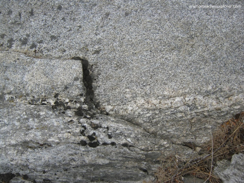
One of the most obvious features of the Almo pluton are the cracks, known as joints, that cut across every outcrop. The orientation and spacing of the joints plays a critical role in controlling the size, shape, and distribution of spires in the City of Rocks. There are three processes that that have created the joints at City of Rocks; contraction, extensional tectonics, and expansion related to the release of pressure as overlying rock is removed by weathering and erosion.

Rock formations in the reserve developed through an erosion process called exfoliation, during which thin rock plates and scales sloughed off along joints in the rocks. The joints, or fractures, resulted from the contraction of the granite as it cooled, from an upward expansion of the granite as overlying materials were eroded away, and from regional tectonic stresses.

The granite has eroded into a fascinating assortment of shapes as high as 180 m. The upper surfaces of many of the rocks are covered with flat-floored weathering pits known as pan-holes. The most notable pan-hole is located on top of Bath Rock and is continuously filled with water from rain or snowmelt.
The most prominent joint orientation at City of Rocks is north-south and near vertical; this set of joints likely dates from east-west extension soon after cooling and consolidation of the Almo pluton. Later, flatter exfoliation joints formed parallel to the Earth’s surface as the overlying rock was eroded away and the pressure was reduced, causing sheets of the massive granite to peel off like layers of an onion.
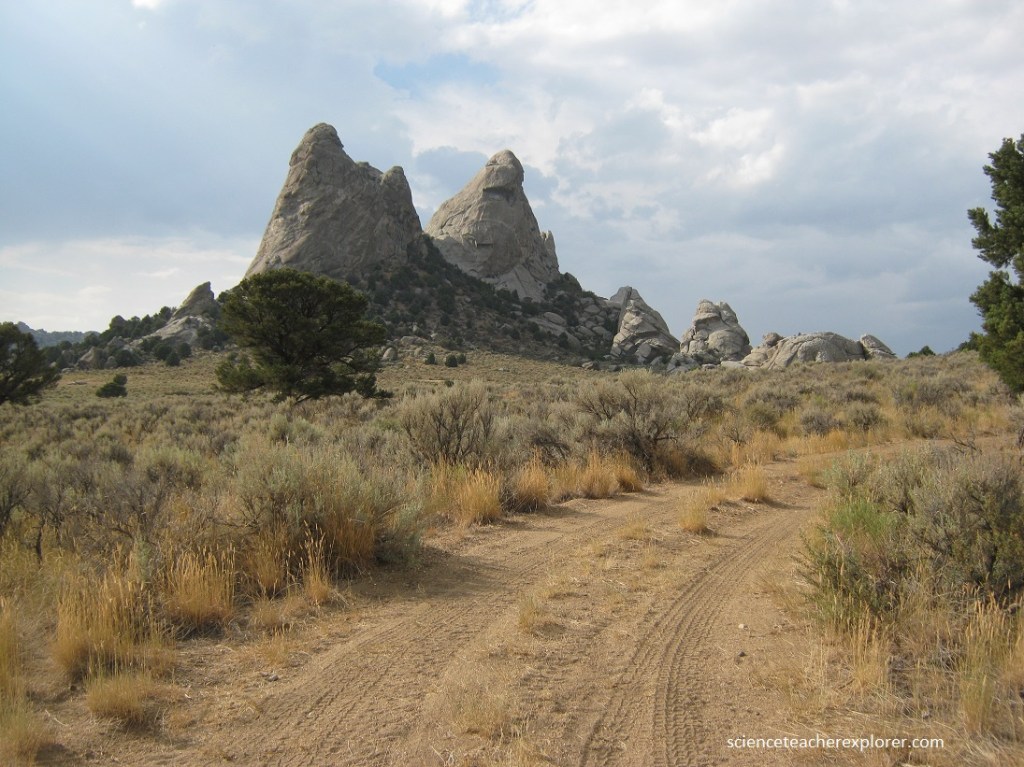
The Almo pluton originated as an intrusive body of magma and therefore has complex contact relationships with the surrounding country rock, (Elba Quartzite deposited during the Proterozoic Eon between 15,000 and 600 million years ago). The contact is best exposed on the eastern and southern margins of the pluton where the magma intruded Archean gneiss and granite of the Green Creek Complex. The most dramatic contact between these granitic rocks is in the saddle that separates the Twin Sisters (pictured above and below).
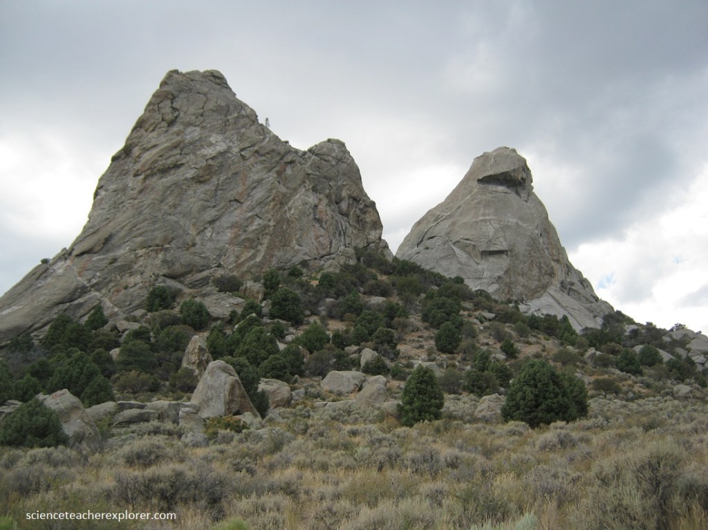
Pictured above, the ‘Green Creek Complex’ can easily be distinguished from the younger ‘Almo pluton’ by its darker color caused by a greater concentration of iron-bearing minerals. Additionally, the North Sister is much more rounded and dome-like, whereas South Sister is more jagged and angular.
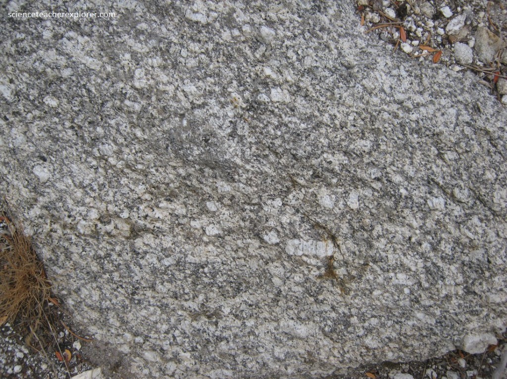
Pictured above, in the “Green Creek Granite Complex” has a plethora of light-colored, blocky, thumb-sized crystals of potassium feldspar. These exceptionally large crystals are several times larger than the surrounding crystals of quartz, biotite, and plagioclase feldspar. When crystals of one mineral are many times larger than neighboring crystals, the rock is said to have a porphyritic texture.
The porphyritic texture of the South Sister suggests two distinct cooling phases within the magma chamber. An initial phase of prolonged cooling resulted in the large potassium feldspars. This period was followed by a faster cooling rate wherein the quartz and biotite crystallized. Additionally, a dike has formed in the above rock, where magma has injected into fractures cooled and crystallized. The elements in the dike are silicon, oxygen, potassium, and aluminum; the necessary ingredients to form muscovite and quartz, (two lighter colored minerals).
Pictured above, the saddle between the South and North Sister is a complex that contains aligned potassium feldspar crystals in pervasive layers. This is the metamorphic rock gneiss and schist, formed from granite that was squeezed in one direction, causing the crystals to align and forming layers.
Pictured above, the biotite (black) crystals are aligned to create a layering known as foliation, (a parallel arrangement of minerals caused by pressure in on direction). Metamorphic rocks dominated by layered mica crystals, such as biotite, are called schist, and they form where existing rocks are intensely squeezed many kilometers below the surface where high temperatures exist.
Pictured above, is a contact rock between the “Green Creek Complex” an the “Almo Pluton”. Note that there are dark lenses of brown schist encapsulated within the “Almo Pluton” granite. Using the principle of inclusion, we can conclude that the schist is older than the granite.
Pictured above is a picture of the North Sister Granite. It contains nearly equal-sized crystals of quartz, muscovite, biotite, and feldspar (both plagioclase and potassium feldspar). The uniformity of crystal size in this granite suggests this batch of magma cooled and crystallized at a steady rate.
To summarize: About 2.5 billion years ago, deep beneath a growing mountain range, rock was metamorphosed into schist and gneiss, and magma cooled and crystallized into granite, forming part of the “Green Creek Complex. Hundreds of millions of years later, the area was again thrust skyward to form a lofty mountain range during the Sevier Orogeny. About 28 million years ago, magma intruded the once-molten granite of the Green Creek Complex, partially melting some of it. This new batch of magma crystallized as the Almo Pluton. Granite –both young and old—was later exposed by uplift and erosion to form the unique geologic and historic landmark that is the “Twin Sisters”.