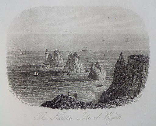
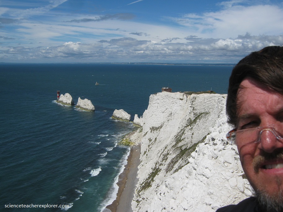
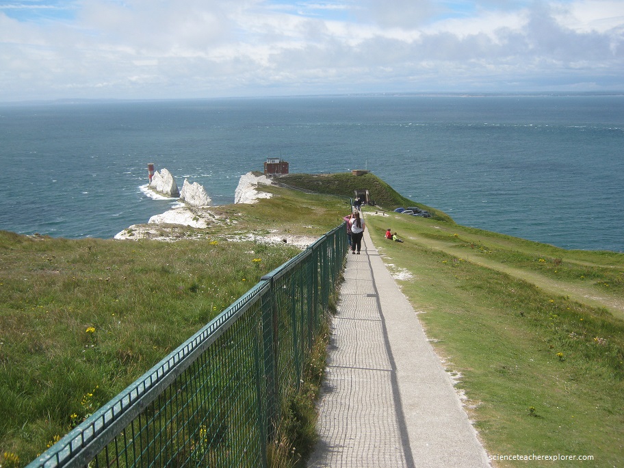
The Needles, England
On July 28th, 2016, I visited “The Needles” of the southern England Coast.
“The Needles”, in Alum Bay, mark the end of a ridge of chalk that runs through the Isle of Wight.
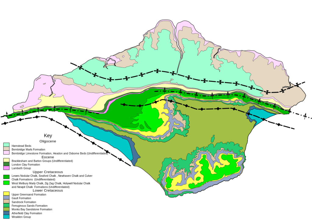
The needles rise about 100 feet above the sea, isolated as the soft chalk of the headland erode away. The geological layers north of the chalk belong to the Tertiary era and consist primarily of clays, sands and, in places, layers of stone. Various types of sands predominate south of the central ridge of chalk and, along with the chalk, were laid down in the Cretaceous period. These sands are of marine origin and are divided into two general types: Upper Greensand and Lower Greensands (Ferruginous sands). The Chalk itself was formed in a warm sea by the accumulation of the remains of vast numbers of coccoliths (minute planktonic algae) that collected in a massive layer of ooze on the sea bed. Corals, urchins and ammonites are found in both the chalk and the Upper Greensand. This Cretaceous group overlies fluvial Wealden layers, which outcrop at the west and east end of the Island south of the chalk ridge. It is in these Wealden layers that the well-known remains of dinosaurs have been found, usually in cliff falls.
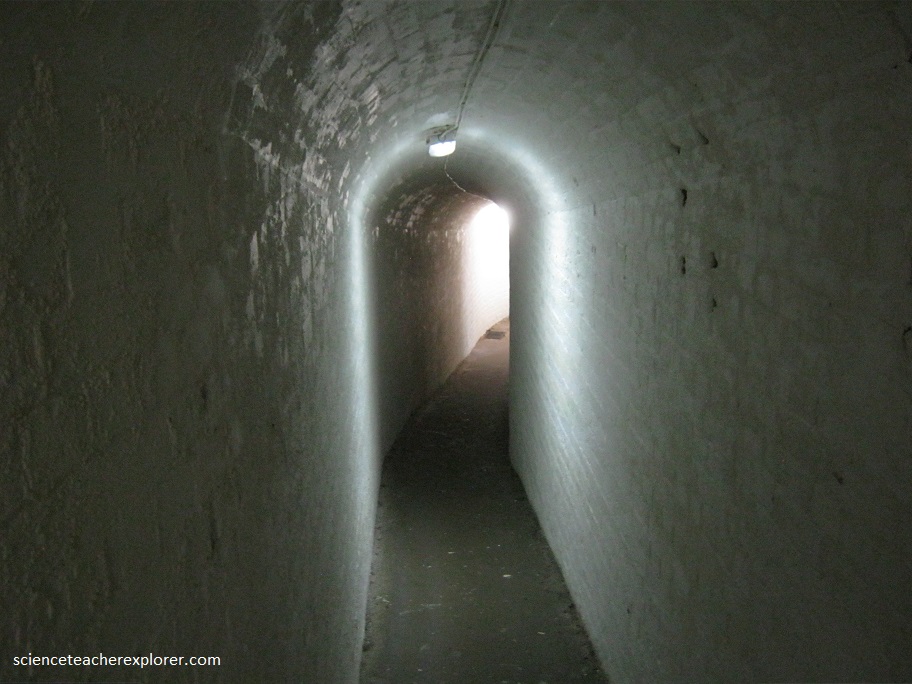
The world’s first radio station was set up in 1897 at the Needles Battery, at the western tip of the island. In early December 1897, Gugielmo Marconi set up his revolutionary wireless equipment in the Royal Needles Hotel, above Alum Bay, and sent the very first wireless transmission.
Built at the crest of “The Needles” are “The Batteries”. The Needles Batteries are two military batteries built above the Needles stacks to guard the West end of the Solent. The field of fire was from approximately West South West clockwise to Northeast and they were designed to defend against enemy ships.
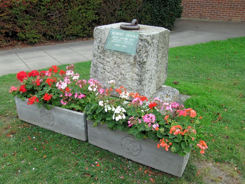
The Isle of Wight was also home of the famous scientist Robert Hooke. Robert Hooke is one of the most neglected natural philosophers of all time. The inventor of, amongst other things, the iris diaphragm in cameras, the universal joint used in motor vehicles, the balance wheel in a watch, the originator of the word ‘cell’ in biology, he was Surveyor of the City of London after the Great Fire of 1666, architect, experimenter, worked in astronomy – yet is known mostly for Hooke’s Law. He fell out with Newton, and certainly had a difficult temperament. He deserves more from History than he received in his lifetime.
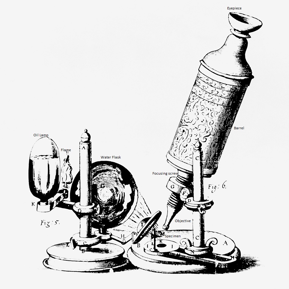
Pictured above, this beautiful microscope was made for the famous British scientist Robert Hooke in the late 1600s, and was one of the most elegant microscopes built during the period. Hooke illustrated the microscope in his book, Micrographia, one of the first detailed treatises on microscopy and imaging.
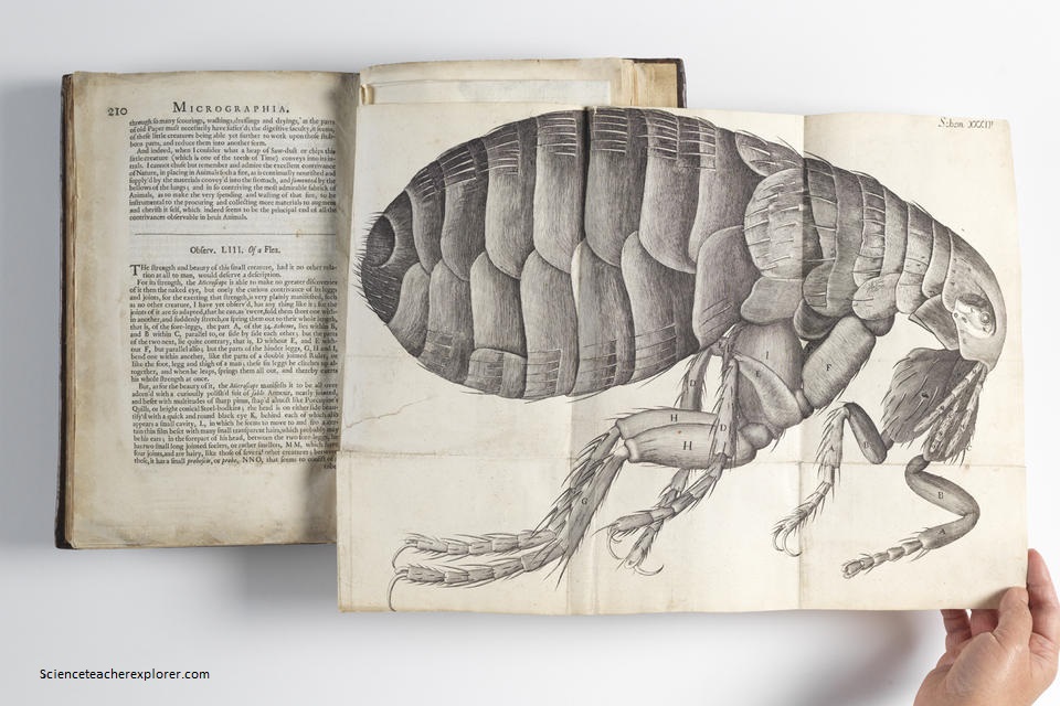
But perhaps Hooke’s most notable discovery came in 1665 when he looked at a sliver of cork through a microscope lens and discovered cells.
That evening I ferried back to the mainland to explore, “Old Harry Rocks” just west of “The Needles” across the Alum Bay.
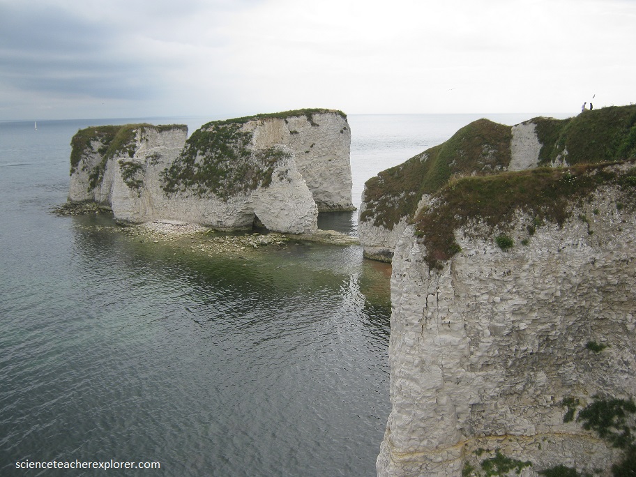
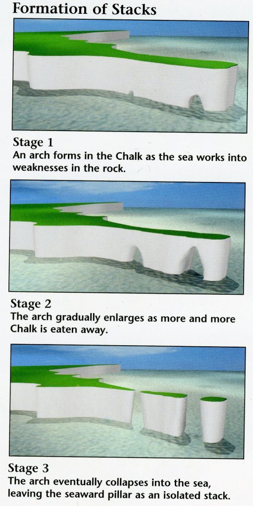
Below, is a photo of me, standing above another set of Chalk cliffs, near the village of Studland, that features beautiful promontories, sea stacks, and natural arches. The stacks are formed when the sea attacks a fracture in the chalk, forms a cave, and then gradually wears the cave through into an arch in the headland. Later, the arch collapses to leave a sea stack. Over time, the sea undermines the base of the stack, until it collapses into the sea–a tack known as Old Harry’s Wife fell in 1896.
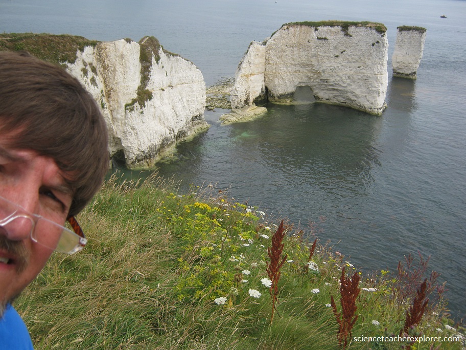
Here, erosion has separated the, “Old Harry Rocks” from the mainland. Old Harry, the name of the isolated stack shown, is a medieval name for Satan, while the land on the clifftop opposite is called Old Nick’s Ground—another nickname for the devil. A major fault, the Ballard Down Fault, lies in this stretch of cliffs. South of the fault, pictured below, the chalk is vertical, however to the north, the chalk has been laid down almost horizontally.
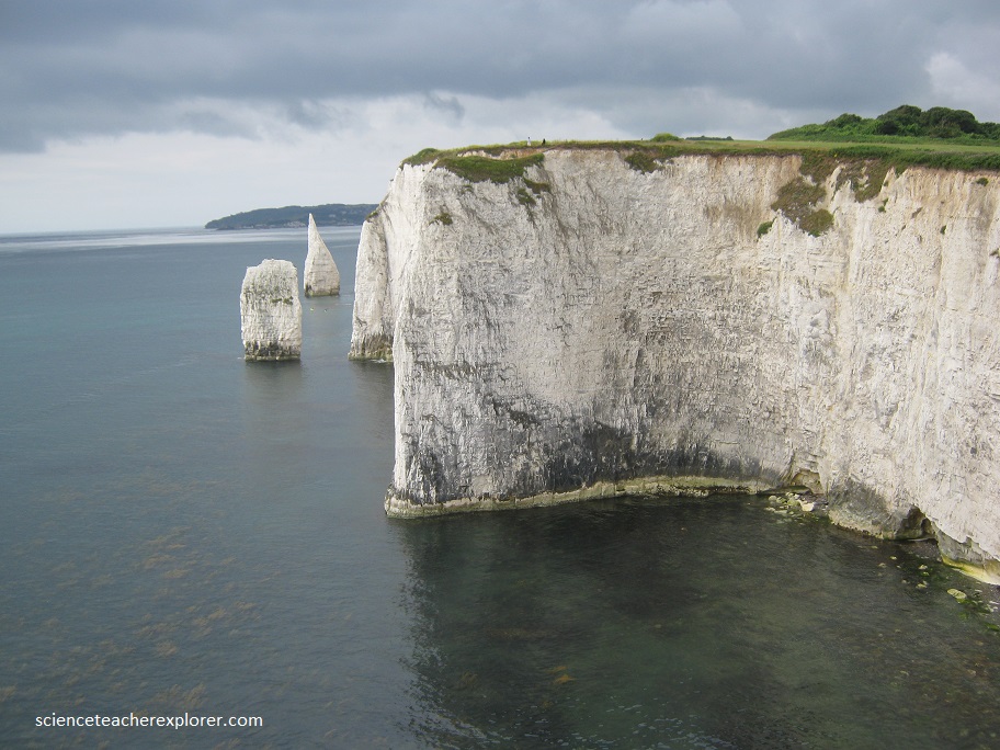
The chalk of Old Harry Rocks used to be part of a long stretch of chalk between Purbeck, (the Ballard Down) and the Isle of Wight, but remained as a headland after large parts of this seam were eroded away. The downlands of Ballard Down are formed of chalk with some bands of flint, and were formed approximately 66 million years ago.
