Coba, Mexico 2008
During Spring Break of 2008, my wife (Becky) and I flew down to the Yucatan, Mexico. We stayed in a small resort near Puerto Morales for about a week.
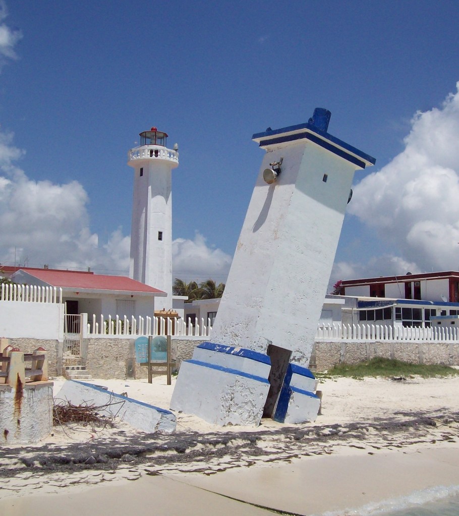
Puerto Morales is a quite little town and seaport in Quintana Roo, Mexico’s easternmost state, on the Yucatan Peninsula. The town is located in the northeast of the state, about 36 km south of the resort city of Cancun, and about 30 km north of the city of Playa del Carmen.
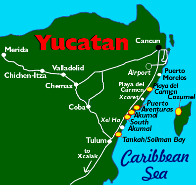
Our main destination to explore on this trip was a Mayan archeological site called Coba. The ruins of Coba lie 43 km northwest of Tulum, also in the State of Quintana Roo, Mexico. This archaeological zone is reached by a two-kilometer branch from the asphalt road connecting Tulum with Nuevo Xcan on the Valladolid to Cancún highway.
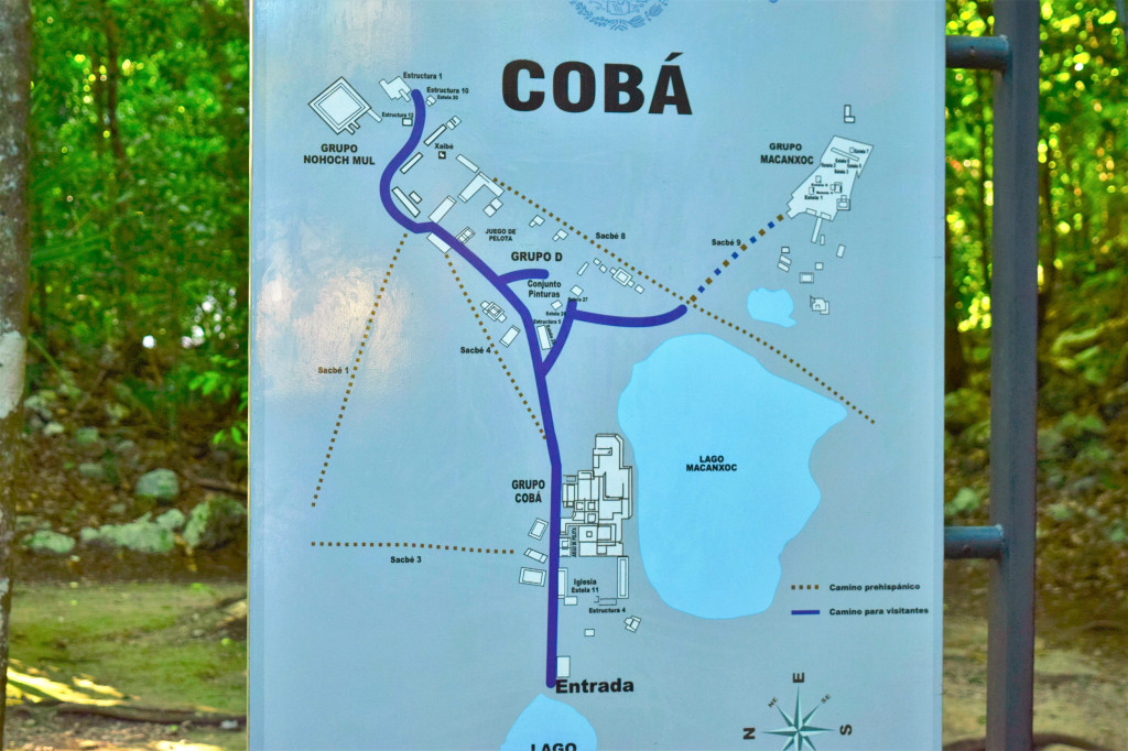
Coba is located around two lagoons, “Lake Coba” and Lake Macanxoc. Coba means ‘waters stirred by the wind’, an appropriate Mayan name as this settlement is surrounded by these two large lagoons. Additionally, there is a series of elevated stone and plaster roads radiate from the central site to various smaller sites near and far. These are known by the Maya term sacbe or white roads.
Coba was estimated to have had some 50,000 inhabitants (and possibly significantly more) at its peak of civilization, and the built up area extends over some 80 km2. The site was occupied by a sizable agricultural population by the first century.
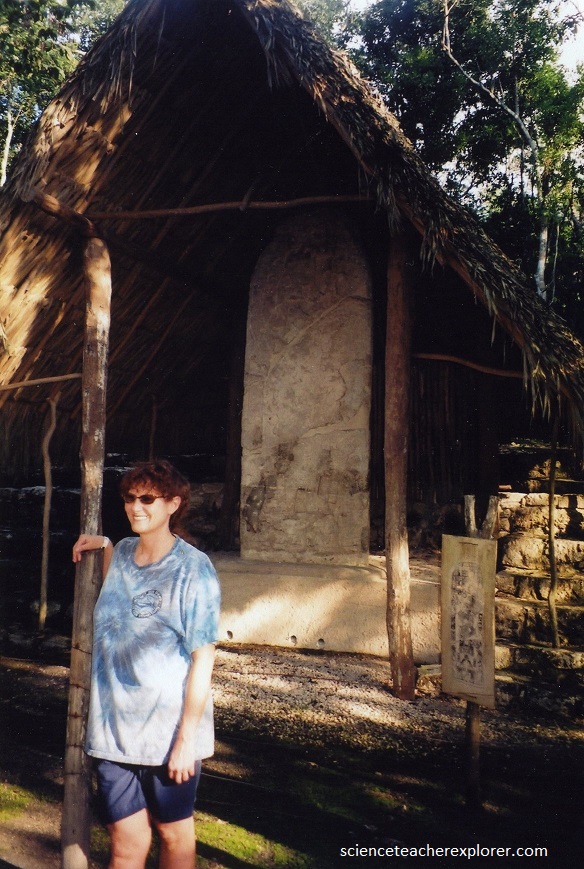
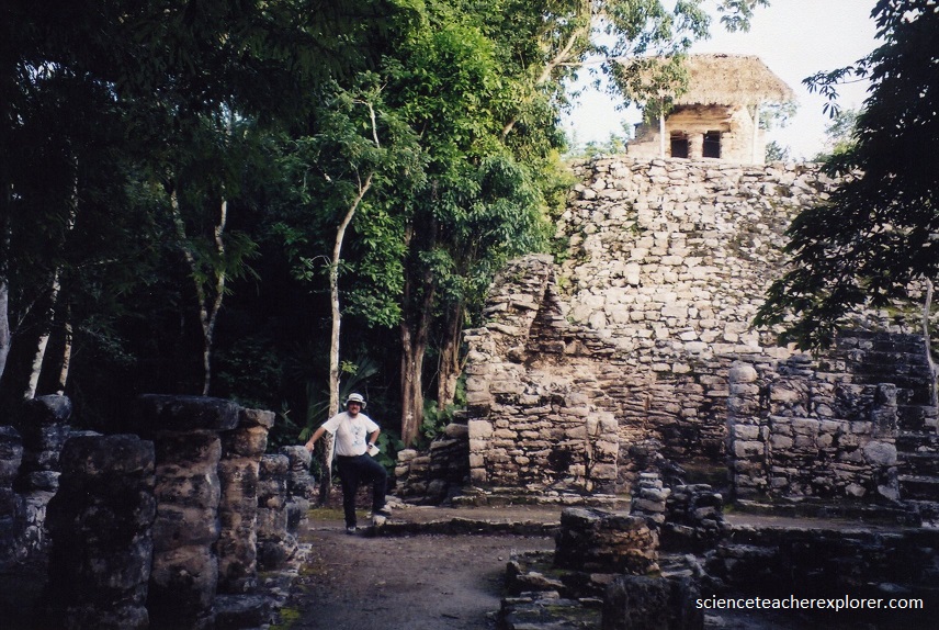
Pictured above, the bulk of Coba’s major construction seems to have been made in the middle and late Classic period, about 500 to 900 AD, with most of the dated hieroglyphic inscriptions from the 7th century. Everywhere the Mayan’s built a large structure, they left a carves stone nearby with carving that explained what the structure was, etc. Pictured above, is one of these inscription-stones housed in a little shack. The stone is called a “stelae” and it is protected by a palapa roof. It is important to note that Coba remained an important site in the Post-Classic era and new temples were built and old ones kept in repair until at least the 14th century. The stelae contains drawings and glyphs that document major events and historical facts that happened in the city of Coba. This is what archeologists uses to decipher the history and movements of the Mayan culture throughout the area. Today the glyphs are nearly illegible but the history radiates from these important artifacts.
Pictured above, Coba is the nexus of the largest network of stone causeways of the ancient Mayan world, and it contains many engraved and sculpted “Stelae” that document ceremonial life and important events of the Late Classic Period (600–900 A.D.) of the “Mesoamerica” civilization.
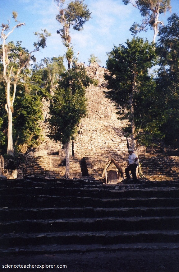
Coba contains a group of large temple pyramids known as the “Nohoch Mul”. (Pictured above and below). The La Iglesia Pyramid is the second tallest pyramid at Coba at over 24 meters in height, and which was built and added onto over hundreds of years beginning in the Early Classic. It consists of nine tiers crowned by a small, Post Classic temple. It is set at the back of an open, west facing courtyard, and looks over the plaza towards Lake Coba.
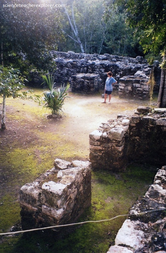
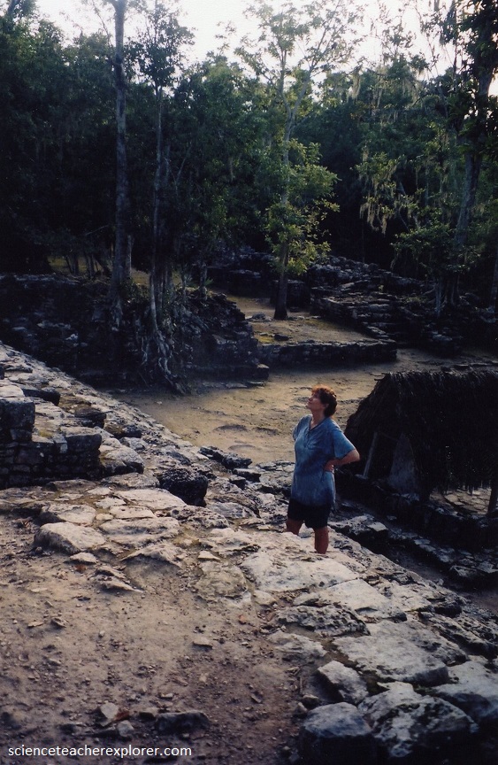
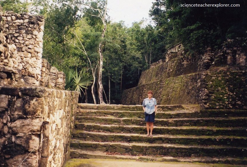
Coba consists of a large complex of ruins, only a small portion of which have been cleared from the jungle and restored by archaeologists. Pictured below, the Ixmoja pyramid is 42 meters high and is the tallest Mayan structure in the Northern Yucatan.
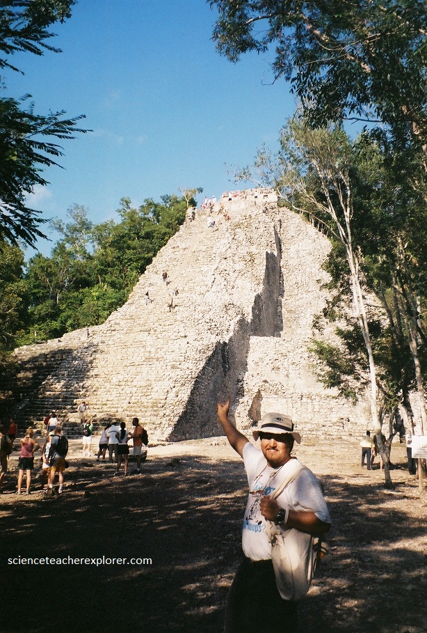
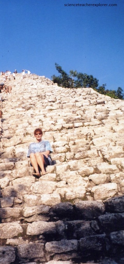
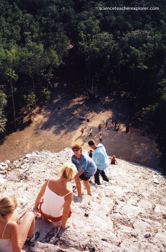
It is permitted to climb to the top of the Ixmoja Pyramid, by a very steep set of approximately 120 stone stairs.
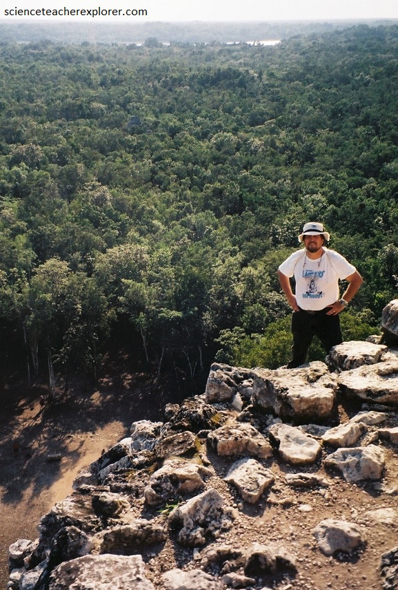
Pictured below, the climb to the top of the Ixmoja Pyramid is well worth it, albeit a little nerve-wracking if you are afraid of heights: The top of the pyramid juts out over the forest and you get a beautiful view of vast flat sea of green and get an idea of why the pyramids were so powerful.
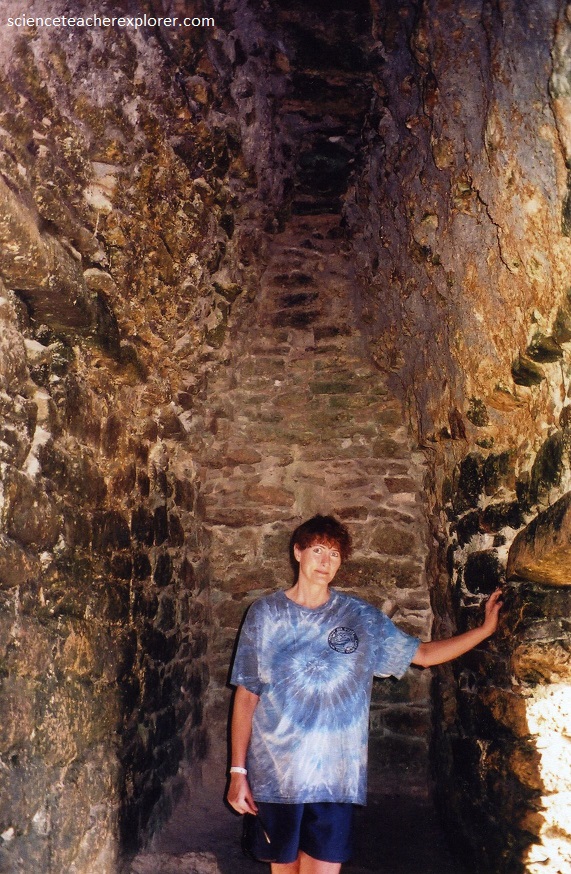
Pictured below, at the top of the Ixmoja Pyramid is a doorway leading to a very small room with no windows.
Of course, once you climb up the 120 stone steps, then you have to climb down. The locals provide a rope, but we felt that made it even more dangerous. Becky and I chose to climb down facing towards the stone, like you do a ladder. (Pictured below).
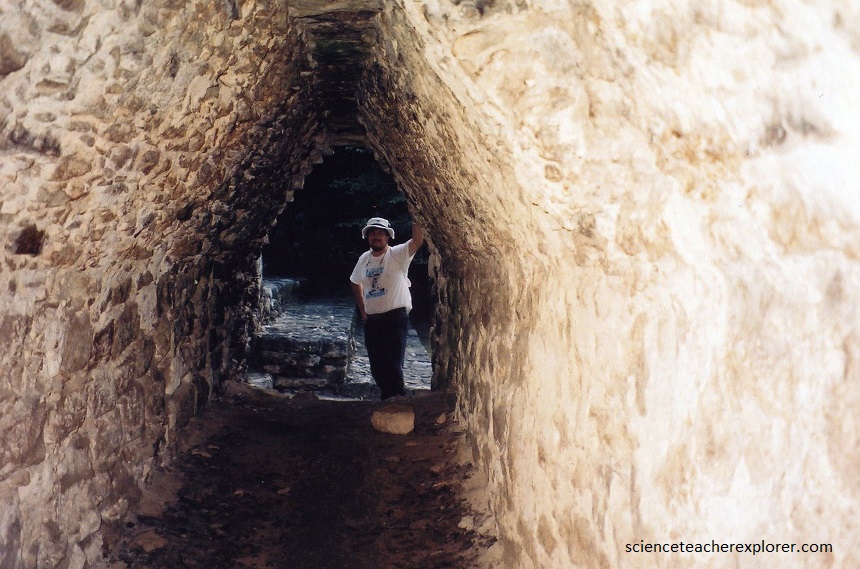
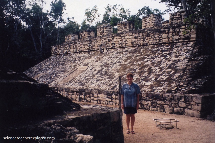
There are several other buildings of interest including several temples, an ancient gallery of carved stellae, an astronomical observatory, and a ball court, (pictured below).
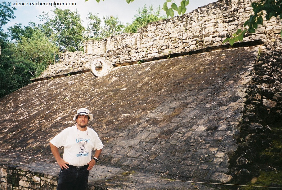
Scholars debate the rules and outcome of the Mayan ballgame. It’s one of the many Mayan mysteries that still exist today. But one thing we know for sure, a game was played and Mayan ball courts can be found at many of the ruin sites today. Pictured above is half of a sports court (alley) where the ancient ball game of Pok-A-Tok or Pitz was played.
In Pok-A-Tok or Pitz, the two teams of seven athletes would compete in this vicious yet ritualistic game. According to Mayan beliefs, their deities enjoyed watching and admired the victors. At the end of the game, the winning captain was honored by being beheaded. His reward was an immediate place in Tamoanchan (Mayan heaven). This sacrificial ceremony was common at Chichén Itzá (about 110 km away) but perhaps not in Coba. In Coba the court was small. The games were probably not of the pinnacle importance here and especially not when compared to Chichen Itza and other sites. In fact, the court probably was only used sparingly and for ceremonial games. I guess it was not a a long “ball” season for the players in Coba.
Pictured above, the Coba-Yaxuna Sacbe is the longest known ancient, raised stone road in the Maya World. It stretches about 100kms across the Yucatan Peninsula on an east/west axis between the two sites, and is thought to date from between the end of the Late Classic (600-900 A.D.) into the beginning of the Terminal Classic (900-1100 A.D.). While this sacbe and others have been reported on, the engineering involved in its construction, and the reasoning behind it, has received scant attention from modern researchers.
Pictured above, this group of buildings mostly corresponds to the last period of occupation in Coba. The pyramid has a temple on it’s upper part whose frieze and lintel were richly painted on their interior side, as well as with a stele. To my right, probably had a roof made out of perishable materials and in front of it are 13 small altars, suggesting the ritual character of the complex, It’s architecture style pertains to what is called the east coast style, which corresponds to the Post-Classic period (1100-1450 A.D.).
