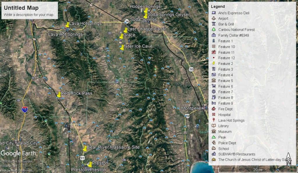
Soda Springs, ID 2010
On January 29th, 2010; I organized an educational group to visit the scientific sites around Soda Springs, Idaho.
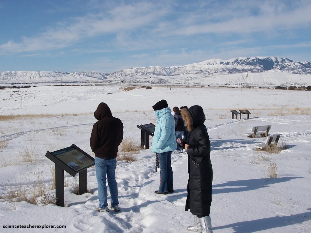
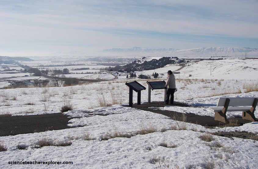
We started with the Bear River Massacre Site. California Volunteers from Camp Floyd, south of Salt Lake city, annihilated between 240 and 400 Shoshoni Natives at the mouth of Battle Creek, north of Preston on a frigid morning, January 29th, 1863. Yes, we visited the site on the 147th anniversary, (pictured below).
The attack was led by Colonel Patrick E. Connor. Although the Mormon settlers had asked Connor for help, the attack was also motivated by Connor’s desire to open the Bear River area to settlement by non-Mormons.
As the soldiers charged down into the ravine, they fired at every living person: men, women, and children, all slaughtered without mercy. Some Shoshone attempted to flee by jumping into the frigid river, which was soon brimming with “dead bodies and blood-red ice,” according to a survivor.
The 4 hour fight left the Shoshone band decimated and terrified. Lodges, food caches and belongings were burned and women and children murdered. Chief Bear Hunter was cruelly tortured to death. When the killing ceased, the massacre field was strewn with bodies which left unburied and at the mercy of scavenging animals and people.
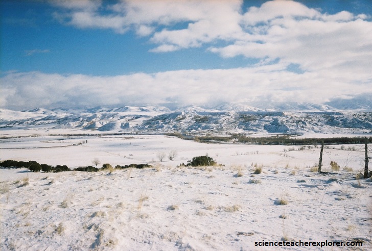
Today, historians estimate that the Bear River Massacre was the deadliest in the history of such events between Native Americans and the U.S. Military. Given incomplete data regarding casualties, this horrifying distinction does remain up for debate, however. Nevertheless, casualty estimates for the Bear River Massacre range from 250 to more than 400 Shoshone (with around 24 Americans also killed). One Danish pioneer who stumbled upon the battleground claimed to have counted as many as 493 bodies.
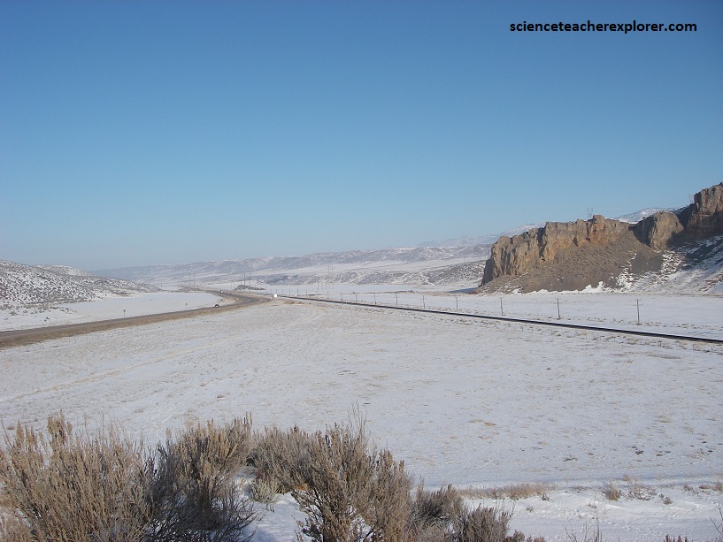
A few kilometers down the road towards Downey, Idaho is “Red Rock Pass. It is geologically significant as the spillway of ancient Lake Bonneville. The pass was cut through resistant Paleozoic Shale, limestone, and dolomite, and forms a narrow gap 3.2 km in length. At one time the pass was 91 meters higher, where the shoreline of Pleistocene Lake Bonneville stood. 14,500 years ago, an overflow caused a sudden erosion of unconsolidated material on the northern shoreline near Red Rock Pass. As the material gave way, Marsh Creek Valley, immediately downstream, was flooded from wall to wall, and the rapid discharge eroded the pass to its present level. The flood then flowed into the Snake River Plain, generally following the path of the present-day Snake River to its outlet in the Pacific. The Bonneville flood, as it is known, was a catastrophic event. The maximum discharge was about 420,000 m³/s.
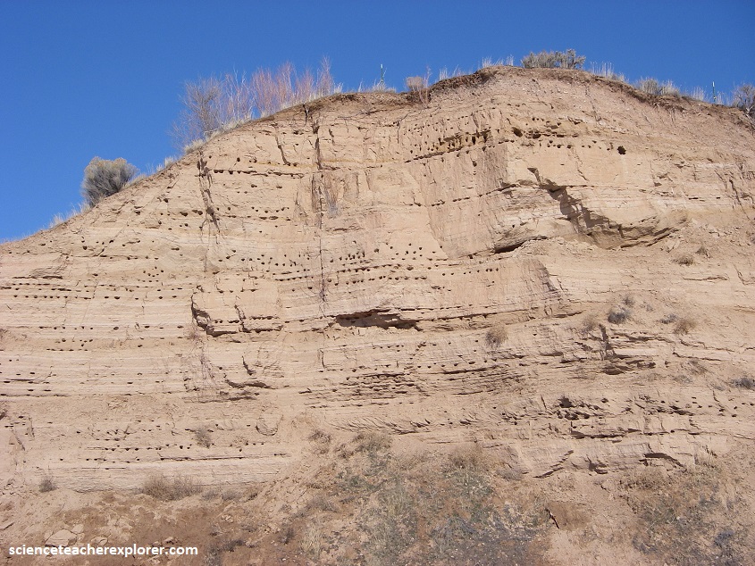
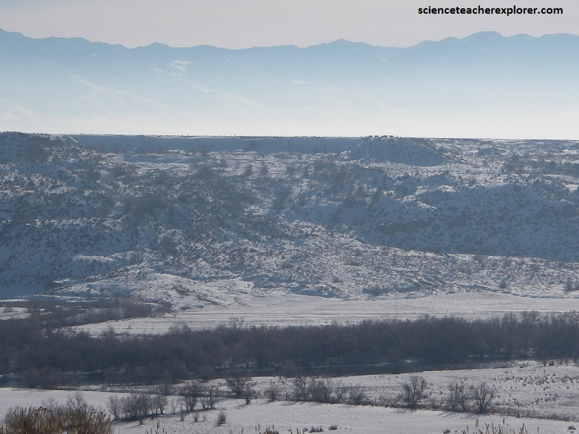
Pictured above, the Bear river deposited a huge, mostly red clay delta here where it entered Lake Bonneville. Then 14,500 years ago, it’s shoreline went down about 30 meters following the enormous discharge into the Snake River, mentioned above. From then on, Lake Bonneville gradually receded to become the Salt Lake. Bear River then had to cut through and erode it’s old delta, forming the steep sides and gullies seen above.
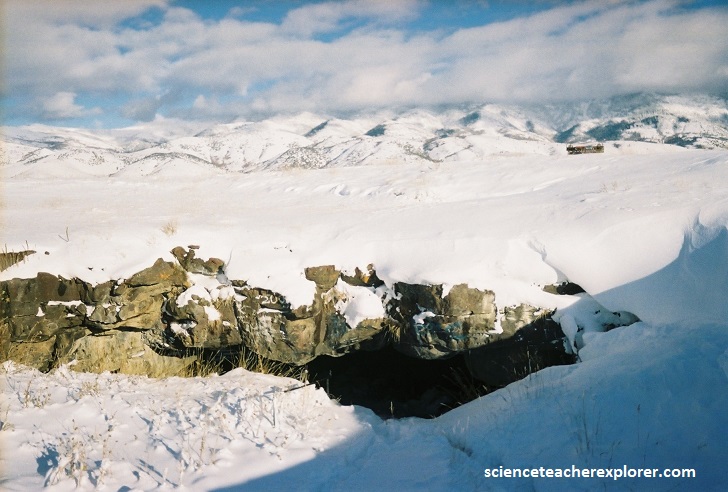
Pictured above, Just 4.8 km south of Grace, a few meters away from the highway on a little turnoff to the east labeled “Ice Cave Road,” an unassuming hole in the ground opens into a cold, dark chasm carved by molten lava 500,000 years ago. This hole in the ground is called “Niter Ice Cave”.
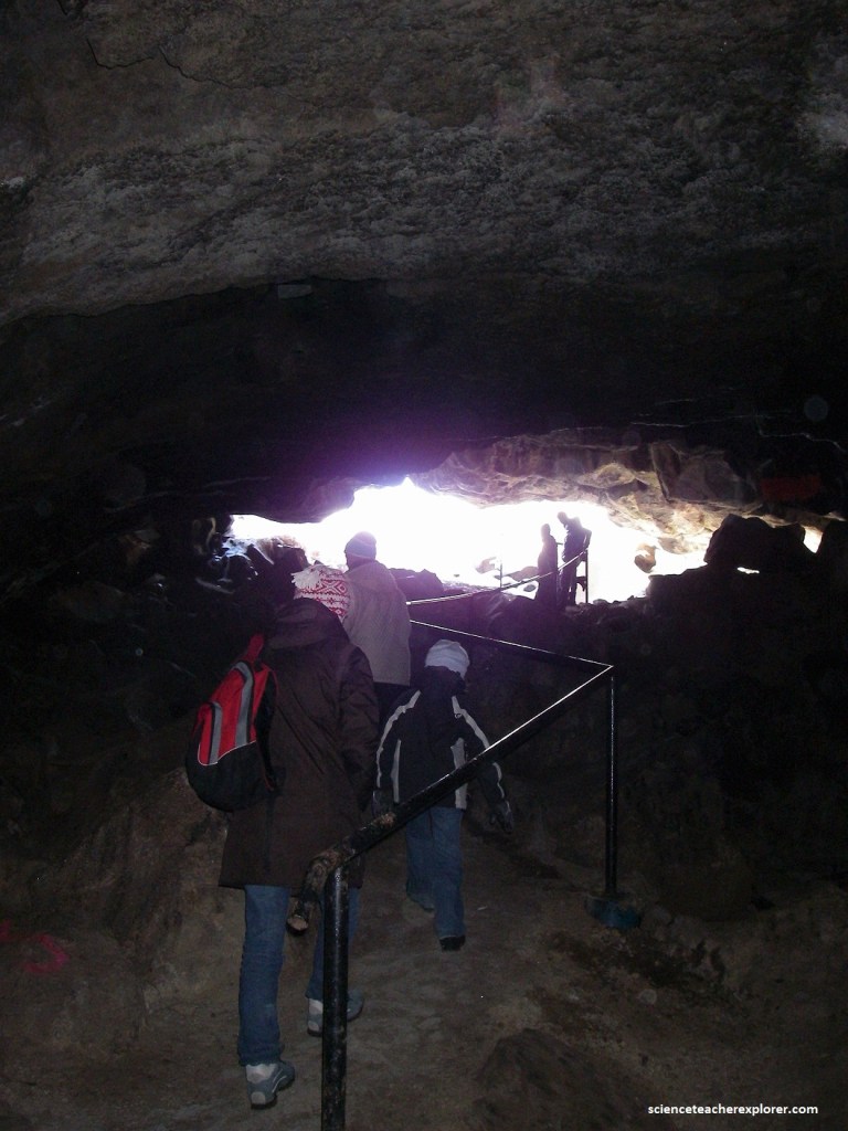
The cave was formed during the middle Pleistocene Epoch about 500,000 years ago when lava flowed out of a vent at Ice Cave Knoll, located on the west side of State Highway 34. This type of basalt volcano typically forms caves, more appropriately called lave tubes, through which molten rock (magma) feeds the distant regions of the growing lava flow, and within which the lava remains fluid for great distances. Niter Ice Cave is actually a small remnant of a lava-tube system that was once several kilometers long. The lava flows are now mostly covered with wind-blown loess.

Niter Ice Cave was important to the early settlers. In 1898, John A. Dalton traveled to Blackfoot, Idaho and filed on a homestead of 160 acres. His family was delighted to find this ice cave and would send their daughter Elsie for milk, butter, and cream, stored in the cave. Mr. Dalton built the first ladder to be used in entering the cave and referred to the storage area as the window. Obviously, a feature of the cave is ice. Water collects and is frozen by cold air passing through the cave. This freezing process takes for about seven months, then gradually melts during the remainder of the year. Pictured above, a railing leads visitors down the somewhat steep and often slippery entrance.
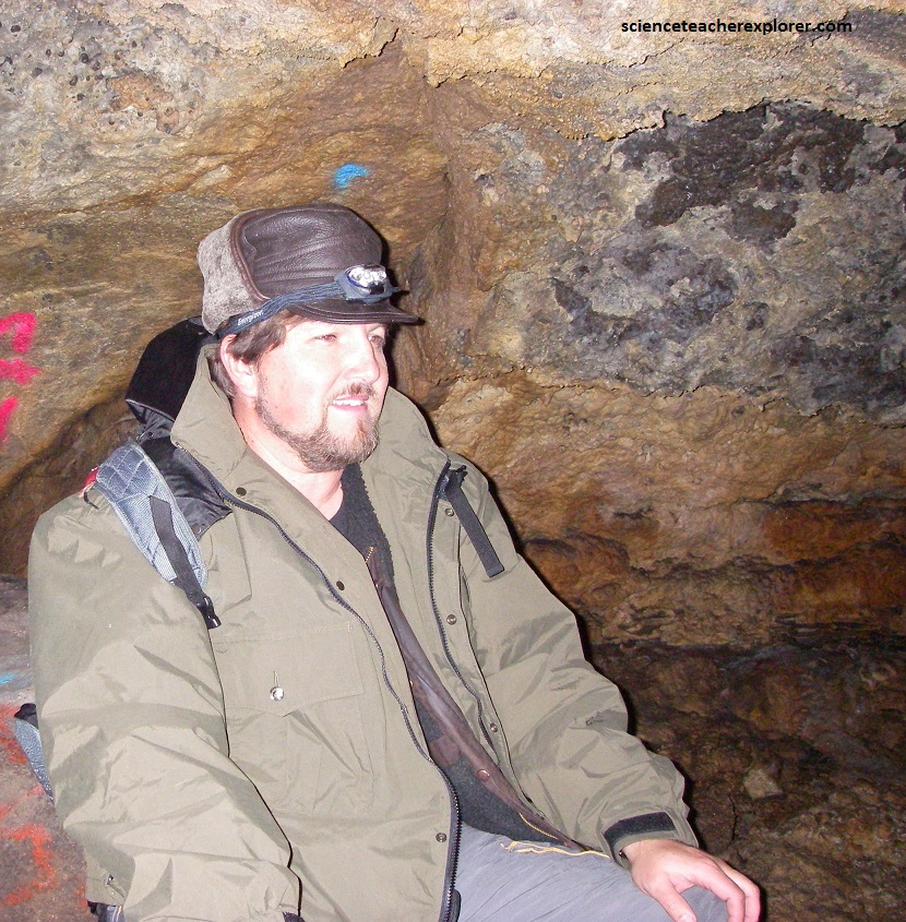
Pictured above, graffiti on the walls and an abandoned fire pit are unfortunate reminders of the cave’s local popularity, use and sometimes misuse, but further inside, nature itself splattered a metallic pattern of minerals, Sistine chapel style, across the cave’s ceiling, sparkling like fireflies in the artificial light of a headlamp.
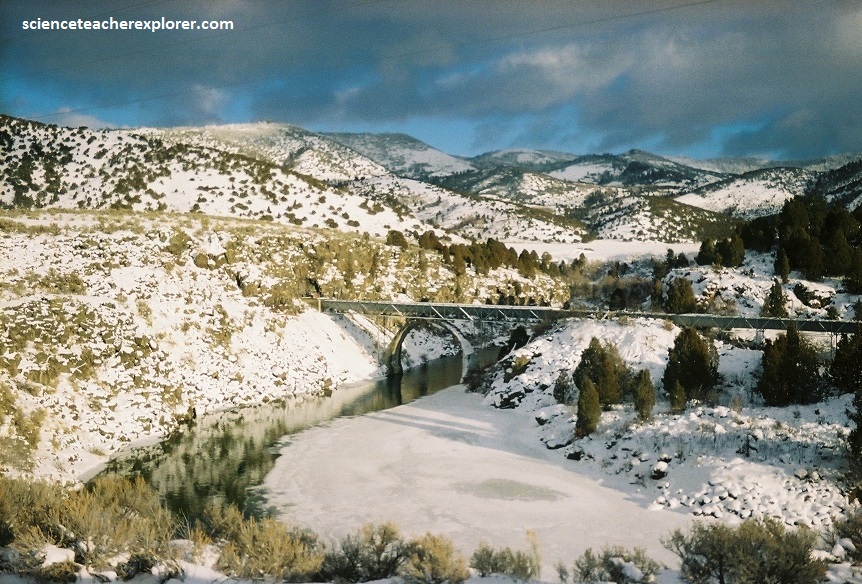
Pictured above, known as the life-blood of the Grace valley, the Last Chance Canal Co. had its beginning in 1895, with attempts to build wooden flumes, only to have them destroyed by heavy snows. Though they suffered many hardships, the early pioneers perservered and with
ingenuity, and were finally able to get water to both sides of the valley in 1902. In 1917 a tunnel was excavated and a new cross-river flume was constructed supported by a massive concrete arch. This flume was replaced by an all-steel flume in 1946. The entire system, the Last Chance dam, tunnel, flume, and the Last Chance main canal feeds five primary
irrigation canals near Grace, Idaho.
Just a few kilometers northeast of Grace is the Soda Springs community in Idaho. The city is named for the hundreds of natural springs of carbonated water that are located in and around the city. The springs were well known to Native Americans and were a famous landmark along the Oregon Trail in the middle 19th century.
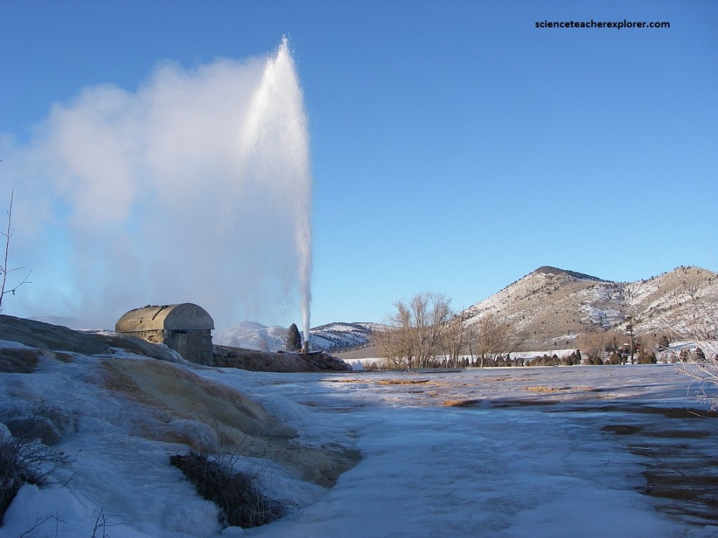
Today the city is also known as the location of the Soda Springs Geyser, which was unleashed in 1934 when “town fathers” were looking for hot water for a “hot pool” bathing attraction. Instead they drilled into a chamber of highly pressurized carbon dioxide gas and cold water and the geyser was released. After running for weeks, and flooding the downtown area, it was capped and manually released when requested as a tourist attraction. Now it is let loose every hour on the hour by a timed release valve. Pictured above, its height and volume has not decreased after many years. The water coming out of the geyser is about 70 degrees Fahrenheit, shoots 30 meters into the air.
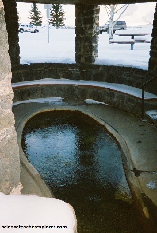
Free, clear, sparkling soda water still is available in beautiful Hooper Springs. Pictured above, the prime attraction for more than 160 years, soda water from these springs was marketed nationally after rail service reached this resort area in 1882. W.H. Hooper, Salt Lake City’s leading banker and president of Zion’s Cooperative Mercantile Institution, had his summer home here. Since the waters were naturally carbonated and was allegedly tasty for making root beer, the Idan-ha’ Natural Mineral Water Company shipped bottled water from the Soda Springs area all over the world in the 1890s.
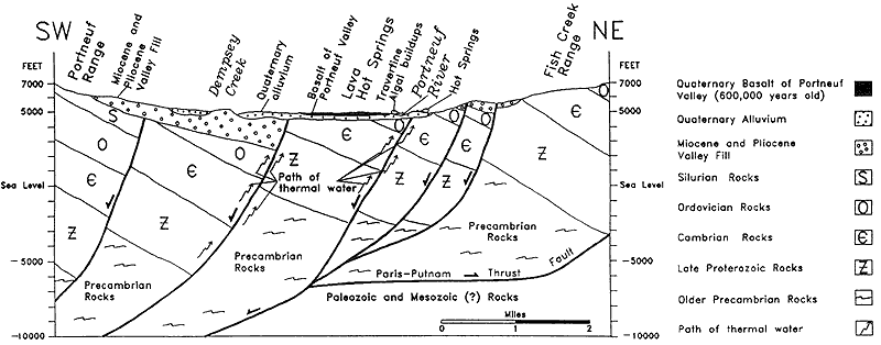
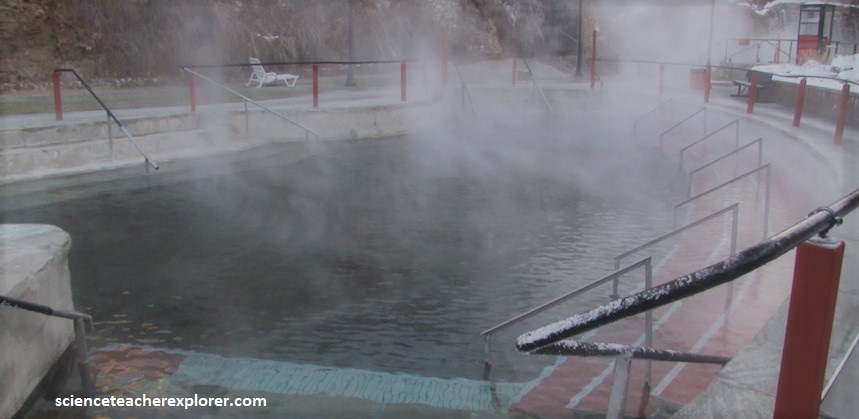
Just a 20 km west of Soda Springs is Lava Hotsprings. The Lava Hotspring system has a flow of 130 liters/second. The hot mineral water emerges from the ground at 113°F / 45°C. The mineral content of the water includes manganese, sodium, iron, calcium bicarbonate, potassium, magnesium, iron, zinc and fluoride. The Shoshone-Bannock Natives called it the “land of healing waters”. The rock content of the spring vents consist of Paleozoic quartzite and younger travertine.
The source of heat at Lava Hot Springs can be attributed to the young volcanic activity and high heat flow from the upwelling mantle plume underneath Yellowstone. However, it is also responsible for the lava flows and cinder cones of both the eastern Snake River Plain and the Blackfoot Volcanic Field, which stretches from Grace to the Blackfoot Reservoir. The closest of those lava flows is just to the east of Lava Hot Springs, in the valley just on the other side of Fish Creek Pass and towards the Soda Springs.
