Los Ilinizas, Ecuador
While trekking in Ecuador in 2022, my buddy (Mike Stevens) and I decided to explore the Los Ilinizas Ecological Reserve. Only 55 km southwest from Quito, we visited this reserve because it was named after the famous Ilinizas volcanoes, (west of Cotopaxi Volcano).

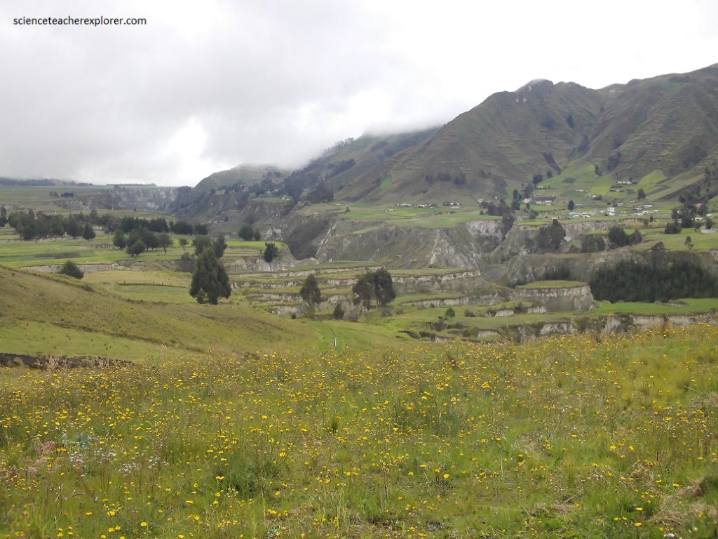
The Los Ilinizas Ecological Reserve was declared a protected area on In 1997 and has an area of 149,900 hectares, which includes the provinces of Cotopaxi, Pichincha and Santo Domingo de los Tsáchilas. The altitude of the reserve starts at 800 meters above sea level and reaches 5,263 meters. Here you can find various types of forests such as tropical forests, warm valleys, extensive meadows and Andean paramo.
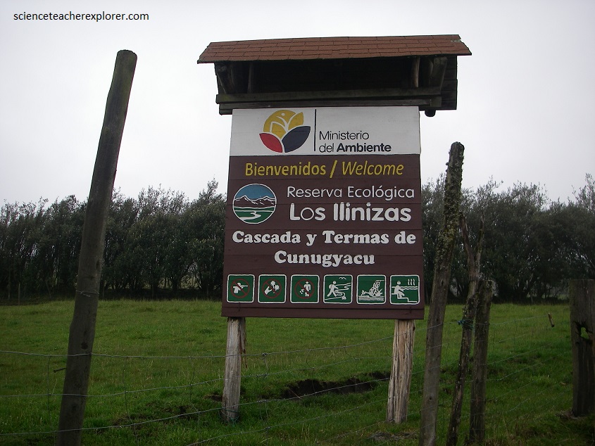
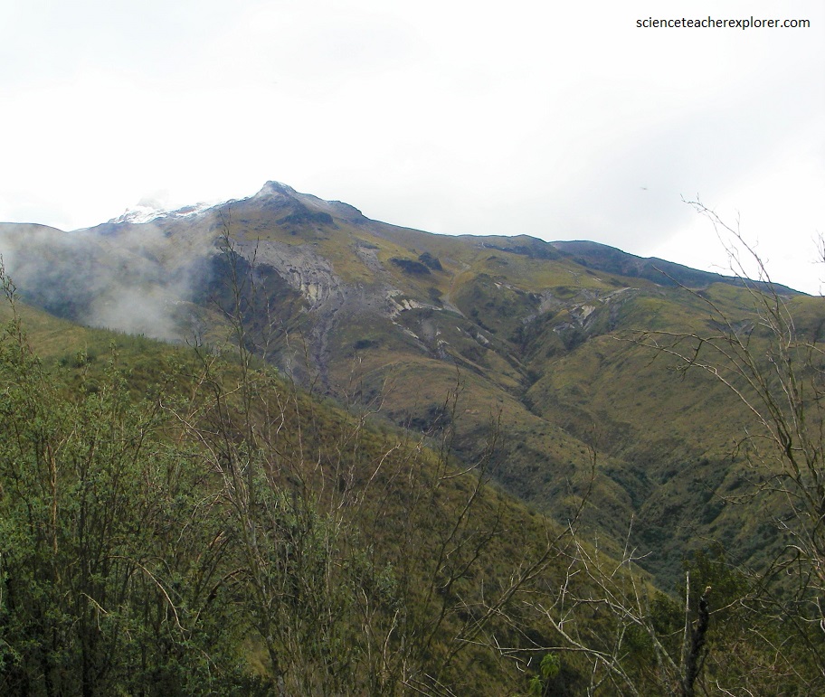
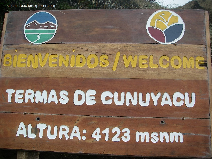
The first place we explored is the foothills of the Ilinizas. The Ilinizas are two summits of a single origin (Norte & Sur) , which were part of a single active volcano. The highest and widest summit is that of the south (Sur) with 5,263 meters of altitude and always has snow, while the North summit (Norte) has an altitude of 5,125 meters without snow. We were only interested in climbing the foot of Ilinuza Sur to visit some natural hot-springs called the Cascada de Oro and the Termas de Cunugyacu. To get to the Cascadas de Oro and the Termas de Cunuyacu we took the detour to the Pastocalle parish (Lasso sector) from the Panamericana (E35). From the main square we ascended 11 kilometers along a third-order road until we reached the entrance of the Reserve (pictured below).
The soils that cover the reserve are of early volcanic origin. The high altitude reached by its peaks allows the existence of a well-marked trail.
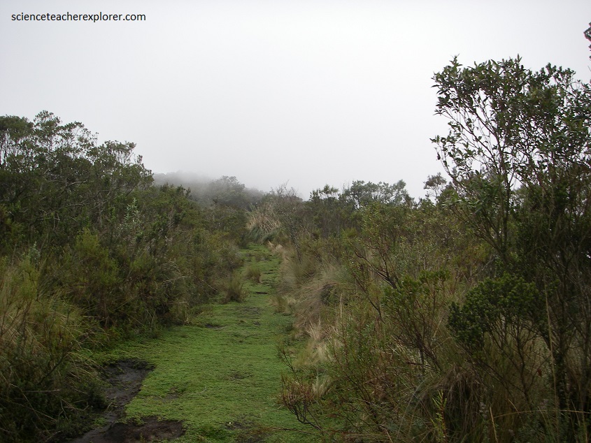
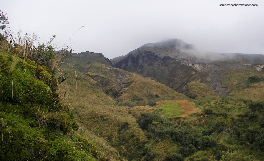
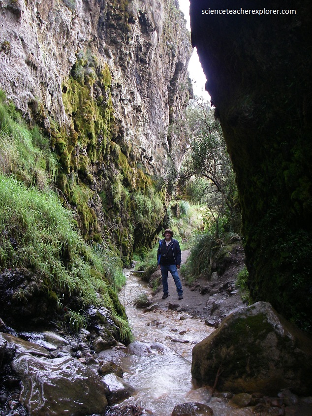
Pictured above, to get to the hot springs we had to follow the path to the waterfall and then walked for another 15 to 20 minutes until we reached the pool, passing through a Polylepis forest.
Regarding the flora, we found Sangre de gallina, sangre de drago, pambil, suro, achupalla, canelo, matapalo, arrayán, moral bobo, chinchín, sacha chocho, rabbit ears, cedar, walnut, wax laurel. , alder, jiguas, chonta and tagua, matapalos, porotones, giant ferns, paper trees, chuquiraguas, pajonales, chochos de monte, mortiños, chilcas, zapatitos, lecheros and cacti.
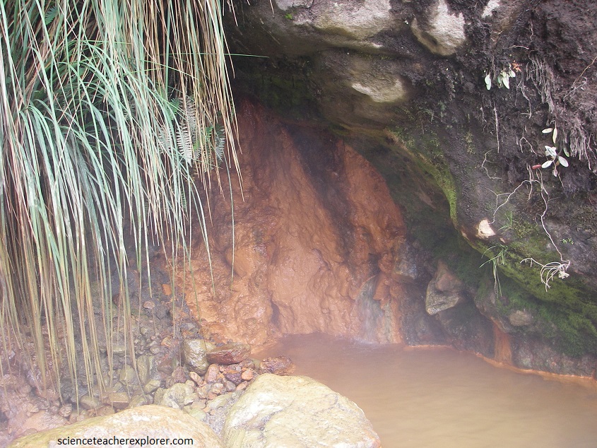
The hot springs of Cunuyacu are born from Iliniza Sur. The temperature in the atmosphere in the Los Ilinizas Ecological Reserve varies depending on where you are, if you are in the high zone it can be between 0 and 2 degrees Celsius while in the low zone it is between 20 and 25 degrees Celsius.
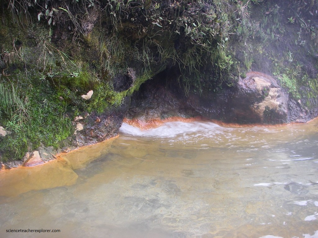
Pictured below, the the Cascada or Golden Waterfall contains a large amount of minerals such as sulfur and iron, which cause the stones to change color to an intense orange, although the water remains transparent and does not smell of any kind.
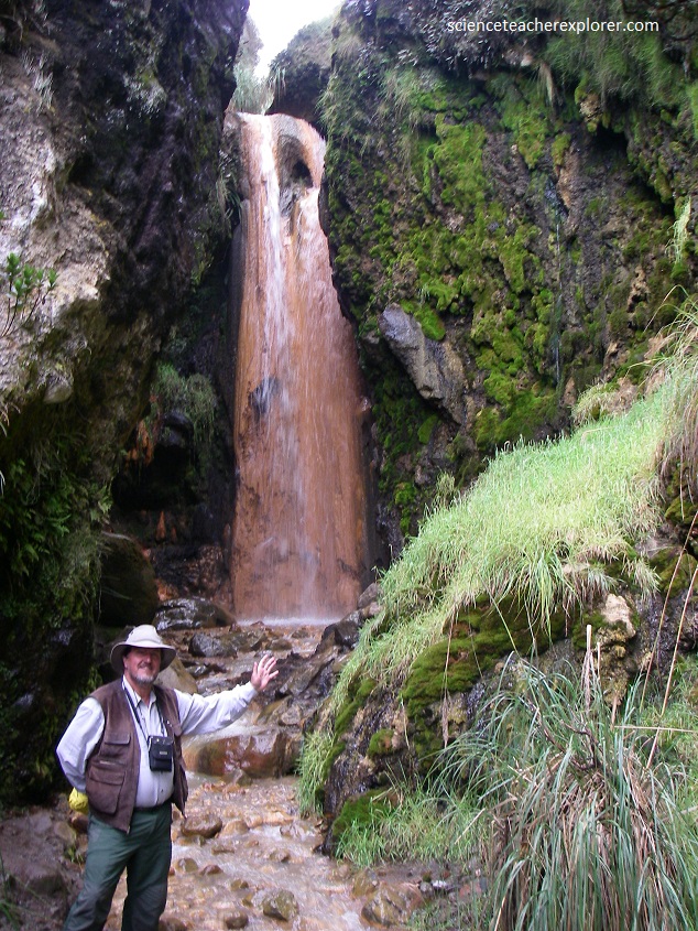
The small but impressive waterfall has a height of 12 to 15 meters with the water temperature around 6ºC.
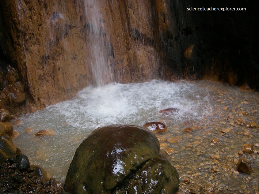
The color is due to the rocks that have been tinted red and yellow by volcanic minerals. The color of the water itself is clear and it doesn’t give off a bad odor that volcanic minerals tend to produce.
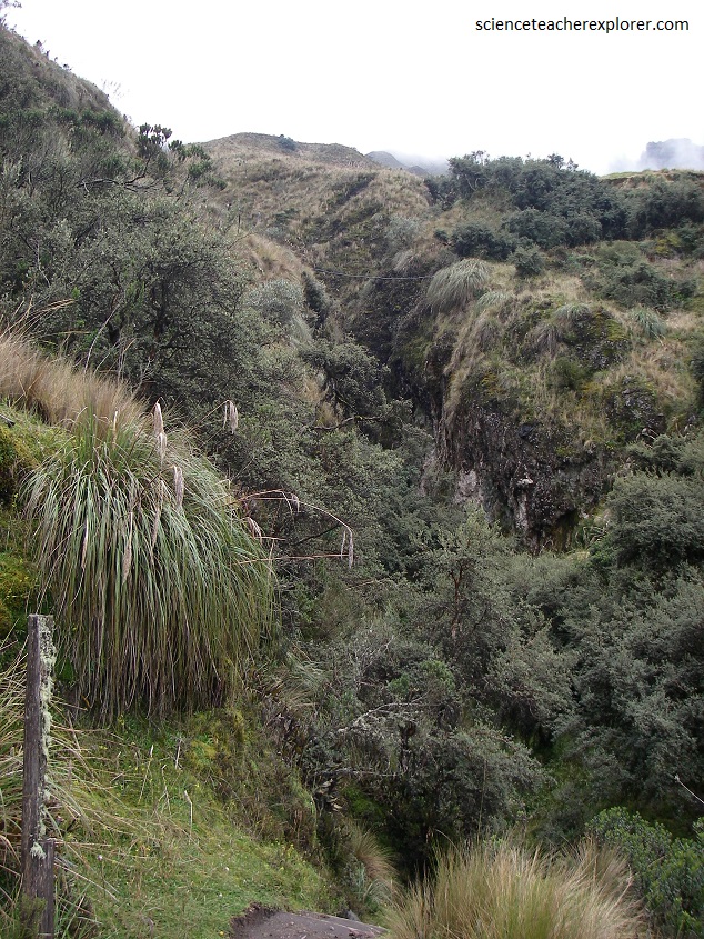
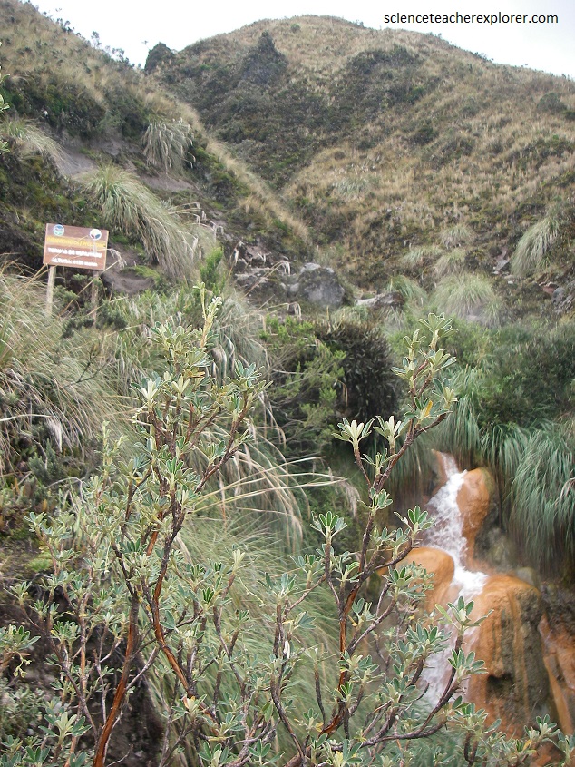
We spent about 20 minutes taking pictures at the Golden Waterfall before continuing to the Termas de Cunugyacu hot-spring. After crossing a bridge at the river, the trail split with one route leading to the waterfall and the other going to the Termas de Cunugyacu hot-spring, (pictured below).
Along the trail, we passed through a mystical little forest of Polylepis trees. In Ecuador, this tree is nicknamed the ‘Paper Tree’ due to its appearance of the bark peeling off like layers of paper.
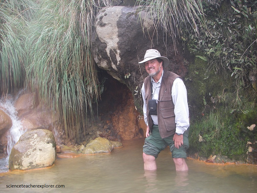
Pictured below, the hot spring was a small natural pool where they’ve stacked some sandbags to contain more water. The water temperature itself was warm, not hot, but it’s more refreshing after the hike. We could smell the minerals here, but it is not too bad.
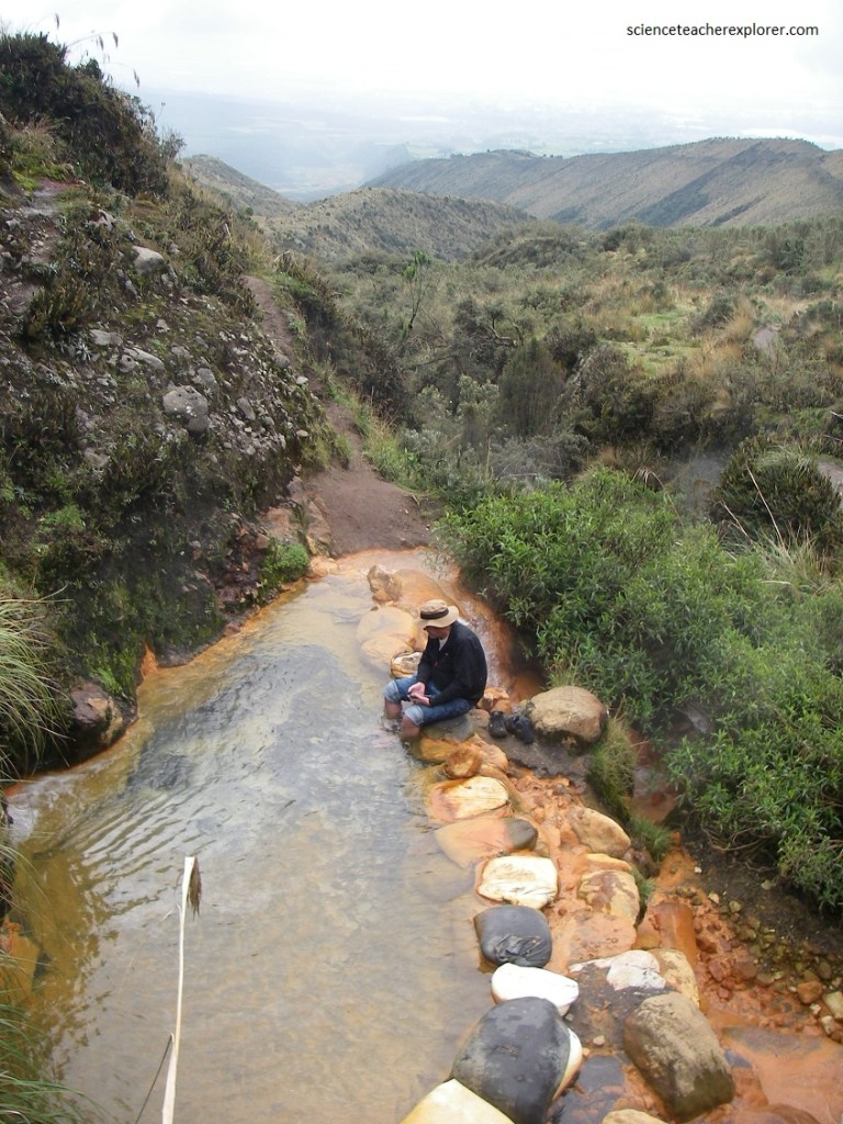
Pictured above, the highlight was the view since the pool is like a balcony on the mountainside looking over the landscape. The weather wasn’t great so we didn’t get to see much of the neighboring mountains, but it was still a great place to relax. We stayed there for about an hour before it started to rain, so we started heading back before the downpour.
The Cunuyacu hot springs are natural pools located at 4,125 meters above sea level on the slopes of the snow-capped Iliniza Sur. The thermal waters are transparent and of volcanic origin and have a temperature of 22ºC to 25ºC.
The thermal waters of the Ilinizas offer a medicinal alternative, since bathing in thermal waters produces an increase in body temperature, eliminating pathogenic microorganisms, as well as toxins from the body, as well as increasing the hydrostatic pressure of the body, which increases the blood circulation and oxygenation, better covering the metabolic demand of the different tissues. In addition, the hot springs have useful therapeutic properties to normalize the functions of the endocrine glands, as well as the functioning of the body’s nervous system. It helps improve and stimulate the immune system, mental relaxation, endorphin production and regulation of glandular functions.
The thermal waters of Termas de Cunugyacu, contains a large amount of useful minerals for the body, and useful to maintain the state of biological health. The chemicals include:
- Sodium: important to control the water balance of the skin.
- Magnesium: offers an energizing effect and is useful in inhibiting inflammatory processes.
- Selenium: prevents premature aging.
- Calcium: important mineral for the body, provides moisture. In addition, it is beneficial in reducing the aging process of the skin.
- Copper: useful in cell regeneration, favoring the synthesis of collagen, melanin, and keratin.
After exploring the foothills of Ilinuza Sur, we spent another day trekking the Quilotoa Crater.
The driving route to get to the Quilotoa Crater follows the Panamericana Highway south as far as Latacunga. From Latacunga, take E 130 going west, where it then climbs a regional road up to the Quilotoa village.
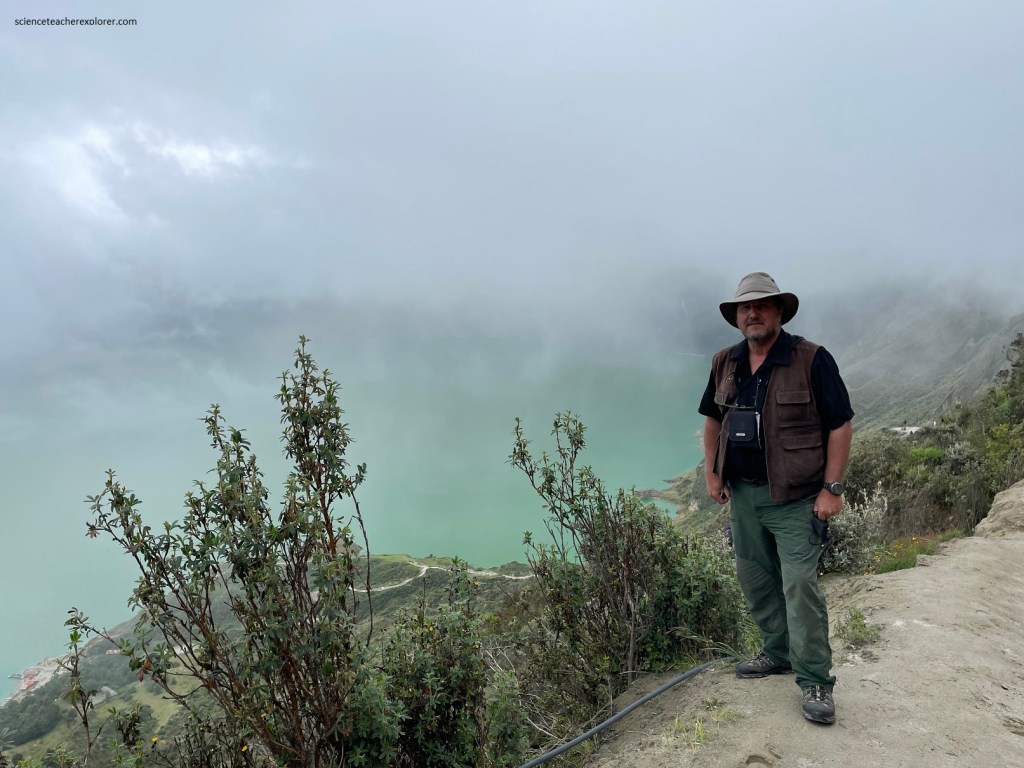
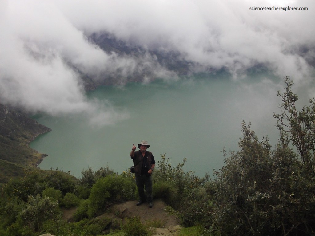
The Quilotoa Lagoon is one of the most beautiful places in the Ecuadorian Sierra. The lagoon is located inside a crater of an inactive volcano. The distance from the edge of the crater to the water of the lagoon is 2 kilometers, along a path that reaches the shore of the lagoon. The descent is not very difficult but the ascent is somewhat complicated due to the change of height.
The Quilotoa Volcano last erupted around 1280 A.D. in one of the planet’s most explosive eruptions of the past 1000 years. It caused the collapse of the volcanic dome to form the wide crater seen above and below. The Quilotoa Volcano has since been dormant.
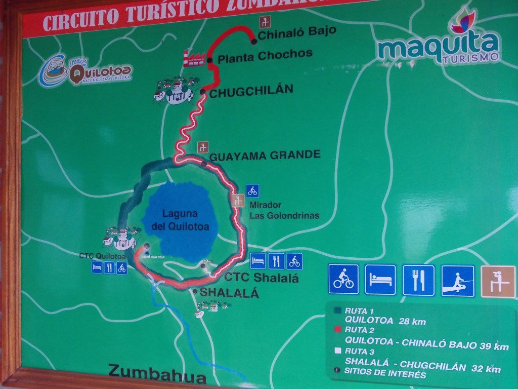
Quilotoa village near the rim, sits at an altitude of 3,914m above sea level. The elevation of Quilotoa lake shore inside the crater is 364m lower.
The lake is estimated to have a depth of up to 250 meters. The steep crater slopes mean that there is a sharp drop-off to this depth. Quilotoa crater measures 3km in diameter, with a circumference of approximately 10km. This would be the distance of the trail, if had decided to walk around the rim. However, we choose to stay on the south-western side near the village.
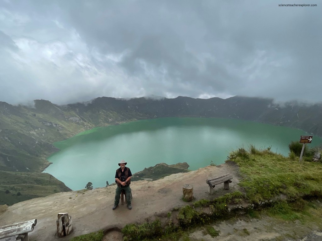
Volcanic minerals in the crater give the lake water it’s emerald-green tint. The water color also appears to change depending on time of day and sunlight.
