Yosemite NP, CA 2021
In the late summer of 2021, Becky (my wife) and I explored the Yosemite National Park in the United States. I had driven through Yosemite National Park in 1990, on my way back from San Francisco. I hadn’t spent most of one day doing that.
From deep glacial valleys on the west to the crest of the Sierra on the east, the park has magnificent scenery and the highest and most spectacular waterfalls in the United States.
Batholithic intrusions that make up the greatest part of the bedrock, represents the root of a volcanic plutonic complex that formed in Mesozoic time as a function of subduction on North America’s western margin.

Within Yosemite National Park, a complex of igneous rock of varying composition was intruded over a period of more than 100 million years. These batholithic rocks were intruded into older metasedimentary and meta-volcanic rocks now preserved as isolated masses and at the eastern and western margins of the batholith. Because the granites, granodiorites, quartz diorites, and monzonites that make up the batholith in this area have differently to geologic processes since their emplacement. Thus the character of the igneous structures influenced, and to a large extent controlled, the development of the magnificent and varied scenery that we see in the park today.
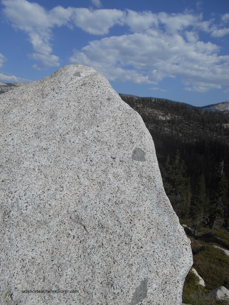
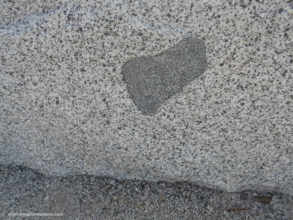
Practically all the rocks in Yosemite are intrusive igneous rocks of the Sierra Nevada Batholith, granite and it’s kin. Pictured above, the granite is composed primarily of quartz and feldspar, with sprinkles of dark minerals such as biotite and hornblende. Some of the granite-like rocks can be classed as granodiorite or as quartz monzonite, depending on the proportion of different minerals of the feldspar group.
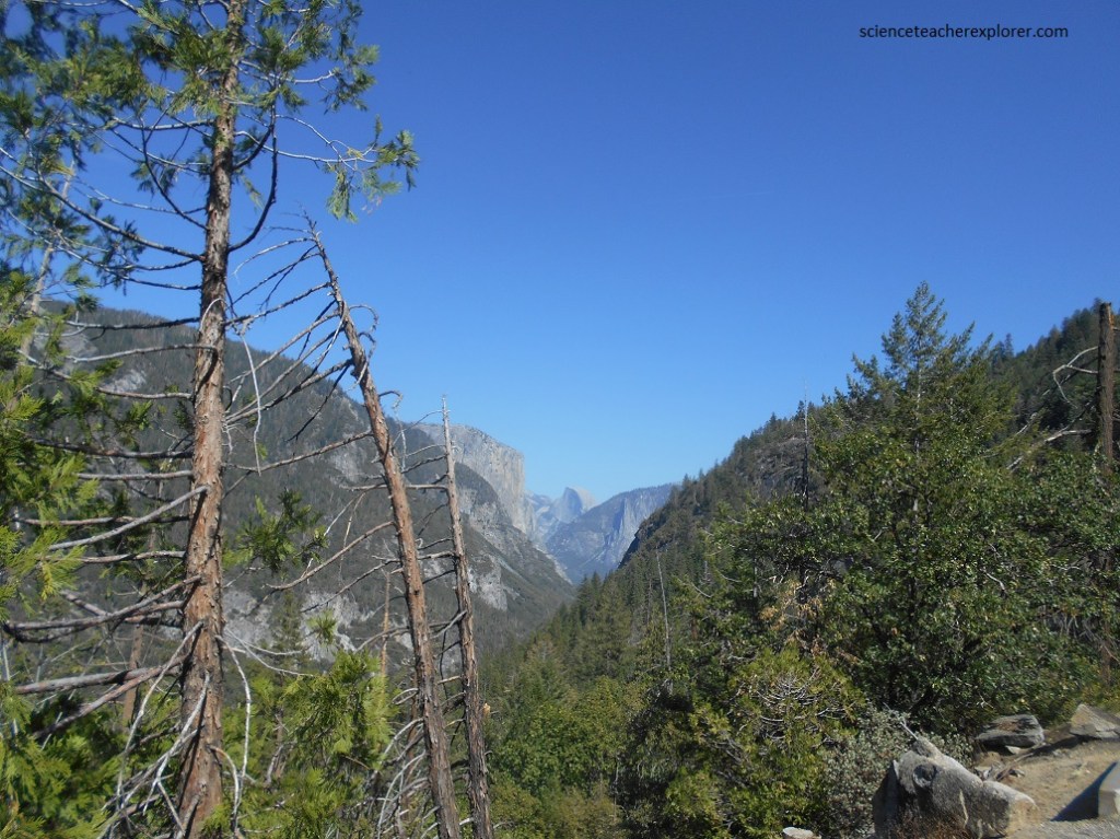
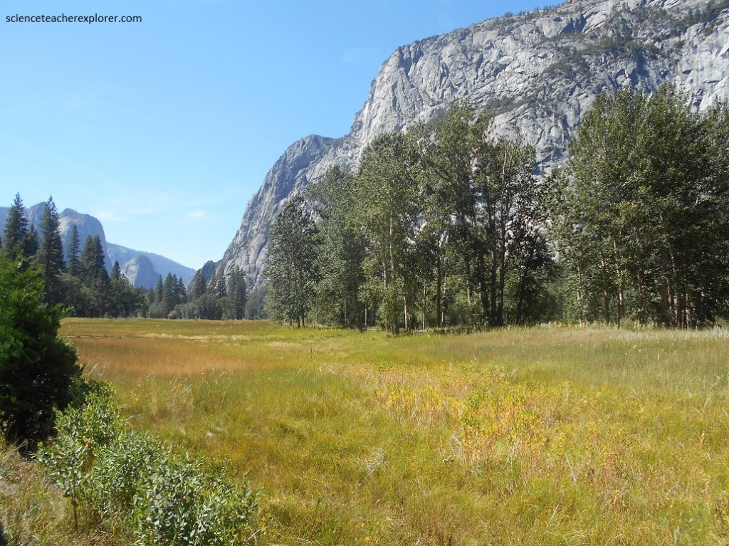
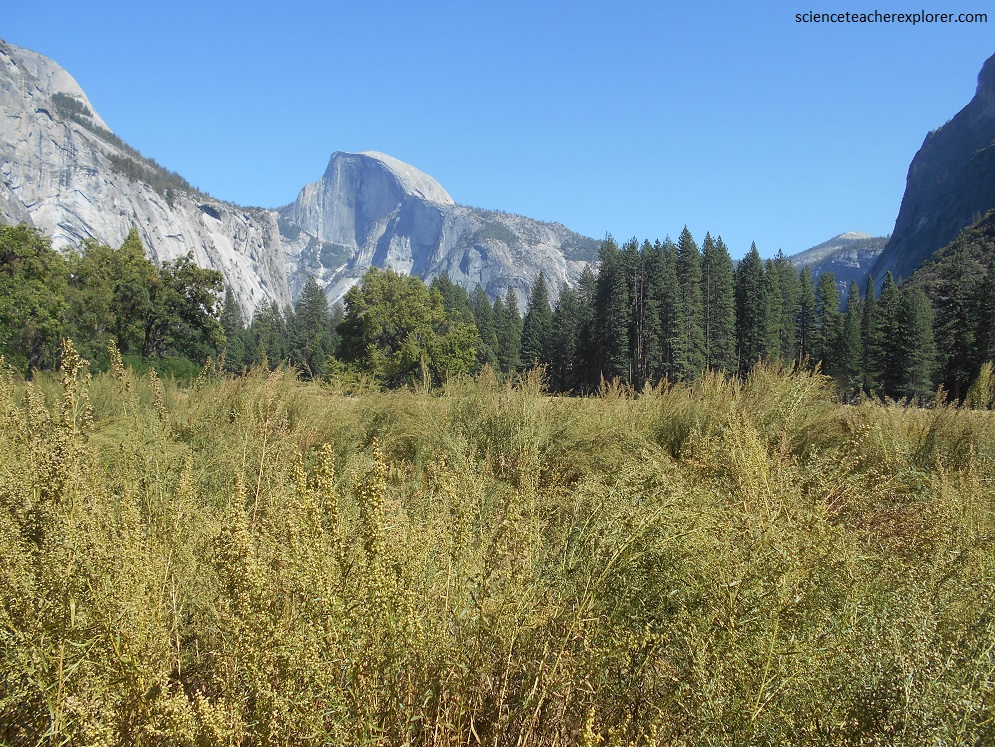
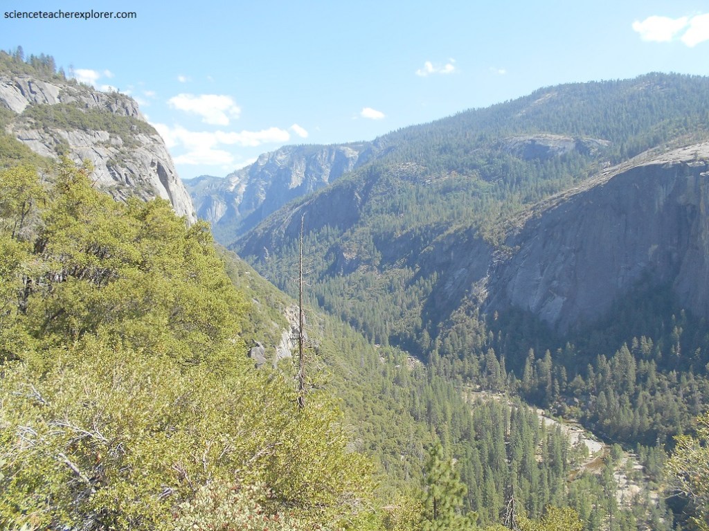
Only about 11 km long and hardly 1 km wide (a width about equal to its depth), Yosemite Valley is one of the loveliest spots on earth (pictured above and below). Its meadowed floor and handsome granite cliffs, its majestic waterfalls and foaming cascade, its mirrorlike pools and great rockfalls tell an eloquent story of uplift and erosion, of changing climates, of winters and summers and floods of spring, a story verified by features in the uplands that surround the valley itself.
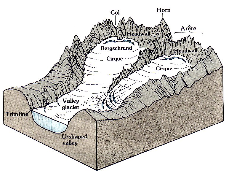
The floors of Yosemite Valley and it’s near neighbors contain glacial moraines, and behind them flat-lying lake deposits as much as 700 m deep. Glaciers were major sculptors in all of Yosemite, (Glacier ice formerly covered close to 70% of the present national park).
Pictured above, everywhere in the Yosemite National Park, is evidence of glacial remains, (spectacular cliffs, hanging valleys, high-plunging waterfalls, and stair-stepped canyon floors).
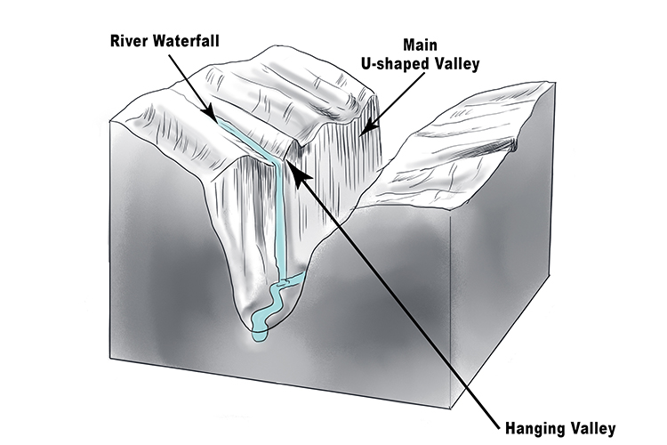
Pictured below is Bridal-veil Fall. Usually flowing all summer long, (except when Becky and I were there), this beautiful fall leaps 189 m from a high, classic hanging valley shaped by a tributary of the Sherwin Glacier.
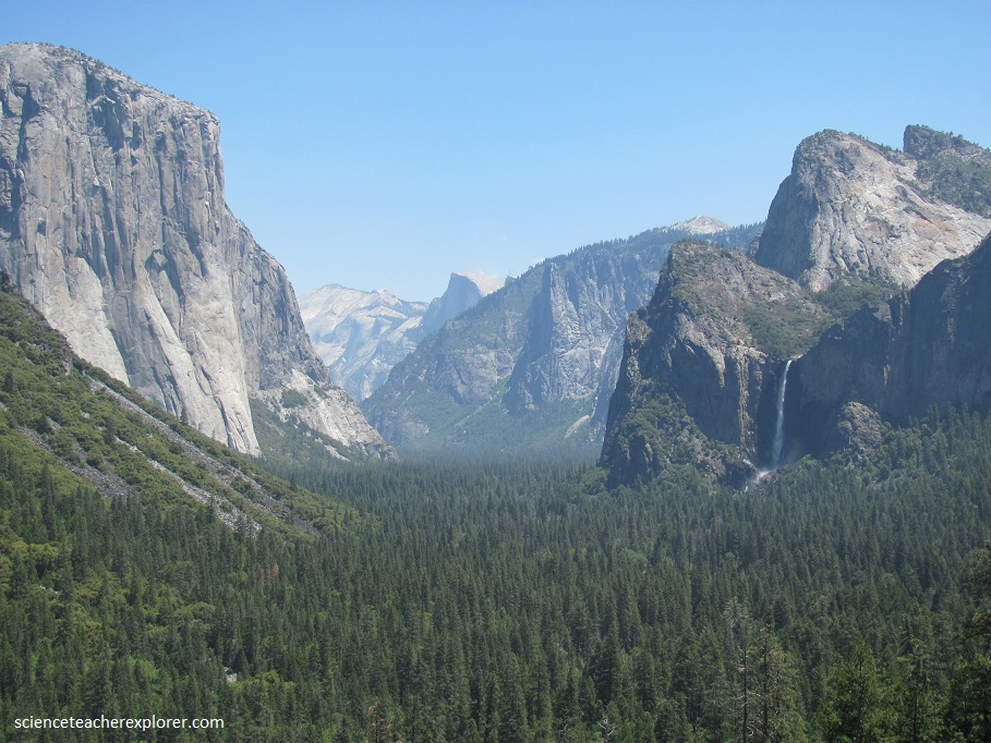
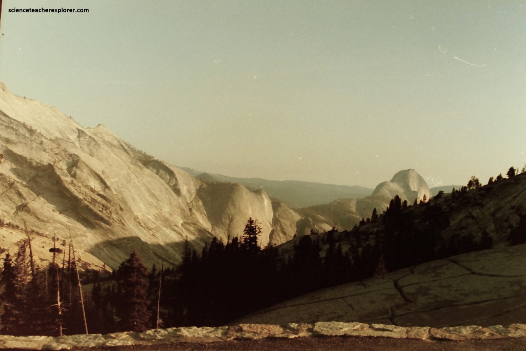
Pictured above from a 1990 photo; the cliff which the Bridal-veil Fall plunges is largely a product of the Sherwin Glacier, the only glacier to reach downstream. The Sherwin Glacier, which reached its maximum size about 75,000-60,000 years ago, was by far the greatest and mightiest river of ice, (in places 1200 m thick). Pictured below, as the Sherwin Glacier ground through Yosemite Valley, filling it from rim to rim, Glacier point and North Dome felt ice across their summits, though Half Dome and El Capitan projected above it.
Imaged above, formed by the union of glaciers from Tenaga Canyon and the upper valley of the Merced River, the Sherwin Glacier also received small tributary flows from both sides. Since with its enormous mass it cut downward far faster than did it little tributary glaciers, it brought about the difference in elevation between Yosemite Valley and its tributary canyons, (the difference responsible for today’s magnificent waterfalls).
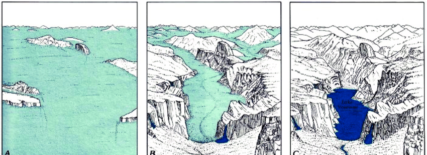
As the Sherwin Glacier flowed through Yosemite Valley, never reaching the tops of the cliffs, it tidied up the scattered boulders and recessional moraines left by its predecessor, and smoothed and sharpened the cliffs on either side of the valley. Most significantly, its terminal moraine, near Bridal-veil Falls, dammed the valley. When the ice retreated, the valley was the site of a new lake, Lake Yosemite.
The actual rock floor of Yosemite Valley lies well below it’s present grassy meadows. The terminal moraine of the Bridal-veil Glacier, of which only the very top is now visible, dammed the valley, creating Lake Yosemite. As the lake filled with stream-carried sediments, the valley floor became almost flat.
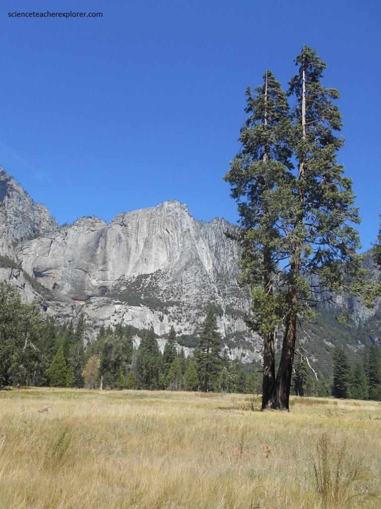
Leaping 536 meters, Upper and Lower Yosemite Falls plunge from a high hanging valley nearly to Yosemite Valley’s floor. Yosemite Creek, in the hanging valley above the falls, is fed largely by snowmelt, so the falls usually decrease to trickle or appear to dry up completely by late summer, (pictured above).
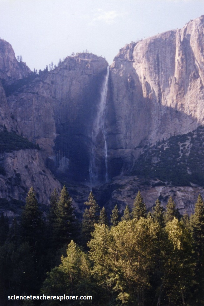
The rock wall of this part of Yosemite Valley consists of strong, massive El Capitan and Sentinel Granites. The Upper and Lower Falls are separated by a zone of horizontal fractures which permitted more glacial plucking and which now continue to erode back from the base of the Upper Fall.
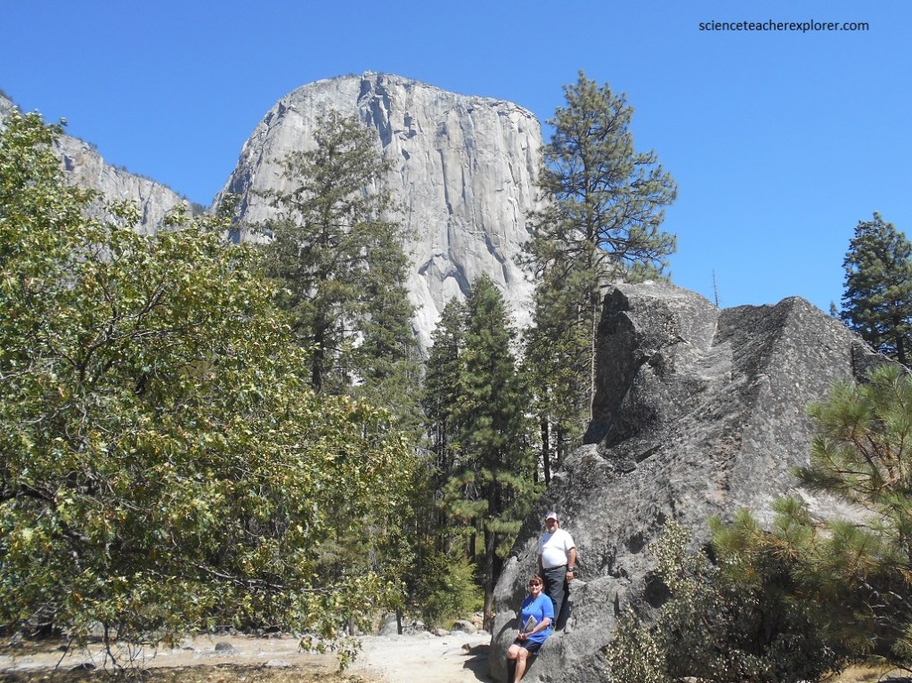
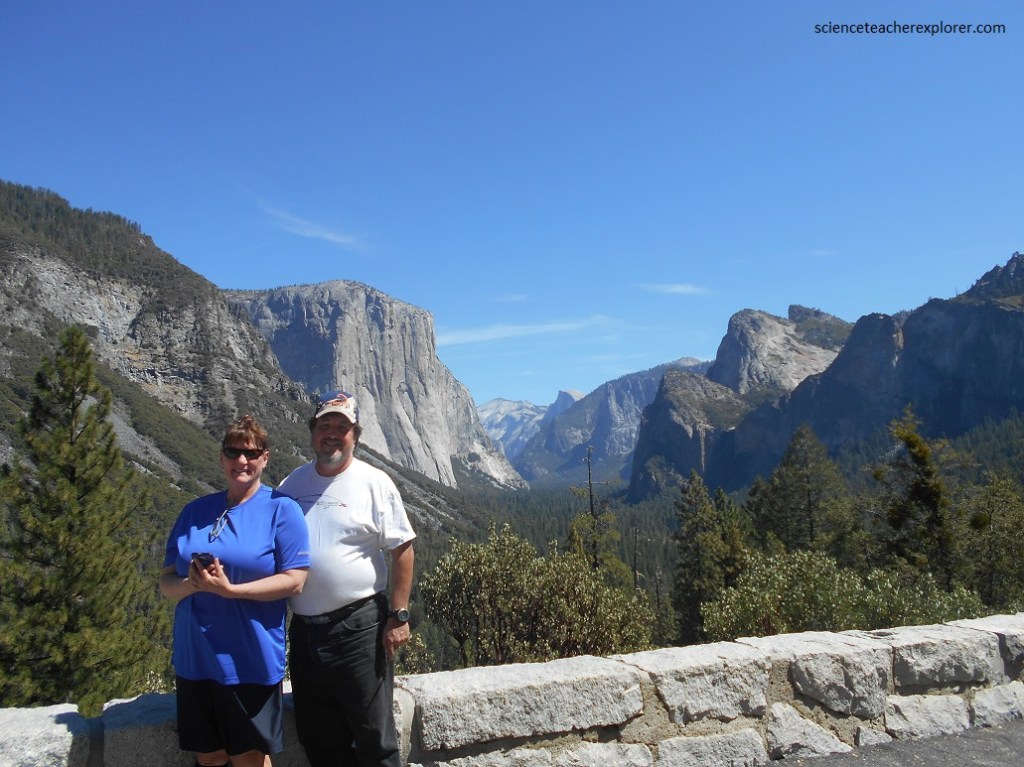
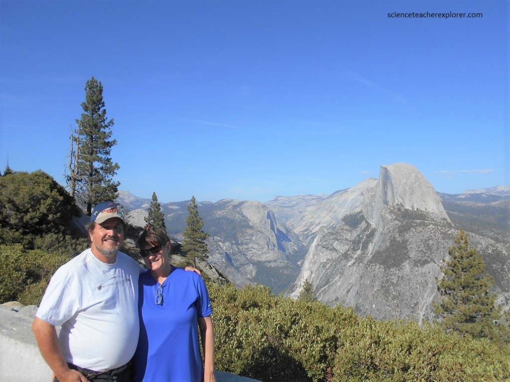
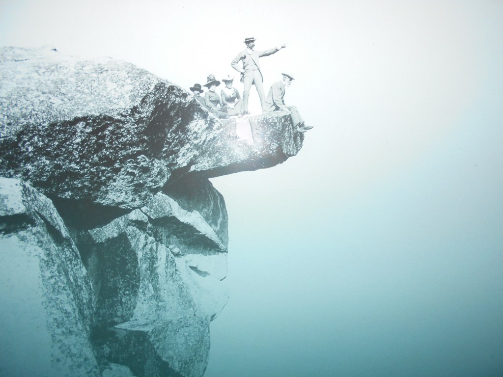
El Capitan forms, with Cathedral Rocks, the gateway to Yosemite Valley. The mighty cliff rises 883 meters above the valley floor. It developed where the El Capitan Granit, massive and rlatively unjointed, cuts across the valley to Cathedral Rocks. Both El Capitan and Cathedral Rocks owe their present shape to the El Portal Glacier. Within the massive granite are dark veins of gray diorite. Since it cuts across the granite, the diorite is the younger. Becky and I are sitting on a large chunk of the diorite because it is densely jointed and therefore a poor cliff-former. It usually breaks up into the Rockslides.
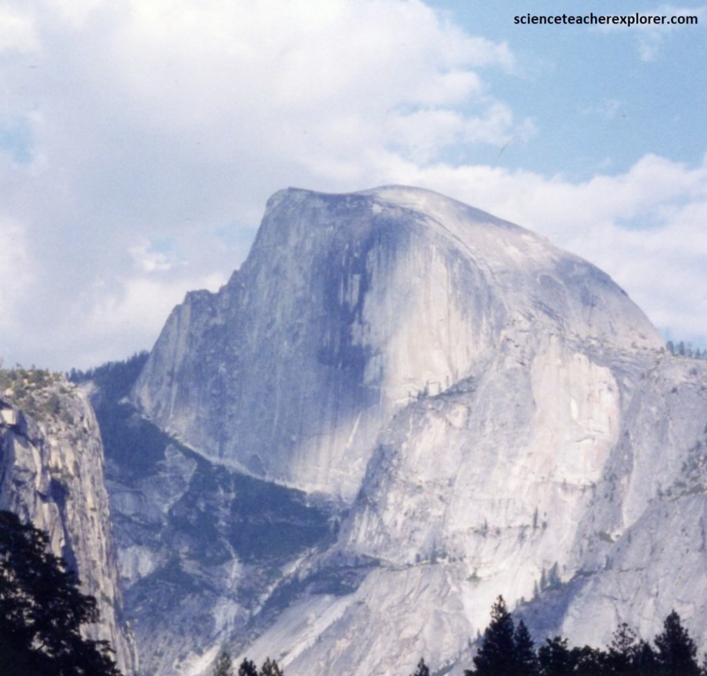
Composed of massive Half Dome Granite, this great rock monument is a product of both glaciation and pressure-release jointing.
The imposing precipice of “Half Dome’s” north face was established by glacial plucking along vertical joints, some of them visible on the low-shoulder about 2/3rds of the way up this face. Half Dome’s summit rose 150 m above the Sherwin Glacier, and much more of course above later, smaller glaciers. Its rounded south side is a product of scaling, or exfoliation, along pressure-release joints.
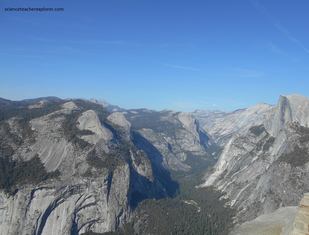
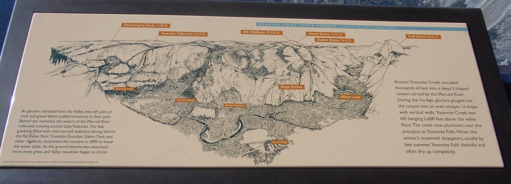
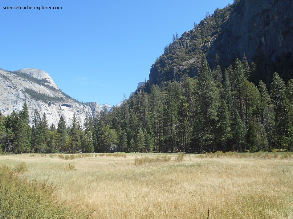
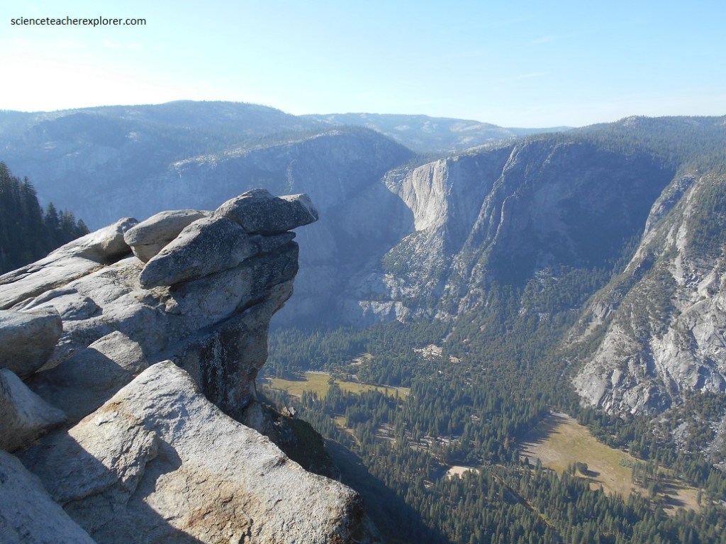
Pictured above, from Glacier Point the upper part of Yosemite Valley is laid out before our eyes, (one of the most magnificent views we’ve ever seen). To the northeast, Half Dome towers over the bare-rock walls of Tenaya Canyon, and North Dome rises above Royal Arches and the Washington Column, (picture below).
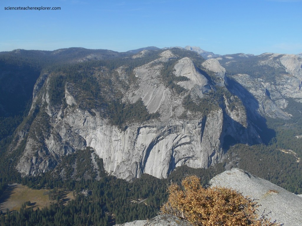
Royal Arches were created as masses of undermined, unsupported granite fell away from the north valley wall. Under the stress of gravity, slabs of massive unjointed rock break away in long curves.
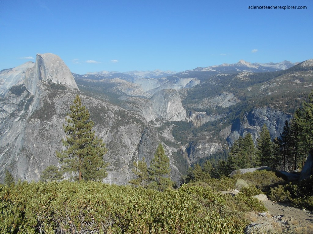
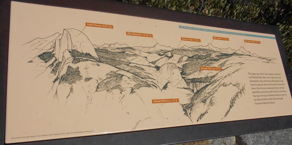
Pictured above, from “Glacier Point” to the southeast, Grizzly Peak, Liberty Cap, and the north slopes of Mount Starr King frame Little Yosemite Valley. Picture below is “Nevada Fall” that plunges 181 m over a cliff, whose position is governed by joints in the rock. Joints are widely spaced just above the fall, where the massive rock withstood glacial plucking, remaining as one of the treads in the glacial stair way of Little Yosemite Valley.
Little Yosemite Valley displays a classic example of a glacial stairway, where flowing ice scoured out nearly horizontal stairway “treads” and nearly vertical “risers”. The positions of treads and risers are governed by spacing of joints in the granite. (Joints affect the width of the glacial valleys).
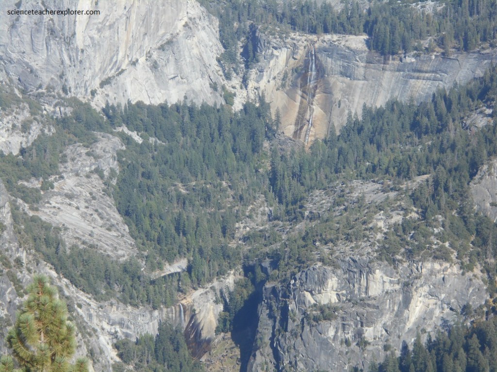
Pictured above, Vernal Fall is the lowest fall of the glacial staircase that extends upstream through Little Yosemite Valley. The position of the fall, governed by joints in otherwise massive Half Dome Granite, is at right angles to that of Nevada Fall. Today the rock continues to be undermined by frost and gradual decomposition of ever-wet rocks.
Nearly 1000 meters above the valley floor, Glacier Point was overridden by ice of the Sherwin Glacier. Evidence lies in glacial striations and polish here on the point itself, as well as in glacial erratics, (boulders of distinctly different rock types), near the summit.
Built as the “Great Sierra Wagon Road” to supply mines near Tioga Pass, this highway was purchased and repaired, as a gift to the people, by Stephen Mather in 1915. It gradually ascends the forested west-tilting slope of the Sierra to Tuolumne Meadows, and then climbs to Tioga Pass.
Powerful geological forces shaped this landscape. Evidence emerges throughout this granite scene.
Chambers of magma deep with the earth slowly crystallized 100-80 million years ago to form hard granite rock. Overtime, erosion by rivers and extensive glaciers exposed and sculpted the rock.
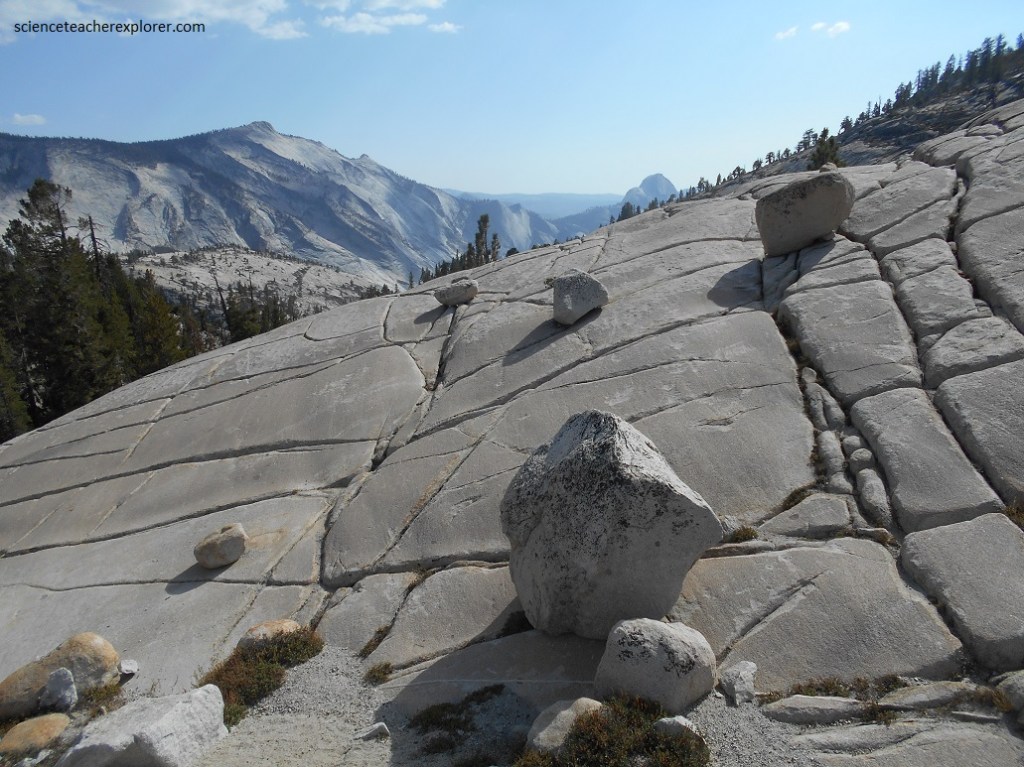
Pictured above, these large boulders randomly placed on the bedrock are evidence of the most recent glaciation. The rocks either toppled down slopes onto the glacier or were plucked from the bedrock. They landed here as the ice melted away.
In the distance of the above photo, “Half Dome” is seen on the right. To the left is the massive northwest face of “Cloud’s Rest”. From its summit (2386 m elevation) the sheer granite face, one of the largest in the world, drops nearly 4300 m to lower Tenaya Creek.
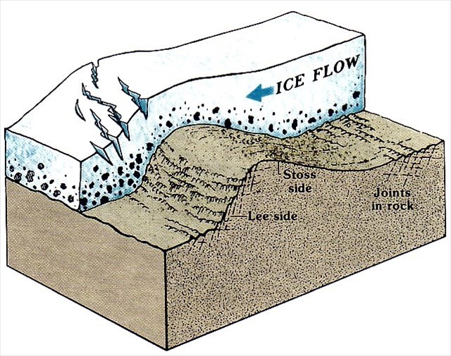
Over the last million year, major glaciers have come and gone in Yosemite. Only 20 thousand years ago the most recent glacier extended from the high peaks to the distant horizon (Tioga Glacier). Like rough sandpaper smoothing wood, these glaciers polished the rock you see near here, (Roche Moutonnee)
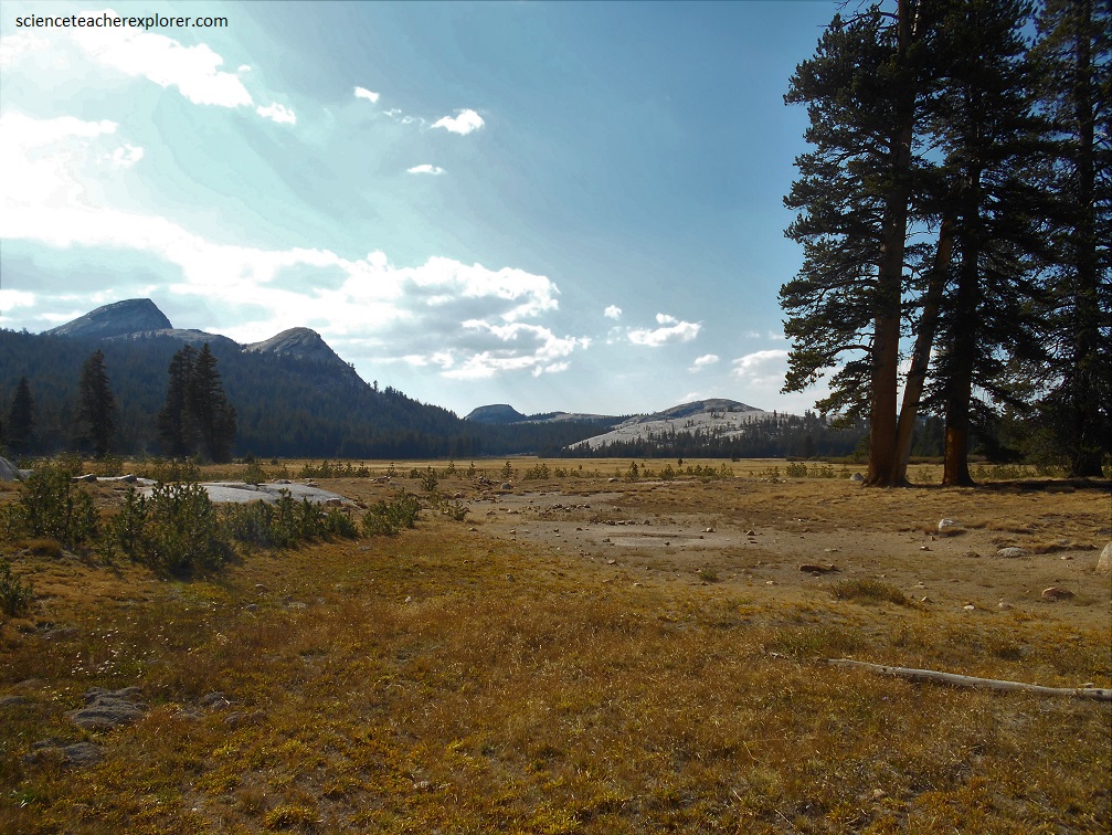
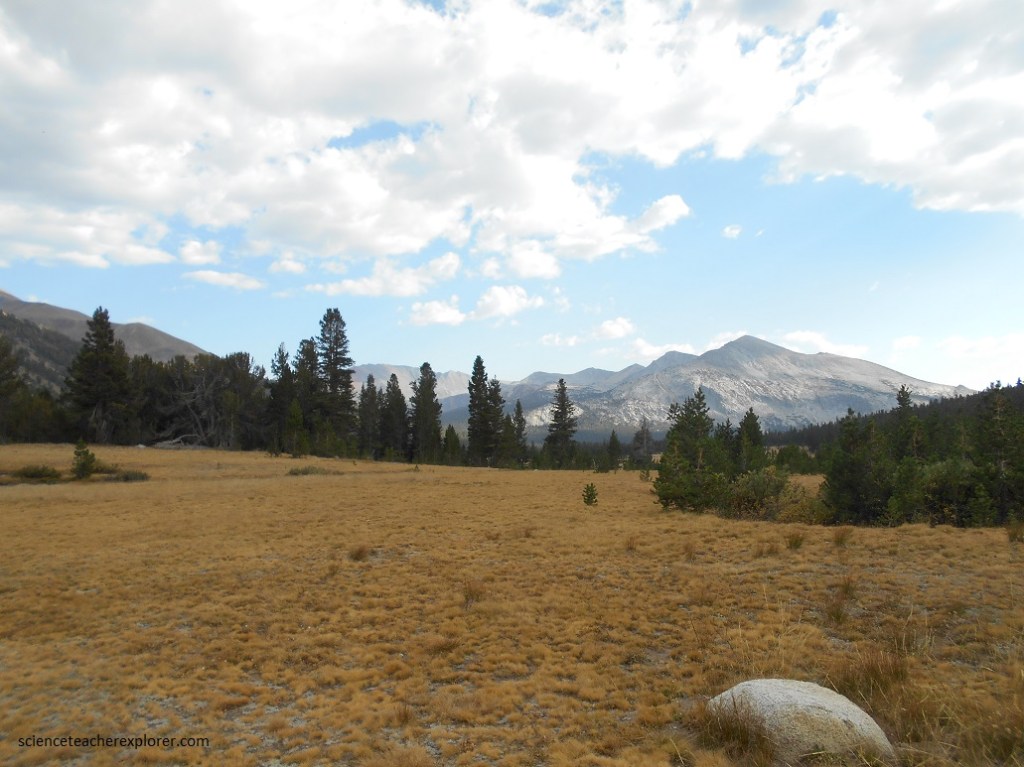
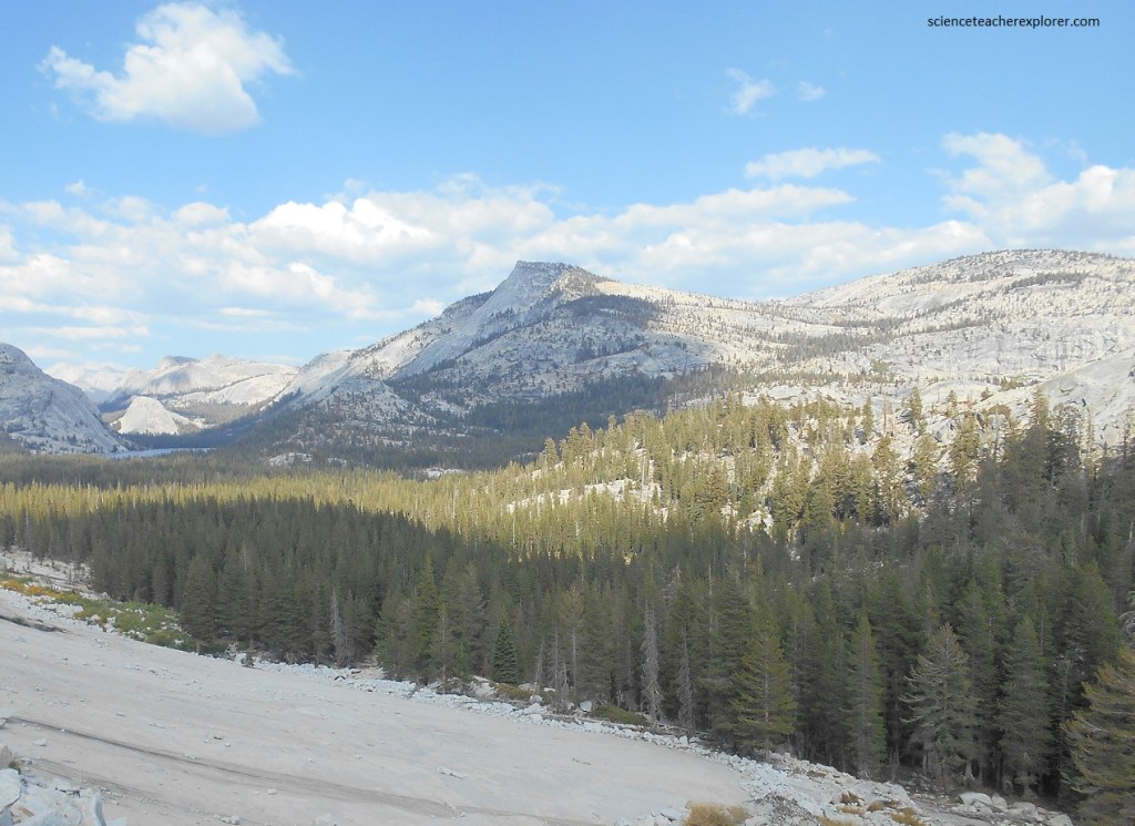
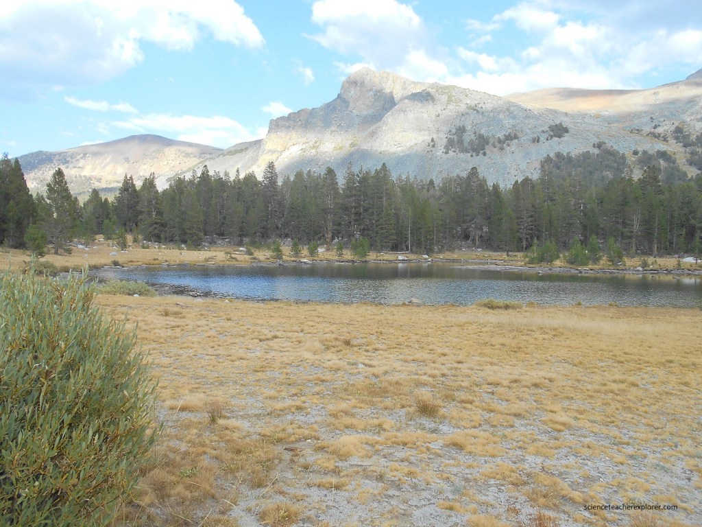
Picture above, the Toulumne Meadow is the largest in the Sierra, and was buried by most of the past Glaciers. The Sherwin ice cap was more than 600 m thick over Tuolumne Meadow. Its slow outward flow scoured a shallow depression in the bedrock surface, a depression occupied much later by rock studded ponds. As the ponds filled in with sand, gravel, and plant material, the meadow came into being. The Toulumne River winds lazily from one end of the meadow to the other, it’s shifting course isolating oxbow lakes in abandoned meanders. Ice rounded and polished numerous Roches Moutonnees, including the large granite domes that border the meadow, and left them strewn with erratics.
Pictured above, Tioga Pass is 3031 m high, the road crosses an eroded roof pendant of altered, metamorphosed sedimentary and volcanic rock. This is the boundary of the park. The road continues onto Inyo National Forest.
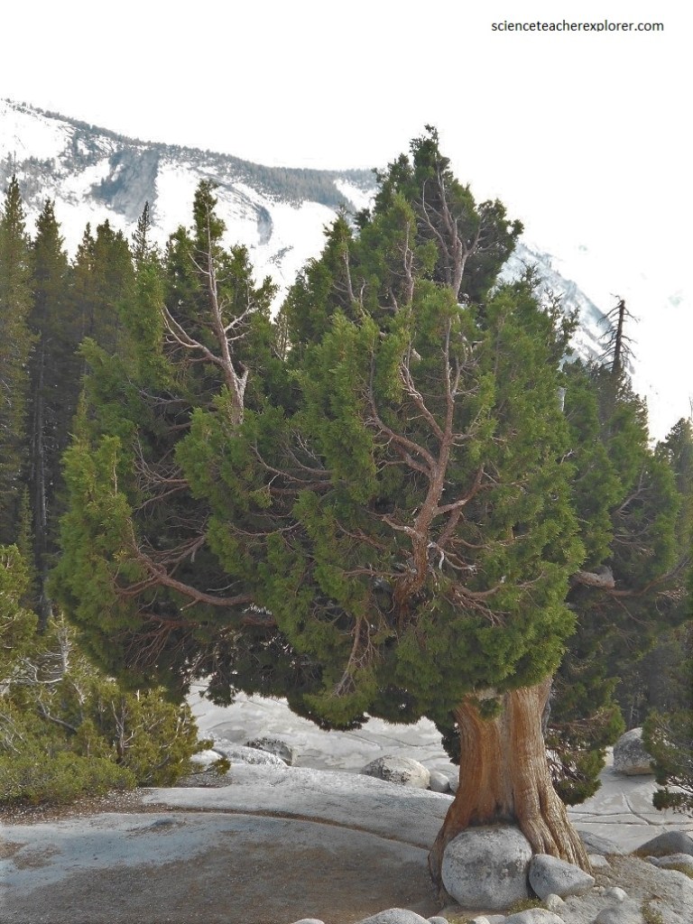
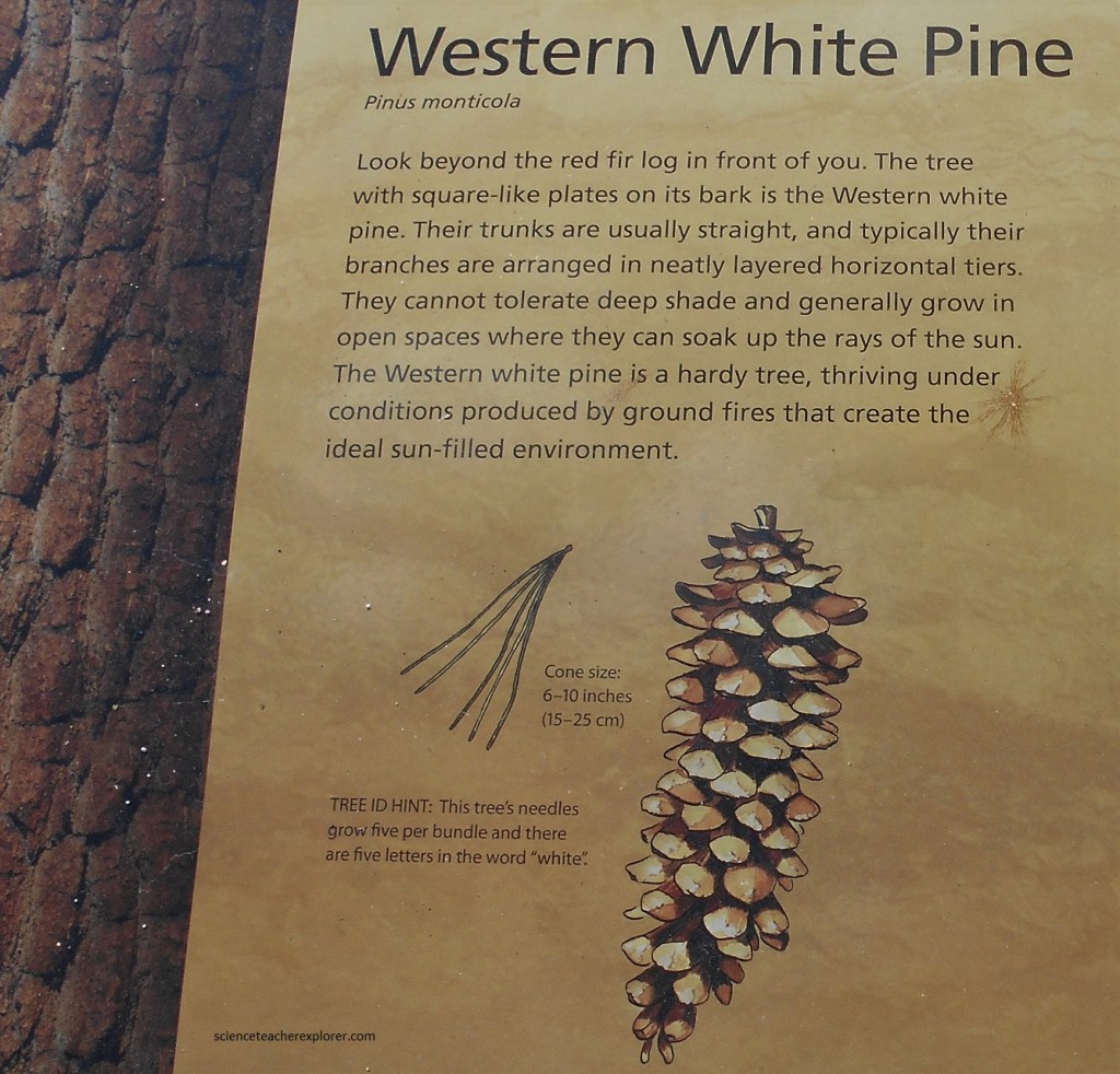
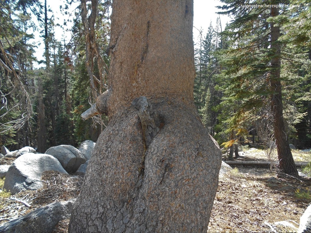
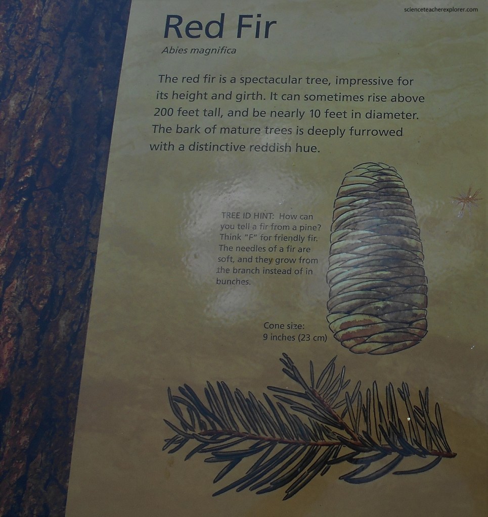
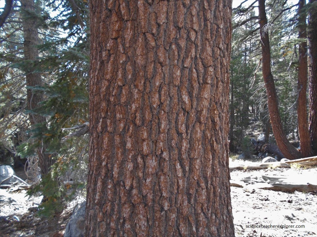
Three major pines are found along the Tioga Pass Road. I’ve provided pictures of all three of them.
Tioga Lake is a small glacial lake in the Inyo National Forest of, about 3 km north of the Tioga Pass entrance to Yosemite National Park.
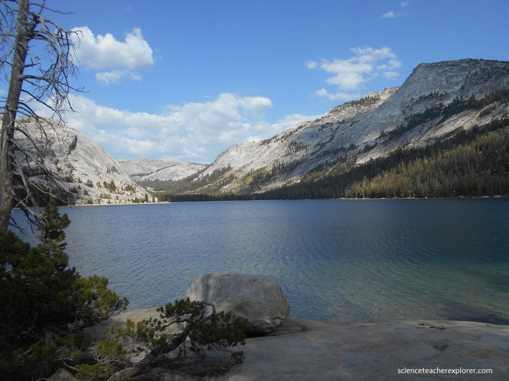
Because of its inaccessibility, the region and Tioga Lake itself are popular with campers who want to avoid the crowds of Yosemite, photographers, anglers, and nature lovers in general (pictured above). Because of the altitude and its location at the crest of a major pass, the weather is extremely unpredictable, and the length of the seasons varies from year to year.
Because of its wide range of elevations, Yosemite encompasses several life zones determined by elevation, moisture, temperature, and exposure to storms. Sometimes, conditions vary significantly within a zone and allow for a micro-climate, a place where the climate contrasts with that of the entire zone. The picture above and below are in one such micro-climate. Trees that typically grow at higher or lower elevations live in close proximity. The Upper Montane zone (1800-2450 m elev.) above.