Mono Lake, CA 2021
During the late summer of 2021, Becky (my wife) and I, visited the Mono Lake area in Nevada. Below is a copy of the Inyo National Forest Regional Map that was given to us by the Mono Basin Scenic Area Visiter Center on the western side of the lake in Lee Vining, California. Photos were difficult to take, because all the Forest Service lands were closed to the public due to the number of Forest Fires in California. I understand, but I was troubled that you could close public lands. So many of the photos were taken from a distance.
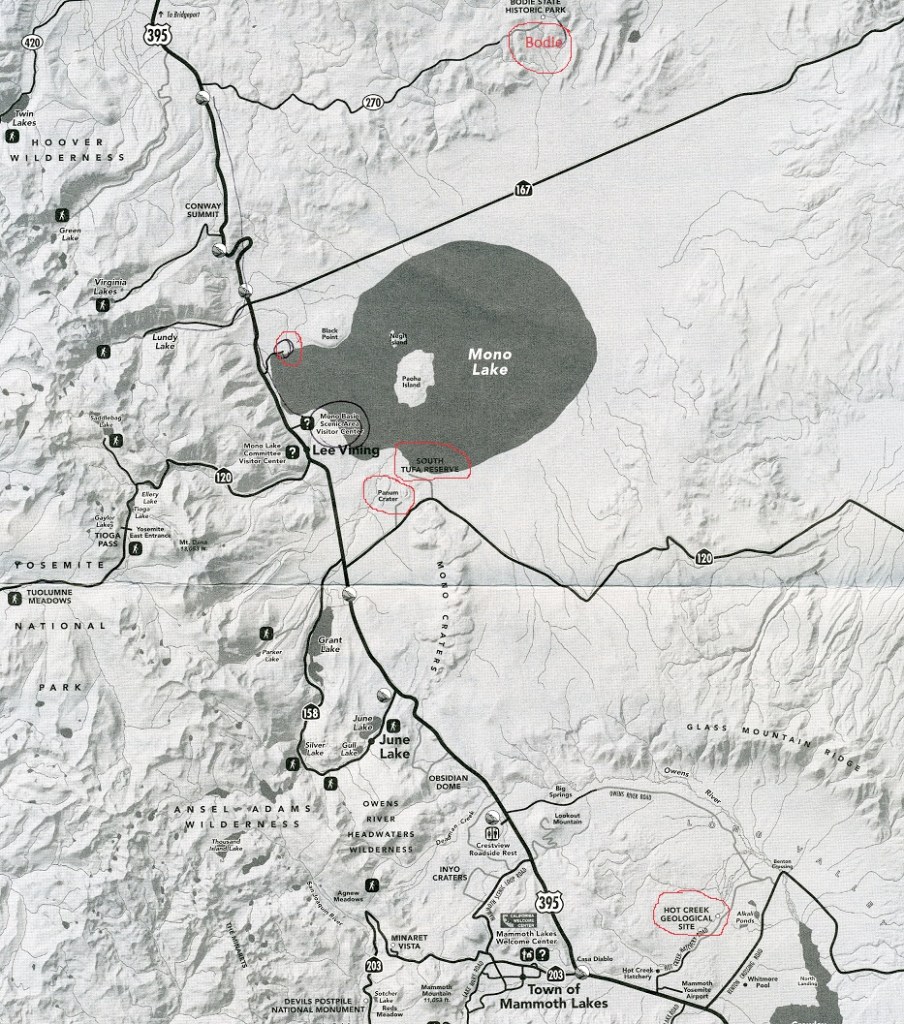
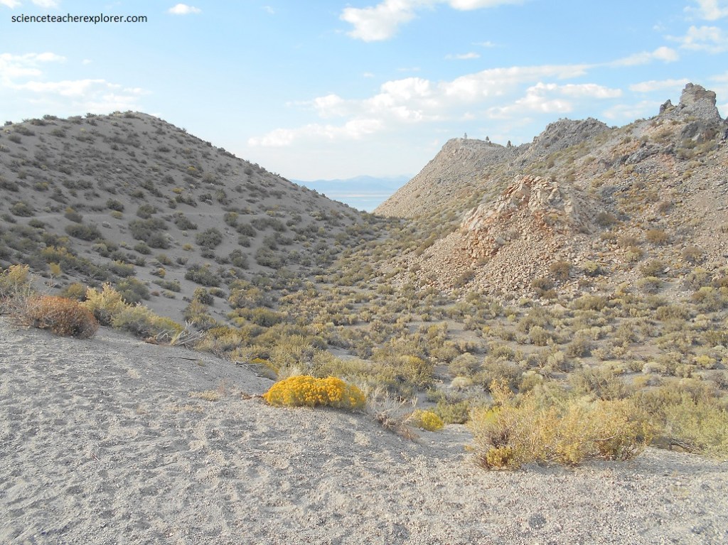
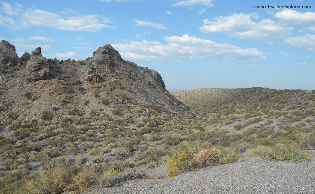
Our first visit was of the Panum Crater. Located at the end of a 1 km gravel road, Panum is the youngest of the Mono Crater chain of small rhyolite volcanoes.
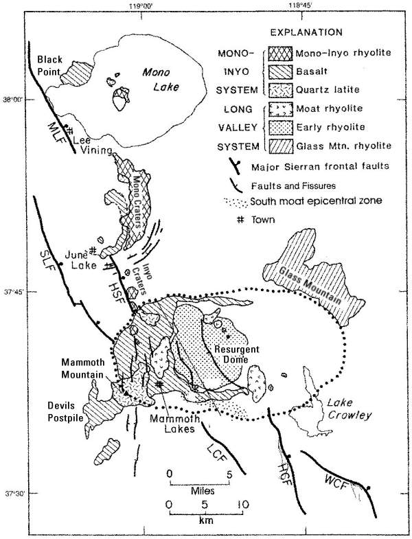
40,000 years ago, the site of the Mono Craters was virtually flat. Pictured below, a series of eruptions, some occurring as recently as 650 years ago, created this mountain range, the youngest in North America. The Mono Craters are a long, almost straight line of little volcanoes that starts within the Long Valley caldera and extends north to Mono Lake. Radiocarbon dates range from about 40,000 – 550 years ago.
Panum is the youngest of the Mono Crater chain of small rhyolite volcanoes, having erupted only 650 years ago. Rhyolite is an extrusive igneous rock with the same composition as granite, but because the magma reached the surface and solidified quickly into a volcanic rock. Because rhyolite lava has lots of silica, gas gets trapped in it, making rhyolite eruptions quite explosive.
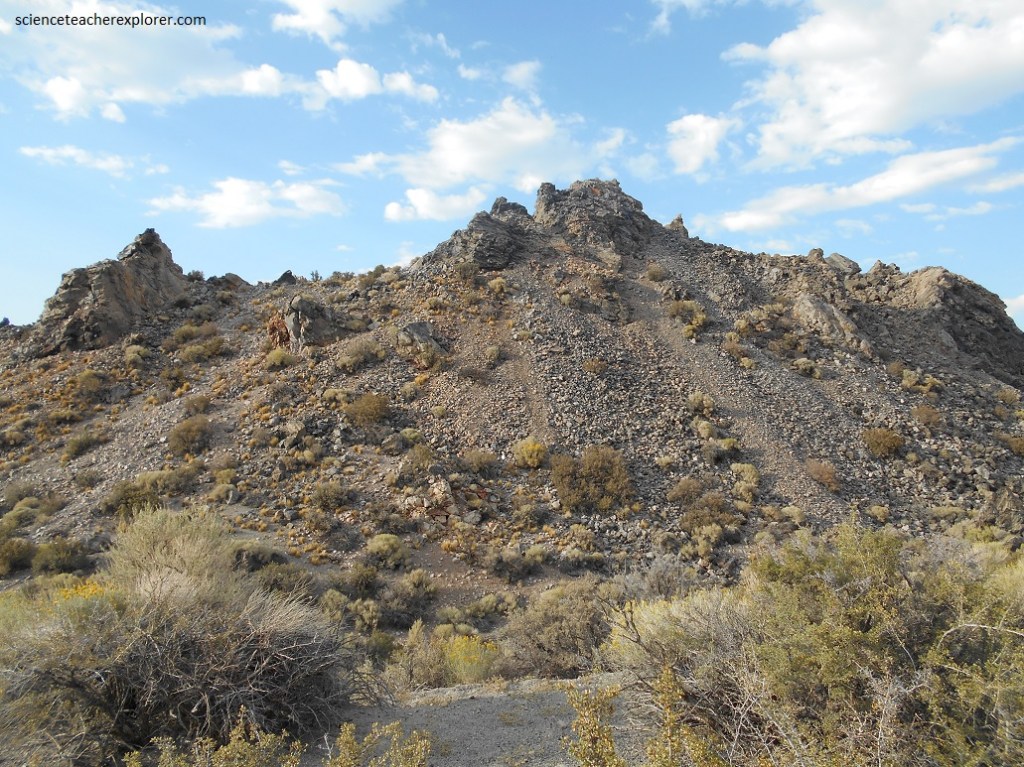
Panum’s central dome is surrounded by a ridge of tephra, volcanic ash and fragments deposited from the air. Much of the rock inside the crater consists of obsidian and pumice, which are both chemically similar to rhyolite (quartz–about 76%) but cools so quickly that crystals don’t have a chance to develop. It also makes in very viscous (thick) and glassy.
Picture below, Obsidian, a black shiny rock is chemically identical to pumice but erupted slowly, losing trapped air. It cooled to quickly to form a crystalline structure, but formed glassy rock that has extremely sharp edges when broken.

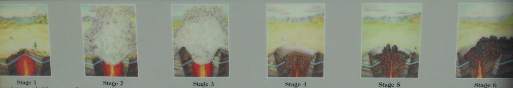
Image below from an interpretive sign is the sequence of rhyolitic plug-dome event of Panum Crater. Stage 1: Panum began as a bubble of extremely hot liquid rock magma, rising up from a fault deep within the earth’s crust. Stage 2: Coming into contact with the water table just below the surface of the Earth, the hot molten magma superheated the water, creating instant steam. The sudden pressure created by the steam’s expansion caused a violent explosion, blowing out rock and debris and leaving behind a gaping crater. Stage 3: Pumice ash shot into the sky, then fell back around the crater, ash and pumice continued until the large pumice ring, still visible around Panum today, was formed. Stage 4: Thick lava continued to rise in the center of the crater, forming a dome that hardened and cracked as lava continued to ooze up. Hardened lava (crumble breccia) was pushed aside by the rising lava until the volcanic forces weakened and slowed. Stage 5: As the final dome hardened and cracked, thick lava squeezed through the cracks, forming obsidian spires. Stage 6: Some of the volcanoes in the Mono Craters chain continued to erupt and lava overflowed the rims, creating a lava flow called a coulee.
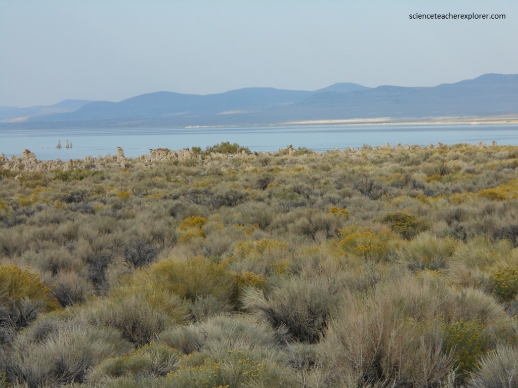
Located in the Great Basin drylands, Mono Lake is the last remnant of Lake Lahontan, one of two large lakes that once flooded the area during the last ice age. Today, Mono Lake collects salts eroded from several hundred kilometers around, making it 3x saltier than seawater.
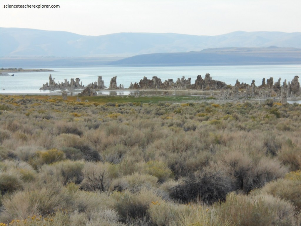
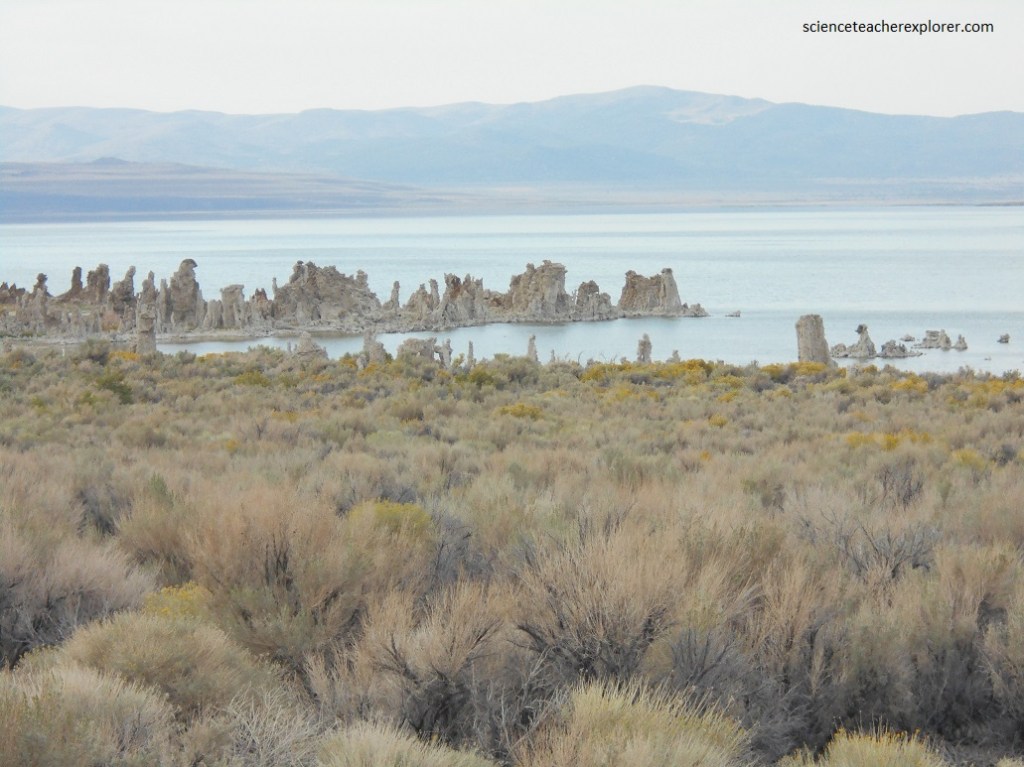
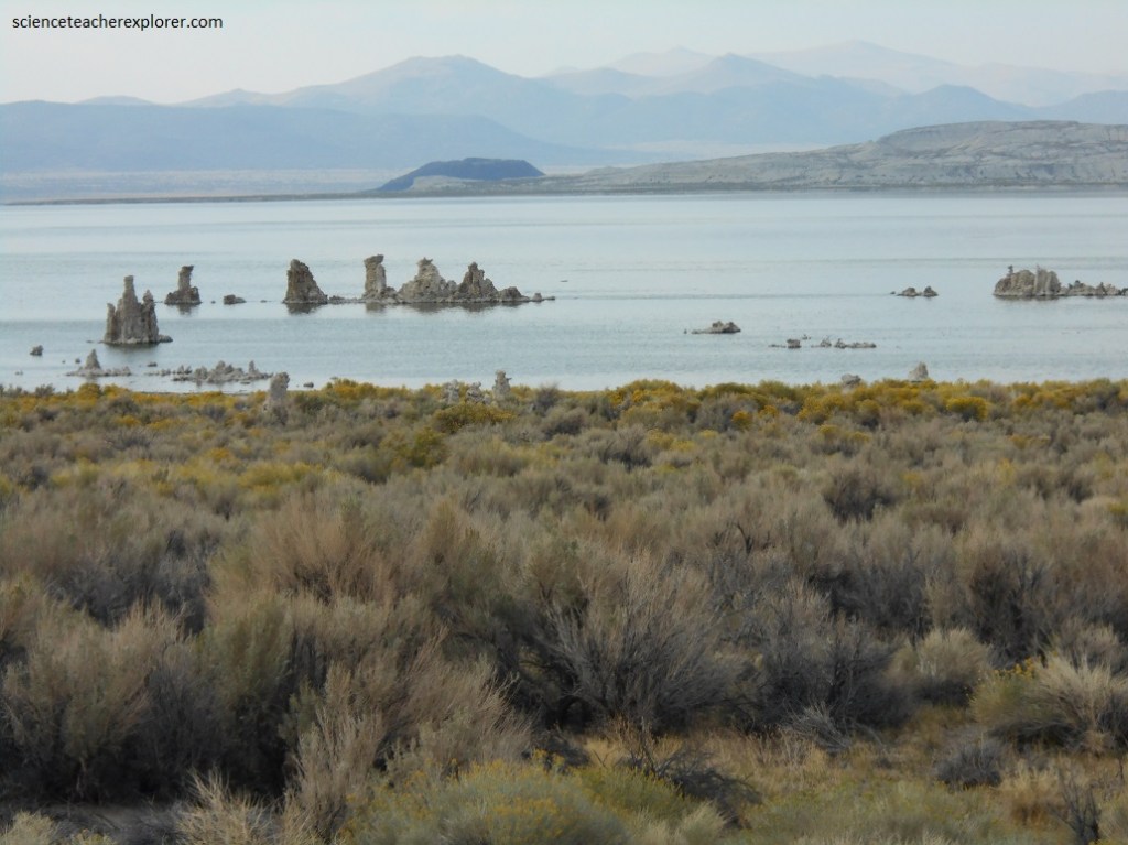

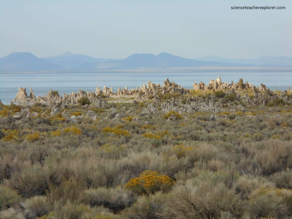
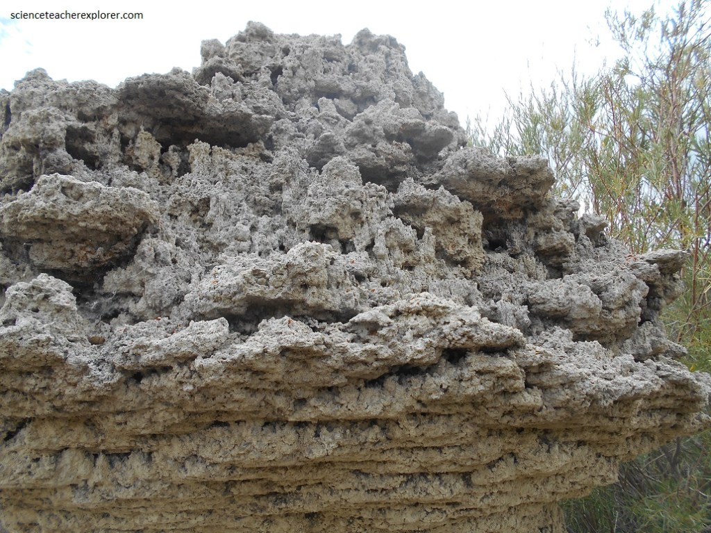
Mono’s best features are the tufa towers, (best seen at the South Tufa). Reaching up to 9 meters these are formed when fresh water, acidified from passage through the Mono Craters’ volcanic deposits, wells up in the alkaline lake. This causes calcium carbonate dissolved in the lake’s waters to precipitate and accrete in alien-looking white and gray limestone towers.
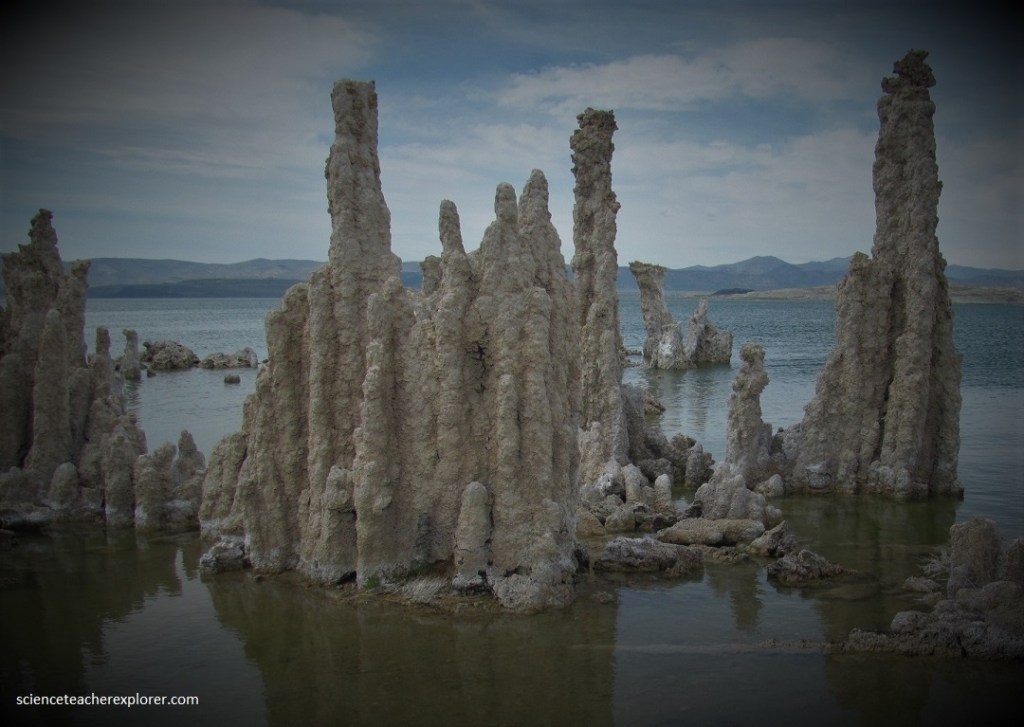
Tufa towers are continuously forming within Mono Lake. The towers visible at South Tufa are indicative of the lake’s former water level, since tufa only forms under water.
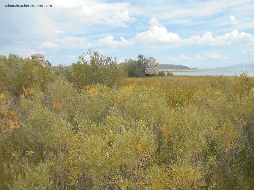
At nearby Navy Beach, delicate sand tufa formations line the shore. Sand tufa forms when calcium-rich spring-water wells up through Mono Lake’s sandy bottom, forming a weak calcium carbonate cement that holds the sand grains together.
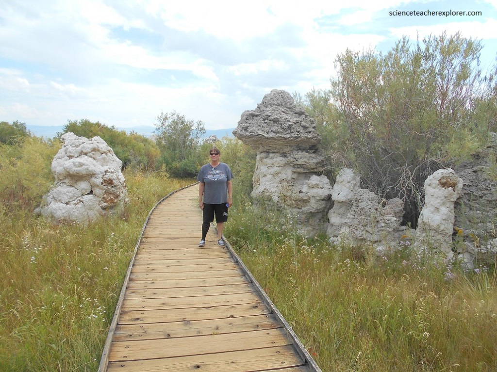
Pictured above, the reserve was established in 1982 to preserve the spectacular tufa formations; limestone towers that are created under the surface of Mono Lake where freshwater springs rich in calcium bubble up mixing with the alkaline water to form calcium-carbonate spires. The reserve also protects the bed and waters of the lake as well as sensitive habitats, such as the wetland here below the County Park.
Mono Lake has been called a dead sea but it is actually one of the most life-productive lakes in North America. The food chain begins with microscopic algae, which are food for trillions of brine shrimp and alkali flies. Mono’s shrimp and flies provide a plentiful food supply for millions of migratory and nesting birds each year.
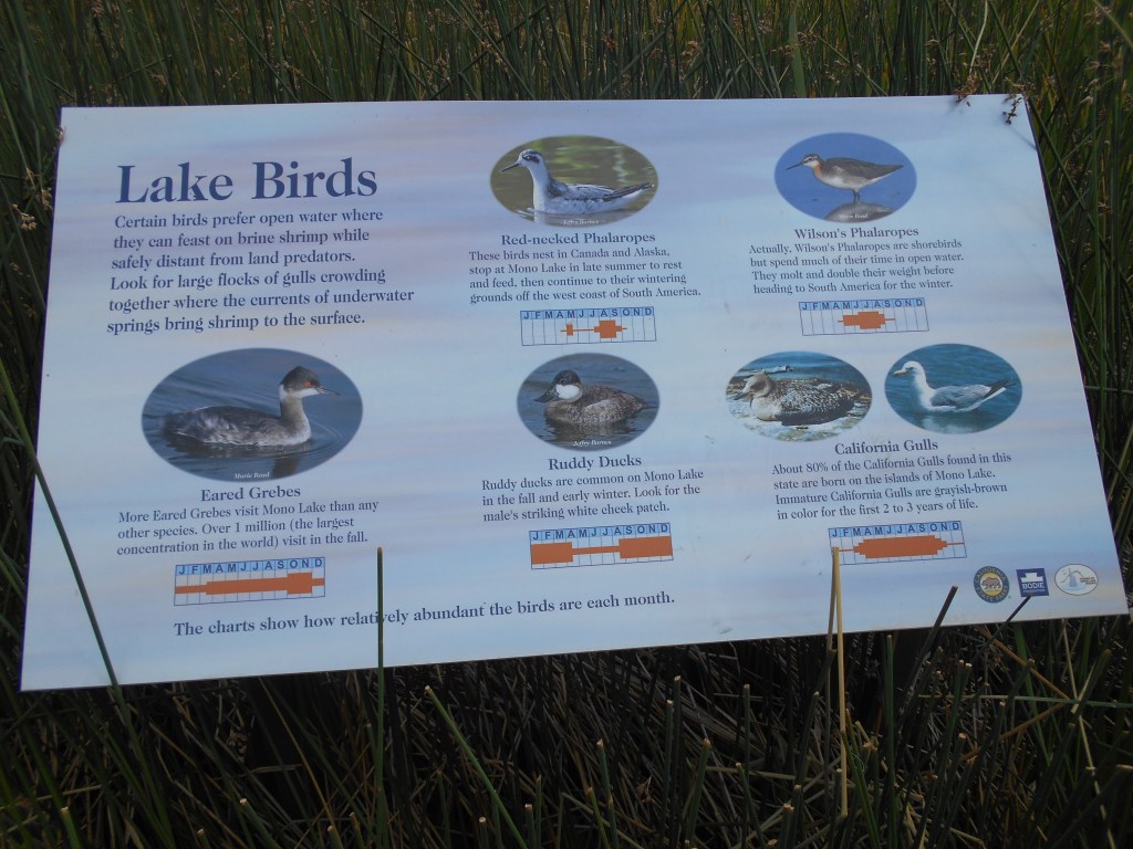
The most notable species are the Eared Grebes, Wilson’s and Red-necked Phalaropes, American Avocets and a few other shorebirds. In spring and summer, Mono’s islands host one of the largest nesting populations of California Gulls in the world.
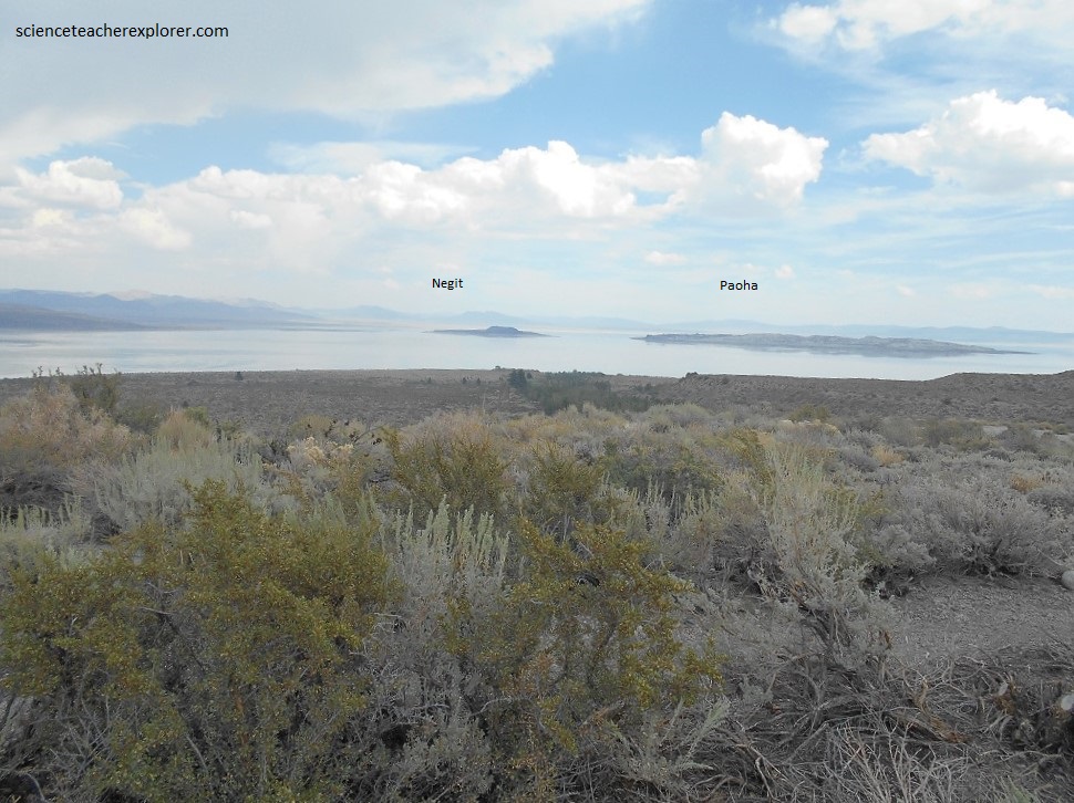
Pictured below, Paoha, the larger of the two islands, does not look volcanic because its surface is composed of lake bottom sediments. About 300 years ago, magma rose underneath the lake and pushed these sediments above the water level. Negit, the black island, was formed by volcanic eruptions that occurred between 300 and 1,700 years ago. Negit once hosted most of the state’s nesting California gulls. When the land bridge emerged in 1977, most gulls moved to nearby islets to escape predators that could reach their nests.
Pictured below, Black Point is a volcano that erupted underwater. The eruption that spewed out this pile of black cinders occurred under a much deeper Mono Lake during one of the Mono Basin’s many ice ages. As the climate warmed and Mono Lake shrank, Black Point was exposed. It’s sharp cinders are mined and scattered on roads during the winter to provide traction on slippery ice.

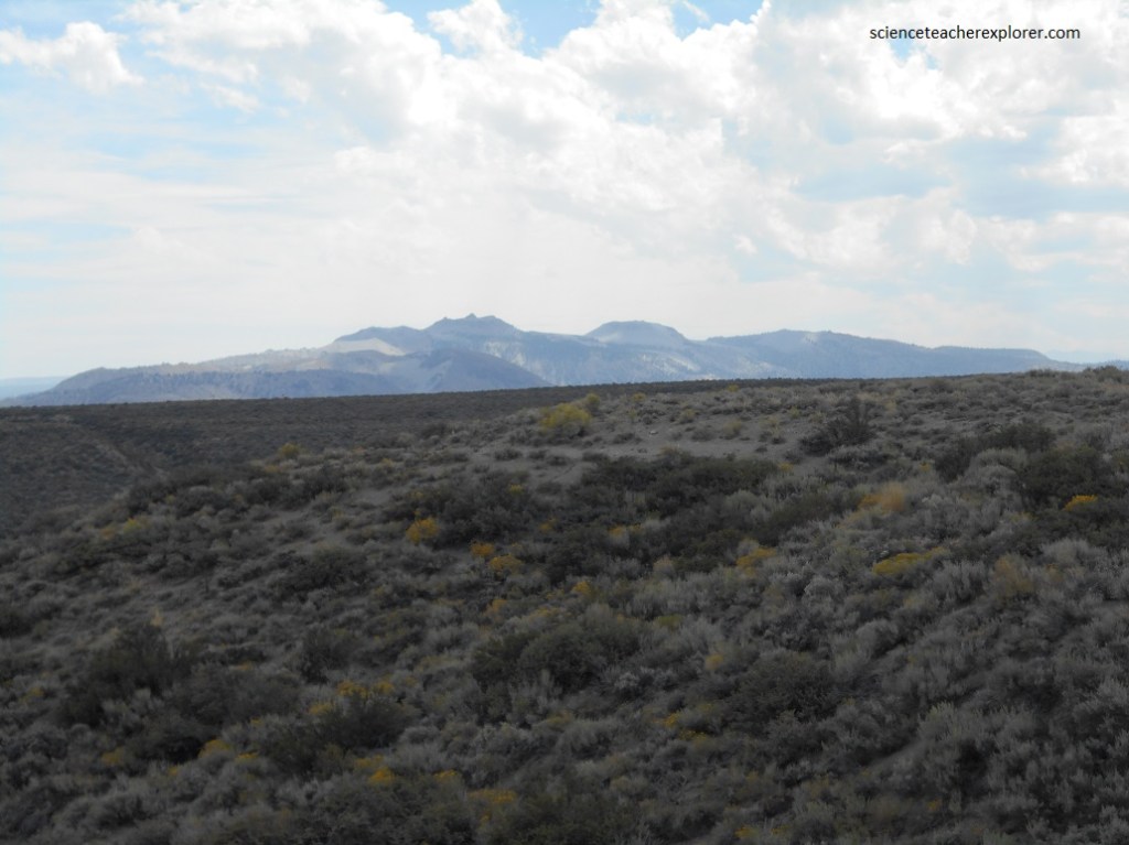
Becky and I left Mono Lake area to explore the Hot Creek Geological Site. Of course it was also closed, so I could only get a far off picture of it. Pictured below, the Hot Creek Geological Site is a series of hot springs that bubble up from the streambed of a cold-water creek as it flows through the center of the Long Valley Caldera, (the remnant of a massive volcanic eruption 760,000 years ago.)
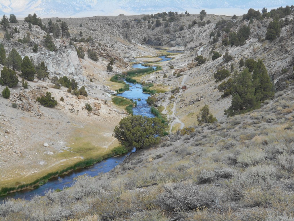
The onset of dangerous geyser activity in 2006 forced a closure of the creek to swimming or soaking because scalding water may erupt at any time. When a geyser erupts, water in the seemingly placid creek can spurt up to 2 meters high, spewing scalding hot water on the unwary. The USGS claims that this activity might be related to long-term temperature increases in groundwater due to the 1997 earthquake swarms that could have opened new pathways for hot water and steam.
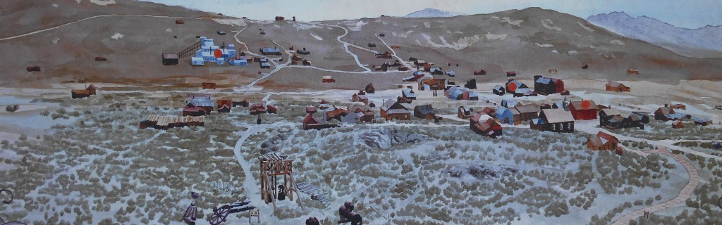
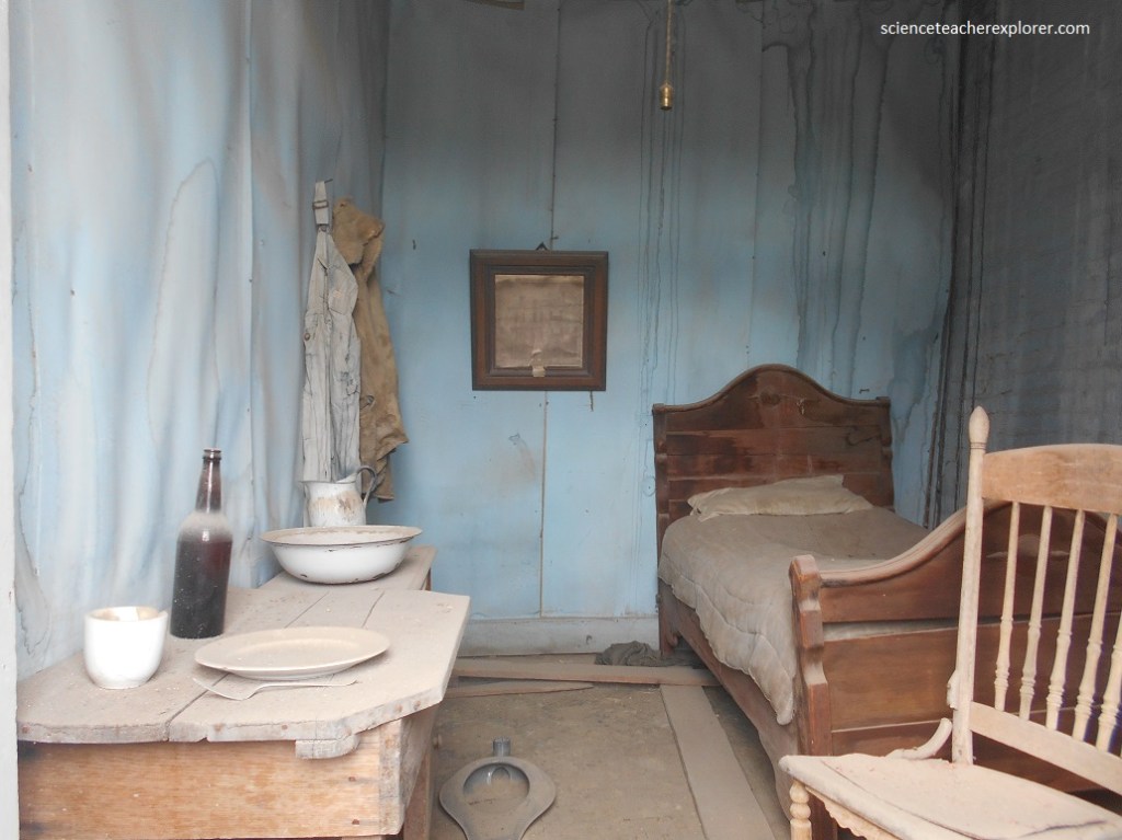
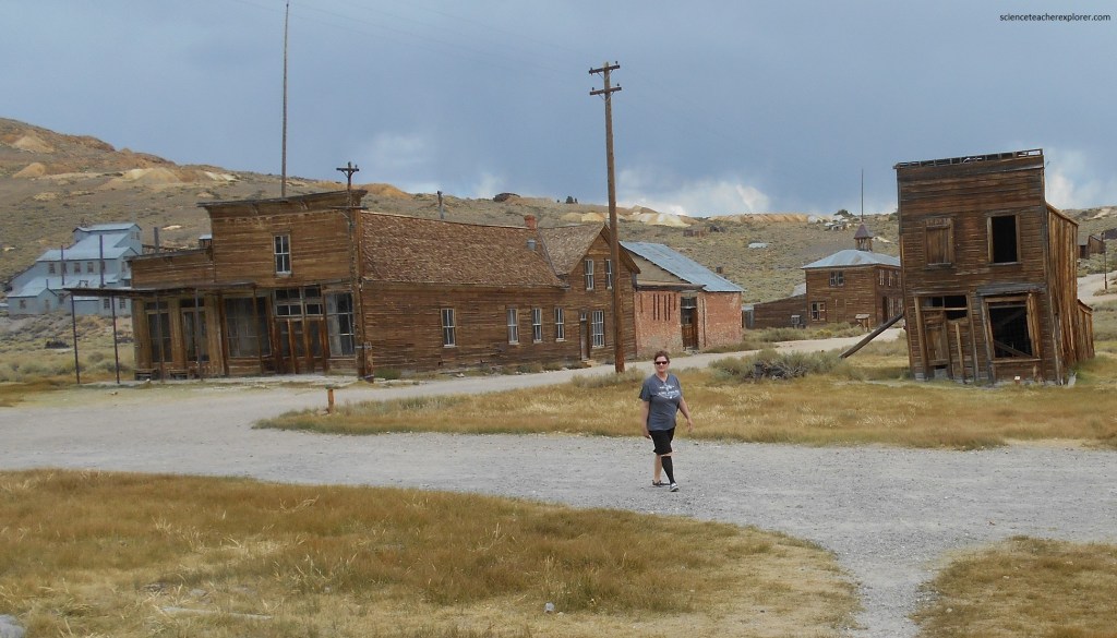
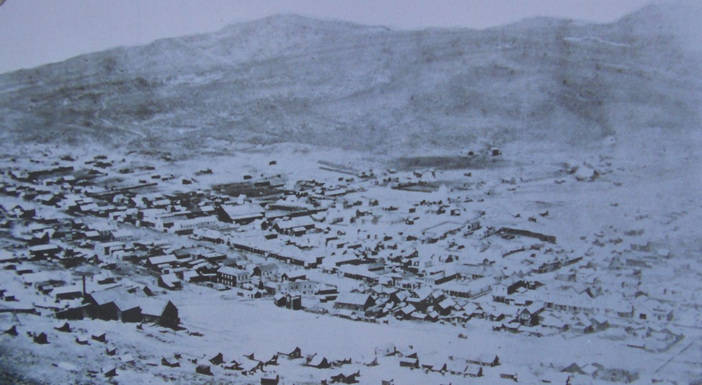
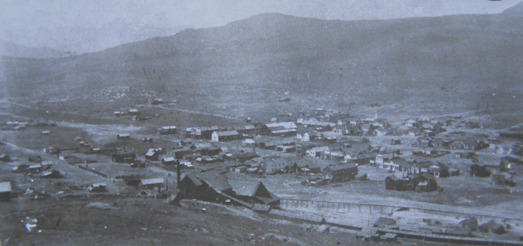
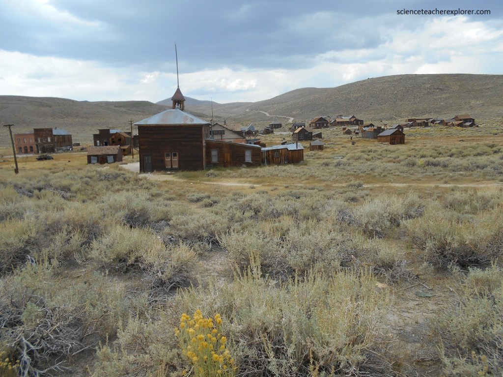
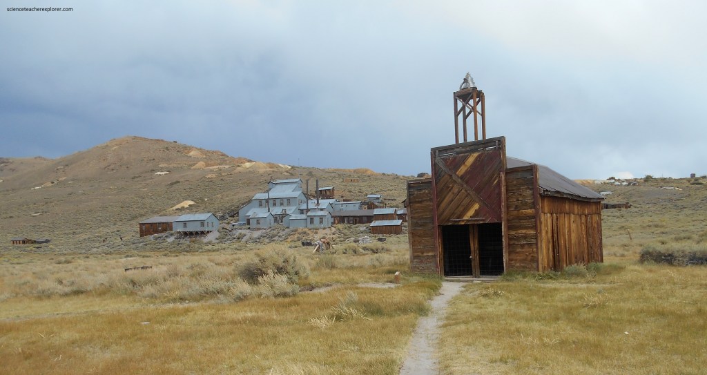
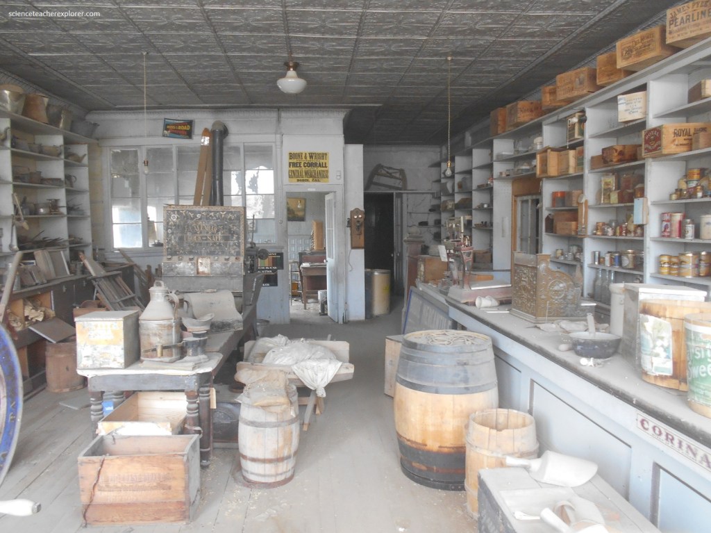
After exploring the immediate area of Mono Lake, (since everything seemed to be closed), Becky and I decided to drive 20 km north to explore Bodie State Historic Park. Bodie State Historic featuring a gold and silver mining ghost town, is located southeast of Bridgeport, California.
Four prospectors, including W.S. Bodey, stumbled upon one of the richest Eastern Sierra gold strikes in 1859.
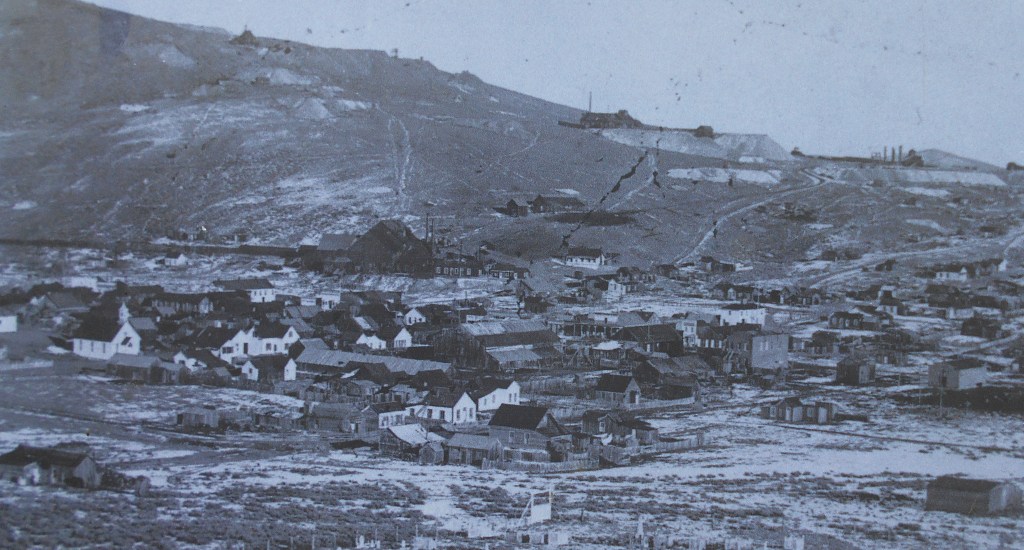
Bodey froze to death in November of 1859 when he returned with supplies during a blizzard. He never lived to see the town in his honor, (pictured above).
Mining was slow in Bodie during the 1860s and 1870s due to richer strikes at Aurora, and Virginia City in Nevada. From 1863 to 1877 only a handful of industrious prospectors and miners worked the Bodie mines.
A collapse in the Bunker Hill Mine exposed a rich vein of gold and sliver ore in 1875 and the Bodie rush and boom began. By 1879 the population of the town grew to well over 2,000, (it reached 7,000 or more inhabitants within another two years and swelled seasonally in the summertime).
More than $30 million worth of gold in 1880 dollars, was extracted from its network of mines. Bodie was one of the most significant deposits mined during the late 1800s.
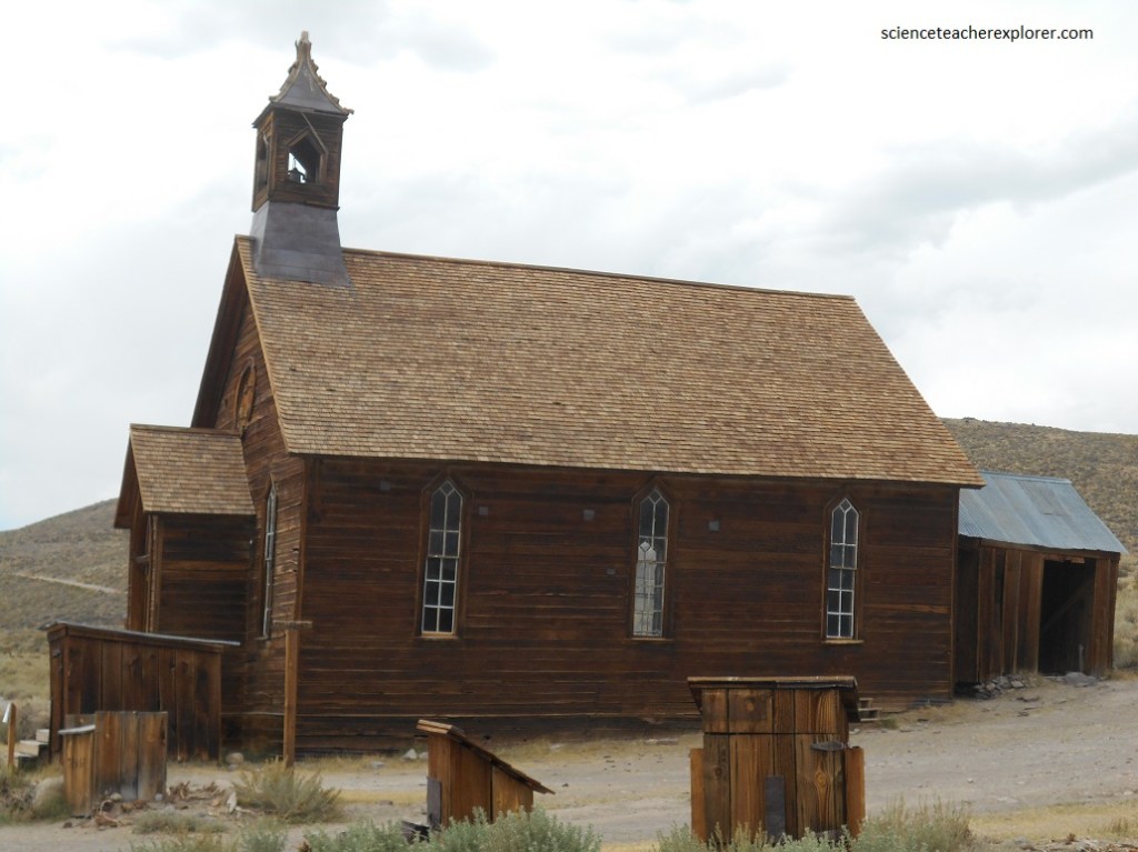
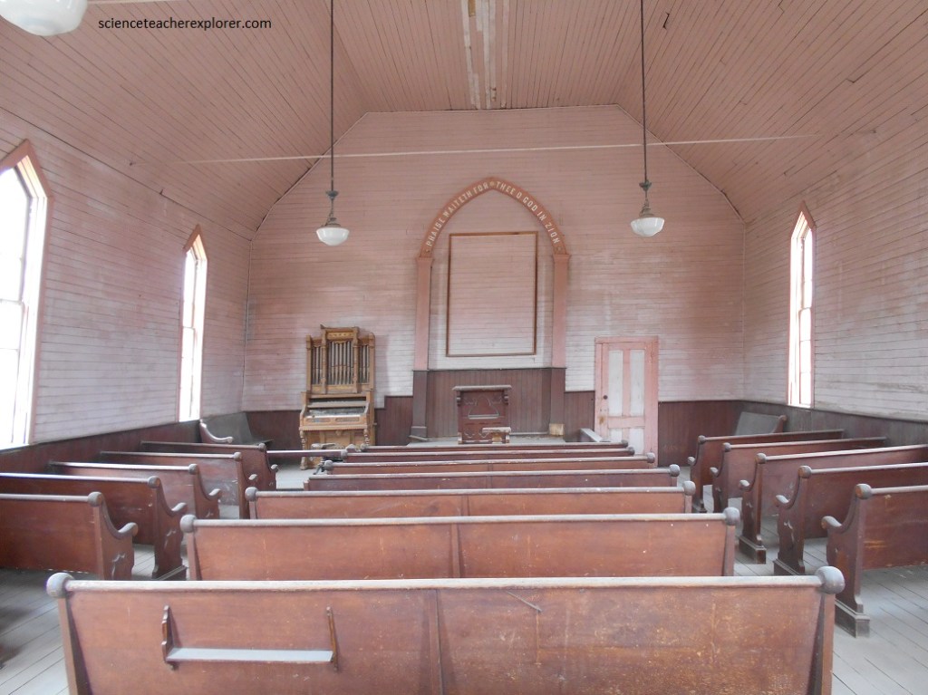
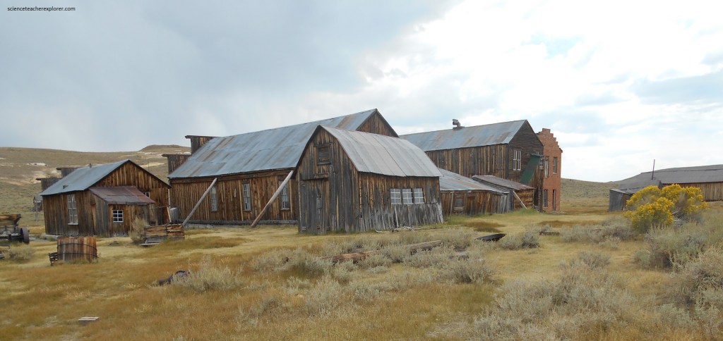
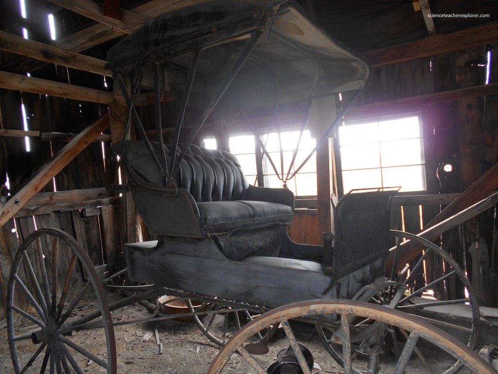
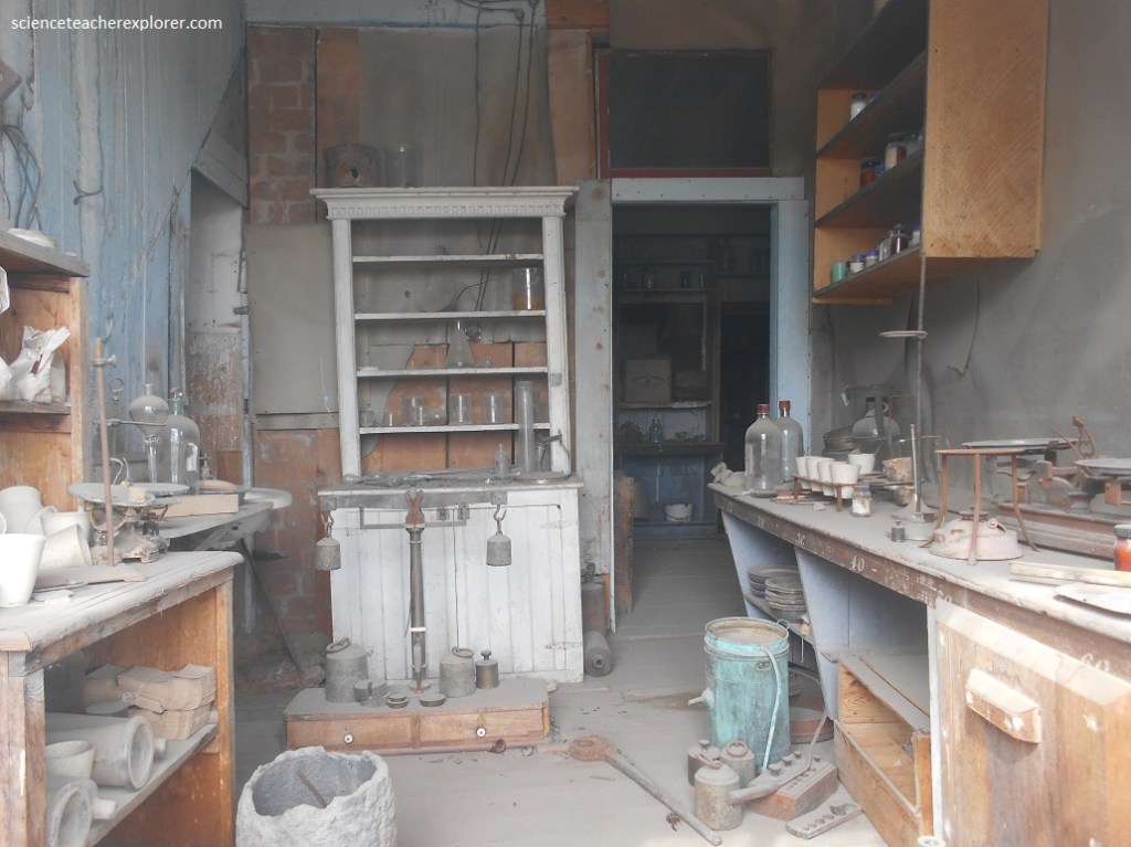
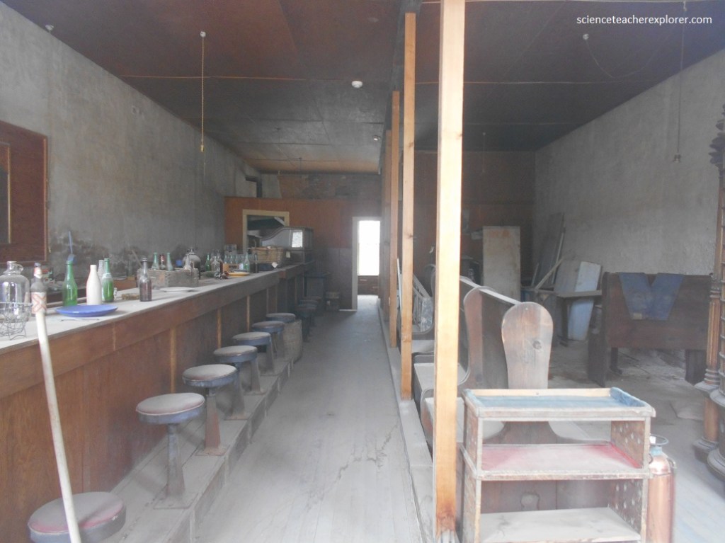
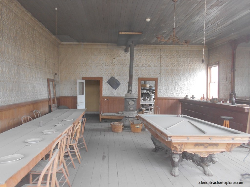
At least two major fires destroyed much of Bodie, but about two hundred structures remain. In 1962, the state of California made it a Historical Landmark and closed up all the remaining buildings to view. Visitors are now encouraged to wander freely through the town without access to 98% of the structures. The park is maintained in a state of arrested decay, and several buildings are propped up with posts to keep them from falling over.
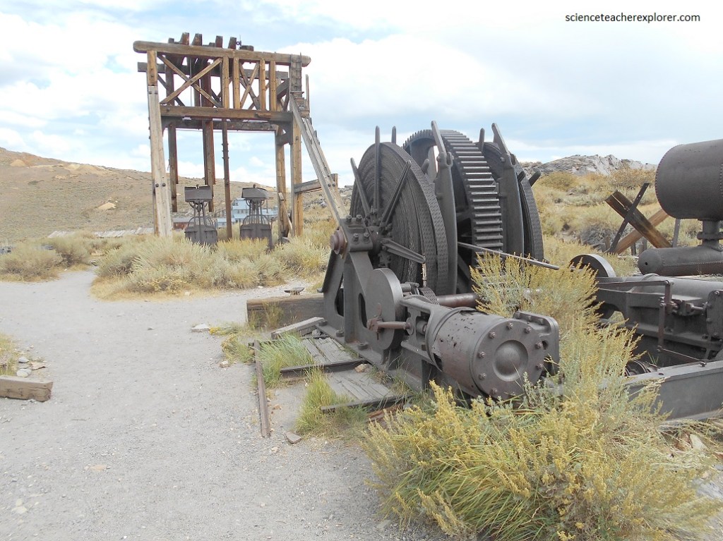
Thirty different companies mined the earth along with nine stamp mills that pulverized the ore and separated the gold. In Bodie you would have heard the constant explosions that blasted the quartz rock out of the mountains along with the relentless banging of 159 stamps.
The gold at Bodie is an epithermal deposit related to ancient volcanic activity in the region. Epithermal deposits form when mineral rich water from deep underground rises along factures in the rock and then cools, precipitation the minerals in veins near the surface. At Bodie, the principal ore-bearing quartz vein was approximately 33 meters wide and 33 meters deep.
Total gold and silver production value for Bodie from 1860-1941 equaled $33954,919.20. The highest annual gold and silver production was in 1881 and totaled 3,160,067.51. After 1884 the annual combined production value fell by 50%, but production continued more or less steadily.
Two years without production came after the stock market crashed in 1929, followed by one year of production in 1931.
The Bodie fire of 1932 resulted in another four years without report. From 1936 to 1941 productions was low but steady.
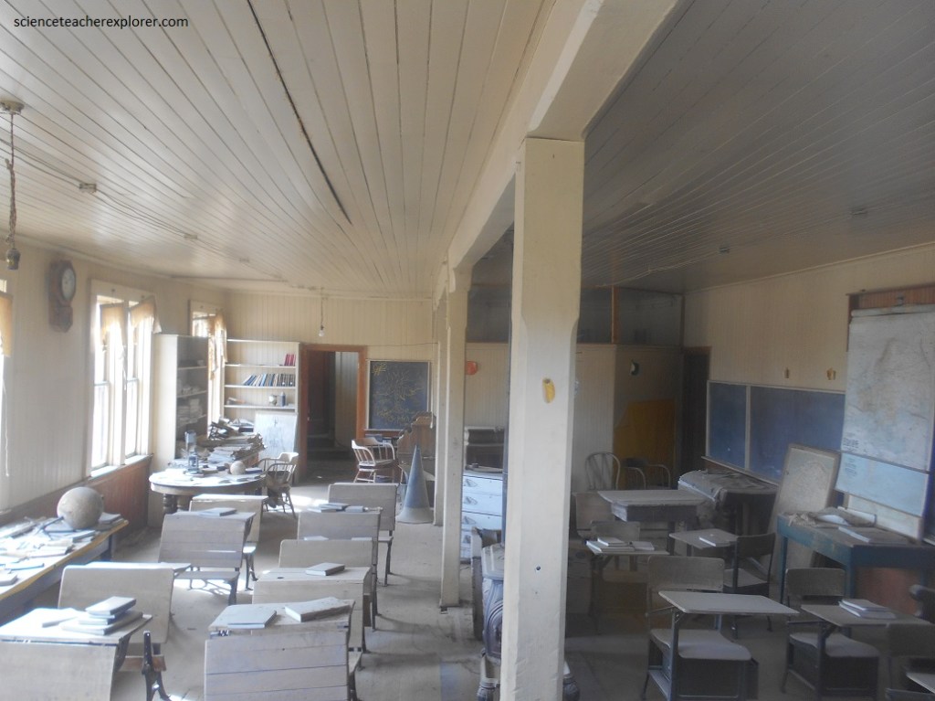
On October 8, 1942, due to copper shortages, the U.S. War Production Board issued Limitation Order L-208, which stopped gold mining operations. The War Board order affect more than just the Bodie mines, since lack of jobs for the mine and mill worker caused the school and post office to close as well.
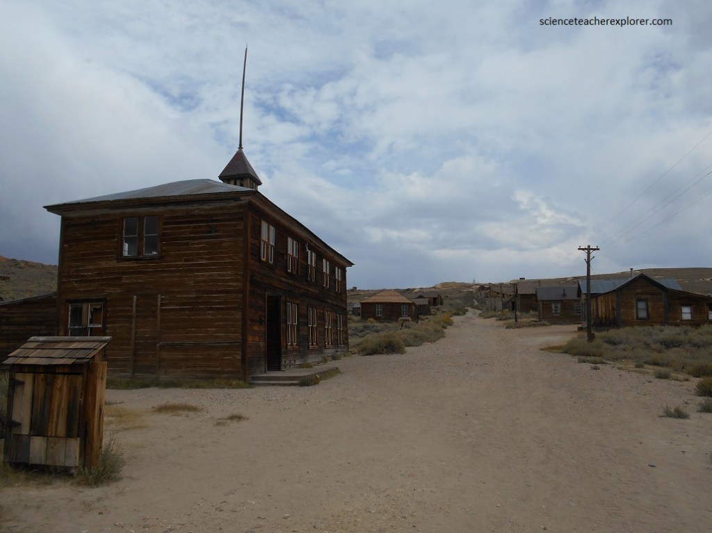
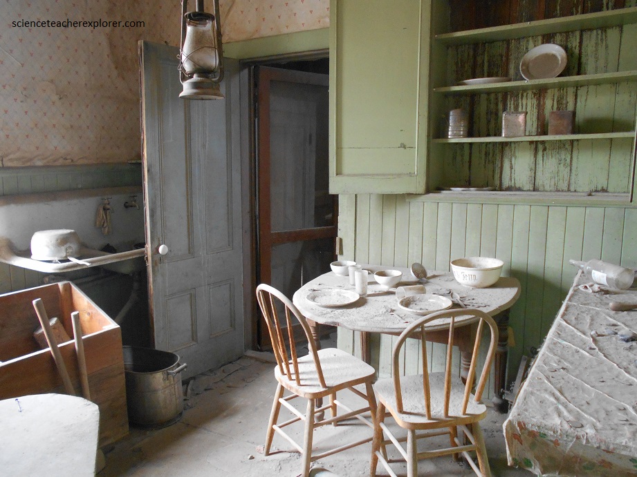
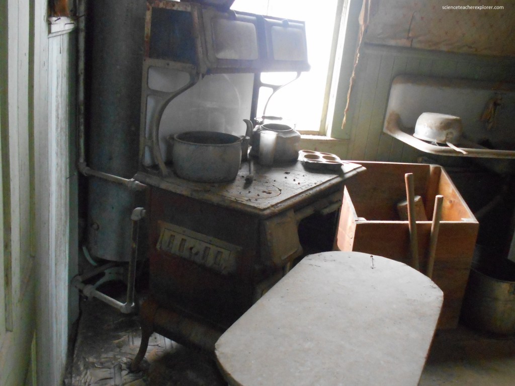
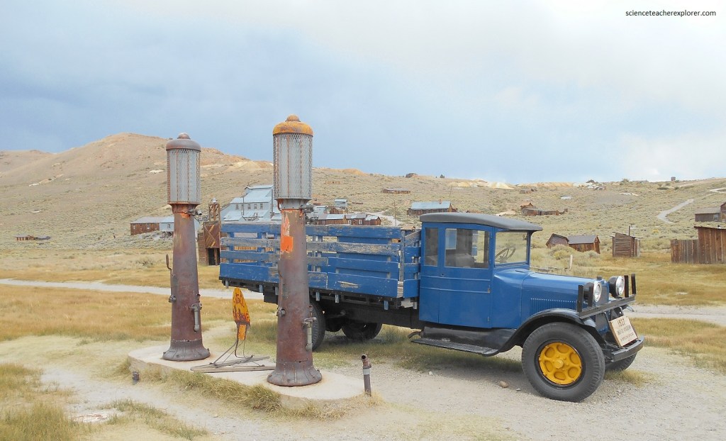
Today, Bodie it looks much the same as it did over 50 years ago when the last residents left. To preserve the ghost town atmosphere, there are no commercial facilities at Bodie, such as food or gasoline. There is a bookstore inside the museum. Pictured below is a gasoline station, but not in service.
With an average of 303 nights below freezing per year, no month has ever been completely frost-free. The harsh weather is due to a particular combination of high altitude (8,400 feet or 2,600 meters) and a very exposed plateau, with little in the way of a natural surrounding wall to protect the long, flat piece of land from the elements. Plenty of firewood was needed to keep residents warm through the long winters. The winter of 1878–79 was particularly harsh and claimed the lives of many residents.
Average annual precipitation is 299.5 mm, with August on average being the driest month and January the wettest. There are an average of 60 days annually with measurable precipitation. The wettest “rain year” was from July 1968 to June 1969 with 563.4 mm and the driest was from July 1999 to June 2000 with 158.5 mm. The most precipitation in one month was 187.7 mm in January 1901, and the most in 24 hours 116.1 mm on February 12, 1895. Average annual snowfall is 2.37 m. The snowiest year was 1965 with 6.83 m. The most snow in one month was 2.47 m in January 1969. [[Information came from the Bodie Regional Climate Center]].