Toadstools, UT 2012
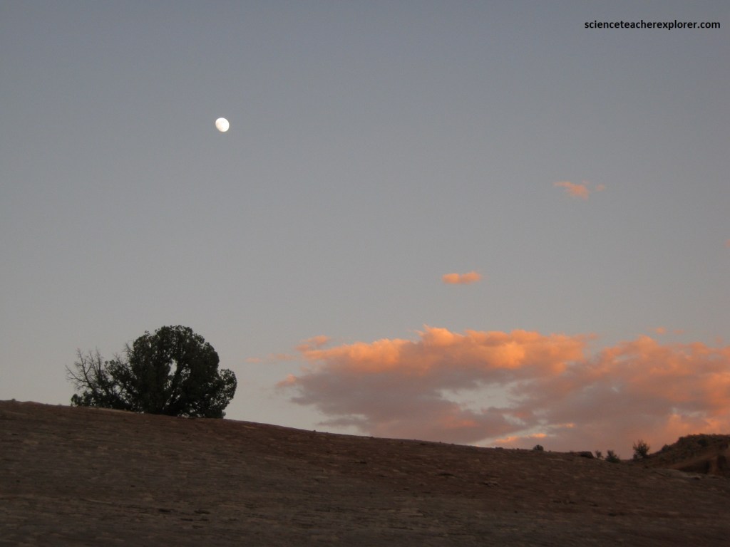
In May of 2012, I took a small group of students and Faculty friends to the Utah and Arizona border to witness the Annular Solar Eclipse. While there, we explored the Wahweap and Rimrocks (Paria) Toadstools.
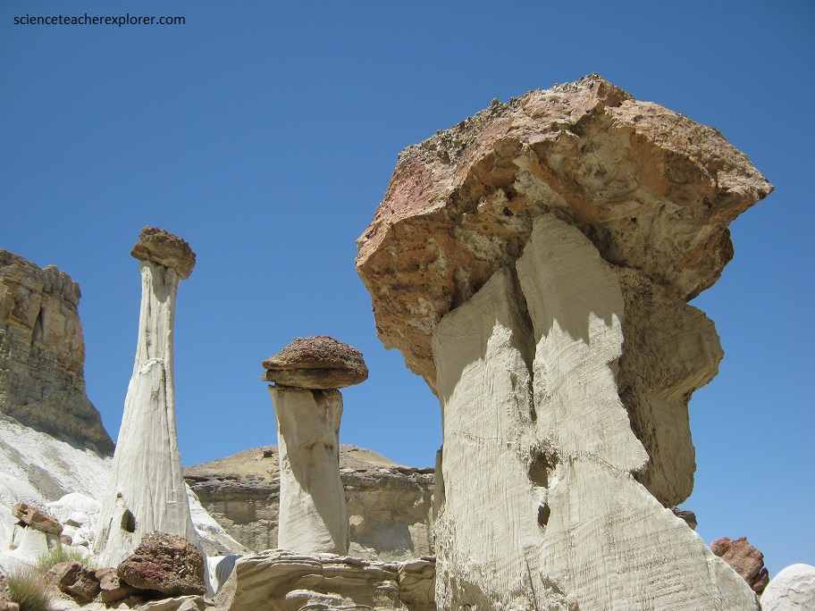
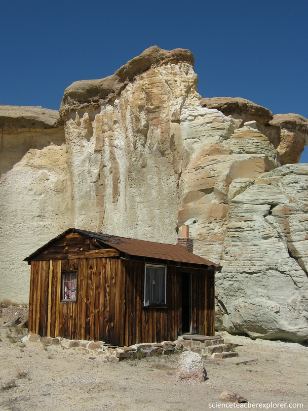
These unusual rock formations began forming over 100 million years ago in the Utah area. A “hoodoo” is a column of weathered rock, formed when a thick layer of soft rock is covered by a thin layer of hard rock.
Sometimes, when cracks in the hard rock allow the underlying soft rock to erode, one small cap of the hard rock is resistant to cracking, and it protects the underlying soft rock. This cone of protected rock eventually takes the shape of a vertical pinnacle.
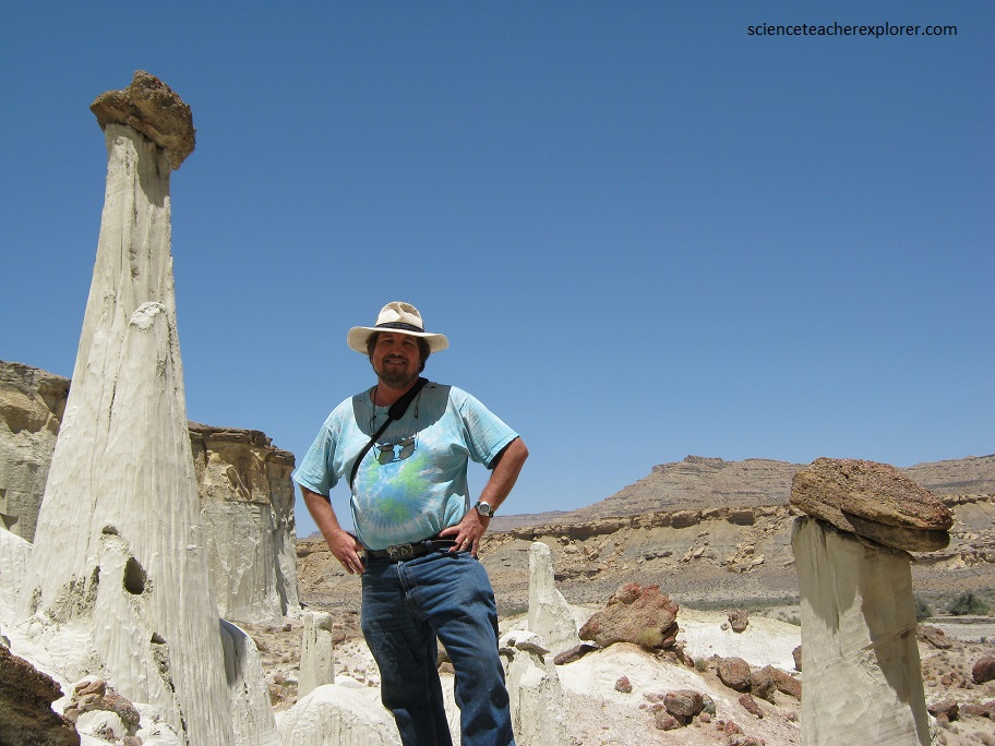
These white sandstone spires, which have been named everything from “goblins” to “white ghosts,” look like they came straight out of the mind of Dr. Seuss.
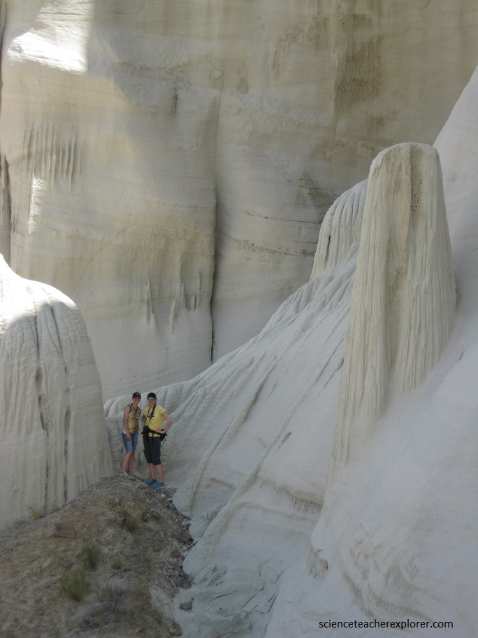
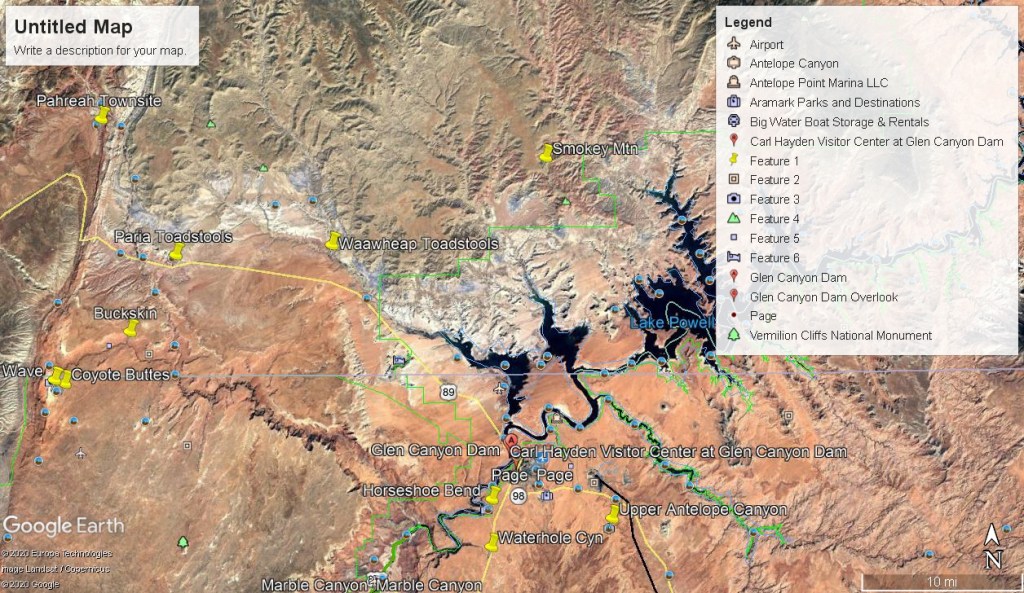
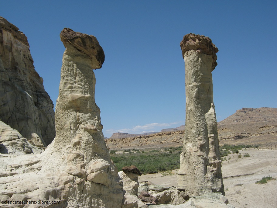
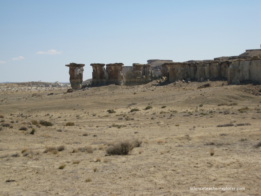
The 9.2 mile trail begins at the confluence of Coyote Creek, Wahweap Creek, and the peculiarly-named Nipple Creek, where you will hike under direct sunlight on the Wahweap Wash. At the 0.5 Mile Mark you will reach the dilapidated “Hanging Fence”, and finally, by the 3.6 Mile Mark, you will have entered the first of the Wahweap Toadstools (Hoodoos).
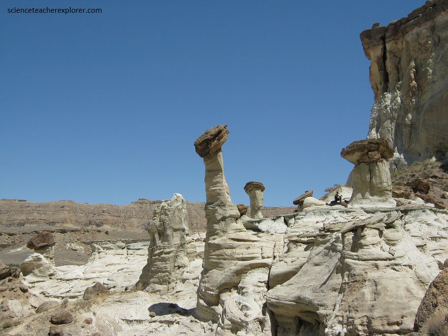
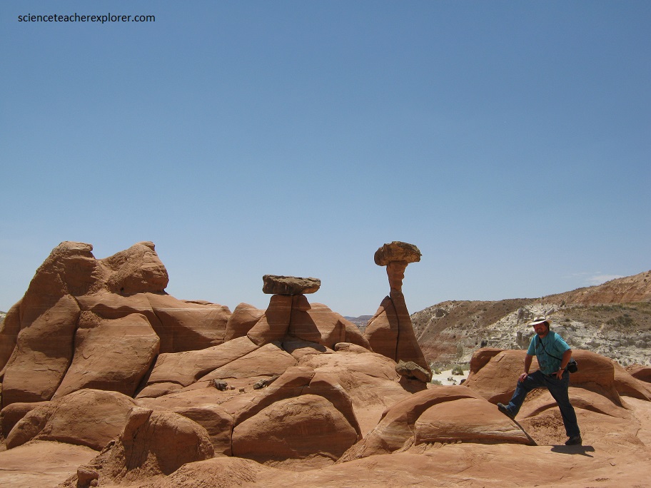
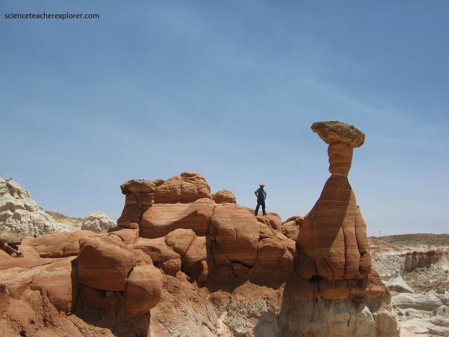
These fotogenic Toadstool/Mushroom-like features were created by 2 types of rocks with contrasting erosional characteristics.
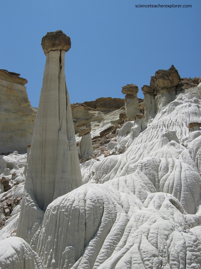
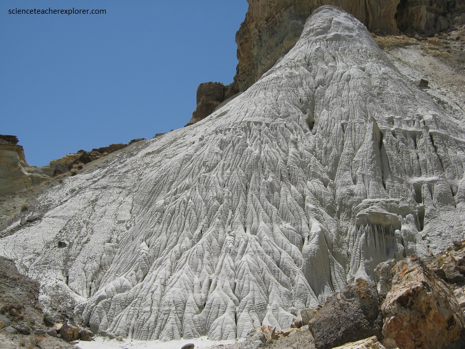
The pedestal part of the toadstools is white sandstone and believed to be the Gunsight Butte Member of the Entrada Sandstone Formation.
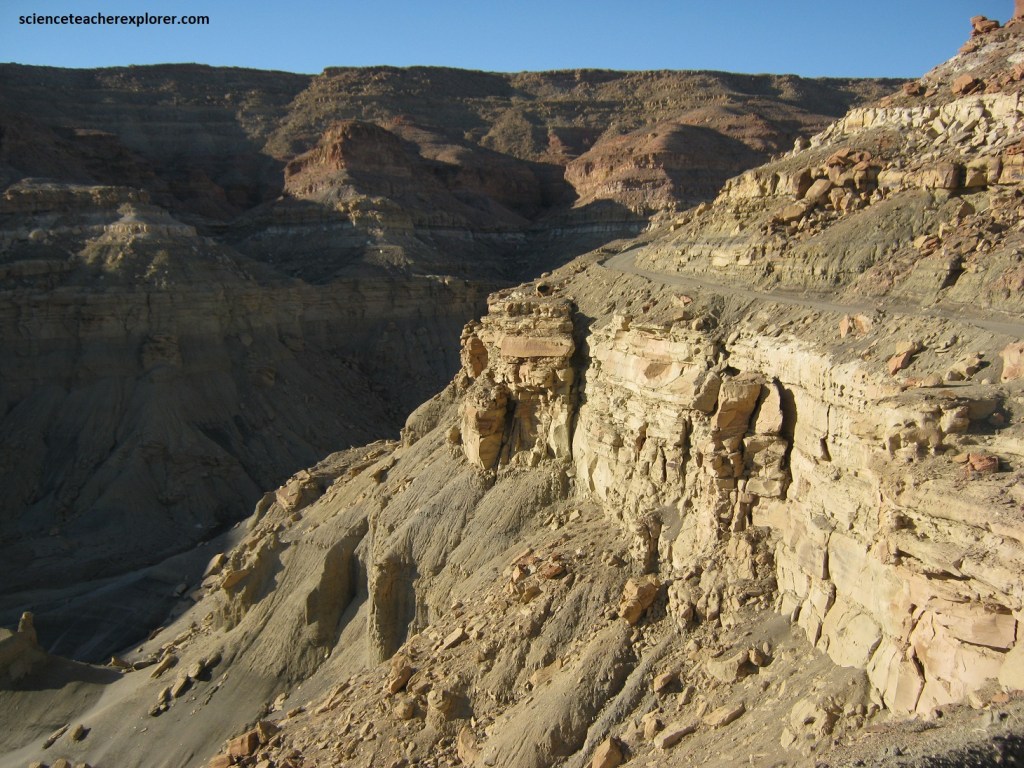
Pictured below, the Gunsight Member is the white fine-grained massive sandstone with a red layer at the bottom forming most of the high cliffs in the Rimrocks, (seen later).
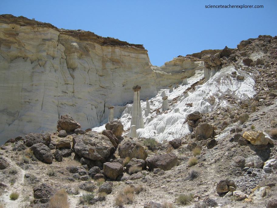
Pictured below, the Wahweap Creek Toadstools have a reddish conglomerate capstone or topknots. On the canyon wall this is the layer immediately above the white Gunsight Butte Member.
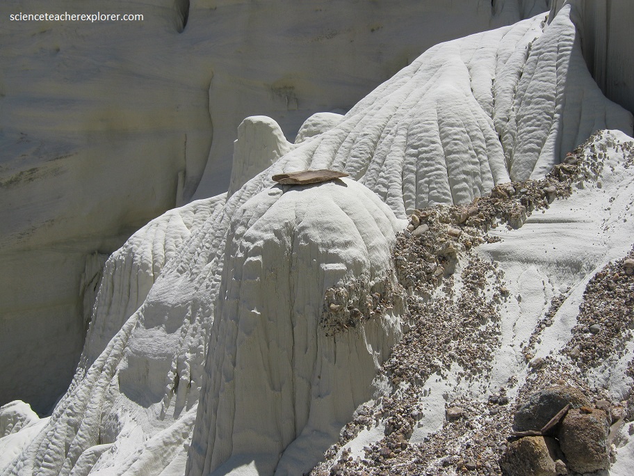
The Gunsight Butte is a white fine-grained friable, (which means the grains of sand can be rubbed off easily) sandstone.
The unique thing about the Gunsight Butte Member is, when it rains and the outer surface of the pedestal gets wet, gravity pulls the outer centimeter or so down and it looks just like flowstone on most limestone caves. It’s as if these pedestals are made of sugar and with each rainstorm are slowly melting away.
This is truly a unique place. The Gunsight Butte Member in this area, appears to fall into the category of Quartz arenite, (more than 90% of the grains are derived from quartzite). The cement or matrix holding the grains together is calcium carbonated, a kind of limestone.
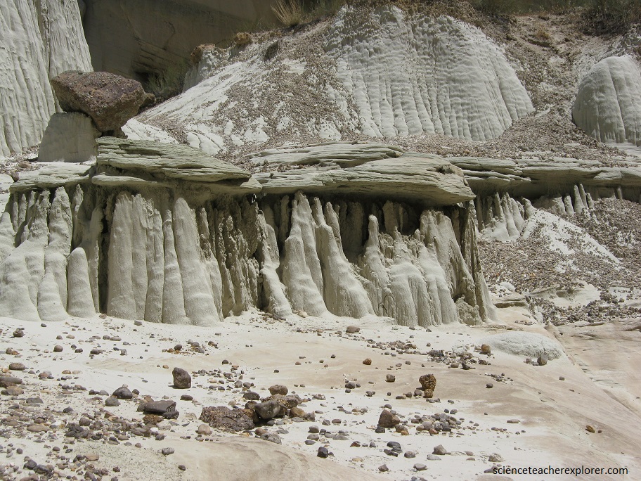
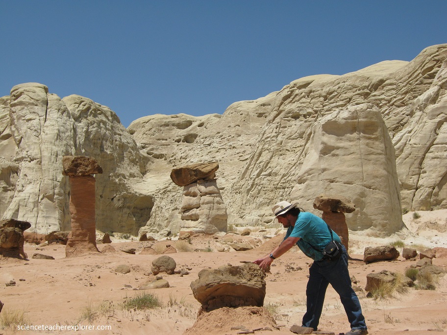
Over thousands of years, parts of the limy sandstone or conglomerate caprock broke off and rolled downhill to rest on top of a bench or a more eroded part of the Gunsight Butte Member.
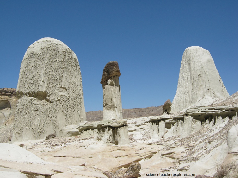
Then the caprock, being more weather-resistant, shielded the softer white fine-grained sandstone below from eroding away.
After many years, all that’s left is a pedestal and a chunk of capstone balanced on top or fallen nearby.
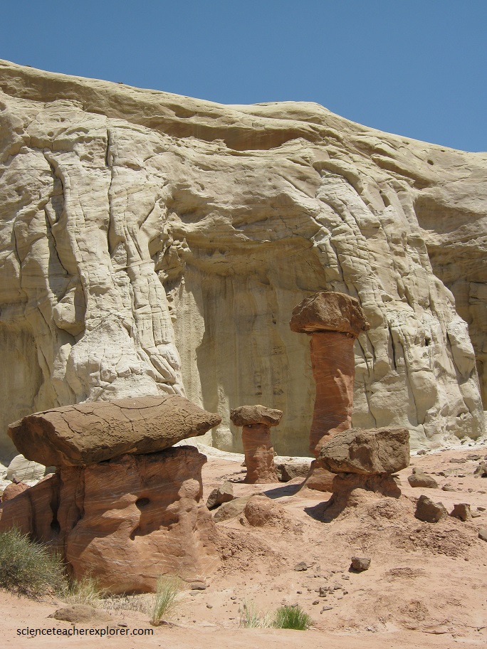
Pictured above, the capstone in “The Rimrocks” is a gray more weather-resistant sandstone with some limestone, (at least the erosional features look like limy sandstone).
The Rimrocks could be from an upper layer of the Entrada, Henrieville or Dakota Formations. For sure, it’s from one of the layers above the Gunsight Butte, and below the Tropic Shale.
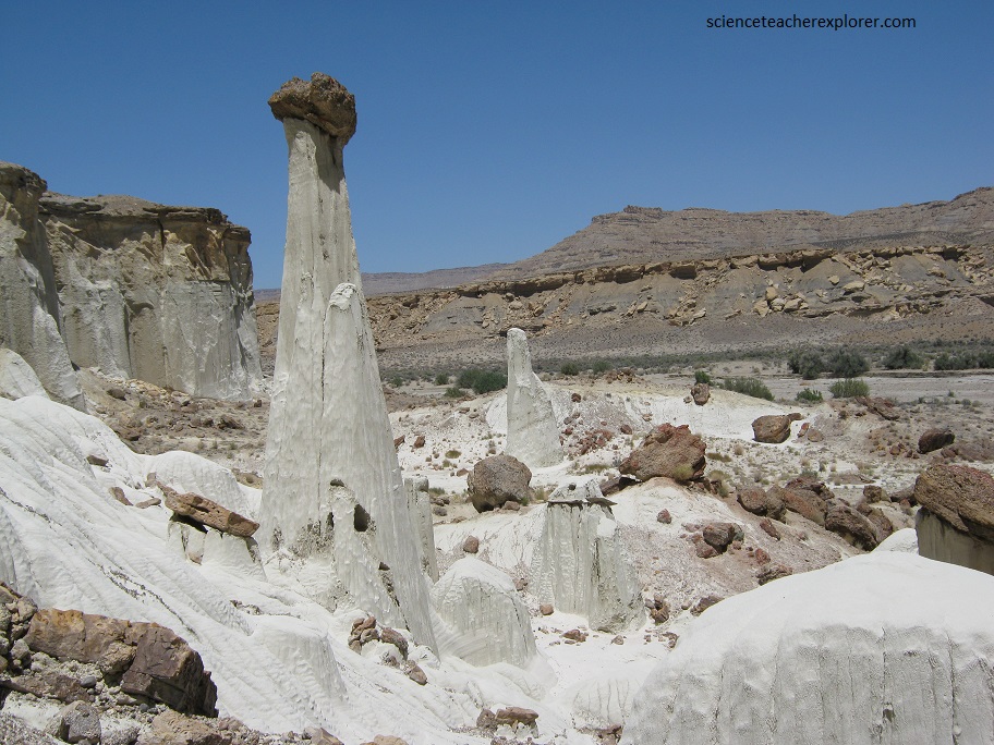
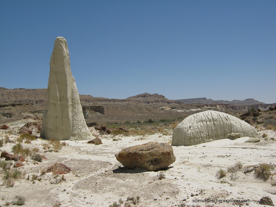
Just east of the Wahweap mushrooms and north of US 89, is the red Paria Rimrock Toadstools. These toadstools are formed identically as the Wahweap toadstools, but within a lower-older layer of the Entrada Formation. This red standstone pedestal is immediately below the Gunsight Butte Member. But the capstones are of the same resistant rock.
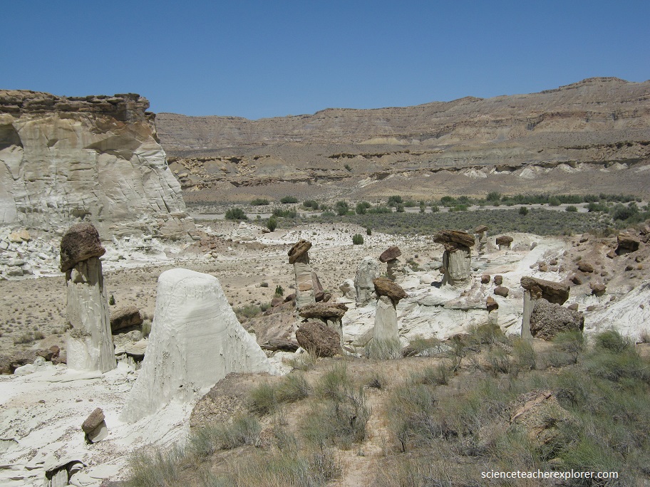
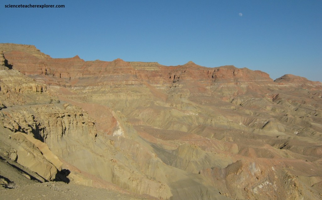
The Paria Rimrocks contain cliffs, buttes, hoodoos, and badlands: all carved from sugar-white and cinnamon-red sandstone. The Rimrocks look like a geological confectionery.
From the trailhead next to US 89, a well-worn path follows a sandy wash northward. After about a kilometer, the trail climbs through some badlands, and right to the base of Toadstool Hoodoo. The hoodoo sits on the edge of a broad, red terrace. The trail continues up to the top of this terrace, where more hoodoos stand huddled in a small cluster. They are easily seen from anywhere atop the bench. Tall white-grey cliffs rise to the north.
The Rimrock bench stretches away to the west. The land below Rimrock bench slopes up into a scenic mess of red and white badlands, then falls away abruptly into an adjacent valley. To the east, the Rimrock bench is bordered by a low ridge. The far side of this ridge forms one wall of a white-rock canyon that winds northeast for 2 km before narrowing. In the distance, the surrounding area consists of washes, mud hills, and eroded, multicolored buttes. The Rimrocks stretch for about 3.2 km westward.
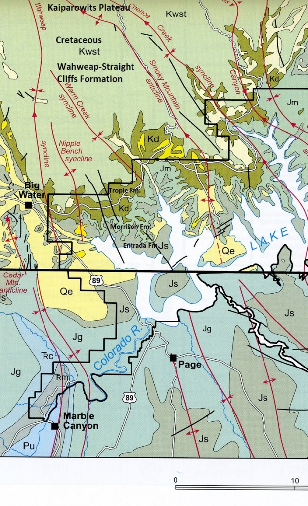
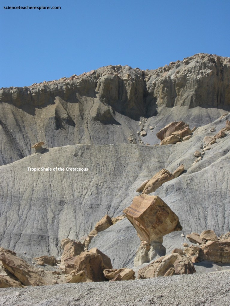
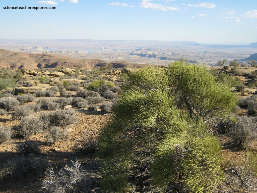
Further southeast on US 89, (a few kilometers), is a small village of Big Water, Utah. Turning left within the town, we traveled up a graveled road towards the Kaiparowitz Plateau, (image above). Pictured below, the road travels along the Entrada Formation, into the Jurassic Morrison Formation. Eventually, the road climbs across the Jurassic/Cretaceous boundary, into the Cretaceous Tropic Shale.
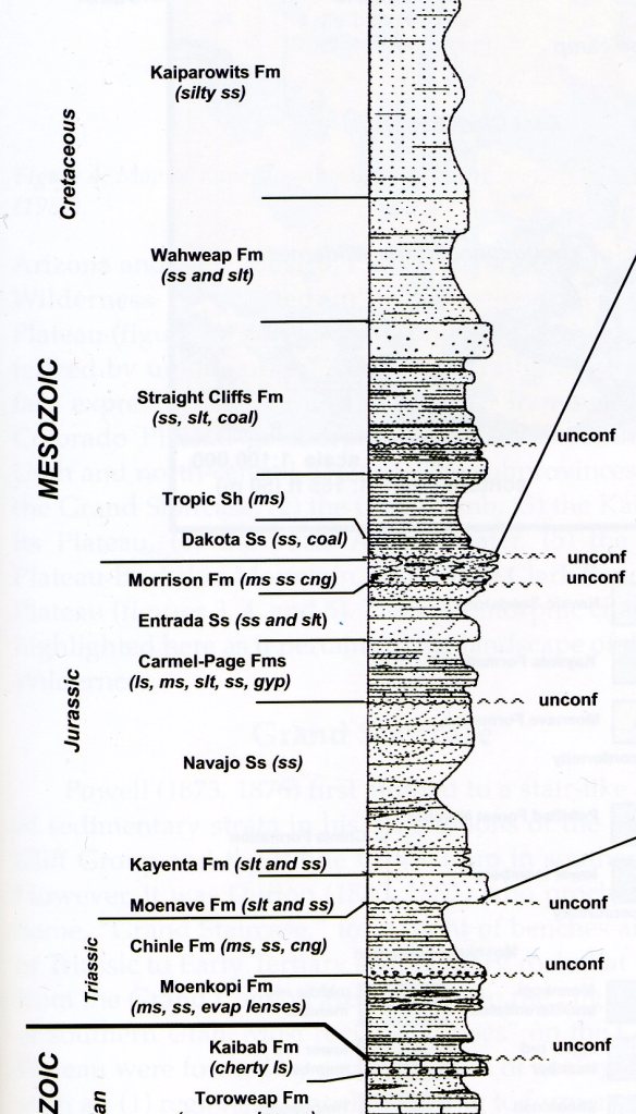
The Tropic Shale is a thinly laminated to thin-bedded mudstone and shale unit with lesser amounts of sandstone, bentonitic claystone, siltstone, and limestone. The muds were deposited on the floor of a shallow sea that had transgressed westward from the midcontinent area. Note that the undercutting produced by the weathering of soft-slope-forming Tropic Shale units, causing vertical cracks to open in the hard cliffs above them. Sometimes these boulders from Hoodoos seen already on this website.
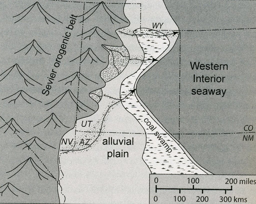
Cretaceous rocks in the Grand Staircase-Escalante National Monument are mostly limited to the Kaiparowits Basin Section. These Cretaceous rocks are 1600-2000m thick and were deposited in marine, mixed continental and marine, and continental environments. During this time mountains developed in western Utah and the Western Interior Seaway transgressed and regressed into and out of the monument area, (imaged below).
The Straight Cliffs Formation consist of many rock types other than sandstone. It is actually divided up into members which are: (ascending) the Tibbet Canyon, Smoky Hollow, John Henry, and Drip Take Members. The entire formation is 300-600m thick in the Kaiparowits Plateau section of the monument.
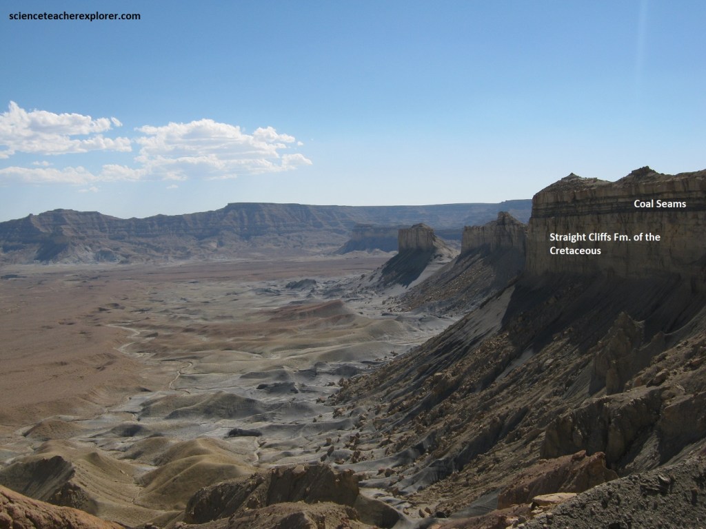
Pictured above, the lowermost member of the Straight Cliffs Formation is a cliff-forming sandstone that crops out above the Tropic Shale all around the margin of the Kaiparowits Plateau. The member ranges in thickness between 23-62m. It is mostly yellow-gray to moderate-brown sandstone that coarsens upward. The member was deposited in beach and shallow-water marine environments.
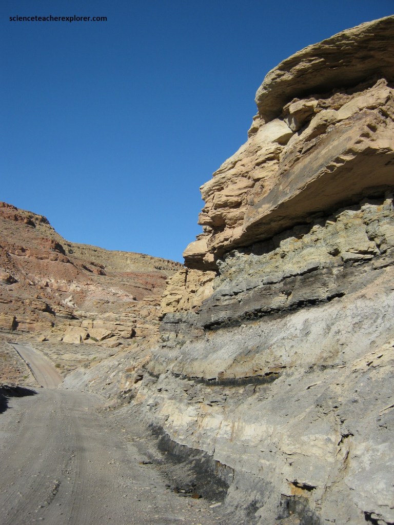
Pictured above, the “Smoky Hollow Member” is a ledge- and cliff-forming unit of sandstone, gray shale, mudstone and very thin coal seams. Coal, where present, is generally found in the lower part of the member, associated with dark-gray carbonaceous mudstone and thin-bedded sandstone. These beds were deposited in a variety of nearshore continental environments in lagoons and on flood plains.
Generally, structural geologic features seen along this Kaiparowits Plateau road result from two phase of deformation. Many of the folds that are seen, began during the latter part of the Mesozoic (Jurassic-Cretaceous); and were initiated during the Sevier orogeny and later modified as compression of the region continued through the Laramide event (Cretaceous-Tertiary). During mid-Tertiary, uplift of the Colorado Plateau was accompanied by basin and range extension which affected the faulting of the monument region. The uplift of the Kaibab region and folding along the East Kaibab monocline accompanied initial formation of the canyons about 15 million years ago.
Pictured below, the Kaiparowits coal field is mostly based on coals found in the Cretaceous Straight Cliffs Formation in the Kaiporawits Basin section of the monument. These coals were first mined by settlers near Escalante in the late 1800s. All mining in the coal field ceased in the early 1960s as the local market converted to the use of petroleum products for heating purposes. However, coal remains an important scientific resource in the monument. At the top of the Straight Cliffs Formation, we could see what a natural coal outcrop looks like, how coal burns and oxidized along outcrop (Smoky Mountain), the nature of roof and floor rock, and many other aspects of coal geology.
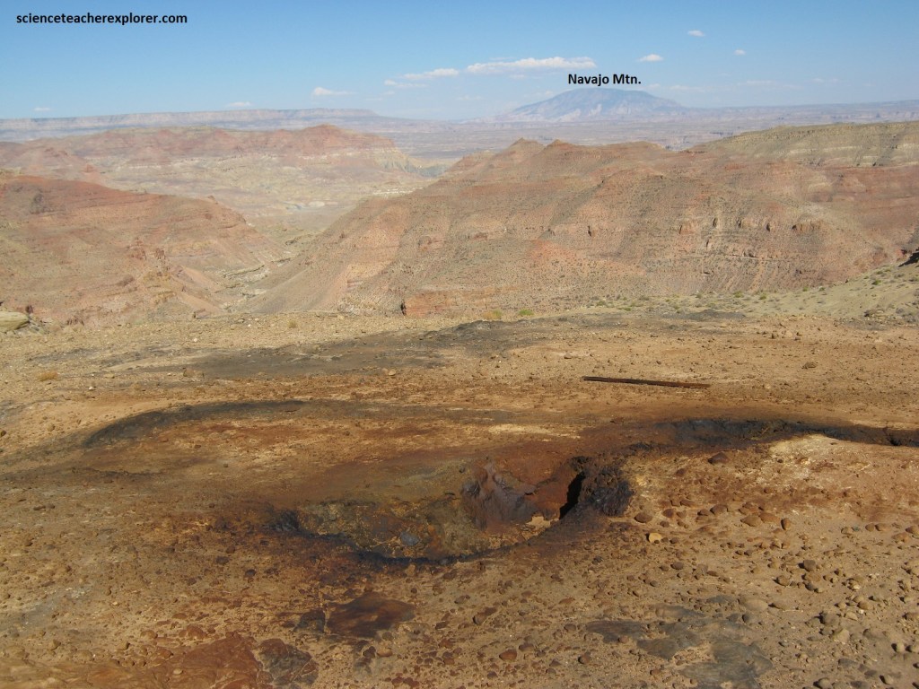
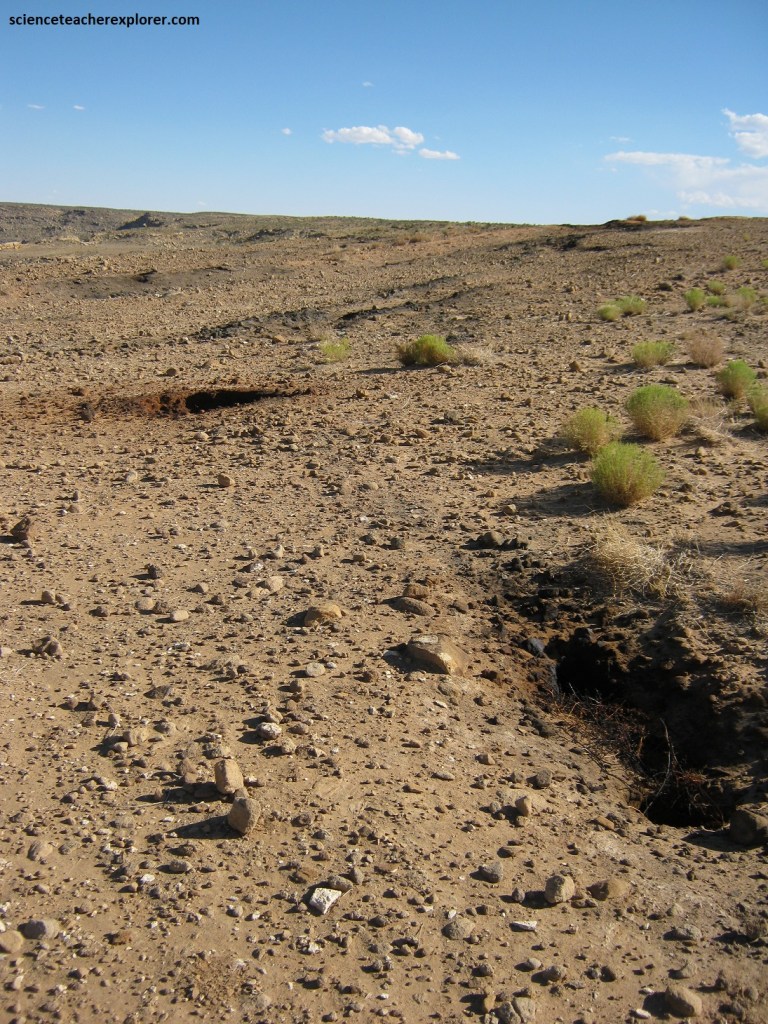
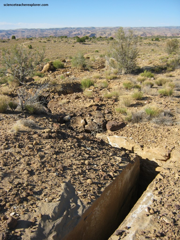
Pictured above, an underground coal seam (or seams), fuels the fire beneath Smoky Mountain on the Kaiparowitz Plateau. Smoky Mountain’s numerous coal seams are interbedded among 1,000 feet of Cretaceous-aged mudstone and sandstone known as the Straight Cliffs Formation. As mentioned above, the Straight Cliffs Formation was deposited approximately 80 to 90 million years ago when the area was encroached upon by a fluctuating body of water called the Western Interior Seaway. The fluctuating sea level caused deposition of the alternating layers of mudstone, sandstone, and coal we found in the cliffs and ledges of Smoky Mountain of the Kaiparowitz Plateau.
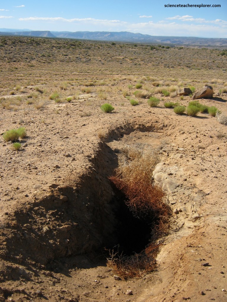
Pictured above, numerous long fissures, or ground cracks, run parallel to the cliff edge. The cracks near the cliff are likely due to the erosional undermining of the cliff’s mudstone base. Other cracks developed as the underlying coal seams burned out and reduced to ash, leaving little to no support for the overlying sandstone. These cracks eventually propagate to the surface, allowing additional oxygen to reach the fire, so it is unlikely that a lack of oxygen will naturally lead to the fire’s demise.
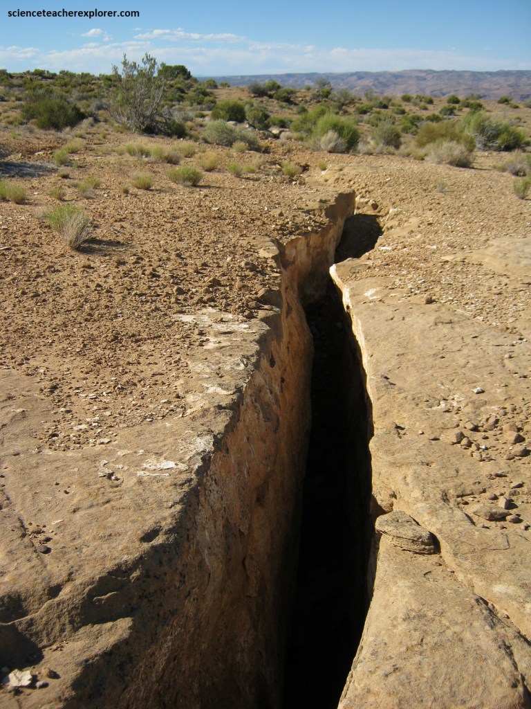
Pictured above, a lightning-sparked wildfire is a likely candidate for starting the fire. Coal is susceptible to spontaneous combustion due to its ability to self-heat in the presence of oxygen and moisture coupled with minimal ventilation for cooling. In the case of a lightning-sparked wildfire, hot embers may fall into preexisting fissures, igniting any exposed coal. Once coal begins burning, it often burns until there is none left, or the oxygen source is cut off.
Because this coal fire is a naturally occurring phenomenon, it will likely continue to smolder until the coal is gone as this location is now part of Grand Staircase-Escalante National Monument, which preserves the land within its boundaries for non-destructive scientific studies.
Coal is not the only fuel for underground fires; natural gas fires also burn in a few places across the planet. However, Utah has had eleven uncontrolled coal seam fires concentrated in Kane, Emery, and Carbon Counties.