Mule Cyn., UT 2001
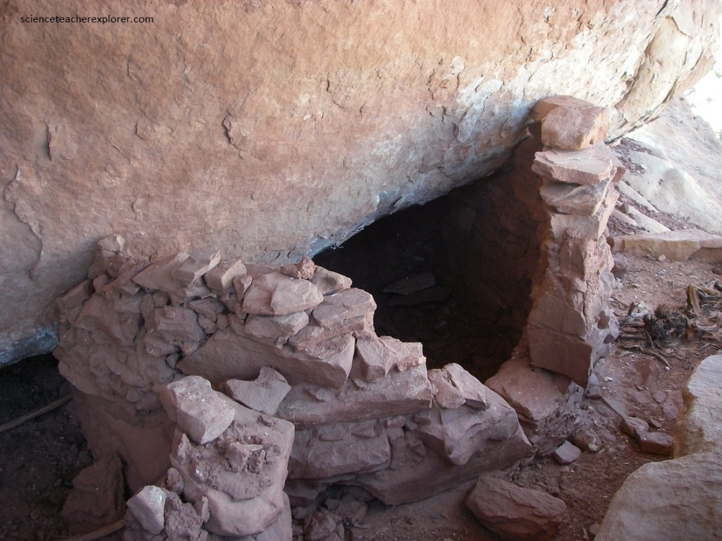
In 2001, I started exploring the Mule Canyons of the Bears Ears Area. The Mule Canyons, (North, South and Lower) are great places to discover Ancestral Puebloan ruins in a natural setting. The ruins, sheltered in alcoves and beneath overhangs along the canyon’s north wall, were occupied by Native Americans over 700 years ago.
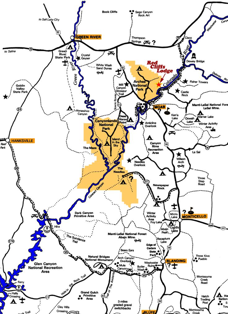
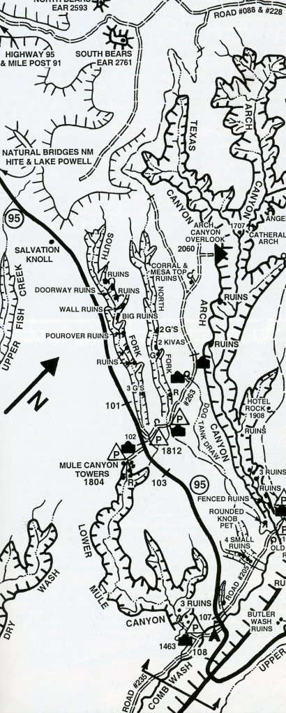
Imaged above, the Mule Canyons are locate roughly halfway between Blanding, Utah and Natural Bridges National Monument. To get to the North & South Forks of Upper Mule Canyon, drive along Highway 95 to between mile posts 101 & 102 and turn north onto Road #263. Imaged below, drive this graded road 500m and park beside the road at the bottom end of “South Fork of Mule”. Or drive 1.6 km from the highway and park at the lower end of the “North Fork of Mule”. If you have a 4WD, you can drive on to Texas Flat and the “Arch Canyon Overlook”. This is 9.7 km from the Highway. Too explore “Mule Canyon Towers” (or Cave Canyon Towers), turn south on Highway 95 until mile post 102 or 400m southeast from the Road #263, turn right right onto a small road and drive or walk one kilometer, (open & close the gate).
My first group of students that I took into the area was in 2001. I was required to split the group of 30 students & 8 advisors into four groups. One group explored the nearby Cedar Mesa Area, another explored the Natural Bridges National Monument, while another group explored the North & South Mule Canyons, and the last explored the Lower Mule Canyon. Each group had a couple of advisors and would exchange to a new location every day for 4 days.
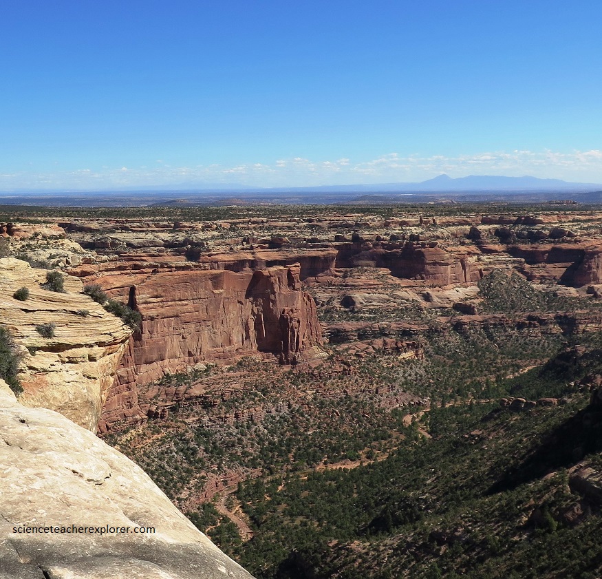
Pictured above, Arch & Texas Canyon is a canyon of radiant color. In the hills above the canyon, pale greens mingle with gray and white. The canyon bottoms glow with the red of the setting sun. Much color in canyon country derives from the presence of iron in different combinations with oxygen. Oxygen rusted the iron a brilliant orange-red. Without enough oxygen, iron turns green. When iron combines with both hydrogen and oxygen, it becomes yellow-orange limonite. Above the multi-colored valley, the Cedar Mesa Sandstone appears startlingly white. The ancient sea’s waves washed nearly all of the darker minerals away, leaving only white quartz sands behind, (imaged above).
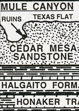
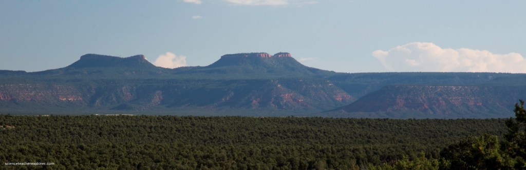
260 million years ago, the area of Mule Canyon was a beach of dazzling white sand, shoreline to the sea covering eastern Utah. Over time, water spread and receded, depositing layers of sand, silt, and mud. 10 million years ago, plates colliding below the surface pushed these layers upward. This uplift was incredibly slow, about one hundredth of an inch per year. This area is now a high desert called the Colorado Plateau. After uplift, the Colorado River and its streams cut into the plateau and created the winding Arch & Texas canyons with buttes like the Bears Ears, (pictured below). The ‘ears’, specifically, are the pair of similarly-shaped sandstone-caped buttes rising from the Cedar Mesa Formation, which – from a distance – give the impression of ursine ears poking above the horizon.
However, the main reason we were at Mules Canyon, was to explore some of the “Ancient Pueblo” Ruins within the North and South Mule Canyons. Our student groups started in the morning with the North Fork of Mule Canyon. The North Fork of Mule Canyon contained a few pools and shallow streams in 2001 but was usually dry. It was lightly vegetated with the floor that was mostly wide slickrock with no obstacles when walking upstream. The canyon contained four major groups of ruins but we only had time to visit a few of them due to time.
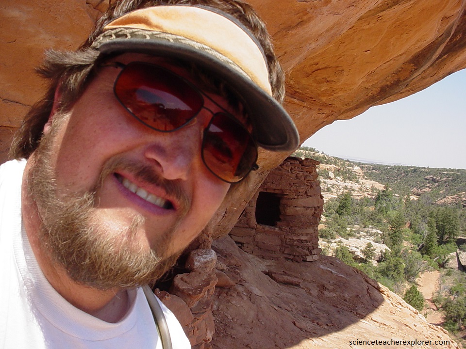
Pictured above, after passing a few minor ruins, we came upon our first major ruin site on a ledge on the right at the end of a spur in the canyon, ( about 3.0 km up the canyon). It was quite high above the streambed and so visible from some distance downstream. Here were two small granaries, one intact, the other mostly collapsed. Directly below the two granaries, on the canyon floor, is an elongated seep in a shady alcove.
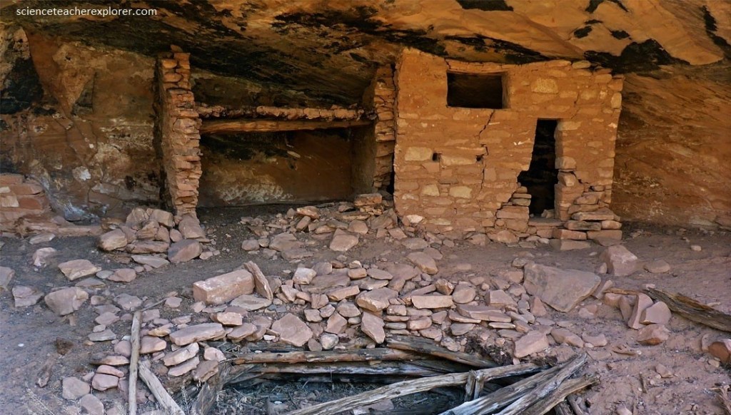
A short distance beyond the seep, and not far above the canyon floor, we came upon our second major site, (pictured above). It consisted of two main structures with two-rooms. They seem to be two-level dwellings with sturdy wooden floor/ceilings. The remains of a kiva was seen in the front, with fallen roof timbers. From here we turned around to explore the South Fork of Mule Canyon.
The South Fork of Mule Canyon had at least eight groups of structures that are found along the sunny north side of the canyon over a distance of 6.4 km. Some of the structures were close to the path, others up to 60 meters above the valley floor. A stream was flowing intermittently in the Spring of 2001, forming a few deep pools, which were easily passed. There was a little undergrowth initially but more upstream, where the taller cliffs and flowing water created a cool, moist environment and allowing large fir trees to grow.
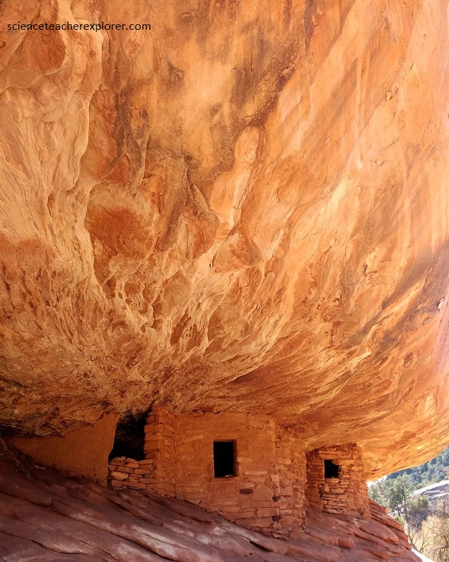
Pictured above, the famous “House on Fire Ruin”, was located 1.5 km along the trail, just as the canyon turns due north. A very short cairned path leads a little way up a slickrock slope to the well preserved ruin. In 2001, it consisted of a neat group of 4-5 granaries, built in an alcove. The Cedar Mesa sandstone in the ceiling above the structure was fractured and weathered to create an unusual radial pattern, resembling flames, especially when illuminated by reflected sunlight in the afternoon.
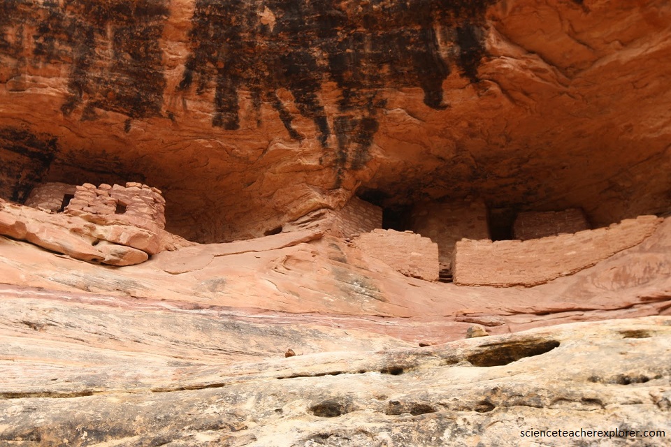
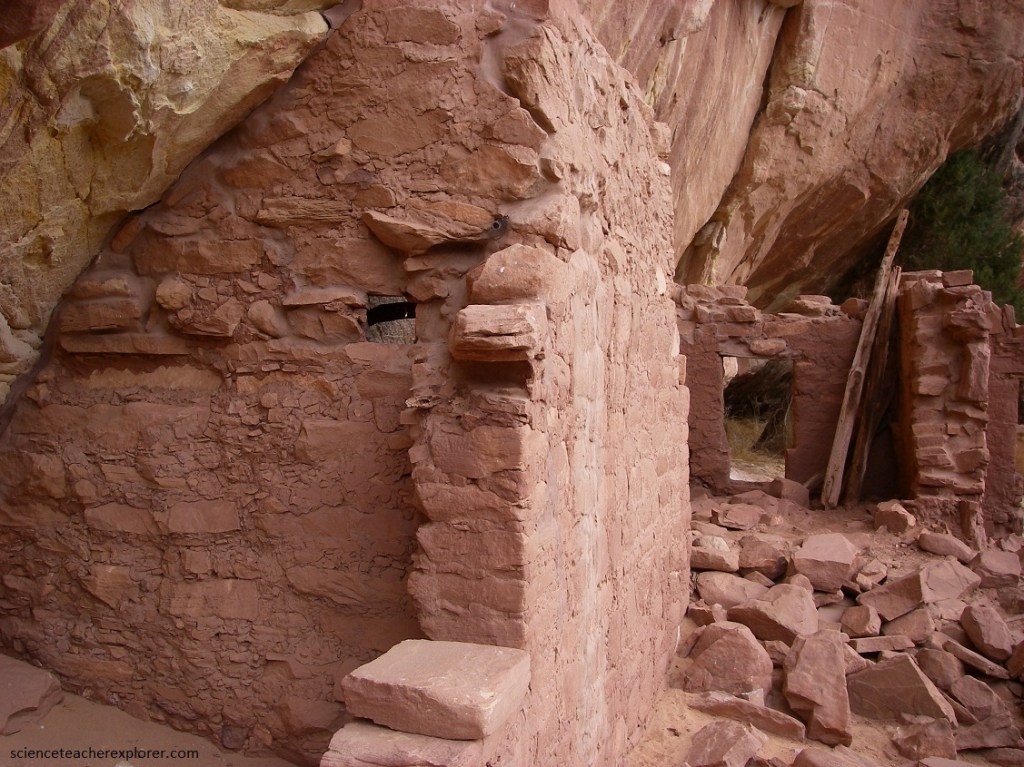
Pictured above, our second major ruin was larger and more impressive, occupying two adjacent alcoves, and including multiple rooms. It consisted of well constructed walls and a neat row of steps. The ruin was built at the base of the uppermost Cedar Mesa sandstone layer. Further up the canyon, the Cedar Mesa sandstone becomes gradually higher above the streambed. As we continued up the canyon, the ruins became higher off the valley floor. We passed several of these minor ruins before we made it the the biggest and best ruin. “Wall Ruin”
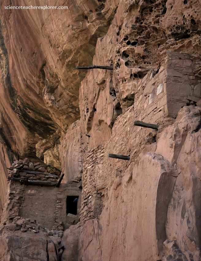
Pictured above was our last ruin before we turned around and headed back. Pictured above, Wall Ruin was the best, most unusual ruin in the south Fork of Mule Canyon. It was situated half way along a short side ravine (6.2 km from the start), which contained a small stream, flowing through tall, segmented reeds. The rooms of the dwelling are built into ledges and alcoves on a vertical cliff face, the surface of which had been eroded into many tiny cavities. Protruding posts showed in 2001, where ladders were used to be tethered and allow for entry into the different levels. The upper parts of the ruin were quite inaccessible, but the lower story could be reached by climbing 5 meters, using a log that was provided by an earlier group. The Wall Ruin site had various passageways and small rooms, with intact ceilings and relics on the floor, (in 2001), including metate stones and pieces of pottery and corn cobs.
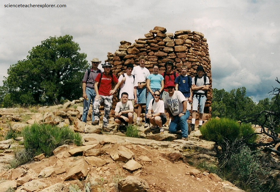
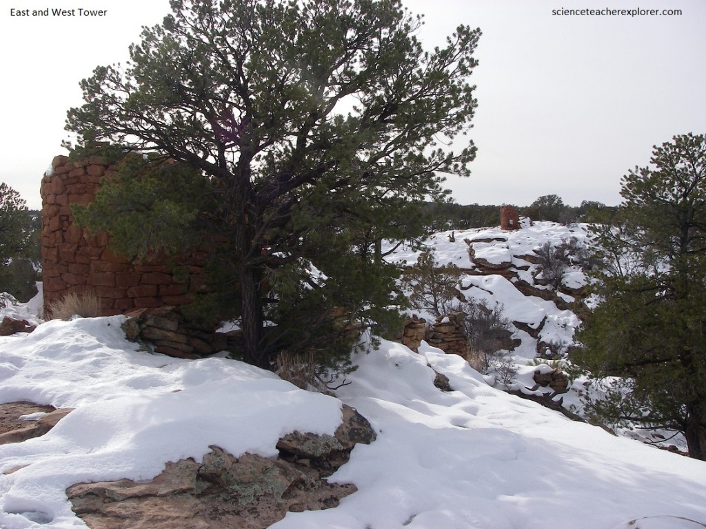
Of course, another leg of our tour in 2001, was to explore the towers in the Lower Mule or Cave Canyon. There are several towers in various states of decay located on the left (east) and right (west) sides of the rim of “Lower Mule or Cave Canyon. Much of the first story of one of the towers on the east rim is in very good shape. On the west rim a partial wall with a doorway remains. The other towers are basically piles of rubble. However, these structures rise straight from the bedrock and the walls were built from shaped and unshaped sandstone blocks and slabs.
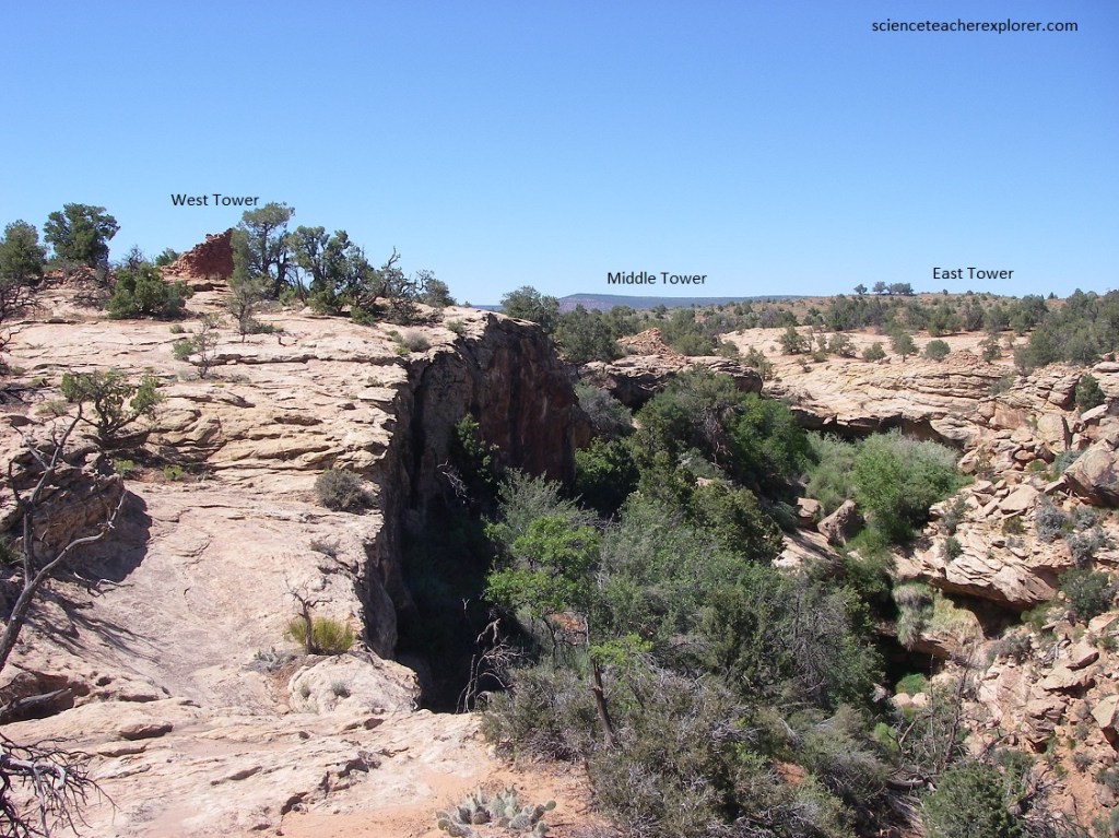
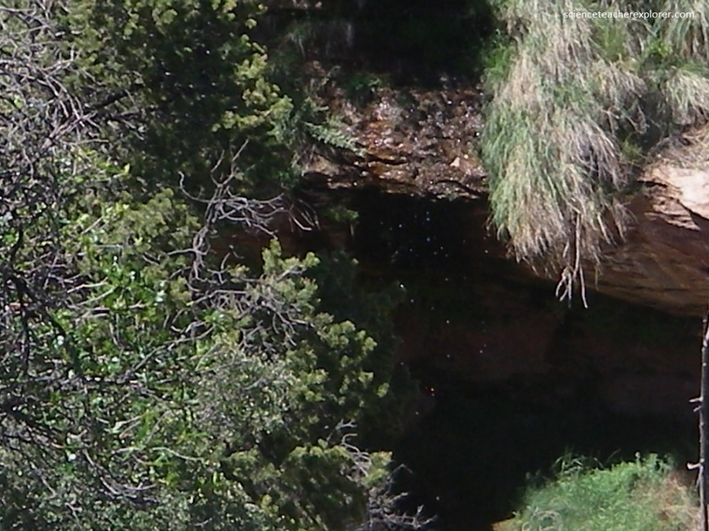
Pictured below, the towers surround a cave with a spring. The site was occupied around 1100 A.D.. From the East Tower, along the rim, we found a tunnel the took us under the rim, where we climbed down to the first bench below. Once on the first bench we walked back to visit the spring and large alcove below the dry-fall.
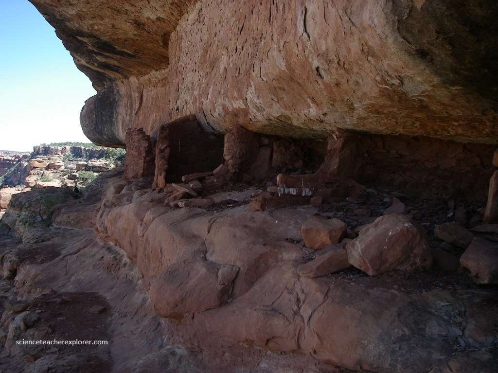
After visiting the spring, we hiked east to view additional ruins tucked in alcoves and located beneath overhangs along the cliffs on the east/northeast canyon wall.
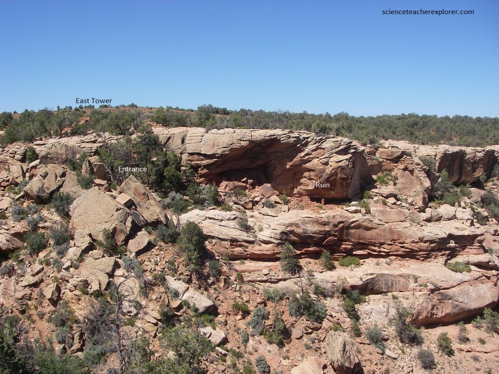
After hiking 100m along the first bench past the first ruins, we climbed down a landslide to the fourth bench, where we found additional ruins, (picture below).
Pictured below, these Ancient Pueblo ruins had two rooms with a door. The word “Anasazi” has popularly come to mean ‘ancient ones’ but is considered by some to be a racist term. The word itself is Navajo, meaning “enemy ancestors.” Using the term Ancient Pueblo or Ancestral Pueblo is also problematical. Such usage obscures the observation that the Mogollon tradition is also considered to be ancestral to Pueblo peoples. Most archaeologists are tradition bound and continue to use the term Anasazi, which is prominent in their professional literature.
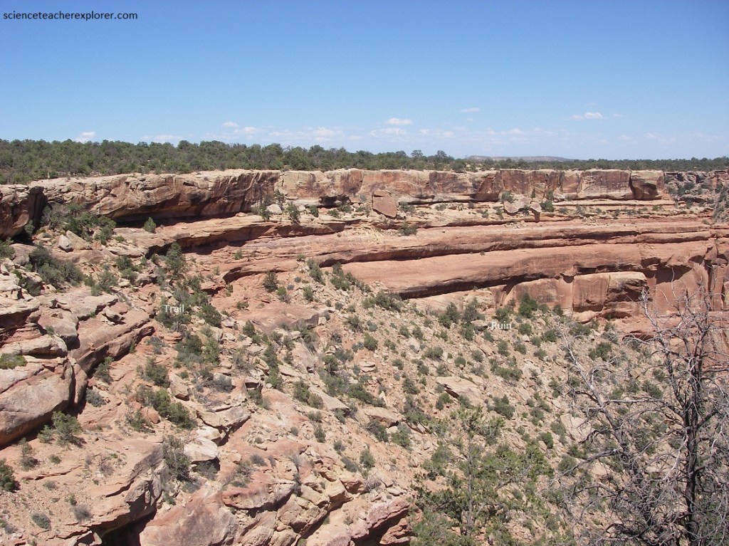
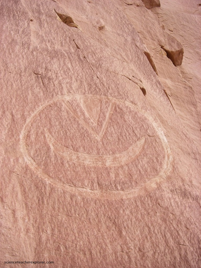
As the canyon drops steeply from the towers, the exposed rock layers provide a lot of good building sites. None of the cliff dwellings in the canyon, or the towers on the rim, have been stabilized or restored in any fashion. Pictured below, are a great number of ruins on the left. But as we scrambled to the cliff face, we noticed a wall that was precariously perched on a cliff on the right. There were several spectacular petroglyphs leading out it. And, above the wall was a giant Pictograph of an angry smiley face.
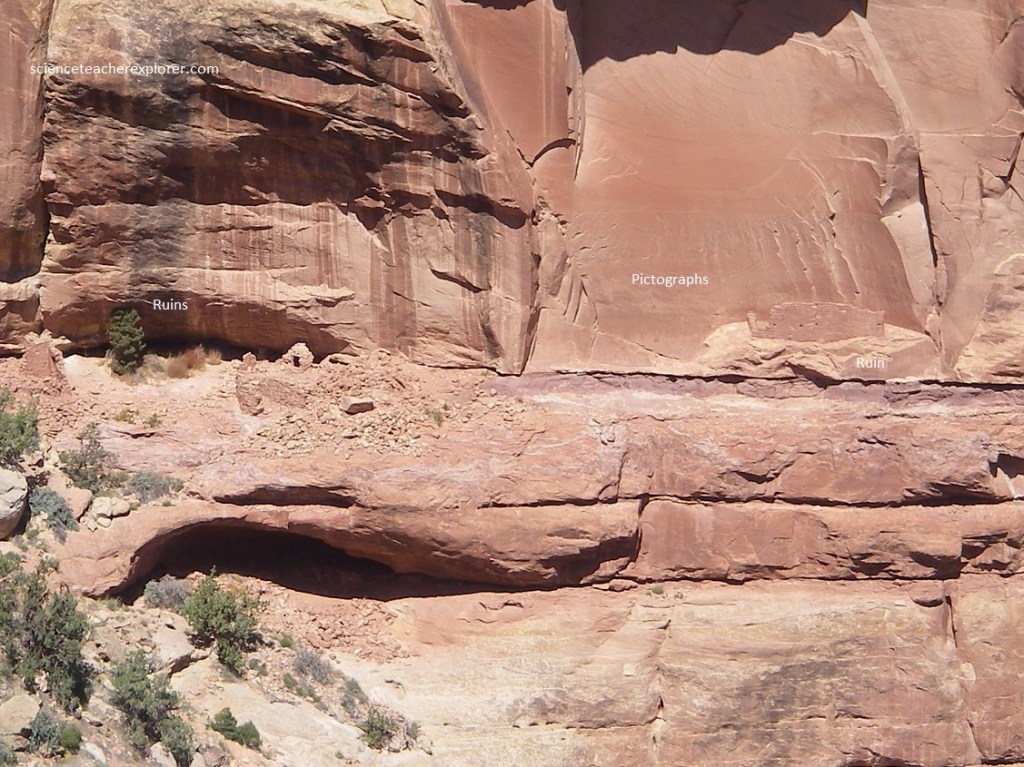
I determined that the “angry smiley face” was a shield for the clan that lived there. Prior research among scientists has considered shield designs as possible symbols of group identity, and that the placement of shield imagery within Pueblo alcove community is an indicator of consolidated group practice.
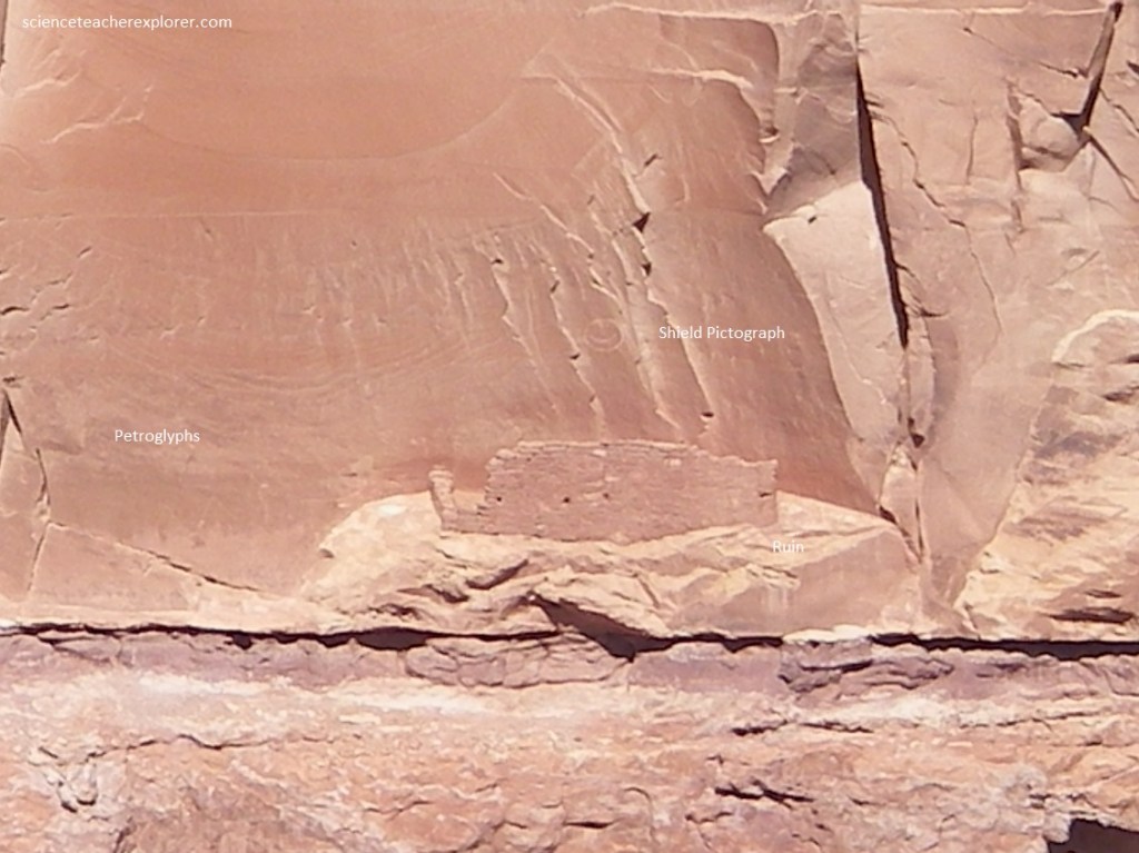
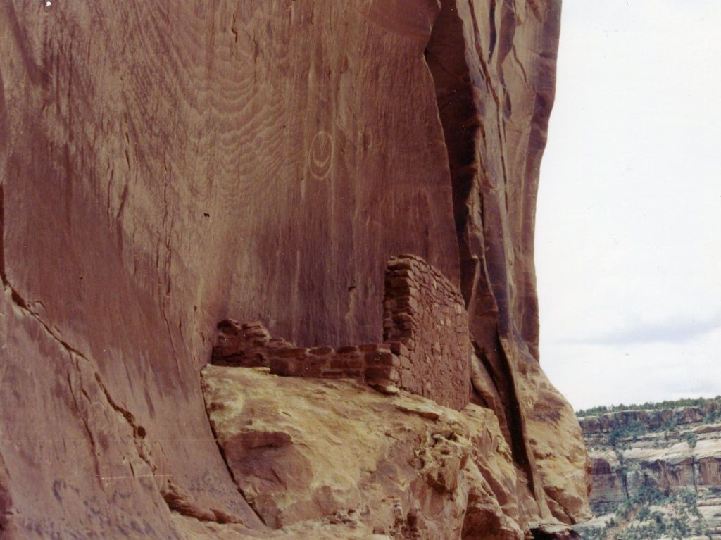
Very carefully, we climbed up into the cliff-dwelling, (behind the wall), to get a better look at the shield (pictured below). We found the cliff face behind the wall full of petroglyphs. It was a panel of petroglyphs. I told the students that the shield gave the community a shared a form of community identity and place in a location that was highly visible above the special cliff dwellings. Was I right? Maybe…….
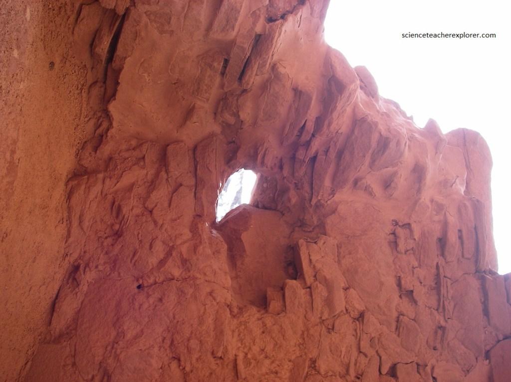
One of the students asked me about the holes in the wall. I went to tell them that they were probably remnants of the wood poles for a roof, when I noticed they had odd angles, relative to the wall, (not perpendicular). Some of the holes ran southwest & up; and others ran northwest.& up. I couldn’t finish my explanation, and told them I didn’t know. That was when my assistant advisor, (Mike Stevens), noticed with his binoculars, that there were structures on the other, (north-western), side of the canyon. I was skeptical, because I had never seen the Ancient Pueblos build their dwellings on a north-facing slope. But I kept it in mind, until the Summer Solstice of 2005. I had an idea!
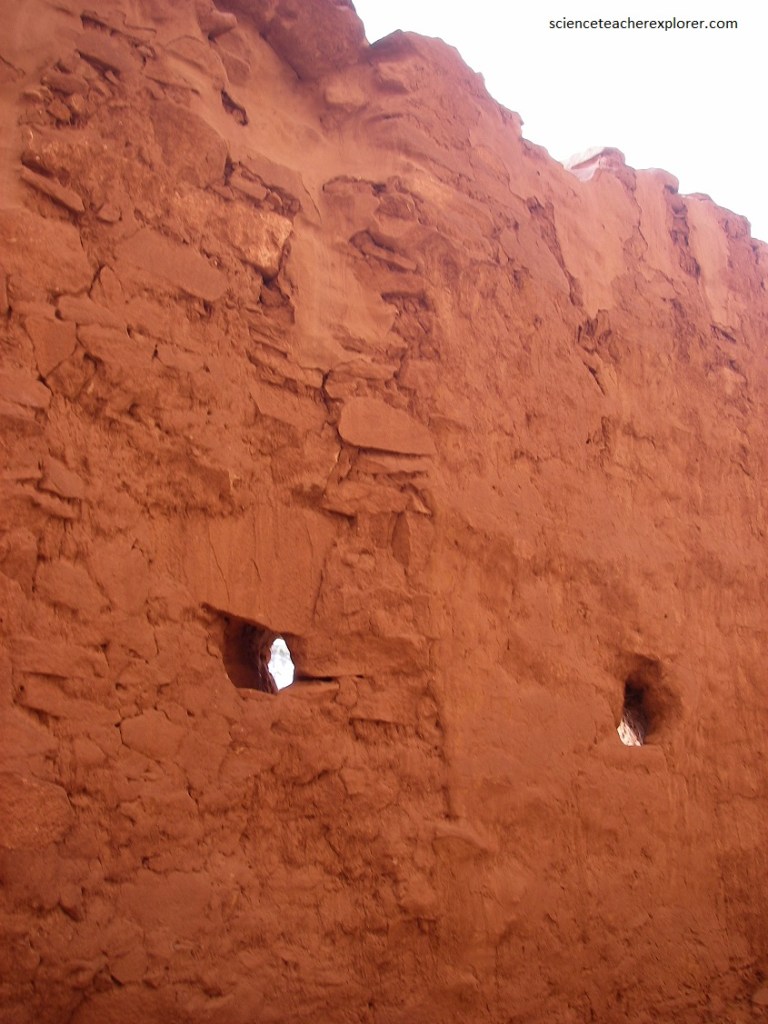
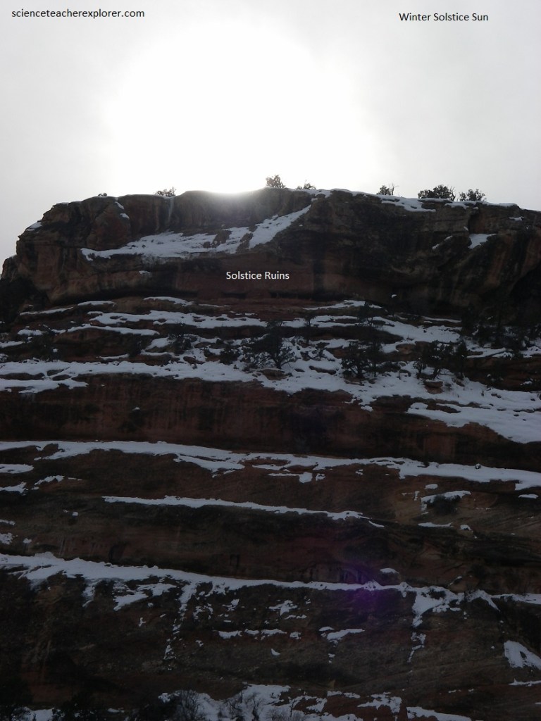
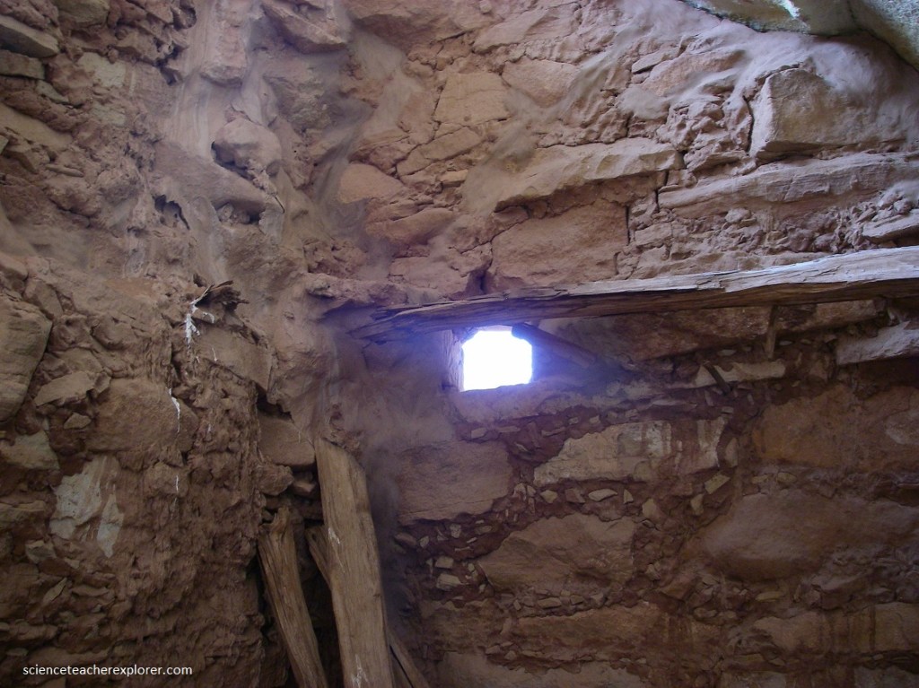
I returned with a small group of students (five) in 2005, on the Summer Solstice (June 21st of 2005) to see if my hypothesis worked. Were these holes placed in the wall for astronomical reasons? In other Ancient Pueblo sites in the 4-corners area, ancient structures indicate an understanding of the Sun’s movements. The holes in the wall could provide a window the lets a beam of light shine into the cliff-dwelling on the back wall at the Summer Solstice, (pictured below).
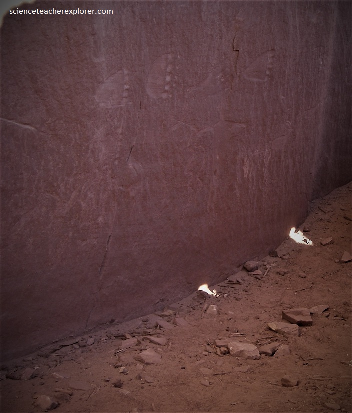
Amazingly I was right. Pictured above, two “Sun-Daggers” were projected toward the back wall as the sun went down during the Summer Solstice. Where were these Sun-Daggers headed? The left Sun-Dagger ended at the crotch of the god-like figure as the sun approach sunset. But what about the right Sun-Dagger? The way it was angled, it probably allowed the beam of light to hit the same destination on the Winter Solstice. But this was a hypothesis. I had to come back during Winter Solstice, (Dec. 21st, 2005) to test it.
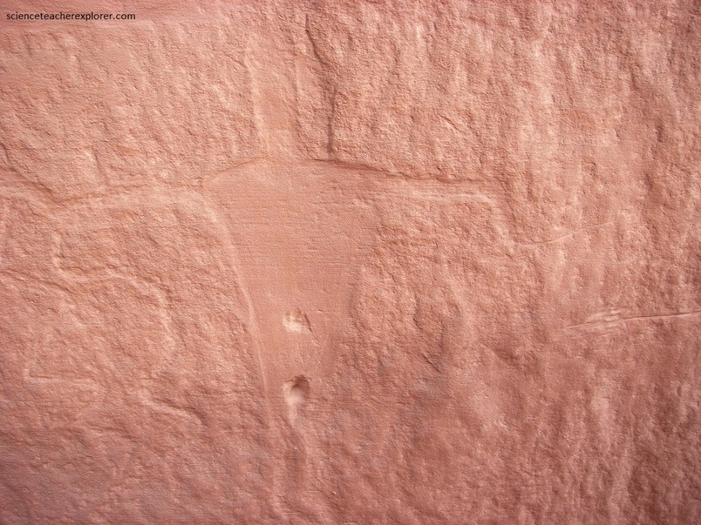
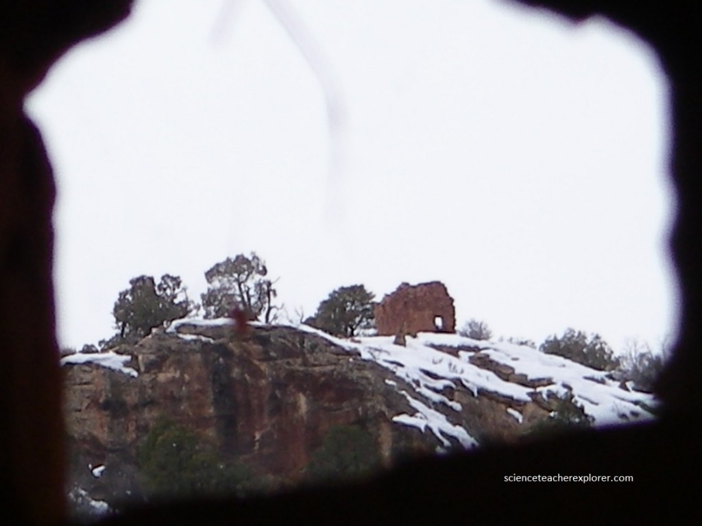
I came back on Winter Solstice of December 21st of 2005. And I was right again. This time the right Sun-Dagger hit the crotch of the god-like figure at sundown. Apparently the holes were made for the Summer and Winter Solstices and they both ended at the same location on the back wall. Boom! Then I discovered something else. Pictured below is where the sun goes down on the other side, (northwest) of the canyon. This is where Mike Stevens testified to seeing other out-of-place dwellings. Apparently, I had to explore that other side in the morning. But wait. If the Ancient Pueblo people built structures below the Winter Solstice sun-down location, then would they build a structure at the Summer Solstice sun-down location?
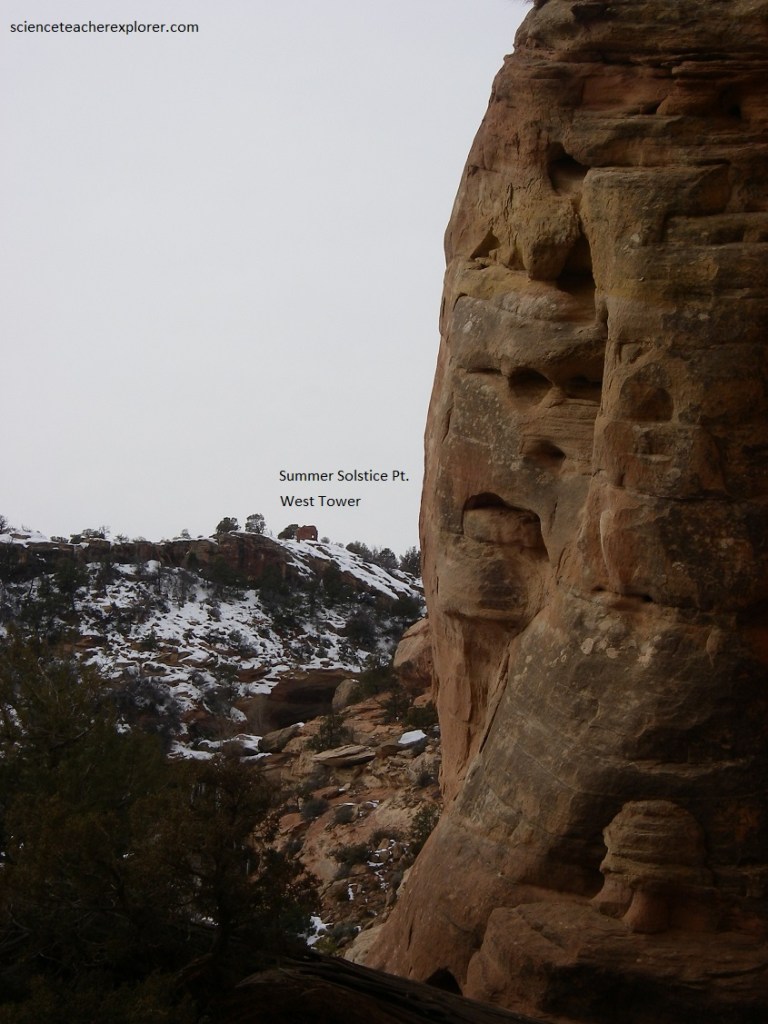
Pictured below is the cliff-dwelling wall hole that aligns with the Summer Solstice sun-down location. This was an opportunity to see if there was a dwelling across the valley that lined up. [I was unable to do this during the Summer Solstice because of the blinding effect of the sun-rays]. I discovered that the Summer-Solstice sun-down location was the West Tower near the spring. Apparently, they built the West-Tower in the location where the Summer-Solstice went down from this cliff-dwelling. Amazing!
Note that the The doorway of West-Tower is intact and faces southeast along the rim, (towards me near the cliff dwelling). Measuring 65 centimeters wide and 1.3 meters tall, the base of the doorway is 50 centimeters above the foundation. (I’m thinking Sun-Rise viewing point for the Summer Solstice).
On my way back from the east side of the Canyon, I wondered if the ancient dwellings next to the cliff-dwelling had similar alignments. Pictured below is a double room dwelling that has a strange small window. This window, also seemed to be pointing at the West Tower.
Throughout history, the ability of a people to survive and thrive has been tied to environmental conditions. The skill to predict the climatic change of the seasons was a essential element in the ability to “control” those conditions. Seasonal calendars thus became the foundation of early cultures: hunting and gathering, planting and harvesting, worshiping and celebrating, were activities dictated by specific times of the year. All of these activities have fostered the identity of cultures.
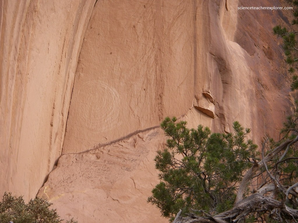
Apparently, the Lower Mule Canyon Ancient Pueblo people found a variety of way to chart the arrival of the equinoxes, solstices and other important “dates” in the year. These included observing the sun’s position on the horizon at sunset, patterns of sunlight and shadow on spiral petroglyphs, patterns of sunlight and shadow on natural features on the landscape, and the alignment of the sun with architectural structures.
A skeptic may ask, “isn’t the sun in a different position today than it was when the rock art images were created or the structures were made?” The short answer is “yes.” Celestial objects change the positions of their rise and set slowly with time due to the earth’s precession. This is referred to as the “obliquity of the ecliptic.” Since the day of the Ancient Pueblos, the change in the obliquity has shifted the position at which the sun rises and set by only 0.07 degrees. This would not produce a significant change in the observed sun/shadow patterns of our observations at this location.
Pictured below, All the towers have a similar view stretching primarily to the south, looking directly down the canyon. The Chuska Mountains can be seen from many of the towers and it is likely that, at their original height and without the present day vegetation, one could see the Sleeping Ute Mountain in the distance. All are in view of one another. Almost all of them have a direct view into the spring. It is possible that at times these towers served as a marker or monitor for the water source, perhaps reinforcing water claims and limiting access to the spring.
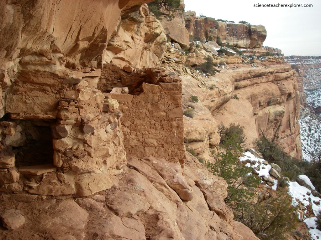
The next morning, Dec. 22nd I revisited the Lower Mule Canyon. But this time I hiked down the west rim to where the out-of-place ruins were. Again, it is rare to find Ancient Pueblo dwellings on the northwest slope of a canyon. However, these dwellings were built under the alignment of the Winter-Solstice sun-down location, (pictured below).
I believe that the Mule Canyon sun-watchers monitored the sun and anticipated the times of solstices through imaging and/or sighting. The predominant method of watching the sun at these Lower Mule Canyon Pueblos was sighting horizon markers from a fixed observation position, like the Cliff-Tower mentioned above.