Twin Falls, Idaho
Over the years, I’ve crossed by Twin Falls on my way to my wife’s hometown near the Idaho & Oregon border. Twin Falls is located on the southside of the Snake River Canyon in an area of Pleistocene lake beds. The soil is deep and rich except in areas scoured by the Lake Bonneville Flood on the north side of the canyon.
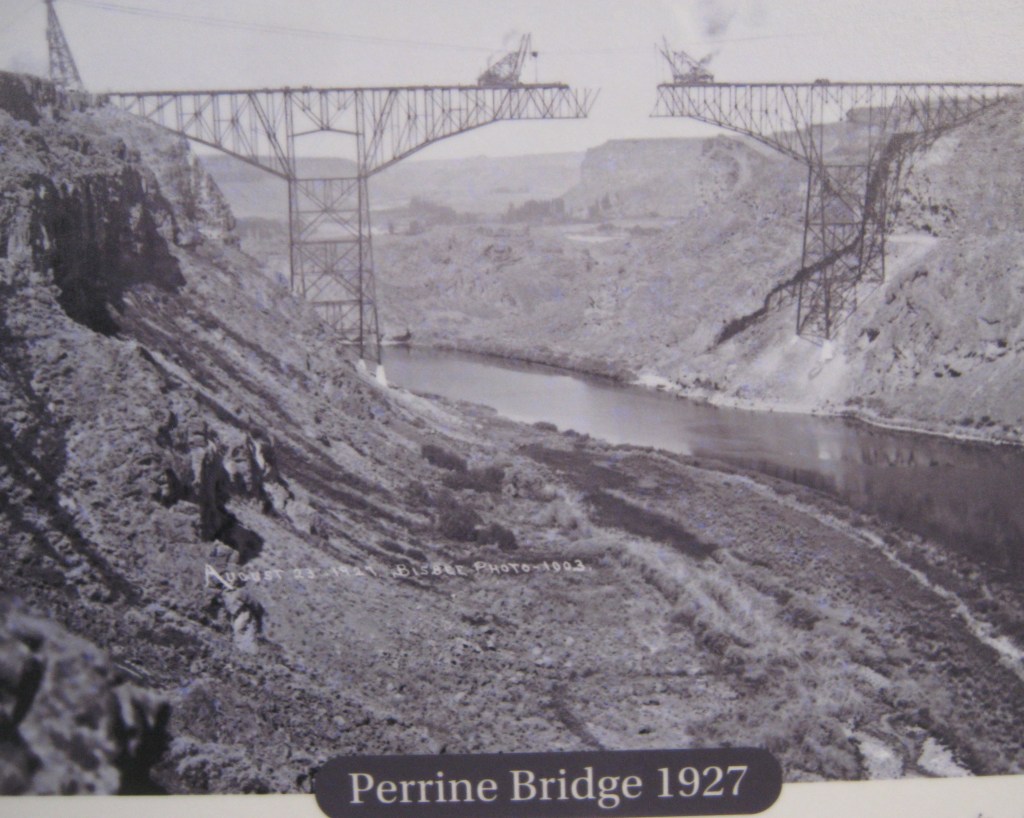
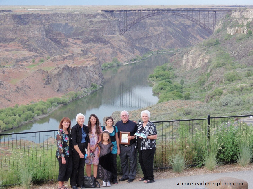
Pictured below, US 93 crosses the majestic Snake River Canyon via the iconic Perrine Bridge, 160 m above the river.
Pictured above & below, The bridge and its visitor center, nearby this overlook, and a rim trail were good places to observe the canyon landscape, the exposed volcanic rocks, and the effects of the catastrophic Bonneville Flood.
Pictured below, Becky’s aunt, Jeannie Coles is posing next to the Perrine Coulee Falls on the rim trail. The Perrine Coulee Falls was formed as a result of the creation of the canal system in 1905. Before the Perrine Bridge was built in 1927, the only way across the canyon was through the Perrine Coulee Falls. Becky’s mother and aunt was raised near Twin Falls, Idaho.

The canyon of the Snake River exposes Miocene (6.3 million year old) rhyolite underneath the cover of the 5 million year old basalt lava. Pictured below, at Shoshone Falls the Snake River cascades over this rhyolite in a waterfall carved during the catastrophic Lake Bonneville Flood about 14,500 years ago. Shoshone Falls is 70 meters high, higher than Niagara. When this picture was taken, during the late summer, the falls is reduced to a trickle due to the river’s impoundment by upstream reservoirs that store water for irrigation.
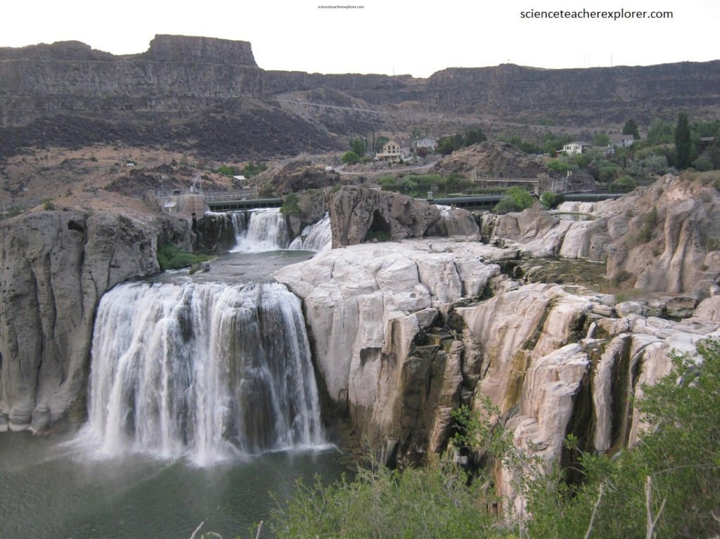
Shoshone falls spills over a resistant ledge of light-colored, massive rhyolite. This rhyolitic volcanism is related to the migration of the Yellowstone hot spot about 6.3 million years ago preceded the overlying basaltic lava flows by about 1 million years.
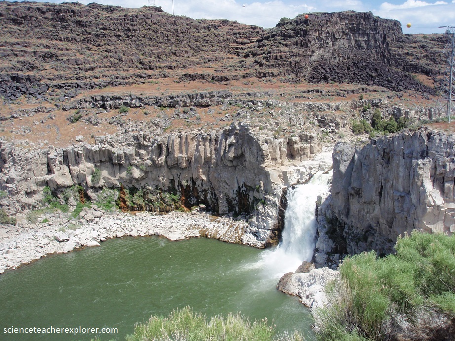
Pictured above, three distinct rock layers make up the walls of the Snake River Canyon; grey (white) rhyolite composes the lower half of the cliff, an unlayered beige, slightly pink breccia lies breccia lies immediately above the rhyolitic; and fractured basalt composes the upper half of the cliffs in the distance.
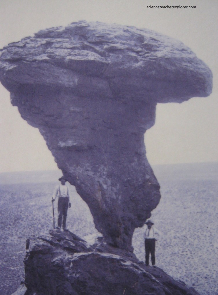
Pictured above, “Balance Rock” is over 16 meters tall and 40 tons, the wind-carved rock balances precariously on a pedestal of only 1 meter across.
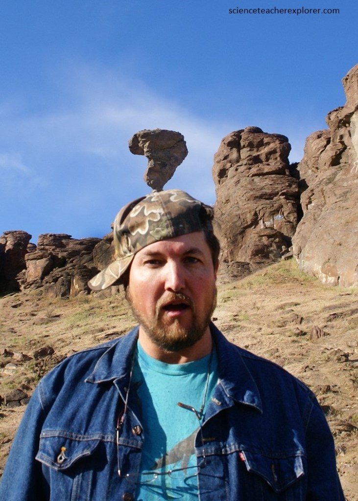
Balanced Rock is thought to have been carved by wind and water over the course of millions of years. It was formed of the rhyolite lava formation created at an estimated 16.3 million years ago from the Yellowstone Caldera before it moved eastward.
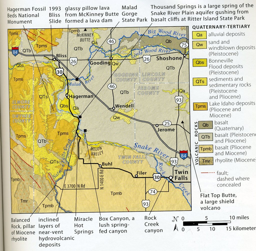
The sheltered Hagerman Valley, with nearby towns appropriately named (Bliss), has a long growing season and abundant water supply, in stark contrast to the mountain and desert country just a few miles north of south of the Snake River Canyon.
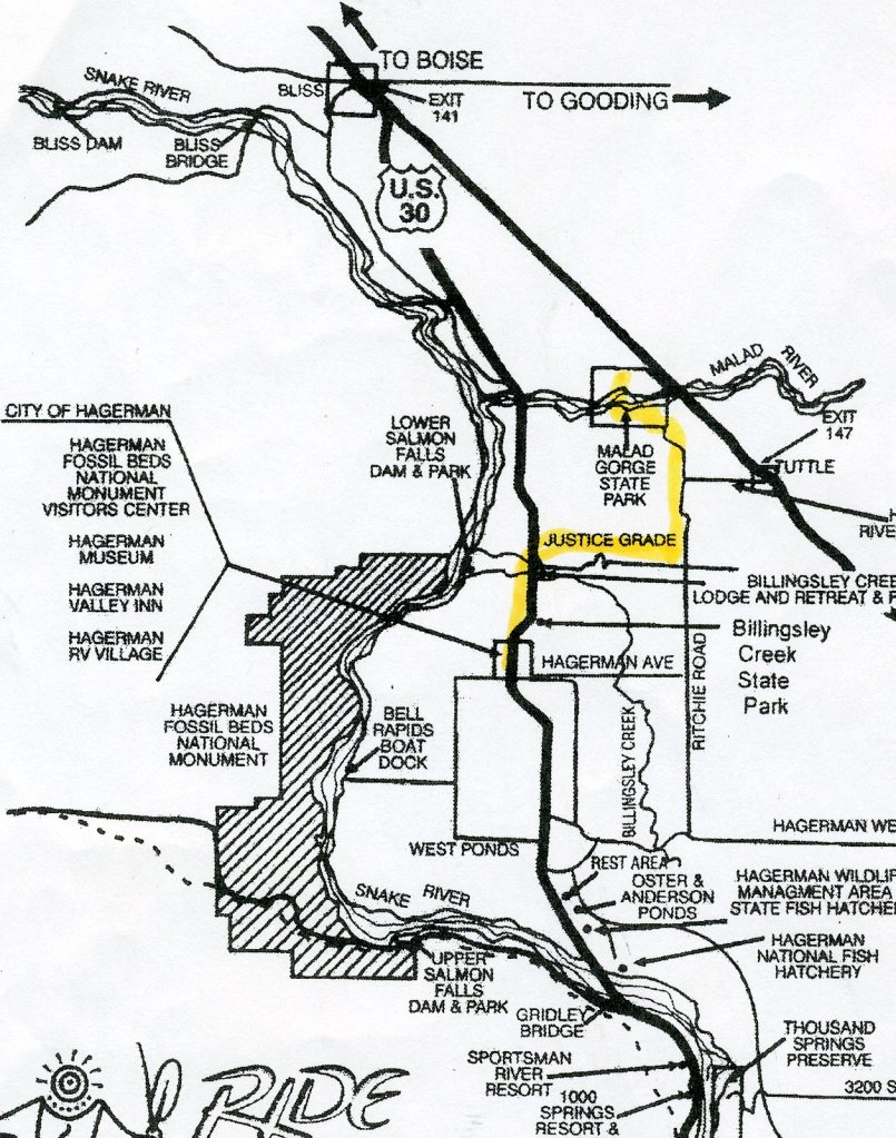
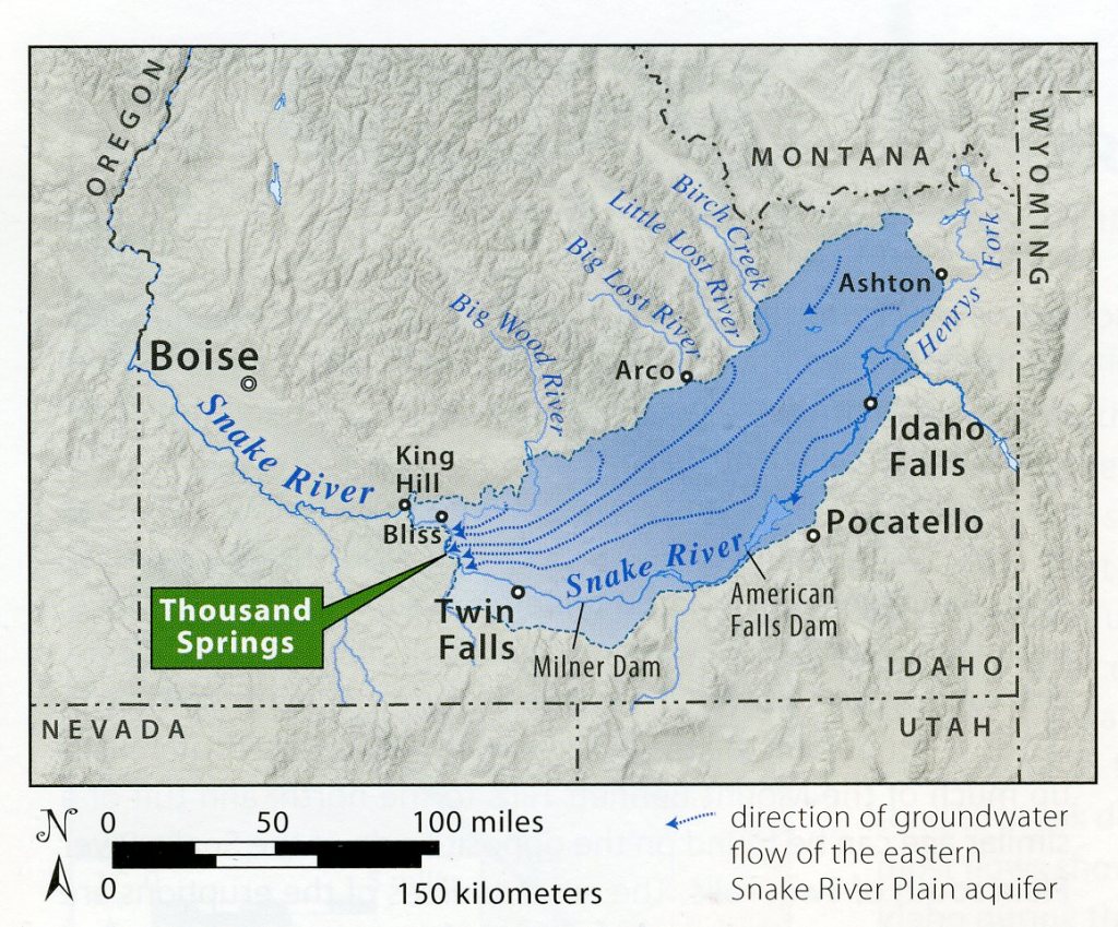
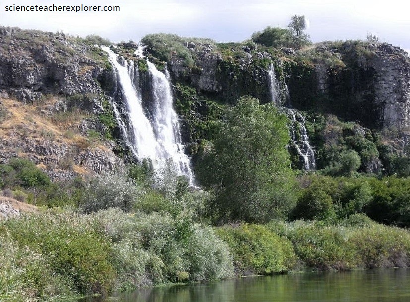
The Snake River aquifer is a complex system, with multiple layers of high permeability. It discharges 8 million acre feet of water per year in the famous Thousand Springs area on the north wall of the Snake River canyon from Twin Falls to Hagerman. Most of the commercially produced trout in the United States are grown there.
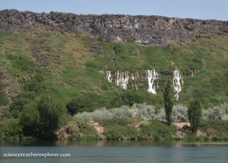
The Snake River Plain is underlain by fractured and rubbly basalt lava flows, which form a highly permeable aquifer. Interbeds between the basalt layers are mainly sand, silt and clay, with smaller amounts of volcanic ash. Within basalts, permeable zones are mainly the tops and bottoms of lava flows, with columnar jointing in between providing slower vertical transmission of water. Rhyolite that underlies the basalt does not have high permeability, as many of the pore spaces are filled with chemical precipitates. Water which falls mainly as snow in the mountains north and east of the eastern Snake River Plain is absorbed into the basalt in many places along the northern margin of the plain.
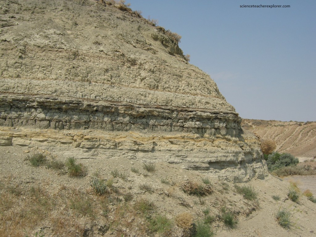
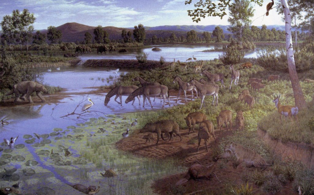
Pictured below, Hagerman Fossil Beds National Monument, an area of bluffs and steep slopes on the west side of the Snake River, was set aside in 1988 to preserve one of the world’s premier localities for Pliocene fossils.
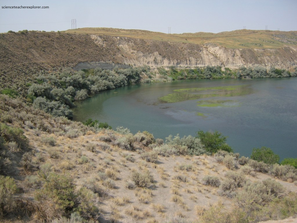
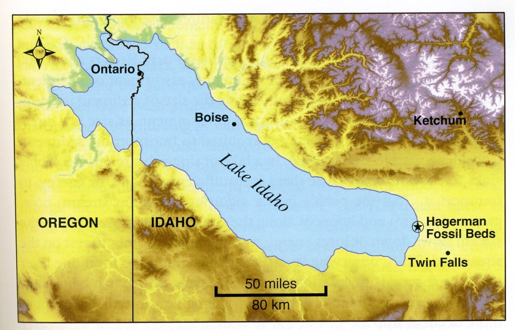
The fossils lie within the Glenns Ferry Formation sediment deposited in lakes, streams, deltas and marshes associated with Lake Idaho 4-3 million years ago.
Fossils found at the Hagerman Fossil Beds National Monument includes mastodons, camels, beavers, snakes, voles, otters, peccaries, and fish of the Pliocene age.
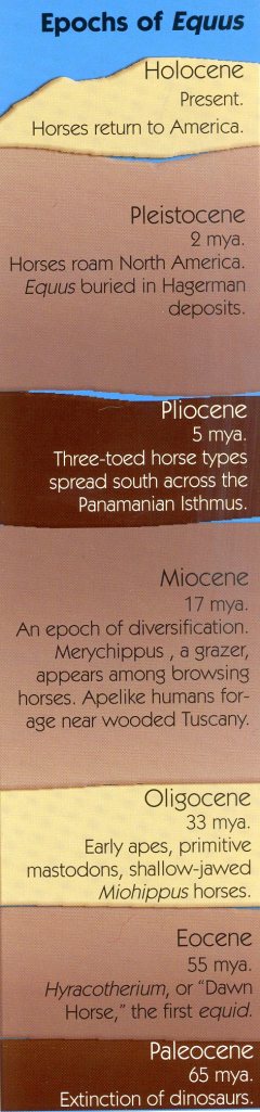
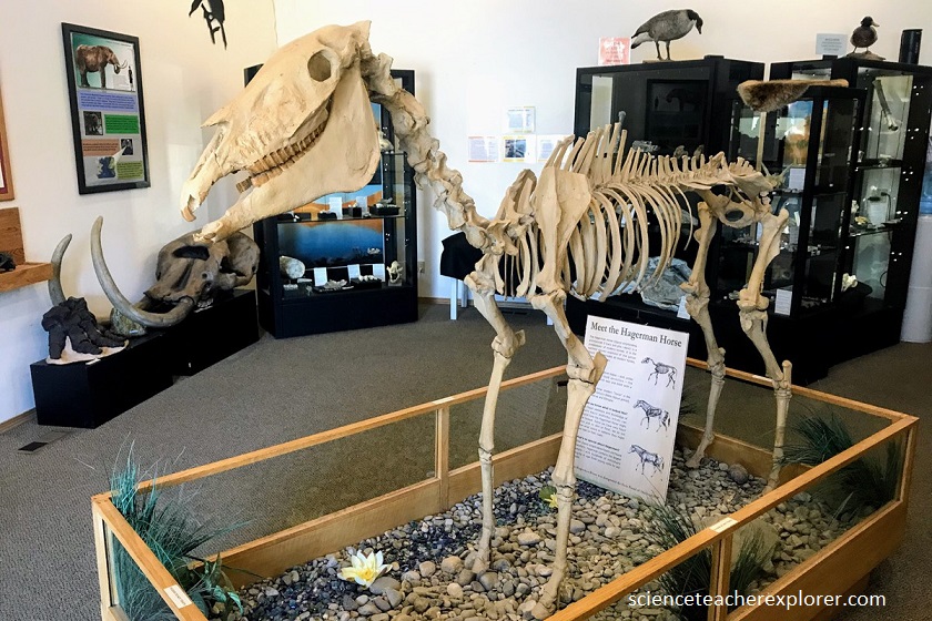
The monument’s most famous fossil and the Idaho state fossil is the Hagerman horse (Equus simplicidens), a shorter version of the modern horse.
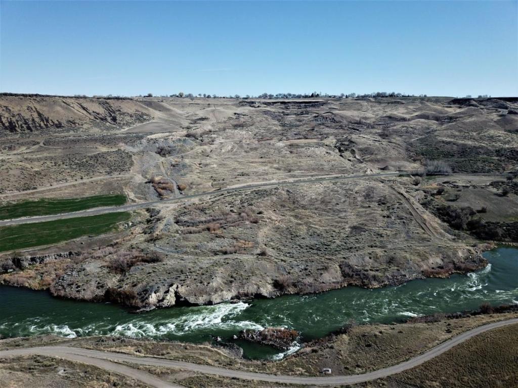
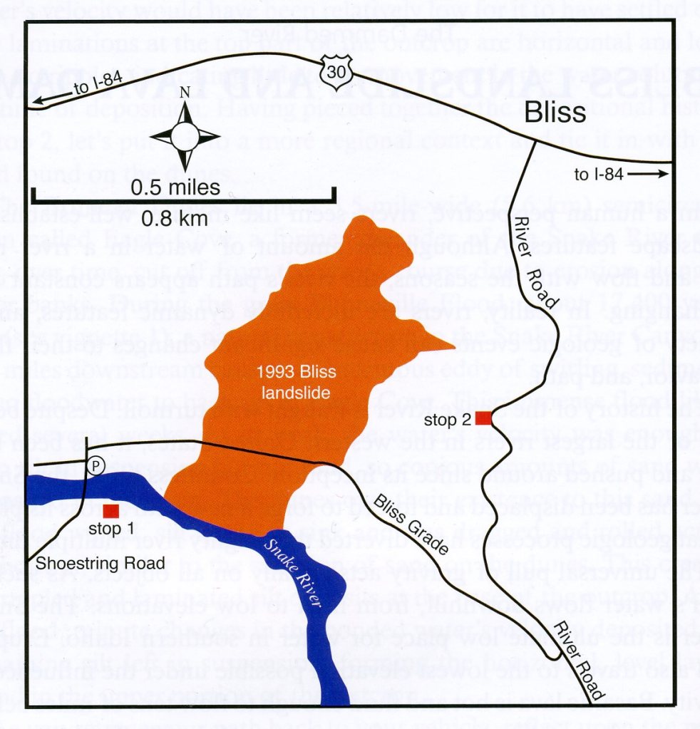
Pictured below, just south of Bliss, Idaho, the “Old Bliss Grade/River Road skirts the eastern edge of a large landslide that occurred on July 24, 1993. The 100-acre slide moved sediment and debris into the Snake River, temporarily blocking the river and displacing it several hundred feet south of its former course.
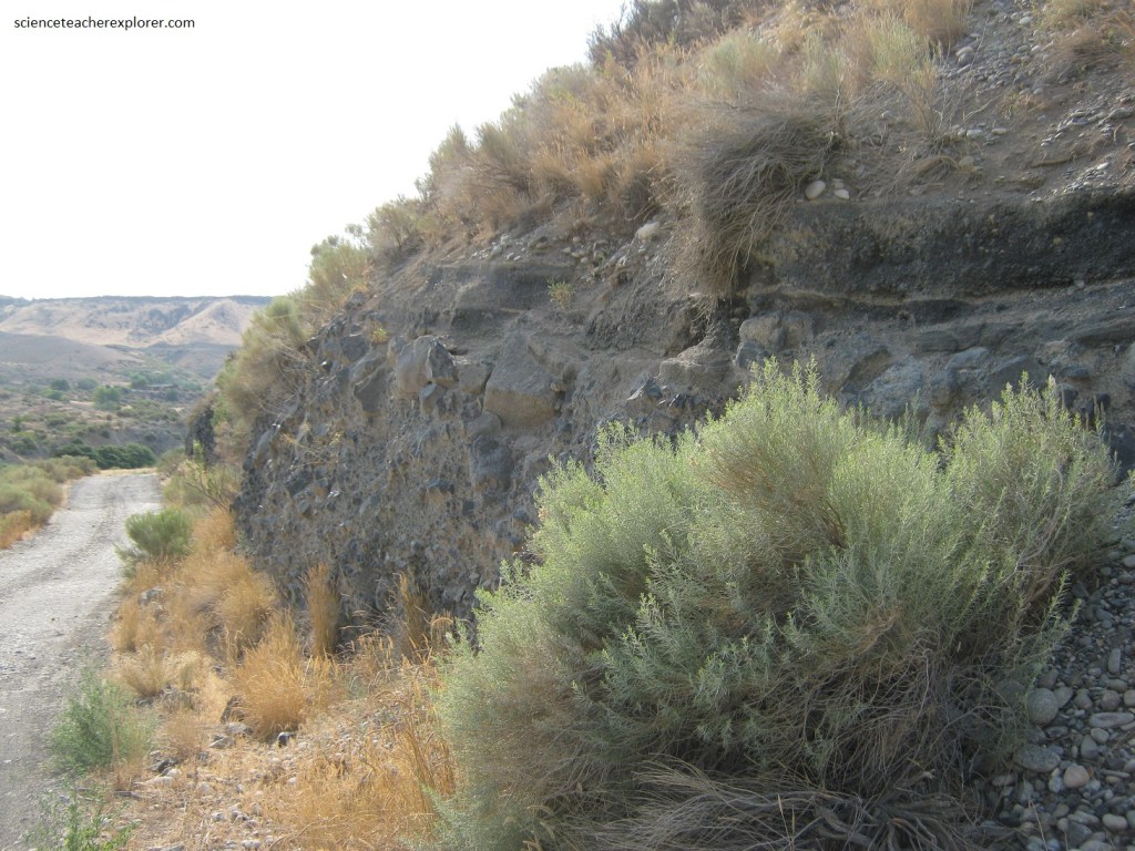
The geology of the area was a major contributing factor of the above landslide. About 52,000 years ago, lava erupted from McKinney Butte, a local shield volcano, and traveled downhill to the rim of the Snake River Canyon near Bliss. The lava spilled over the edge and into the river, forming a dam of lava, (Pictured below).
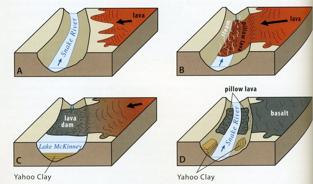
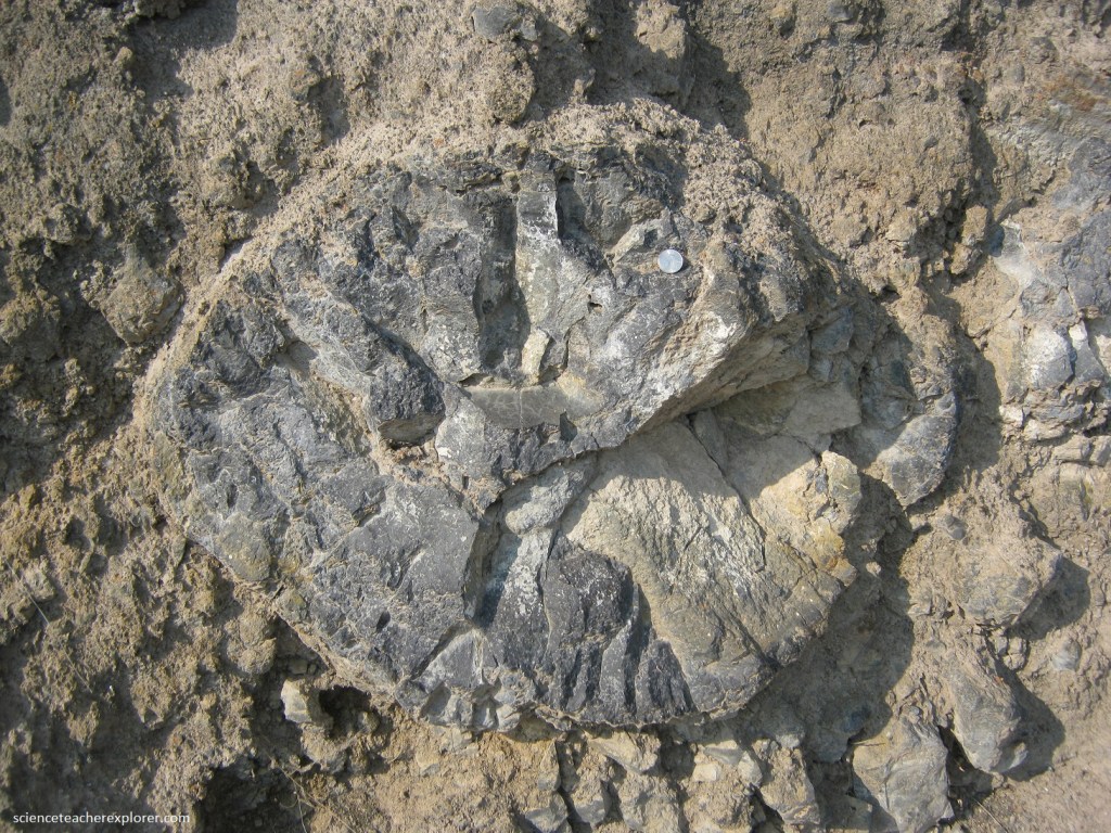
Pictured above and below, the cold river water of the Snake, chilled the lava quickly, forming pillow basalt. The continuous supply of lava into the Snake river formed an immense dam of rubbly basalt nearly to the canyon rim and river water ponded behind the dam to from a lake, called “McKinney Lake”.
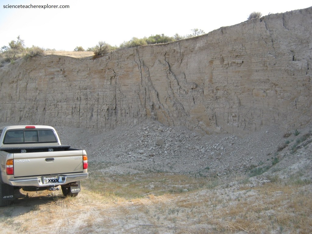
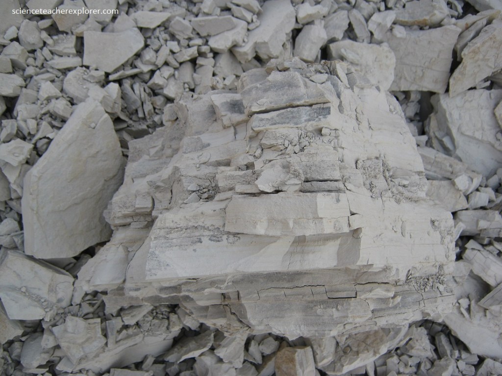
During the Lake McKinney phase, sediment carried in suspension by the Snake River slowed as it entered the calm water above the dam, allowing clay, known formerly as the “Yahoo Clay”, to drop and settle to the bottom of the lake. South of Bliss, Idaho; the Yahoo Clay forms an extensive layer draped over the existing canyon walls north of the Snake River, (pictured below).
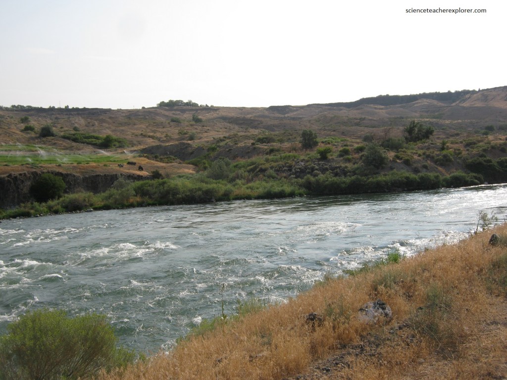
The 1993 landslide event mobilized a large portion of the Yahoo Clay. A slow-moving fluidized mixture of soil, sediment, and water that formed a lumpy, irregular landscape. Imaged below, the landslide moved all the way into the Snake River, temporarily blocking the river for several hours before a new path was cut through.
Steady undercutting by the Snake River at a prominent westward bend at the base of the slope undermined the weak Yahoo Clay. Higher than average precipitation during the 1992-93 winter and heavy rain the day before the slide saturated the clay, making it prone to failure. In 2021, the slope is considered unstable and future slide events are expected, (pictured below).
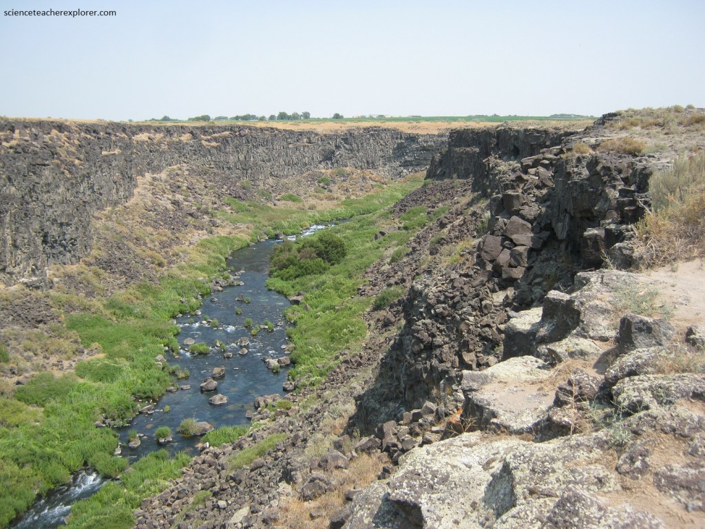
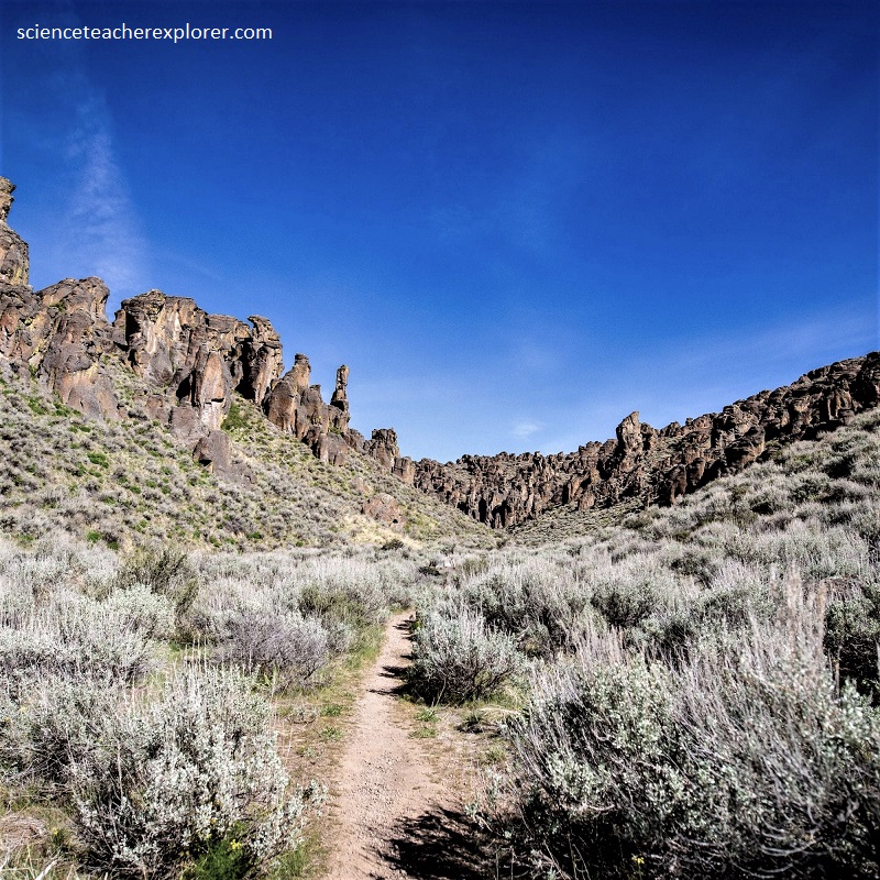
“Box Canyon” is a lush oasis surrounded by a vast, sagebrush desert. It is a nearly 3.2 km long, 67 meter deep canyon with sheer basalt walls, connecting to the Snake River on it’s western edge and terminating in a large amphitheater of stone on it’s eastern side.
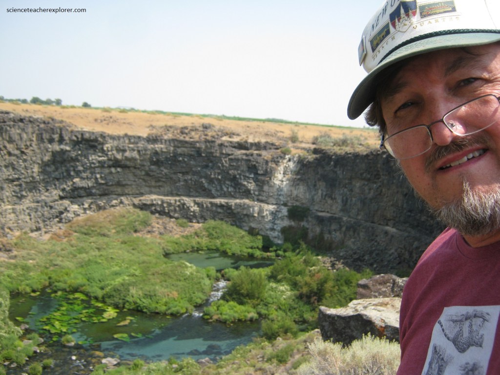
Pictured above, “Box Canyon” is fed by a large spring at the head of the canyon but lacks an extensive drainage basin and a flowing stream above. The spring is the 11th largest springs in North America, discharging approximately 680, 000 liters of water per minute. The source is again the Snake River Plain Aquifer.
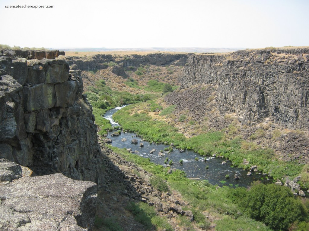
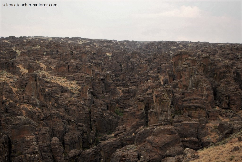
Pictured above, the rocks surrounding Box Canyon are made of nearly horizontal layers of dark basalt. These are solidified lava flows that erupted from two large shield volcanoes, “Flat Top Butte” and “Bacon Butte”, about 300,000 years ago. The summit vents for these shield volcanoes are located more than 32 km to the east, indicating that the lava was hot and fluid upon eruption and able to travel long distances over the landscape.
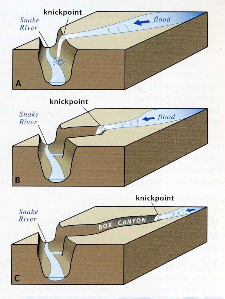
How exactly did this odd canyon form? Most box canyons similar form where springs emerging from the base of the canyon’s head is undercut by the cliff’s above. A process known as groundwater sapping. However, groundwater sapping works to lengthen the canyon if the spring undercuts loose sediments such as sand. Box Canyon is an amphitheater-shaped canyon carved from hard basalt. Therefore, the accepted theory is now about floodwater pouring over the rim of the Snake River Canyon forming a waterfall. Erosion at a knickpoint of a waterfall moves upstream as it erodes the lip of the falls and removing bedrock, (imaged below). Of course you would need a flood to accomplish this.
Imaged above, a mega-flood candidate for the water source to create the “Box Canyon” is a Pleistocene Epoch glacial dam 45,000 years ago.
Pictured above and below, the Gooding City of Rocks are two areas, Little and Big City of Rocks. Gooding City of Rocks is characterized by the channeled cliffs and pillar-like hoodoos. They are both found a few kilometers, north of Gooding, Idaho on Highway 46.
Pictured above, the Gooding City of Rocks developed in rhyolitic tuff that has been preferentially eroded along vertical fractures. The rock erupted about 9 million years ago when the Yellowstone hot-spot was centered under the central Snake River Plain rather than it’s present location under Yellowstone National Park.
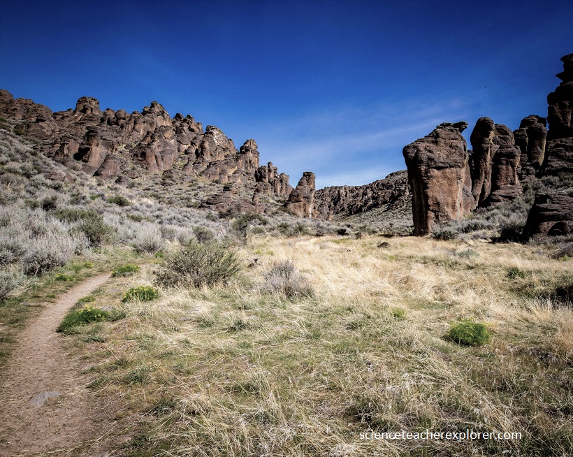
Particles of erupting rhyolitic magma traveled far into the air but were still hot enough upon landing that they fused and flowed like lava. Flow banding that is folded in places characterizes rocks that form from these types of high temperature eruptions. The upper and lower parts cooled quickly against the air and the ground, forming a glassy, dark colored rock called vitrophyre.
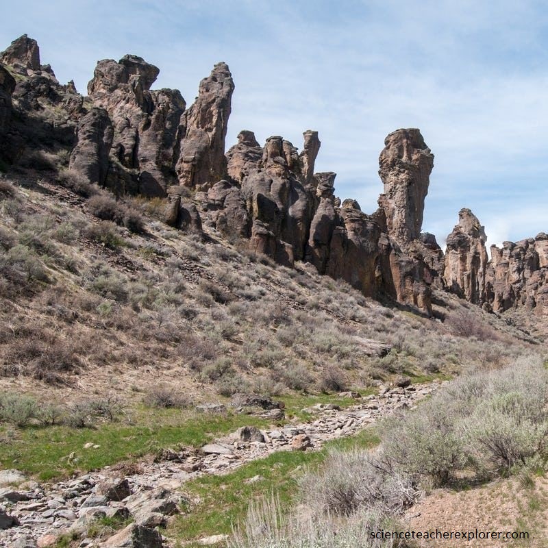
The rock fractured as it cooled and was broken even further when the Snake River Plain subsided. Freeze-thaw cycles of water in these fractures has further weathered the rock, helping to form the ethereal rock shapes.
