Chihuahua Desert
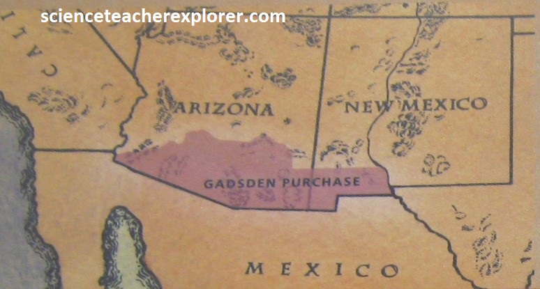
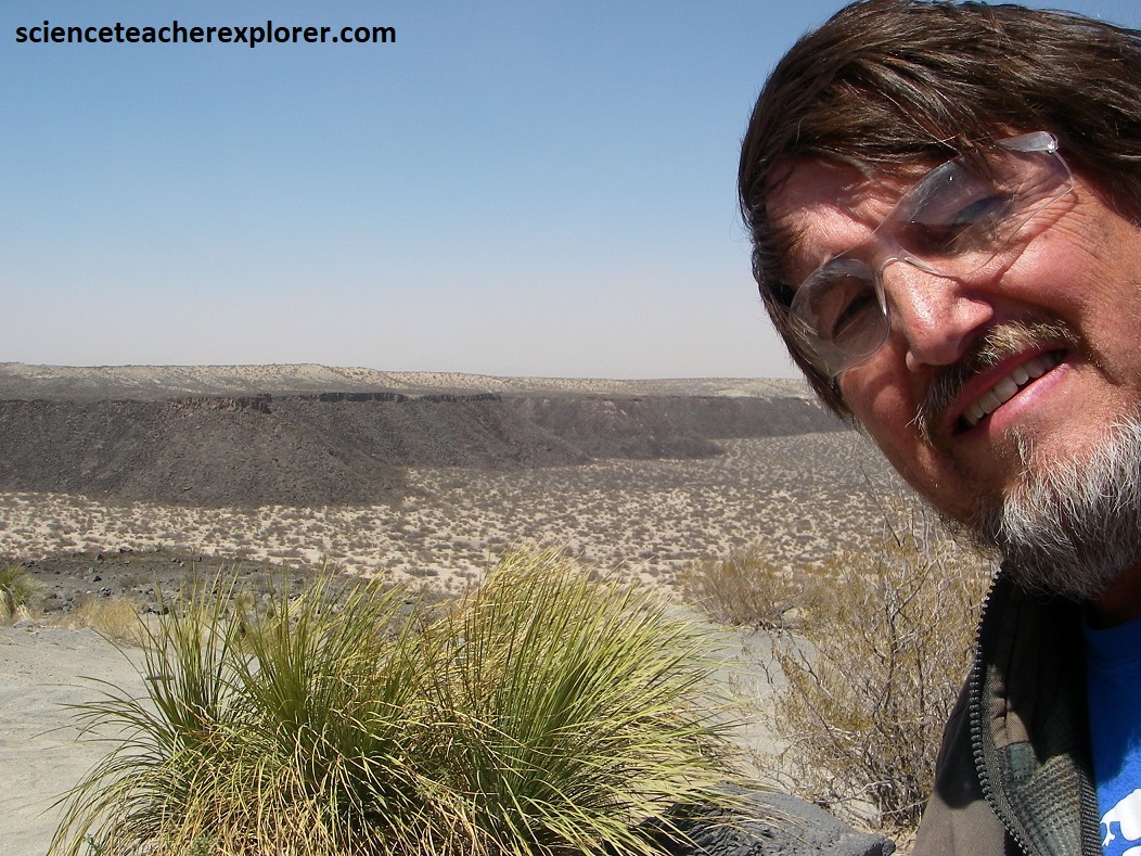
In April of 2024, I drove through the southwestern part of New Mexico to explore the United States part of the Chihuahua Desert. Southwestern New Mexico became part of the United States following the Mexican-American War of 1846, as a result of the Treaty of Guadalupe Hidalgo which officially ended the conflict and ceded a large portion of Mexican territory, including what is now New Mexico, to the U.S.
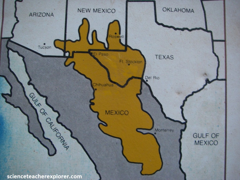
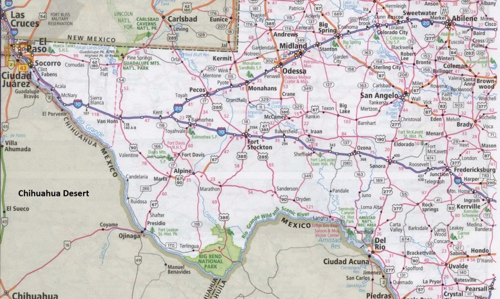
The Chihuahua Desert’s 520,000 square kilometers consists of mostly flat plains that are occasionally broken by gullies, hills, and stark mountain ranges. Imaged below, from deep in Mexico, the great, arid arc of the Chihuahuan Desert spills into Texas, (generally west of the Pecos River), and into parts of New Mexico and Arizona. Its geological story is vividly revealed in exposed rock strata, erosive remnants, arroyos, and canyons.
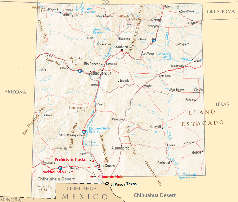
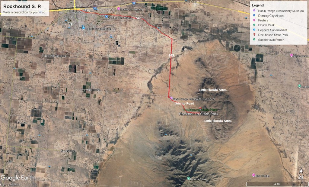
I was on my way to the 2024 Solar Eclipse in Texas, through Silver City and Deming, when I made three side-trips to the Rockhound State Park, the Prehistoric Trackways National Monument & the Kilbourne Hole, (image below).
My fist geo-destination was Rockhound State Park. To get there, I took state-road NM-549 east from Deming. Then I turned right, (south), on NM-143 and continued to junction NM-141/143 where I turned left onto Stirrup Road, (southeast) to the entrance of the park.
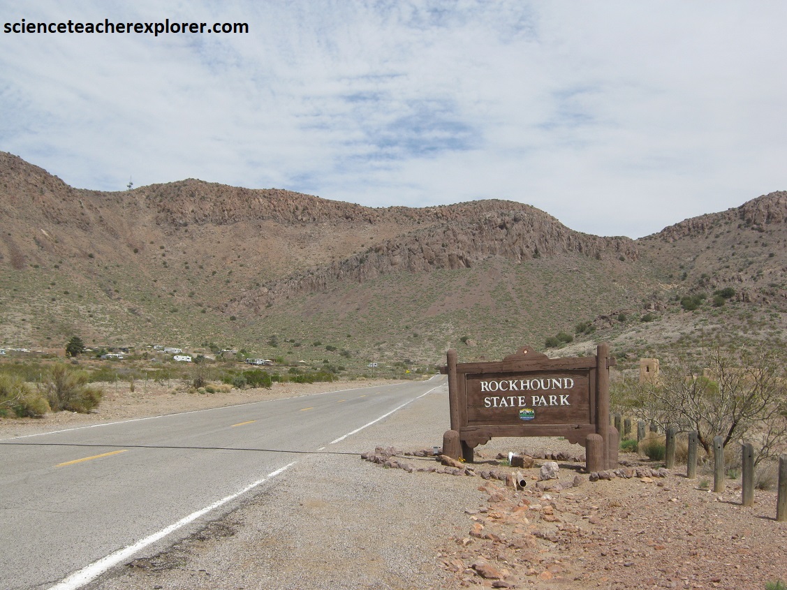
When Rockhound State Parks was established in 1966, it was the only state park in the U.S. that encouraged visitors to collect rocks and minerals. Each visitor is allowed to collect as much as 6.8 kg of rocks and minerals from the 1,100-acre park; mineral dealers are not allowed to collect for sale.
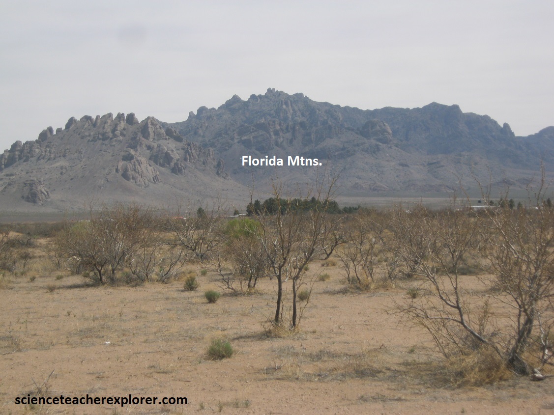
The park lies on the western side of the Little Florida Mountains. Pictured above, The Florida Mountains lie directly to the south with the Florida Gap separating the two ranges. The Florida and Little Florida Mountains are typical of the mountain desert throughout the Chihuahua Desert region. Elevations range from 1,467m along the foothills, where the state park is located, to 2,483m at Florida Peak in the Florida Mountains.
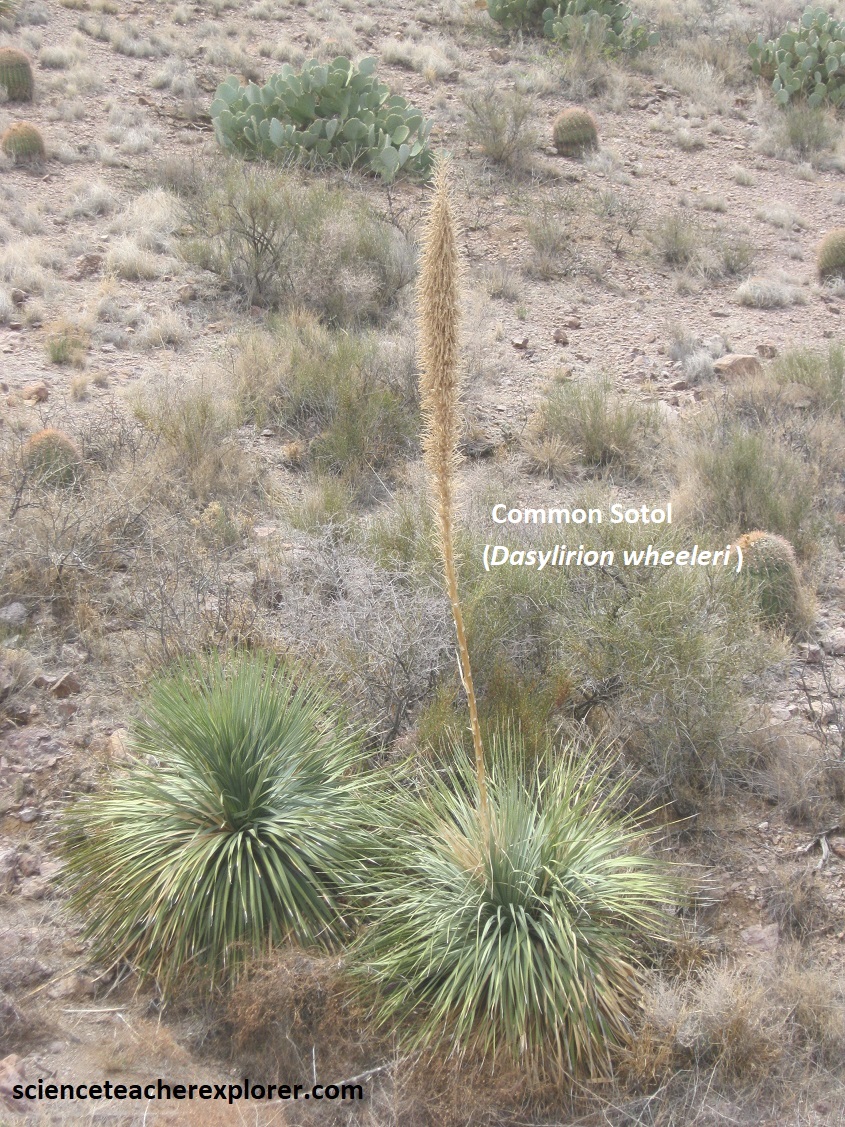
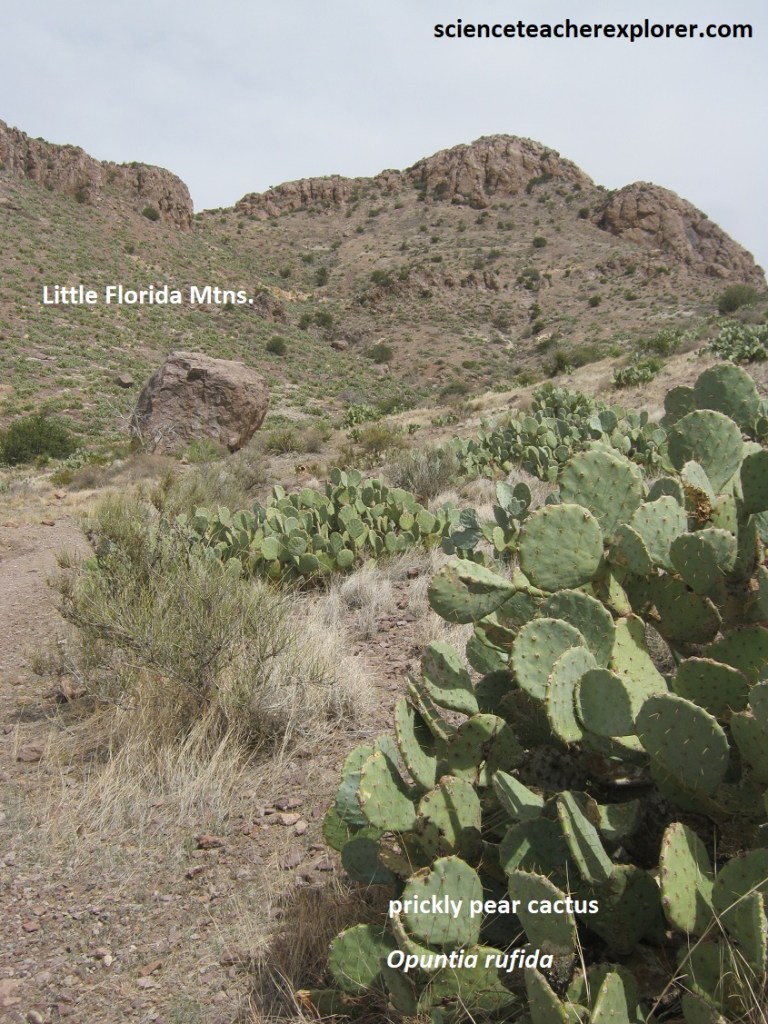
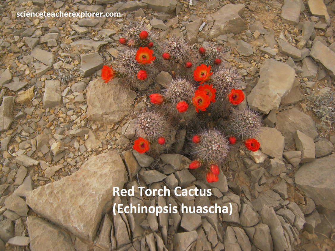
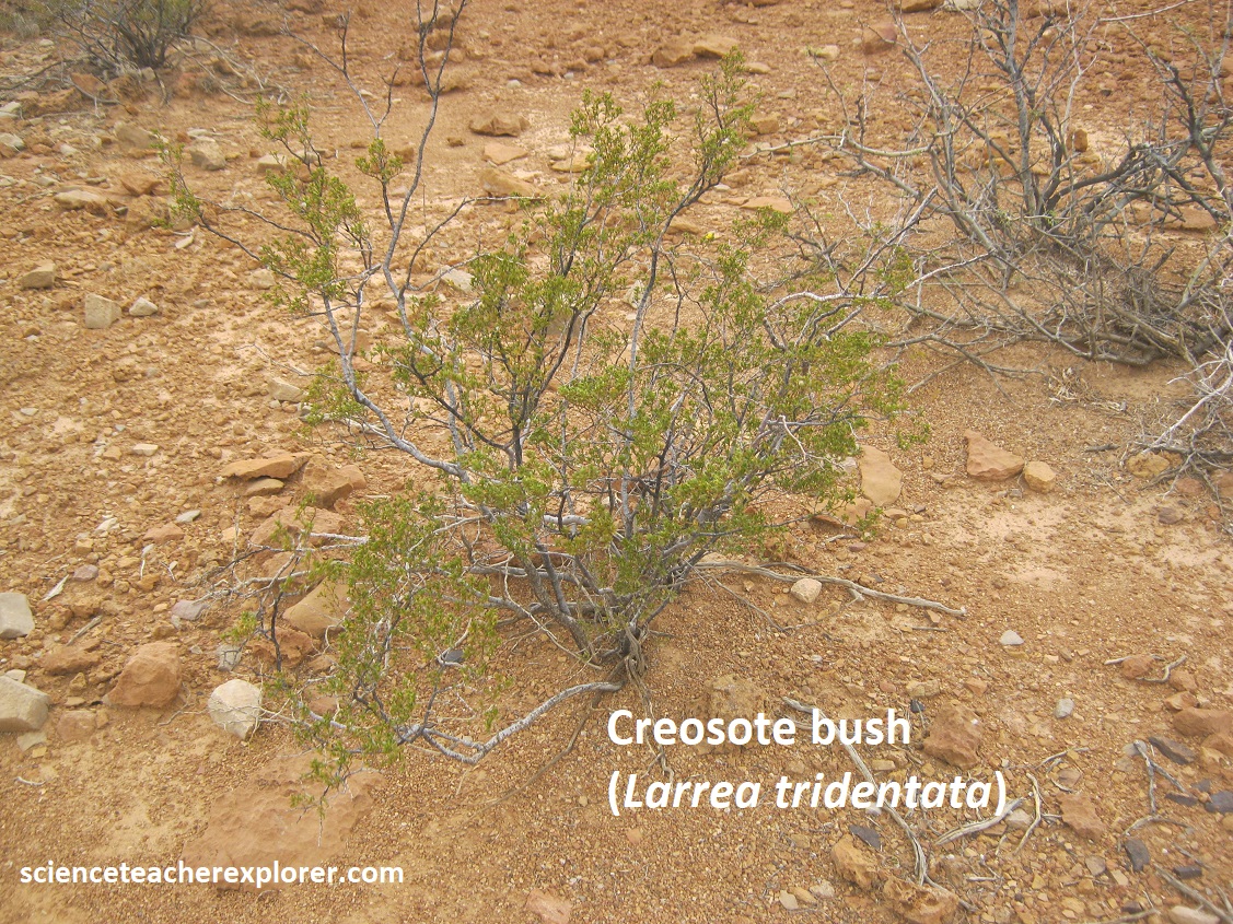
Water is scarce and limited to wells and hidden springs. Pictured above, a variety of plants thrive in this environment, including yucca, prickly pear cactus, barrel cactus, ocotillo, creosote bush, mesquite, and hackberry; juniper and scrub oak are common in the canyons.
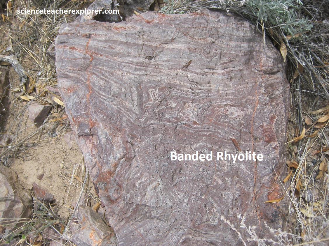
Paleozoic through lower Tertiary sedimentary rocks overlie a Cambrian granitic to syenitic pluton in the northern Florida Mountains. However, the Little Florida Mountains consist predominantly of interbedded mid-Tertiary andesitic, dacitic, and rhyolitic ash-flow tuffs and lavas, and volcanic-derived fanglomerates intruded by rhyolite domes and dikes. The volcanic activity that began about 33 million years ago and ended about 10 million years later. The Little Florida Mountains consists of volcanic andesite, dacite, and rhyolitic tuffs and flows, (pictured below).
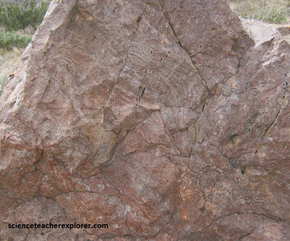
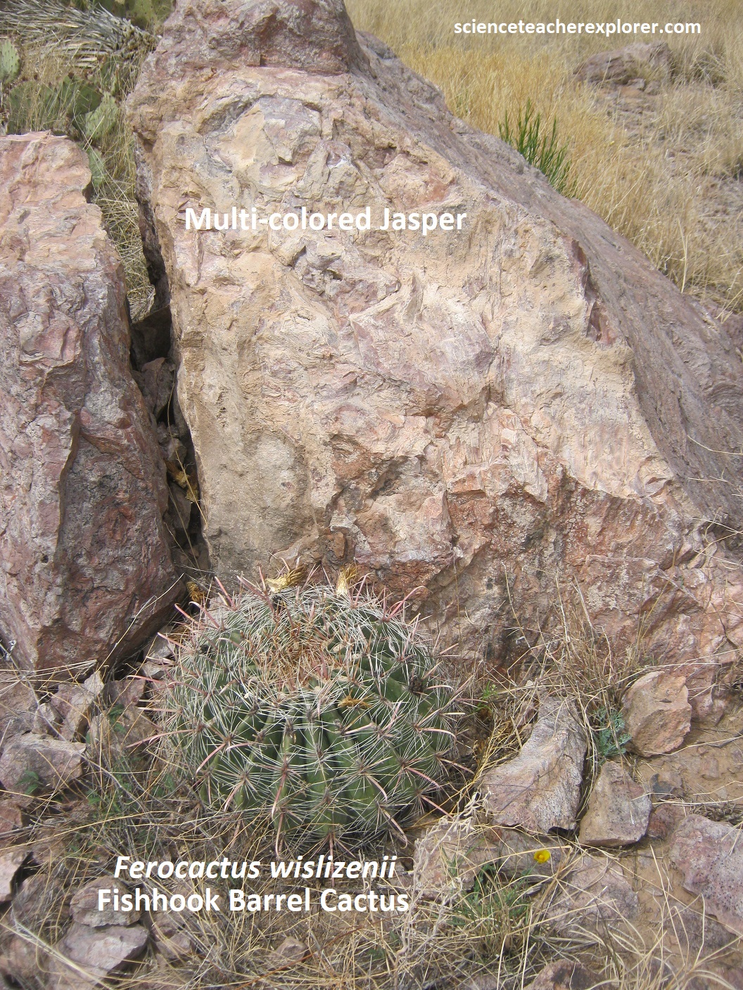
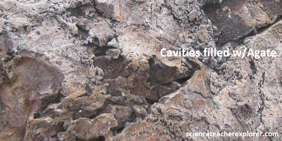
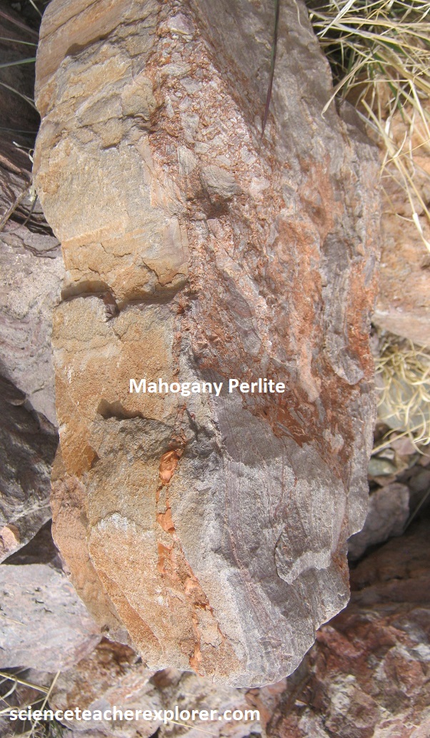
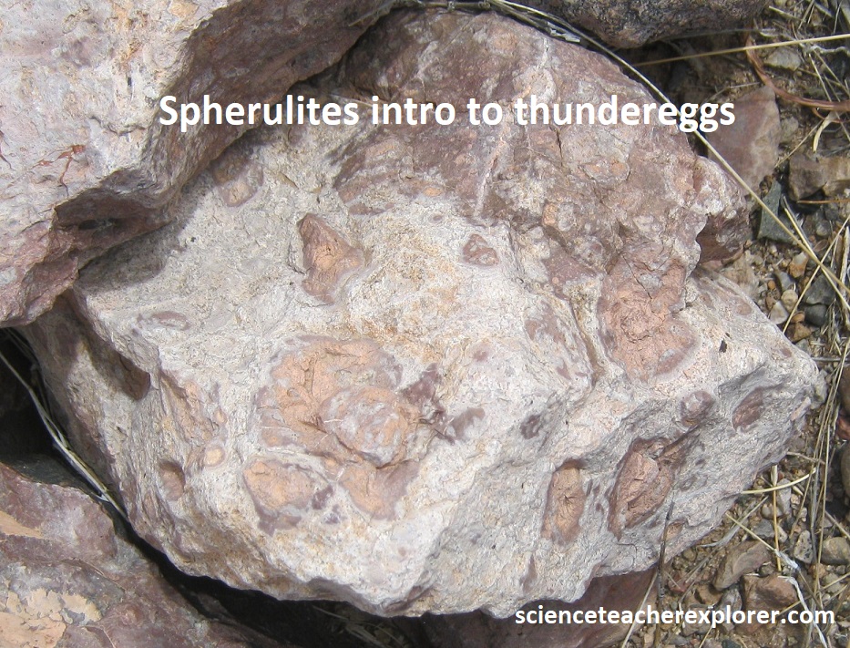
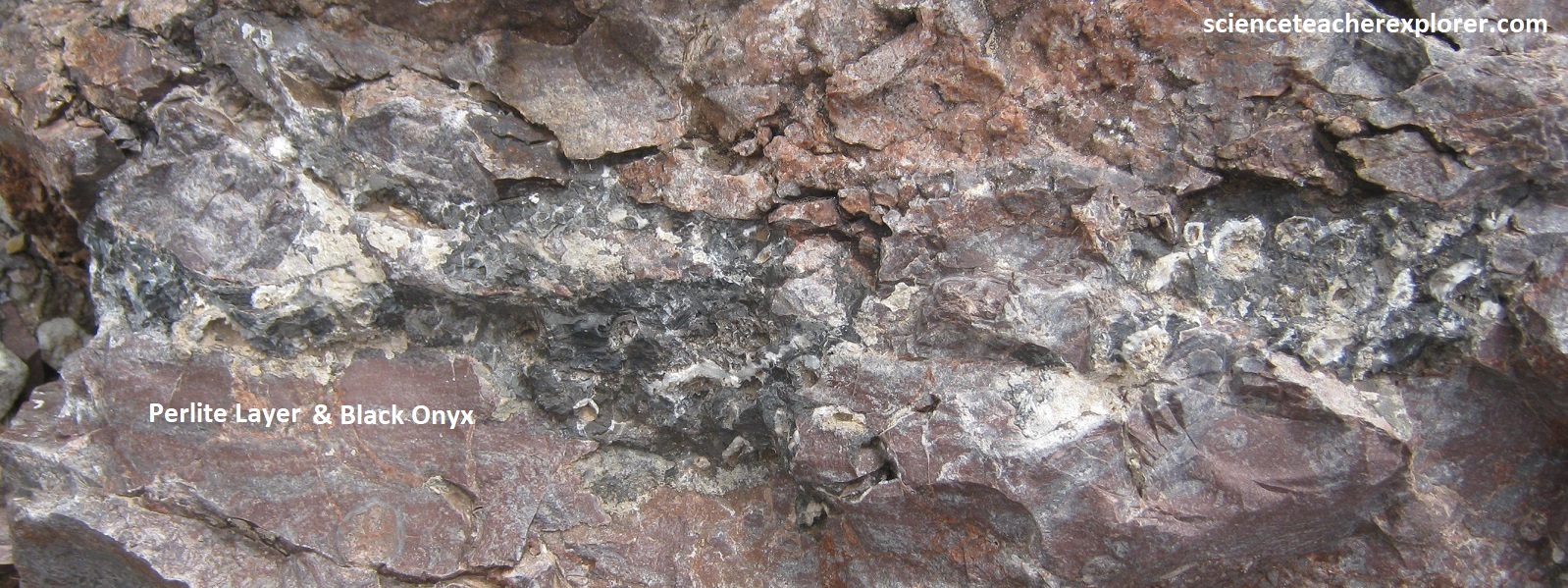
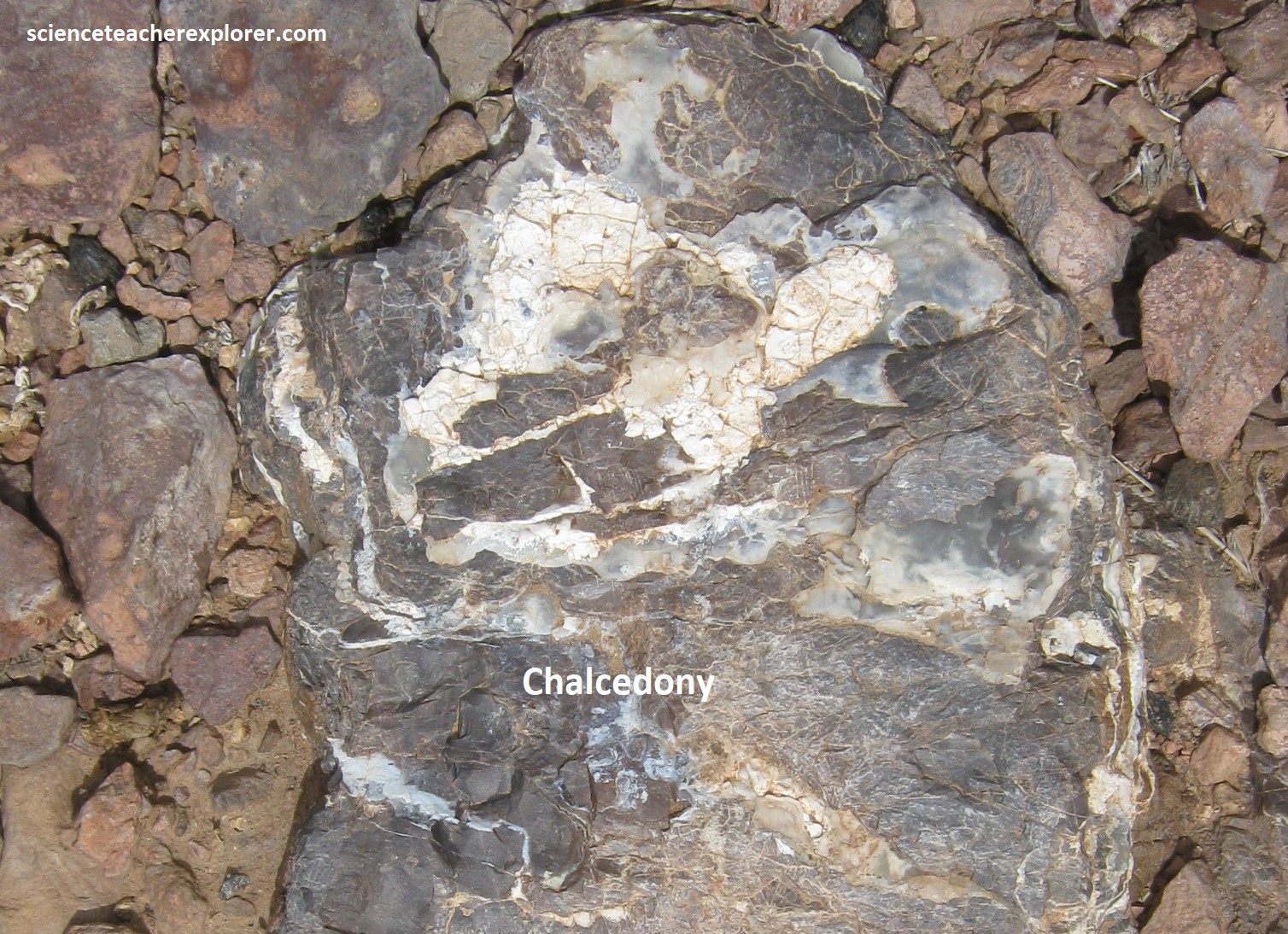
Geothermal ground waters and springs were associated with the volcanic activity. Silica cementation of the younger fanglomerate of Little Florida Mountains indicates that these fluids continued to circulate long after eruption of the volcanic rocks and during their erosion. This left deposits of various manganese- and iron-oxide minerals, along with fluorite, barite, calcite, and quartz, are found in the fanglomerate. Agate is present in a wide range of colors and is one of the minerals that visitors collect. Some thundereggs and geodes are found that contain multicolored agate in addition to well-formed quartz crystals, (pictured below). Gray perlite, jasper, onyx, agate, crystalline rhyolite, Apache tears (obsidian), and quartz crystals are among the more common rocks and minerals found in the Rockhound State Park.
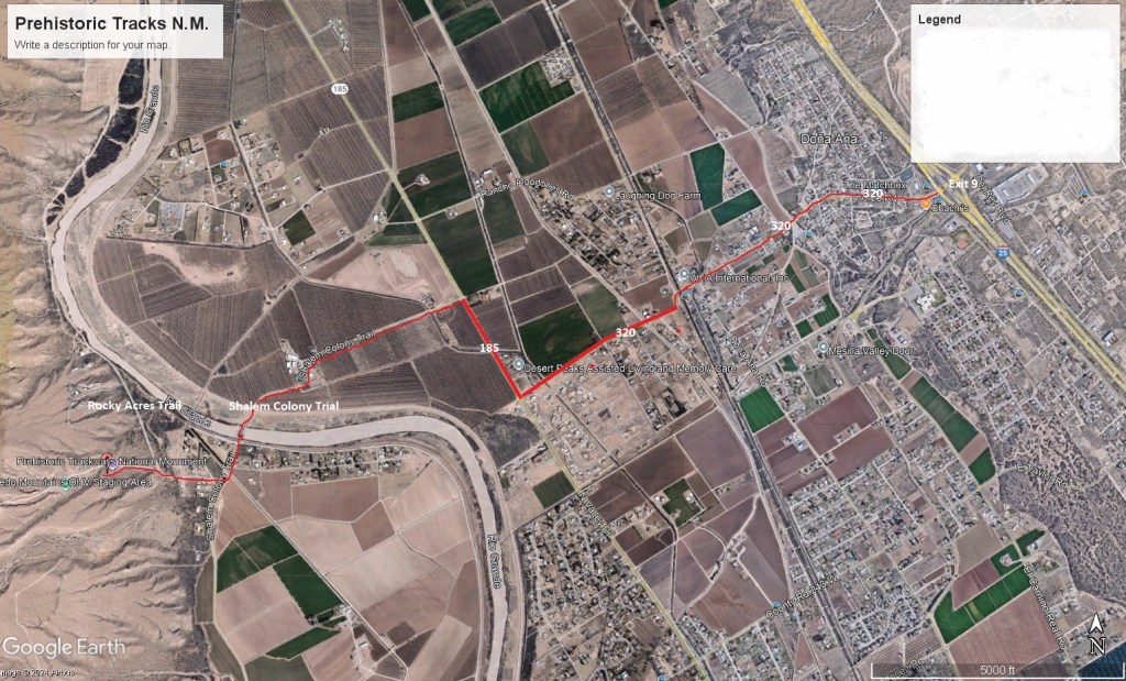
After returning to Deming, I continued east on I-10 to Las Cruces where I exited on I-25 and headed north to exit 9 at Dona Alna.
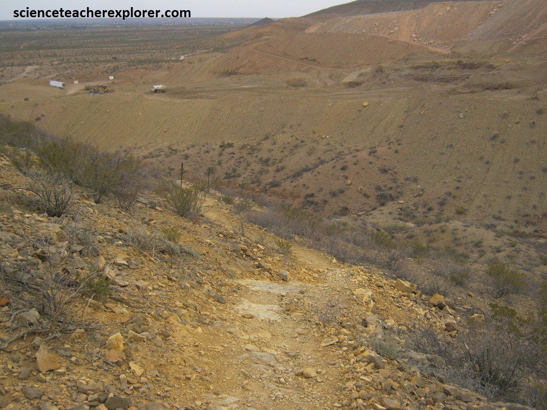
From exit 9, I dove through town on NM-320 west to NM-185. From there, I right and drove 0.8 km, to cross the Rio Grande, and then turned right onto the Rock Acres Trail. I then drove about 0.4 km and beared left onto the dirt road going west called the Permian Track Road, (imaged below).
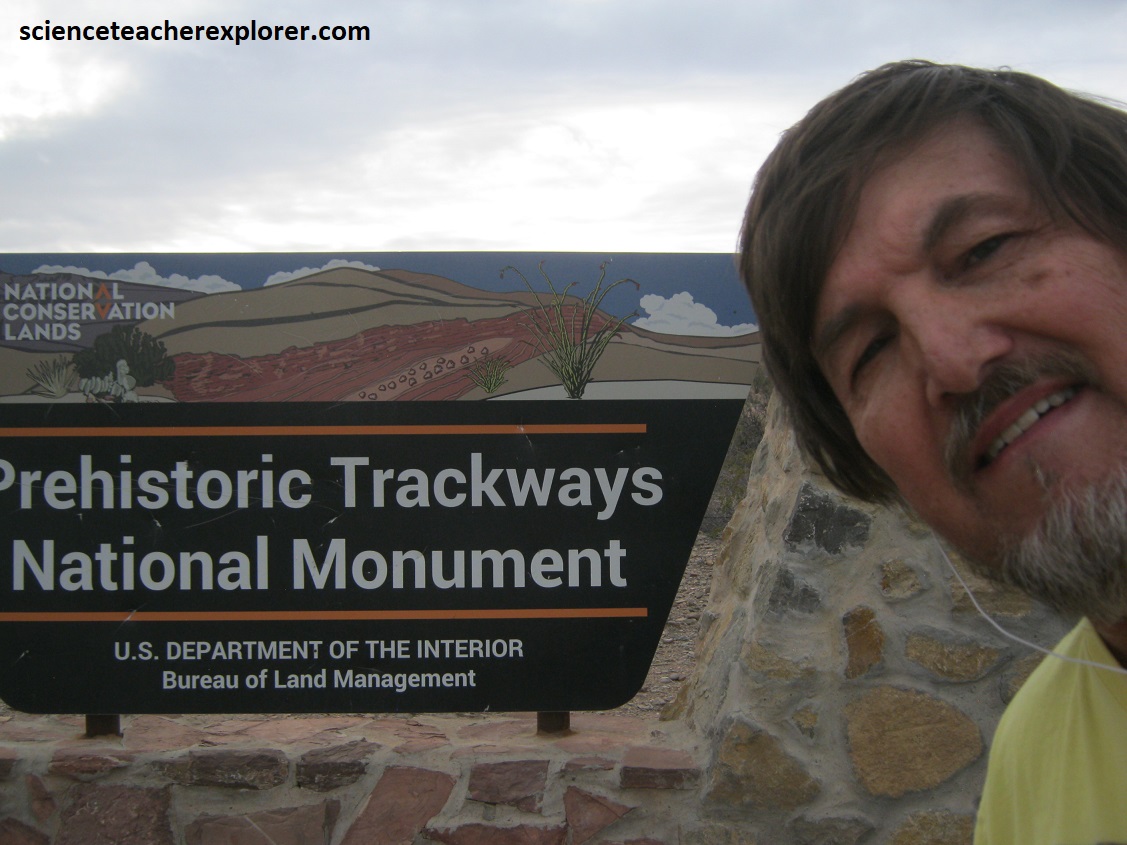
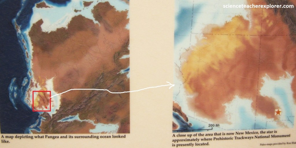
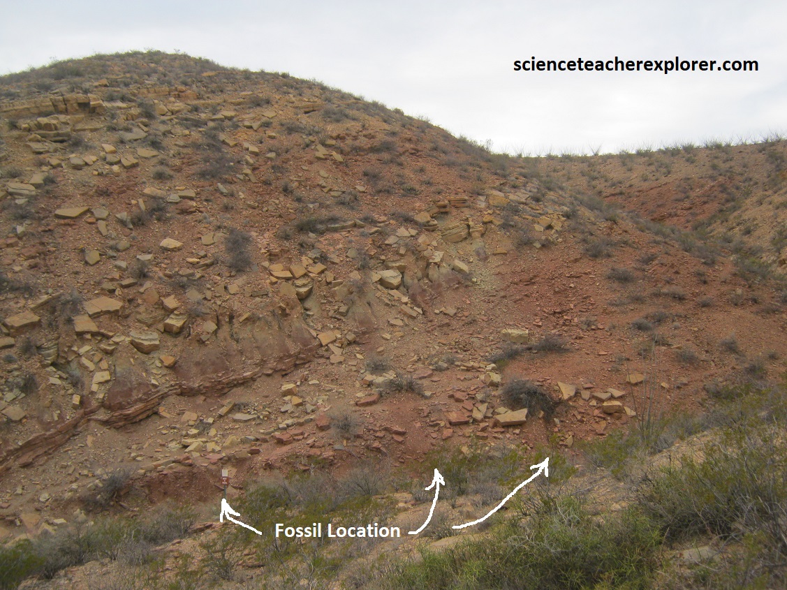
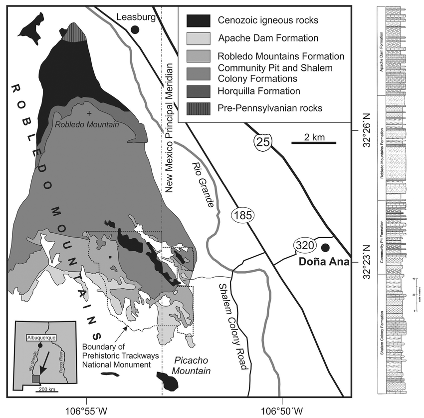
At the entrance to the Prehistoric Trackways National Monument, the Robledo Mountains looked like many other mountains in the Chihuahuan Desert, (rugged rocks doted with creosote, yucca, ocotillo and other cacti, (pictured below). However, these reddish rocks were a window into the world that existed in the Permian Period, when all continents were stuck together as a single supercontinent known as Pangea.
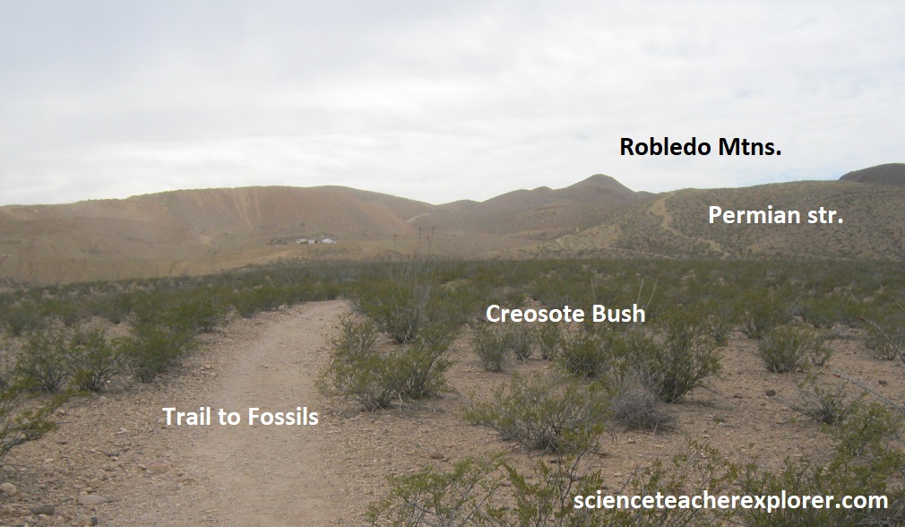
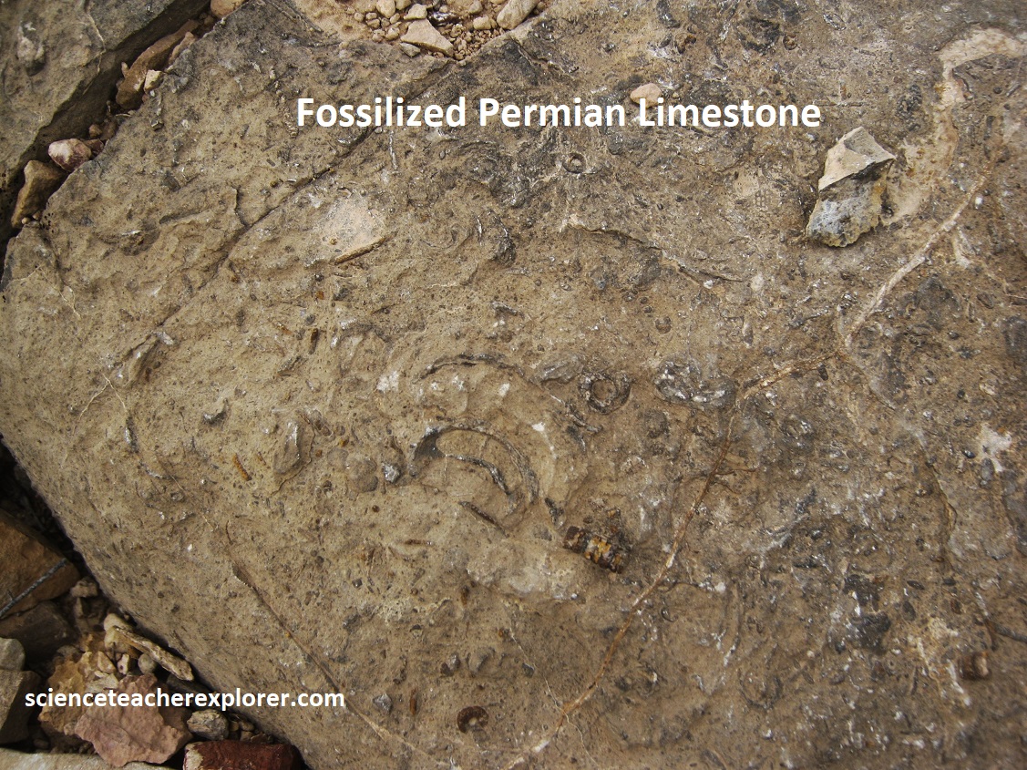
These rocks, the Hueco Group, were deposited in rivers, floodplains, tidal flats, and the warm shallow sea at the edge of the giant Pangea continent near the equator, (imaged below).
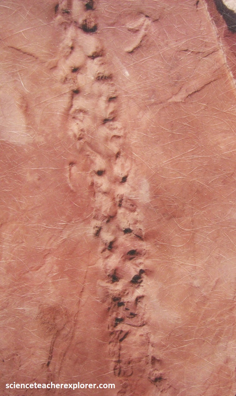
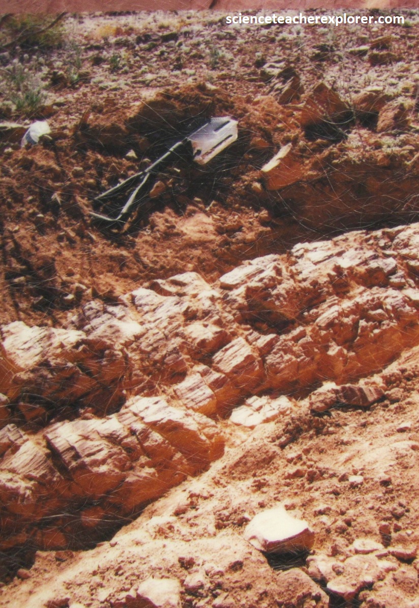
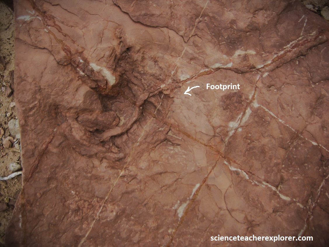
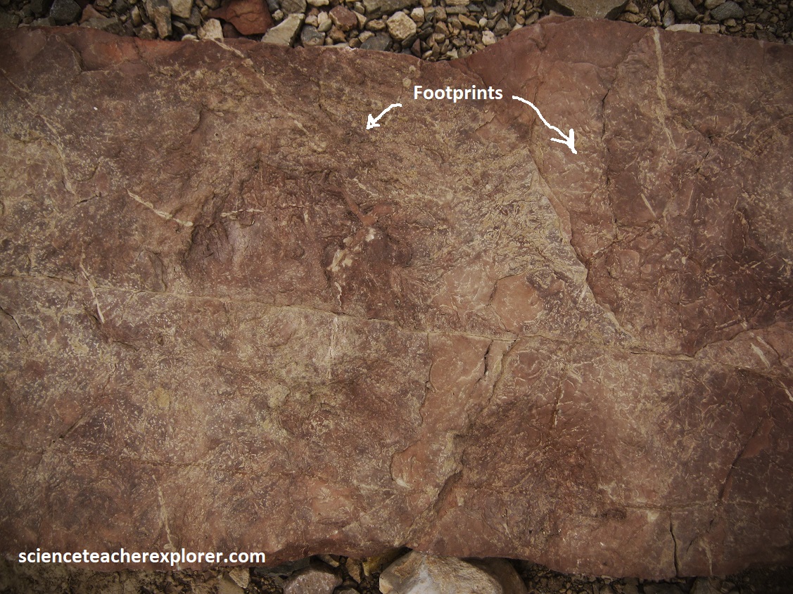
In the mid-1980s Jerry MacDonald, an amateur paleontologist, brought national recognition to the Robledo Mtns. when he found long, intact fossilized trackways. These trackways belonged to the Permian Period (280-240 million years ago), tens of millions of years before the dinosaurs. Under the supervision of the Smithsonian Natural History Museum, MacDonald excavated thousands of these trackways from what is now know as the Discovery Site, (pictured below). Further research conducted has proven the Robledo trackways as one of the most important Late Paleozoic fossil records in the world.
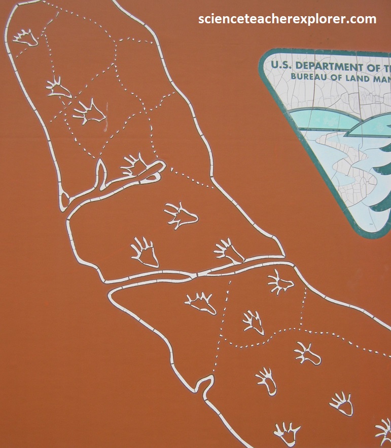
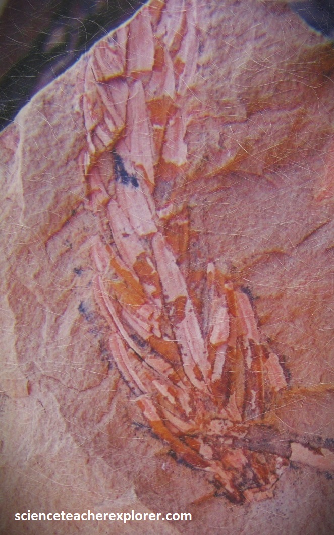
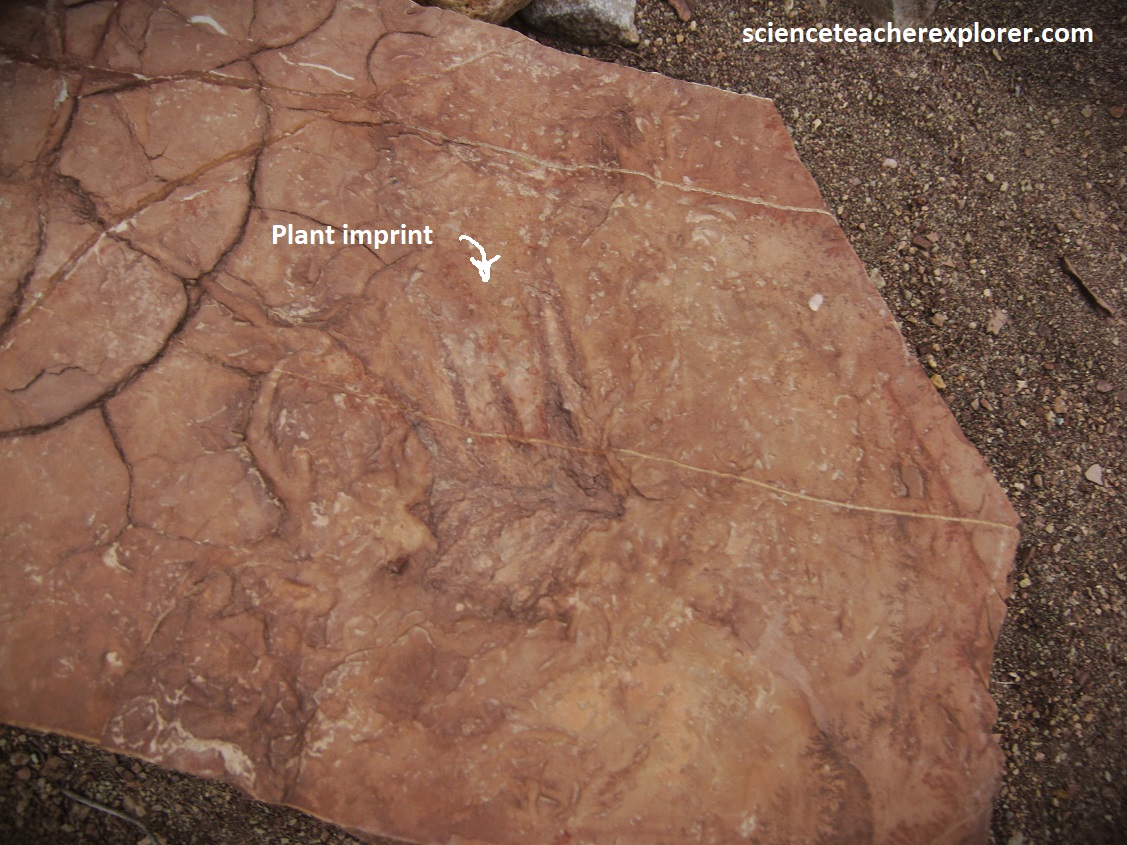
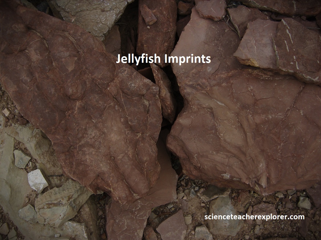
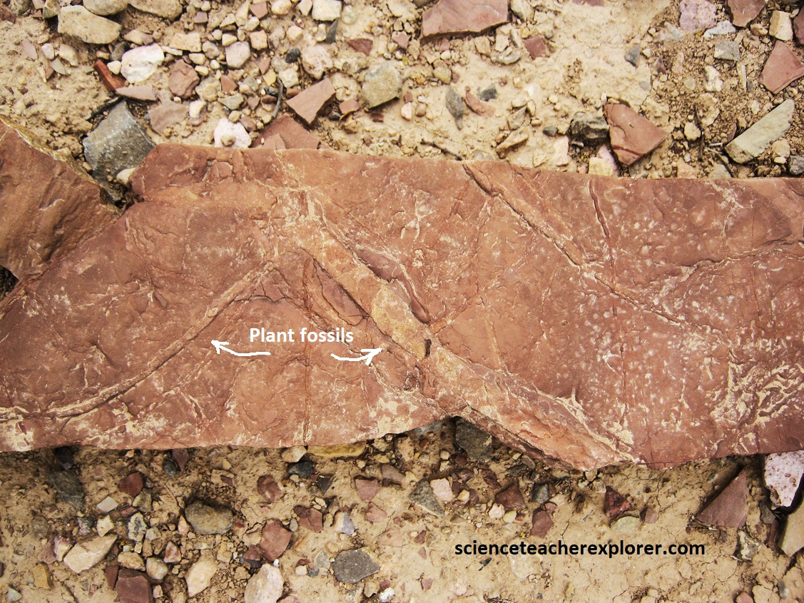
Pictured below, A 2010 scientific survey has located over 150 fossil sites in and around the Monument. These sites consist of tracks of reptiles, amphibians, and insects, along with marine fossils, plant fossils and petrified wood all dating to around 280 million years ago.
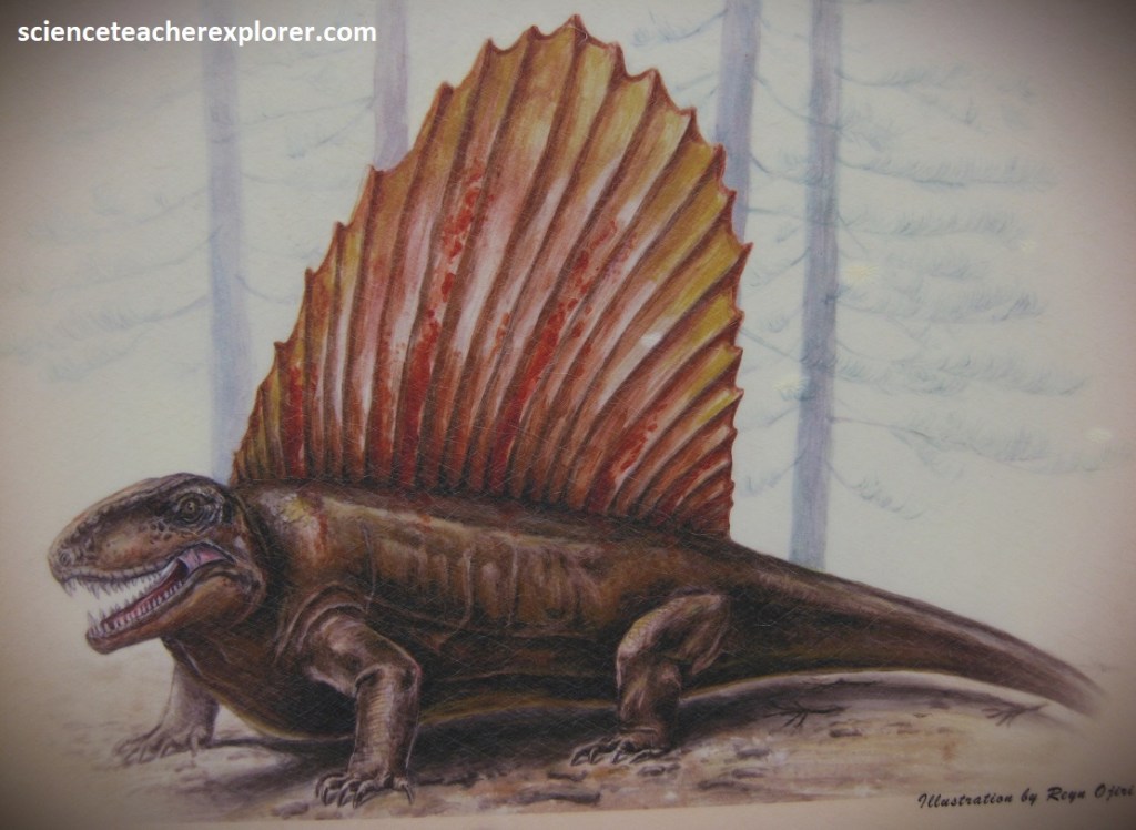
It is challenging to imagine what this land looked like 280 million years ago. Paleo-illustrators help us to picture that world. Pictured below are some illustrations that Mary Parrish, a paleo-illustrator with Smithsonian’s National Museum of Natural History, made after working with scientists here in the Robledos Mtns.: {(All the images taken from an interpretive sign, on-site)}
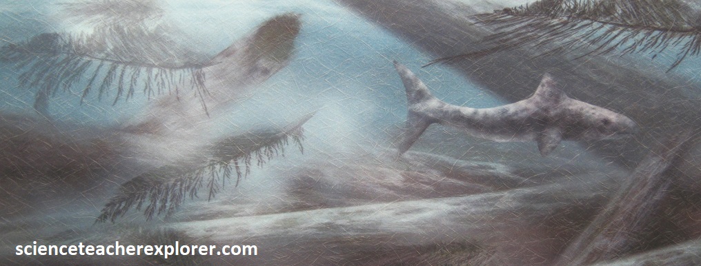
This is an illustration of the calm after a storm. This shark swims over trunks and fronds of ancient conifers that washed out to sea during a storm .
This is a scene of Permian Period sea life. There are sponges, bryozoans, crinoids and mollusks.

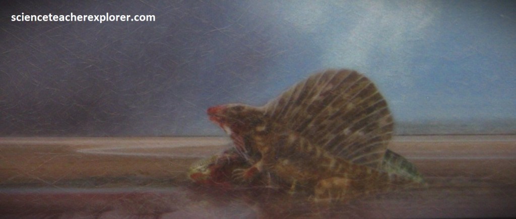
Here is a scene of a Dimetrodon eating it’s prey. The mud flats surrounding them are what make for a perfect environment to capture the tracks of these prehistoric animals.
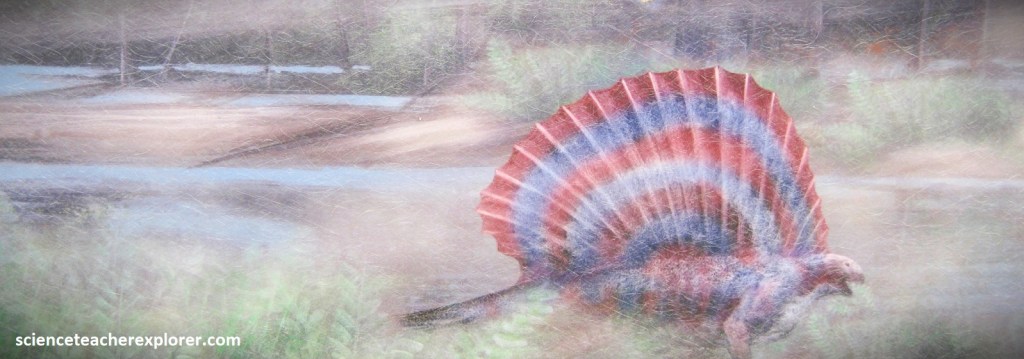
The Edaphasaurous was a plant eating cousin of the Dimetrodon, enjoying the tropical environment that used to be here 280 million years ago. It was eating a plant called Supaia also found in the fossil record of the Monument.
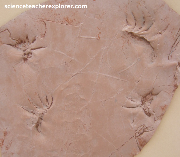
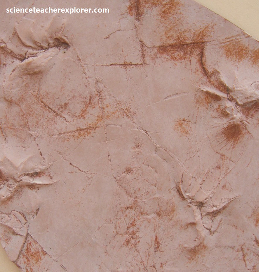
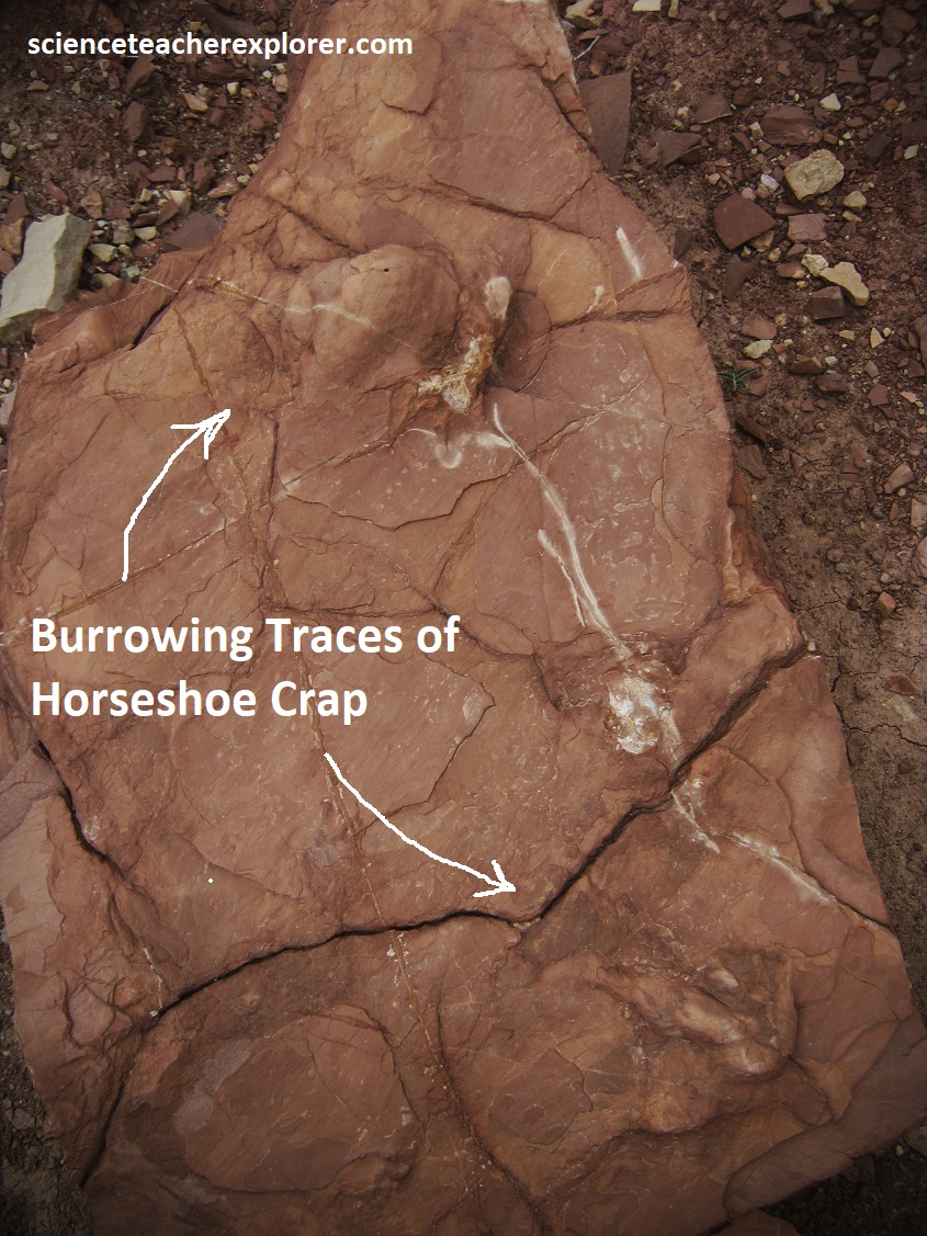
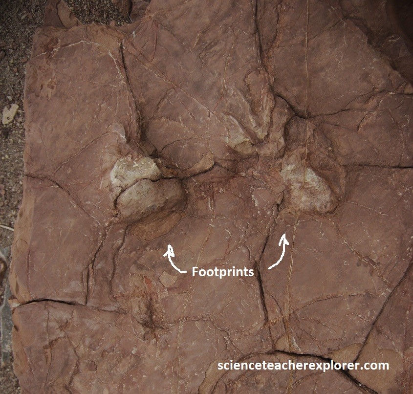
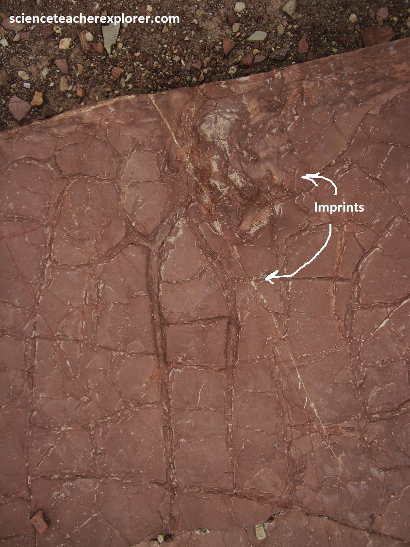
I trekked to the discovery site and found a number fossilized rocks, (pictured below). The trackways are found mostly on ancient red mudstone. The tracks make up a megatrackway (stretching over 26 km) within and around the Monument. In certain areas, the tracks are exposed, but much of the fossil bearing layers are still buried within the mountains. Below are the photos I took along the way:
These fossilized tracks, animals & plants give scientists an idea of how the animals walked, where they lived and hunted, and how they interacted with each other and the environment. The fossils make a connection to life forms that have been extinct for over a quarter of a billion years. Below are the fossils I found along my trek into the Prehistoric Trackways National Monument.
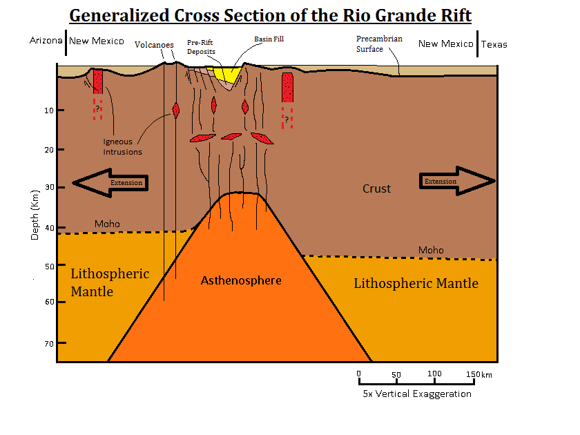
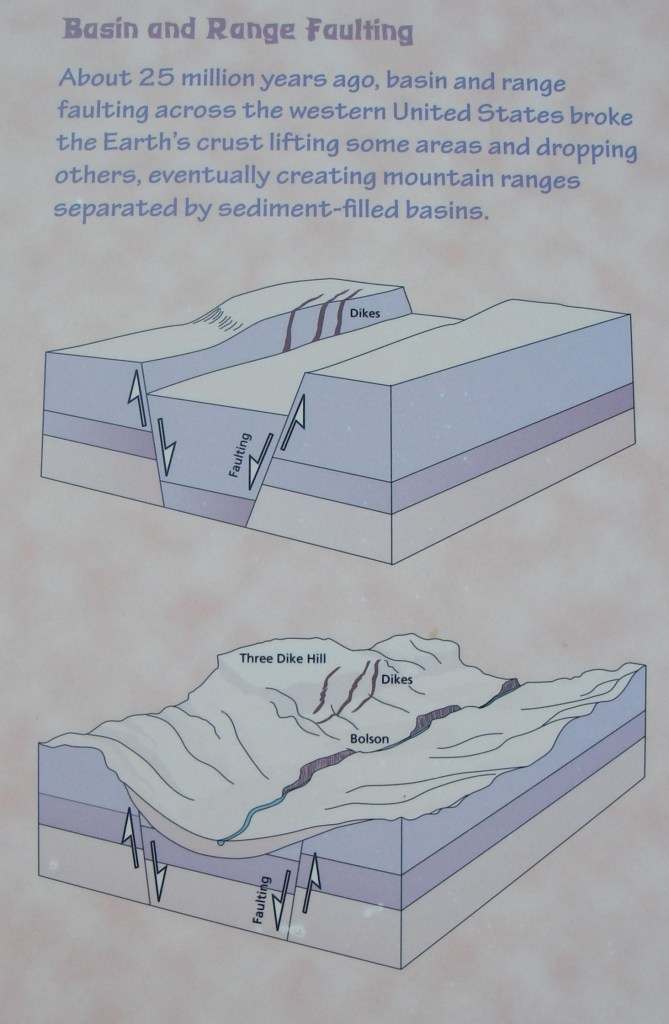
The Robledo Mtns. sits along the Rio Grande Rift, a rift valley stretching from Mexico through New Mexico into central Colorado. This rift started 35-29 million years ago and is a thinning of the Earths’ surface caused by the crust beginning to spread apart. Along the Rift are geological features showing evidence of volcanic activity, upheavals, intrusions and fault lines.
The Robledo Mountains have all of these features making it a interesting geological area. {Pushed up form faulting of the Rift are these 280 million year old layers of sandstones, mudstones, siltstones and shales intermixed with yellow to gray limestone deposits that were tilted upward towards the rift, (eastward).
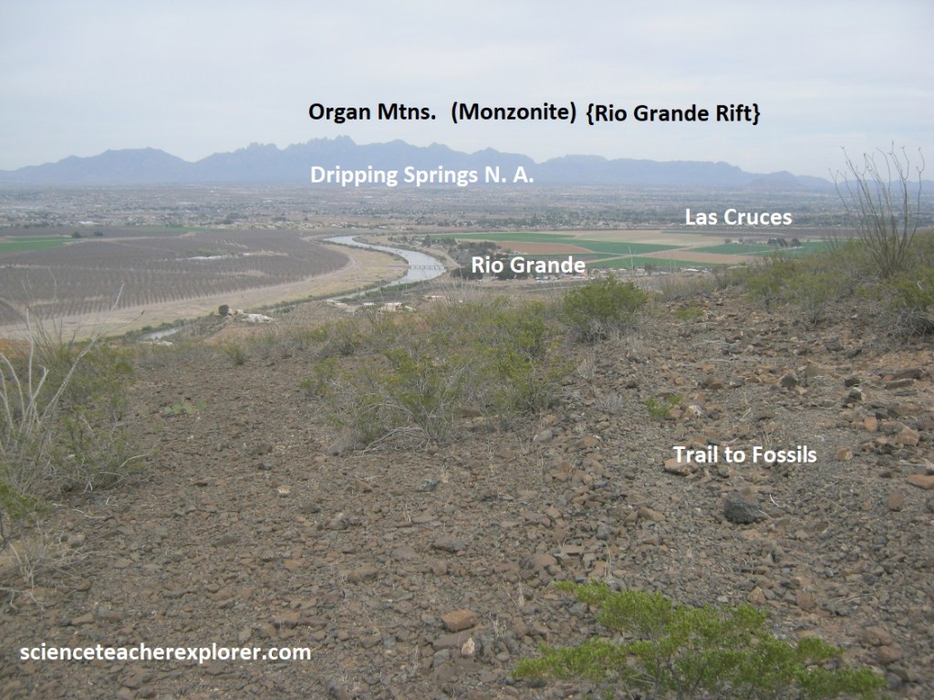
From 15-8 million years ago, when the Rio Grande Rift was actively splitting this region apart, the fault block mountains across the valley were uplifted, (pictured above). The monzonite that was once underground is now exposed at the surface. The organ-pipe shape developed from the weathering of the joints in the rock. When rock that originally formed deep underground under a lot of pressure are later exposed at the Earth’s surface, the pressure exerted on the rocks is much less, so they expand. Cracks, called sheet joints, open up, and the rock weathers into a rounded shape, appearing-like organ pipes. Hence the Organ-Pipe Mtns.
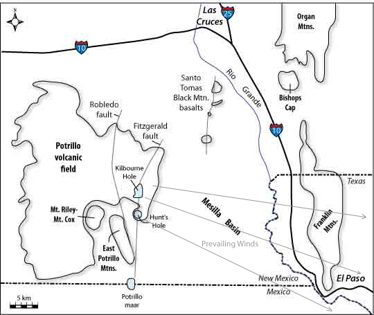
Driving back to Las Cruces, I continue south on I-10 towards El Paso to exit 155. My next destination in the Chihuahua Desert was the Kilbourne Hole southwest of Las Cruces. Imaged above, this barren desert, was volcanically active as recently as 20,000 years ago as the Potrillo volcanic field, (with its numerous cinder cones & lava flows).
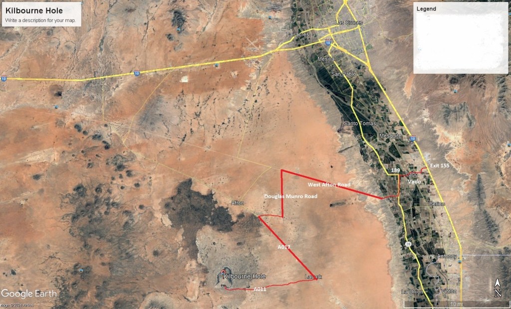
From exit 155 on I-10, I headed west on Vado Drive to a stop sign on NM-478. I turned left, (south), and drove 0.3 km to NM-189. I turned right, (west), and drove 1.8 km to NM-28 where and then turned left, (south) and drove 3.2 km. At Afton Road, I turned right west and drove 18 km on a dirt road. After passing a structure in a gully, I turned left, (south) on another dirt road called Munro Rd. and drove another 10.5 km to a Railroad crossing and turned right across them. This took me to a graveled county-road called A017 where I turned left and drove southeast for 11.6 km. Looking carefully at the signs, I turned onto an unmaintained road called A011. This road required 4WD. I drove about 13 km to Kilbourne Hole. WOW! what an adventure with the GPS.
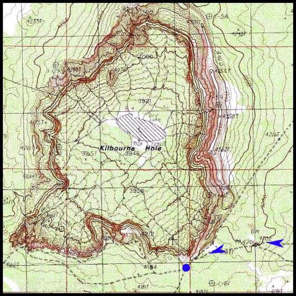
Kilbourne Hole is a crater that is approximately 2.6 km long, (NE-SW), 1.6 km wide, (NW-SE), and about 100m deep. I was interested in this crater because the Kilbourne Hole is a maar-type volcano. A rare-type of volcano.
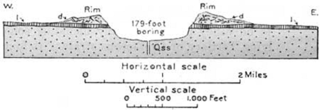
The maar-type of volcano forms when hot magma hits shallow groundwater. The water flash boils into steam and blasts a crater, or maar, in the ground. The Kilbourne Hole eruption cut through the 81,000-70,000 year old Afton basalt flows. This makes the explosion a relatively young event, (pictured below).
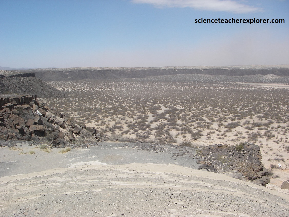
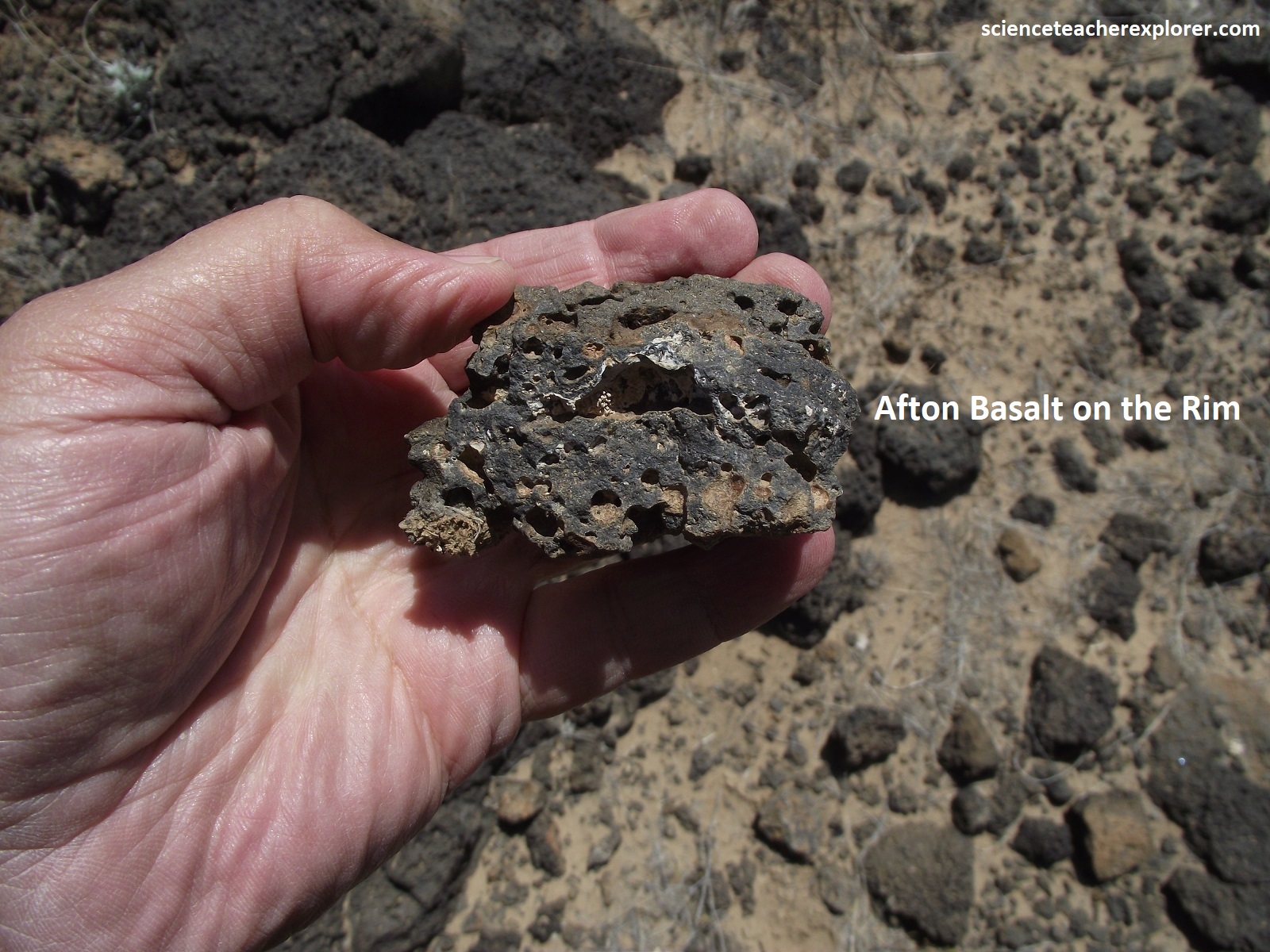
Pictured above, the Kilbourn Hole is a large maar volcano the erupted through a flat basalt plain. Note the black cap of the young Afton Basalt around the crater rim.
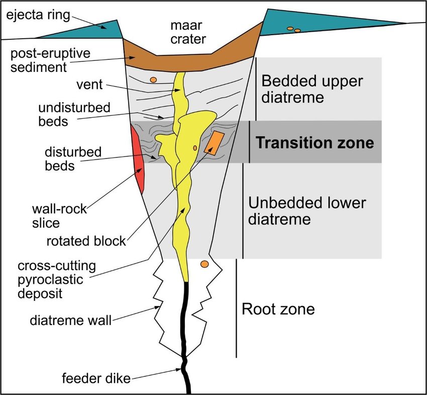
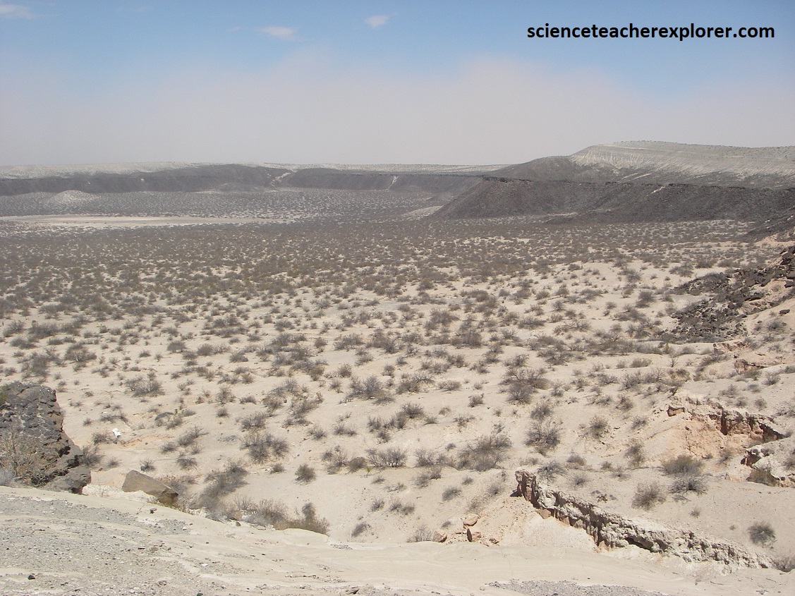
Surrounding the crater are pale-colored base-surge deposits that form when there is more steam and gas in an eruption than ash and other Pyroclastic material, (pictured below).
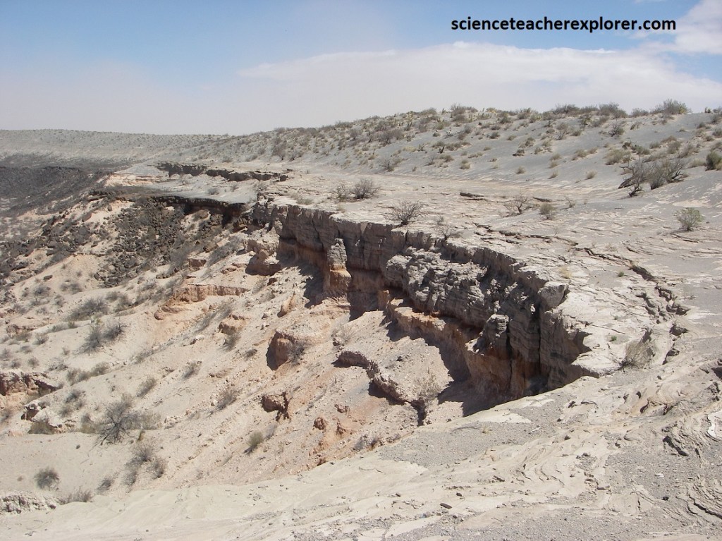
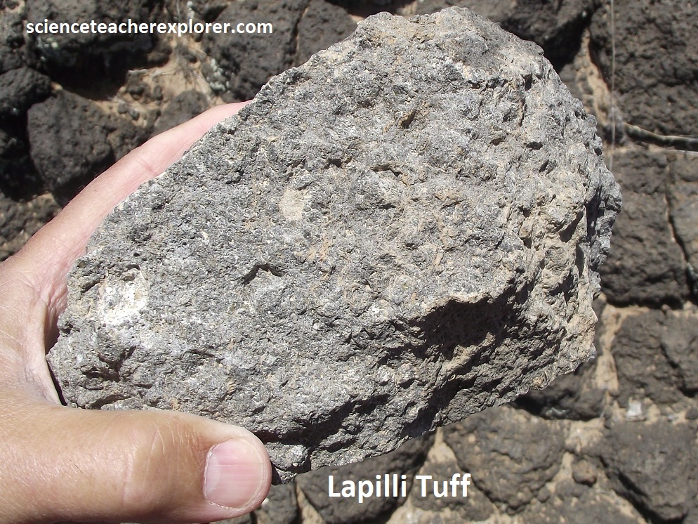
A base surge contains Lapilli tuff that forms as fine-grained ash paricles stick together around condensing water droplets or solid particles.
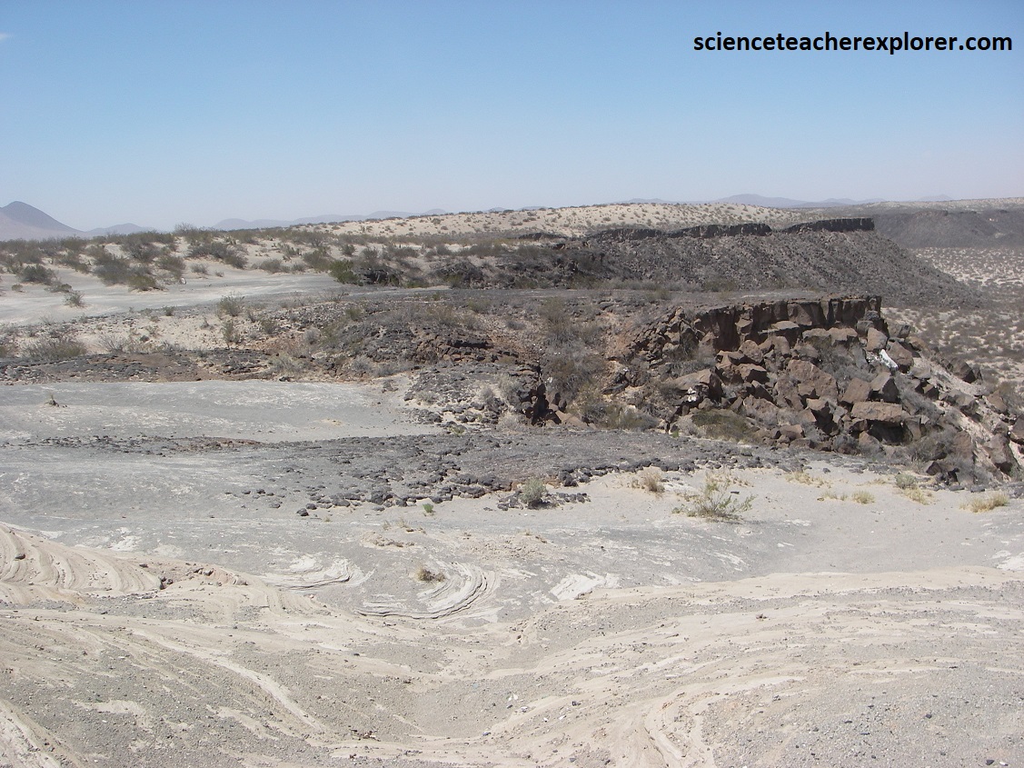
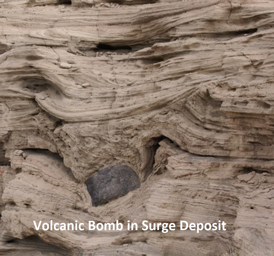
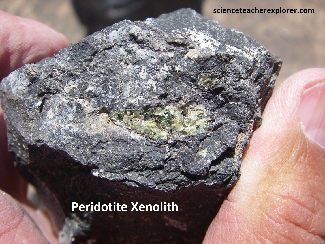
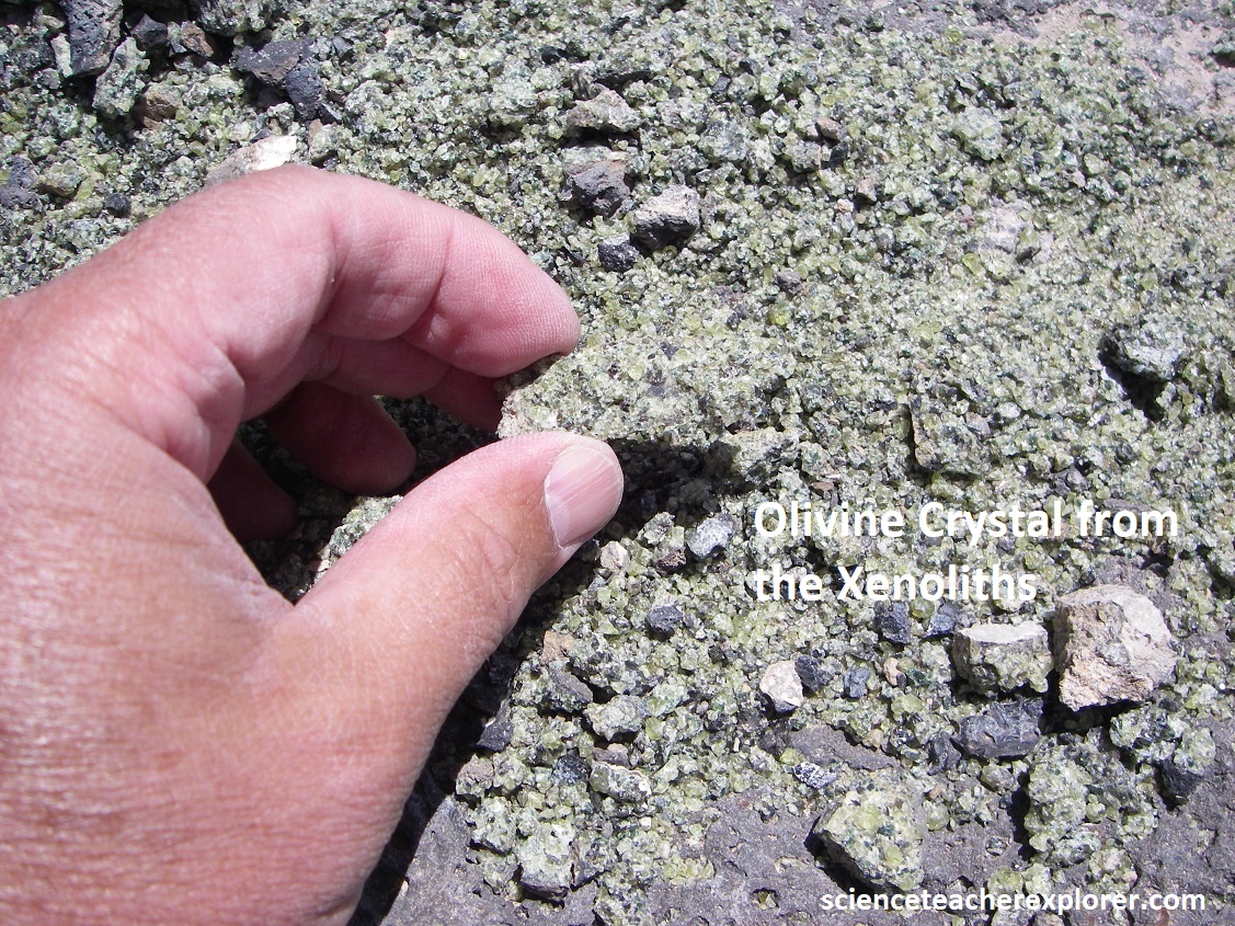
Kilbourne Hole is best know for the volcanic bombs and xenoliths. A volcanic bomb forms when lava explodes from a volcano. As the molten blob flies through the air, it cools into an oval-shaped blob of basalt. However, the volcanic bombs at the Kilbourne Hole contain xenoliths, (pieces of rock picked up from the magma from deep below). Since the originating magma underground was 64 km deep, then the xenoliths contain pieces of deep upper mantle crystals. These are extremely rare to find, (i.e. olivine or even diamonds). Pictured below are crystals of the mineral Olivine & Peridotite found within these xenoliths. Notice the Peridotite xenolith is surrounded by the dark basaltic rock-lava.
To continue my exploration of the Chihuahua Desert, I drove southeast on I-10 through El Paso and onto Van Horn, Texas. There, I detoured onto US-90 south, towards Marfa, Texas.
Just before I made it to Valentine on US-90, I discovered this strange store beside the road, selling Prada shoes in the middle of no-where. Hilarious!
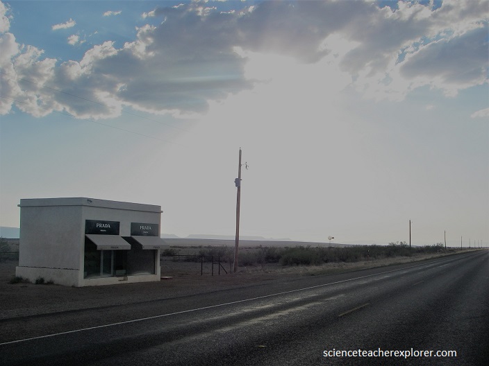
A permanent land art project by artists Elmgreen & Dragset. Modeled after a Prada boutique, the structure includes luxury goods from the fall 2005 collection. However, the sculpture will never function as a place of commerce, the door cannot be opened.

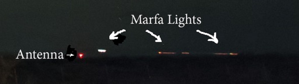
Passing through Marfa, Texas on US-90 was an opportunity to visit the world-famous home of the mysterious “Marfa ghost lights”, (imaged below). The Marfa Mystery Lights are visible on many clear nights, (I was not there on one of these), between Marfa and Paisano Pass on US-67 as one looks towards the Chinati Mtns. The lights may appear in various colors as they move about, split apart, melt together, disappear and reappear.
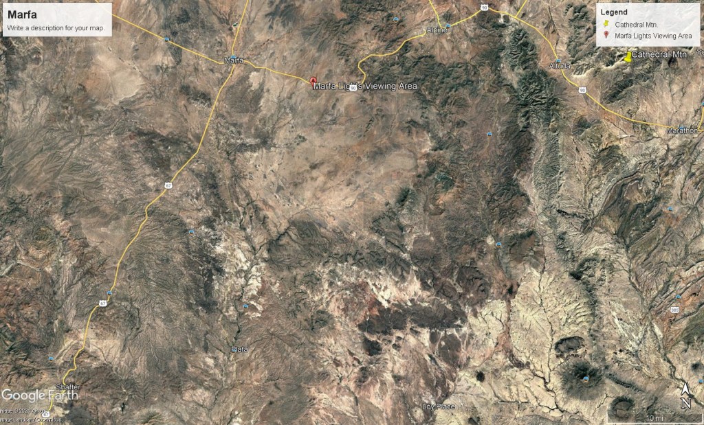
Robert Reed Ellison, a young cowboy, reported sighting the lights in 1883. He spotted them while tending a herd of cattle and wondered if they were Apache campfires. Apache Natives believed these eerie lights to be stars dropping to the earth. A example of these is seen below, to the right of a red radio-tower light. (a common location to see these lights while visiting the, “Marfa Lights Viewing Center next to the US-90, 13.6 km east of Marfa”).
Many viewers have theories ranging from scientific to science fiction as they describe their ideas of aliens n UFO’s, ranch house lights, St. Elmo’s fire, or headlights from vehicles on US-67, the Presidio highway. Some believe the lights are an electrostatic discharge from suspended sand, swamp gases, moonlight shining on mica, or ghosts of Conquistadors searching for gold. While I was there at the Marfa Lights Viewing Area, I took photos of the geography of the surrounding Geography.
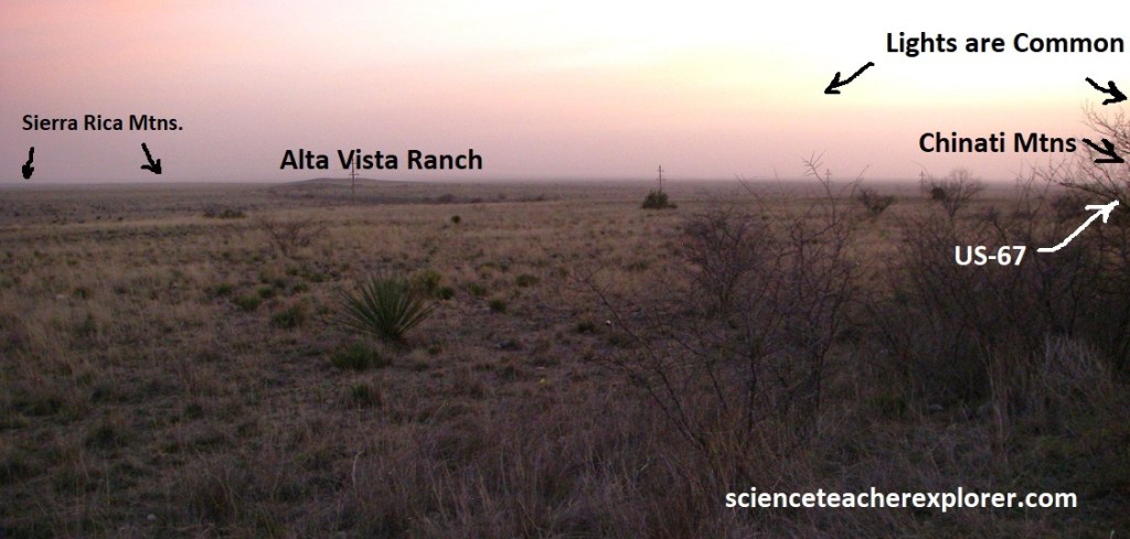
An explanation as to why the lights cannot be located is an unusual phenomenon, where atmospheric conditions produced by the interaction of cold and warm layers of air refract and reflect light so that it can be seen from afar, but not up close. The mystery of these lights still remains unsolved. Pictured above, looking south, (over the Marfa Army Air Field), where the lights are usually reported, are the Sierra Rica Mountains in Mexico on the southern horizon, (the wind-blown sand made it impossible to see in the photo). The Chinati Mountains are on the skyline to the southwest, where US-67 crosses on its way to the small towns of Shafter and Presidio.
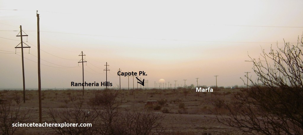
Pictured above, looking west is the flat alluvium plain of the Marfa Basin. On the distant horizon, Capote Mountain of the Sierra Vieja Range would be seen if it was clearer. Off the south side of the mountain , Capote Falls flows diring the wet season. {Mineral deposit left from the water have formed a capote or cloak that gives the mountain its name}. Movie buffs may recall that the 1955 classic “Giant” was filmed on the Ryan Ranch, 24 km west of Marfa, (starring Elizabeth Tayler, Rock Hudson and James Dean).
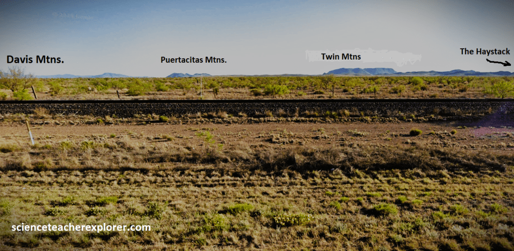
Picture above, looking north from east to west, the peaks that form the skyline are the Haystacks, or the Twin Mountains, the Puertacitas Mountains and Blue Mountain, all in Jeff Davis County. The Davis Mountains are the second highest range in Texas. The highest elevation in this range is Mount Livermore at 2794m above sea level. At this higher altitude, the Davis Mountains receive enough rainfall to support Douglas Fir, Oak, Maple, Ponderosa Pine and Madrona trees.
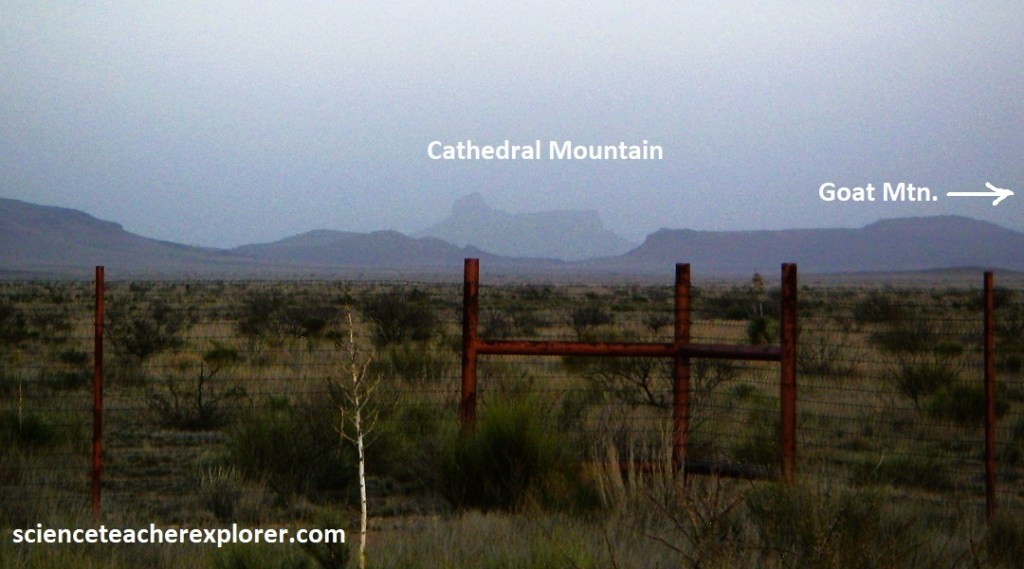
Pictured above, looking east are part of the Paisano. These mountains were formed by the lava flows and ash deposits from the Paisano volcano that erupted about 35 million years ago. The distinctive profile of Cathedral Mountain, rising to an elevation of 2287m is semi-clear to the southeast of the Marfa Light Viewing Area on US-90.
In July of 2013, I drove US-67 from Marfa, TX to visit the Big Bend National Park. Just after I passed the town of Shafter, (heading south), I viewed the uncanny likeness of Abraham Lincoln’s profile on a nearby mountain while looking west. (pictured above).
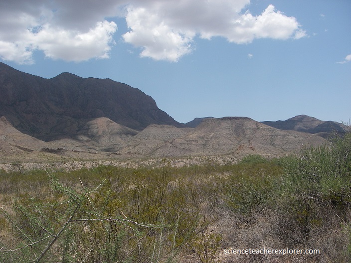
Big Bend National Park encompasses the largest protected area of the Chihuahuan Desert in the United States. The 800,000-acre national park contains three basic habitats: river, desert, and mountains. The Rio Grande Wild and Scenic River forms its southern boundary, and it’s the only park in the United States that contains a complete mountain range – the Chisos.
Rocks of volcanic origin dominates much of the visual landscape in Big Bend National Park. The first of a series of volcanic eruptions occurred approximately 42 mya near the present northwest boundary of the park. Upward-moving magma lifted the area that is now the Christmas Mtns and resulting fractures of surface strata allowed lava to spread in great sheets across the land.
Between 38 and 32 mya a series of volcanic eruptions occurred within the park. Initial activity began in the appropriately name Sierra Quemada, meaning “burned mountain range” in Spanish, located below and south of the present South Rim of the Chisos Mountains. Volcanic activity that followed in the areas of Pine Canyon, Burro Mesa, and Castolon gave rise to colorful volcanic ash and layered lavas in lower park elevations and for most of the mass of the Chisos Mountains.
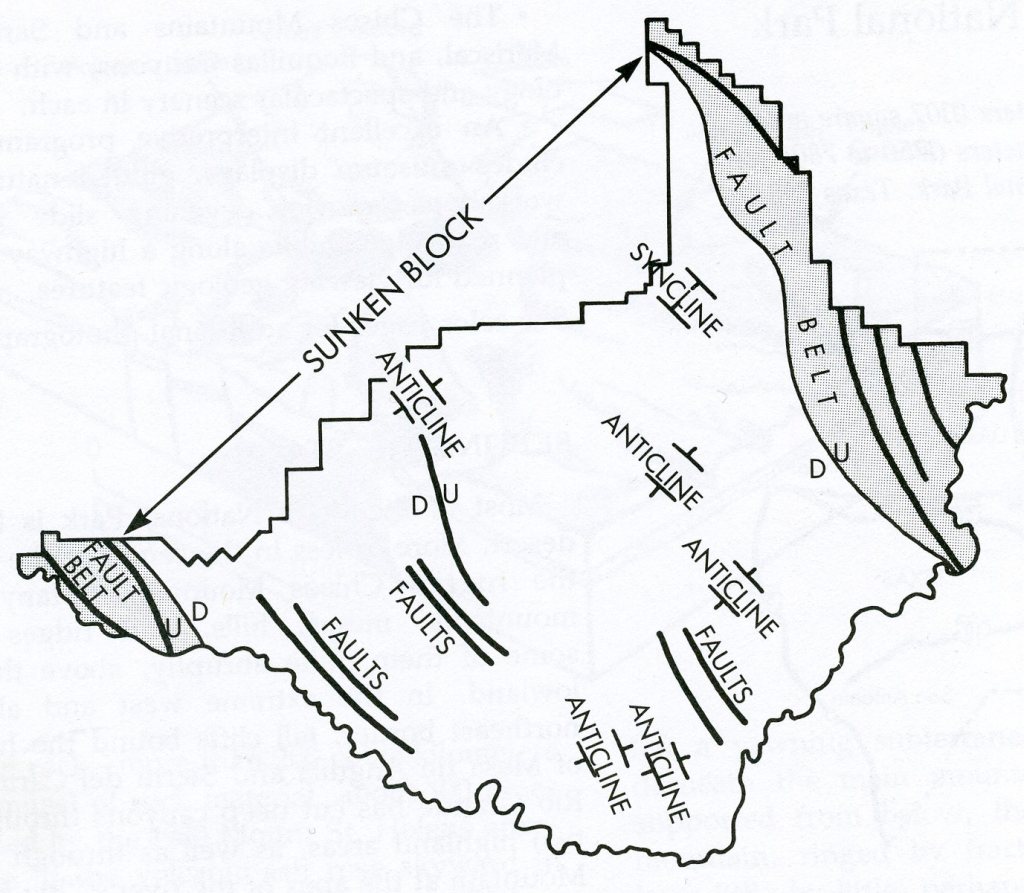
The Basin of the Chisos Mountains is part of a great rift valley that stretches from Colorado to Mexico. The basin and its mountains sit in a sunken block in the rift, surrounded on either side by more mountains.
The result of this geological convolution is a land of contrasts, (of desert lowlands and moist mountain woodlands). But most of all it is a land of panoramic vistas.
Once you reach the Big Bend National Park, the highlight the park is the Ross Maxwell Scenic Drive. The Ross Maxwell Scenic Highway extends down the west side, between the Chisos Mountains and Burro Mesa through mostly volcanic terrain all the way to Santa Elena Canyon, where you find sedimentary rock in the form of limestone. About 30-40 million years ago, this region witnessed some of the most violent activity known to history. In fact, many of the rugged mountains in the Chisos Mountains are actually the eroded remains of ancient remains of ancient volcanoes.
Dikes arise from deep magma chambers. Following paths of least resistance, molten material welled up into subterranean faults or fissures 17 million years ago. All dikes, including Big Bend’s, cut across other beds of rock. Softer surrounding rock weathered away, leaving igneous dikes silhouetted across the landscape.
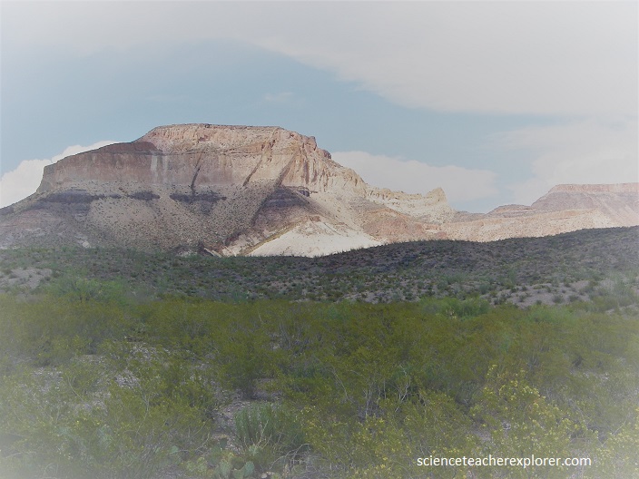
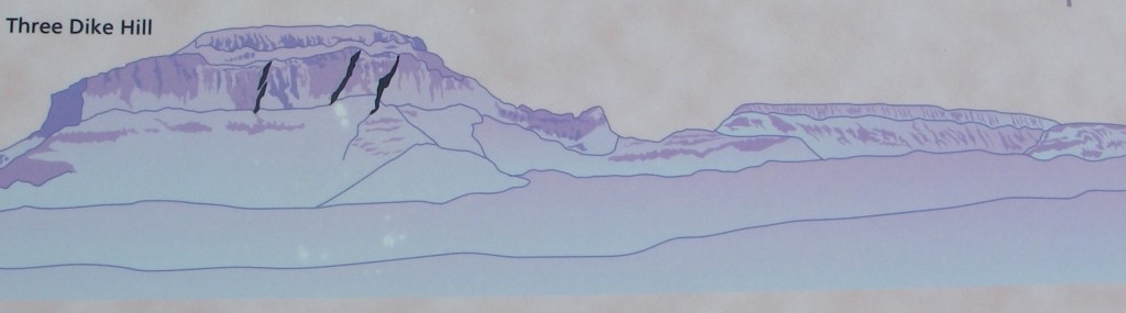
Named for Ross A. Maxwell, a geologist and the Park’s first administrator, it is replete with remarkable views and even more remarkable geologic features. Interesting geological phenomena can he seen from the road at several places. In the Chisos Formation, between the Chisos Mountains and the south end of Burro Mesa, are three dikes in the Three Dike Hill. These appear as rock walls that stand above the surface and are traceable for miles. They are formed of rock similar to that exposed in Ward Mountain and probably came from the Ward Mountain intrusion.
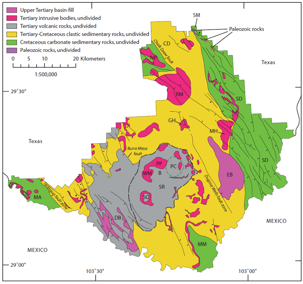
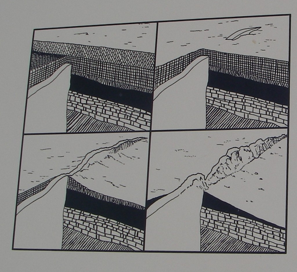
Beginning approximately 26 mya, the central area of Big Bend National Park was subjected to development of fracture zones as the continental plate that covers the western part of the U.S. was stretched between the west coast and a point east of the park. Large blocks making up much of the central mass of the park between the Sierra Del Carmens on the eat side of the park and Mesa de Anguila on the west dropped downward along active faults. Limestone layers at the base of both east and west ranges thus match layers found at the top of the mountains (Imaged below).
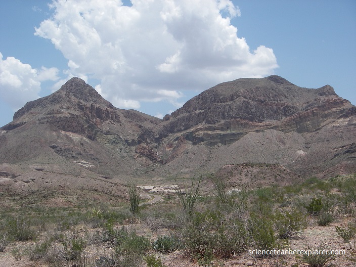
One of the most interesting geological features along the Maxwell highway is Goat Mountain. In the north-western face of Goat Mountain, (pictured below) one can see the cross section of a former canyon that was cut into volcanic rocks (Chisos Formation) and later filled by younger lava (South Rim Formation). A new theory, (pictured below), tells a tale of fiery explosions and massive volcanic domes.
Pictured left below, an initial explosion created a crater with an older, layered volcanic rock. Possibly the explosion occurred when rising magma (molten rock beneath the Earth’s crust) came into contact with water trapped in the older lava, causing it to flash into steam.
Pictured center-left below, silica rich magma continued searching upward, causing repeated pyroclastic eruptions (a mixture of superheated gas, ash, and rock fragments). The flows partially filled the crater, informed a collar of steaming volcanic material around the vents.
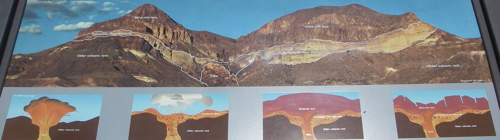
Pictured center-right above, over time, the gas content of the magma decreased, and the final eruptions produced thick slow, slow moving silica rich lava (magma that reaches the surface). The lava form thick domes that were higher than, and spread over, the crater walls. A dozen or so similar volcanic domes of dotted the landscape between Burro Mesa and Castolon.
Pictured right above, about 27 million years ago, the region was uplifted and faulted and erosion began to shape the land we see today. The overlying silica rich lava was resistant to erosion and form steep, jointed cliffs.
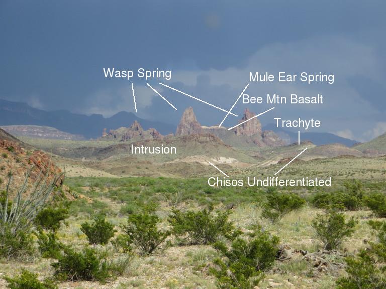
Farther on are Mule Ear Peaks (pictured below) formed by dikes that erosion has sculptured into the shape of a mule’s ears.
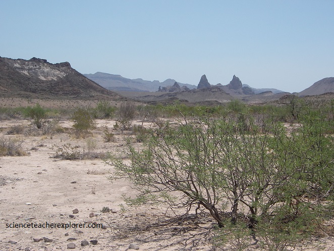
Pictured above, is of one of the most famous landmarks in the park. From a distance you would swear there was this gigantic animal crouching down behind a ridge with just his ears and the top of his head showing. The ears look very mule-like, hence the name “Mule Ear Peaks”. They are actually the eroded remnants of a pair of dikes. The rock of these dikes is mapped as Wasp Spring, implying that these dikes used to be volcanic fissures that violently erupted at least some of the Wasp Spring member of the Burro Mesa Formation found in this area of the park.
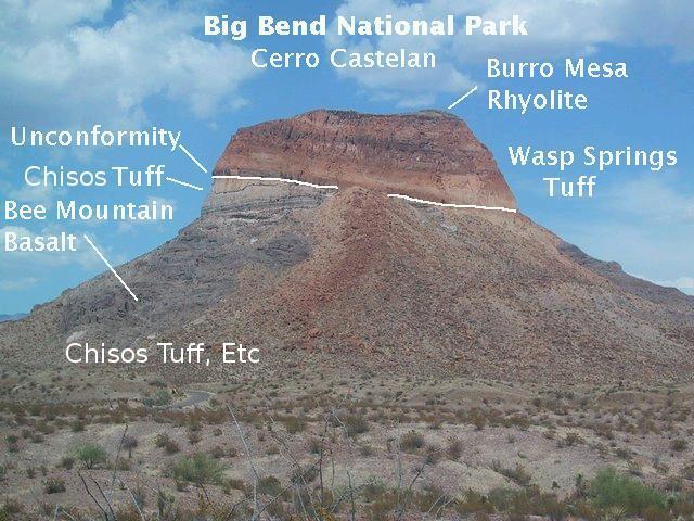
Pictured below, Cerro Castellan – also known as Castolon Peak or Castellan Peak, is a conical volcanic mountain in West Texas that rises 330 m above the desert floor (1,100 m elevation) in Big Bend National Park. Cerro Castellan itself is part of an ancient series of summits once known as the Corazones Peaks that has since succumbed to millennia of erosion by wind, precipitation, searing heat and bitterly cold winters.
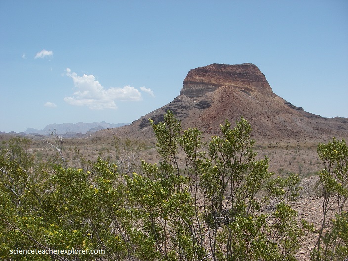
Geologically, the Cerro Castellan is a remnant of a high stack of volcanic rocks, including ash, lava, and tuffaceous rocks. It is capped by a dense lava flow underlain by various tuffs and basalts. A somewhat northwest fault cuts the eastern face of Cerro Castellan. Under the Burro Mesa Formation, pictured below, there is a time break, called an unconformity, during which erosion took place. It appears what you are looking at here is what is left of one side of a valley into which the Burro Mesa Formation was deposited. The unconformity may mark what used to be part of the valley floor. However, there may be another unconformity here within the Chisos Formation. Finally, note the talus (debris) from rock falls of the Burro Mesa Formation.
The last 10 million years or so have been dominated by erosion sculpting the modern Big Bend landscape. As the highlands eroded, gravel and boulders formed a blanket of sediments around the base of the mountains. In the lowlands, sediments filled in the low places and erosion wore down the high places, forming a relatively flat, gently sloping surface called a pediment. Remnants of the pediment can be easily seen along park roads, for example, to the east of the Maverick Entrance Station.
Although little vegetation grows on the sheer cliffs and steep, pointed profile of its peak, the lower slopes of Cerro Castellan support a sparse growth of Chihuahuan Desert scrub, including most prominently such characteristic species as creosote bush and ocotillo.
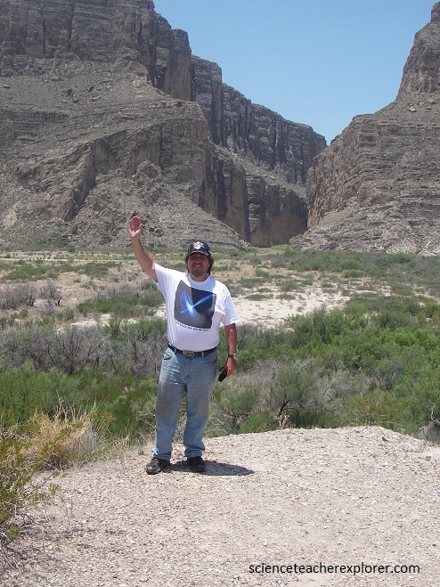
The view of Santa Elena Canyon (at the end of Maxwell Scenic Drive) is one of the most spectacular in the Park (pictured above). The Rio Grande, like a giant rasp, has cut through the massive Lower Cretaceous limestone layers in the mesa making a gorge, which in some places is not more than 10 m wide but which has sheer walls approximately 500 m high. The middle of the Rio Grande at the bottom of the canyon is the International Boundary between Mexico and the United States; Sierra Ponce (Mexico), on the left, Mesa de Anguila (United States), on the right. Santa Elena Canyon is a prominent physical barrier between the United States and Mexico. The canyon is cut across an uplifted block of Lower Cretaceous limestone.
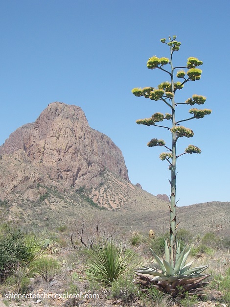
There are eleven species of agave in Texas, three of which are found in Big Bend National Park. Pictured on the right above, the gigantic Havard Agave (Agave havardiana) is one of the most visible icons in the Big Bend National Park. It blooms once in its life after growing 20-50 years. Mexican long-nosed bats pollinate the bright yellow flowers. The leaves of the century plant have a blue-gray color. The century plant also provides an excellent source of fiber for ropes, mats, sandals, etc. The hearts of the plants were harvested by the Native Americans and then baked in a stone-lined pit for two to three days. Once baked, the plant provided a source of food that could be dried and stored to help them to survive the long winter. The dried flower stalks served as building material. Century plants in Mexico provide the alcoholic beverages of pulque, mescal, and tequila.
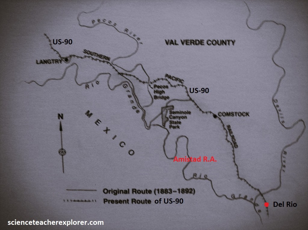
In 2024, from Marathon, TX, I continued my exploration on US-90, by driving southwest along the Mexican border to Langtry, (pictured below).
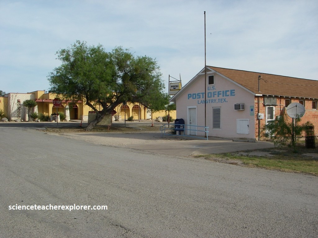
Pictured above, Langtry was created in 1882, when the Galveston, Harrisburg & San Antonio Railroad, (later known as the Southern Pacific), signed a deed with the Torres Family, who owned the land. The town was likely named for George Langtry, who led an area rail building crew. Lore, though, links the town’s most famous inhabitant to its naming; Roy Bean, who owned a local saloon and served as justice of the peace, became known as “The Law west of the Pecos”. He was enamored of Lillie Langtry, a popular British Actress, and although she was probably not the town’s namesake, she did visit here in the early 20th Century.
In 1896, Judge Roy Bean made national headlines with a unique boxing match held at this site, (pictured above). Robert James Fitzsimmons was to fight James J. Corbett, the Heavyweight Champion, but the legislature had outlawed boxing in Texas. While promoters sought a new location for the match, Corbett retired, handing the title to Irishman Peter Maher, who soon agreed to Fight Fitzsimmons. Bean arranged for spectators, the press and Texas Rangers to travel by train from El Paso to Langtry, where he held the fight on a sandbar on Mexico’s side of the Rio Grande; Texas Lawmen had not authority there and Mexico had no Law enforcement on hand. Fitzsimmons knocked out Maher out in 95 seconds, winning the title.
Noted for mineral-thick waters and sudden floods, the Pecos River snakes through Texas on it’s way to the Rio Grande, (pictured above). Historian J. Evetts Haley and folklorist J. Rank Dobie, who called it “a strange river”, and a “barricade”, are among many who have immortalized the Pecos in writing. Zane Grey Wrote, “rising clear and cold n the mountains of norther New Mexico, it’s pure waters cut through rough country that changed it’s flood to turbid red”. Storytellers have likened the river and the arid land of the Chihuahua Desert to hell, death and violence. A natural border for several counties, the Pecos River is where the mythic wild west begins, the land that produced the legendary Judge Roy Bean and fabled Pecos Bill.
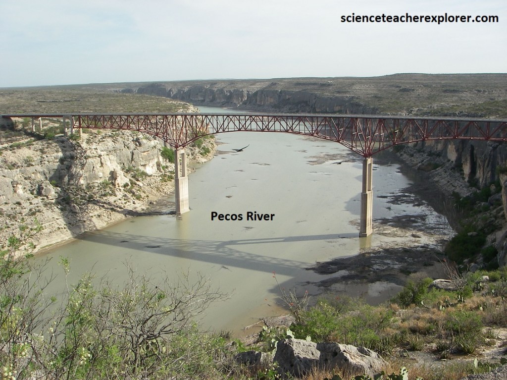
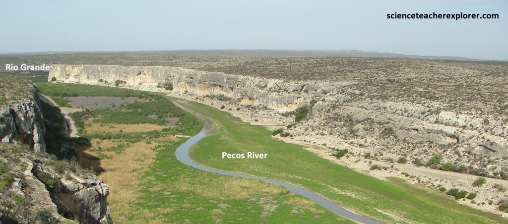
Pictured above, high canyon walls dominate the last 100 km of the Pecos River before it enters the Rio Grande. The southern Pacific Railroad built the first high bridge across the Pecos River in 1891. The first highway bridge to spa the river was built 1.6 km down river from here in 1923. Just 17m above the water, the 1923 bridge was destroyed by floodwaters in 1954. Two temporary low-water bridges built nearby in 1954 and 1955 also were destroyed by floodwaters. A new 437m long bridge was completed here in 1957. At 91m above the river, it is the highest highway bridge in Texas.
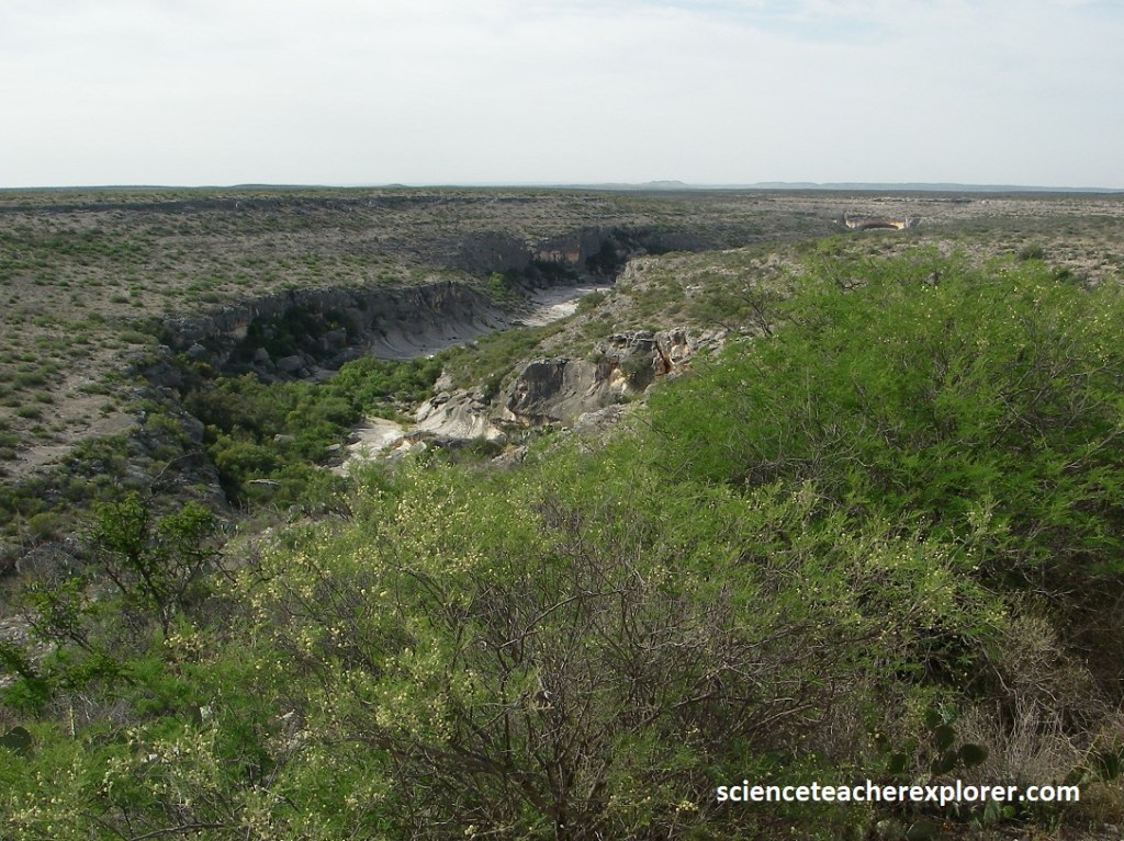
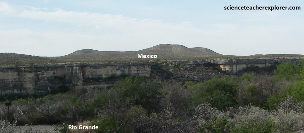
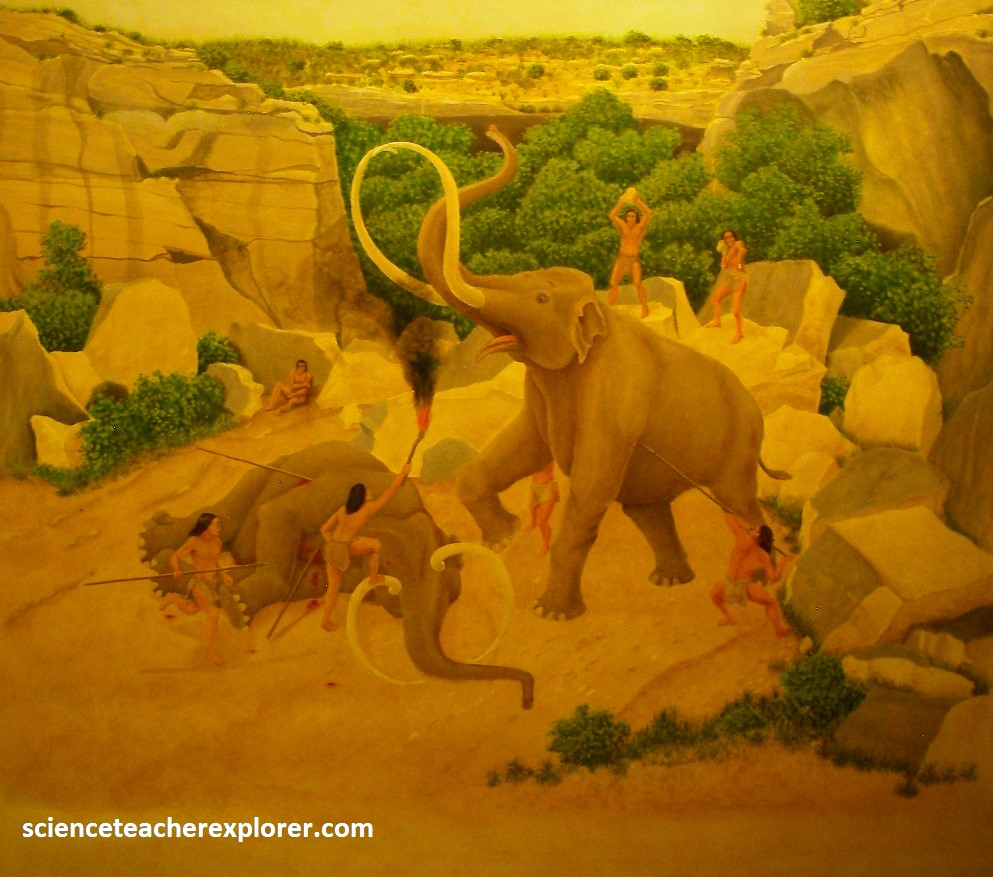
Just east of the Pecos Bridge on US-90 is Seminole Canyon State Park, (Archeological Site). Cave art and archeological artifacts at the Seminole Canyon State Park, date back to the earliest human habitation in the area. It is estimated that human habitation of the area began 10,000 years ago, during the Holocene era when mammoth animals would have also inhabited the area. Vegetation is believed to have been a denser and richer variety to support the life of the area. The erosion from floods and rains that happened over the ages chipped away at the Devils River Limestone, can be seen in some of the area rock walls. Where there was especially soft rock or lots of erosion, overhangs formed. Seeking shelter from sun and rain, indigenous peoples moved into the shelters and began to leave cave art evidence of their presence some 2,000–8,000 years ago. The designs they painted and the objects they left behind tell stories of their lives.
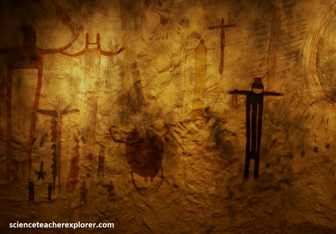
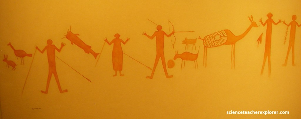
The Devil’s River Limestone walls surrounding the people of the lower Pecos provided space for artistic expression. Art was widespread in the primitive, world, and in the area of modern Val Verde County, perhaps 5,000 years ago, an artistic tradition began which has been compared to the famous cave paintings of France and Spain. The scene recreated below, on interpretive signs, are samples of pictographs from Panther Cave in Seminole Canyon.
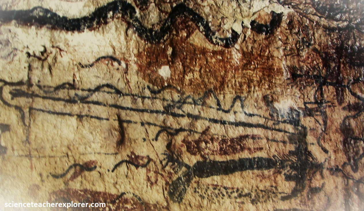
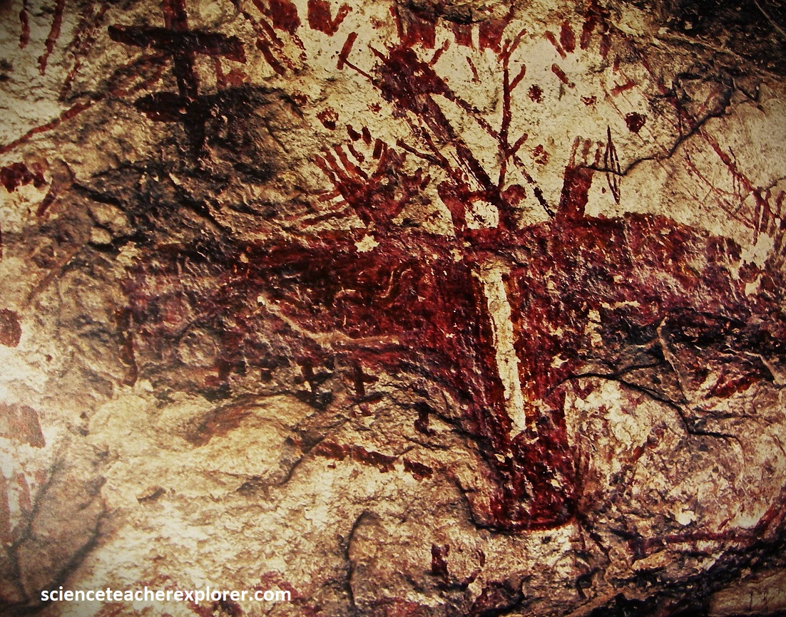
Best known of the many different sorts of pictographs in the area are the man-like figures. Whether these represented men or gods is still a mystery, but some objects near the figures can be identified. {Odd-looking bags hanging from the arms of the figures represent prickly pear cactus pads sewn into carrying bags. Throwing sticks or atlatls were used for weapons before the invention of the bow and arrow. Naturalistic animals suggest the experienced eye of the hunter}. Subtle changes in the pictographs occurred during the several thousand years separating the earliest and latest paintings. What began as attempt to portray man-like figures and objects realistically gave way to abstractions in which the same forms were economically suggested by simple lines.
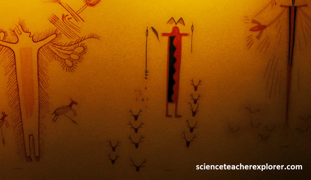
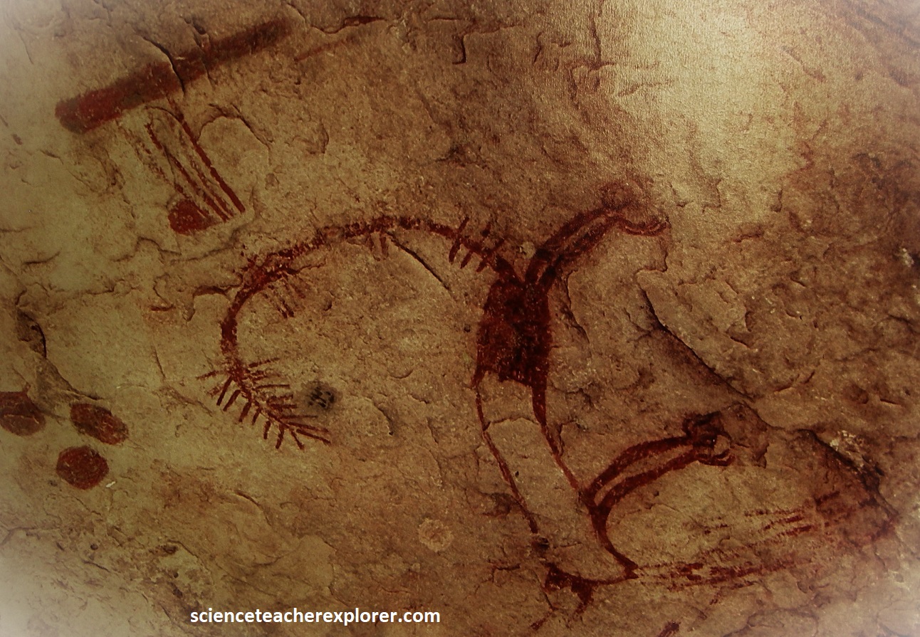
Between 600 and 1,000 A.D. a significant change called the Red Monochrome occurred in the rock paintings. Using only red pigments, artists painted men and animals in a very different style. The new painters were no longer concerned with the mystical man-like figures, but pictured men and animals in more ordinary relationships. The new artists also faithfully recorded an important new tool, the bow and arrow, (imaged below).
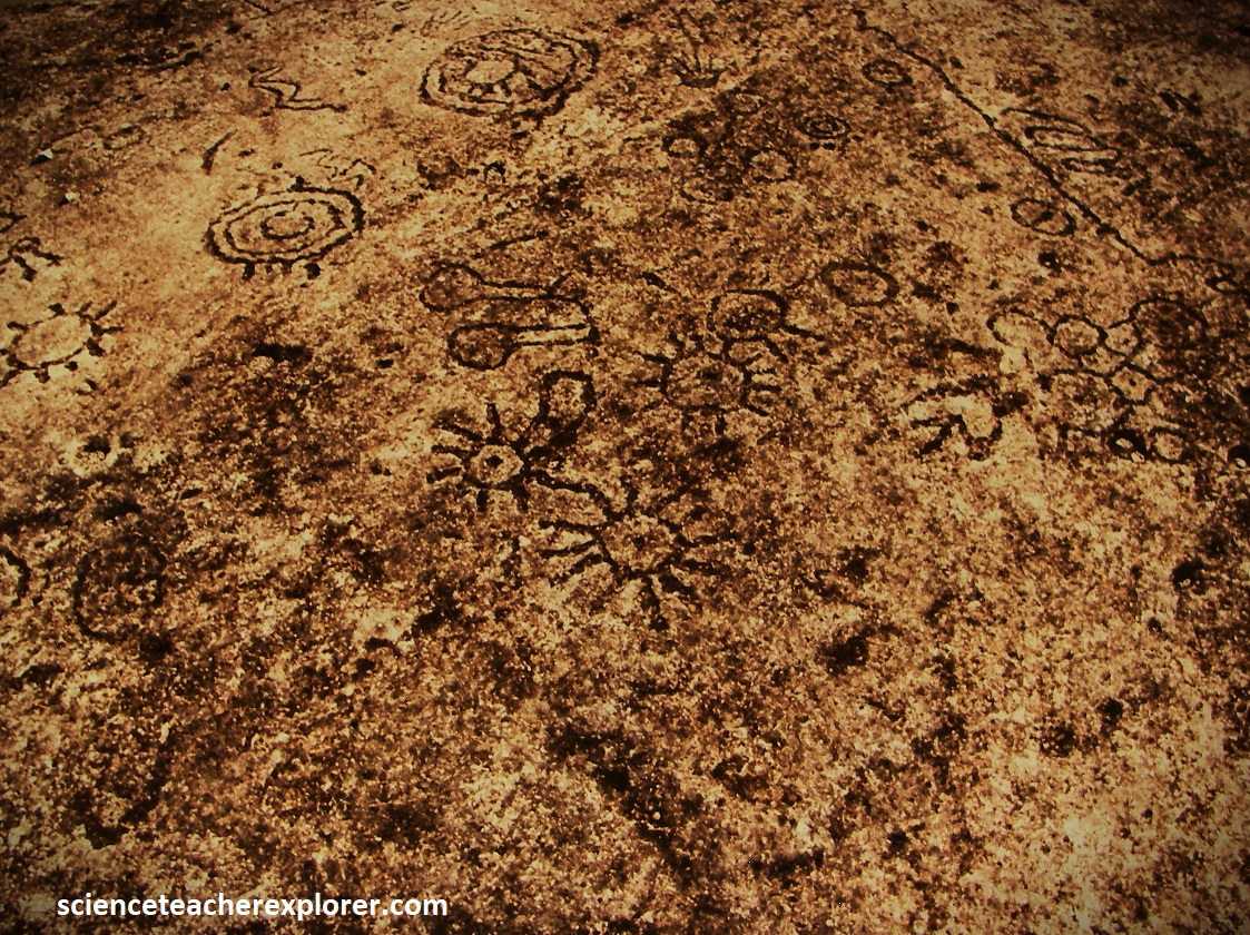
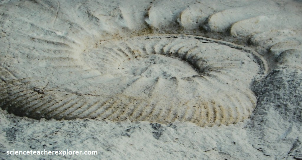
A hundred million years ago, this area around Seminole Canyon was a shallow sea teeming with live. Some of these creatures had shells. When they died, their shells fell to the bottom of the sea, (pictured below). Over time, the shells broke down, compacted, and became limestone. The sea rose and fell, leaving layer after layer. The canyon walls and road cuts into the layers of stone formed across Central Texas. Limestone’s a soft stone. Water from creeks found cracks and carried away the grainy limestone to form canyons, (including Seminole Canyon).
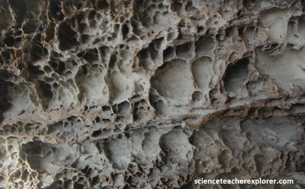
Pictured below, I was rocks in the canyon that looked like honeycombs. I believe this formation is caused by salt and swirling winds.
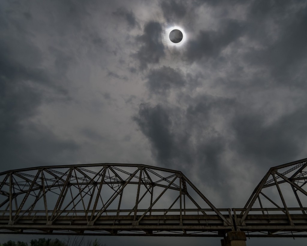
Returning to US-90 and driving southwest, I passed Del Rio, Texas. My ultimate destination for my 2024 Chihuahua-Desert trekking-adventure was the April 8th, 2024 Total Solar Eclipse, (image below).
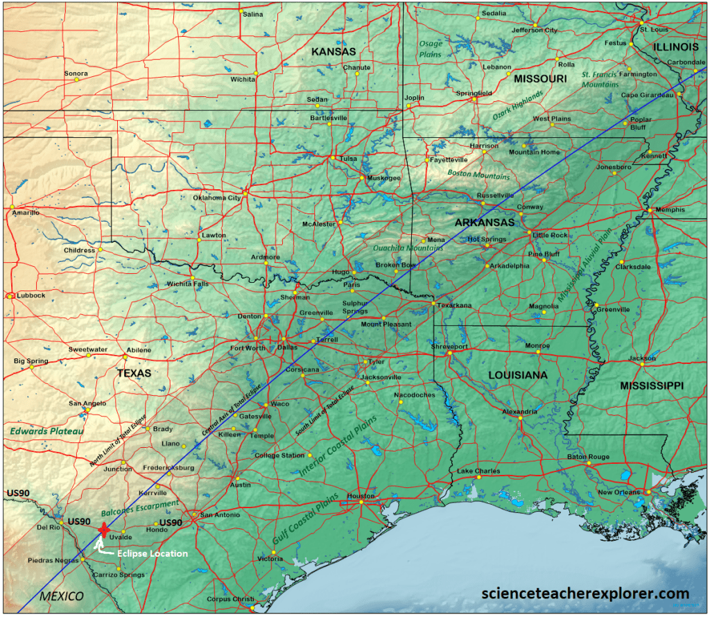
The path of the eclipse 2024 continued from Mexico, entering the United States in Texas, and traveled through Oklahoma, Arkansas, Missouri, Illinois, Kentucky, Indiana, Ohio, Pennsylvania, New York, Vermont, New Hampshire, and Maine. Every total solar eclipse centerline, the duration of totality is longer than anywhere else. That point is also the duration of totality “tipping point,” meaning that the duration gradually increases along the centerline up until that point and then starts to decrease on the other side. In other words, for the 2024 eclipse, the duration of totality was all downhill in the U.S., with the longest durations in Texas and the shortest in Maine. Therefore, the path of totality in Texas was to be considered a prime viewing destination on April 8 of 2024.

Additionally, Texas was also widely considered to have the best eclipse-day weather prospects in the country. In Texas, “the north [or west] side of the track has a notably sunnier April climate than the south [or east].” In general, the farther south we were for this eclipse, the better our weather odds. And we couldn’t get any farther south along the path of totality in the U.S. than Texas. I figured that most of south-west Texas would have about a 50% chance of cloud cover. So I headed there, with my traveling buddy, Marc Curtis and his wife Jennifer.
Our plan was to capture the eclipse with a camera in view of a recognizable landmark. Since the Eclipse first contact occurred at about 12:10 P.M., that landmark had to be high in the sky.
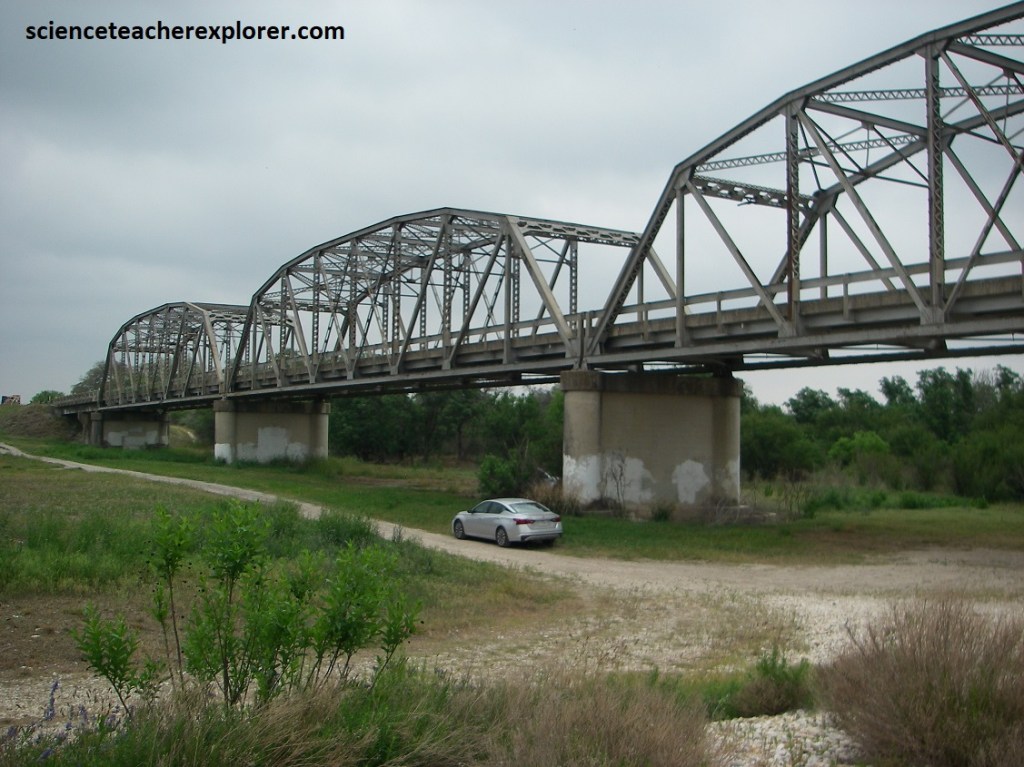
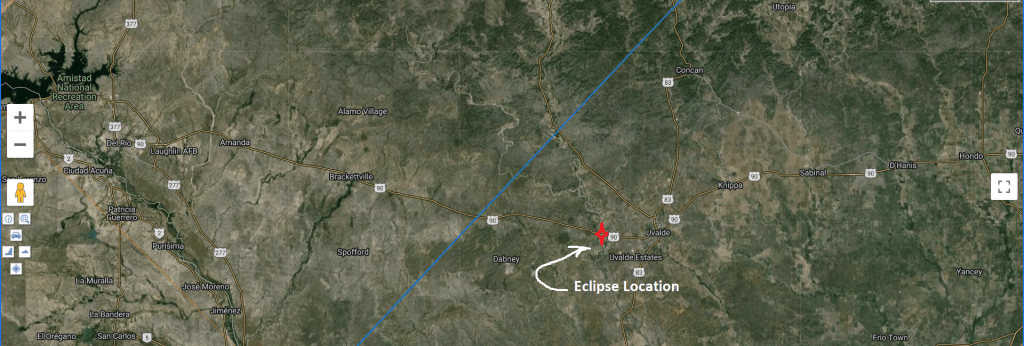
We chose the Uvalde, TX ; US-90 bridge that crosses over the Uvalde River. We figured that it would be almost dry, this time in the year and all we had to do is wait and cross our fingers for no clouds. As mentioned above, our chances were good.
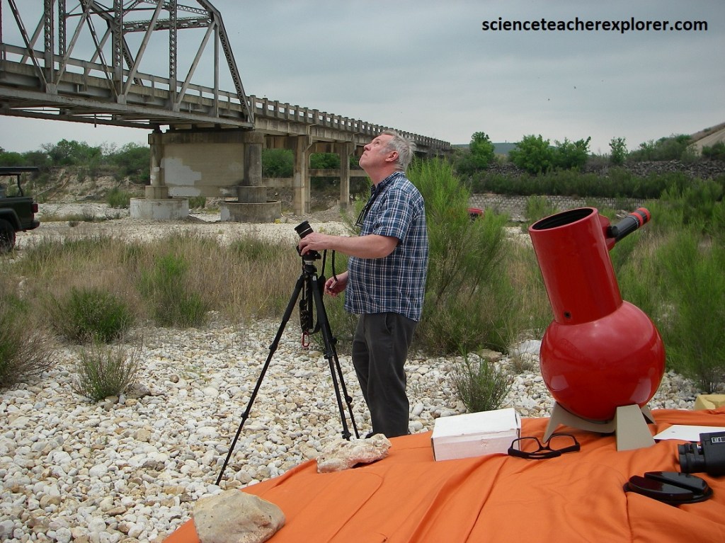
For us the critical times were: (Hard to tell through the clouds)
First contact occurred: 12:12 p.m. CT
Totality started at: 1:29 p.m. CT
Totality ended at: 1:32 p.m. CT
Fourth contact occurred: 2:52 p.m. CT
Unfortunately, we missed the totality of the eclipse due to the clouds. Below is what I captured:
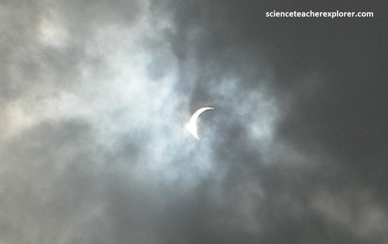
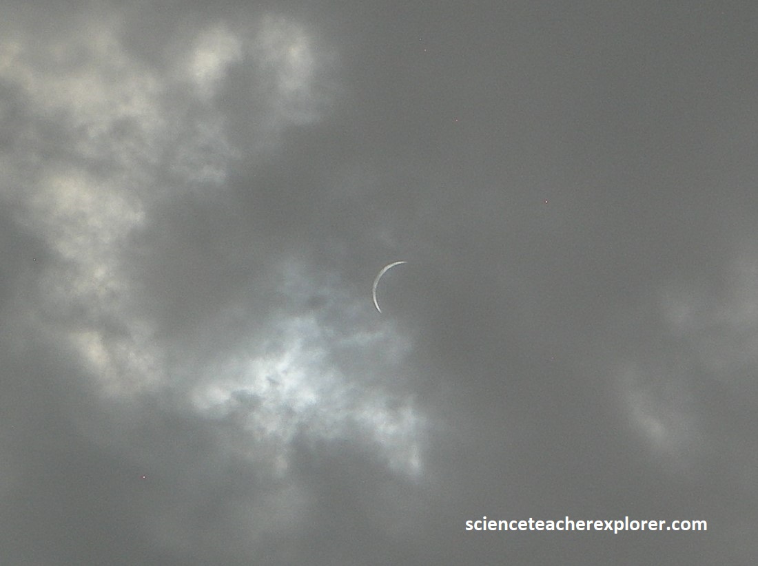
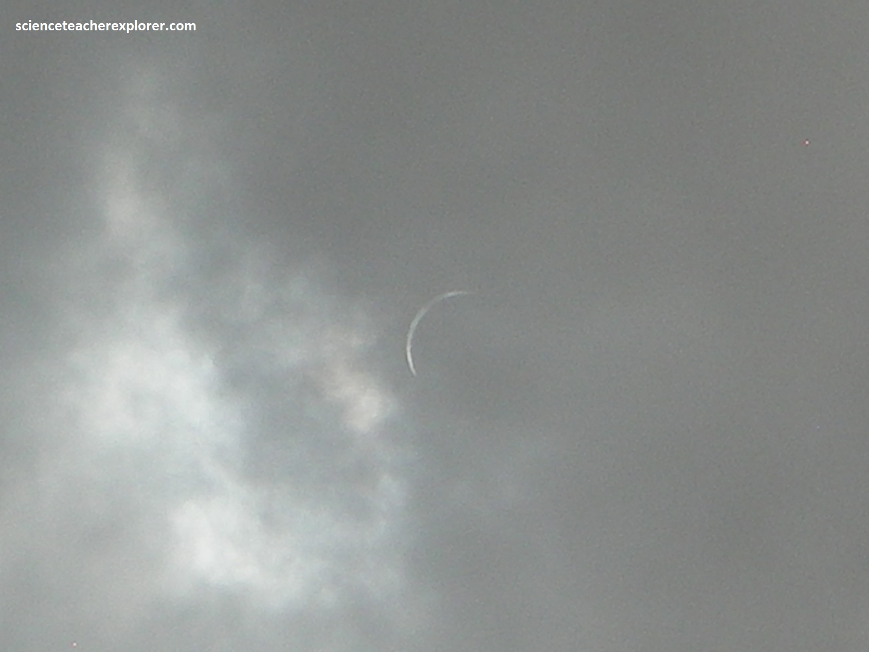
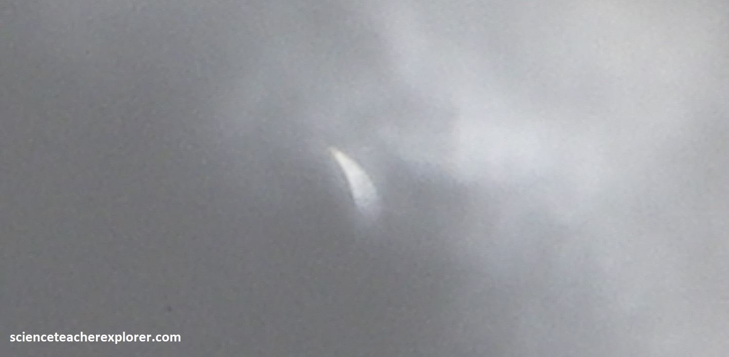
A very disappointing event for us at the Uvalde bridge. With the Sun likely in the peak of its 11 year solar cycle, (known as solar maximum), I was hoping to see the corona blast out from all sides of the Moon. But no luck! However, Marc Curtis had his son-n-law, north of us, near Austin, in the Hill-country. He pulled off some great images of the totality, through the clouds. Marc was able to splice together, what we should of seen. I’ve included that image below: