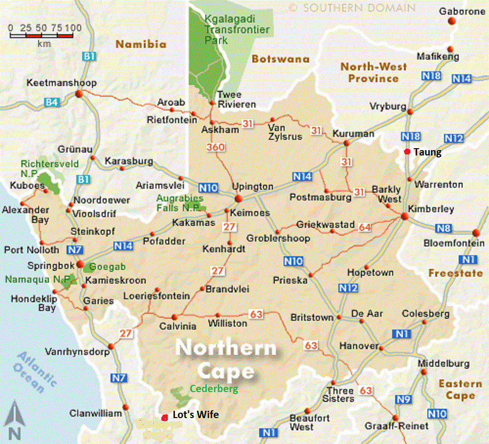
Northern Cape, 2024
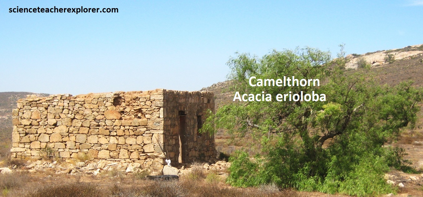
While trekking South Africa in 2023 & 2024, one of our, (my trekking buddy Mike Stevens & I), goals-of-exploration was to explore the remote areas of the Northern Cape. The points-of-interest included: Kimberly, Taung, Kuruman, Kgalagake N.P., Springbok, Augrabies Falls N.P., Richtersveld N.P., Namaqua N.P., and Cederberg.
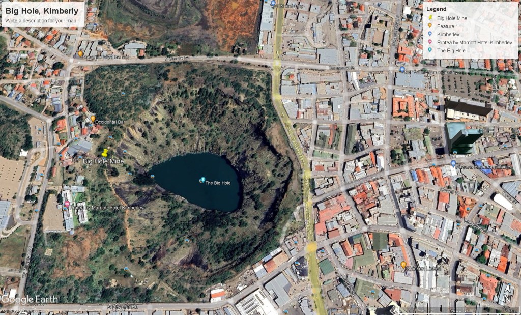
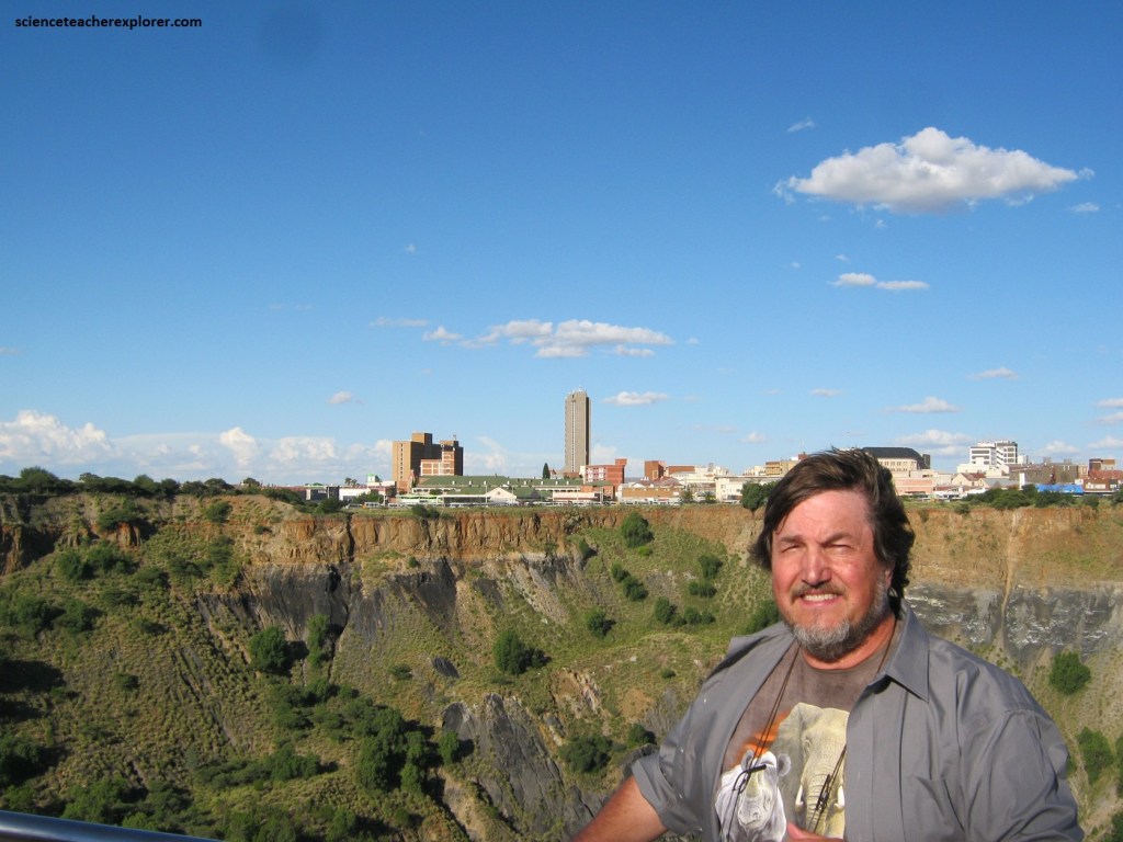
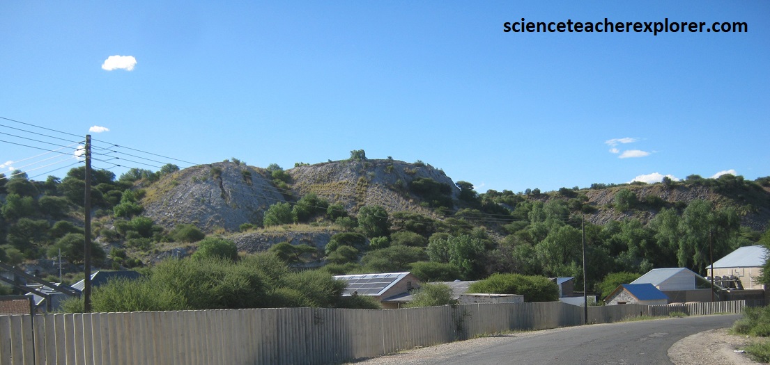
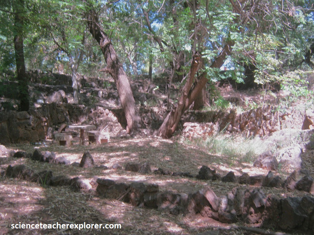
In April of 2023, we found ourselves exploring the Big Hole, Kimberly, 480 km south-west of Johannesburg, (pictured below).
In 1871, a member of Fleetwood Rawstone’s ‘red Cap Party’ found an 85-carat diamond on the small hill that was known by diamond diggers as Colesberg Kopje. This discovery sparked the biggest diamond rush the world has ever seen, an event that was to change South Africa’a fortunes forever. The hill was excavated and became the famous Kimberley Mine, one of five large diamond mines in the area operated by De Beers Consolidated, and once the richest diamond field in the world. Originally known as New Rush, the town that rapidly established was renamed Kimberly in 1973 after Lord Kimberly, then Secretary of State for the African Colonies.
The discovery of diamonds at Colesberg Kipje on the De Beer brothers’ property led to a crazy scramble for claims and within day 800 claims had been staked; soon more than 2,000 hopeful prospectors were at work. Eventually an open pit formed, known as the Kimberley Mine and now the ‘Big Hole’.
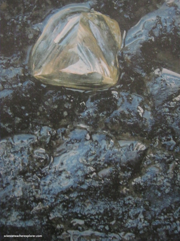
Picture above, kimberlite was reached at a depth of around 20-30m and was soon realized that the diamonds came from the kimberlite pipe that continued downwards.
Pictured above, the Kimberley Pipe is one of several diamond-rich volcanic pipes and smaller intrusions that cluster around Kimberley. This was a volcanic event that took place during the mid-Cretaceous. The volcanic pipe intruded explosively through the Ventersdorp and Karoo Supergroups. There are reported to be around 850 know kimberlite intrusions in southern Africa, of which only about 50 are diamond bearing, and very few contain diamonds in economic quantities.
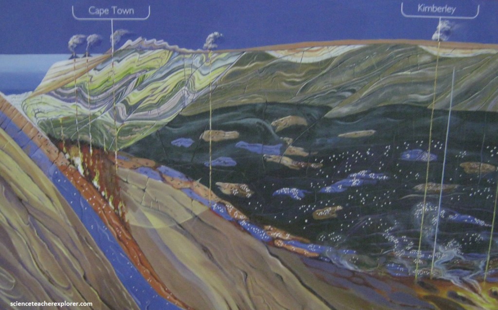
Over the course of many millions of years, erosion removed the upper parts of the volcanic pipes and countless almost indestructible diamonds were shed into streams and rivers, where they are still being mined as alluvial diamonds; or they found their way to the Atlantic coastline, where they are recovered in abundance along the old beach deposits and out at sea. Before the discovery of the pipe at Kimberley, diamonds were known only from alluvial river gravels in India, Brazil and South Africa (the Vaal River). The mines of Kimberly showed for the first time that diamonds could also be found in a certain type of volcanic rock that formed steep, deep pipes. Here for the first time was the ‘primary’ source of diamonds. Diamonds formed in the mantle as volcanoes. This rock type, not to geology at the time, was identified and named ‘kimberlite’ by Carvill Lewis, (an American geologist).
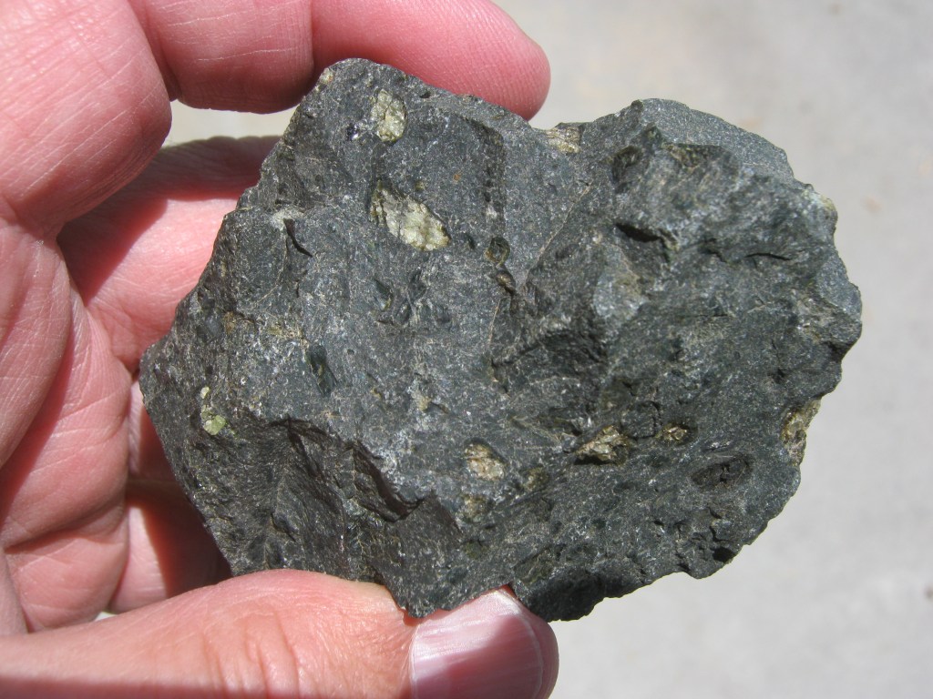
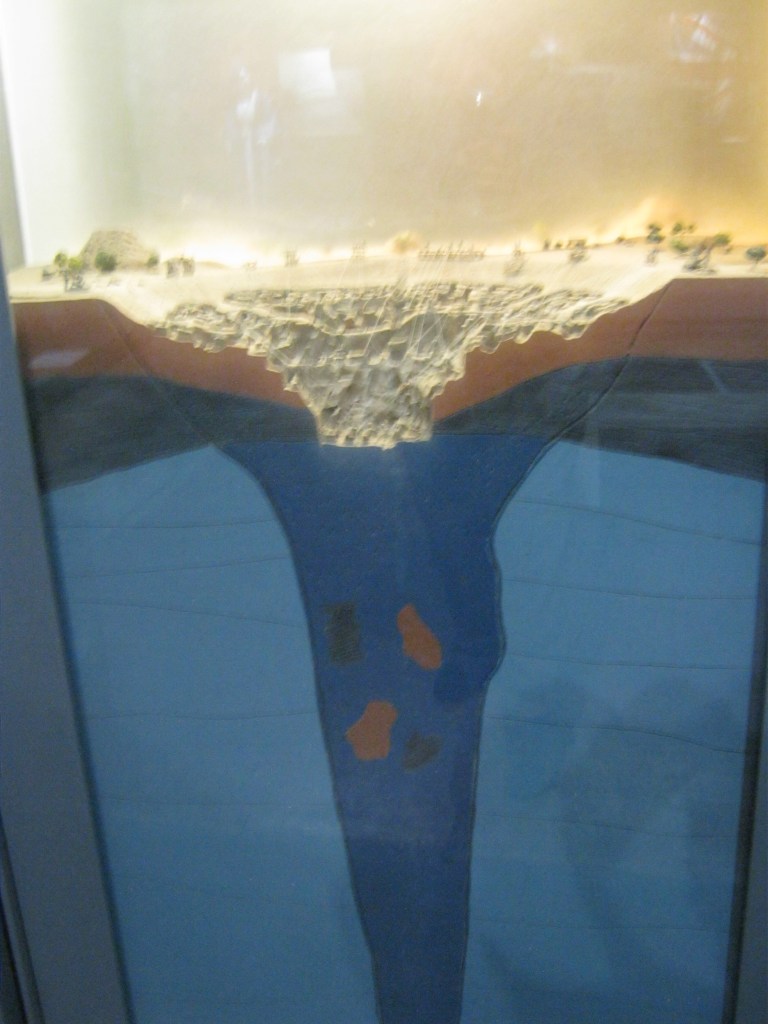
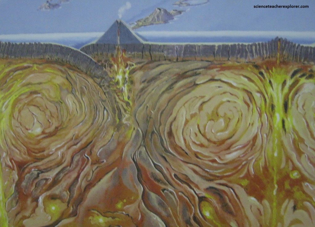
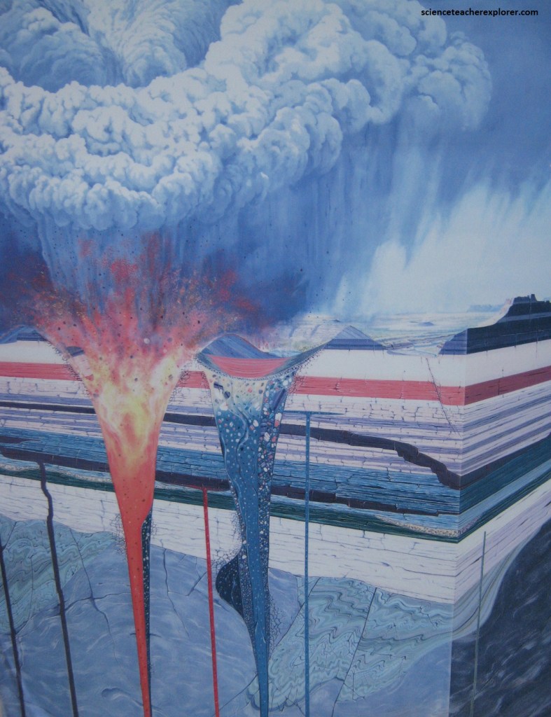
The Kimberly region is underlain by thick continental crust of the ancient pre-Cambrian ‘Kaapvaal Craton’, which is the key to the genesis of diamonds. Diamonds form at a depth of more than 150 km in the upper mantle, but only within the relatively cooler diamond-stable zone that exists beneath thick cratons. The diamonds are brought to the surface as accidental inclusions in kimberlite magma of even deeper mantle origin, (pictured below).
Diamondiferous kimberlites are found within the oldest crust, (more than 2.5 billion years old). These are known as Archaean cratons. While exploring for diamonds, geologists look for diamond-related minerals, called indicators, because there are more of theses than diamonds, so they are easier to find. The more indicators there are in soil samples, the closer the source kimberlite is. The best indicators are pyrope garnet (orange, red and mauve), chromite and micro-ilmenite (black) and chrome diopside (bright green). Geophysical methods that measure physical properties like magnetics or gravity and detect kimberlites in suitably quiet backgrounds, are also used.
At surface the “Big Hole” is very roughly circular and about 500m across. Considerable slumping of softer sedimentary side walls into the hole has taken place, but the elliptical outline of the kimberlite pipe is clear in the deeper and harder Ventersdorp lava. In the cretaceous the explosive eruption of the Kimberley volcano probably formed a massive crater into which sediment was deposited and in which a variety of life existed. The upper part of the pipe was removed during many millions of years of ongoing denudation of South Africa’s interior plateau, which here amounted to the removal of an estimated 900m of overlying Karoo formations.
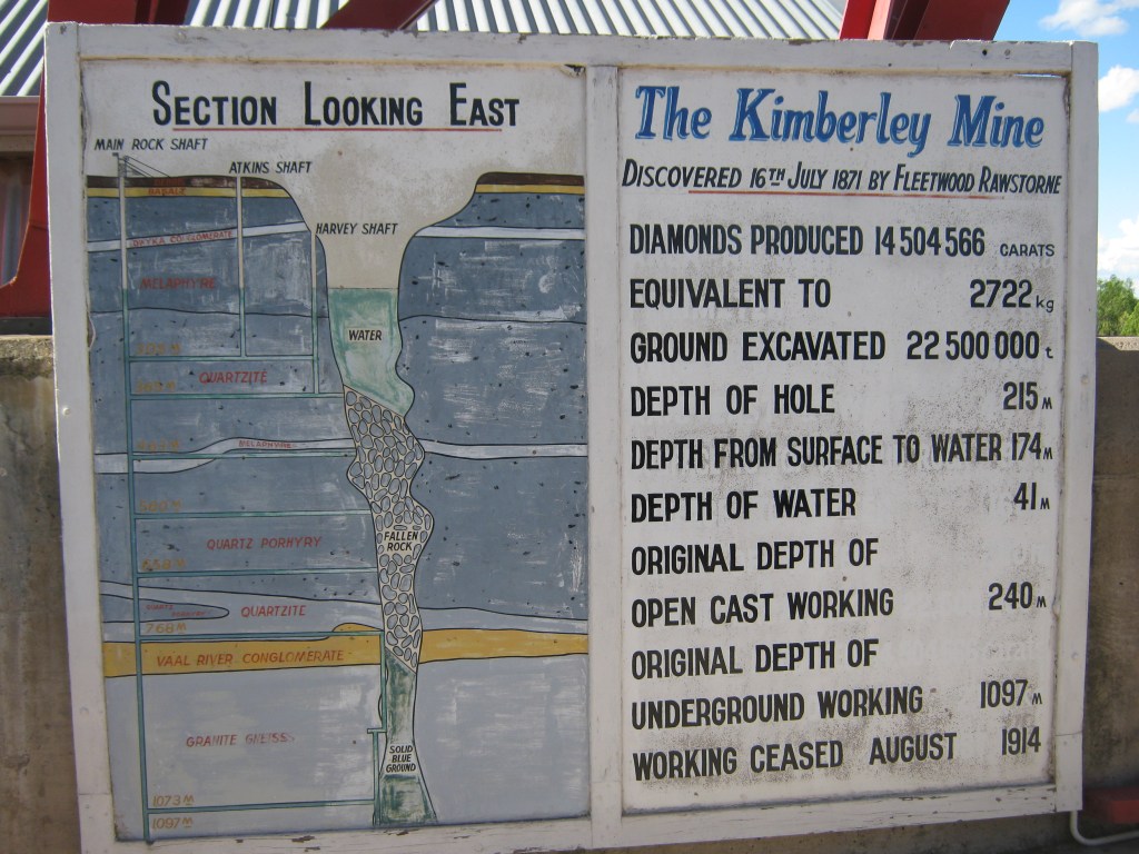
Pictured above, this is one of the world’s most famous kimberlite pipes, the smallest of the 5 large diamond-bearing pipes clustered around Kimberley. Roughly oval in shape, and typically carrot-shaped, it narrows as it goes down, from about 300m by 150m at the surface to around 170m by 70m at a depth of about 650m. This is the lower ‘diatreme’ portion of the pipe, and as it descends the narrowing pipe connects with an east-west-trending kimberlite dyke, the probable feeder fissure. This kimberlite is about 87 million years old; the diamonds that it contained are very much older.
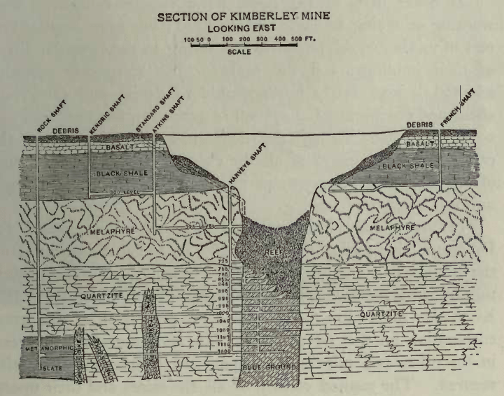
Pictured above, the pipe was dug by hand to a depth of 240m using picks, shovels and explosives to create the Big Hole. Thereafter it was mined underground by a shaft system that reached 1,097m below the surface by the time the mine shut down in 1914. Some 22.5 million tons of rock were removed, from which over 14.5 million carats of diamonds were recovered. Both the grade and the quality of diamonds from this pipe are said to have been higher that those from the other Kimberly mines.
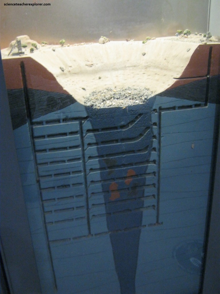
Picture above, when underground mining was introduced, the chambering technique was developed to access the kimberlite ore that had become impossible to extract through open-pit mining. Vertical or inclined shafts were dug some distance from the mine and then tunnels were hewn, intersecting the kimberlite pipe at depth.
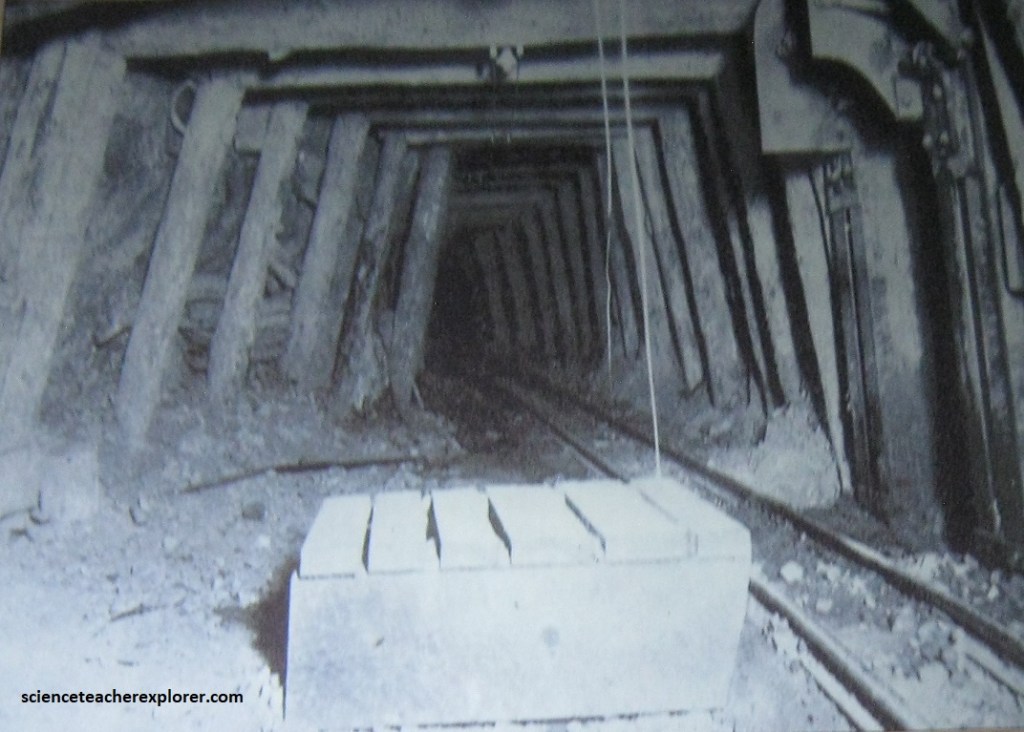
Pictured above, at the end of these tunnels, vast chambers were hewn in the ore. Explosive, affixed to a long fuse, were rigged into the kimberlite ore and thus the diamond-bearing rock body was blasted. The ore crumbled into the chambers and then it was loaded onto cocopans and brought to the surface for sorting. [This chambering technique is the forerunner of today’s Blast Hole Open Stoping mining method]. Once ore had been extracted from one level, a new series of shafts and tunnels was constructed lower down and the extraction process was repeated. Each new set of chambers was therefore much deeper underground.
The secret to diamond’s superlative properties lies in the nature of its carbon bonding at high pressure and temperature. Carbon has four available electrons in its outer shell. In diamond, these electrons bond with four others form four adjacent carbon atoms, resulting in a tetrahedral unit of strong covalent bonds. The atoms are tightly packed together, giving diamond not only a high density (3.51), but also a repeating structural unit of eight atoms arranged in a cube. Because of the cubic symmetry of the atoms in the diamond lattice, diamond can grow into at least two different crystal shapes.
The common, well-known shape of perfect diamond growth is the octahedron (an eight-sided crystal). Cubes (six-sided) tend to grow when growth rates are fast. Twinned crystal are common, and most abundant are flat shapes known as mackles. Other shapes are just s common, but are not growth shapes; rather, these are shapes caused by the chemical dissolution of diamond. Most common shapes in diamonds from South Africa are rounded duo-decahedrons (12-sided). Typically caused by the chemical resorption of eight-sided octahedrons. Natural breakage is also common and this forms diamond fragments of no shape. The famous Cullinan Diamond was simply a large fragment of even bigger diamond.
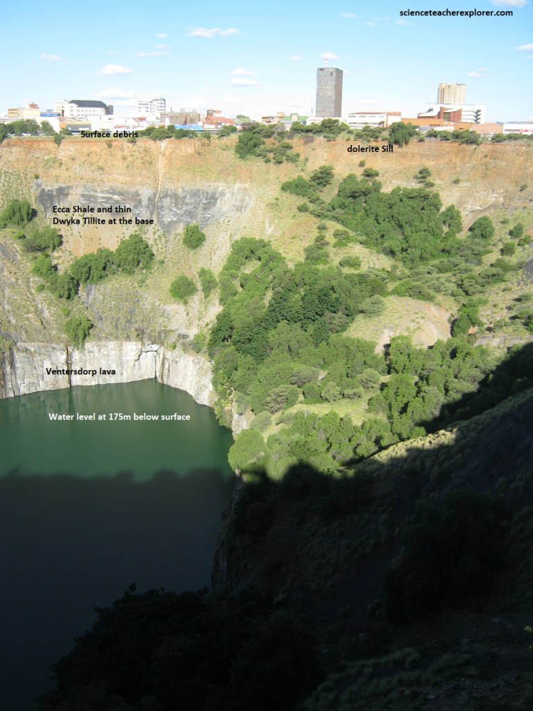
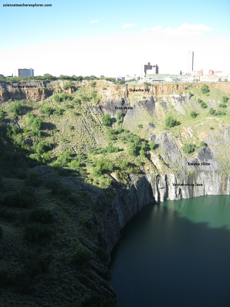
Pictured above shows the geology in the upper part of the “Big Hole” excavation. The thin brown top layer is surface debris atop a weathered dolerite sill, followed by a thick layer of blueish Karoo (Ecca group shale) and thin Dwyka Group tillite that overlies the much harder solid vertical wall of Ventersdorp Supergroup lava. The water level has settled at around 175m below the land surface.
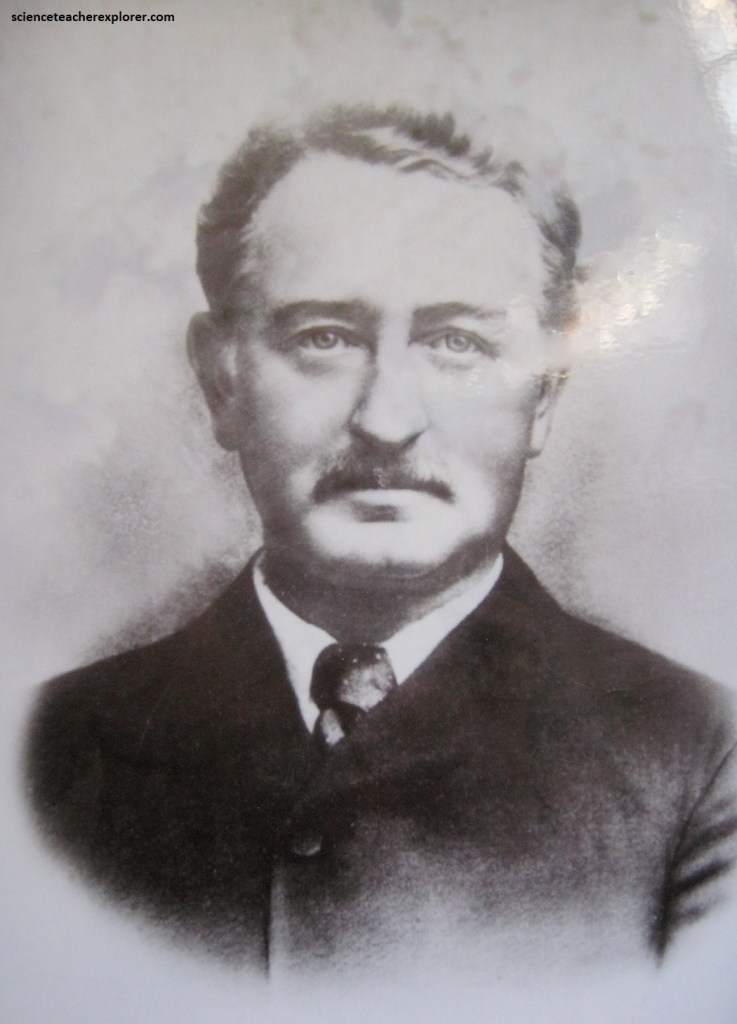
Pictured above, Cecil John Rhodes was a statesman and empire builder who had the greatest influence of any single person on the history of the African continent. The son of an English parson, he was sent to South Africa on account of his lung condition. Here he joined his brother, and they soon made their way to the diamond fields, where Rhodes gradually advance from being a speculative digger to forming De Beer Mining Company in 1880 and De Beers Consolidated Mines Ltd in 1887. He also acquired a large stake in the Transvaal gold mines and formed the Gold Fields of South Africa Company in 1887.
150 years ago, the site of the Big Hole was a featureless, flat-topped hill. When word spread that diamonds had been discovered, thousands of prospectors, armed with nothing more than picks, shovels and hope, descended on Kimberley and created the largest hand-dug excavation in the world. Kimberly is one of the most unique and authentic historical destinations in South Africa.
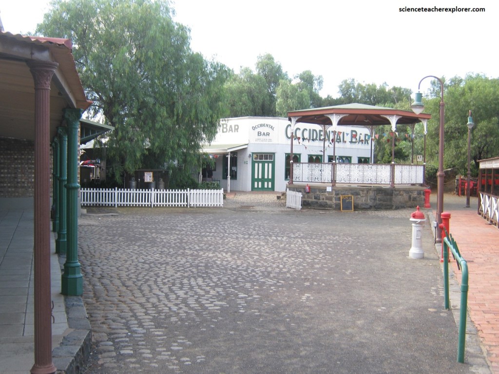
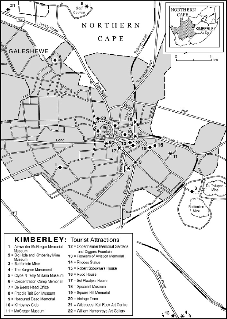
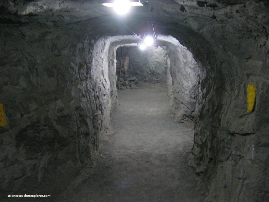
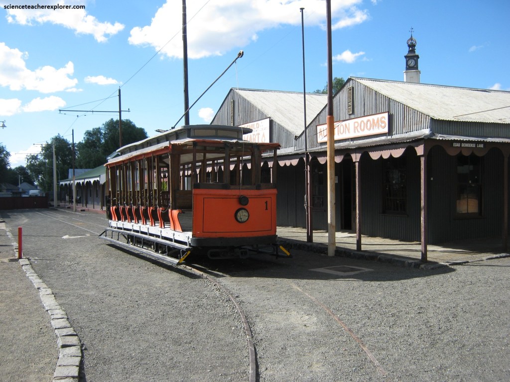
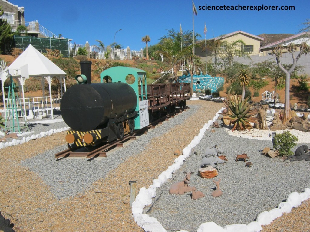
The Kimberley Mine Museum, located nearby, is a recreation of the town in its heyday. While visiting, we were able to go underground in a recreation of a mine shaft from the time period, watch a film about diamonds in Kimberley, visit an exhibition center, see a cut and uncut diamond display, use the new viewing platform to get a bird’s eye view of the Big Hole from above, and visit the Old Town to see Kimberley in its prime, (pictured below).
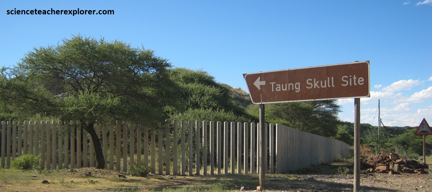
In March of 2024, Mike and I, continued our trek of the Northern Cape by driving through Taung, South Africa, (137km from Kimberly on N18). The South African fossil site of Taung is famous for the type specimen of an early hominin known as Australopithecus africanus, which first demonstrated human origins in Africa. The Taung child skull was blasted out of an ancient cave infill during quarry operations at the Buxton Lime-works, near the village of Taung. It is the southern-most Pliocene anthropologic site, and indeed has the greatest latitude of any such fossil site. Pictured below, the studies indicate that the Taung Child was recovered from 3.03–2.61 million year old deposits that are stratified within volcanic-tufa.
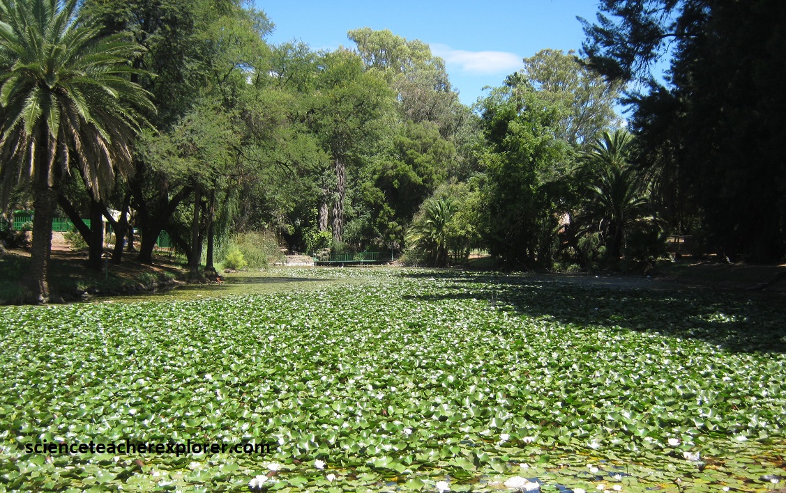
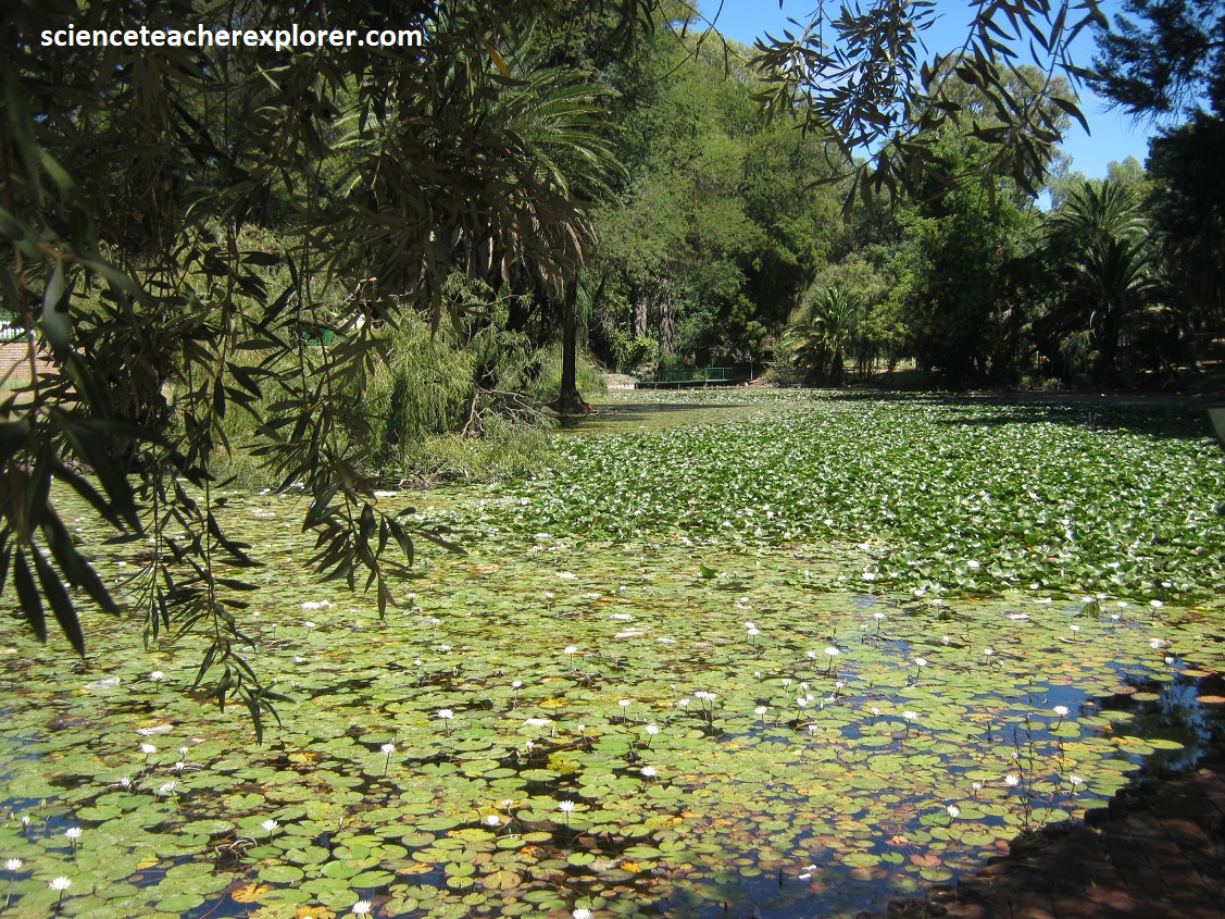
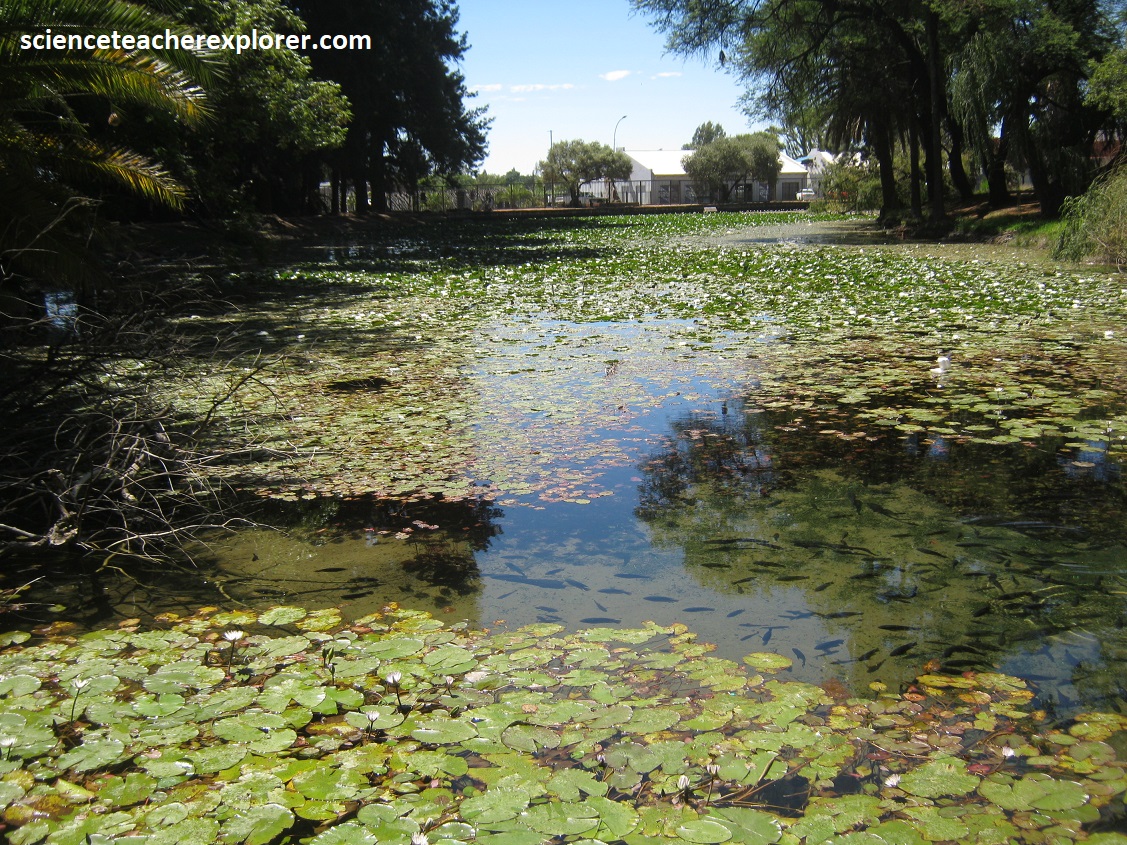
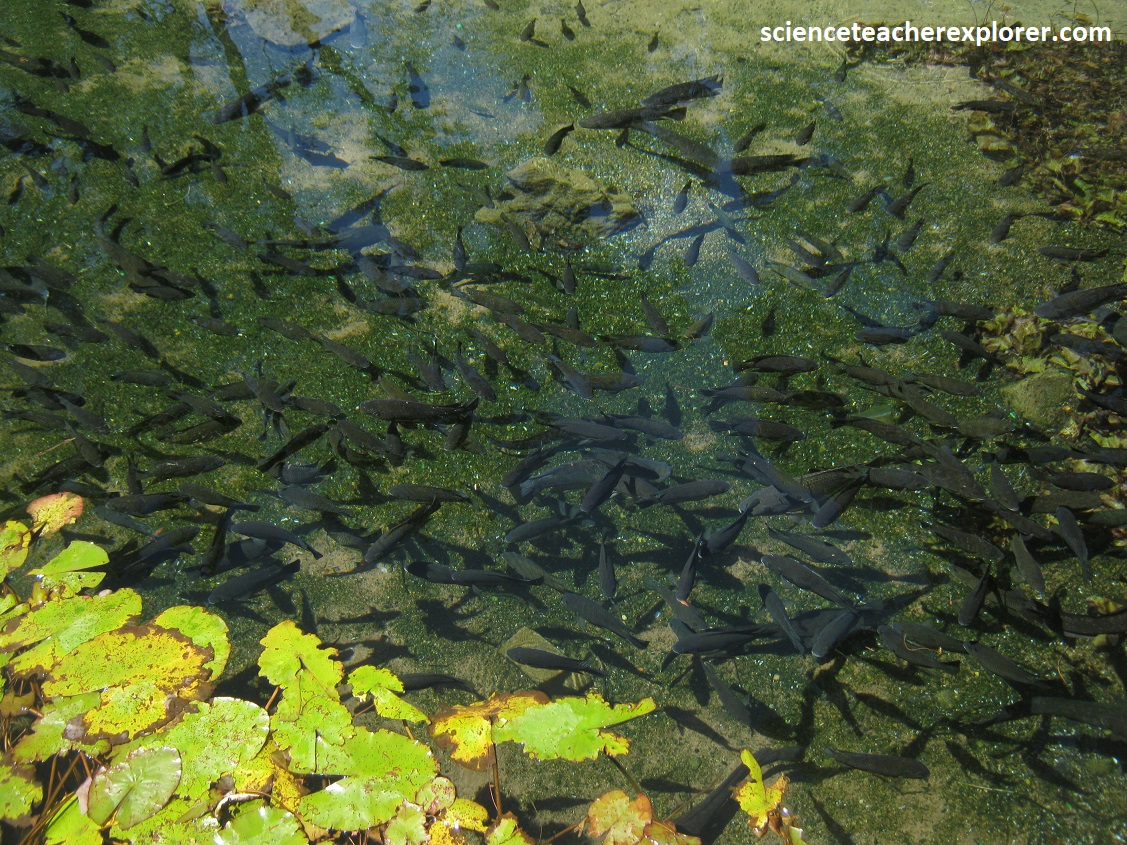
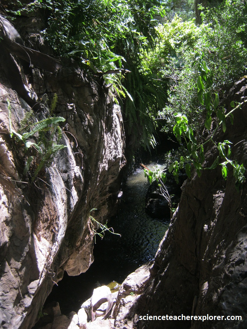
Mike and I continued driving north on N18 and turned southwest on N14. We drove to Kuruman, South Africa. This is the location of the “Eye”, where more than 20 million liters of pure water gush out of the ground every day, (a reliable and never-ending supply of water in the southern portion of the Kalahari Desert). It runs into a large, lily-covered pond that is home to a variety of large fish.
Kuruman is located on the northwestern edge of the Ghaap Plateau, a remarkably flat limestone formed in the warm and shallow sea from around 2.5 billion years ago, and close to the north-south-trending, ironstone-dominated Kuruman Hills. The surface overlies a zone of ancient Karstic solution cavities and channels, (the makings of a good aquifer). The Ghaap Plateau is crisscrossed by many vertical volcanic dikes, mostly oriented roughly north-south and northwest-southeast. At Kuruman there is also an east-northeast-trending dike parallel to the N14 highway. These volcanic dikes result in large hydrogeological compartments being formed in which ground water collects or form barriers for the movement of ground-water.
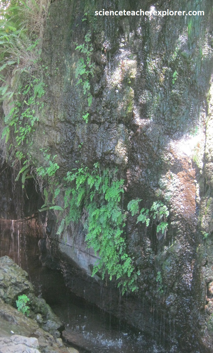
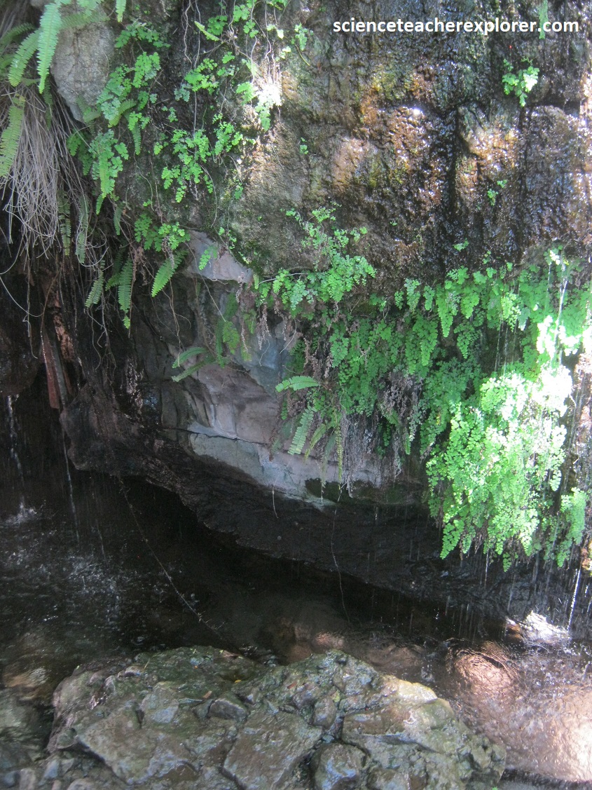
Pictured above, it is from this inconspicuous, fern-covered cleft in the 2.5 billion year old “Cambell Rand” limestone/dolomite that the Eye of Kuruman produces the vast and constant flow of crystal-clear water. Kuruman, alongside the usually dry Kuruman River, is located in a topographic 1,300m low, so ground water from the Ghaap Plateau to the east and the Kuruman Hills to the west flows towards the town. Additionally, the “Eye” is located in the northeast corner of a dike-bounded ground-water compartment and the Gravitating ground water is literally pushed to the surface at the lowest point. For the community, this is the perfect location to take a picnic and enjoy the coolness of the Spring in the hot-summer. Some of the locals believe that the spring is sacred and has special healing properties, (pictured below).
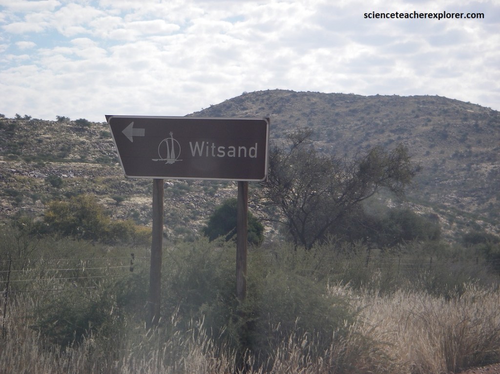
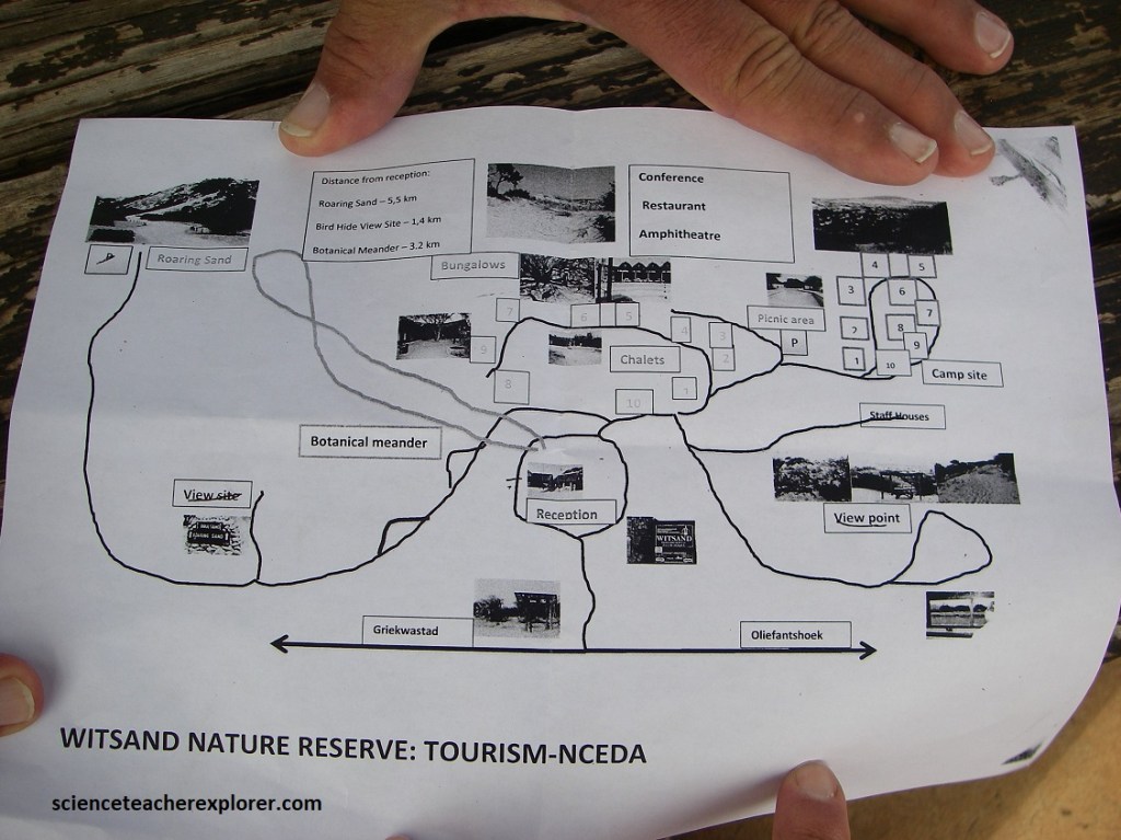
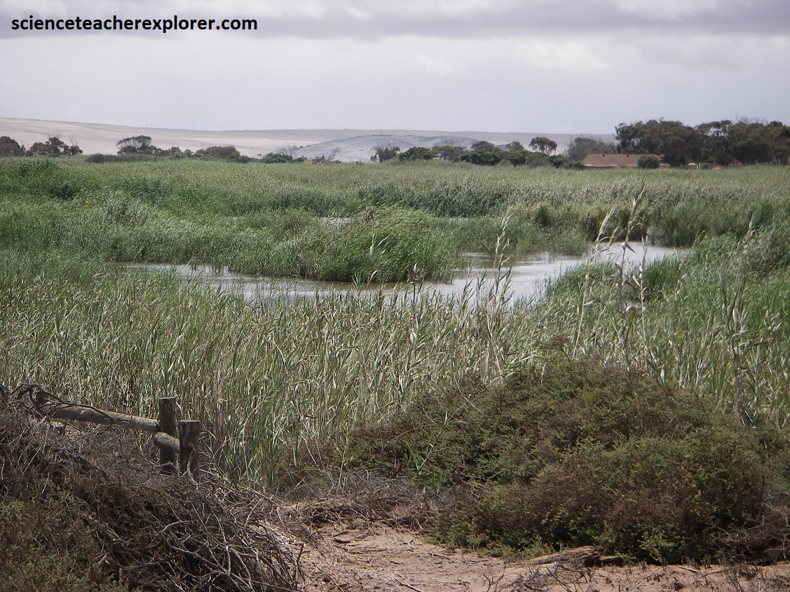
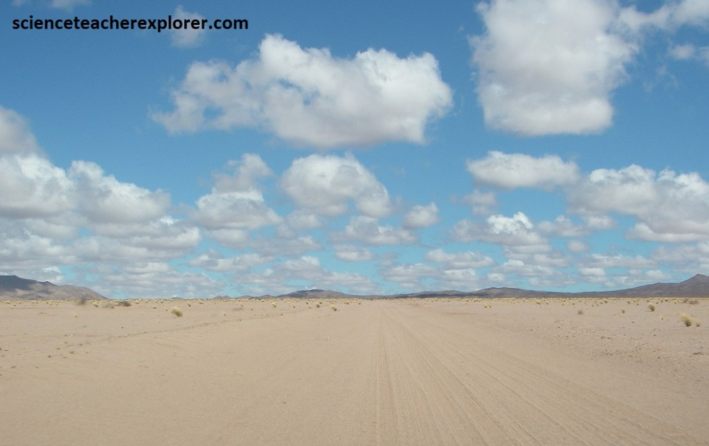
From Kuruman, we continued driving, southwest on N14 towards Upington 263km away. The northwestern area of the Northern Cape is Kalahari Desert country, (large areas of semi-arid land, often covered with a layer of reddish wind-deposited Kalahari sand). East of Upington, however, lies a series of large, white sand dunes which form a stark contrast to the red sands of the Kalahari Desert, and sits incongruously against the surrounding landscape. These dunes are called the Witsand (White Sand) and are protected within their own nature reserve. I visited this area in 2025, (pictured below).
It is not just their color that sets the sands of Witsand apart. When the sand is dry and hot, any disturbance causes the dunes to “rumble,” “roar,” or “hum.” The sand actually emits a very distinctive, low-pitched noises that has been likened to the roar of water from rapids or waterfalls heard from a distance. Because of this sound, the dunes have become known as the Brulsand or “roaring sands.”
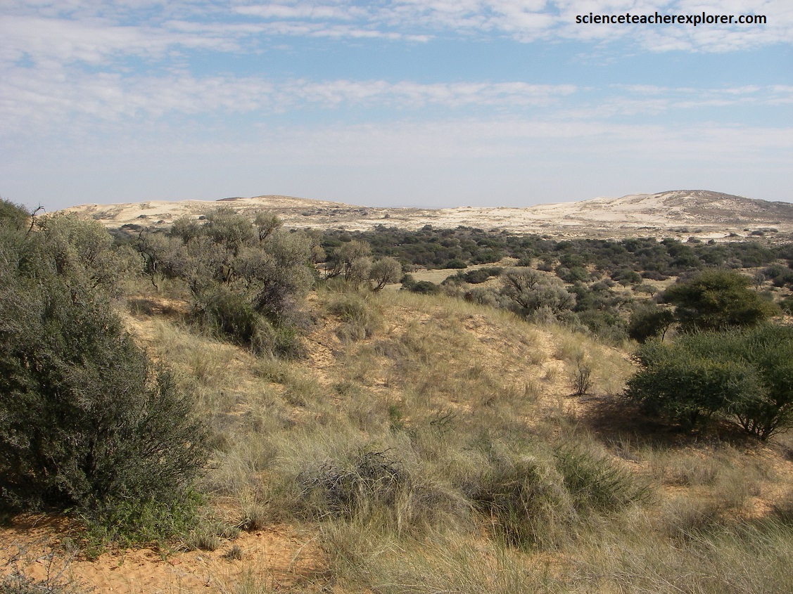
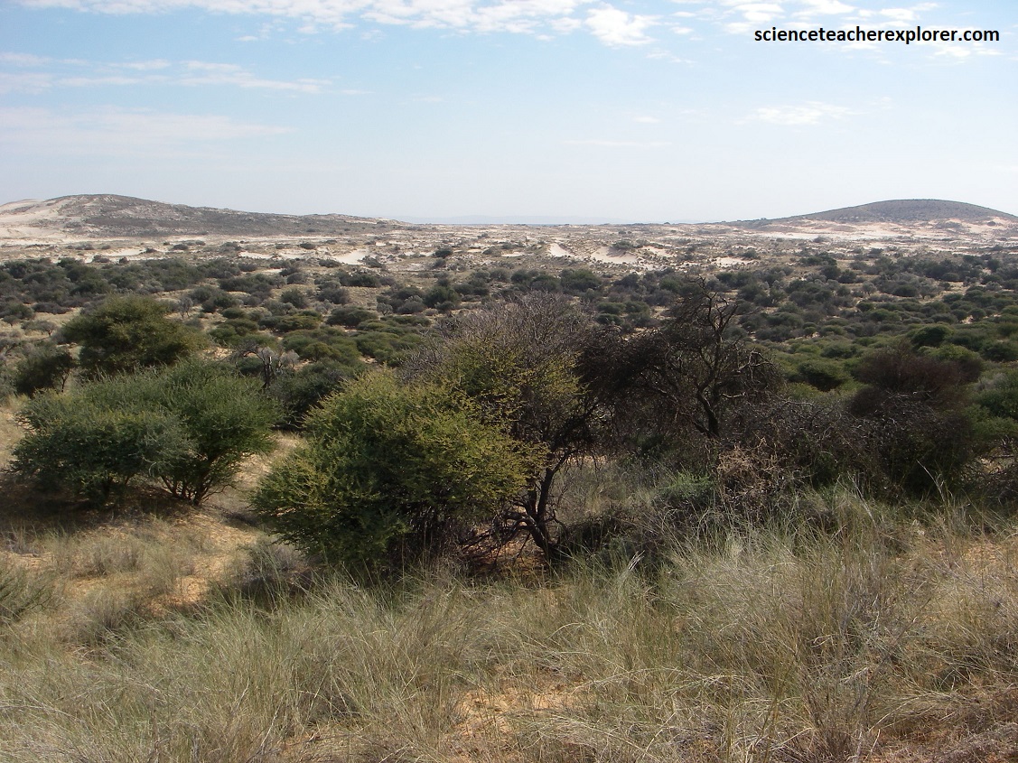
Pictured above, between the dunes is a series of valleys where, despite the dryness of the area, there are wet places known as “vleis.” These are fed by water creating a wholly different oasis environment which supports many plants and animals, and forms a startling contrast with the barren dunes on either side.
Witsand Nature Reserve is approximately 3500 ha in size, most of which comprises the unique dune system. Witsand is situated at the foot of the Langberg Mountains. The rocks forming the Langberg are estimated to be between 1.9 – 2.0 billion years old and form part of what is known as the Olifantshoek Supergroup.
The Witsand covering these formations is much younger, (only approximately 65 million years old). The sands form part of the Kalahari Group. This formation can be almost half a kilometer deep at places, but in the Witsand system they average 70m in depth.
The Witsand System consists primarily of aeolian (windborne) sand. This extremely light and fine Kalahari sand was blown into the quartzite formation that underlies the dune system and hold vast quantities of spring, runoff and rainwater. In time the oxides are leached from the sand, providing the many different colors and nuances, giving the dunes their particular beauty.
It is estimated that between 20-30% of the basin volume is now filled with water (both surface and groundwater). The heavy clay and fine silts allow very little evaporation to occur and act as a sponge retaining the bulk of the water. It is estimated that the quartzite basin hold no less than 1211 million cubic meters of water at any particular time. The water is extremely pure throughout the system, and is known to contain fewer solids than rainwater.
The Witsand System as it is today, is situated approximately 1200m above sea level, and comprises a combination of linear and parabolic dunes which vary between 20m and 30m in height. The dunes run a length of 9km in a NE-SW direction and are up to 9km in width.
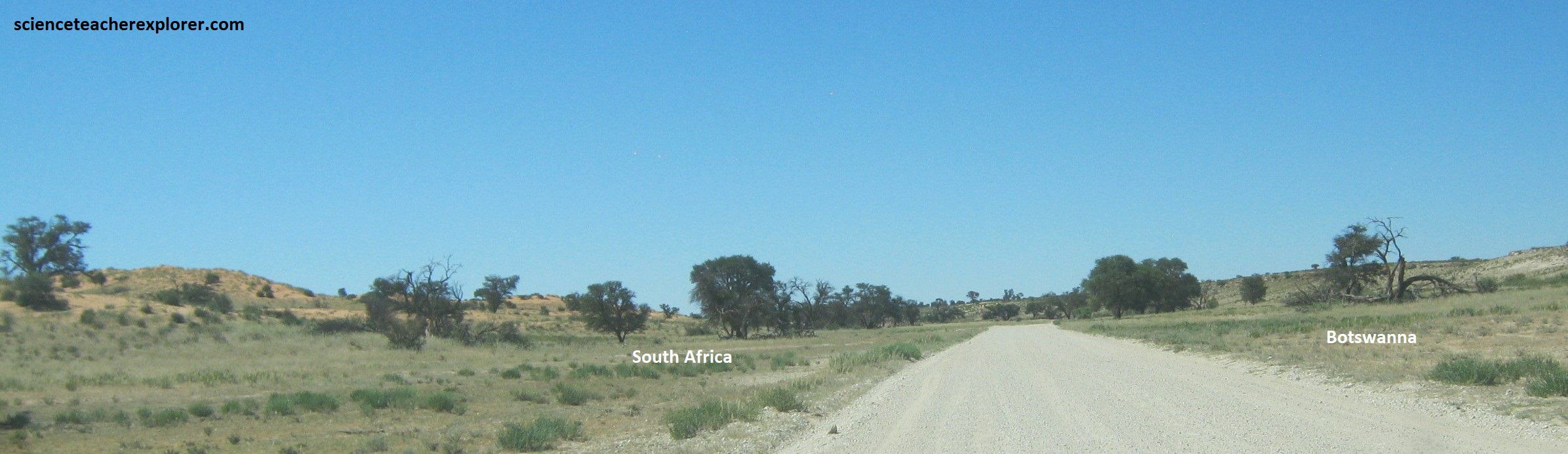
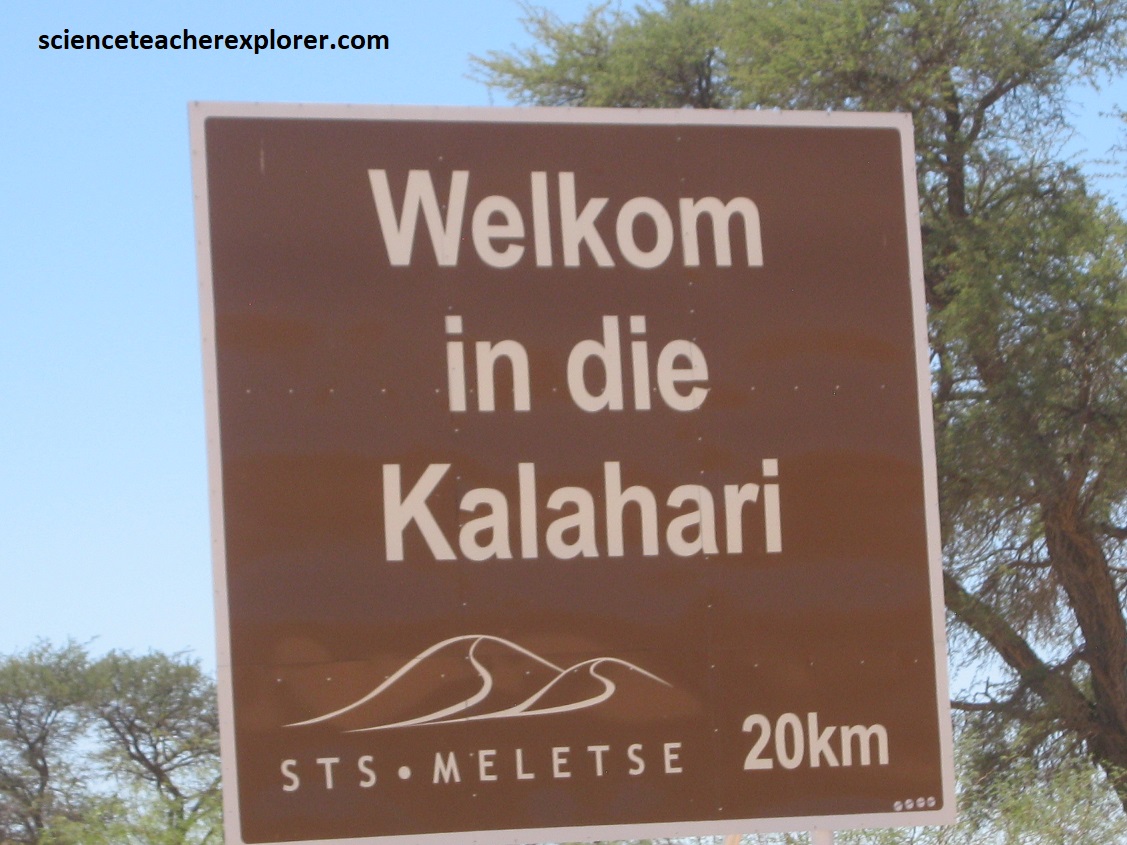
From here, at Witsand, we took a day to briefly explore the Kgalagadi Transfrontier National Park. The distance from Upington to Twee Rivieren at the front gates is 253km. Kgalagadi’s meaning is of “a place of great thirst”.
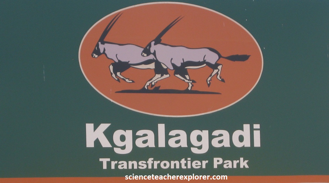
Africa’s first peace park, (the Kgalagadi Transfrontier Park), was formed by the amalgamation of Kalahari Gemsbok in South Africa and Gemsbuck National Park in Botswana. Spanning more than one country, the peace park unifies fragmented ecological habitats across national boundaries, and promotes environmental and political stability, (imaged below).
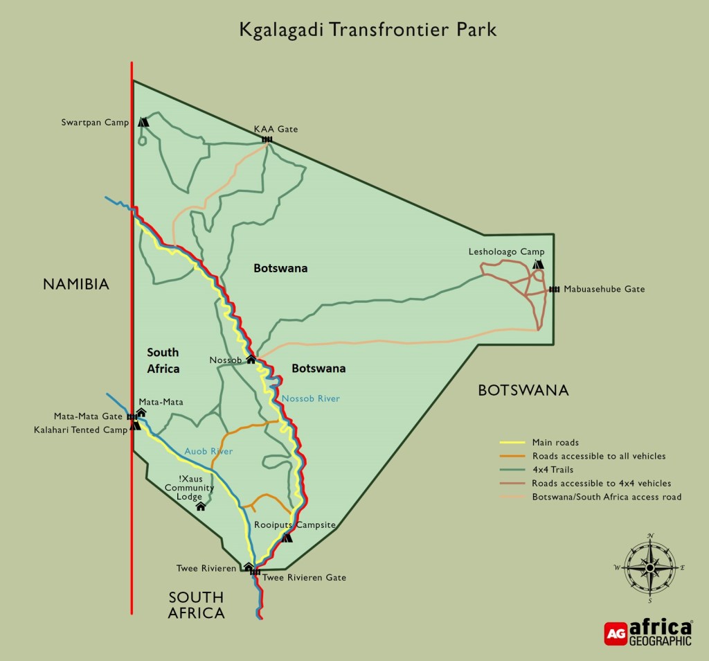
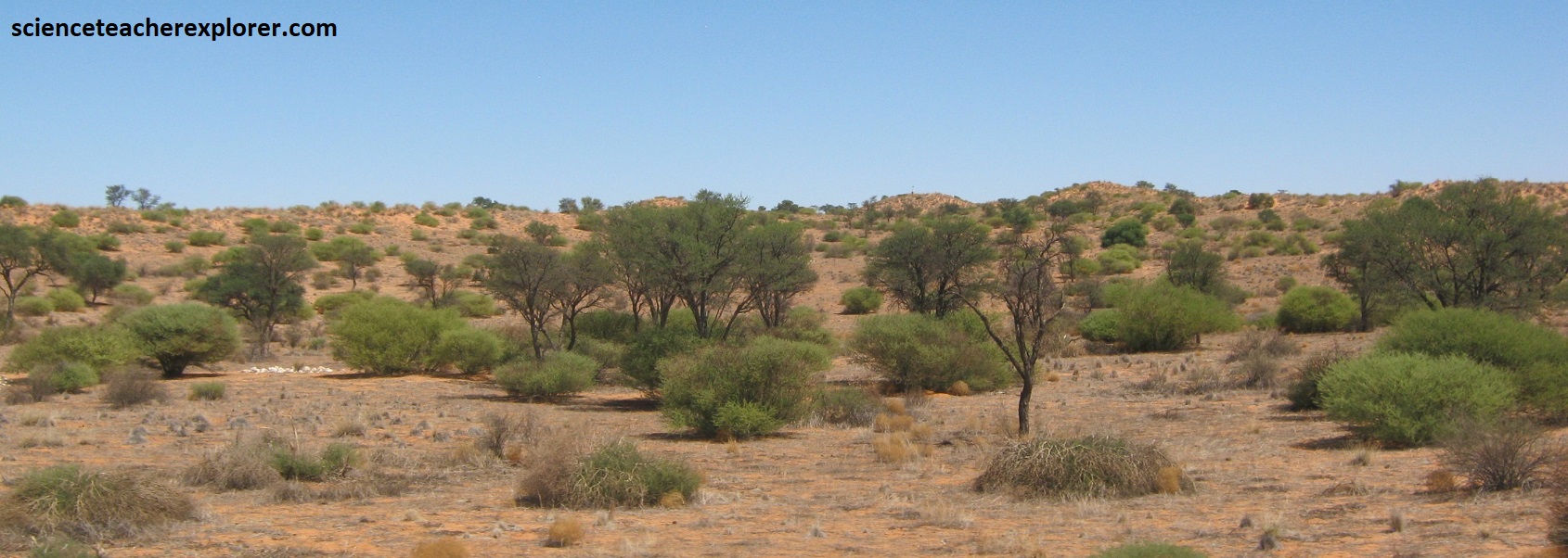
At the heart of the Kgalagadi Tranfrontier Park are two river, (the Auob and the Nossob), which flow southward to the Molopo River, carrying valleys through the red sands of the Kalahari, (pictured below). We chose to drive up the Nossob road for a little while.
The park covers an area of 3.8 million hectares and is home to a diversity of wildlife which has specifically adapted to survive in the harsh, dry climate.
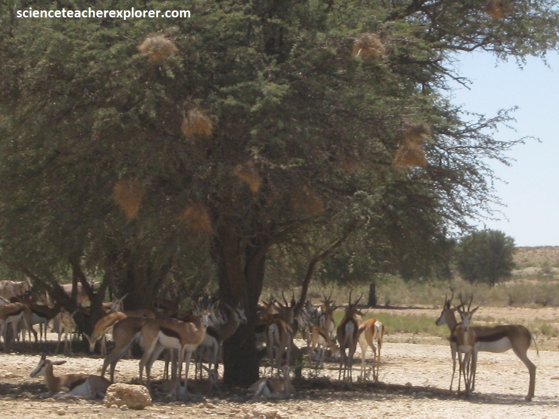
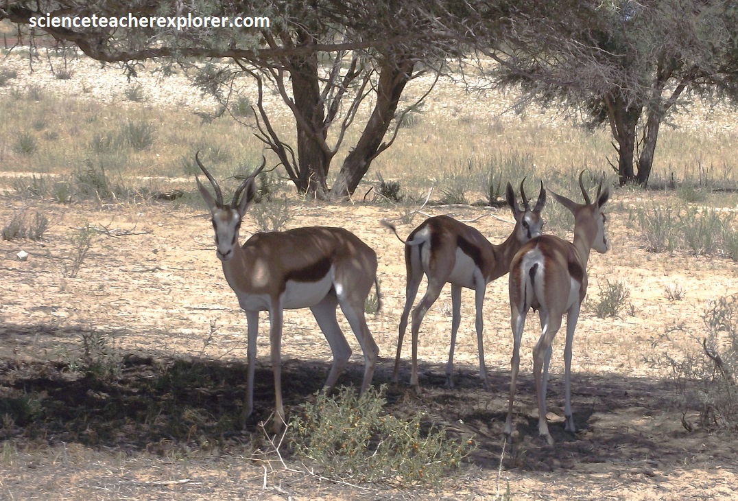
Pictured above, a herd of Springboks, (Antidorcas marsupialis), are well adapted to live in this harsh environment. Their diet comprises a wide variety of grasses, shrubs, herbs and fruit. Being able to breed throughout the year allows short lambing intervals when the most food is available, usually between February and March, at Kgalagadi Transfrontier Park. With all the lambs being born at the same time they are less vulnerable to predators, as only a small number of the new lambs can be preyed upon. The springbok’s familiar ‘pronking’ is believed to be a signal to possible predators that the animal is fit and strong and would not make an easy catch. It is also used to warn other springbok against danger, or it can merely communicate enthusiasm. In the past, springbok would gather in large herds (tens of thousands) in their search for greener pastures in arid areas. These large scale migrations have been curtailed by extensive fencing, farming and hunting.
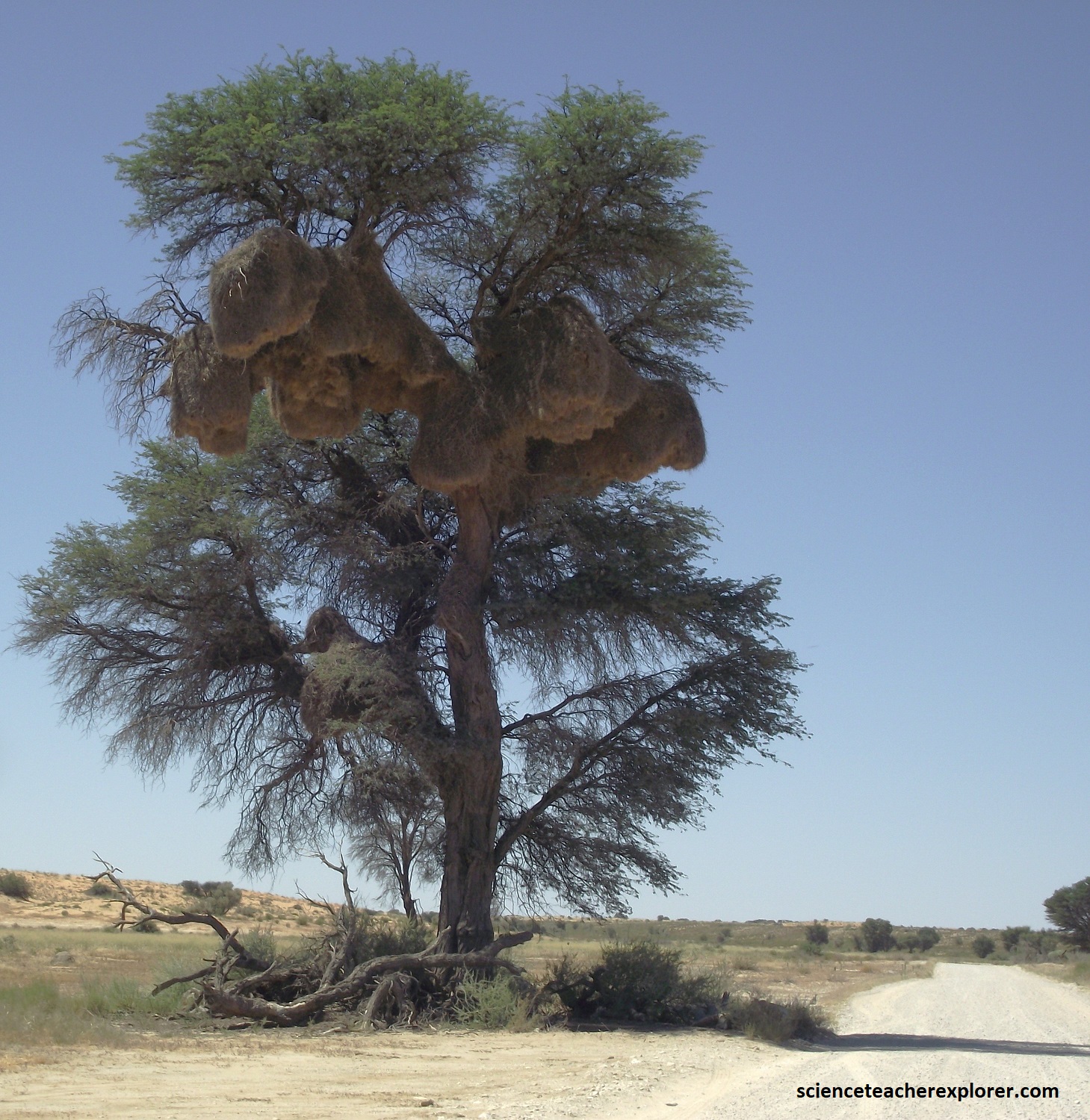
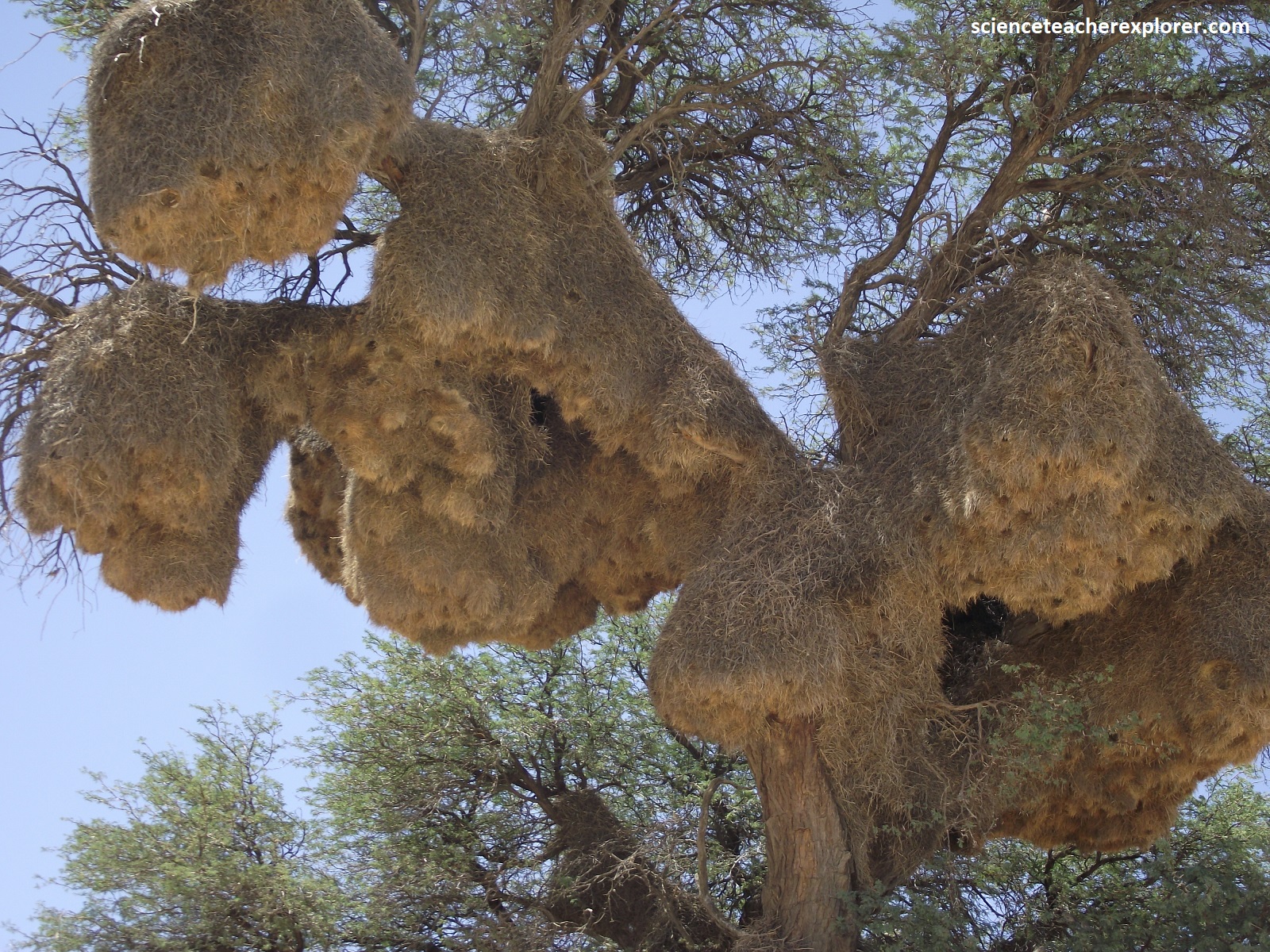
The sociable weaver is a small bird that lives in the dry northwest & Northern Cape of South Africa. Although unremarkable to look at, its social life marks it out as unusual. Pictured above, it lives in colonies of up to 300 birds, centered on a single huge communal nest. With incredible ingenuity, sociable weavers build nest an astonishing 7m in length, weighing up to 100kg. These cities of woven grass are constructed with a rainproof roof which is made from coarse material, such as sticks supporting thick grass. Inside there are up to 50 nest chambers, (each about the size of a man’s fist), lined with fine grasses, fur, and other soft material collected from the surrounding veld. The nests also have a downward-facing entrance tunnel that is lined with grass straws pointing inward to prevent snakes and other predators from entering. It is common for other species to act as squatters in the nest.
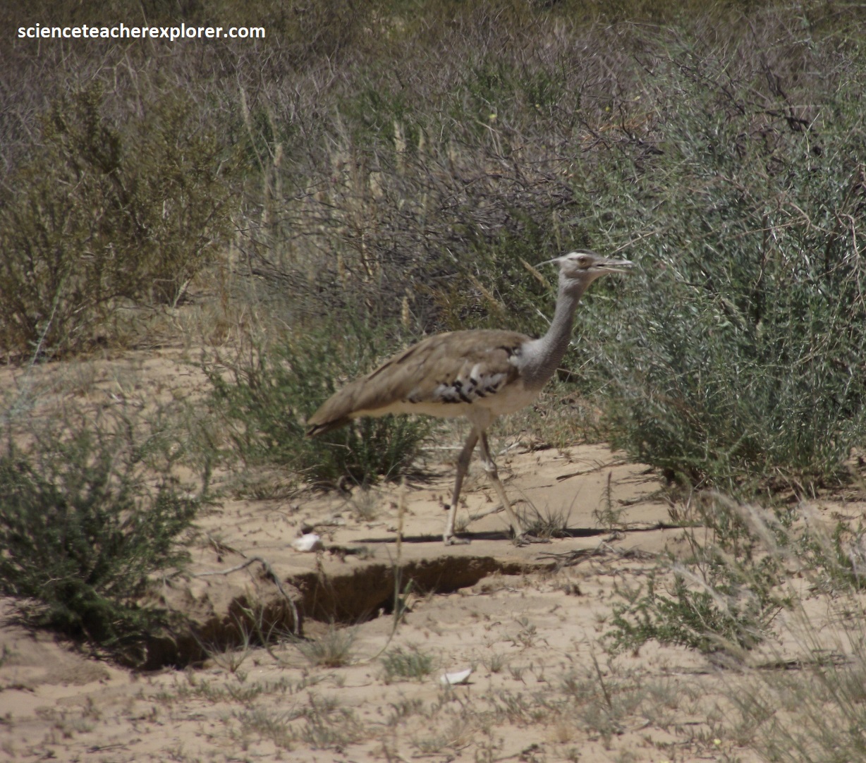
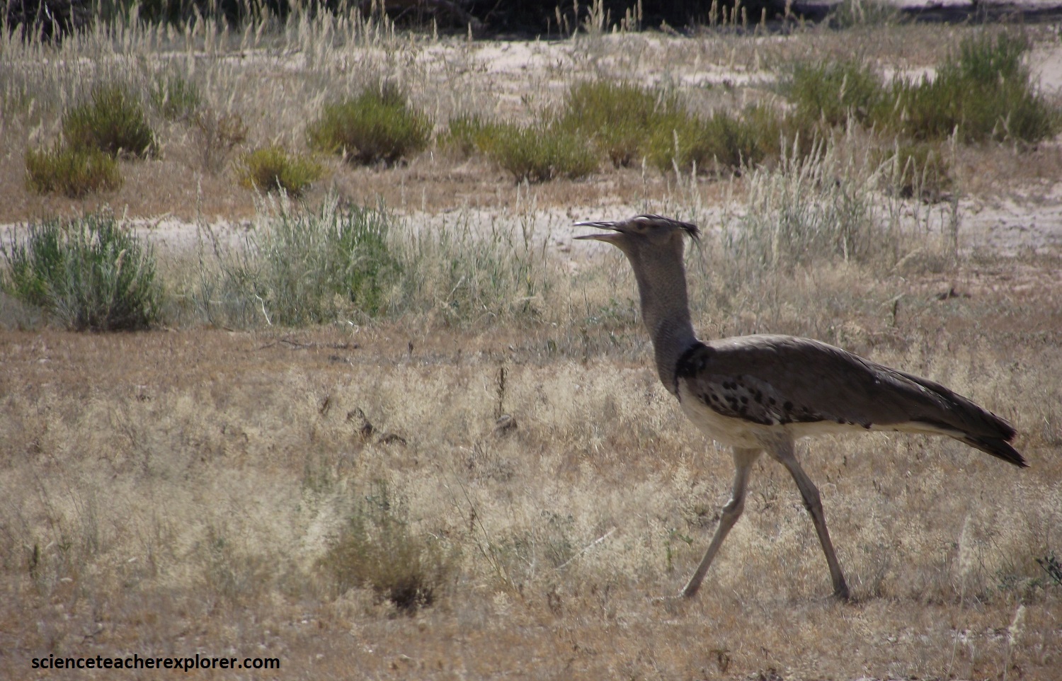
Pictured above are two Kori Bustards, Ardeotis kori, along the Nossob River bottom in the Kgalagadi Transfrontier Park. This is South Africa’s heaviest flying bird. These large bustards had a dark crested head and a greyish barred neck. The backs and wings were pale brown and the bellies were white. The strangest thing about them is that they both seemed to walk slowly with their bills held slightly upwards. A proud looking character.
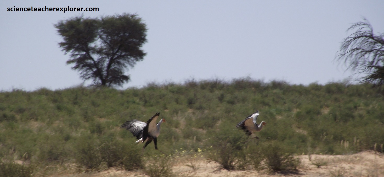
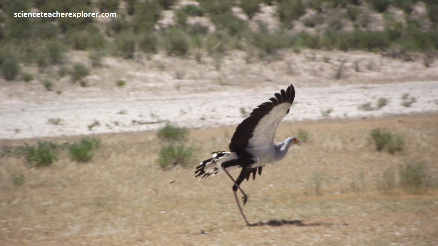
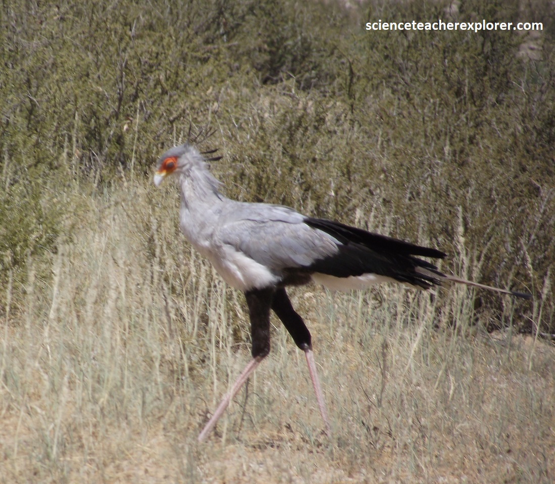
Pictured above are couple of Secretarybirds, Sagittarius serpentarius, that seem to be playing tag, (one running after the other). They both had very long tails and legs. They had long droopy crests at the nape, as well as their bellies, tails, and rumps were black. Additionally, their faces were characteristically orange. I do believe the Secretarybird forages for prey on the ground and they seldom fly, but in this case, I witnessed both birds flying a short distance. One chasing the other.
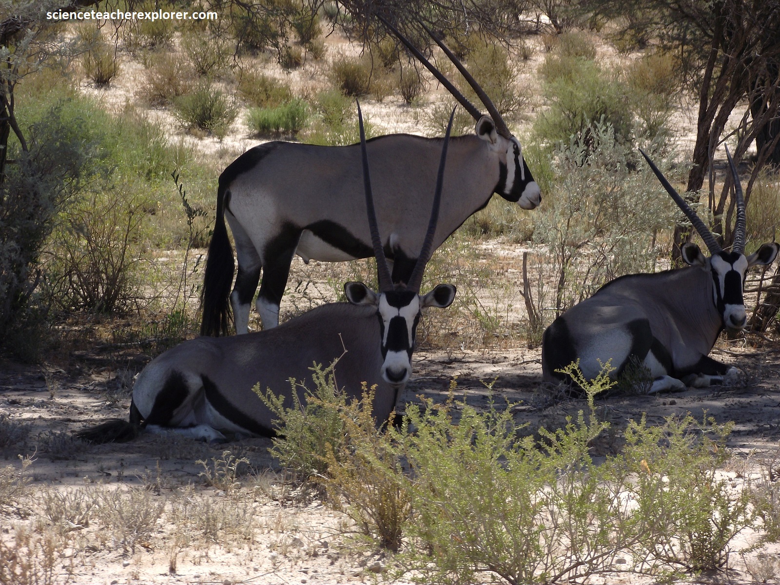
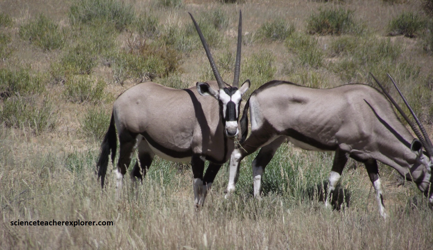
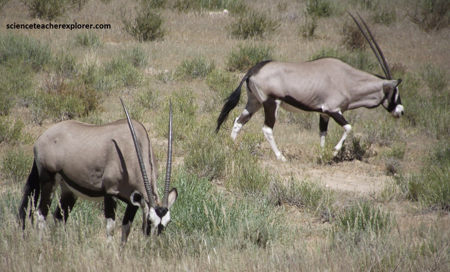
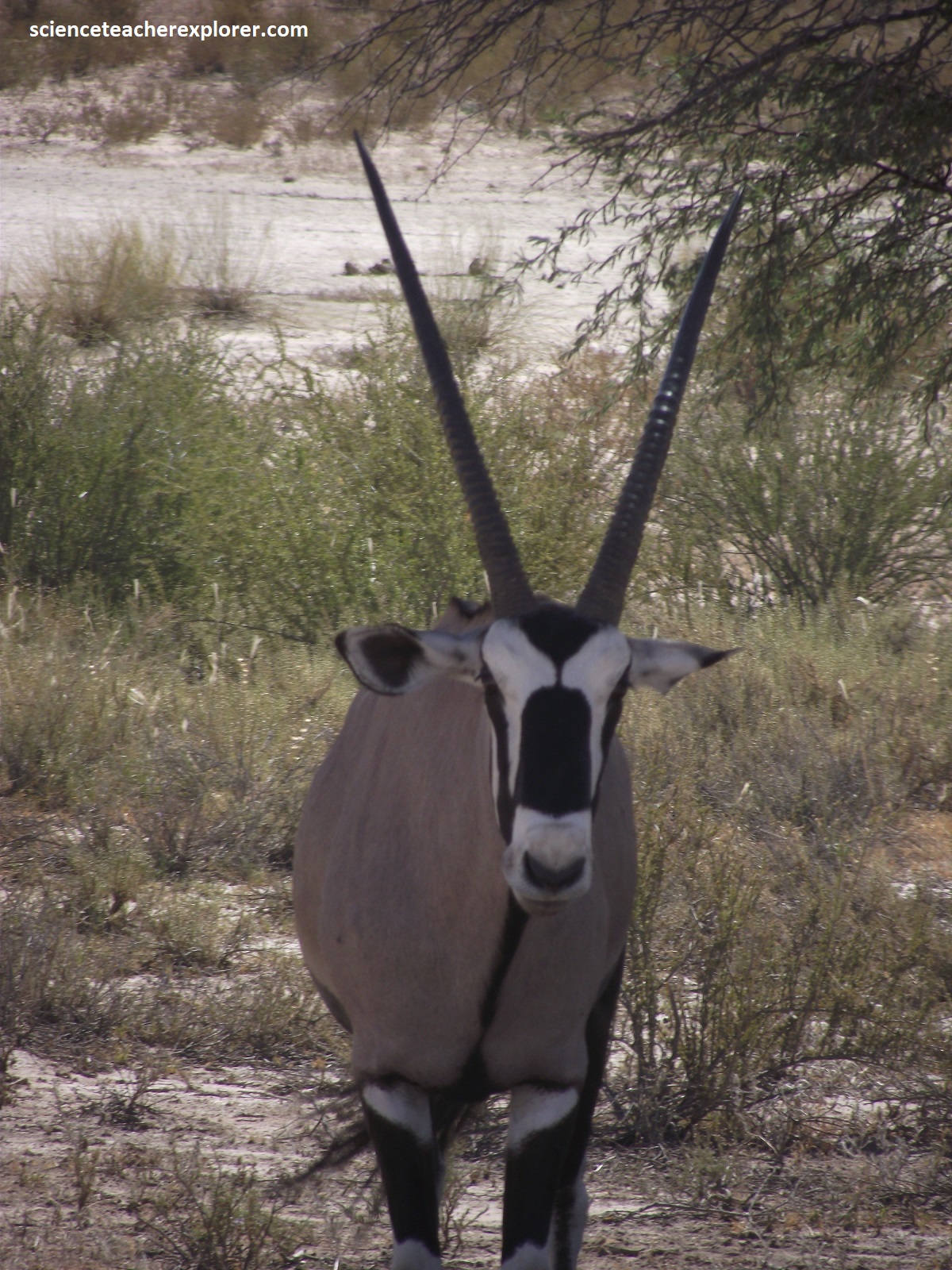
Pictured above are several Gemsboks, (Oryx gazella), that seem to be grazing and resting at the Kgalagadi Transfrontier Park in the Northern Cape of South Africa 2024. These large grazers may be seen on the grassy river bottoms of the park. They are perfectly adapted to desert environments and do not need to drink water, but rather obtain moisture from eating a wide variety of food including succulent plants. They feed mainly at night when the moisture content of the vegetation is high. A well-adapted digestive system ensures that as much moisture as possible is extracted before the waste products leave the body, as concentrated urine and dung. Gemsbok have adapted well to the high temperatures of the Kgalagadi Transfrontier Park. They are able to raise their body temperature above that of the environment. In this way they lose heat to the surroundings. A highly vascularized lining in the nasal region allows warm, oxygen-rich blood from the body to be cooled before it reaches the brain. In this way the body temperature can be raised while the sensitive brain can remain a few degrees cooler. Gemsbok in the Park calve throughout the year. Although varying from year to year, depending on rainfall patterns, calving peaks frequently occur in September.
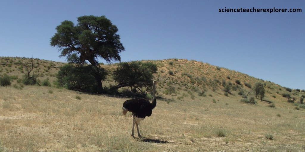
Pictured above is a wild Ostrich, (Struthio camelus), strutting along the river bottom. At 2.5m tall, it is the world’s largest and heaviest bird. It’s significant weight, up to 145kg, prohibits the bird from taking flight. The ostrich as many unique abilities that make it well-adapted to living in the Kalahari Desert. Because the ostrich ha an elongated neck, and large protruding eyes shadowed by long lashes, it has been likened to a camel. But the similarities do not end there. Ostriches can also withstand high temperatures and go for long periods of time without water, usually getting enough moisture from the plants they eat.
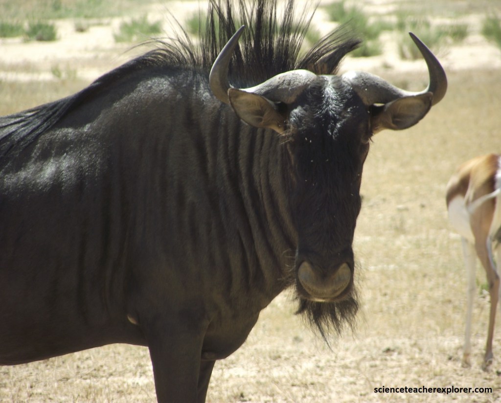
Pictured above is a Blue Wildebeast, (Connochaetes taurinus), hanging out in the Kgalagadi Transfortier Park of South Africa. These are blue-grey cattle-like animals with dark vertical stripes on the neck and flanks. This one had a black face, mane and tail. Here in the park, the herds were quite small. Most were Gregarious.
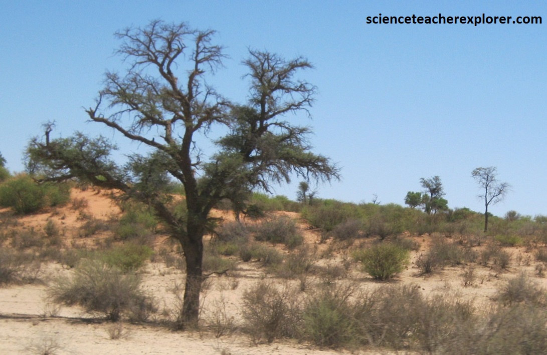
The Kgalagadi Transfrontier Park has terrain that consists of red dunes, sparse veetation, occasional tree, and the dry riverbeds of the Nossob and Auob Rivers. The rivers are said to flow only about once per century. The red sand is the result of a thin layer of iron oxide that coats the grains. The entire western Kalahari Desert is characterized by long chains of dunes, oriented roughly to the north or northwest. Over millions of years, erosion planed off the mountains and formed the low hills that we see in the Kalahari Desert today. The main characteristic of the Kalahari is the nature of the soil is fine sand that color varies from red in the drier parts and grey in the areas that have a higher rainfall. The red soil indicates that it is a dry region.
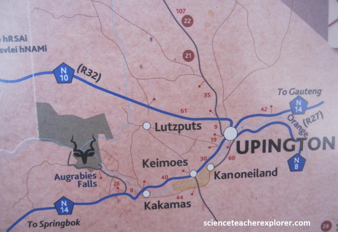
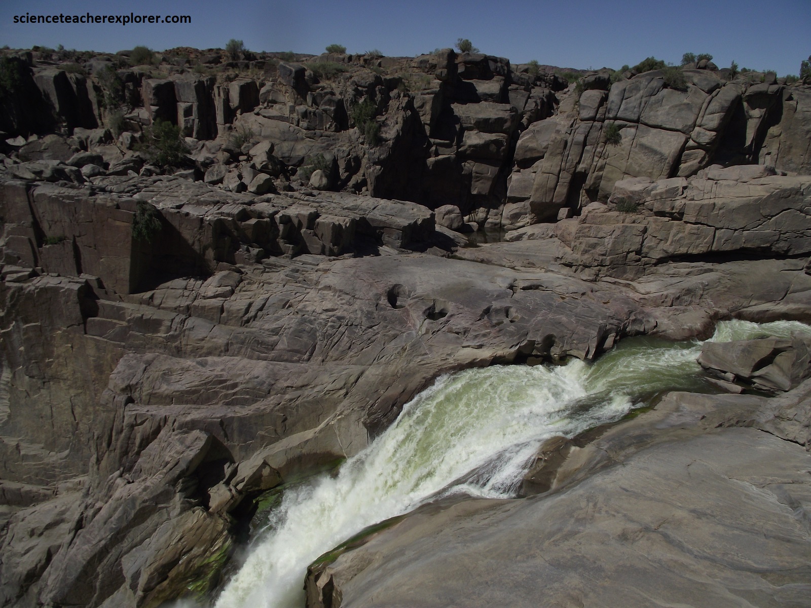
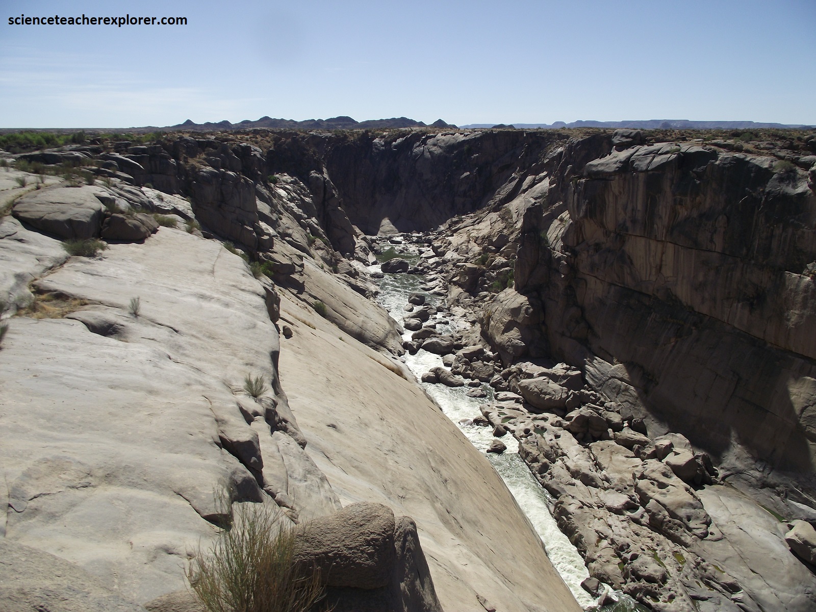
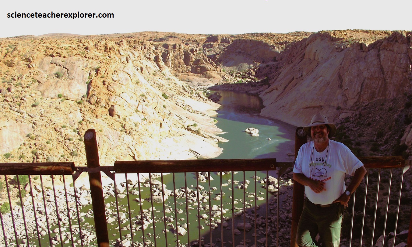
Just west of Upington, was the spectacular Augrabies Falls National Park. The Augrabies Falls, with their granite ravines and gorges, form an impressive feature on the Orange River on the Northern Cape, roughly 80km upstream from the southeast corner of Namibia. The formation of the landscape is such that the falls could only be approached from the south, (imaged above). Pictured below, the water gathers speed as it runs down a series of rapids carve through the granite, giving an initial drop of about 90m. A final rush through a dog-leg an the water hurtles over the final fall of nearly 60m, into a deep surging pool below. The roar of the waters gave rise to its local Khoikhoi name, “the place of great noise.”
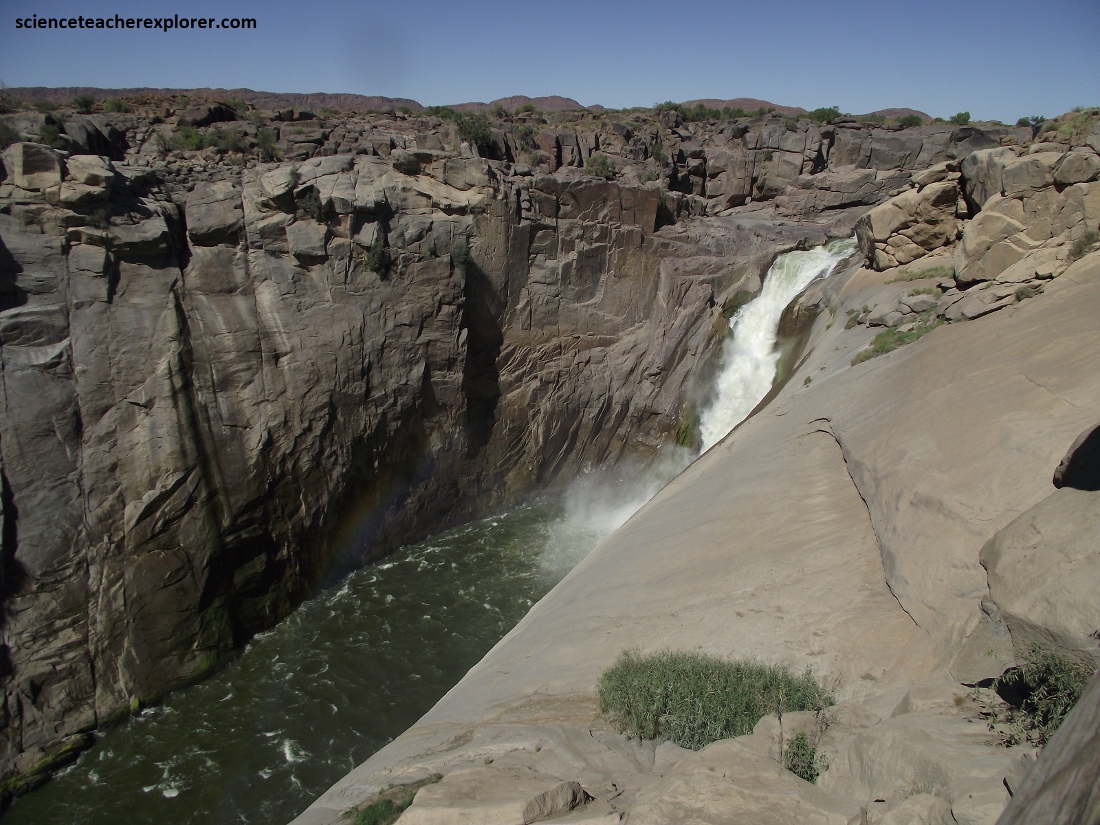
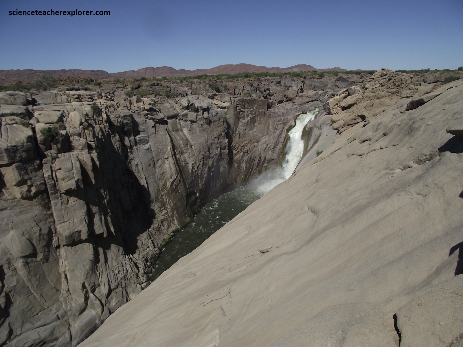
The Augrabies Falls granite is a light grey rock consisting of quartz, pink- feldspar and dark mica minerals which reveal a delicately folded pattern. The peculiar zigzag folds are a dramatic illustration of the intense pressure that prevailed during the metamorphic process when the granite body was formed during the Namaquan Orogeny around 1.1 billion years ago. {Note: A series of earthquakes of unknown cause took place here during the period 2010-2012, indicating deep tectonic disturbances}. Its naturally dark surface is covered by ‘desert varnish’, a shiny black weathering crust typical of certain igneous rocks in arid climates.
Pictured above, a fascinating array of weathering patterns can be seen in these rocks. The decomposition of feldspar causes the hard granite to become crumbly, and hollows are then excavated by wind and rain. Large convex rock surfaces, known as exfoliation domes or ‘whalebacks’ are characteristic of the Augrabies Falls granite. Their formation is related to stress release along sub horizontal joints. Under the influence of chemical weathering, large thin slabs of rock become detached from the rock surface, (pictured above).
Pictured above and to the left, we found west of the falls, ‘Moon Rock’, (an area of bare, weathered Augrabies granitic gneiss domes showing numerous remnant boulders of eroded gneiss.) Pictured above and to the right, is part of the Oranjekom Complex, (a Riemvasmaak gneiss), with a small mafic intrusion called the Swartrante, (black ridges of gabbro and anorthosite).
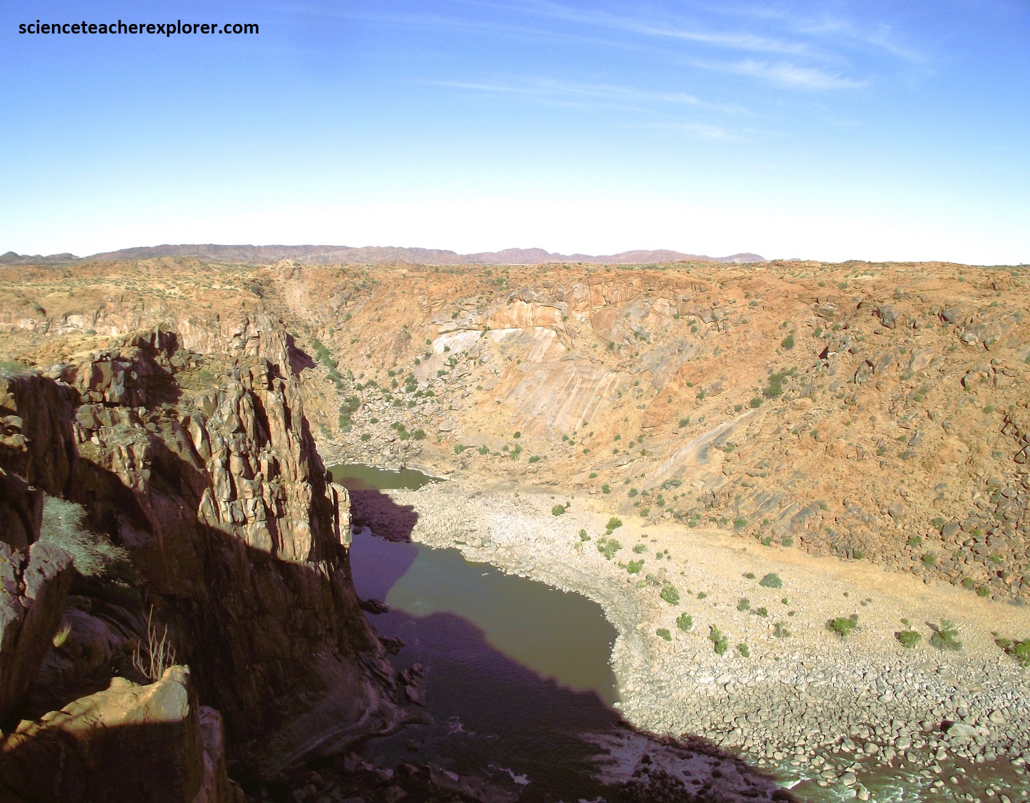
Pictured above, the Augrabies gorge provides an excellent demonstration of the eroding power of the mighty Orange River, which has, over millions of years, carved out one of the most spectacular gorges in Africa, 18km long, up to to 500m wide and about 100m deep. Within the gorge the rocks are largely unweathered, having been recently eroded and smoothed by the river, but by the falls it has been exfoliated into gneissic domes. This indicates a country-wide uplift less than 5 million year ago, that lowered the base level of erosion and the early Orange River started cutting back, the gorge and lengthening it rapidly over time. The Main Falls is a major knickpoint along the lower part of the Orange River where, under arid conditions, strong head-ward erosion has cut its way into the planed-down post-African land surface. Gorge formation was also assisted by major zones of weakness caused by orthogonal structural jointing; this is revealed by the marked zigzag path that the river has following.
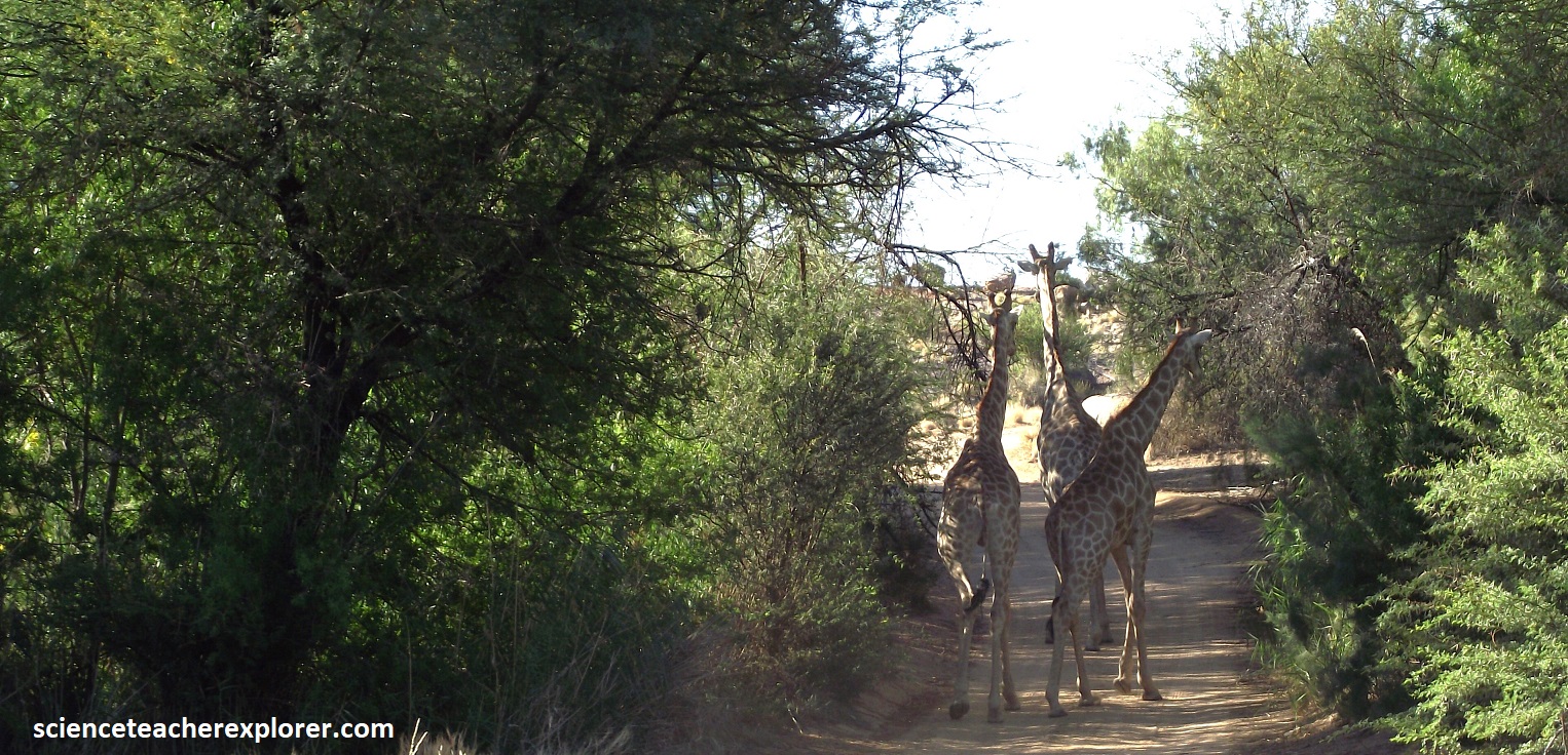
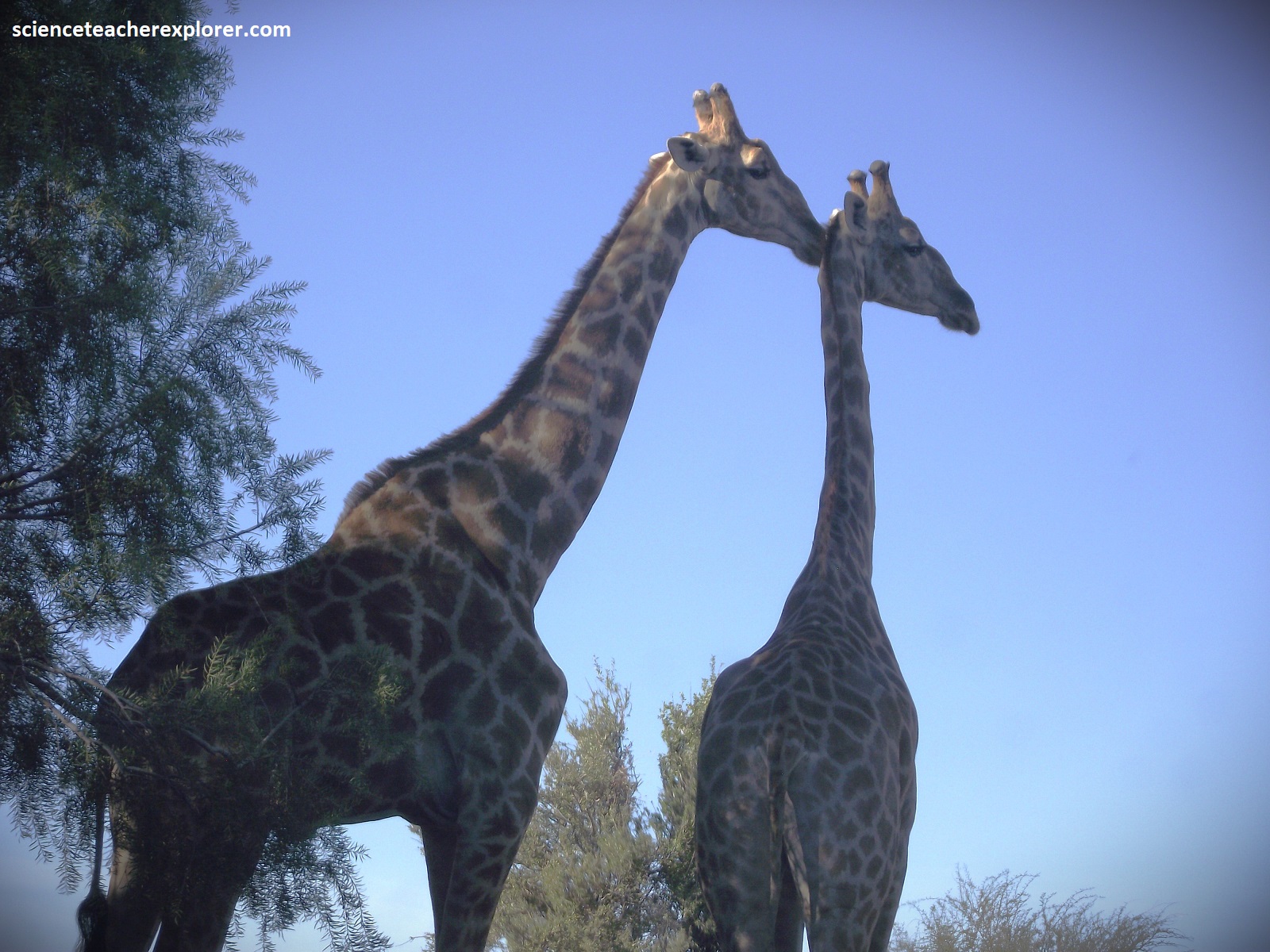
Driving around Augrabies Falls National Park, above the falls, gave us a look at the local wildlife and vegetation. Pictured above is a head of Giraffes, Giraffa camelopardalis, along the road. The giraffe is the worl’s tallest land mammal, with males reaching an impressive 5.5m height, and females growing to 4.5m. After a gestation period of 15 months, a single calf is born, with a birth weight of 100kg and measuring 1.5m in height. They are predominantly browsers. Surprisingly, their long necks contain only seven vertebrae, the same as in humans and other mammals. As a counter-measure against the extreme heat, giraffe in Augrabies Falls are lighter in color than those in regions to the east.
Additionally, the Wild Tamarisk, (Tamarix usneoide), by the road, is an evergreen species found in and along the sandy drainage lines. It has a short trunk and leafy branches usually extending outwards at ground level. The leaves are scale-like and very small, providing fodder for the giraffes. The wild tamarisk tends to form thickets, which in days gone by, provided a refuge for thieves. The leaves of the tamarisk have a high salt content and are favored by the rock hyrax. Also next to the road is the Jacket-plum, Pappea capensis), with its rounded bright red plum covered in a shiny, furry green capsule. The bright red, jelly-like seeds are edible and have a delicious sweet-sourish taste, which is like a dessert for the giraffes.
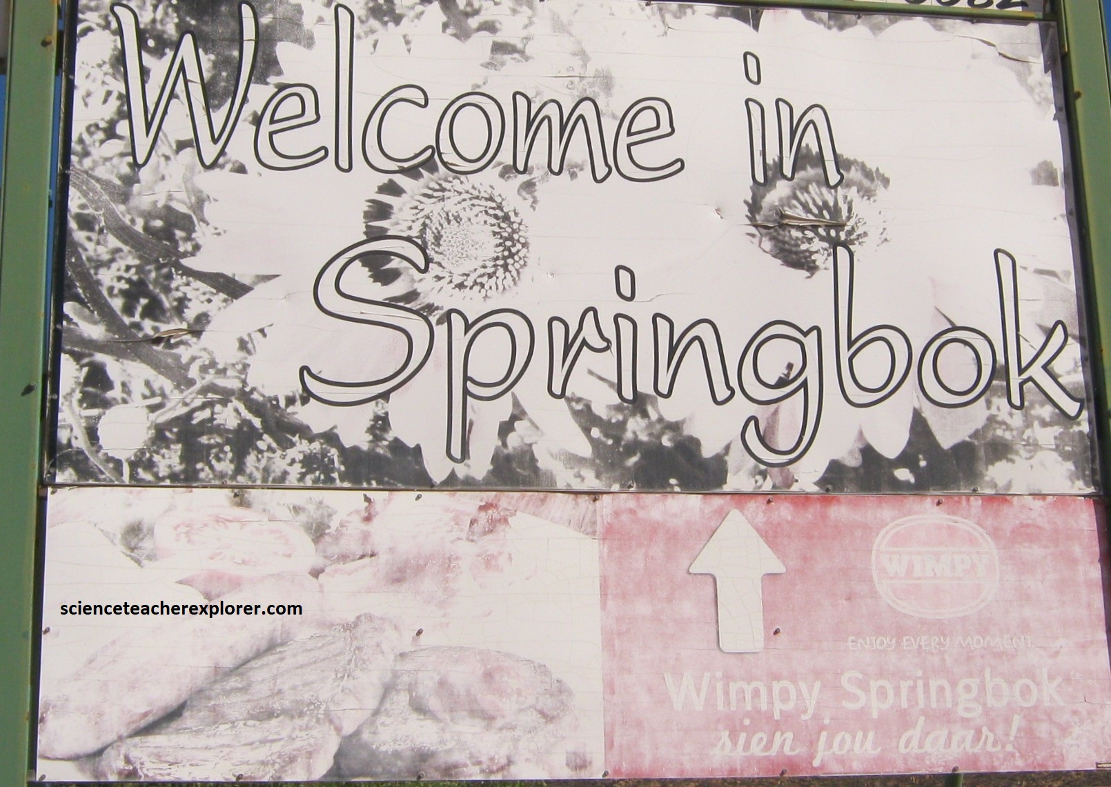
After we explored/trekked the Augrabies Falls, Mike and I continued driving southwest on N14 to Springbok, 377km away. This region is part of the Namaqua Highlands and is part of an immense and extremely complex geological province call the Namaqua Metamorphic Province. The formations here consist of a wide variety of granites and gneisses, and of sedimentary rocks that were tectonised and intruded 1.0-1.2 billion years ago along the southern and eastern margin of the Kaapvaal Craton during the major Namaqua mountain-building event.
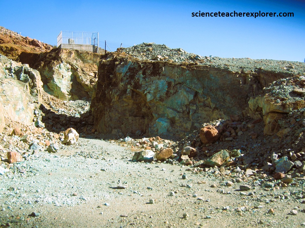
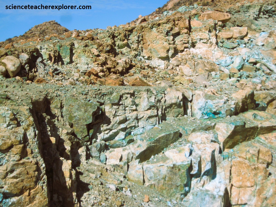
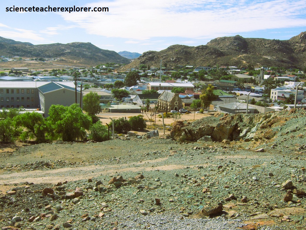
Pictured above, on a hillside directly west of Springbok, the old Blue Mine was the first to produce good copper ore in 1852 from what later became known as the rich Okiep Copper District. The widespread copper mineralization is associated with the extensive Koperberg Suite, which forms countless small intrusive ‘basic bodies’, often called ‘noritoids’. These rocks were originally intruded as igneous dikes into east-northeast-trending structures around 1.06 billion years ago, and now occur as is continuous pod-like mafic bodies within tight anticlinal structures known as ‘steep structures’.
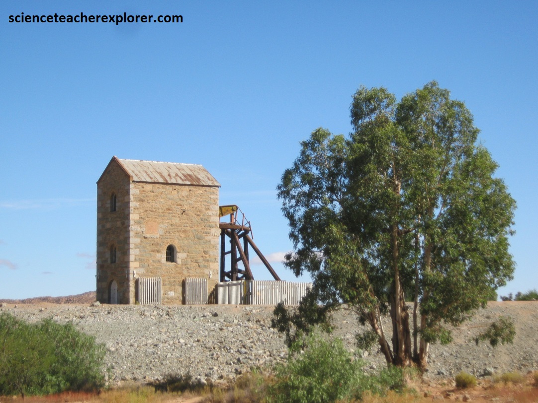
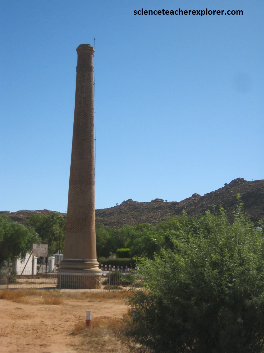
Copper mines soon opened up, after the Blue Mine, at places like Okiep, Nababeep, Spektakel and Concordia, using the skill and practices of Cornish engineers and miners. Pictured above, Historic National Monuments at the village of Okiep that hark back to the day of the pioneer Cornish miners and engineers of the 1830s. Above left is a well-preserved beam pump and its stone-built housing. Above right is a smelter smoke stack that was once part of the local copper-mining district.
Pictured above, ore and later copper metal was transported to the coast, first by ox-wagon down the escarpment to Hondeclip Bay and later by narrow-gauge railway to Port Nolloth. Over the years this mining industry went through several phases of ‘boom and bust’ in what became known as the Okiep Copper District, (it was ranked as the world’s richest copper mine in the 1870s). In 1937 the Okiep Copper Company was formed and production increase rapidly after World War II, some 30 mining operations eventually being undertaken in the district. The Koperberg mine produce 37 million tons of copper, up to about 1998 when it closed.
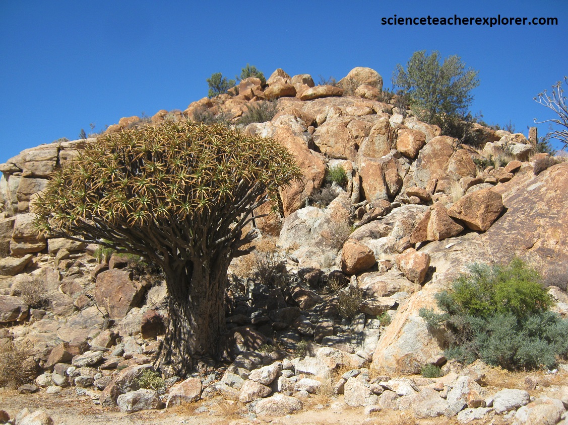
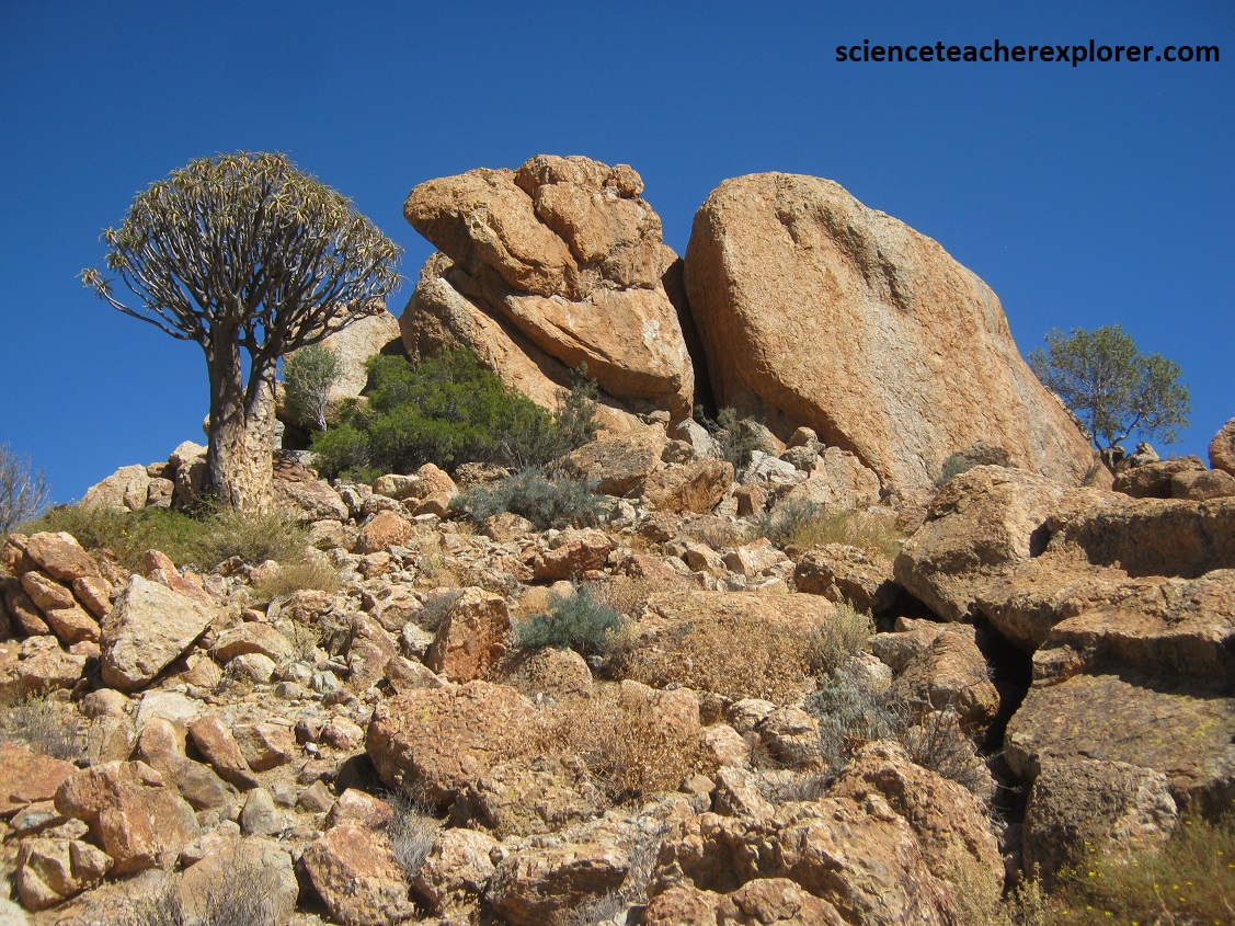

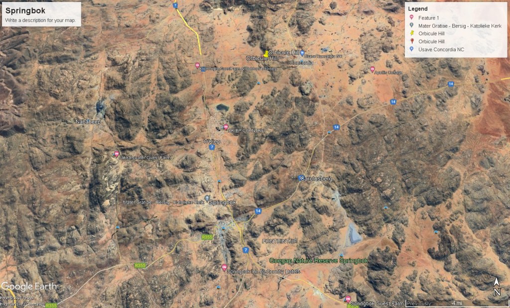
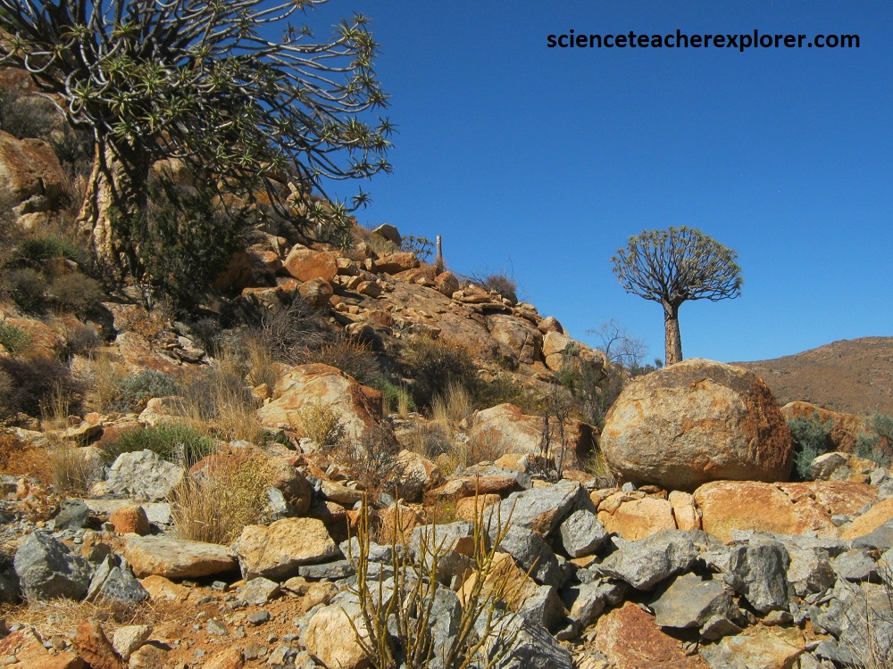
Pictured above, Mike and I trekked to a small hill, west of the village Corncordia, where there was a magnificent display of rare orbicular diorite formed by the segregation of two granitic magmas, one forming the concentric orbicules, and the other the matrix. It was also the site of two types of Quiver Trees, the Aloidendron dichotomum (pictured above top-left) and the Aloidendron pillansii (pictured above bottom-left). There are numerous varieties of these aloes, living up to 400 years old, that leave a lasting impression on anyone who has seen them in their natural environment. It is one of the most exceptional botanical features of the area.
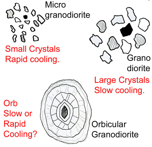
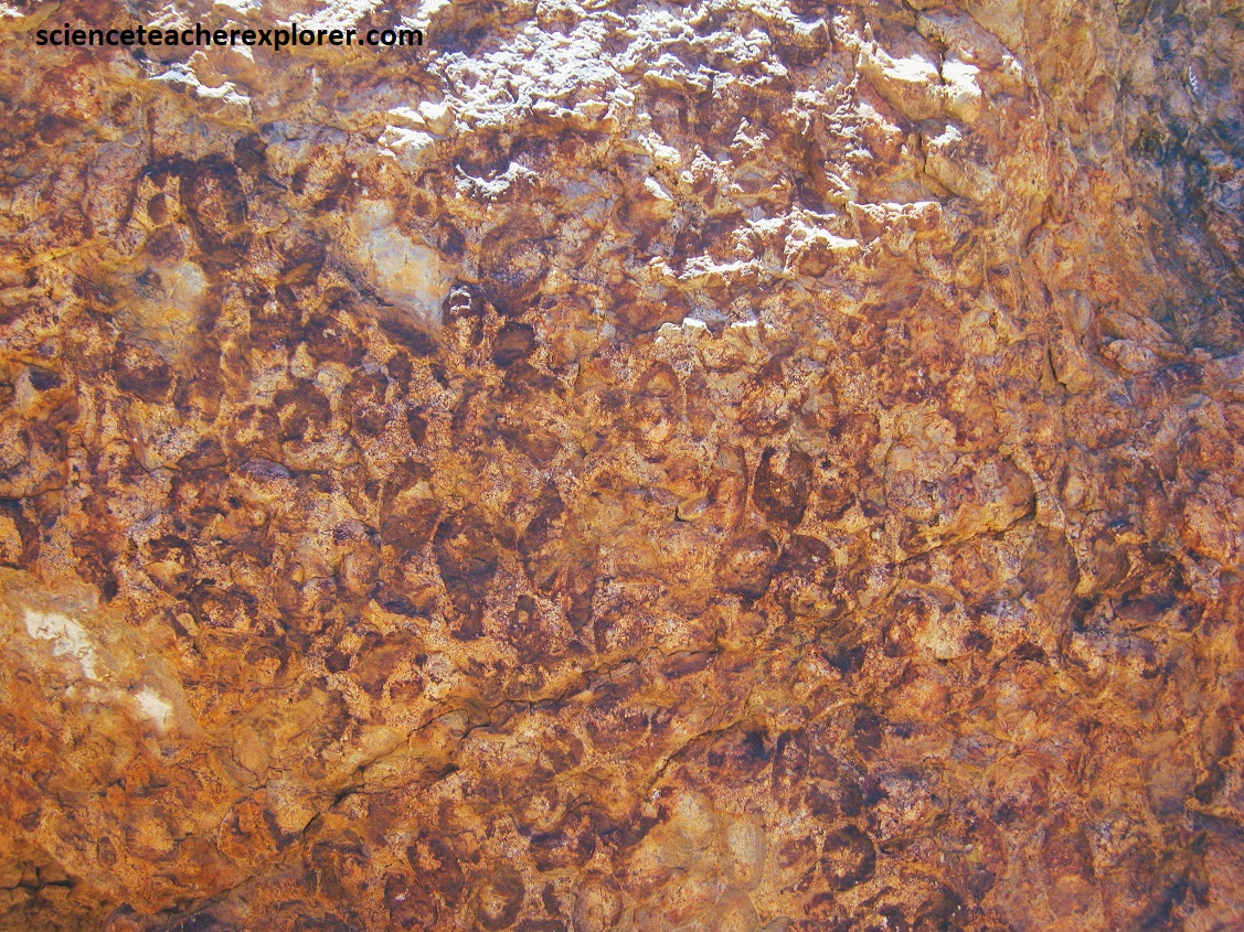
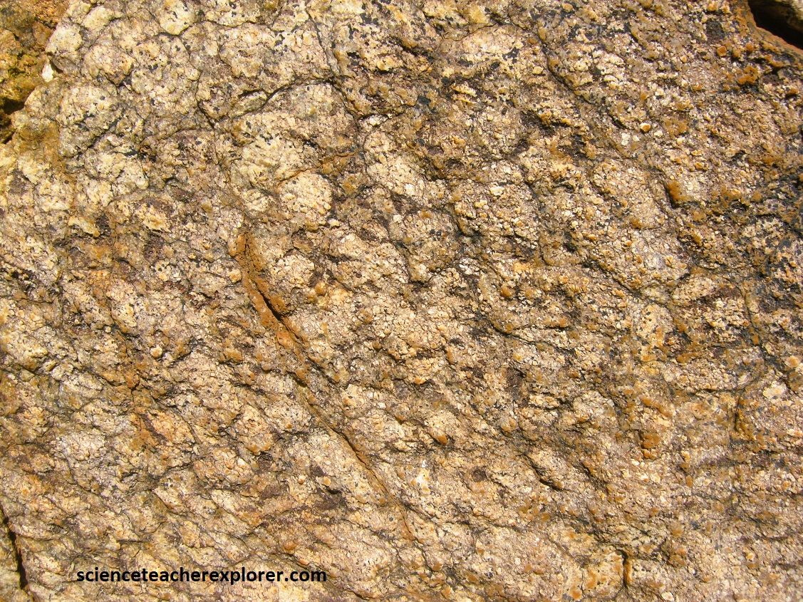
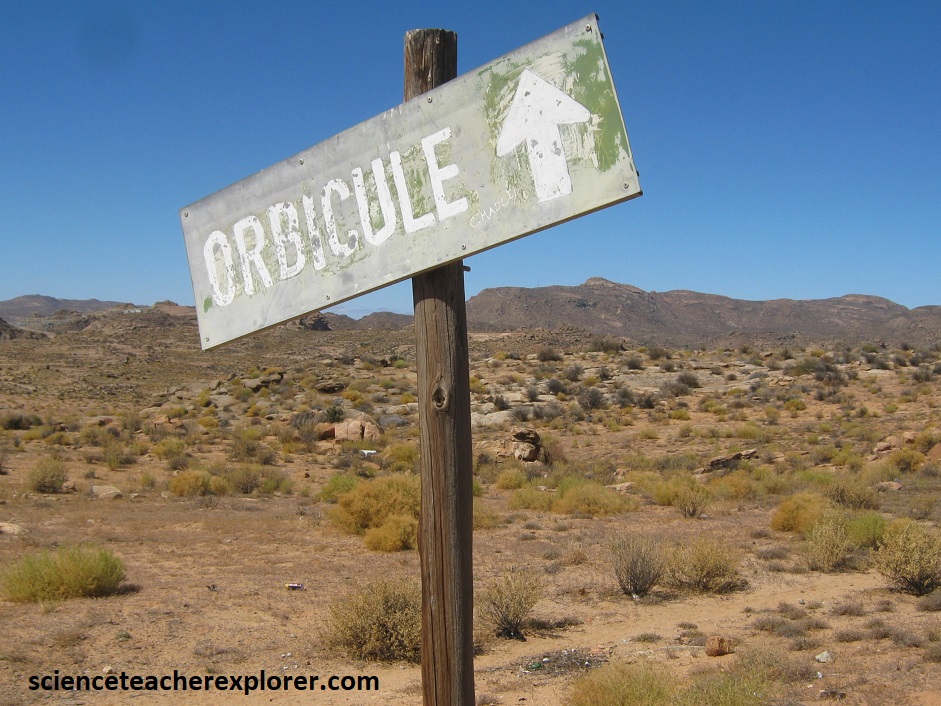
Pictured above, the orbicular diorite found in this hill, is a rare geological phenomenon, formed when magma that contains granite, cools in spherical shapes that contain concentric layers. Orbicule Hill (also known as “Wonderkoppie”, is one of only two places in South Africa where these rocks occur, and is a national monument but presently abandoned and obscure.
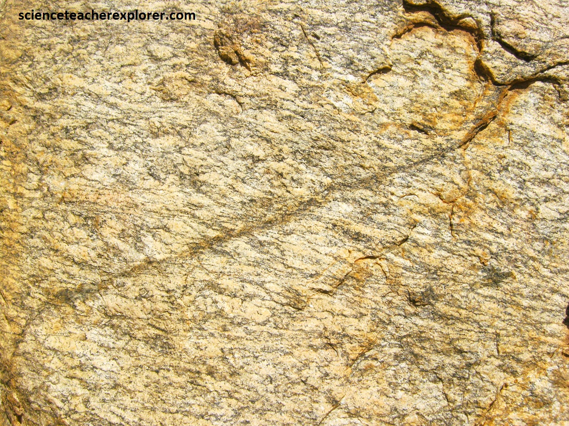
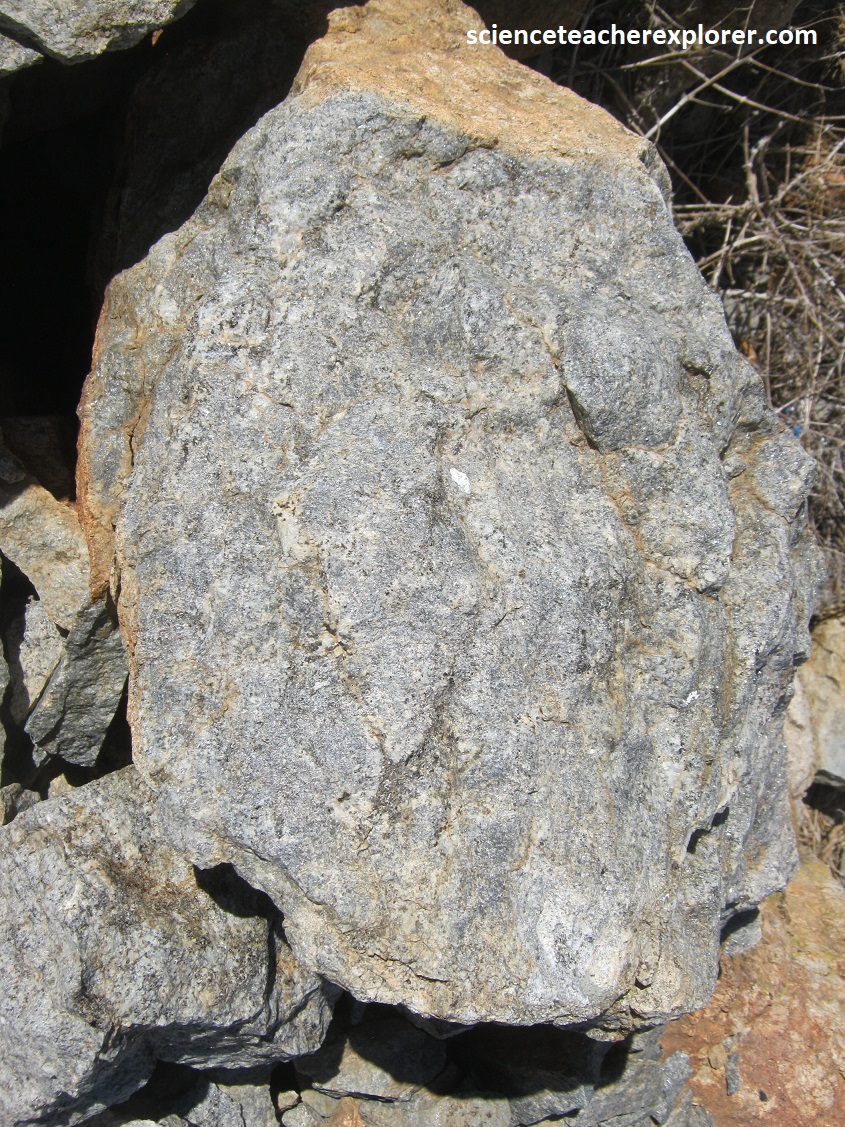
The term orbicular is applied to rounded, onion-like masses with distinct concentric layering that are distributed in various ways, (pictured above). However, they seem to weather & appear differently. These orbicules are found in the igneous, metamorphic and migmatitic terrain of the Namaqualand Metamorphic Complex. Concentric shells of contrasted texture and mineralogy about a central cores compose orbicule structures, which is often characterized by radially and/or tangentially oriented minerals. A rare site, indeed!
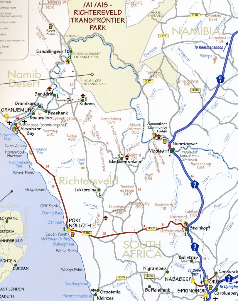
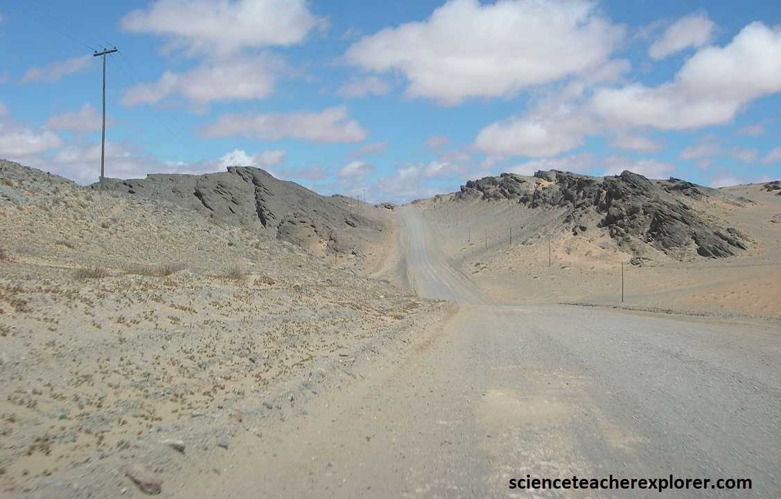
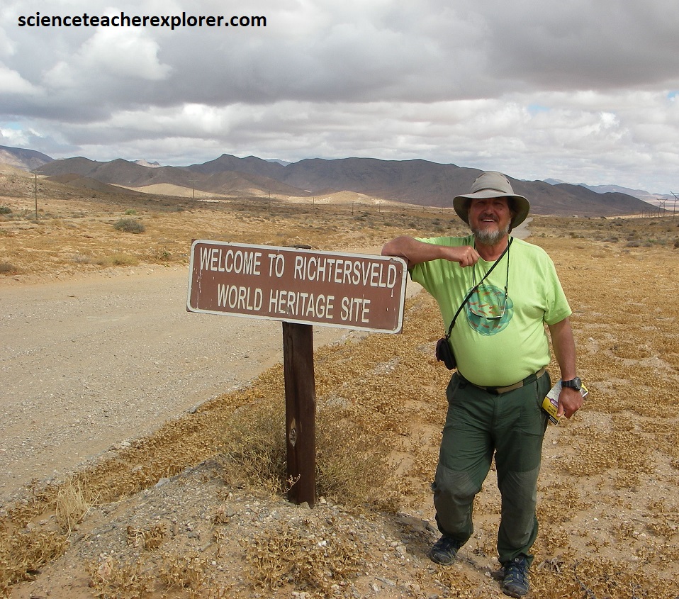
Our next destination to explore/trek was “The Richtersveld”. To get there, Mike and I had to drive north on N7 from Springbok to Steinkopf, (51km). From there, we headed west on R382 to Port Nolloth, (pictured below), and then north to Alexander Bay, (177km), where we’d have to take a graveled road east to the border of the Richtersveld National Park.
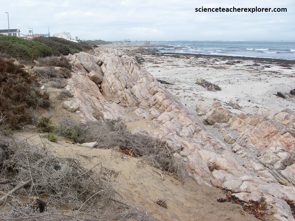
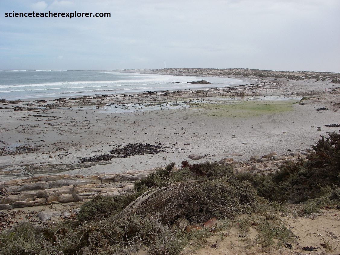
Pictured above is Port Nolloth, South Africa. As mentioned before, Port Nolloth was established on a road-stead in the bay in 1855 to serve as export harbor for the copper ore from Okiep. It went into decline when the copper mines were briefly closed in 1919 and then again when the transport of ore and blister copper was diverted to the new railhead at Bitterfontein in 1927. However, the town received a new lease on life with the discovery of alluvial diamonds along the coast of Namaqualand in 1926, from Kleinsee in the south to Alexander Bay at the mouth of the Orange River in the north.
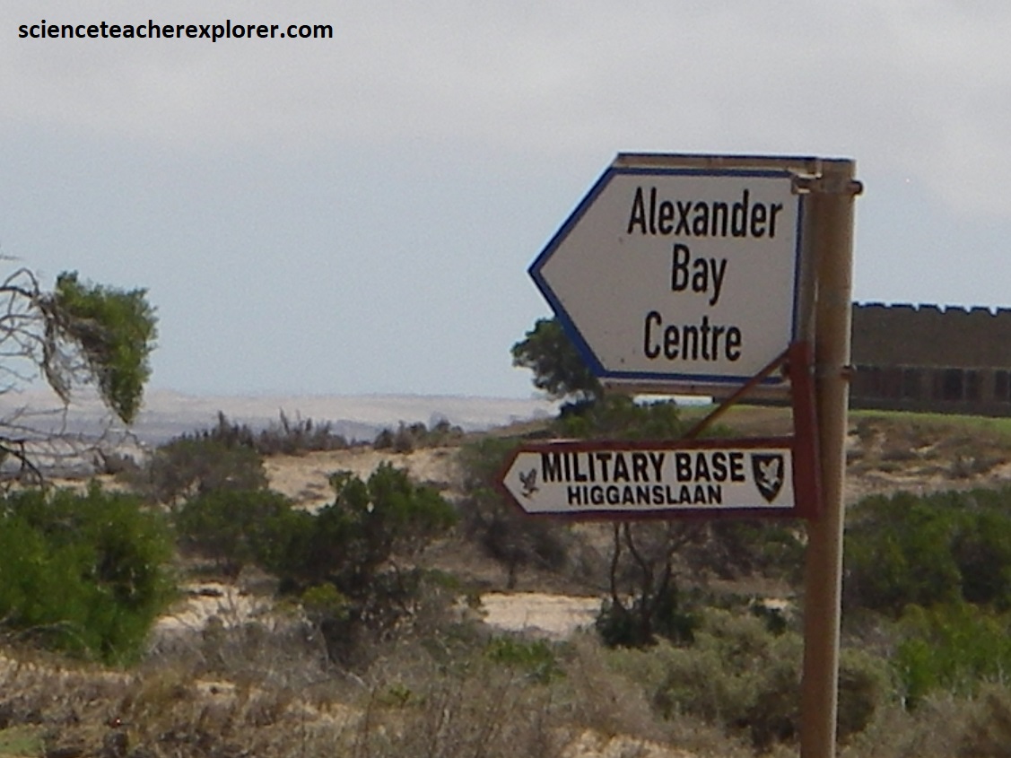
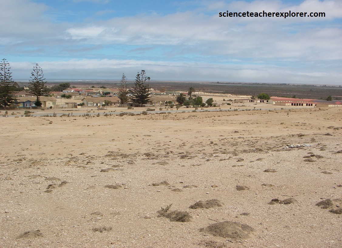
Pictured above, Alexander Bay, about 100km north of Port Nolloth, is synonymous with alluvial diamonds. This restricted and largely self-sufficient mining town was named for Sir James Alexander, who shipped the copper ore he mined at Kodas in the Richtersveld in barges down the Orange River to be exported from this bay.
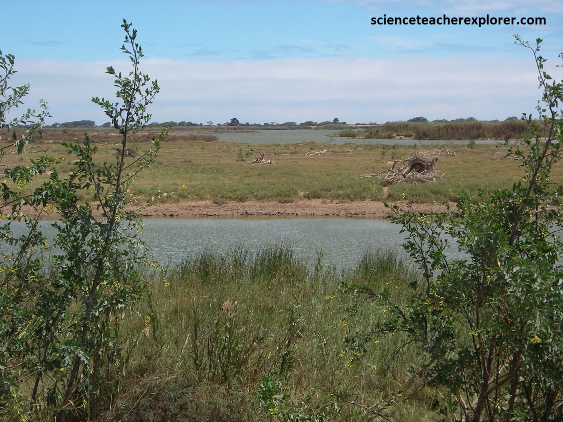
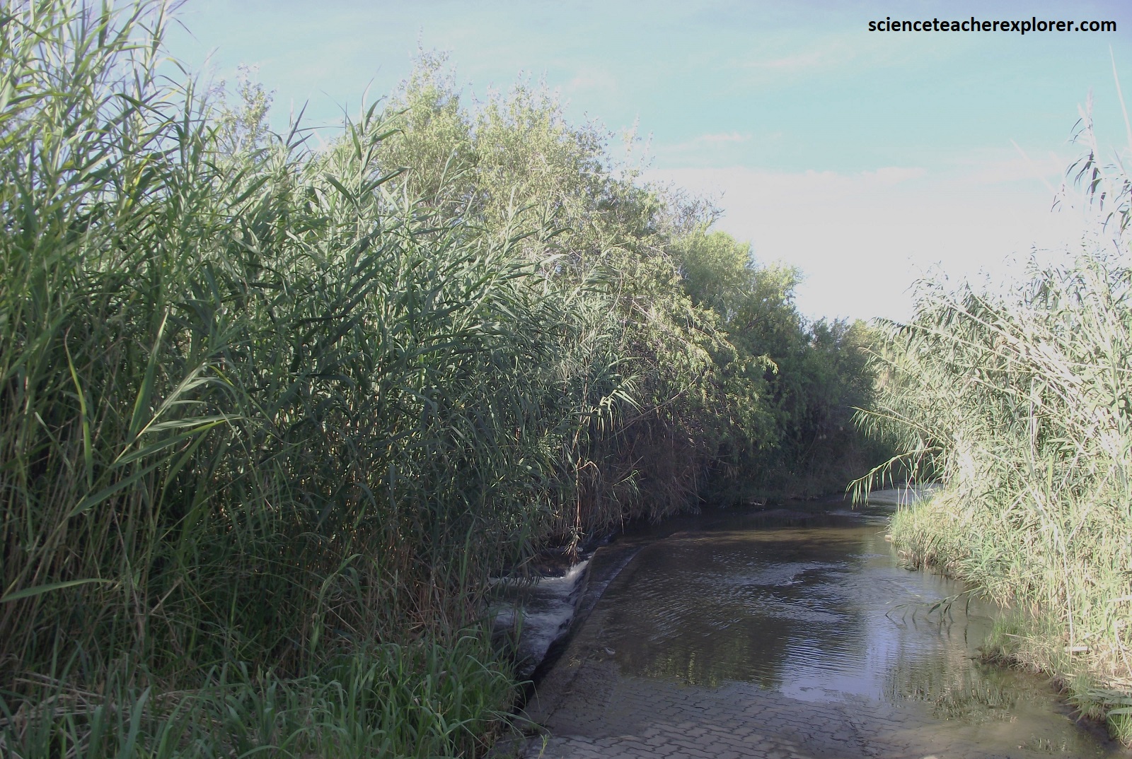
Pictured above, the Orange River mouth is located just north of the town of Alexander Bay. It is a delta-type river mouth, consisting of a series of braided troughs interspersed with sand banks, channel bars and islets, with a tidal basin and salt marshes. Extensive mudflats occur at the mouth, and large areas of intra-fluvial marsh occur upstream of the mudflats. This system is so dominated by fresh water that it has few estuarine characteristics. The major part of the vegetation of the lower section of the river is typical of a low-salinity wetland. These silt beds on the riverbanks formed when the river flooded its banks, leaving behind some of the mud it carried. Some of these beds occur up to 30m above the present reverbed and marks one of the biggest floods in southern Africa. These floods happened only 700 years ago.
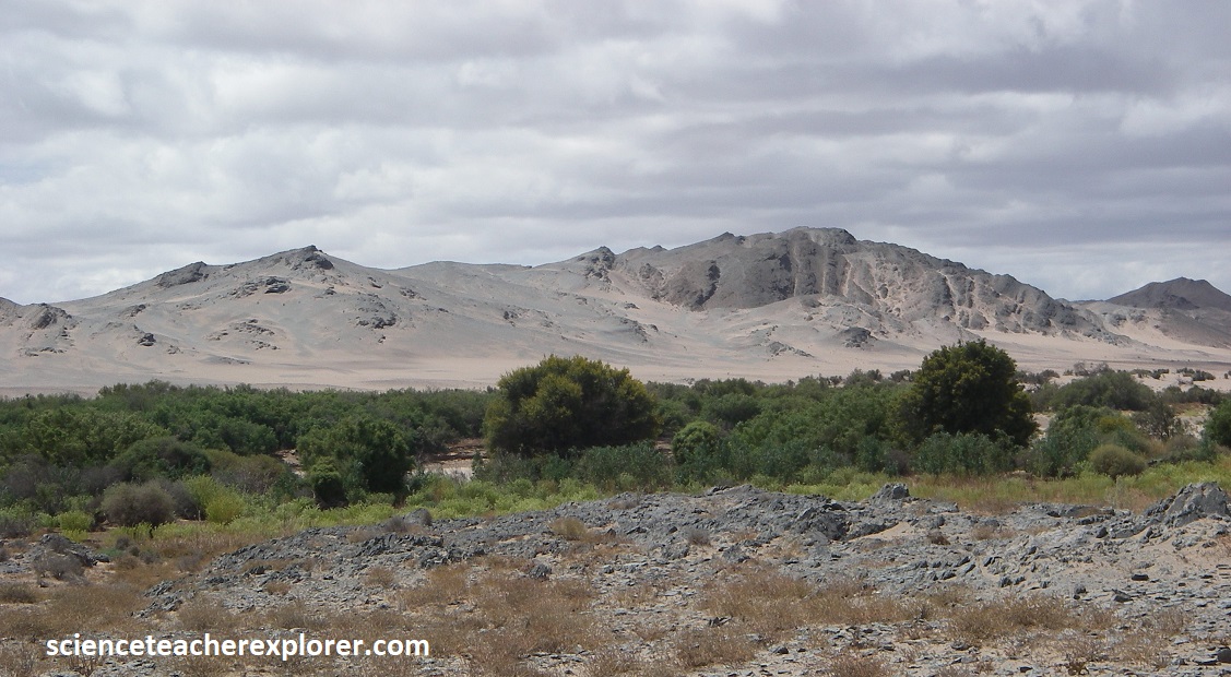
The graveled road west of Alexander Bay followed the Orange River most of the way. Approximately 920 million years ago some igneous activity took place when magma intruded from below in the area. The formed large granitic plutons of the Richtersveld Suite, which occur to the west, (along the road to Richtersveld National Park, next to the Orange River. The rocks surrounding the plutons became metamorphosed. the volcanic rocks became schists, the shales became slate and the sandstones became quartzites. Some 20 million years later river started to import sand, mud and gravel into what was now an inland sea. Along the shallow areas calcium carbonate was precipitated, later changing into limestone, dolomite and marble. These rocks are known as the Stinkfontein Group. [The appearance of layering is formed during high pressure induced metamorphasis of lava. The layers are perpendicular to the direction of the pressure and not formed during deposition like in sediments.]
The earliest identifiable rock layers in this region date to around 2 billion years ago. Known as the Orange River Group, these are mainly igneous rocks that are volcanic in origin. The lavas of the Orange River Group were then overlain by some sedimentary rocks (sandstone and shale). These can still be seen in the Rosyntjieberg Formation. The intrusions include: The Vioolsdrift Suit, emplaced 1.9-1.75 billion years ago; The Richtersveld Igneous Suite, dating back 1 billion years; The Gannakouriep Suite, a series of north-south trending black dikes that were emplaced about 870 and 540 million years ago. Some sediments are thought to have collected at the foot of an ancient mountain range. This caused calcium carbonate to precipitate out of the water, forming limestone and dolomite of the Stinkfontein Group. Another element of the sedimentary group is a collection of glacial-tillite once crept through the region. This is the oldest known glacial deposit in the world. However, it seems to have formed the so-called backbone of the Richtersveld and forms the highest peaks in the region. Note that around 570 million years ago, there was a period of sedimentation that created the Nama and Numees Groups, which consists of dolomite, limestone, shale and sandstone also.
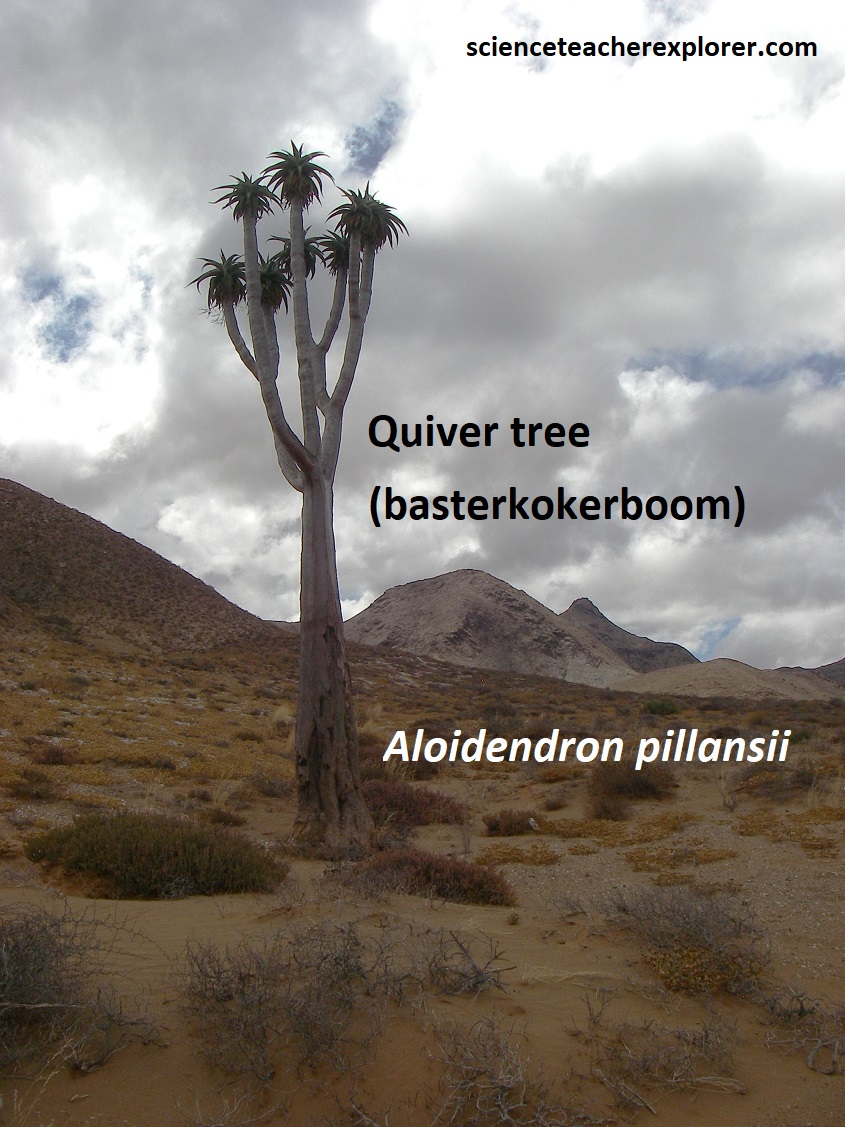
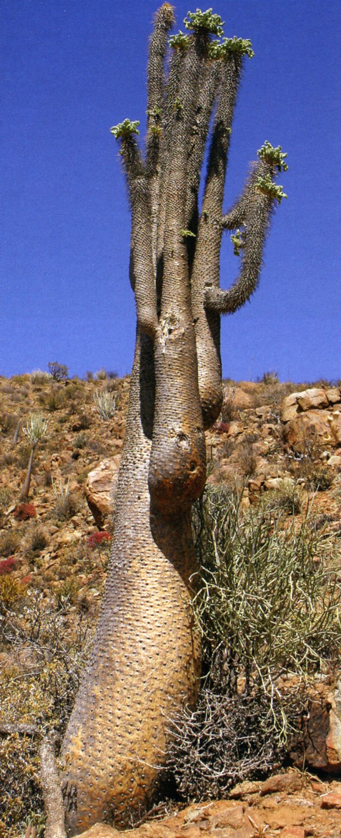
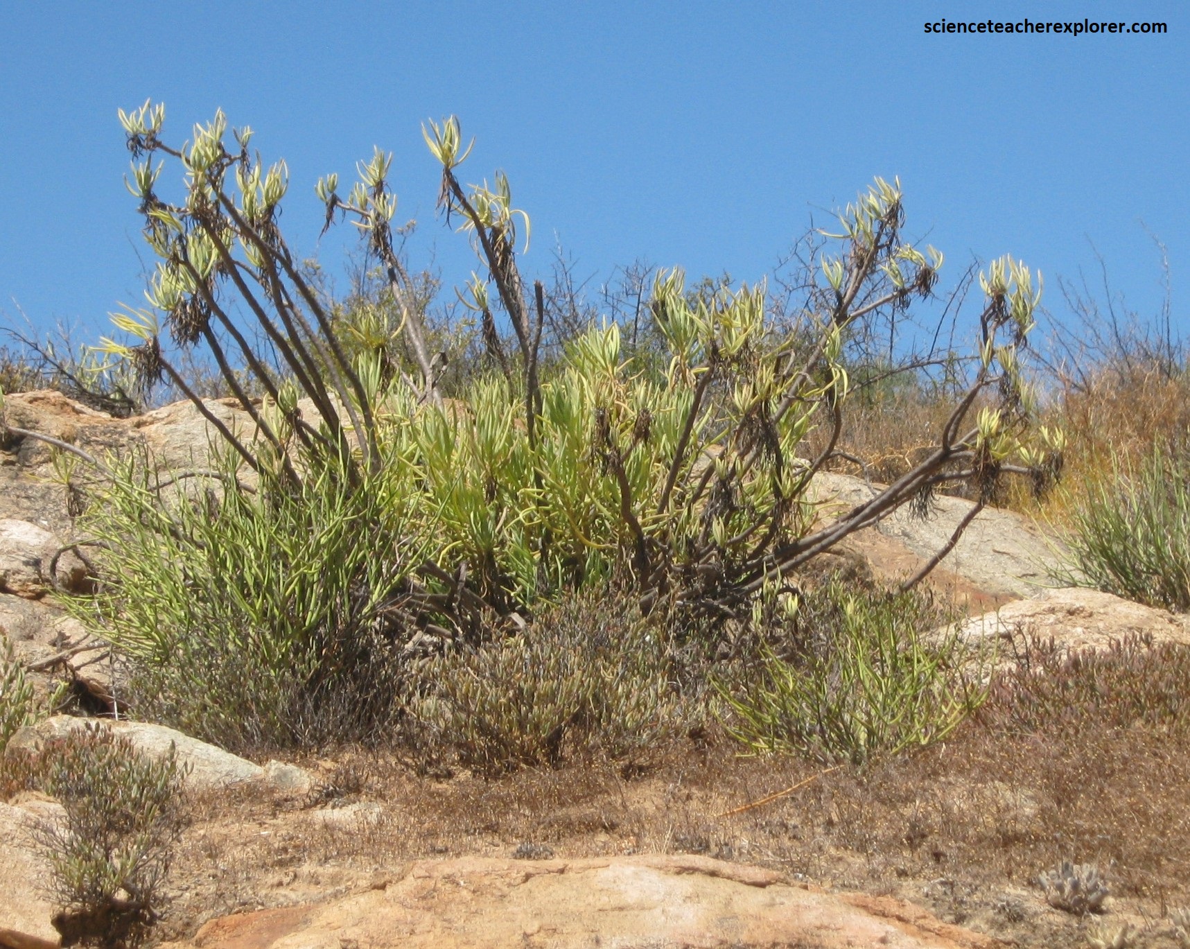
Pictured above, found throughout the Park, these Basterkokerboom (Aloidendron pillansii), has erect, robust branches with large rosettes of greyish-green leaves at the terminal ends of the stem. The branches are distinctly clasp by the leaves. Small white teeth are arranged on the leaf margins. The branched inflo-rescence arises from the lowest leaves of the rosettes. It is the tallest endemic aloe that grows in here. [The above middle picture shows a juvinile Basterkokerboom]. However, (above on the right) is another distinctive plant called the Pachypodium namaquanum. It is known in Afrikaans as “halfmens” since legend has it that it is half plant and half human.
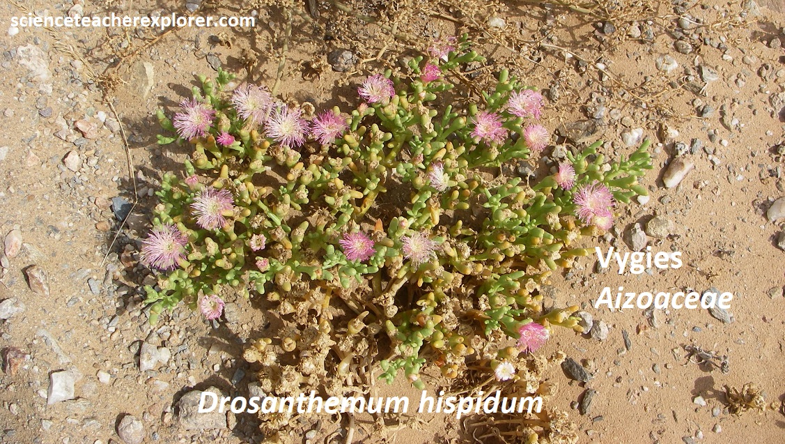
Pictured above, Richtersveld is, surprisingly, something of a botanist’s paradise. While it is accurately described as a mountain desert, its rugged mountains and apparently barren valley are home to approximately one-third of South Africa’s plant species and many are the rarest succulents known to man. Pictured above are Vygies (Aizoaceae). These succulents are also known as midday flowers. Their showy flowers compete with daisies for brightness. They are called midday flowers because most of them open at midday, in bright sunshine, to attract insects. The shine on the petals is caused by pyramid-shaped cells (called idioblast cells) in the surface layer which concentrate and reflect the light. The family evolved approximately 25 million years ago, and the Richtersveld has well over 600 described species, with new ones still being discovered. Note the above picture on the left shows Vygies blooming as far as the eye can see. In the rainy season, August & September, this would appear like a giant flowered-carpet, looking south.
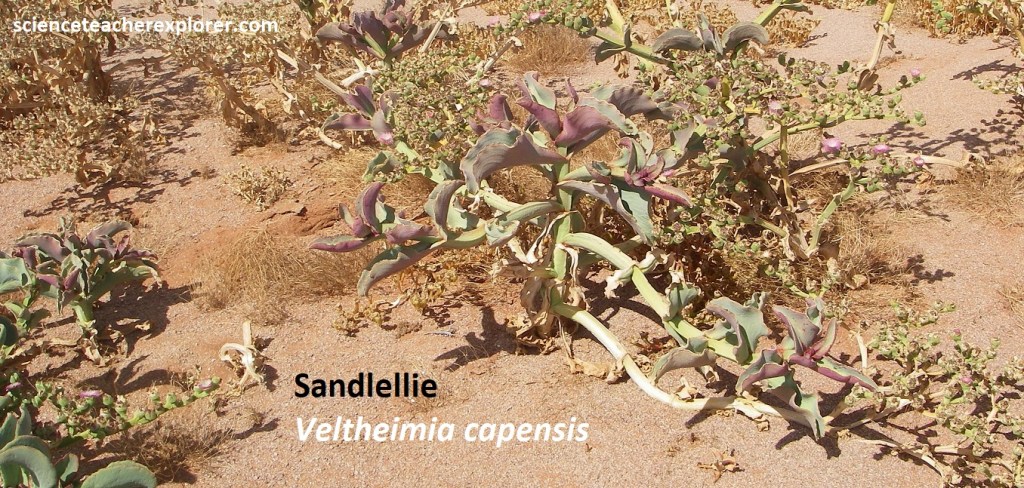
Another strange and rare succulent is the above Sandlelie, (Veltheimia capensis). It has a robust bulbous perennial (20-50cm), with dull greyish, wavy or crinkly leaves, and a dense raceme of nodding, tubular, pinkish flowers, (20-35cm) long. I found these in a gigantic sandy flat, west of the Richtersveld.
West of the Richtersveld lies a series of large, white sand dunes which form a stark contrast to the red sands of the Kalahari Desert to the east, and sit incongruously against the surrounding landscape. It is not just their color that sets them apart. When the sand is dry and hot, any disturbance causes the dunes to “rumble,” “roar”, or “hum”. The sand actually emits a vert distinctive, low-pitched noise that has been likened to the roar of water from rapids or waterfalls heard from a distance.
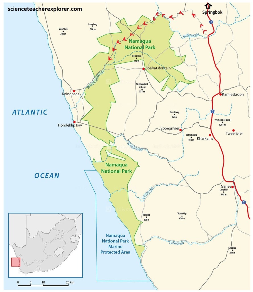
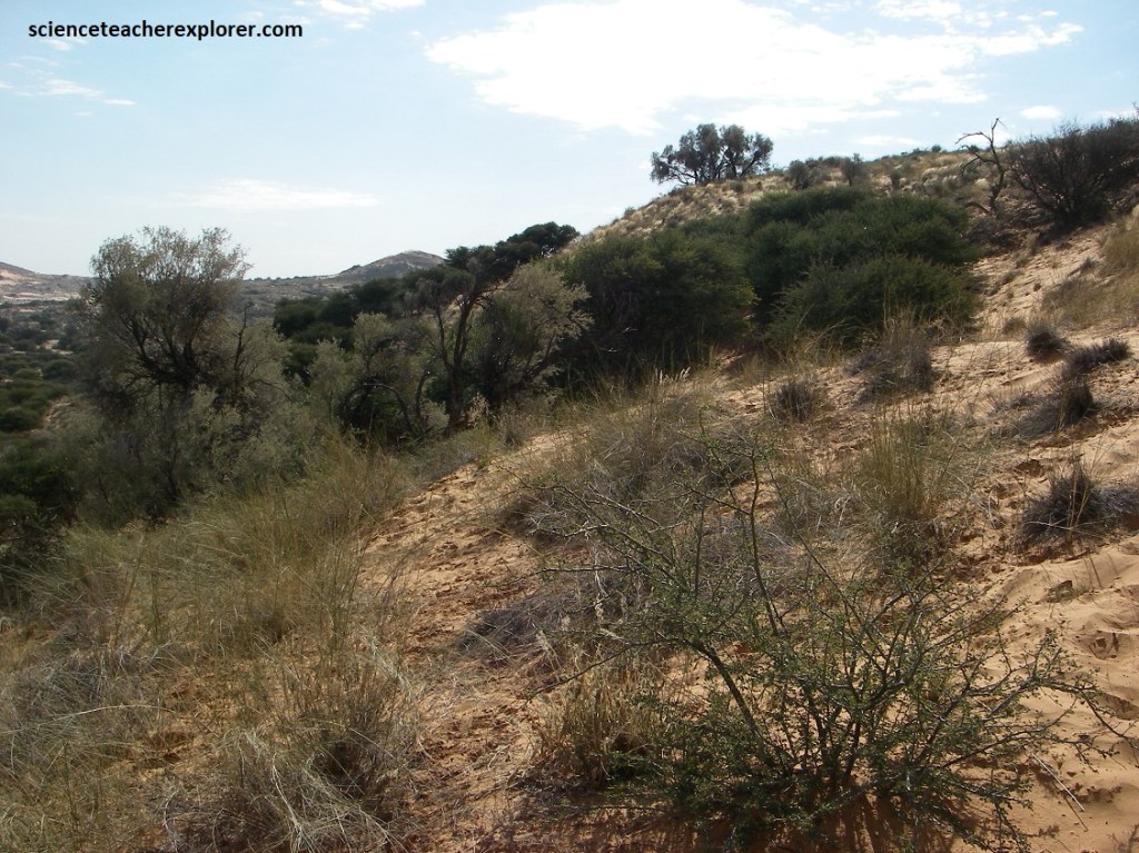
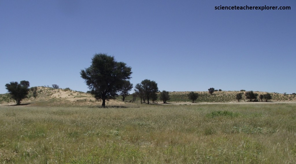
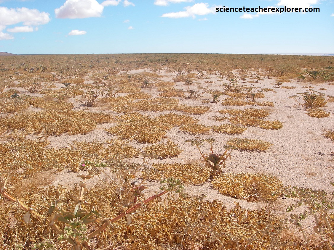
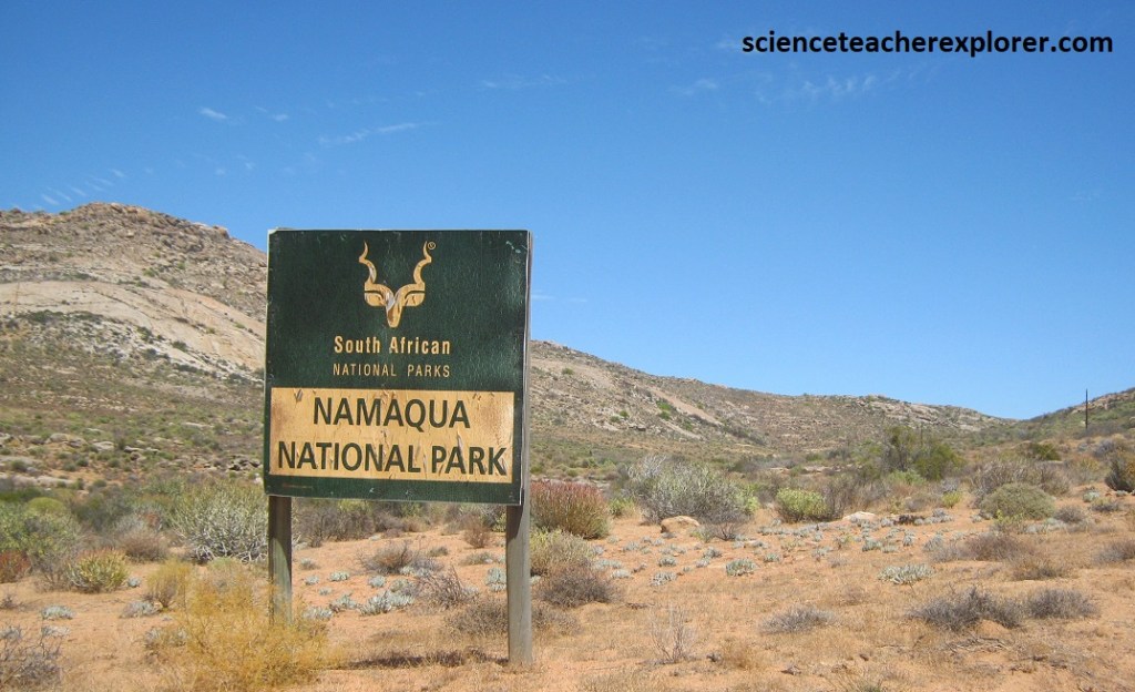
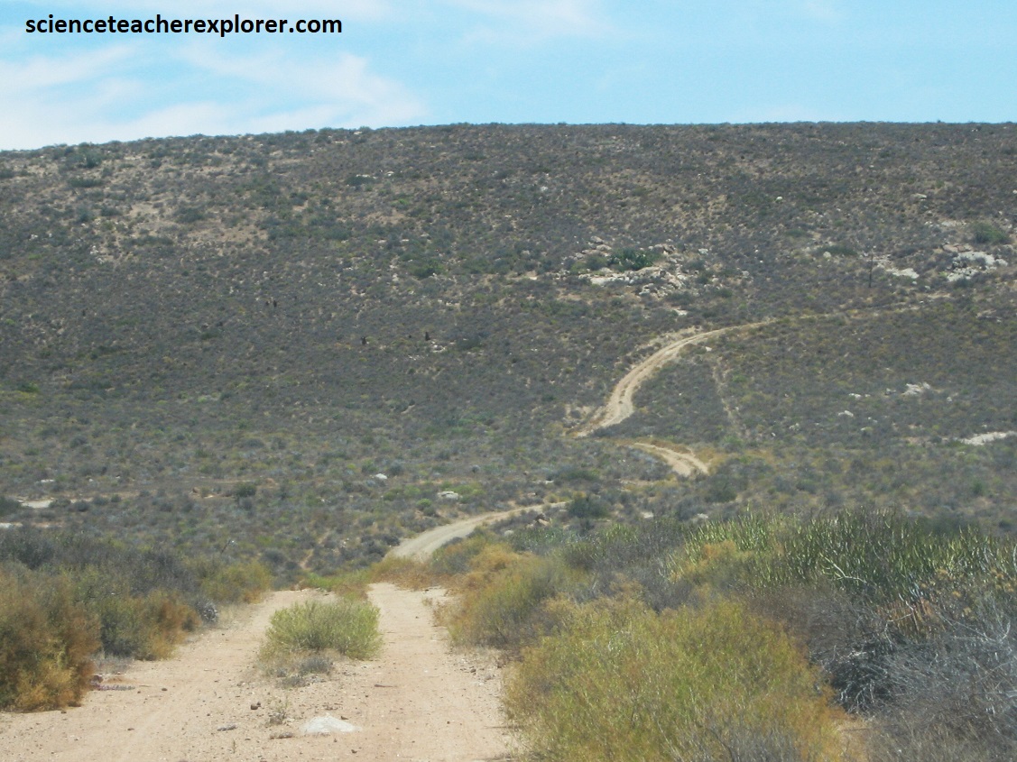
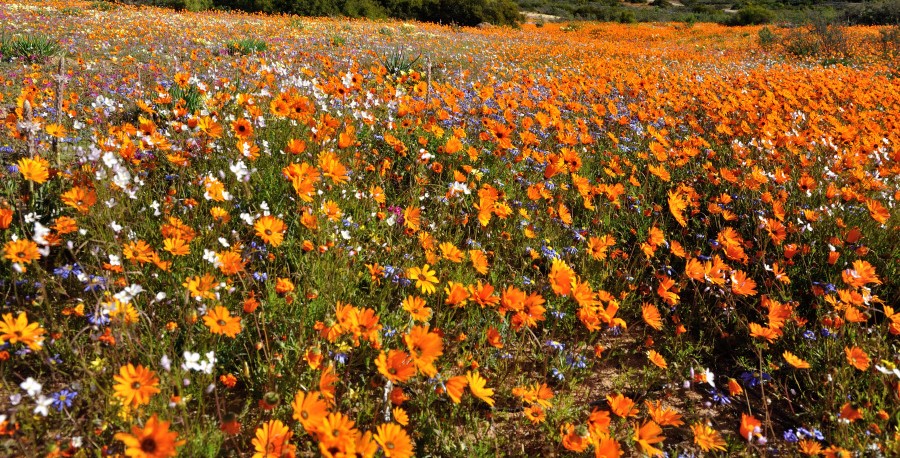
Once Mike and I returned to Springbok, we drove south 90km on N7 to explore and trek Namaqualand National Park, (image above). The dry and often fearsome Namaqualand region is home to arguably the most astounding floral displays in the world. Every year between August and October, spring puts on her prettiest bloom-bedecked frock. Unfortunately, we were there in March of 2024, during the dry-season. The roads here are mainly for high clearance vehicles and/or 4WD vehicles.
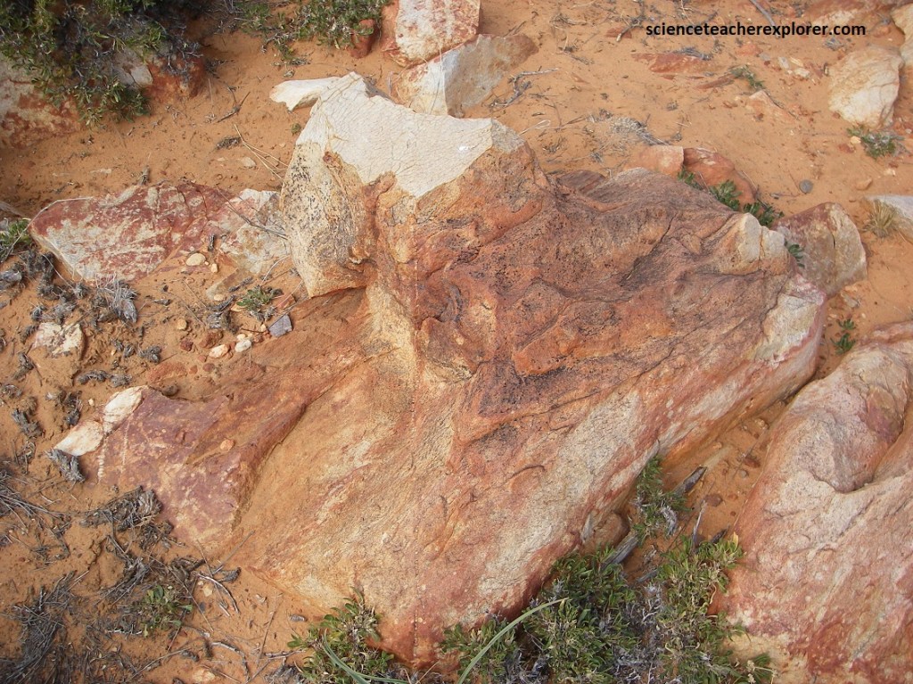
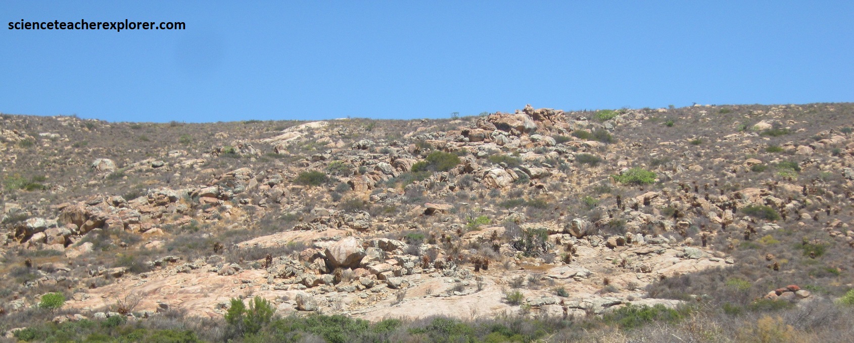
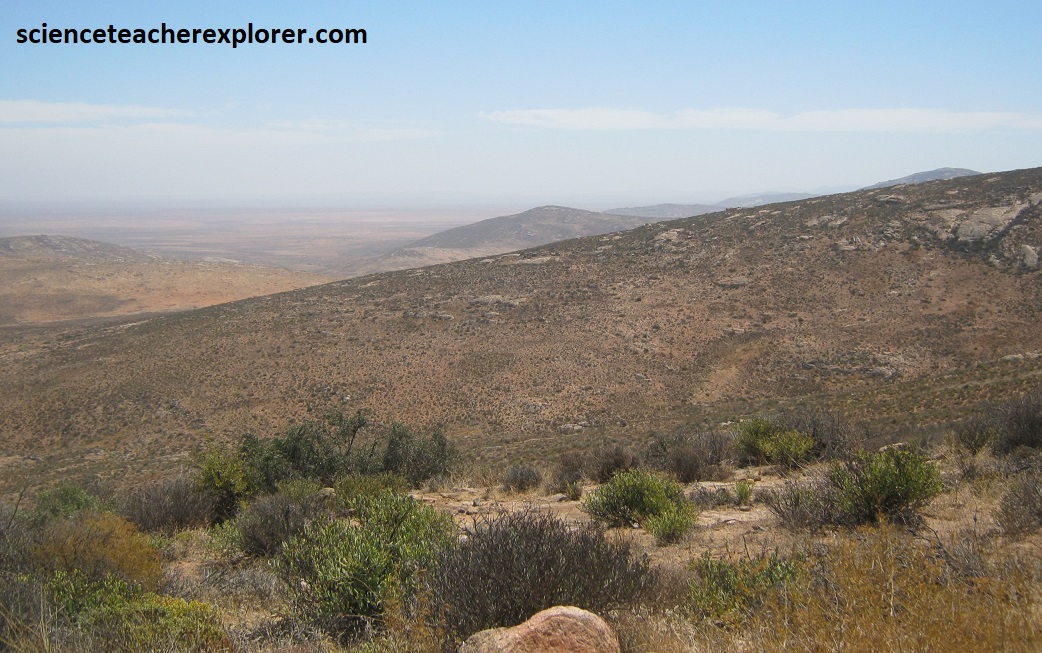
Pictured below, the bedrock within the Namaqua National Park largely comprises of Quartzo-feldspathic Gneiss of the Kookfontein subgroup with the Namaqualand Metamorphic Complex. Bedrock outcrops occur on koppies or mountains with smooth rock faces or large boulders. The Namaqualand granite-gneiss complex consists of mainly meso-zonal biotite gneiss and a fine-grained granulite. Pictured above, Wolfhoek se Berg is the highest point above sea level in the park at 948m above sea level.
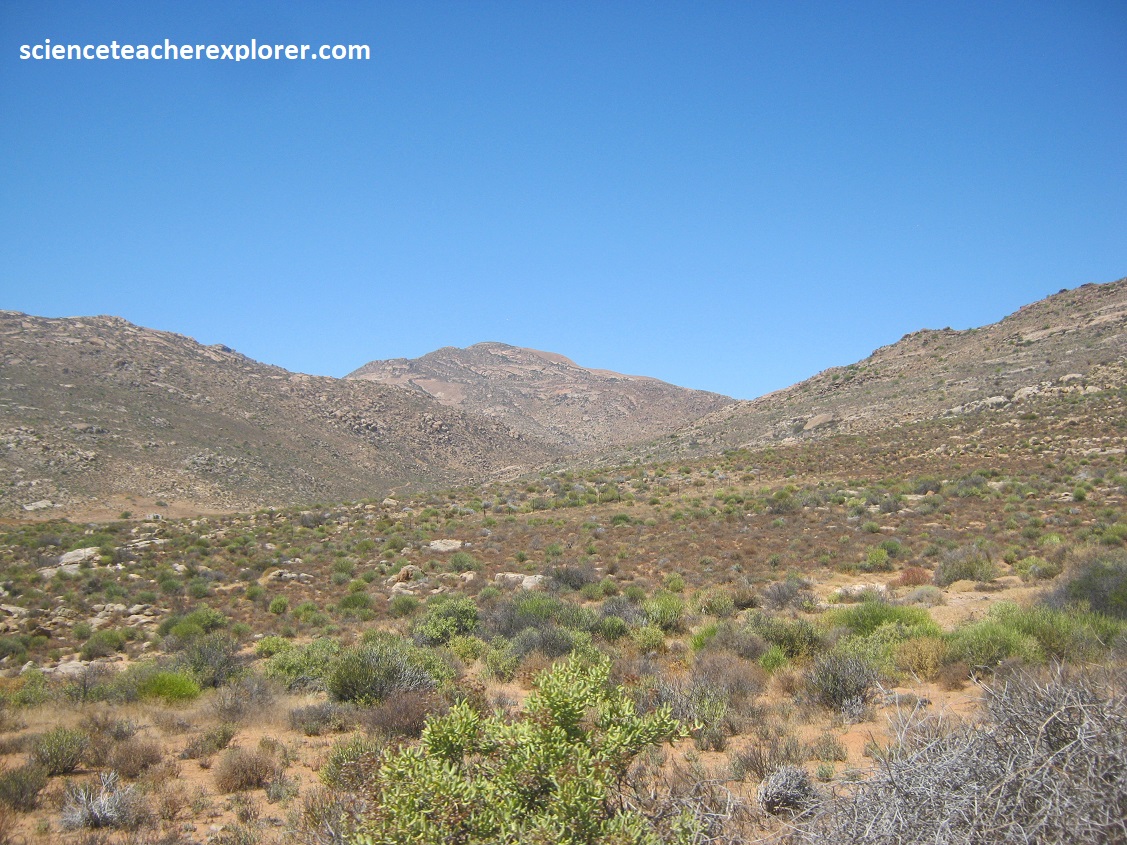
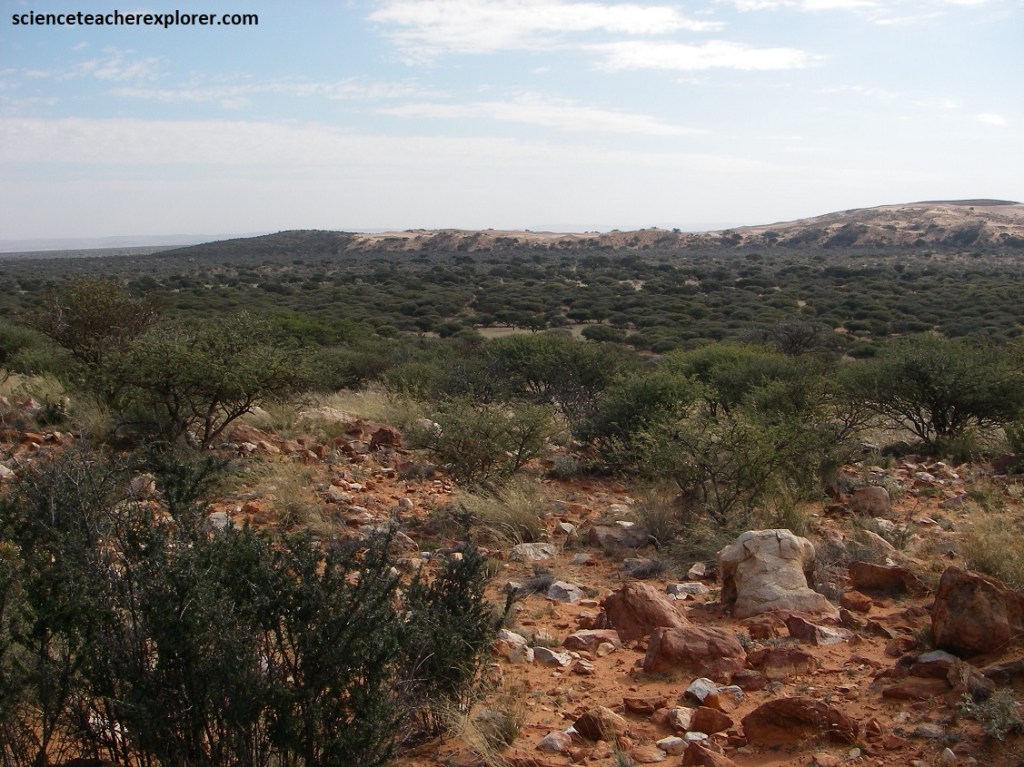
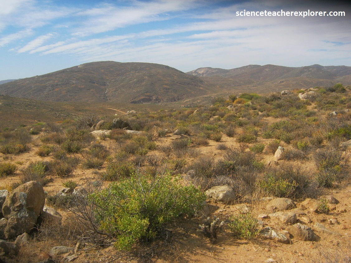
Namaqualand is a considered a “Succulent Karoo” biome. The Succulent Karoo Biome is primarily determined by the presence of low winter rainfall and extreme summer aridity. Rainfall varies between 20 and 290 mm per year. Because the rains are cyclonic, and not due to thunderstorms, the erosive power is far less than of the summer rainfall biomes. During summer, temperatures in excess of 40°C are common. Fog is common nearer the coast. Frost is infrequent. Desiccating, hot, Berg Winds may occur throughout the year, (pictured below).
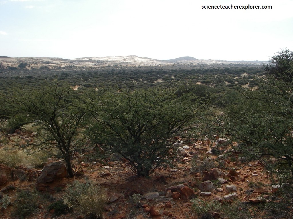
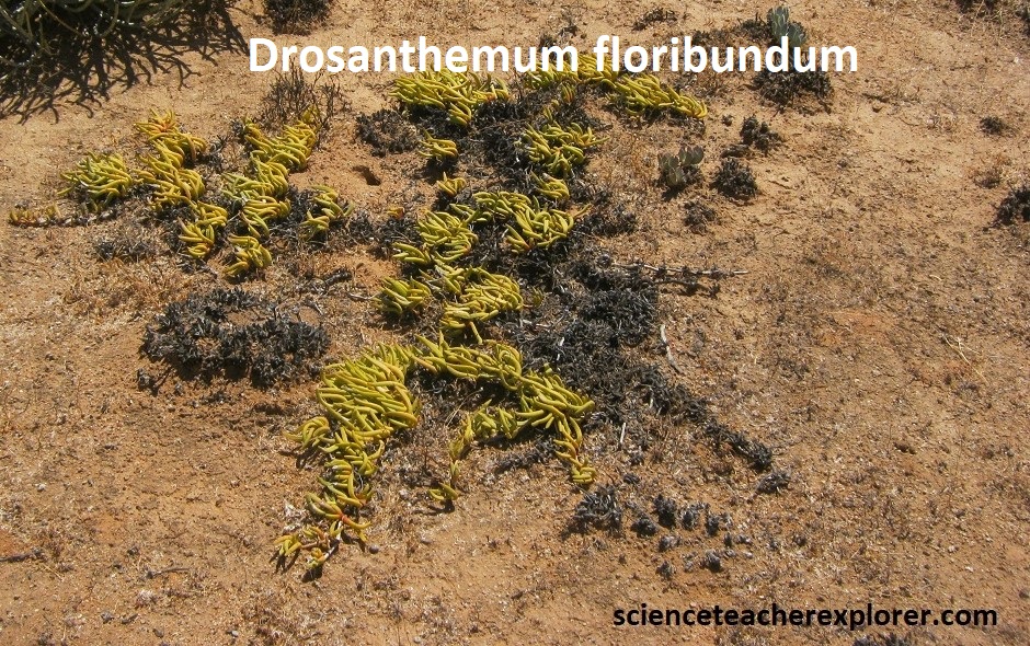
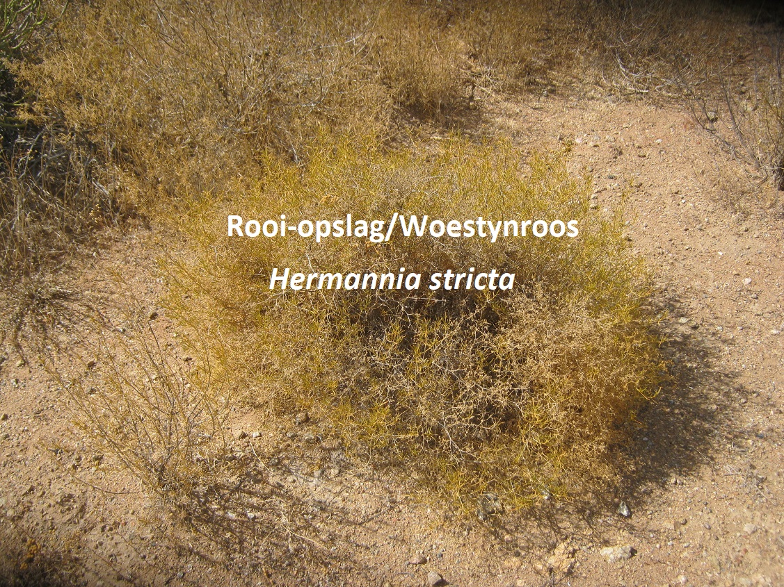
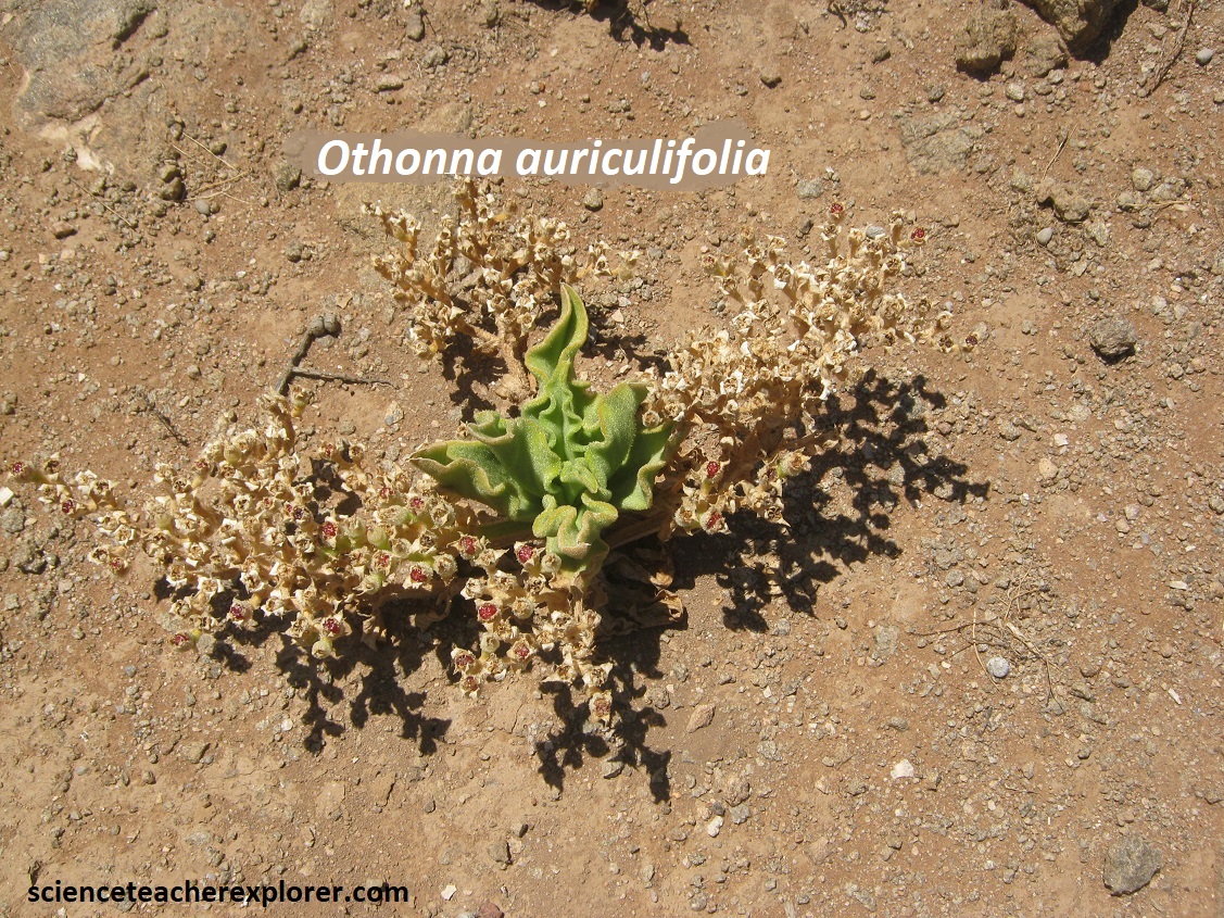
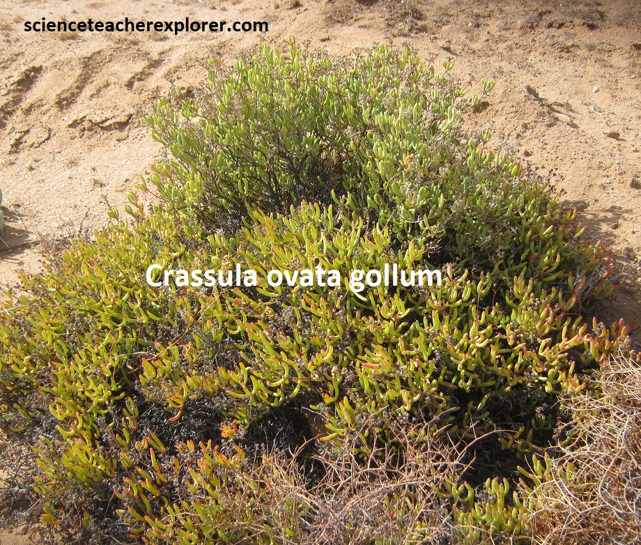
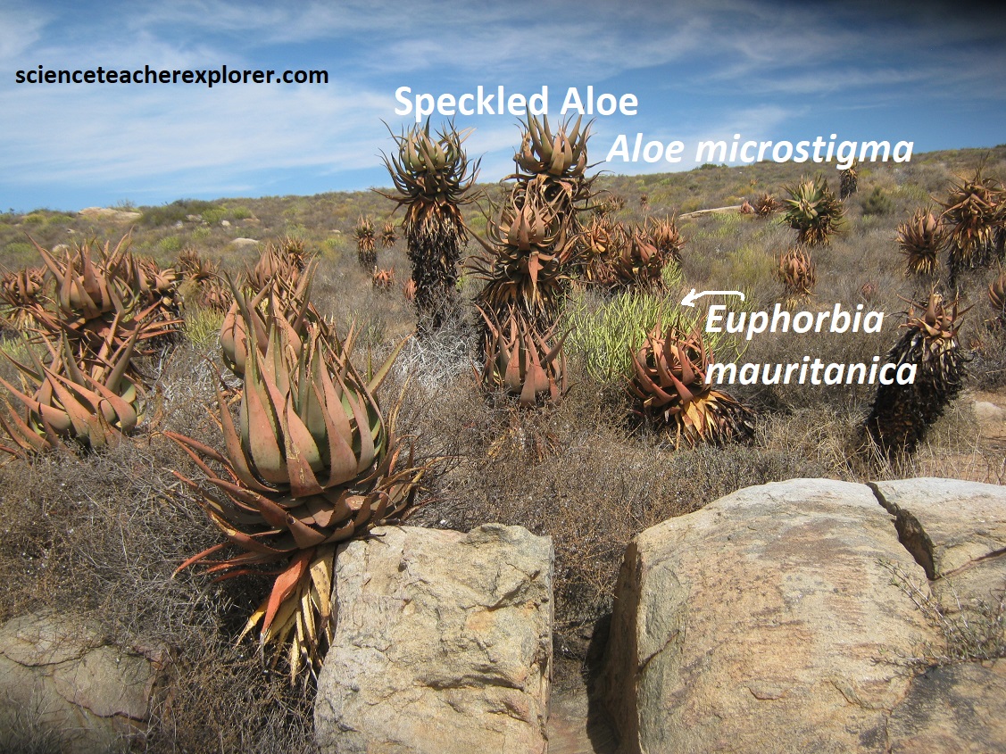
The vegetation is dominated by dwarf, succulent shrubs, of which the Vygies (Mesembryanthemaceae) and Stonecrops (Crassulaceae) are particularly prominent. Mass flowering displays of annuals (mainly Daisies Asteraceae) occur in spring, often on degraded or fallow lands. Grasses are rare, except in some sandy areas, and are of the C3 type. The number of plant species mostly succulents – is very high and unparalleled elsewhere in the world for an arid area of this size. Pictured below is a number of succulents that I could identify.
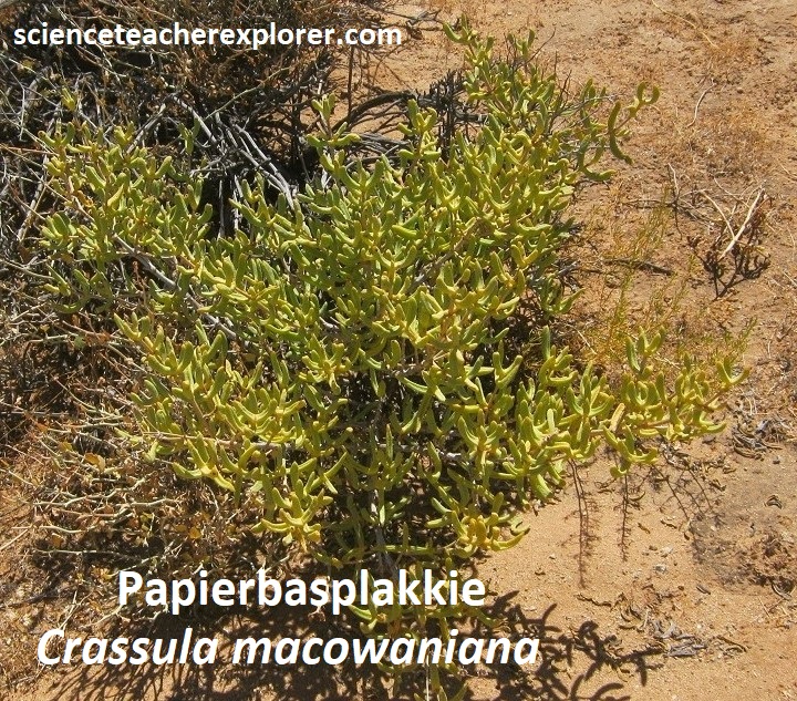
Pictured below, the Papierbasplakkie, (Crassula macowaniana), is a well-branched, woody shrub growing up to 50cm high with reddish green leaves usually situated at the ends of the branches. The flowers are about 5mm across, white with pink centers and produced terminally in thick dens clusters.
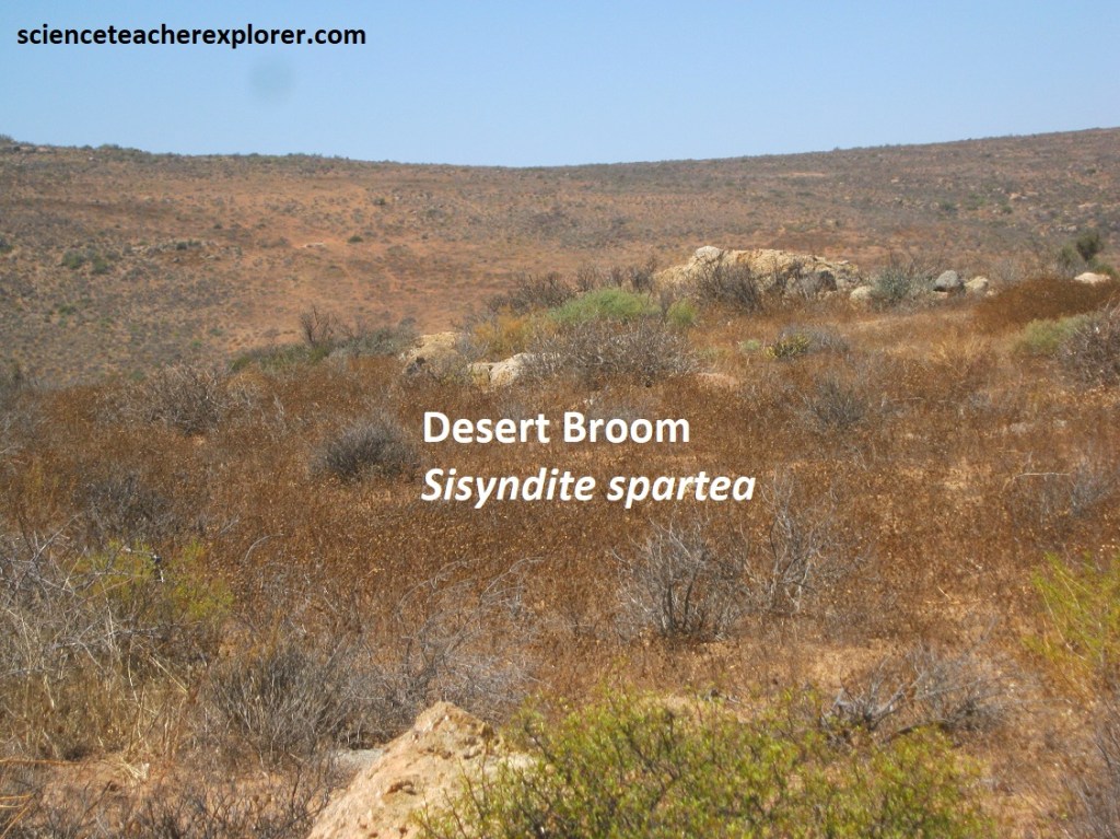
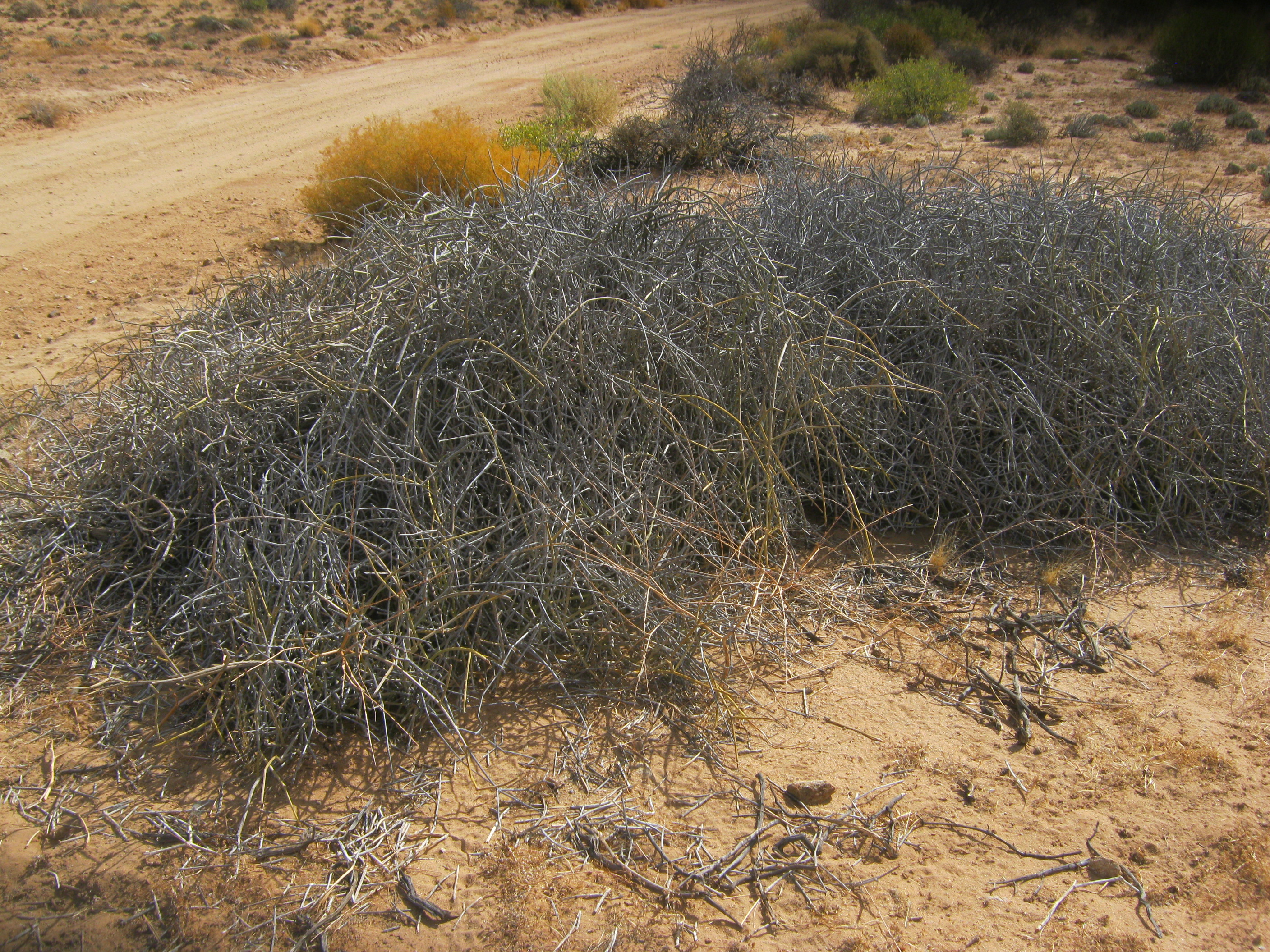
Pictured below, the dry season look of the Desert broom, (Sisyndite spartea), is a branched shrub, growing up to 1m in height. It has broom-like rushy stems that are grey-green and almost leafless, but there are tiny oval leaves scattered along the branches. The large yellow flowers forms a cup shape. The seedpod is covered with long, fluffy, creamy hairs. Locally know as “t’kam-bos”, commonly found along river beds and can live for hundreds of years. The roots are boiled and given to women after giving birth, to restore strength.
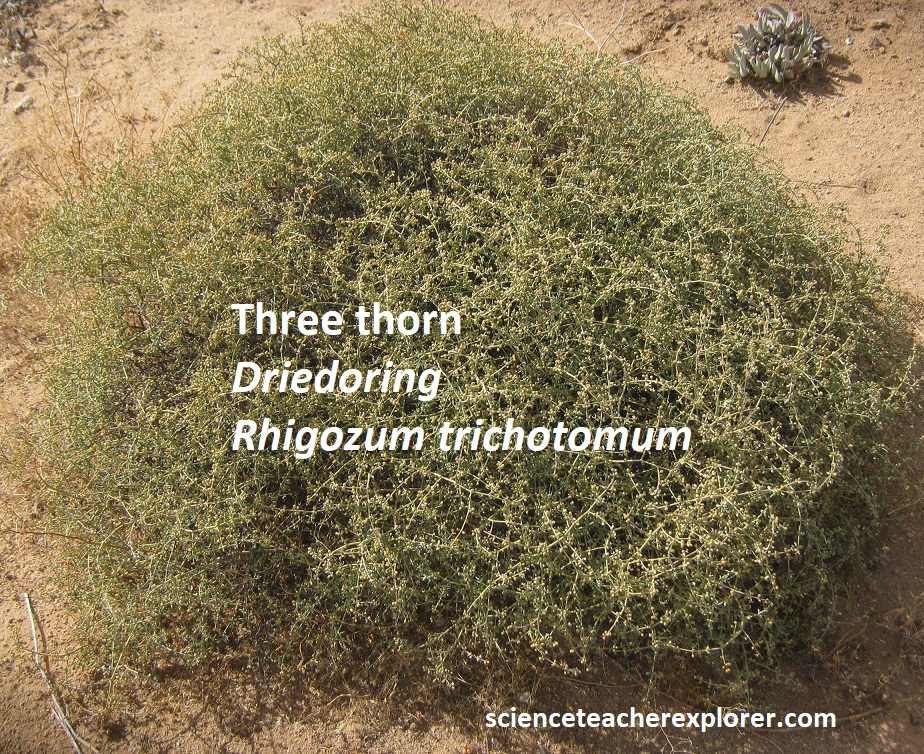
Pictured below, the Three-thorn Driedoring, (Rhigozum trichotomum) is a shrub with white or pinkish flowers when in bloom, During a drought or very dry periods, the plant sheds its leaves and appears to be dead. The loss of leaves is, however, an adaptation to prevent water loss by reducing the surface area through which transpiration can take place. The three-thorn is a favorite food of springbok that eat its pods, flowers and young shoots. This shrub also plays an important ecological role, as it fills gaps left by overgrazing and also stabilizes sloes by forming a barrier where seeds collect and germinate.
Since most of these plants are extremely rare and we were exploring them in the dry-season, (without the identifiable blossoms), I had trouble naming them. Pictured below are some examples of exotic plants that I couldn’t identify.
Pictured below is what the park would look like in the rainy-season, (August-October). This photo was provided by the park’s visitor-center. We were sorry that we missed it!
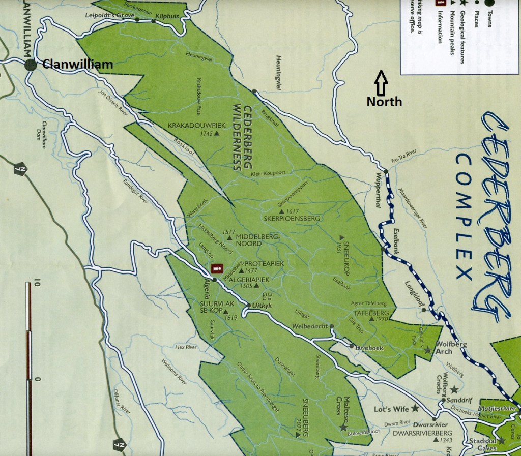
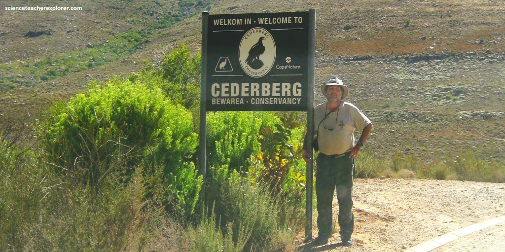
After Mike and I finished exploring the Namaqualand National Park, we continued driving south on N7 to Clanwilliam, 273km away. From there, we drove southeast on a graveled road, into the Matjiesrivier Nature Reserve through the Driehoeks River Valley, pass Algeria & over the Uitkyk Pass (47km) to explore the Cederberg Wilderness, (imaged below).
The geology of the Cederberg comprises of the Cape Supergroup (Table Mountain Group, Bokkeveld Group and Witteberg Group) and the Karoo Supergroup (Dwyka Group, Ecca Group and Beaufort Group). [Ordovician to Carboniferous]
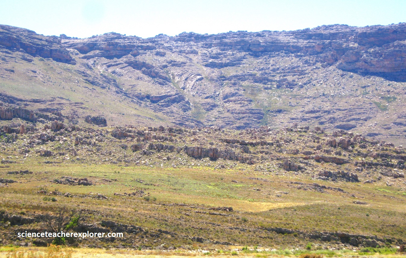
The Cape Supergroup was formed about 500 – 300 million years ago by a succession of sedimentation of sandstone (silt, mud and sand). The distinct reddish color of rock is a result of minerals like iron and manganese that formed part of the sediments. About 330 Ma ago climatic change set in and the rapid growth of the continental ice sheets resulted in a drop in sea level which exposed the upper Witteberg Group. These moving glaciers played a big role in the forming of the high mountains and deep valley landscape of the Cederberg Mountains as we know it today.
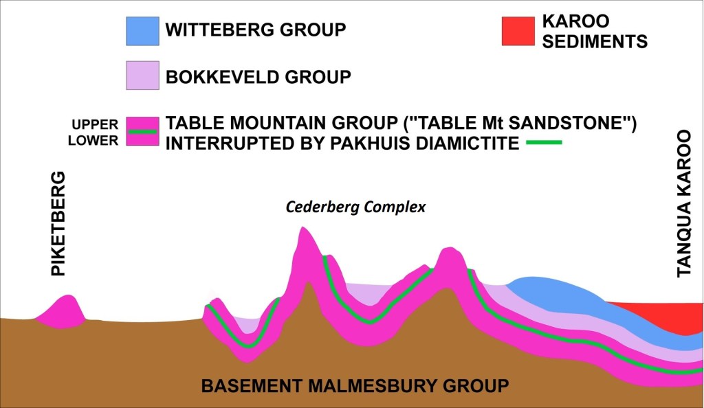
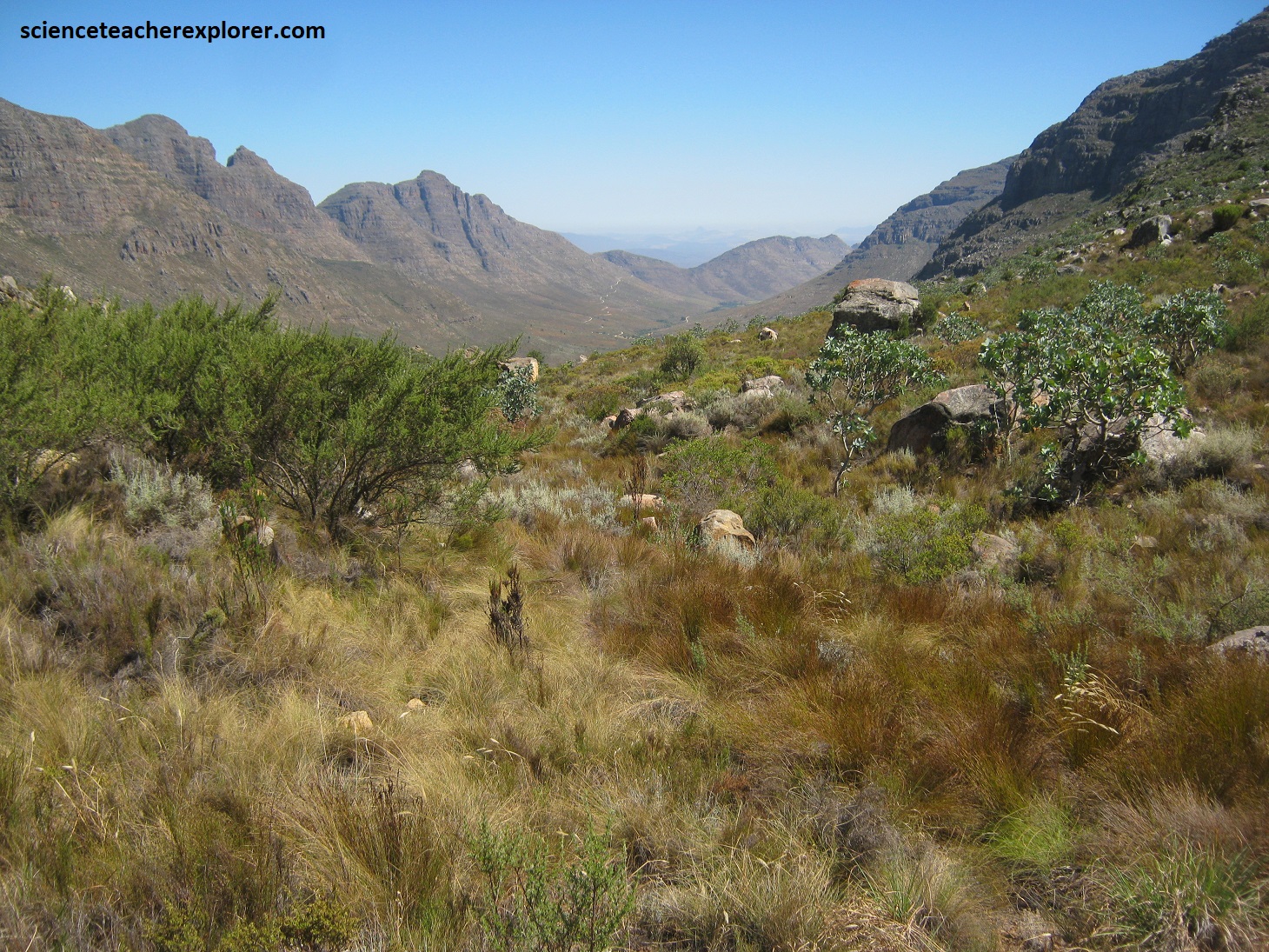
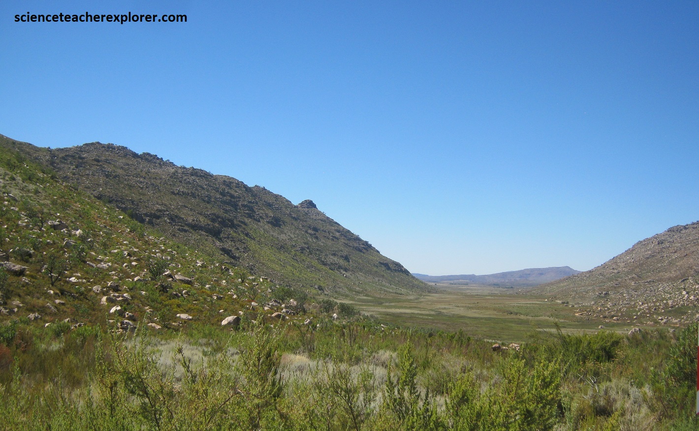
The first layer of the Karoo Supergroup was deposited over the Cape Supergroup, about 310 million years ago when the icy conditions subsided. Due to intercontinental movement and forces about 300 million years ago the stratigraphy of the Cederberg shows eastward-dipping of strata of the Cape Supergroup overlain by the Karoo Supergroup. This can be seen in the ridges above the Uitkyk Pass, (pictured below). Pictured below on-top, are viewing northwest & southeast on Uitkyk Pass of the Cederberg. Pictured below on-bottom are viewing the Skeeukof (1930m) & Tafelberg (1969m) ridges above Driehoek, (near Lot’s Wife formation).
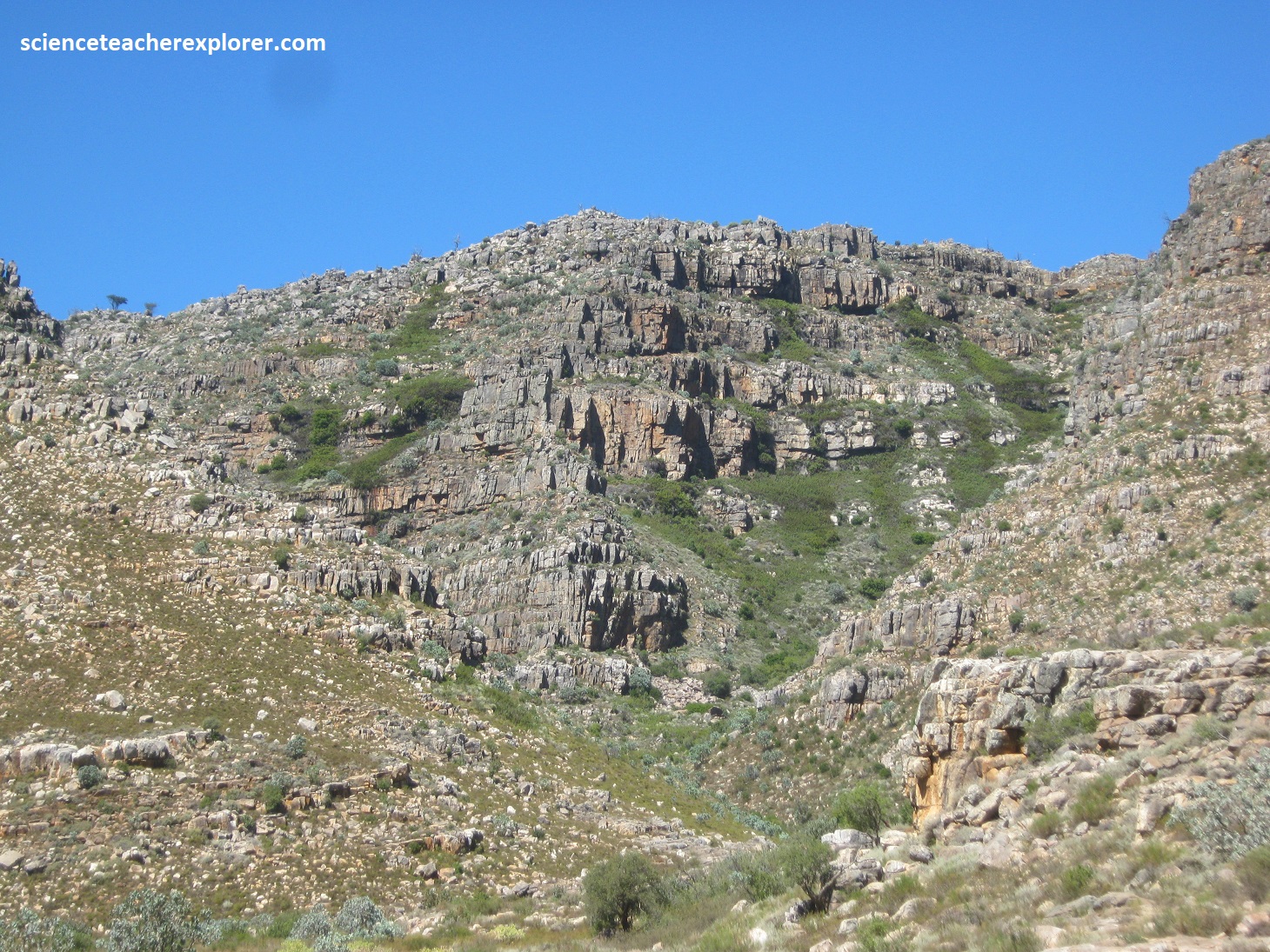
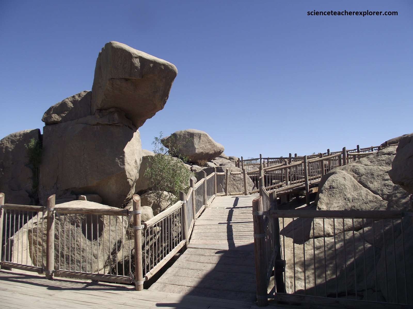
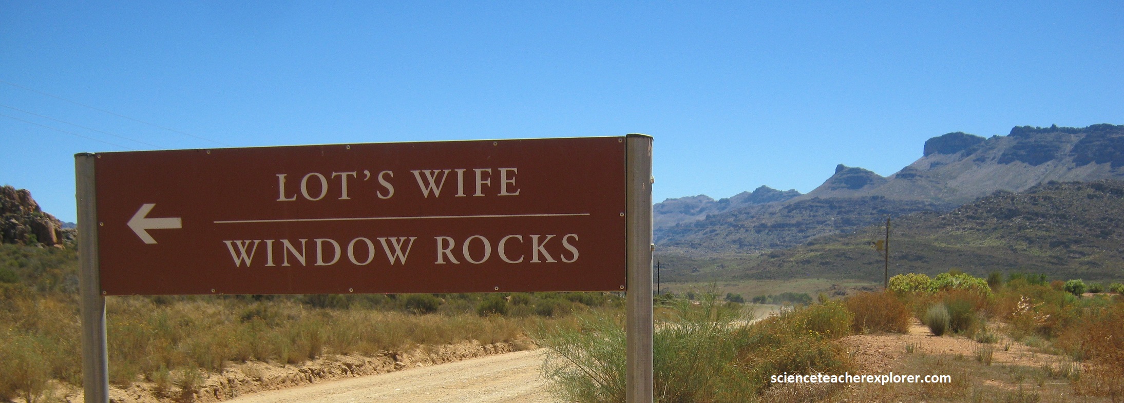
We finally arrived at our destination; Window Rocks of the Cederberg Complex. Of course, the primary attraction is Lot’s Wife, (pictured below).
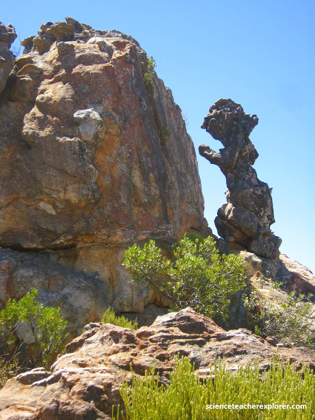
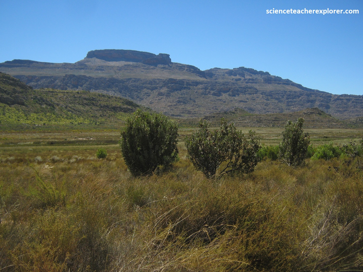
Pictured below, “Window Rocks”, with their craggy rock faces, weathered columns, isolated pinnacles and gargoyle-like formations, make for an intriguing geo-site to trek and explore. These peculiar sandstone columns that were formed by differential weathering and wind erosion, and are related to strong vertical jointing. For instance, the erosion starts with weathering along countless vertical joint surfaces within gently dipping sandstone layers, coupled with the eroding action of wind and water over millions of years.
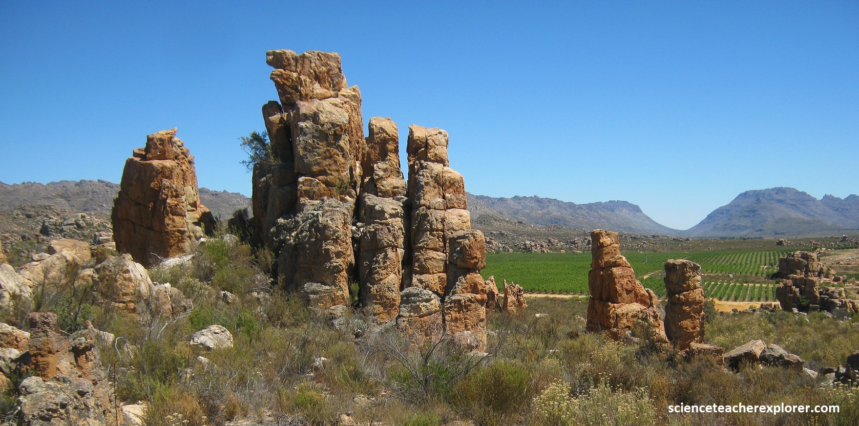
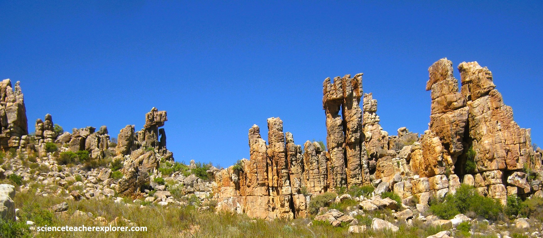
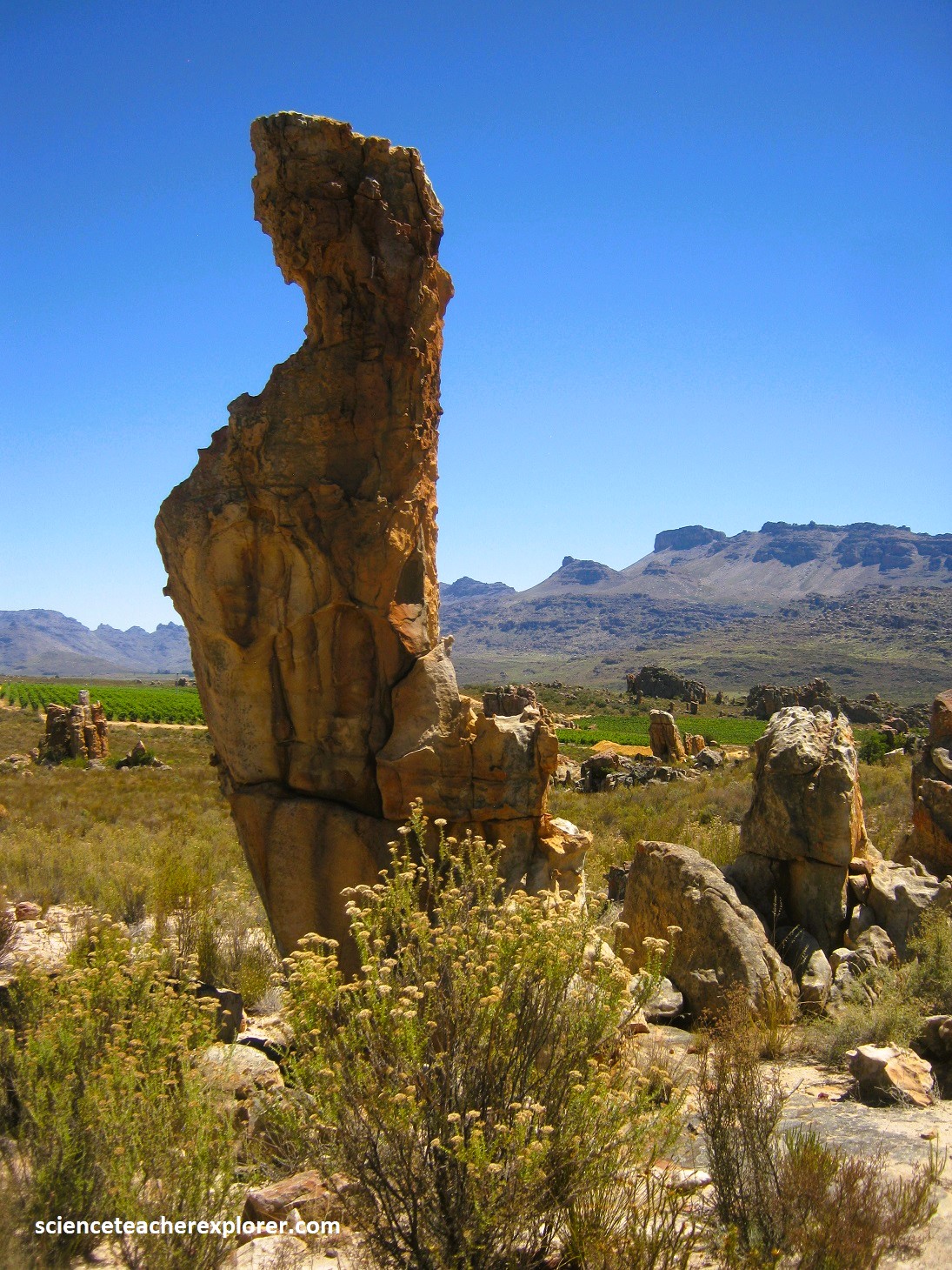
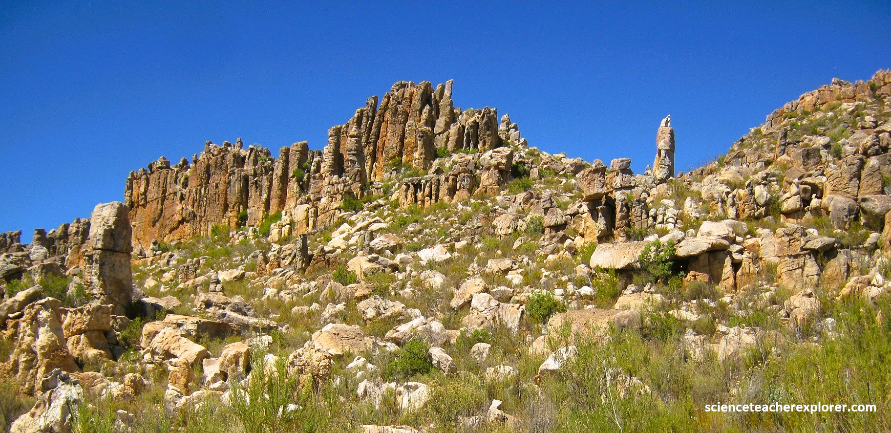
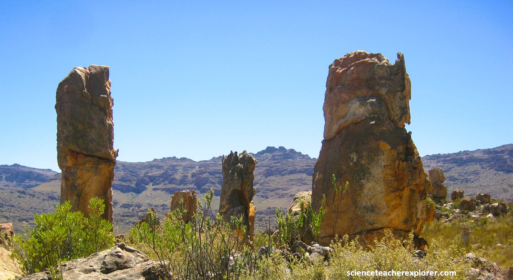
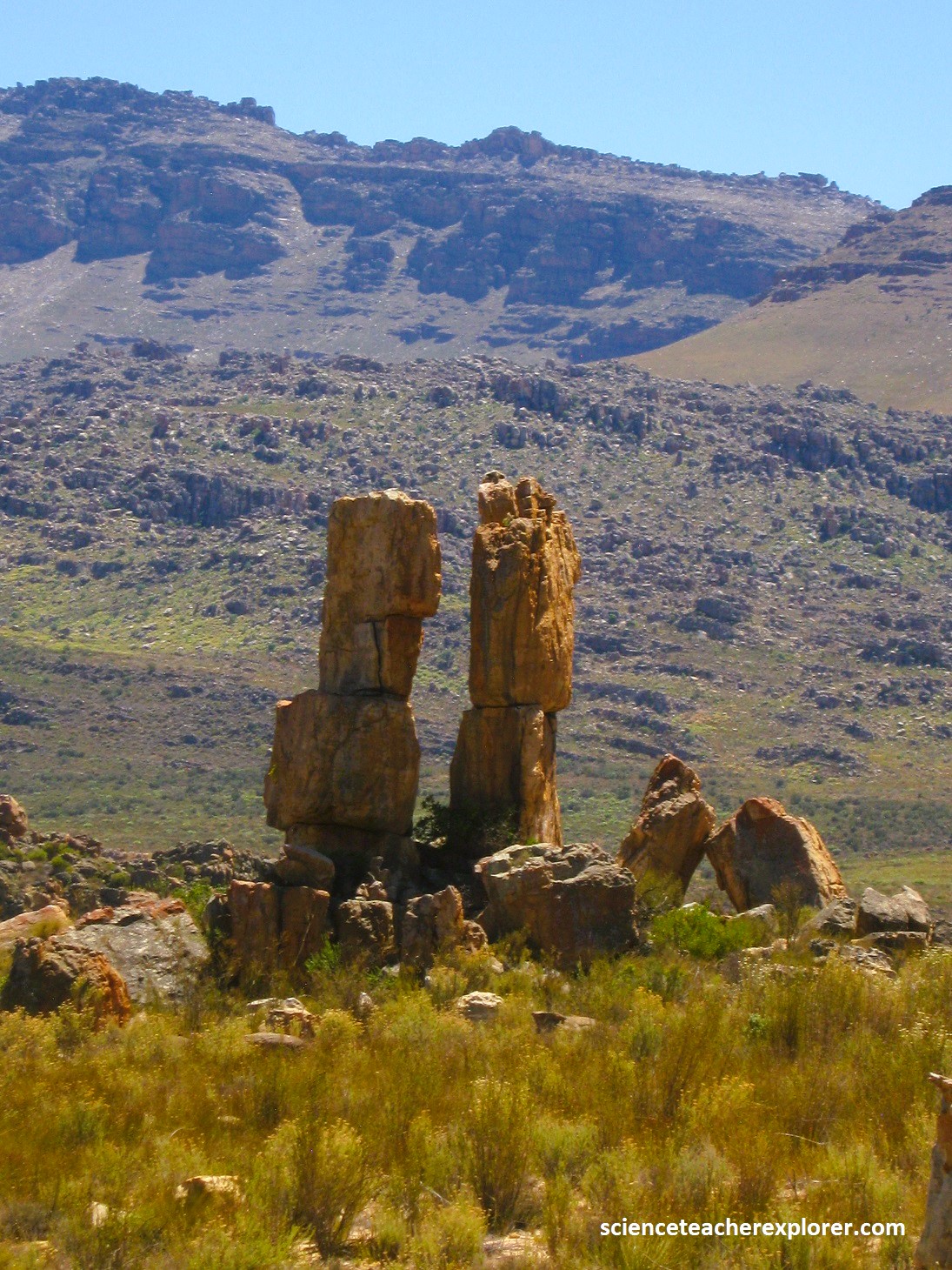
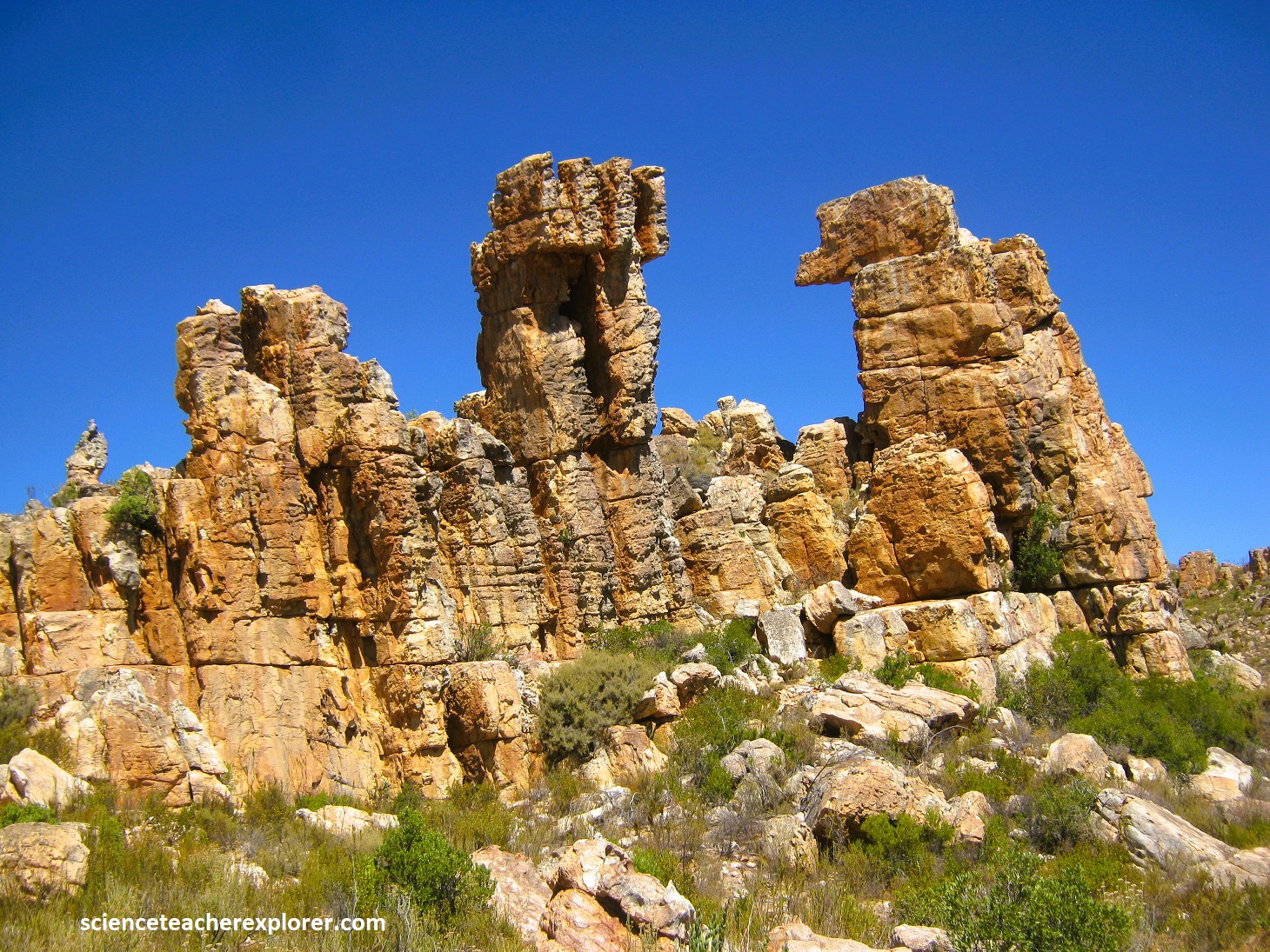
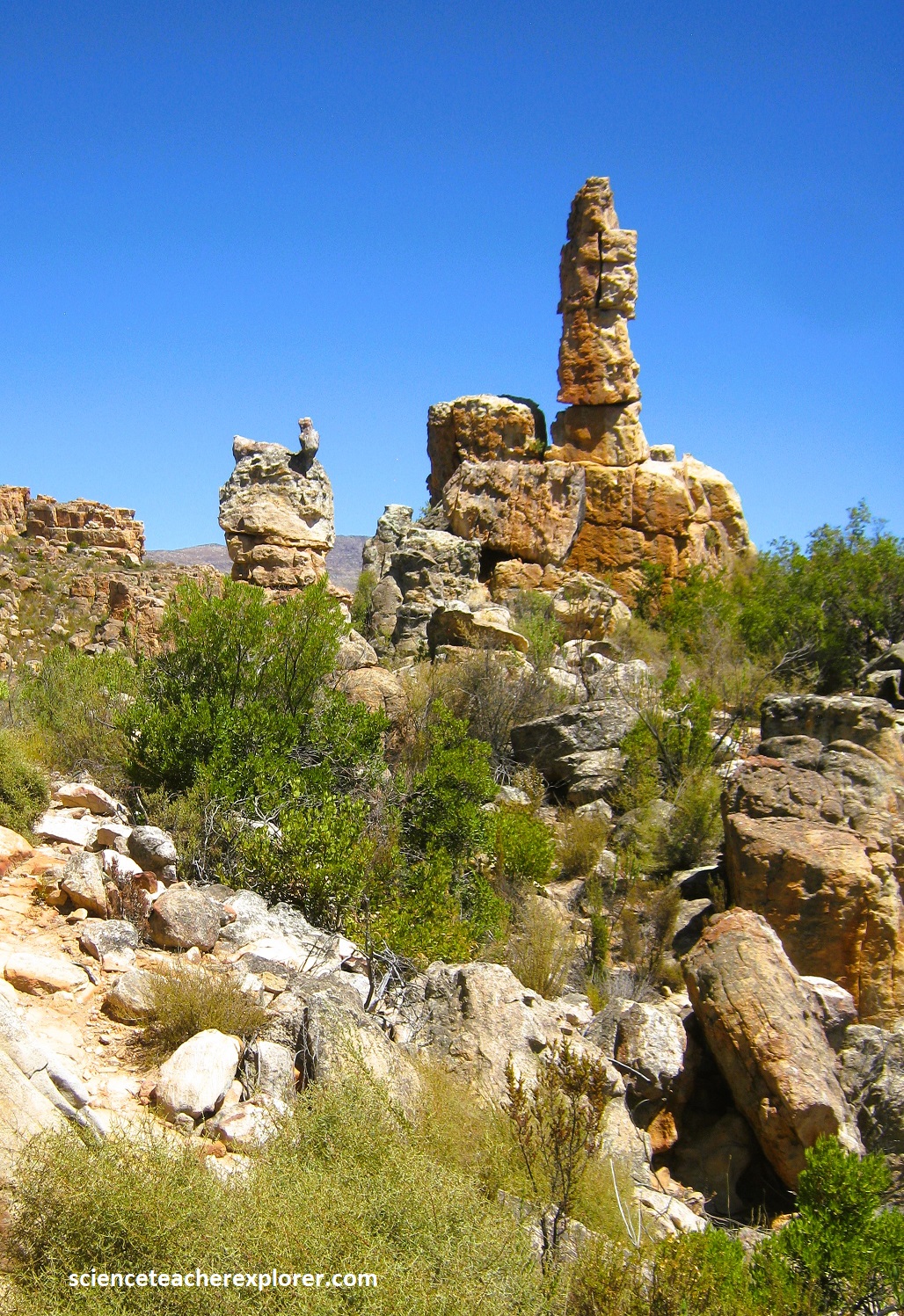
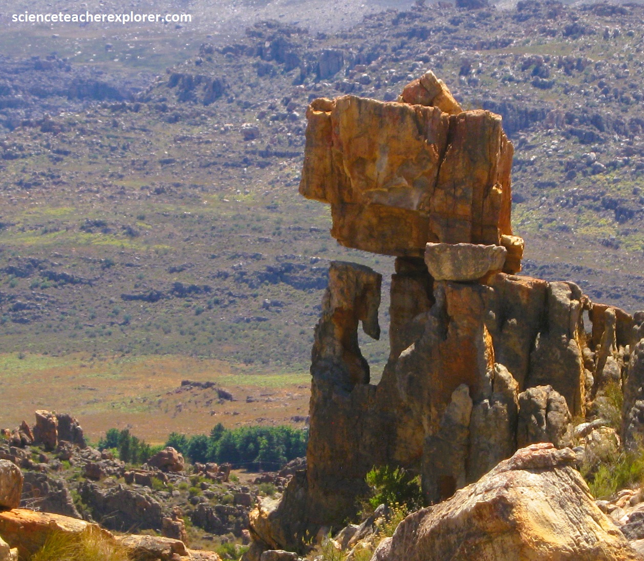
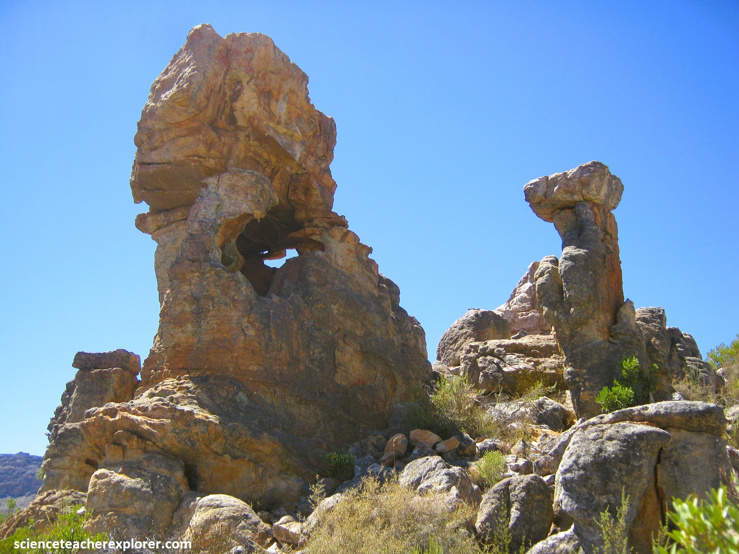
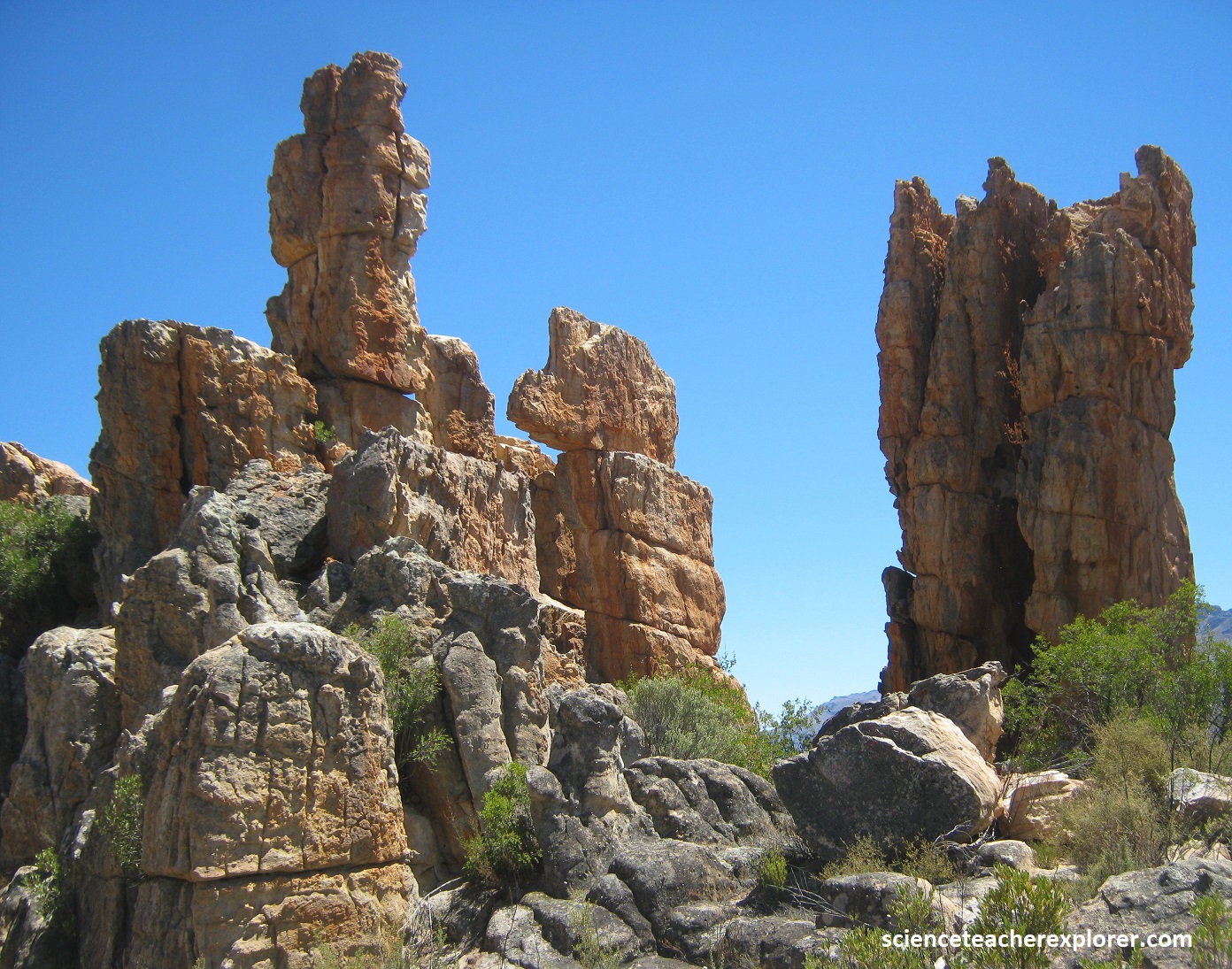
The rock formations at “Window Rocks” are in the upper part of the Table Mountain Group, lying above the Cederberg shale marker unit. These sandstone strata dip gently eastwards and are overlain by the Bokkeveld Group in the east. The reddish to orange colors are due to oxidation of iron minerals to abundant lichen on the rock surfaces.
This portion of the Cederberg Wilderness is at the border of the Northern and Western Cape. I’ve included here on the Northern Cape site because the map was a bit sketchy in this area. I enjoyed the view over the strange and scattered rock formations of the “Window Rocks” in the Cederberg Mountains of South Africa, with the mountains in the background shrouded by open sky.
