Buckskin, Utah 2000
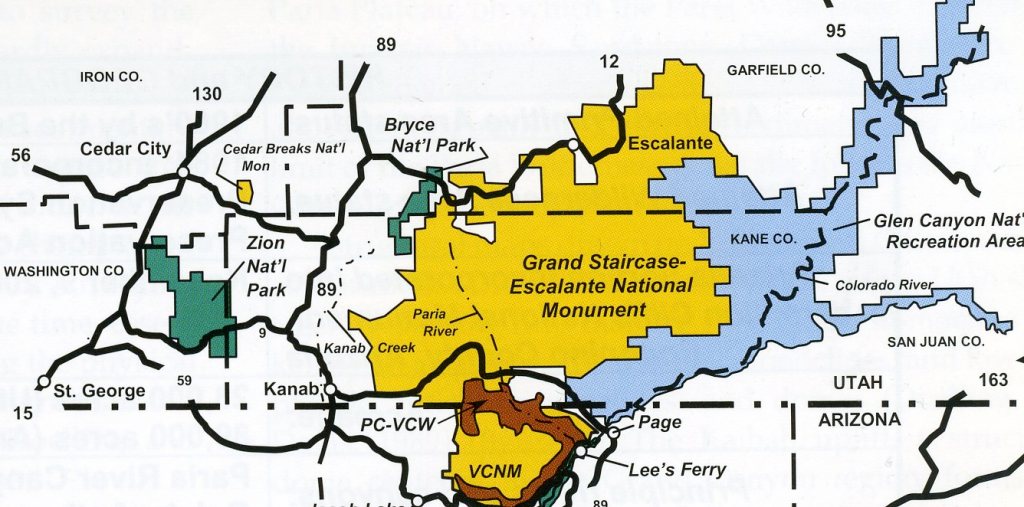
In May of 2000, I organized an educational hiking field-trip into Utah’s Buckskin Gulch. Buckskin Gulch is alleged by many trekkers to be the longest, narrowest slot canyon in the world. In the year of 2000, Buckskin Gulch was part of the Paria Wilderness, and now is part of the Grand Staircase-Escalante National Monument.
Buckskin Gulch is located about halfway between Kanab, Utah and Page, Arizona and south of Highway 89. To keep my student numbers down in the fragile areas of the wilderness, I split them up into 3 groups (6 students/group). Each group would take a day exploring the different parts of the wilderness; (Coyote Buttes, Buckskin Gulch & The Wave), then they would rotate to the other sites. During this 3 day period, we stayed at the Waa Weap Campground near Page, Arizona, 42 km away.
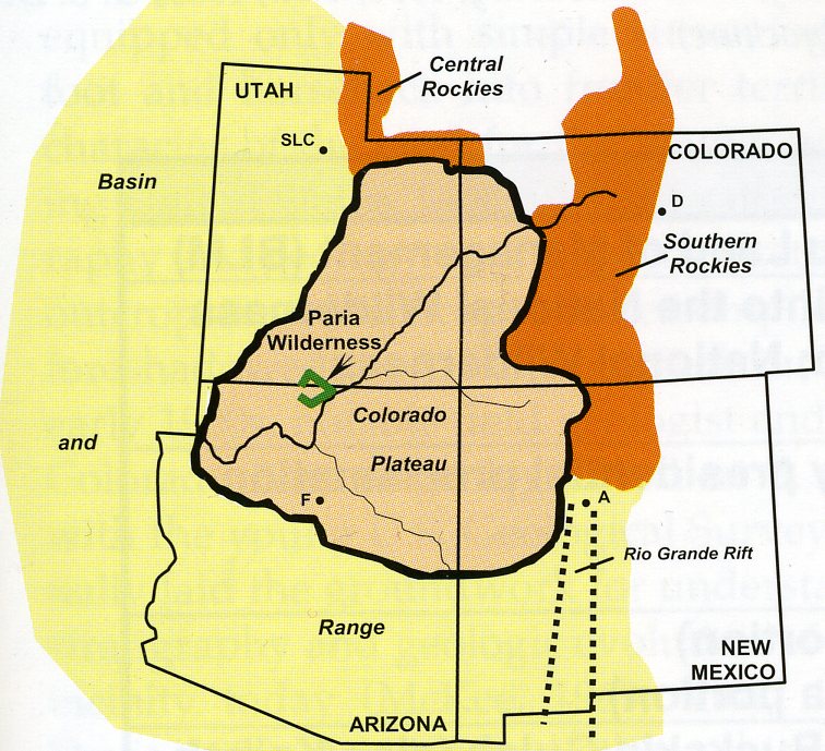
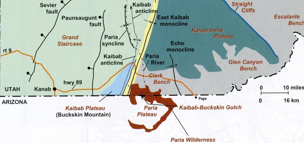
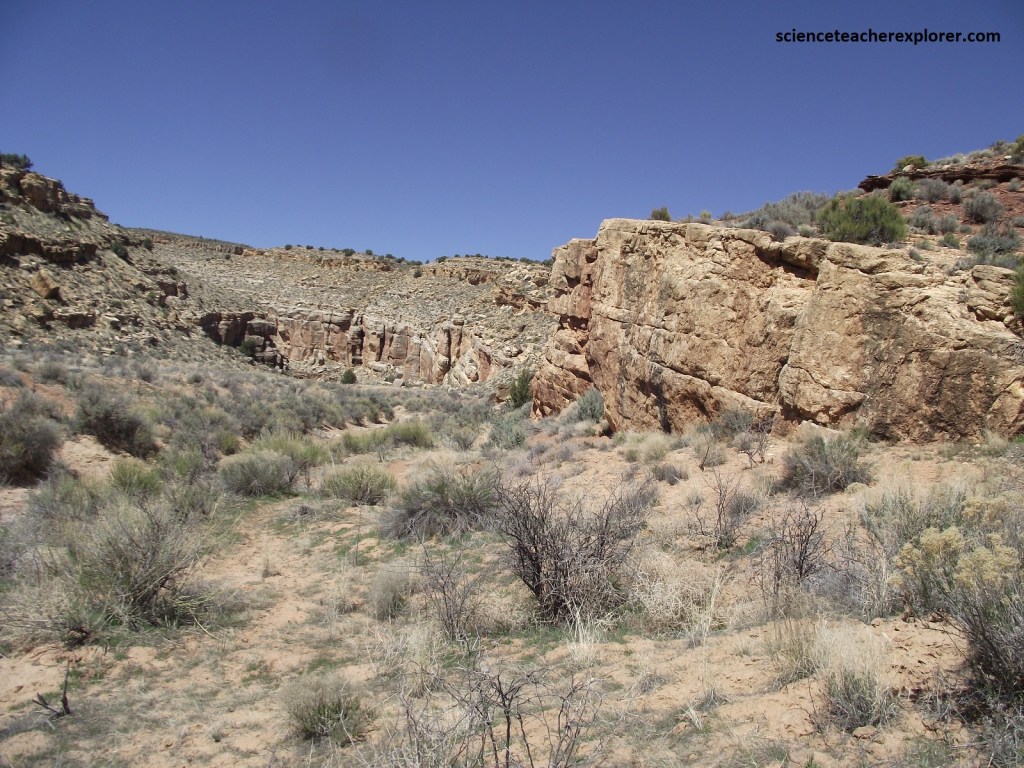
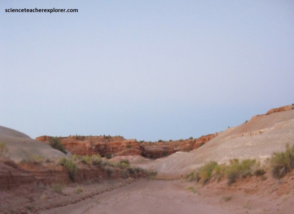
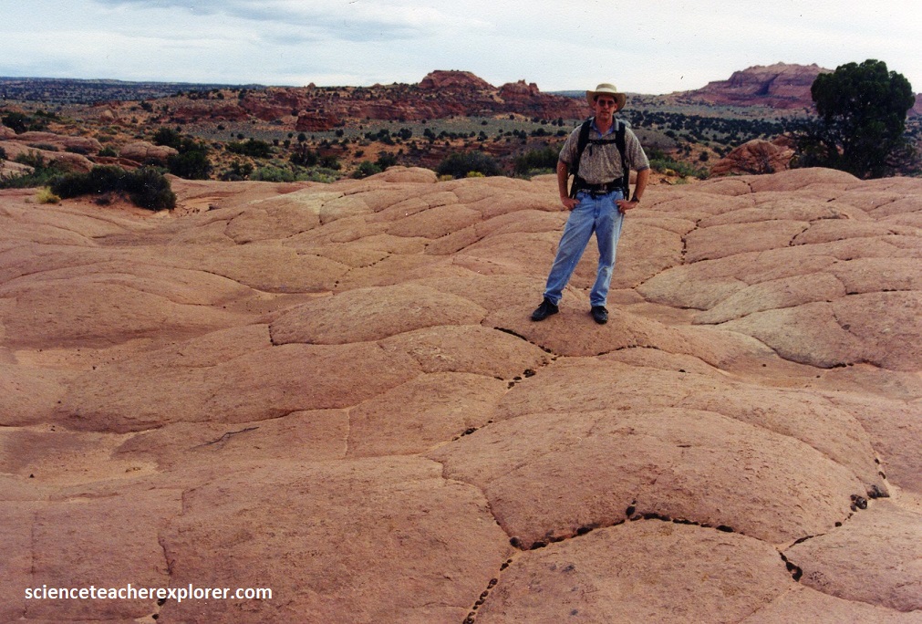
Lying astride the Arizona-Utah border, the Paria Wilderness is a colorful landscape of unusual rock formations. From its headwaters in Utah’s high plateaus, the Paria River has carved, on its way to meet the Colorado river at Lees Ferry, Arizona, an intricate network of canyons along the flank of the East Kaibab Plateau-Monocline or Buckskin Mountain (imaged below).
Hidden within this maze of cliffs, canyons, and buttes is a destination unlike any other on the Colorado Plateau. Buckskin Gulch forms a deep gash through Buckskin Mountain at the north end of the Kaibab uplift in the Grand Staircase section of the monument.
Imaged above, the Buckskin Gulch-gash in Buckskin Mountain, exposes the oldest rocks (Permian) of the monument: (ascending) the Hermit Shale, Coconino Sandstone, Toroweap Formation, and Kaibab Formation. The Early Triassic Timpoweap Member of the Moenkopi Formation forms a carapace on top of this section called the Buckskin Mountain, which appears as a “whaleback” from U.S. Hwy 89, (image below).

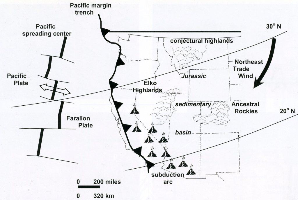
During the end of the Cretaceous period, the Kaibab uplift and East Kaibab monocline began to take shape due to compressive force affecting western North America.
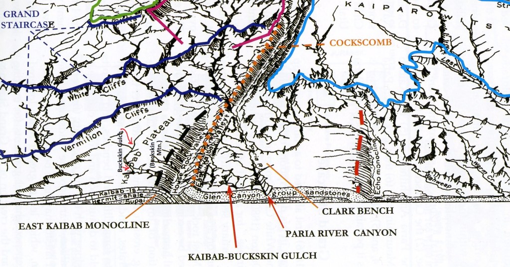
Access to the top of the deep gash of Buckskin Gulch is provided by following a side road off the House Rock Valley road, which extends southward from U.S. Hwy 89 just before the highway cuts eastward through the Cockscomb.
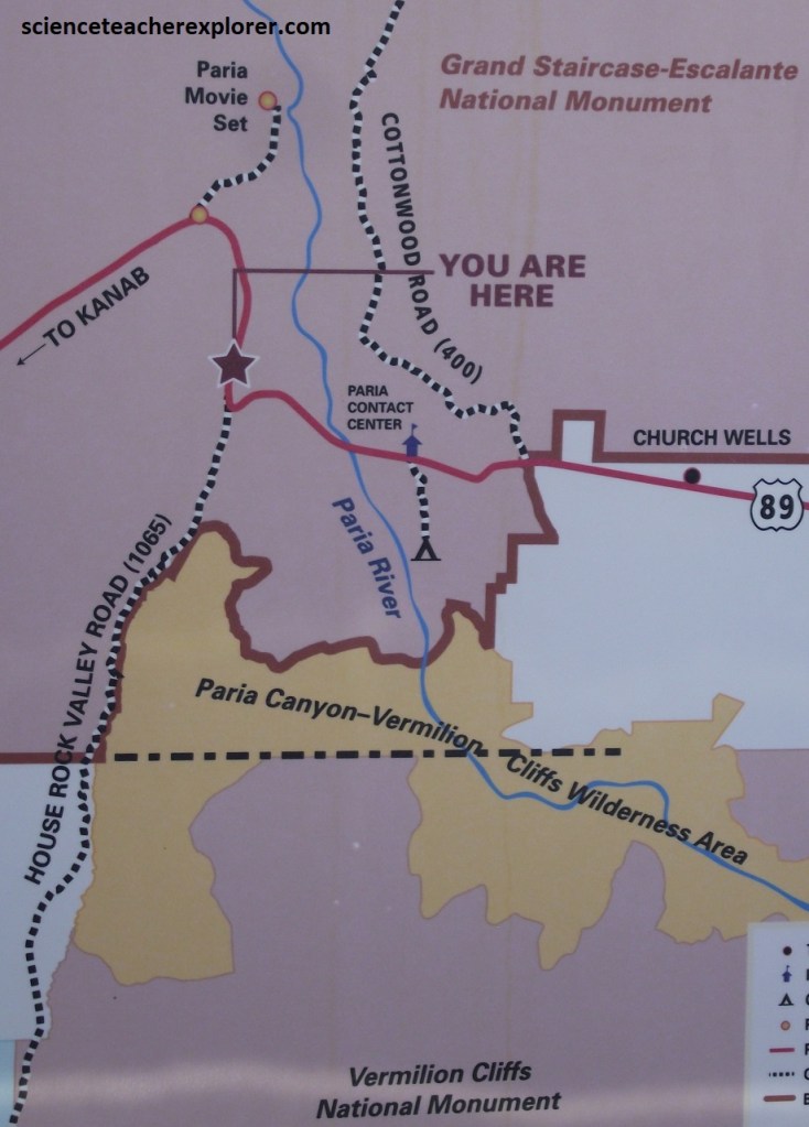
Normally, the approach to the slot canyon hike starts at the, “Wire Pass Trailhead” and ends at the Paria River confluence. I hiked through the Buckskin Gulch in the early 1990s, (it took me 2 days), however I chose to drop the students and my father, (Patrick Lindsay 1924-2012), into the Gulch from the “Middle Trail” to save time.
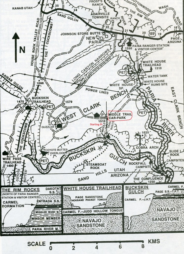
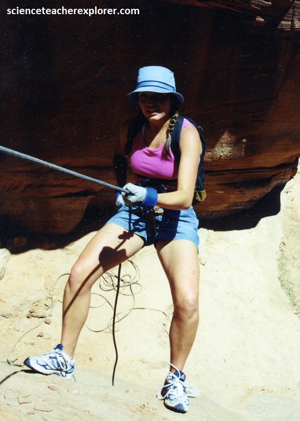
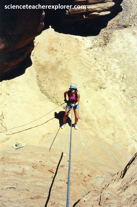
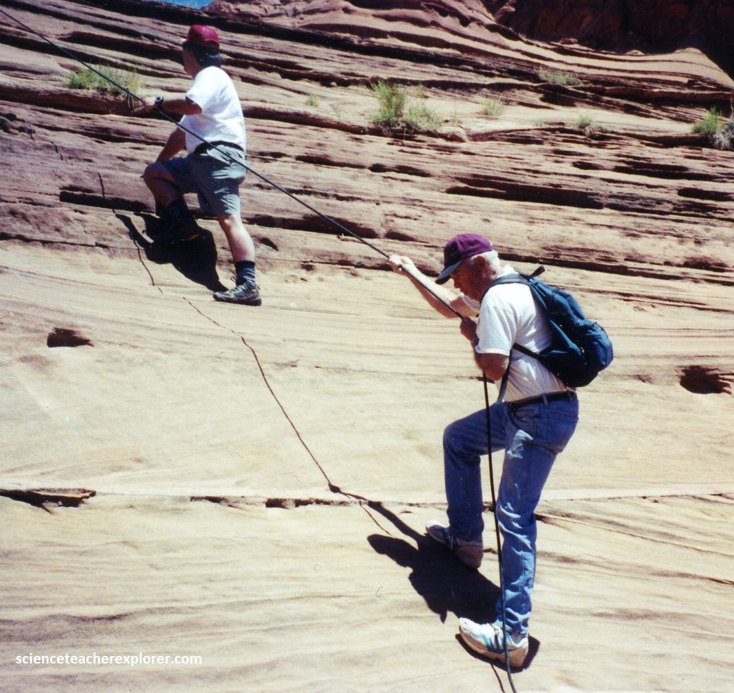
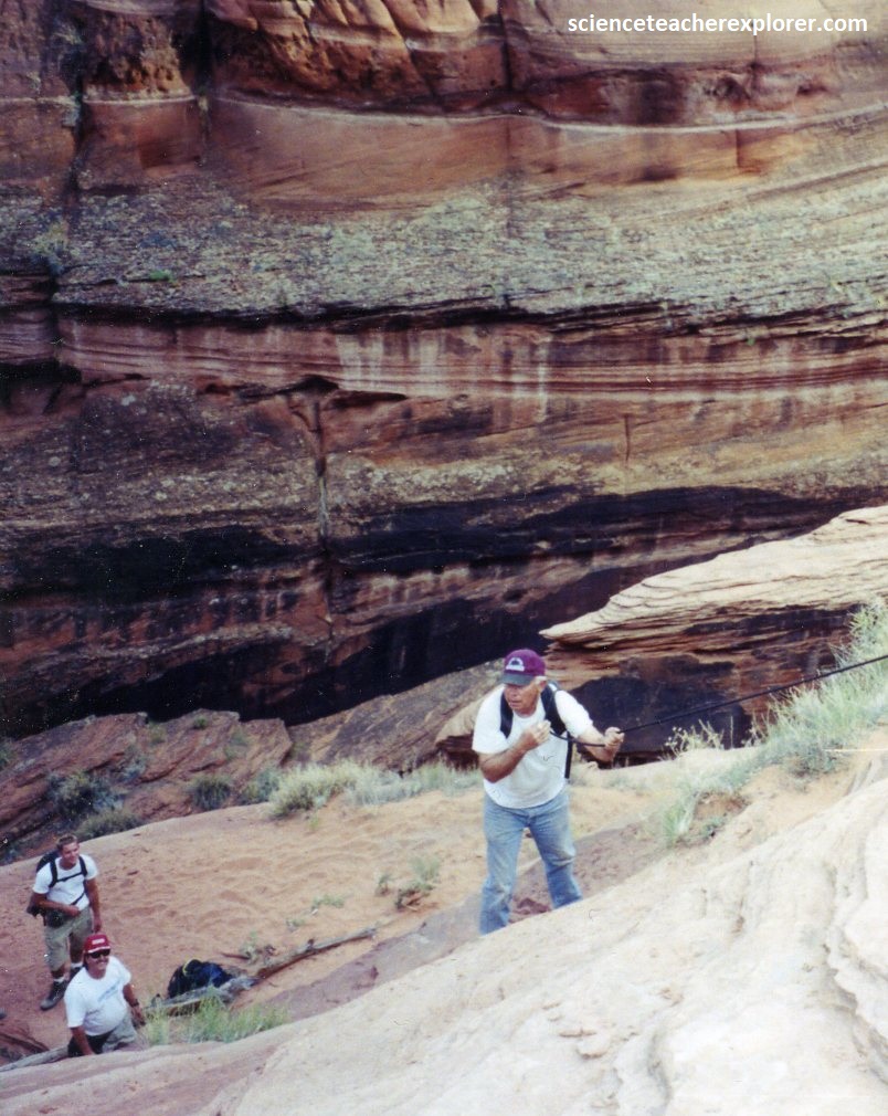
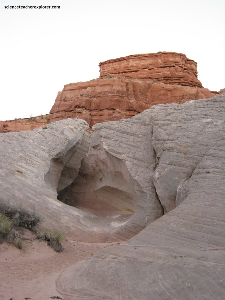
The Buckskin Gulch “Middle Trail” is not really a trail at all, but rather a route down which on can climb from the top of the north rim. The rim was not well marked in 2000, but nevertheless it was easy to spot because of the erosion along the geological fault within the Navajo Sandstone. It was located in a short, open section of the canyon where the walls were not steep and the rim is only 33m above the canyon floor.
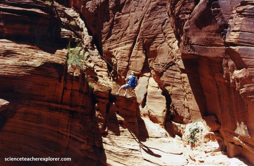
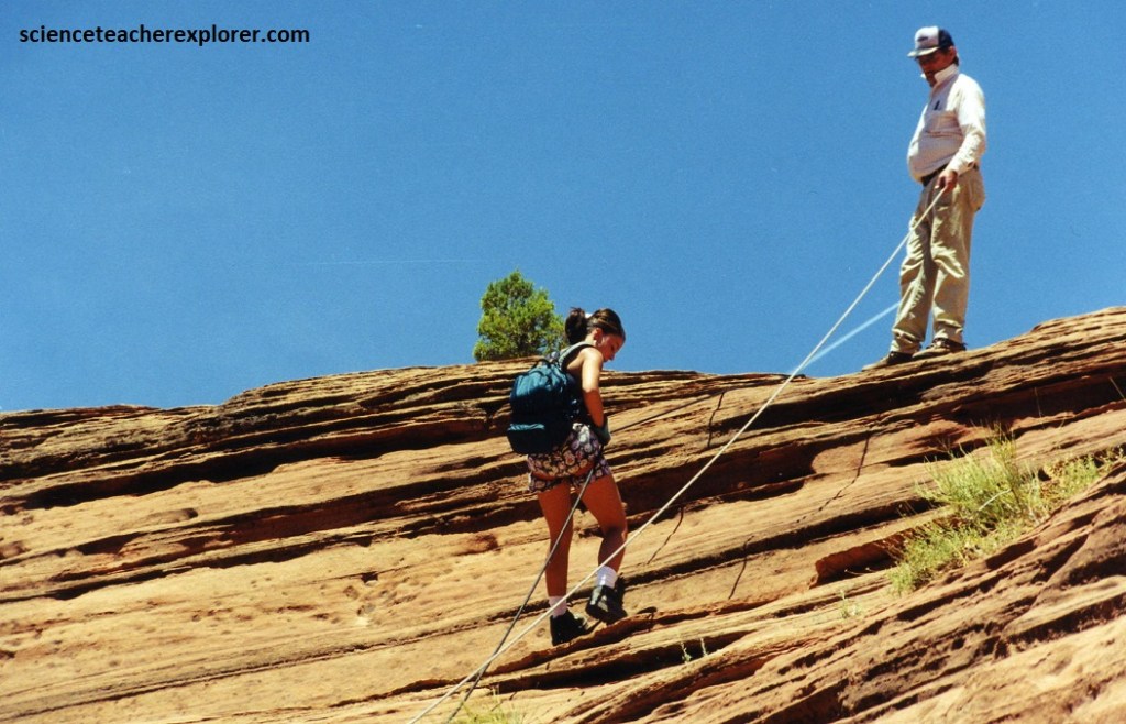
The descent was was not a walk, but rather a nontechnical rappel with a rope. I chose to do a rappel to keep my students safe from an accidental fall.
It was fun for the students and an educational experience, since all of them have never done a rope rappel before. [Pictured below, is one of my students rappelling off of the “Middle Trail” in Buckskin Gulch, Utah 2000.]
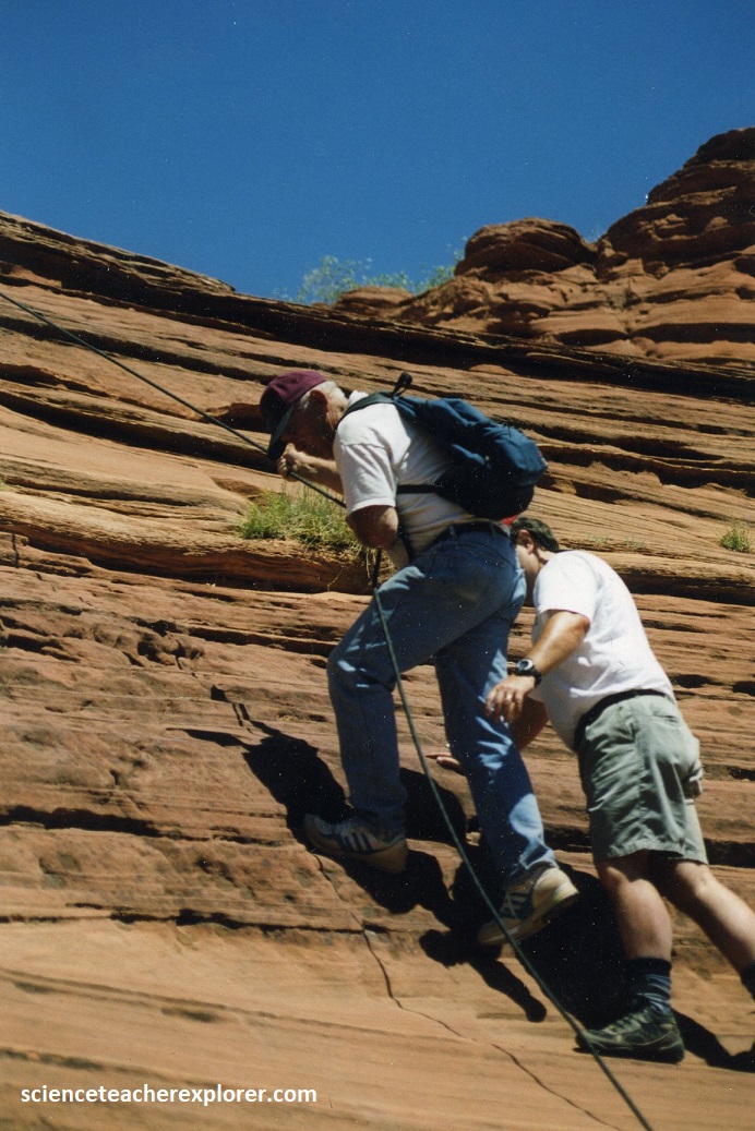
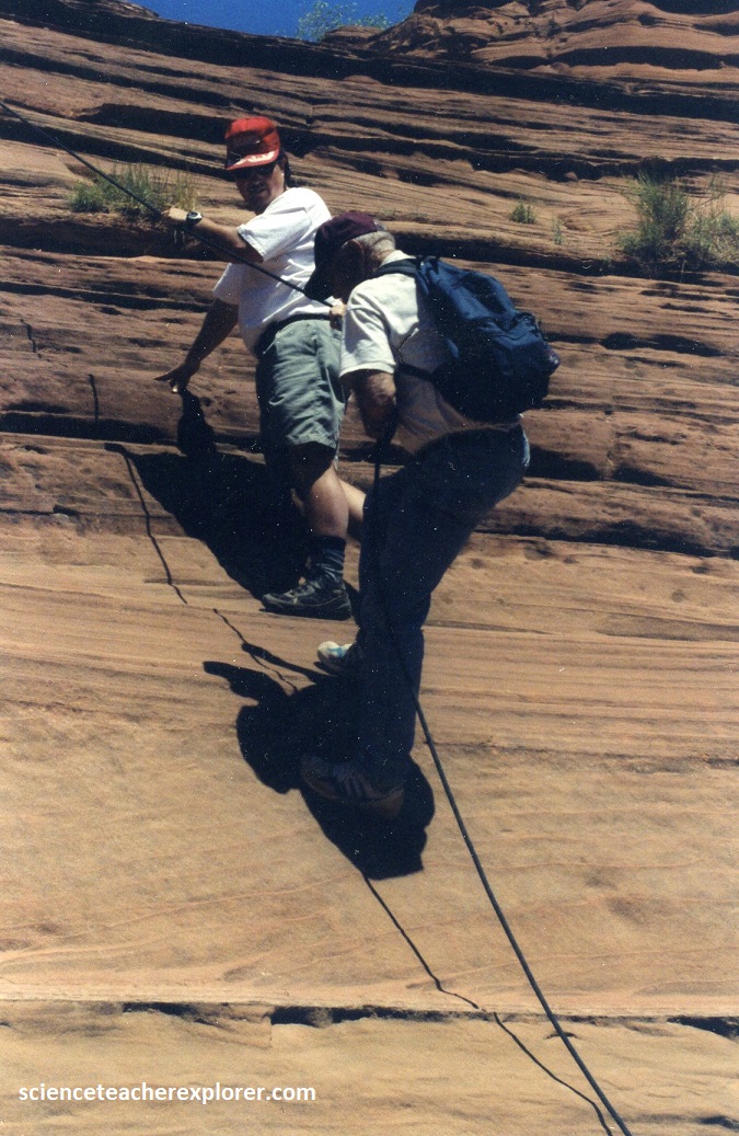
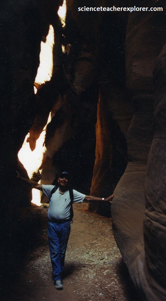
Pictured below, my father, (Patrick Lindsay 1924-2012), joined us on this tour of Buckskin Gulch in 2000. Even though he was raised and lived in Southern Utah, he had never attempted any slot-canyon adventures in his lifetime. He was 75 years old, and needed my assistance in rappelling down the “Middle Trail” for Buckskin Gulch.

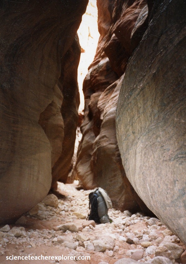
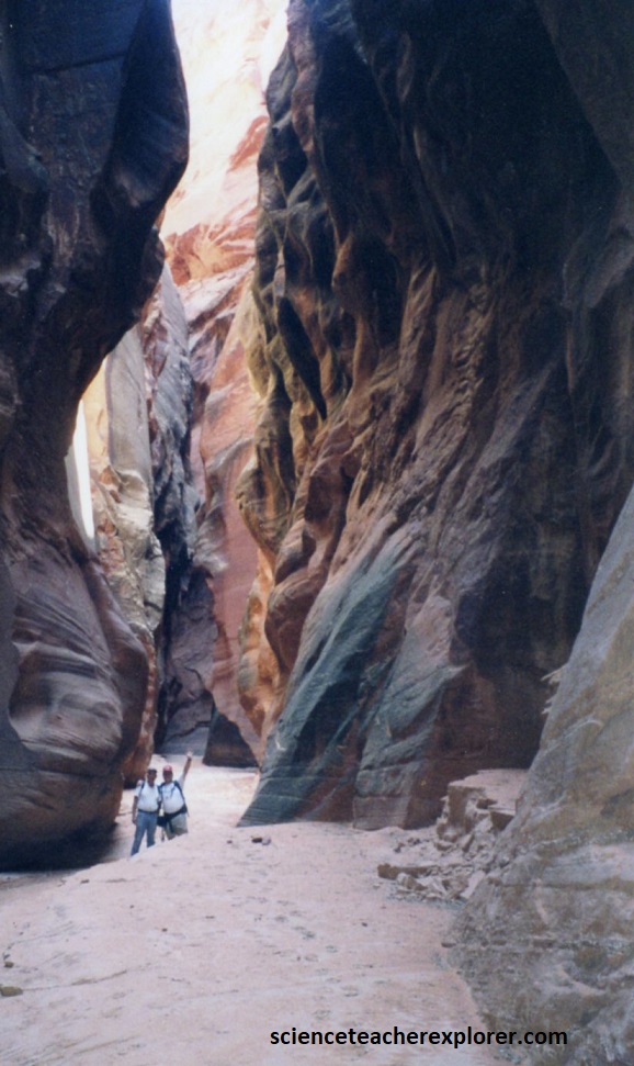
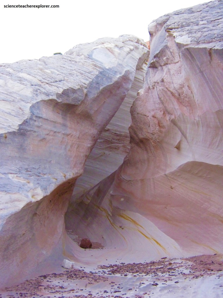
Soon after leaving the Middle Trail the narrows close in, and the depth of the canyon continues to increase.

For the most part it is an easy walk along the bottom of Buckskin. The bottom is normally flat with very few large stones to imped our way.
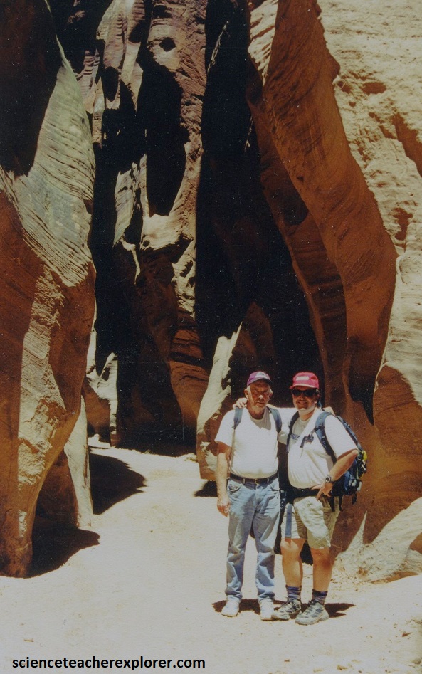
My father and I had the opportunity to take a couple of pictures together in the Buckskin Gulch Narrows in May of 2000. Much of the canyon was very dark and difficult to take pictures.
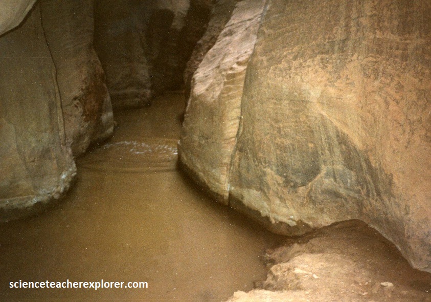
West of the “Middle Trail”, we entered a stretch of canyon where there were pools of stagnant water.

Many of the pools contained rotting vegetation and are foul smelling. The largest of these pools has been named, appropriately enough, the Cesspool.
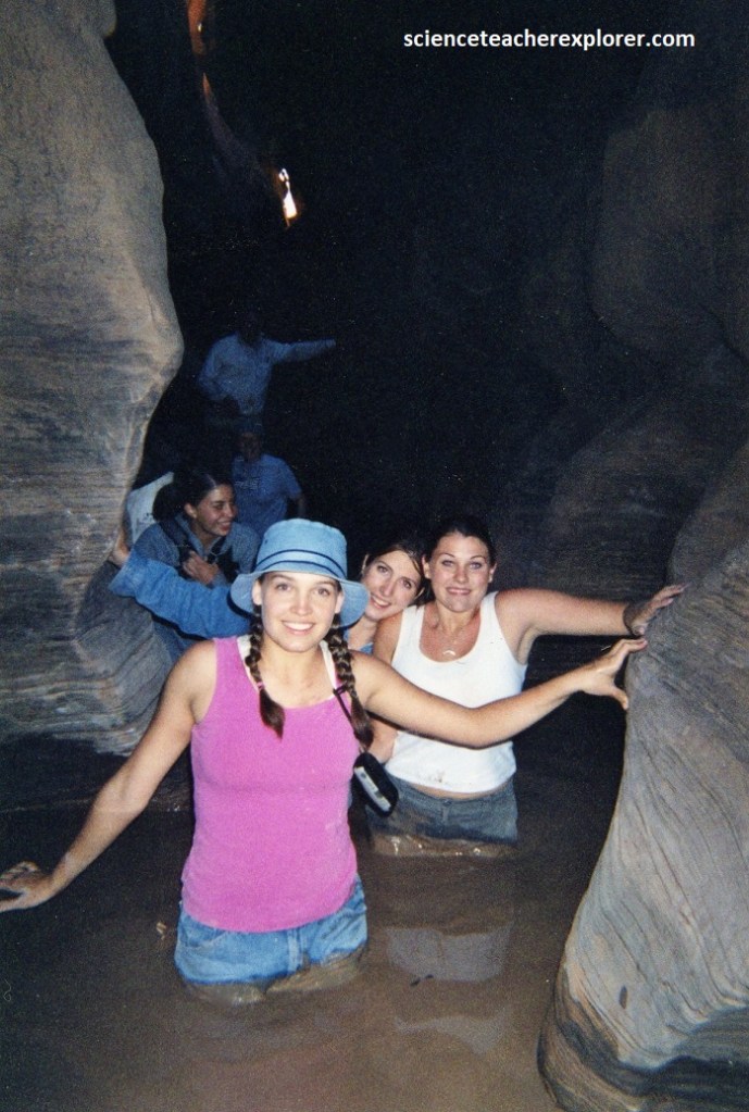
Pictured below, wading through the pools were a revolting experience, but fortunately they were rarely more than thigh deep. We noticed that there were no animals of any kind living in any of the stagnant pools.
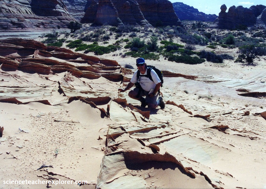
Pictured below, one of my assistant-advisors, David Fillerup (1945-2021), was very valuable on this trip by providing and assisting with his rappelling gear for the three days of the trip.
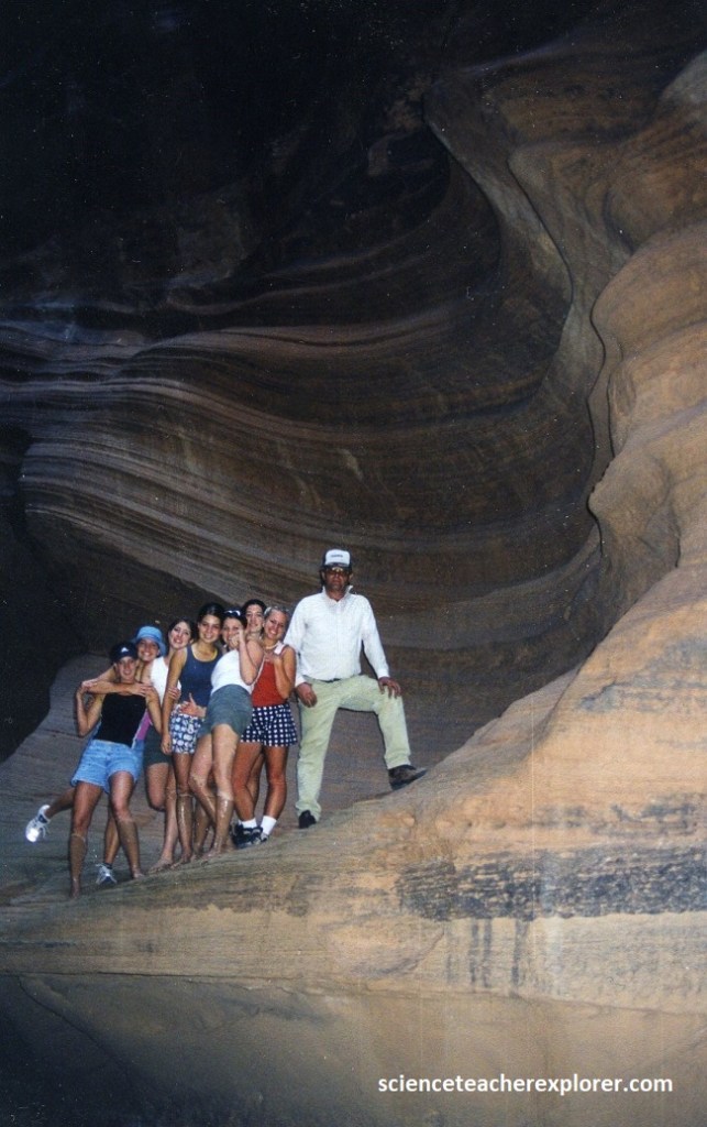
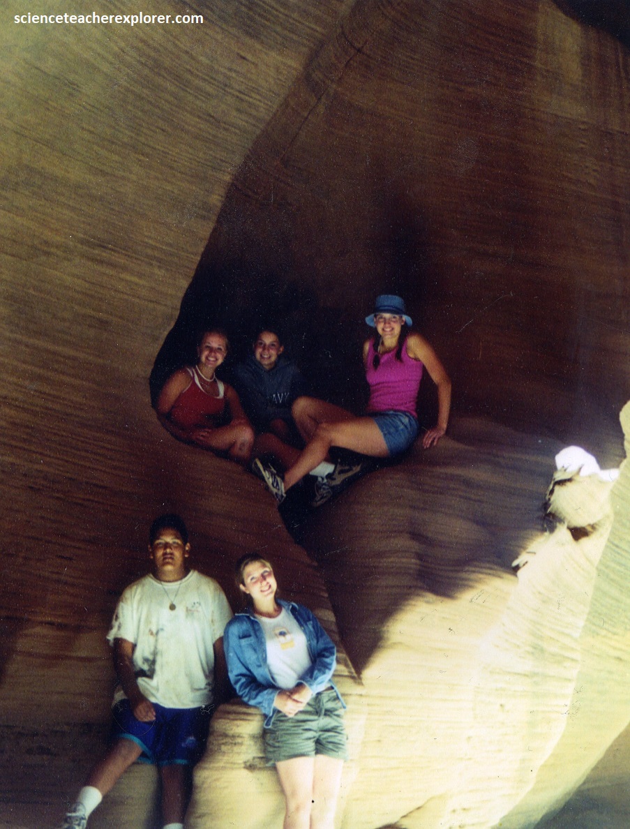
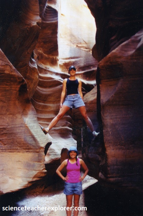
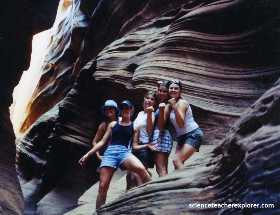
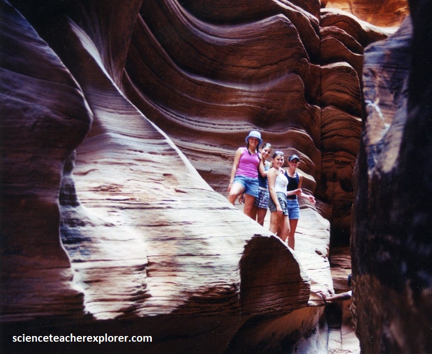
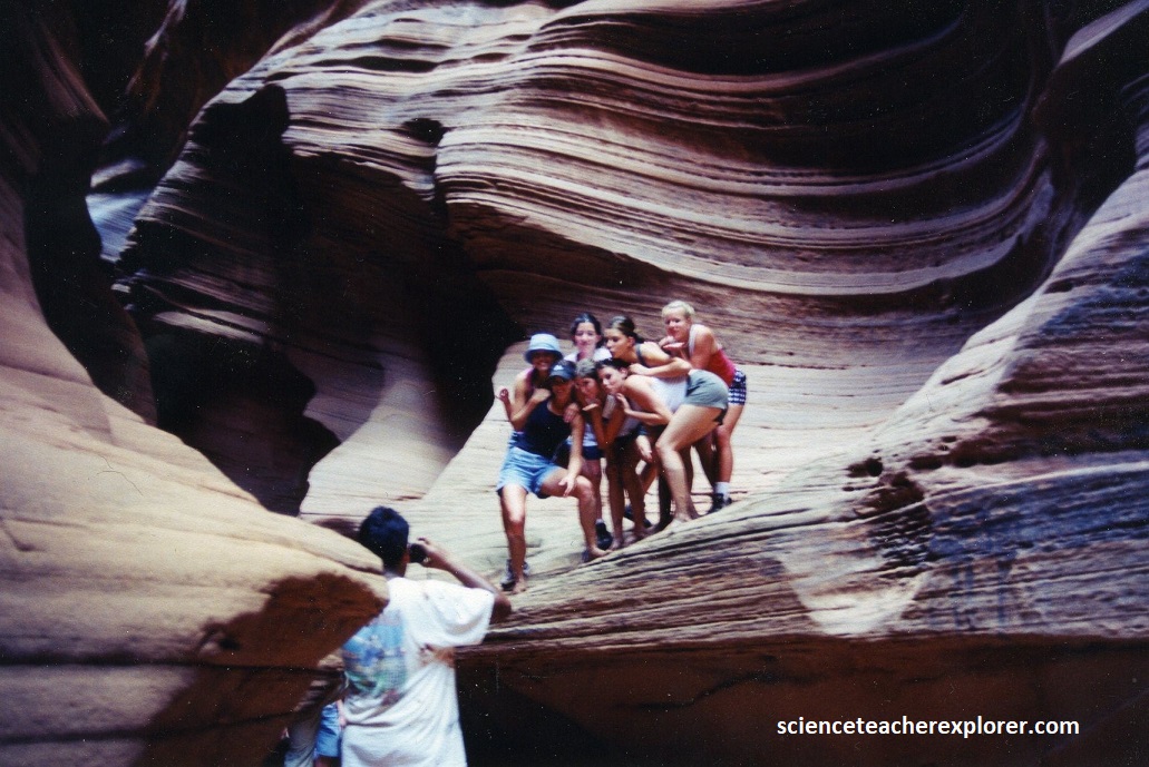
Pictured below are several of my students, taking the opportunity to take pictures of themselves in the most spectacular parts of Buckskin Gulch.
There were no more deep wading pools below (east) “Middle Trail”, but after about 6.5 km, our progress was stopped by a pile of huge rocks that became wedged into a tight constriction in the canyon.
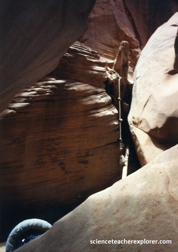
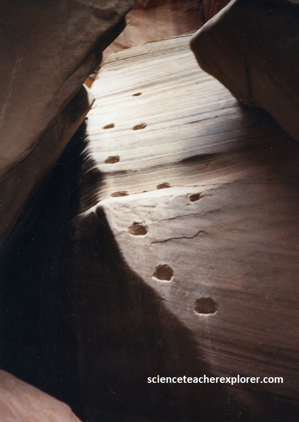
Pictured above, this rock jam was Buckskin Gulch’s most serious obstacle, and we needed a rope to get safely around it. The standard route required us to climb about 3m down the smooth face of one of the boulders. Pictured below, previous hikers had chipped footholds into the soft sandstone.
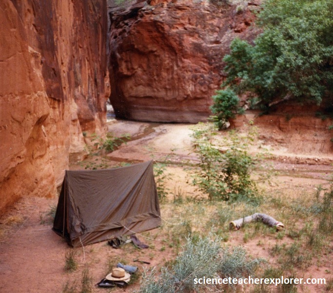
Since I got a late start in 1992, and I wasn’t aware of “Middle Trail”, I was required to sleep in a tent inside the canyon. This was not recommended, due to the dangers of a flash flood. However, the Buckskin narrows extended almost uninterrupted for over 20 km with the width of the canyon seldom exceeding 7m. The walk through the dark narrow canyon, for the first time, was truly a unique trekking experience. However, I trouble sleeping, because the bats kept hitting the side of the tent all night.
Pictured above, about 1.6 km below the rock jam, or 0.8 km above th Paria River confluence, we come to an excellent campsite. There was a large grove of maple and boxelder tree growing in the sand above the streambed. Near the rock jam, a series of seeps in the Navajo Sandstone walls supplied a tiny flowing stream on the canyon floor. The fresh water was a welcome change from the stagnant, lifeless pools west of the “Middle Trail”. In 2000, my educational groups were not required to camp and continued down to the Paria confluence.
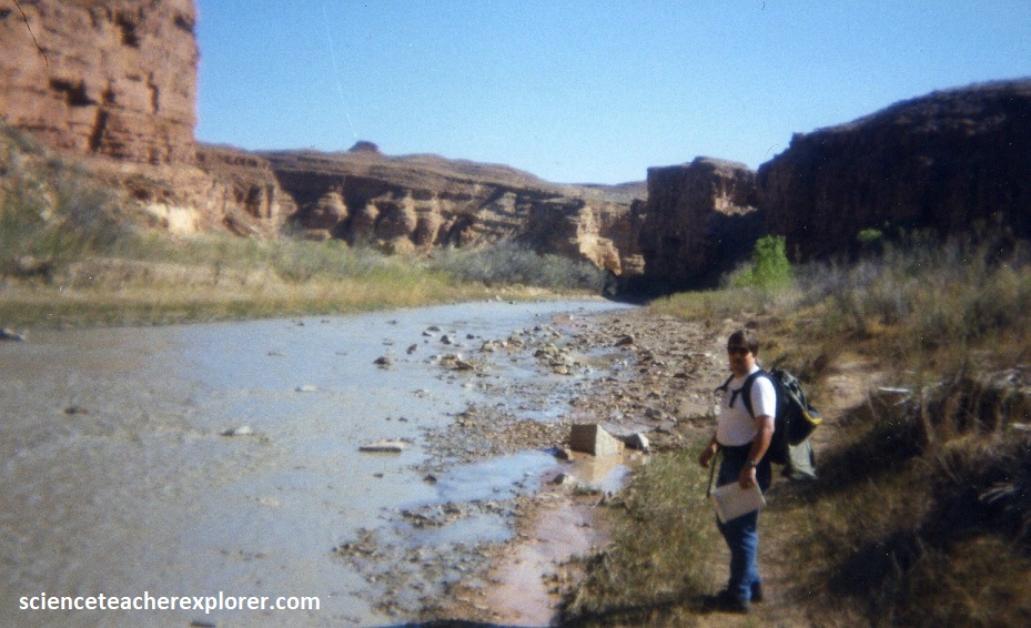
Pictured above, Slide Arch in not really an arch at all, but rather a large piece of sandstone that has broken away from the east wall and slid down into the river. At the Paria confluence, my students turned left upstream of the Paria River. Their destination was the White House Trailhead 8 km north.
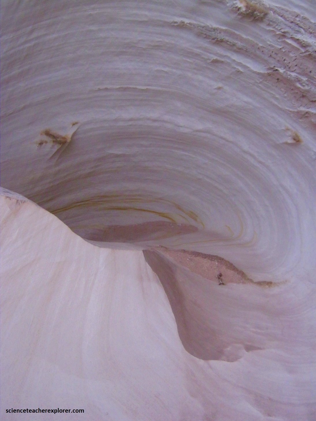
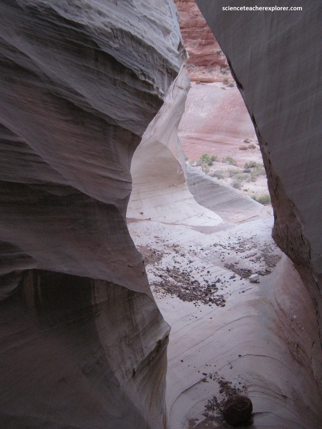
About one kilometer north of the White House Trailhead is a small ravine that takes you east to another geological site called the “Nautilus”, (pictured below). This made a nice visit, after the students got to the vehicles that were waiting for us, after a long hike through Buckskin Gulch.
Pictured below, the Nautilus was a semi-official name in 2000 of a beautiful formation of wind and water-eroded Page sandstone, at the edge of a small tributary ravine near the Paria River.
The Nautilus lies on the southeast side of the drainage, just west of a little tributary you walked down for 300m.
The main part of the formation is pictured above; a graceful, swirling gap through the sandstone mound, mostly colored pure white but speckled with tiny yellow dots and crossed by thin lines of red and orange.

The gully looks cool, and different, from all angles. There are several smaller areas of the same grey sandstone nearby, and a few other interesting eroded formations.
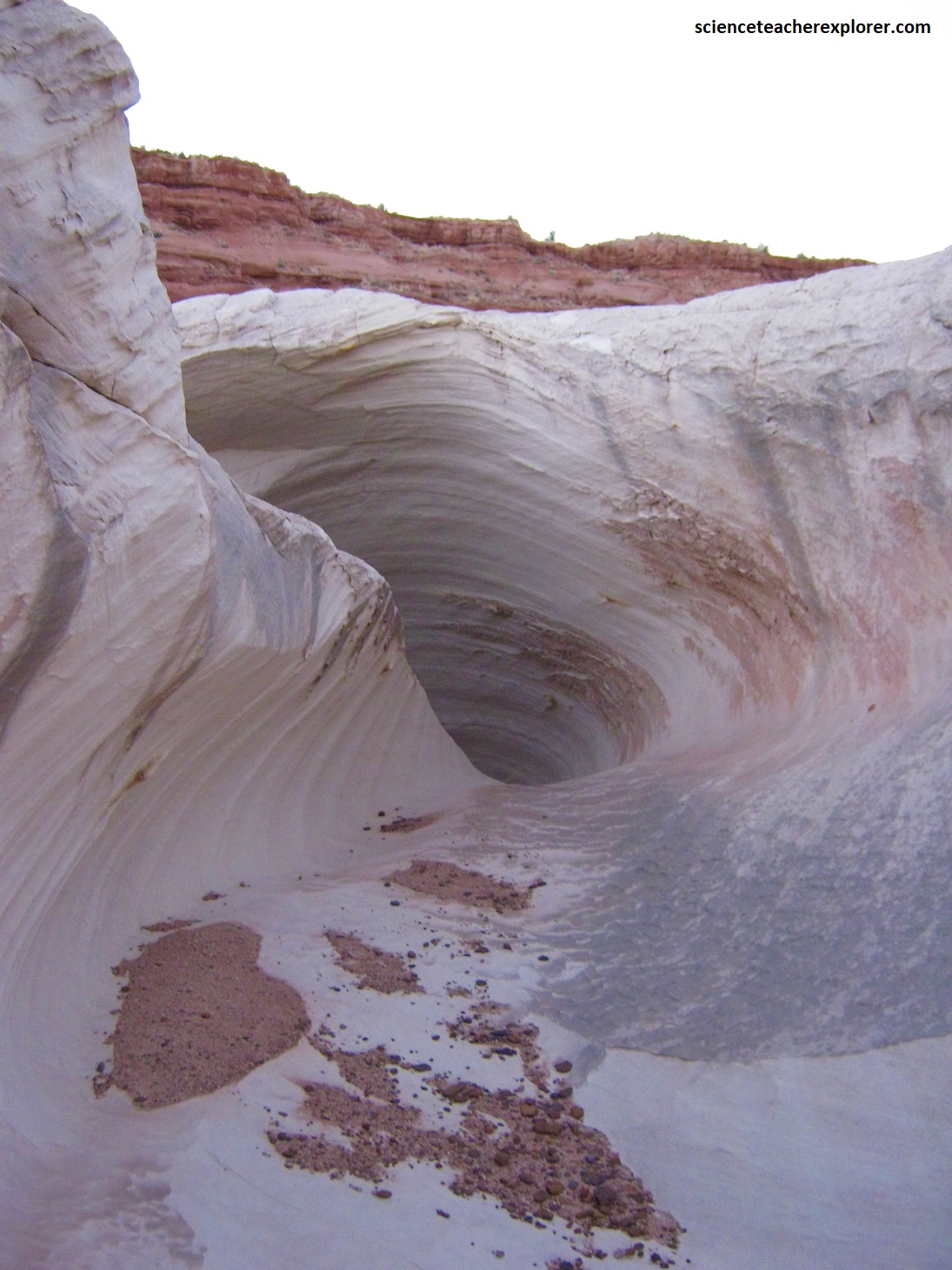
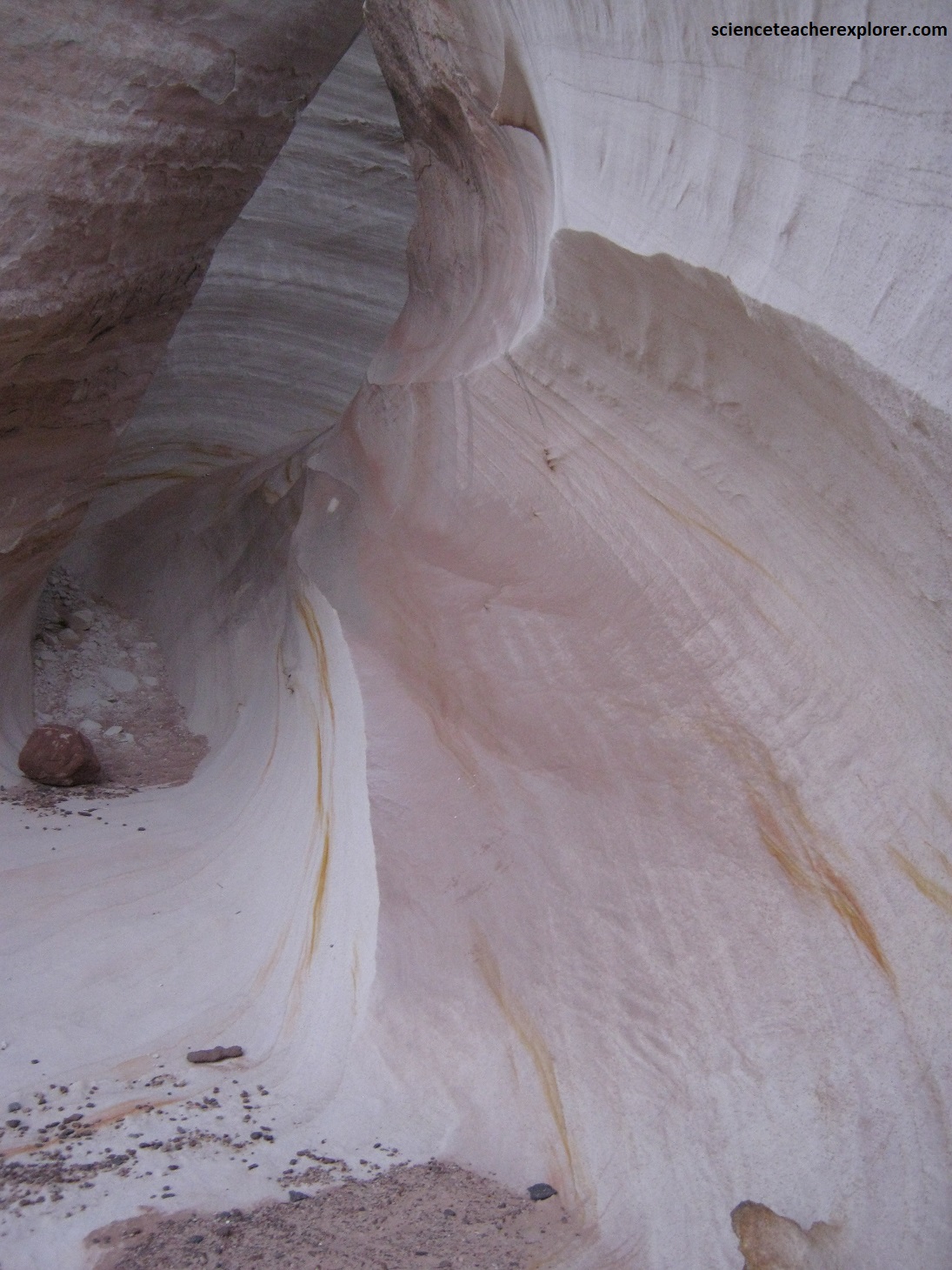
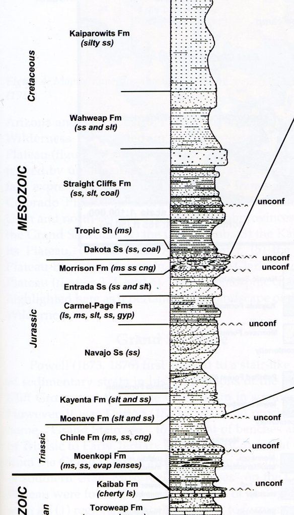
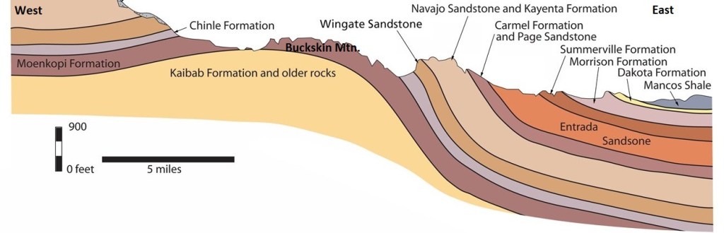
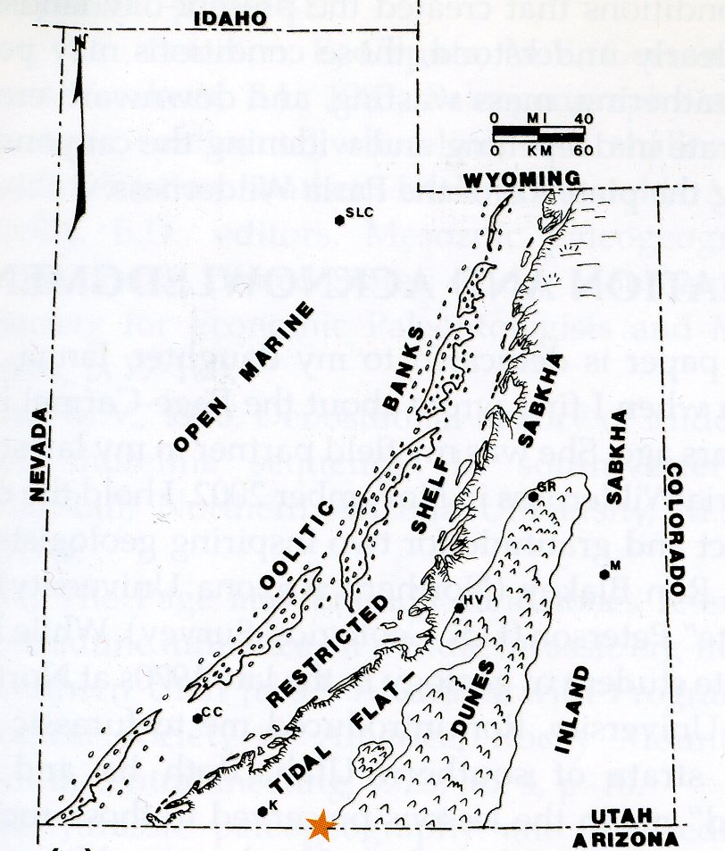
Most of the surface of the Nautilus has a regular rippled texture, betraying its origin as a petrified sand dune from the Jurassic time Period. The red Carmel Formation contains marine rocks that inter-tongue with the terrestrial rocks of the Page formation. The Page Sandstone represents beach, back-beach, and dune deposits on the landward side of the Carmel deposition. The Carmel sea transgressed southward from Canada in a north-south-trending embayment that terminated in northern Arizona, (image below).
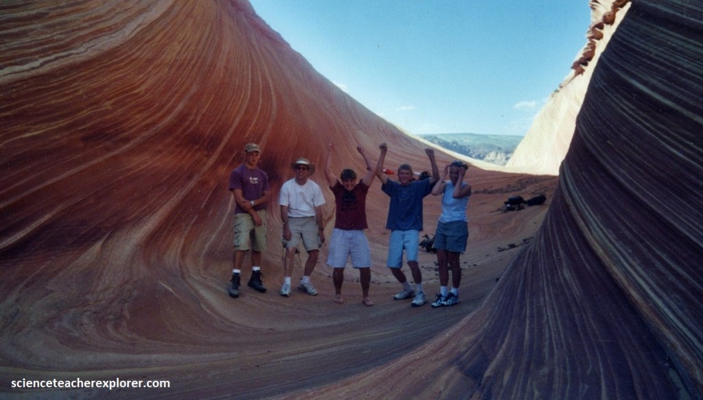
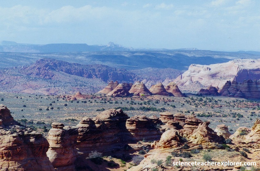
As mentioned above, the other groups visited an area called “The Wave” and Coyote Buttes, (imaged below). One group trekked to the Wave byway of the Wire Pass Trailhead on the House Rock Valley Road and the other drove around the Coyote Butte Ridge with 4WDs to “Paw Hole”, Poverty Flat Ranch & then north to the Teepees.
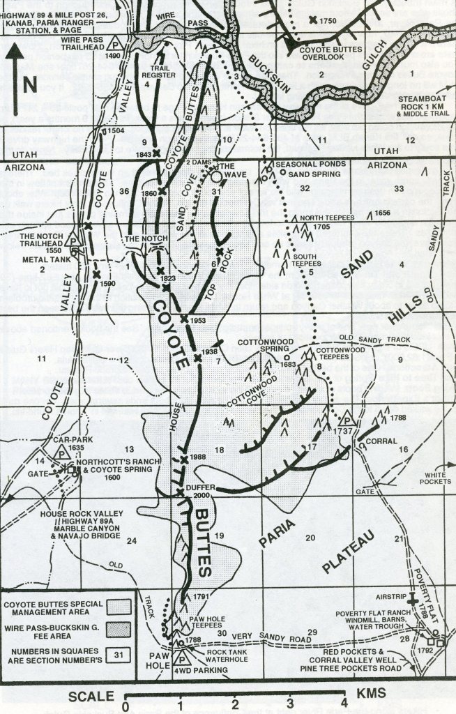
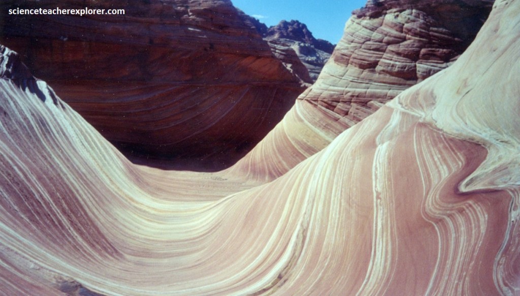
The kaleidoscopic scenery of these locations, extend a little way south into Arizona, before the land becomes more sandy and barren. This is Coyote Buttes, which was unknown before the mid 1990s but is now quite popular mostly because of just one formation, “The Wave”, a small ravine between eroded sandstone domes formed of amazingly beautiful rocks containing thin, swirling strata (pictured below).
The intricate layers in the rock of “The Wave” are composed of giant dunes deposited about 150 million years ago during the Jurassic. At this time, the region that would become the Colorado Plateau was part of a vast Sahara-like desert along the west coast of North America.
As the dunes were buried under more and more sand, they became saturated with groundwater. Slowly, the groundwater minerals cemented the sand grains together, turning the dunes to stone. These ancient dunes later became know as the Navajo Sandstone, the most prominent and widespread rock layer exposed by uplift and erosion on the Colorado Plateau.
As my group entered the smoothly sculpted sandstone canyon, the patterns in the rock walls created a three-dimensional puzzle for their eyes. “The Wave” is characterized by its undulating, swirling, and contoured sandstone layers, which give it the appearance of a frozen, petrified wave.
The sandstone here features of the intricate patterns and vibrant colors, with shades of red, orange, yellow, and pink. The unique geological formations and the play of light and shadow create a dreamlike and almost otherworldly atmosphere.
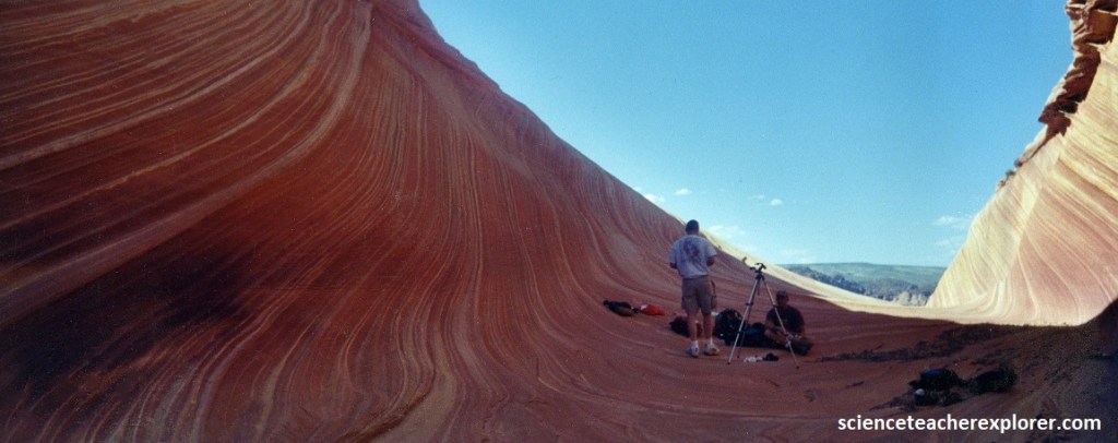
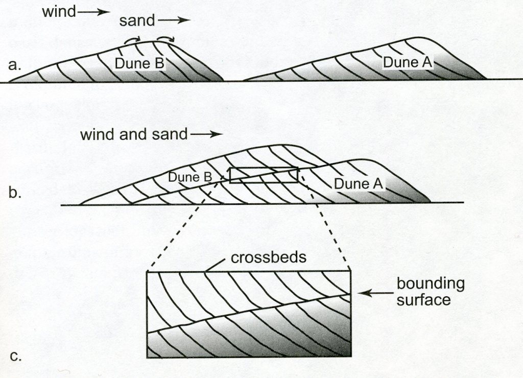
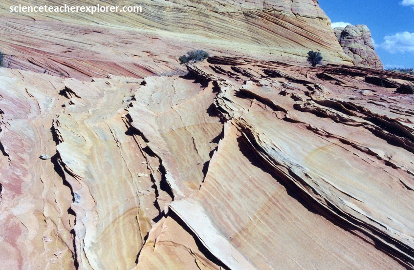
The thin slanting lines in the rock, called cross-beds, represent the steep faces of sand dunes as they advance downwind, (imaged below).
Pictured below, the cross-beds are strikingly colorful at Coyote Buttes.
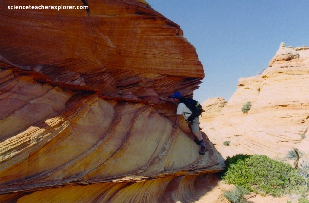
Pictured above, the amazing palette of colors is the result of minerals once carried by the groundwater that saturated the rock as it lay buried. The colors are caused by subtle differences in the chemical states of the minerals, principally iron and manganese, which stained the individual sand grains and the binding cement. We noticed that the colors did not necessarily follow each individual cross-bed layer, in places creating complex and abstract patterns at angles to the cross-beds.
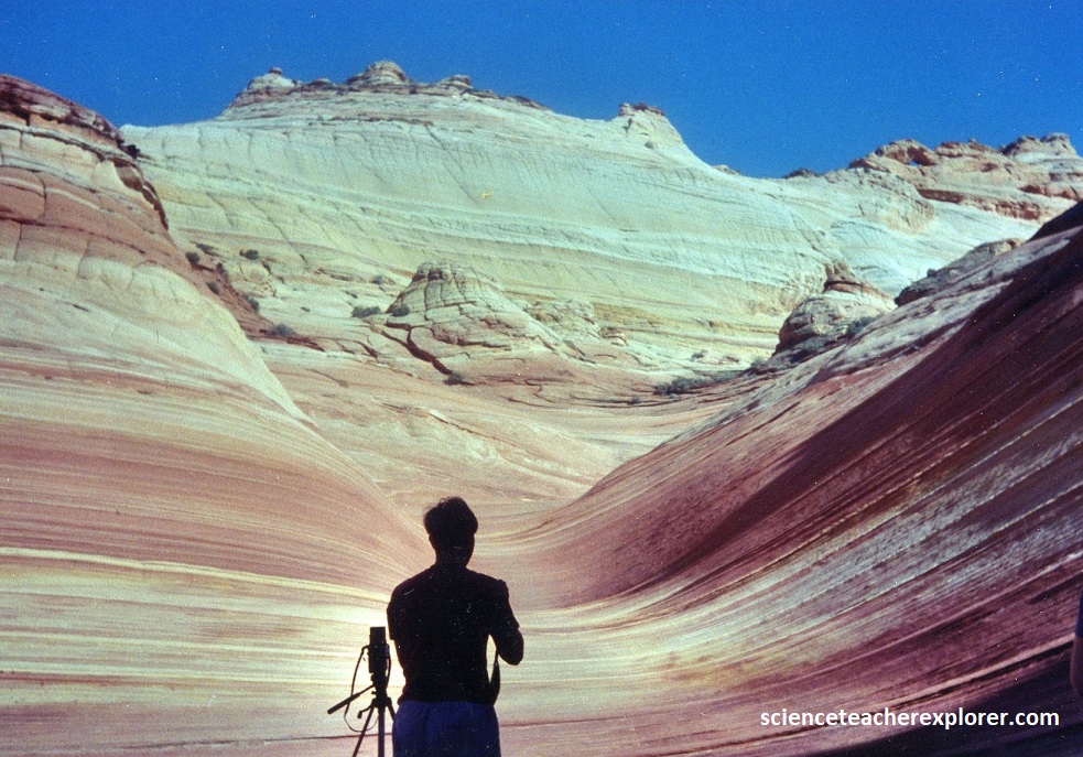
Pictured above, in the Northern Coyote Buttes, (above “The Wave”), we followed the main canyon higher, where the once perfect cross-beds were wildly contorted. Pictured above, these disruptions in the layers formed before the sand became rock. The weight and pressure of sand piled on top of the buried dunes, coupled with the water pressure between the sand grains, caused the layers to flow, a process called soft sediment-deformation.
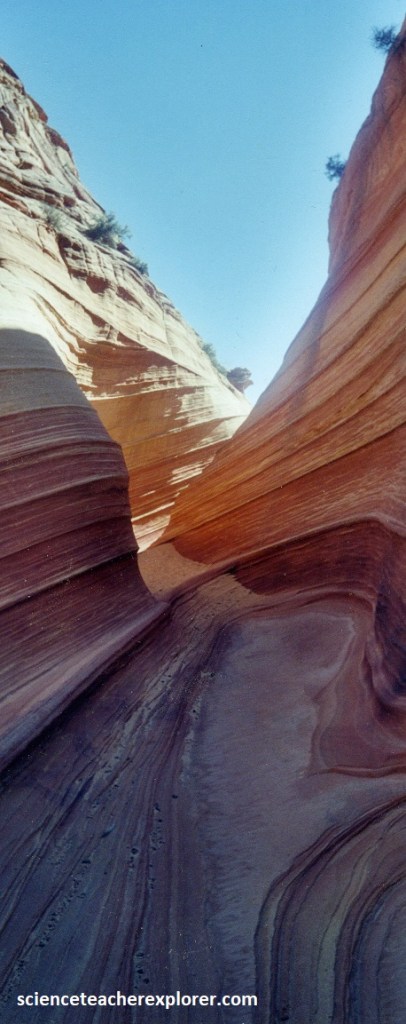
Pictured above, once the sedimentary rocks were formed, the landscape began to experience a variety of erosional forces, including wind, water, and ice. These natural elements started to shape and sculpt the rock layers, exposing the intricate patterns and unique formations seen today. Erosion and weathering acted differently on the various types of sedimentary, creating a wide range of features, from the smooth, swirling contours of “The Wave” to the jagged cliffs of the surrounding area to the south, (pictured below).
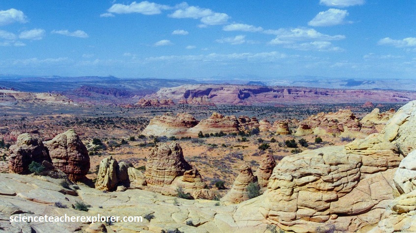
Pictured above, one of the most important factors in creating the distinctive features of Coyote Buttes is differential erosion. This occurs because the sandstone layers are not uniformly hard; they have varying levels of resistance to erosion. Softer layers erode more quickly, while harder layers remain more resilient. This leads to the creation of fascinating formations such as the undulating shapes.

Pictured above, “The Teepees” is one of the standout features in the South Coyote Buttes near Cottonwood Cove. These tall, slender, and pointed rock formations resemble teepees, with alternating bands of colorful sandstone. They make for a captivating and photogenic subject.
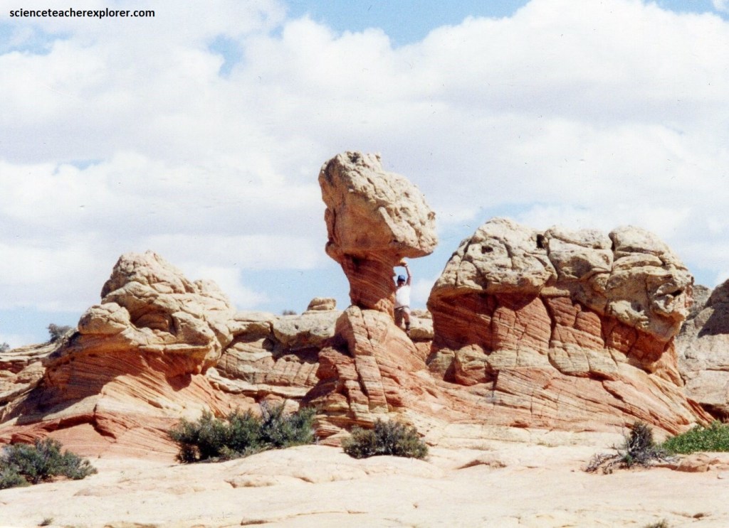
Pictured above, “The Paw Hole” was an area containing a variety of intriguing sandstone formations, including arches, hoodoos, and twisted rock columns.
Pictured above, are clusters of hummocky, turtle-like rock formations created by weathering and erosion, (jointing), of contorted sandstone layers deformed by soft sediment deformation. Notice the 180 degree angles they make between joints.
The geological landscape of Coyote Buttes is the product of a fascinating interplay of geological processes over an immensely long period. The unique patterns, colors, and formations in the sandstone are the result of sediment deposition, lithification, erosion, differential erosion, geological uplift, and mineral content. This combination of factors has created one of the most visually stunning and geologically significant landscapes in the world. A great place for an educational field trip for my students.

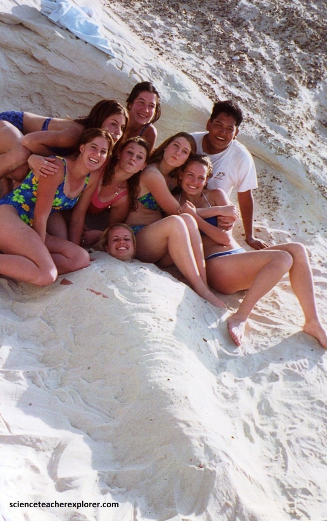
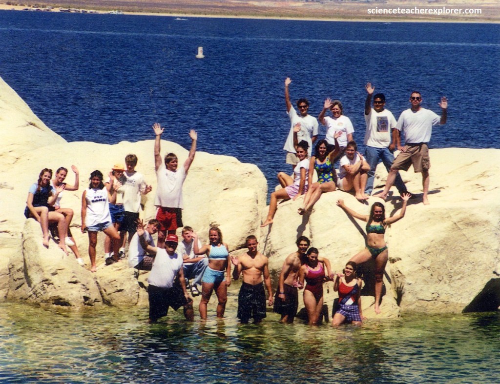
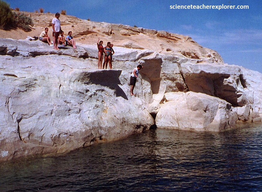
In the evenings of 2000, we stayed at the Waa Weap Campground near Page, Arizona. One of our entertainments for the evening was to swim in the nearby Lake Powell.
Pictured below, the steep canyon walls comprising massive, Jurassic-age, Navajo Sandstone is standing up the shores of Lake Powell, Arizona/Utah. Cliff jumping is a usual sport at Lake Powell.
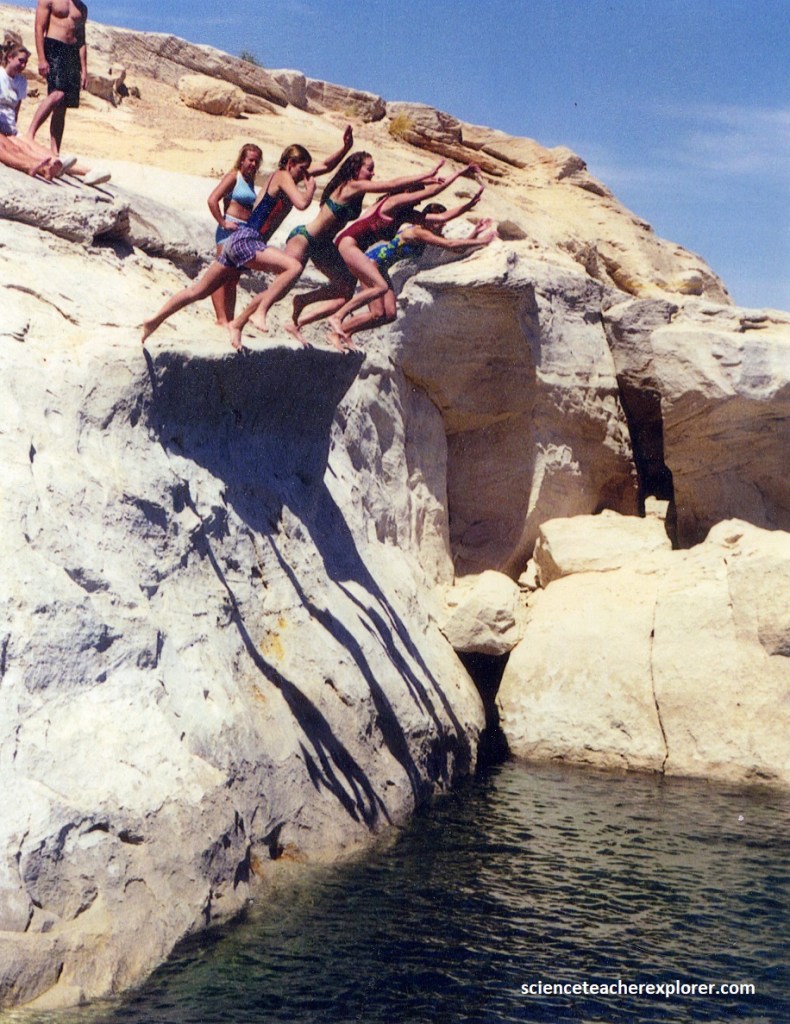
The variety of colors and multi-shaped formations make this man-made wonder a monument to the geological artwork etched by the forces of wind, water and erosion. Completed in 1963, the Glen Canyon Dam at Page, Arizona created the 300 km long Lake Powell. The lake’s ebb and flow harbors almost 3,200 km of shoreline. Towering cliffs of sandstone boarder these countless inlets, (pictured above and below).

The oldest or Triassic Period (230 million years ago) and the draining of an inland sea created these pale, orange or red pinnacles of 200 million years ago. But simply stated the lake is surrounded by cliffs, arches and many other formations of gigantic splendor, each a virtual artist’s pallet of color. Whatever the period, the Lake Powell region of Northern Arizona and the Paria Wilderness unveils a virtual banquet of geological shapes and natural colors.
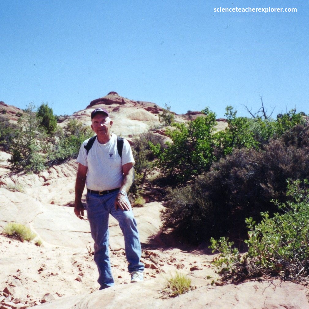
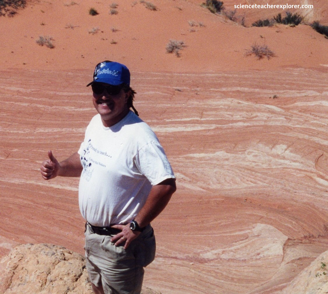
Pictured above, are photos of my father, (Patrick Lindsay 1924-2012) and myself in May of 2000.
