Cape Fold Belt, S. Afr.
In February of 2024, a traveling buddy of mine, (Mike Stevens), and I trekked and explored the Cape Fold Mountain Belt of South Africa. The locations we visited across South Africa were: Addo Elephant National Park; Meringspoort; Swartberg Pass; Bavviaanskloof; Cango Caves; The Hex River Valley & The Stadsaal Caves of the Cedarburg Range.
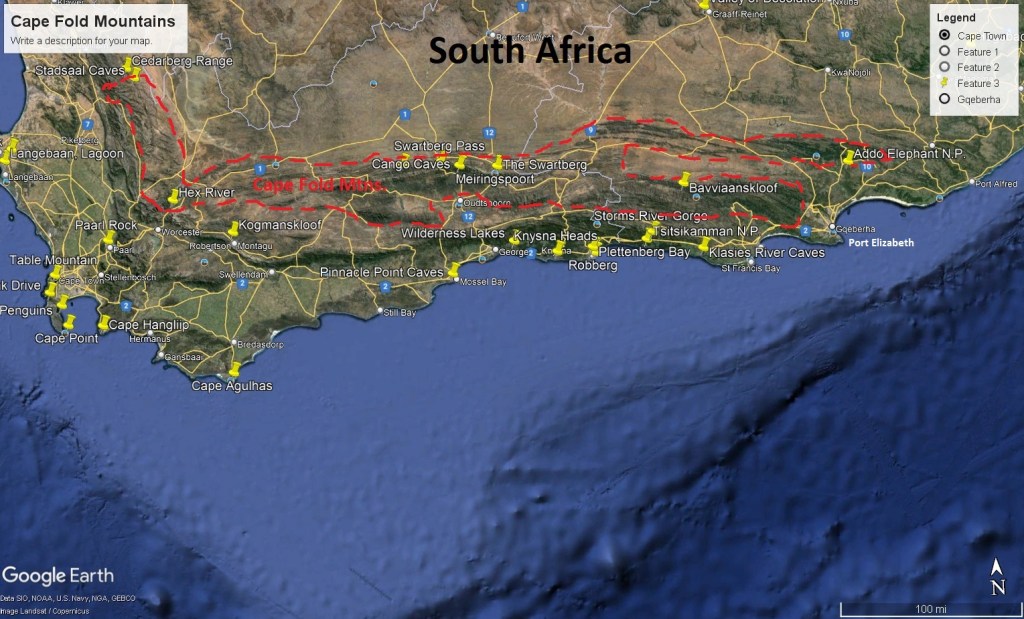
The Cape Fold Mountain-Belt form a series of parallel ranges that run along the south-western and southern coastlines of South Africa for 850 km from where it joins the “Great Escarpment” of the Cederberg Range at Stadsaal Caves, (200 km to the north of the Cape Peniinsula), and then along the south coast as far as Port Elizabeth & Addo National Park, (650 km to the east).
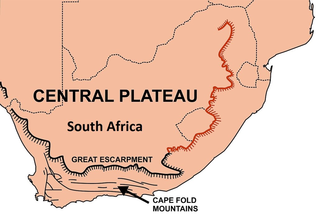
Imaged below, the Cape Fold Mountain-Belt are a strongly linear region with two branches, the Northern branch fringed to the west by the Atlantic Coastal Plain, and the Southern branch bordered by the Southern Coastal Platform in the south; and it includes the Little Karoo.
As mentioned, we started touring the “Cape Fold Mountain-Belt”, north of Port Elizabeth, South Africa at the “Addo National Park”. From Port Elizabeth (Gqeberha), we used the South Gate of the Addo, as it was just a 30-minute drive north along the N2.
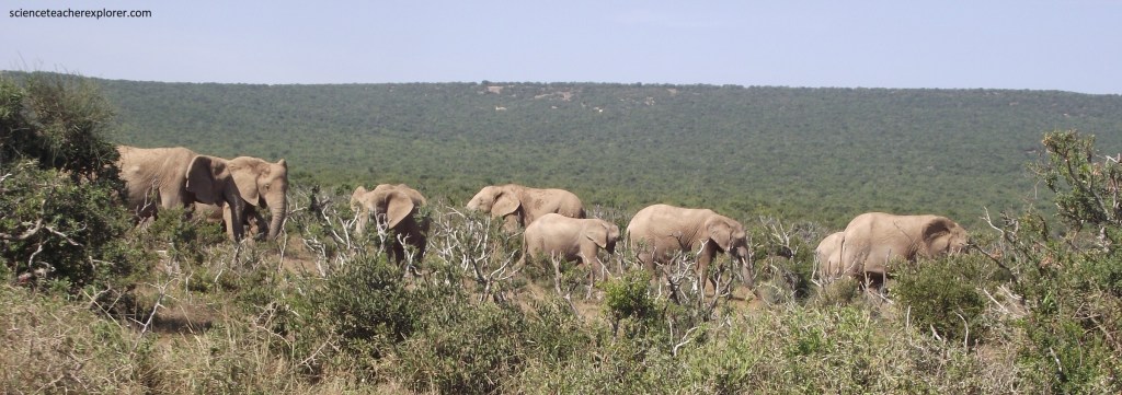
Addo once teamed with wildlife, but by the early 1900s ivory hunters had decimated the elephant population, and black rhinoceros and lion had been hunted to local extinction. Agricultural use of the land grew ad elephants in particular were considered a threat. As a result, between 1919 and August 1920, the elephant population was all but exterminated by one man, (Major P. J. Pretorious). By the time public pressure ended this mass culling only 16 or the 130 elephants survived, and by 1931, (when Addo Elephant Park was officially proclaimed), just 11 elephants remained.
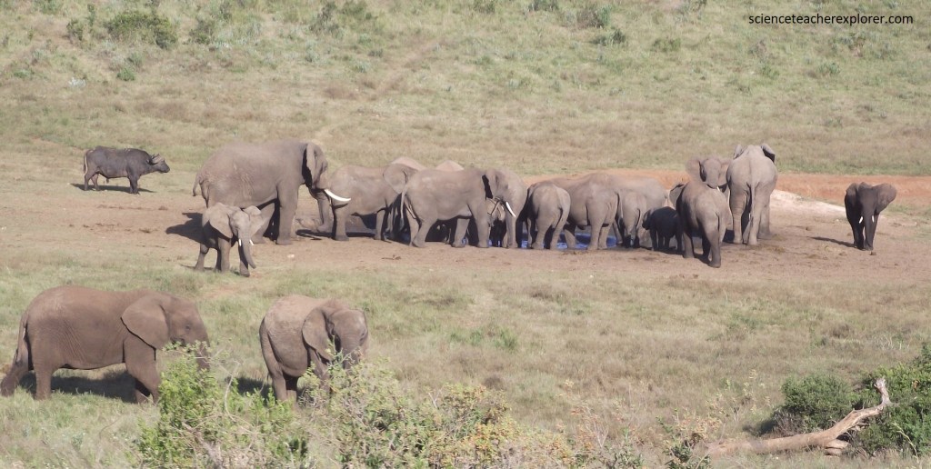
In an effort to save the remaining elephants, Park Manager Stephen Harold Trollope fed the herd & brought the herd from local extinction. Today the park is home to approximately 600 African elephants, (it has been so successful it has actually become overcrowded).
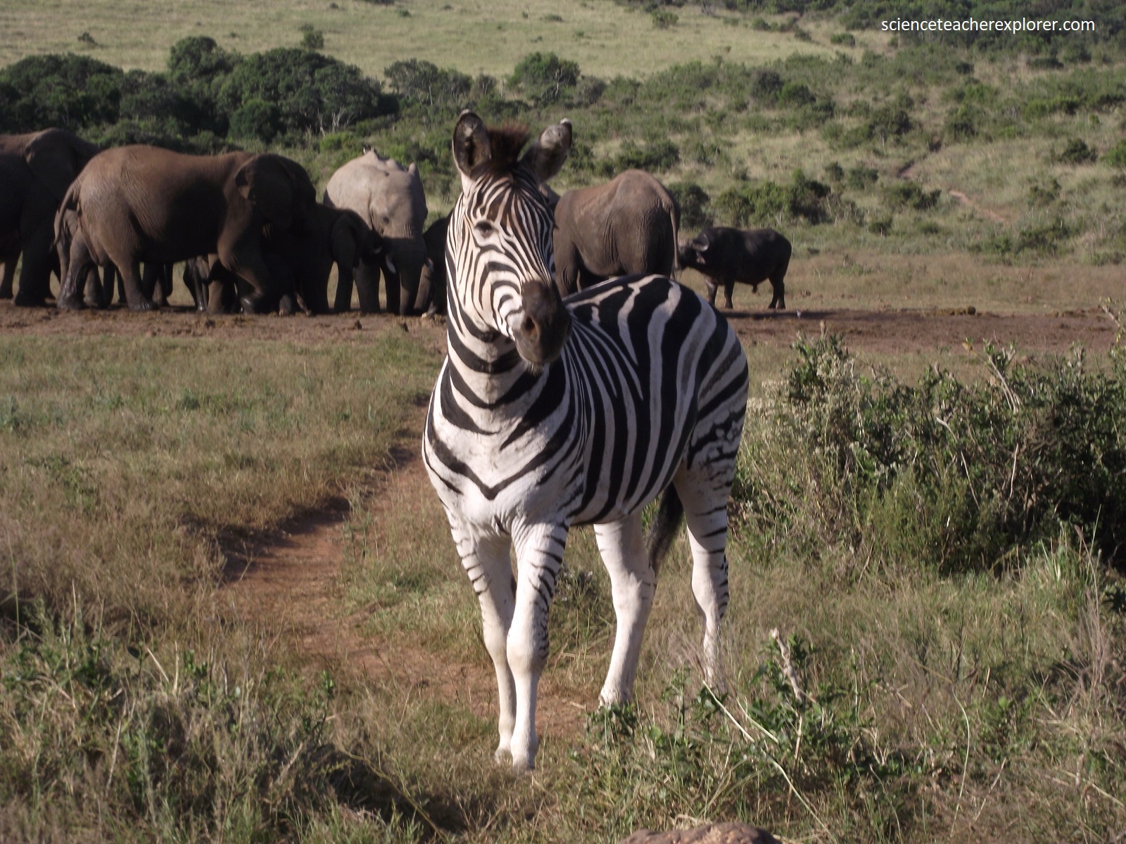
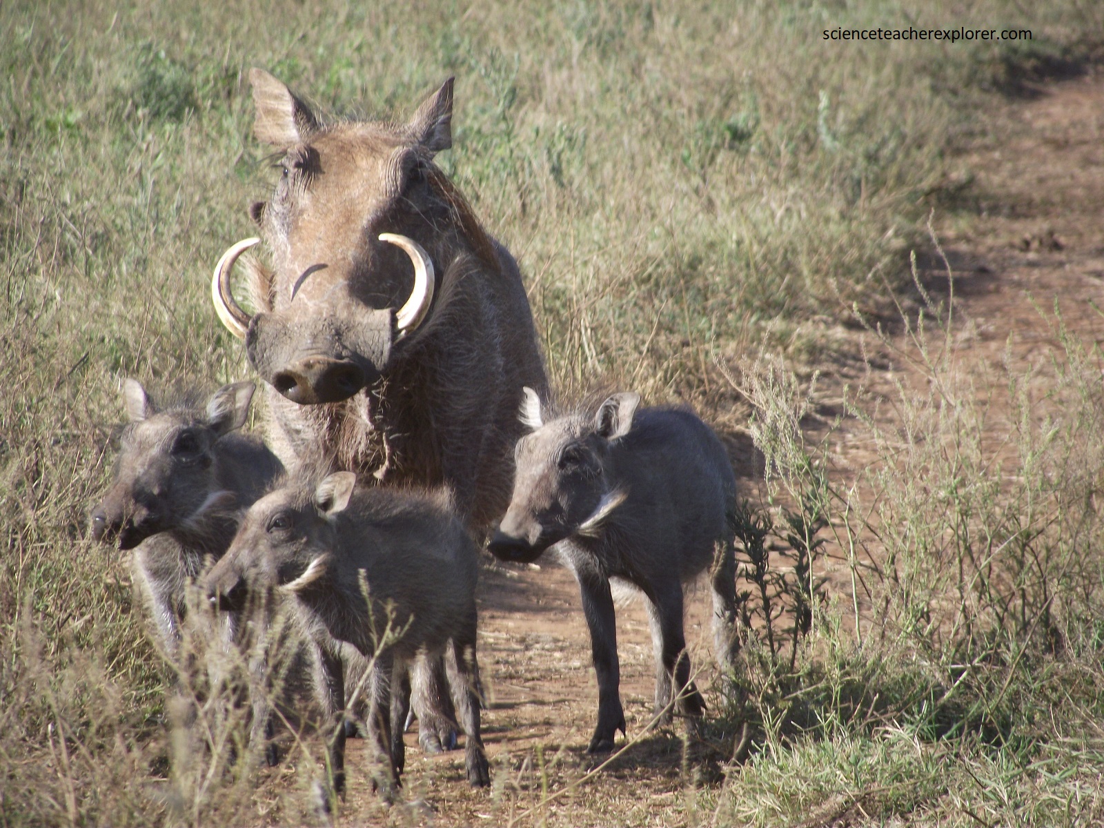
Pictured below, at the same water-hole as the family of elephants, is a small herd of “Cape Mountain Zebra” and a family of “Warthogs” trying to get a drink at the Lismore Waterhole.
In response, surrounding land has been acquired, (the new Greater Addo national Park covers 4,856 square kilometers).
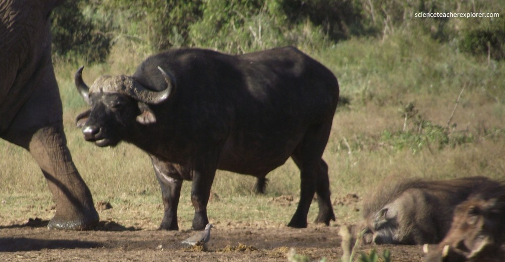
This truly diverse park supports five of the seven biomes found in South Africa, supporting an array of wildlife, birds, plants and marine species. It is the only park that boasts the big 7: elephant; lion; Cape buffalo (pictured above); leopard; black rhinoceros; great white shark; and the Southern right whale.
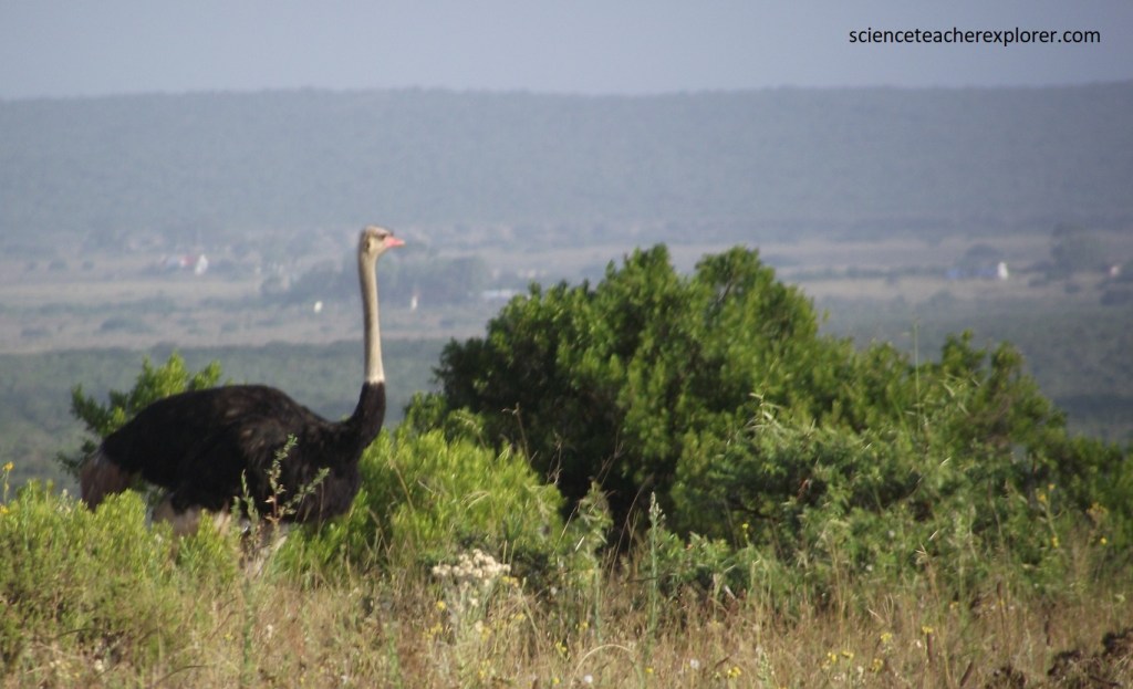
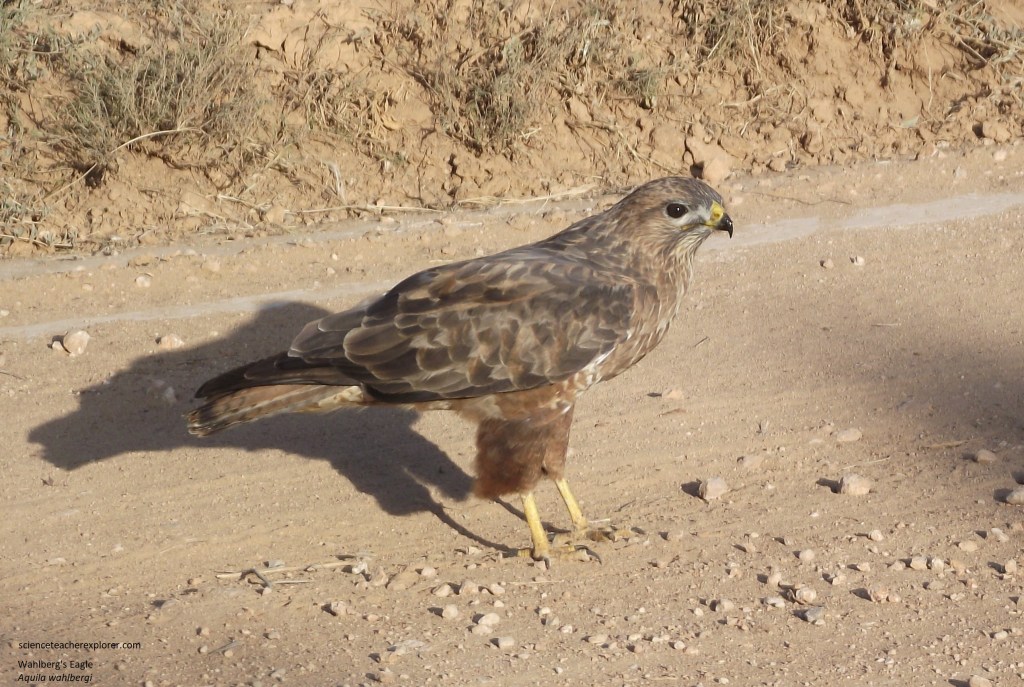
Birding in Addo is diverse with each of the five biomes home to specific species. Addo Main attracts birds that love thickets as well as open plains where farmlands once existed. Pictured above and below, we saw a flock of Common Ostriches and a “Booted Eagle” on the road near the southern gate of Addo. I actually wrongly identified it as a Wahlberg’s Eagle but eventually came to the conclusion of the Booted Eagle. They seem very similar with it’s dark morph.
The vegetation in Addo Main is the reason why it can support large amounts of wildlife with Spekboom being the star performer. Even though the unique vegetation of Addo is a dense, sub-tropical thicket, the peculiar succulent found in the park, Spekboom, can grow up to 3m high and is high in protein as well as water content. It has adapted to heavy browsing and regenerates at a much higher rate than most other plants, (pictured below). It has fleshy leaves that are soft and pleasant to squeeze. Recent research has shown that the Spekboom plant has remarkable properties in its ability to process carbon dioxide. It is thought to be one of the most efficient plants at removing the gas from the atmospher.
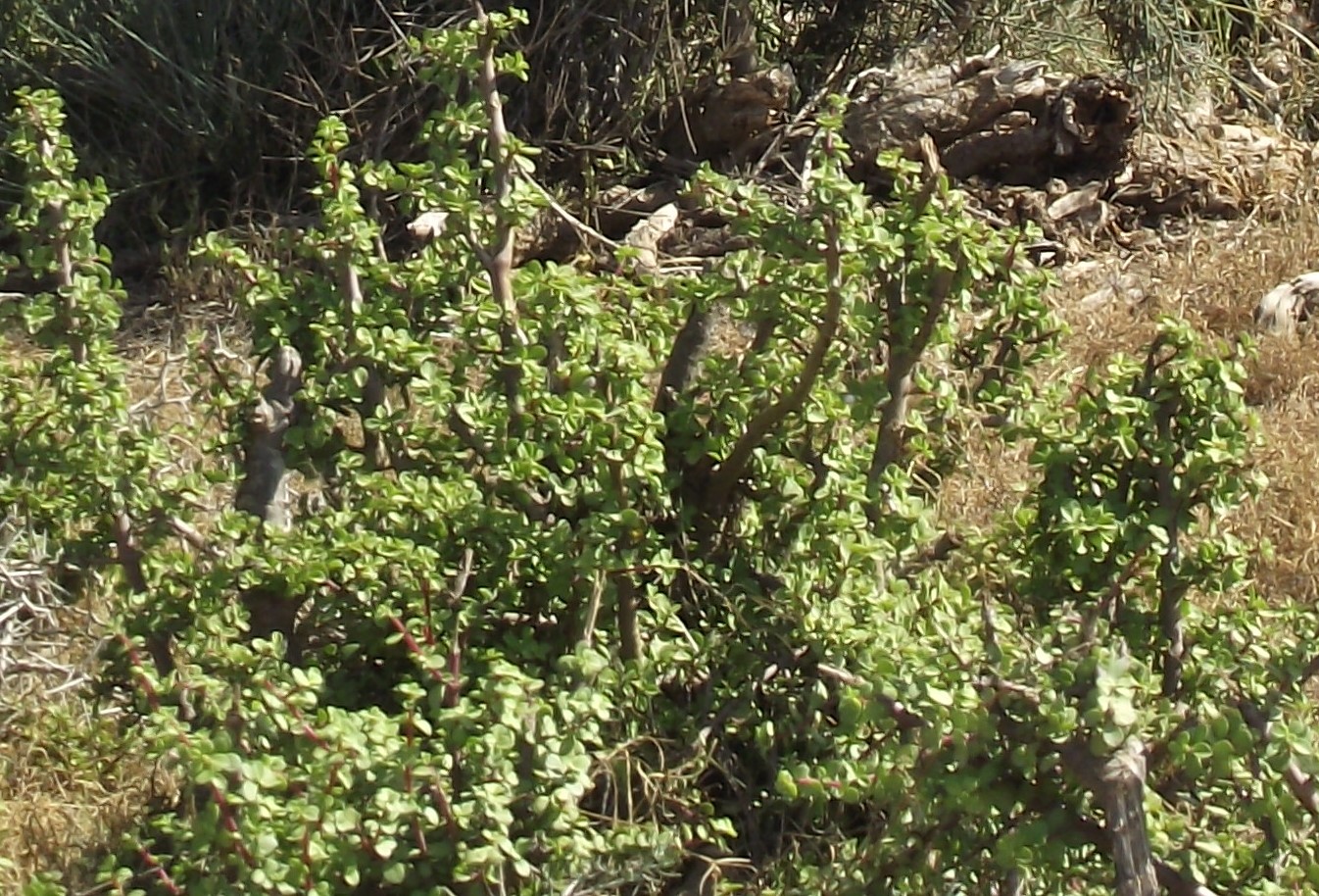

Spekboom (Portulacaria afa) found at the Addo Elephant National Park in South Africa 2024.
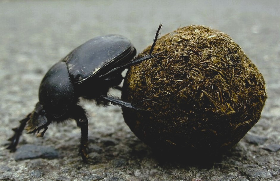
As adult elephants deposit upward of 150 kg of dung every day, dung beetles are extremely important to the ecology of the area, (so much so that they are now a protected species). Pictured below, the flightless dung beetle, (Circellium bacchus), is found almost exclusively in Addo. We found this one, crossing the tarred-road near the center of the park.
Pictured below, the northern part of the main Addo consists of deep ravines and rounded hills in the Winterhoek Mountains and was originally established in 1985 as Zuurberg National Park.
Addo Elephant National Park is home to interesting species of antelope and they are found in abundance, along with red hartebeest, eland, and kudu, (pictured below).

Pictured above, the Kudu (Tragelaphus strepsiceros) is a large, elegant antelope with white stripes on the body. They have large rounded ears. This male has an impressive, spiral-shaped horn.
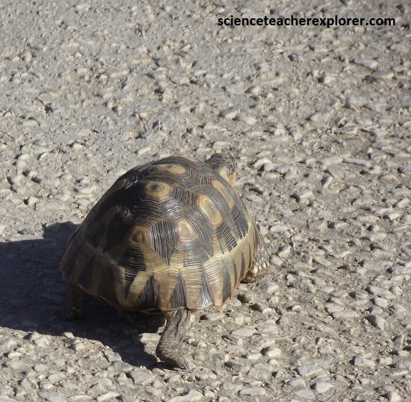
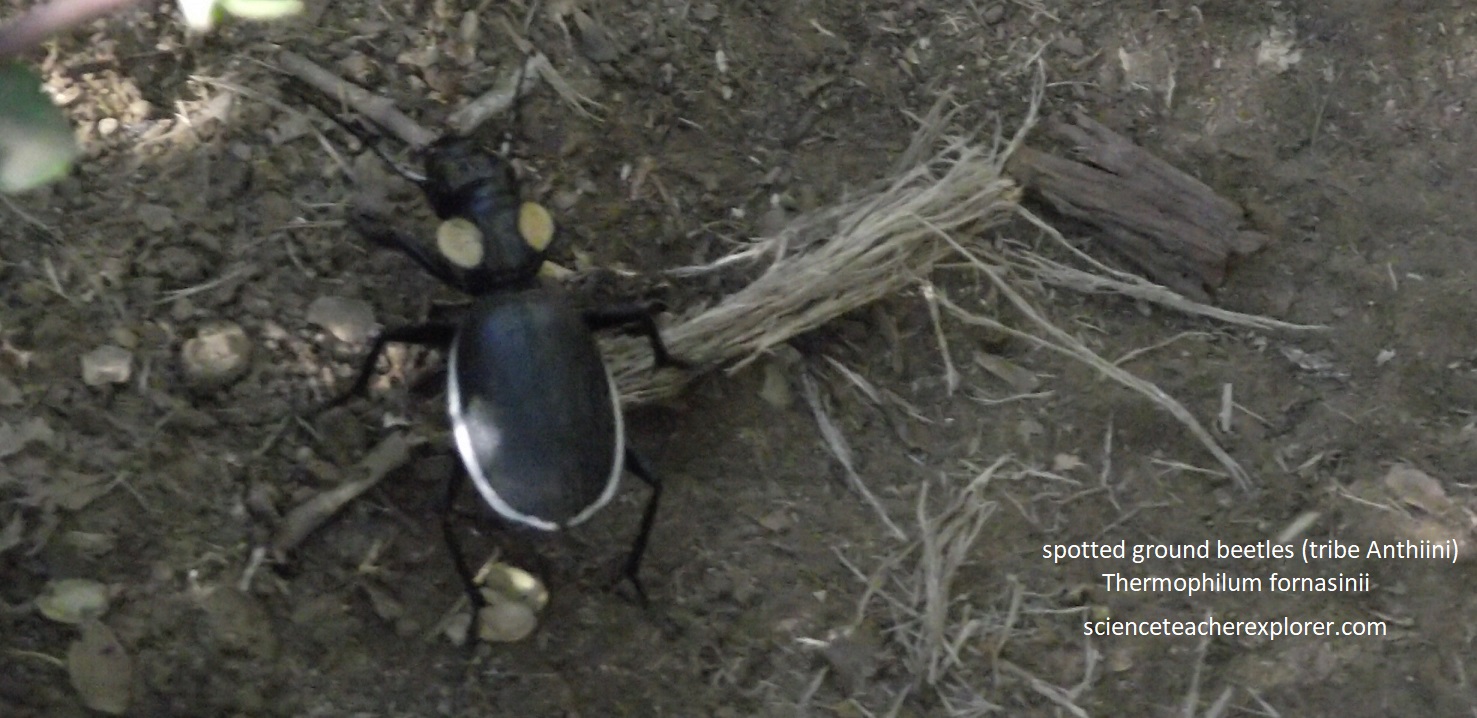
Pictured above, a Leopard Tortoise (Stigmochelys pardalis) on the left with a domed carapace or shell and a Spotted Ground Beetle (Thermophilum fornasinii) on the right. The Spotted Ground Beetle are large, powerful predators that rely on speed and agility for capturing prey, and since they are also flightless these characteristics come in handy for avoiding becoming prey themselves. Failing that, they employ chemical defense in the form of secretions from a pygidial gland located in the area of the ninth abdominal segment. The chemical cocktail within these secretions contains concentrated organic acids or quinone that can be squirted at potential predators in a strong jet.

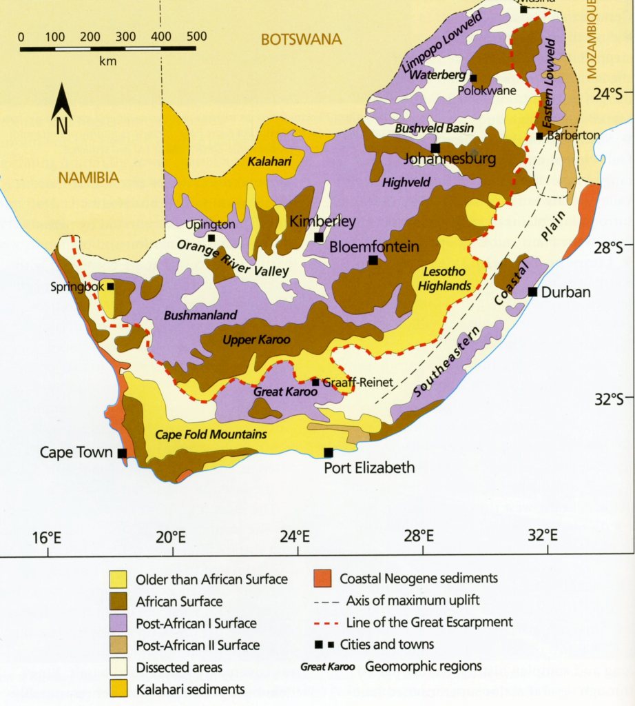
The land that rose above the level of the sea that cut the marine platform (Alexandria Formation in the Addo Park). Along these rivers, cycles of erosion worked their way into much of the interior of southern Africa, giving rise to the African Erosion Surface (African land Surface). This surface exists at different altitudes and develope over the last 100 million years (since the mid-Cretaceous Period). They capped by hard silcretes and , in the Addo Park, characterized by Grassy Fynbos vegetation. Pictured above, these African Land Surfaces are clearly visisble along the upper reaches of the Zuurberg Mountain Ranges, (part of the Cape Fold Mountains) in the northern part of Add Elephant Nation Park.

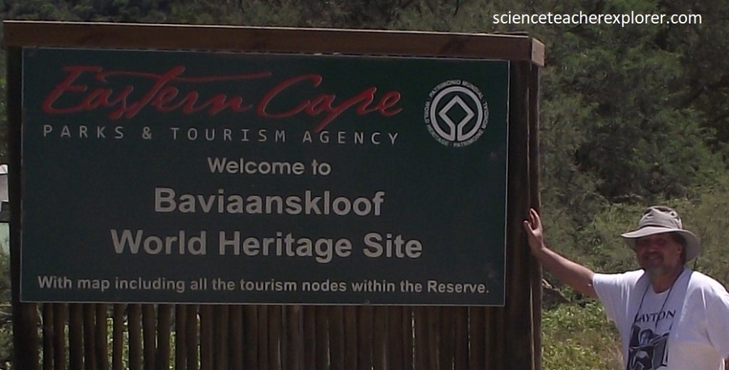
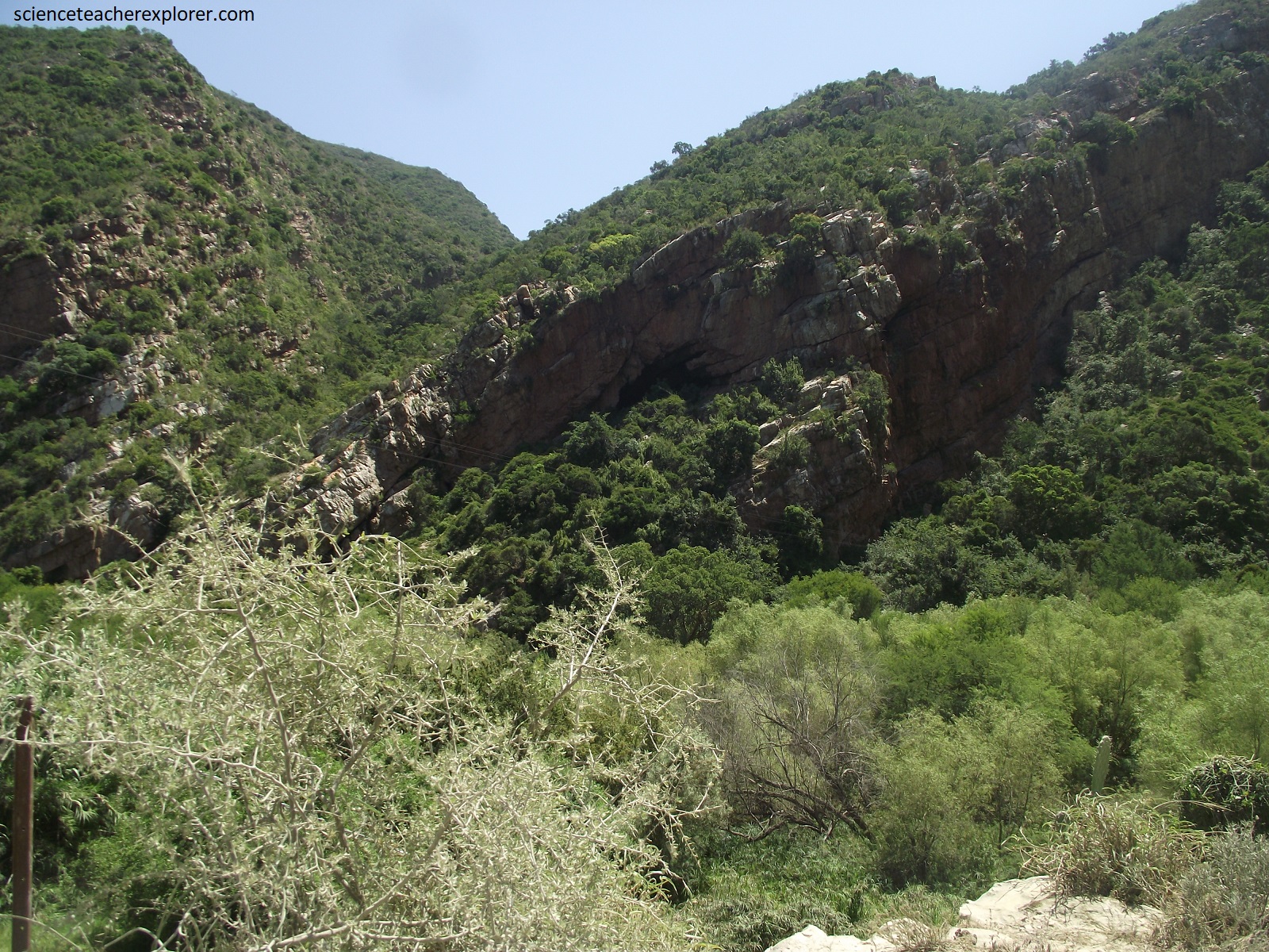
From the north-gate we headed south and then west to the Baviaanskloof World Heritage Site, (imaged below).

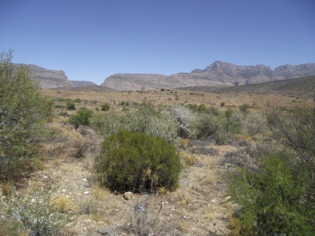
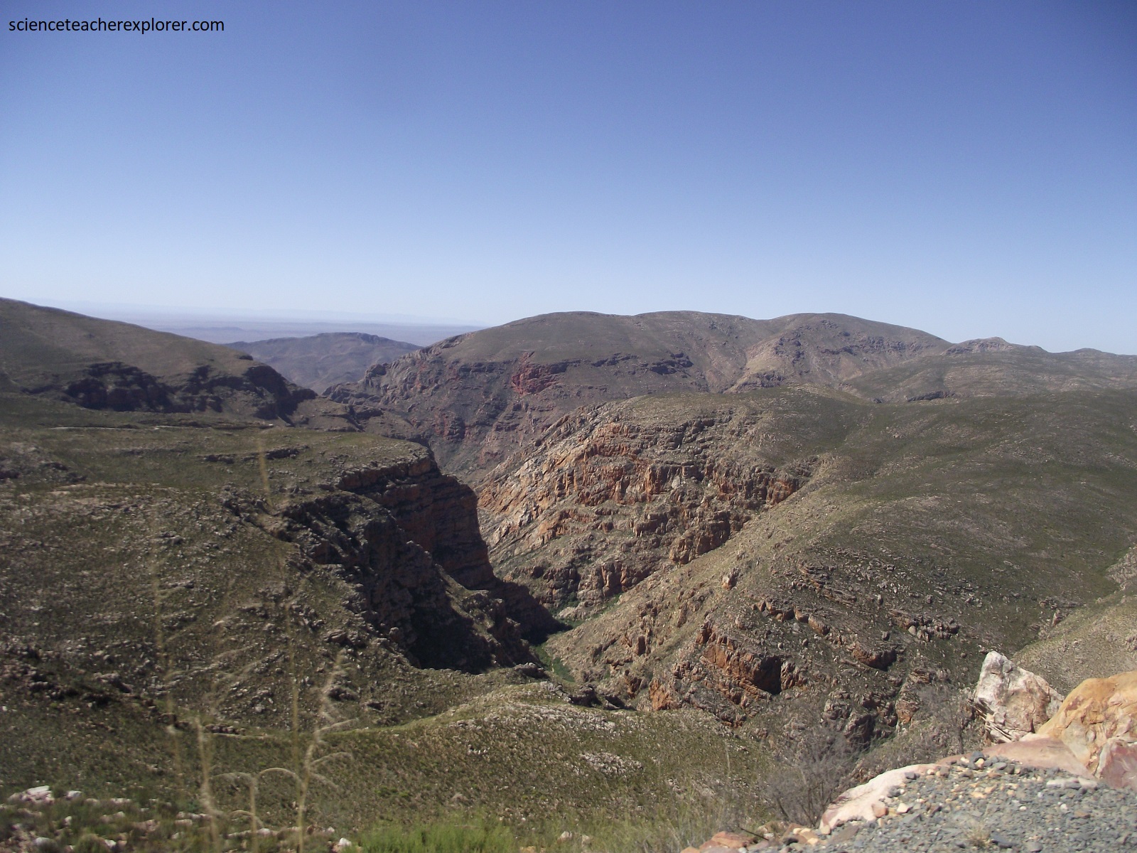
Strangely one sometimes finds wild and lonely regions in close proximity to well-populated centers. Baviaanskloof, (the valley of baboons), is just such a place. With it’s eastern end only 100km west of Port Elizabeth, it could be easily bypassed, heading down the busy coastal Garden Route to Cape Town.
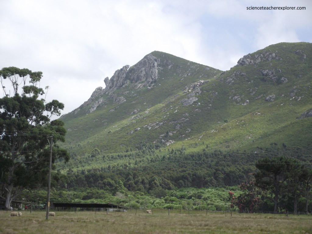
As few roads traverse the high ranges, there are remote valleys and uplands here in the Baviaanskloof that seem to stretch indefinitely.
Baviaanskloof itself stretches east-to-west for over 100km between two mountain ranges, both with summits reaching above 1,700m at the eastern end of the Cape Fold Mountain Belt.
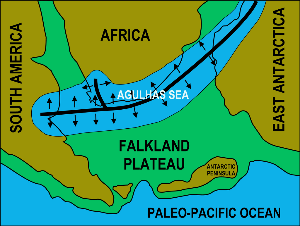
Imaged above, a rift developed about 510 million years ago, separating Southern Africa from the Falkland Plateau. Flooding of the rift formed the Agulhas Sea. The sediments which accumulated in this shallow sea consolidated to form the Cape Supergroup of rocks, which form the Cape Fold Belt today. As South America pulled away form Africa during the break-up of western Gondwana, a major zone of transform faulting called the Agulhas-Falkland Fracture Zone developed immediately south of what is today’s southern Cape coast.
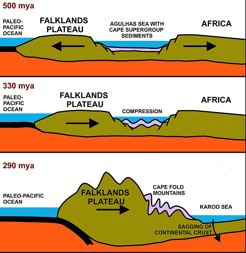
This large-scale break-up of Gondwana resulted in major faulting and rifting within the ancestral, (and , at that stage much higher), Cape Fold Mountains, following the east-west structural grain, and leading to the development of a series of fault-bounded, intermontane basins. Strong erosion of the high Cape Fold Mountains resulted in fast-flowing, gravel-filled streams and rivers. This poorly sorted sediment, consisting of boulders, cobbles, pebbles and sand, was deposited on land as mountain-side alluvial fans, while finer sand and silt washed downstream to flood plains.
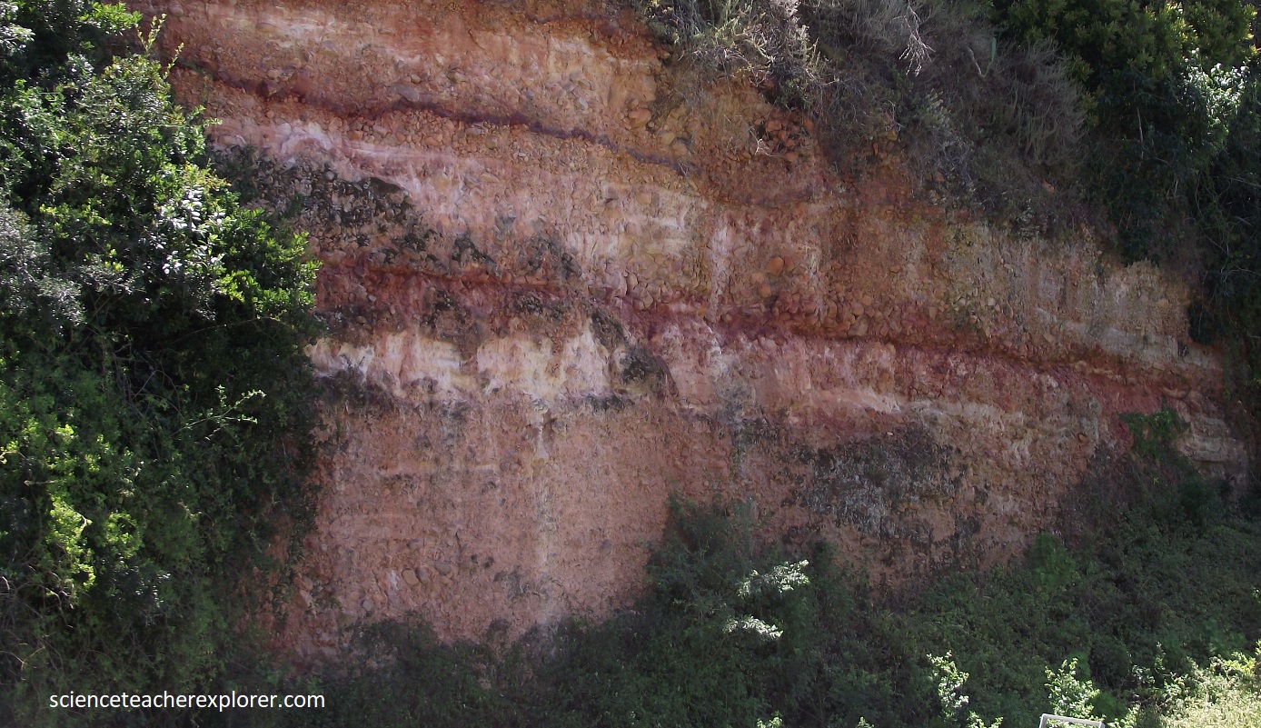
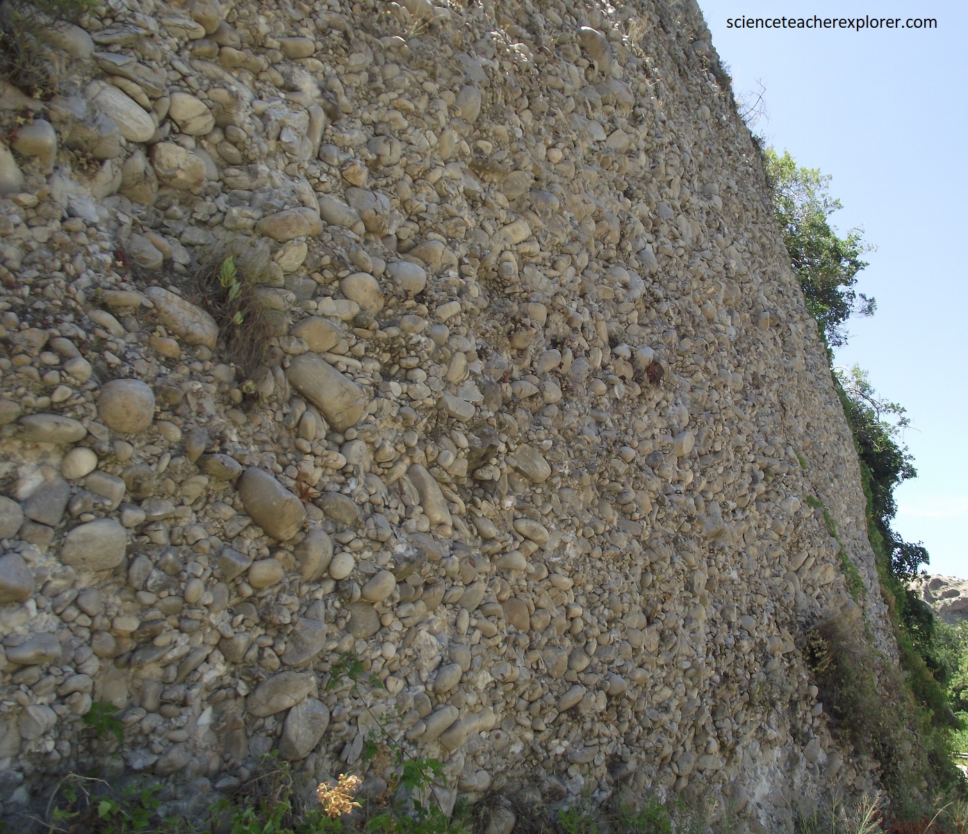
Pictured above, sediment accumulated at the base of active fault scarps and subsidence of the faulted basins kept pace with sediment being deposited. The result was exceptionally thick but localized deposits that are now the Enon conglomerates. Note the ‘red’ variety, (on the left photo above), in which the pebbles are more angular and have an abundant coating of limonite (rusty iron oxide). Note the mixed sizes of rounded quartzite pebbles and cobbles that can be seen, (on the right photo above), alongside the road at Andrieskraal before entering the Baviannskloof from the east.

Pictured above, there are excellent exposures of incredibly thick conglomerate formation along the riverside in the Andrieskraal area, where spectacular white and red cliffs rise more than 100m above the Gamtoos flood plain. One such exposure has famously been likened to a profile of the elderly Queen Victoria. These exposures lie on the road to the Baviaanskloof Wilderness Area, part of the Cape Floral Region World Heritage Site.

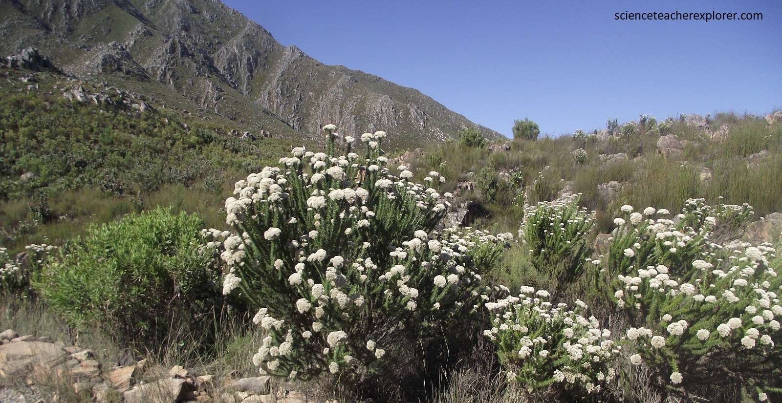
Pictured above, the greater Baviaanskloof region is exceptionally diverse, being an area of convergence of 3 diodiversity hotspots, (the Cape Floristic Region, the Succulent Karoo and the Maputaland-Pondolan-Abany) and 7 biomes, (the Fynbos, Albany Thicket, Nama Karoo, Succulent Karoo, Forest, Grassland and Savanna). The predominant vegetation in the Baviaanskloof is fynbos, which makes up about 3/4s of the reserve. There are a number of fynbos variants mapped with grassy fynbos types occurring on the lower mountain slopes and plateaus, restioid and mesic fynbos occurring on the higher slopes, and subalpine fynbos on the peaks. Species that are often-encountered are Protea neriifolia, Protea nitida, Erica cerinthoides, Leucospermum cuneiforme, Leucadendron salignum. Many of these species are threatened.
Spectacular conglomerates that make up the Enon Formation, the lowermost division of the Uitenhage Group, extend discontinuously from west of Oudtshoorn to Addo Elephant National Park in the east, and are part of the several disconnected, fault-controlled sedimentary basins from the Cretaceous. Pictured above, one of these is the 40km long Gamtoos Basin, sandwiched between mountains of the Cape Fold Belt in the southeastern Cape.
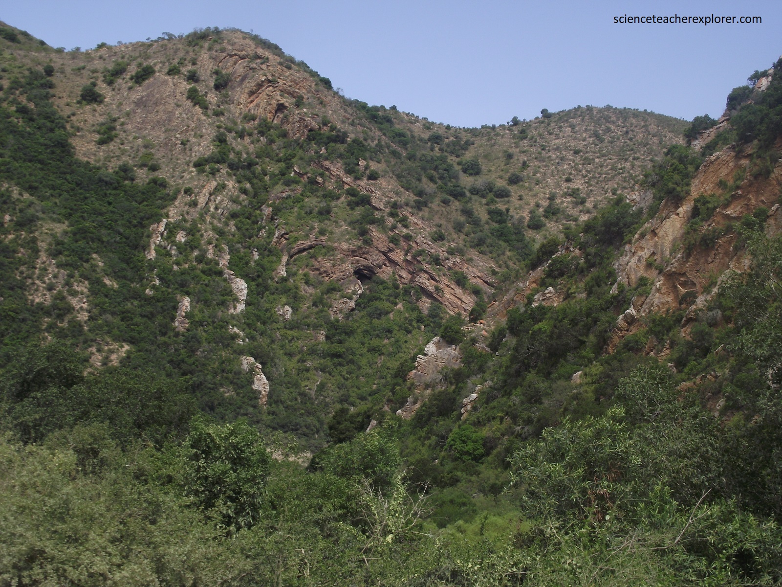

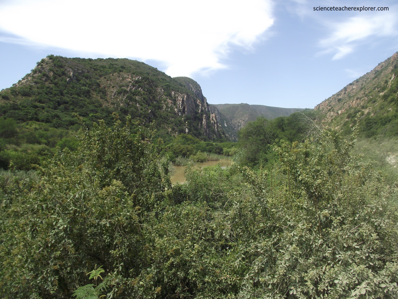
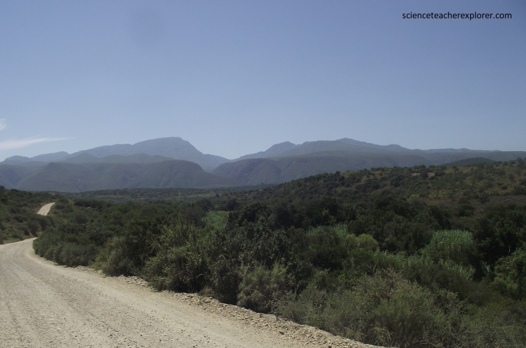
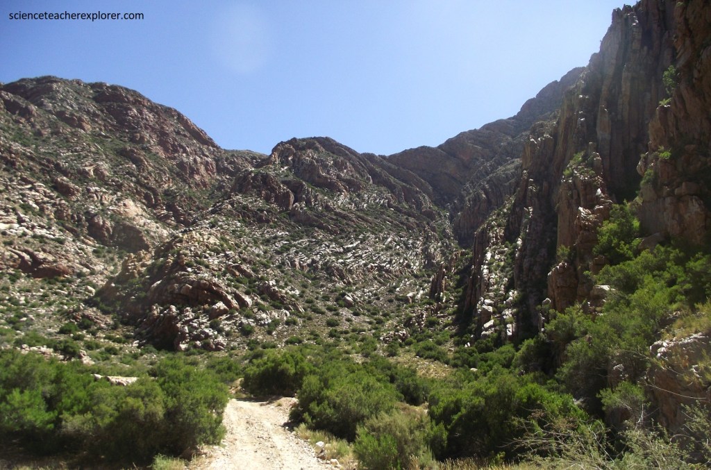
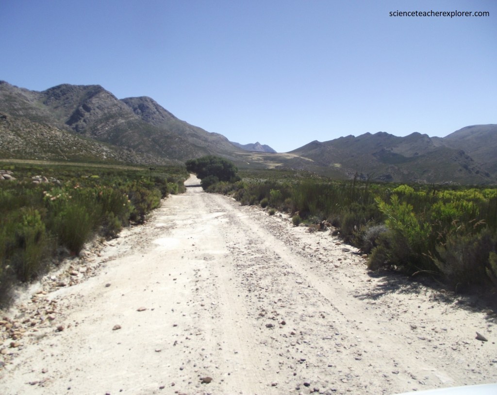
The mountains in the Baviaanskloof, although only of moderate height, are majestic and dramatic. This is due in part to numerous geological factors; The ranges usually have few to no foothills and rise directly from valley floors. The bases of the mountains are usually at or near sea level. The graveled road that follows the river along the bottom of Baviaanskloof is R332.
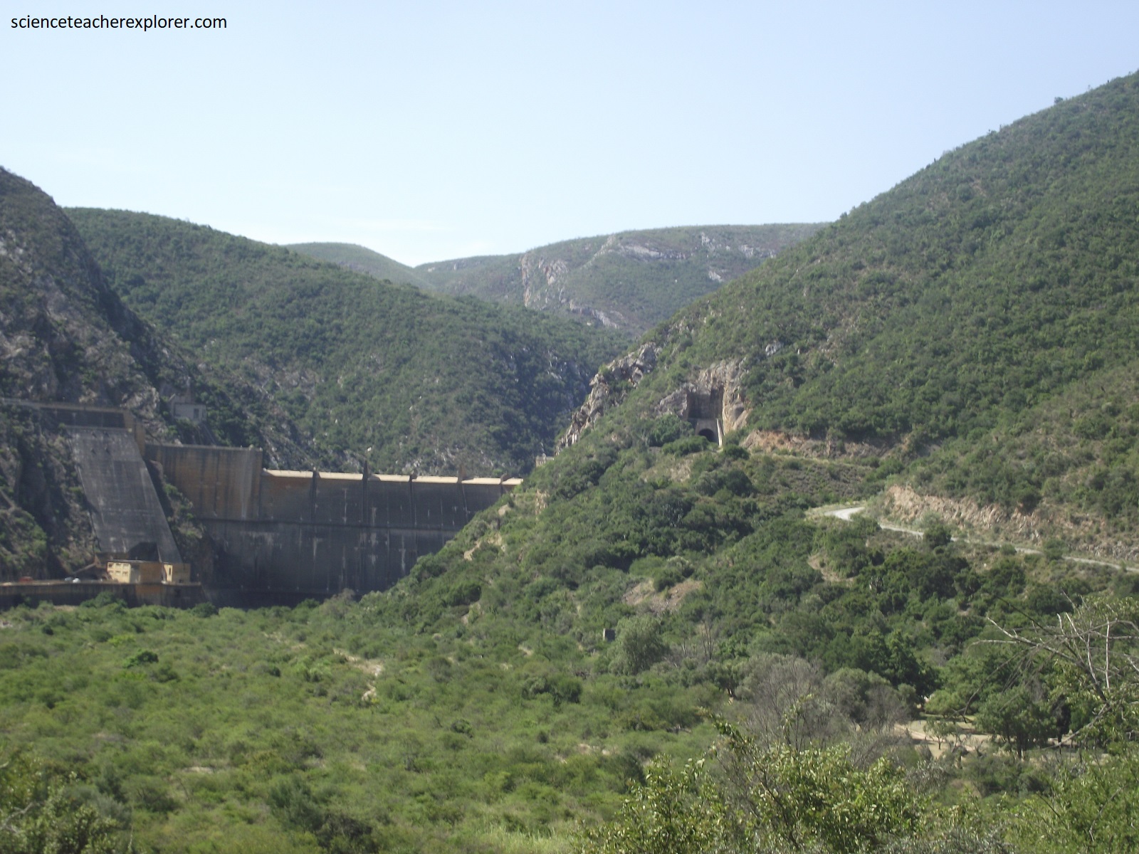
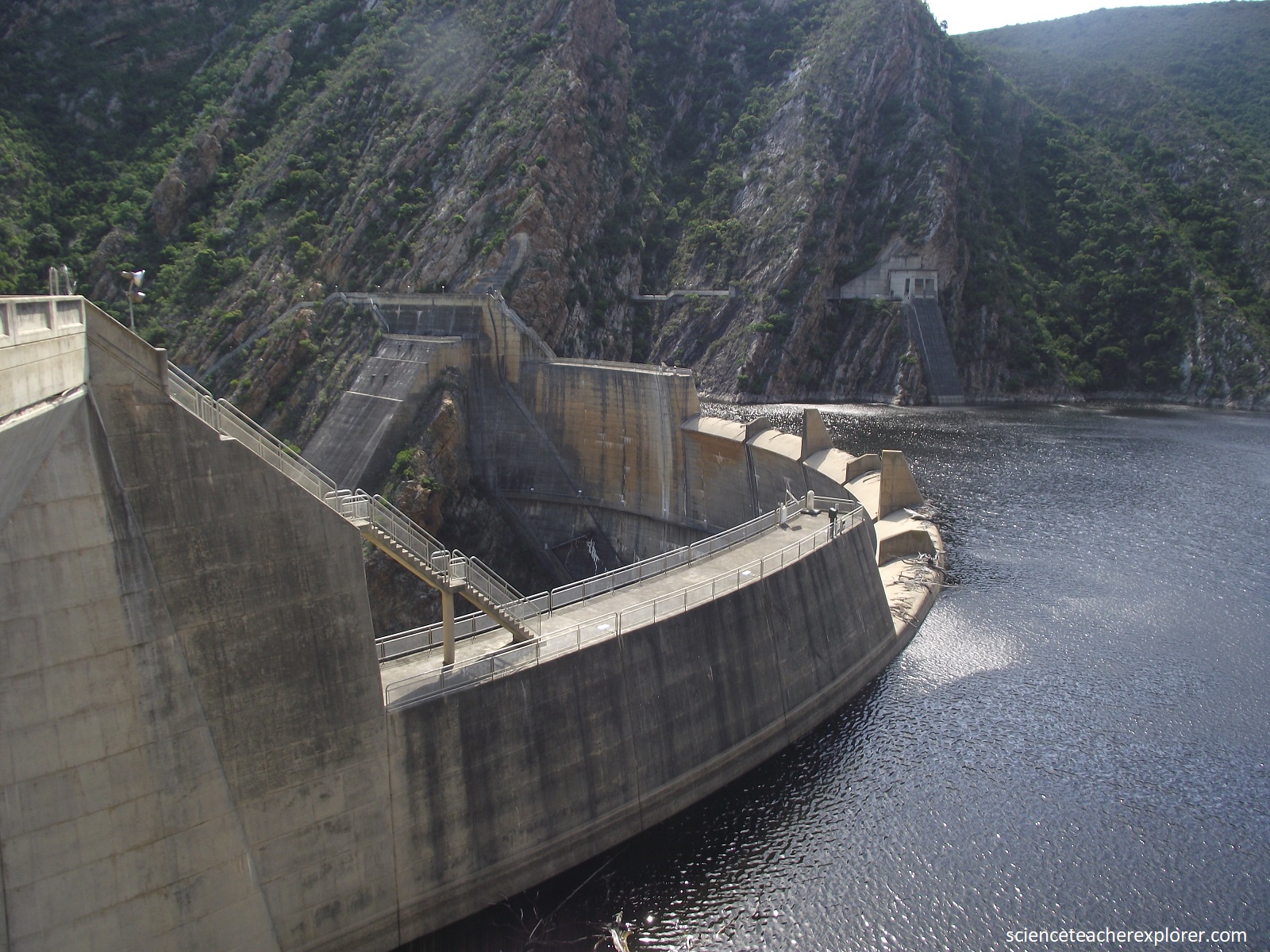
Pictured above, at the head of the Gamtoos Valley is the long, sinuous and narrow Kouga Dam. The water is held back by a double-arch dam wall built in 1967. The dam is hemmed in by steeply dipping strata of the Cape Fold Mountains.

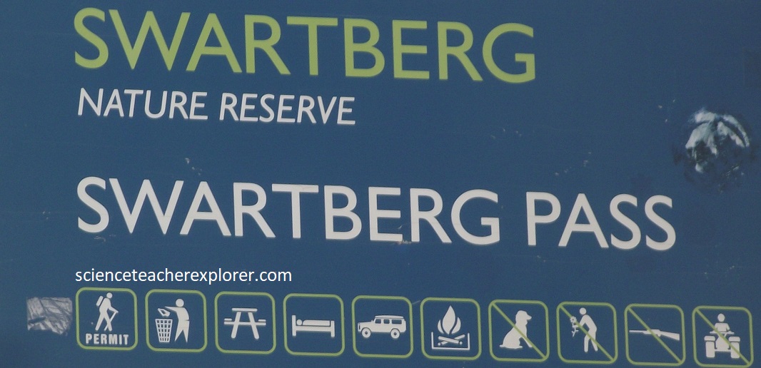
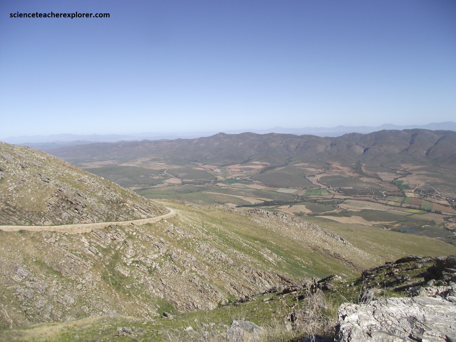
Once finished exploring the Baviaanskloof on R332, we continued driving west on N9, R341 & N12 to Oudtshoorn where we stayed for a few days to explore the Swartberg Mountain Range. Oudtshoorn is famously known for their multitude of Ostrich Farms, (pictured above).
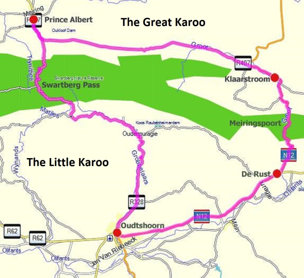
The Swartberg Mountain Range runs for over 200km west to east, forming a rampart between the Great Karoo and the Little Karoo, (imaged above).
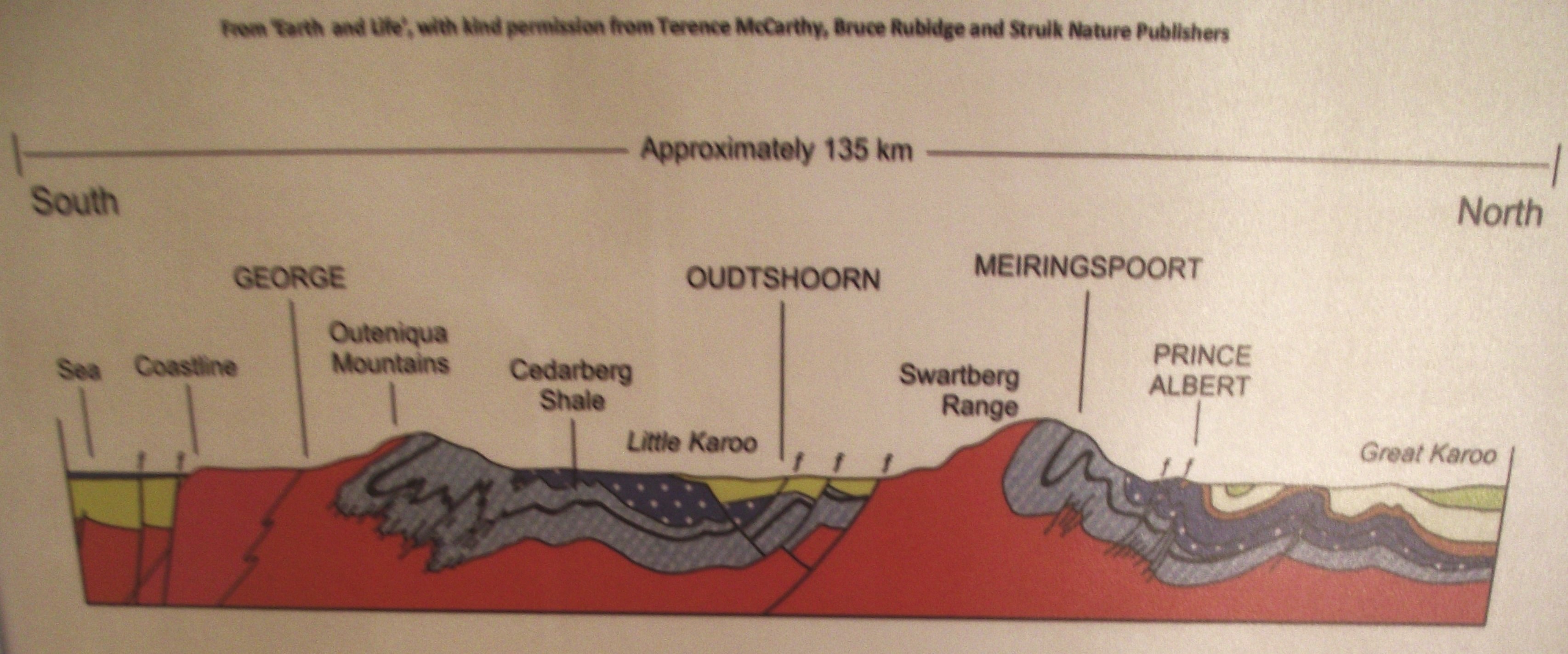
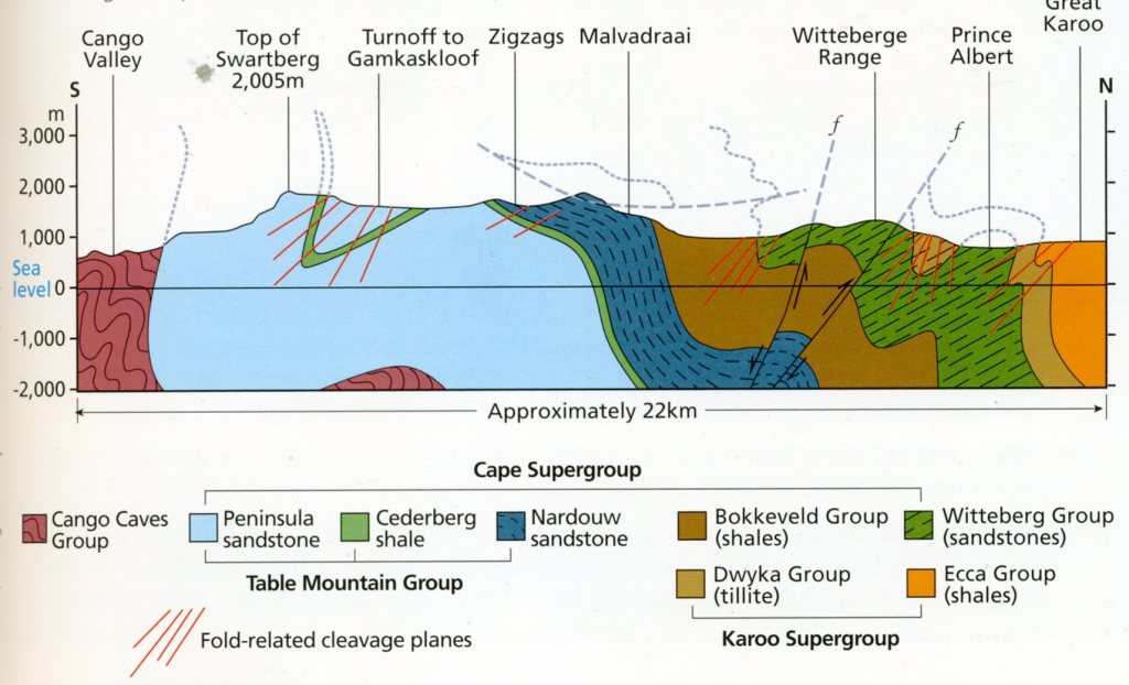
Imaged above is the north-south geological x-section of the Swartberg Mountain Range at Meiringspoort, (image taken from an interpretive sign on-site). The Swartberg Mountain Range is part of the Cape Fold mountain system and was initially formed by the movement of the African, South American, and Australian continental plates when they were all part of the Gondwanaland supercontinent 250 million years ago, (mentioned before).
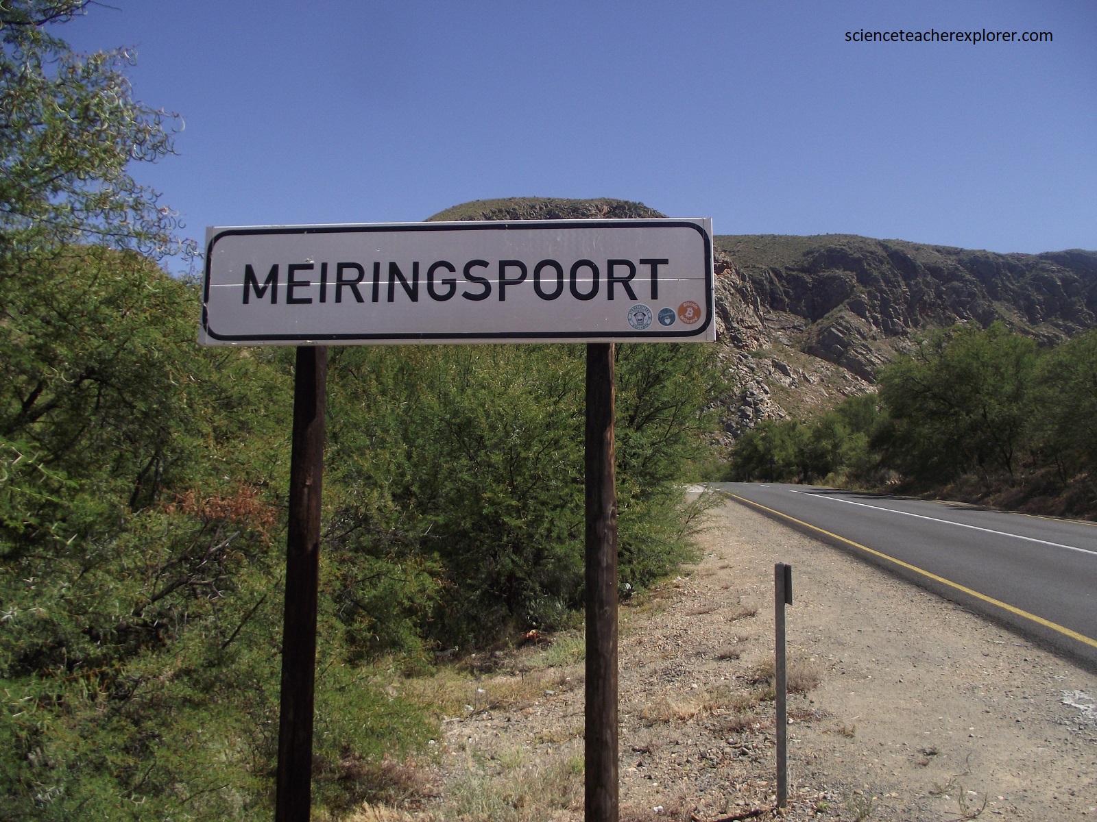
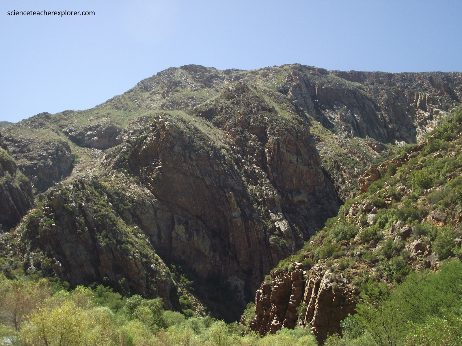

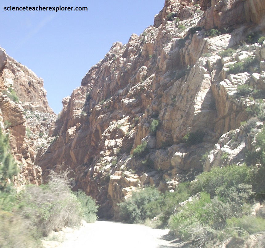
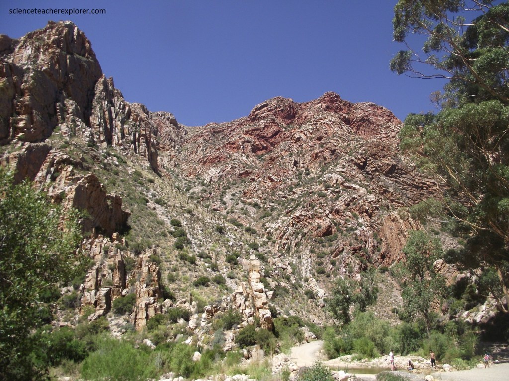
Pictured above, the spectacular cliffs of folded layers of sandstone, (of red, yellow, and ocher hues interspersed with green lichens), tower nearly 1,500m upward. The most accessible were at Meiringspoort on N12, north of De Rust. The pictures above show the folded, steeply dipping Table Mountain Group quartzitic strata near the southern entrance to the Meiringspoort Gorge.
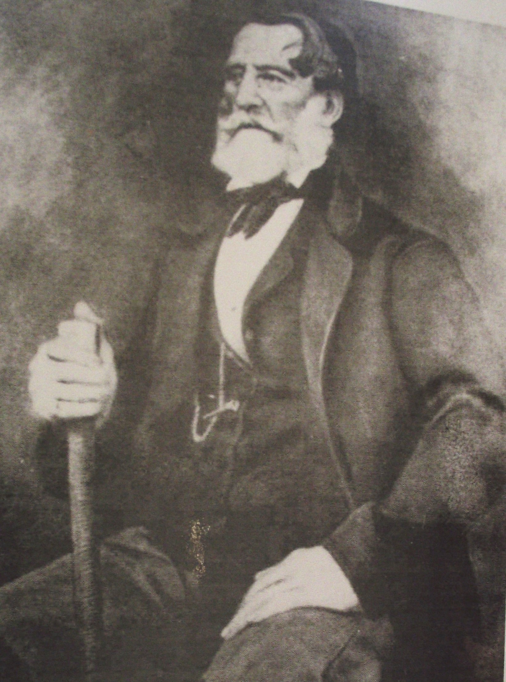

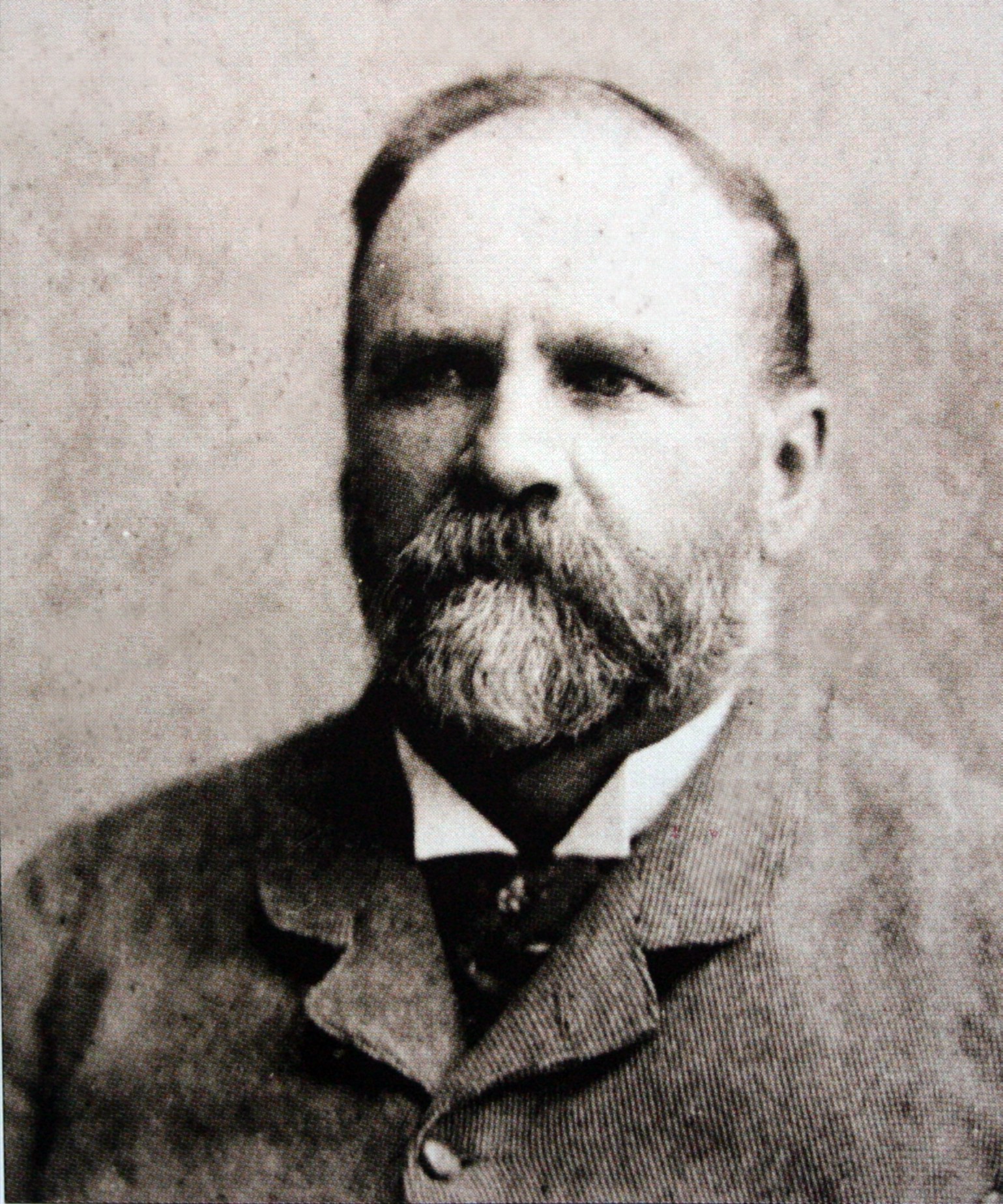
Imaged above are photos of Petrus Johannes Meiring and the flood damage of the Meiringspoort Gorge, (image taken from an interpretive sign on-site). The poort was named after Petrus Johannes Meiring, a local farmer who, in 1854, showed eminent road-builder Andrew Geddes Bain the tortuous route through the gorge. Construction of the road, (called the Boer Road), by Adam de Smidt was completed in 1857, providing the first proper road through the Great Swartberg into the Great Karoo. However, the route followed the course of the Groot River, fording the river at 25 drifts, and was repeatedly washed away by floods, (imaged above).
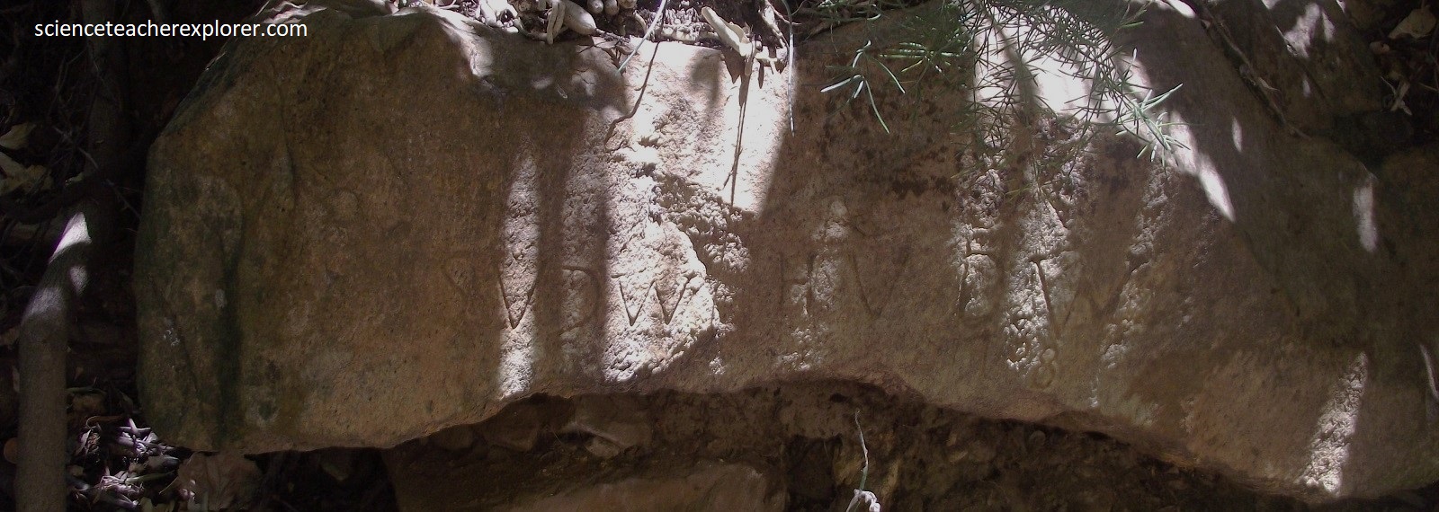
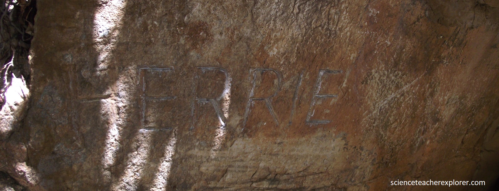
Pictured above, in 1929, the Afrikaans writer C.J. Langenhoven carved out the name of his imaginary elephant, Herrie, on this stone in Meiringspoort. Herrieklip was proclaimed a National Monument in 1975. This point in the Poort marks the beginning of Nagas Kloof, a deep raving named after Nagas, the chief of a San tribe that lived higher up in the deep recesses.

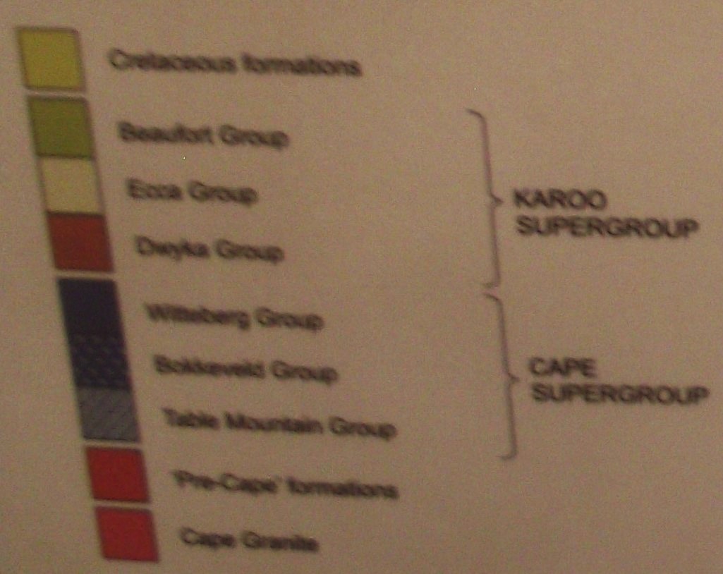
The entire sedimentary sequence of the Cape Supergroup can be seen, as well as the older pre-Cape Cango Caves Group near De Rust and younger Karoo Supergroup rocks further north. What makes the formations so impressive is the strong deformation of the Cape Orogeny, which created the Cape Fold Belt.
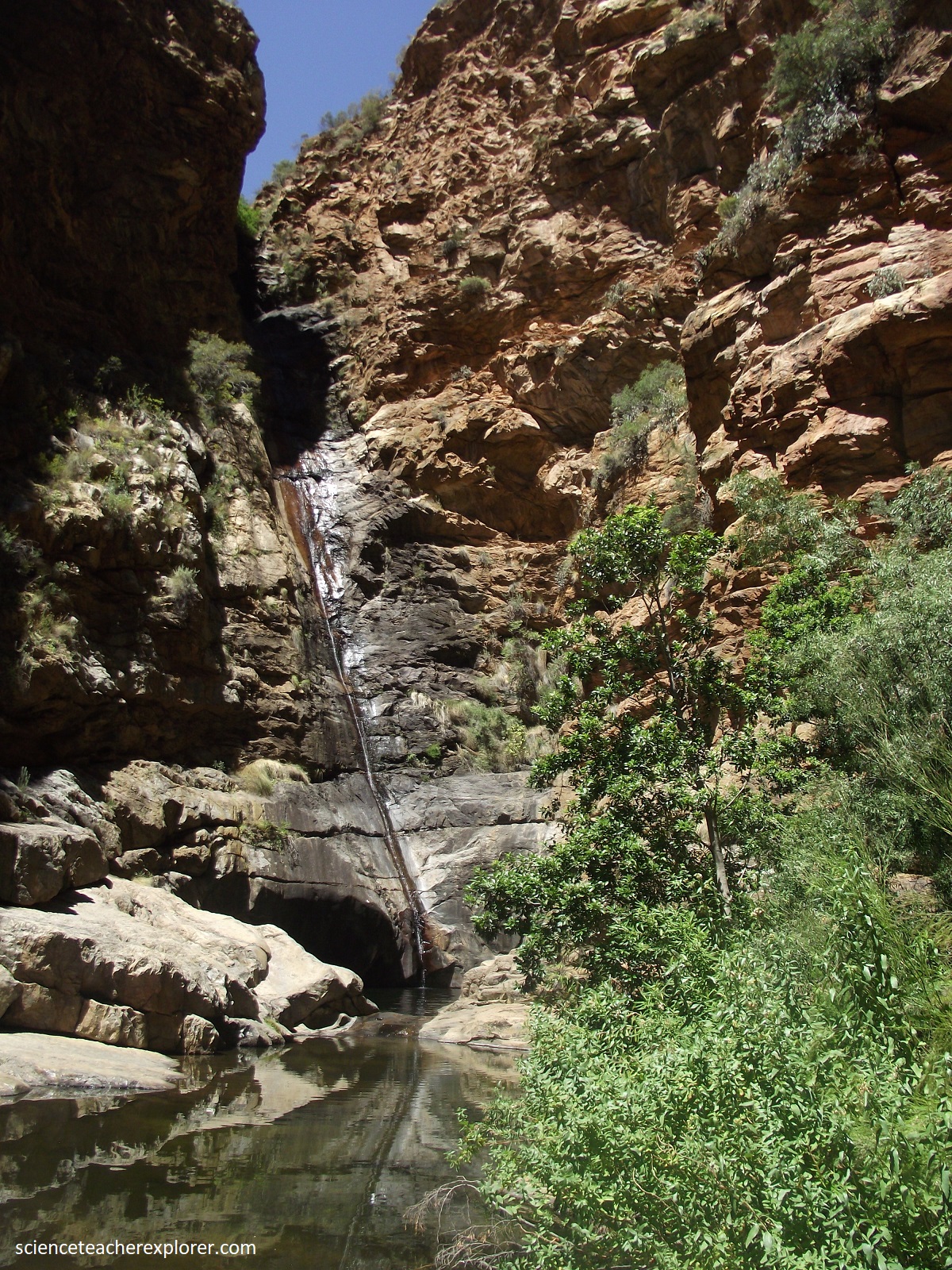

Pictured above, a short trek from the rest area, brought us to a waterfall that was well hidden in a side ravine, and which was visited in 1925 by the Prince of Wales. The stream dropped some 60m into a 9m deep pool.
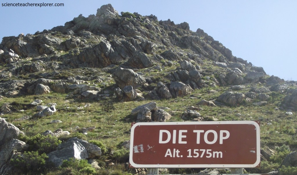
Pictured above, the northern side of Meiringspoort is composed of alternating layers of Bokkeveld Group shales, siltstones and sandstone, which could be seen along the roadside near Klaarstroom on R407. Further north and towards Prince Albert, the whitish ridges are composed of Witteberg Group sandstone, the top group of the Cape sequence. We drove onto Prince Albert to begin our drive over the Swartberg Pass on R328. Pictured below, at the Prince Albert-side entrance to the Swartberg Pass, Witteberg Quartzitic sandstone makes its first appearance, dipping moderately to the south and overlying typical Dwyka tillite.
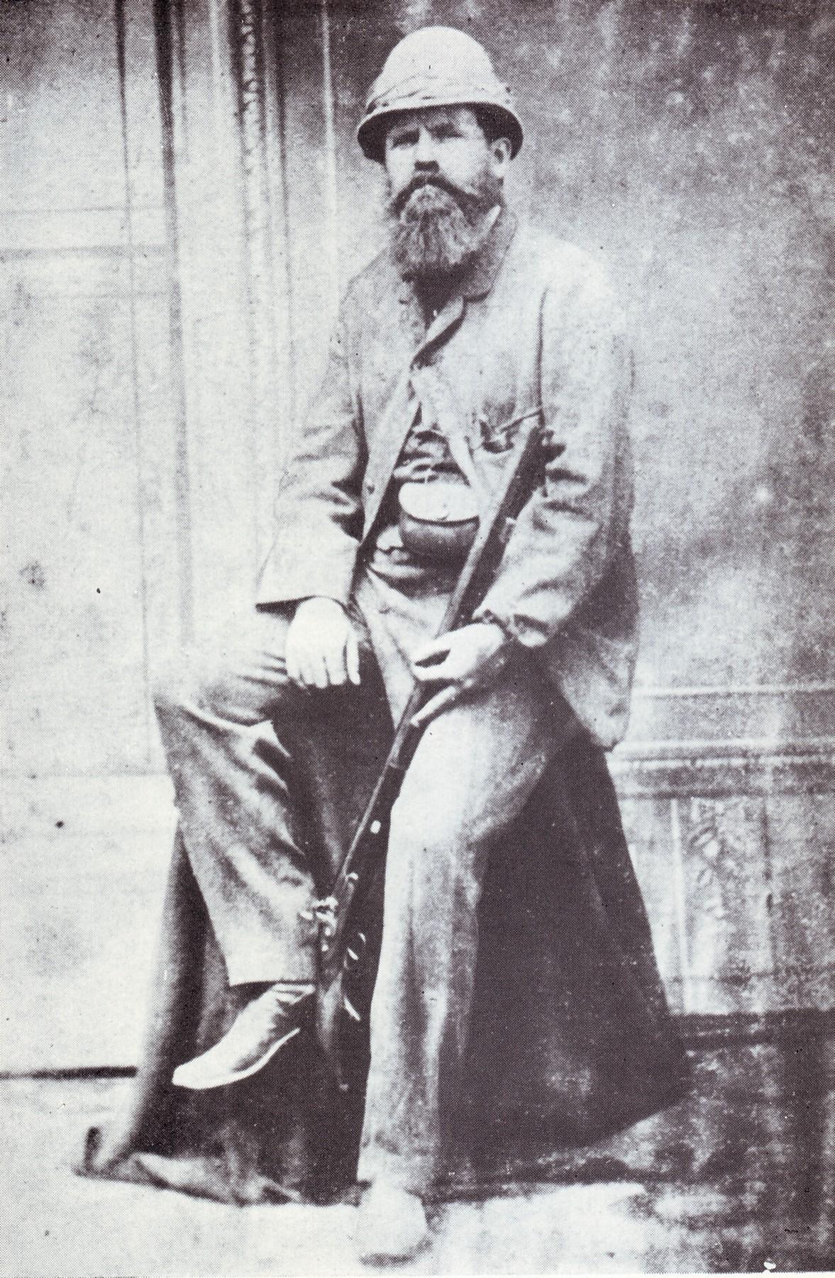
In the 19th century a reliable route into the Great Karoo was becoming essential as Meiringspoort was often impassable. Thomas Bain surveyed the route for the pass in 1875 and road building from the northern side started in 1881. Eventually he took over the road construction in 1883, using about 240 convicts as manual labor and, after suffering through untold hardships in heat, rain, and snow, completed the pass. The Swartberg Pass links Prince Albert in the north and historic Oudtshoorn in the south, and straddles the great Swartberg Range. This awe-inspiring 24km long Swartberg Pass road is regarded as one of the most spectacular mountain roads in the world. The road was untarred and reached an altitude of 1,585m.
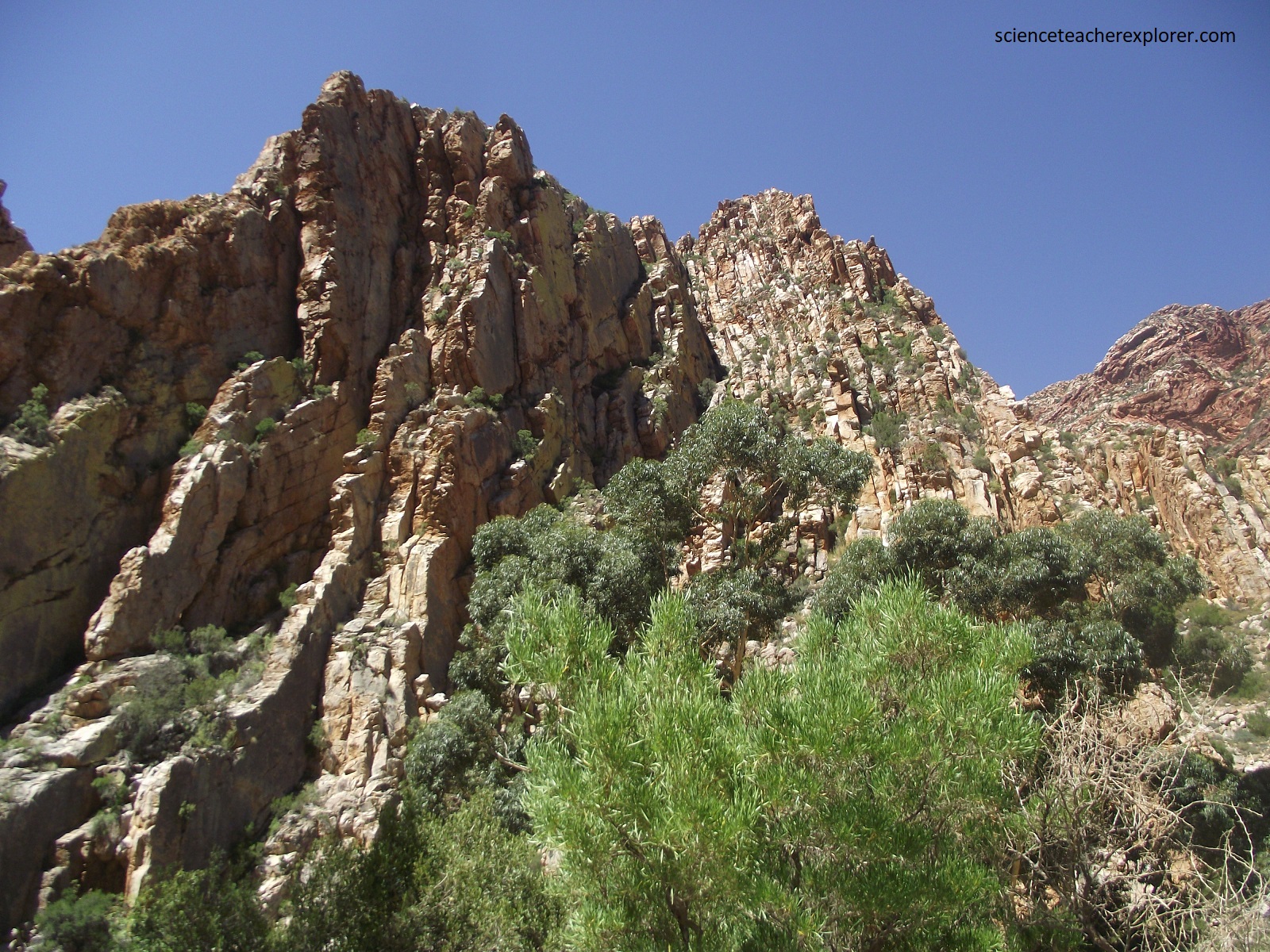
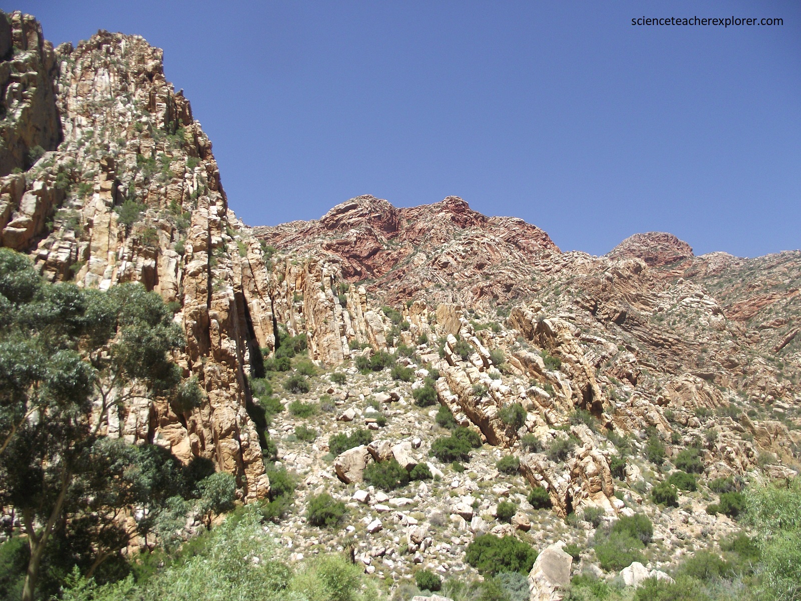
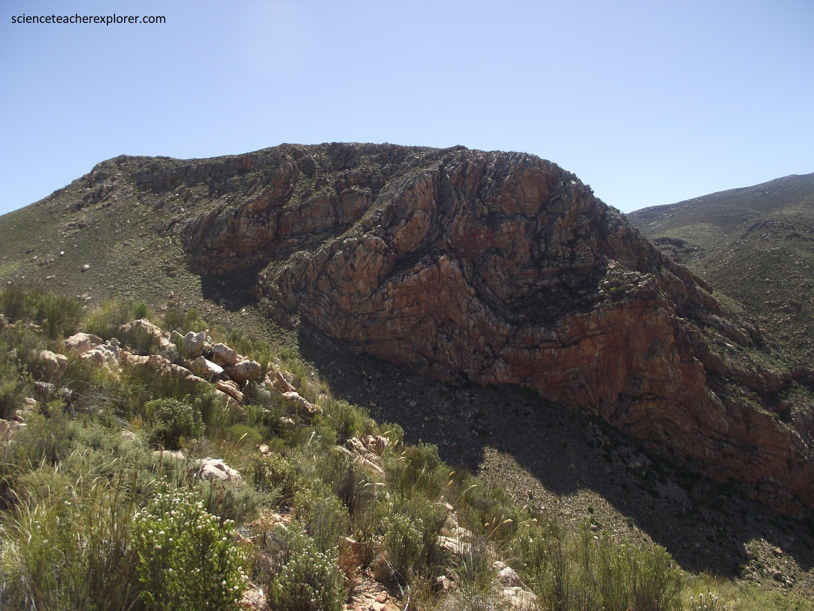
Pictured above, towards the northern end of the Swartberg Pass road, in the gorge made by the Dorps River near Malvadraai, extraordinary complex folding of the Nardouw Subgroup quartzitic sandstone, (the upper part of the Table Mountain Group), is very clearly seen.
Imaged above, excellent geological can be seen crossing the Swartberg Pass, of the east-west-trending Cape Fold Belt that formed during the Cape Orogeny around 280-230 million years ago. The pass traverses the northern side of what has been geologically interpreted as a mega-anticline with smaller complex-folds, a 40km-wide and 10km-thick complex fold structure that is fault-bounded in the Little Karoo to the south, and which does out northwards in the Great Karoo.
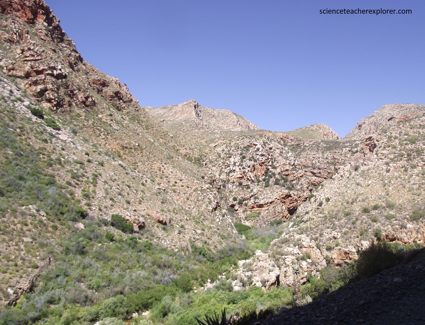
Pictured above, the intensely folded Nardouw Subgroup quarzitic sandstone of the Table Mount Group is proof of the immense Earth forces that operated at the time of the Cape mountain building. The Great Swartberg is over 200km long, up to 25km wide and, in place, exceeds 2,000m in height. The extremely rugged terrain is dissected by countless ravines, and it is being eroded by the extreme climate. The narrow gorge of the Dorps River has cut deeply into the quartzitic sandstones.
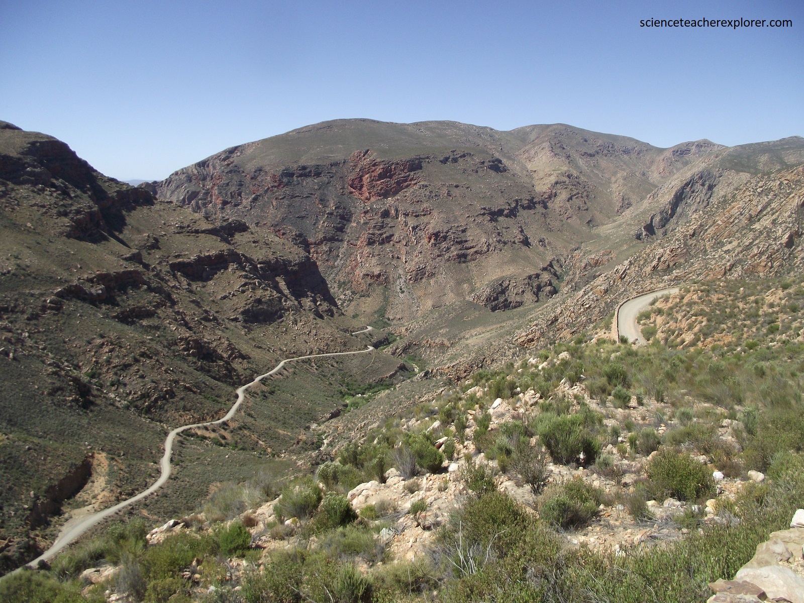
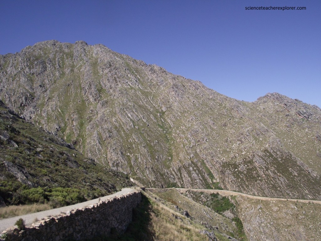
Pictured above, the pass road enters a series of S-bends, and swings away into the south-west up a major kloof, known as Mullers Kloof. The bottom photo is of the Teeburg viewpoint. Looking north, the photo takes a majestic view over the 500m deep chasm that runs all the way down to Malvadraai.
Pictured above, from atop of the Swartberg Pass, is this road that takes you to the Gamkaskloof. It is a 20km long valley which was successively the home of San, Khoikhoi, and Afrikaner farmers but had no road access until 1962. Officially known as Gamkaskloof, most people call it “The Hell” because of a remark by an early stock inspector, who said that it was “a helluva place to get into or out of”. In the early 19th century, Dutch farmers sought refuge here and stayed on with little change in lifestyle over the decades. During the Boer War, a group of Boers evading pursuit by the British took to the mountains and were astonished to come upon this isolated community who spoke an archaic form of Dutch. Geologically the valley is formed by an elongated synclinal structure underlain by softer Bokkeveld Shales and hemmed in by mountains of Table Mountain quartzitic sandstone.
Pictured above, the highest point of the south-dipping Great Swartberg is an unnamed peak reaching 2,005m, directly to the west of the Top view-site at around 1,585m. Thick, resistant Table Mountain Group quartzitic sandstones form the high ground. The thin Cederberg shale unit separates the Peninsula Formation and Nardouw Subgroup that make up the majority of the Swartberg Range. From the top, a surprisingly level upper surface is seen along the crest of the Great Swartberg Range reminding one that the Cape Fold Mountains are remnants of an ancient land surface that lies above the old African erosion surface.
Pictured above, the steep south-dipping shape of the southern mountain face is a result of steeply dipping, overturned quartzitic sandstone beds. Here, R407 snakes its way down the Peninsula quartzitic sandstones.

Pictured above, In the foothills at the southern end of the pass, there are poorly exposed and older, (600 million year old) carbonate rocks of the Cango Cave Group. Actually, the Cango Caves are found in these undulating foothills of the Great Swarberg some 30km north of Oudtshoorn. It is on R328, off of R407, after the graveled road turns to tar.
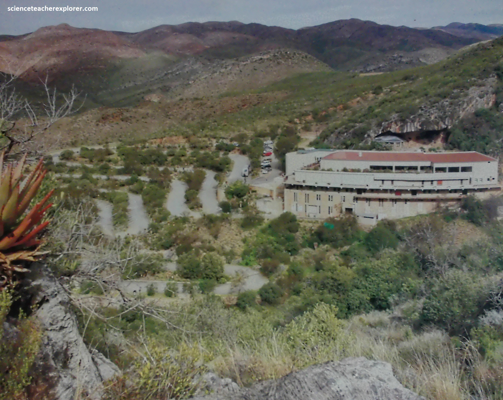
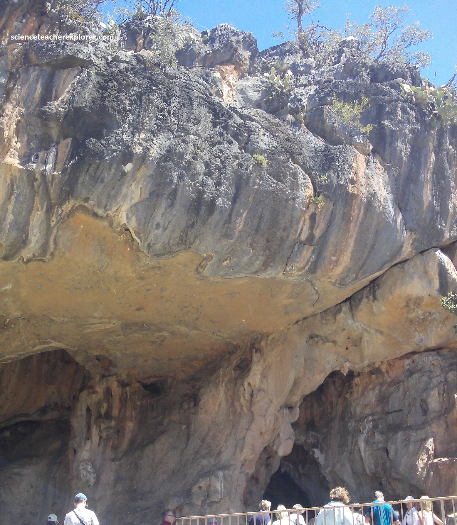
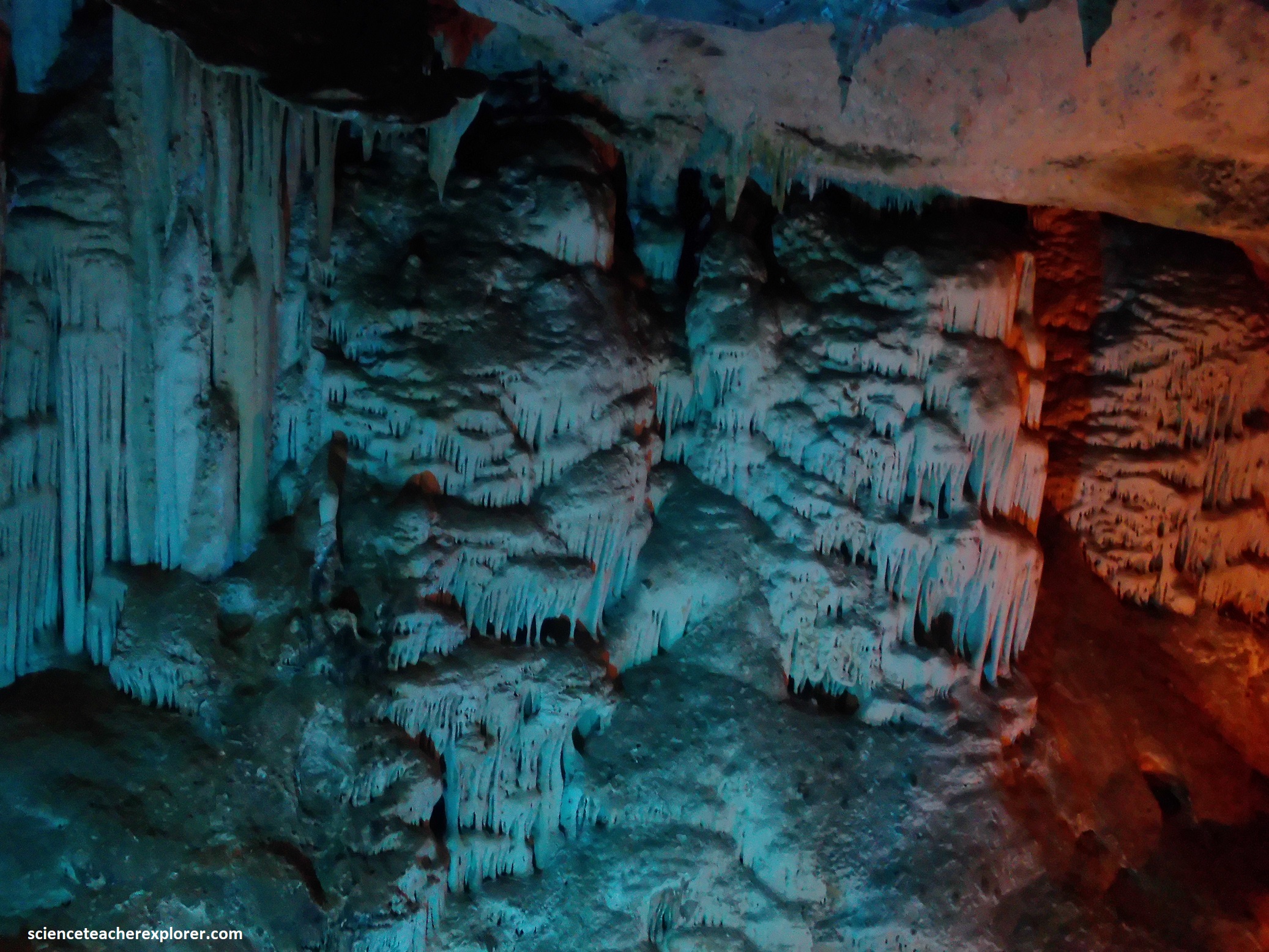
{Pictured above, the entrance area of Cango Caves}
Deep below the southern side foothills of the Swartberg Mountains is the labyrinth of caverns, tunnels, and underground lakes that forms the Cango Caves.
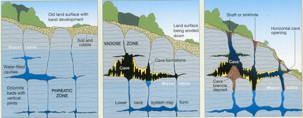
The Cango Caves were formed by an underground stream diverted from the surface, and slow chemical erosion of limestone. This is the result of very slightly acidic rainwater penetrating along vertical fracture, joints and bedding planes, very slowly dissolving the surrounding carbonate rock and forming water-filled caverns. This take place below a stable land surface where dissolution is assisted by good rainfall. In places, the cavities join up and provide a pathway for running underground water. As the level of the water table drops (or uplift takes place) the cavities are drained and become exposed to air, and much younger secondary cave formations, (speleothems), are formed from mineral-rich dripping water. At the Cango Caves, this started around the Tertiary time period or later. Today, a perennial stream flows about 15m below the present cave, in a much smaller passage.
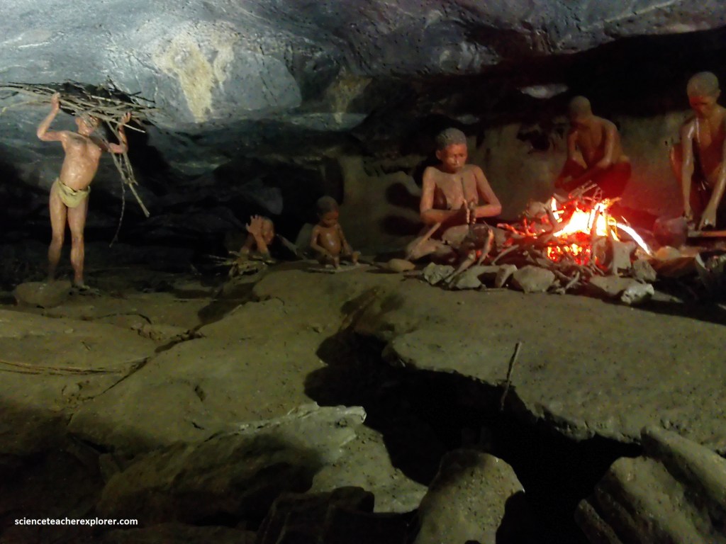
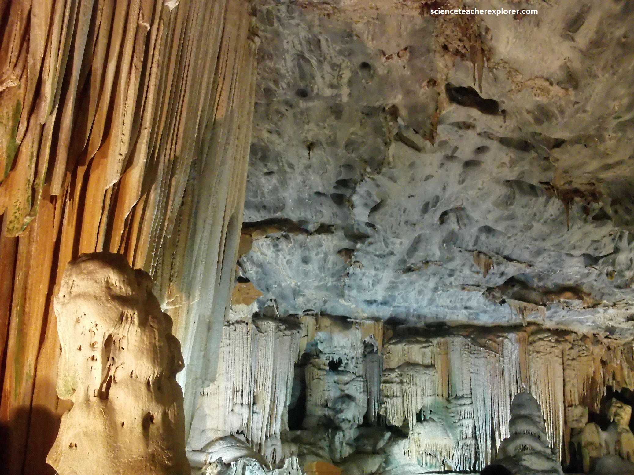
The Cango Caves were discovered in 1780 by cattle herder Klaas Windvogel who, accompanied by his employer Mr. Van Zyl and local teacher Barend Oppel, was lowered into the first great chamber. By the light of their flickering torches they discovered a stalagmite 9m high, which was name Cleopatra’s Needle, (pictured below).
Archaeological work has shown that human activities in the caves go back to the Stone Age and that the entrance was used by the San and decorated with their rock paintings, (pictured below). Th caves were declared a National Monument in 1938 and now a Provincial Heritage Site.
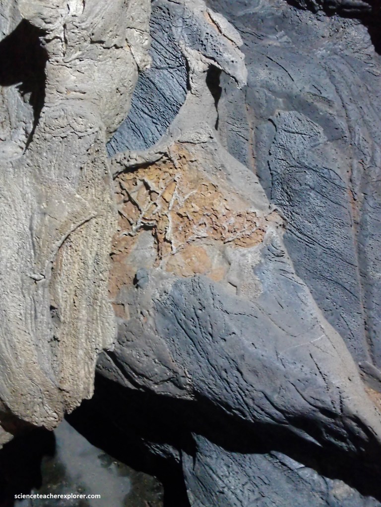
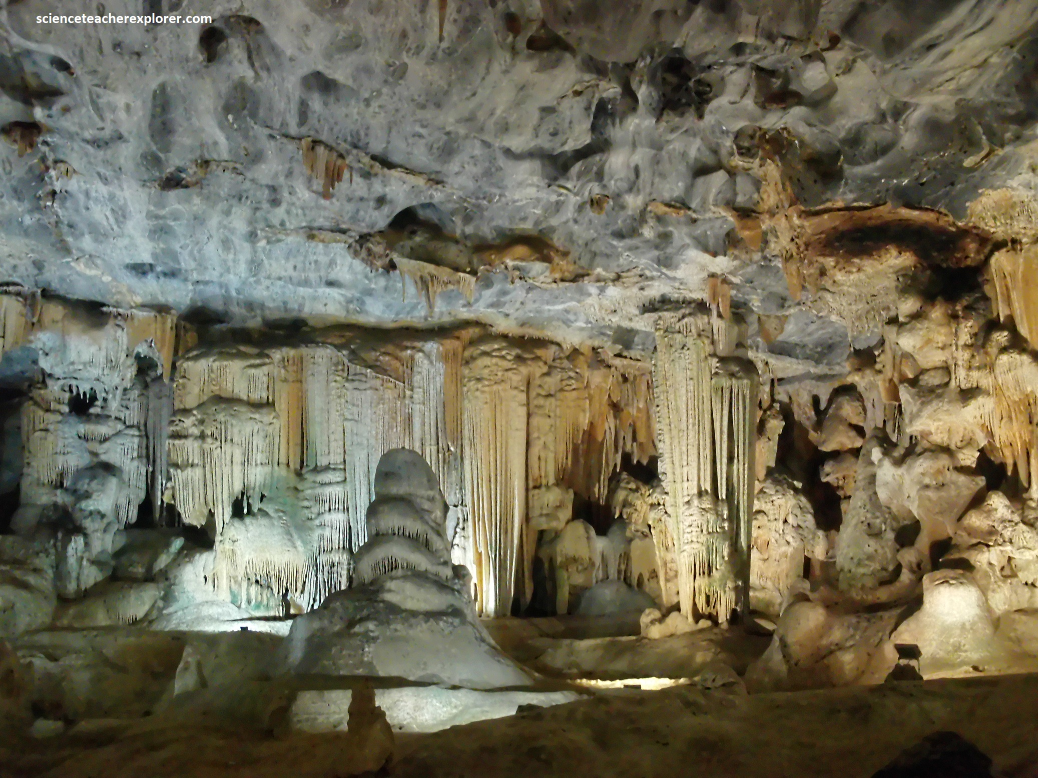
The caves are hosted in pure grey marine limestone, which is part of the Matjies River Formation. This mixed shale and limestone formation is 20km long, 2km wide and dips steeply to the south. Clean fresh rocks are not seen in the cave because of younger cave formation, as well as poor light, but are exposed at the entrance, (pictured below). Of major interest are the spectacular interior cave formations, many of which have been given popular names.
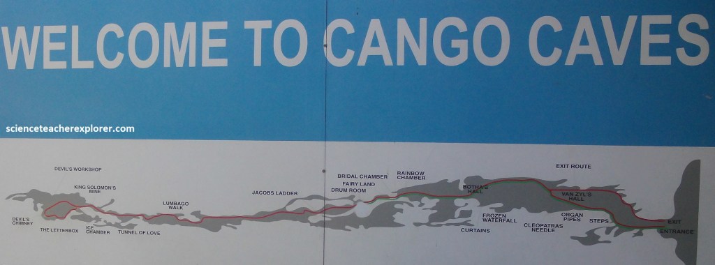
Pictured below, the first chamber, known as Van Zyl’s Hall, is 100m long and 15m high, but in more recent years, cave explorers have found more chambers, including one 300m long.
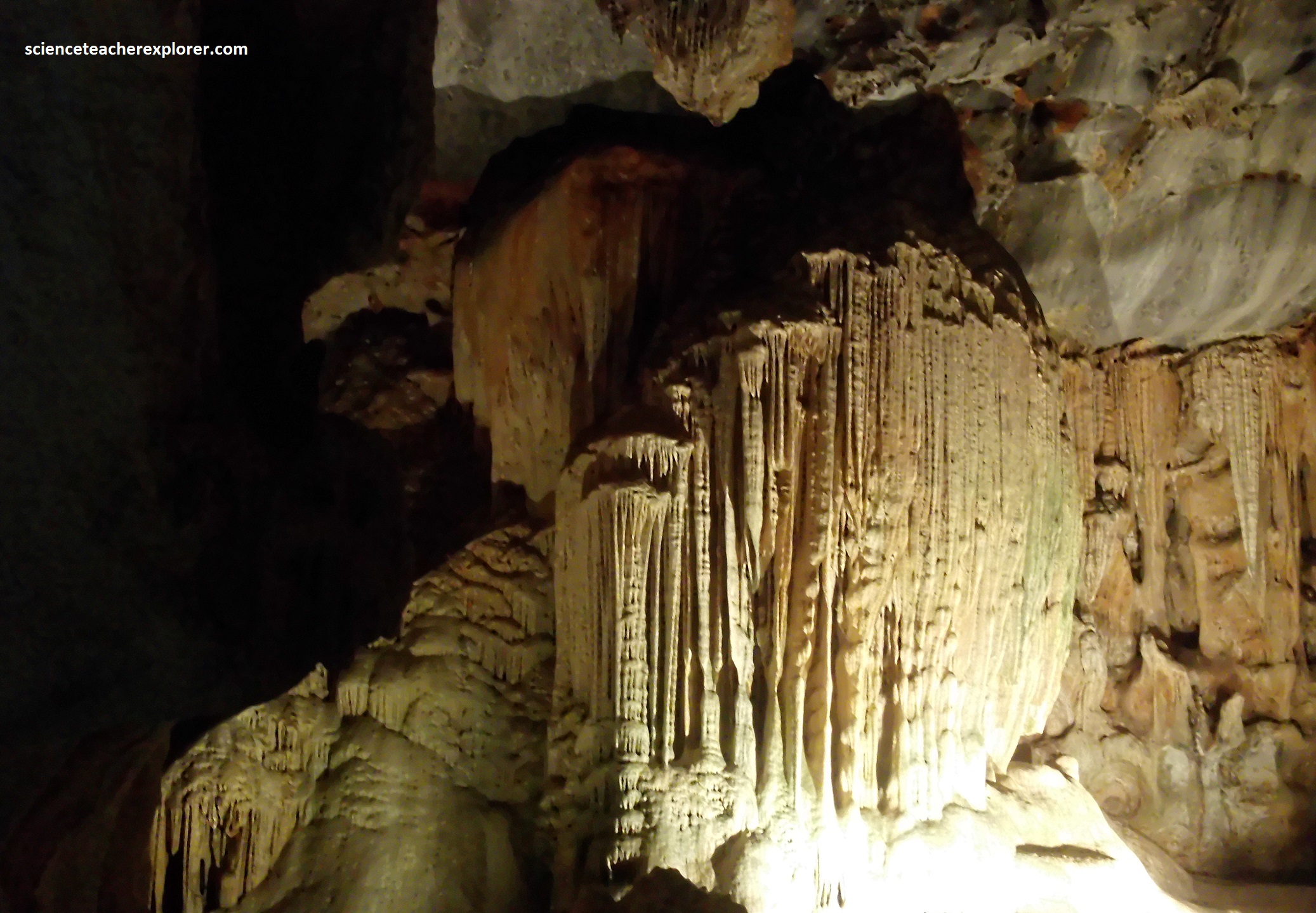
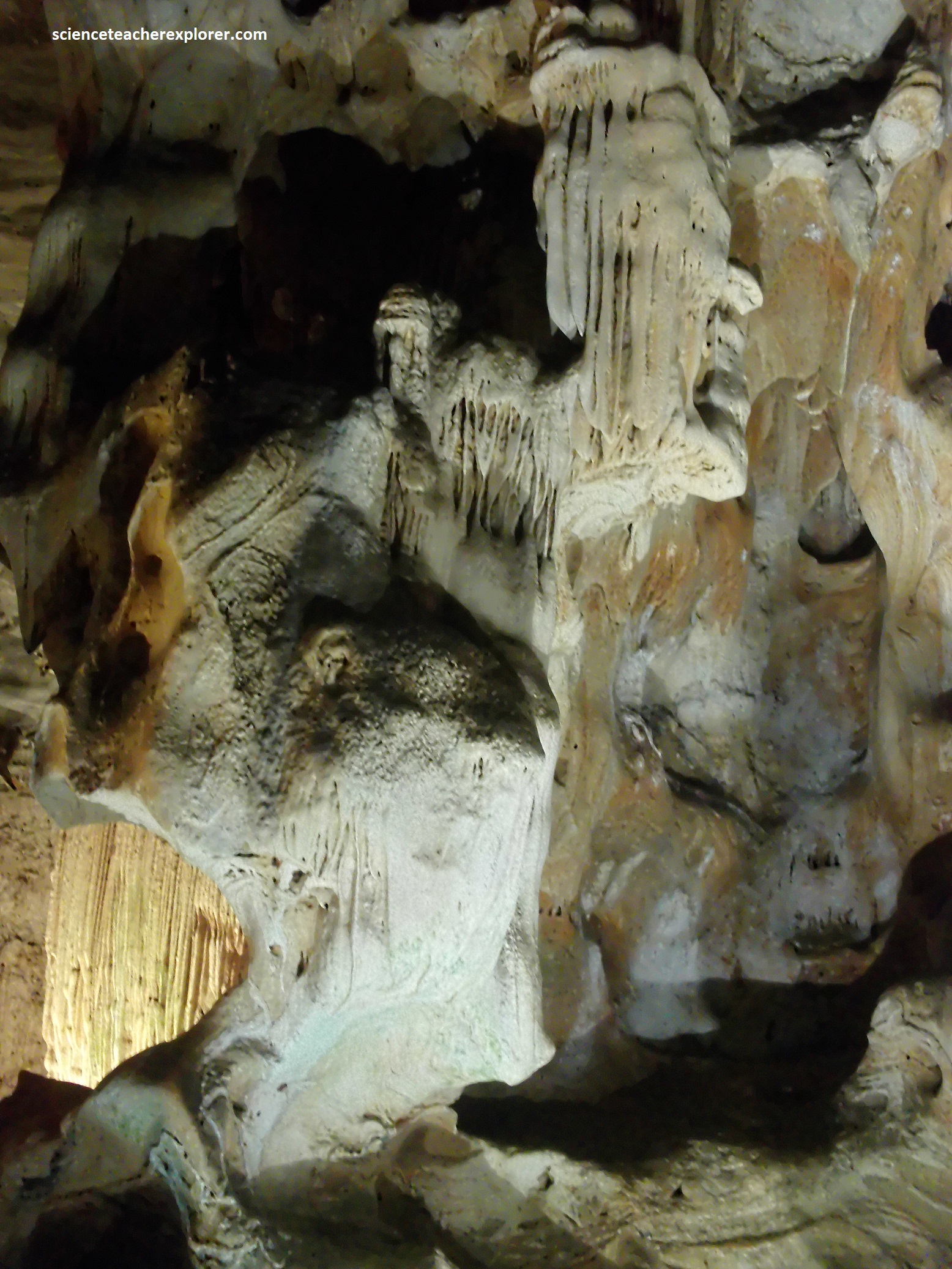
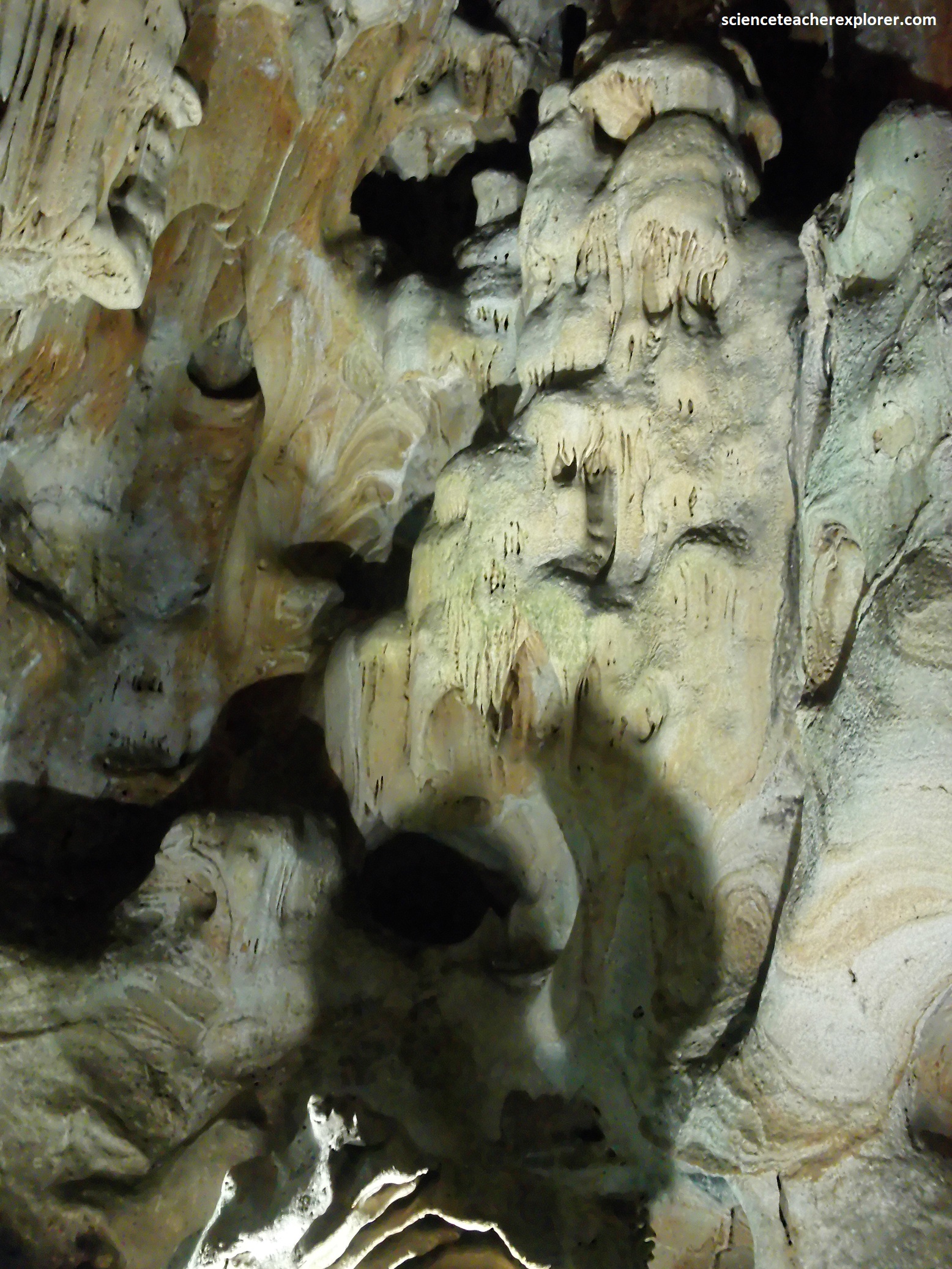
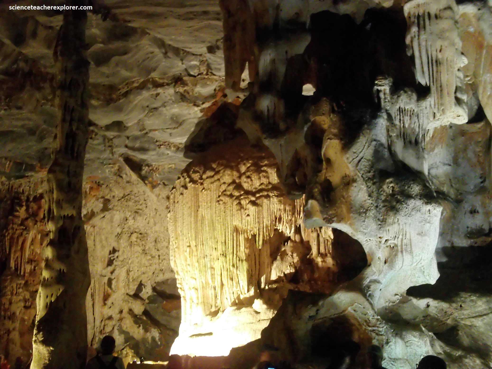
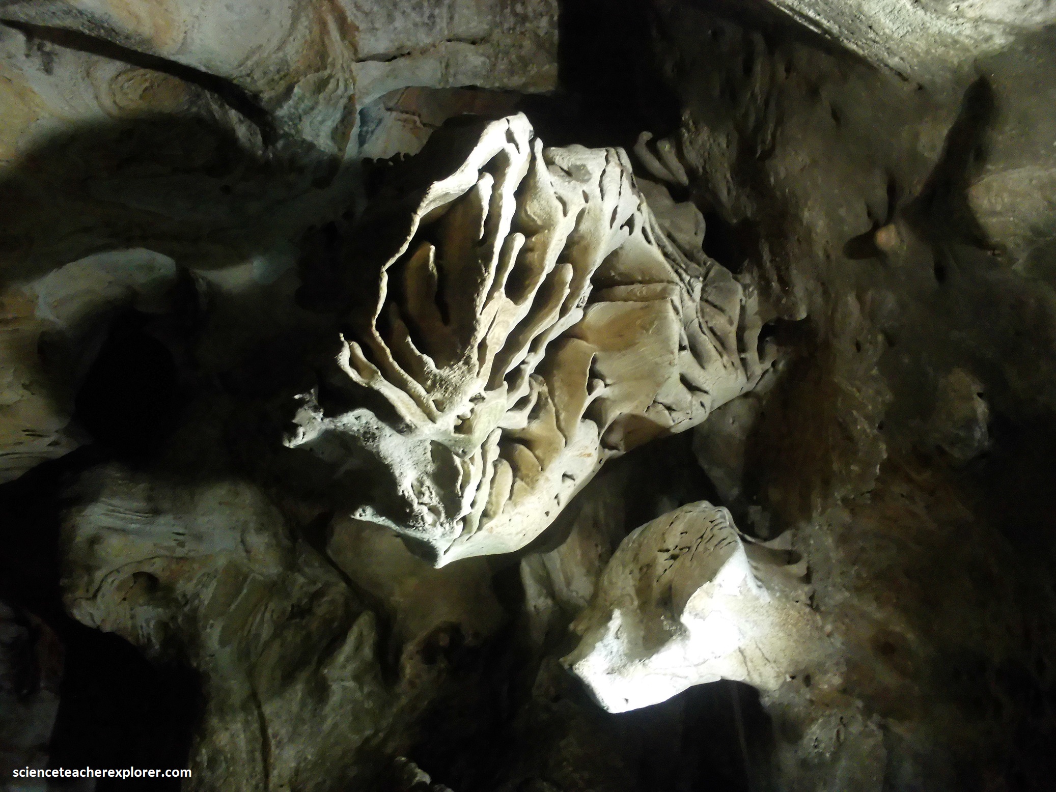
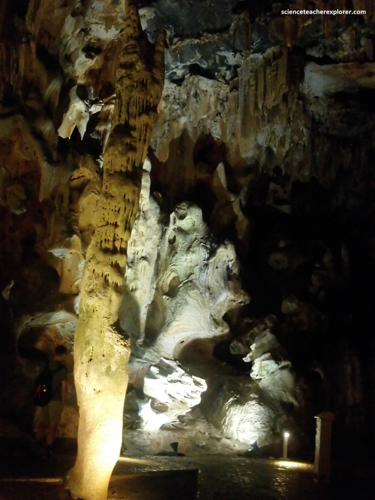
With names like the Crystal Forest and the Throne Room, each chamber features stalagmites and stalactites made of calcite, (a crystallized form of calcium carbonate), that grow into distinctive shapes, (pictured below).
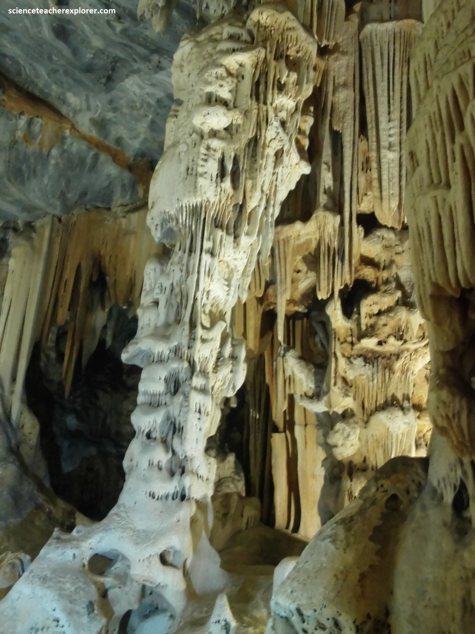
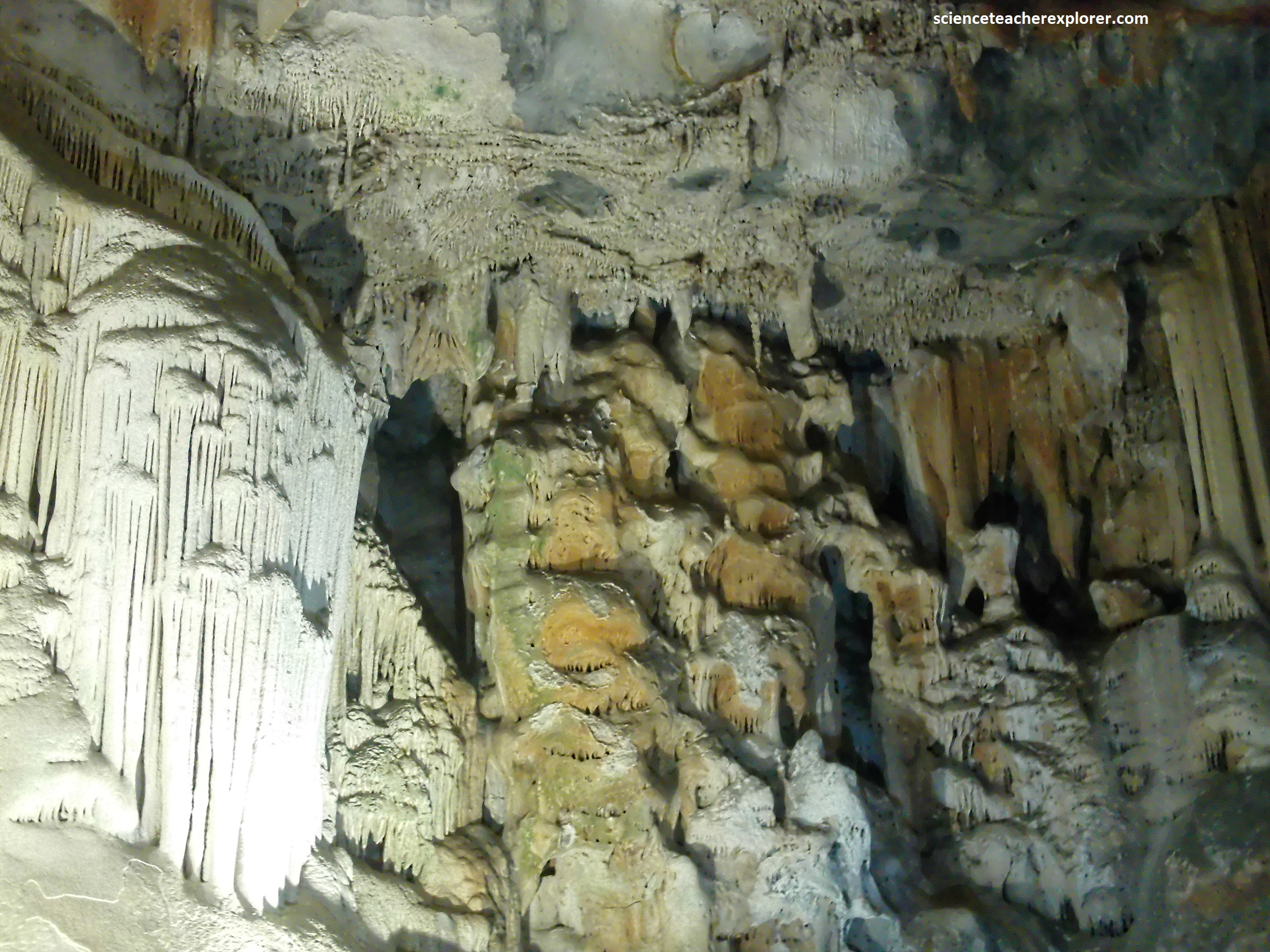
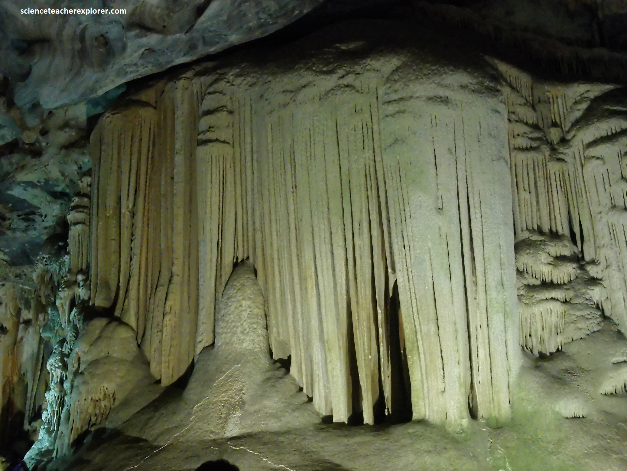
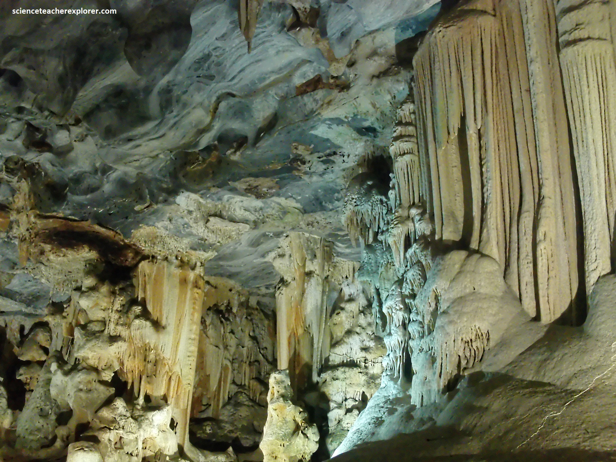

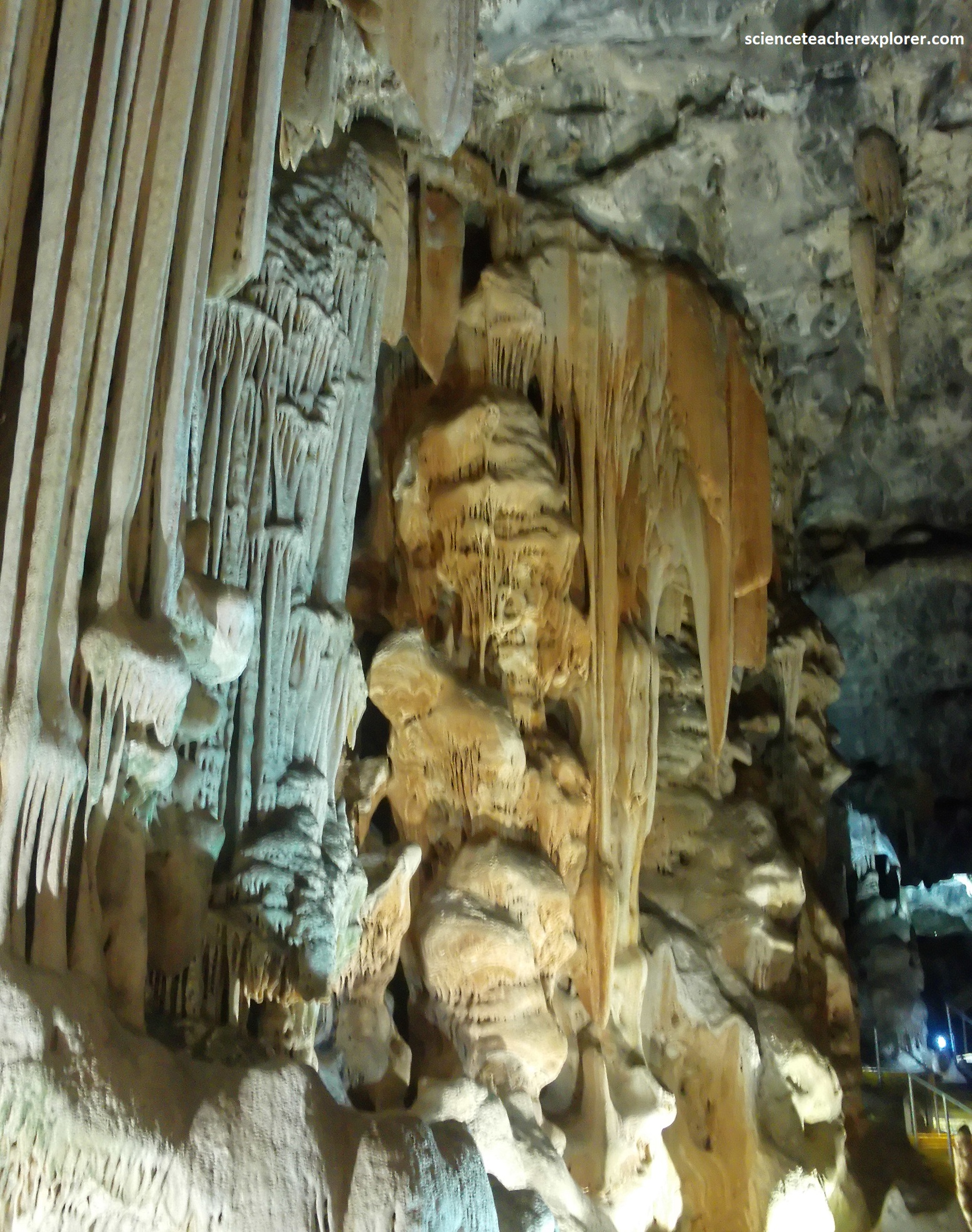
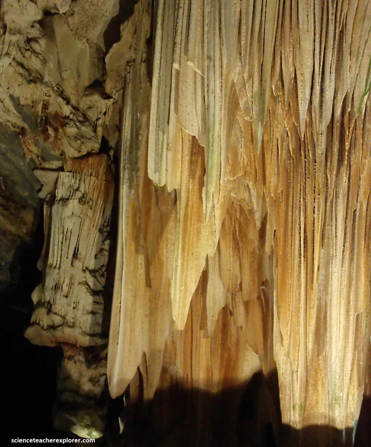
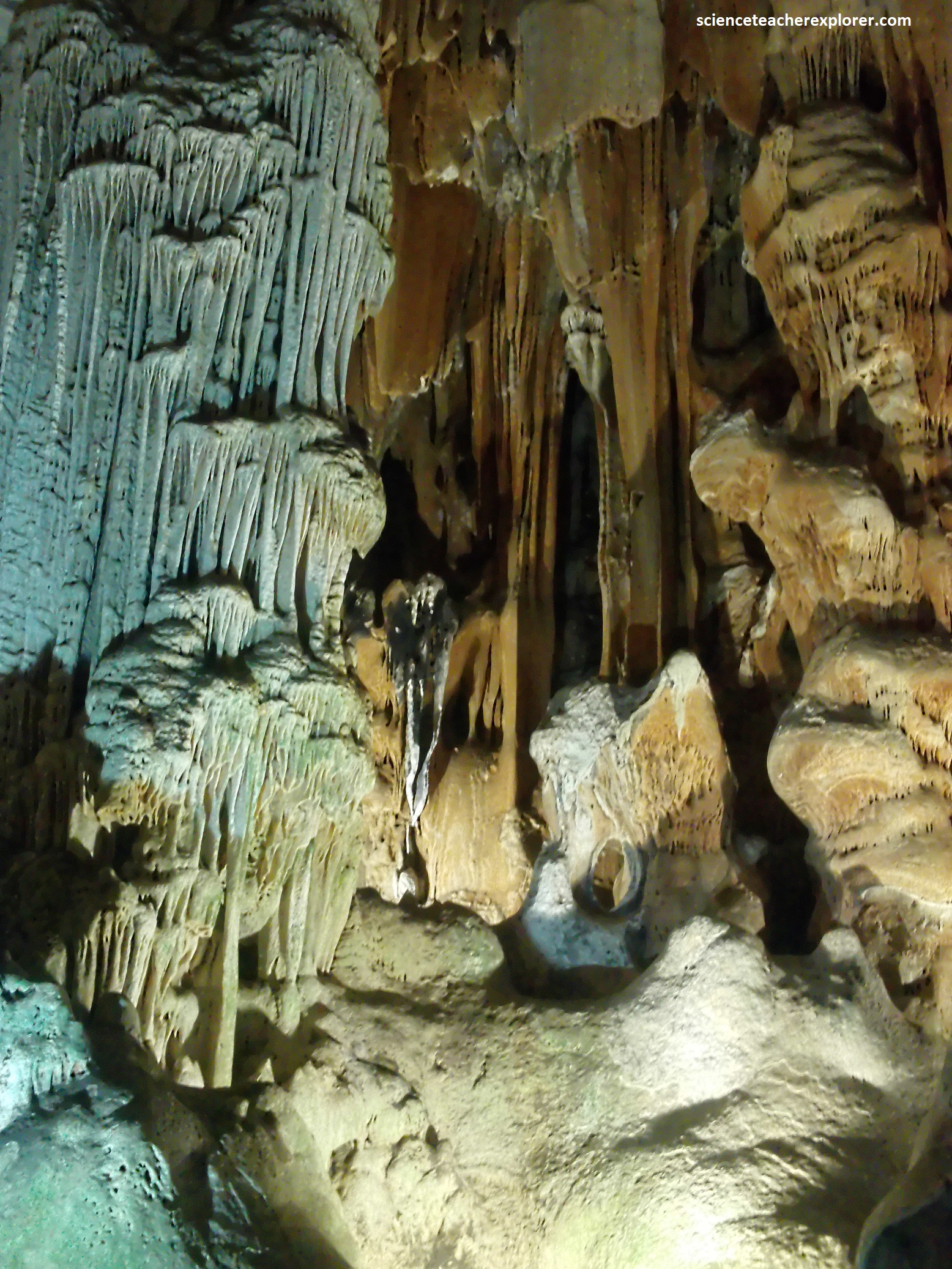
Pictured above, Bhota’s Hall has hanging gothic curtains and a floor-to-ceiling column called the Leaning Tower of Pisa. The formations are generally tinged red and pink by iron oxide or manganese.
The Cango system of tunnels and its many named chambers is known to extend underground for at least 5km and comprises Cango I-IV. The upper caverns are essentially dry and contain spectacular and varied displays of speleothems, and many side chambers. Cango I is the only cave open to the public and is 775m long and fairly level.


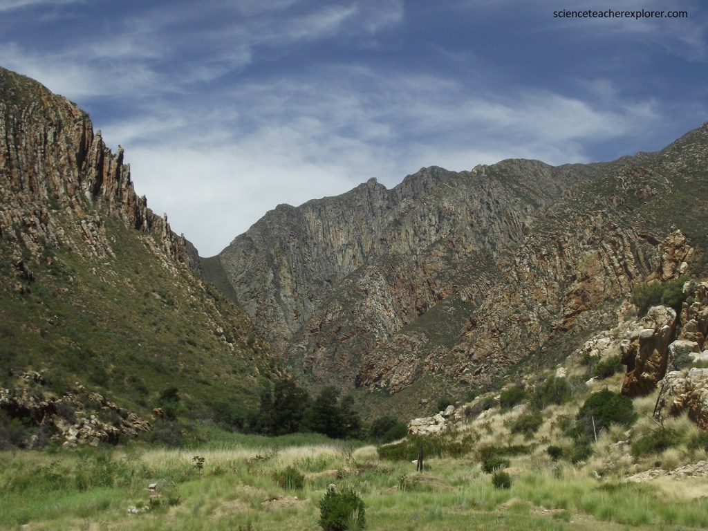
After exploring the Oudtshoorn & Swartberg areas, Mike and I drove west on R62 to Montagu for trekking and exploring the Cogmans Kloof. It lies between the towns of Ashton to the southwest and picturesque Montagu to the northeast. Pictured above is a geological map of the Cogmans Kloof, (image taken from an interpretive sign on-site).
In the early 18th century a rough track following the Kingna River bed was the only way through the almost impenetrable Langegerg Range, and it was subjected to regular flooding. Again, road-builder Thomas Bain was called in, (images above taken from the public domain of Wikipedia). Bain got to work in 1875 and the pass was opened in 1877.


Pictured above, at the Cogmans Kloof we could see folding of the Cape Fold Mountains at its very best, particularly in the intensely folded zone in the Langeberg Mountain mass as you look north-east towards Montagu. The Cogmans Kloof cliffs rise to a point 500m above where I am standing in the picture above. They comprise of quartz-rich sandstones, which are hard and extremely resistant to weathering. The impressively folded rocks seen here are almost entirely of the Nardouw sandstone in the upper part of the Table Mountain Group, (the lower part of the Cape Supergroup), and were originally horizontal. They formed from sediment that settled between 480 and 400 million years ago on the floor of what was then a vast alluvial plain. However, they have been intensely compressed and deformed from gravitational collapse. Very similar folding was seen in the Great Swartberg Range.
Between 280 and 230 million years ago, the region was subjected to intense compressional forces, which geologists believe were directed in several pulses from the south towards the north. This tremendous pressure, applied over some 50 million years, caused the strata to bow and bend into the contorted shapes and patterns visible today.
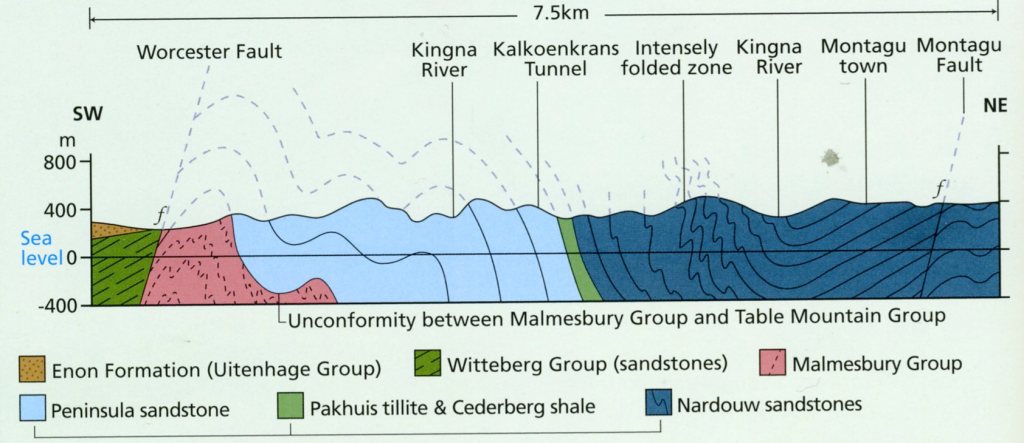
Imaged above, the overall geological structure is of a large anticline in mainly Peninsula sandstone on the Ashton side, with smaller subsidiary folds, and a major syncline in Nardouw sandstone on the Mantagu side. The syncline includes the intensely folded zone that has been attributed to collapse under the influence of gravity.

The most recent major moment in the geological history of Cogmans Kloof occurred between 150 and 90 million years ago, when a 500m downward displacement along the south of the Worcester Fault resulted in the juxtaposition of rocks of greatly differing ages. The fault runs eastwards from a point just west of Wolseley, through Worcester and Robertson and beyond. Sudden movement along the Worcester Fault in 1969 caused South Africa’s largest earthquake in historical times, which registered 6.3 on the Richter Scale.
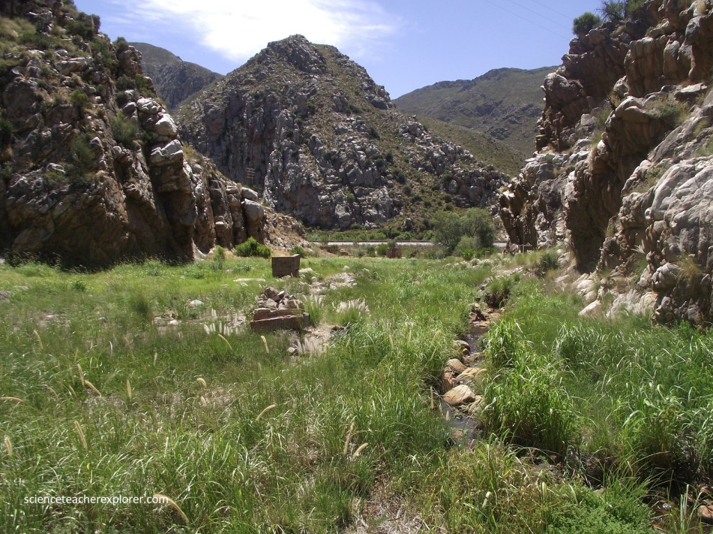
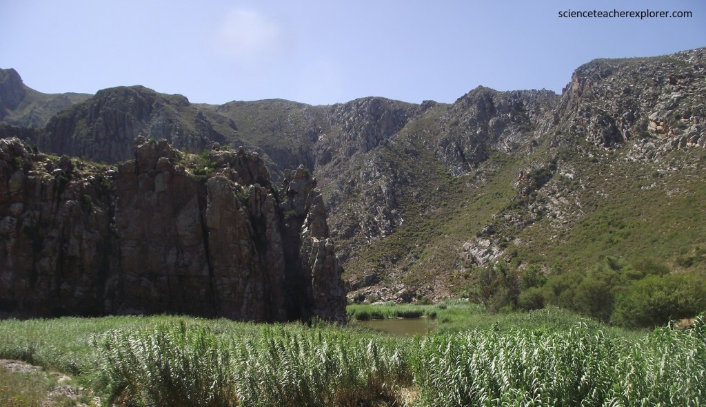
The striking appearance of the gorge, with its high peaks and steep rock faces on both sides, is testimony to the erosive power of the Cogmans River, which runs through it. This river starts just above the northern end of the gorge, at the confluence of the Keisie and Kingna rivers, and flows past Ashton to join the Breede River 18km further downstream. Geologist believe the river may well have existed prior to the uplift of the Langeberg Range and was able to erode downwards at a pace equal to that of the rise of the land. When the downward erosion of the main river channel halted or slowed, the stream would tend to cut sideways, widening the gorge. When erosion of the main channel resumed, the terraces on the side remained.
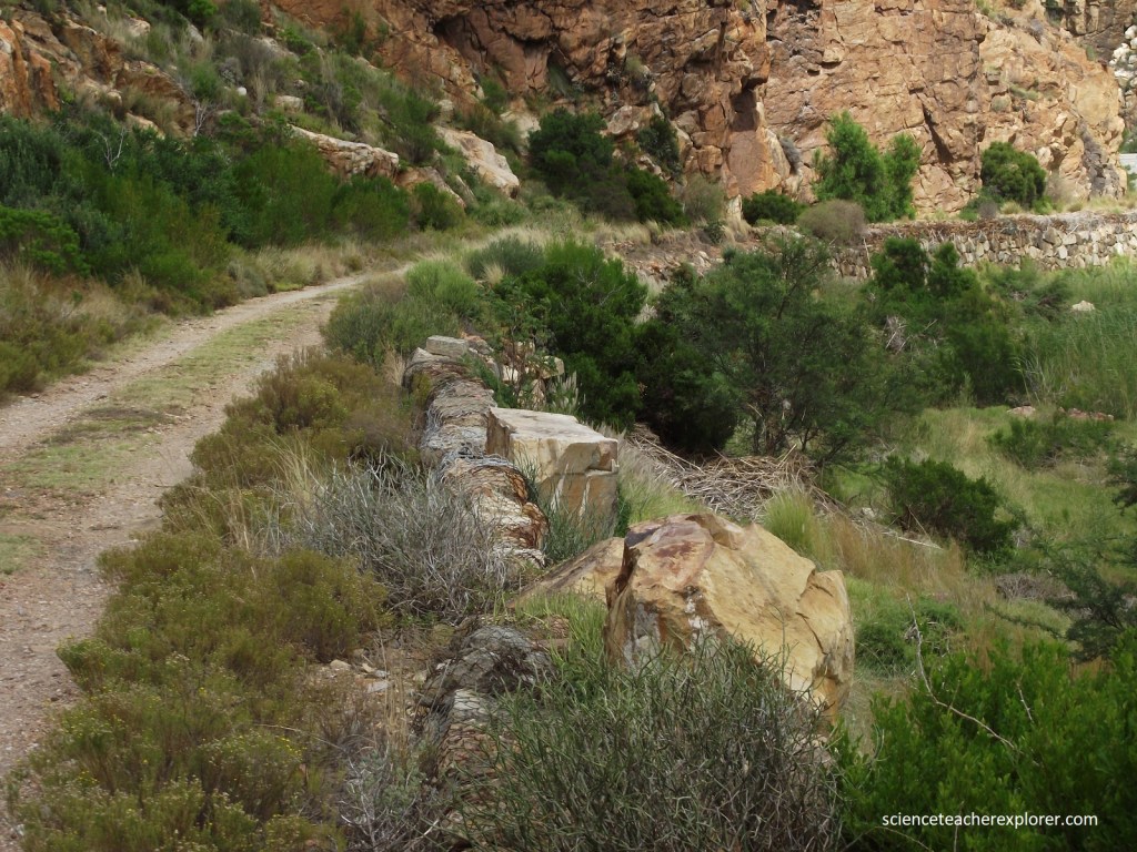

Pictured above, a 16m long tunnel had to be blasted by Thomas Bain, through the massive sandstone barrier known as Kalkoenkrans, and dynamite was reputedly used here for this purpose for the first time in the 1870s South Africa. On the koppie above the tunnel is a small blockhouse, also known as For Sidney built of local stone in 1899 during the Anglo-Boer War. Mike and I decided to trek up to it, (pictured below).

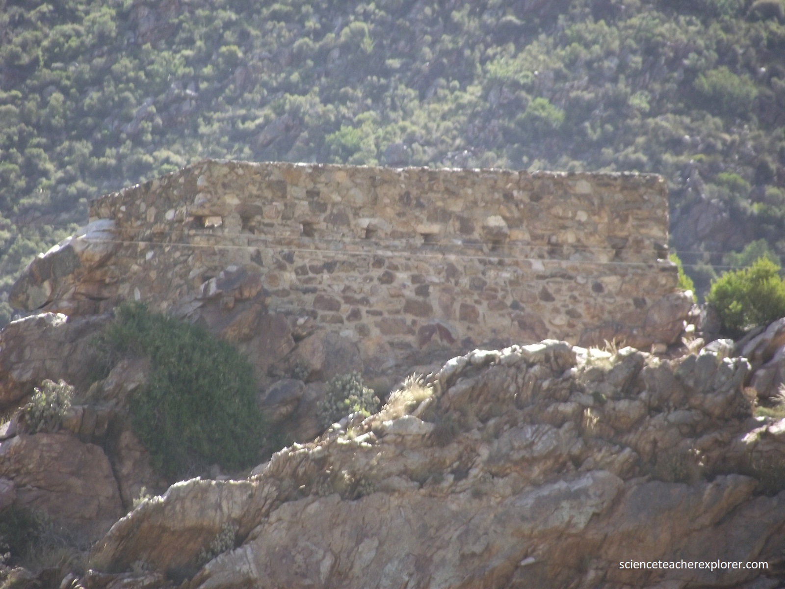
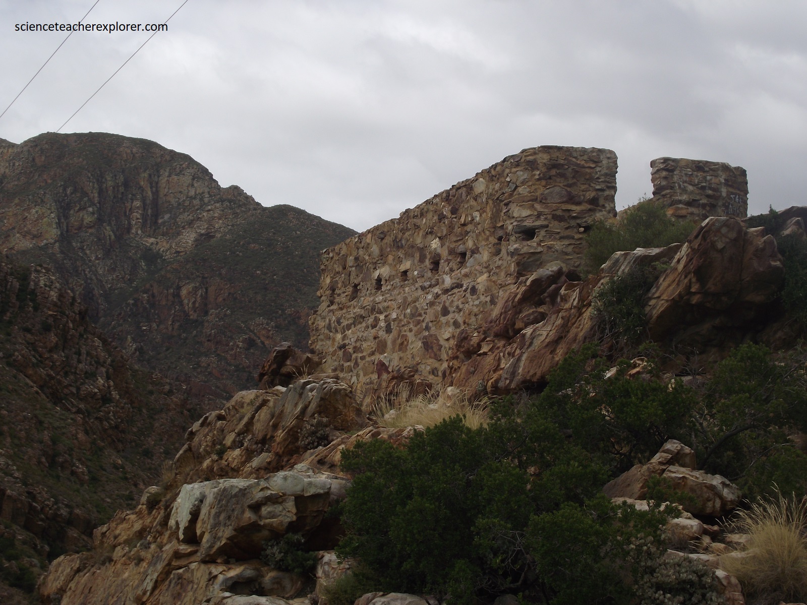

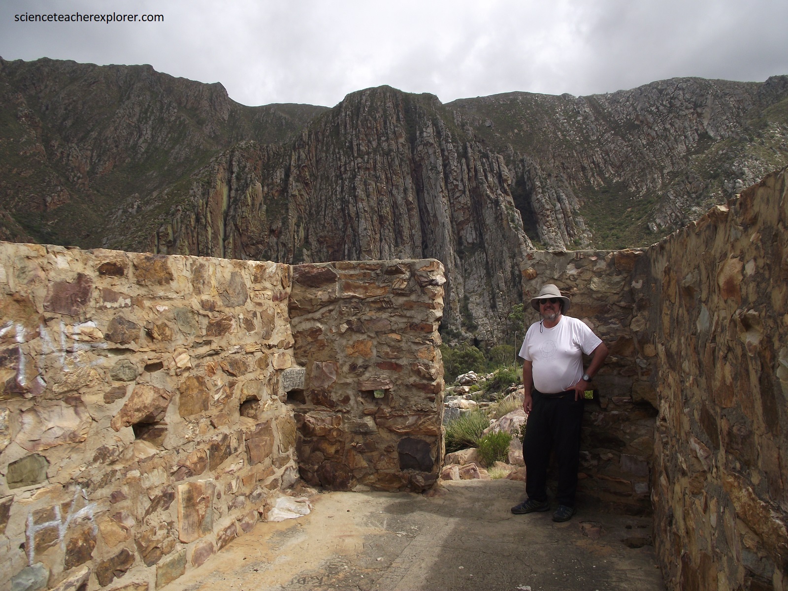
This fort, built in 1901, was named after Lt. Col. Sidney of the Royal Field Artillery, who was in charge of British forces stationed in the Montagu area at the time. The fort was garrisoned by a company of Gordon Highlanders, survivors of the famous battle fought a year earlier at Magersfontein. Pictured above, the mortared stonework formed a rectangular structure about 10m long and 4m wide. The 40cm thick walls were 2m high with a simple opening on the west end to serve as an entrance. There were 21 rifle ports built at intervals into the walls, with indications that the fort once had a roof that drained into an internal water tank.
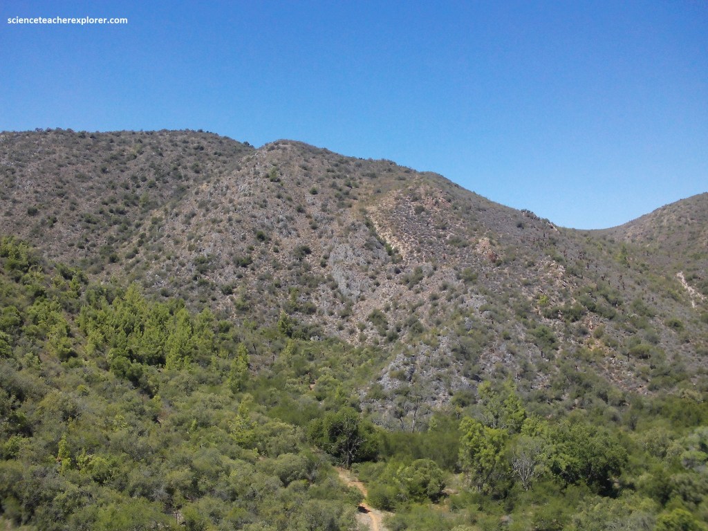
Near the tunnel & Fort Sidney, we could see outcrops of layers of hard Peninsula Formation sandstone, part of the Table Mountain Group, (pictured above). Now almost vertical in attitude, these were once horizontal beds, intensely folded and upturned during the Cape Orogeny. The Langeberg is one of the Cape’s major mountain ranges and is a remnant of ancient mountainous terrain that is found above the African land surface and is considered part of the Cape Fold Belt. Pictured below, the Langeberg’s most westerly and highest point is located 5 km east of the town of Worcester. Our next destination was located there from the Hex River Valley. So, we headed north-west on R60 from Ashton to Worcester and turned right on N1 to enter the Hex River Valley.

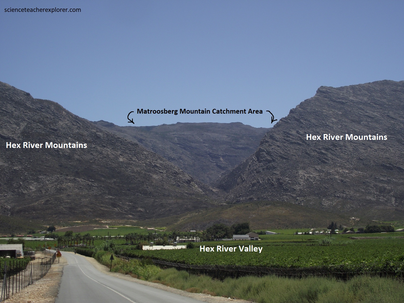
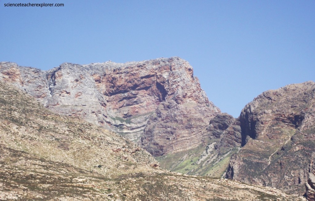
Pictured below, the Hex River Valley was a lush, beautiful valley and pass, linking the fertile farming areas of the Western Cape with the broad, arid expanses of the Great Karoo. The top photo below is looking east down to the Hex River Pass on N1. The bottom photo is looing southwest along the Hex River Valley on N1, past the Hex River Pass.


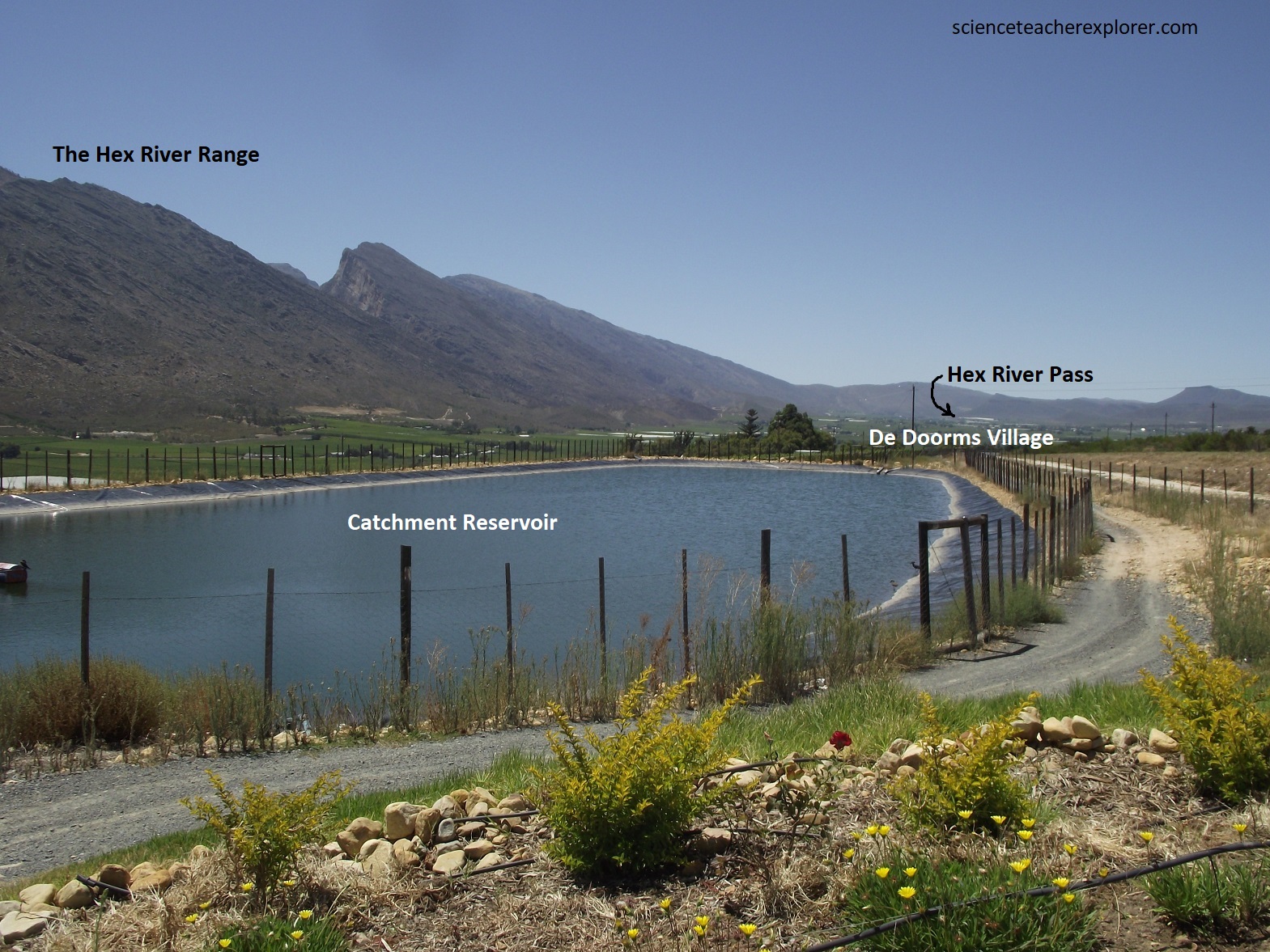
The Hex River Valley is one of South Africa’s foremost fruit and vineyard areas, famous for its export-quality produce. The Hex River Valley is both a geological and floral transition zone. The floral transition is from Mediterranean climate fynbos to the Succulent Karoo flora. Pictured below, the surrounding mountain ranges create a vast catchment area for the valley, enabling growers to produce premium table grapes. Inhabitants of the valley receive water from mountain streams that have their sources deep in the snow-capped mountains. The runoff replenishes the river and the water table in the region’s strong aquifers, that contains minerals and organic material which help create the ideal medium for fruit production.
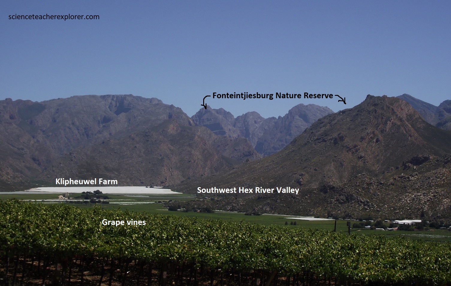
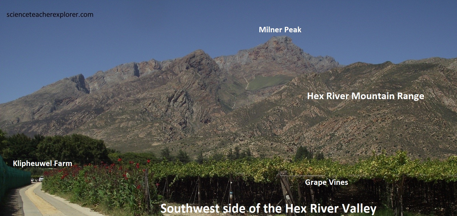
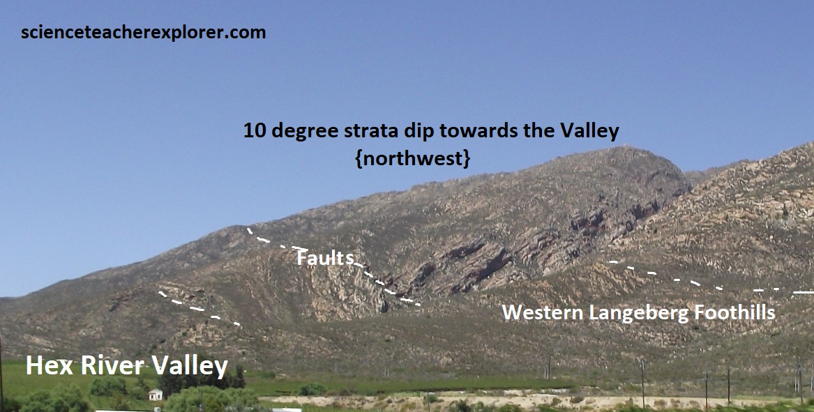
The geology of the south-west of the Hex River Valley is part of the Western Cape Fold Mountain complex consisting of Table Mountain sandstone, along with quartzitic sandstone and minor shale from the Nardouw sub-group to the north and phyletic shale, greywacke, limestone and arenite from the Porterville Formation in the south and west.
To the northeast of the valley, this gives way to Bokkeveld Shale and the but formation typical of the Karoo, (pictured below).

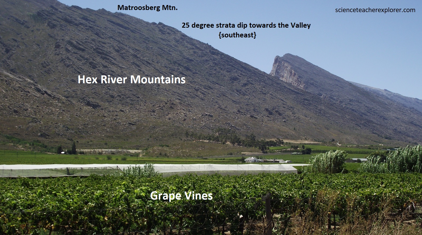
Imaged below, is the indication that the Hex River Valley is developed from a massive syncline and the Hex River Mountains are developed from a massive anticline of the Cape Fold Complex.

The Hex River Valley runs from South West to North East. It is 25km long and relatively narrow, measuring only 4km wide at its widest point.
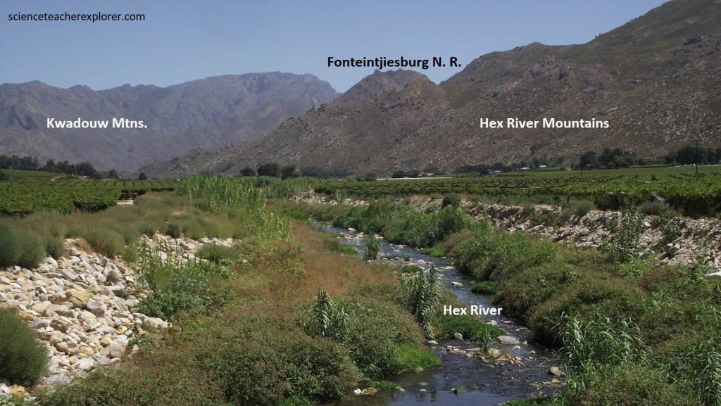
The valley is surrounded by the towering peaks of the Hex River Mountains to the North and the Kwadouw & Langeberg Mountain Range to the south, which account for the region’s magnificent and rugged scenery. The highest peak in the Hex River Mountain Range is Matroosberg and at 2230m it is one of the highest peaks in the Western Cape.
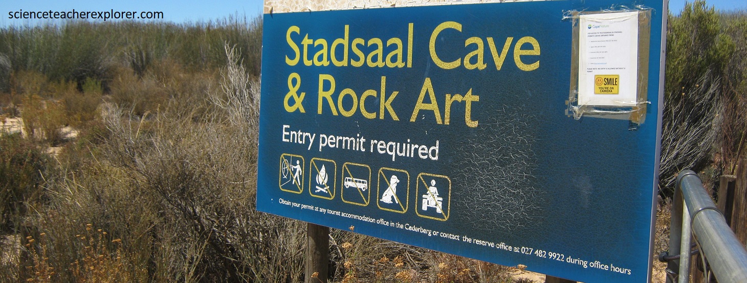
From the Hex River Mountains, the Cape Fold Belt seems to turn north, toward the Cederberg Range. We decided to drive north from Worcester on R43, R44 & N7 to Clanwilliam for exploring and trekking the Cederberg Range. This also was the location where the Cape Fold Mountains intersect with the Great Escarpment. Our point of interest in the Cederberg Range, was the Stadsaal Caves. From Clanwilliam we drove southeast on a graveled road, into the Matjiesrivier Nature Reserve through the Driehoeks River Valley, to explore the Stadsaal Caves, (imaged below).
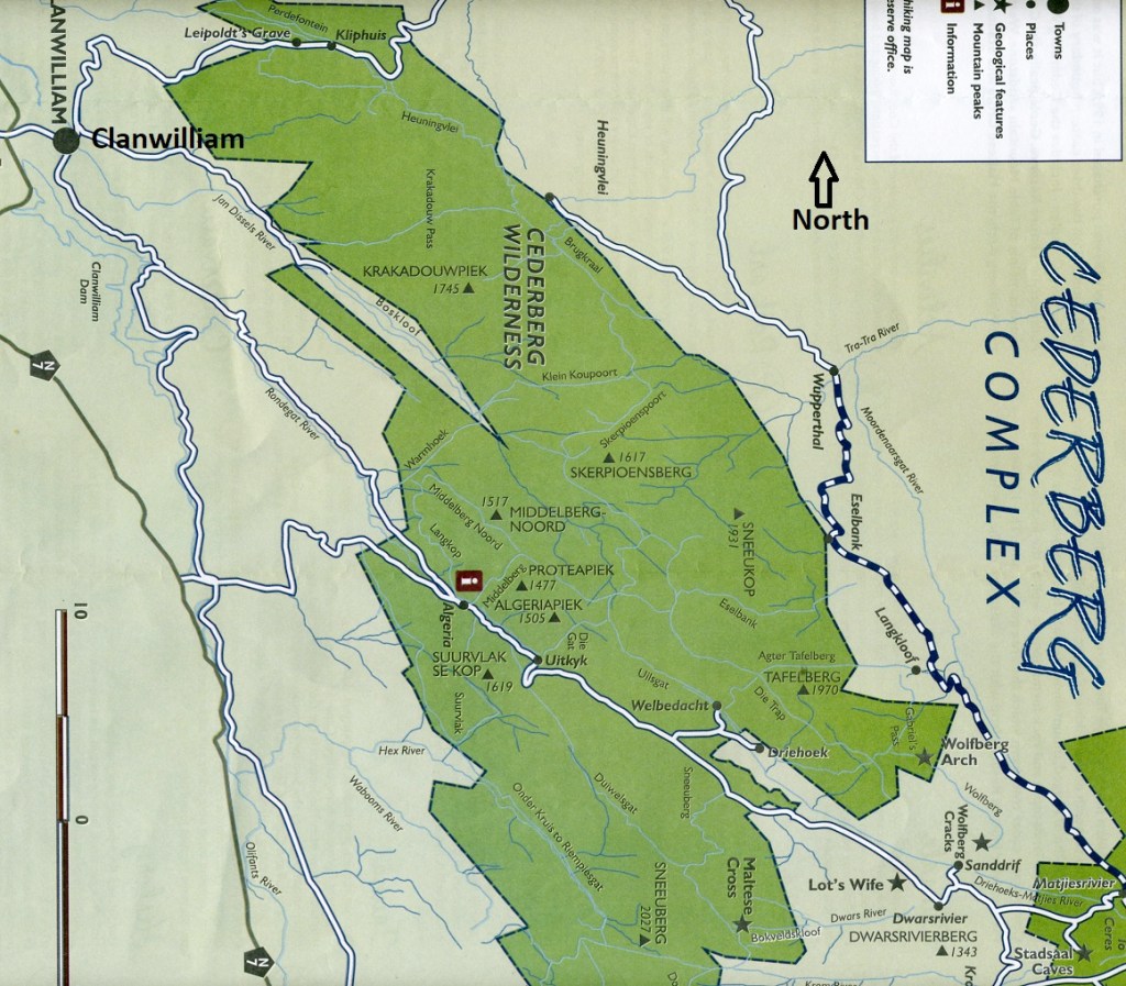
The Cederberg is part of the northwestern branch of the Cape Fold Belt where roughly north-aligned deformation of the Cape Fold Belt was less intense, and now forms a broad anticlinal structure, (pictured below).

The Cederberg is considered to be a remnant of the ancient surface above the African land surface, thus indicating the erosion has taken place over many millions of years.
As a matter of fact, the Cederberg was formed approximately 700 million years ago and comprised 3 layers of sediment: 1) first layer of sandstone form approximately 500 million year ago and comprises silt, mud and sand compressed under intense pressure, 2) a shelf of shale, made up of mud and clay mineral as a result of glaciers in the surrounds which created a body of water, and 3) the second layer of sandstone which was formed approximately 200 million years ago.


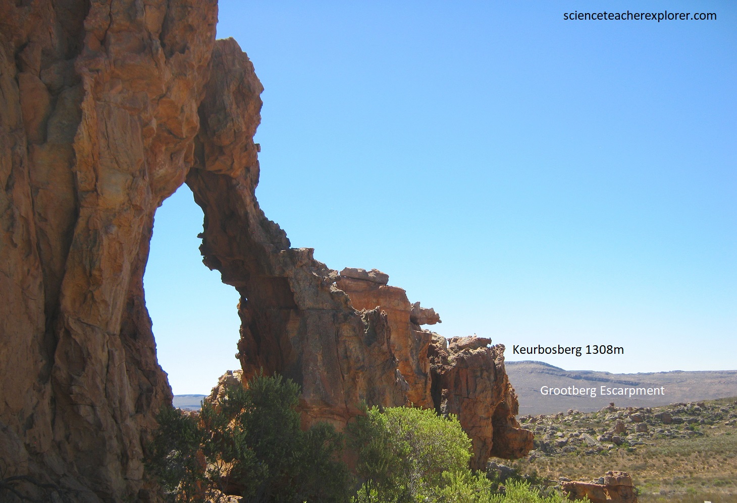
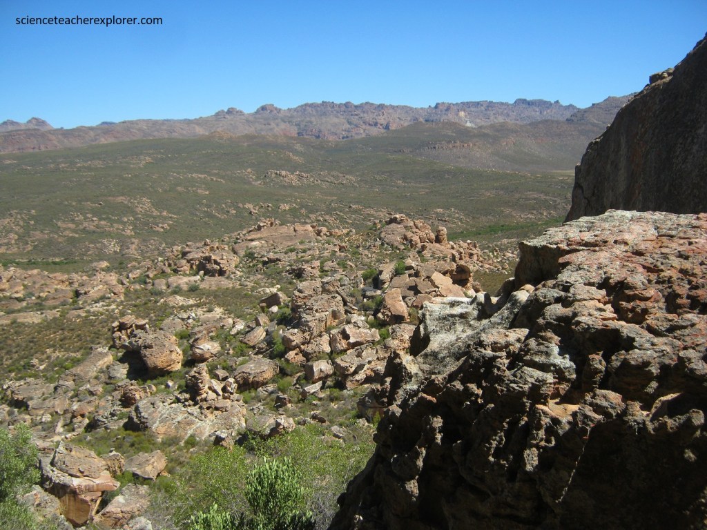
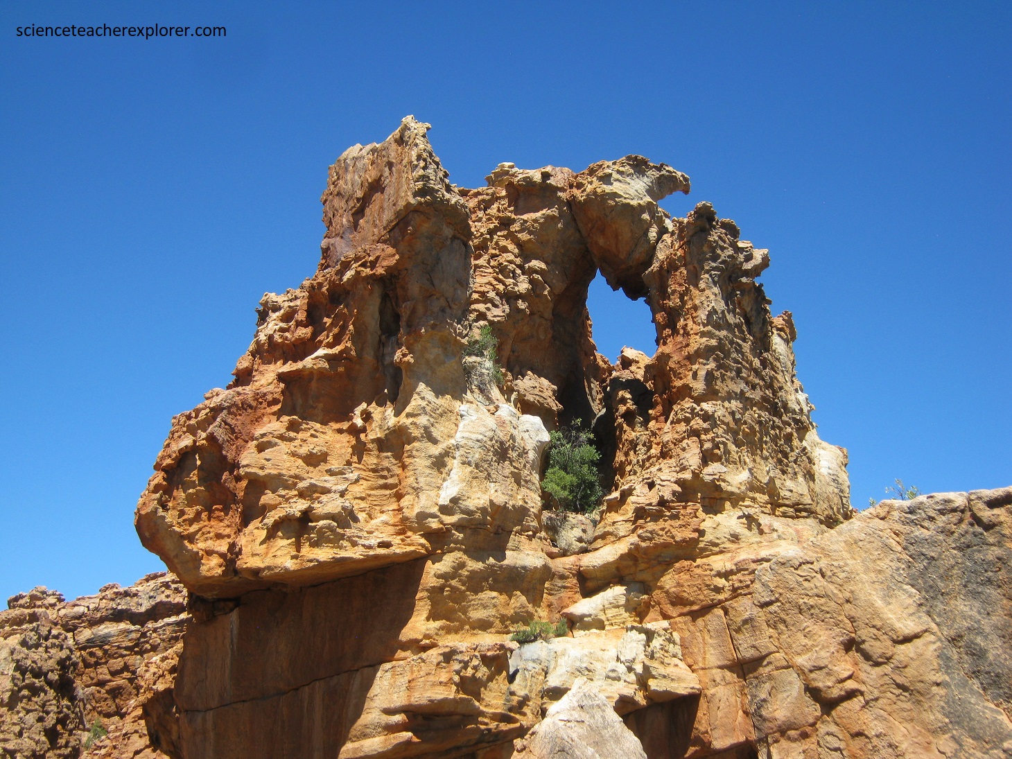
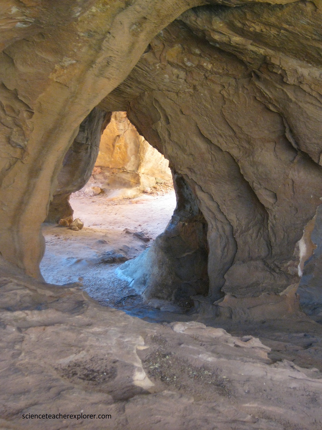
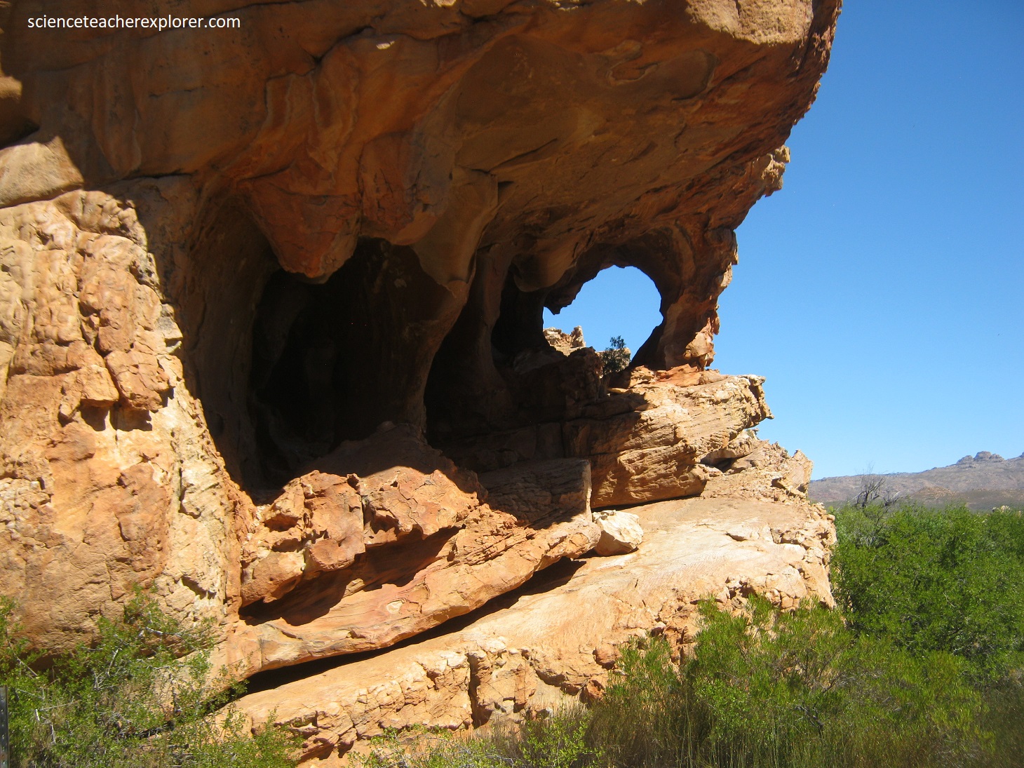
Pictured above are the Stadsaal Cave entrance and their surrounding Cederberg Mountains. Pictured below, the spectacular Cederberg abounds with strange-looking, brightly colored eroded rock formations, making a landscape like no other in South Africa.
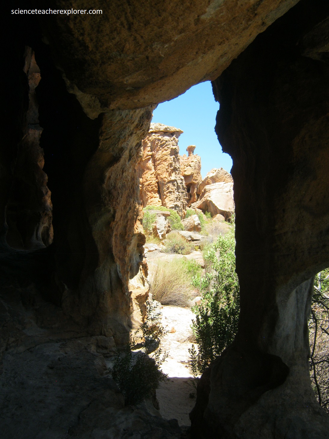
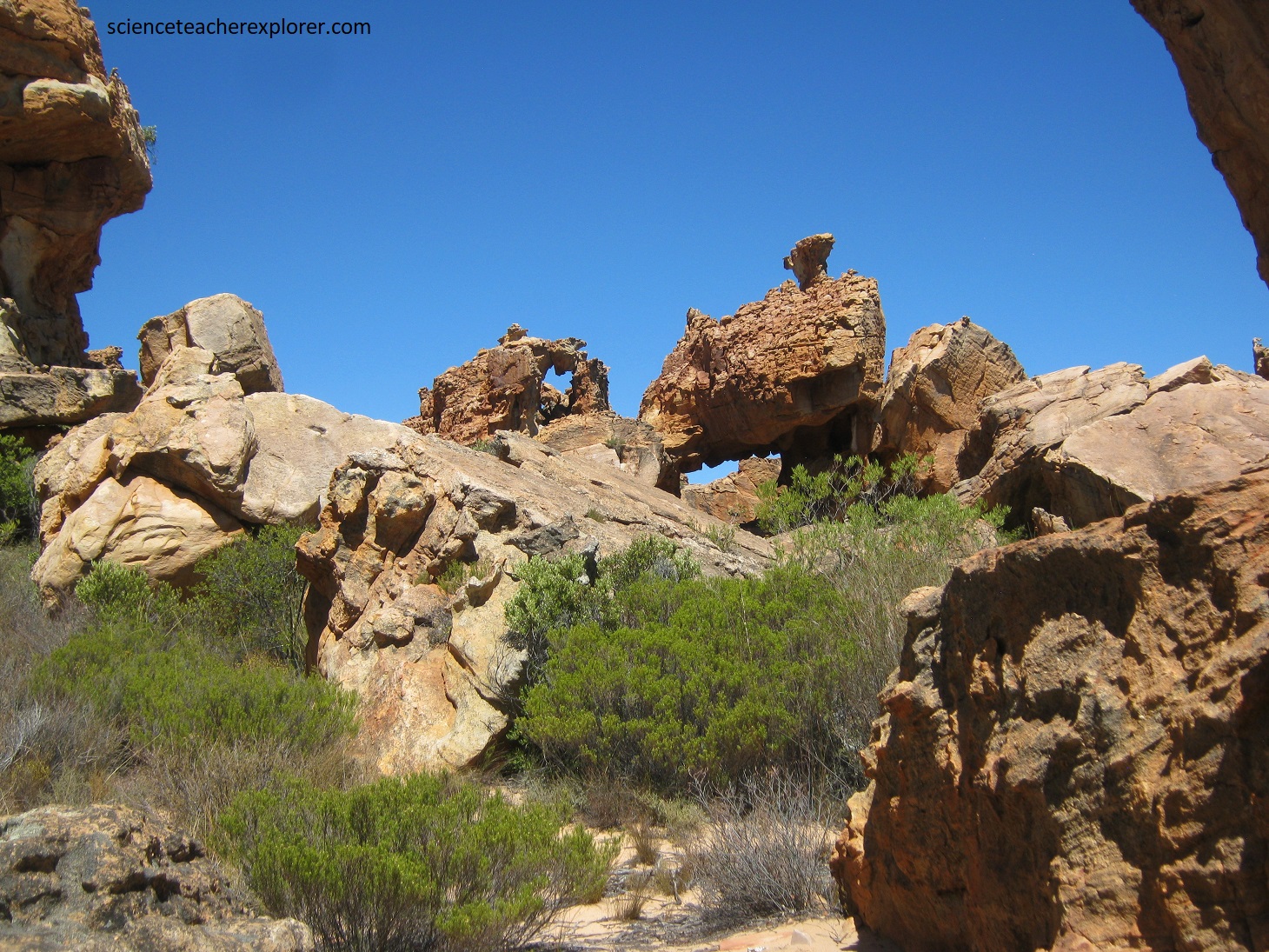
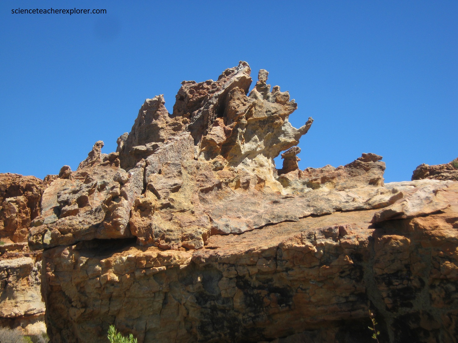
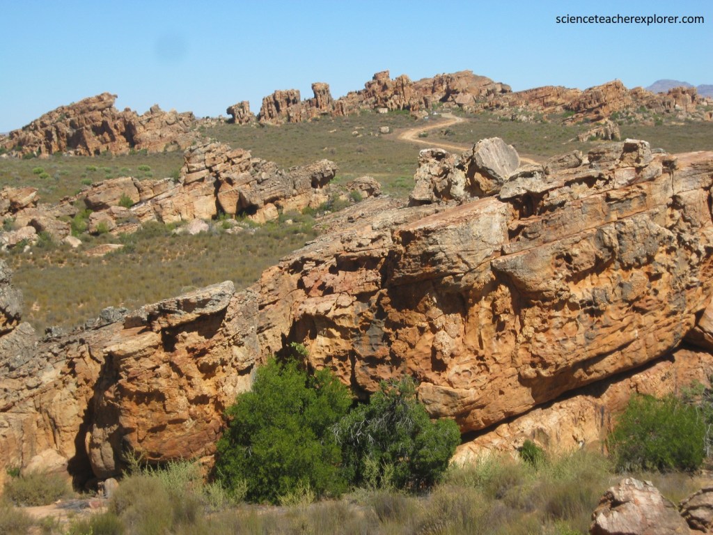
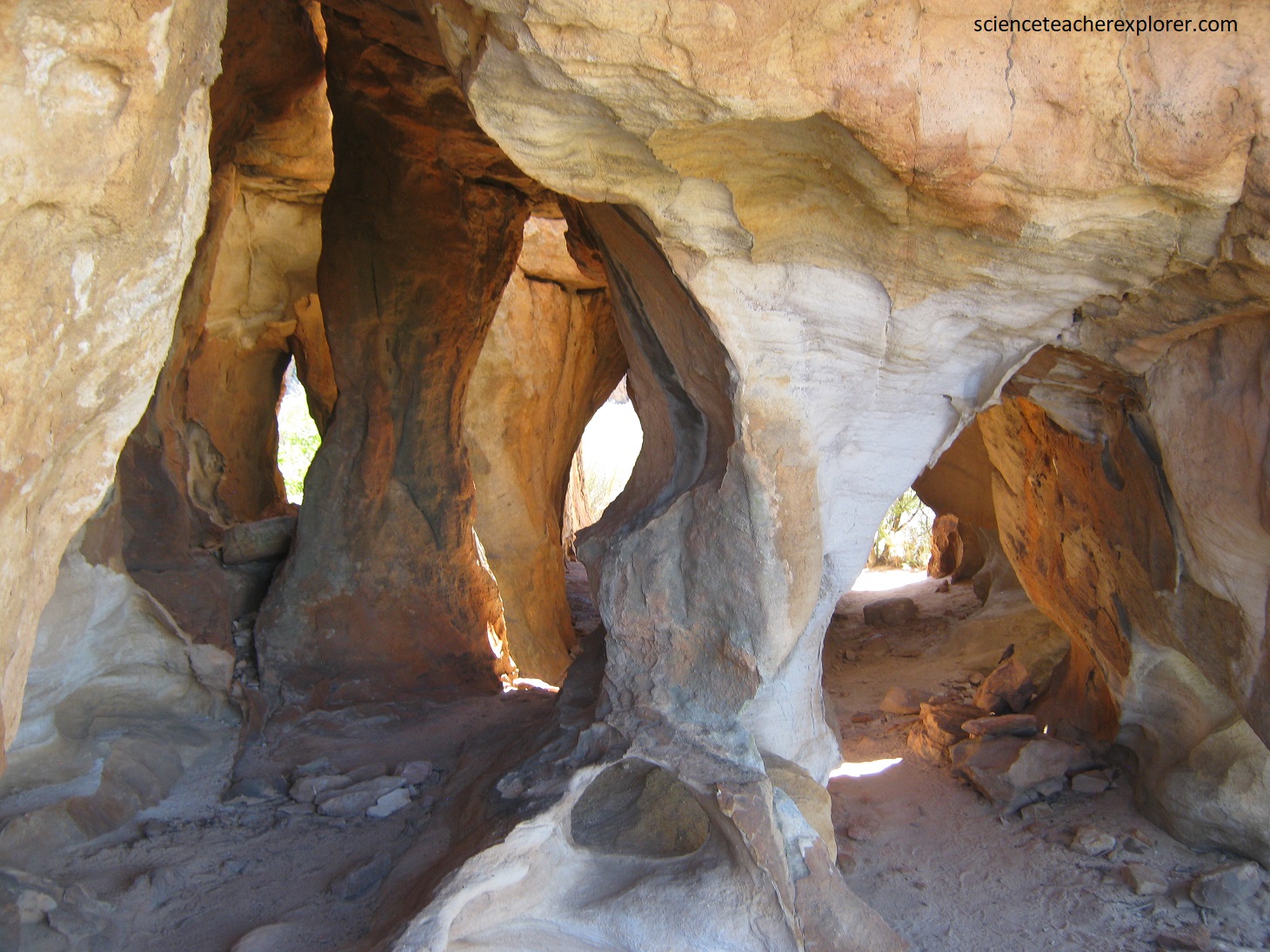
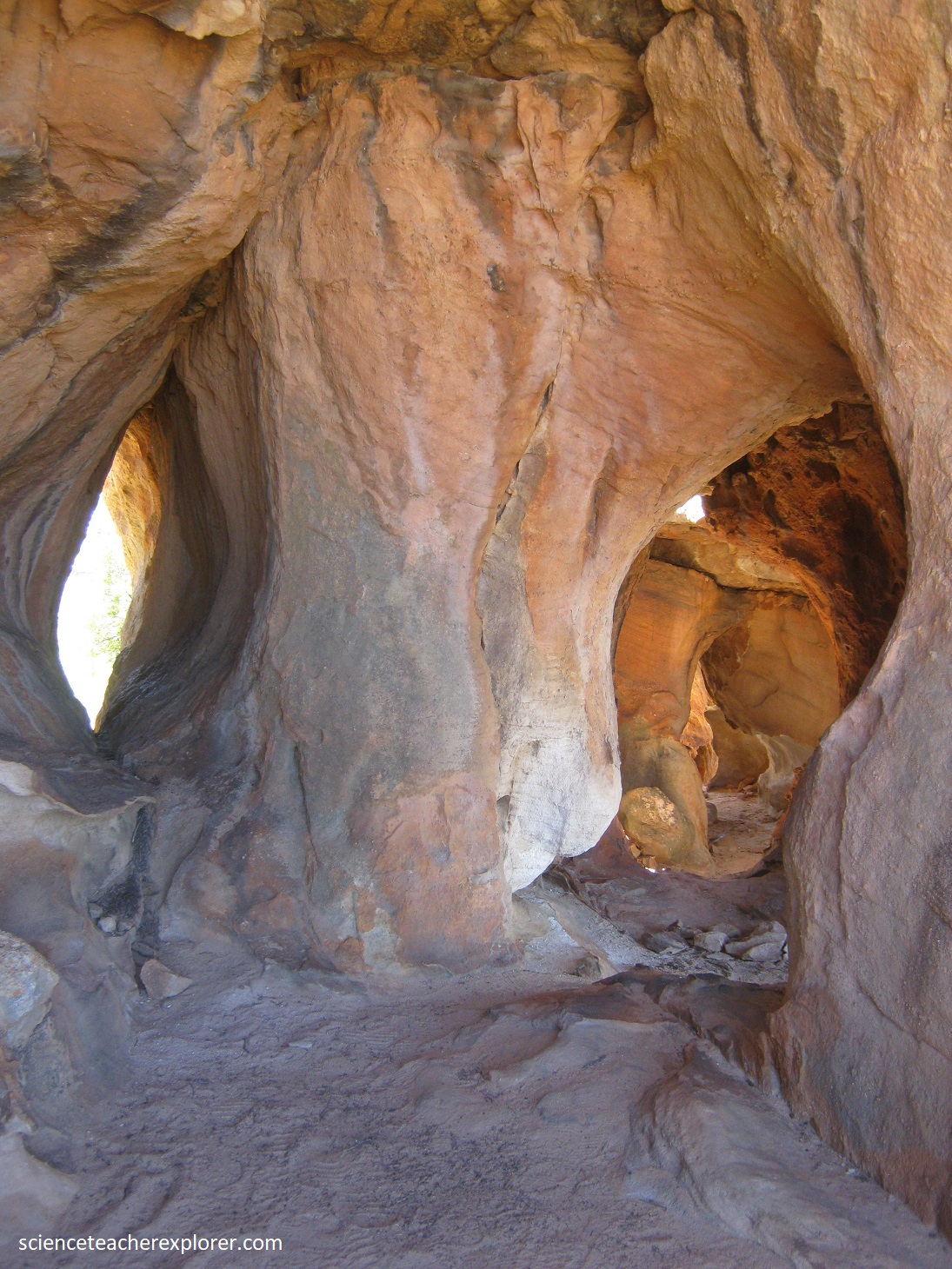
Pictured above and below, the Stadsaal Caves, with their craggy rock faces, weathered columns, isolated pinnacles and gargoyle-like formation, make for an intriguing geo-site.
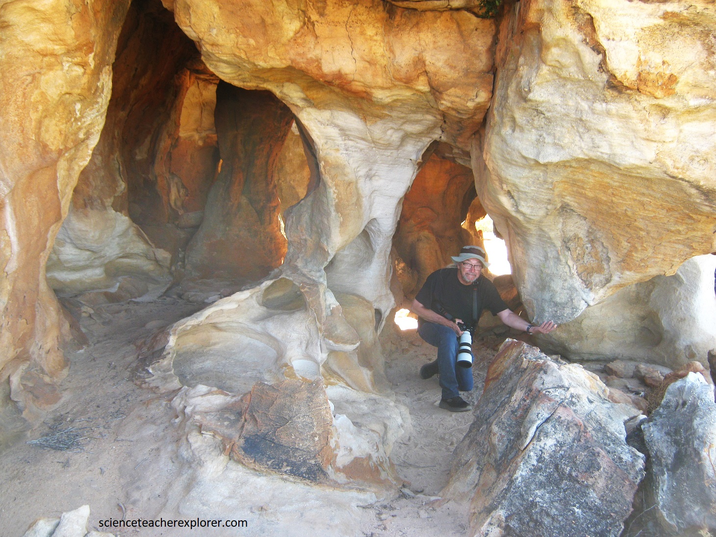
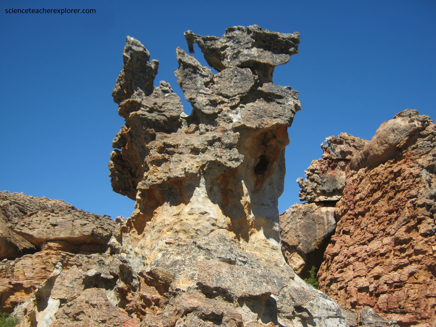
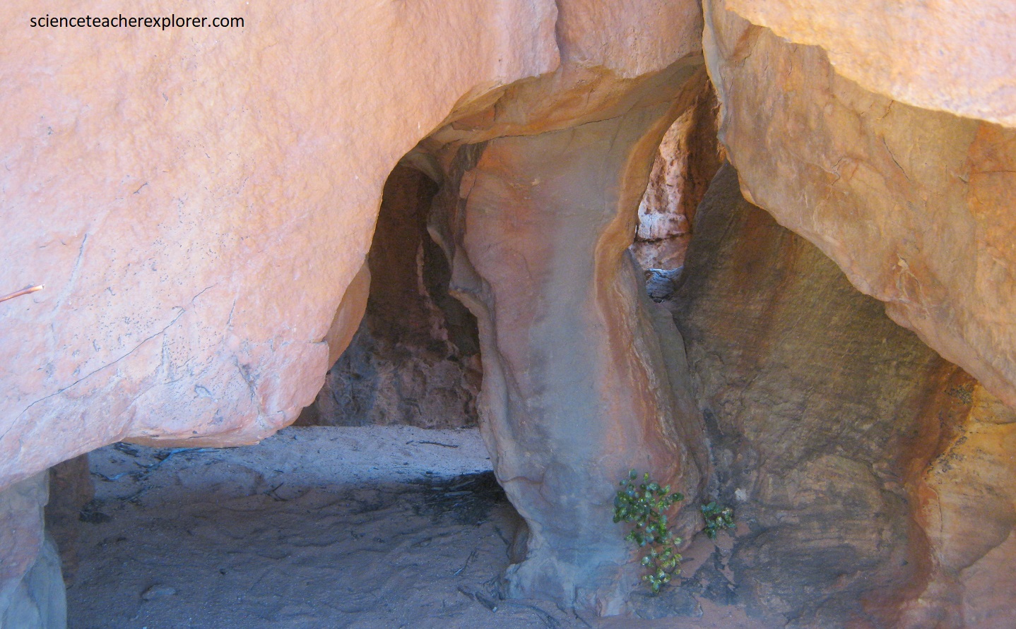
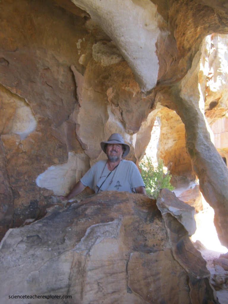
Pictured above, Mike kneeling in a series of peculiar sandstone columns that have formed by differential weathering and wind erosion, and are related to strong vertical jointing. Notice the remains on the roof of columns that have eroded away.
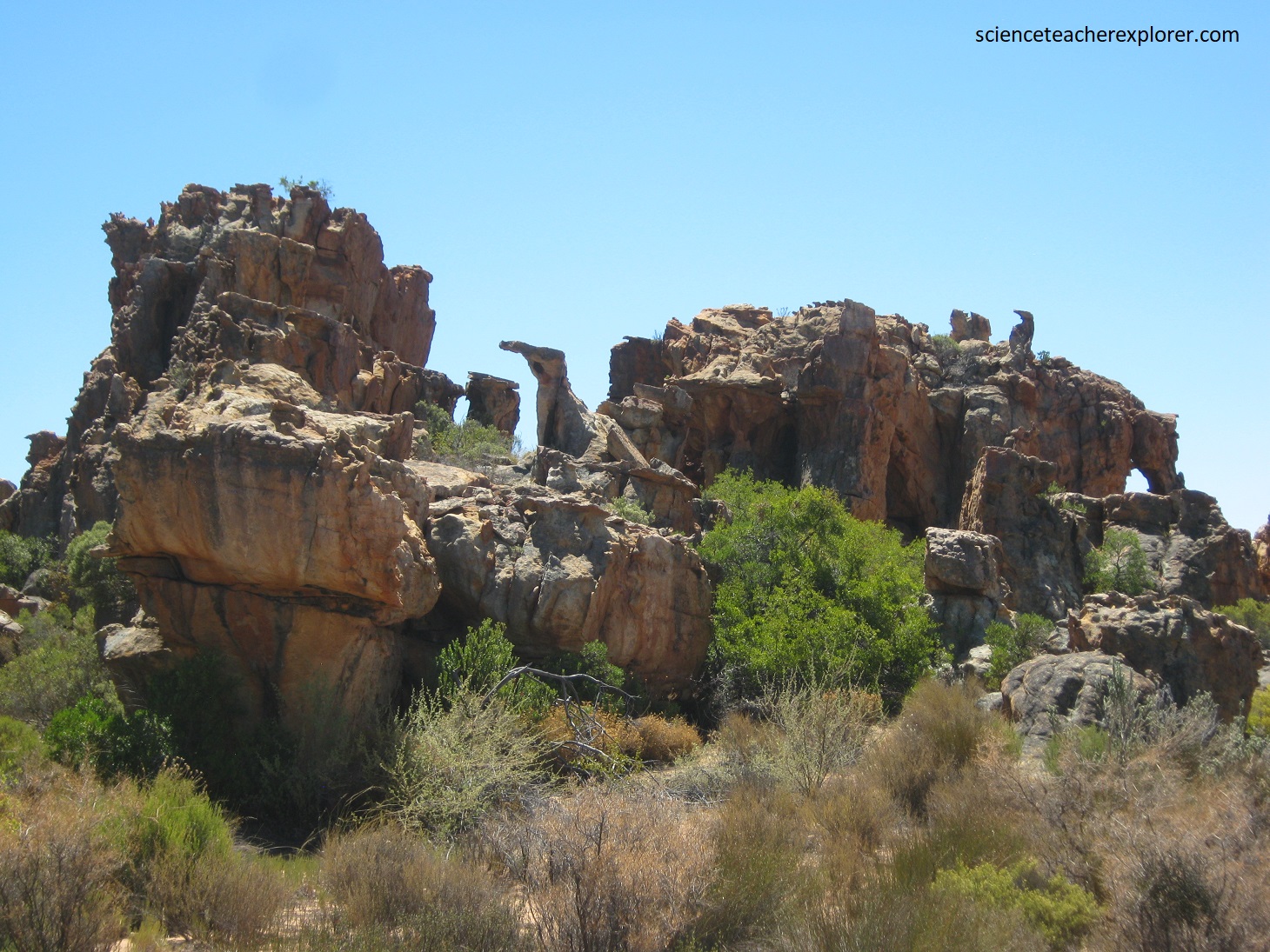
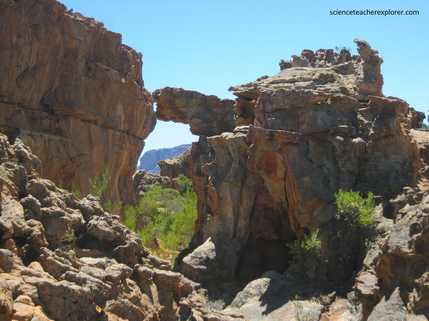
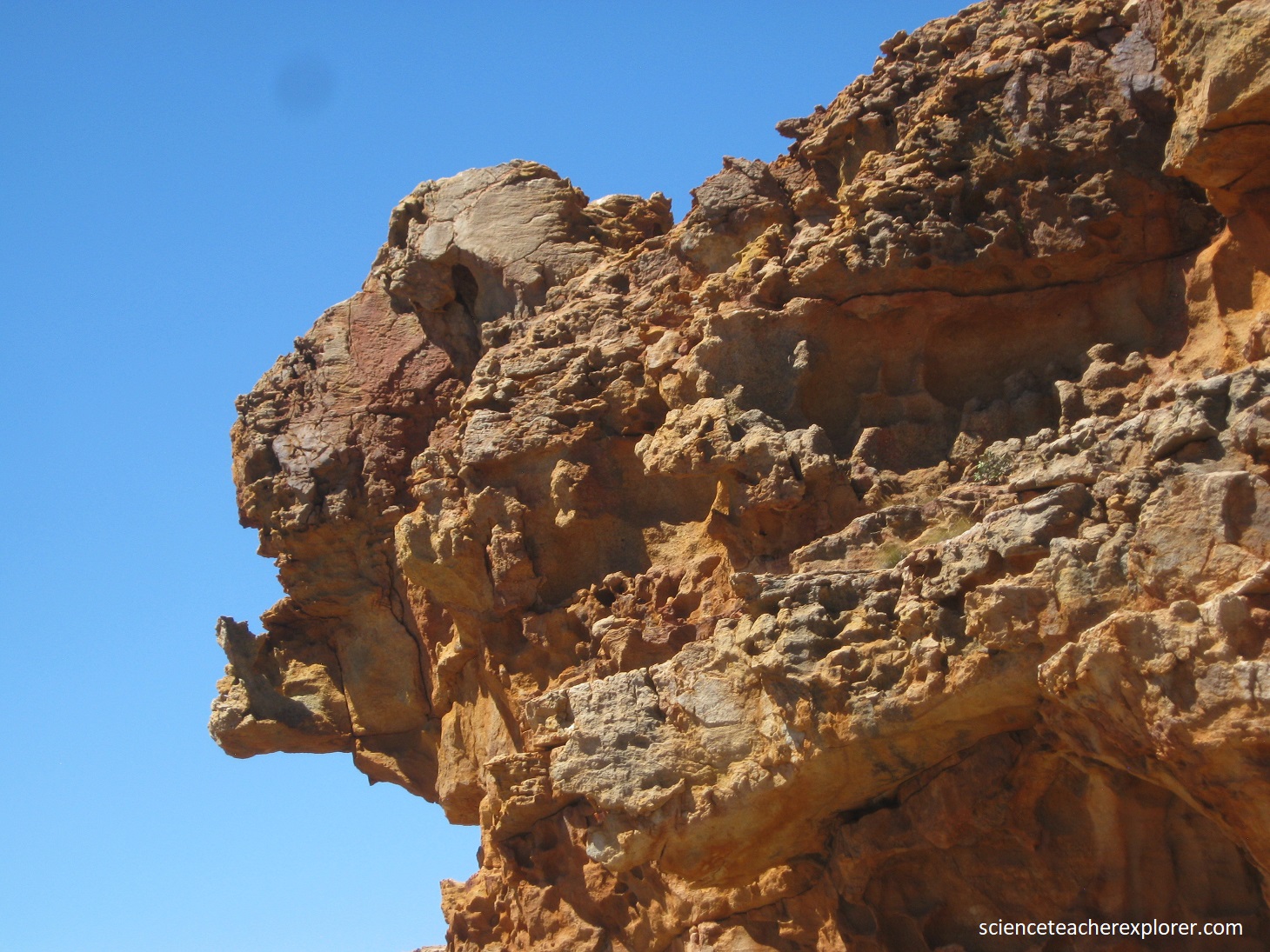
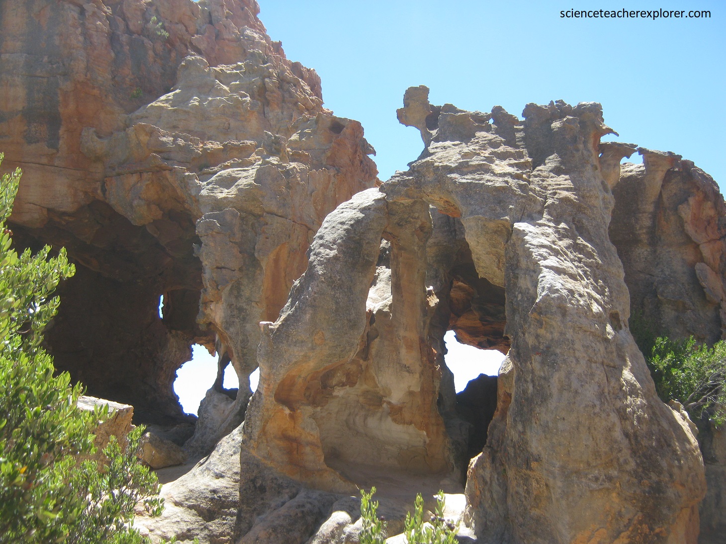
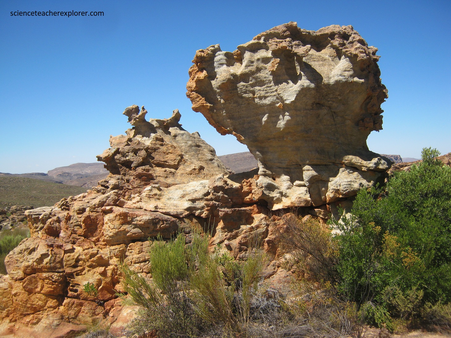
Pictured above, erosion starts with weathering along countless vertical joint surfaces within gently dipping sandstone layers, coupled with the eroding action of wind and water. The bottom photo above is the result of ongoing erosion by wind of a less resistant sandstone pillar near ground level. Eventually the pillar will be worn away completely near the base and the upper part will collapse.

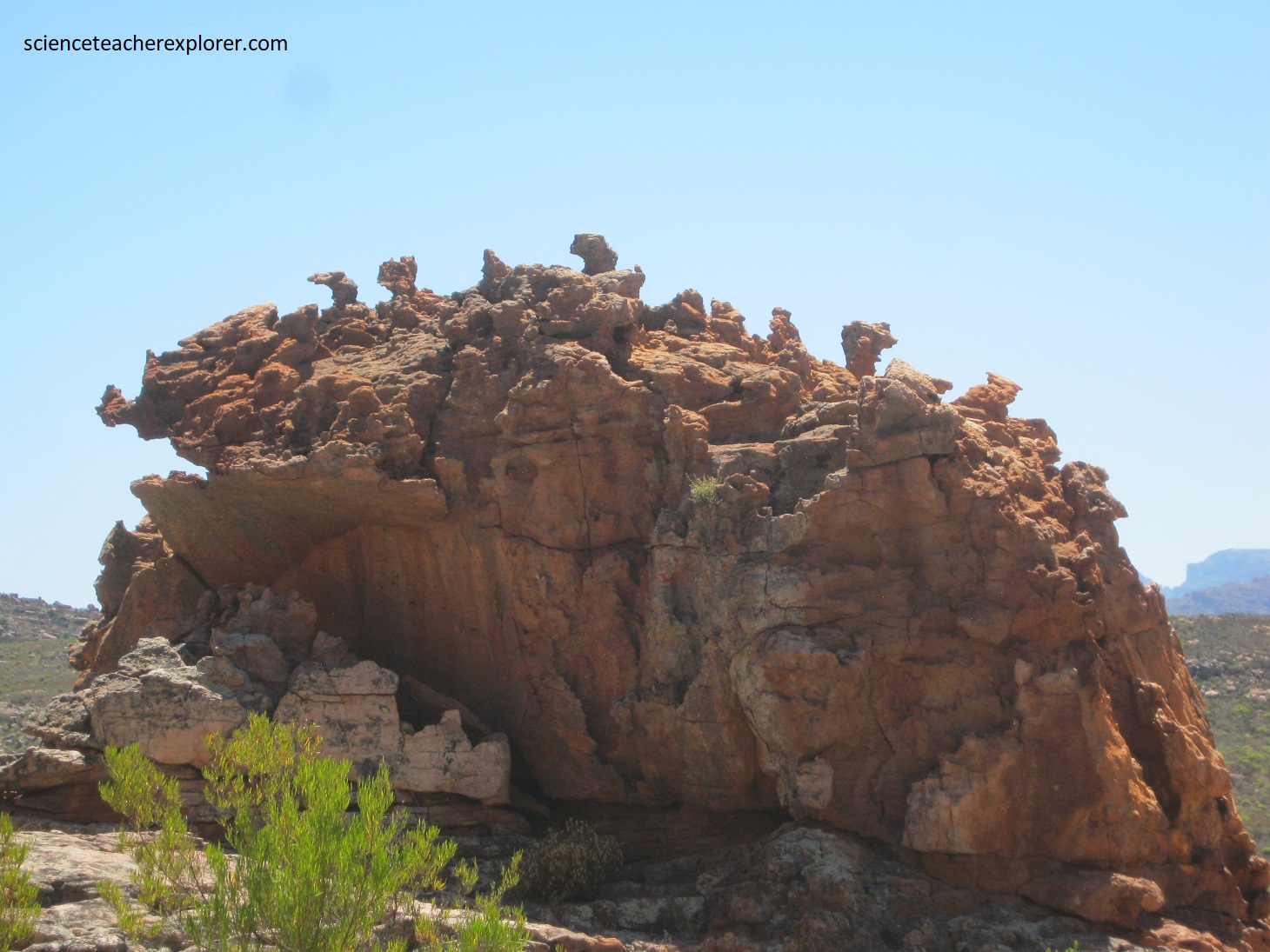
Pictured above, the bizarrely shaped and brightly colored rock formations are perfect demonstration of natural sculpting, and testimony to the resistance of rock to the power of erosion.

The rock formations at Stadsaal Caves are in the upper part of the Table Mountain Group, lying above the Cederberg shale marker unit. The eroded out of well-jointed, brownish sandstones are of the Nardouw Subgroup. These sandstone strata dip gently eastwards and are overlain by the Bokkeveld Group in the east. The reddish to orange colors are due to oxidation of iron minerals to abundant lichen on the rock surfaces.
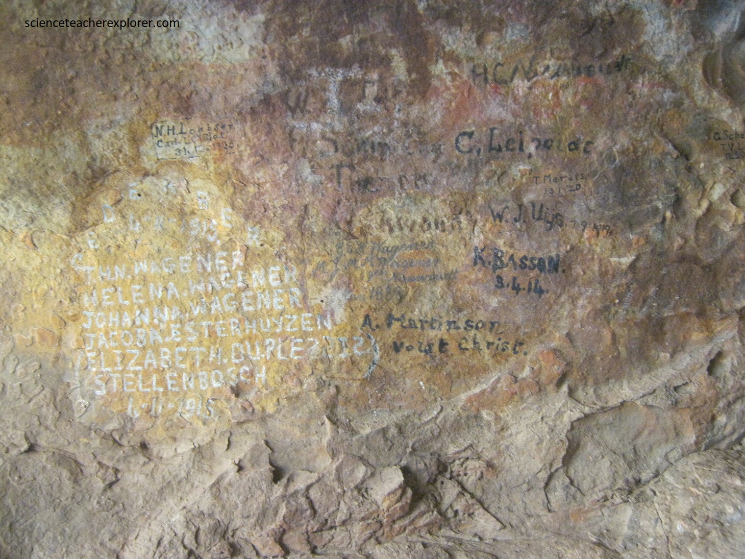
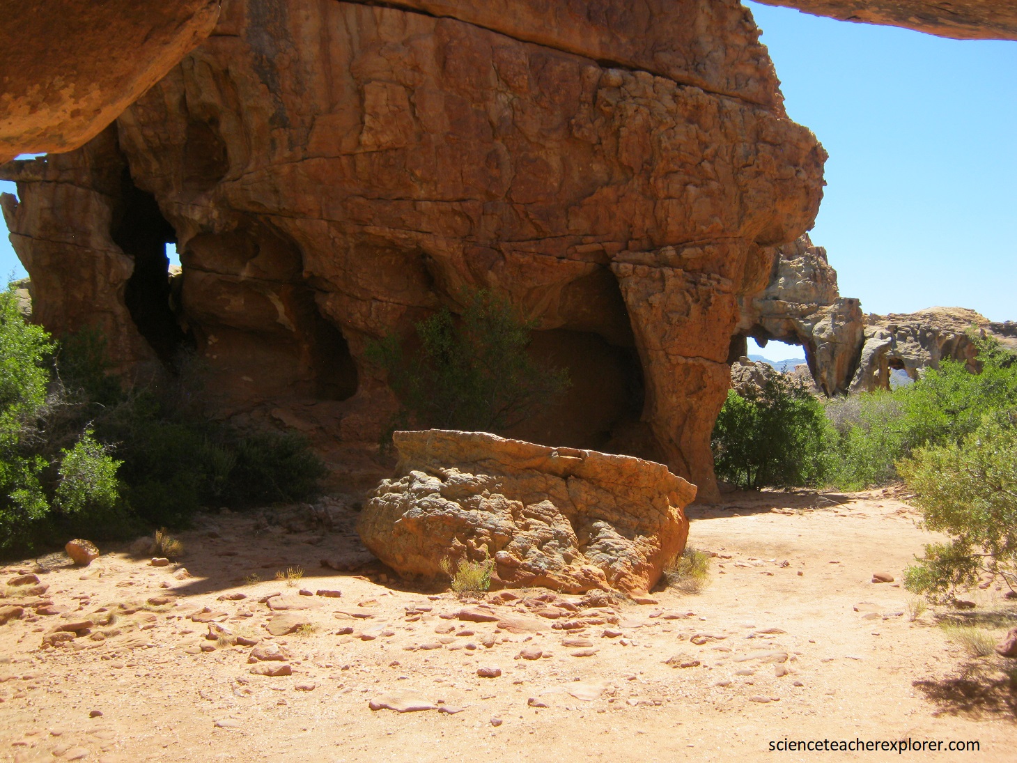
Pictured above, these caves provided us a wonderful experience as we made our way around and into the numerous eroded formations. Note the historic graffiti, dating from the 19th century, in the main cave.
These sandstones were laid down around 440 million years ago as quartz-rich sands on a braided river plain or on a shallow marine shelf. Sedimentary layering are common indicators of shallow-water deposition. This took place long before the break-up of Gondwana. Later, the entire sequence was mildly folded during the Cape Orogeny, (280 million years ago).
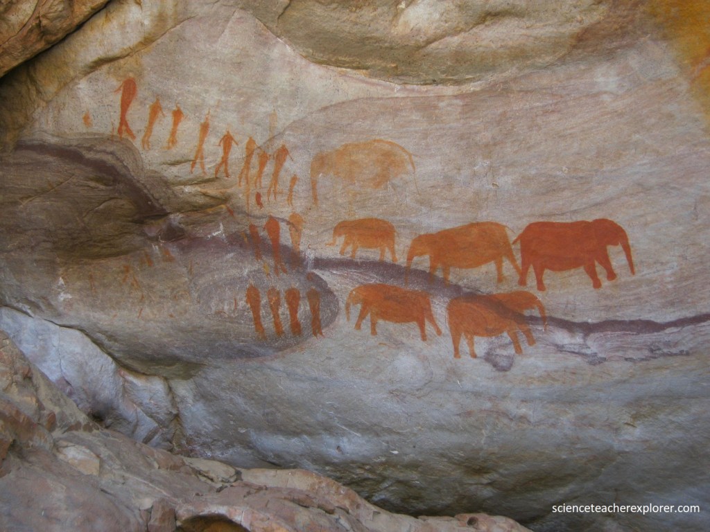
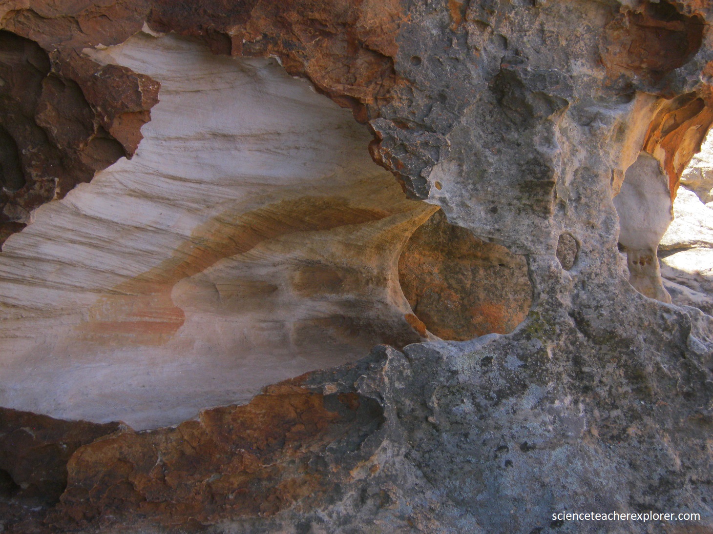
Pictured above, the rock paintings at this site were done by the San (Bushmen). These hunter-gatherers, whose more ancient ancestors lived in the Cederberg for over 500,000 years, began painting on the walls of shelters in the Western Cape at leas 5,000 years ago. Rock paintings were done by medicine-men or shamans who had supernatural powers. The paintings illustrate the experience of the shamans who use their power to make rain, heal sick people and control game animals. The paintings show three rows of people and a group of elephants. However, the people have no hunting equipment and some seemed clothed. But the elephant seem to be in a defensive position, looking outwards from a circle. Elephants were regarded as possessing potency that shamans could use for purposes like rain-making. Perhaps the clothed people are healers who have approached the elephant in their imaginations to draw power from them.
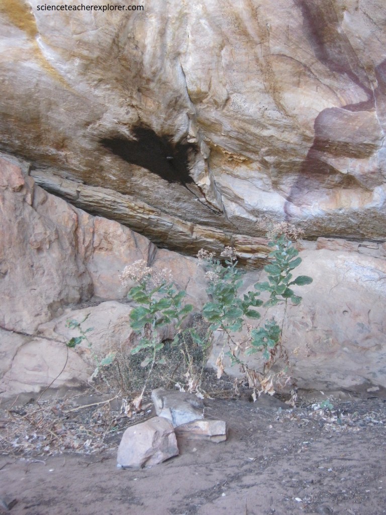
Pictured above, this black substance is always found underneath a rock, thus on the roof side of a rock overhang. The moisture that seeps through the rock is ingested by a small fly that then excretes a sticky black substance onto the rock. The locals use the black klipsweet as a medicine. It is dissolved in warm water and the potion is drunk to cure stomach aches. The klipsweet has a salty taste.
The Cape Fold Belt of South Africa has just about the richest geological heritage on the planet. Each site had been chosen with care & research that details the interesting natural phenomena and wonder.
