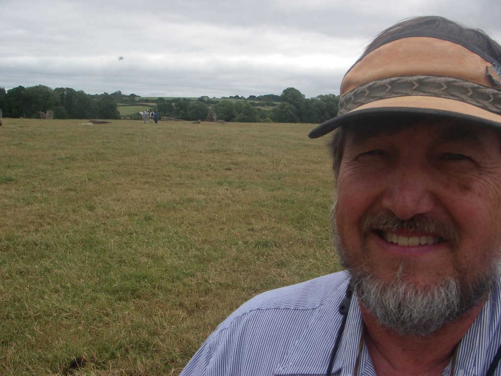
Cheddar Gorge, ENG
On August 5th, 2016; I found myself exploring the Cheddar Gorge area in England.
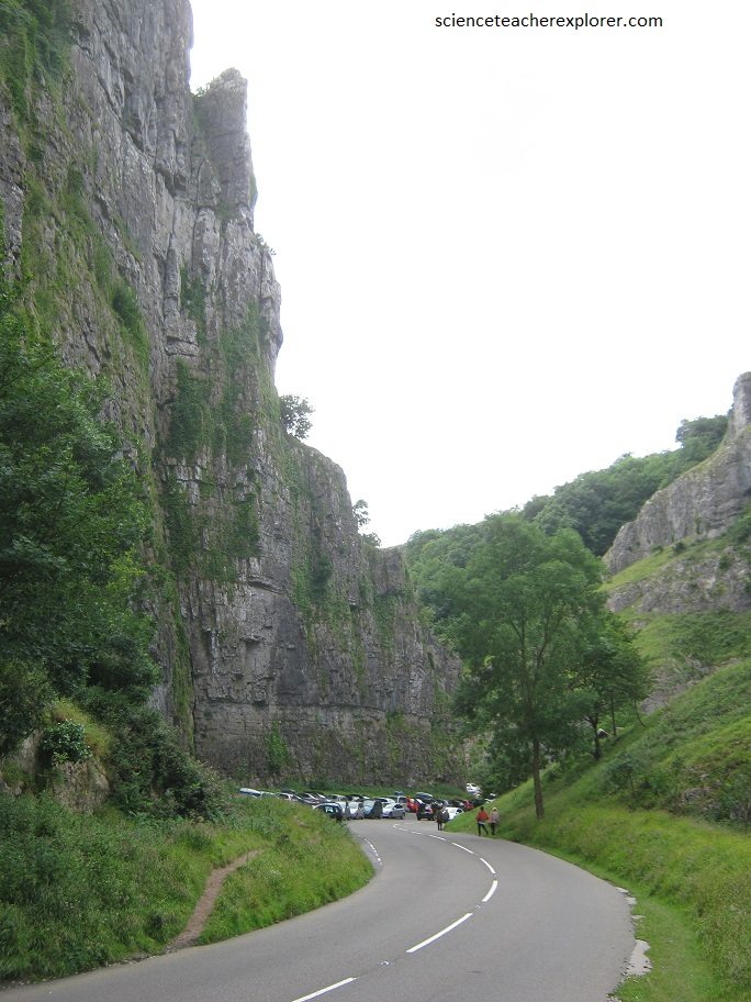
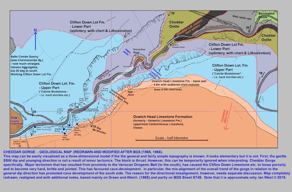
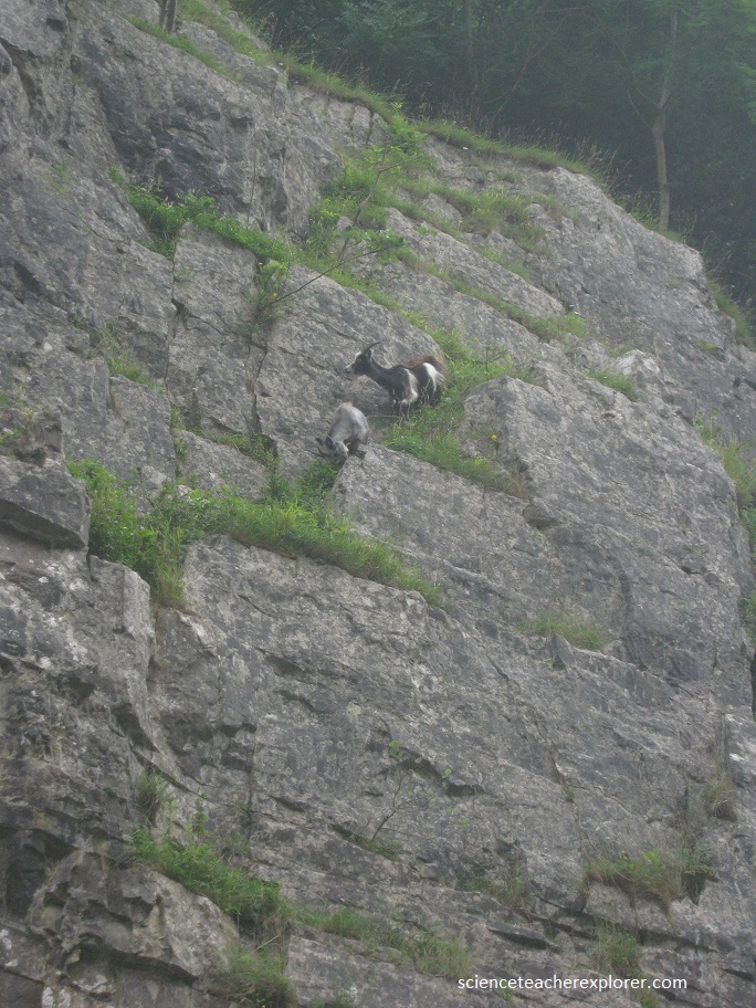
Below, I’m posing at the top of Cheddar Gorge, a steep, narrow limestone gorge surrounded by cliffs near the town of Cheddar. It runs through the Mendip Hills.
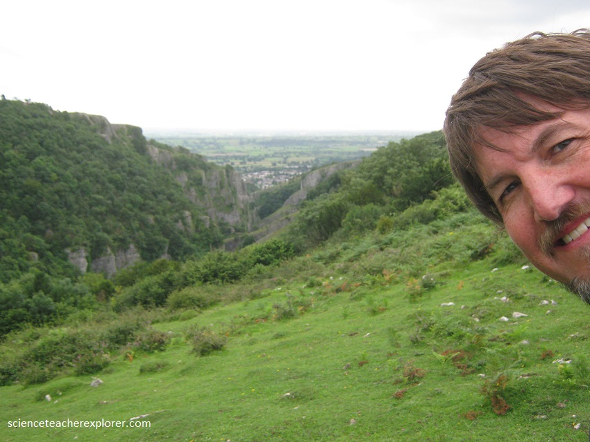
It is the largest gorge in Great Britain, dropping to a maximum depth of 123 m and attracts 300,000 visitors a year.
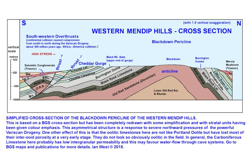
The rocks of the gorge date back to the Carboniferous period, from about 280 – 340 million years ago. The gorge itself was formed about 18,000 years ago, as glaciers over Britain melted and huge volumes of meltwater eroded the limestone into the shapes we see today.
Britain’s oldest complete human skeleton was found in a Cave within Cheddar Canyon—9,000 yr. old Cheddar Man.
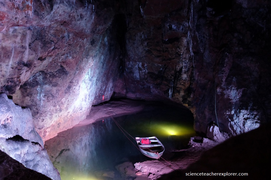
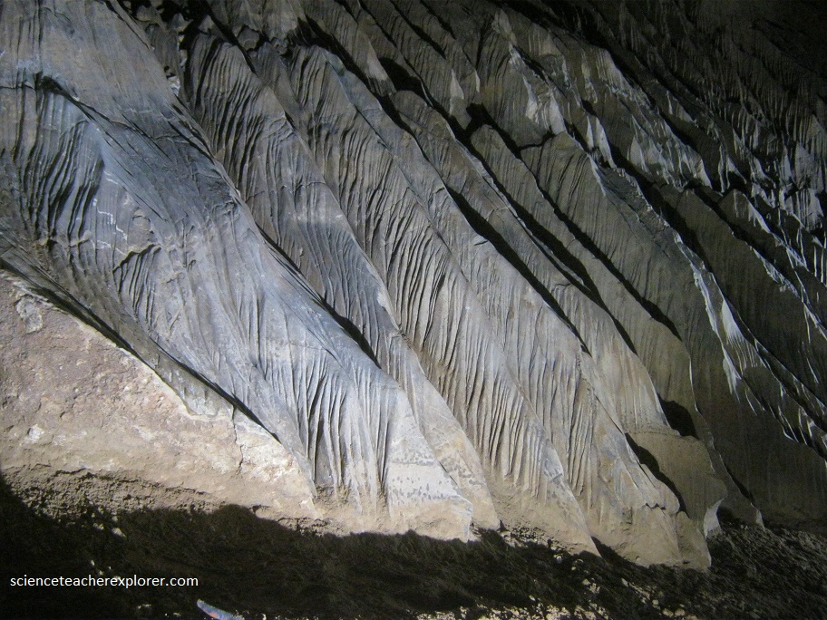
Nearby, I had the time to explore “The Wookey Hole”. Wookey Hole Caves are a series of limestone caverns, a show cave and tourist attraction in the village of Wookey Hole on the southern edge of the Mendip Hills near Wells in Somerset, England.
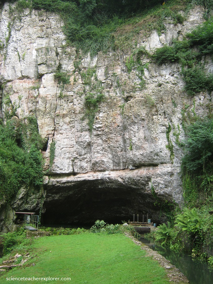
The River Axe flows through the cave. It is a Site of Special Scientific Interest (SSSI) for both biological and geological reasons. Wookey Hole cave is a “solutional cave”, one that is formed by a process of weathering in which the natural acid in groundwater dissolves the rocks. Some water originates as rain that flows into streams on impervious rocks on the plateau before sinking at the limestone boundary into cave systems.
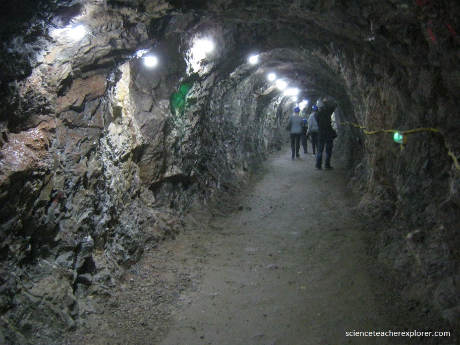
The dry portion of the cave offered safe habitat with a constant temperature of 50 degree F. The first human lodgers came some 50,000 years ago, hunting bears and rhinoceros with stone weapons. Archeologists believe that one cave, Hyena Den, was alternately occupied by hyenas and man between 35,000 and 25,000 B.C.. In the Iron Age, Celtic farmers lived near the cave entrance for more than 600 years. Wookey Hole is the birthplace of British cave-diving, and the museum covers this during the tour.
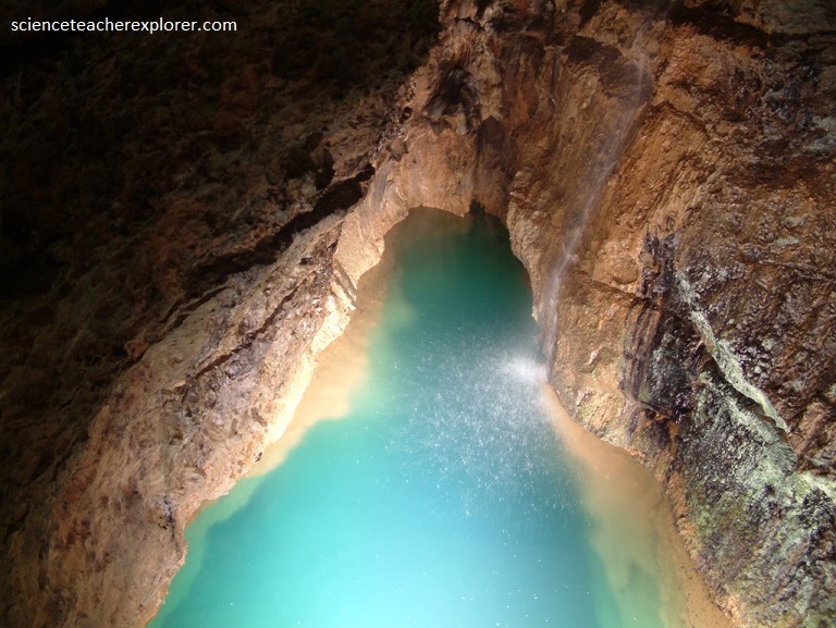
Below, I’ve taken a photo of a very strange formation found at the lowest level of the cave. I’ve never seen a cave formation like this.
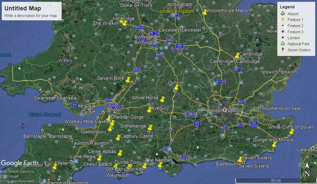
Then later in 2025, I had the additional opportunity to visit one of the most iconic stone circles nearby in the United Kingdom. It was called the Stanton Drew Stone Circles and found just 10km south of Bristol, England & 21.5km northeast from Cheddar Gorge in the Somerset Province. (It is also 70 km Northwest of Stonehenge).
Stanton Drew Stone-Circle is one of England’s largest and most mysterious prehistoric monuments. Although this is the third largest complex of prehistoric standing stones in England, it is surprisingly little known.
Stanton Drew consists of three stone circles and a three-stone group known as “The Cove”, in the garden of the local Pub or park. Additionally, there is a (now recumbent) standing stone called Hautville’s Quoit that lies across the river to the north on an alignment with the centers of the Great Circle and the southern circle. It is a large stone close to Hautville Quoit Farm, (recumbent since at least the mid 17th century but assumed to have originally been upright) {I didn’t visit the Hautville’s Quoit}.
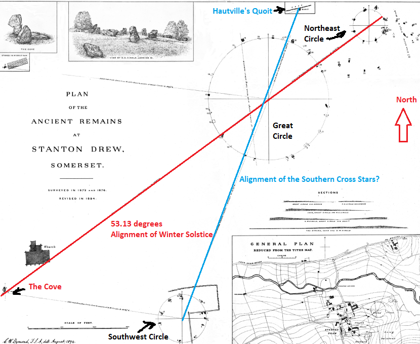
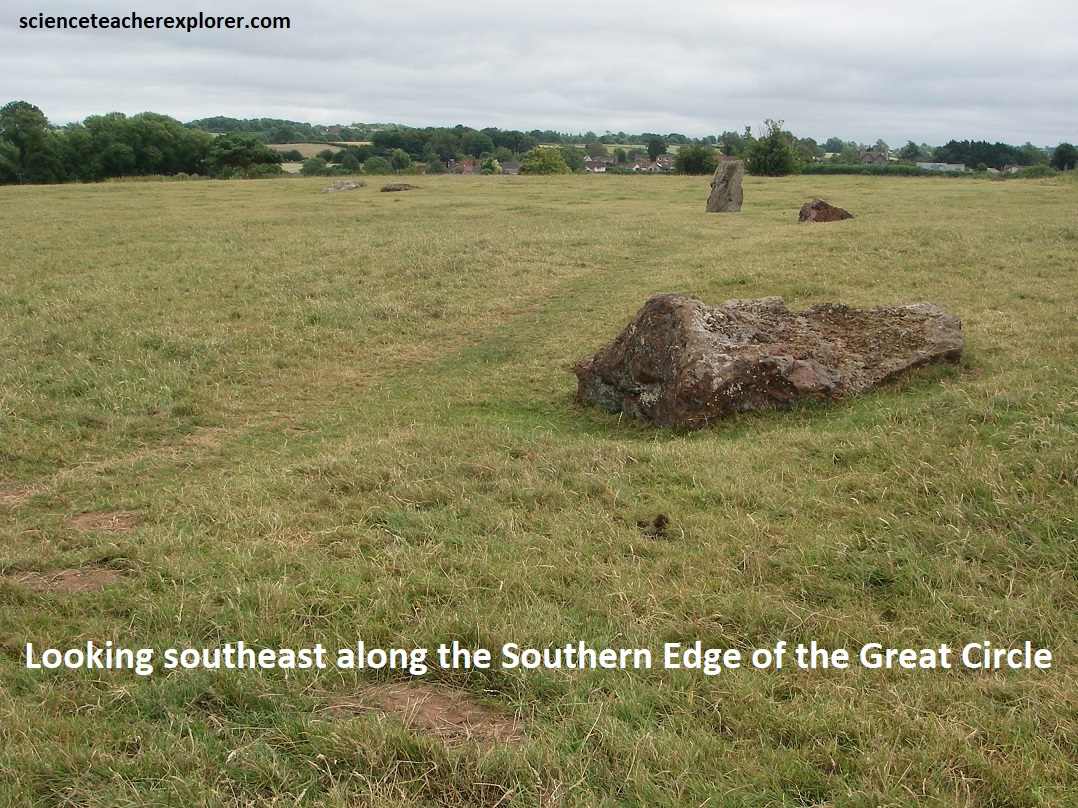
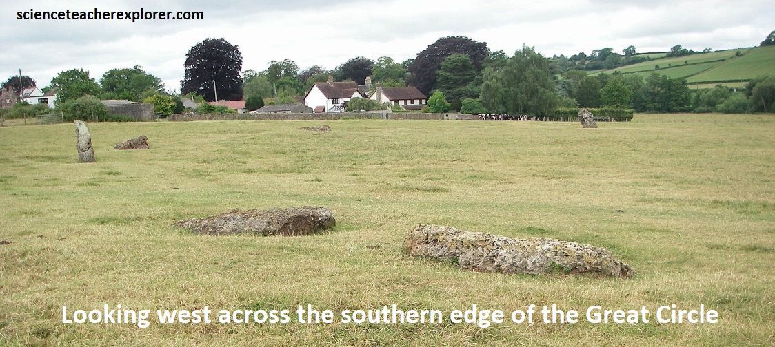
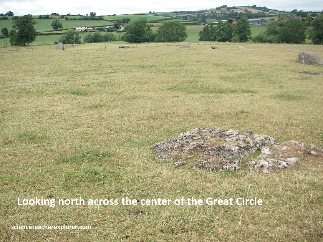
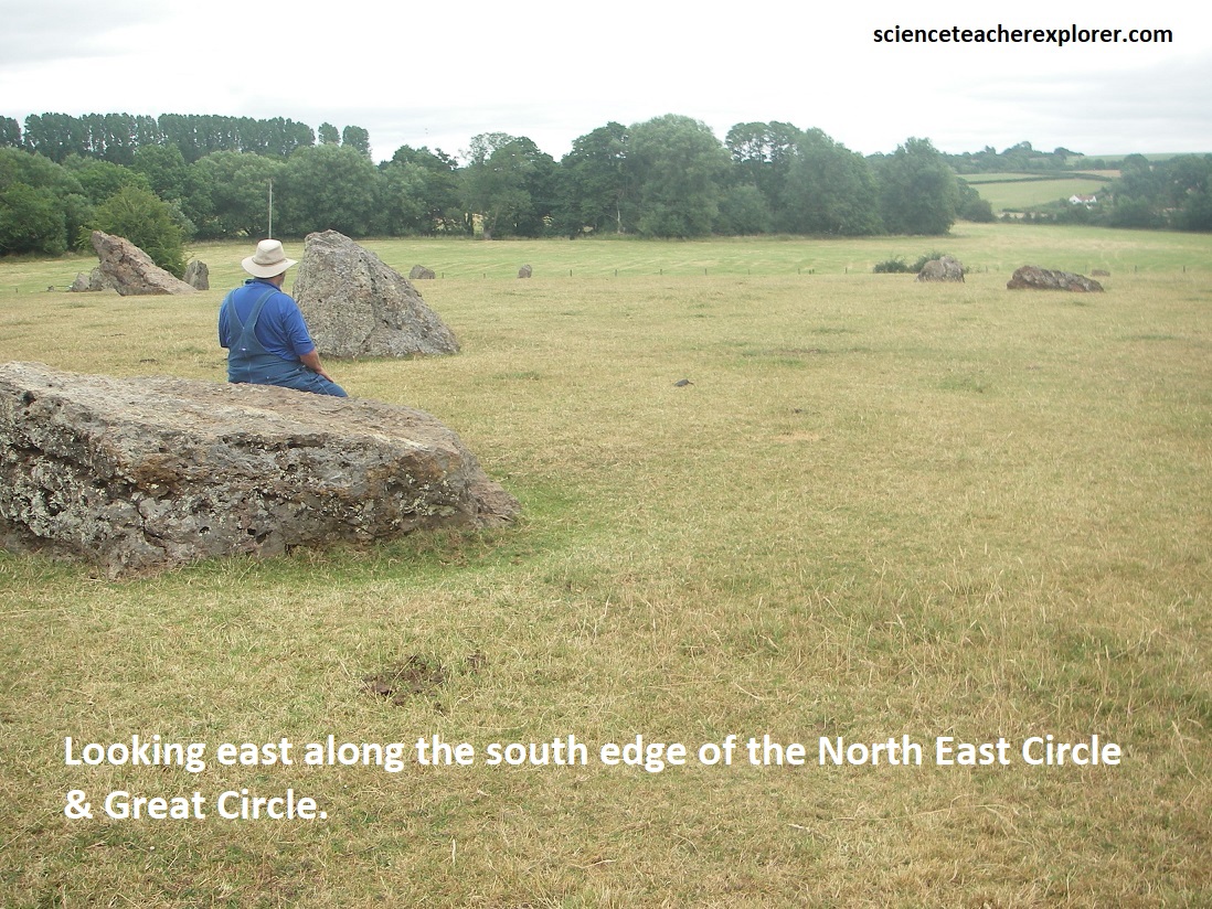
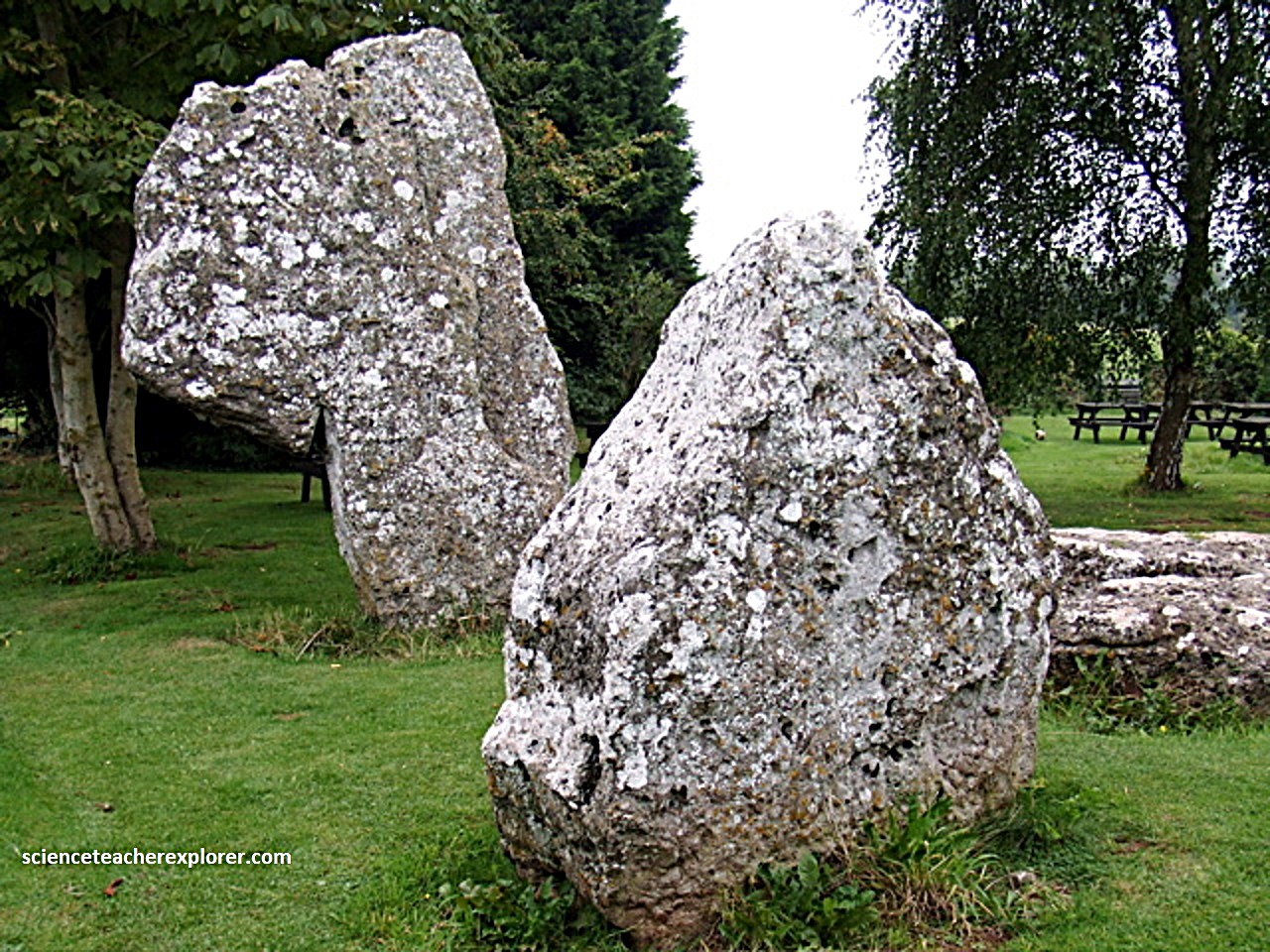
The most famous feature is the Great Circle, the second largest stone circle in Britain (after Avebury). The stone circle is 113m (it is slightly egg-shaped) in diameter and probably consisted of 30 stones, of which 27 survive today, (pictured below with my trekking buddy, Tracy Davis). It probably was surrounded by the ditch (approximately 135m outer diameter — now filled in) of a henge.
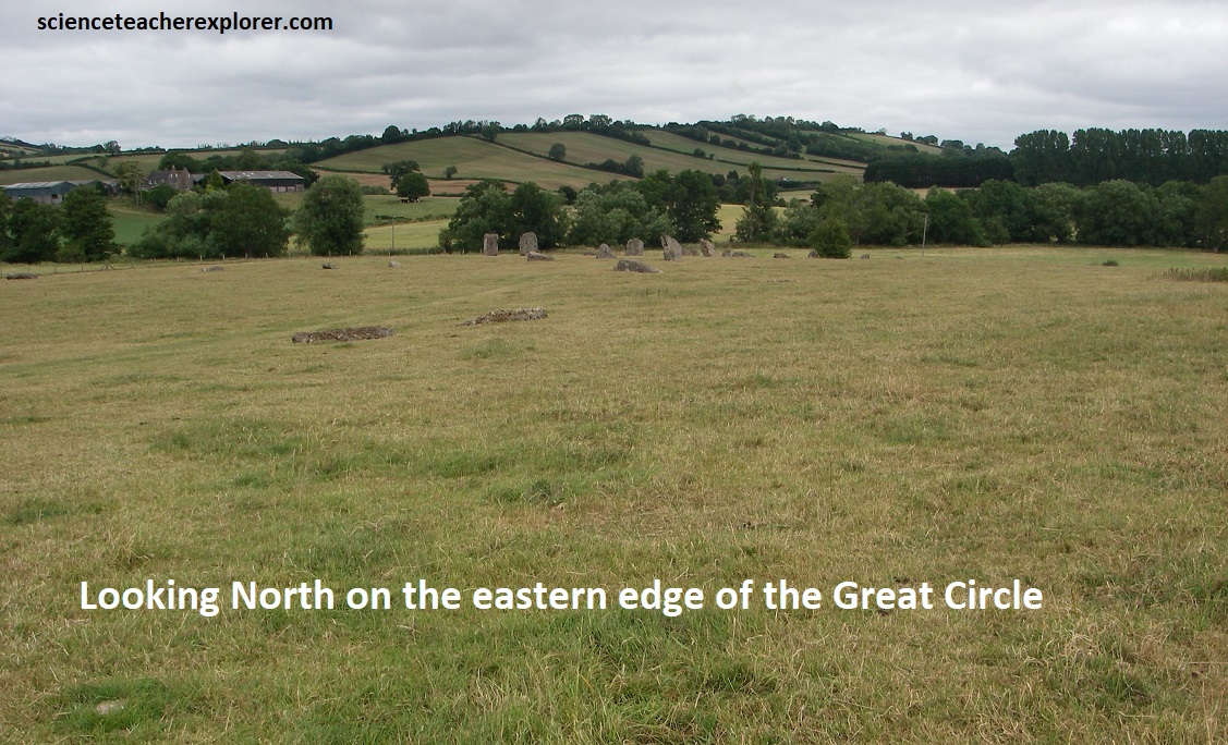
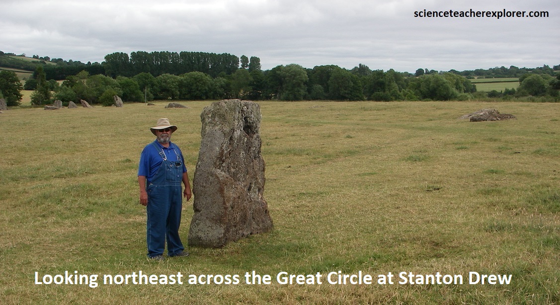
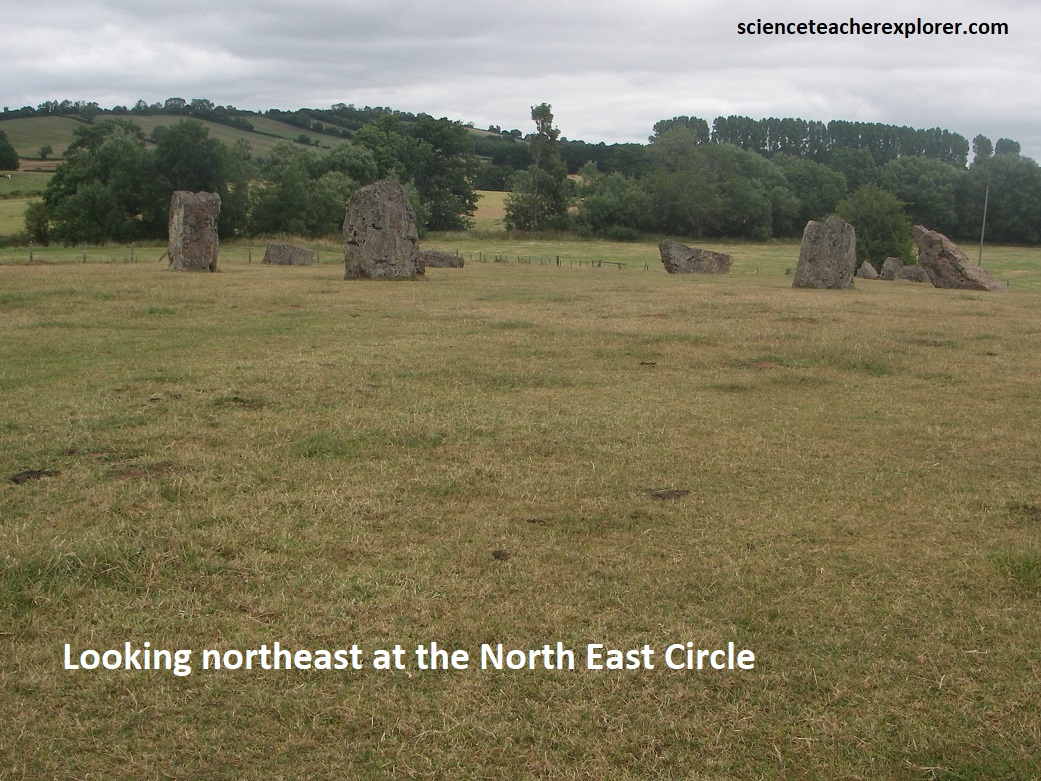
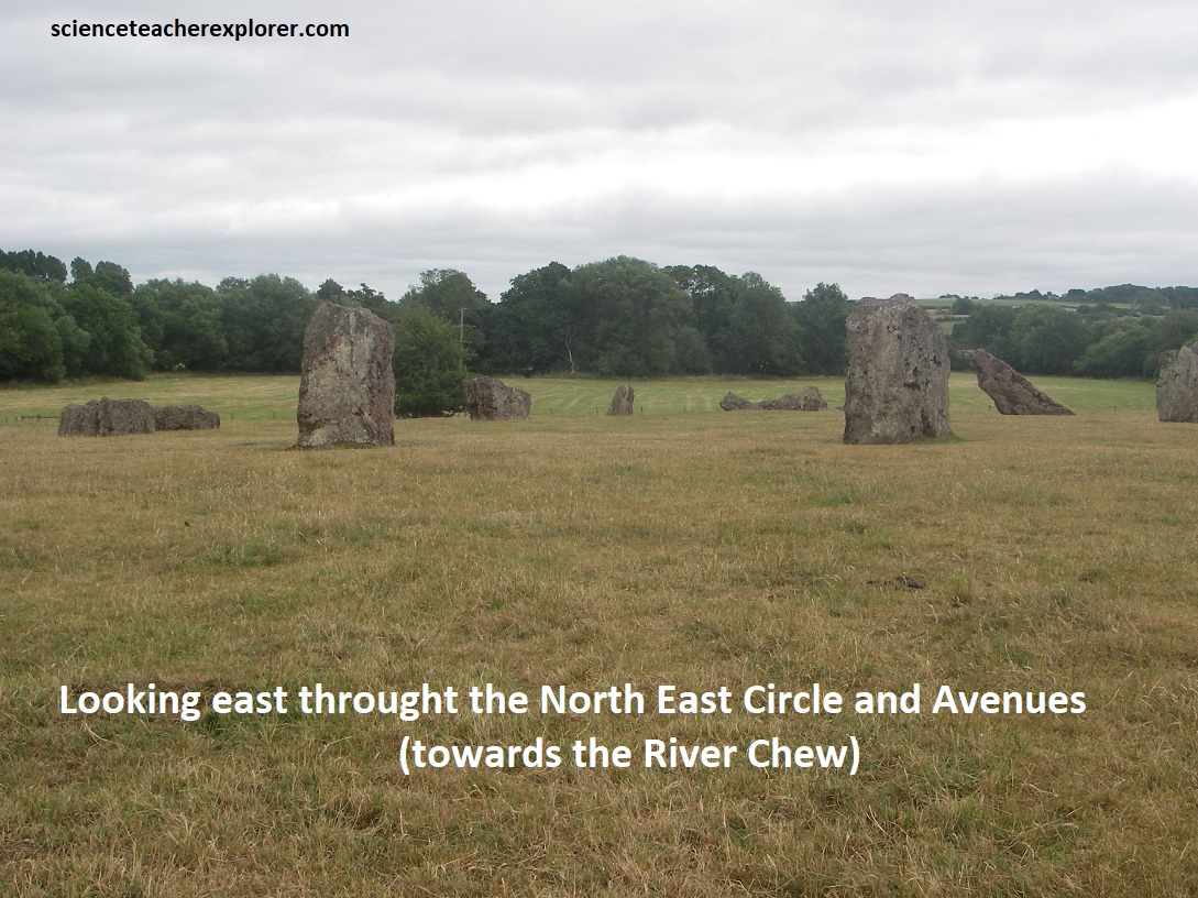
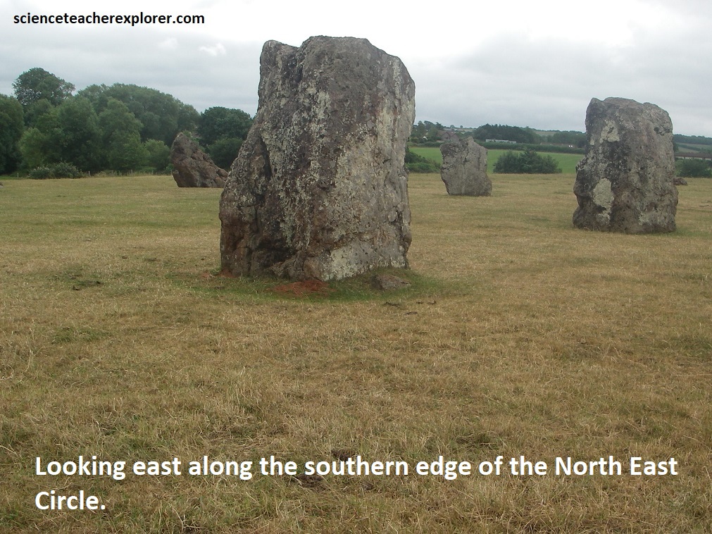
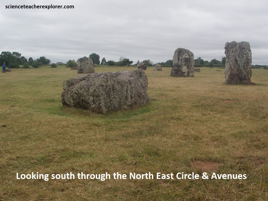
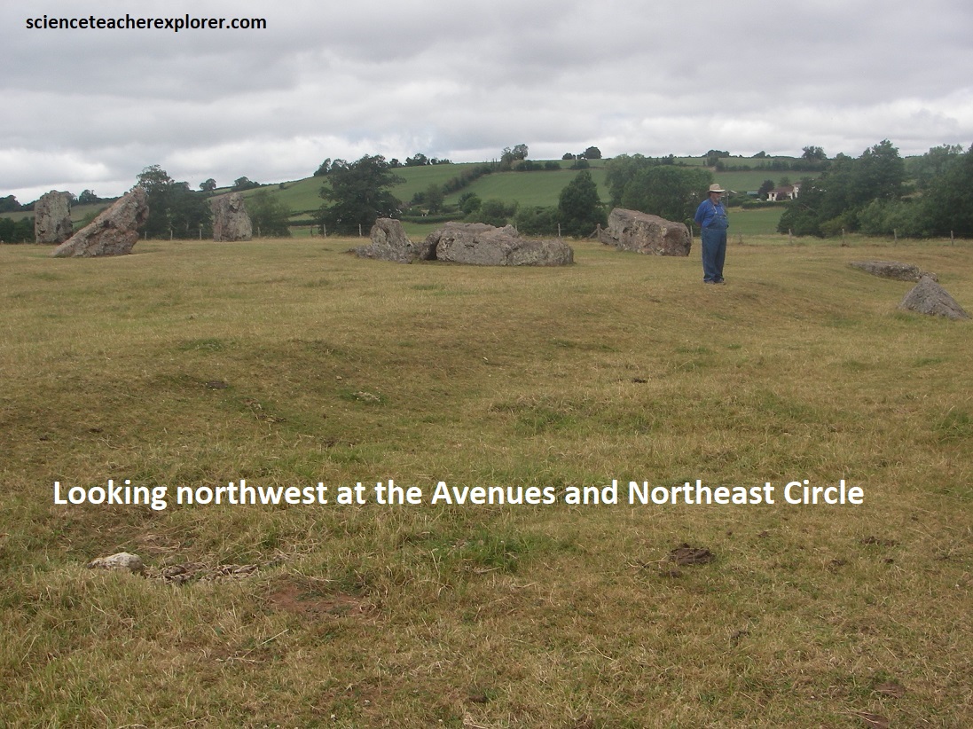
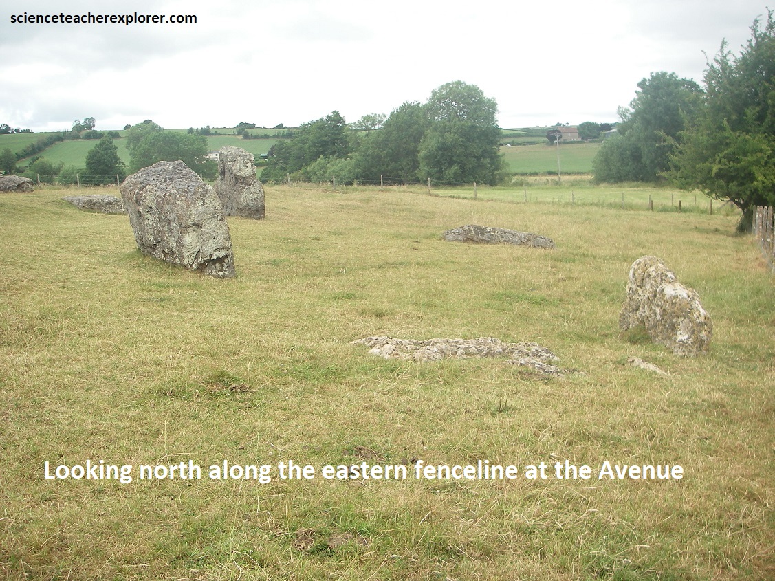
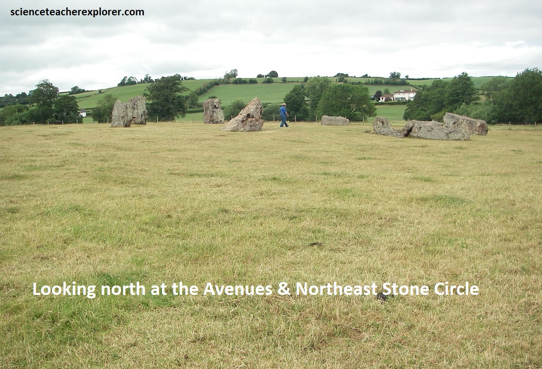
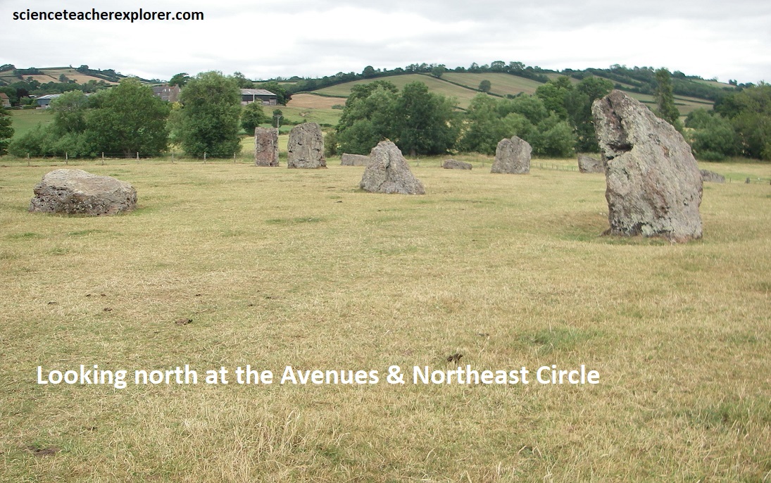
The North East Circle is 30m in diameter and probably consisted of 10 or more stones, of which 8 survive today. An avenue-of-sorts extends to the northeast of the Great Circle towards the River Chew below and a second avenue meets it from the north eastern stone circle, (pictured below with my trekking buddy Tracy Davis).
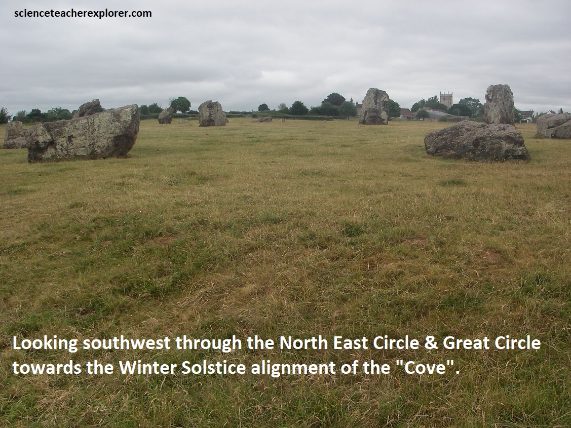
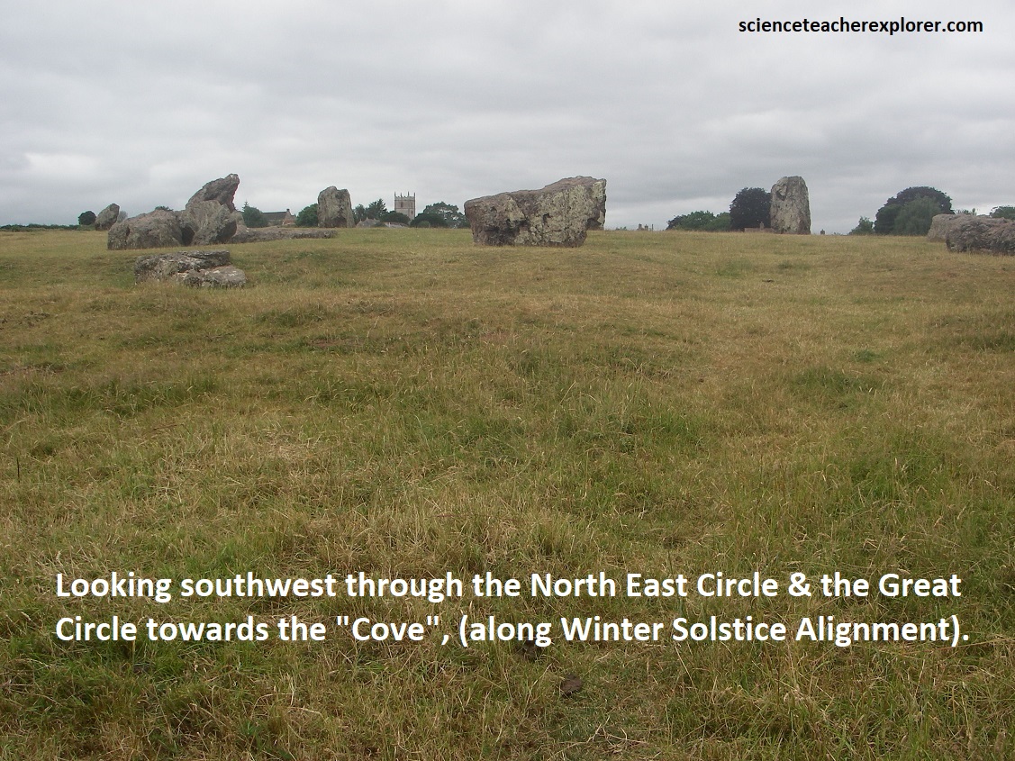
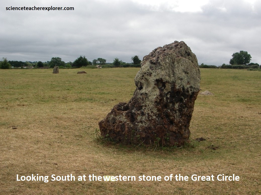
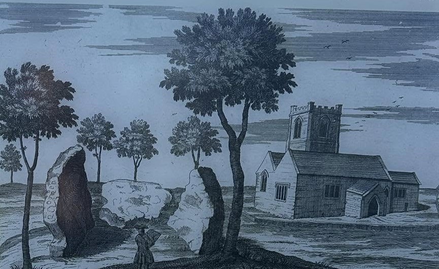
The South West Circle is 43 m in diameter, and has 12 stones surviving today, (all recumbent). We didn’t over down there due to the fact is was on private land. Further to the west is the “Cove” of two standing stones with a recumbent slab between them, which can be found in the garden of a public house. All are of different heights, the stone to the north east being 4.4m the south western 3.1m, and 1.4m, (Images below were taken from an interpretive sign on-site).
A Geophysical Survey was done by the English Heritage in 1997 and revealed a surrounding ditch and nine concentric rings of postholes within the Great Stone Circle. More than four hundred pits, 1meter across and at 2.5m intervals, stood in rings at the site. The ditch is 135m in diameter and about 7m wide. A 40m wide entrance was visible on the north east side, {the images below were taken from an interpretive sign on-site}. (Drawing was done by Jennie Anderson).
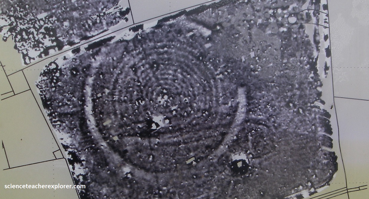
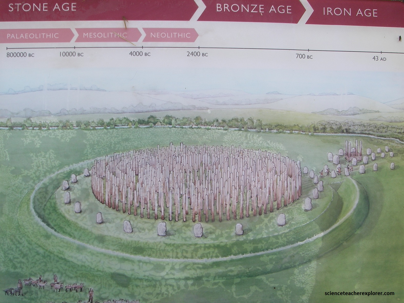
As noted above, the Geophysical surveys, detected features under the ground that told us that there were nine concentric rings of wooden posts, each standing several meters tall. It would have been a strange and memorable experience for a prehistoric person to walk among the forest of timbers and witness the ceremonies taking place there. Based on comparison with other stone circles and timber monuments, it is likely that they were constructed in around 2500B.C. as ceremonial monuments.
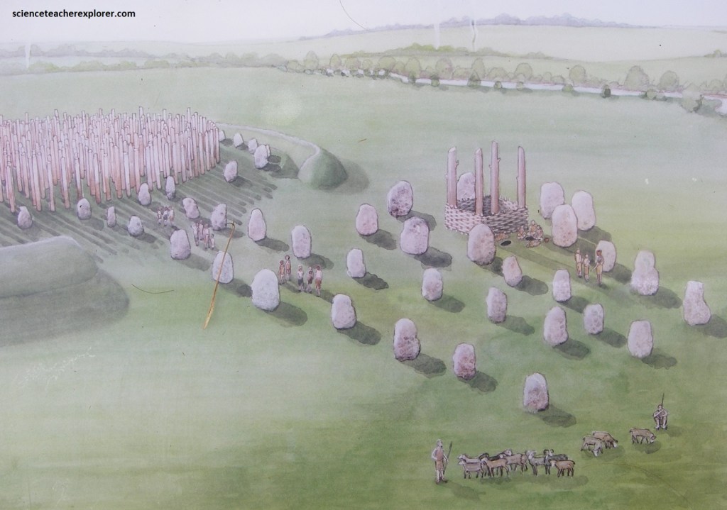
Additionally, the North East Circle of the smaller ring of eight stones, the geophysical survey identified four post holes in a squared-off manner, in the center. Then, the third-ring of twelve stones of the South West Circle, had five inner-rings with a total of 59 post holes equally spaced out.
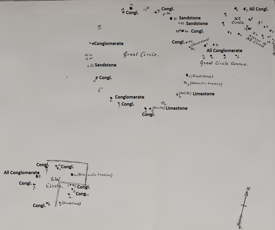
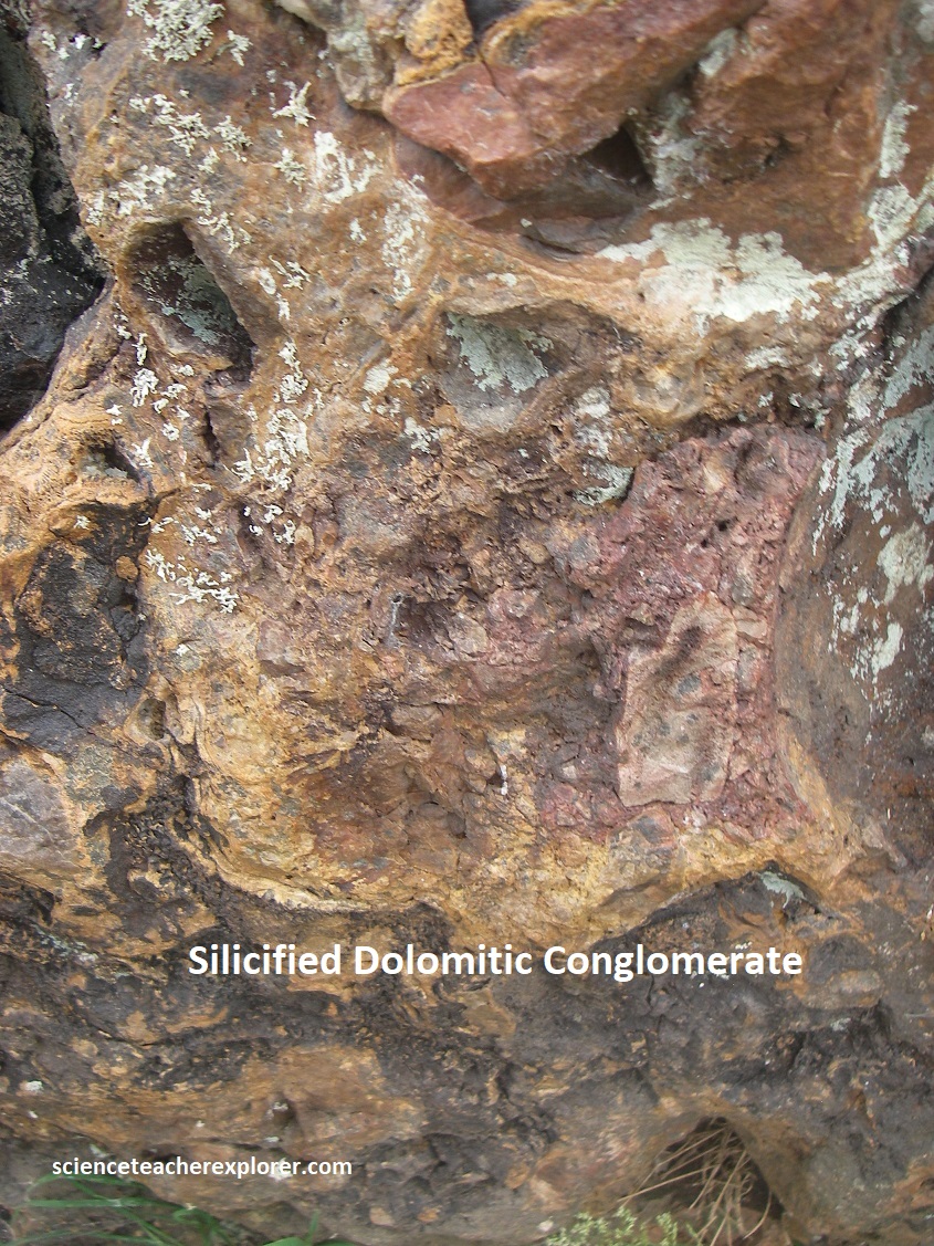
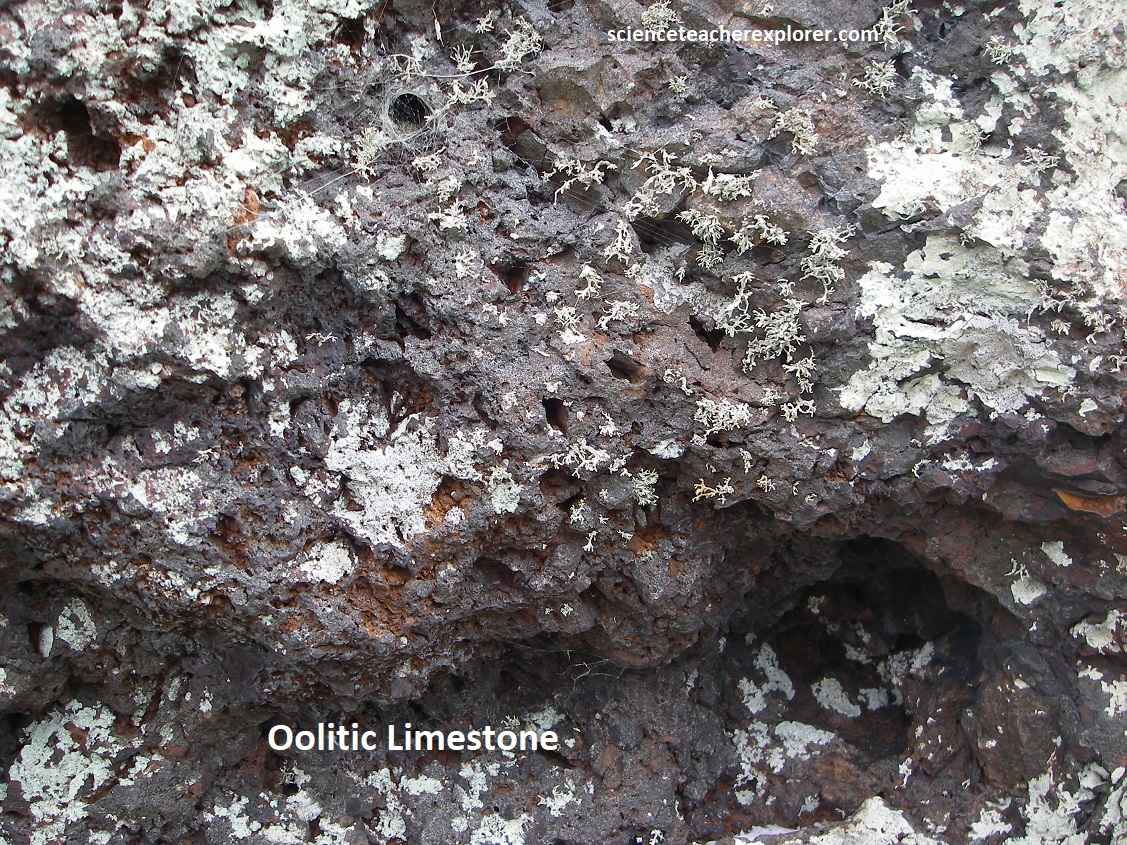
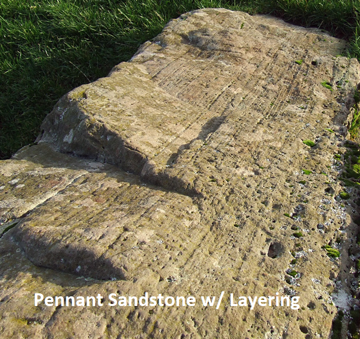
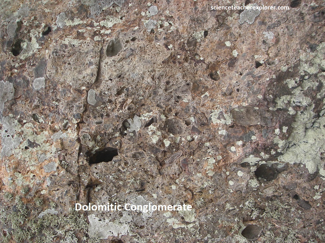
At this Stanton Drew site, at least three principal rock types have been identified: 1) Silicified Dolomitic Conglomerate of Triassic Age, (248-205 Million Years Old). 2) Pennant Sandstone of Carboniferous Age, (354-290 Million Years Old). 3) Oolitic Limestone of Jurassic Age, (205-142 Million Years Old). Their sources include the Broadfield Down, Mendip Hills, Green Down, Rudd and the Leigh Down. These are all found a great distance away and would of taken a great effort to place them here. However, some could of been brought here by boat, or glacier-dynamics.
These circles were probably first noted by the famous antiquarian John Aubrey in 1664. He recorded that the villagers were breaking stones with sledge-hammers and was told that several had been removed in recent years. The first detailed map and drawings were made by William Stukeley in 1723. The circles remain very much as he recorded them, although his plan shows the stone circles divided among fields and orchards. In the absence of many facts about them, the stones have attracted a rich tradition of folklore. Perhaps because it lies off the beaten track, Stanton Drew’s remarkable prehistoric stone circles have not received the same level of interest and exploration as the more famous examples at Avebury and Stonehenge. Yet recent surveys have revealed that the circles and cove were part of a much more elaborate and important ritual site than had previously been imagined.