Cherokee Lowland, KS
In the early summer of 2024, I found myself exploring the southeastern corner of Kansas.
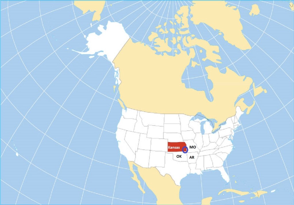
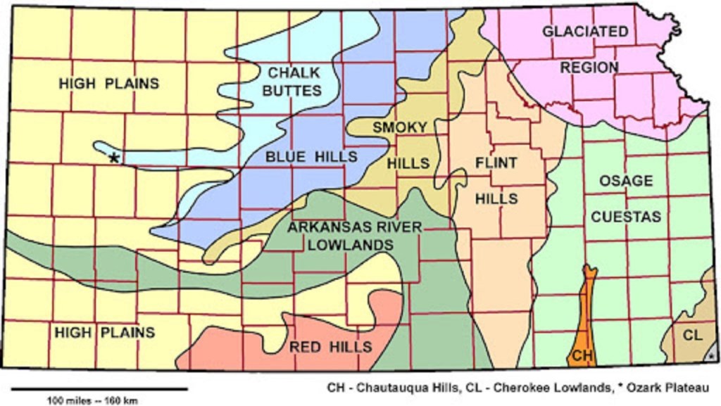
This geographical area is known as the Cherokee Lowlands of Kansas. This region is mainly a gently rolling to flat plain that covers about 2,600 square kilometers in Bourbon, Crawford, Cherokee, and Labette counties. “Lowland” refers to a relatively level terrane, compared to other regions in the area, such as the “Ozark Plateau” region to the southeast.
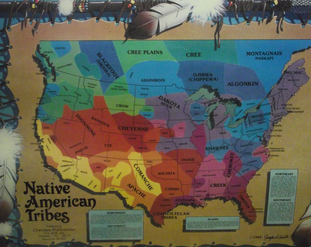
For thousands of years, the land we now call Kansas has been home to indigenous nations and tribes including the Arapaho, Cheyenne, Comanche, Kansa, Kowa, Missouria, Osage, Otoe, Pawnee and Wichita. As the federal government removed and suppressed indigenous peoples, the traditions, community structures, and spiritual beliefs unique to each indigenous nation and tribe were a comfort and a form of self-determination when sovereignty was denied. Failure to understand and respect these cultures and their differences from the Euro-American traditions that were increasingly pressed upon indigenous nations led to the mistrust and misunderstanding that defined the struggle for sovereignty. In deeming indigenous cultures and traditions unsatisfactory, federal authorities characterized indigenous peoples as wards who must be controlled. This unequal relationship expressed itself in treaties and dealings with federal authorities.
In 1823, the United States Supreme Court issued a decision stating that European “discovery” of land in North America superseded indigenous ownership claims’ and indigenous people were occupants, rather than owner. of their own lands. In 1830, the federal government built upon that decision with passage of the Indian Removal Act. Encouraged and supported by President Andrew Jackson, the act was a legal means to remove indigenous people from their homelands to open this territory of American settlement.
The United States Army began forced removal in 1838. Many tribes in the old Northwest, {Ohio, Indiana, Illinois, Minnesota, Michigan and Wisconsin}, and the southeast were subjected to removal. The forced relocation of what white leaders called “Five Civilized Tribes”, due to their increased acculturation into American social norms, (the Choctaw, Creek, Seminole, Chickasaws, and Cherokee), along trails through much of the southeast is known today as the “Trail of Tears”. Members of the tribes were shackled to wagons while villages were ransacked and burned to discourage resistance. The harsh treatment, grueling pace, and insufficient supplies throughout the forced march killed thousands of indigenous peoples.
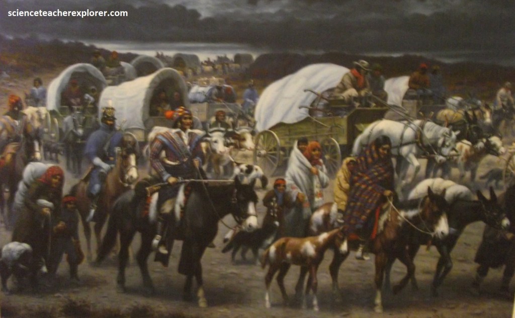
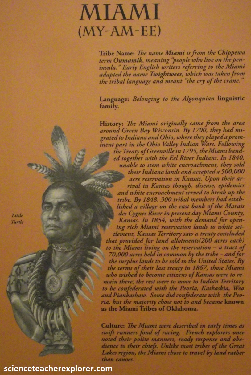
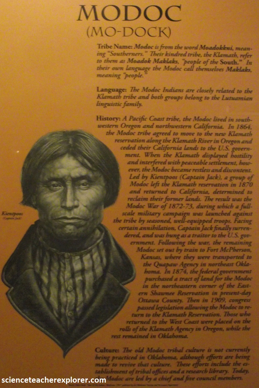
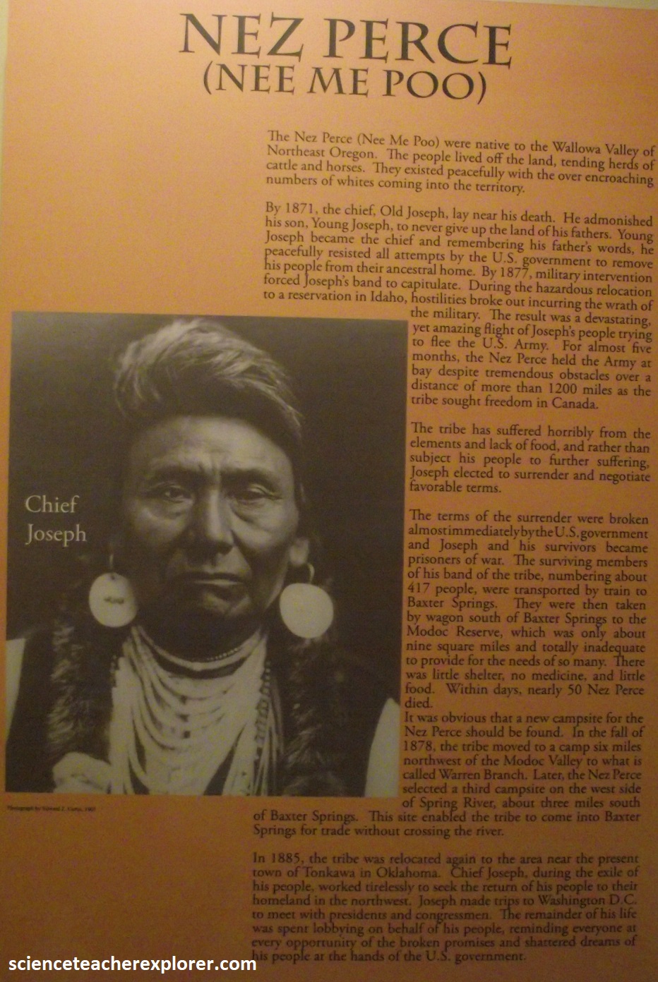
The Indian Removal Act provided a $500,000 allotment to tribes forced into relocation, an amount that paled in comparison to the cost of proper food and travel supplies for an entire tribe. Their new homes lacked the traditional foods, building materials, and terrain necessary to maintain their traditional ways of life. Trade routes opened along the borders of the new Indian Territory to supplement the loss of eastern goods. American traders took advantage of the demand for goods by raising prices, credit debt accumulated amount the relocated tribes. {Image below are some of the tribes relocated} ((the images below were taken from an interpretive signs at the Baxter Springs Museum, KS in 2024).
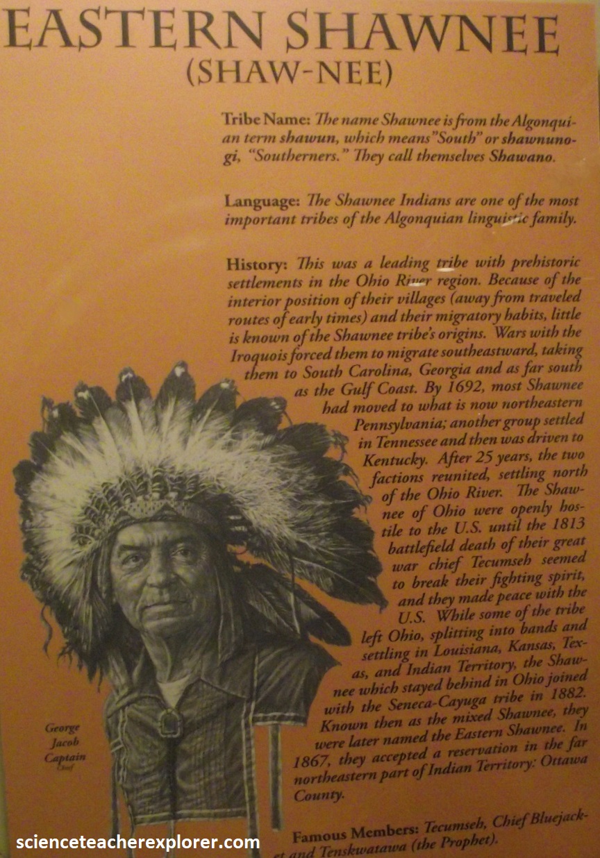
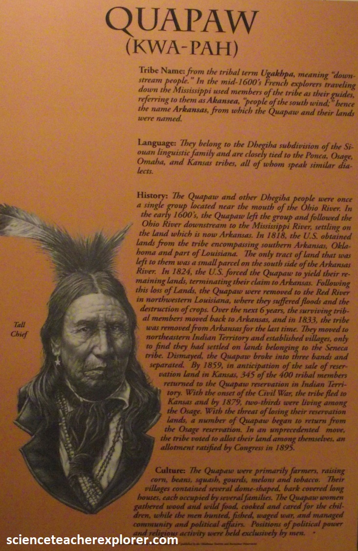
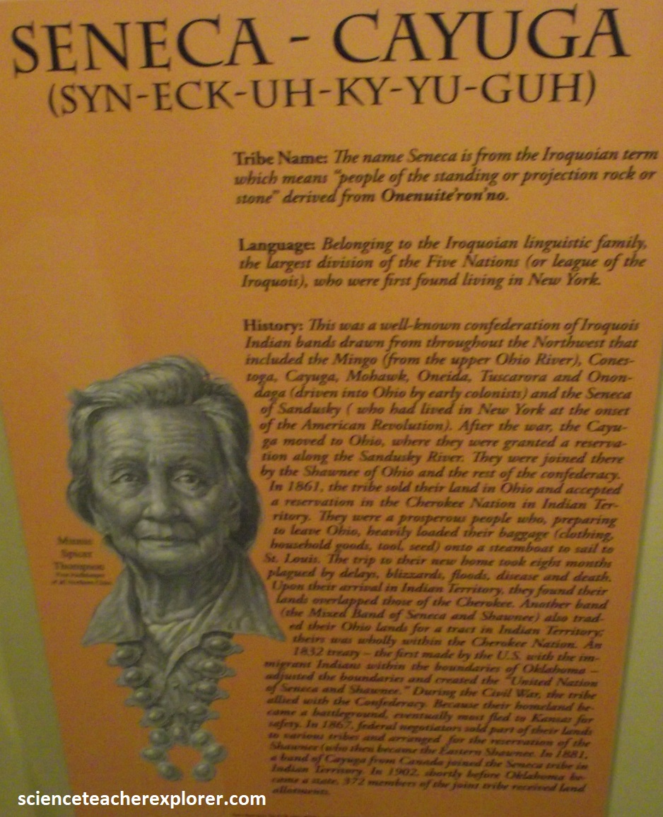
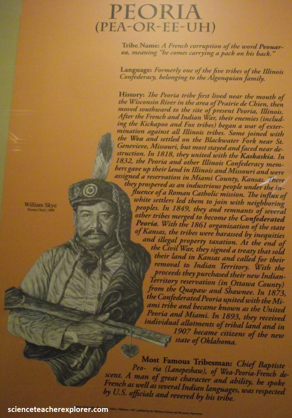
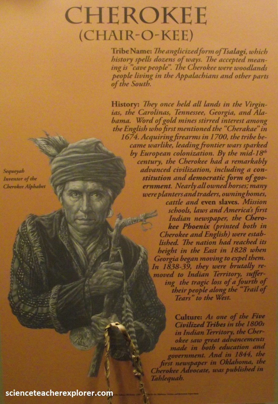
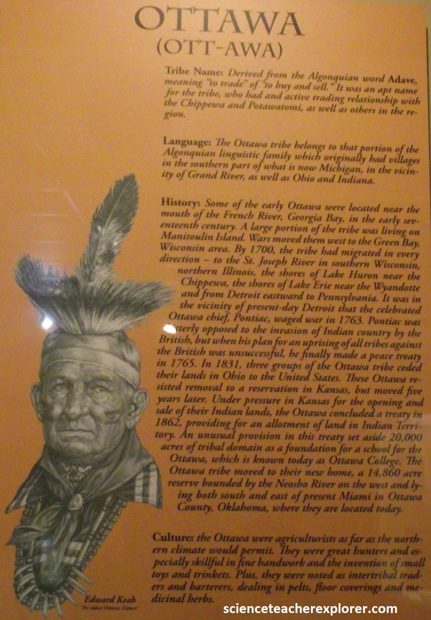
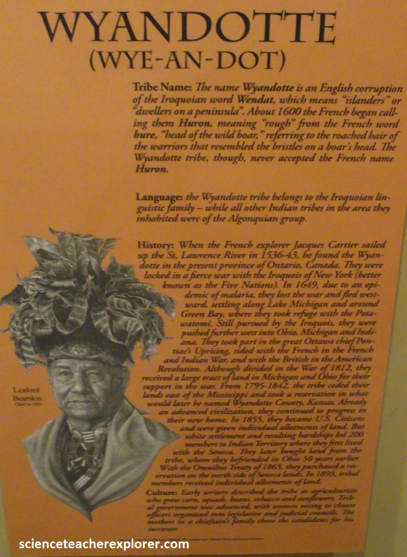
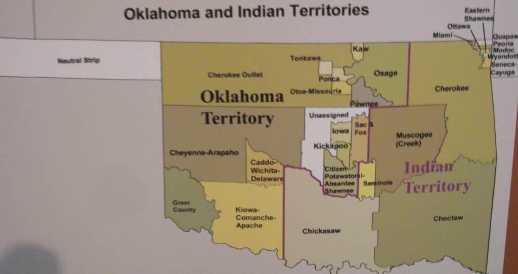
As the U.S. government officials broke treaties and white settlers attempted to swindle Native Americans out of their newly acquired lands, many tribes used the U.S. legal system to ensure their survival. By fighting within the system that was designed to dispossess them, Native Americans expressed sovereignty in tangible ways toward those seeking to colonize their land. Due to land cession treaties, illegal taxation, and economic abuse by Indian Agents, all the tribes that originally inhabited Kansas established reservations in Oklahoma. Many of the emigrant tribes removed to Kansas from the east, (Cherokee, Delaware & Shawnee), now reside in Oklahoma. Four emigrant tribes, (Iowa, Kickapoo, Potawatomi and Fox), maintained reservations in Kansas while the Wandat owns land in the state. Due to the presence of diverse tribal nations throughout it’s history, Kansas has been indelibly influenced by them. Place names, foodstuffs, political precedents, and other everyday familiarities to modern Kansans have roots in the cultures of our Indian forebears. One common thread running through these is the spiritual, social, and diplomatic contributions of sovereign Native Nations.
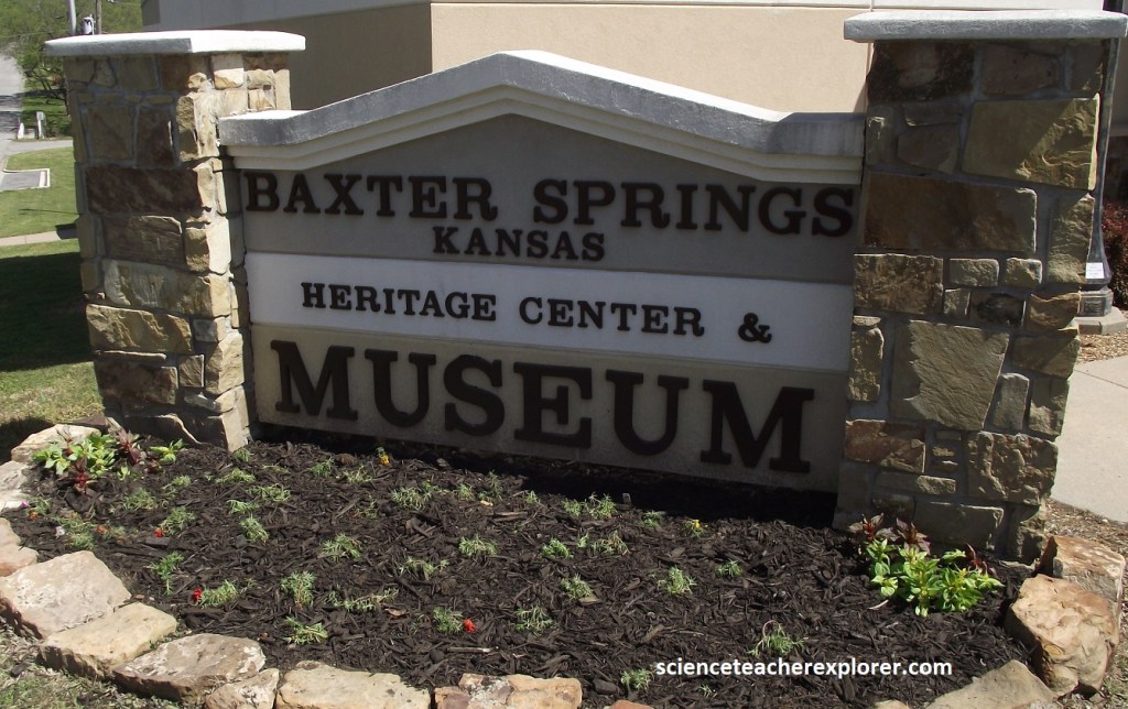
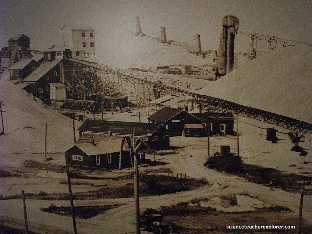
Pictured above, my first area of exploration in the Cherokee Lowland area was Baxter Springs. I’ve already mentioned my visit at the Baxter Springs Museum with it’s amazing history of the local Indigenous tribes. However, much of the late 19th & earth 20th Century history of the area was related to mining of it’s rich natural-resources.
The first commercial-ore discovery in this area was actually made in southwestern Missouri around 1838. It was lead in the Mississippian Deposit in the Ozark Plateau. But exploration expanded into the tri-state area, (via the Cherokee Lowlands). By the start of the Civil War, these mines were producing so much lead that both the North and South fought to control the mining area to secure a source of lead for bullets.
Although zinc was much more common than lead throughout the Tri-State mining district, production up to 1869 was confined to lead, which could be easily smelted in homemade furnaces. Zinc production took off in the early 1870’s, following the completion of railroad lines and the construction in 1873 of a coal-fired zinc smelter at Weir City, Kansas (fueled by coal from nearby mines). In 1878 another smelter was built at Pittsburg, Kansas.
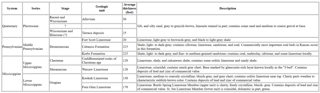
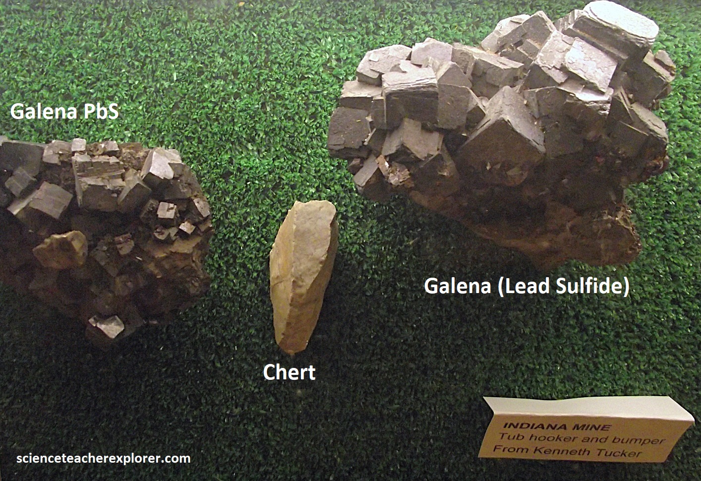
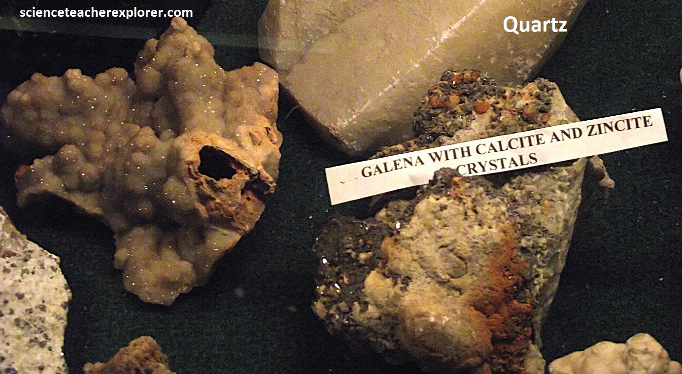
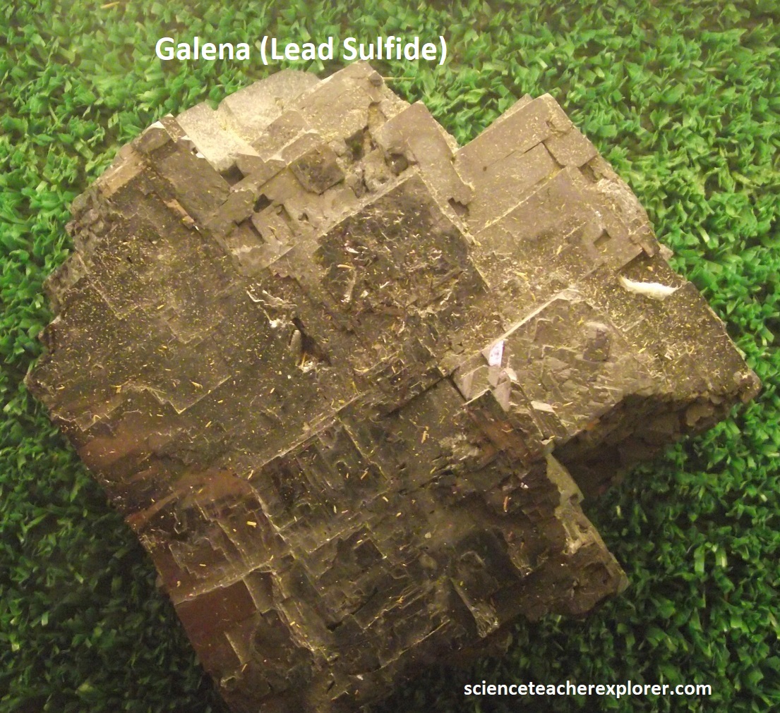
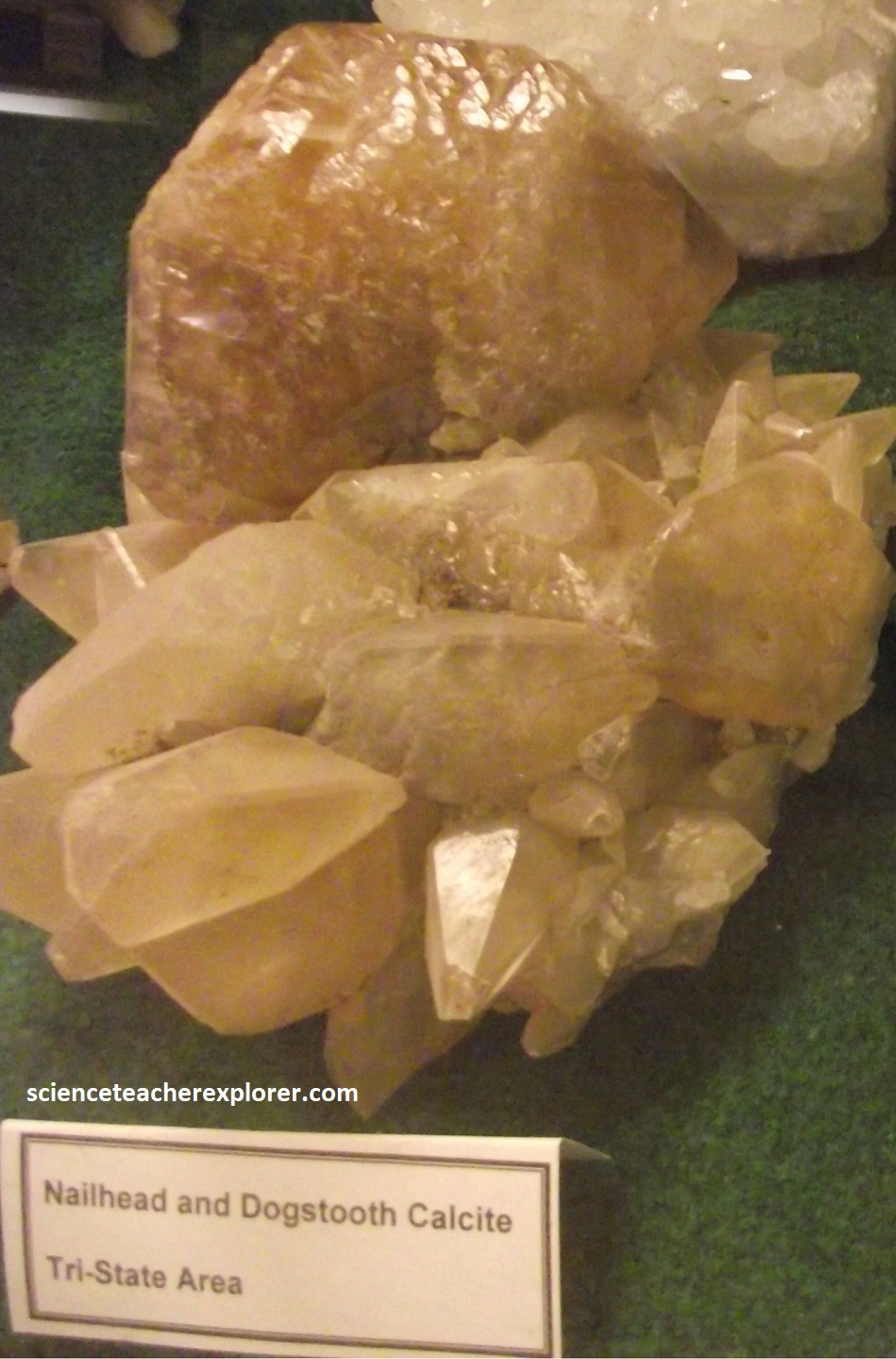
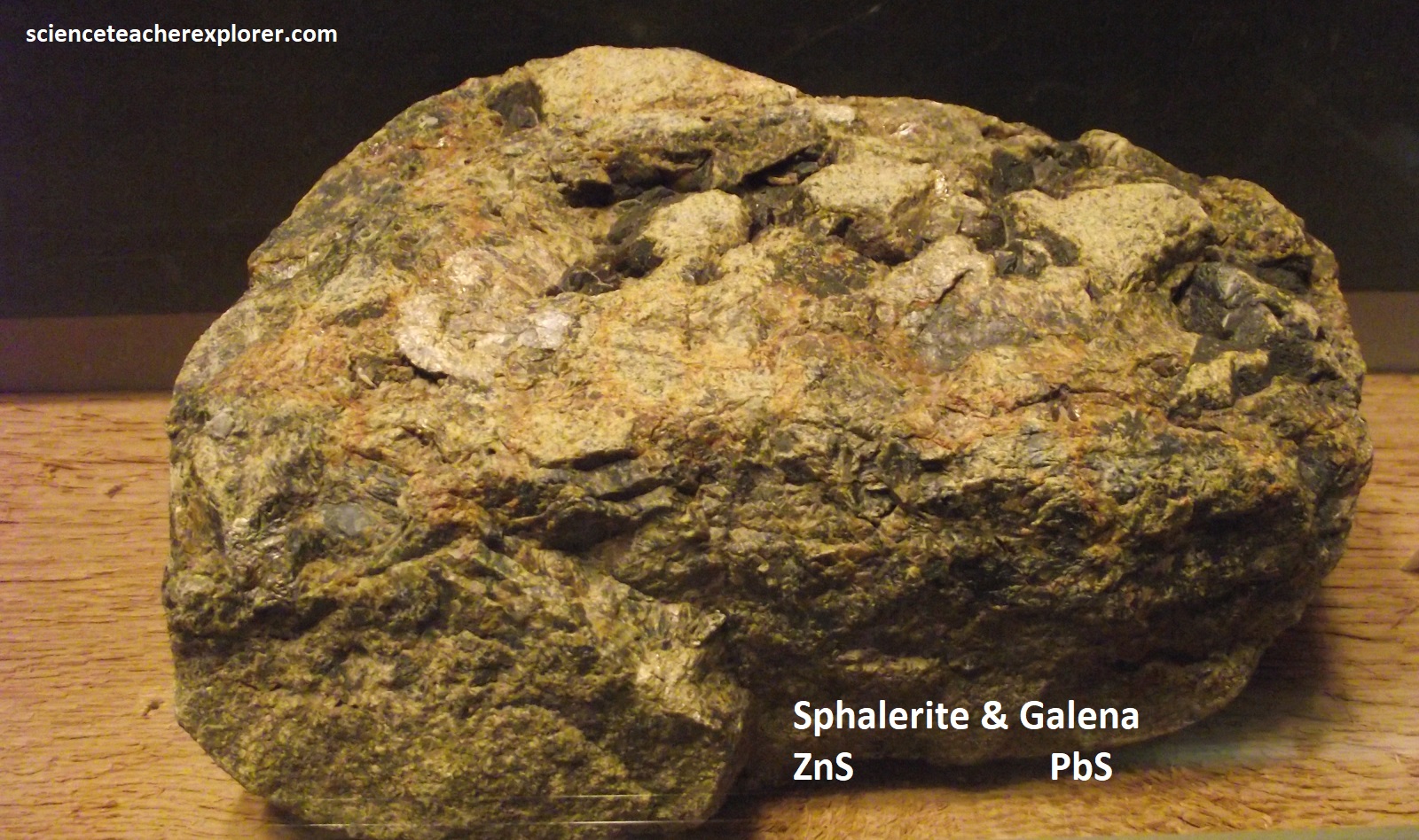
Imaged above, lead and zinc ores in the Tri-State area occurred in Mississippian cherty limestones. After these cherty (quartz) limestones were deposited at the bottom of an inland sea, they were exposed at the surface and were subjected to erosion. Over time, the softer limestone was leached from the beds, while the more resistant chert remained. Following this period of erosion, the seas returned during the Pennsylvanian Period (323 to 290 million years ago), and the shales of the Cherokee Group were deposited on top of the Mississippian rocks. This set the stage for the ores to be deposited, probably millions of years later.
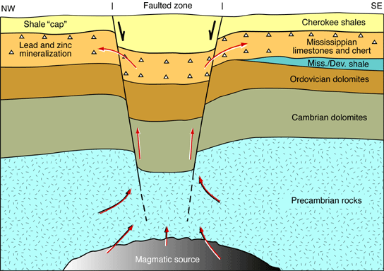
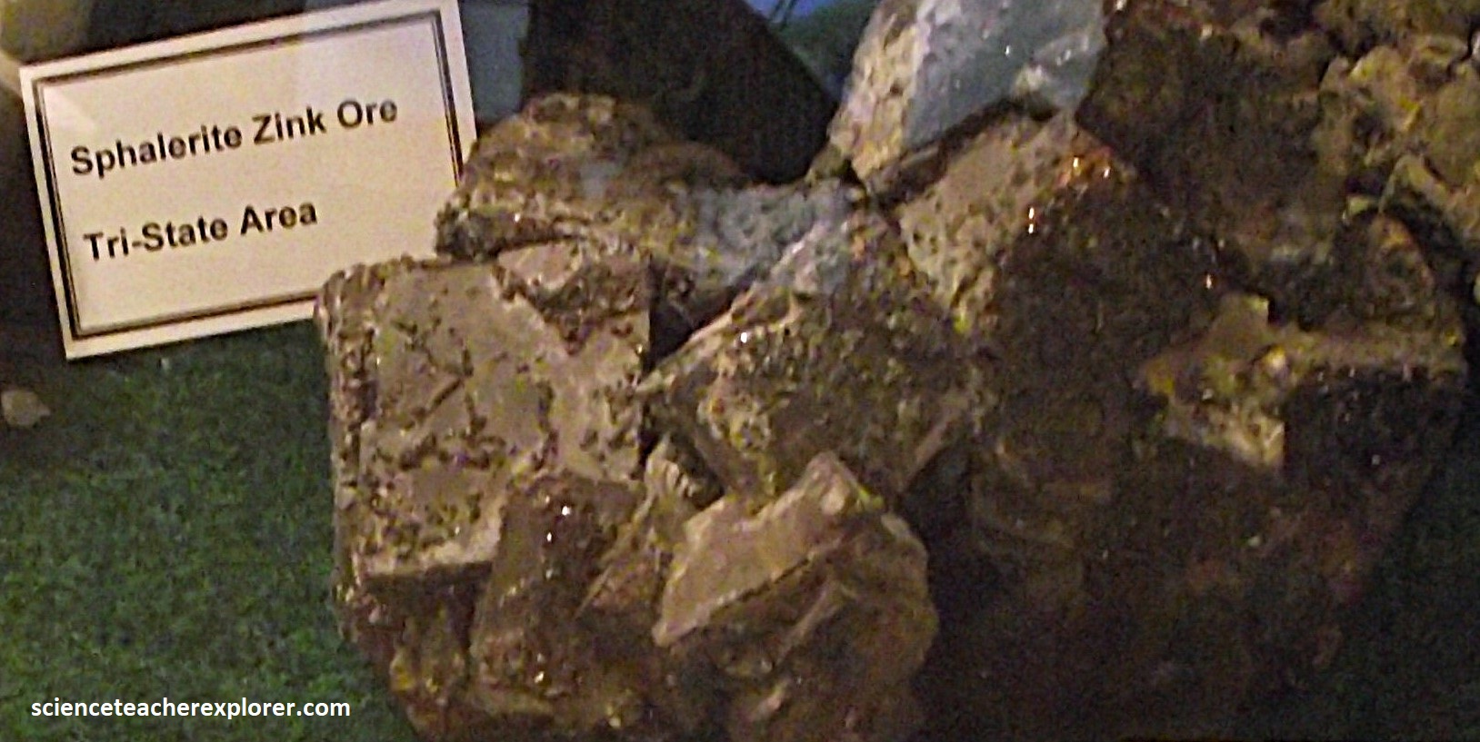
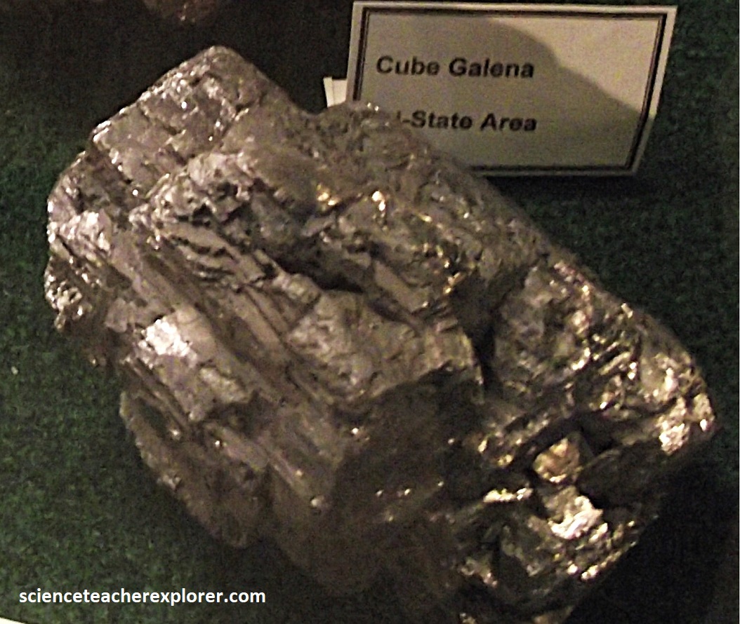
The lead and zinc ores are believed to have formed from hot, metal-bearing solutions that originated deep within the earth. These solutions probably rose along major faults and fractures until they came to the Mississippian beds, (imaged below). The Cherokee Group shales acted as an impermeable barrier, or cap, to the rising metal-bearing solutions and forced them to migrate laterally. These solutions spread through the broken beds of chert (quartz) and other porous and permeable layers in the Mississippian limestones, depositing the galena, sphalerite, and other associated materials. Deposited more than 320 million years ago, these are the oldest rocks at the surface in Kansas. Ore-bearing formations dip gently to the west and are a hundred meters below the surface along U.S. 69 in the Picher field, where they are buried beneath younger Pennsylvanian rocks of the Cherokee Group. (photos below galena, quartz & sphalerite samples taken from Cherokee Lowland Mines and displayed at the Baxter Springs Museum in 2024).
Discoveries of the Lead & Zinc deposits were usually found in the limestone caves, so mining was done underground, using room-and-pillar methods, in which room-shaped areas were mined and similarly shaped areas were left for roof support, resulting in a checkboard-like arrangement of alternating rooms and pillars.
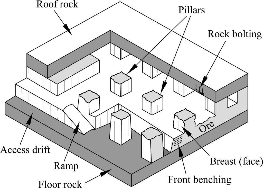
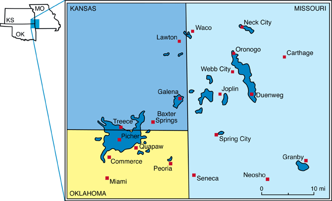
Imaged above, ore bodies in this area had irregular shapes; some were flat sheets; others were linear “runs”; others were circular. After the miners discovered an ore body, they usually followed the ore by using the mining method of room-and-pillar fashion, (mentioned above).
Pictured above, some underground rooms had walls 10 to 30 meters high and pillars 6 to 17 meters thick. In the eastern part of the district, however, the ore was closer to the surface, and the shallow mining could be done using hand tools and a simple hoisting device that was either man- or animal-powered.
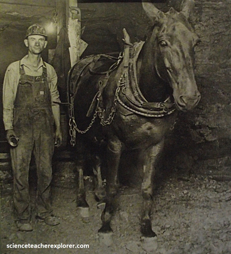
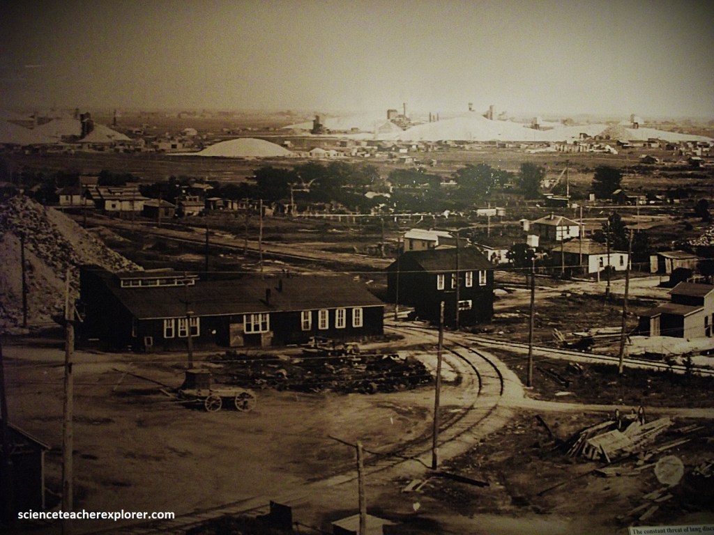
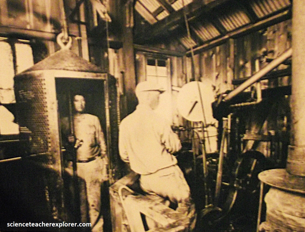
Each mine in the district had one or more vertical shafts, through which ore was brought to the surface and was then taken to nearby mills, where it was crushed and treated to separate the minerals from the gangue. The gangue was mostly chert and limestone, which was ground into fine gravel and was piled into man-made hills over 100m high. This waste material, which locally is called chat, is no longer consider worthless. Many of the large chat piles have been quarried for use in concrete aggregate, road construction, ballast in railroad beds and roofing material. {Pictured below is a small lift container that transported four-miners up and down the mine-shafts; (the historical photo was taken from an interpretive sign at the Baxter Springs Museum, KS in 2024)}.
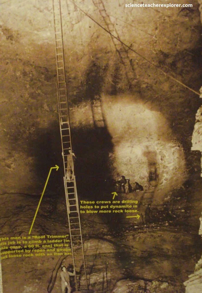
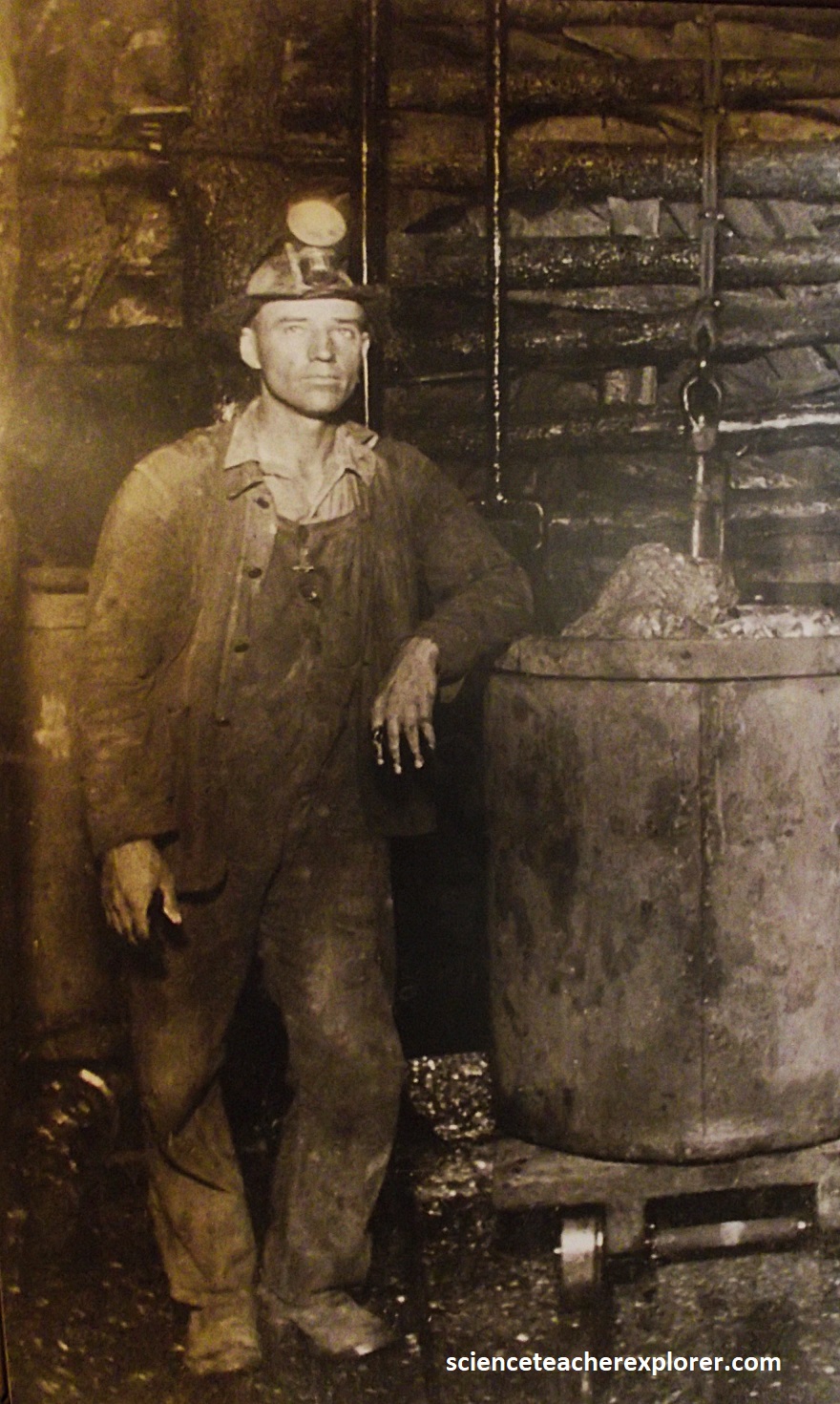
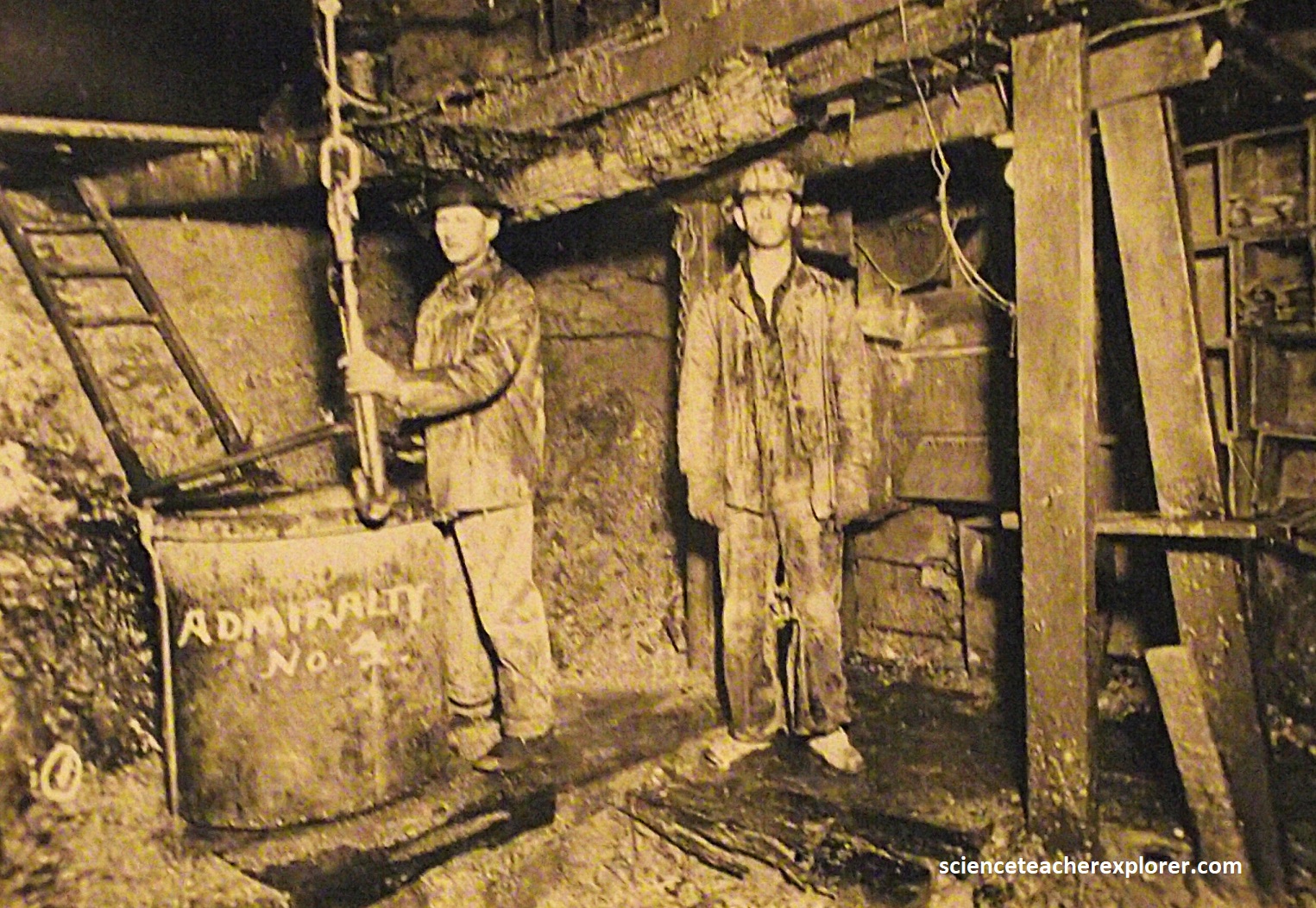
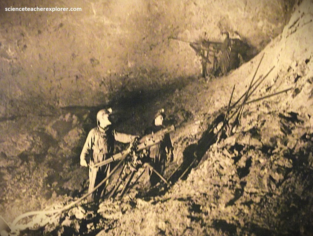
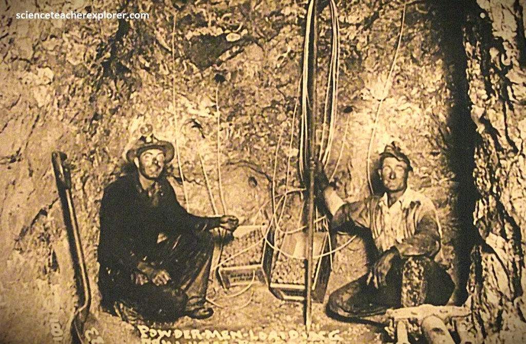
Production from the Tri-State peaked between 1918 and 1941. During the 1920’s, more than 11,000 miners worked in the area, and perhaps three times as many were involved in support work and industries. {Pictured below are mine workers in the Cherokee Lowlands of the early 1900s; (the historical photos were taken from an interpretive sign at the Baxter Springs Museum, KS in 2024)}.
After World War II, production of the Lead-Zinc mining of the Tri-State area gradually declined. In 1970 the last active mine, located 3 km west of Baxter Springs, Kansas, shut down due to environmental and economic problems, bringing to an end a century of lead and zinc mining in the Cherokee Lowlands.
During the life of the district, more than 4,000 mines produced 23 million tons of zinc concentrates and 4 million tons of lead concentrates. The Cherokee Lowlands produced more than 2.9 million tons of zinc, with an estimated value of $436 million, and 650,000 tons of lead worth nearly $91 million.
Although the mines in the Cherokee Lowlands are now closed, many of the shafts remain open. Other mine shafts, and even the mines themselves, have collapsed over the years. Because of the sized of the mine rooms, some of the resulting collapses have been large and dramatic. {There is one such collapse a few hundred meters west of U.S. 69 just north of the state-line road}. [In response to concerns about subsidence in populated areas, the federal government began a voluntary buy-out of properties, and relocation of the residents, in Picher, Cardin, and Hockerville, Oklahoma].
Many of the rock layers that were mined in the Cherokee Lowland, for ore also were aquifers–that is, water-bearing formations. Thus, water flowed into the mines through these rock layers. All of this water was pumped out during the mining activities. However, this water has been acidized through contact with iron sulfides, (Pyrite), that remained in the mine walls by the miners. In 1979, water began to spill out onto the surface downstream in Oklahoma, creating bright red stains as it come into contact with the air and as the iron oxidized and precipitated out of solution. In other words, the closed-mines in Kansas have now provided opens for water to recharge the mines and contaminating the ground water. Federal, state, and local agencies have grappled with the problem, but this remains one of the most environmentally blighted areas in the nation.
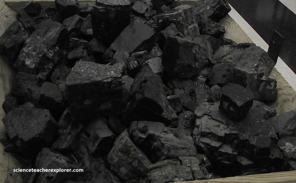
Pictured above, Coal Mining was also a predominant industry in the Cherokee Lowlands by the turn of the 20th century. It had a lasting impact on the region’s landscape. During the Pennsylvanian Age, the eastern part of Kansas stayed nearly at sea level. Great swamps covered the low-lying areas along the coasts, and primitive plants, including ferns as tall as trees, grew densely. After the plants died and fell into the marsh, they were covered by water and mud and sand. As layers of sediment accumulated above the decaying plant material, it was compacted, eventually producing coal.
Starting in 1874, mineshafts were dug to reach underground coal deposits, but by the 1930s, strip mining on the surface had become the main mode of excavation. (Pictured above, giant-mechanical shovels were used to remove the overburden (soil and rock overlying the coal layers), coal companies dug deep trenches to reach and mine the coal.
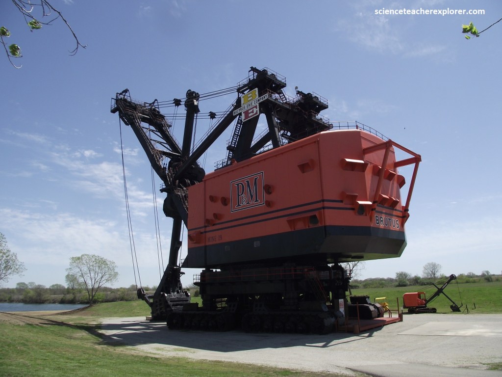
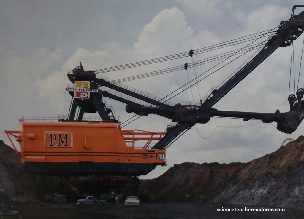
Pictured above, a nearby museum is the permanent home of 5,500-ton Big Brutus, the second largest shovel of its type when it was in operation during the 1960s and 1970s.
The Big Brutus Museum is in the Cherokee Lowlands, Kansas and is 9.6 km west of KS7 and 0.4 km south of West Mineral.
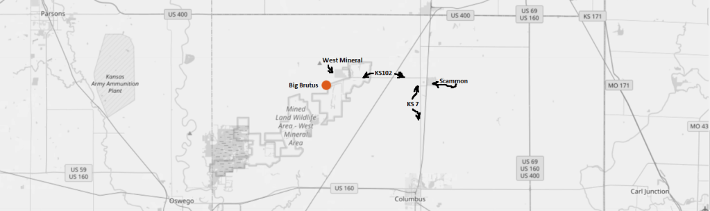
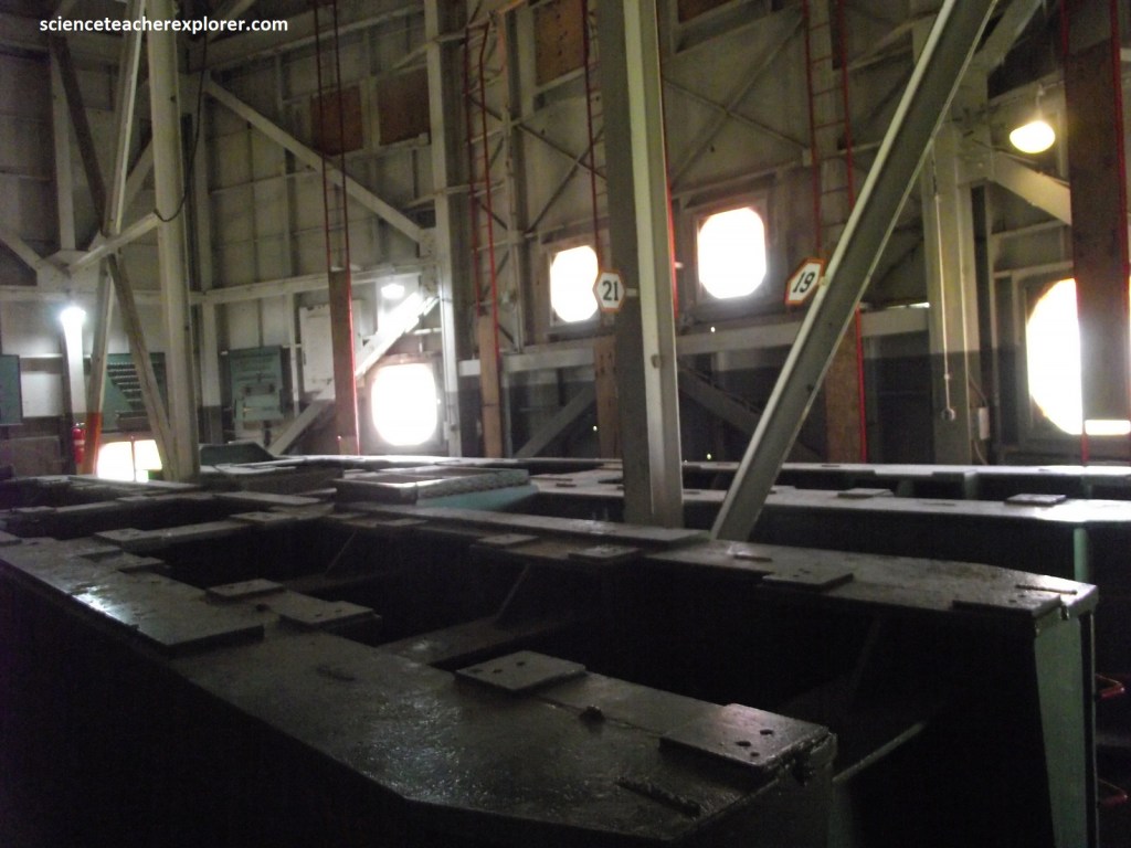
The statistics give the hard cold picture — Bucyrus Erie model 1850B second largest electric shovel in the world 16 stories tall (53m), the mass of a 5 million kilogram boom, 50m long dipper capacity 90 cu. meter (by heaping, 150 tons — enough to fill three railroad cars.) maximum speed 0.35 Km/hr. cost $6.5 million (in 1962) by the Bucyrus Erie Company of Milwaukee. It was purchased by the Pittsburg & Midway Coal Mining Company of Pittsburg, Kansas. Pictured above, The Bucket held 90 cubic meters of overburden which was approximately 135-150 tons of material. Brutus did not dig coal it only removed the overburden.
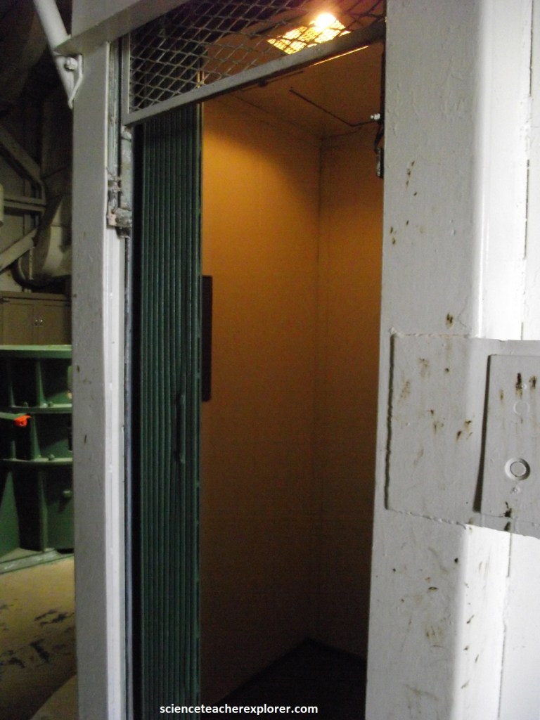
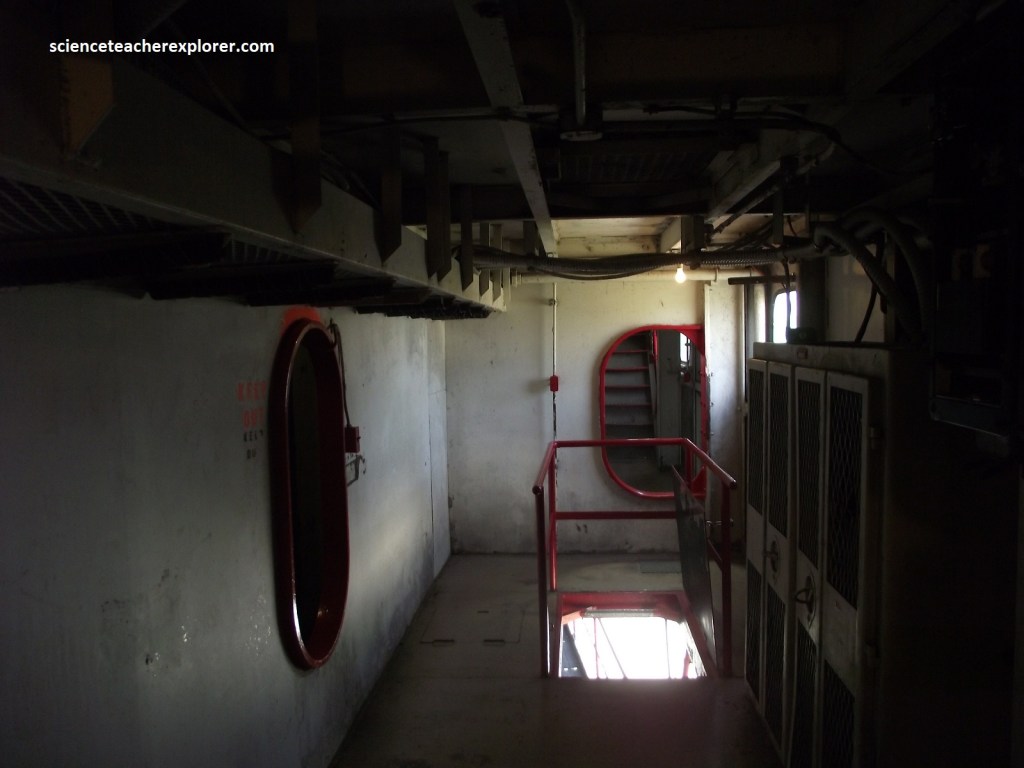
Pictured above, the elevator was the only way into the house when Brutus was in operation. The house rotates around the elevator which is stationary.
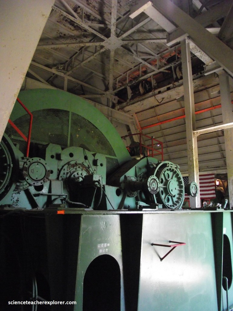
Pictured above, there were two 3500 H.P. Electric A.C. motors mounted in the center. These motors operated thirteen D.C. Generators which in turn operated thirteen D.C. Motors. The D.C. motors operated the main wench swing & crowd.
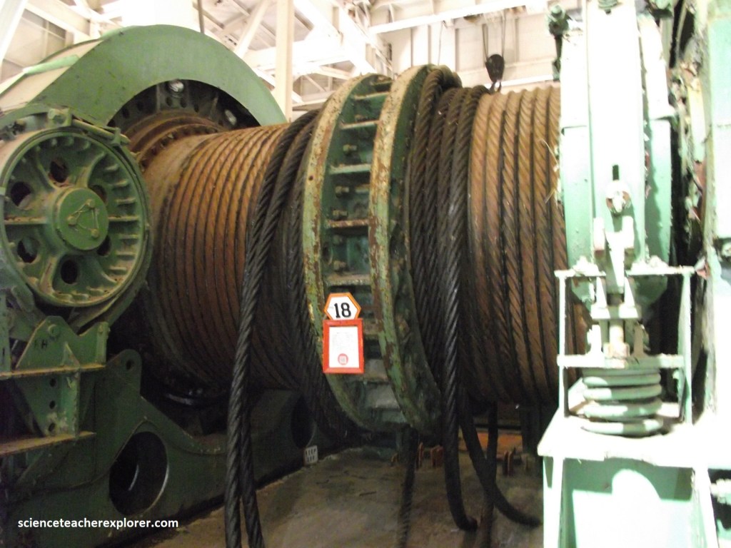
Pictured above, the main host was operated by eight 500 horsepower, DC electric motors. There is 267m of wire rope (cable) on each side. The cable weighs approximately 25 pounds a foot. The main barrel and attached gears weigh a total of ninety-three and one-half tons.
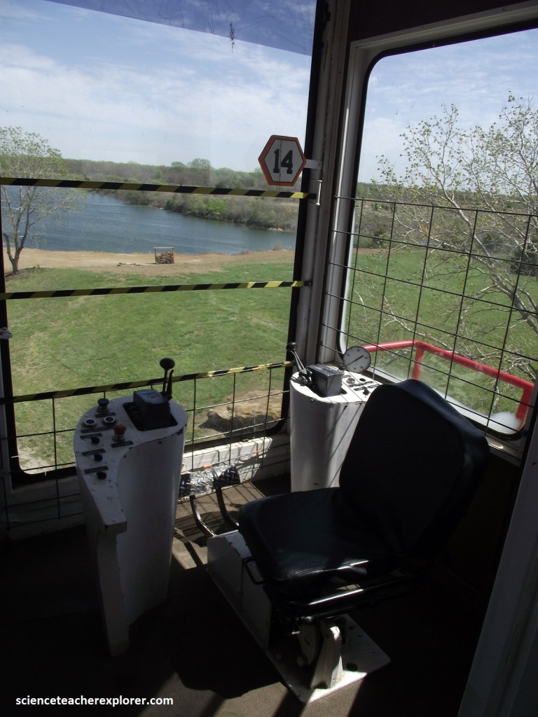
Pictured above, this is where the operator worked. He was in charge of the operating crew and the 3rd man on the crew. His job was to operated the bucket & to swing the house with the foot pedals. He also gave instructions to the groundman. The Operator’s cab & adjacent room were the only areas on Big Brutus that were air-conditioned.
Pictured above, there is a small hoist that was used to raise oil drums, etc. into the main house.
Pictured above, These platforms were where the two 3,500 HP sychronous AC motors and thirteen DC generators were located. The AC motors ran the generators. Each generator was responsible for controlling one of the thirteen DC motors inside the house.
Pictured above, the Transformer Room was the main electrical distribution point for the shovel. The external, power source was connected to a set of collector plates & then connected to the transformer room where it was distributed throughout the machine.
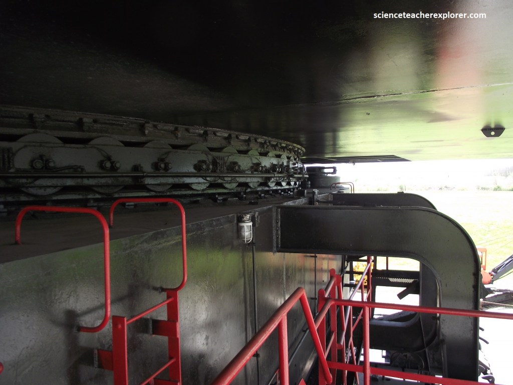
Pictured above, everything on up is supported by the roller circle. The circle is 45 feet in diameter. This allowed the house to rotate 360 degrees. Then there are the Swing Gears. Three Gear Boxes of this type were used to swing the house. Each was driven by a 750 H.P. direct current electric motor
Pictured above, the crawlers propelled Brutus along the “pit” floor at a maximum speed of .35 Km/hr.. They each weigh 2,008 pounds or 913 kg. The groundman was one of three men that made up the operating crew of Big Brutus. His job was to move the shovel by operating the crawlers. He was instructed by the Operator, to move forward or backward, etc. He also had to insure that the ground around the machine was level & clear of obstructions. He was notified by phone or by a horn signal, when it was necessary to the machine.
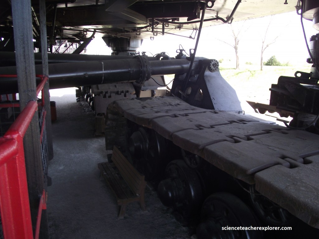
Imaged above shows the workings of Big Brutus and the Crowd & Stick . The function of the crowd gears was to operated the “Stick” that is attached to the Bucket. It was operated by two 500 H.P. Direct Current electric motors. The Operator was responsible for operating the Crowd. Note that the cable reel that the power cable was stored on. The cable was connected to an external power source (7200V A.C.).
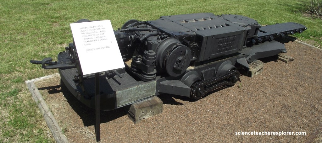
Other Coal Mining items on display was this Short-wall Saw . It was used to undercut the coal seam. Then they drilled and set charges so the coal seam would collapse and was ready for removal. The saw was used in the Kruger Mine at Cherokee, Kansas, twelve miles southwest of Pittsburg, Kansas.
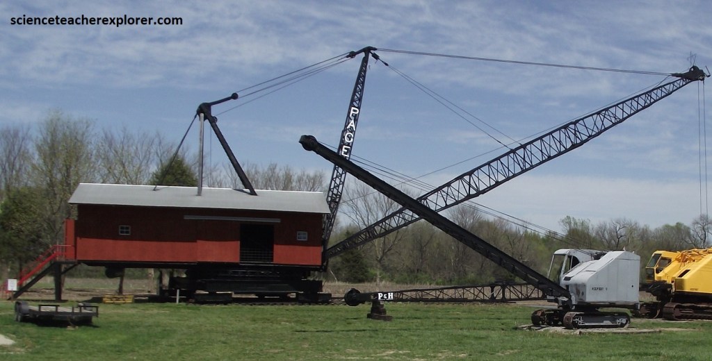
Pictured above, the Dragline Model 222 has a hundred foot boom and it was made in Chicago by Page Engineering Company.
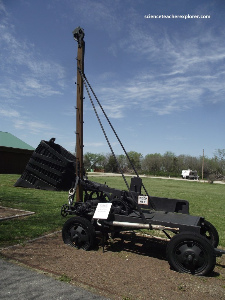
Pictured above, is a Churn Drill that was used to determine if there was coal below and how deep it was or how thick the seam was. It didn’t drill it’s way down but pounded it’s way down through the ground.
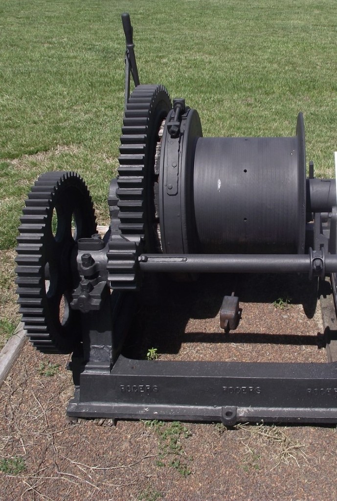
Pictured above, this winch is used in a Dinky Mine for lifting coal and the men up and out of the shaft. It came from the Kruger Mine at Cherokee, Kansas.
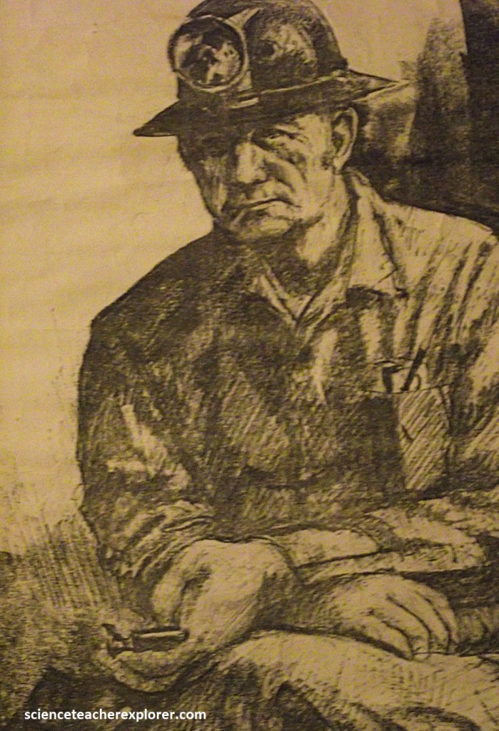
It was a dangerous and difficult existence living in mining camps and digging coal on their hands and knees ten to twelve hours a day. Many were killed. Many more were maimed or died later of Black Lung Disease. Because coal was dug only part of the year, numerous miners established businesses and farms to provide for their families when mines were idle. The Weir-Pittsburg Coalfield would eventually be home to more than 100 coal camps. At one time this region produced a third of the nation’s Bituminous Coal and smelted lead and Zinc ore in such quantities that the Cherokee Lowlands became an industrial giant. the mix of nationalities in these camps created an ethnic geography unique to Kansas that came to be known as “The Little Balkans”. The miners not only dug coal but gave voice and leadership to the United Mine Workers union in its efforts to establish the 8 hr. work day, guarantee safe working conditions, secure equal pay for equal work, create child labor Laws, and implement minority and women’s rights.
