Chesapeake Bay
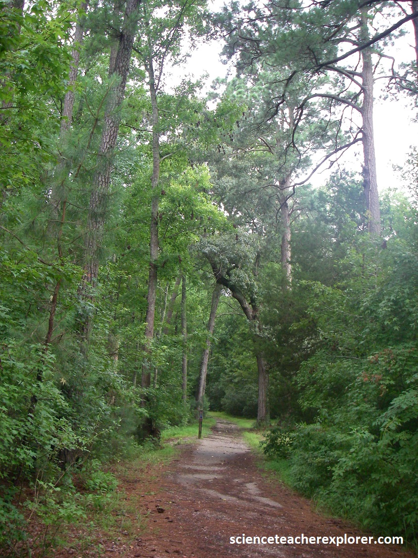
Over the years, I’ve explored areas around the Chesapeake Bay in Maryland and Virginia. The Chesapeake Bay is the largest estuary in the United States and one of the most diverse.
In 1994, I received a grant to explore the Chesapeake Bay from the United States Annapolis Navel-Academy in Maryland. It was part of the Maury Project on the Eastern Coast of the United States. The Maury Project was based on studies of the physical foundations of oceanography and was directed towards improving teacher effectiveness in generating interest and understanding in science, technology, and mathematics among pre-college students. [The project was named after Matthew Fontaine Maury (1806-1873), considered by many as the father of oceanography]. {Below are photos of me teaching Oceanography Teacher-Workshops for teachers with my student-assistants in the Maury Project}.
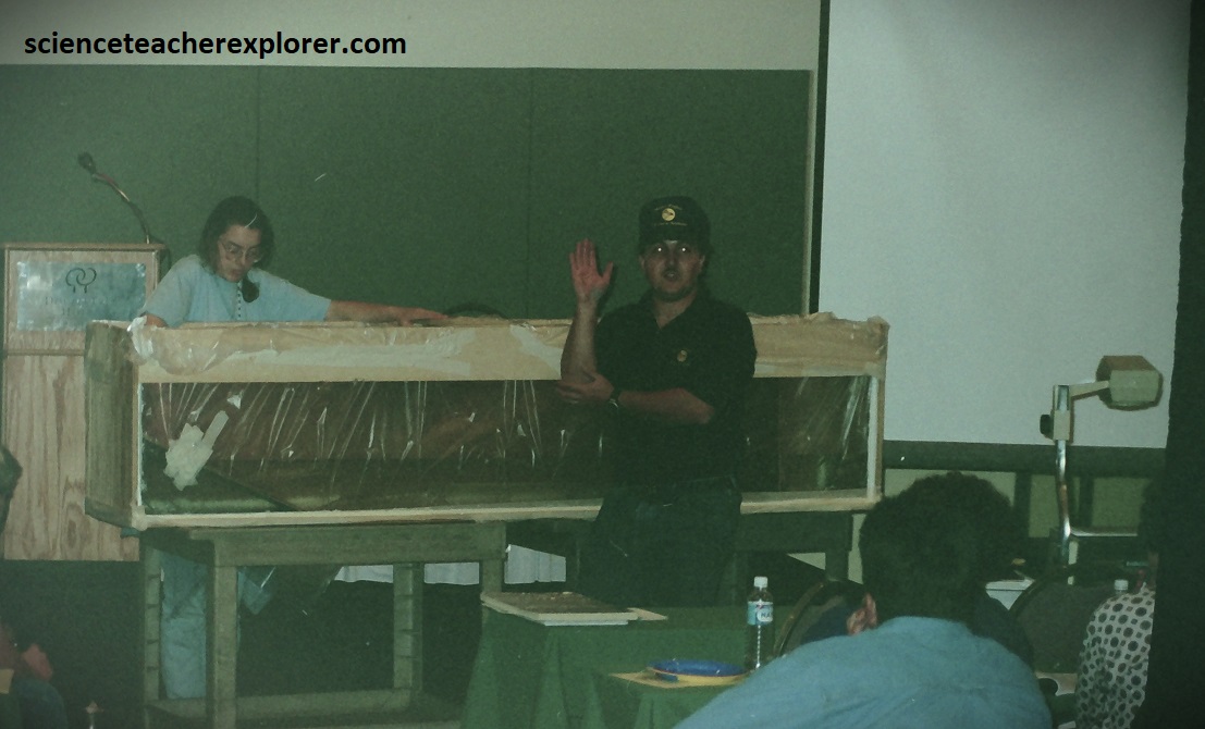
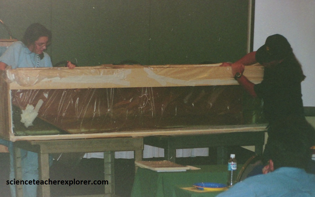
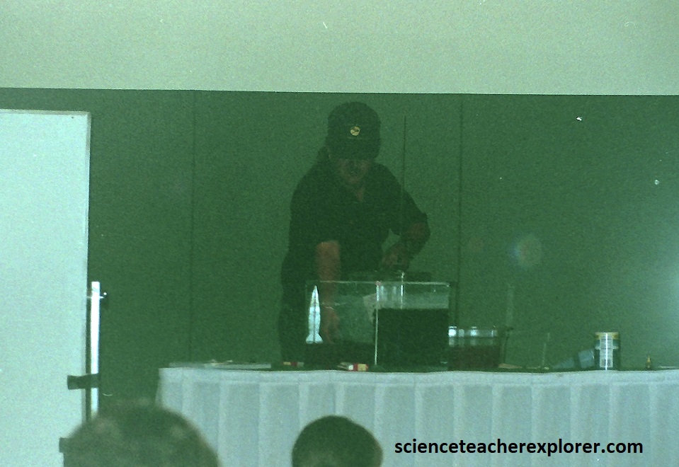
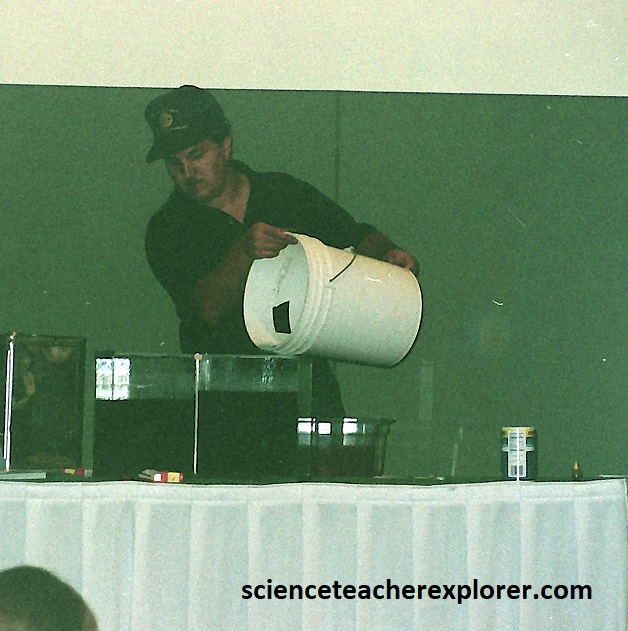
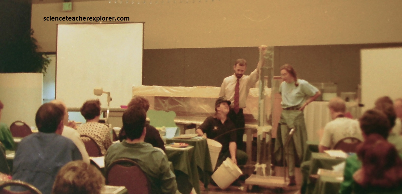
Pictured above, the major components of the Maury Project included the identification and training of a cadre of master oceanographic education resource teachers who would assist the American Meteorological Society (AMS) in training other precollege teachers on oceanographic topics, and (b) the development and implementation of scientifically accurate and pedagogically sound instructional resource materials for teachers. {Note the demonstrations my home-made wave-machine, ocean-currents apparatus & large water pressure tube w/ holes drilled in the side}.
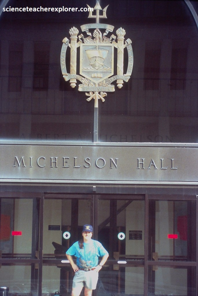
While at the Naval Academy, I took the opportunity to visit Michelson Hall. The markers on the plaza paving, in front of Michelson Hall, followed the line of sight for the optical experiments measuring the speed of light carried out by ensign Albert A. Mickelson, USN, between 1877 and 1879 while serving as instructor of physics at the U.S. Naval Academy. This distinguished graduate of the Naval Academy was the first American Scientist to be awarded the Nobel Prize. {Historical images below were taken from a display at the U.S. Naval Academy in Annapolis}
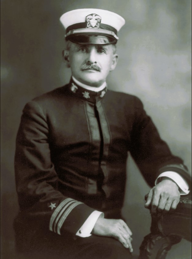
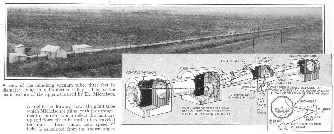
It was the speed of light calculation that made Michelson world-famous, and he conducted it while working at USNA from 1877-1879 and eventually moved it to California. The first measurement was 200 times more accurate than existing measurements. He determined the velocity of light to be 186,325 miles per second, which held true as the standard until Michelson recalculated it before his death in 1931 at 11 miles per second less than the value we use today (186,287 miles per second). Imaged above, Michelson’s speed of light apparatus used a rotating octagonal-mirror and a long path for light to measure the speed of light by timing it’s travel.
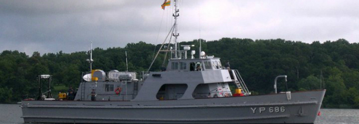
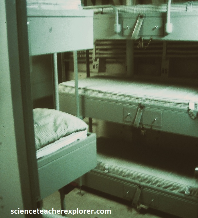
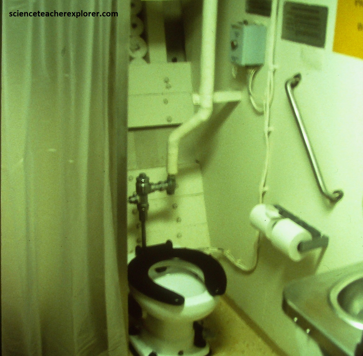
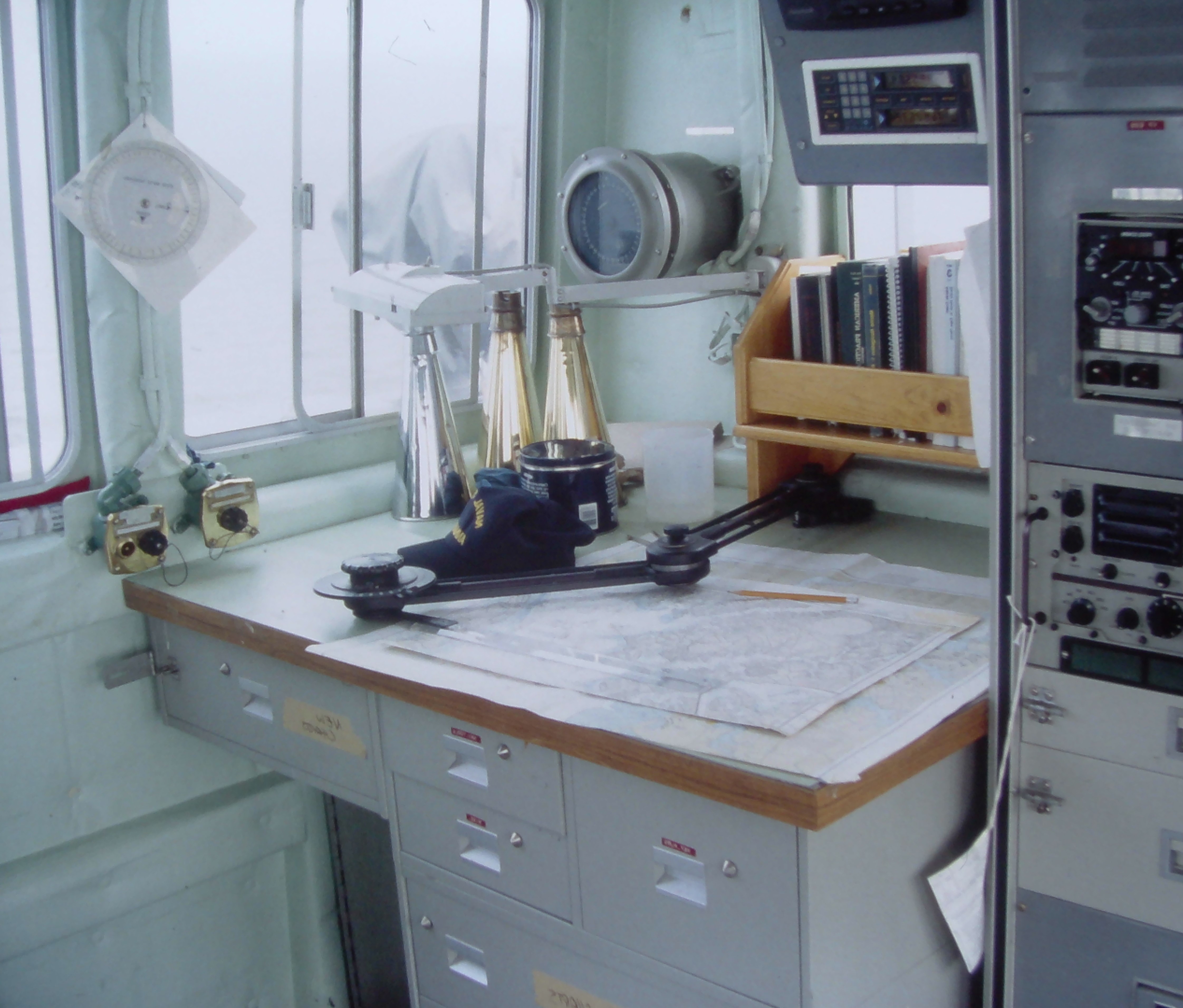
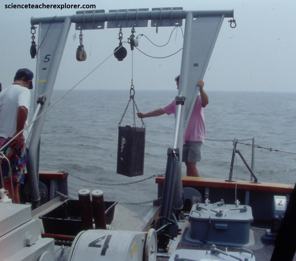
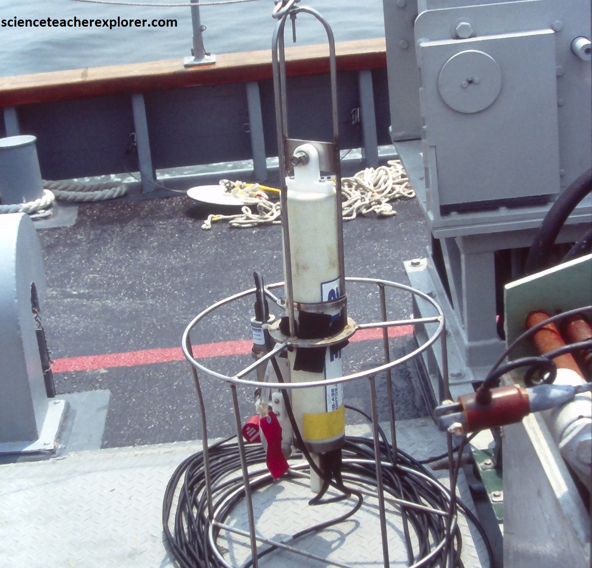
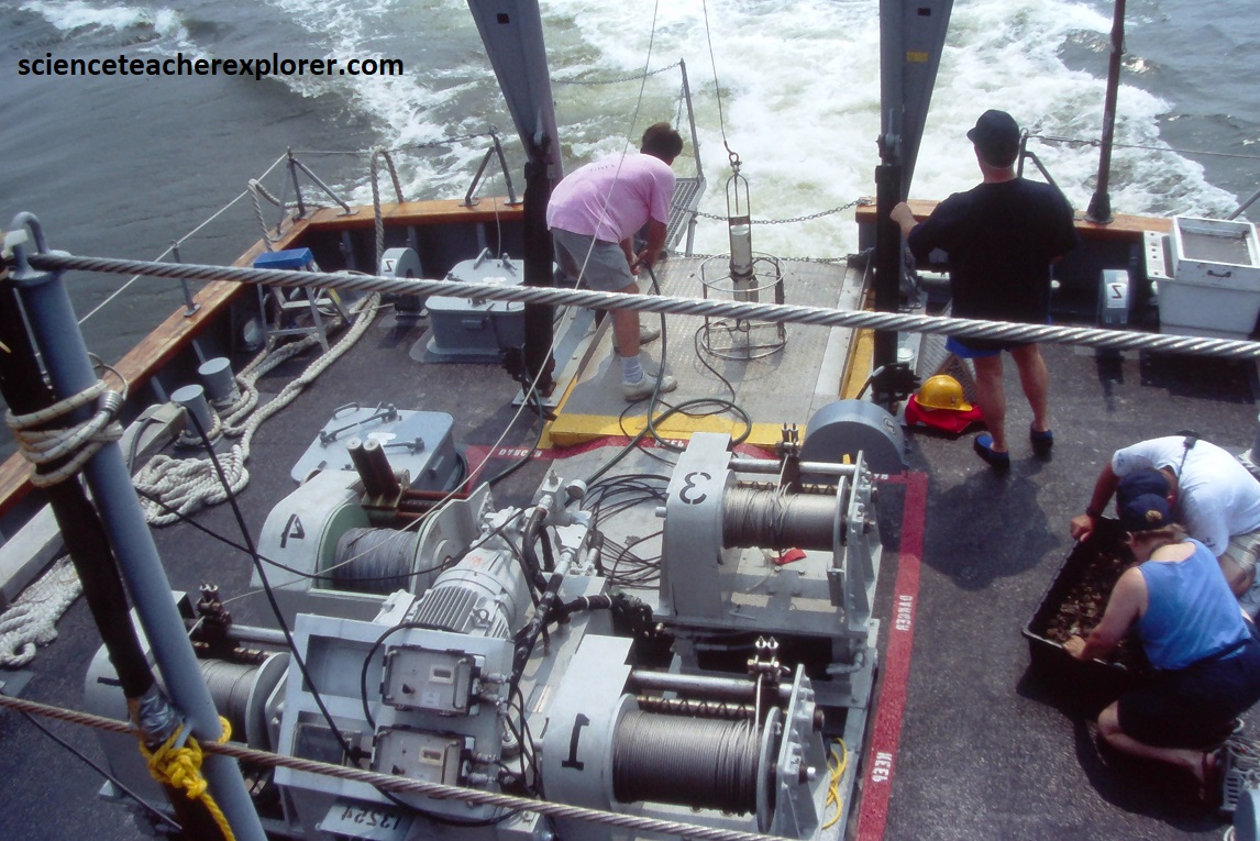
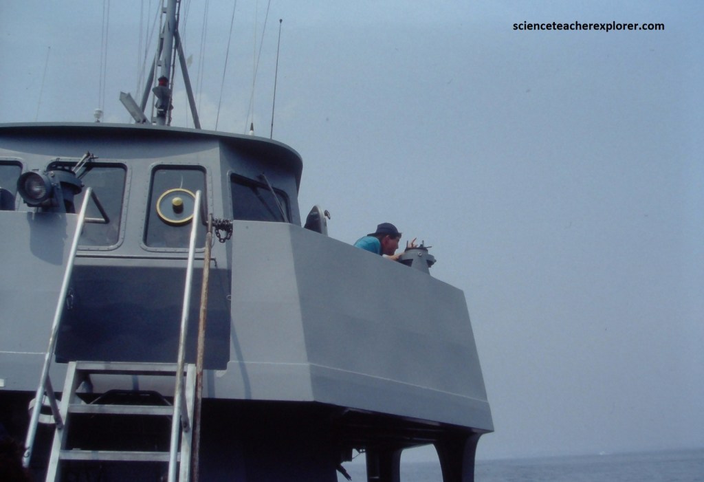
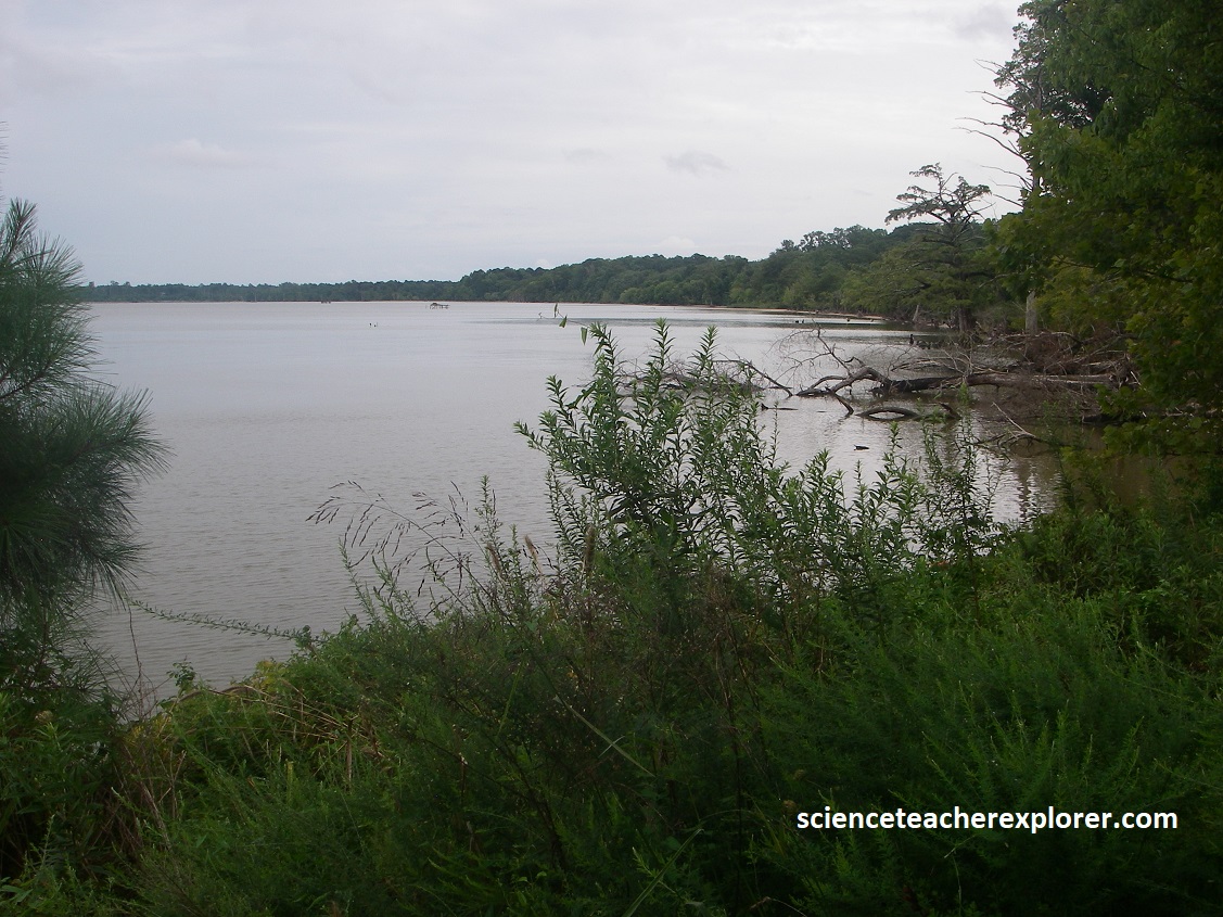
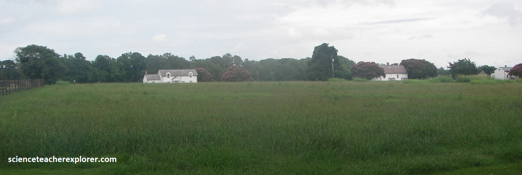
While at the Naval Academy, I had the opportunity to spend a few days Chesapeake Bay, taking data from the YP686 . YP686 was one of the Naval Academy’s Yard Patrol Crafts that had been outfitted specifically for oceanographic research. The vessel carried four oceanographic winches, a hydraulic A-frame, three j-bar davits, as well as a lab and a suite of oceanographic and meteorological instruments. Additionally, the YP686 contained a Captain’s Bridge, Navigational Doghouse, sleeping quarters and a toilet w/shower, (pictured below). {The photos below are a Depth map & navigation chart of Chesapeake Bay, just southeast of Annapolis, Maryland in 1994, (from the navigation dog-house) and a sonar transceiver/receiver.
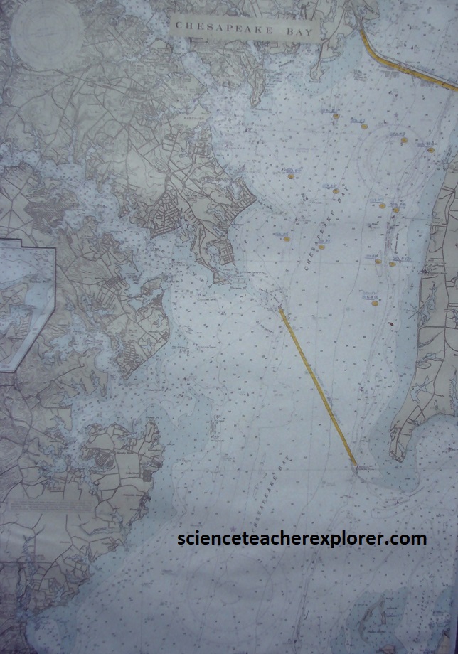
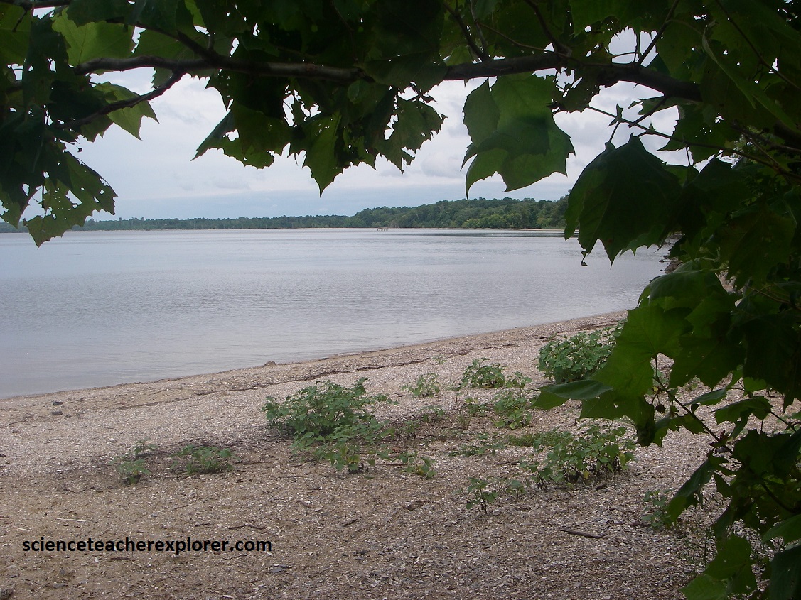
The Chesapeake Bay is about 320km long and about 4.5km wide at its narrowest point to 48km wide at its widest point. The Chesapeake Bay is quite shallow and has an average depth of 6.4m. However, we found that the bay reaches a maximum depth of 53m at its deepest point, just southeast of Annapolis, Maryland.

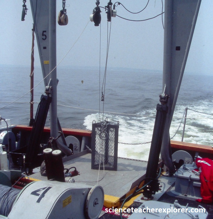
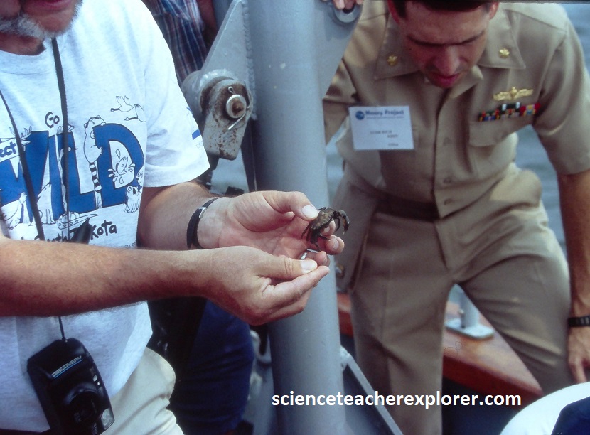
Our first study was to drop a Benthic Cage from the back of the YP686 to study the life at the bottom of the Chesapeake Bay, (pictured below). There are two groups of benthic organisms based on their habitat: epifauna and infauna. Epifauna live attached to a surface, and infauna live within bottom sediments. This cage was designed to gather the Epifauna, (pictured below from the winch). The Epifauna we collected included American Oysters, Black-Fingered Mud-Crabs (Panopeus herbstii), sea squirts, and Ivory Barnacles (Balanus eburneus).
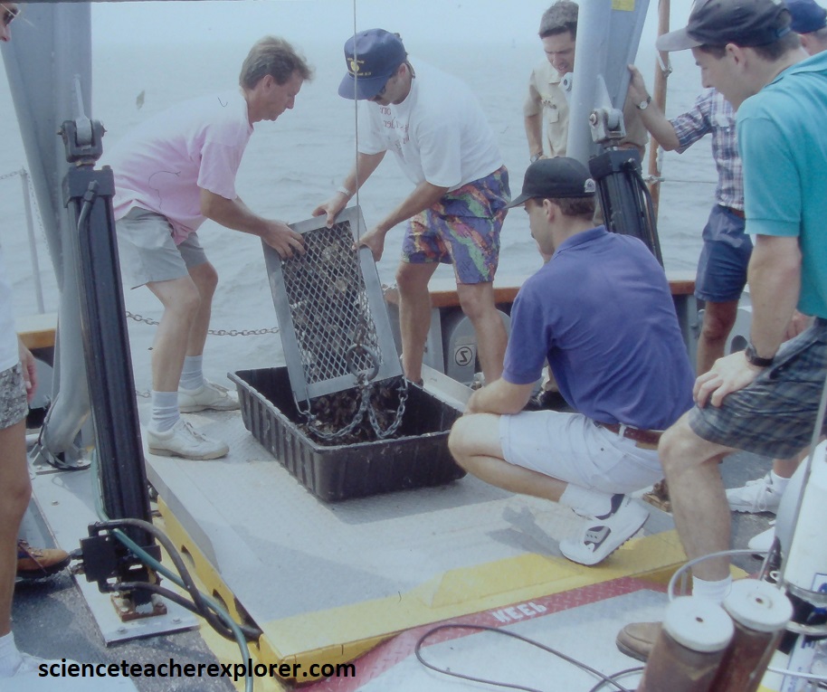
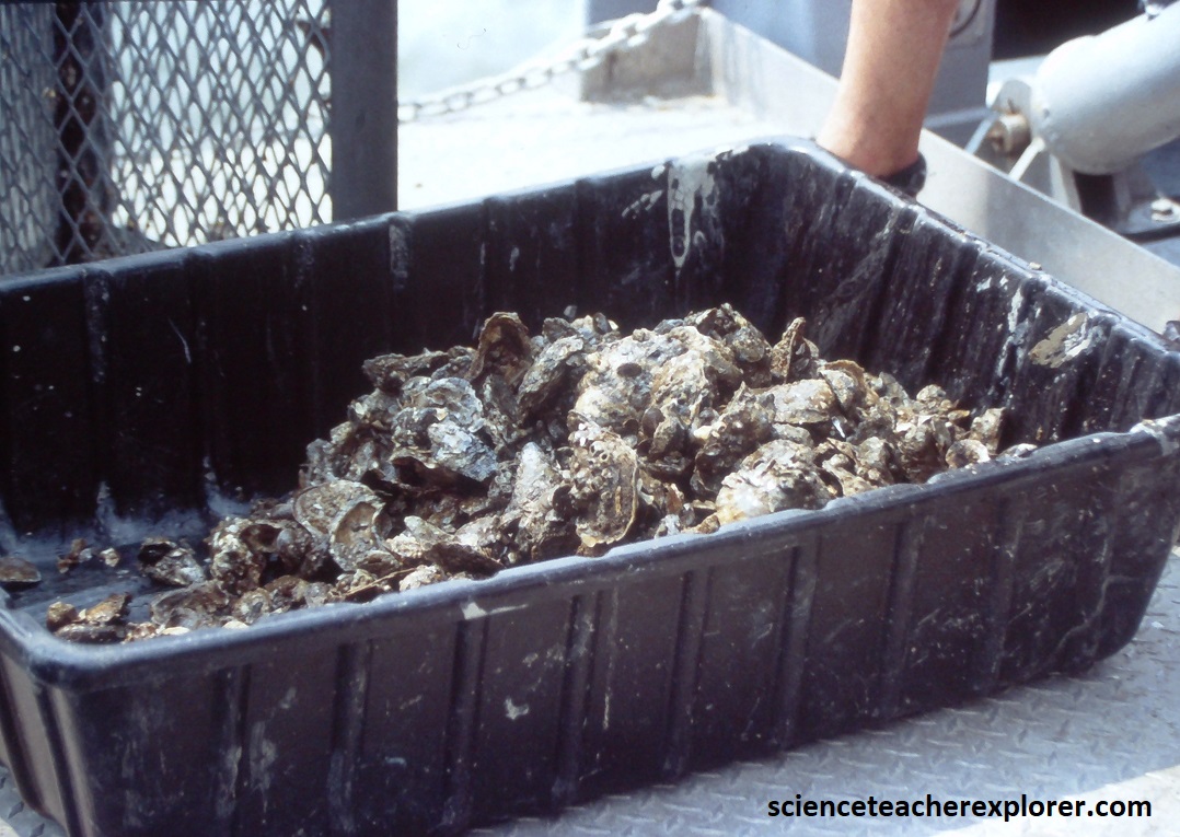
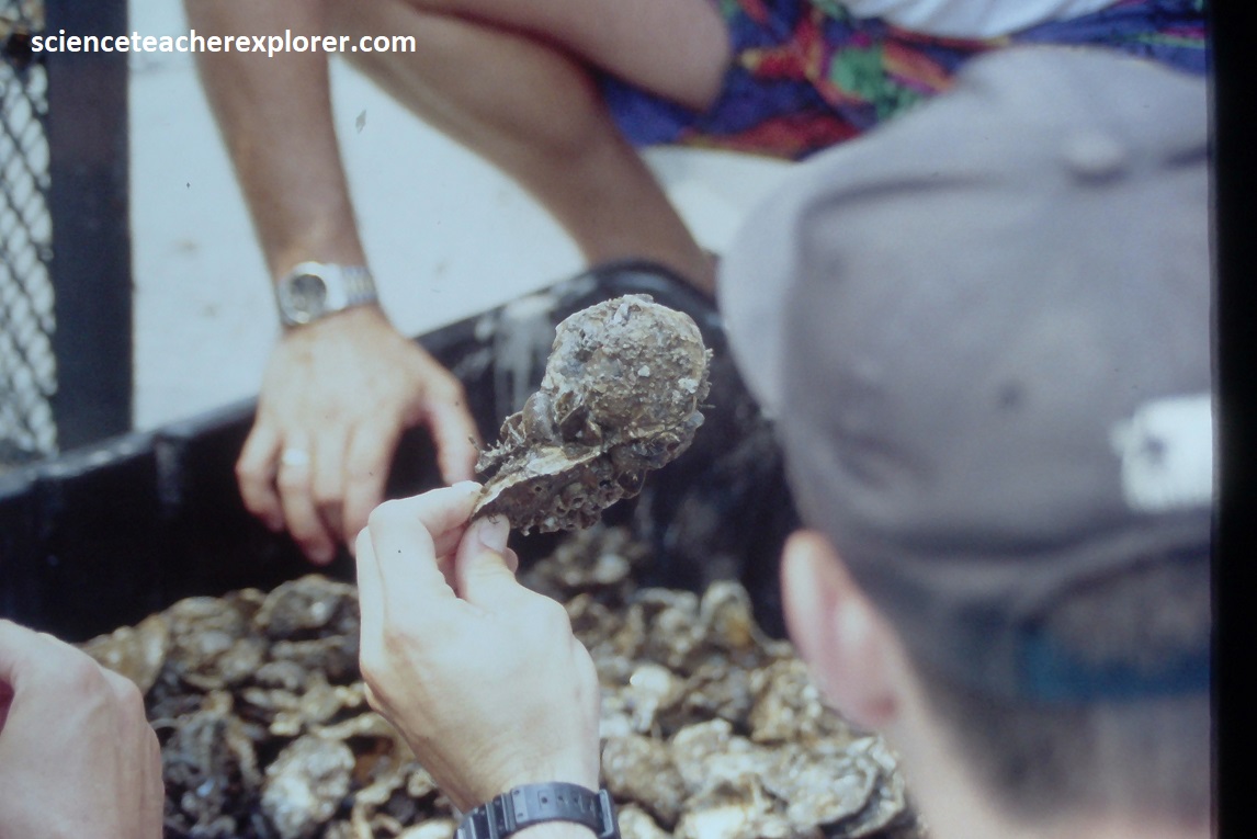
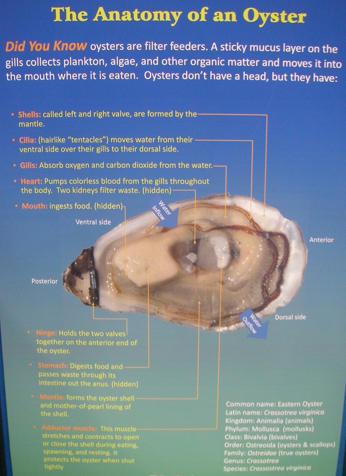
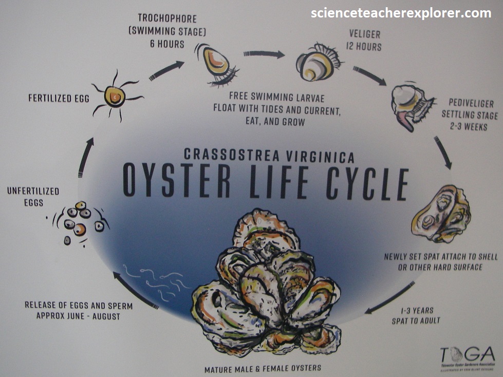
We gathered up a great number of American Oysters, (images below were taken from the interpretive signs on-site).
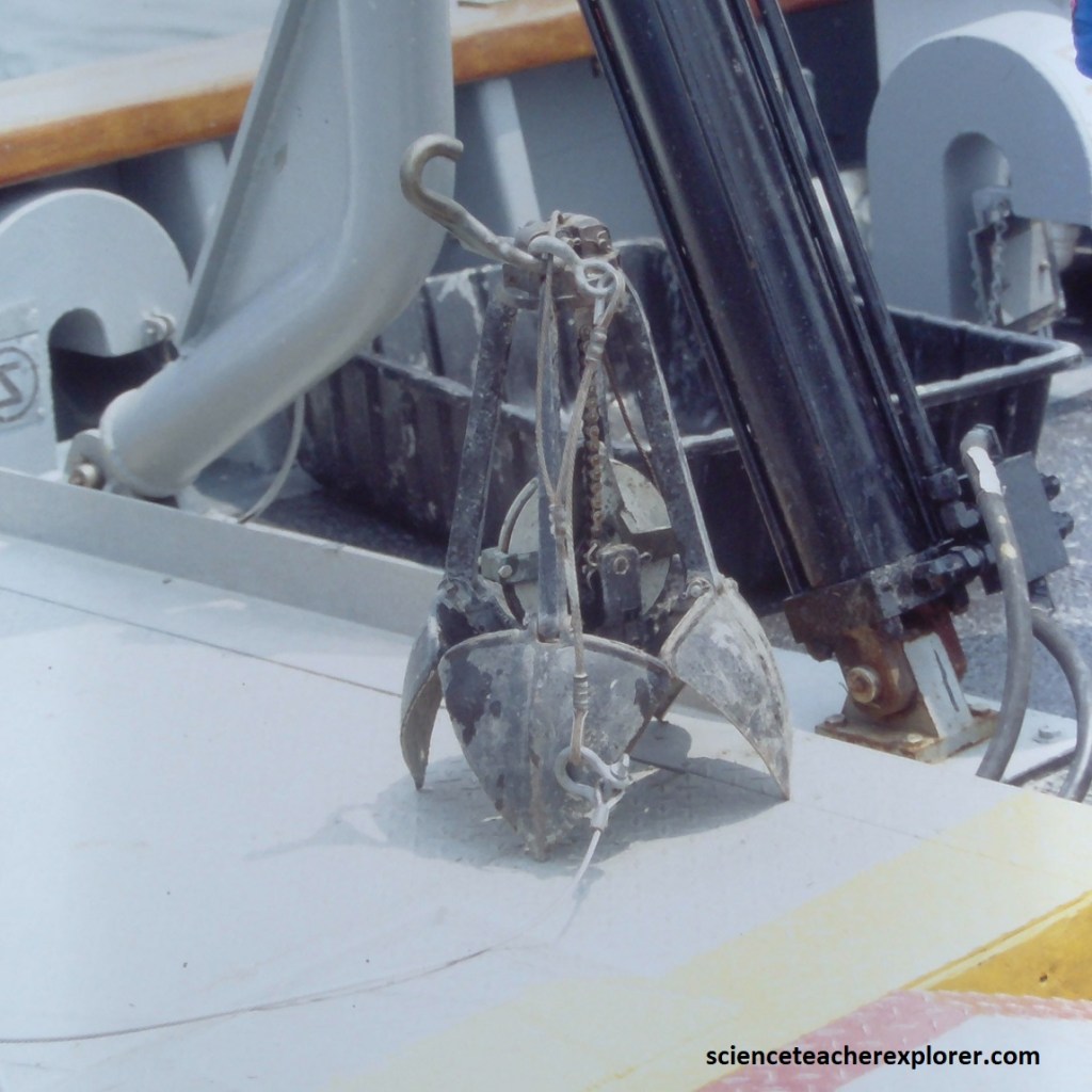
Sampling of infauna, we used a Sediment Grab Sampler seen below. Worms, clams, and other infauna formed their own communities that were connected to the water by tubes and tunnels.
We found that 38 percent of the tidal Bay’s bottom habitat was marginal, degraded or severely degraded, (home to more pollution-tolerant species, fewer species overall, fewer large organisms deep in the sediment and a lower total mass of organisms), almost two-thirds of this habitat was home to a healthy community of benthic organisms. Since then, much of the Benthic community of the Chesapeake Bay has been restored.
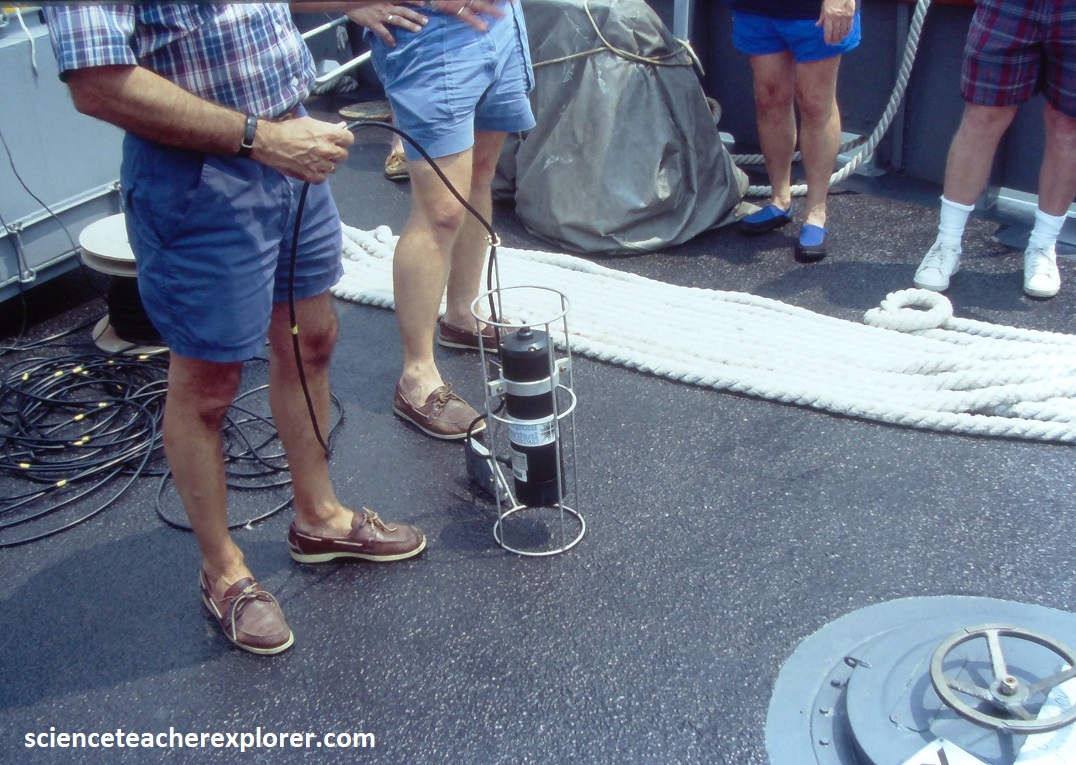
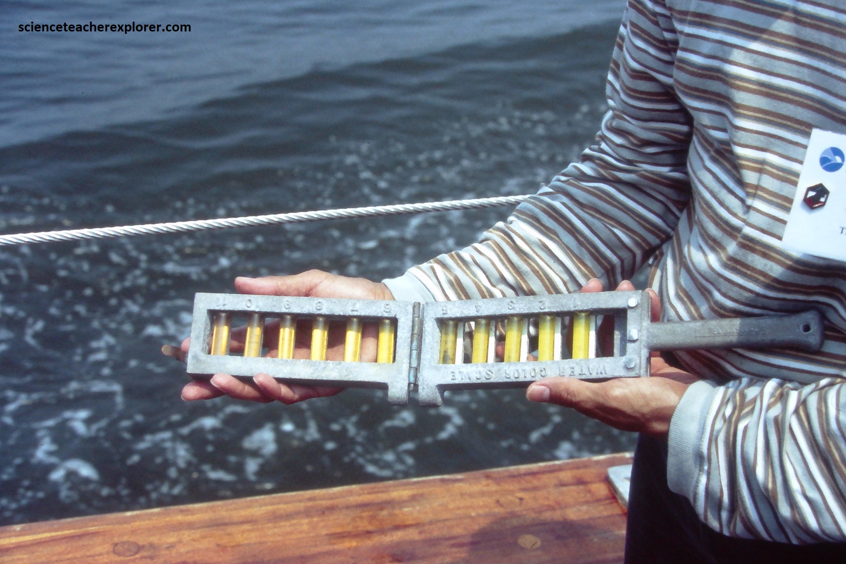
Pictured above, a CTD device is deployed from the aft of the boat. This CTD device’s primary function was to detect how the conductivity and temperature of the water column changes relative to depth. Conductivity is a measure of how well a solution conducts electricity and it is directly related to salinity of the water in the Chesapeake Bay. In general, the lower Chesapeake Bay was salty and the upper Bay was relatively fresh. Salinity gradually decreased as we moved north, farther away from the ocean, and increased as we moved south. The Salinity averaged 25 to 30 ppt at the mouth of the Bay & less than 0.5 ppt at the head of the bay. As expected, the middle portion of the Bay and its tidal rivers were brackish. Additionally, salinity also increased with depth. Fresh water seemed to remain at the surface because it was less dense than salt water. Also, the water on the Bay’s eastern shore tended to be saltier than water on the western side, due to the rivers. However, the Coriolis Force, (a phenomenon caused by the earth’s rotation), pushed flowing water in the Northern Hemisphere to the right. So saltier water moving up the Bay veers toward the eastern shore.
During spring and summer, surface and shallow waters are warmer than deeper waters. This creates two distinct temperature layers that physically separate deeper waters from surface waters, (34-84 degree difference). These temperature layers have a major influence on dissolved oxygen levels. This zone of separation is called the pycnocline. These changes in water temperature influence where underwater grasses can grow and when fish and crabs feed, reproduce and migrate which determines the health of the Chesapeake Bay.
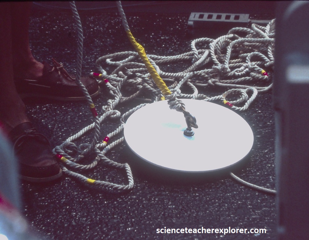
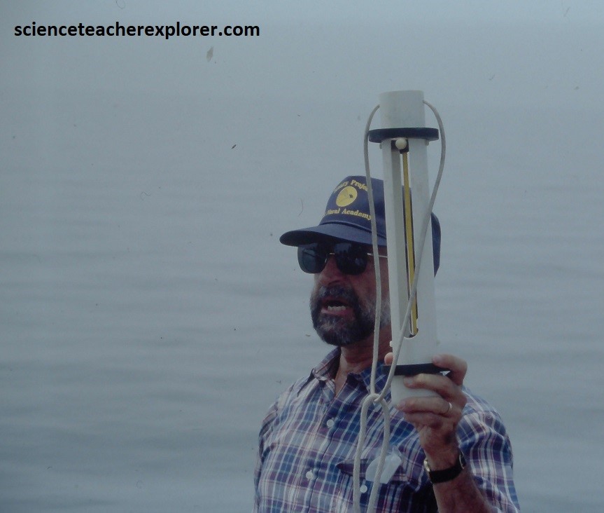
Water clarity is a measure of the amount of sunlight that can penetrate through the water. In general, clear water is an indicator of a healthy Chesapeake Bay. We used a device called a Secchi disc, (a simple white circle attached to a rope), to measure the water clarity. The Secchi disc was lowered into the water until it disappeared, then pulled up until it can just barely be seen. We marked the water line on the rope and measured the distance between the Secchi disc and the water line. The measurement is the water’s clarity: the depth that sunlight is able to penetrate through the water. When excess nutrients or sediments run into nearby waterways, they can fuel the growth of water-clouding algae & decreasing this measurement.
In 1984, scientists found evidence of a large impact crater buried beneath the lower part of the Chesapeake Bay and and its surrounding peninsulas. The first hint was an 8-inch-thick (20 cm) layer of ejecta found in a drilling core taken off 274 km to the north. The layer contained the fused glass beads called tektites and shocked quartz grains that are unmistakable signs of a bolide impact. In 1994, data from oil exploration revealed the extent of the crater. {The images below were taken from “Virginia Rocks! A Guide to Geologic Sites in the Old Dominion”, Dickas 2019}.
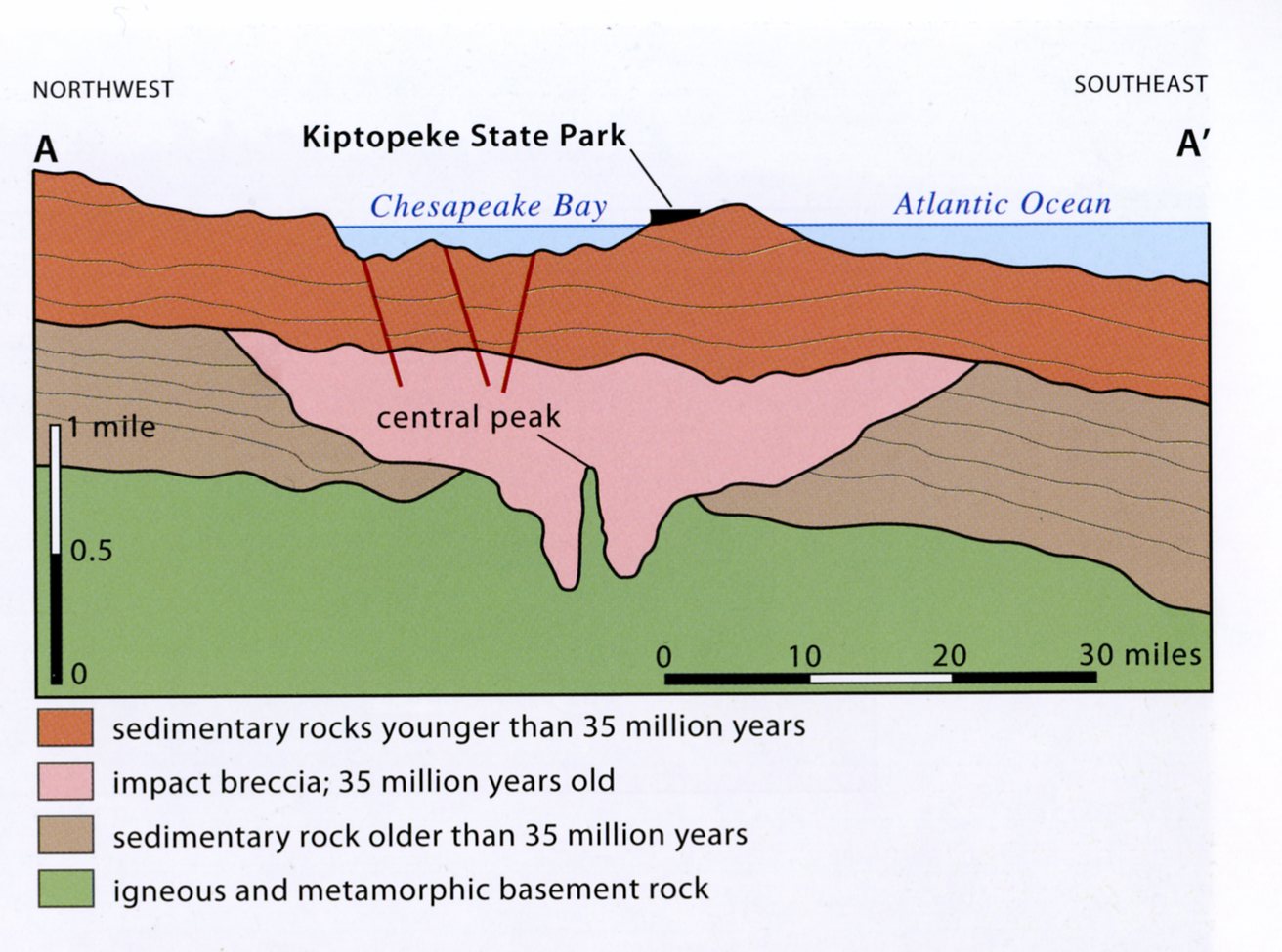
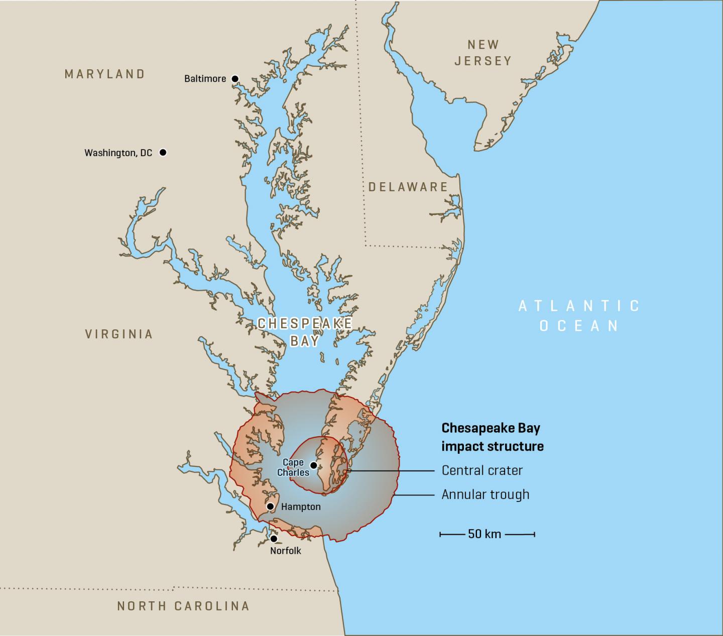
By 2019, the conclusion among scientists was that about 35 million years ago, a rare bolide, (comet or asteroid), hit the area the the present location of the Kiptopeke State Park, that is now the lower tip of the Delmarva Peninsula, near Cape Charles, Virginia. The bolide created what geologists now call the “Exmore Crater,” which they believe was as large 85 km in diameter and 1.3 km deep, (imaged above). The bolide made impact at a speed of approximately 17.8 km/s, punching a deep hole through the sediments and into the granite of the continental basement rock. The bolide itself was completely vaporized, fracturing the basement rock to depths of 8 km, and raising a peak ring around it. The deep crater, 38km across, is surrounded by a flat-floored terrace-like ring trough with an outer edge of collapsed blocks forming ring faults. Known also as the Chesapeake Bay Impact Crater, it is one of the largest impact craters known on Earth. This bolide did not create the Chesapeake Bay, but it helped determine that a bay would eventually be located there from erosion.
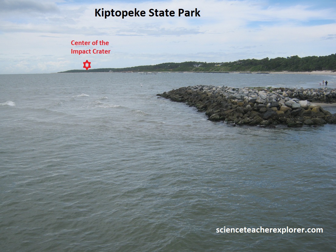
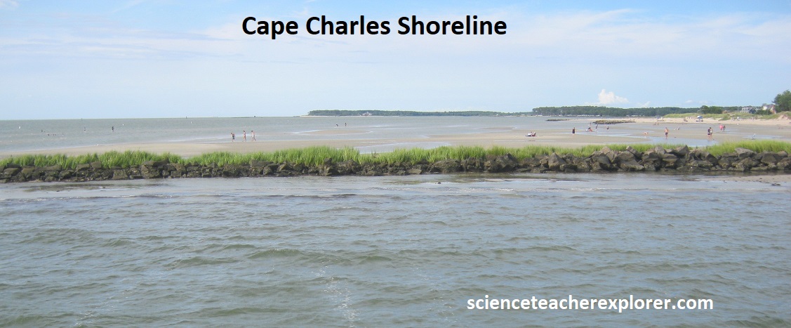
Pictured above, I visited Kiptopeke State Park and Cape Charles in 2024. Standing on these beaches, it was hard to believe that ground zero of this history-altering, Earth-shattering event occurred here. Although park property geographically lies well within the boundary of the impact zone, geologic evidence was buried at a depth of several thousand meters. Most of the local people in the area was absolutely clueless about living on a massive impact crater. I couldn’t even find an interpretive sign that mentioned it. Today such an occurrence would most certainly spell the end for millions of individuals, as well as the destruction of a significant portion of the infrastructure of the eastern seaboard.
At the full extent of the last glaciation, (68,000 yrs. ago), sea level was approximately 100m lower than at present, and as a result continental shelves were exposed throughout the world. At the end of the last glacial epoch, sea level rose relatively rapidly as continental glaciers melted. Approximately 18,000 years ago, the glaciers continued to melt, carving streams and rivers that flowed toward the coast, (James, York, Choptank, Nanticoke, Patapsco, Potomac, Rappahannock & Susquehanna). The sea level continued to rise, eventually submerging the area now known as the Ancient Susquehanna River Valley, the remaining Exmore Crater and it’s feeding river-mouths. This drowned river valley became the Chesapeake Bay and assumed its present shape about 3,000 years ago. Remnants of the ancient Susquehanna River still exist today as a few troughs that form a deep channel along much of the bottom of the Bay.
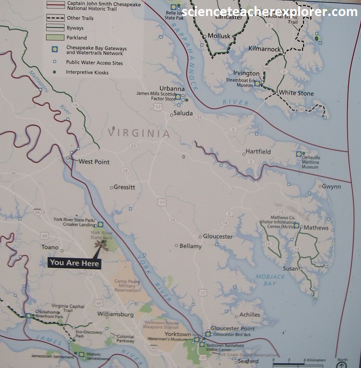
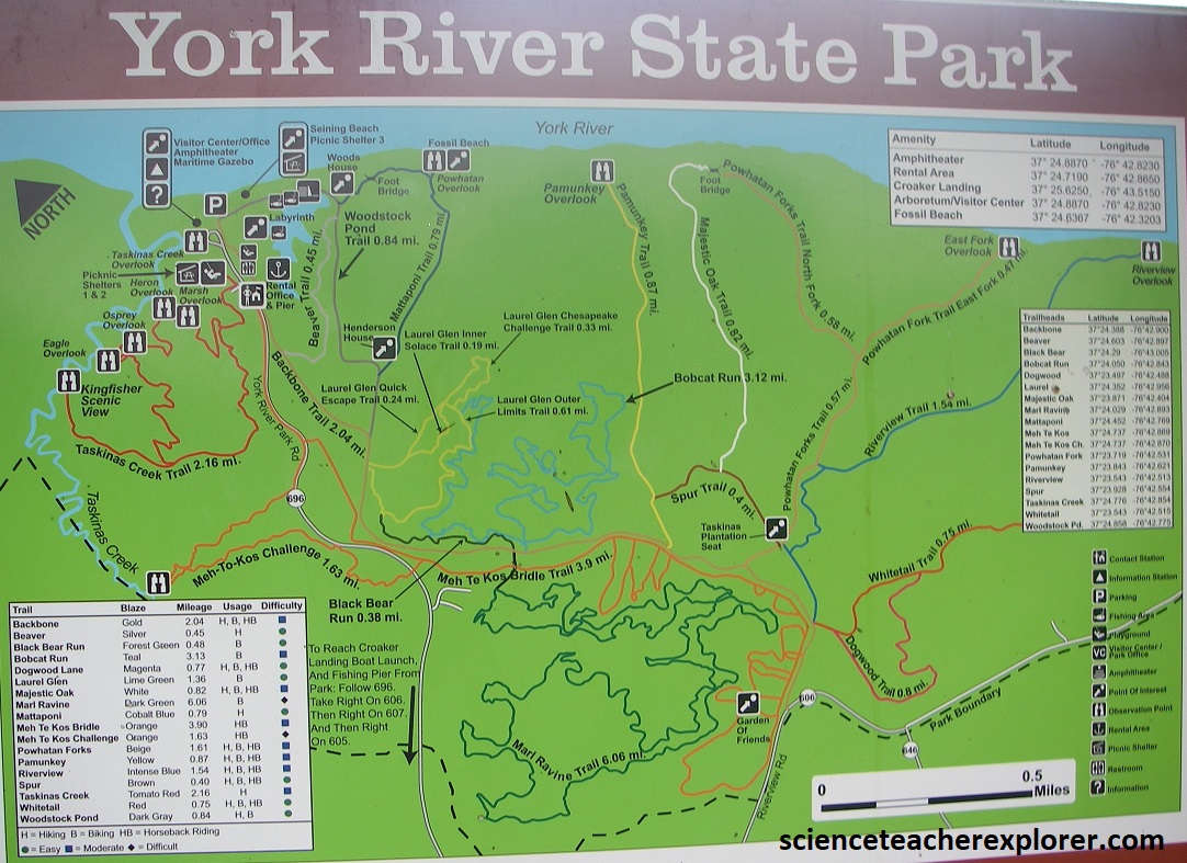
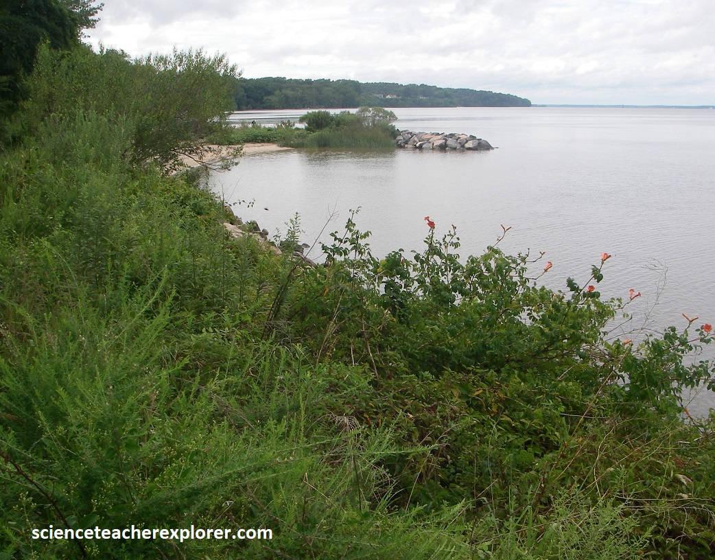
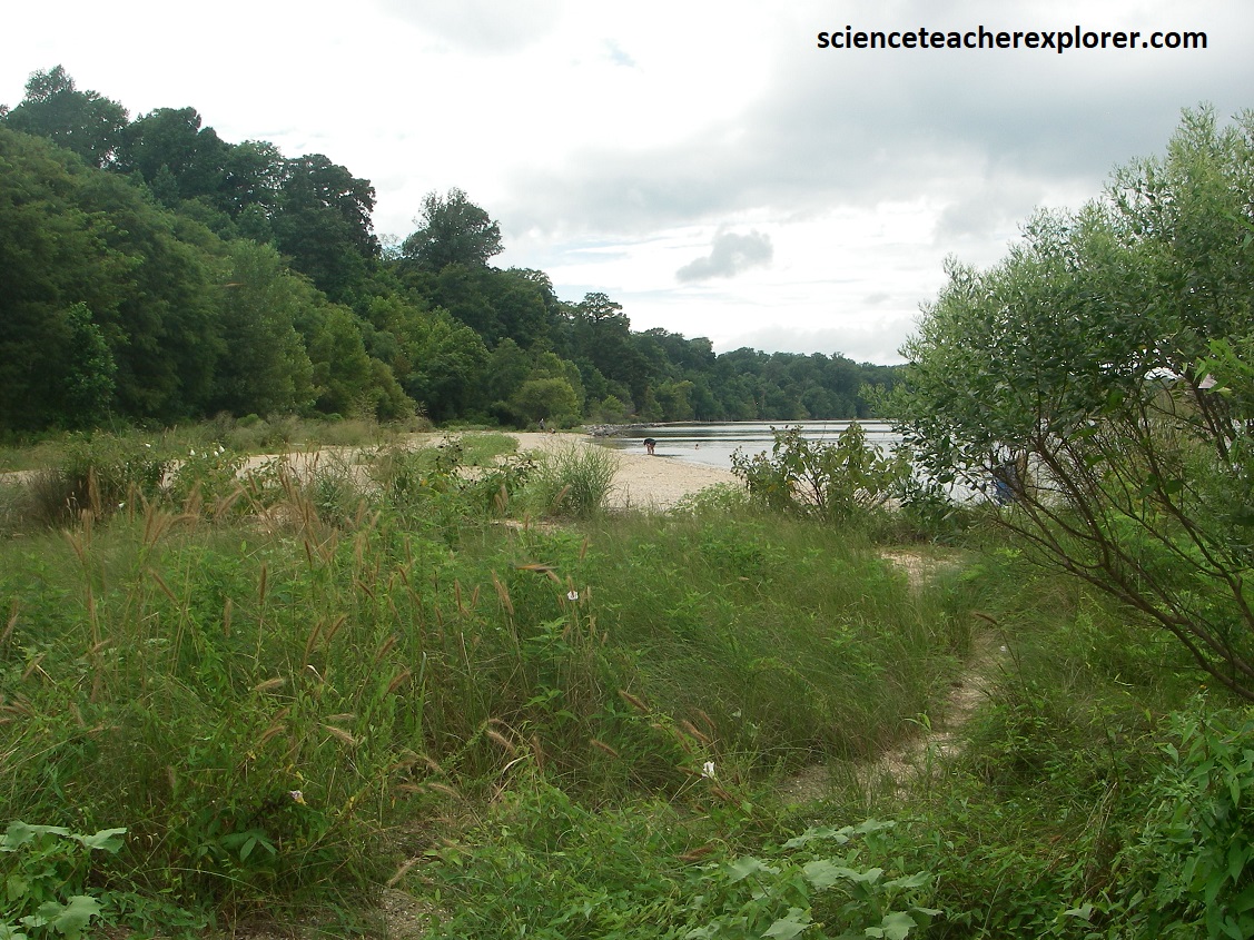
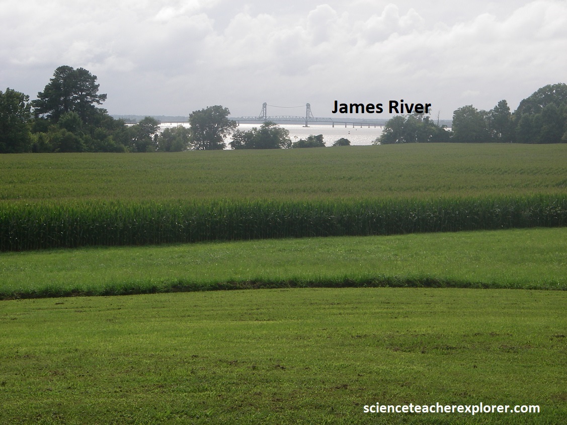
In 2024, Becky (my wife) and I, stayed at Williamsburg, Virginia for a week, to explore the Geo-sites on the York & James River Estuaries, feeding into the Chesapeake Bay. An estuary is a partially enclosed body of water where fresh water from the rivers mixes with salt water from the ocean. These Estuaries are areas of transition between the land and the sea. Imaged above are maps to our first stop, called the York River State Park, (they were taken from interpretive signs on-site). Our main goal was to explore the famous fossils found at the “Fossil Beach.
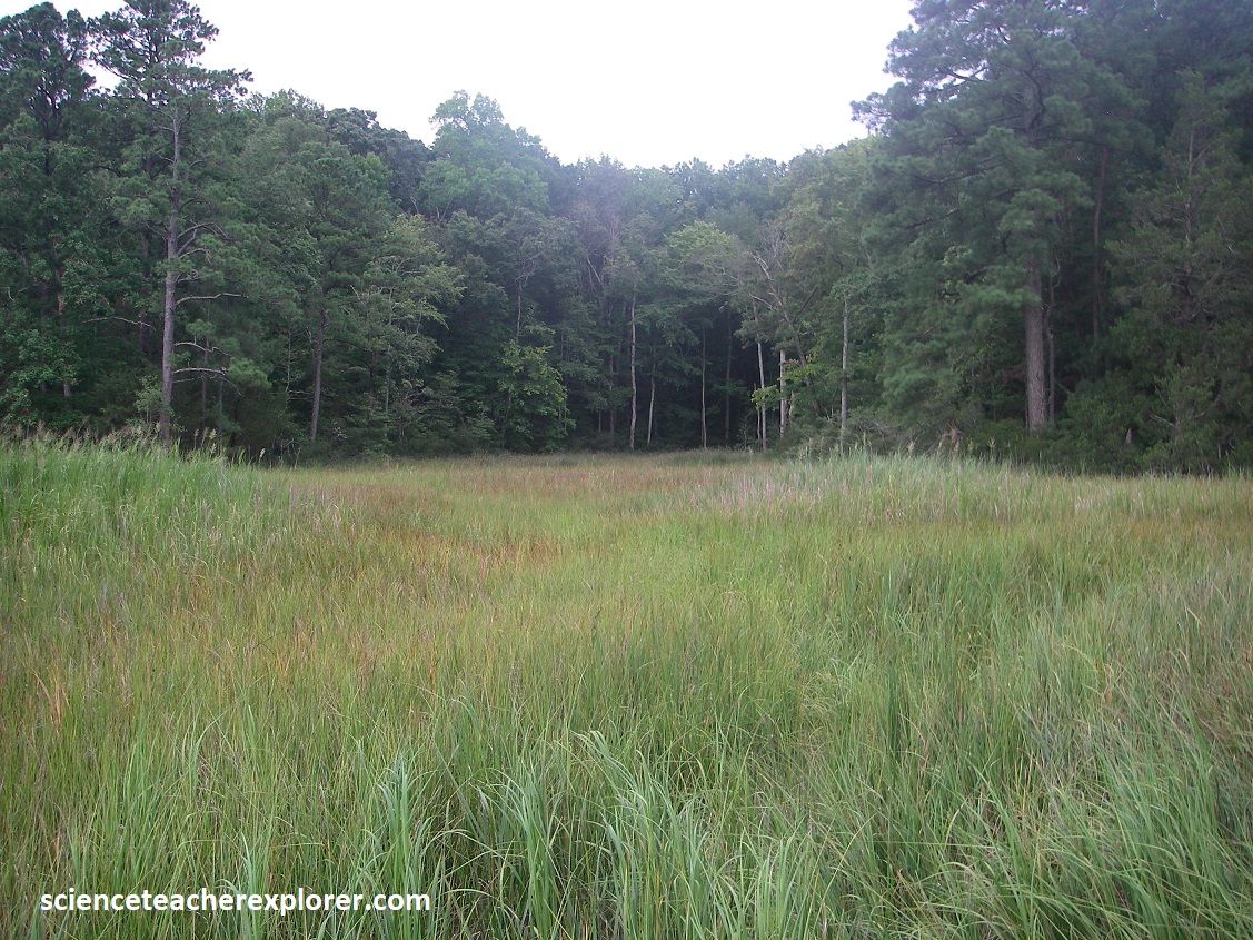
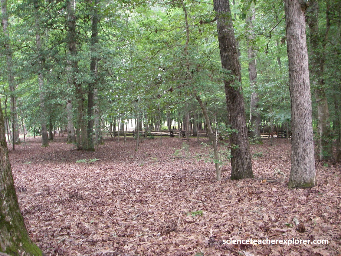
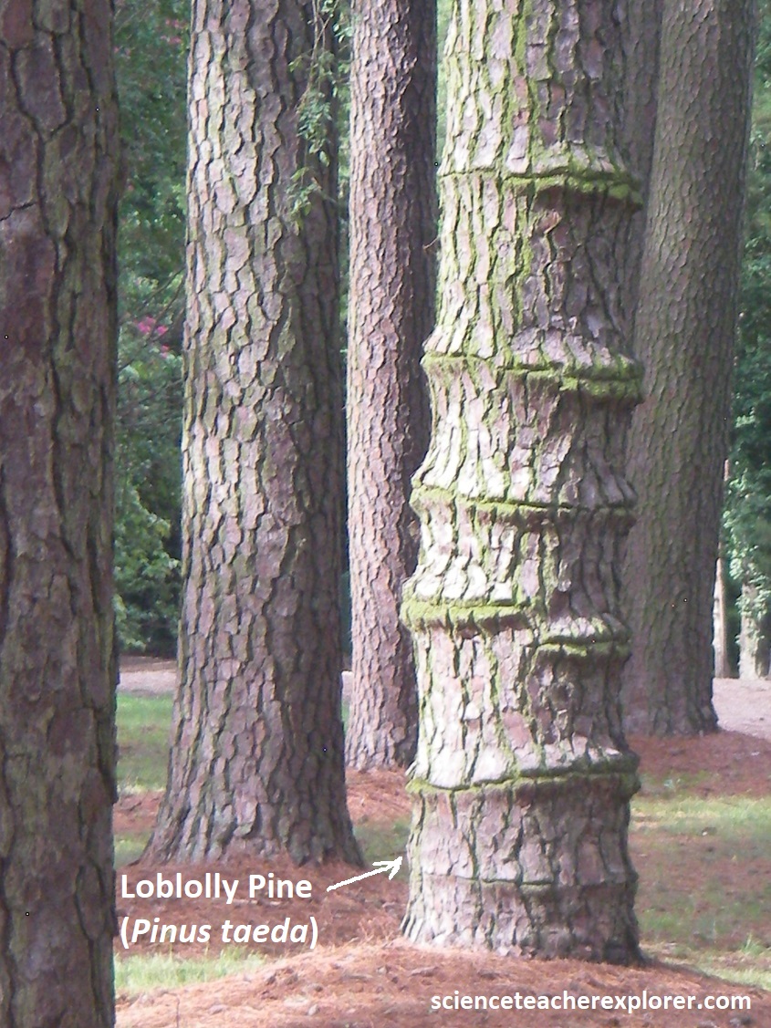
The York River State Park was located near the town of Croaker on the south bank of the York River about 16 km downstream from West Point. The name “Croaker” is believed to have derived from the abundant quantity of Atlantic croaker (Micropogonias undulatus), an inshore, bottom-dwelling fish found in the Chesapeake Bay at the mouth of the York River. More than 64 km of hiking on the equestrian trails allowed us to explore the marsh, river shoreline and forests. While we trekked around, we discovered the following Fauna: Muskrat, Gray Squirrel, White-tailed Deer, Gray Fox, Great Egret, Bald Eagle, Green Heron, Five-lined Skink, Eastern Snapping Turtle & the Northern Cardinal. We also identified the following flora: Mountain Laurel, Redbud, Shadbush, Dogwood, Loblolly Pines, Bald Cypress, White Oak, Black Walnut, Eastern Red Cedar, Virginia Pine, Mockernut Hickory and the American Beech.
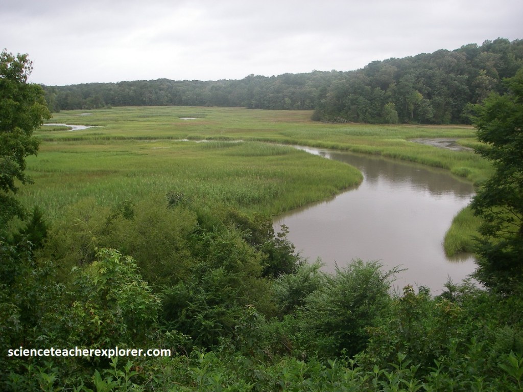
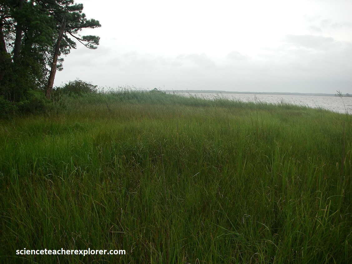
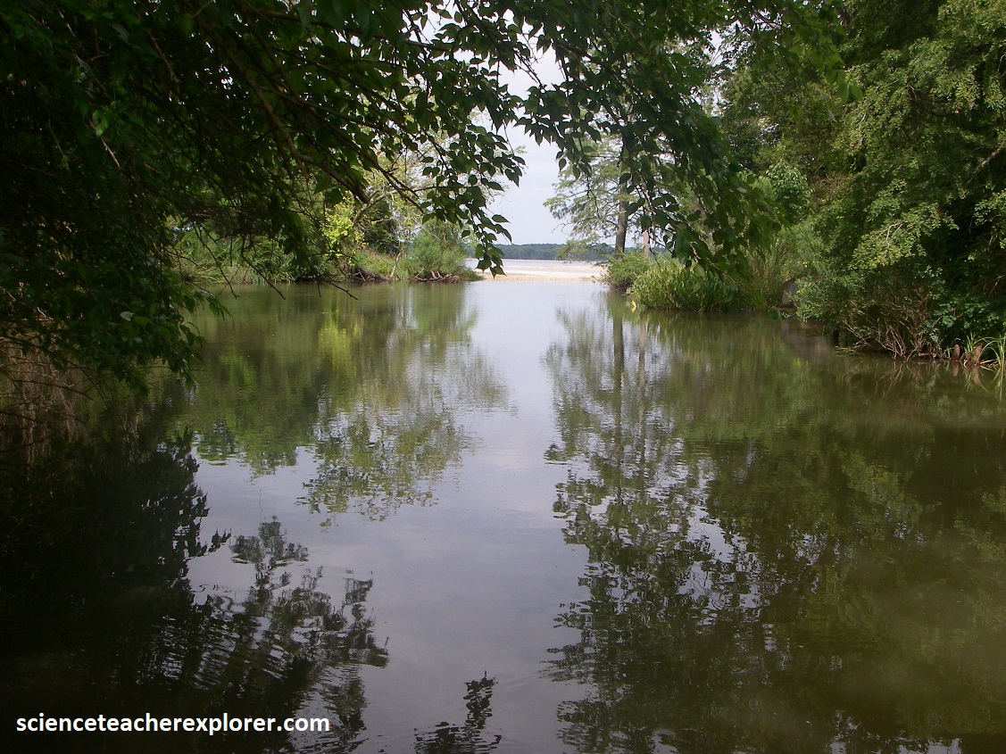
The Taskinas Creek component of the Reserve encompasses 980 acres of which 545 are located within the boundaries of York River Sate Park. The Taskinas Creek watershed is representative of an inner-coastal-plain rural water shed with the southern Chesapeake Bay system. The watershed is dominated by forested and agricultural land uses with an increasing residential land use component. The non-tidal portion of Taskinsas Creek contains feeder streams that drain oak-hickory forest, maple-gum-ash swamps and freshwater marshes. Freshwater mixed-wetlands are found in the upstream reaches of Taskinas Creek. {Picture below is Becky on the shores of the York River Estuarine in 2024}.
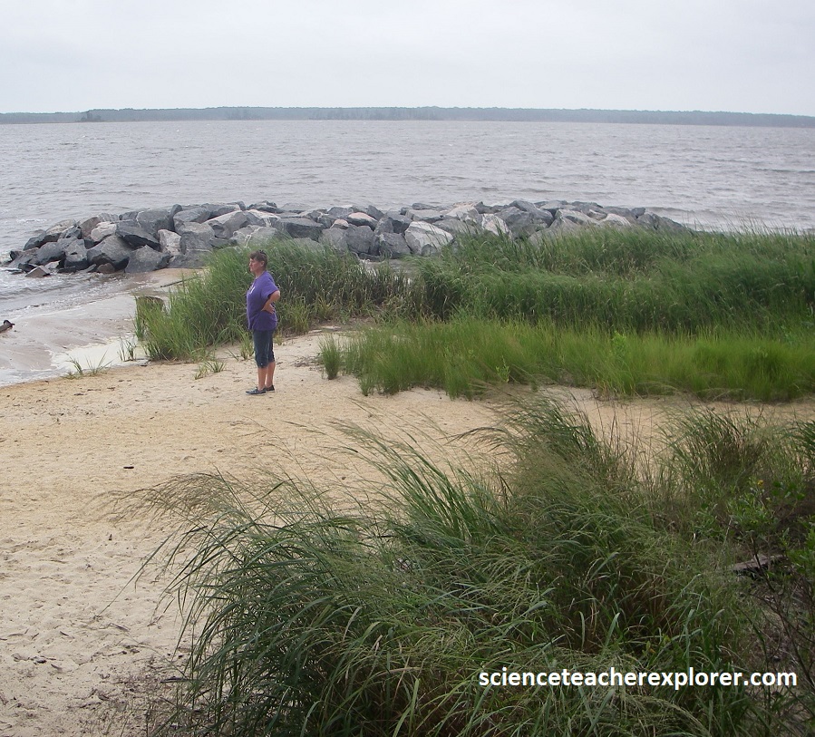
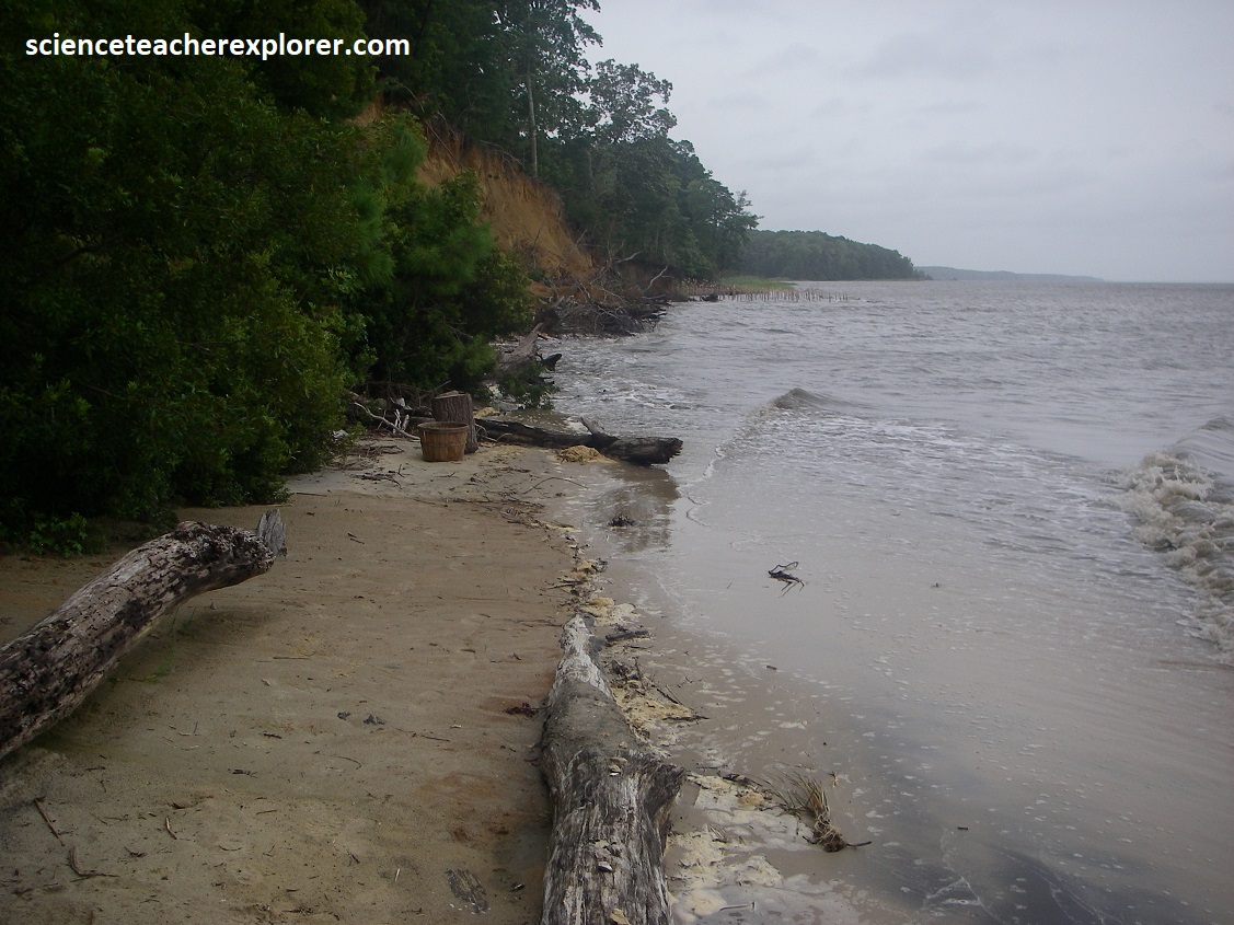
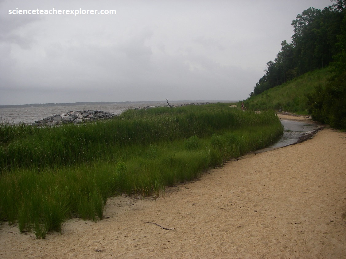
Image below, the Coastal Plain landscape, here at the York River State Park, is terraced toward the coast along a series of “steps and treads,” the “steps” interpreted as the sites of ancient shorelines, and the “treads” as bays and river bottoms that developed after ocean levels dropped. Distinctive in profile, this landscape formed over a multimillion-year period as sea level ebbed and rose n response to the repeated growth and melting of Pleistocene-age glaciers. Imaged below, resembling a wedge of semi-consolidated sediment in cross-section, the Coastal Plain is feather-thin inland and increase thickness offshore. The geology of this region can be presented simply as an undisturbed column of Cenozoic-age strata lacking any signs of mountain building.
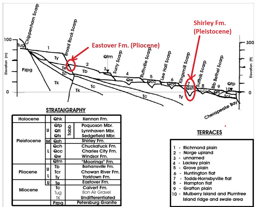
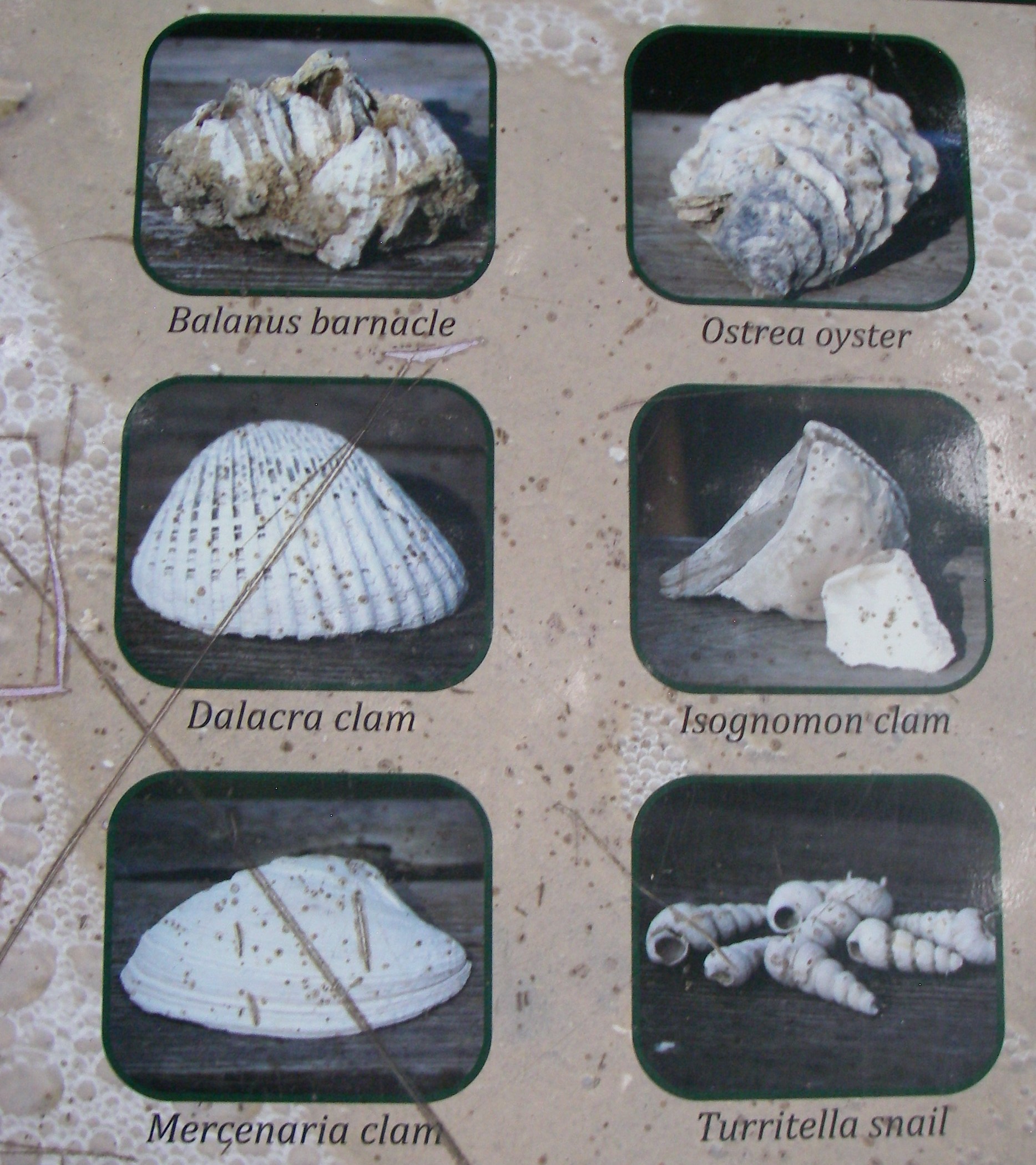
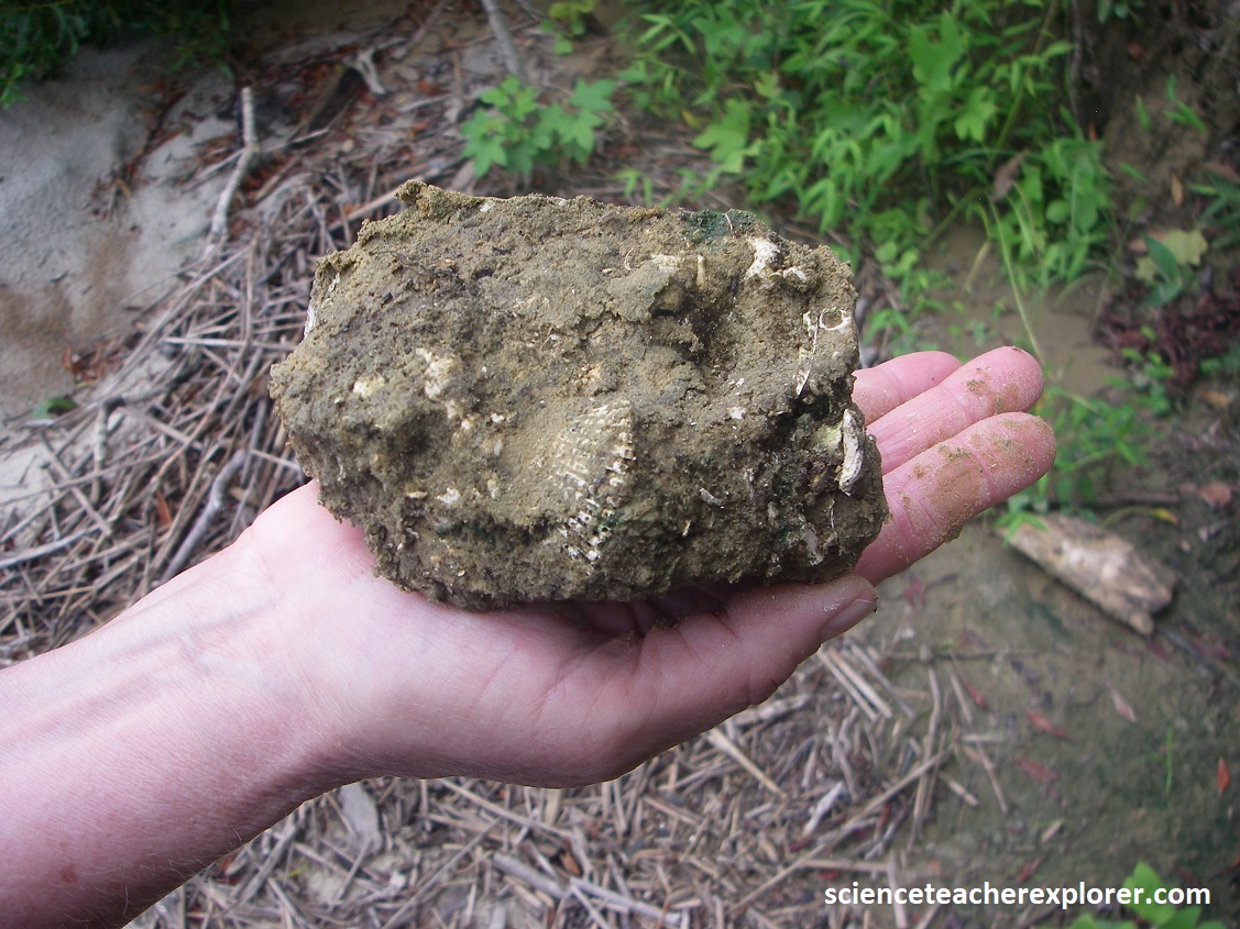
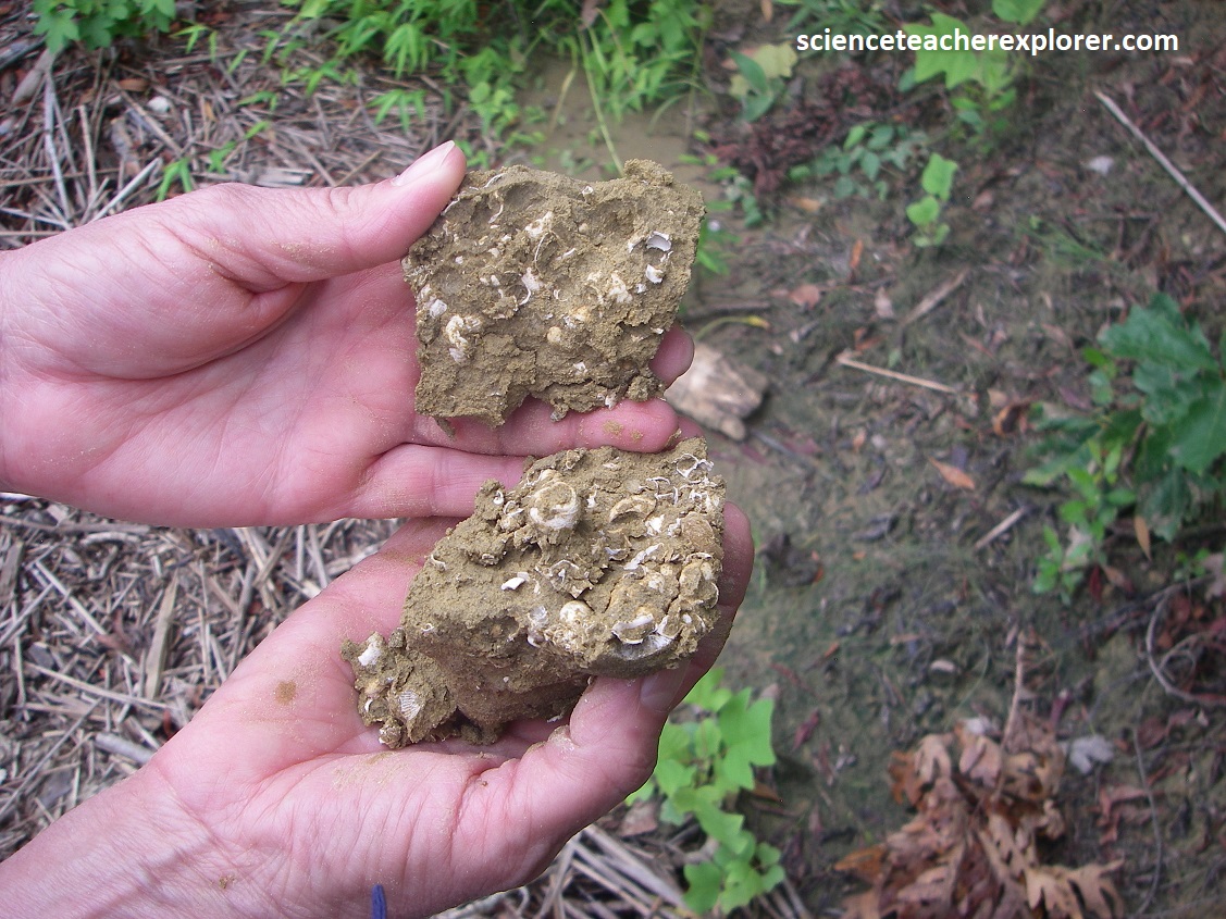
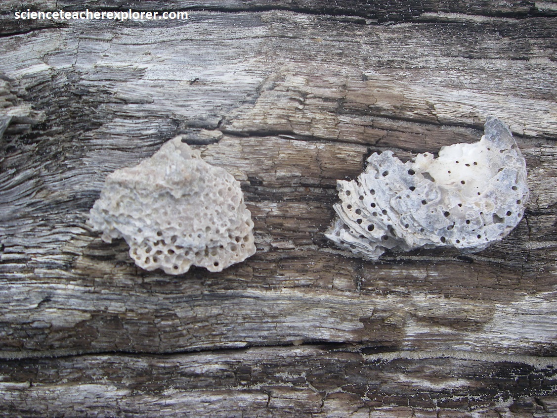
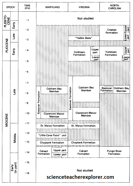
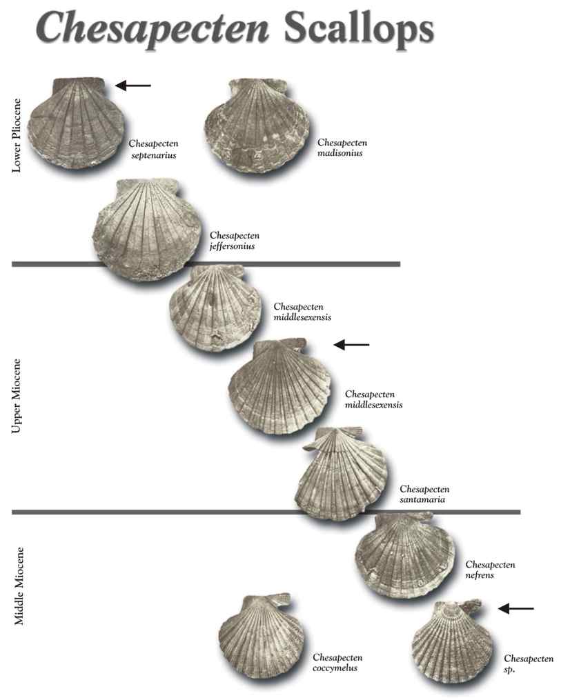
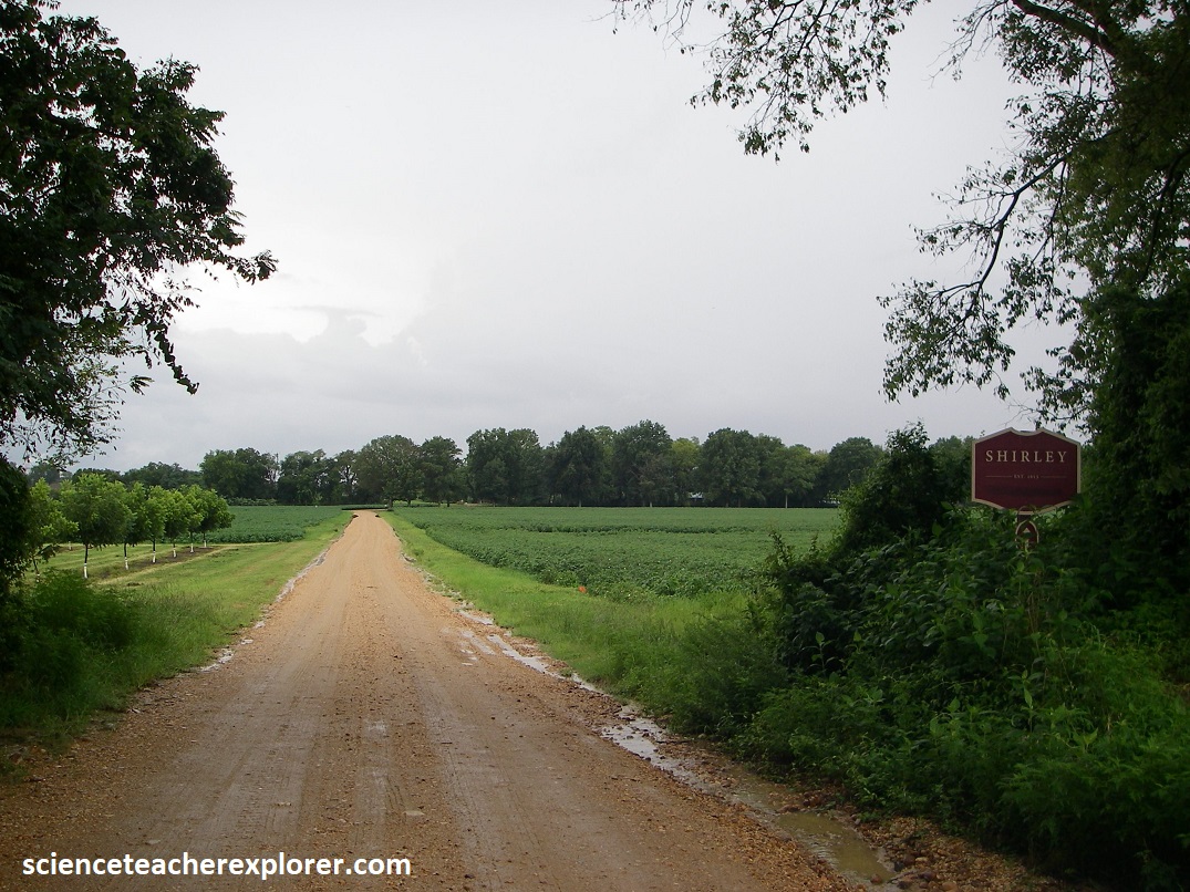
York River State Park is a part of the Shirley land formation, one of many fossil bearing layers around the Bay. Shirley Formation, herein named in southeastern VA, is an upward-fining sequence composed of a basal, gravelly sand which grades upward into a medium gray to reddish-brown fine to coarse sand, and an upper unit of light to medium gray clayey silt or clayey, silty fine-sand. This formation was deposited under fluvial, estuarine, and marsh conditions that also included barrier, bay, nearshore marine, and eolian deposits on the lower York-James Peninsulas. This Unit overlies Chuckatuck Formation and underlies Tabb Formation. Uranium-series ages of 184,000 yrs on corals from correlative deposits place the age of the Shirley at late middle Pleistocene. {Note the fossil identification chart was taken from an interpretive sign on-site}.
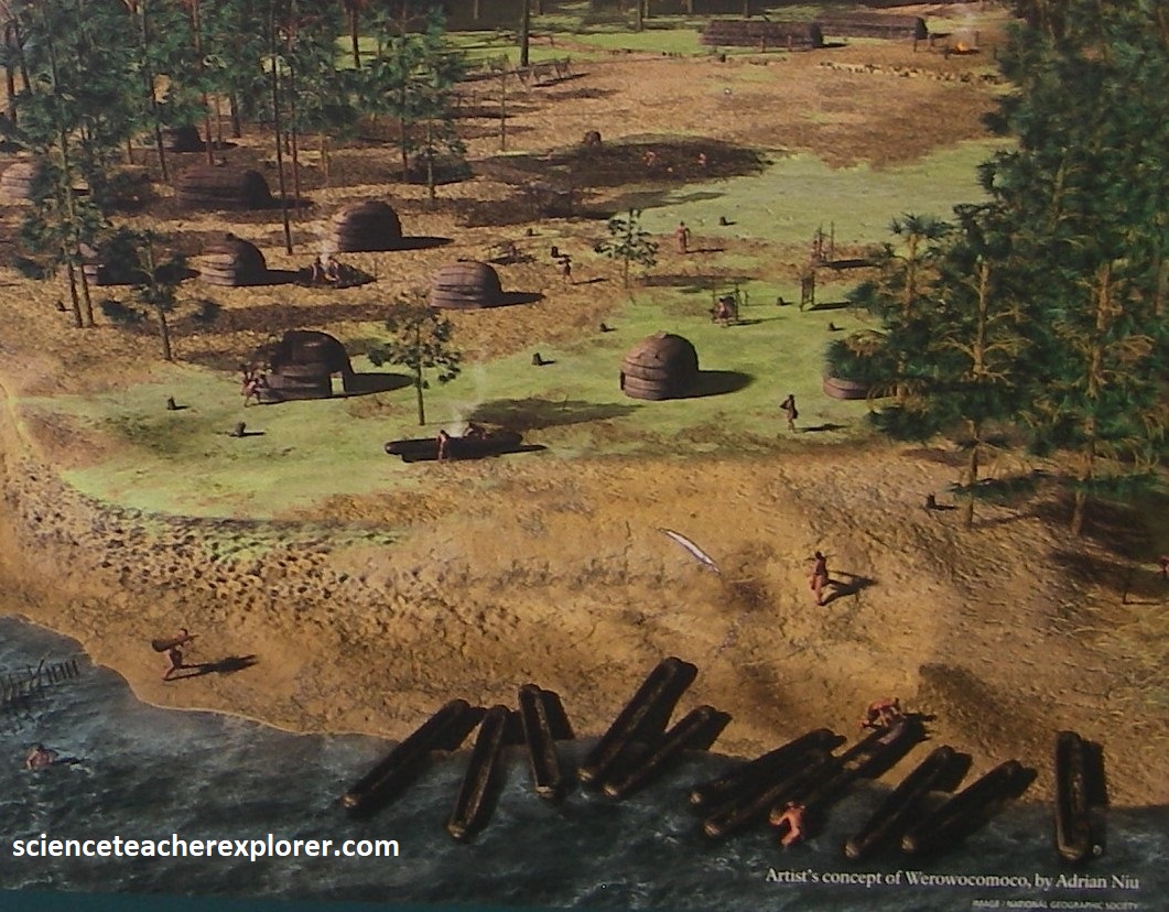
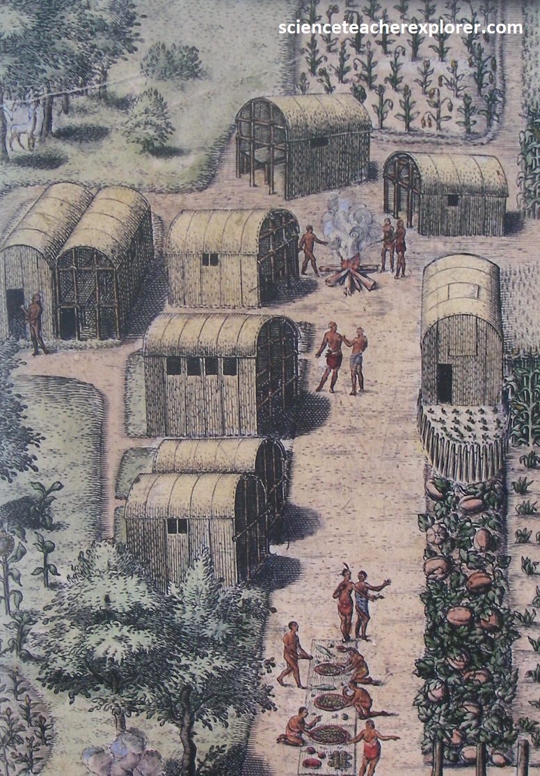
In the early 1600s, Captain John Smith traveled the York River. Several Eastern Virginia Algonquian tribes paid tribute to a spiritual and political leader name Powhatan. In return, he provided military assistance, guidance, and food. Powhatan established is headquarters at Werowocomoco, which had served as an indian center of leadership since the 1200s. However, in 1607, John Smith spent a month in captivity at the site, (located across the river from York River State Park). Powhatan offered to make Smith one of his tributary chiefs and to bring the English colony into his alliance, but Smith did not accept. Following his release, Smith, (leading a group from Jamestown), returned to Werowocomoco to trade, (image below). {Images below are artists depiction of Powhatan and Werowocomoco, and were taken from an interpretive sign on-site}.
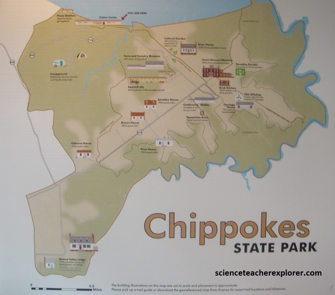
Becky and I continued trekking and exploring the region, by driving south, across the James River Estuary to Chippokes Plantation State Park. {Note: the images below were taken from an interpretation sign on-site}
As mentioned above, Captain John Smith explored the Chesapeake Bay in the early 1600s seeking precious metals and a passage to Asia. He traveled the James, Chickahominy and York rivers in 1607, and led two major expeditions from Jamestown in 1608. Smith and his crew sailed and rowed a primitive 30-foot boat nearly 3,000 miles, reaching as far north as the Susquehanna River. Although Smith did not discover gold, or a river passage to the Pacific, his precise map and detailed observations of American Indian societies and the abundant natural resource guided future explorers and settlers.
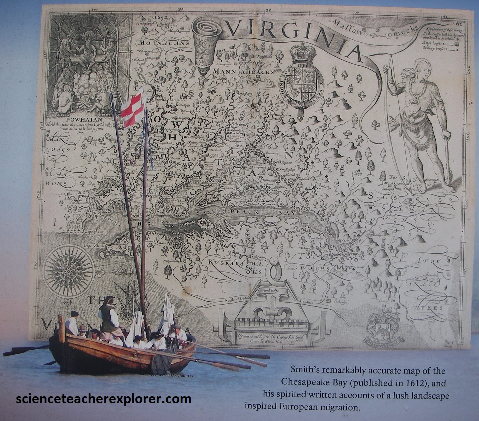
Captain John Smith map of the Chesapeake Bay in 1612; (Image taken from an interpretive sign on-site).
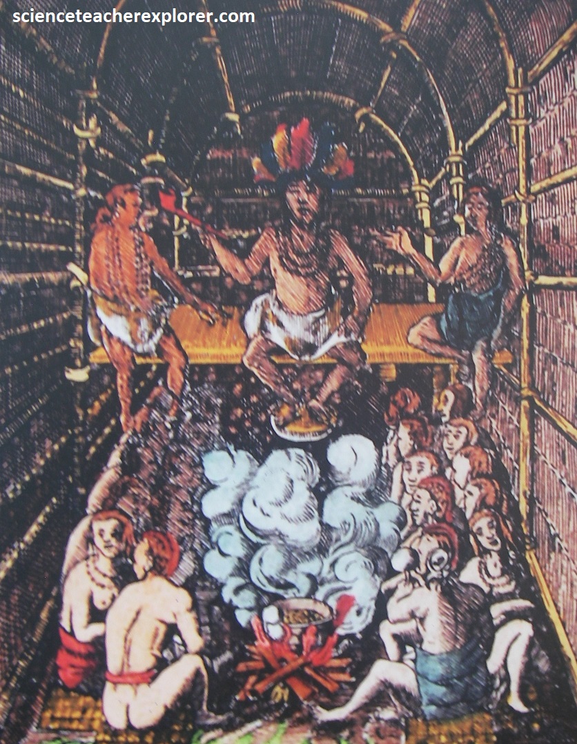
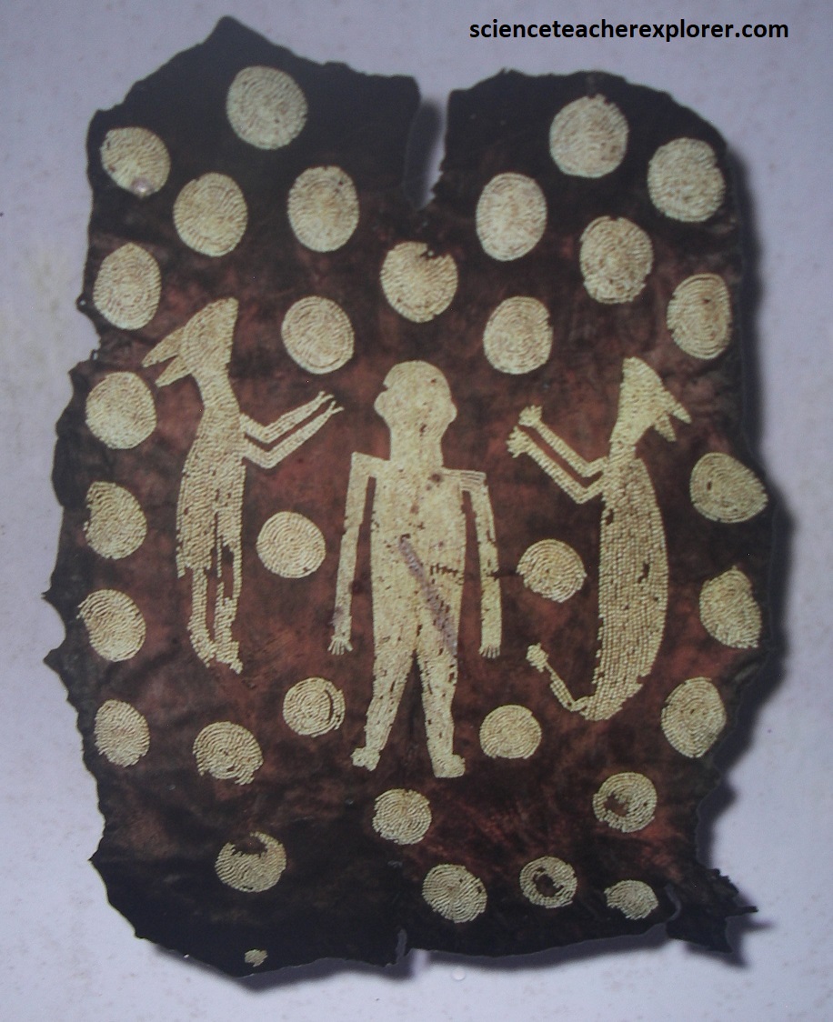
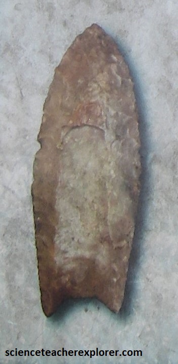
At the time of Smith’s explorations, an estimated 50,000 American Natives dwelled in the Chesapeake region, (as their ancestors had for 18,000 years). Their sophisticated societies included arts and architecture, systems of government, extensive trad and communication networks, and shared spiritual beliefs. The native peoples hunted, fished, grew crops, and gathered food and raw materials from the land and waterways. {Note that the images below were taken from an interpretive sign on-site}. [Note the 11,000 BC Clovis Spear-Point on the right and the ceremonial elk-skin robe that was adorned with 17,000 shells in the center].
Smith discovered a treasure trove of natural wonders in the Chesapeake region: thick forests of giant pines, oaks, and hickories; vast marshlands; huge turtles, 800 lb sturgeon, and great schools of shad and striped bass. Massive flocks of ducks, geese, and swans darkened the sky; and enormous oyster reefs rose above the water’s surface. {The photos below are of the James River shoreline at the Chippokes Plantation State Park, Virginia 2024}
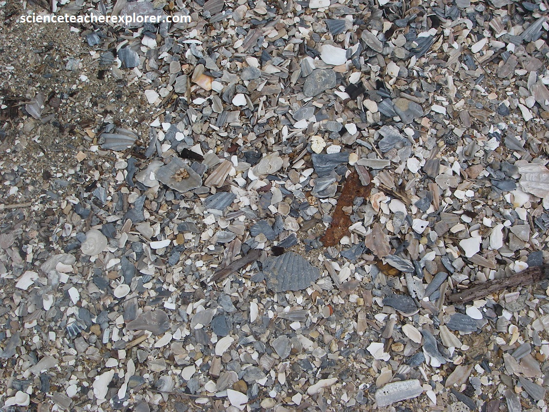
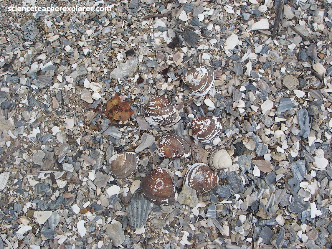
The Eastover Formation is names for a series of beds of silty sand, clay, and shelly fine sand in the Maryland, virginia, and North Carolina Coastal Plain. This formation is well exposed at the along the banks of the James River at Cippokes Plantation State Park, (pictured above). It is divided into two members. The lower member, (Claremont Manor), consists of greenish-gray, fine-grained clayey sand. The overlying Cobham Bay Member consists of units of fine-grained, well-sorted, shelly sand. This Cobham Bay member contains a large number of fossil mollusks, which are indicative of an open-marine, subtropical shallow embayment. This indicates a favorable substrates, abundant food supplies, and warm-temperate to subtropical conditions. {Two main molluscan biofacies are present throughout the basin. One consists of large numbers of the small bivalve, Spisula rapppahannockensis and the other is dominated by the large species of Chesapecten, Mercenaria, and Isognomon. The Cobham Bay Member at the Chippokes Platation State Park is of late-middle Miocene, (dated about 8.7-6.5 million years, {imaged below}.
Specimens of Chesapecten jeffersonius are readily found along the James River shoreline of Chippokes Platation State Park. Fossilized barnacles, shark teeth, and oysters, among others, round out the list of beach fossils that Beck & I were able to observe along the Fossil Trek (pictured below). Specimens of Chesapecten jeffersonius were more than 13 cm in length and width, making them quite large for scallops. Living in the shallow waters, this scallop was quite capable of sudden movement by flapping it valves together, creating jet propulsion that safely distanced it from predators. English naturalist Martin Lister immortalized the Chesapeake Bay scallop in 1687 as the first “New World” fossil ever illustrated in a scientific publication. In 1824 the English geologist John Finck assembled a collection of specimens and sent them to the Academy of Natural Sciences of Philadelphia. There, Thomas Say, names & described it as the Pecten jeffersonius, in honor of Thomas Jefferson, (a U.S. President and naturalist acclaim). It was later changed to Chesapecten jeffersonius in 1993. Note the 9-12 prominent radiating ribs readily differentiating this extinct Virginia Sate Fossil from other species of Chesapecten. {The two images below were taken from an interpretive sign on-site}.
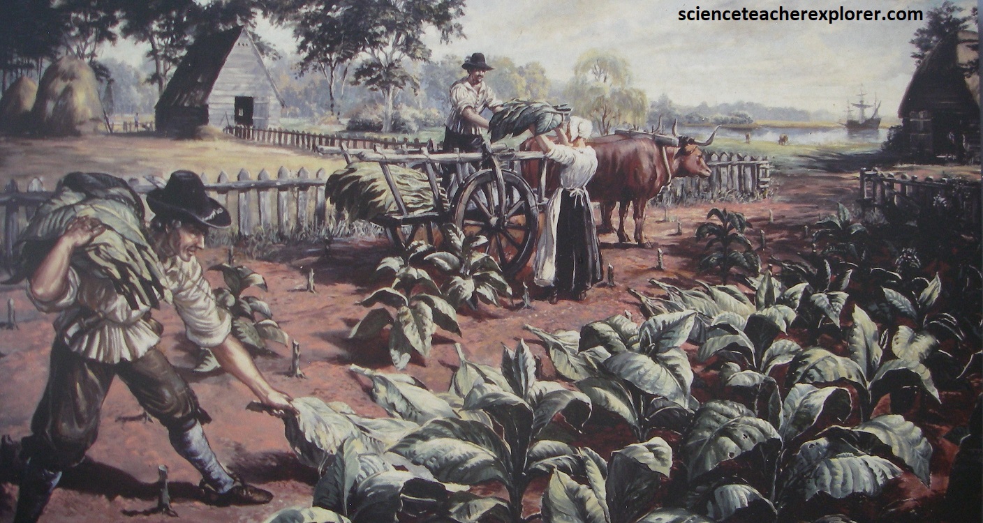
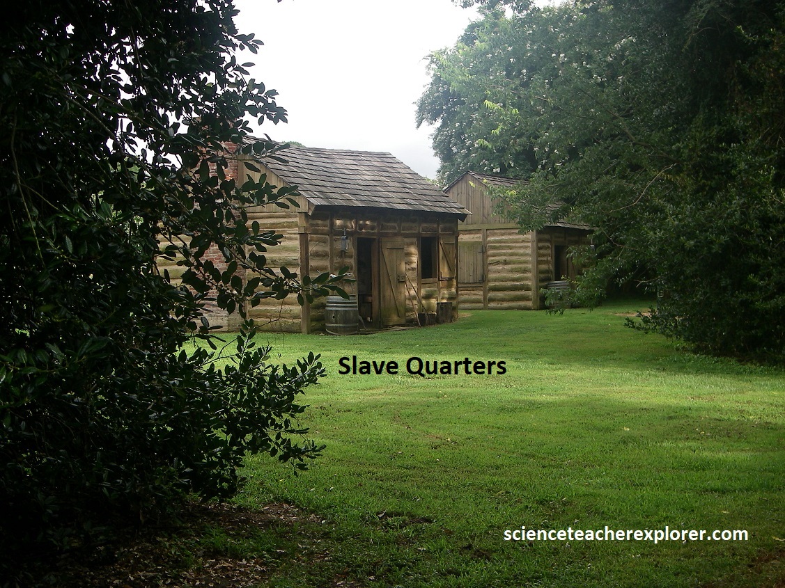
In addition to forests and fossil hunting on the beach, Chippokes Plantation State Park includes three historic houses (plus outbuildings to each) as well as an open-air agricultural and forestry museum. American native cultivated fertile lands along the James River for centuries before the colonists arrived in 1607. They grew squash, corn, and beans to supplement their diet of native plants, fish, shellfish, and game. When the soils at a house site became depleted, the Natives allowed the area to replenish itself while they established a new dwelling and agricultural plot elsewhere. However, the English colonists primarily grew tobacco for profit. Introduced at Jamestown in 1612, tobacco quickly exhausted prime croplands and required vast unspoiled acreage. It spurred tremendous changes on the landscape, (imaged below). {Note the artist’s depiction below was taken from an Interpretive Sign on-site}.
Chippokes Plantation is one of the oldest continuously farmed properties in North America, having just passed its 400th anniversary. Pictured below, ranger-led programs include historic house tours, guided hikes, craft workshops, costumed interpretation, and more. {The historical image below was taken from an interpretive sign on-site}.
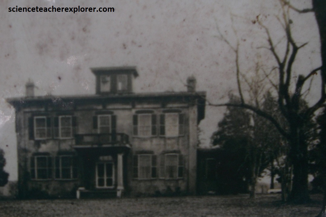
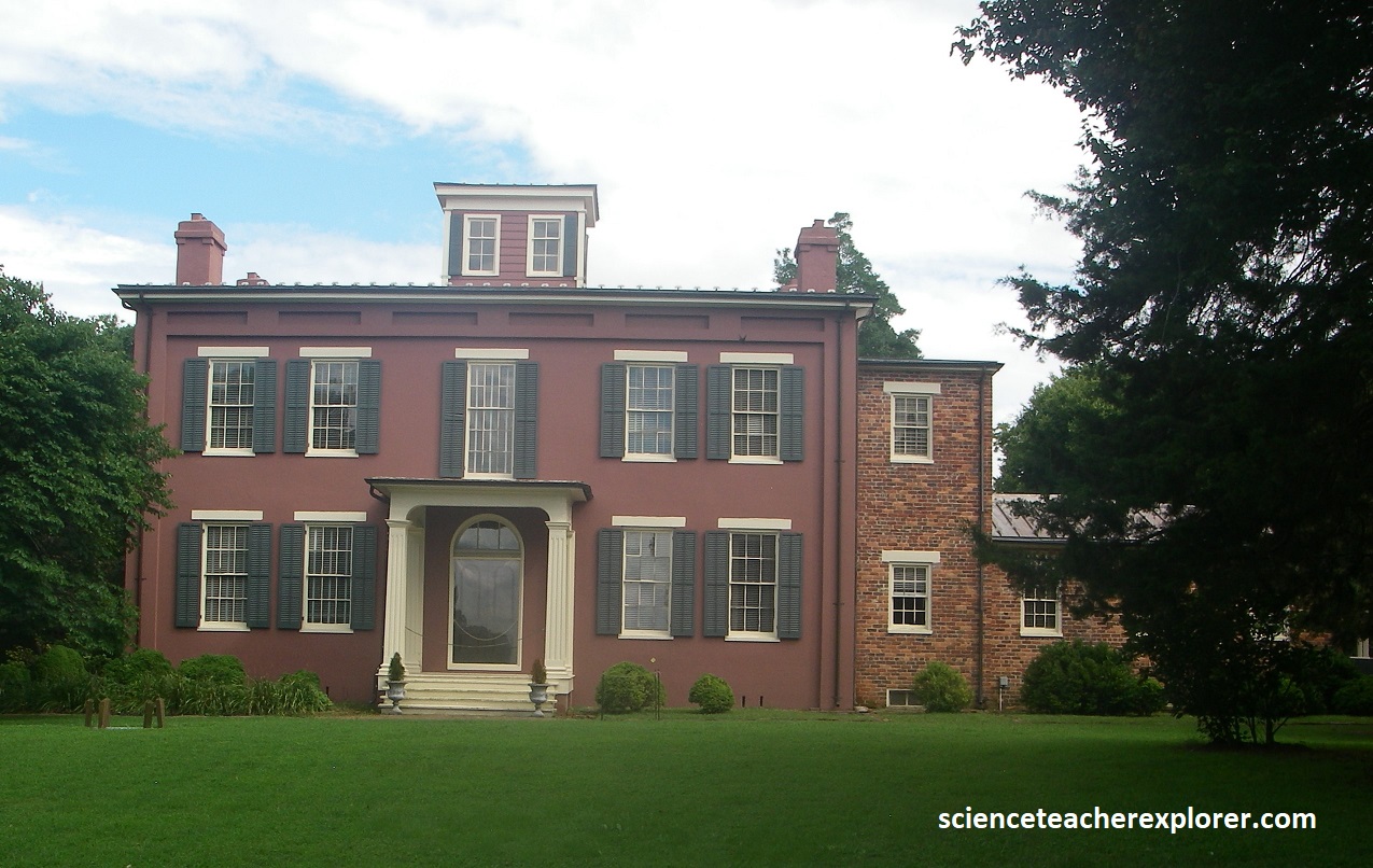
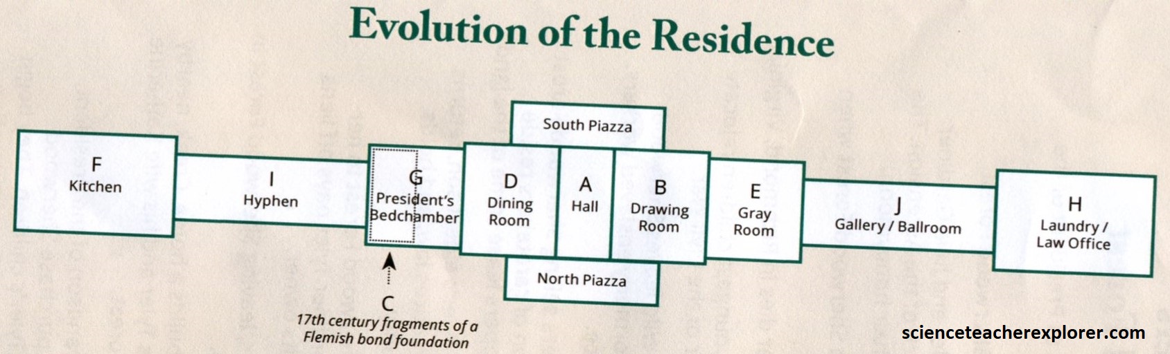
Pictured above, the Jones-Stewart Mansion was built between 1852 and 1854 by Albert Carroll Jones. The Stewarts made extensive renovations to the house in the 1950s, removing a balcony and railing form over the front-porch and adding a wing to the side.
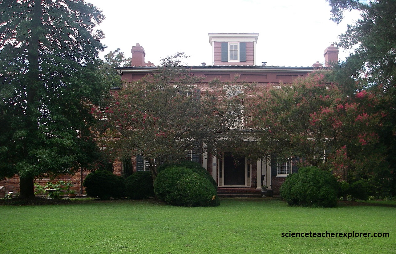
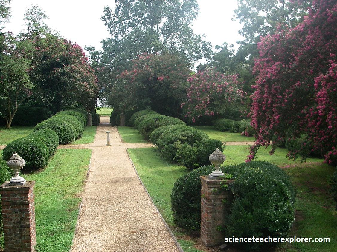
After constructing the mansion in 1854, Albert Carroll Jones established a small garden in the backyard. Evelyn Stewart improved upon this garden by adding more flower beds, shrubs, and shade tress. Designed in an English pastoral style, the garden was given the name, “Paradise Garden”. (Pictured above from behind the mansion).
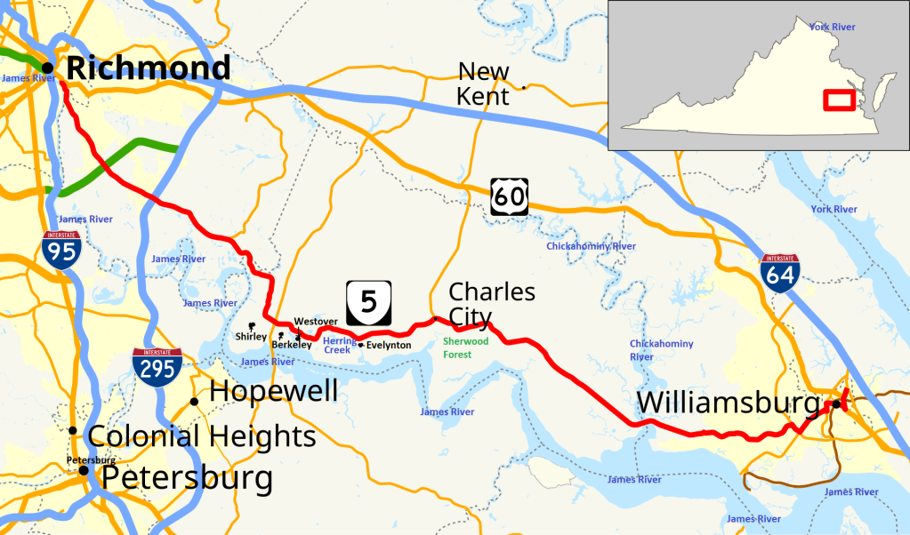
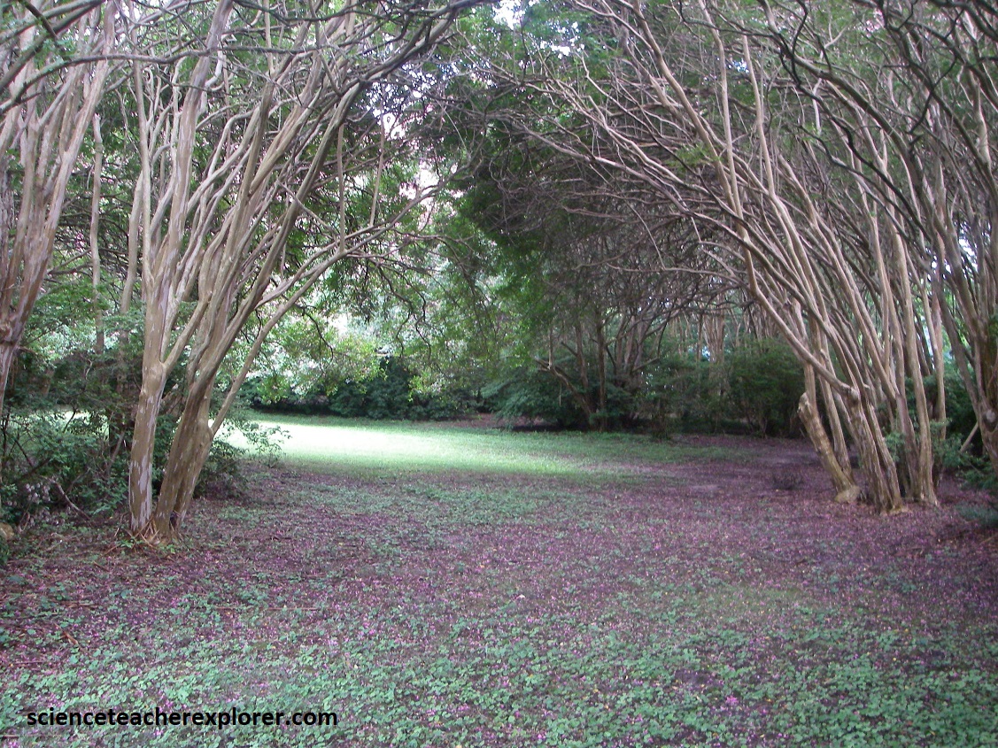
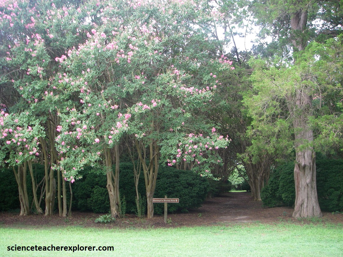
Imaged above, on its twisting journey across southeastern Virginia to Chesapeake Bay, the James River flows with subdued yet stately grace through a landscape that would still be recognizable to the families who build plantation homes along its banks in the 17th and 18th centuries. Today their grand houses still stand as dramatic summations of a vanished era, and Route 5, (colored in red), links them and serves as a virtual time line through that sometimes turbulent past. Beck & I, drove and explored Route 5, from Williamsburg to Richmond. Our first stop was, “Sherwood Forest”, (pictured below). (Note: the historical photo below was provided from interpretive pamphlets & signs on-site).
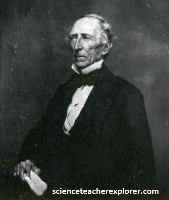
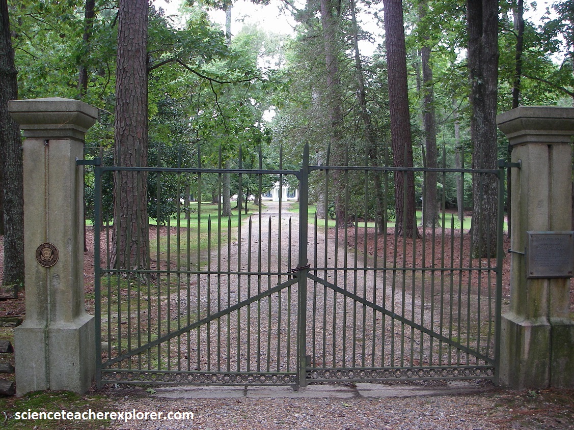
Pictured above, 5 km south of Charles City is one of America’s longest frame housed that form a centerpiece of a plantation. Once owned by U.S. president John Tyler, the white clapboard house at Sherwood Forest can be seen, beyond the front gate, pictured above. The grounds, (25 acres of lawns, terraced gardens, and woods containing more than 80 kinds of trees), includes a gingko tree given to Tyler by Captain Matthew Perry when he returned from Japan in the 1850s and re-introduced gingko trees to America.
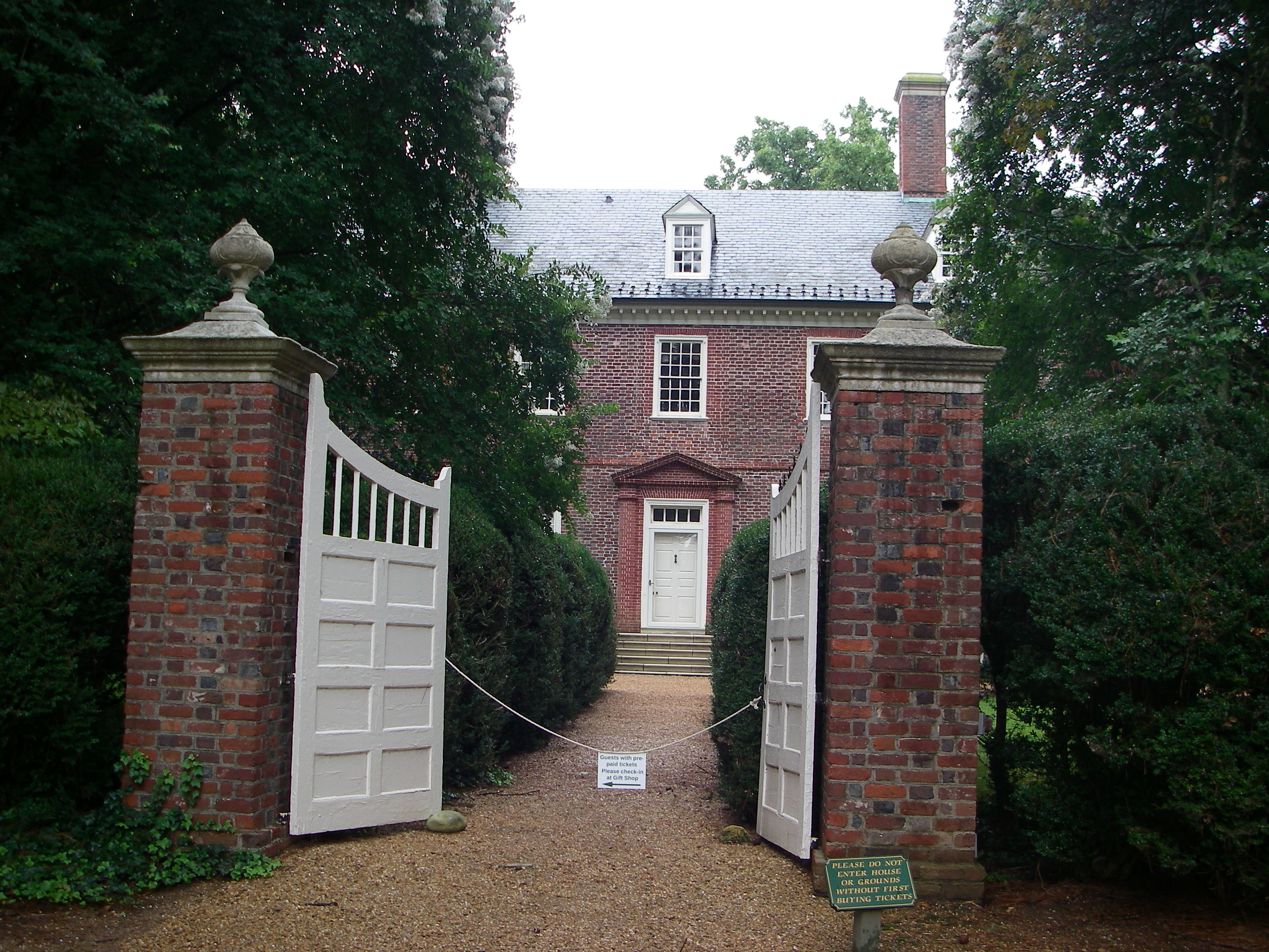
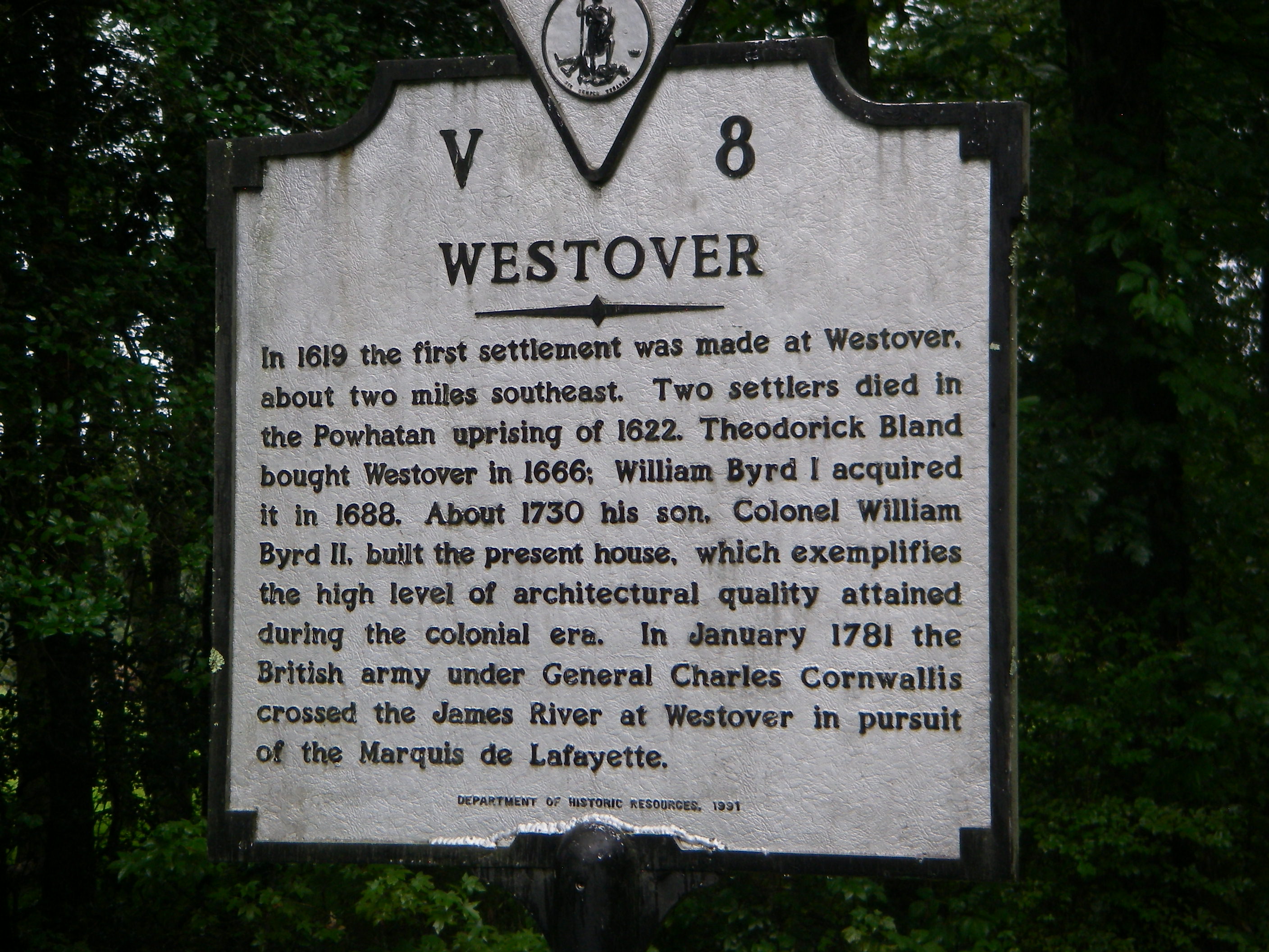
Early colonists in Jamestown migrated westward, bringing Anglican worship there as early as 1613. Pictured above, Westover Parish was recognized in 1625 by the House of Burgesses. A church built in 1630 at Westover Plantation was moved to its present site in 1731. Abandoned for a time after the Revolution, it was reconsecrated in 1833. Badly damaged by Federal troops in 1862, it was restored in 1867. Services have continued ever since. Nearby and west, on Route-5, is Evelynton & Westover.
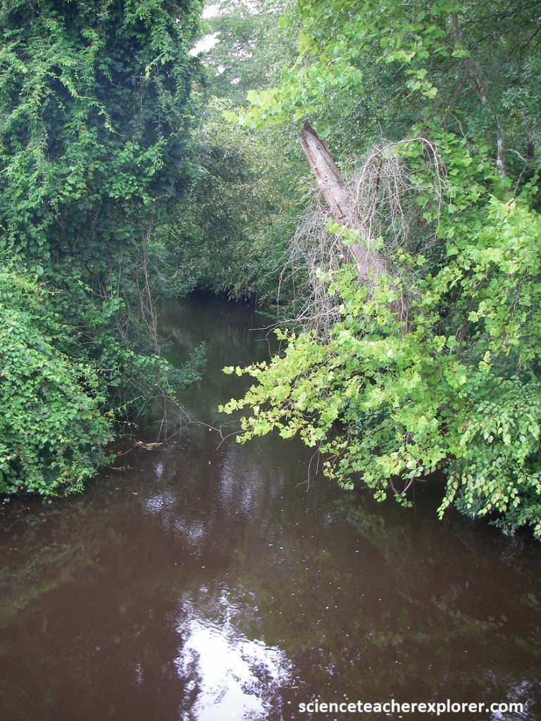
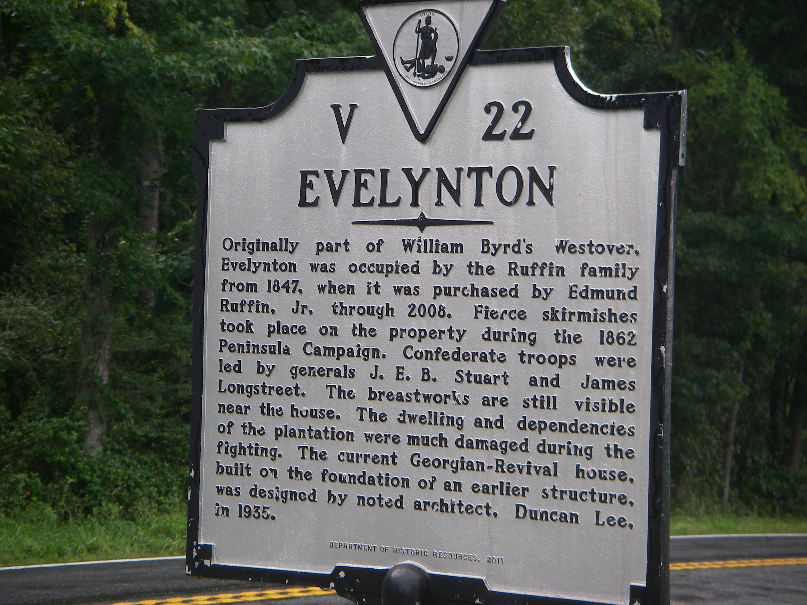
Once a part of Westover, Evelynton stands on a hill with a view that overlooks Herring Creek, (pictured above), twisting through a tidal marsh; the stream attracts cormorants, egrets, and other visitors. It is a tributary of the James River, named for the Alewife and Blueback River Herring that historically have ascended Herring Creek along with Hickory Shad to spawn between February and April, and then return to the sea where they spend most of their lives. River Herring are important forage fish (prey) for the ospreys, bald eagles, striped bass, sharks, tunas, seabirds, and marine mammals.
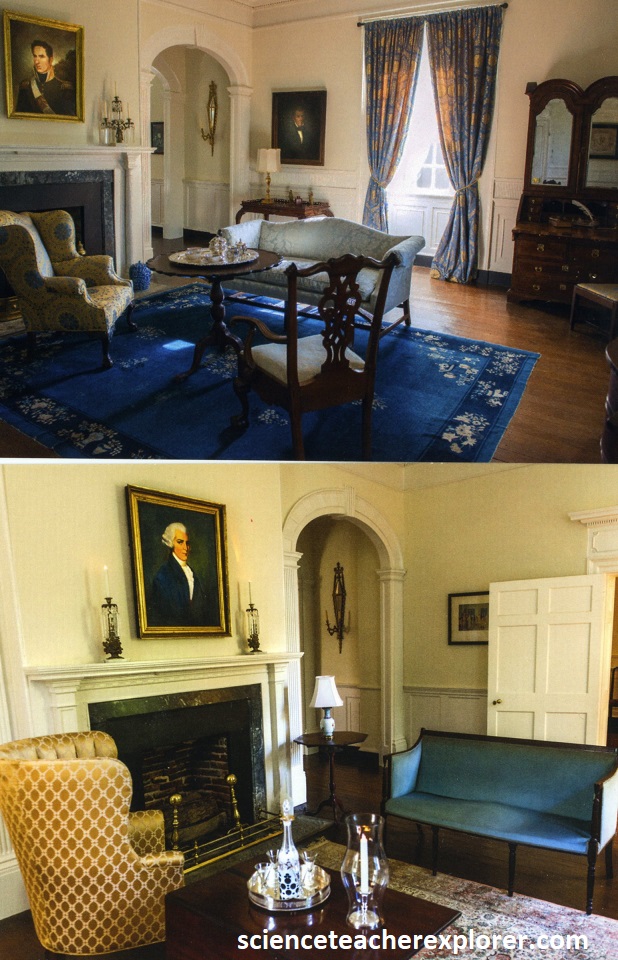
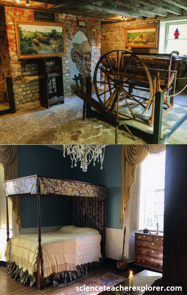
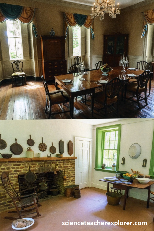
Among the Union troops that bivouacked on the grounds of the elegant brick manor house at Berkley during the Civil War was a young Scottish drummer boy; some 45 years later he returned to purchase the property, which by then had become an uninhabitable ruin surrounded by forlorn, neglected lawns. After decades of restoration, the birthplace of President William Henry Harrison & the Declaration of Independence signer Benjamin Harrison, which was completed in 1726, regained its standing as one of America’s most distinguished landmarks. Pictured above, the rooms feature handsome woodwork and are furnished with magnificent collections of 18th century antiques. {Note: the inside photos seen above were taken from purchased post-cards at the visitor’s center}
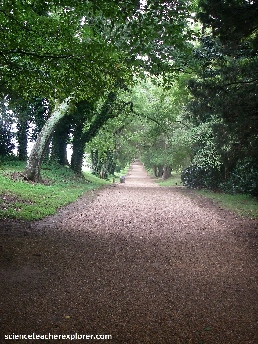
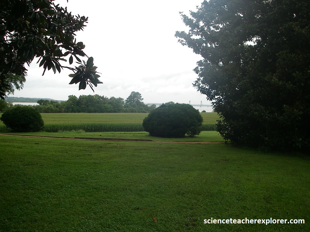
The Berkeley grounds have also been nursed back to health, with roses, azaleas, daffodils, and dogwoods growing across five beautifully groomed terraces that stairstep down to the James River.
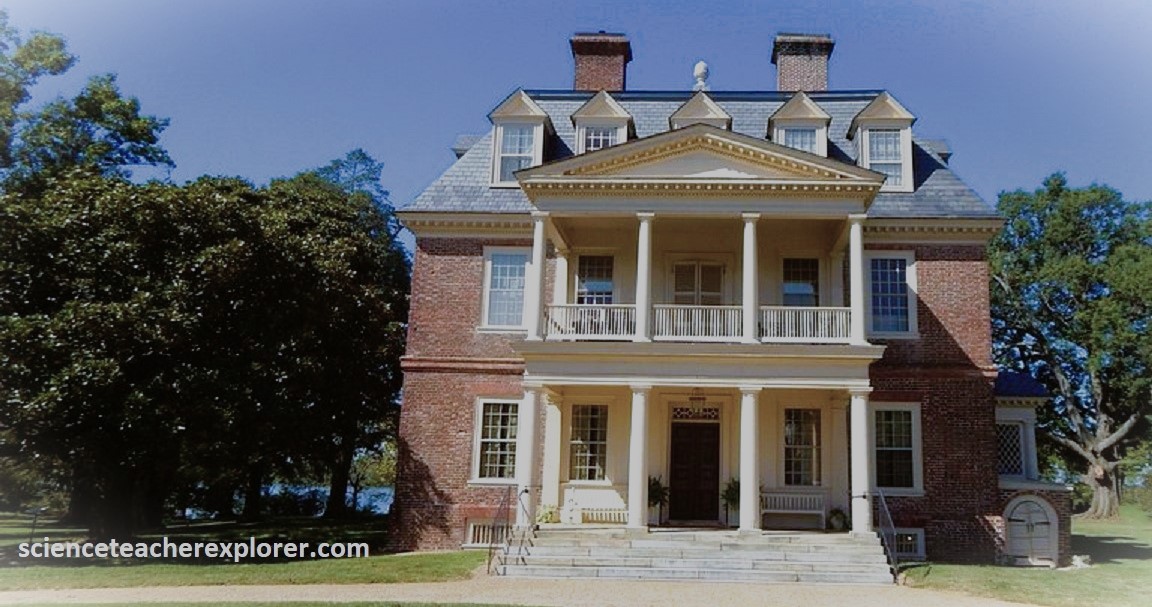
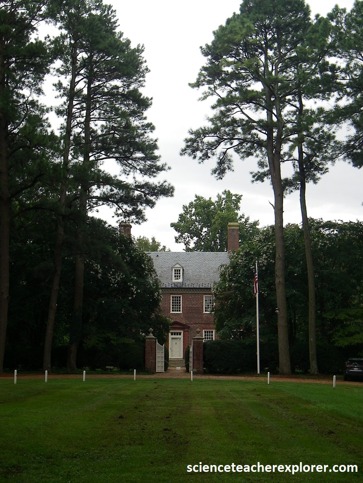
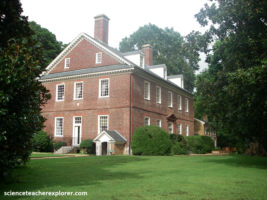
Pictured above, Becky and I approached the Shirley Mansion by driving down Shirley Plantation Road, which becomes a dirt lane that ends at a cluster of 18th century brick outbuildings, called dependencies. In earlier times guest arrived by boat along the James River, where they looked up to see a perfectly proportioned Queen Anne house, (note the wooden pineapple at the top of the house symbolizing hospitality in colonial times). The plantation itself was begun in 1613, making it the oldest in Virginia, and to this day its 800 acres are sown with seeds each spring.
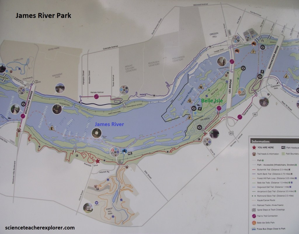
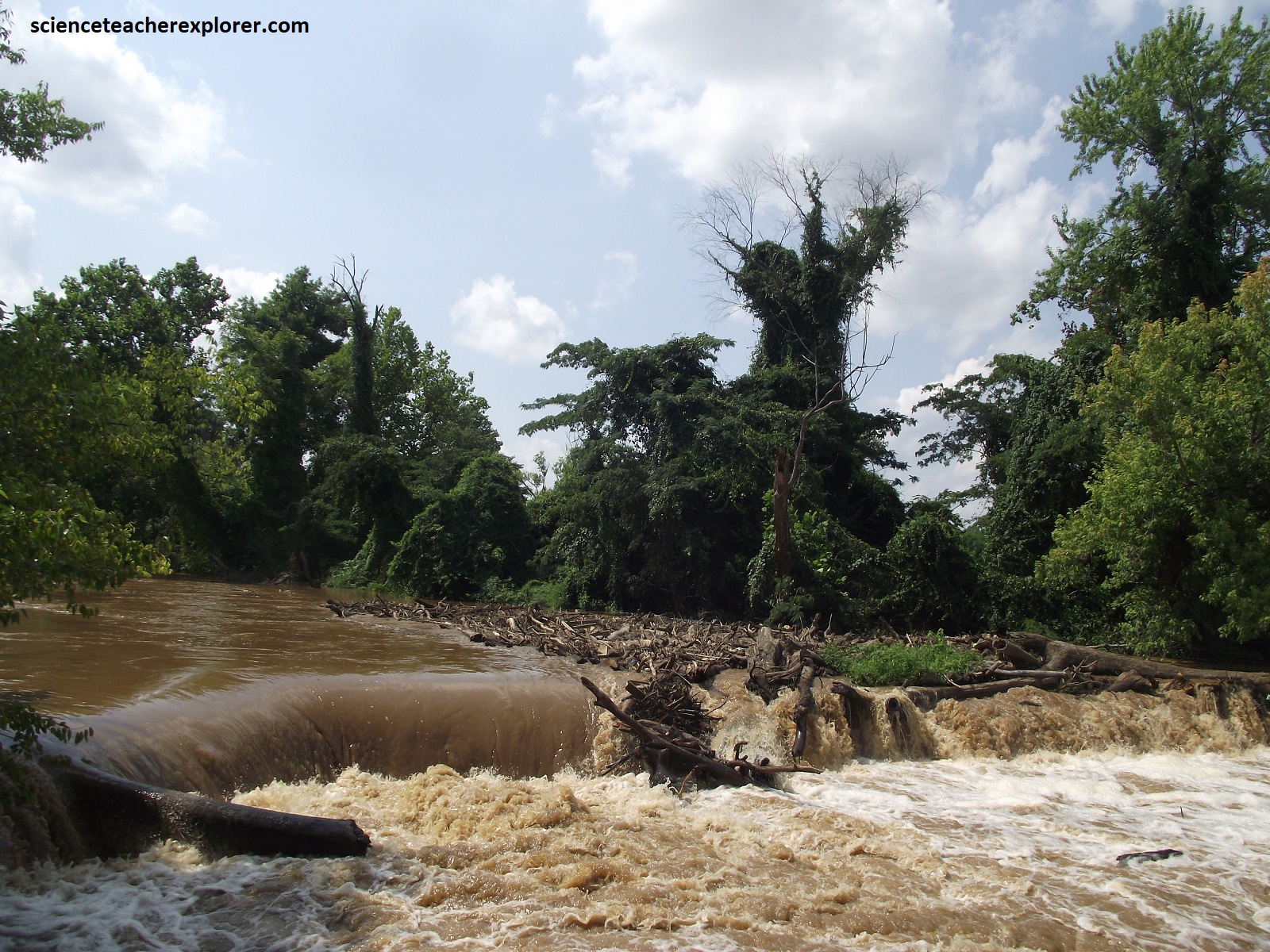
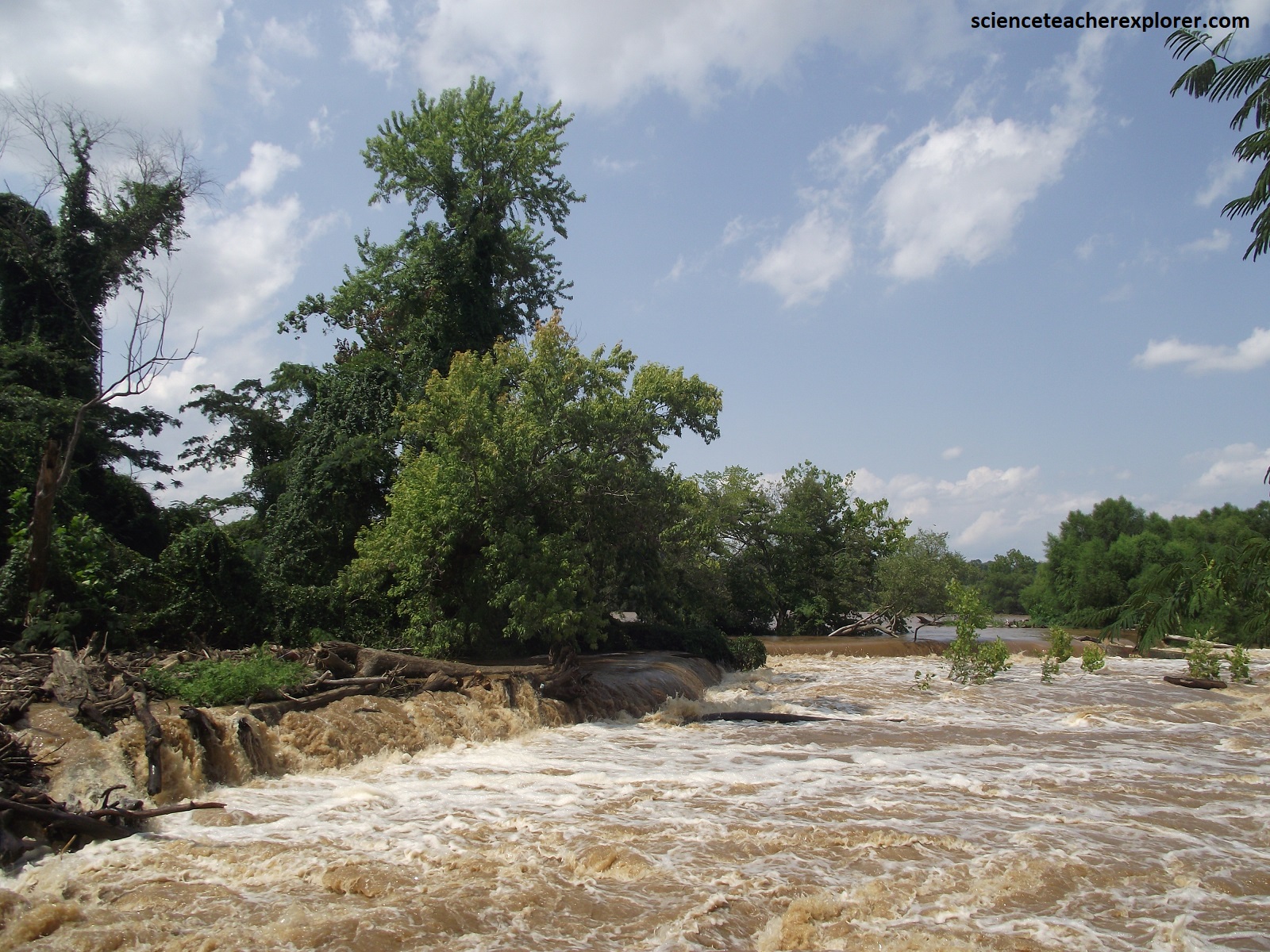
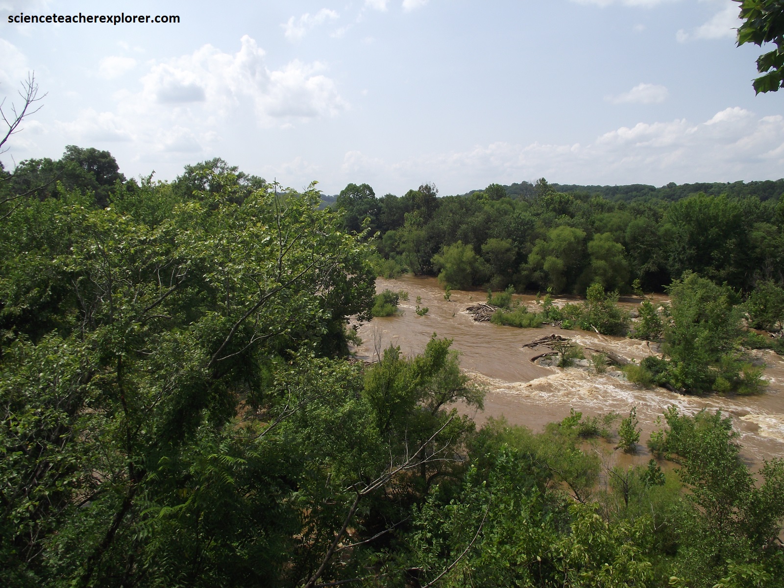
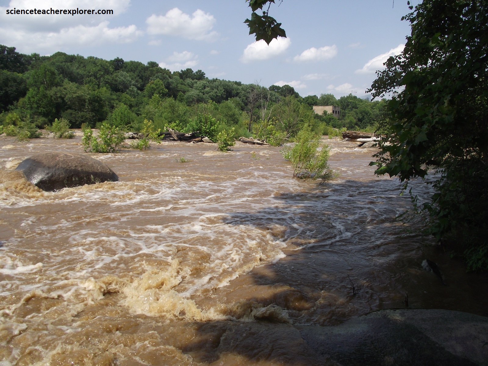
Becky and I continued driving another 32km on Route-5 to Richmond, Virginia. Nowadays modern skyscrapers cast their reflections on the James River in Richmond, where the streets were originally laid out in 1737. Down through the centuries those streets have witnessed more than their share of history. The British plundered Richmond during the Revolutionary War, and as capital of the Confederacy during the Civil War, the city was bitterly contested and burned as the Union troops approached in 1865. Fortunately, the state capitol, (designed by Thomas Jefferson), survived. We stuck Route-5, next to the James River when we made a stop and trekked the trails at the James River Park near Belle Island, (pictured below). Unfortunately, the James River was at a flood stage and make it difficult to observe and study the underlying granite bedrock.
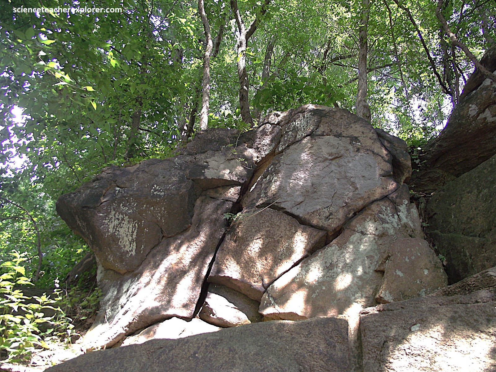
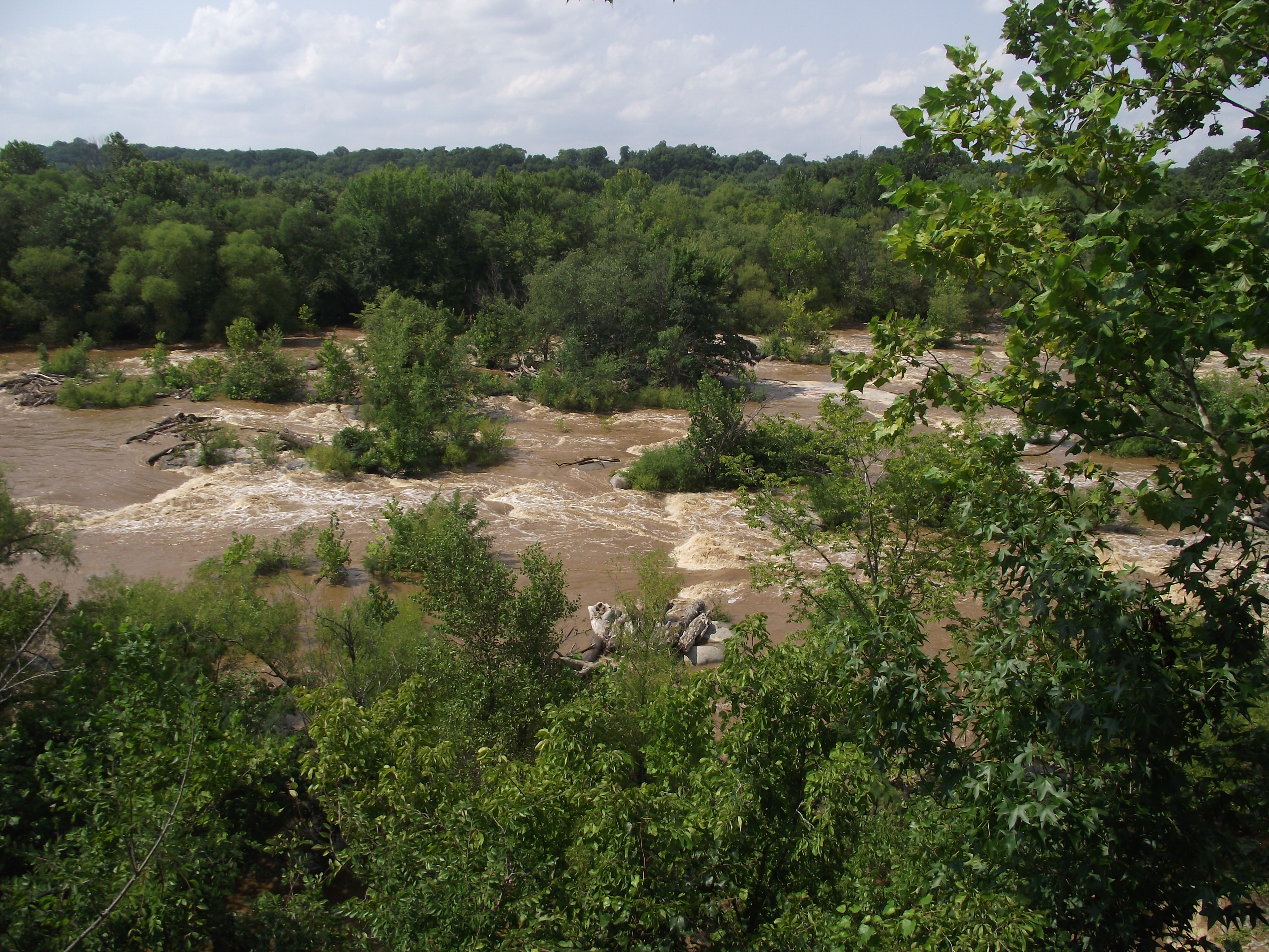
About 330 million years ago a gigantic volume of acidic magma invaded eastern Virginia, triggered by the collision of ancestral North America and ancestral Africa, an event that heralded the onset of the Alleghanian Orogeny, the third of the 3 Paleozoic-age phases of mountain building that were instrumental in the development of the Appalachian Mountains. After crystallizing, this enormous pluton of Petersburg Granite remained covered by younger rock for millions of years, but erosion eventually exposed a number of north-south-oriented outcrops. One exposure forms the pothole-pitted bedrock floor of the Belle Island portion of the James River Park, Richmond, (seen above).
