Chobe N.P., BW 2025
In June of 2025, a trekking buddy, Tracy Davis, and I drove across Botswana, Africa to explore the Chobe National Park.
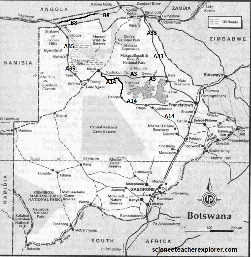
The two of us rented a 4WD truck in South Africa and crossed the border at Martin’s Drift and drove northwest to Muan on A14. From there we continued to to drive east across the Nxai Pan on Nata where we turned left and headed north on A33, where we stayed in Kasane, Botswana for a couple of days, (imaged below).
The Chobe National Park was established in Botswana in 1968, although it’s conservation legacy stretches back much further. It’s first inhabitants and custodians were the Basarwa, (San Bushmen). Later, in the mid-18th century, the Wyeyi tribe, who had settled by the Chobe river, were forced out by the arrival of the dominant Basubiya peoples. Then, in the 1850s, Dr. David Livingstone passed through the park in-route to ‘discovering’ the nearby Victoria Falls. By the 1930s, Sir Charles Rey, (the commissioner of Bechuanaland or Botswana), proposed the region to become a wildlife reserve to prohibit hunting. Delayed by the tsetse fly outbreak, it became a game reserve in 1960 and then a national park in 1968.
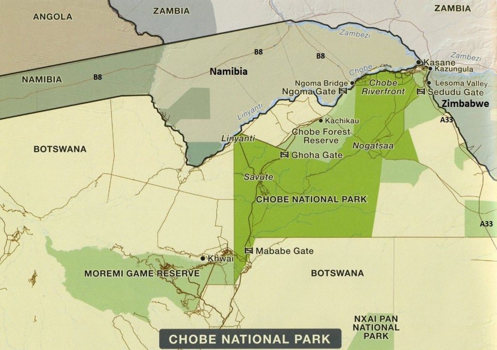
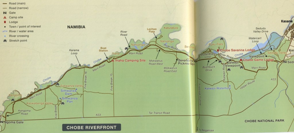
Southern Africa’s largest river, the Zambezi, rises in Angola and flows southeast through Namibia’s Caprivi region, to join Botswana’s Chobe River about 70km upstream from Victoria Falls. The summer rains falling an Angola usually reach the junction by April or May, (we were there in June). As the Zambezi rises it overwhelms the much smaller flow of the Chobe River, which is then pushed backward and appears to flow in reverse. Our destination was to explore the Chobe Riverfront.
The Chobe River starts life in the Angolan highlands. Initially called the Kwando River when it crosses into Namibia’s Zambezi Region, flowing along the Botswana border. Do to the geological topography, it is diverted to the east in a sharp dogleg, simultaneously forming the Linyanti Swamps. From this point, the east-flowing river is known firstly as the Linyanti, then at Ngoma Gate as the Chobe River, before it finally flows into the Zambezi River just after the Zambian border.
From riverine woodland, teak forests and open floodplains to arid acacia and mopane woodlands, a seasonal marsh and a mercurial waterway, the diversity of habitats in the Chobe Riverfront is mindboggling, resulting in a spectacular variety of animals and over 500 species of birds, (depending on the time of year).
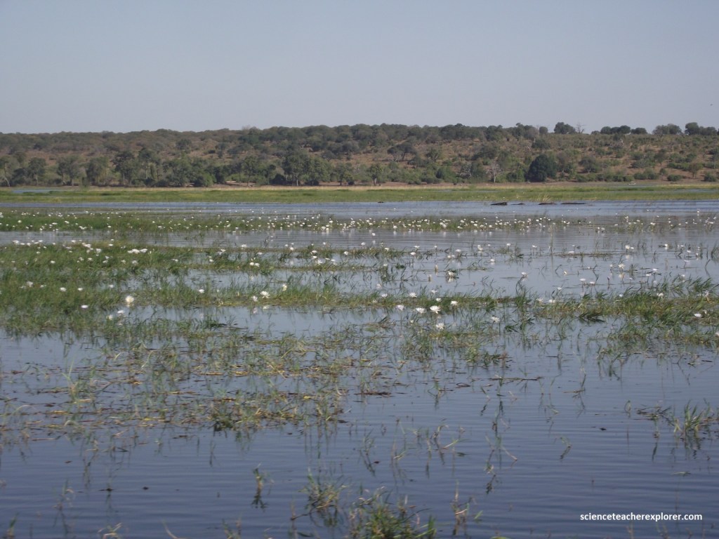
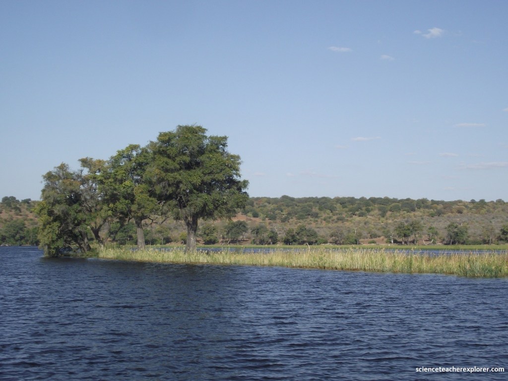
The hill in the distance, is the upward side of the Chobe Fault, (a Normal Fault). The Chobe Fault is This tectonic feature influences the Chobe River’s path. This significant geographical boundary, separates the Chobe River from the Kwando River. The fault causes uplift in the region, creating a complex landscape and affecting river flow, particularly as it contributes to the formation of the Chobe River, which is a backwater of the Zambezi River. (Note white flowers in the water & foreground are “Day Waterlilies” Nymphaea nouchali caerulea, before they pollinate).
As mentioned, the Chobe Fault influences the flow of the Chobe River, which can receive backflow from the Zambezi River. It is also associated with the Linyanti Fault, which has diverted the Kwando River, creating wetlands like the Linyanti River and Lake Liambezi.
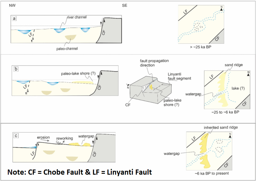
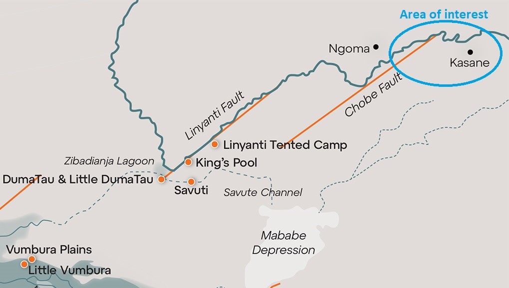
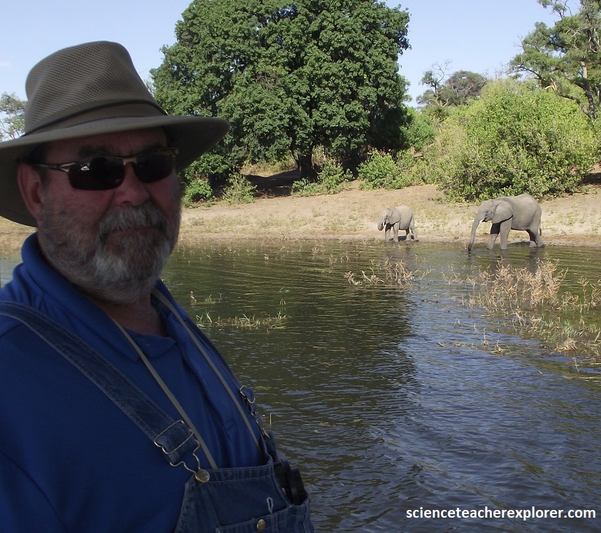
The explanation of the topography lies many kilometers below the surface in the Chobe-Linyanti Faultline, which runs along (and dictates the cours of) the Linyanti and Chobe Rivers. In fact, these fissure deep in the Earth’s crust stretches all the way from the Linyanti swamps in the west as far as the Zambezi River’s Katambora rapids in the east, 20 km outside Botswana’s northeastern border. {Pictured below are of several elephants within the Chobe National Park & of my traveling buddy in 2025, Tracy Davis}.
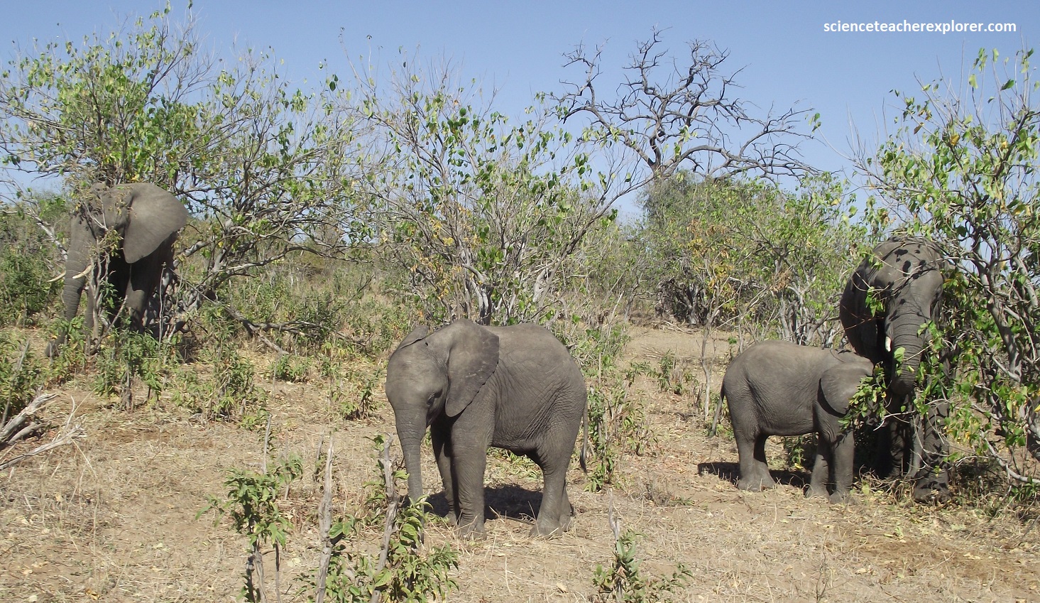
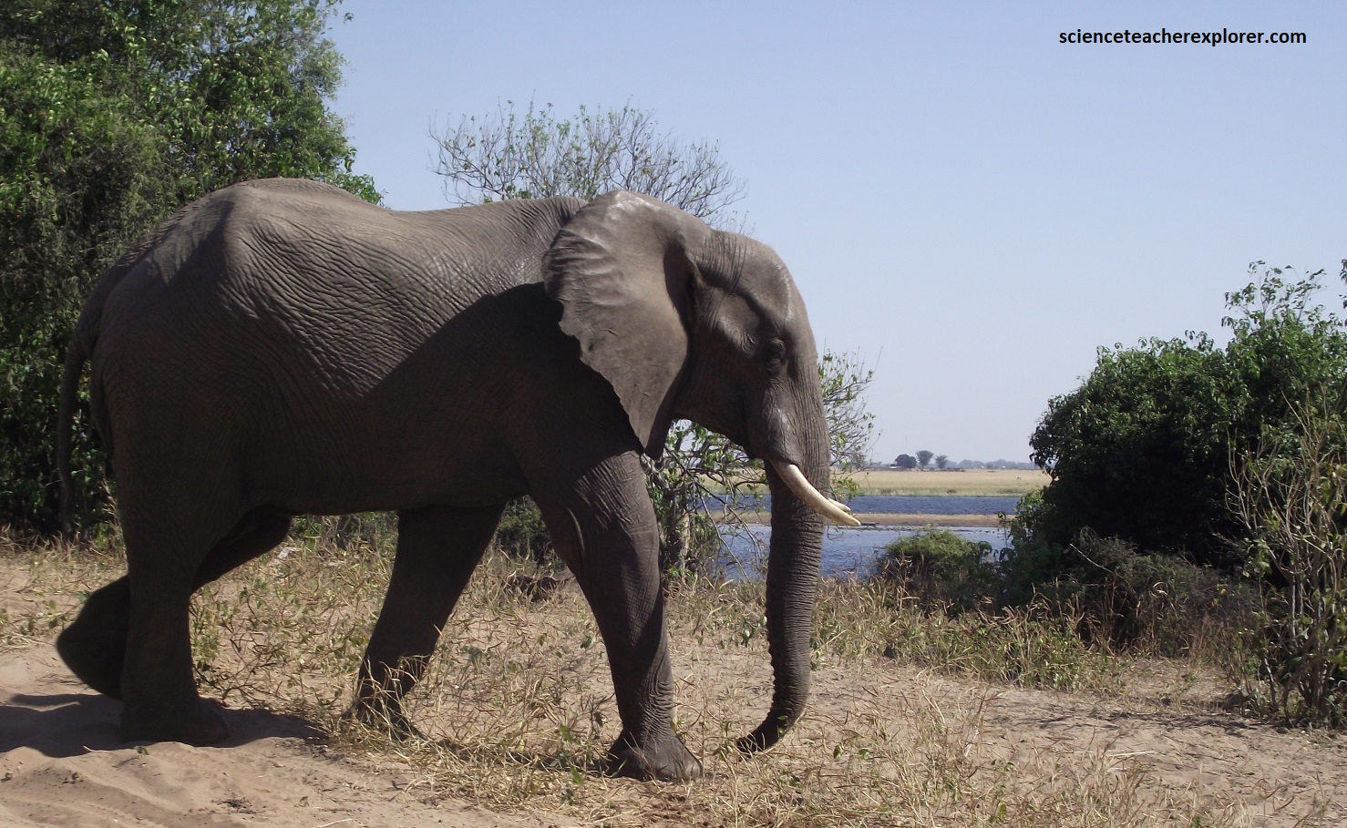
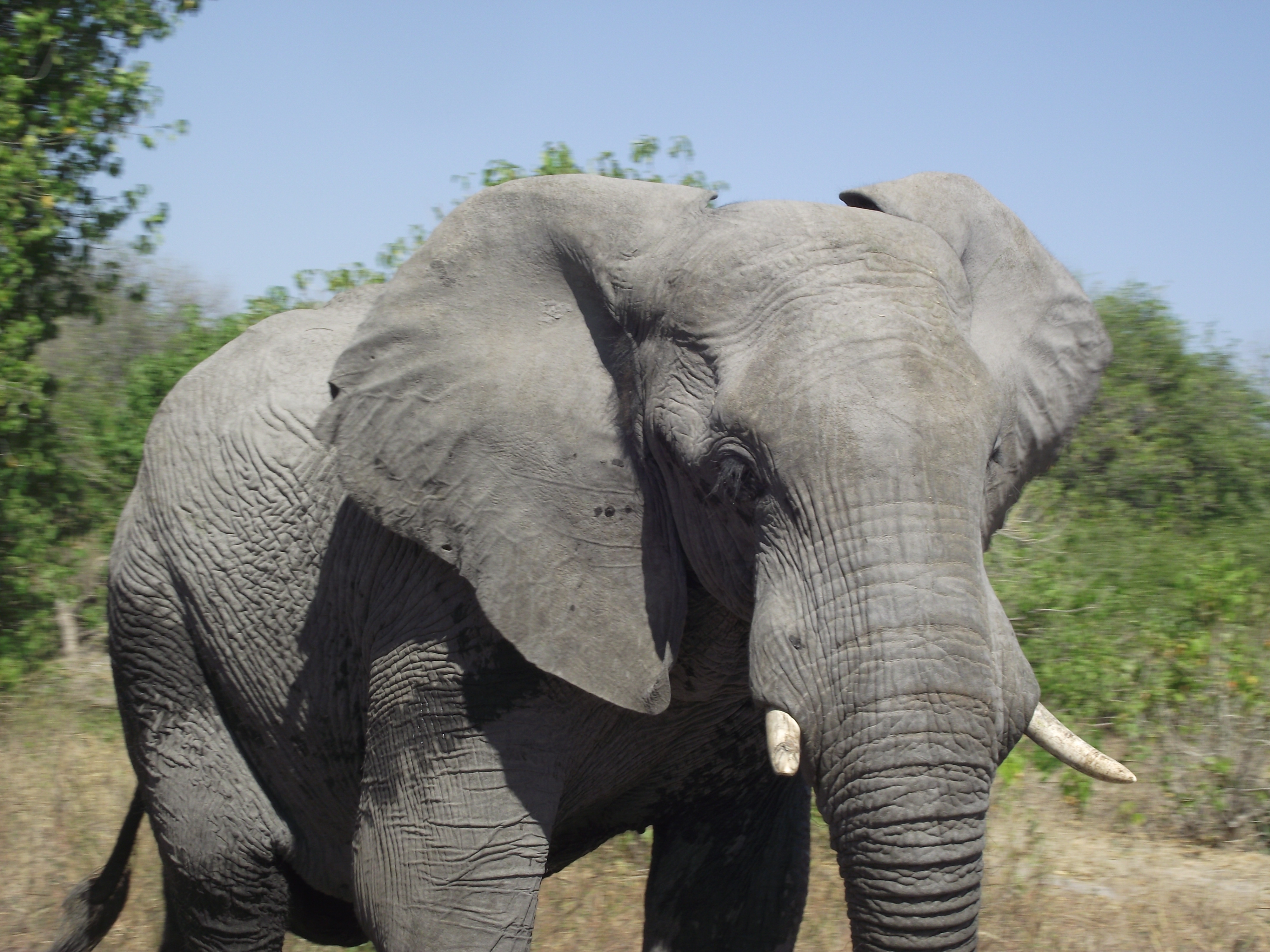
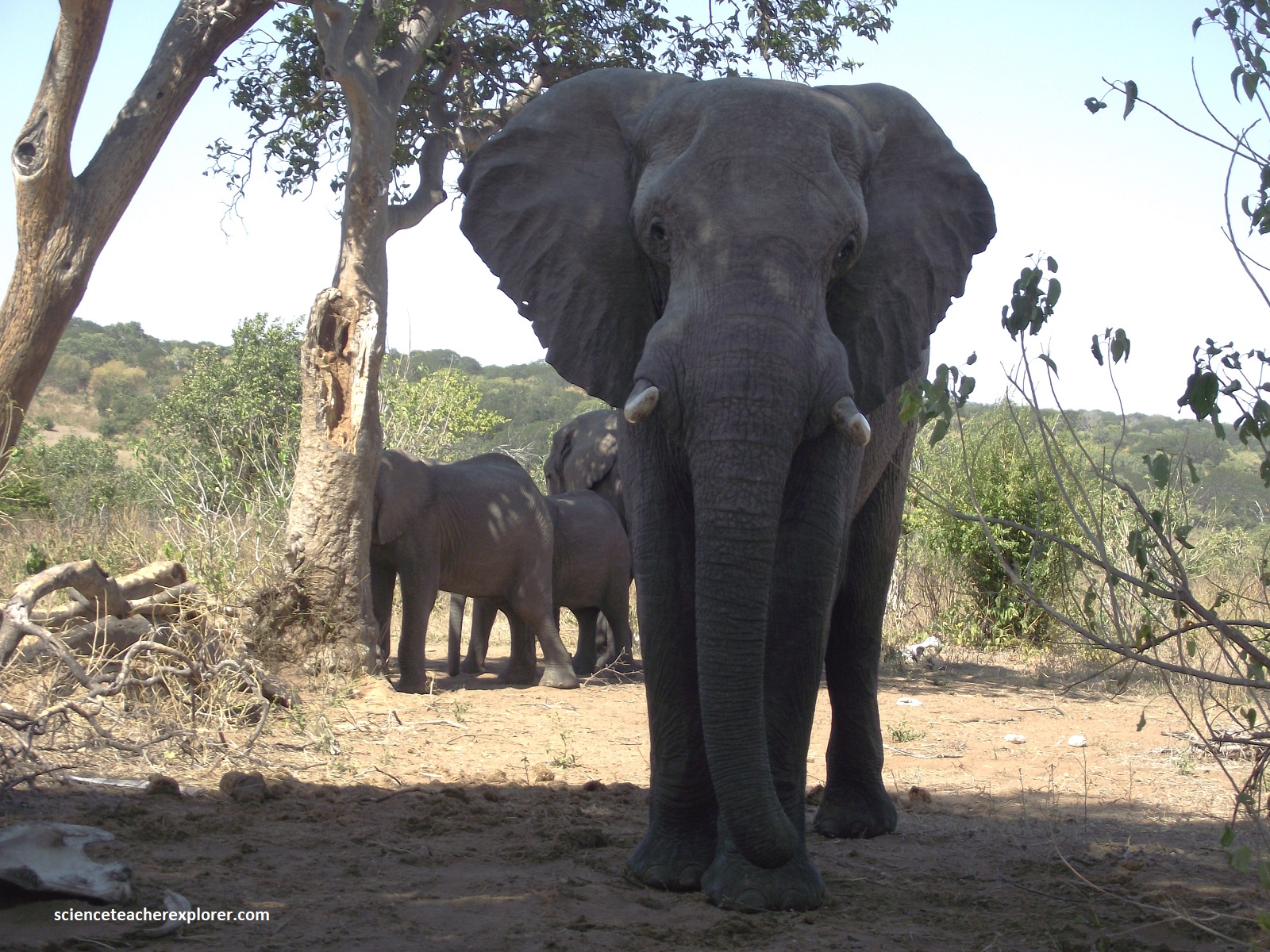
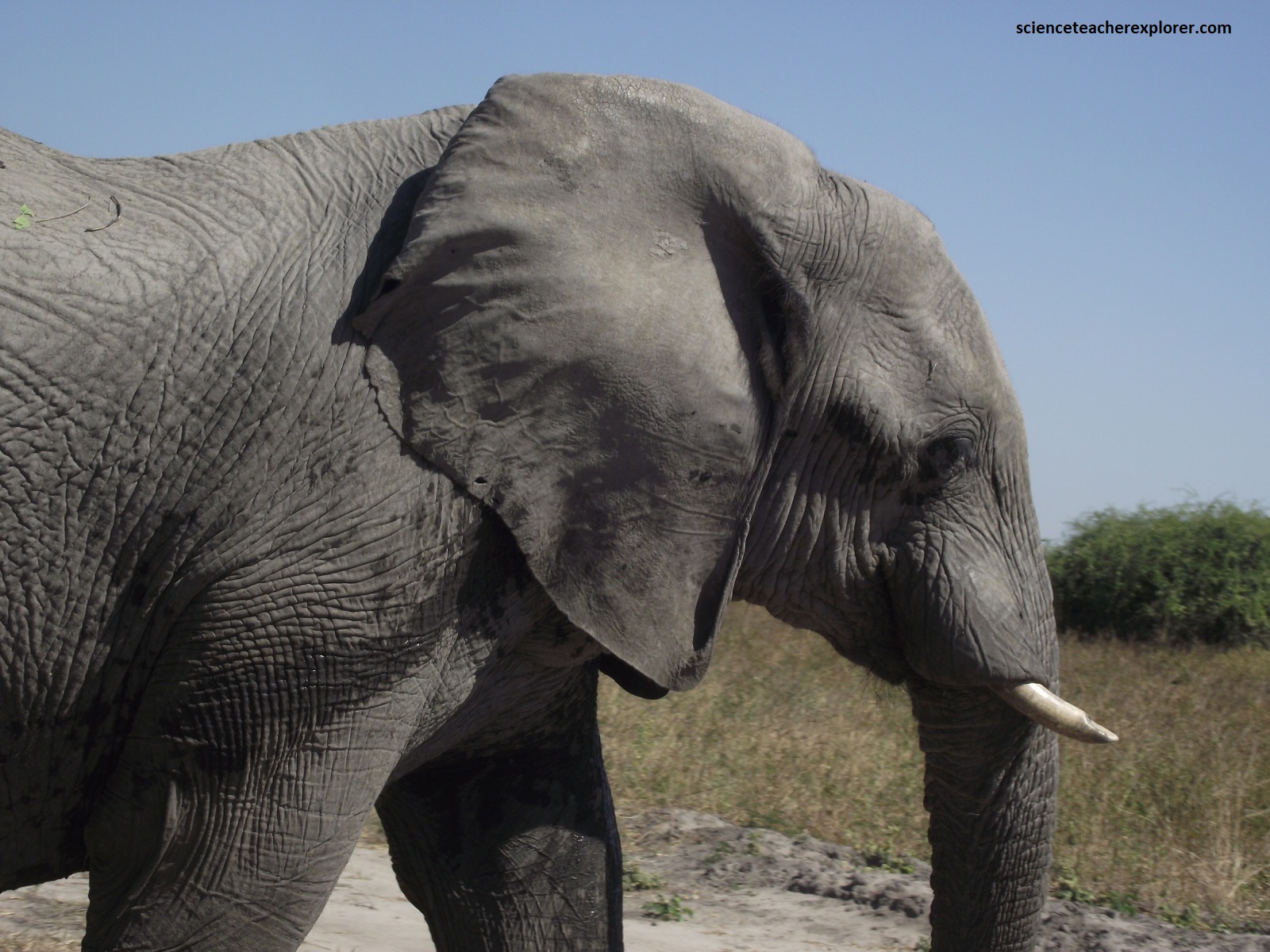
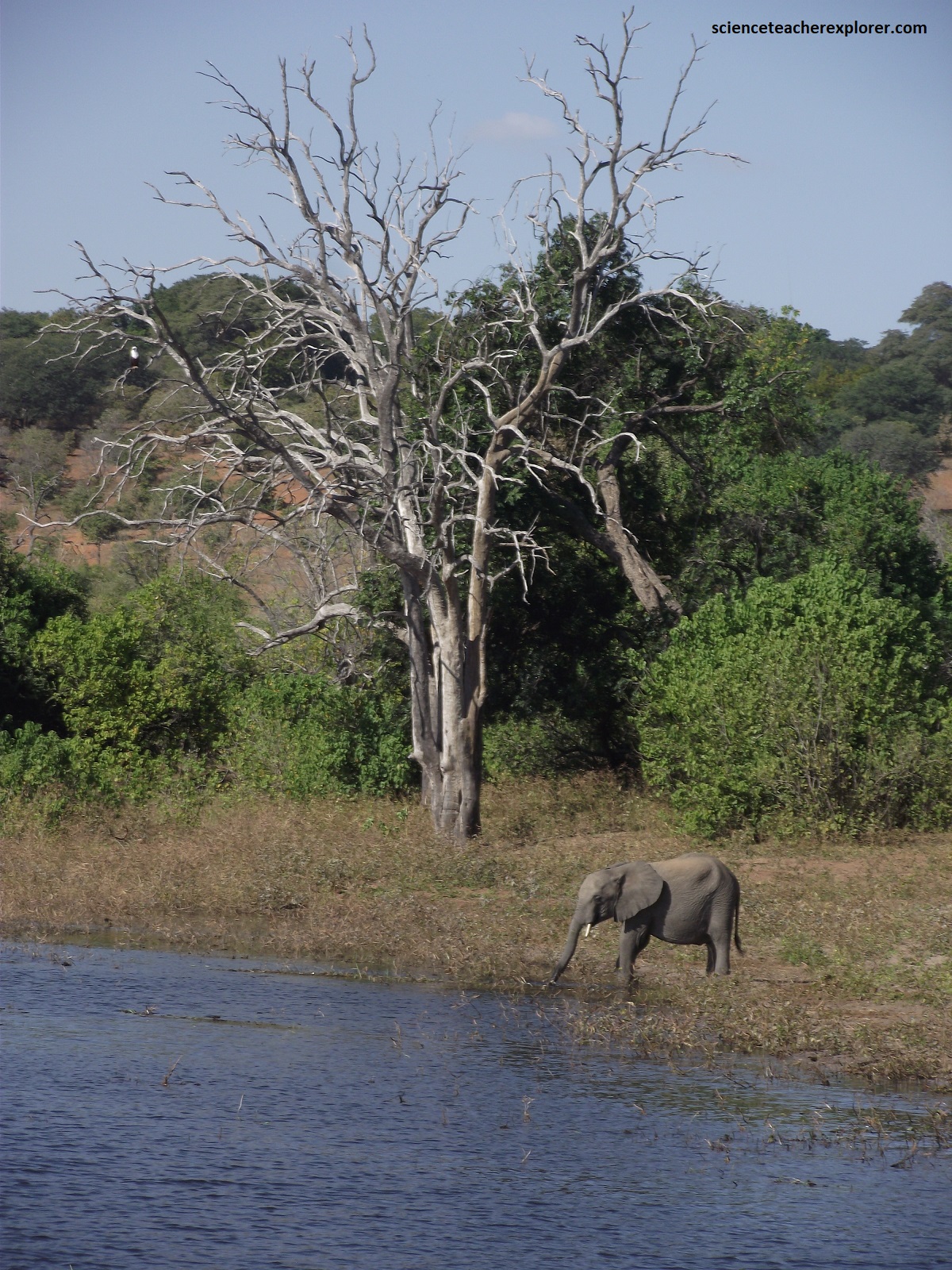
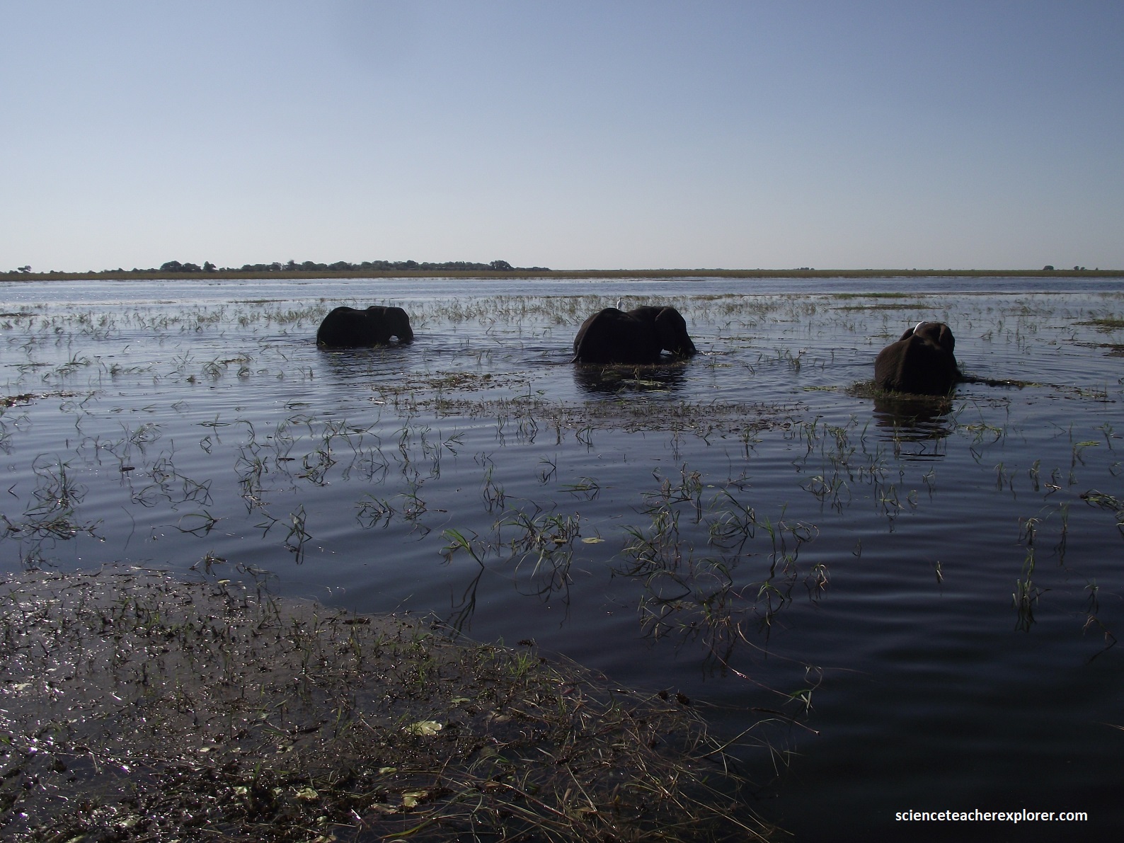
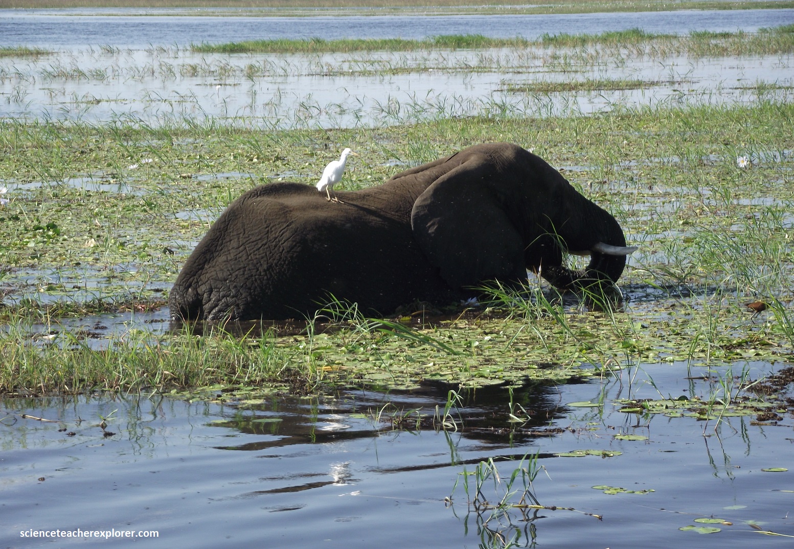
In the dry season, the broad Chobe River attract huge herds of elephant, of which frequently swim across the river to feast on the perennially lush islands that separate Namibia and Botswana, (picture above). The impact of Chobe’s elephant population is the source of much debate among scientists. Their excessive numbers are blamed for transforming the river’s fertile banks into orange, dust dunes by the end of the dry season each year, which, it is argued, damages the habitat and impacts other herbivore populations. Yet, despite their apparent omnipresence, the last recorded estimate (in 2018) of elephants in Chobe National Park was just over 15,500. However, elephant supporters point out to their pivotal role in a dynamic ecosystem, dispersing seeds up to 65km away and fertilizing the ground with 150km of dung daily. Excess population growth is also managed by nature; i.e.: past outbreaks have dented Chobe’s elephant numbers. {Note: Males are larger than females, with a rounded rather than angular forehead and thicker tusks. Dominant females (matriarchs) lead the family units, which may combine to form herds of several hundred}.
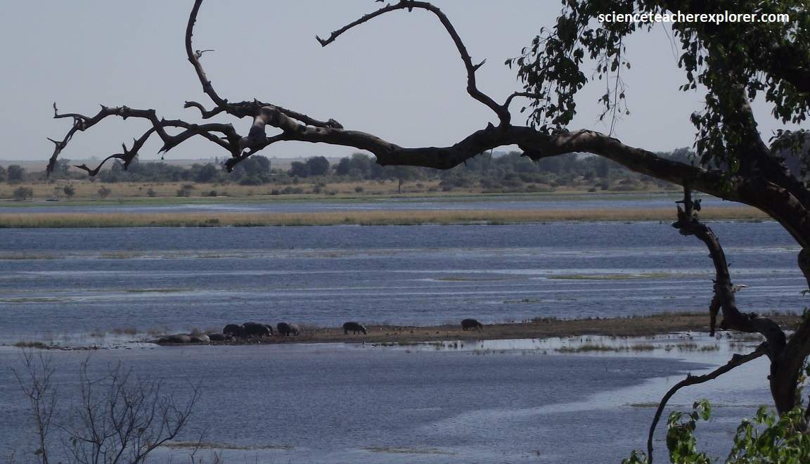
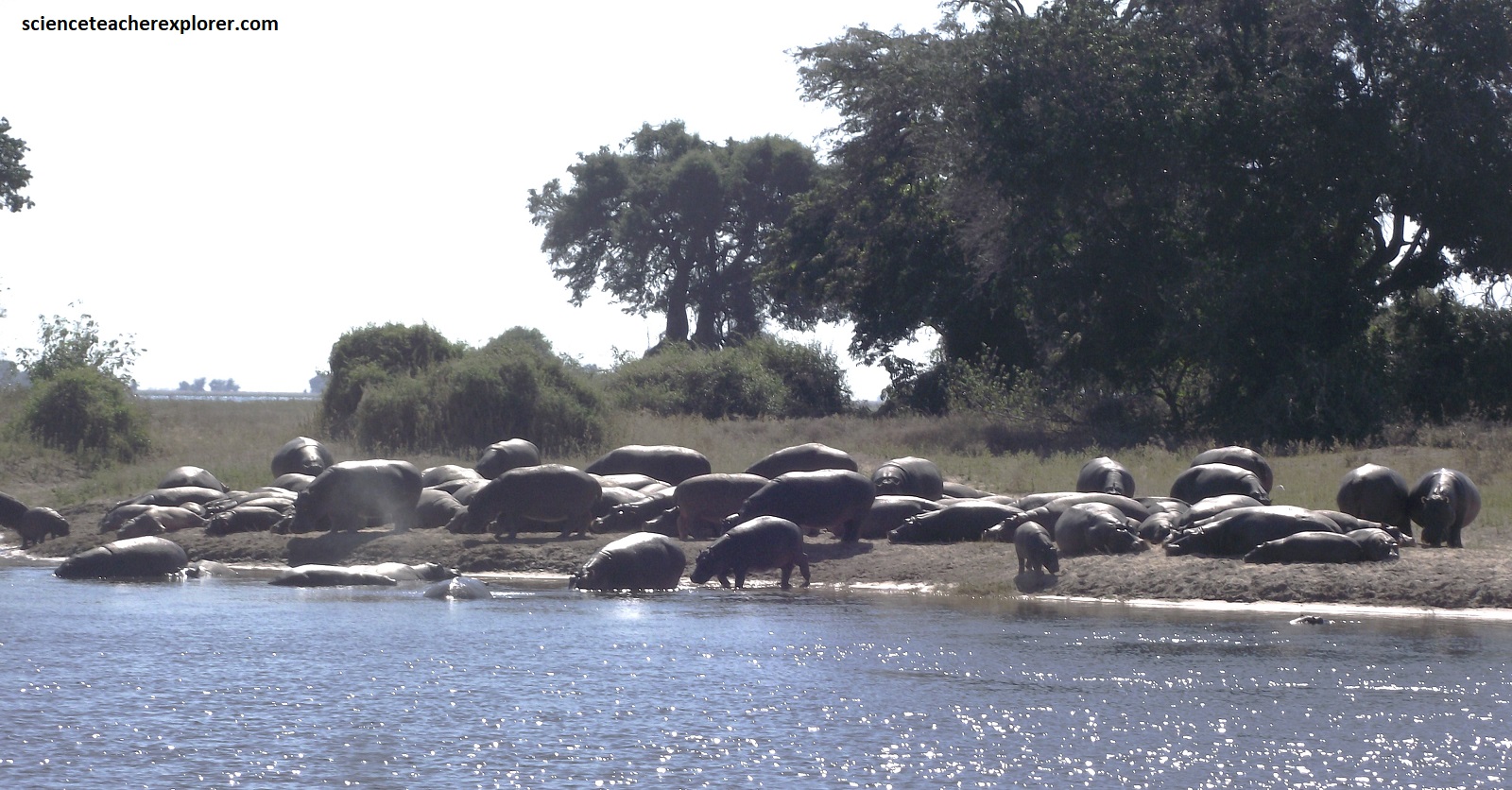
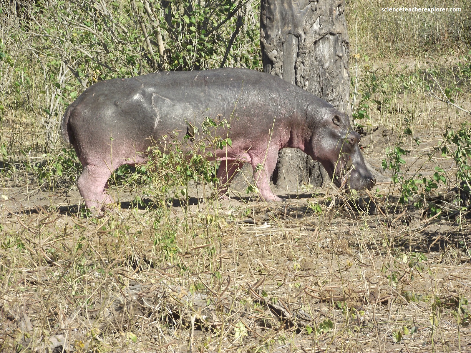
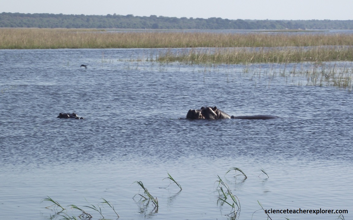
Pictured above, the hippos of the Chobe River are a prominent feature of this Botswana ecosystem, with thousands of hippos in large pods frequently seen along it’s banks. These semi-aquatic mammals are crucial “ecosystem engineers,” enriching the water with nutrients from their waste, which supports fish and aquatic vegetation. Despite being herbivores, they are considered extremely dangerous and are Africa’s deadliest large mammal due to their territorial nature and powerful jaws, which have large, protruding tusks used for fighting.
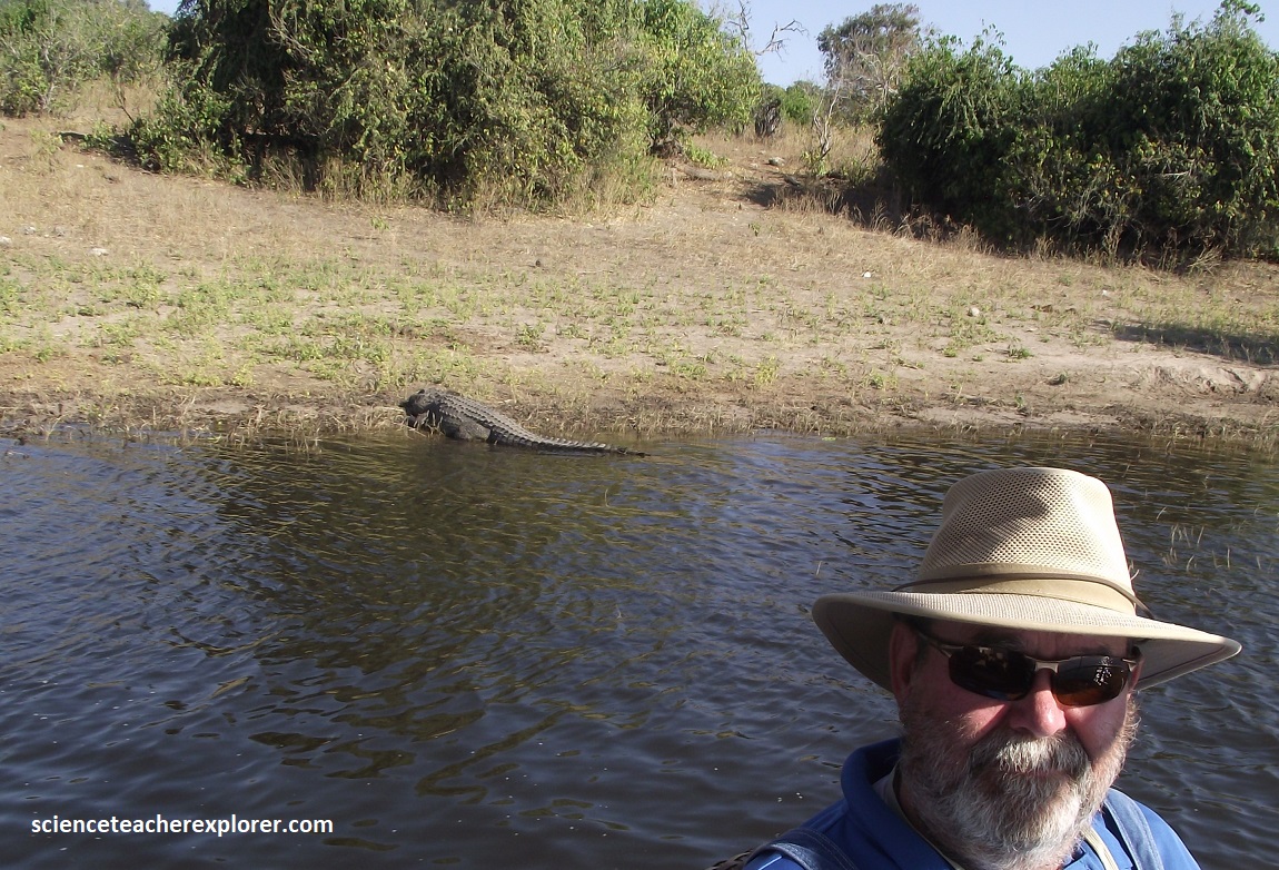
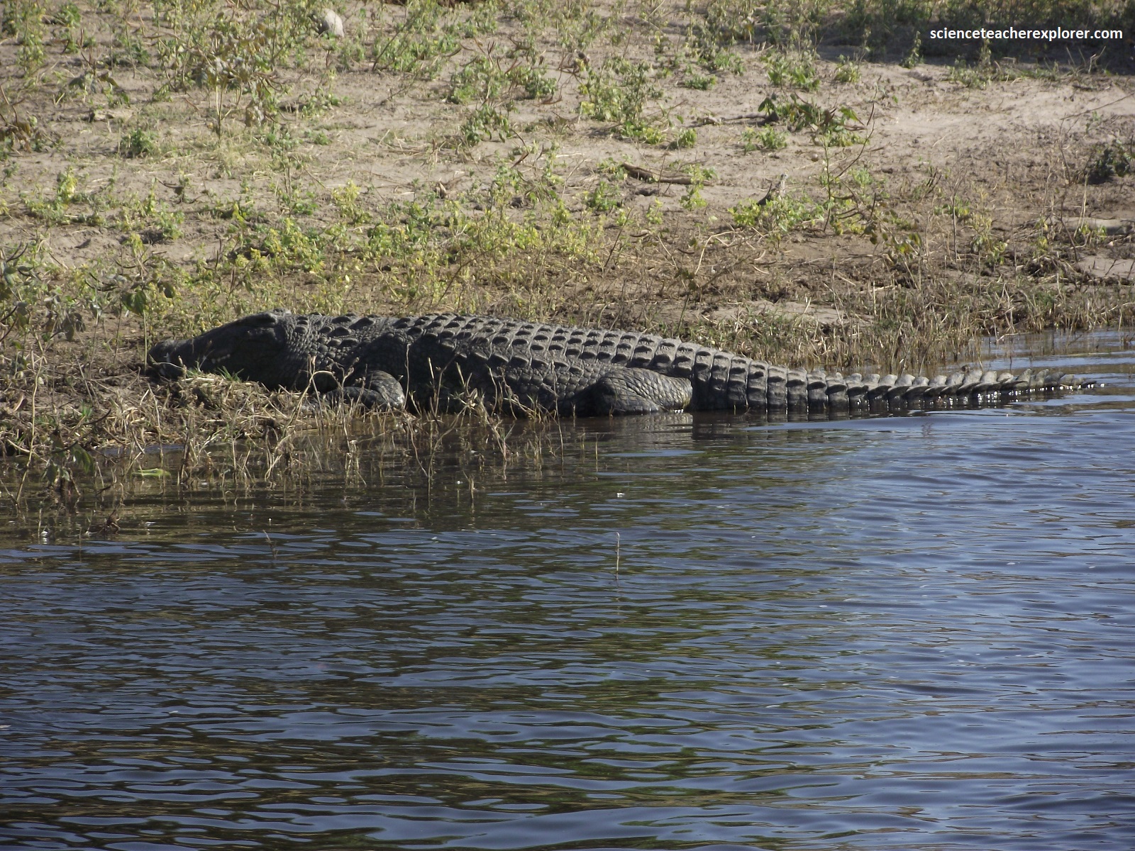
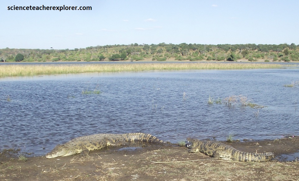
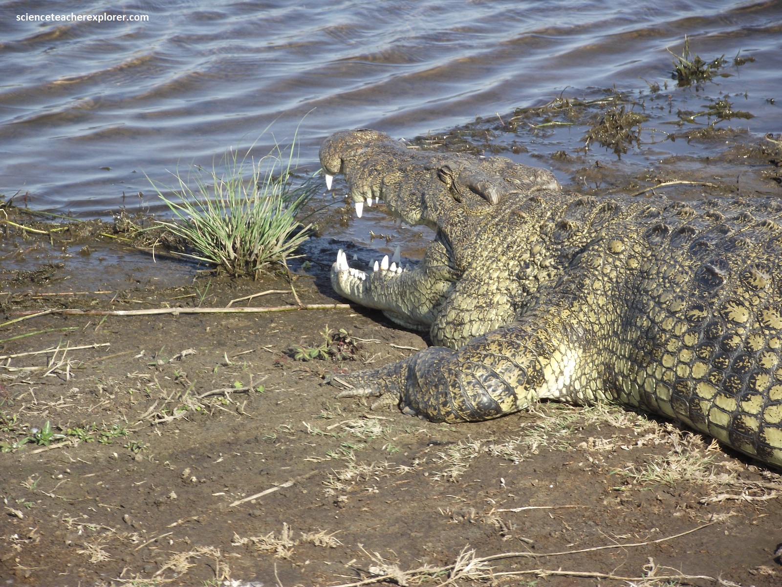
With it’s broad, flowing river, lush floating islands and remarkable density of wildlife, the Chobe riverfront is famous for it gargantuan crocodiles, (some of which stretch to 6m), swimming elephants and chorting hippos. Pictured above are giant Nile crocodiles, (with Tracy Davis in 2025), seen protecting their nests on the banks of the Chobe River.
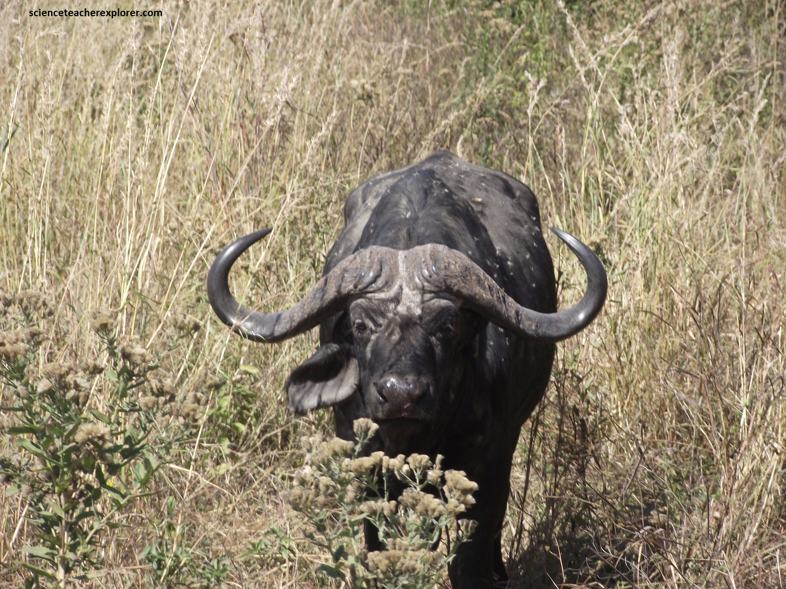
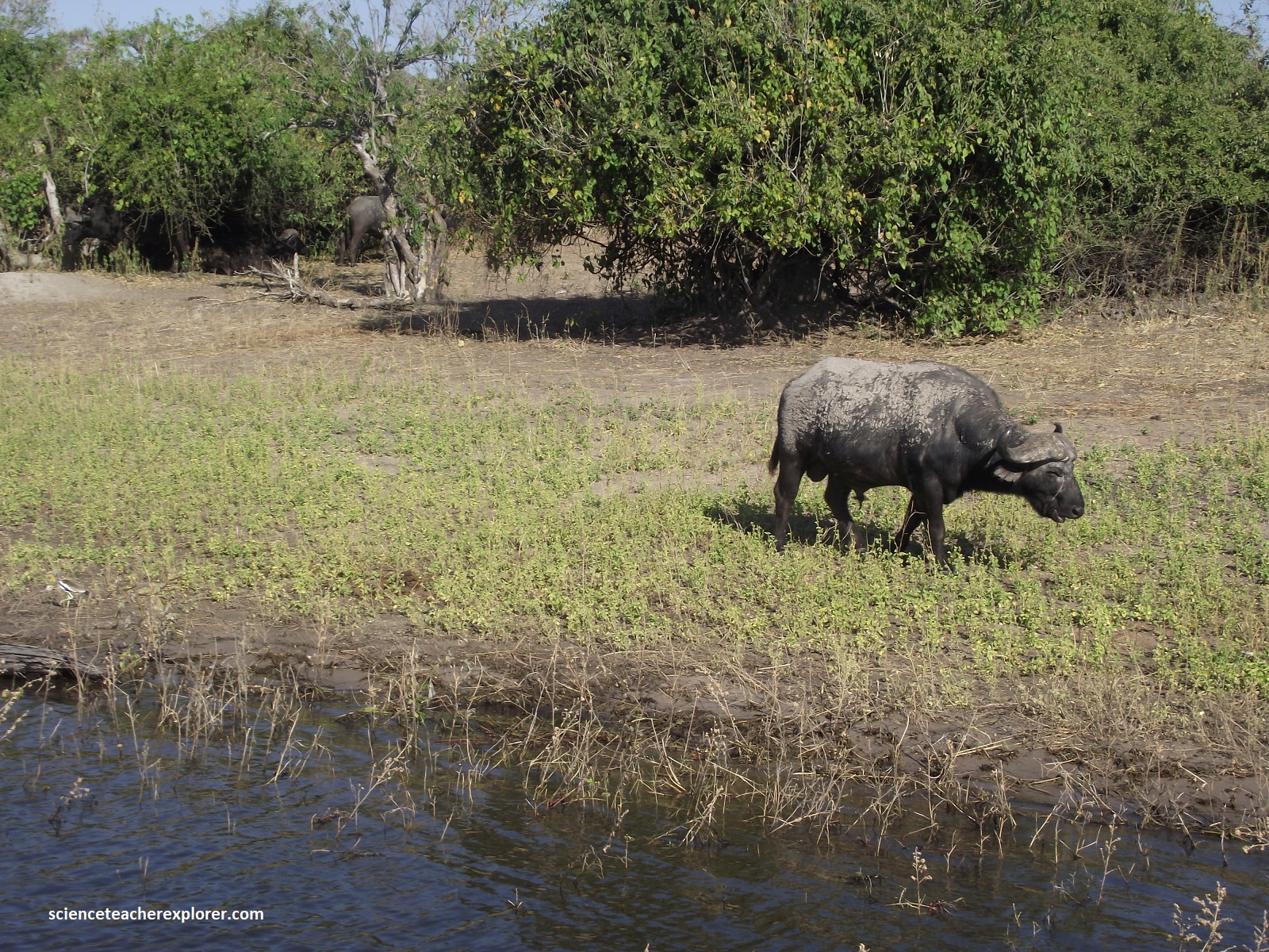
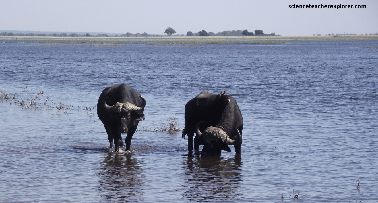
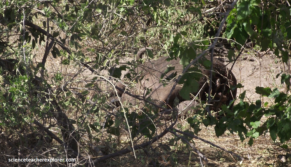
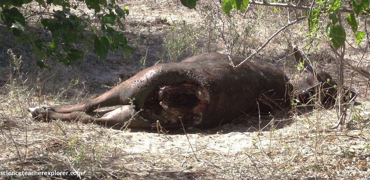
Pictured above, the African buffalo, also known as the Cape buffalo, are abundant in Chobe National Park, near the Chobe River. These large herds are often seen wading in the river to cool off or feed on aquatic plants. Sometimes, the older males that have been pushed out of the main herd often forming “bachelor herds” and are called “dagga boys”. (As pictured above), they frequently stay in the area and can be seen wallowing in mud to get rid of insects and ticks. The Chobe is also known for dramatic events where large numbers of buffalo have drowned while trying to cross the river, often as a result of being panicked by lions. {Speaking of lions chasing buffalo . . . (Pictured below are a small family of lions hanging-out near a buffalo kill)}.
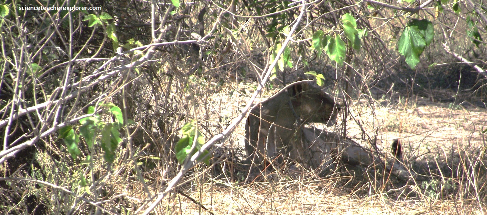
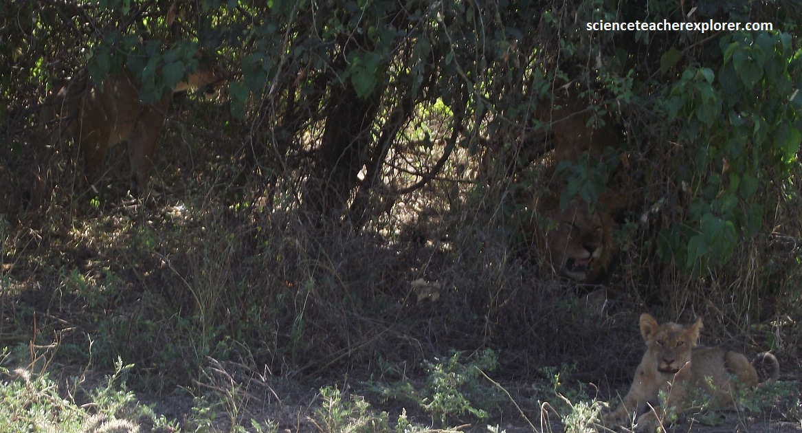
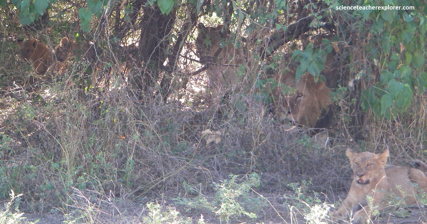
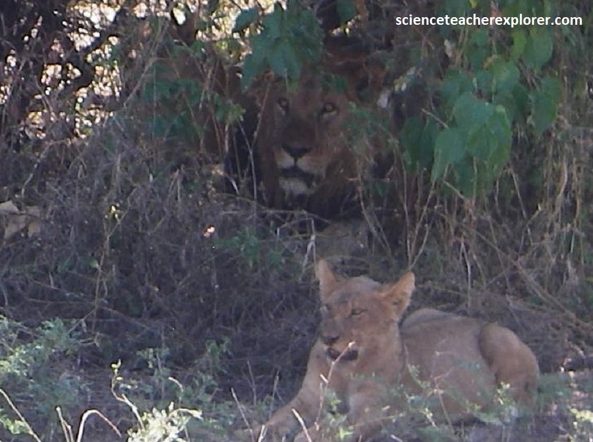
Lions are the most common predator along the riverfront. They tend to operate in small family groups, (as pictured above), rather than as part of a cohesive pride, though they still observe territorial boundaries and rarely cross between eastern and western sectors.
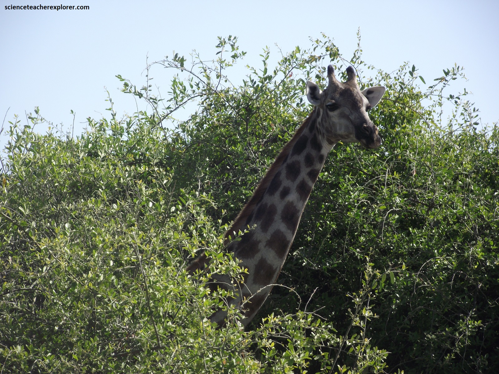
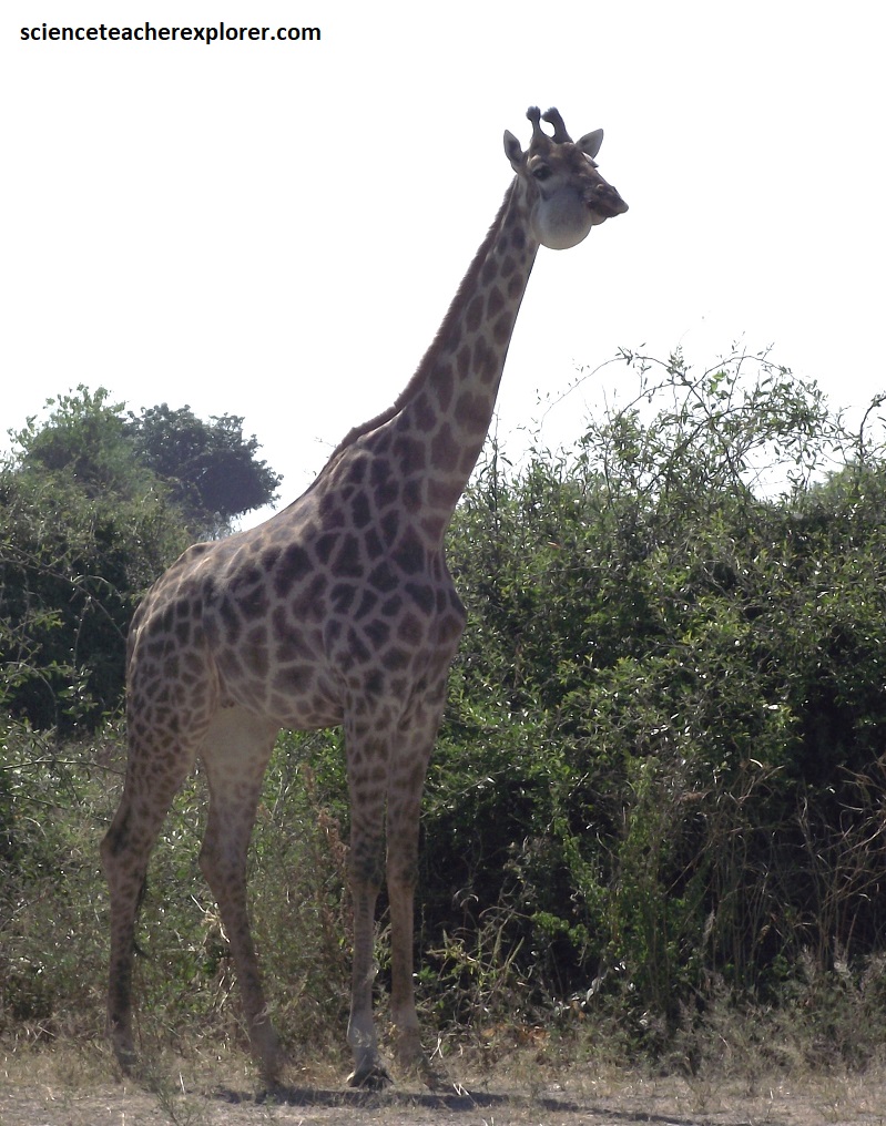
Chobe’s different habitats effectively form a series of layers running parallel to the river. Furthest from the river in the south lie large swathes of Zambezi teak forest. Several patches of knobbly combretum separate this forest from the classic riverine species that line the riverbanks on the eastern side. Jackal-berries, African mano-steen, sausage trees, umbrella thorns, fever-berries and Natal mahoganies are seen here at the Chobe N.P.. Pictured above are the massive long-necked herbivore-giraffe. It feeds on leaves beyond the reach of other browsers and favors Acacia during summer, but switches to Mopane and evergreen trees in the dry season. Social but non-territorial, the individual giraffe become darker with age. The small horns of male giraffes are bald on their tips; where the females horns are tufted. {Note the giant tumor on the giraffe pictured above}.
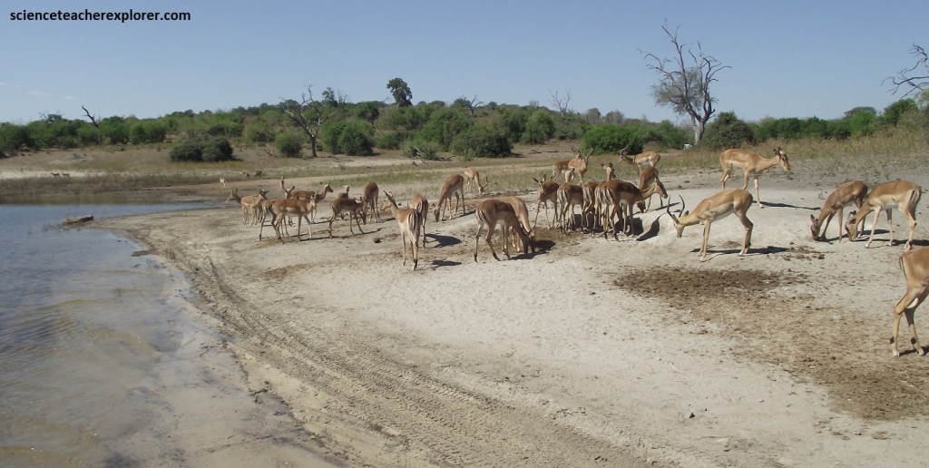
The Chobe National Park is the country’s most diverse in terms of antelope species. Pictured above, impala crow the low-lying floodplains that hug the meandering river. By the peak of the dry season, in October, the impact of thousands of herbivores reliant upon the Chobe River is self-evident. Every blade of grass has been plucked from the ground, leaving the trees floating on the arid ocean of sandy ochre soil.
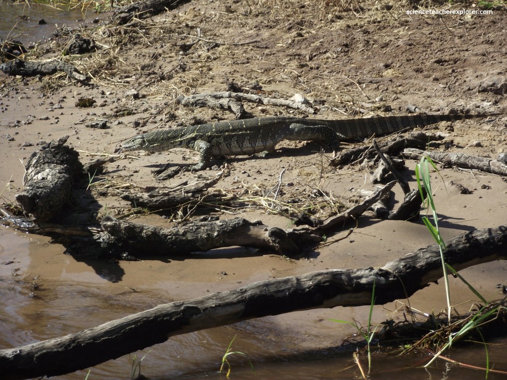
Pictured above is the Nile Water Monitor. They are a common sight on the riverbanks of the Chobe, sunning on rocks and logs, and are adapted to a semi-aquatic lifestyle. Their presence is a normal part of the ecosystem, and they are an important food source for larger predators like crocodiles. However, they also act as a natural control on the crocodile population since they feed on crocodile eggs.
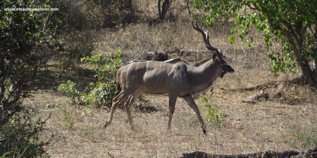
Pictured above, the “Greater Kudu” favors the dry woodland of Chobe National Park. Males carry magnificent spiral horns which attain full length after 3 years. The coat is grey-brown with 6 or more thin white stripes. Males have a prominent mane on the shoulders and throat.
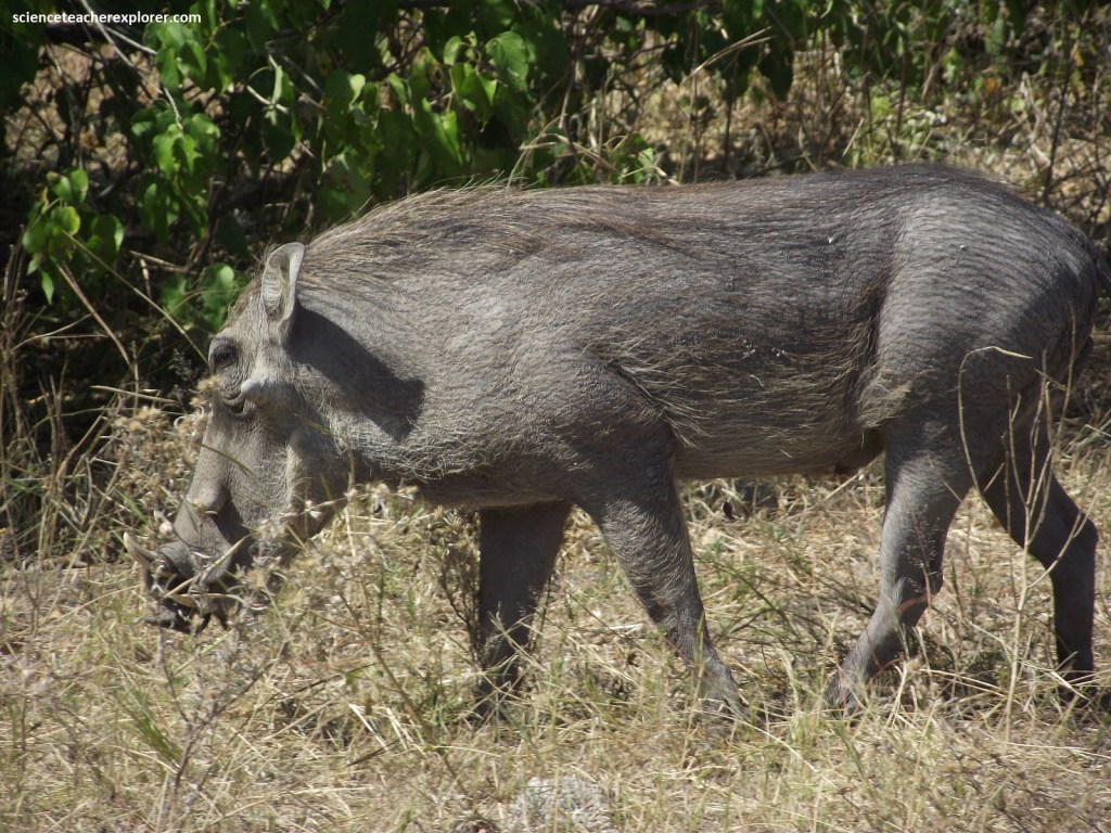
Pictured above, this sparsely haired pig with curved tusks and wart-like swellings on the face is a warthog. Males are larger with longer tusks and two pairs of ‘warts’. The tail is held upright when on the run. It grazes on short grass or digs for tubers on folded knees. The sexes usually live apart.
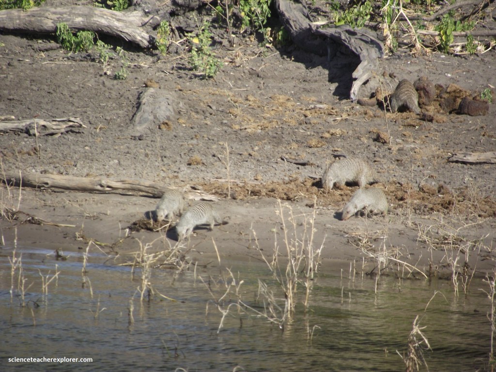
Pictured above is a group of stocky Banded mongoose with distinctive vertical bars on back and flanks of it’s grizzled coat. Gregarious, living in troops of up to 30 with several breeding females and males. Packs move together but individuals forage separately and guard food jealously.
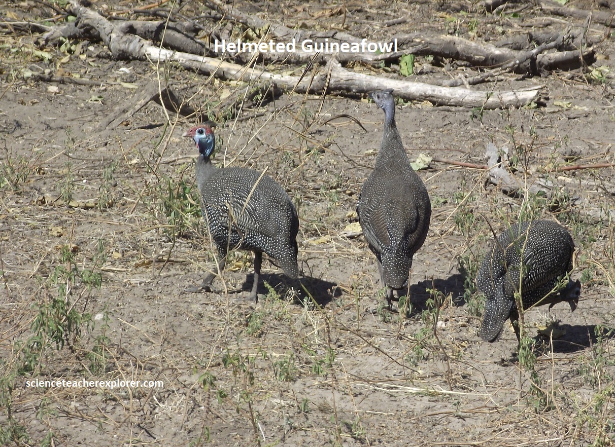
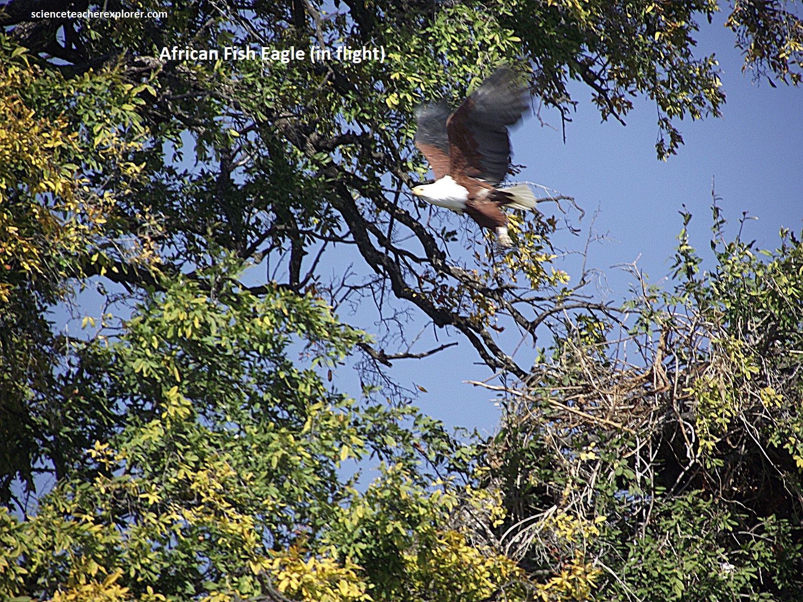
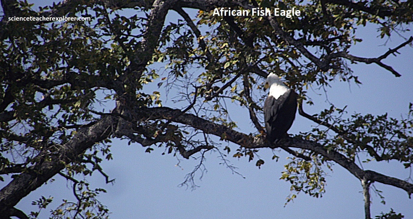
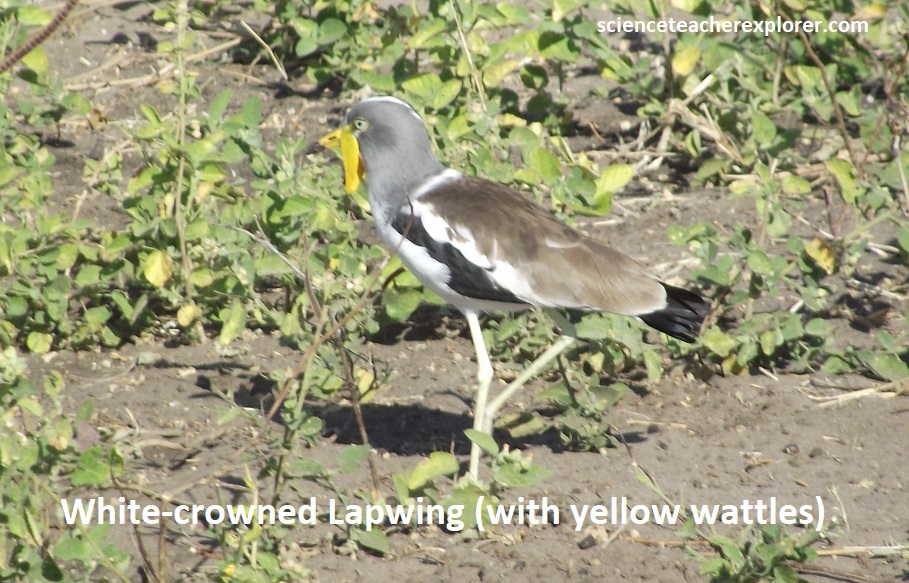
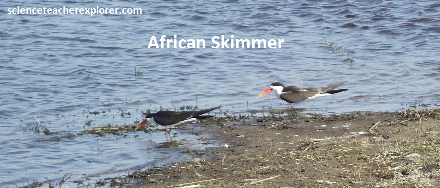
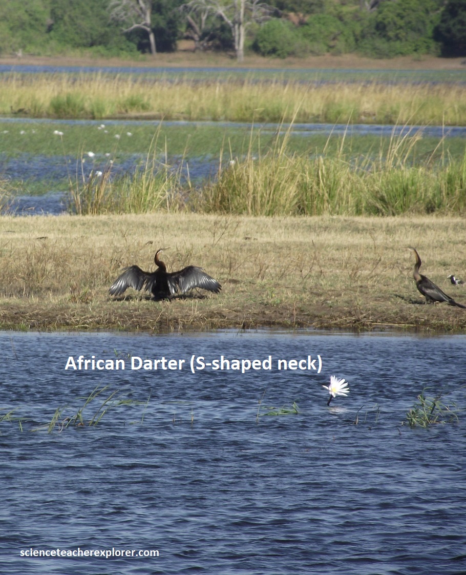
The plentiful birdlife was best seen by boat on the Chobe River. Pictured above, species from the ubiquitous African darters and skimmers to the White-crowned lapwing were seen, not to mention the copious vociferous fish eagles. In the woodlands, we spied a flock of Helmeted Guineafowl near the lion kill. Tracy informed me that he hatched and raised a flock of these in the United States on his farm. He mentioned to me that the young chicks were the cutest little things he had ever seen. Interesting!
