Coronado Trail, AZ 2024
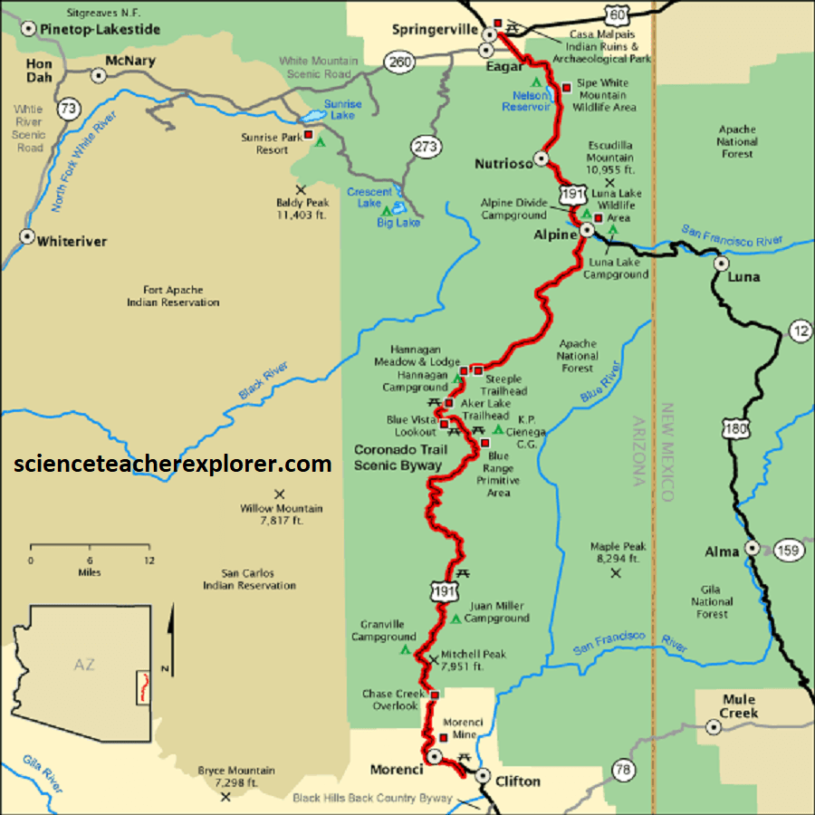
While traveling to the April 8th, 2024 Solar Eclipse in Texas, I made a drive through on Arizona’s southeastern scenic byway called the Coronado Trail, Hwy., (US-191) from Springerville to Clifton.
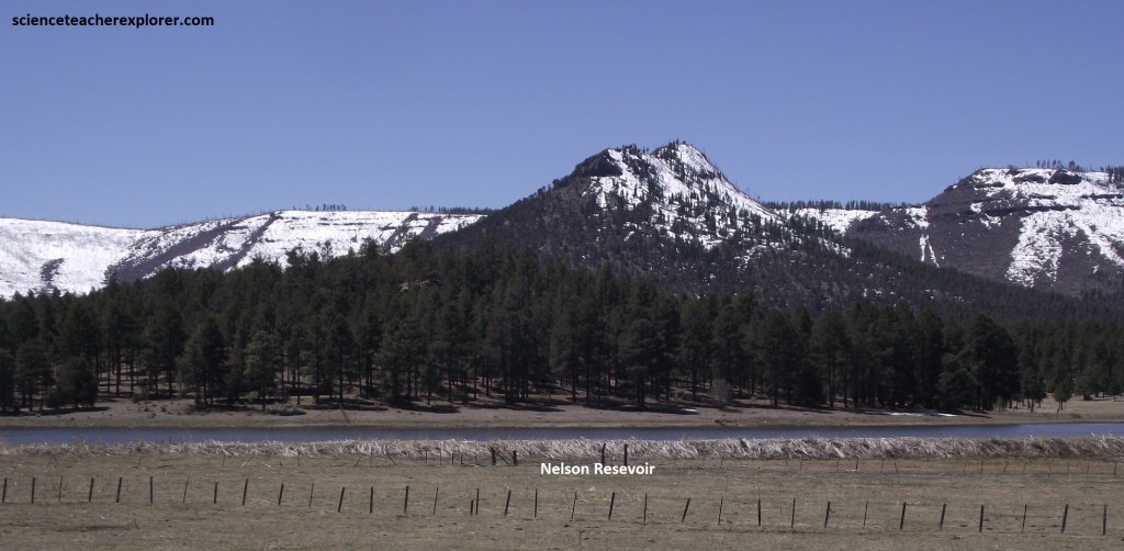
The story goes, the Spanish were the first Europeans to visit this area in 1540, led by gold-hungry Coronado. During tis time, many Spanish adventurers sought the Seven Golden Cities of Cibola. The legend tells of a group of bishops who, during the Moors’ invasion of Spain and Portugal in 715AD, escaped to the west on boats with more than 1,500 people. He allegedly established a community called Antilia so lavish that its inhabitants used golden implements. By 1539, the lands around Arizona, New Mexico and Texas, reported on by Cabeza de Vaca and his companions; were believed to contain an El Dorado known as Cíbola. In that year, Viceroy Antonio de Mendoza dispatched Fray Marcos de Niza and the African Estevanico on a reconnoitering expedition. On return to New Spain, Fray Marcos reported seeing golden cities, the smallest of which was larger than Mexico City. . So Mendoza chose Coronado to lead an expedition, find and explore these cities, and conquer the area and treasures in the name of Spain.
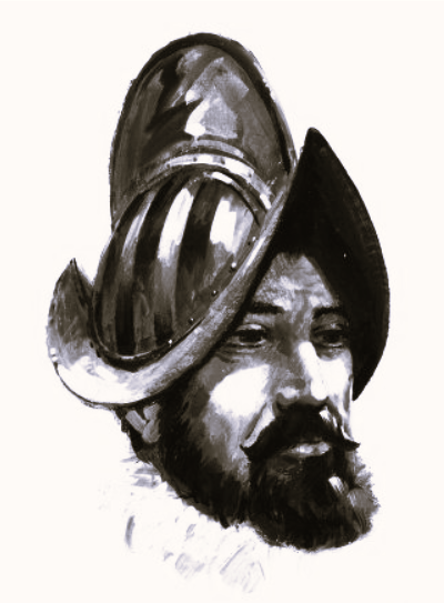
Francisco Coronado began his expedition in February 1540. He had about 300 Spanish soldiers, several hundred natives, and herds of horses, cattle, and other livestock. They were traveling to lands northeast of New Galicia, (from which he was the governor). This area had yet to be explored by the Spanish, even though they controlled much of the land. They began by heading north, along the West Coast of Mexico. They then went through Culiacan, the Yaqui River, and crossed the mountains into present day Southeast Arizona.
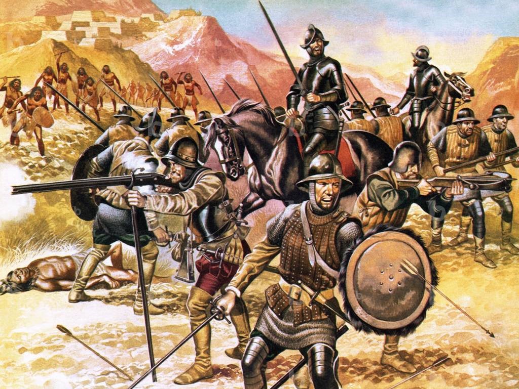
In July 1540, Coronado and his men came upon what they thought was their first discovery of the golden cities of Cibola. What they actually came upon was the Native American pueblos of present day New Mexico Zuni tribe. This fell short of Coronado’s expectations. There were none of the gold or other riches he had expected to find. In the fall of 1540, they moved their base to the Rio Grande in what is now central New Mexico.
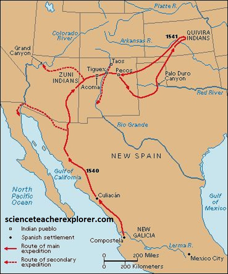
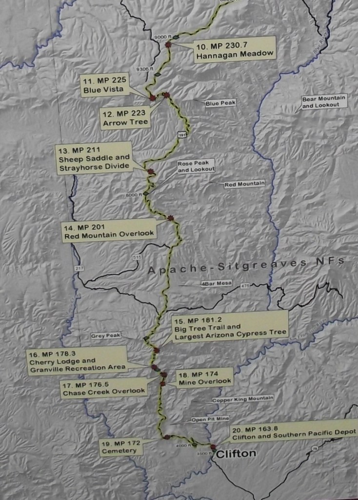
Coronado soon sent out two scouting parties. One party, led by Garcia Lopez de Cardenas, became the first Europeans to discover the Grand Canyon. The other party found more pueblos in the Rio Grande Valley. In the Tiguex area they began a battle with the Pueblo natives. This battle lasted several months before it ended. Coronado was still disappointed that he had found no treasures. But his hope was restored in 1541 when he heard stories of a new land filled with riches, across the Pecos River and northeast into the panhandle of Oklahoma and Kansas territory. Of course, I was only interested in the celebratory trail in south-eastern Arizona. I started in Springerville and drove south on US-191.
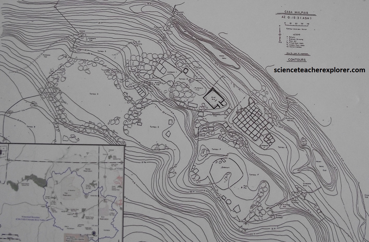
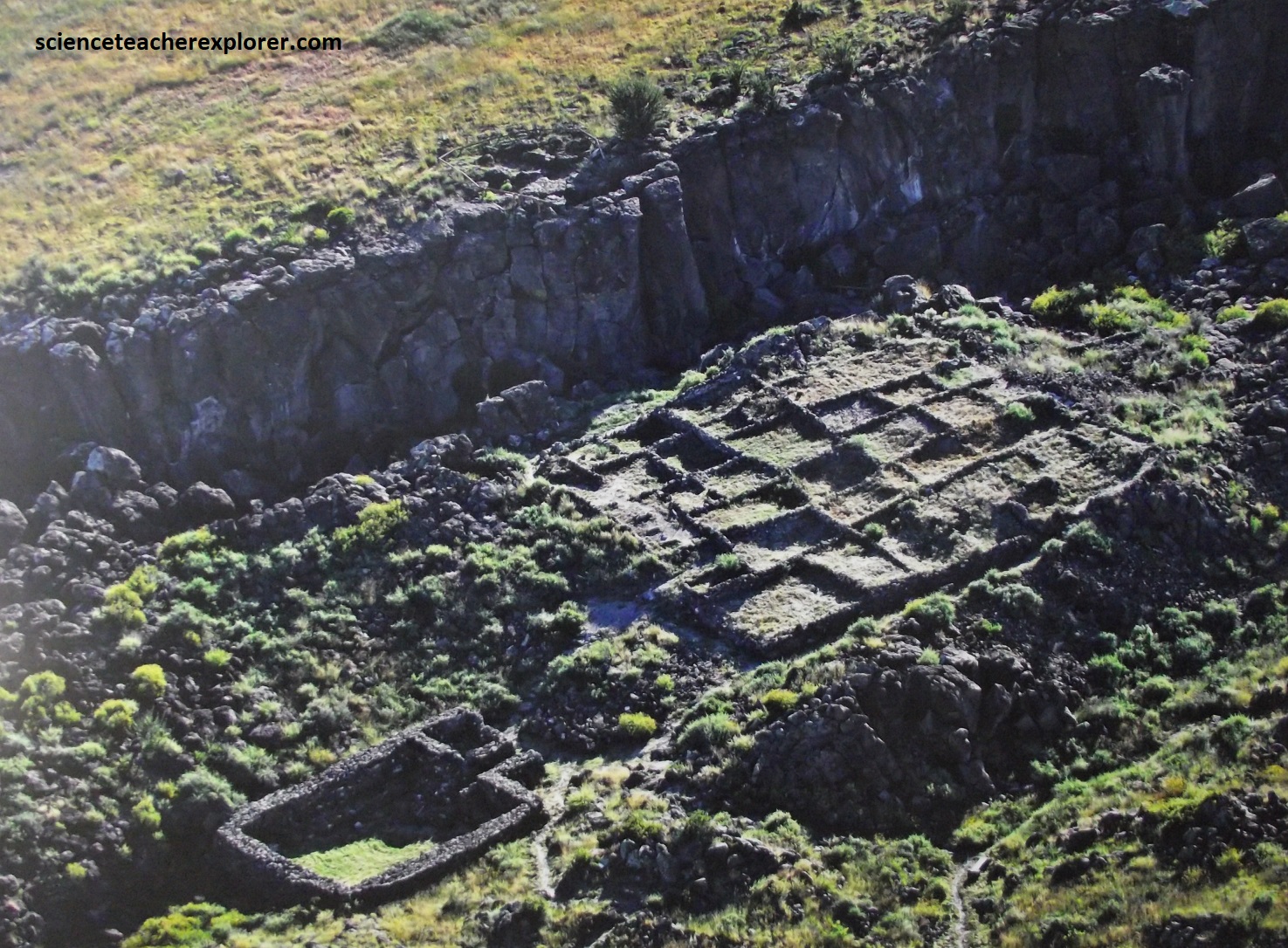
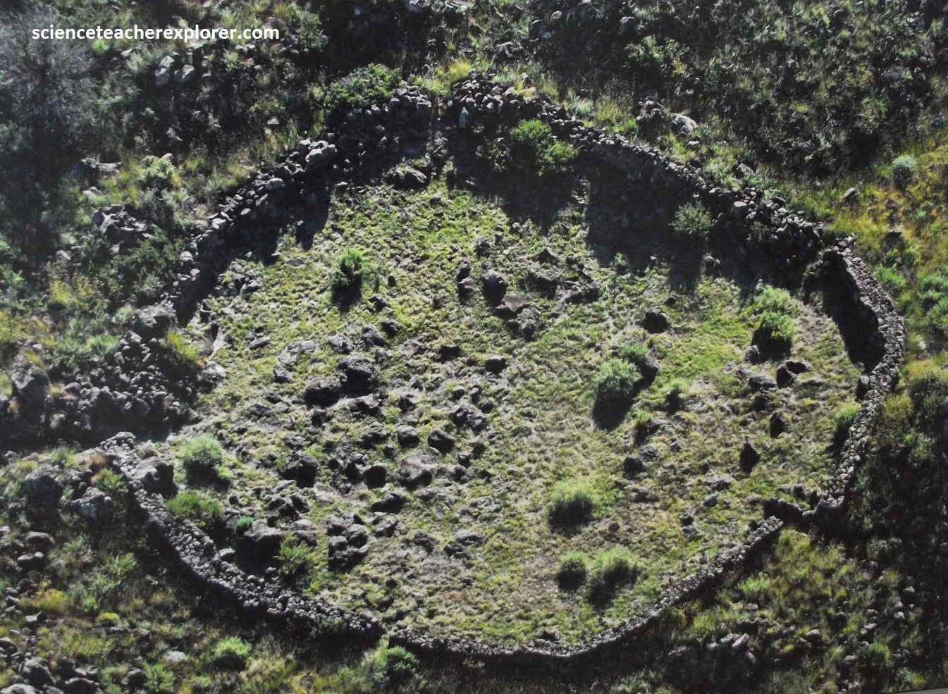
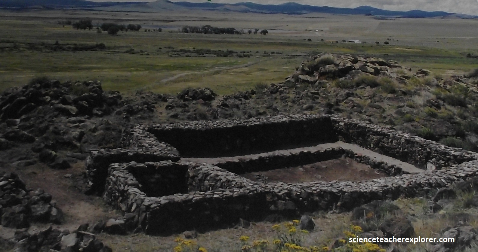
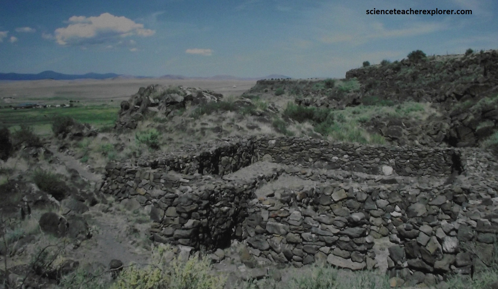
{Images above of the “Casa Malpais” north of Springerville, were taken from interpretive signs found at the Springerville Museum}
Springer is the site of the controversial Mogollon-pueblo “Casa Malpais” (House of the Badlands). Casa Malpaís was built around 1260 and was inhabited until about 1400. It is one of the youngest Mogollon Sites found. Unique and unusual features characterize the site. The Great Kiva, painstakingly constructed of volcanic rock, is the centerpiece. A steep basalt staircase set into a crevice of the high basalt cliff wall leads to the top of the mesa. The pueblo is perched atop terraces in front of basalt cliffs. These cliffs were formed from lava flow from an ancient volcano nearby. The 60-room pueblo, solar calendar, and Great Kiva were built were built in the year 1240. An opening on the structure’s northern side appears to be oriented to true north. Another, on the southwest side of the structure, is offset to allow a distinctive rectangular shaft of light to enter in a direct line with the wall during sunset at summer solstice. At winter solstice, the shaft of light once again enters through the gate and extends to about the middle of the enclosure. During the equinoxes, the sun enters again through the gate and produces a distinctive rectangular shaft of light. Outside this circular feature, is a Bear Claw petroglyph, which at vernal equinox sunset, fits into a shaft of light produced by a natural rock grouping.
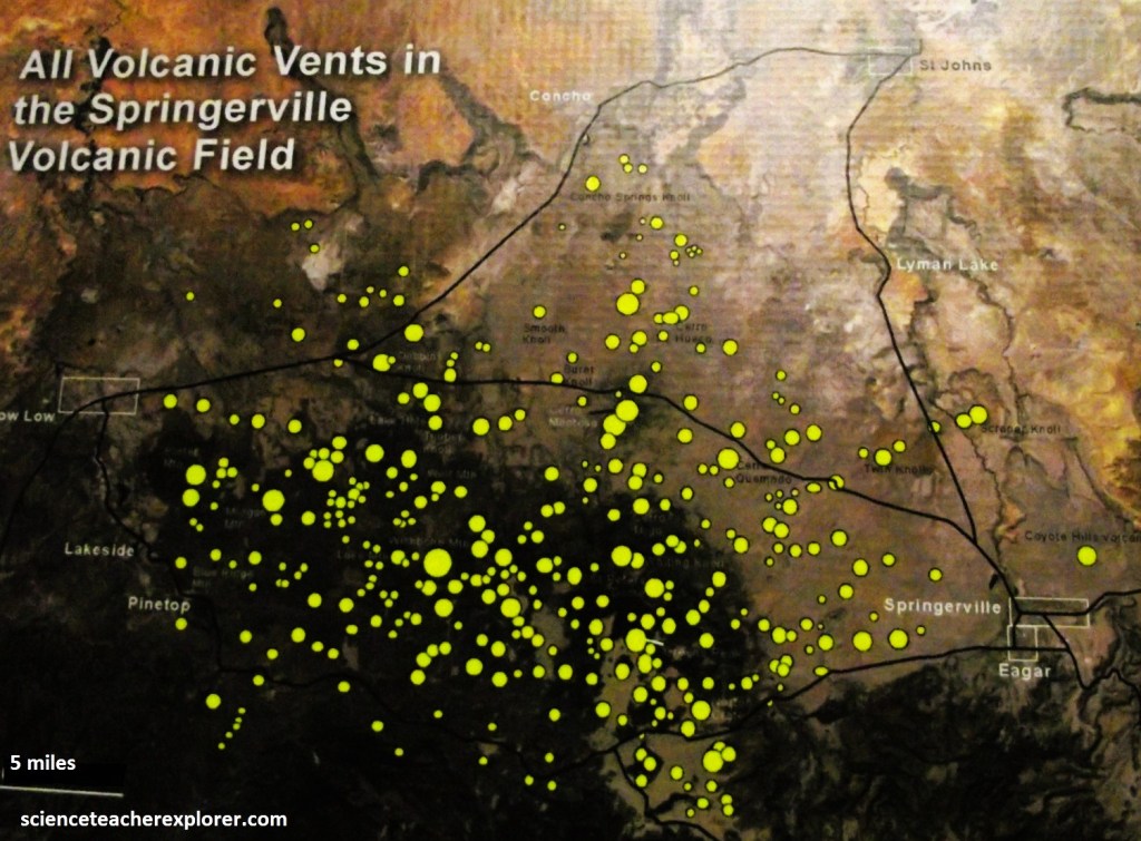
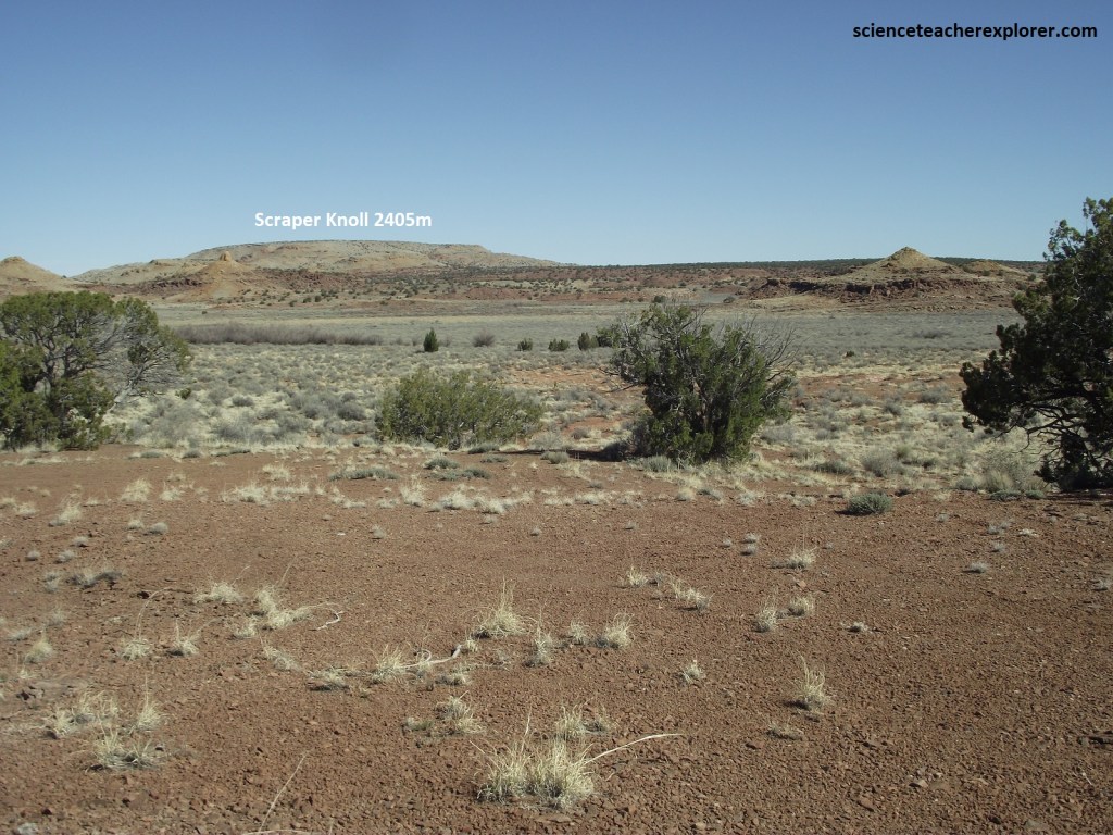
Imaged above, The Springerville volcanic field contains over 400 volcanoes within a 80 km radius of Springerville, making it the third-largest volcanic field in the continental United States. Pictured below is the Scraper Knoll, 10 km north of Springerville, next to the US-191. This is a small shield volcano with a few vents surrounding it.
The Springerville Volcanic Field is approximately 3000 sq. km in area and extends from Springerville to Show Low and from Greer to St. Johns. Elevation ranges form 1830m to 3140m, (from St. Johns to the center of the field at Green’s Peak. The volcanoes range in age from 3 million years to younger than 300,000 years. Most of the volcanoes are at the young end of that range.
The longest lava flow in the field erupted from Greens Peak, and this flow also contains an unusual lava tube called the Harris Cave. The erptions in the field migrated from west to east at the rate of about 3 cm/yr. The youngest volcanoes are in the eastern part of the field near Springerville (Cinder Knolls). The eruptions occurred on the average of one about every 4000 years while the field was active.
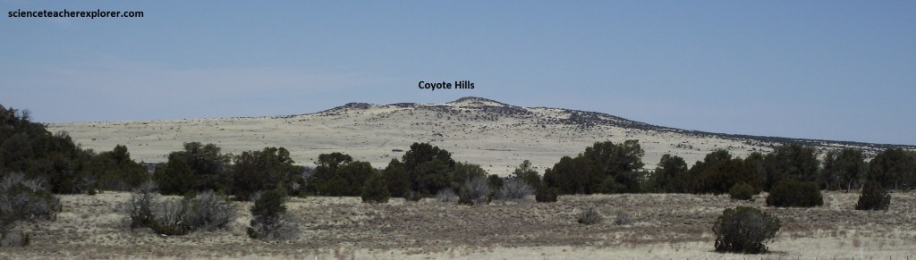
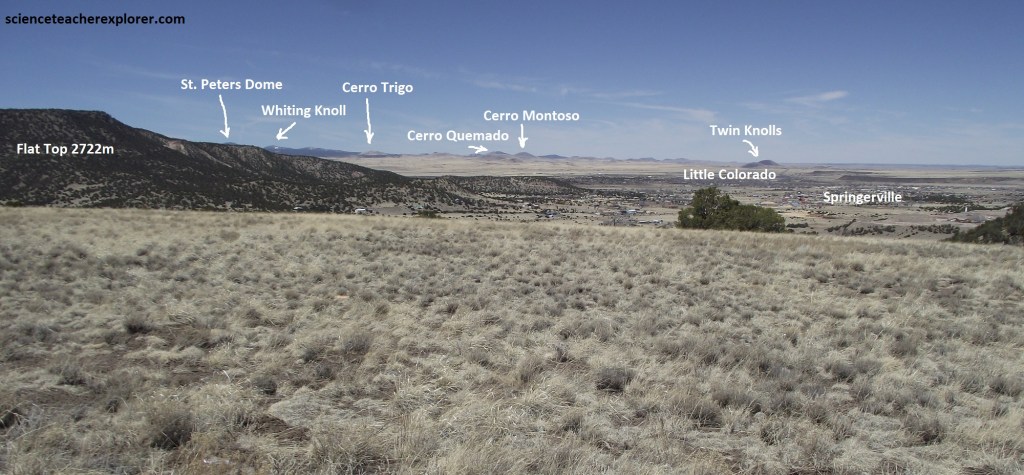
Pictured above, Coyote Hills shield volcano, just northeast of Springerville, is about 800,000 yrs old. It is the same type of volcano that formed the Hawaiian Islands. The Springerville Volcanic field contains many type of volcanoes such as cinder cones, domes, shield volcanoes and maar craters, (produced by magma-water steam explosion).
The volcanism has created the beautiful and scenic area between Springerville and Show Low; and it has contributed as that increases fertile soil, making it perfect for grasslands and grazing. The town began as a trading post, a hub for the Mormon ranchers who settled the region in the 1870s.
Heading south out of Springerville, Rte. US-191, (the Coronado Trail), quickly climbs into hills and canyons of the Apache-Sitgreaves National Forest. The vastness of Apache-Sitgreaves virtually guarantees a wealth of scenic diversity: myriad mountains, canyons, secluded lakes and creeks, and woodland that change in character depending on elevation.
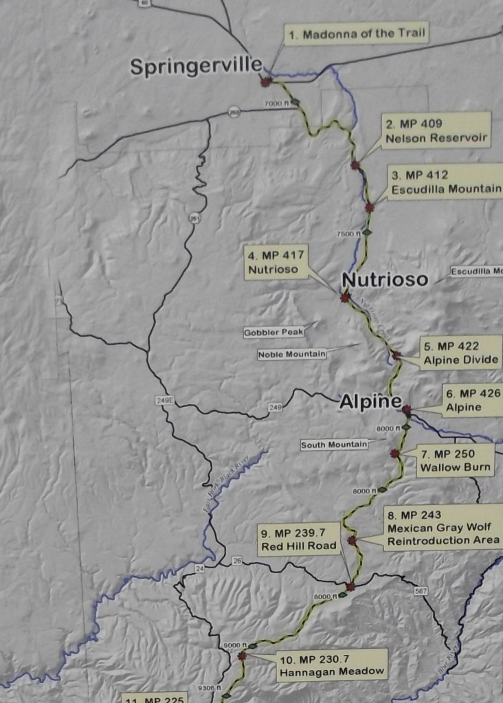
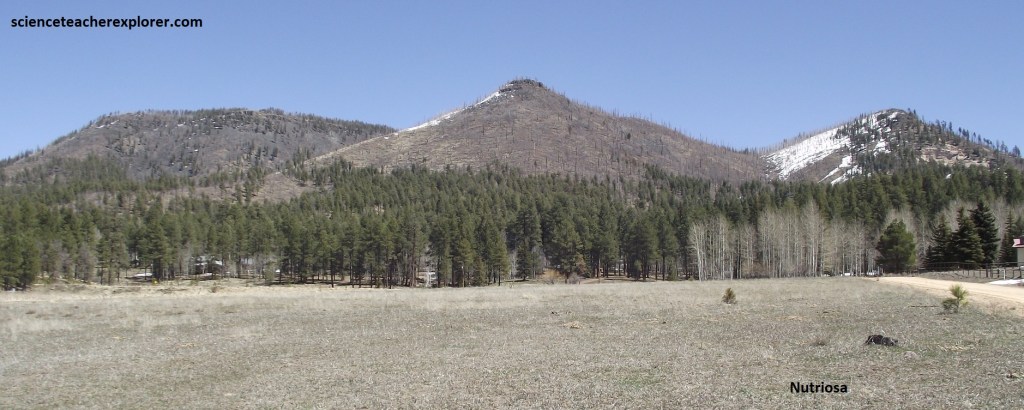
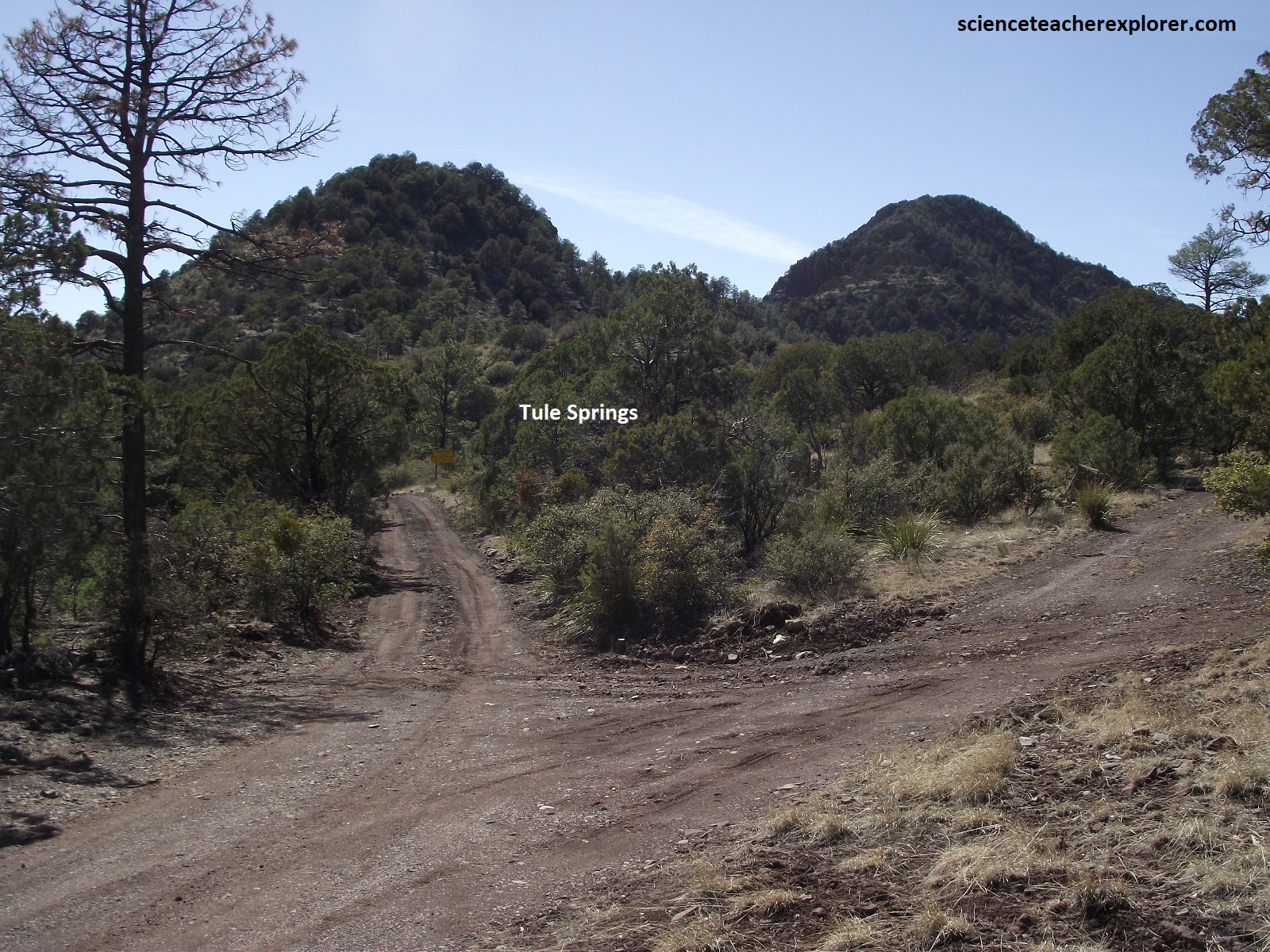
At mile post 417, Nutrioso’s name comes from the Spanish works “nutria” (beaver) and “oso” (bear). Founded by Mormon settlers in the late 19th century, it is home to one of the few remaining sawmill in the Southwest. It remains a quiet small town, (picture below).
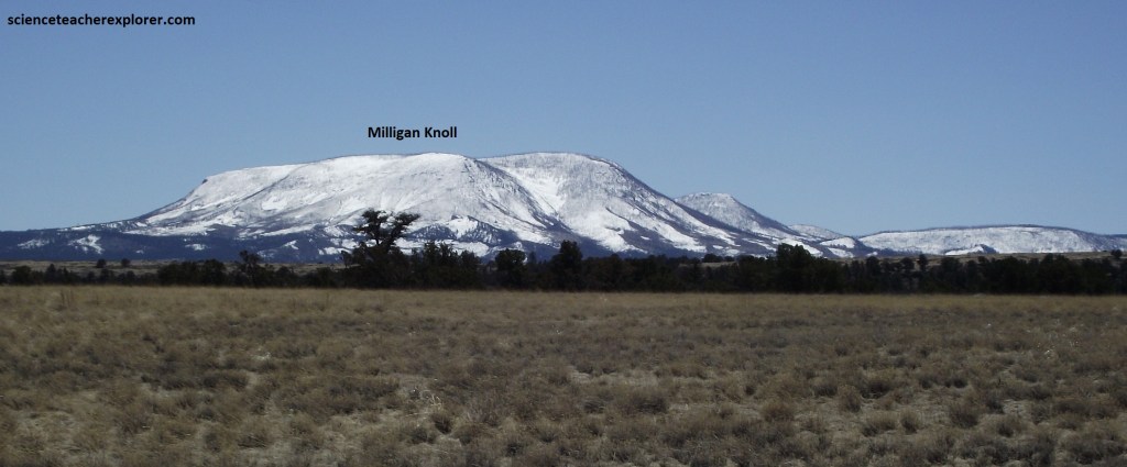
Cresting at 3736m elevation, Escudilla’s rounded crown dominates the eastern horizon. It’s name is Spanish for “soup bowl”, most likely an allusion to the bowl-shaped crater at the summit of the extinct volcano. A large grove of aspens covers the northern slopes, where a fire in 1951 ravaged the firs and pines that once grew there and again in 2011 by the Wallow Fire. Both fires were human-caused. In the rangeland and clearings that fan away from the peak’s base, tangles of raspberries, snowberries, and snowberries, and gooseberries flourish among the other shrubs and grasses. it is reported that the last grizzly bear in Arizona was killed on this mountain in the early 1900s.
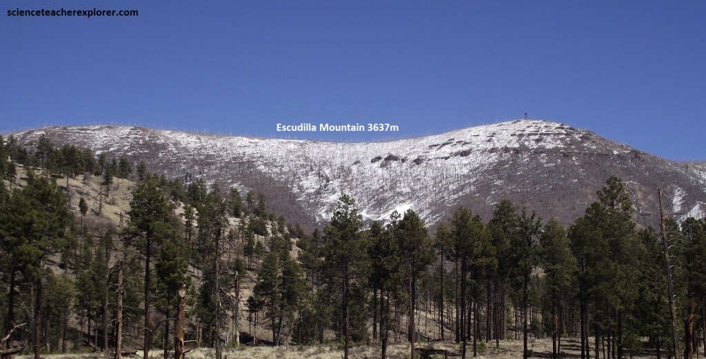
A forest road exited on Rte. 191, 5 km south of Nutrioso, and took me closer to the peak’s steep slopes so I could take the above photograph. Note that the southern peak has the loftiest fire tower in Arizona. You can barely see it on the right-side of the above photo.
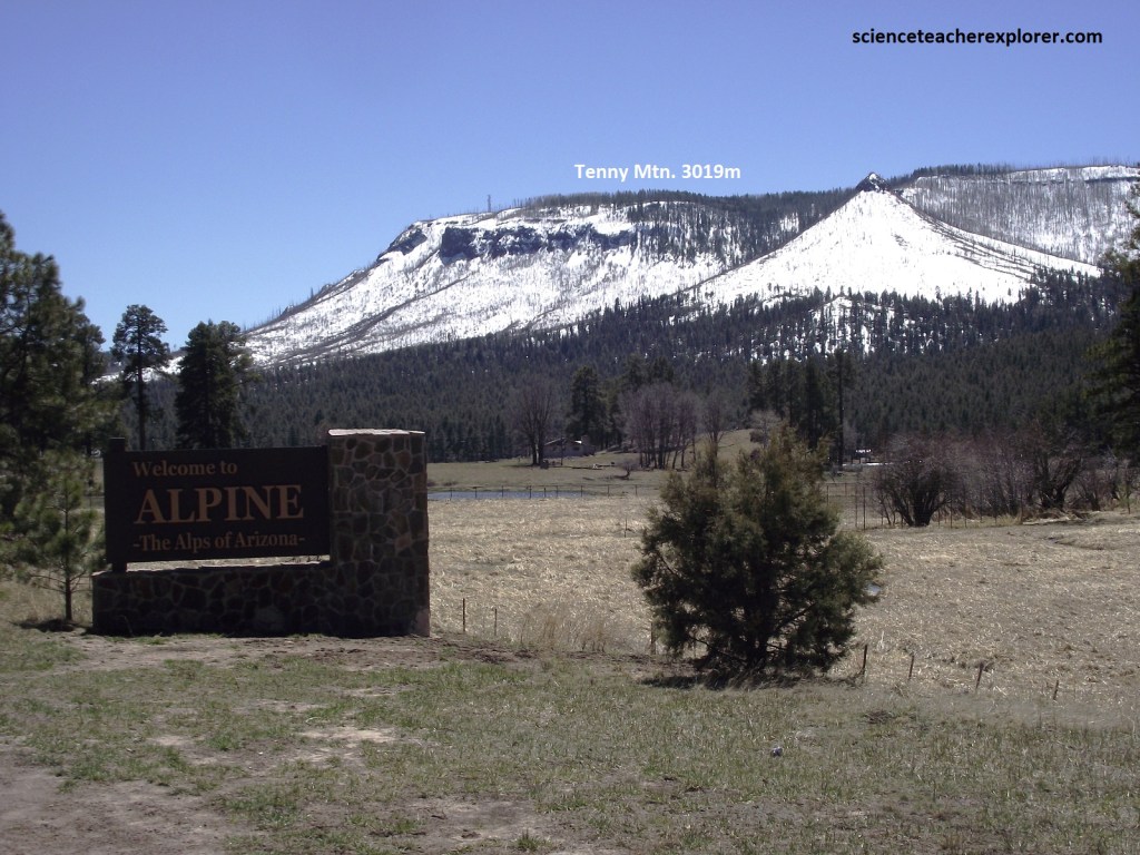
Continuing southward, Rte. US-191 ascends through a forest filled valley to the Alpine Divide, about 2,850m in elevation, then winds downhill through a slender canyon to Alpine, (pictured above). A picturesque town in the heart of the high country, Alpine serve as a center for outdoor activities, including some of the state’s best cross-country skiing. I stopped there to get gasoline.
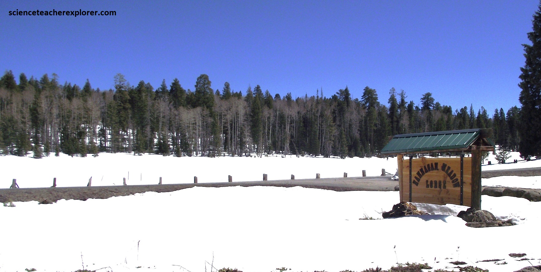
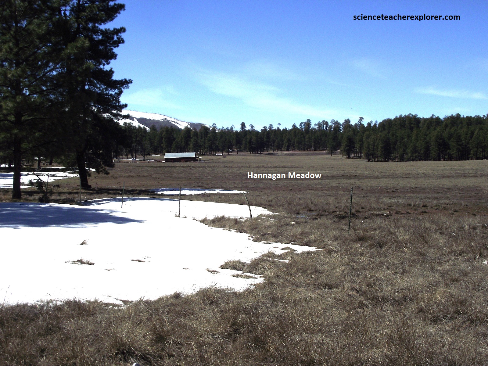
Scattered stands of pines, spruces, and firs in the snow surround the aptly named village of Hannagan Meadow, (m.p. 230.7). In June of 1926, along with 6,000 others, Governor W.P. Hunt gave the newly completed road the name “Coronado Trail”. Robert Hannagan, a Nevada miner, come to the area in the late 1890s to raise cattle. A coin toss with another rancher, Toles Cosper, resulted in the meadow being named after Hannagan. At 3,033m elevation, Hannagan Meadow is a picture of beauty in all seasons.
The highway was once US-666, (The Devil’s Highway), and was later renumbered US-191 and designated a National Scenic Byway. Several trekking trails branch away from the local lodge and thread through the wooded backcountry, home of deer, elk, and black bears. However, there was a bit too much snow for me.
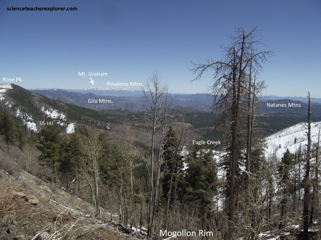
The showstopper on this part of the trail is the Mogollon Rim, a massive, almost a continuous cliff that towers up to 334m in height as it runs northwestward nearly all the way to the Grand Canyon. Picture above, atop the rim, Blue Vista Point looks out on a good-size portion of southeastern ridges, wooded slopes, and maze-like canyons. In the far-off distant south stands the 3,572m high Mt. Graham in the Pinaleno Mtns; to the west the Natanes Mtns with Black River at it’s base and across the Chaparral covered San Carlos Apache Reservation.
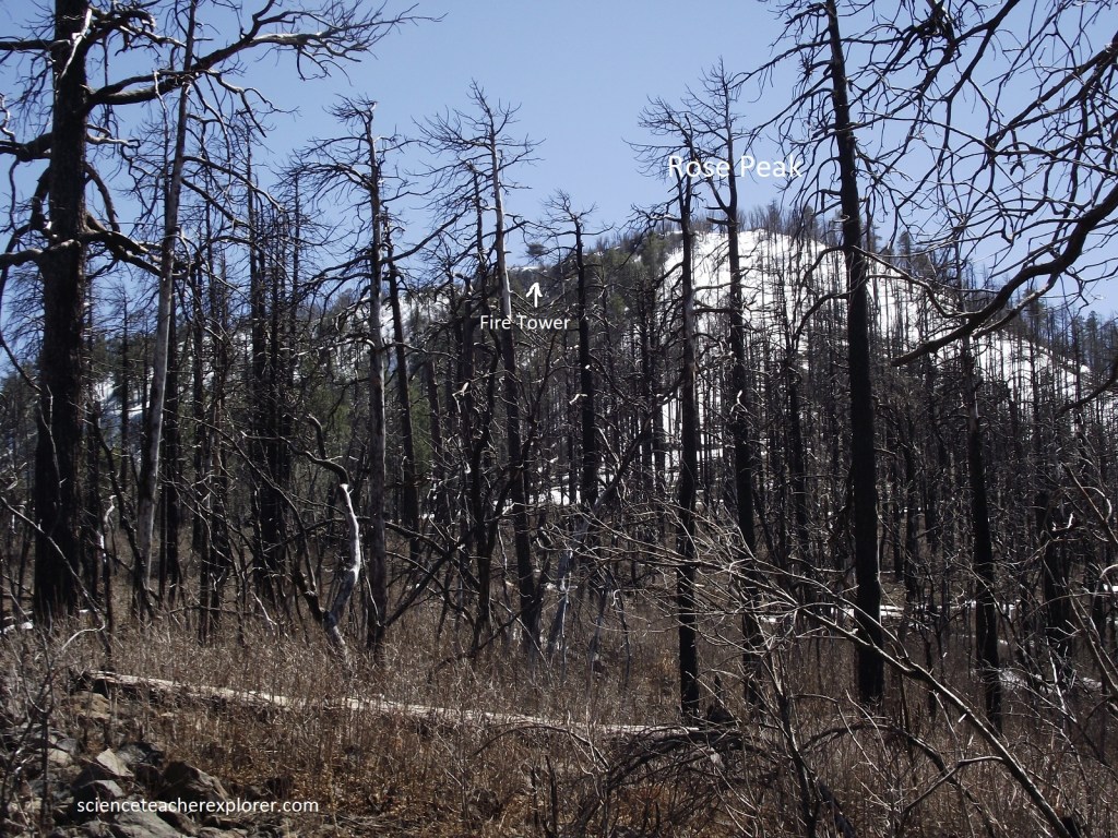
Twisting and turning along a convoluted course, Rte. US-191, makes its way down the steep face the Mogollon Rim. Along the way, spruces and firs yield first to oaks, then to a grassland spotted with pinyons and junipers. The unpaved road to the Tower was snowed in, so I chose not to visit it. Besides, it was probably locked and closed for the winter.
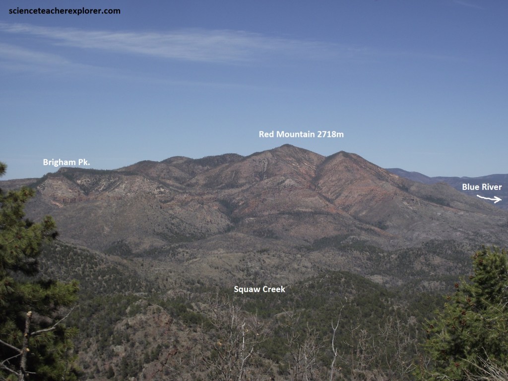
Further south and down the Coronado Trail is the spectacular viewpoint called the Red Mountain or Hill Overlook. This gives us a look into the upper reaches of the Blue Range/River Primitive Zone. This is the approximate location of the release of eleven Mexican Wolves into the wild in 1998. Subsequent releases have continued to occur and today the population is thriving. Protected under the Endangered Species Act, the wolves roam the vast area along the Arizona – New Mexico border (here). Wolves are typically very shy but they have been spotted along the Coronado Trail, for example near this viewpoint. If I decided to stay the night here, I would be lucky to here one howling at the moon.
The 16 km of the Coronado Trail descending into Morenci are the steepest. Down and down the drive plummets, passing through a series of switchbacks, camping spots and cubby-holes, toward far-off desert valleys that simmer beneath a blanket of haze.
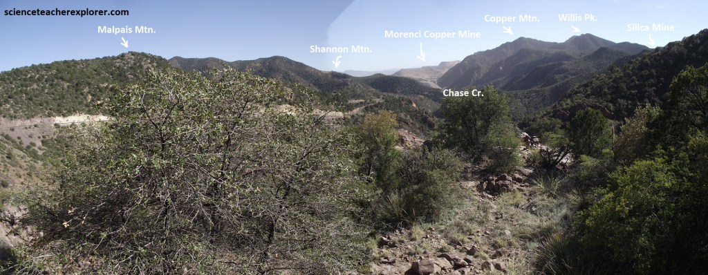
Pictured above, the Chase Creek was named after Captain Chase who left Silver City, New Mexico in pursuit of Apaches in 1870. He hired the Metcalf brothers, Bob and Jim, as scouts. the party camped in the vicinity of Clifton. As the town of Clifton grew, building were constructed along the narrow twisting Chase Creek. Clifton earned an unsavory reputation in the late 1800s as the second wildest camp in the West after Tombstone.
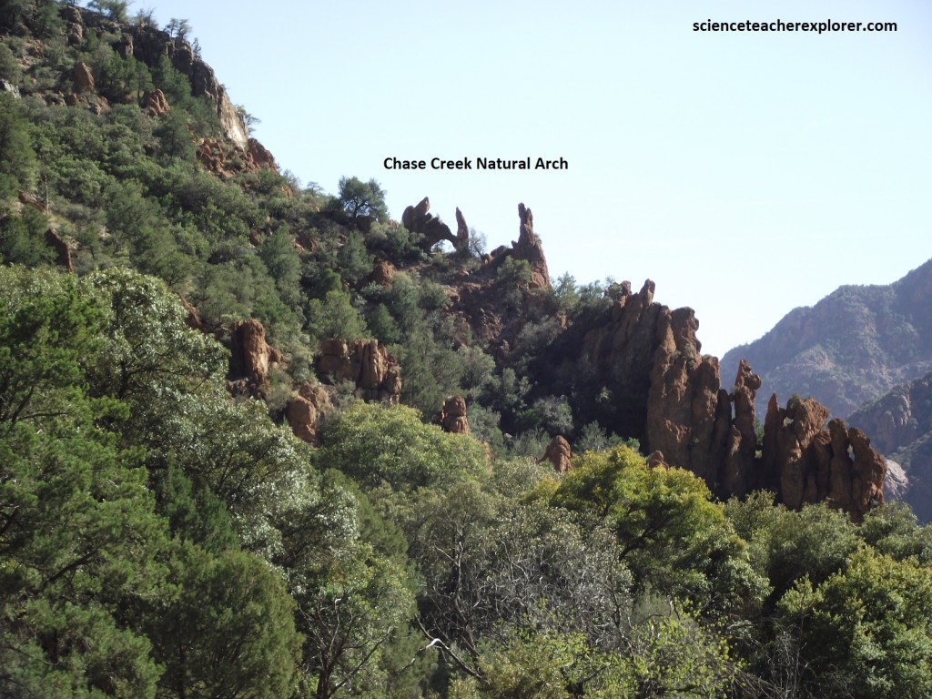
Geologically, Chase Creek was formed by a Normal Fault, creating a week zone in the rock where erosion and water seepage is prevalent. Additionally, the Chase Creek Fault would provide pathways for ore-forming hydrothermal-fluids from deep within the earth, (where the volcanic pluton is located), toward the surface. When these two types of water, (hydrothermal & surface-water) mixes, it adjusts the pH and precipitates minerals within the fault zone, (the rock is called breccia). This geology makes the region highly favorable for the formation of Porphyry Copper deposits. Hence the giant copper-mine at the bottom of the canyon.
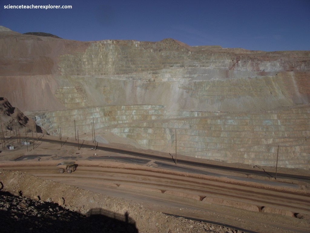
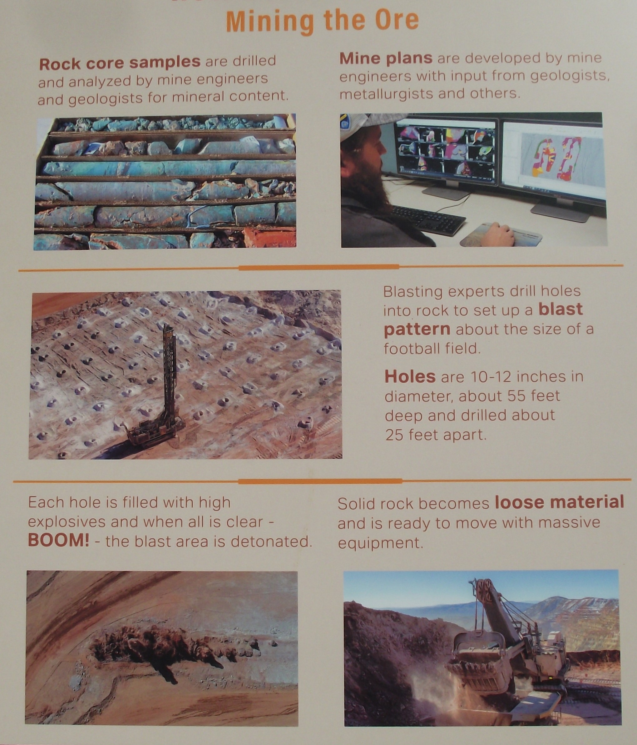
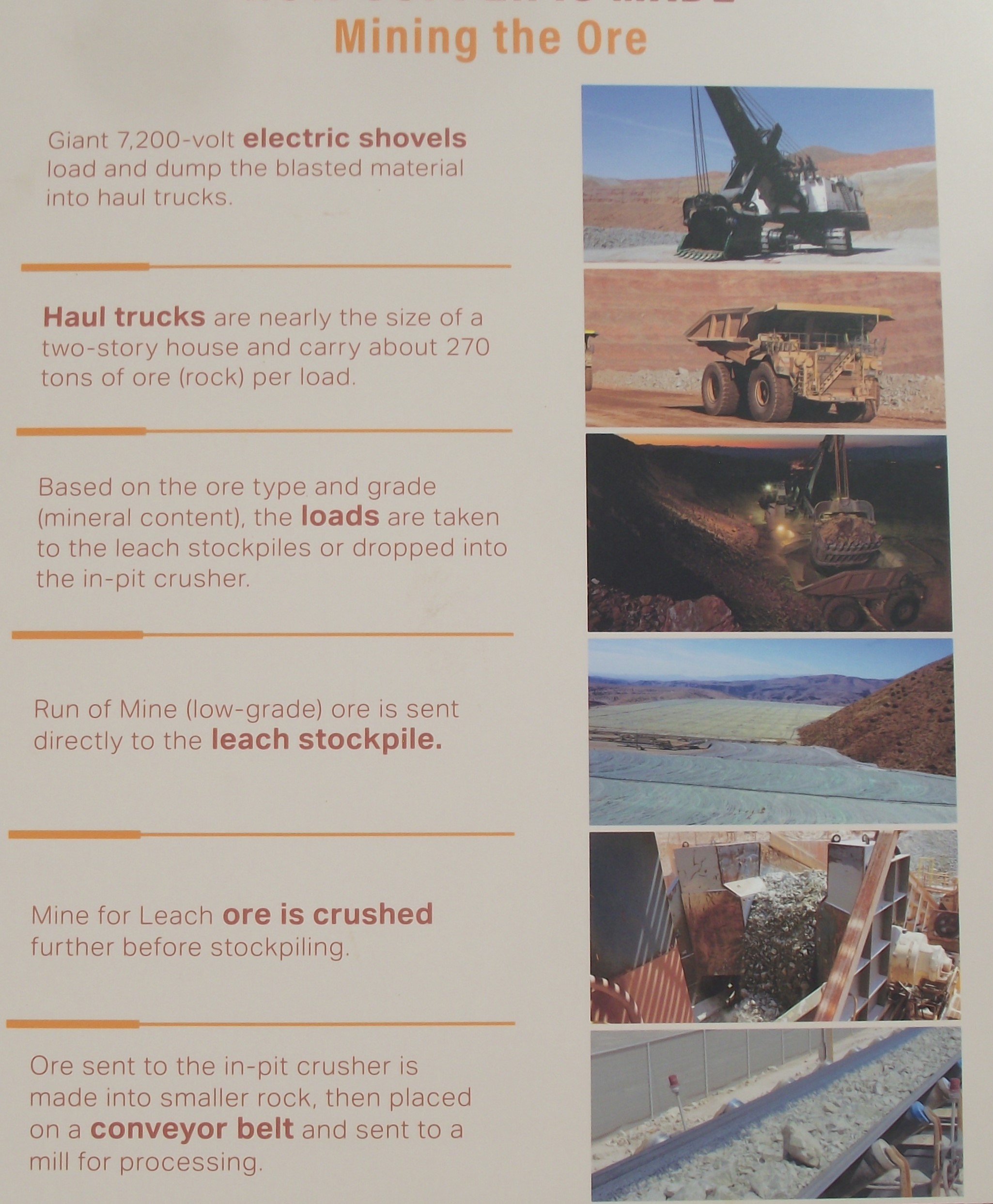
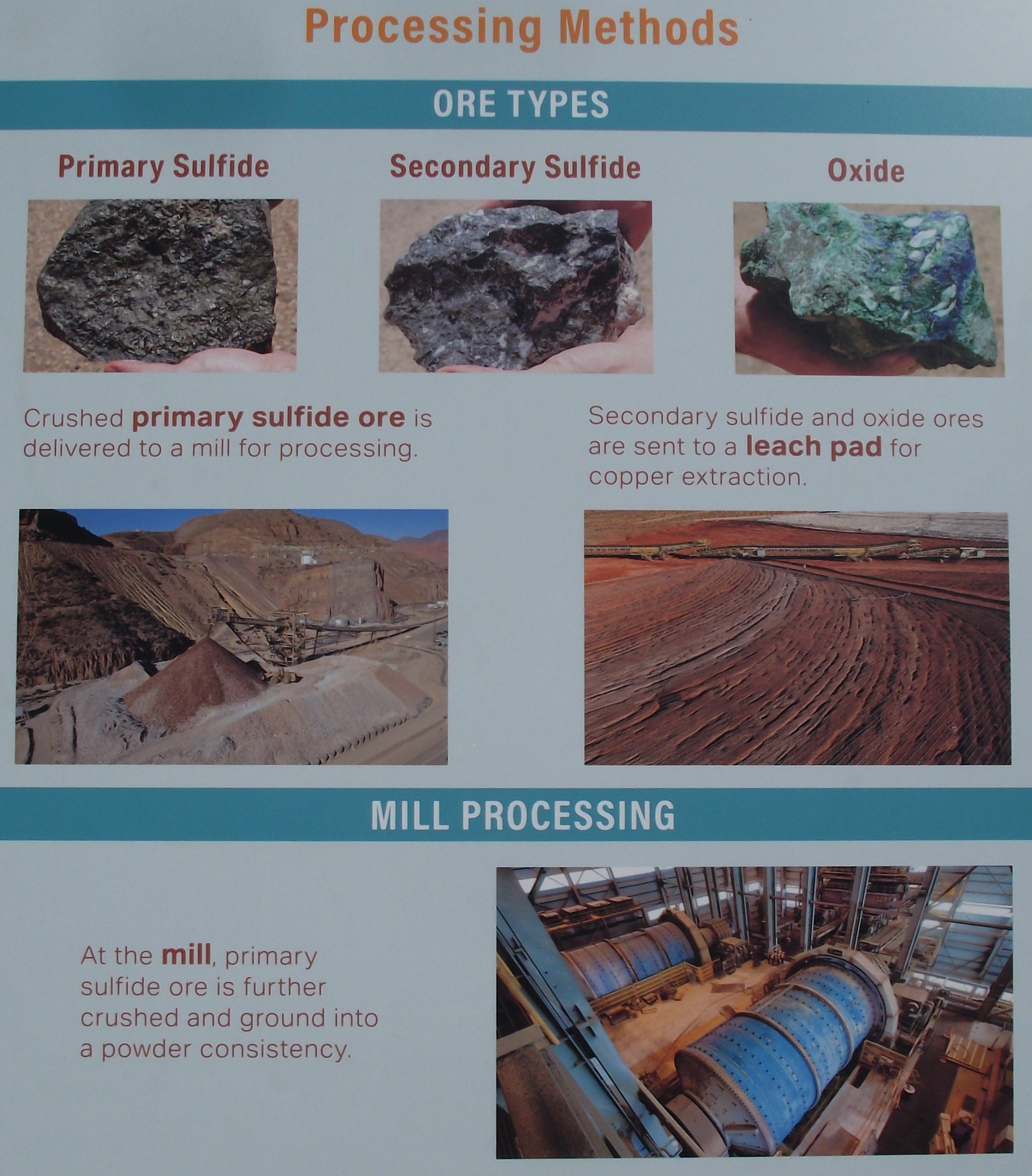
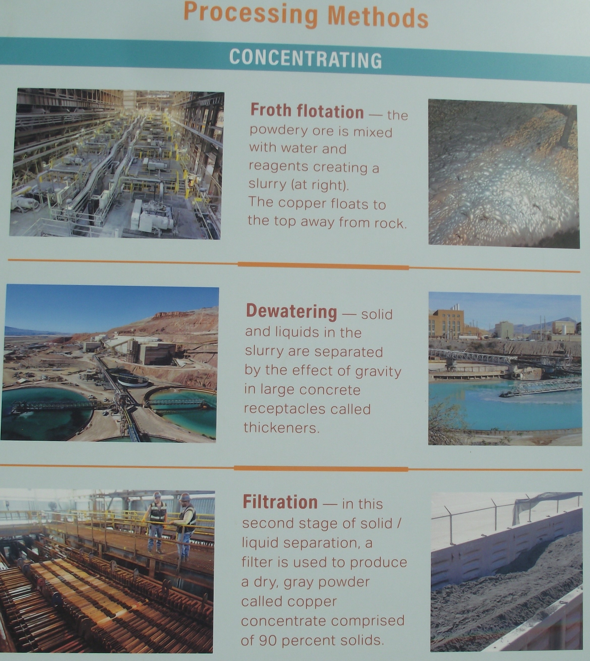
Just before town of Morenci, I skirted a site that explorer and gold-seeker Coronado could not even have imagined; one of the world’s largest open-pit copper mines. Pictured above is a roadside overlook, perching on the western edge of the chasm, which, though not really scenic, is overwhelming for its sheer size, ( a giant hole 3.2 km in diameter).
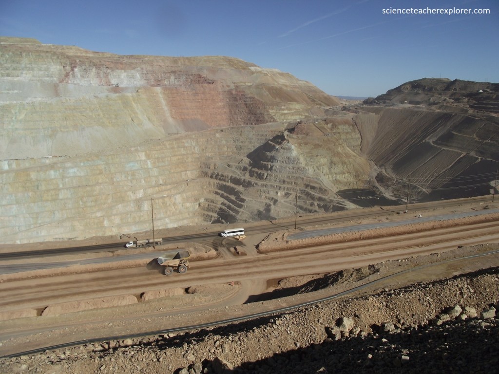
Pictured above, the Morenci Mine is the largest single producer of copper in the United States. The mineralized area, a copper porphyry in the granitic rock quartz monzonite, was discovered in 1866, and numerous mines were in operation by the middle 1870s. Eventually, there were hundreds of kilometers of tunnels beneath the towns of Metcalf and Morenci, and smelters operated near the railhead at Clifton. Beginning in 1939 rail cars were used to move the ore but by 1989 they were no longer needed as a new system of crushing ore was developed and the ore was move to the concentrators on conveyor belts. Profitable ore lay beneath the original towns, so Metcalf and Morenci, (relocated), were sacrificed; where they were is now a hole in the ground.
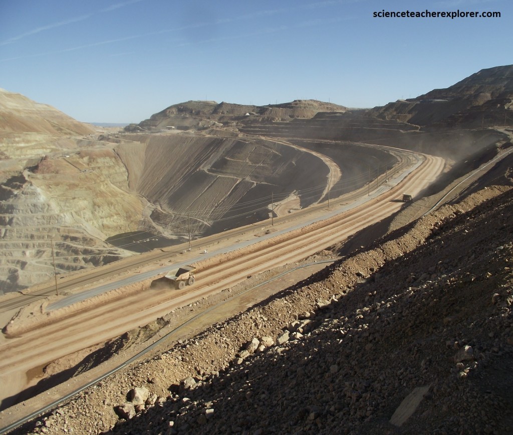
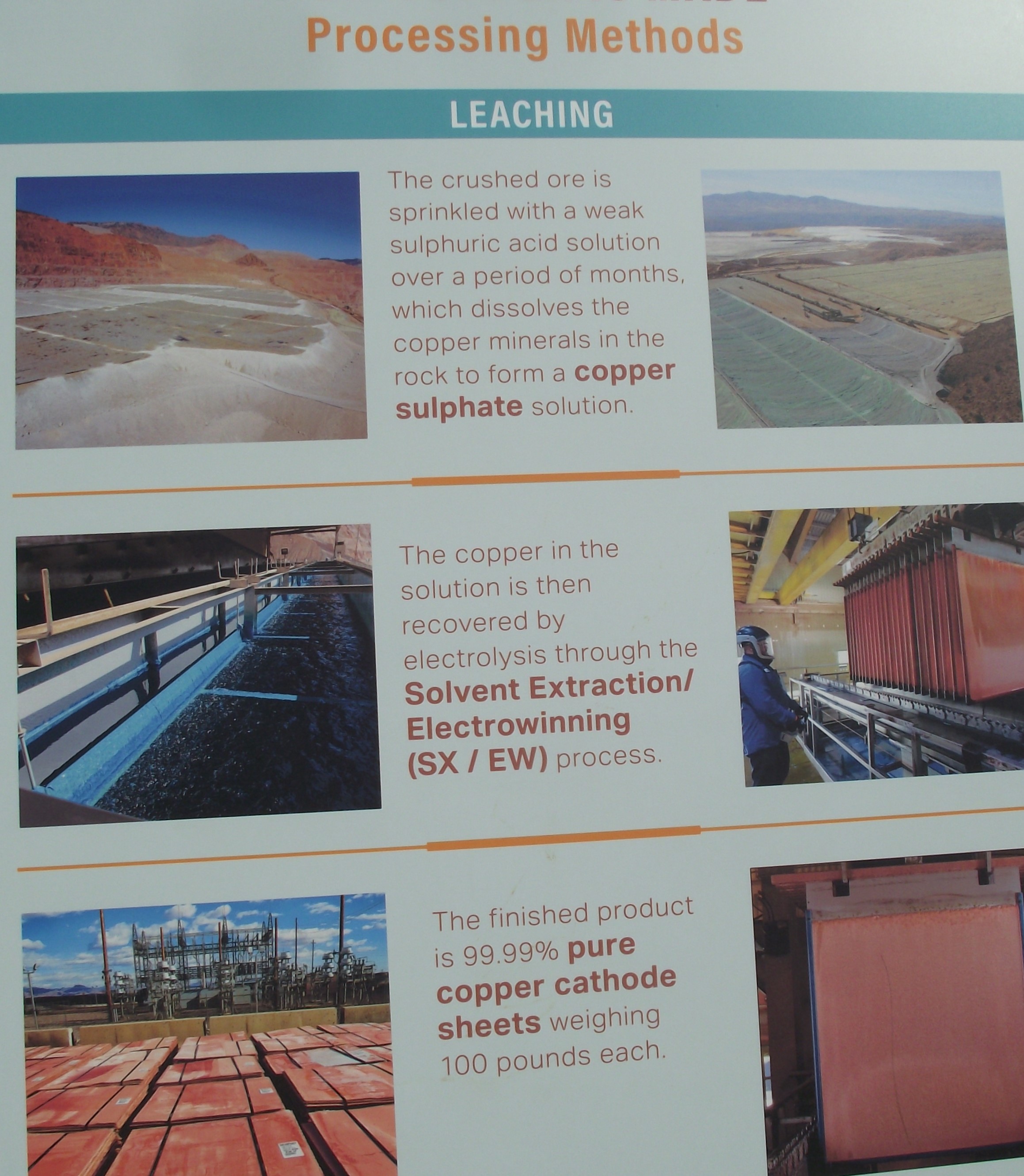
The modern mine, plants and associated properties cover a total area of 221 sq. km. At least 800,000 tons of ore are processed every day. That yields 1/3rd of Arizona’s and fully 1/5th of the U.S. total copper production. Below is a group of interpretive signs that are provided by the Freeport-McMoRan’s Morenci operation next to the Coronado Trail Hwy. 191.
Seeking to enrich the already plentiful coffers of the Spanish crown, Francisco Vasquez de Coronado led an expedition through this area in 1540. His goal was to find the Seven Cities of Cibola, (mythical places said to have streets paved with gold). The journey, needless to say, was a wild-goose chase, and Coronado returned empty handed. But gold or no gold, one fact remains: these out-of-the-way wilds overflows with fantastic scenery.
