Damaraland, NA 2025
While exploring Namibia in 2025; I found myself trekking through an area called Damaraland to the locals. My trekking buddy was an old childhood friend named Tracy Davis.
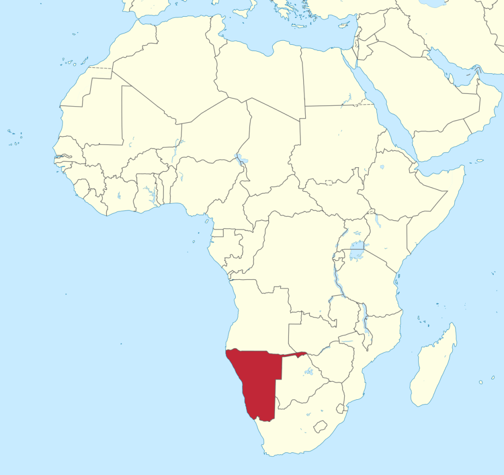
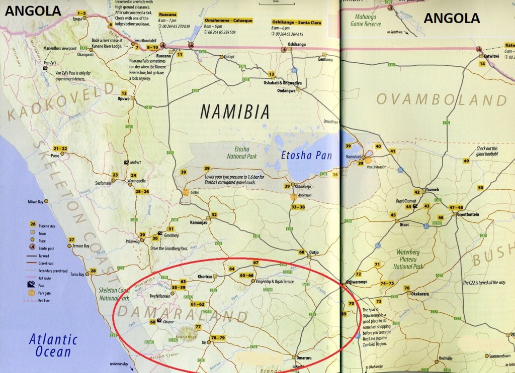
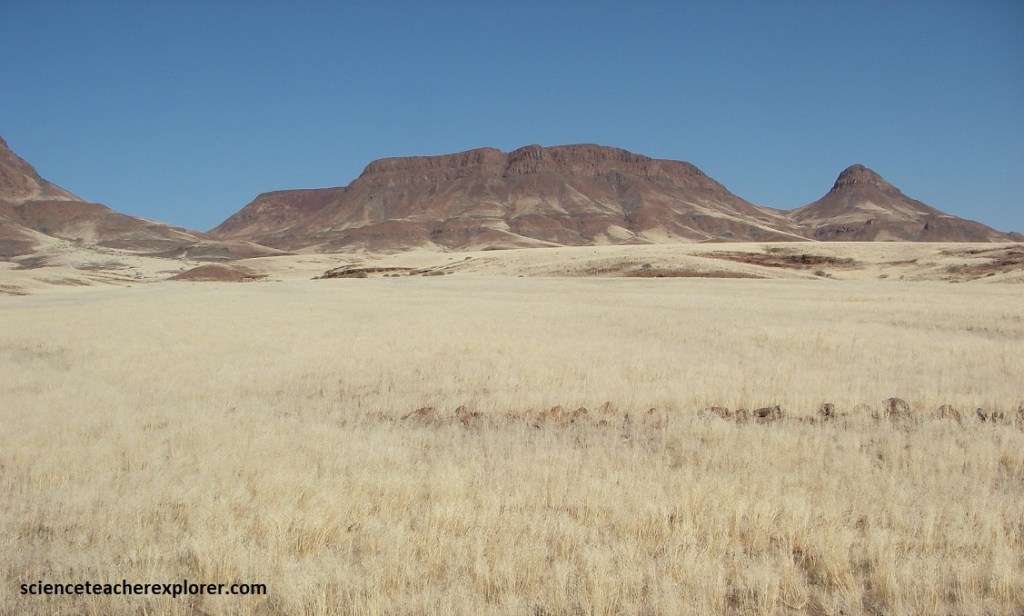
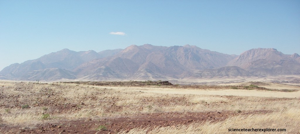
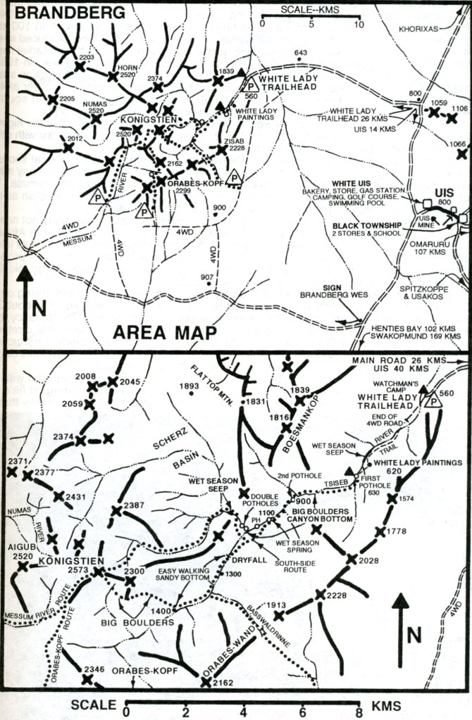
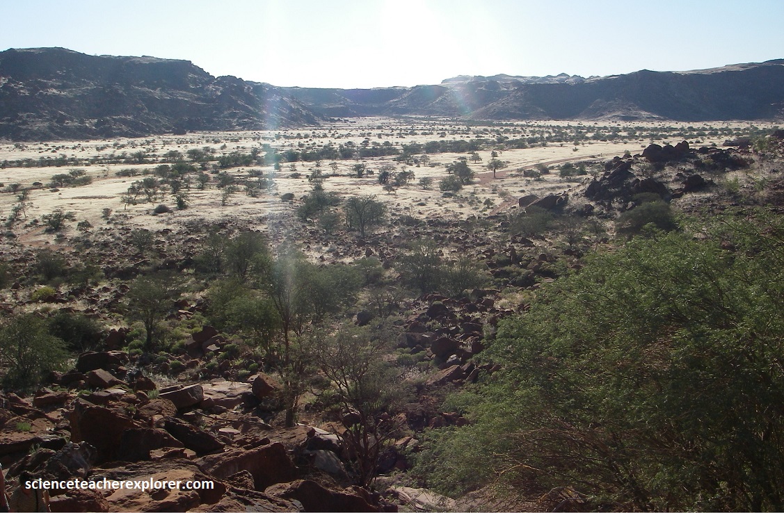
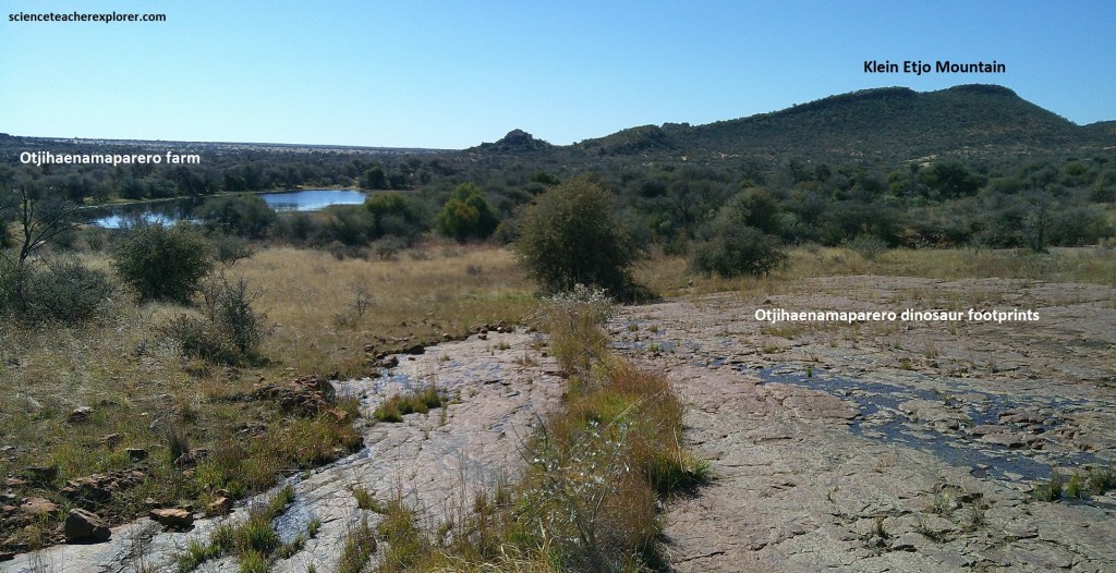
Damaraland is a rugged, mountainous, and arid region in the north-central Namibia, that found between the Skeleton Coast and the Etoscha National Park, (imaged below).
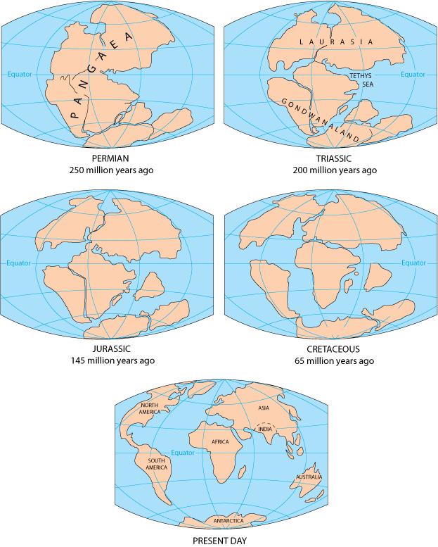
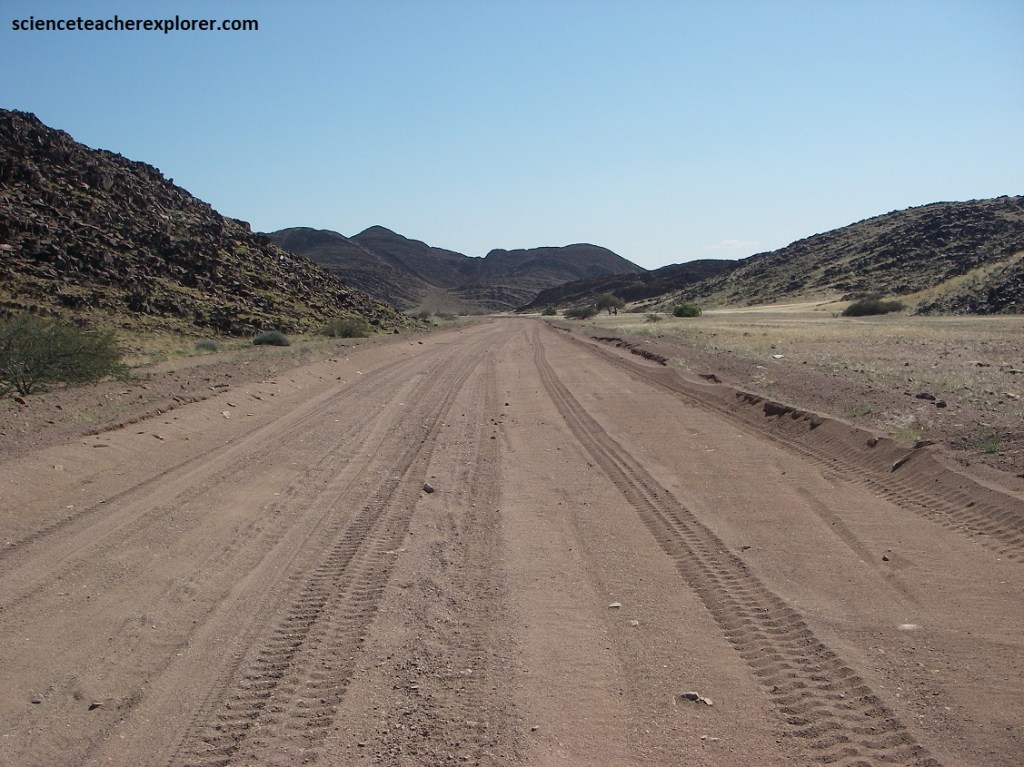
We started our trek of Damaraland on the graveled road D2303 at the border of the Skeleton Coast National Park, heading northeast. The geology along this road was mostly late Mesozoic-volcanic rocks that were formed at the breakup of Gondwanaland during the Mesozoic Era, (Triassic, Jurassic & Cretaceous).
The road D2303 circumnavigated north of the Goboboseb Mountains or the 135 million year old Messum Crater. The Messum Crater is an 18km-diameter, roughly circular volcanic crater. Although the structure is extremely eroded, it can nevertheless be recognized in the field. Volcanic rocks still cover the bottom of the crater, while highly eroded plutonic rocks (gabbro and granites) surround it. A rhyolitic lava dome is visible, forming the central hill.
Eventually, we came upon a junction, where we turned right onto D2342, (southeast) towards western side of Brandberg, (a primary destination of us).
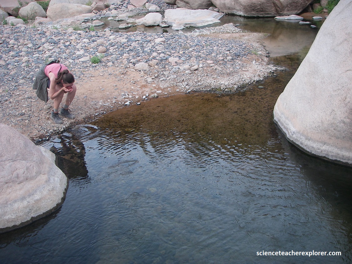
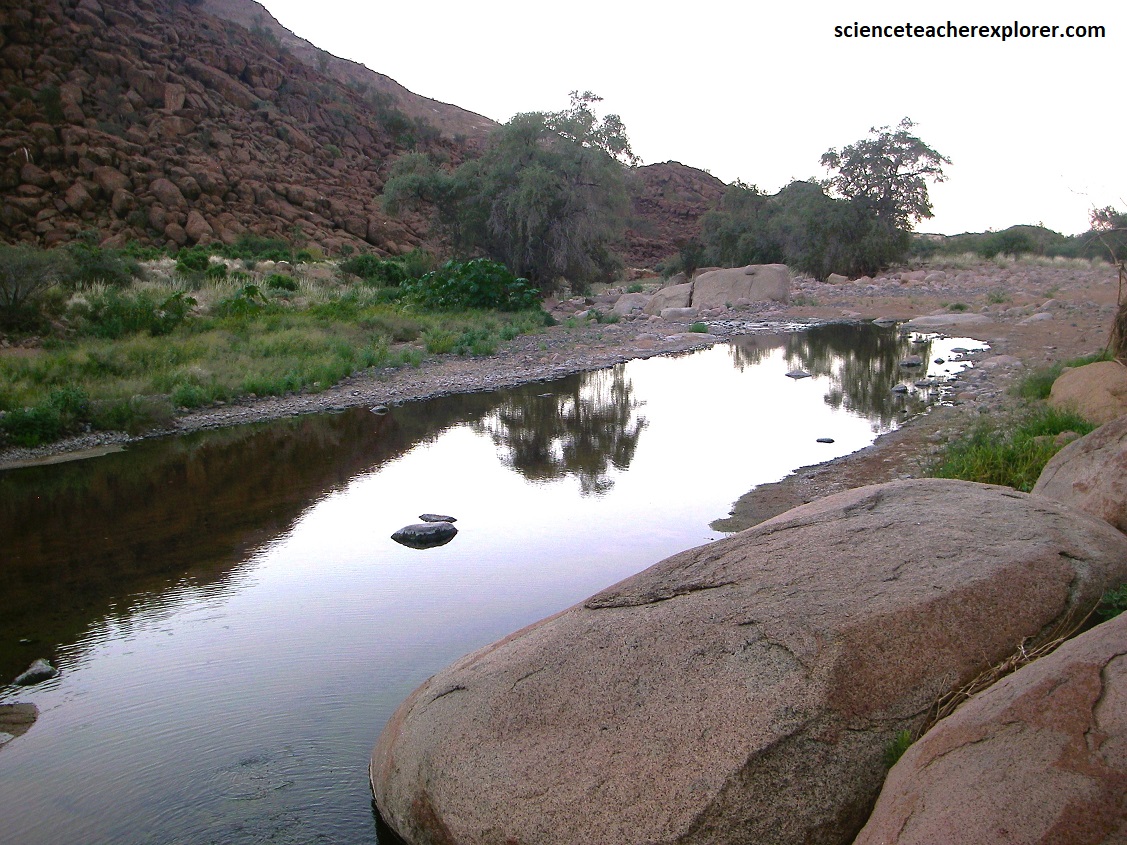
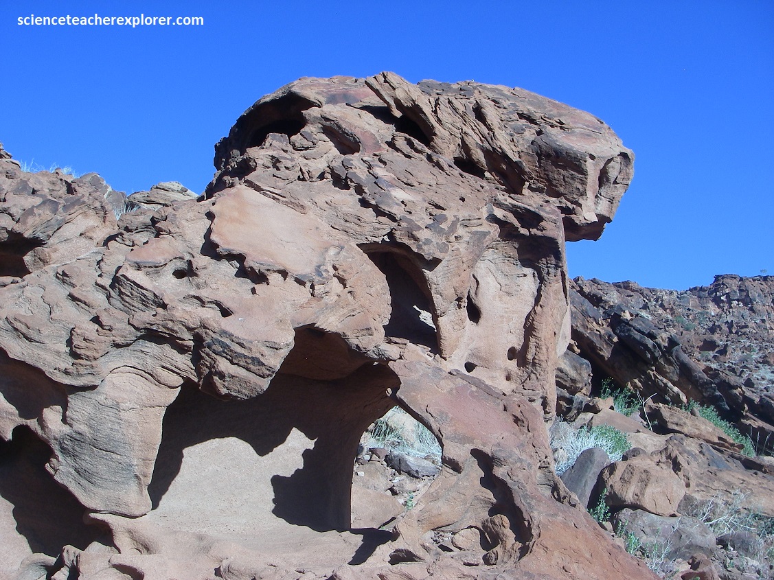
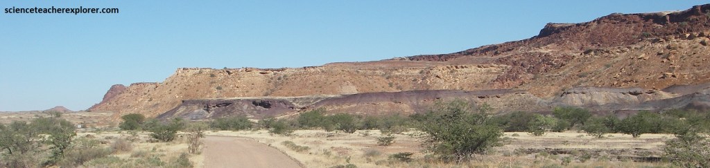
The geology through this area, was spectacular. North of the D2303/D2342 junction was the Lower Ugab River, (pictured below).
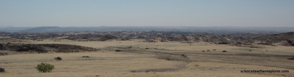
The Lower Ugab River area is characterized by a thick, Neoproterozoic turbidite-succession, which has been which has been subjected to significant geological compressive-forces, resulting in large-scale folding and faulting.
The area contains both siliciclastic (sandstones & mud-rocks) of the “Brak River Formation” and carbonate (limestones & marbles) of the “Gemsbok River Formation”, with a paleo-environmental facies-interpretations, suggesting deposition from a deep-sea slope and basin environment. {Note: the Brak River Formation is pictured on the left and the Gemsbok River Formation is pictured on the right below}.
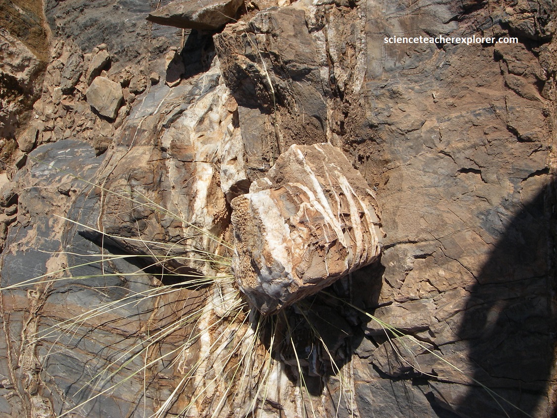
These ancient sedimentary layers were later deformed during tectonic events that occurred around 600-100 million years ago & related to the breakup of Gondwanaland. The folded layering here is mind-boggling. The massive folds, visible in the rock walls, are a result of tectonic compression that deformed the originally flat sedimentary layering of the ocean bottom.
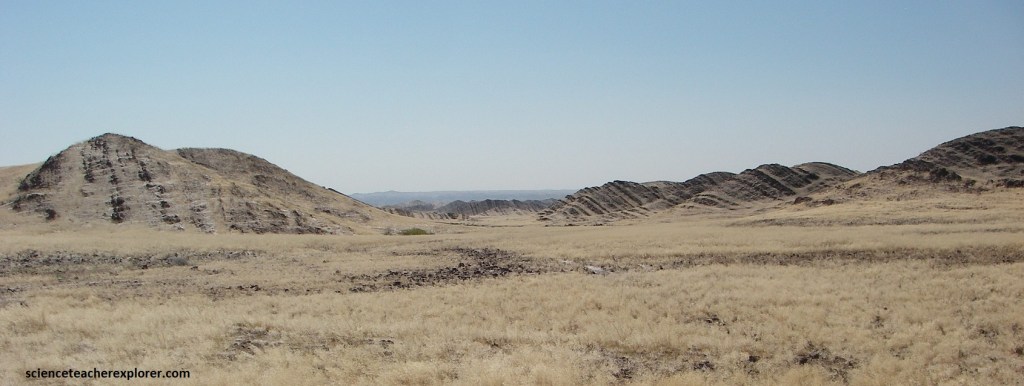
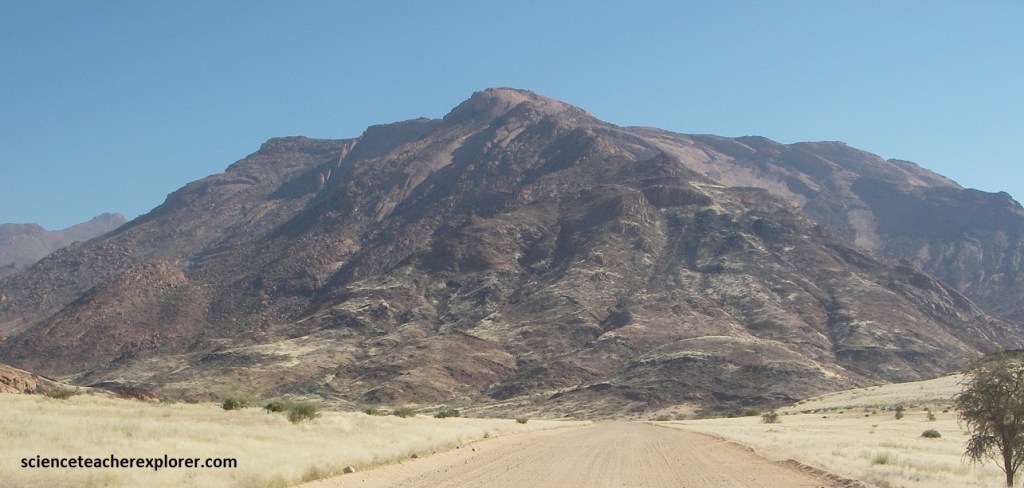
As we continued driving southeast on D2342, we came into view of Brandberg Mountain and it’s surrounding plutonic domes.
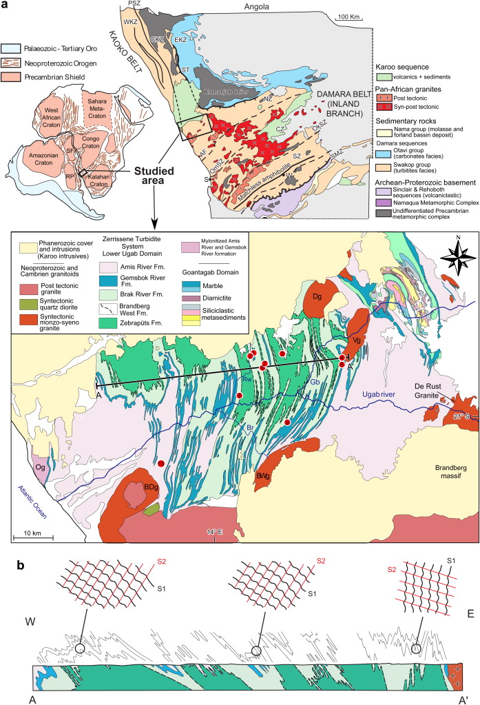
Brandberg Mountain is a large, dome-shaped granite intrusion that formed during the Early Cretaceous, (Post-Karoo Complex).
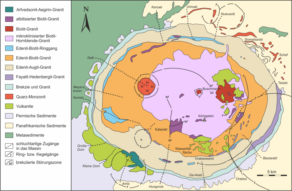
It & it’s surrounding domes are a massive granitic pluton that is primarily composed of biotite-hornblende & potassium-feldspar granite, which was emplaced around 132-130 million years ago during the rifting that led to the opening of the South Atlantic.
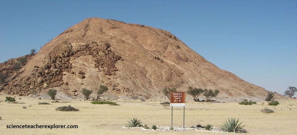
As mentioned, Brandberg Mountain is a great granite massif that rises to nearly 2,700m at the Konigstein, Namibia’s highest point. The mountain is nearly circular with a radius of about 30km and consists of a wilderness of huge boulders and dramatic cliffs. Pictured above, various gorges offer routes into this formidable world but there are no natural springs on the mountain.
Eventually, D2342 intersected with Highway C35, where we were able to stay the night at a very nice B&B in Uis. The next morning, we drove north on C35 for about 13km, and turn left, (west), onto D2359. This graveled road took us to the foot of Brandberg Mountain.
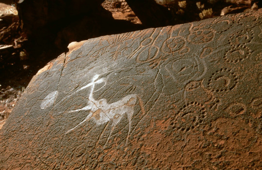
Pictured above, Brandberg Mountain is home to a remarkable wealth of rock art, including one of southern Africa’s best-known paintings; the “White Lady of the Brandberg”. Reinhardt Maack, it’s discoverer, was struck by what he saw as the Mediterranean style of the painting & what he thought was a painted “White Lady” from Europe.
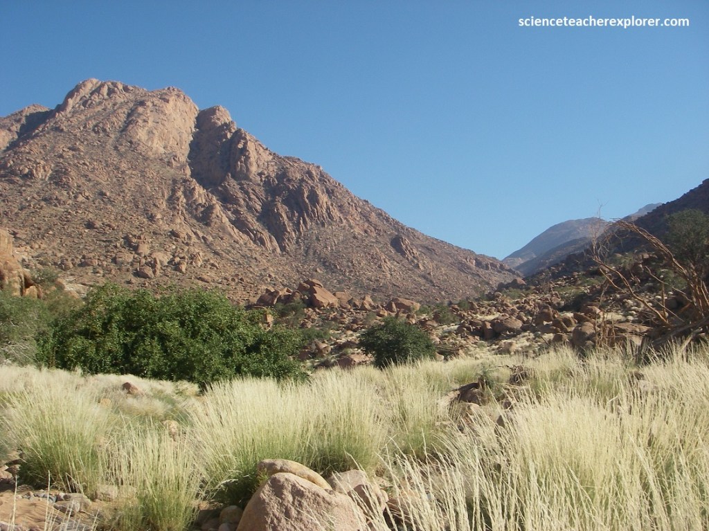
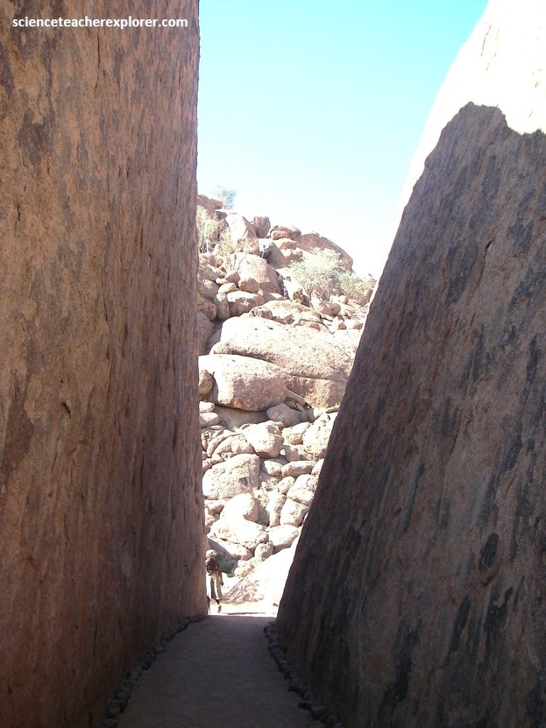
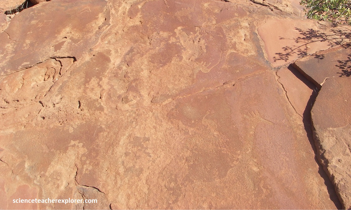
Once parked at the “Dhaureb Visitor’s Center”, I had to trek several kilometers to the “White Lady Panal”. To reach the White Lady it is necessary to trek for about 10km or 1 hour over rough terrain, along a gorge of the dry Tsisab River, (pictured above). I buddied up with a husband/wife couple from Russia.
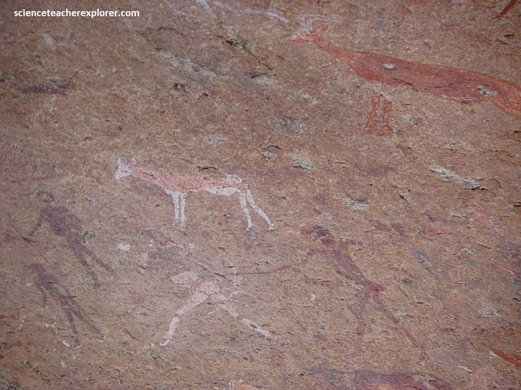
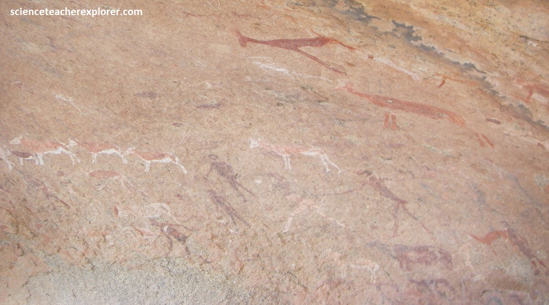
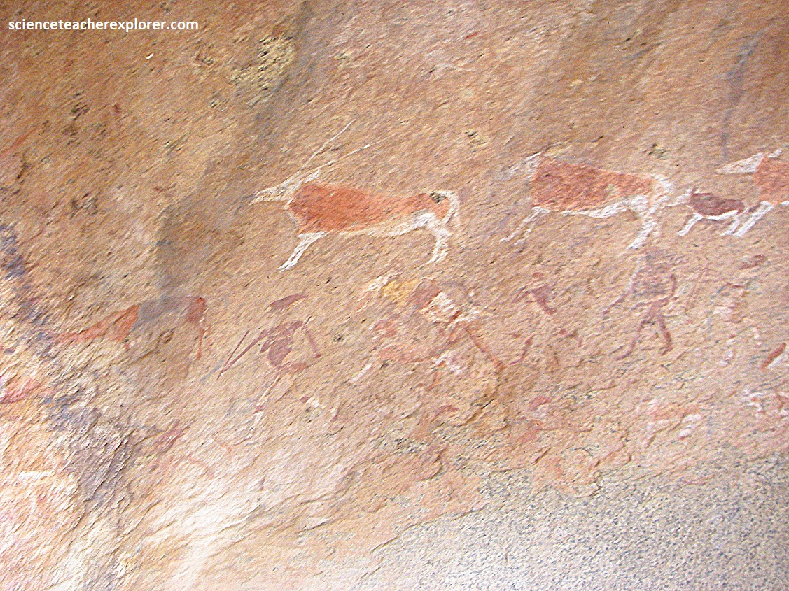
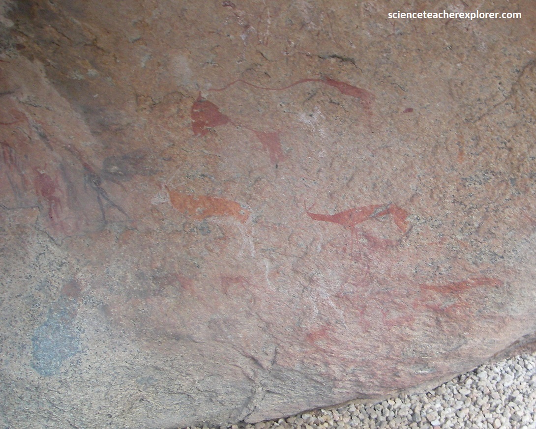
The “White Lady” pictograph-panel is found in a cave known as “Maack Shelter” and portrays several human figures as well as zebras & oryxes, on a rock panel measuring about 5.5 m x 1.5 m. The “White Lady” is the most detailed human figure in the group, and measures about 39.5 cm x 29 cm.
It is now accepted that the painting shows some sort of ritual hunting dance, and that the “White Lady” is actually a shaman. He/she has white legs and arms, which may suggest that her body was painted or that she was wearing some sort of decorative attachments on his/her legs and arms. He/she holds a bow in one hand and perhaps a goblet in the other.
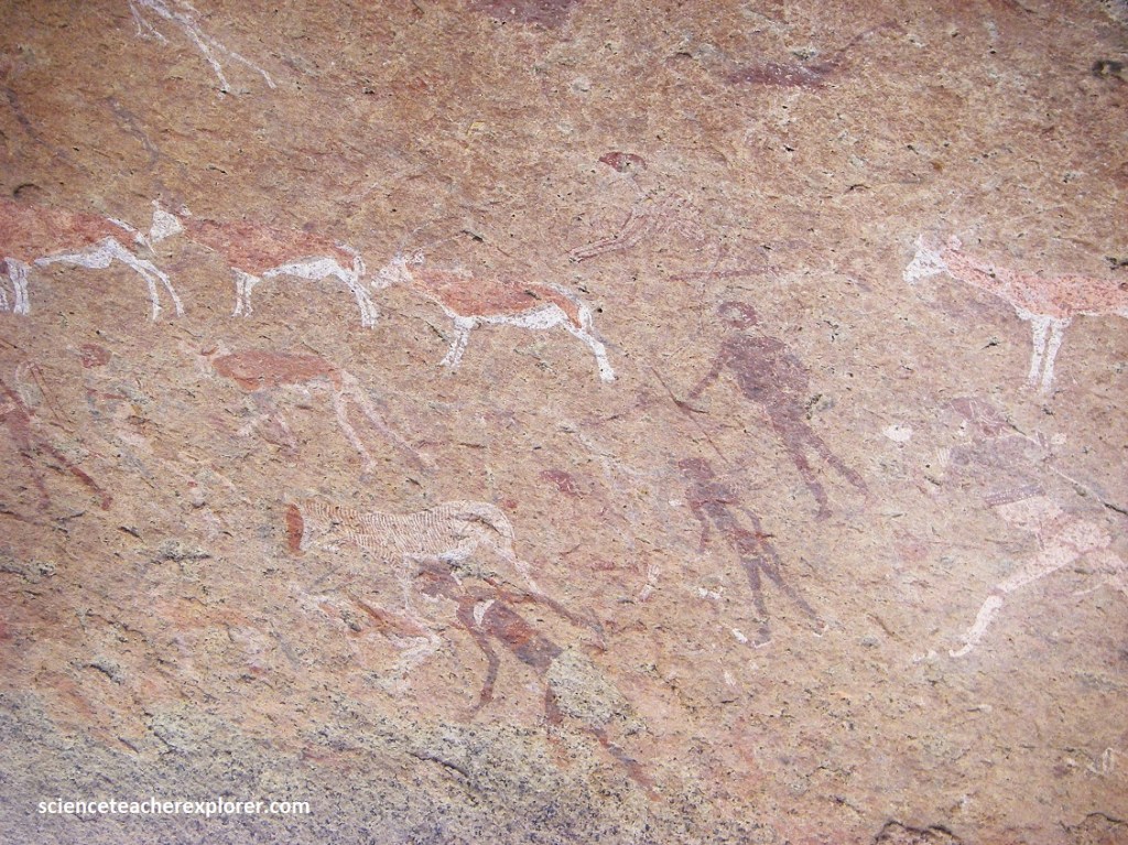
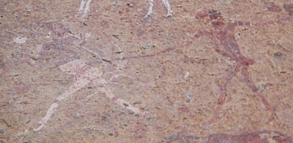
Apart from the shaman/lady, the other human figures have less detail, and are mostly completely black or completely white. One of the hunted animals seem to have human legs. The paint was probably made of ochre, charcoal, manganese, hematite with blood, egg-white and casein used as binding agents. {Pictured below are photos of the remaining portion of the “Maack Shelter”}.
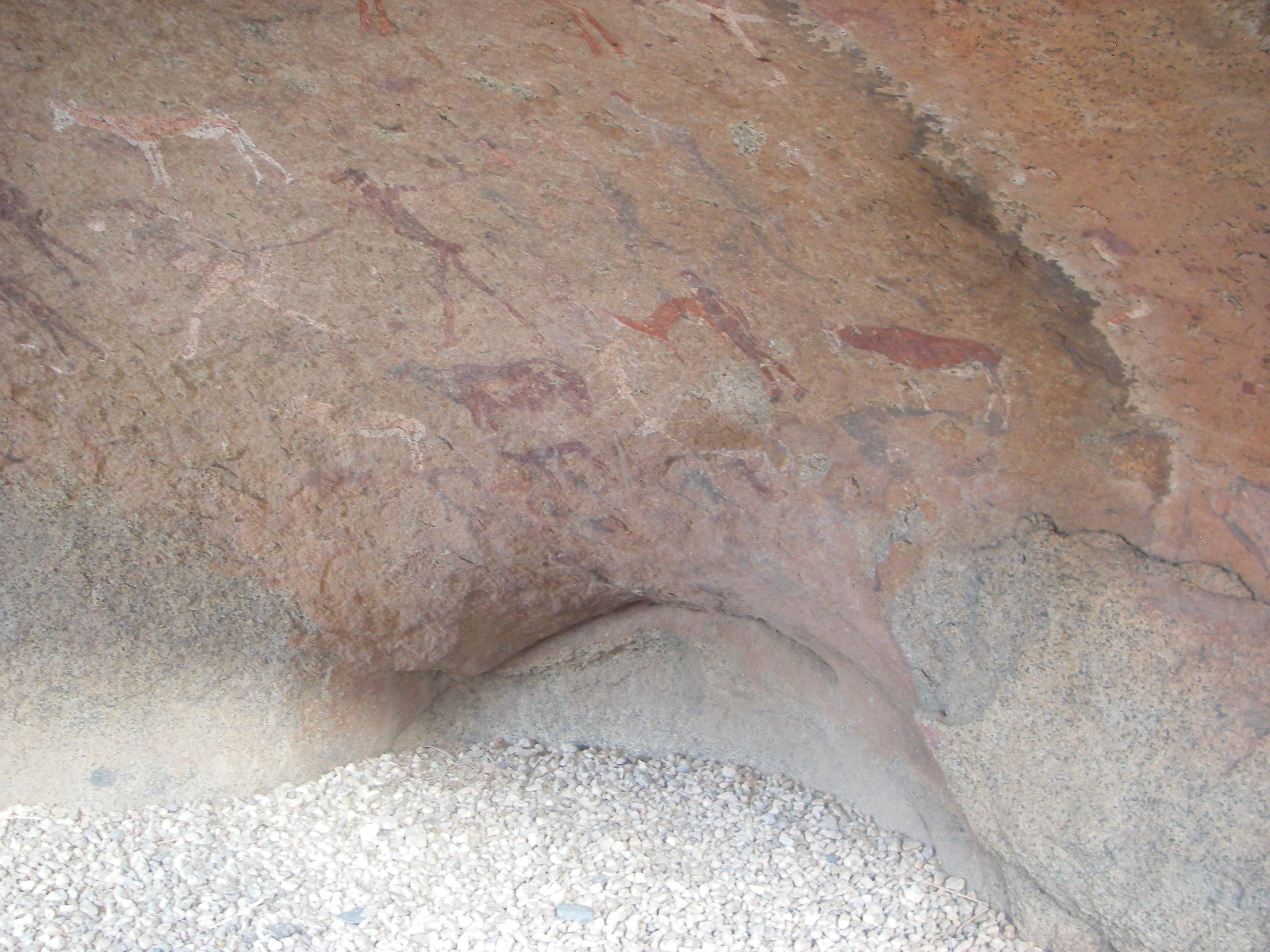
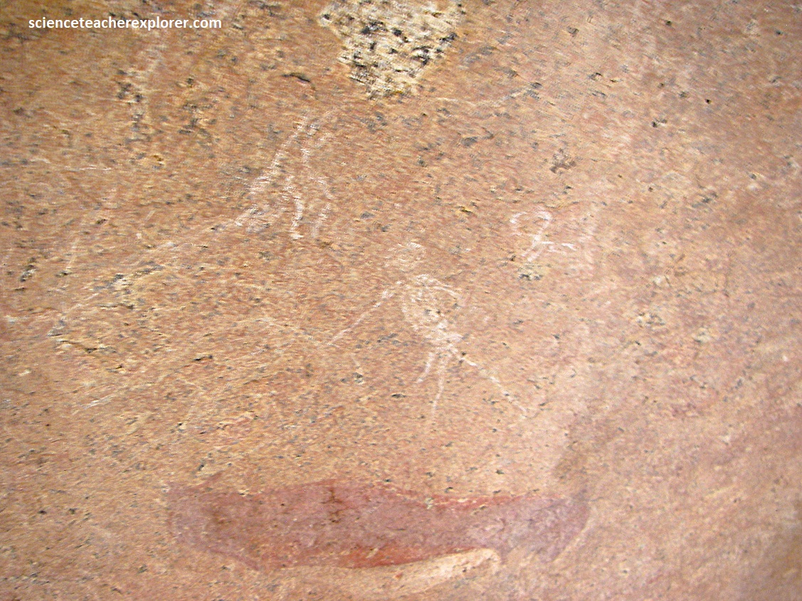
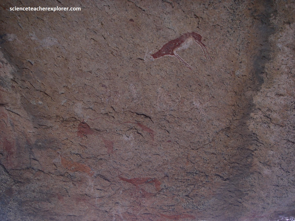
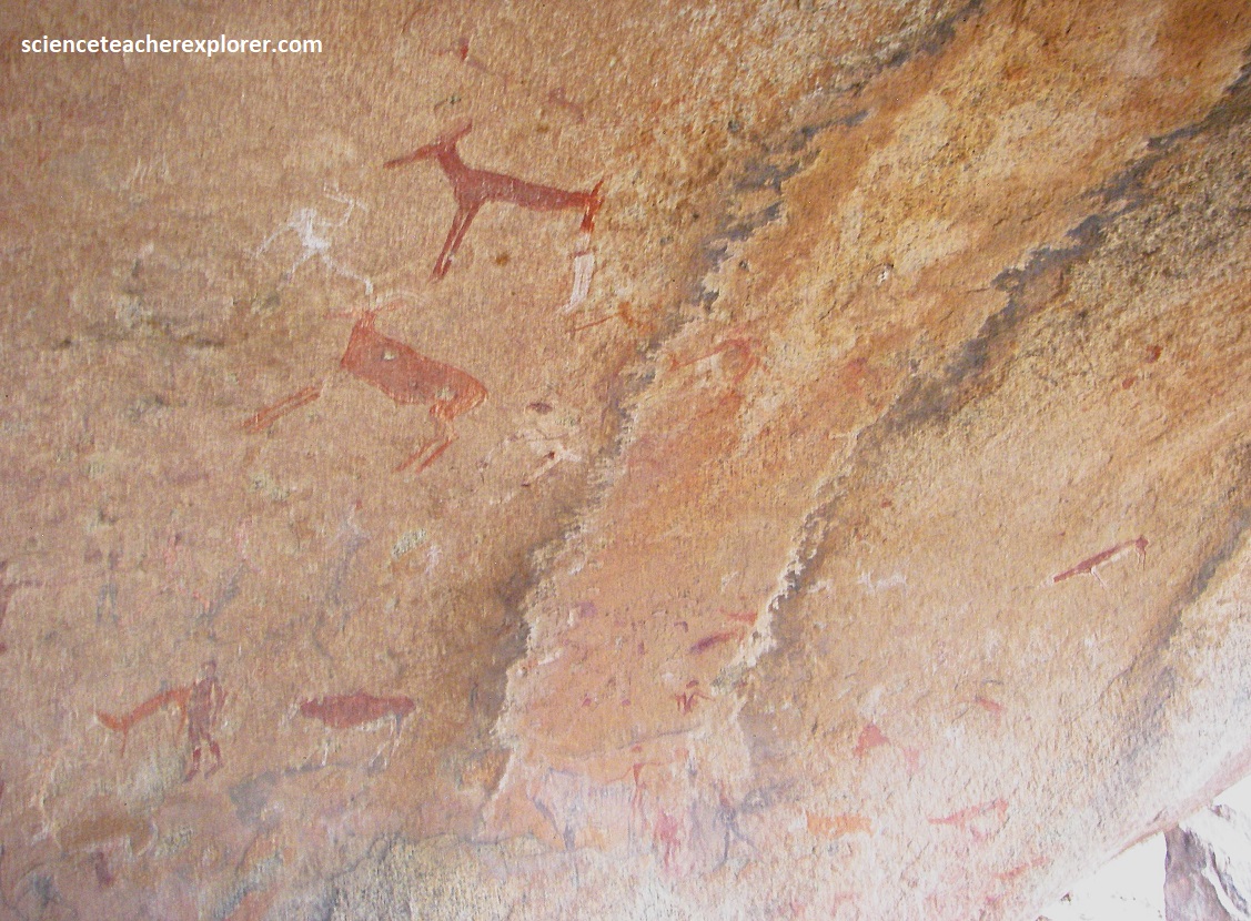
Dating of rock paintings is difficult, but many of those on the Brandberg scientific-team, are thought that the pictographs to be well over 2,000 years old. {Pictured below is one of my Russian trekking buddies}.
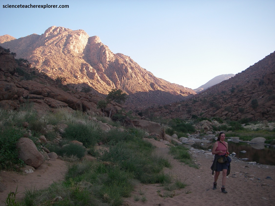
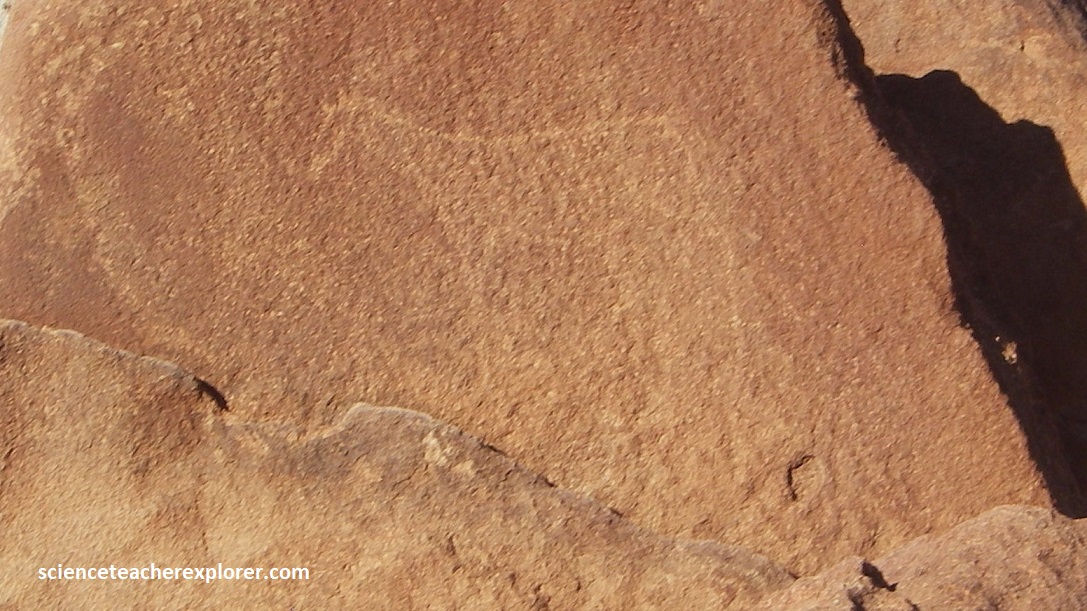
Pictured above, the Tsisab River is typically a dry watercourse but a large number of water holes from the winter rains. During the dry season (May to September), the higher elevation of the massif can draw more rain than the surrounding desert, and its granite subsoil retains water in crevices, creating water potholes, even in the dry season. This is why the Tsisab ravine contains a large number (1,000s) of rock shelters and paintings.
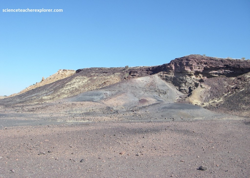
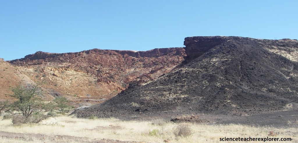
Pictured above, while the Brandberg is a granite pluton-intrusion, the surrounding geological setting is characterized by basaltic volcanism, which is genetically linked to the granite’s formation. The basalts themselves are found in the low hills surrounding the main massif and are remnants of the massive Karoo volcanism that occurred at the time of the continental breakup of Gondwanaland and the formation of the Atlantic Ocean.
After returning to highway C35/M76, we turned left and drove north 100km to Khorixas, Namibia and the C39/M126 junction. There, we got fuel and turned west on C39 to Namibia’s Petrified Forest, (our destination). We stayed, for several days at a nice B&B in the desert, near the Petrified Forest National Park.
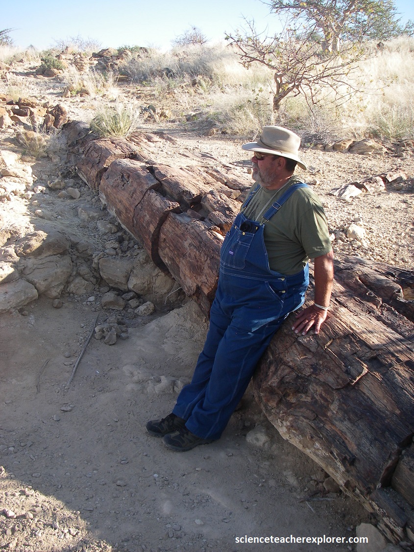
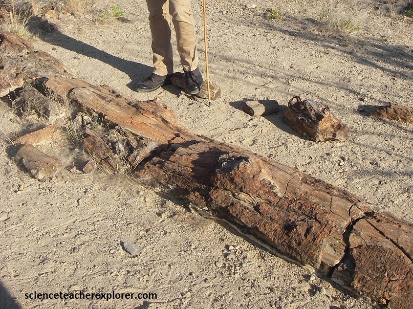
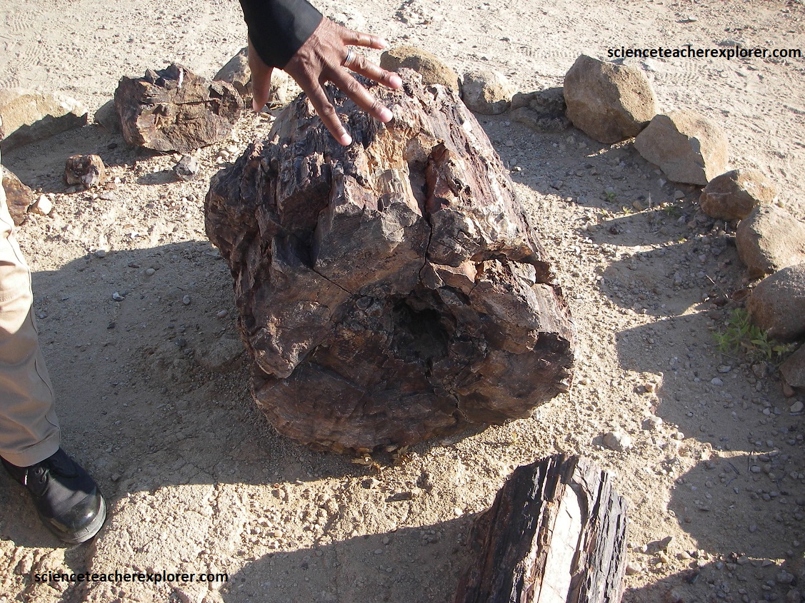
{Pictured above is my trekking buddy, Tracy Davis, standing next to petrified logs at the Namibia’s Petrified Tree National Park in 2025}.
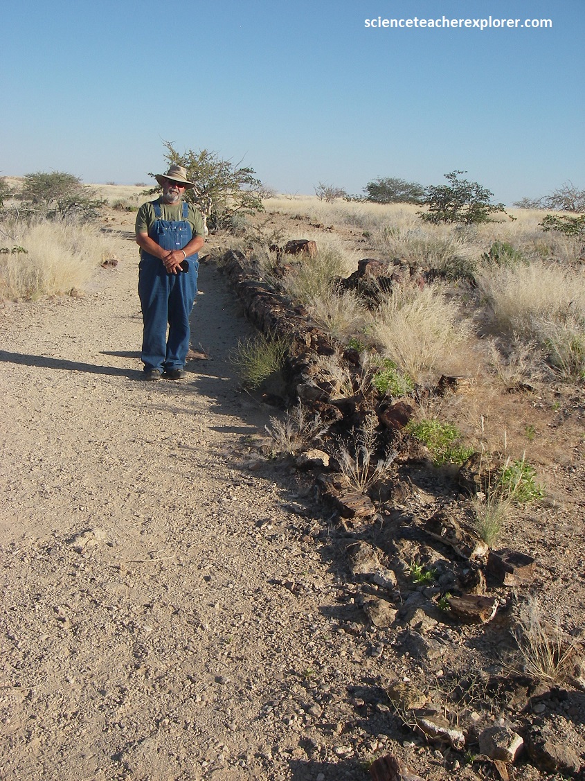
Pictured above, the Khorixas Petrified Forest, 45km west of Khorixas in Damaraland, is a deposit (Ecca Group) of large, fossilized tree trunks, believed to be the remnants of extensive woodlands that once covered the land.
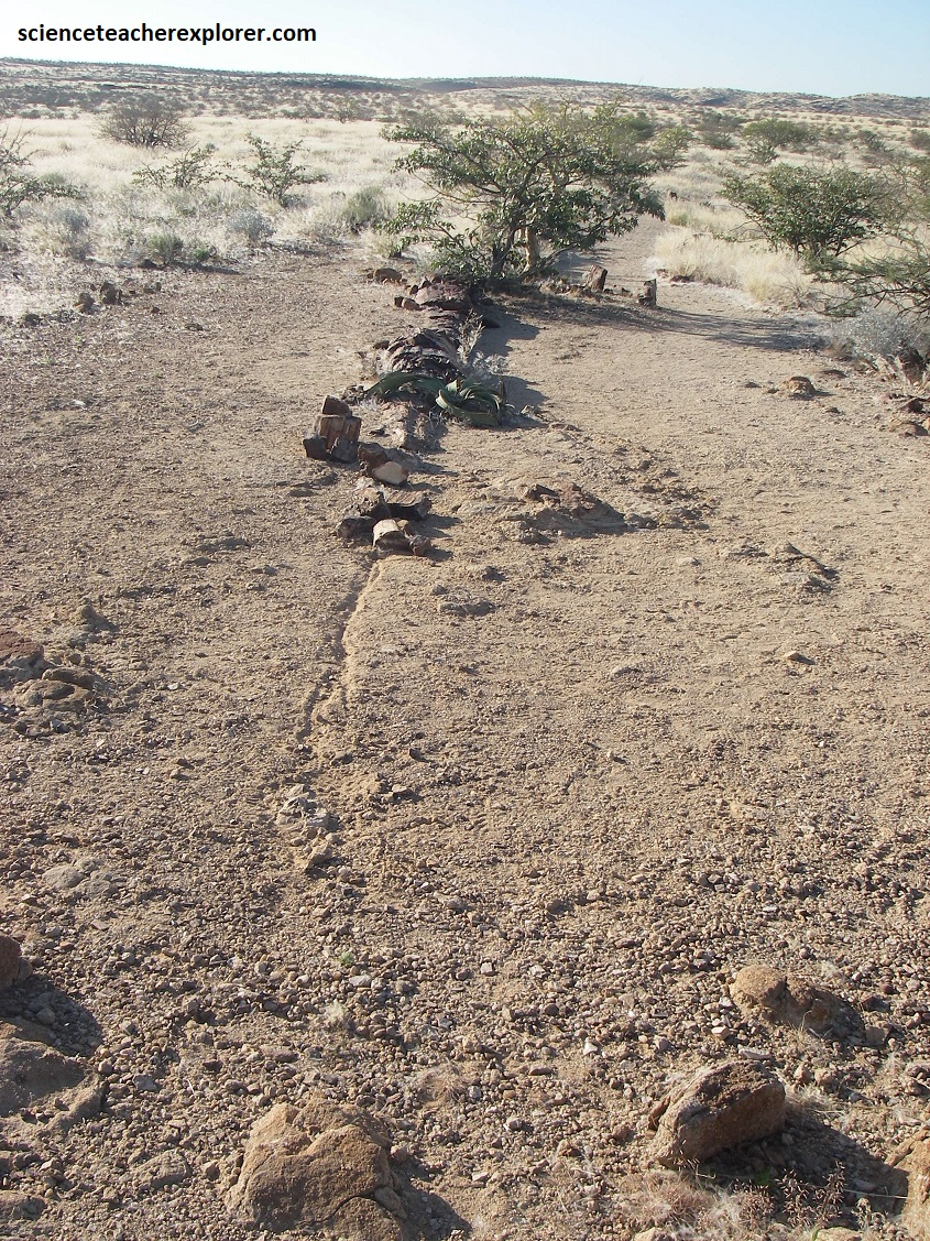
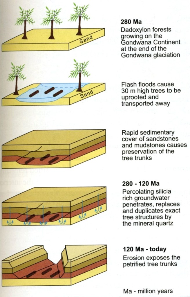
The fact that the trunks were found lying parallel to each other within fluvial sediments suggests that they were swept away from their original location and carried, possibly over some distance, by an event such as a glacial outburst flood.
This event would have happened in the Permian age during brutal climate change at the end of a ‘snowball Earth’ period, and bears testimony to a significant climatic disaster where forces at work were able to sweep away an entire forest of some 30m high trees, and deposit the logs elsewhere, possibly several kilometers away.
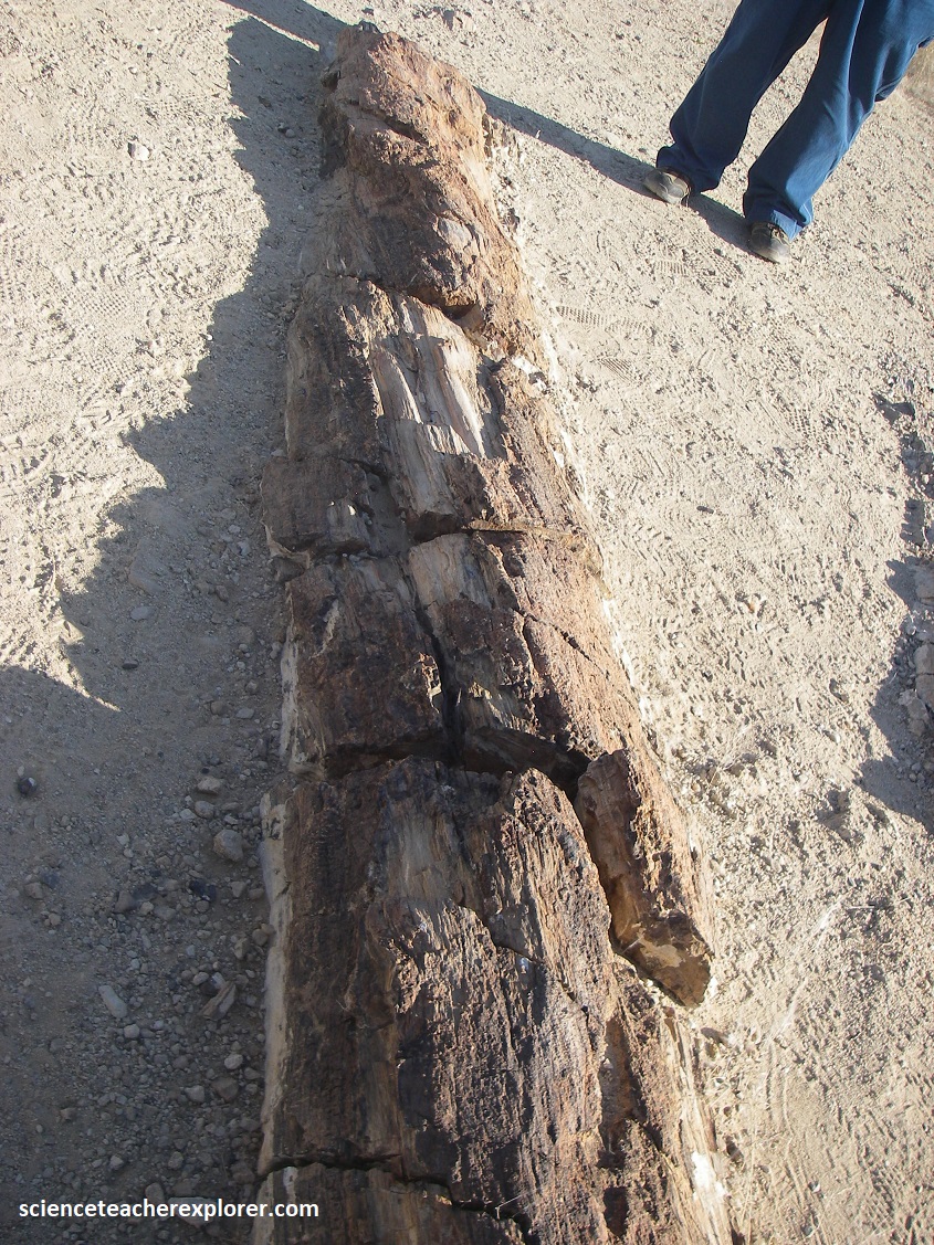
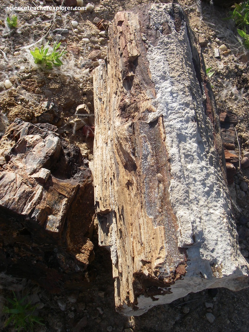
Pictured above, it was actually possible to identify the tree species because of the perfect preservation of the original wood texture, which even makes the structure of the actual bark and annual growth rings are clearly visible. These plants are classified witnin the Gymnosperma group and are the ancestors of today’s conifers. The plants belong to the well known Glossopteris flora, (Dadoxylon arberi), and were the most widespread plant group on the entire Gondwanaland Continent.
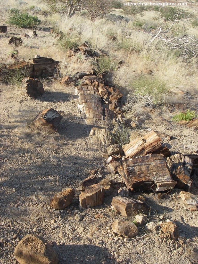
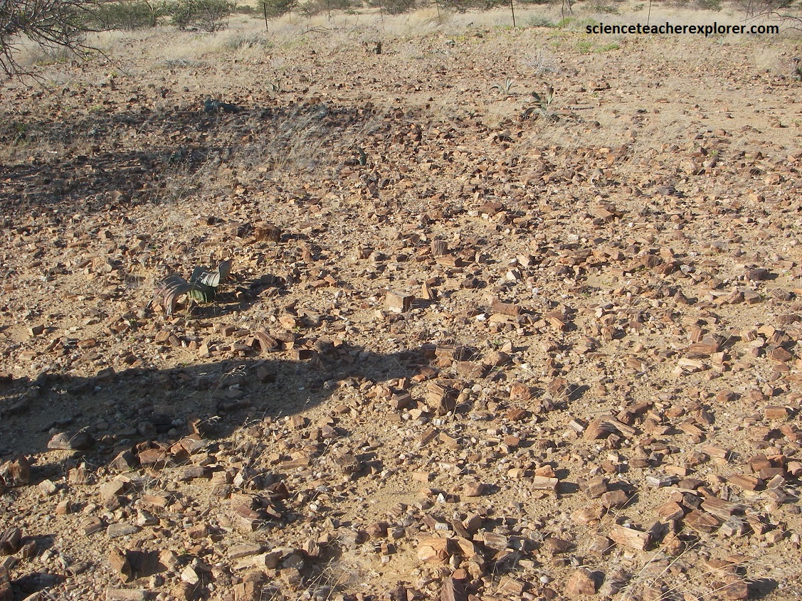
One of the most amazing things about this site in Namibia is that all of the small petrified wood-samples scattered all over the ground, haven’t been picked up and stolen. The picture below is an example of this. In the United States, the Petrified Forest National Park in Arizona, has no small samples laying around. They’ve all been stolen. However, remnants of this ancient forest in Namibia, now has been discovered to spread over several tens of square kilometers.
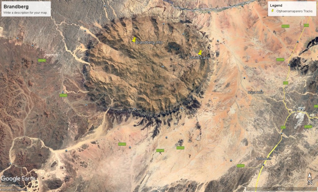
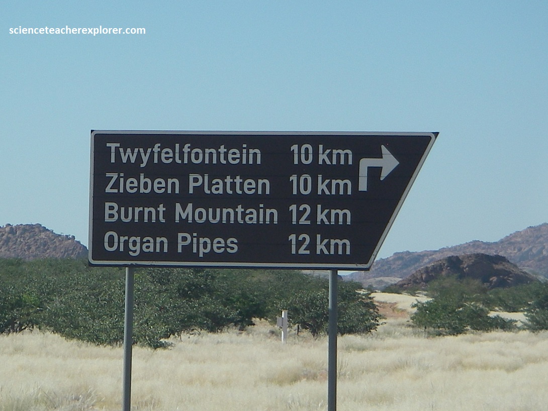
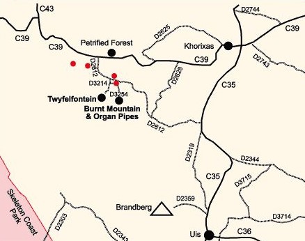
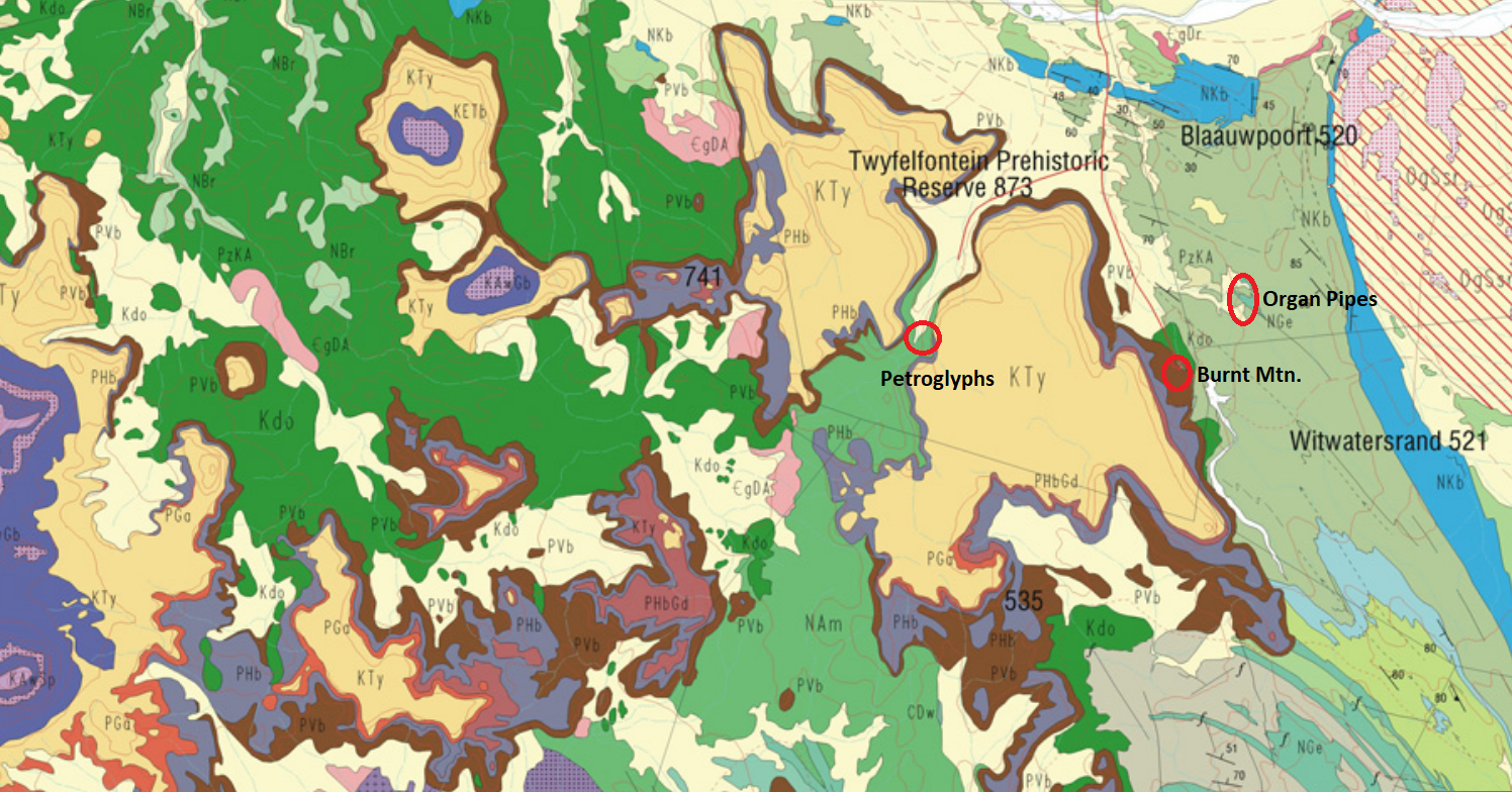
Further down the graveled road, (west), of C39, we came across a junction that brought us to several of our destinations within the Damaraland, (pictured below; Note the map is of public domain).
But before we turned south on D2612 to visit Twyfelfontein, we visited the Damara Living Museum. The Damara Living Museum is an open-air village, painstakingly reconstructed from natural materials by the Damara people themselves to preserve a culture in Namibia. It’s a vibrant, living classroom where history is demonstrated, not just displayed. Here we had the unique opportunity to get to know the fascinating traditional culture of the Damara people.
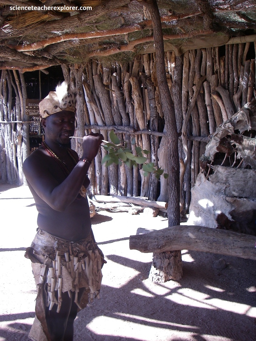
Together with the Bushmen the Damara people belonged to the oldest nations in Namibia. Their original culture was a mixture of an archaic hunter-gatherer culture and herders of cattle, goats and sheep. At the Damara Living Museum, we learned of their life-time Bush-skills in Namibia, (picture below).
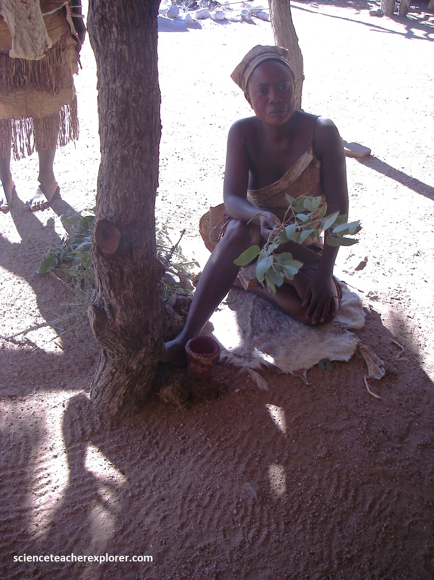
Pictured above, a Damara woman teaches us that her people uses the Mopane tree for building materials, firewood, and medicine. They use its branches as toothbrushes, and its bark for twine and tanning. The leaves are used in traditional medicine to treat ailments like diarrhea, while the wood is valued for its durability in construction and for fuel. The tree also supports a significant food source through the “mopane worm,” a protein-rich caterpillar harvested for consumption. She also mentions that the Mopane tree is loved by the elephant & the elephant dung is used to treat arthritis by rubbing it on joints. For example, fresh elephant dung is soaked in water and applied to the skin for the arthritis relief.
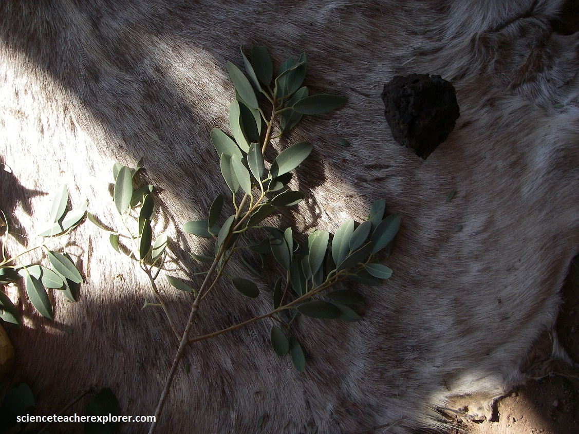
Pictured above, a Damara man teaches use that his people use stink bush (likely Dichrostachys cinerea or Boscia foetida) for medicinal purposes, including treating stomach and gastric problems. Dried, ground leaves can be used as a body powder, and a decoction is sometimes drank to relieve chest pains and intestinal gas. Other uses include applying a powder made from the root bark to wounds.
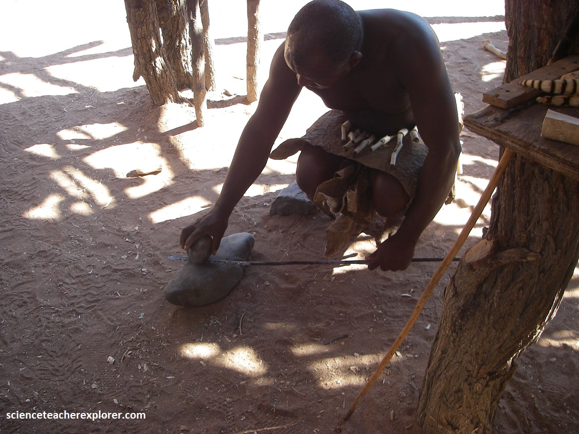
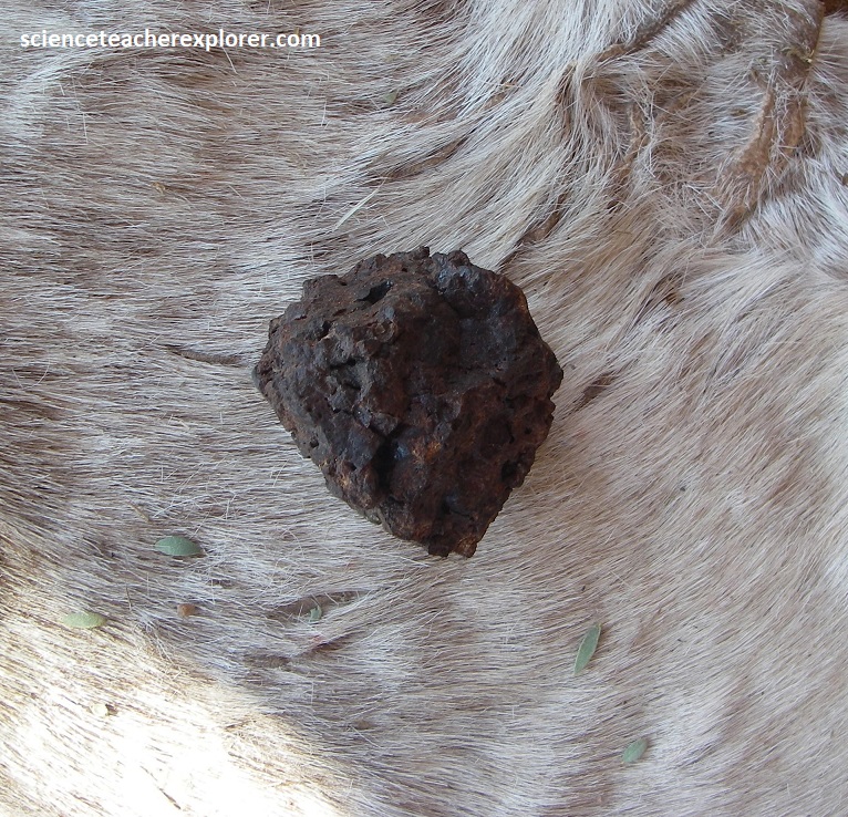
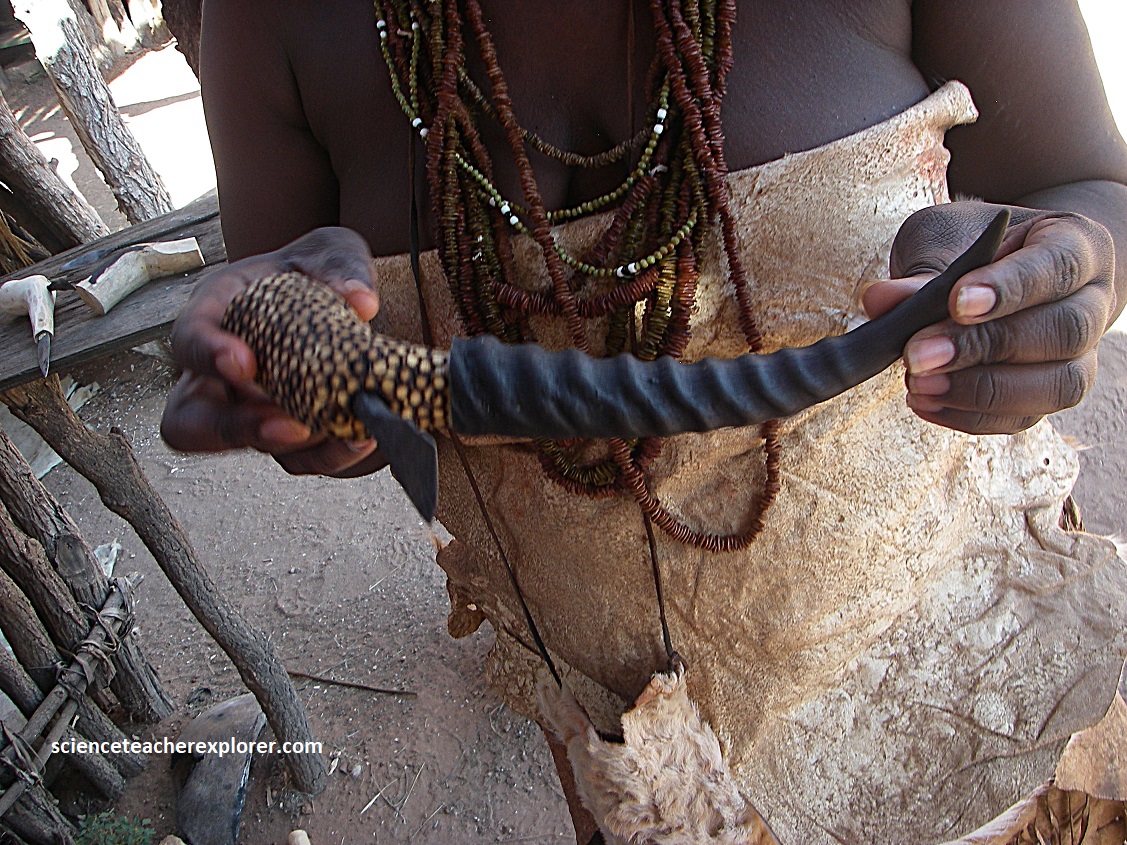
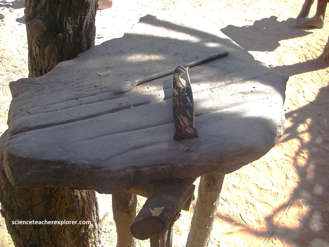
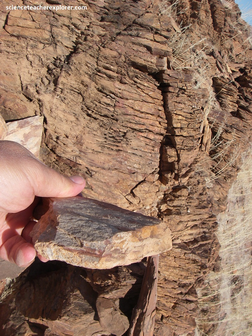
Pictured above, a Damara man shows us how he make iron weapons from and iron-stone & wood. The Damara, referring to a geological area in Namibia, obtains iron from a geological processes that formed iron-rich formations within the Damara Orogeny, such as the Chuos Formation. Iron is found in these formations in the form of banded ironstones, which are rich in iron oxides like magnetite (seen above) and hematite, and were deposited during the Neoproterozoic era.
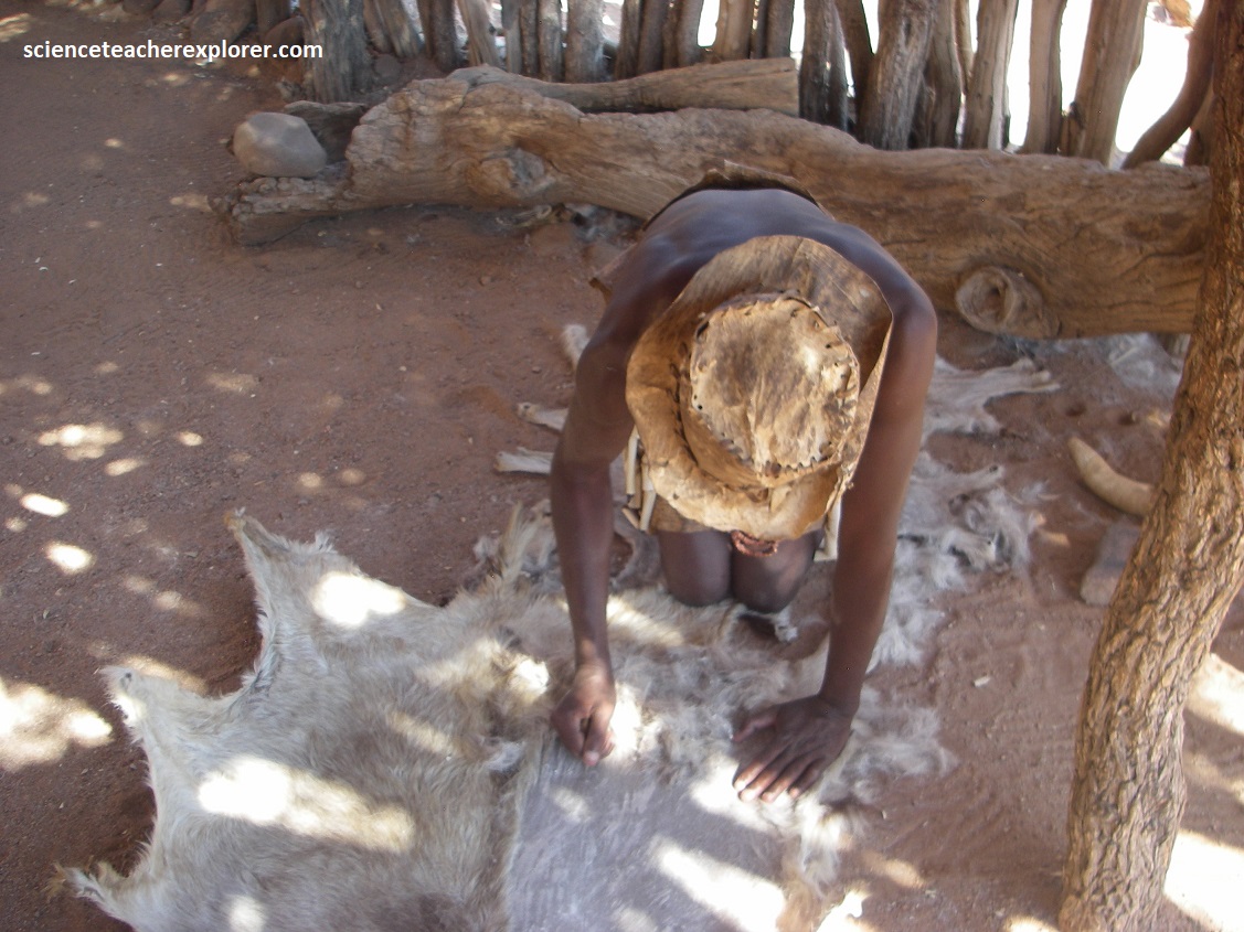
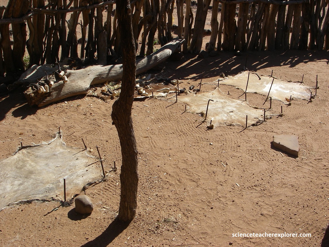
Pictured above, another Damara fellow demonstrates how he makes their traditional clothing from animal hides like springbok and goat. (Note his animal skin hat).
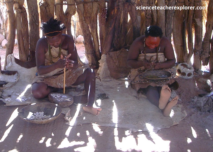
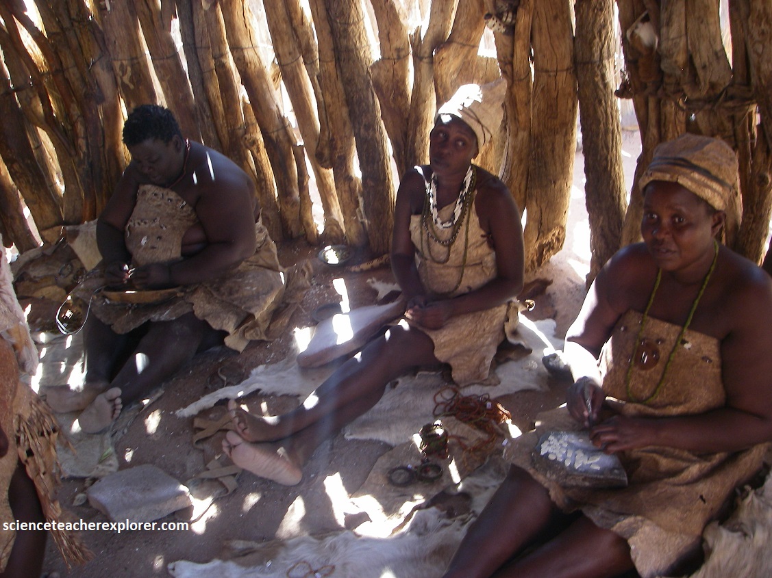
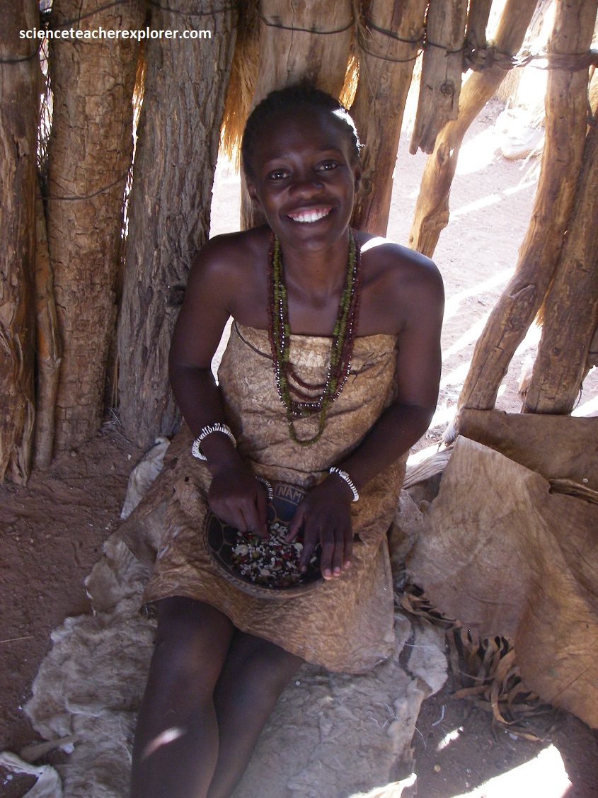
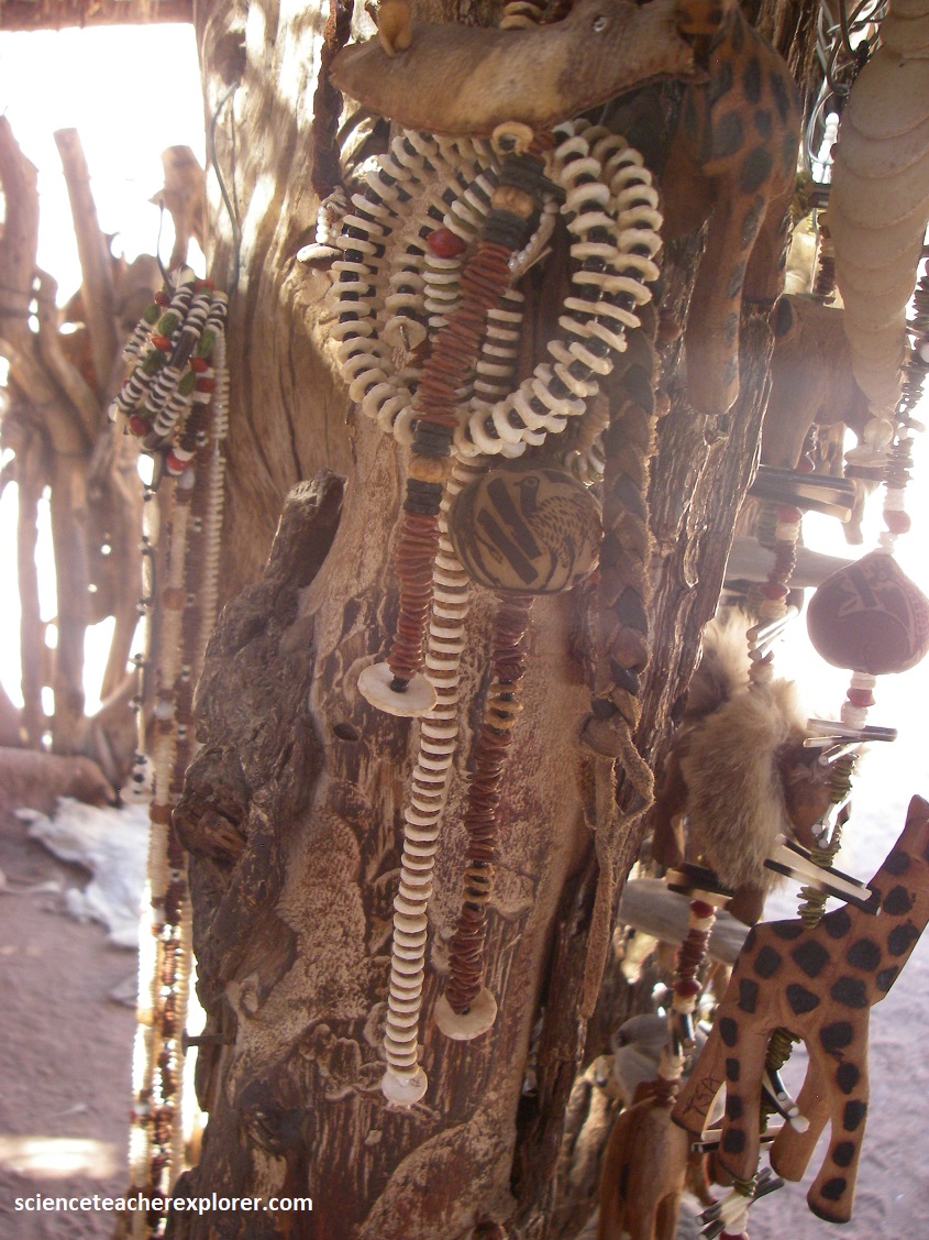
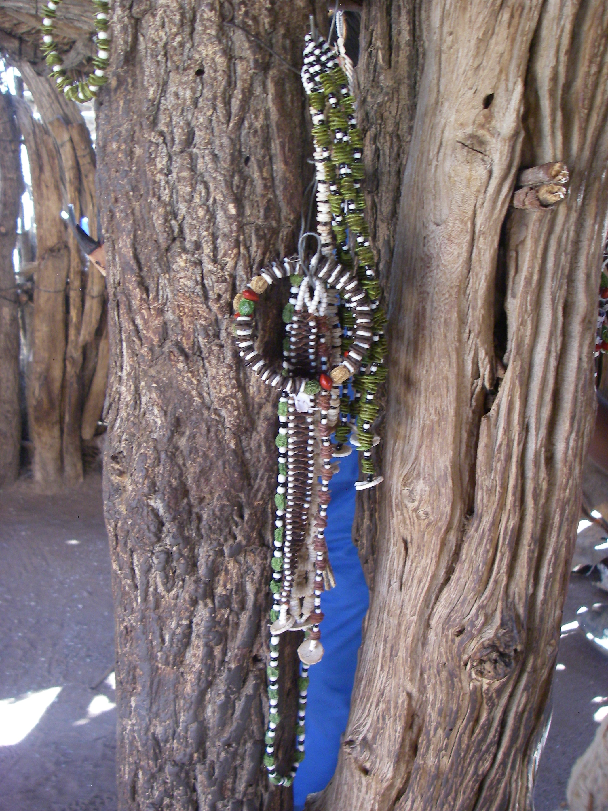
Pictured above are Damara women making traditional Damara jewelry from materials like ostrich eggs, vegetables, quartz and animal skins.
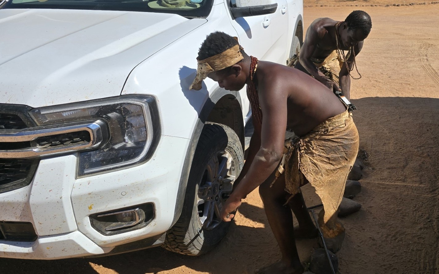
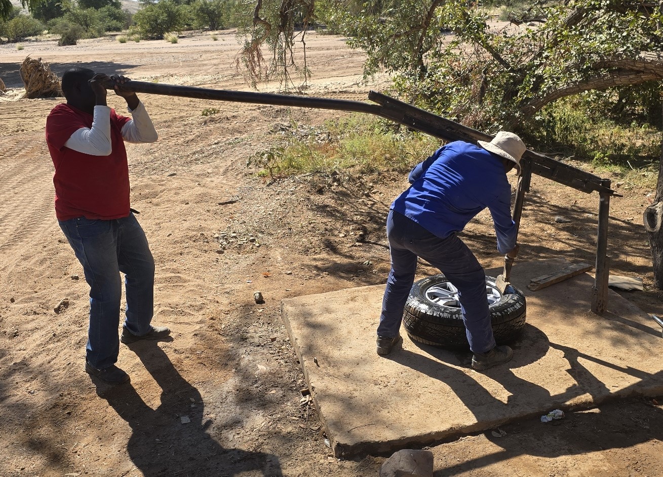
When we left the Damara Living Museum, we found that we had a flat tire. Some of the local tribesmen helped us with changing it. Then we had to drive to Twyfelfontein to get it fixed with some creative equipment. We were in some very remote territory.
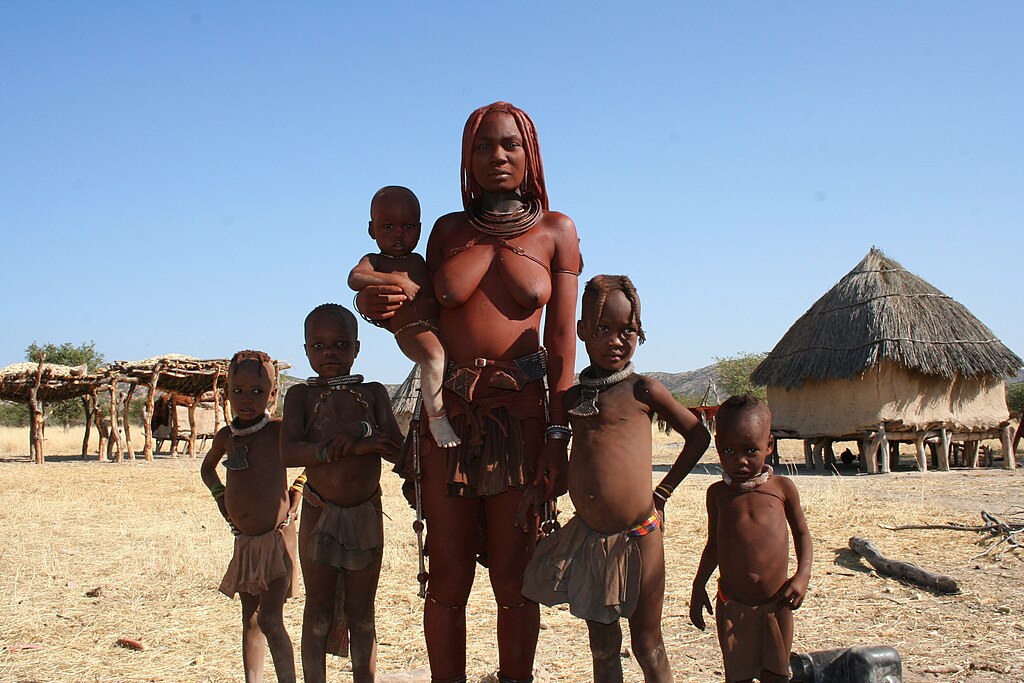

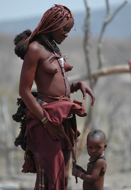
Another tribe that we commonly seen on our trek across Damaraland was the Himba, (pictured above). {Note: the photos above were taken from “Namibia Today: Jan. edition 2025” I was not given permission to publish their photos from the field}. Renowned for their distinct culture, lifestyle, and traditional practices, the Himba have managed to preserve their heritage despite the pressures of modernization and global influences. Himba women are famous for their ochre-covered skin, a result of their unique beauty ritual. Red ochre (found near Twyfelfontein) mixed with butterfat is applied to the skin and hair to protect them from the harsh desert sun, as well as to maintain moisture and smoothness in their skin. This practice also has symbolic meanings related to fertility, protection, and beauty. The Himba also use herbal oils and smoke for cosmetic and medicinal purposes. Like the Damara, Himba women wear traditional clothing made from animal skins, and adorn themselves with elaborate jewelry, including necklaces, bracelets, and headpieces made of beads & shells.
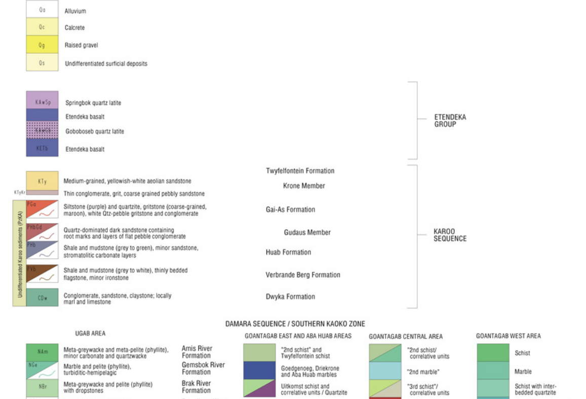
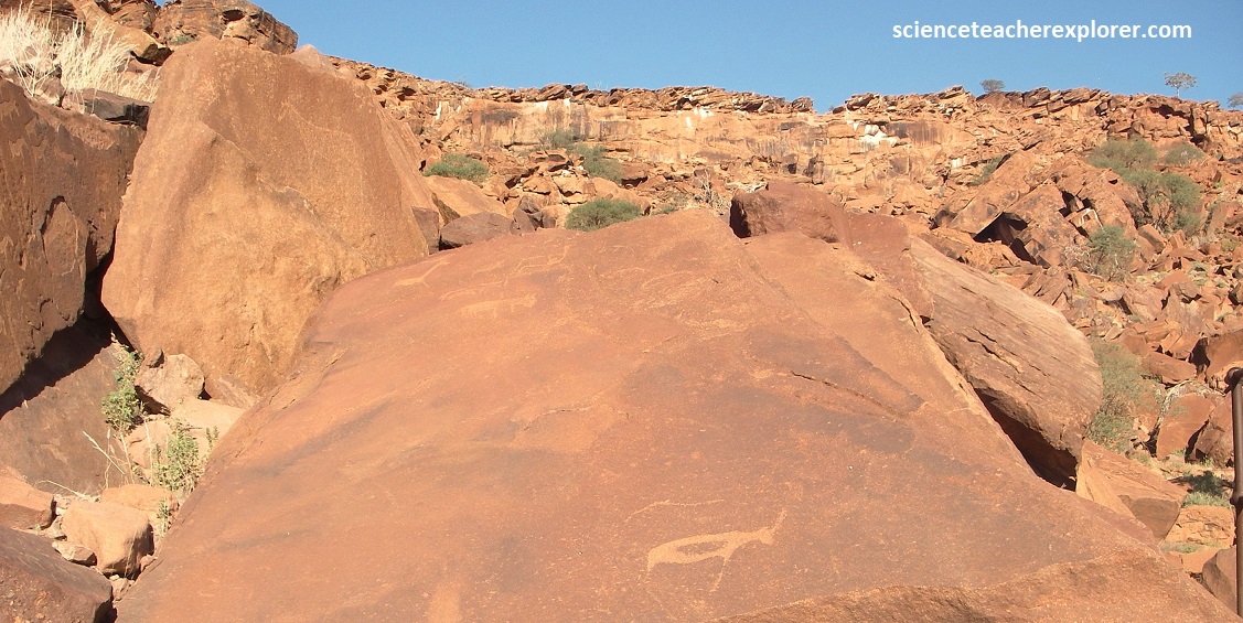
Pictured above, Twyfelfontein, (the ‘uncertain spring’ in the Afrikaan language), lies in a remote semi-arid area in Damaraland, ate the head of a valley running north-south and carrying a small tributary of the Huab River. {Note the image below was taken from a “Geological Survey of Namibia” Schneider 2014C Doros 2001. However, there are only four main formations seen on-site: [1] Twyfelfontein Fm. (Cretaceous 133 m.y.o.) to Etjo Fm. (Jurassic 190 m.y.o.). [2] Gai-As Fm. (Permian 270 m.y.o.) to Krone Member. (Permian 300m.y.o). [3] Kuiseb Fm. (Permian 540 m.y.o) to Huab Fm. (Permian 600 m.y.o.) [4] Damara Sequence schist.
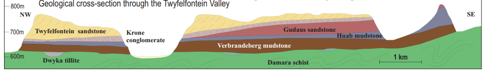
Imaged above, the Twyfelfontein Valley is bounded by sandstones of the Twyfelfontein/Etjo Formation and mudstones of the Gai-As/Krone Formation, which are underlain by dark Kuiseb/Huab Formation schists of the Damara Sequence.
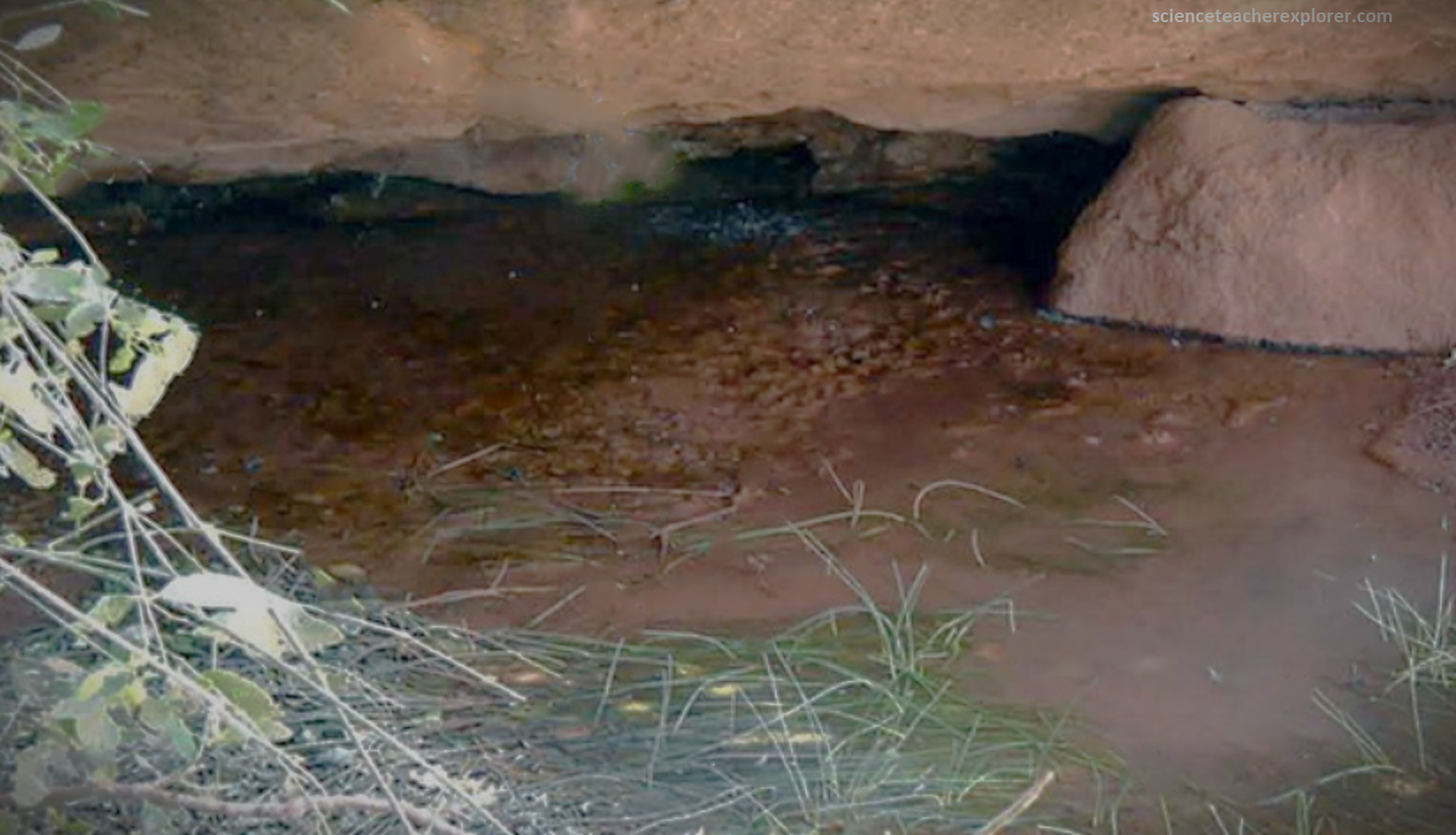
Pictured above, freshwater springs appear at the contact zone of impermeable clay layers ad porous sandstones and sand formations. Such is the case at the Twyfelfontein spring, which comes to life only when the porous sandstone has absorbed enough water following good rains. The presence of this small spring has attracted people and game for a long time, especially hunting communities, where the hunters could observe passing game, unseen, from a rocky terrace some 50m above the spring.
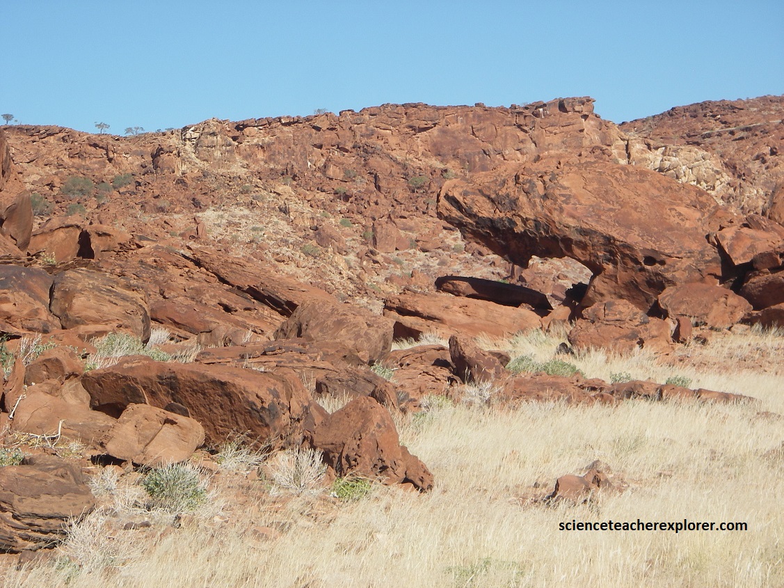
The sandstone of the Twyfelfontein/Etjo Formation weathers in two different ways, depending on its hardness. The softer rock weather into tafoni, which creates reliable shelters; and the harder rocks are transformed into large, flat-faced blocks that provide a suitable surface for rock carving. {Note the animal tracks on the rock-art below}
Pictured above, desert varnish is a striking geomorphic phenomenon, the result of many processes taking place over time. It forms only on the exposed surface of pavements in desert landforms, and is well represented at Twyfelfontein. The varnish source materials are primarily airborne dust which, together with direct aqueous atmospheric depositions, forms an extremely thin coating of a dark, orange-yellow to black substance composed of about 30% iron and manganese oxides, and up to 70% clay minerals. It was clearly the preferred base for rock-art petroglyphs and engravings, as it enables the artist to play with a variety of naturally available colors.
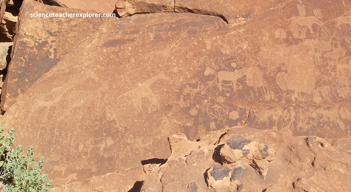
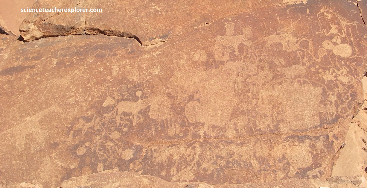
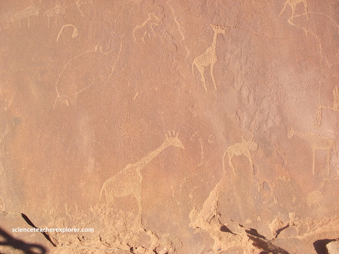
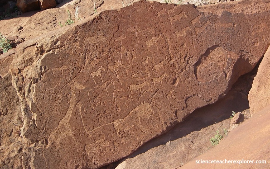
Pictured above and below, it is on thee natural canvases that almost 2,000 images have been recorded, all within a 1 km2 around Twyfelfontein. This open-air gallery contains the largest prehistoric rock engraving site in Namibia, and one of the largest in Africa. (Declared an UNESCO site in 2007).
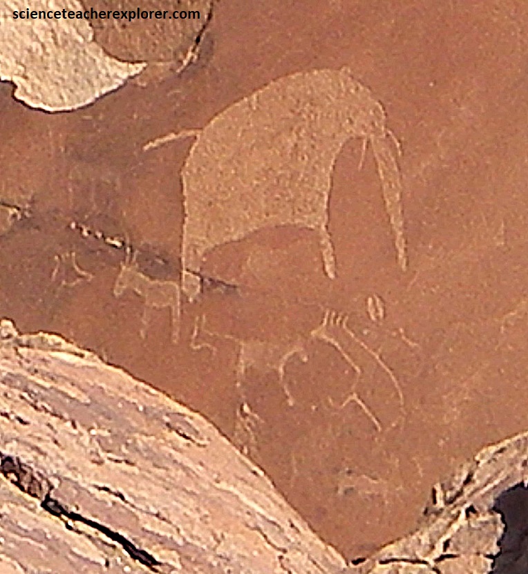
The petroglyphs include an extraordinary diversity of wild animals: more than 200 giraffes, 100 rhinos, as well as elephants, oryx, ostriches, impalas, wildebeests, zebras, a lion, a dancing kudu, and many more.
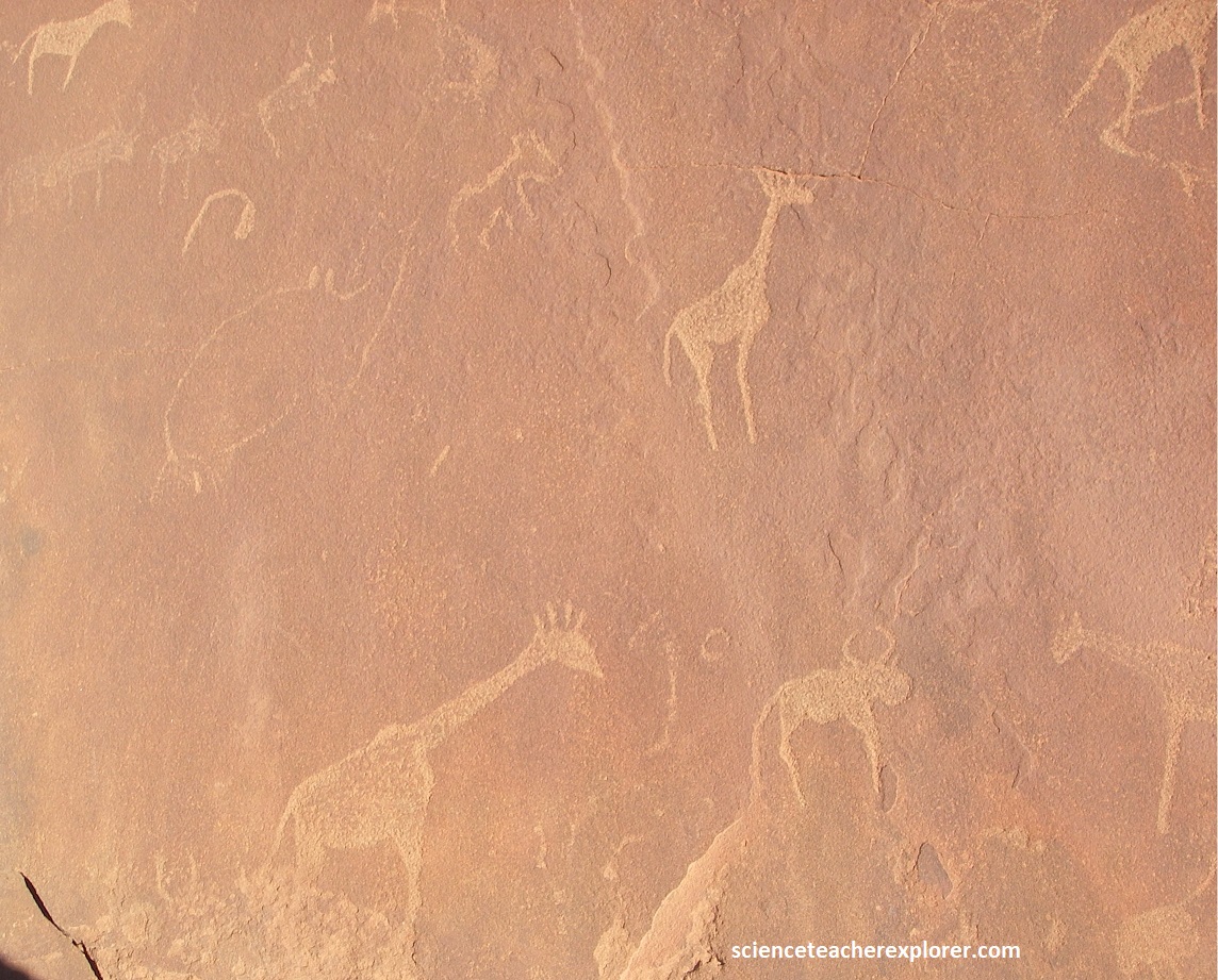
The petroglyphs are thought to have been created by San hunter-gatherers over a period spanning about 2,000 years, starting some 6,000 years ago.
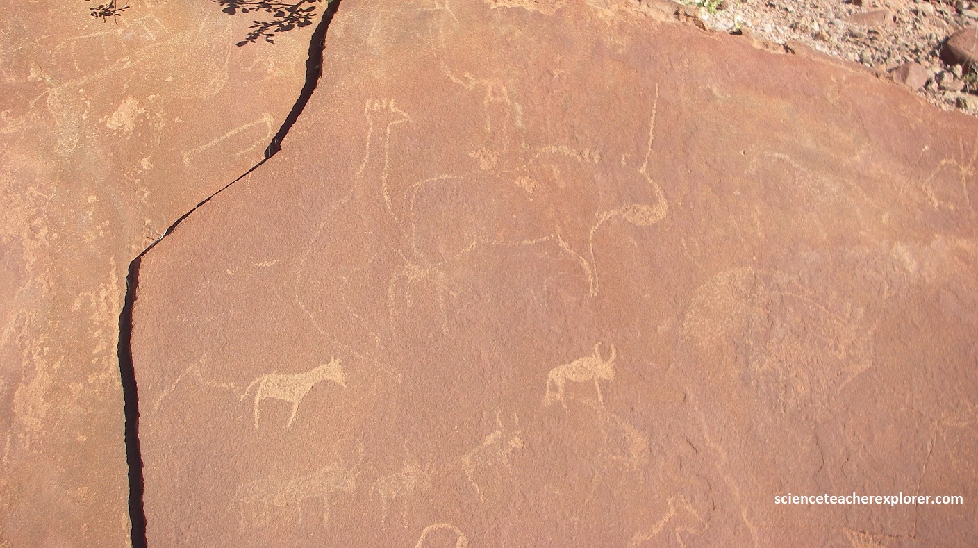
It is believed that the images found at Twyfelfontein are not so much naturalistic representation of daily life, but rather of a highly symbolic nature and most probable related to shamanism.
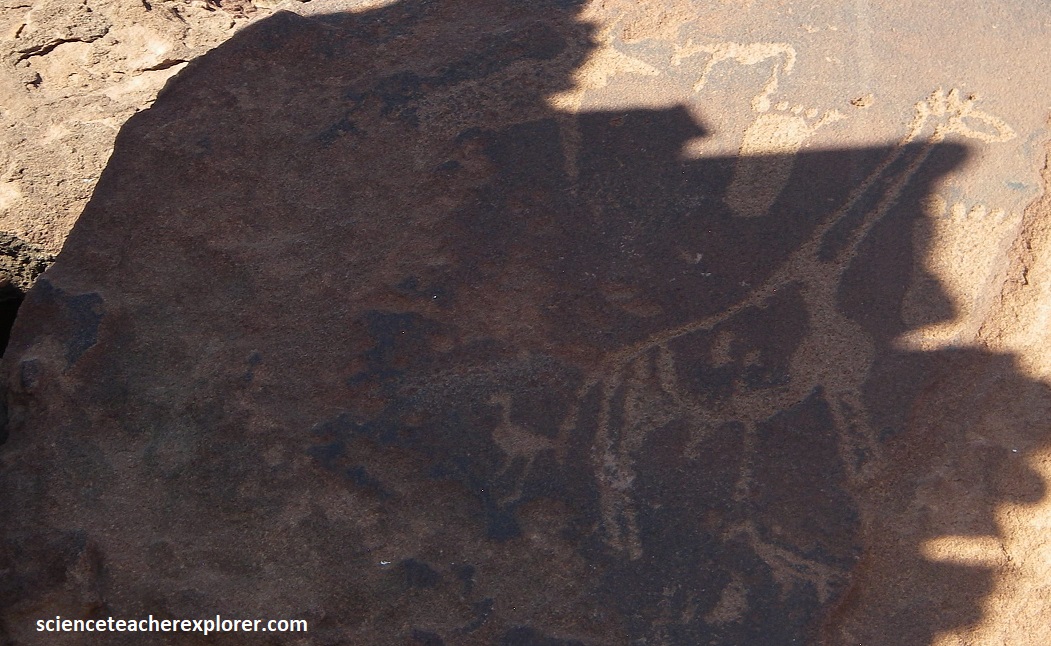
For instance, the ‘Lion Man’ engraving (pictured above) shows five tows on each paw, whereas in real life a lion only has four toes. The deliberate combination of human and animal features shows that this is a shaman who has transformed.
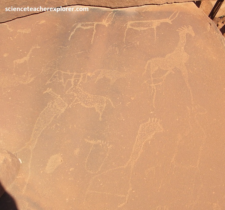
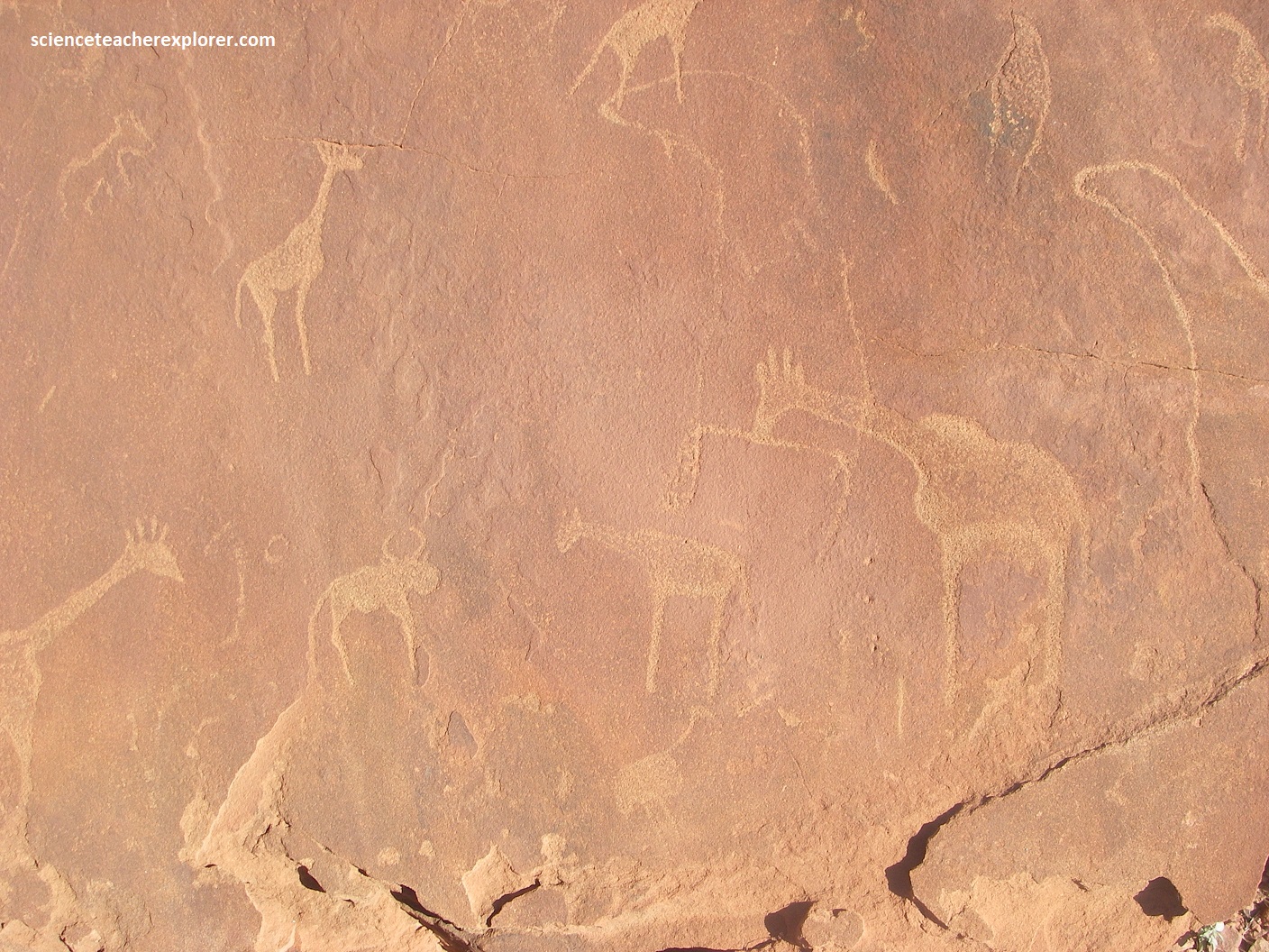
Giraffe are very common in the Twyfelfontein rock art, and characteristically shown without hooves, their legs tapering away to long thin lines. This represents the sensation of rising up into the air, as felt by the shaman in trance. Sometimes the giraffe body is shown distorted or hollow, as the shaman feels his shape changing. A shaman who has changed into a giraffe is shown with five protrusions from the head, representing the five digits of the human foot.
Circles, dots, grids and spirals representing the wholeness of the universe surround the figure of the ‘Dancing Kudu’, possibly the most famous engraving at Twyfelfontein. This supernatural pregnant human-kudu is thought to be the incarnation of a shaman in a trance for accessing special powers to help his fellow humans. {Notice how polished the kudu is…..}
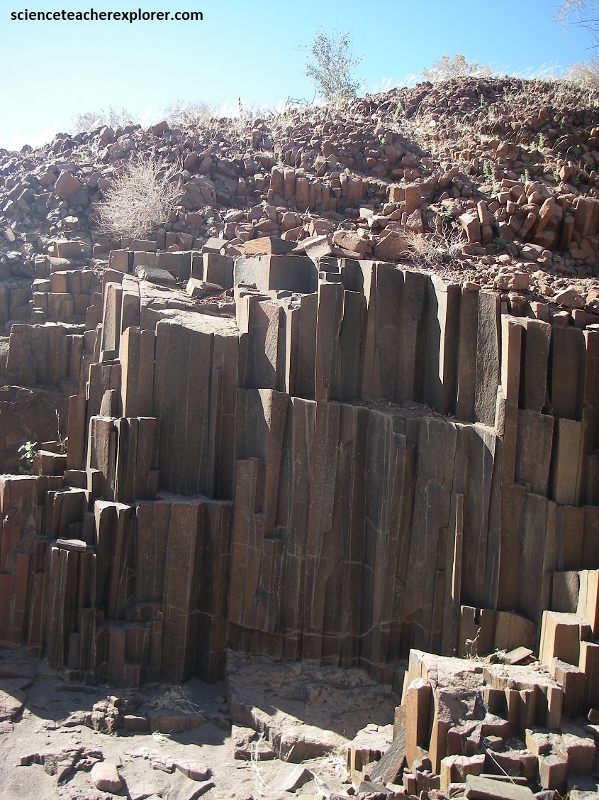
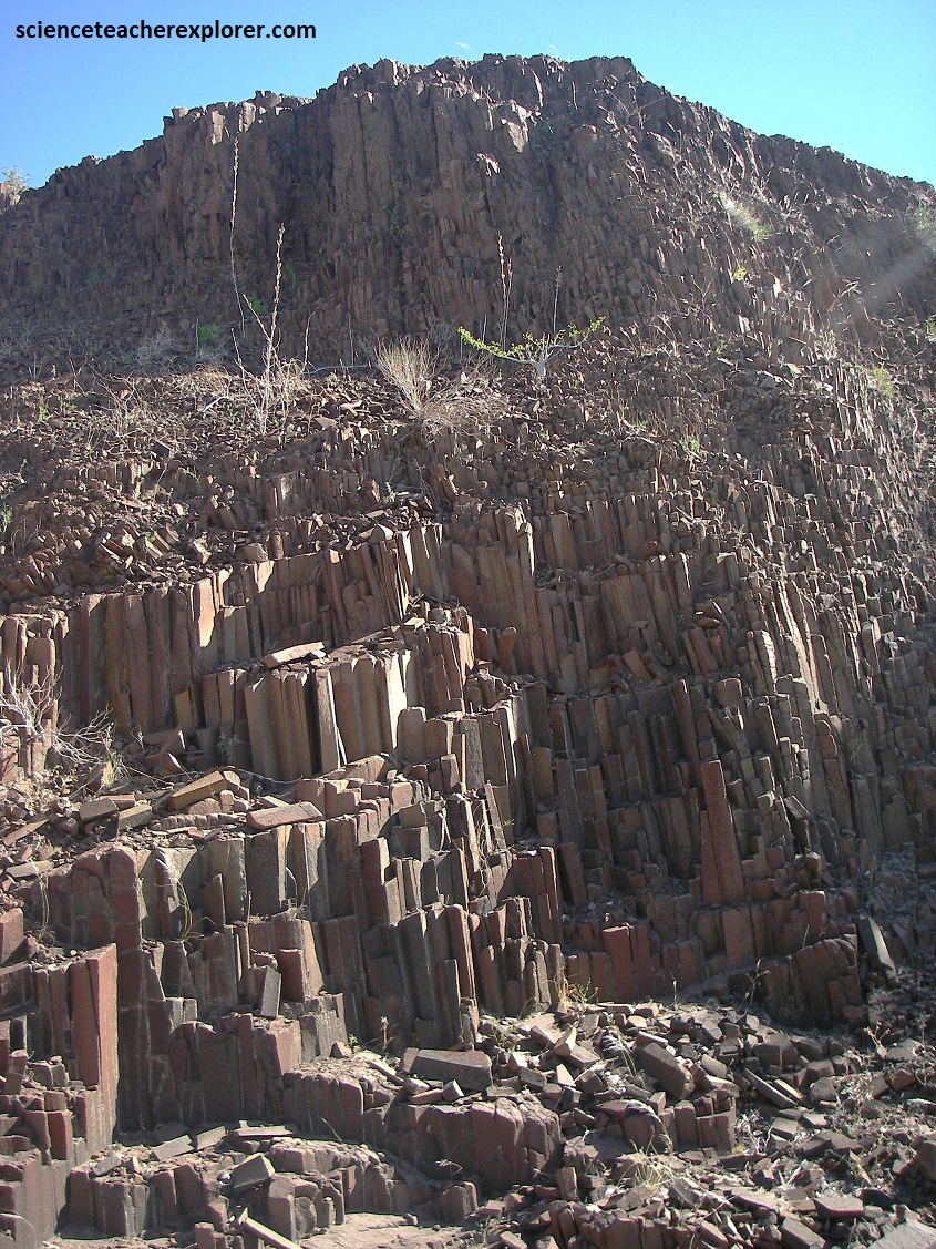
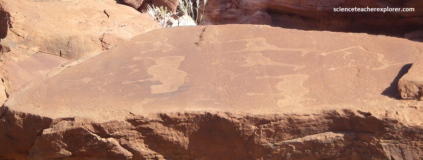
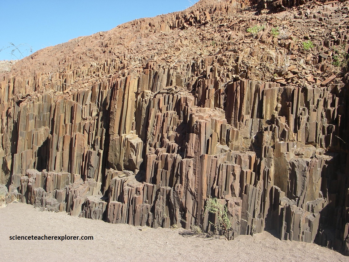
Leaving the Twyfelfontein on D3414, turning right and following the signs to D3254, took us to another another interesting geo-site that is only 6km away. It is an outcrop of crystalized dolerite columns looking much like an assemble of organ pipes, (pictured above).
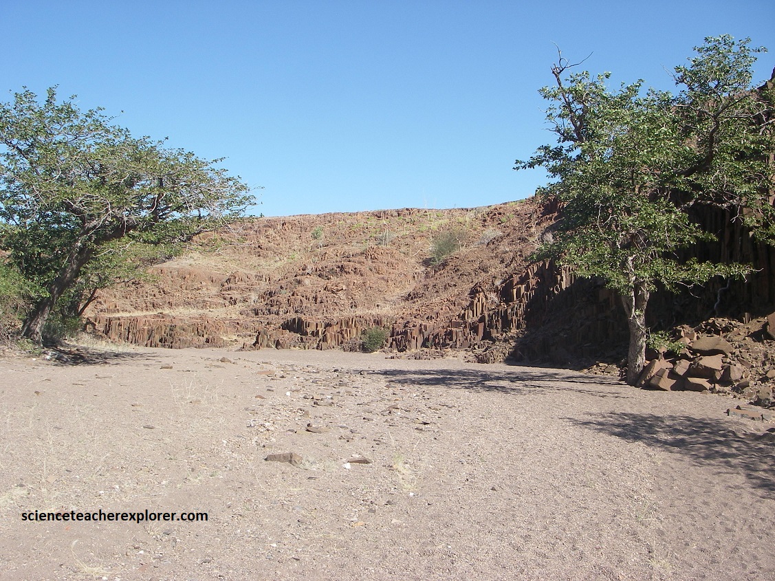
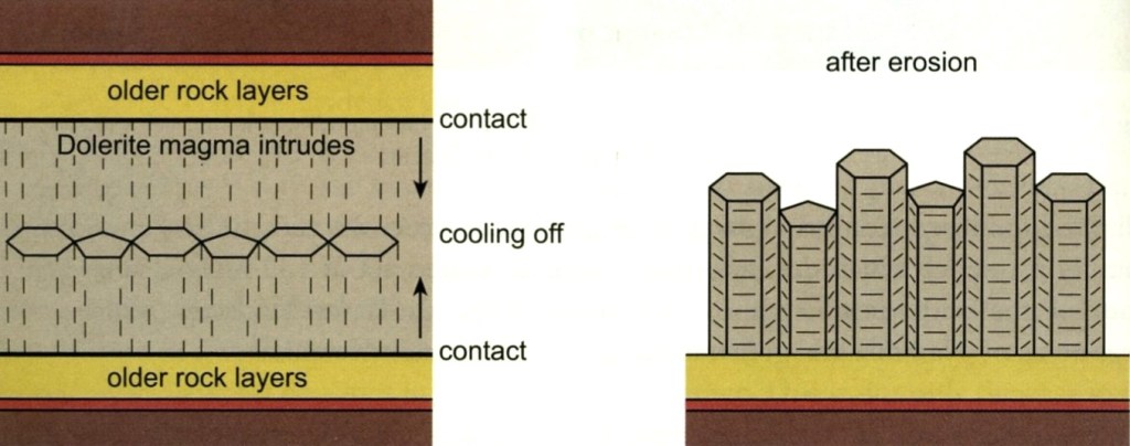
Pictured above, these organ pipes are part of a sill that was formed by intruding Damaran and Karoo sediments during magmatic activity related to the break-up of Gondwanaland in the Early Cretaceous.
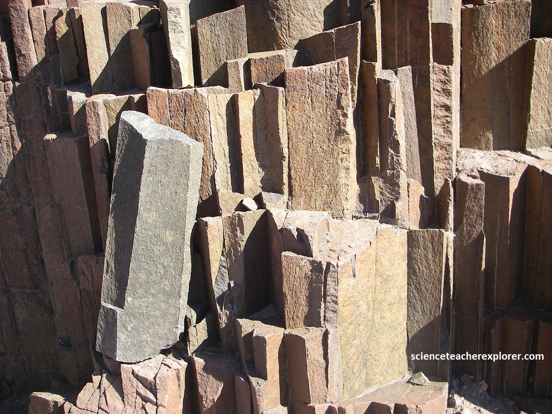
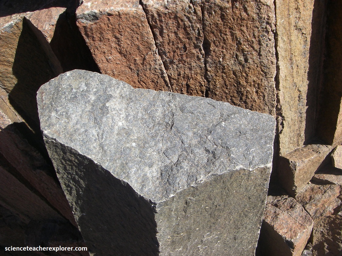
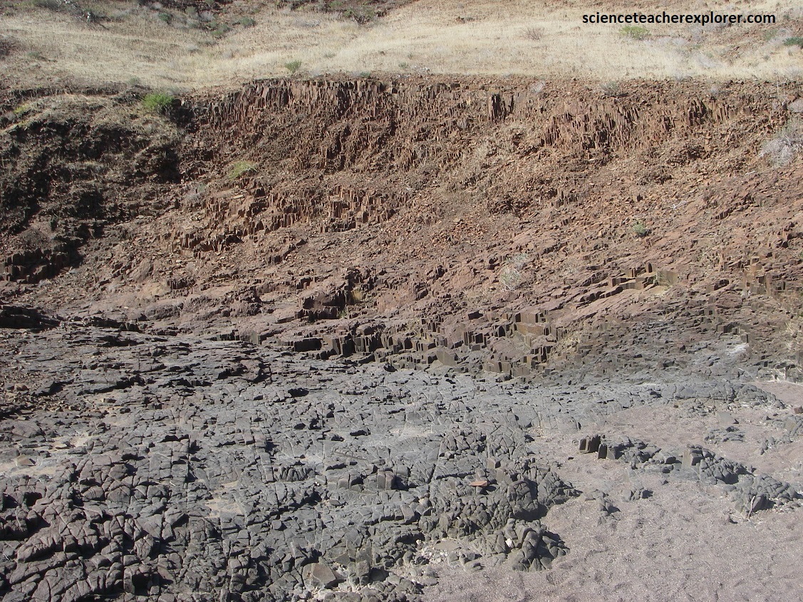
Unable to reach the surface by cutting vertically through existing host rock, molten magma penetrated horizontally into the surrounding rocks. Because it was trapped under the Earth’s surface, the molten dolerite cooled and solidified very slowly, allowing polygonal structures to form, (pictured above). These structures slowly built up into columnar shapes, perpendicular to the surface, (pictured below).
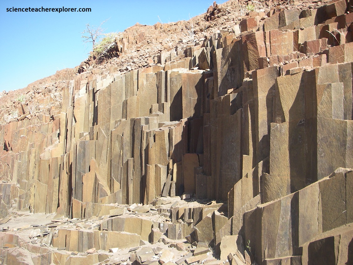
The cooling process of magma starts from the edges of the intrusion, moving inwards, so that the polygonal columns build from both top and bottom and meet in the middle, where the magma cools more slowly, (pictured below).
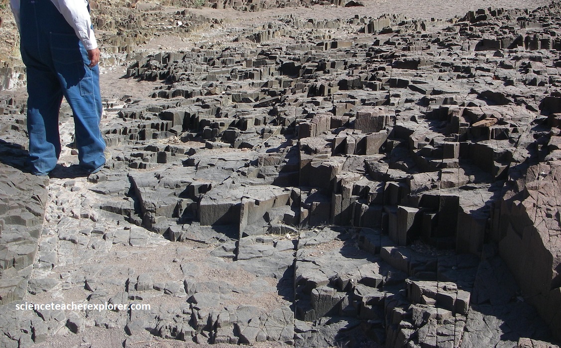
Hexagons make up the geometric pattern that forms naturally during the contraction and shrinking of any soft structure subject to drying and cooling, (pictured below). As these cracks penetrate deeper into the cooling mass, they tend to arrange themselves at 1200 to one another, and hexagonal columns result, which minimize heat loss and cooling tensions. However, because there is some randomness in this process, five-sided or seven-sided columns may also be produced, (imaged below).
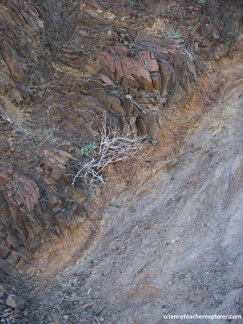
Within a kilometer, (west), of the ‘Organ Pipe’ formations, we trekked over to the ‘Burnt Mountain’. Of course, the ‘Burnt Mountain’ was never in flames, but in its formation, high temperatures played an important role.
Huge amounts of basaltic magma were pushed into a adjacent later of mudstone of the Ecca-Group because of the intensive Post-Karoo Vaolcanism in Damaraland about 130 million years ago. The contact with the 12000C hot rock melts initiated chemical and thermal modifications in the mud-stone of the Verbrannte Berg Formation. The Verbrannte Berg Formation was a former lake deposit that was rich in organic remains. The nearby flowing magma caused this organic material at the contact zone to vaporize and hardened the rock into a black compact rock surface.
Picture above and below, the mudstone and shale are also partly covered by a thin red and purple shiny coating, which causes interesting optical effects. These coatings are caused by iron and manganese oxides, which were formed by the effect of the atmosphere on the rocks aft the ‘Burnt Mountain was exposed by erosion.
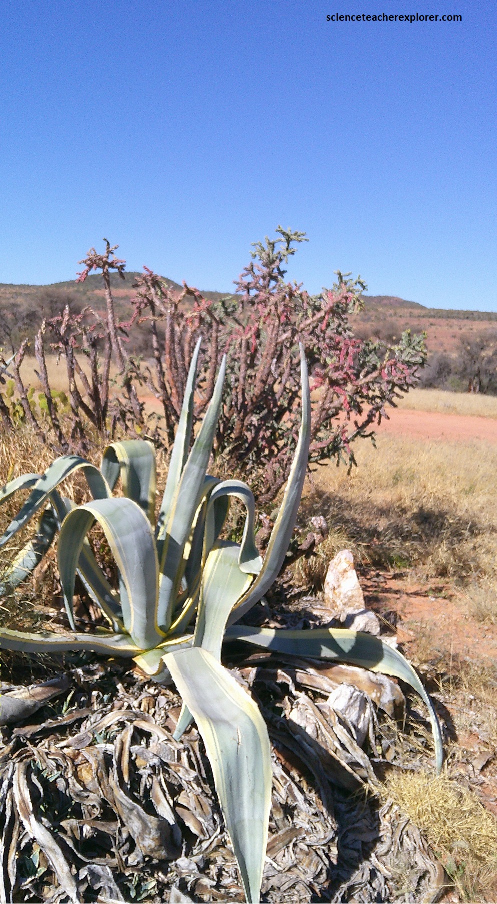
Also located at the ‘Burnt Mountain was this Damara milk bush, specifically the Euphorbia damarana, is a plant found in the north-western desert regions of Namibia that is extremely poisonous due to its toxic latex. Local inhabitants are aware of its danger, and its use includes contaminating watering holes to catch game, though this is not its only use. The latex can cause severe irritation to skin and mucous membranes.
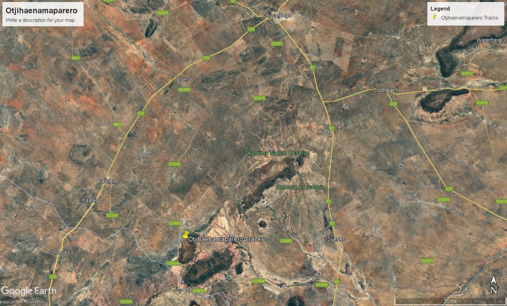
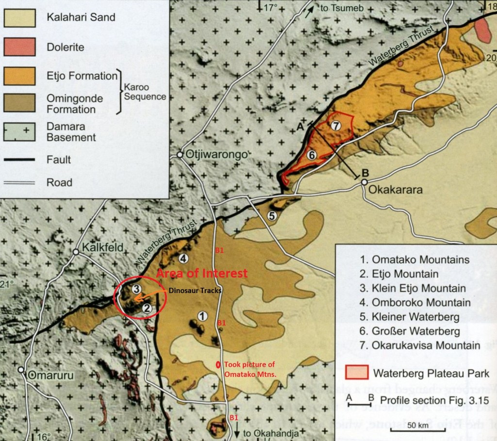
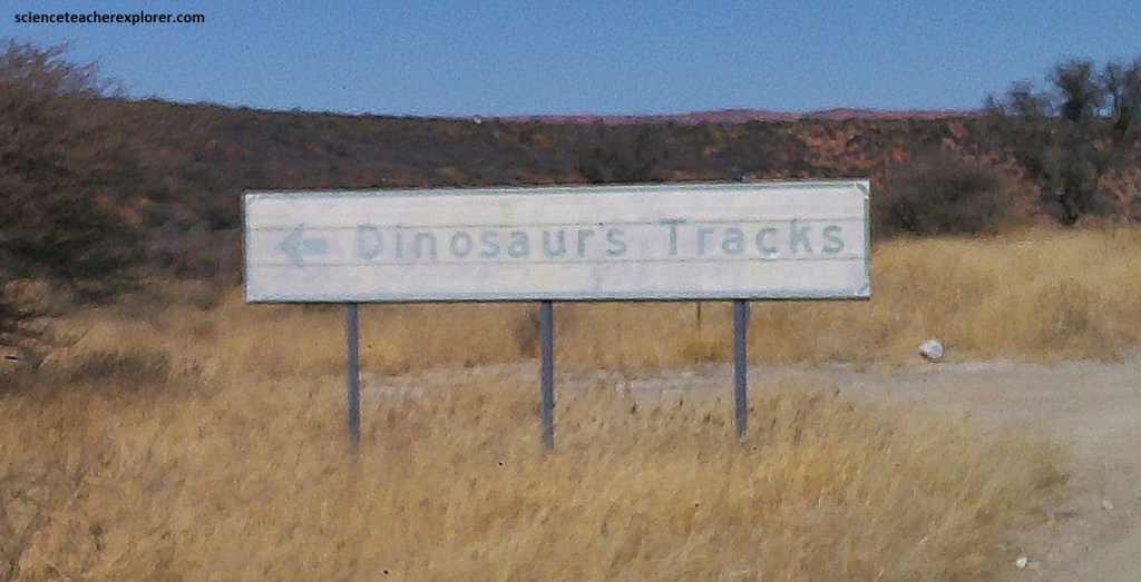
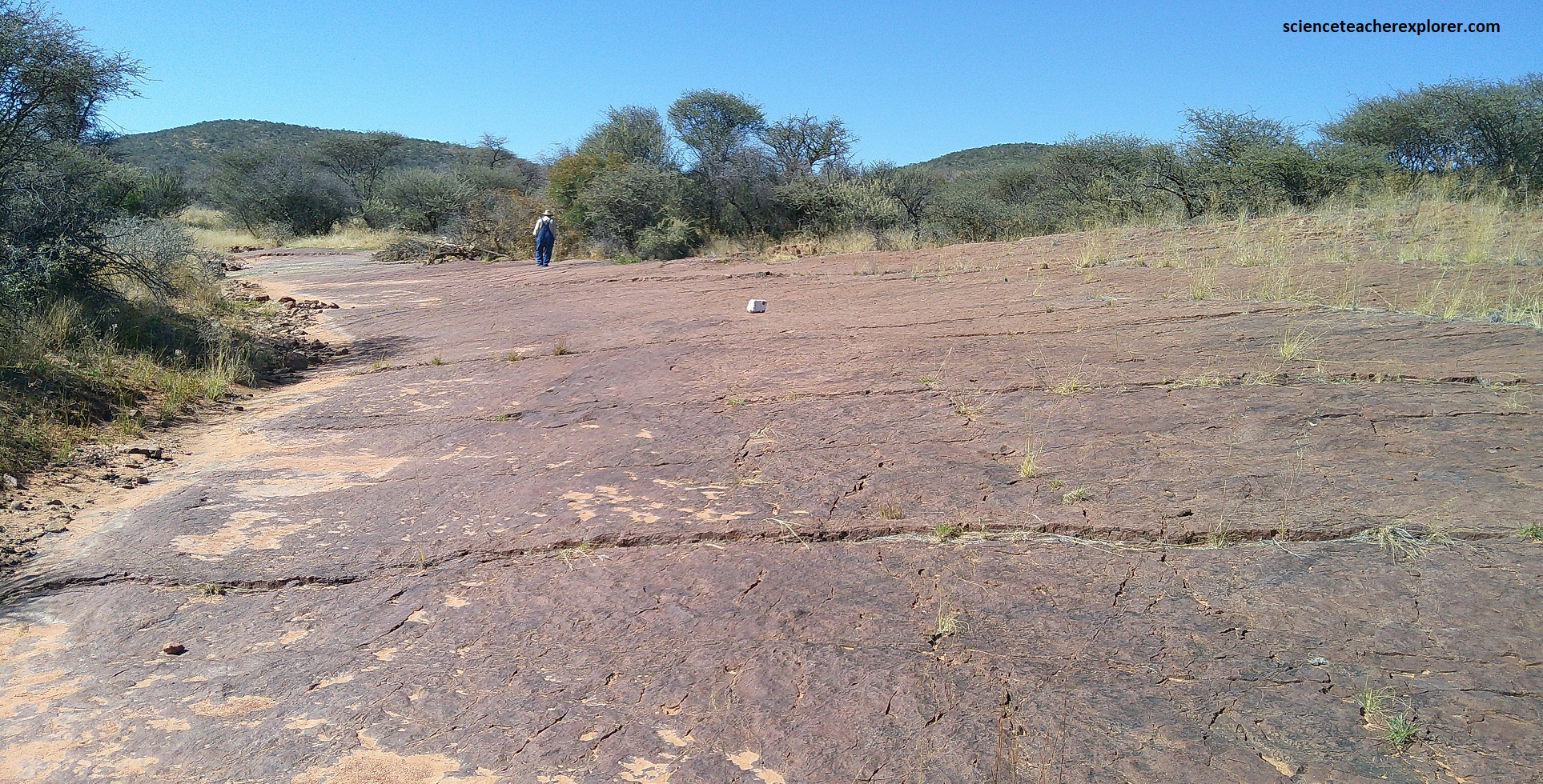
To continue exploring Damaraland for our next geo-site, we had to drive east on C39/M126/M69 through Khorixas and onto Outjo, where we turned right on C38, and drove southeast to Otjiwarongo, Namibia. From there, we turned south on B1 and drove 67km to another graveled road called D2483. From there, we turned west and drove 48km through the Mount Etjo resort camp and then turned left D2414. After a few kilometers, we approached the Otjihaenamaparero ‘Dinosaur Footprint’ site, (imaged below).
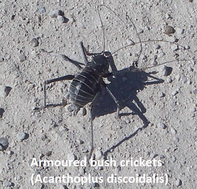
Along the way, we came across an infestation-swarm of these strange crickets. It reminded us of the Utah Mormon Cricket. It was the Acanthoplus discoidalis or the Armoured Bush-Cricket. There were literally billions of these things, all over the country-side. They seem to be a flightless species that typically grows to a body length of about 5 cm. The pronotum bears several sharp, conical spines and the biting jaws are powerful, which can inflict a painful nip, (pictured below).
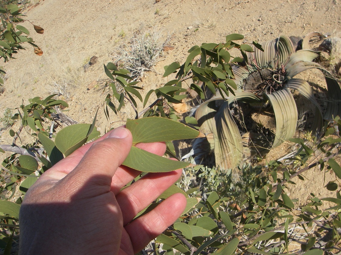
Another endemic plant that we came across on a regular basis within the Damaraland was the Welwitschia Mirabilis. Named after Friedrich Welwitsch who “discovered” the plant in 1859, some of the specimen are estimated to be between 1000 and 1500 years old. It does not grow on the coast, but keeps its distance to it, having its most dense occurrence about 50 to 60 km away (Damaraland) from the Atlantic. The Welwitschia Mirabilis has a dense network of roots close to the ground surface with a diameter of up to 30 m. However it also has a taproot that is able to reach groundwater provided that it stands at about 3 m depth.
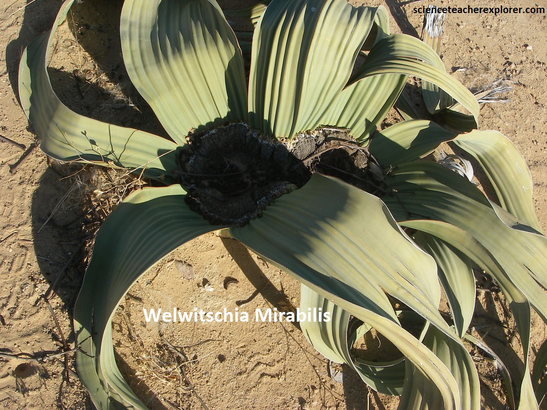
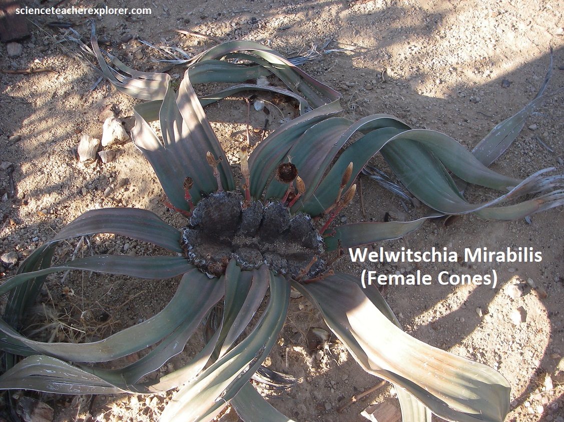
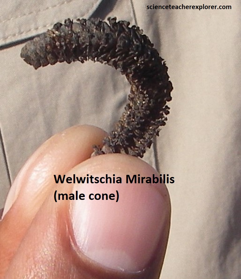
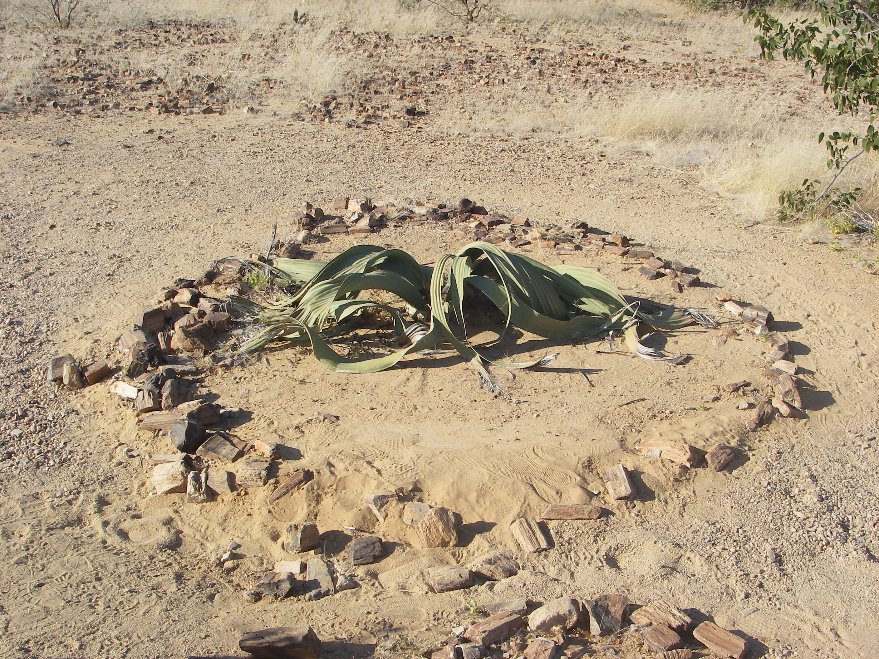
Even though the Welwitschia Mirabilis looks like it has several leafs, it actually has two leaves. These two leaves grow continuously, but slowly and pretend, as they are torn with increasing age, to have several leaves or even a whole heap of leaves. With time these leaves frazzle even at their tips as the wind, the hooves of antelopes damage them. By the way, like with humans the Welwitschia has female and male specimens, pollination takes place with the help of insects, but they usually are found close to one another.
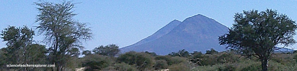
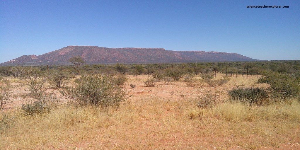
When we were driving north on the B1 road from Okahandja to Otjiwarongo, (about 90km north of Okahandja), we could two striking, cone shaped inelbergs, (picture above). The Herero word Omatako, (buttock), quite aptly describes the mountains rising 700-800m out of the flat surroundings, (elevation 2,289m). The Omatako Mountains are of the Karoo age, (180-240 million years old). The upper 300m of each of the Omatako Mountains is built up of basalt and dolerite that was formed from the early breakup of the eastern Gondwana Continent during the Karoo volcanism. At the base of these mountains is the extensive river-delta deposition of the Omingonde Formation, (sandstone, shales and conglomerates).
During the Karoo age, (180-240 million years ago), this area had developed huge lakes in graben structures. Sediments were transported by rivers into these lakes from the neighboring mountain regions, which contributed as catchment areas. However, at the180 million year mark, an extreme climatic change occurred. {In 120 million years, this area changed from a wet glacial-polar region to a sand desert} The wetlands dried up and were covered by red desert dune sands that are 150m thick. Out of these sands the reddish Etjo Sandstone formed, which is commonly found in the vicinity of Etjo Mountain, (seen above).
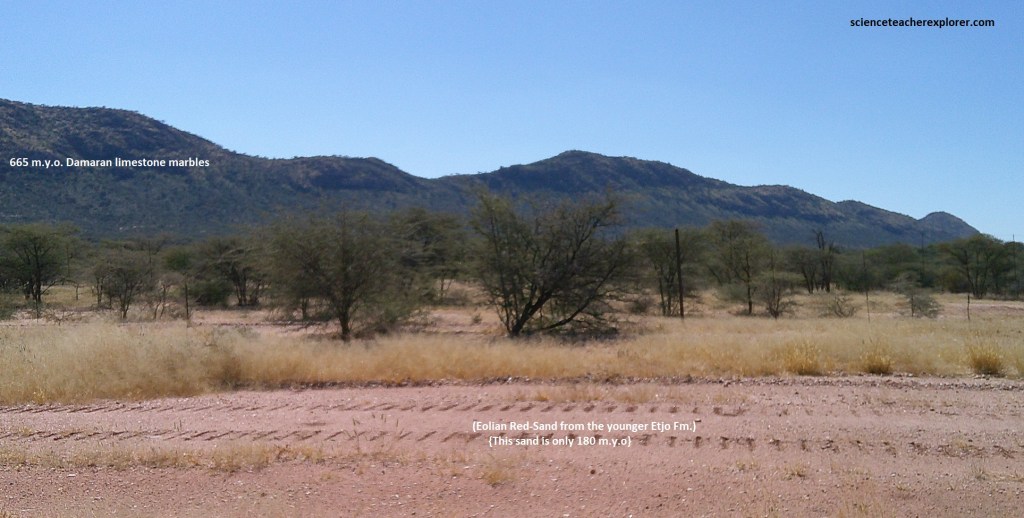
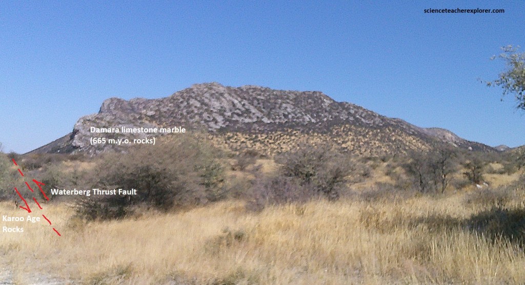
The further geological history of the Etjo Mountain area was mainly characterized by tectonic processes. During Post Karoo volcanism & deposition, an equalizing movement in the earth’s crust took place in western and central Namibia, which caused a comprehensive elevation of the land. Because of these tectonic activities, an old fault zone in the area of the Mount Etjo and Waterberg was reactivated. This zone extends over 250km from Omaruru, through Mount Etjo, along the northwestern foot of the Waterberg up to Grootfontein and is known today as the Waterberg Thrust (imaged below).
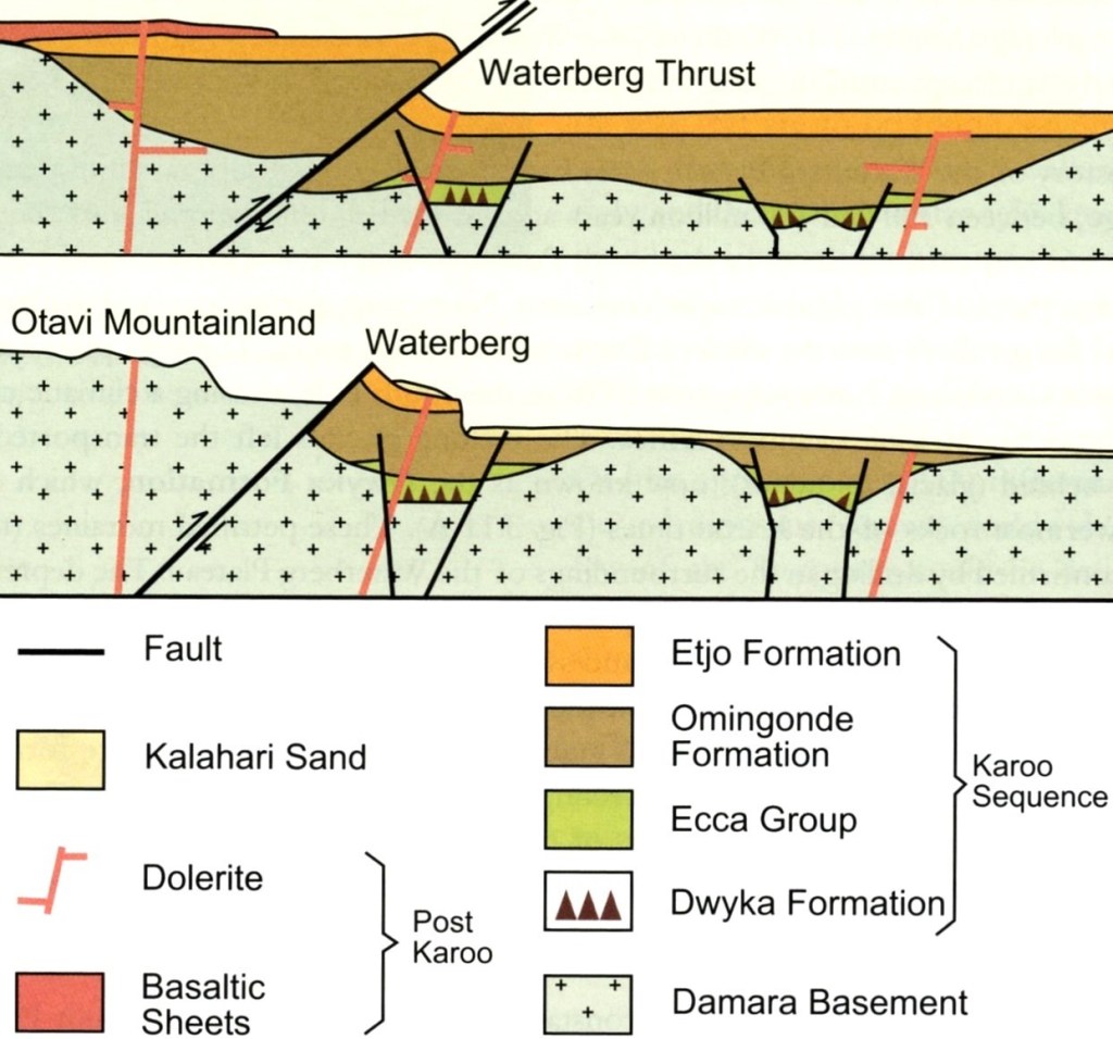
Image above, along the Waterberg Thrust fault, the Damara Mountains and the overlying Karoo rocks were probably lifted up 100s of meters by the forces in the interior of the earth and pushed over the in-situ Karoo rocks in a southeasterly direction. While the thrusted rocks were eroded, the original pile of sediments below were protected against erosion, (imaged above).
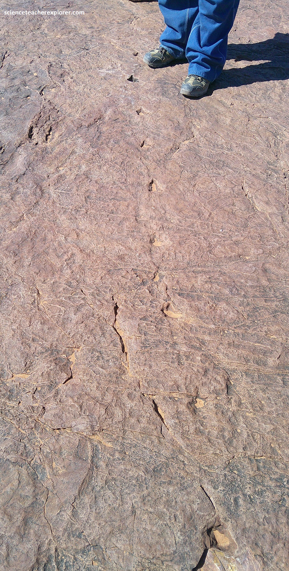
While we were examining the Otjihaenamaparero dinosaur footprints, we saw some rocky hills southwest of the site that contained the reddish Karoo aged sandstones in the lower section and the older light Damaran marbles in the upper section, (pictured below). The contact between these two rocks, marks exactly the course of the Waterberg Thrust, along which the enormous piles of rocks were displaced by about 400 million years.
The rocks of the Otjihaenamaparero dinosaur footprints were formed in the Karoo age, (about 180-200 million years ago). As mentioned above, this was considered a wet climate area with lakes, rivers and deltas. The tracks are actually in the shales layers of the Omingonde Formation. However, as I again mentioned above, this was a time of climate change in this area. Strong storms transported large amounts of wind-born sand into the region and transformed the lakes gradually into sandy wetlands. The dinosaurs, which were still living there and whose living conditions continuously deteriorated, had to concentrate around a few water holes, where they left visible footprints behind in the soft, wet sandy sediments. The prints were quickly filled with clayey particles, covered by more sand and finally solidified into rock by the load of the overburden.
Enclosed within these Karoo sediments, the dinosaur footprints were hidden in the subsurface for millions of years and only in the course of erosion were they then exposed to daylight again. The sandy/clayey particles, which filled the footprints, were less resistant, and were therefore quickly loosened by water and wind, while the footprint contours in the harder shale/sandstone remained.
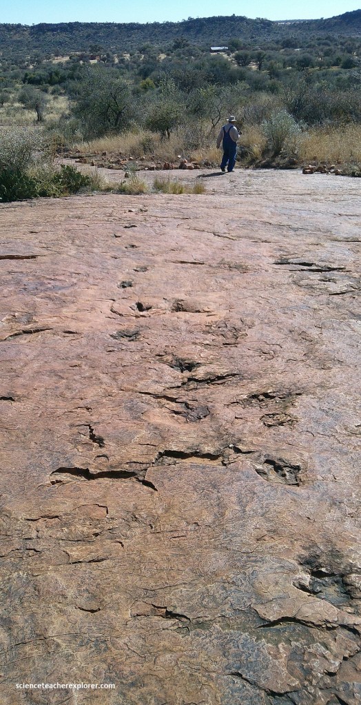
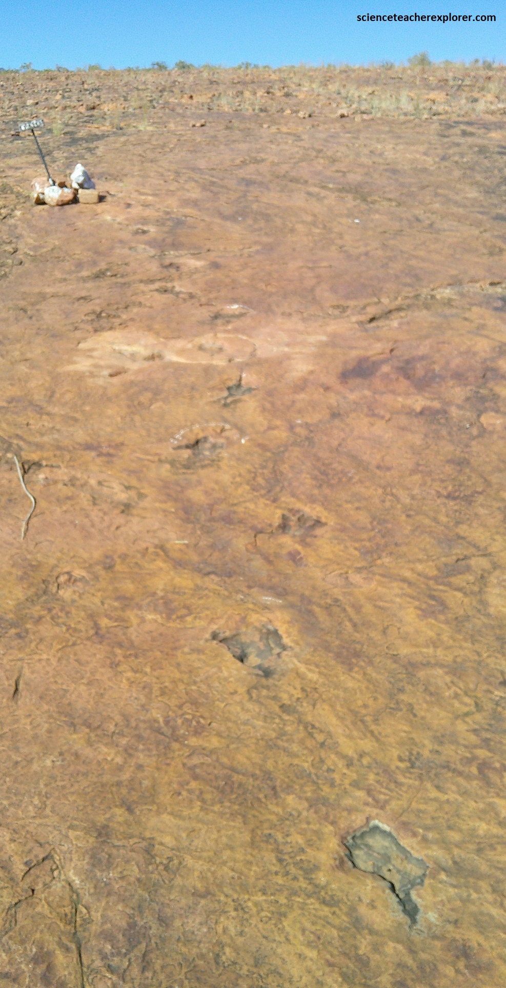
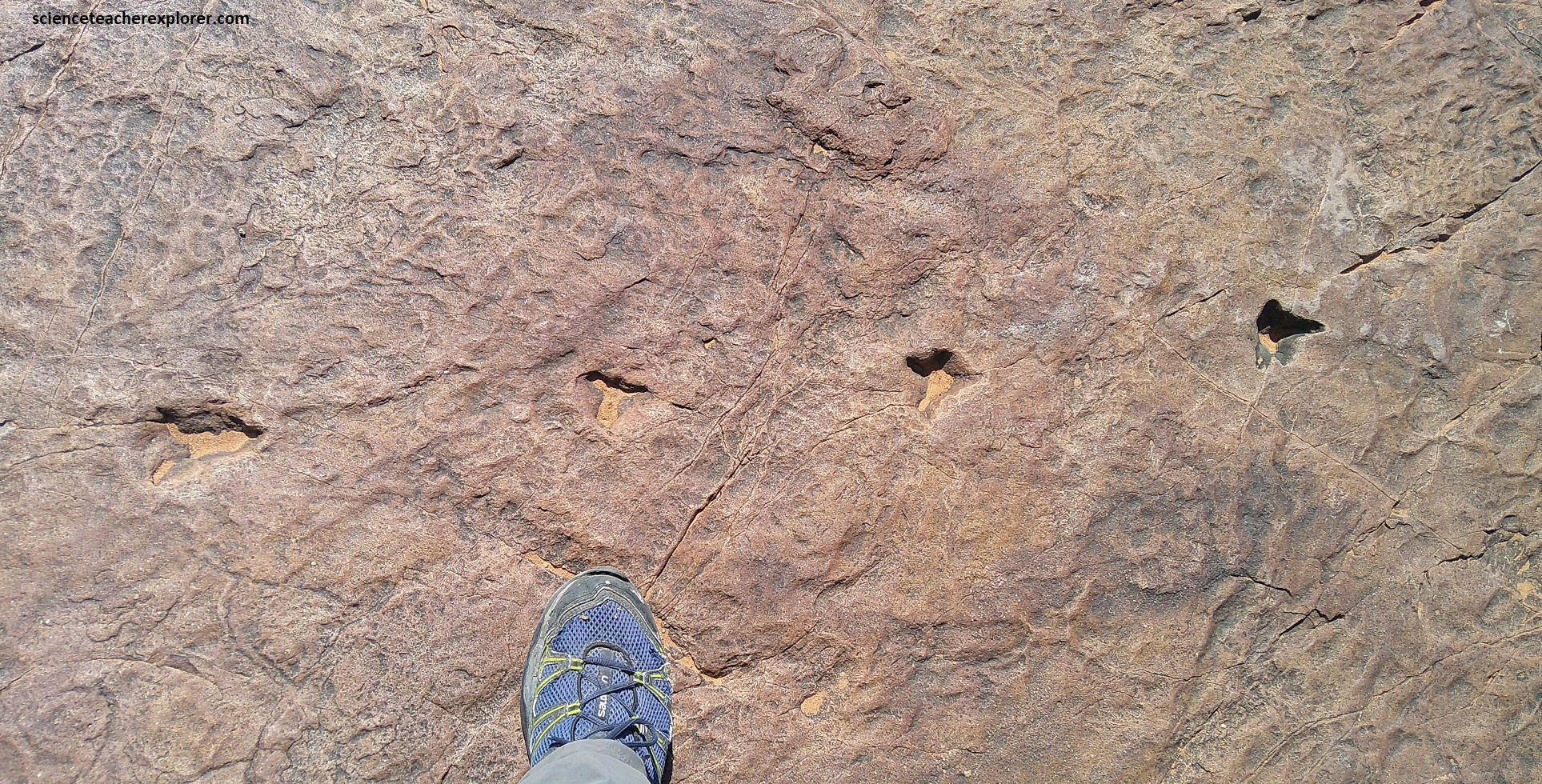
At the Otjihaenamaparero dinosaur footprint site, two pathways seem to intersect, where more than 30 footprints can be identified. Many of the individual tracks measures to approximately 45 x 35cm, with a stride of some 70-90cm.
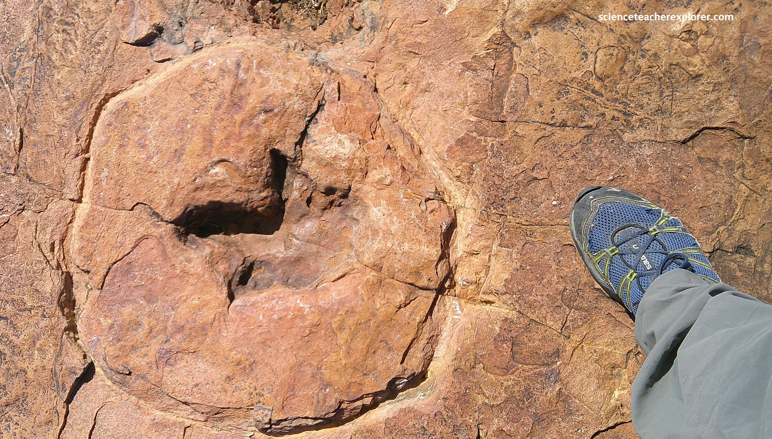
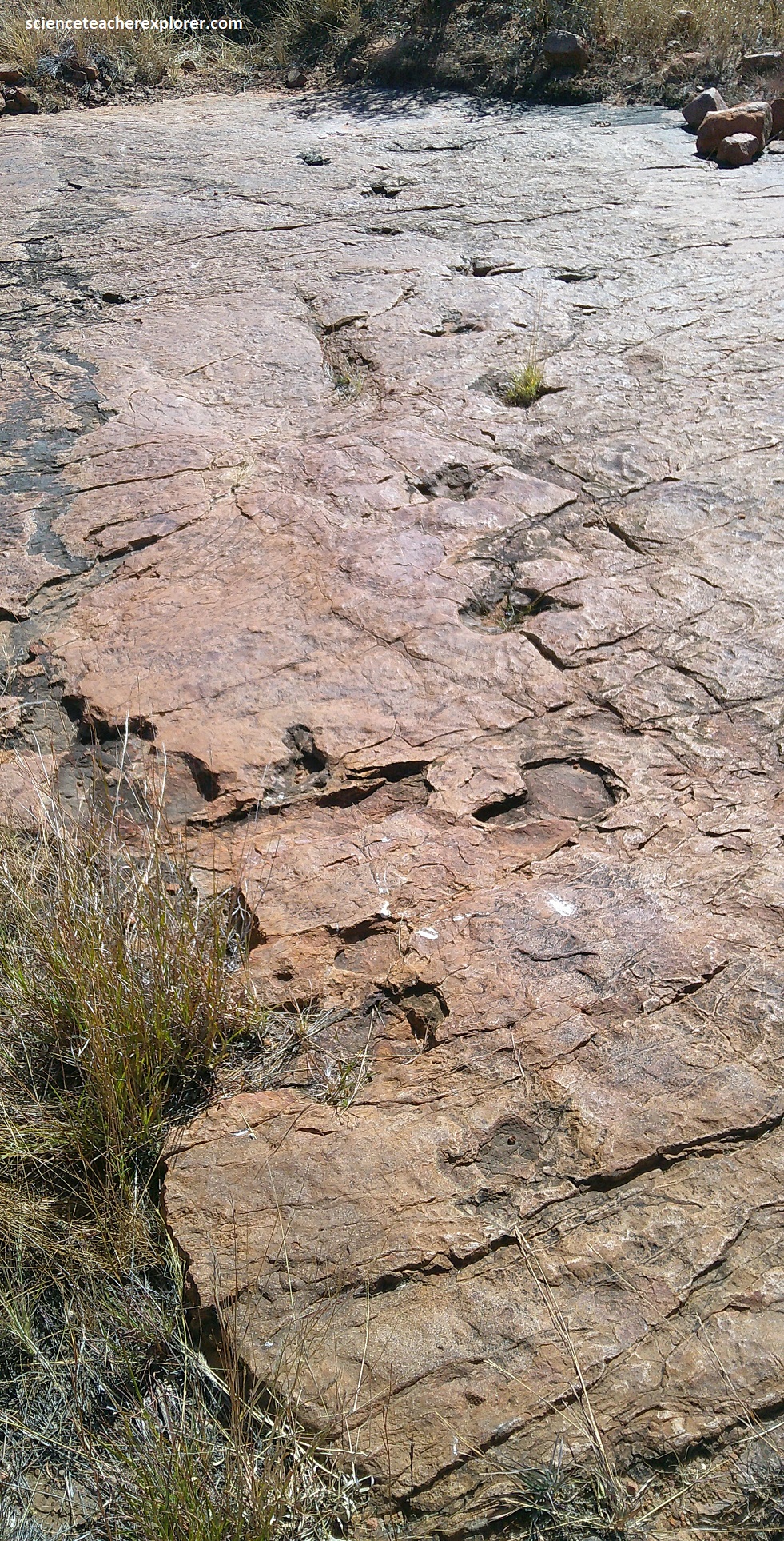
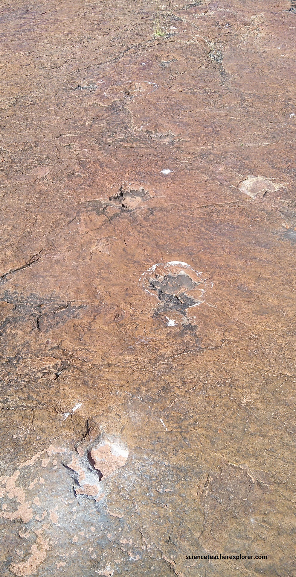
These tracks clearly indicated three-toed, clawed feet, and their arrangement suggests they were made by the hind feet of a bipedal animal, (pictured below).
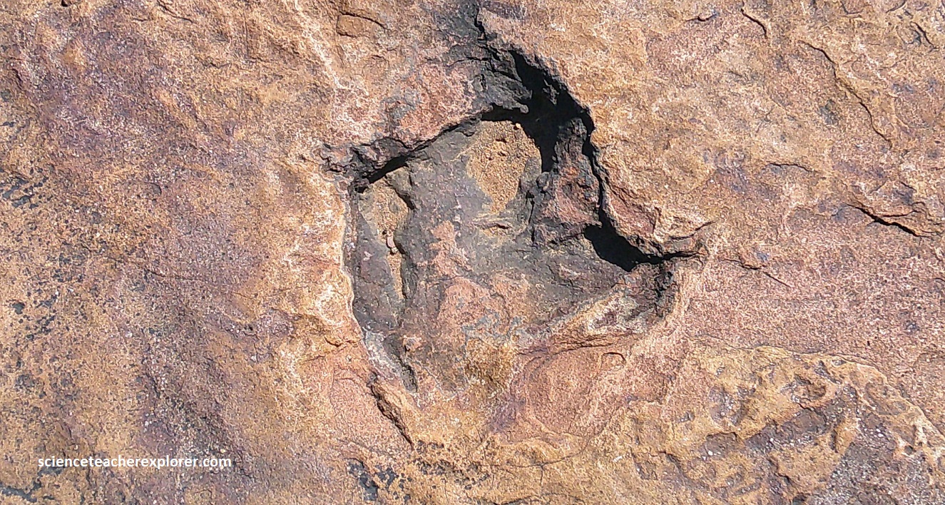
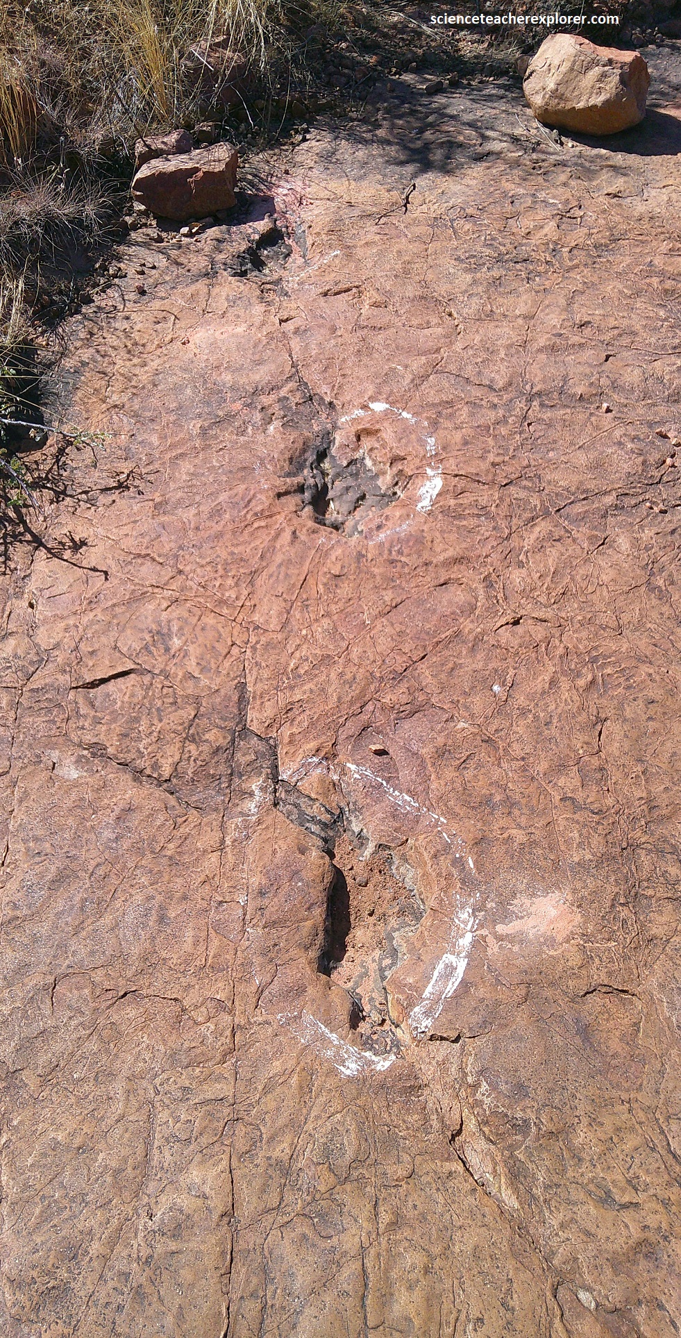
Unfortunately, no body fossils have been found in the area so far, and one is therefore limited to using comparisons with other tracks for identification. From the few dozen footprints that have been discovered and identified round the world, the imprints made by the Otjihaenamaparero dinosaur suggest that it belonged to a large carnivorous theropod species, and most likely to the family of the Ceratosauria, (the earliest known highly specialized meat-eaters at 180 m.y.a).
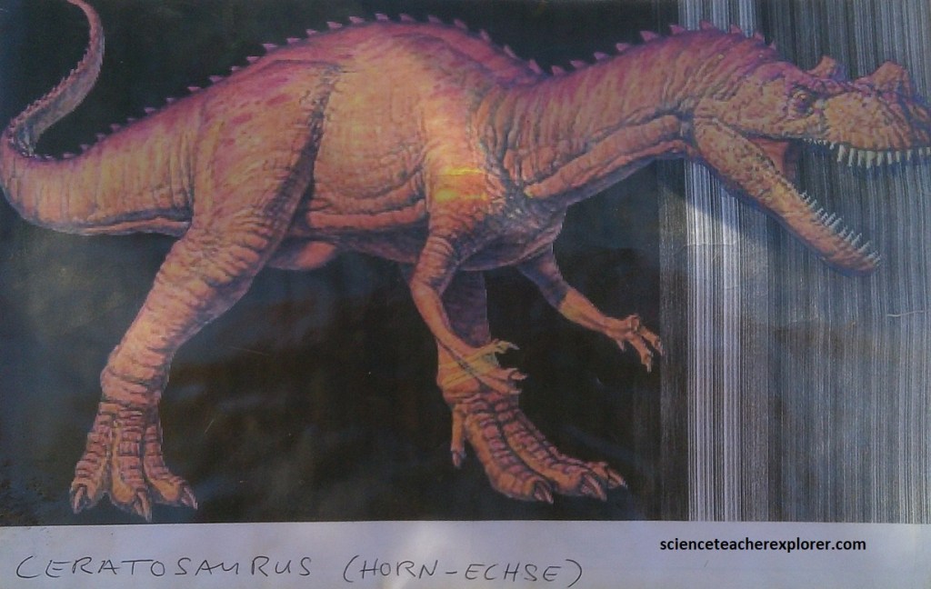
About 3m in length, Ceratosaurians had very strong hind limbs that may have allowed them to run as fast as 40km/hr while maintaining a very narrow gait, with the body forward and the tail held out nearly horizontally behind them as a counterbalance.
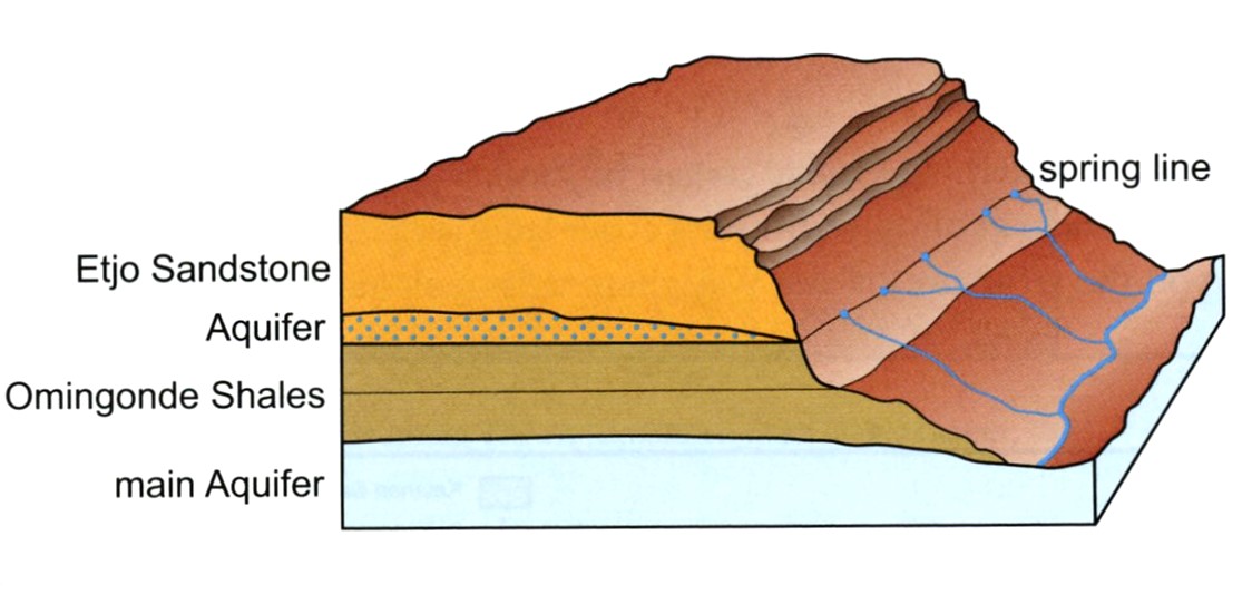
The varied erosion, which still continues today, is additionally intensified by springs occurring at the Klein Etjo Mountain. Rainwater, which falls on the huge Etjo Mountain plateau, is quickly absorbed into the porous Etjo Sandstone, until it meets the impervious shale layers of the Omingonde Sequence, (where the dinosaur footprints are found) in the subsurface. At this contact the water emerges as a contact spring, (image below). {Note: Image taken from, (“Namibia-Fascination of Geology, A Travel Handbook” Grunert 2013) and created by K. Arnold}.
We found some smaller tracks nearby and closer to the farm, (pictured below).
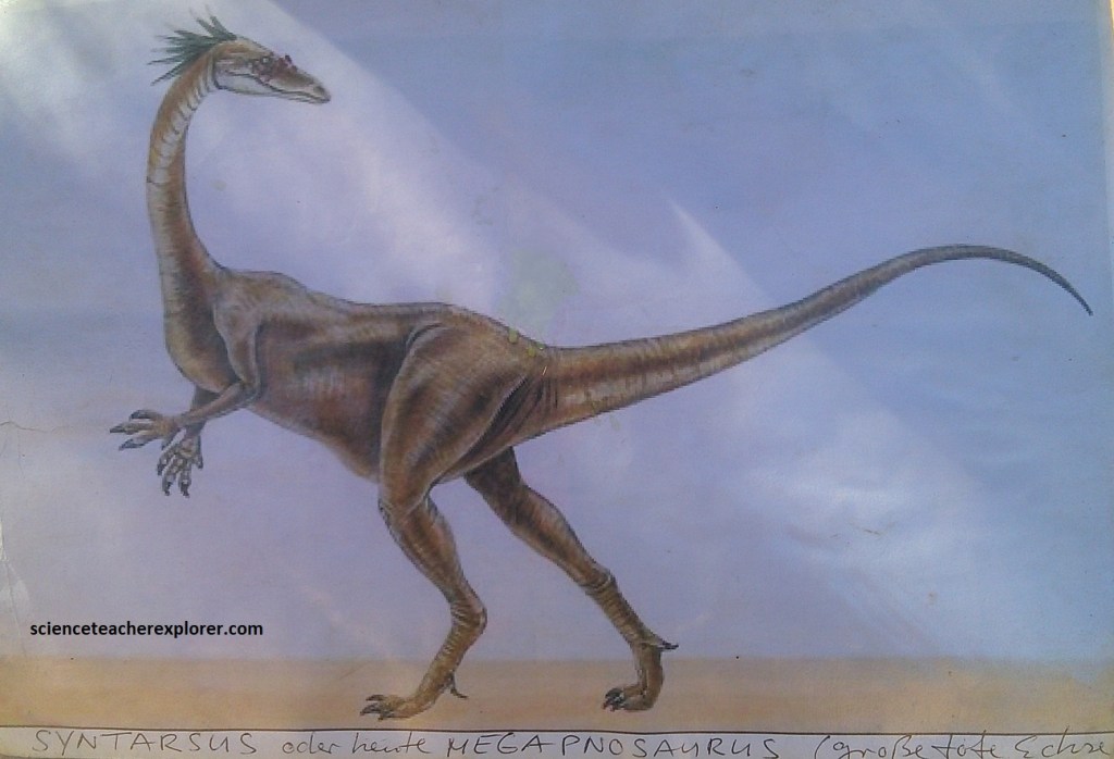
Pictured above, these smaller tracks were probably made by the small Ceratosaurian Syntarsus, which was about the size of a secretarybird, and lived and hunted in flocks. It was also a ferocious predator, and built for speed, (image below).
As mentioned, the eolian sandstone formation of Etjo was formed about 190 million years ago in the Karoo age, during the Early Jurassic period. At this time, the climate was changing from a wet lake covered area to the sand covered desert. Dinosaurs adapted to this harsher new environment in which waterholes were scarce, and occasional rainfall fed that were now ephemeral lakes and rivers. Creatures that come to drink left their footprints in the damp sediment at the water’s edge. The impressions were quickly filled by new layers of sediment, blown in by the winds. Over millions of years, the layers of sand hardened in the Omingonde Shales and Etjo Sandstone formations, thus protecting the footprints from erosion and damage. Gradually, as climatic conditions changed and geological forces triggered phases of erosion, the overlying layers were worn down until the buried tracks were revealed for us to explore and wonder.
