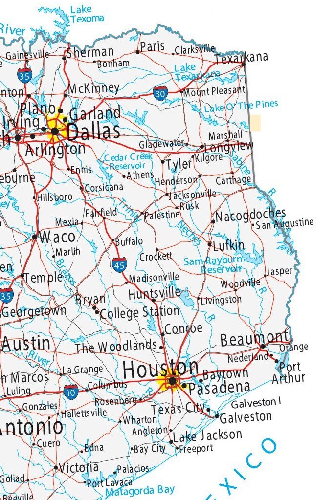
East Texas, 2024
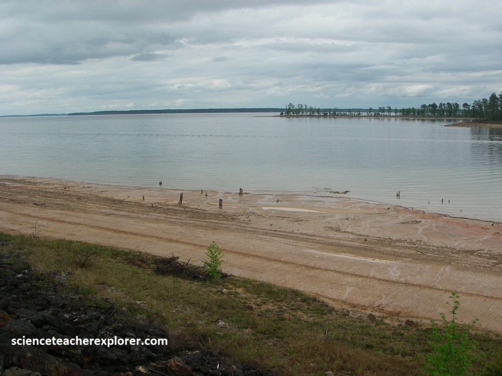
I had the opportunity to trek and explore the backways of Eastern Texas in April of 2024. I began in Beaumont and drove north. {image below is public domain}.
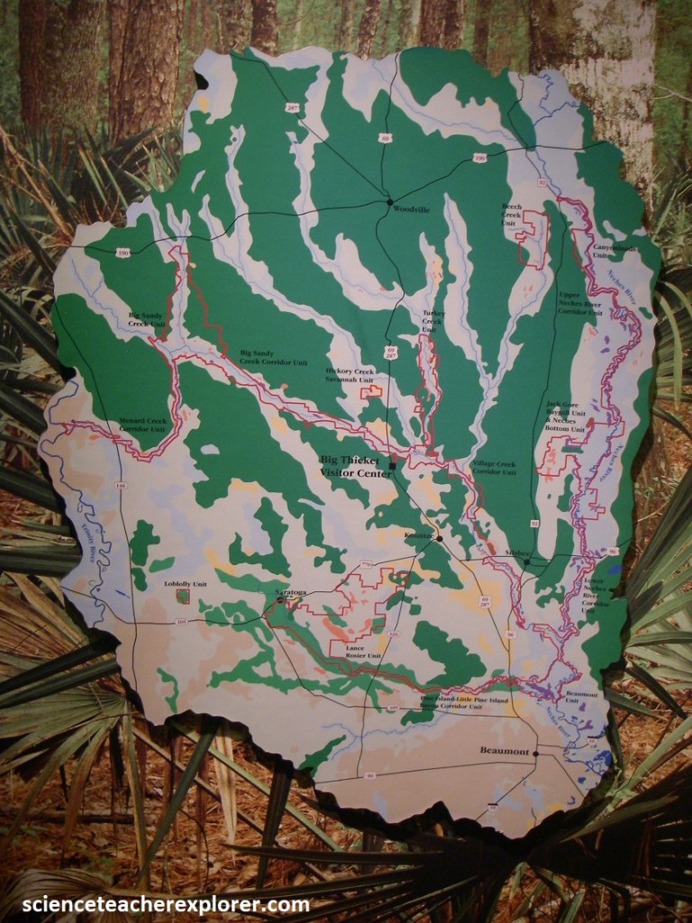
My first destination-of-interest, was the Big Thicket of Eastern Texas. Thanks to its richly varied plant life, The Big Thicket has earned a special renown area among botanists and other observers of nature. The Big Thicket region of east Texas is a transition zone where southeastern swamps, eastern deciduous forest, central plains, pine savannas, and dry sandhills meet and intermingle.
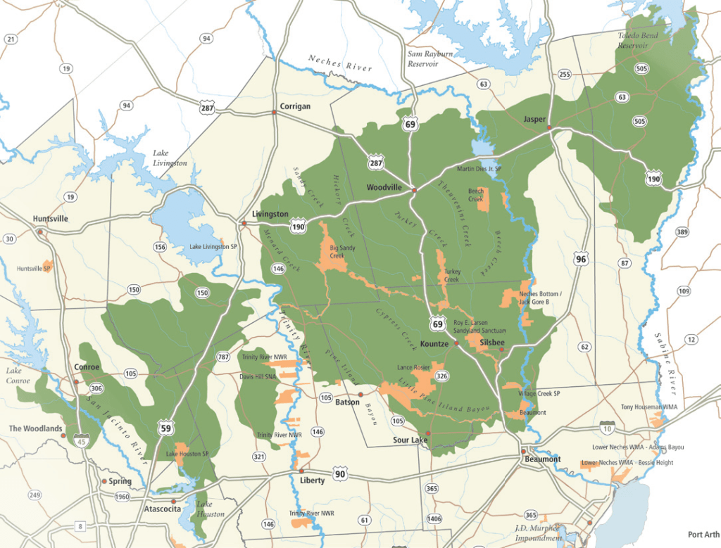
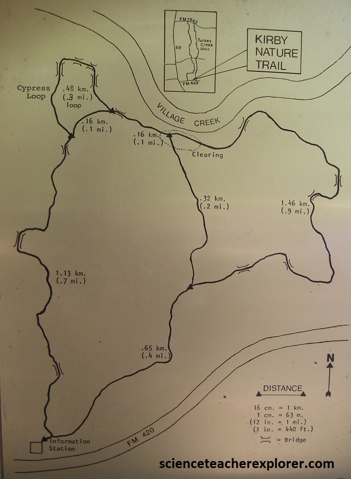
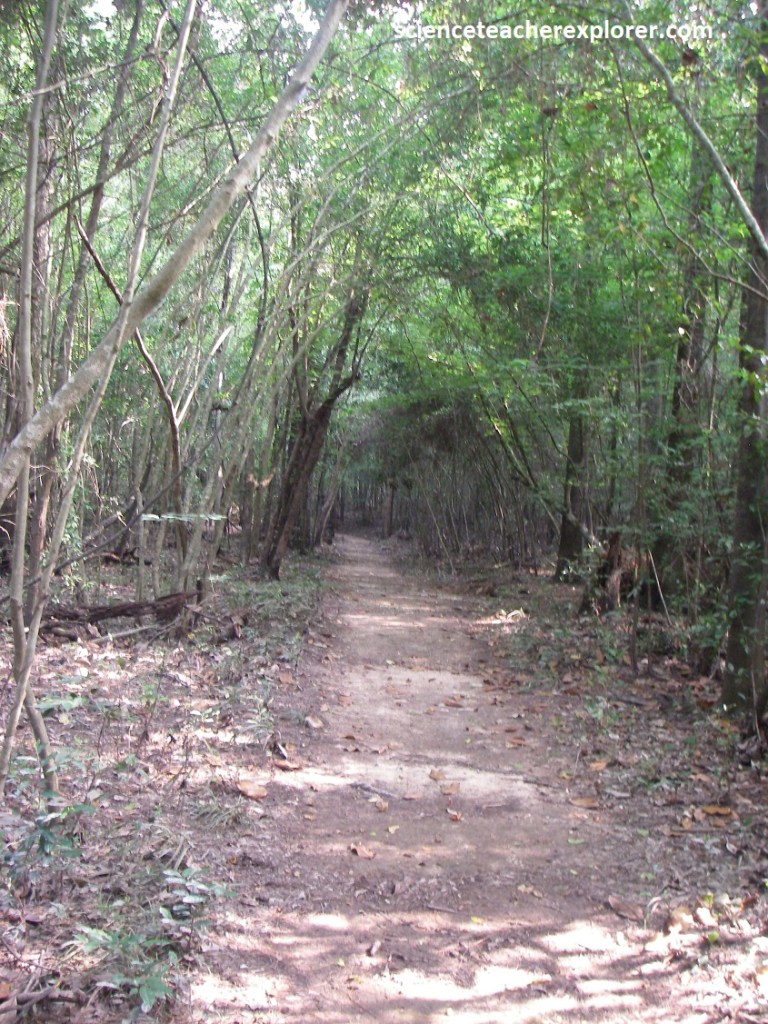
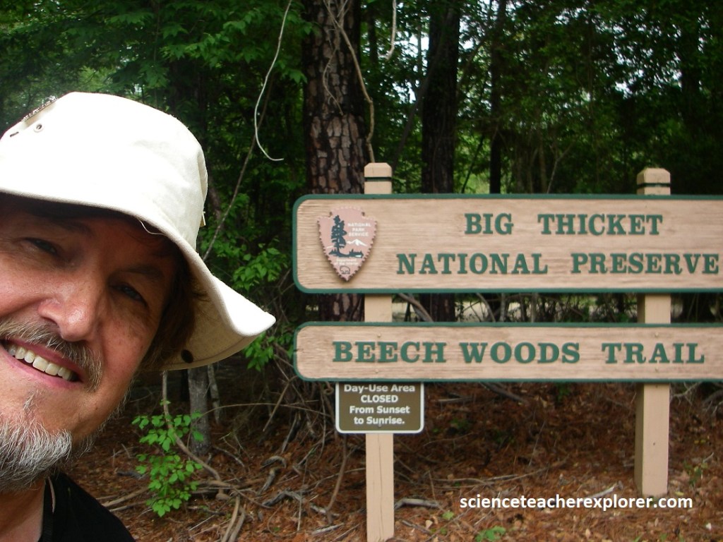
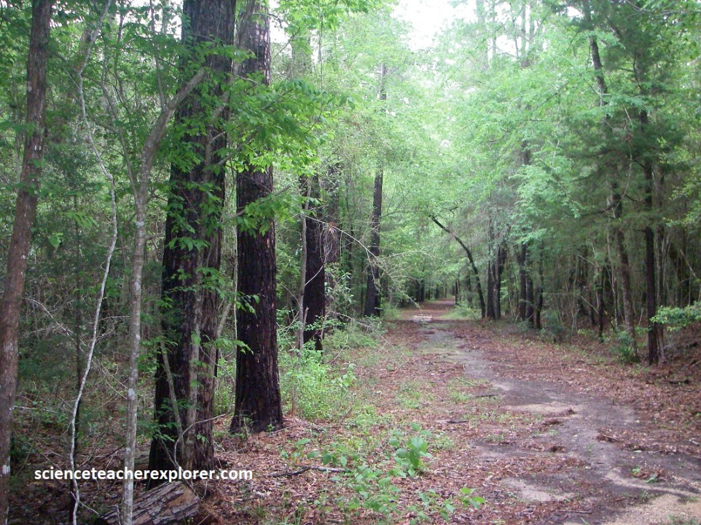
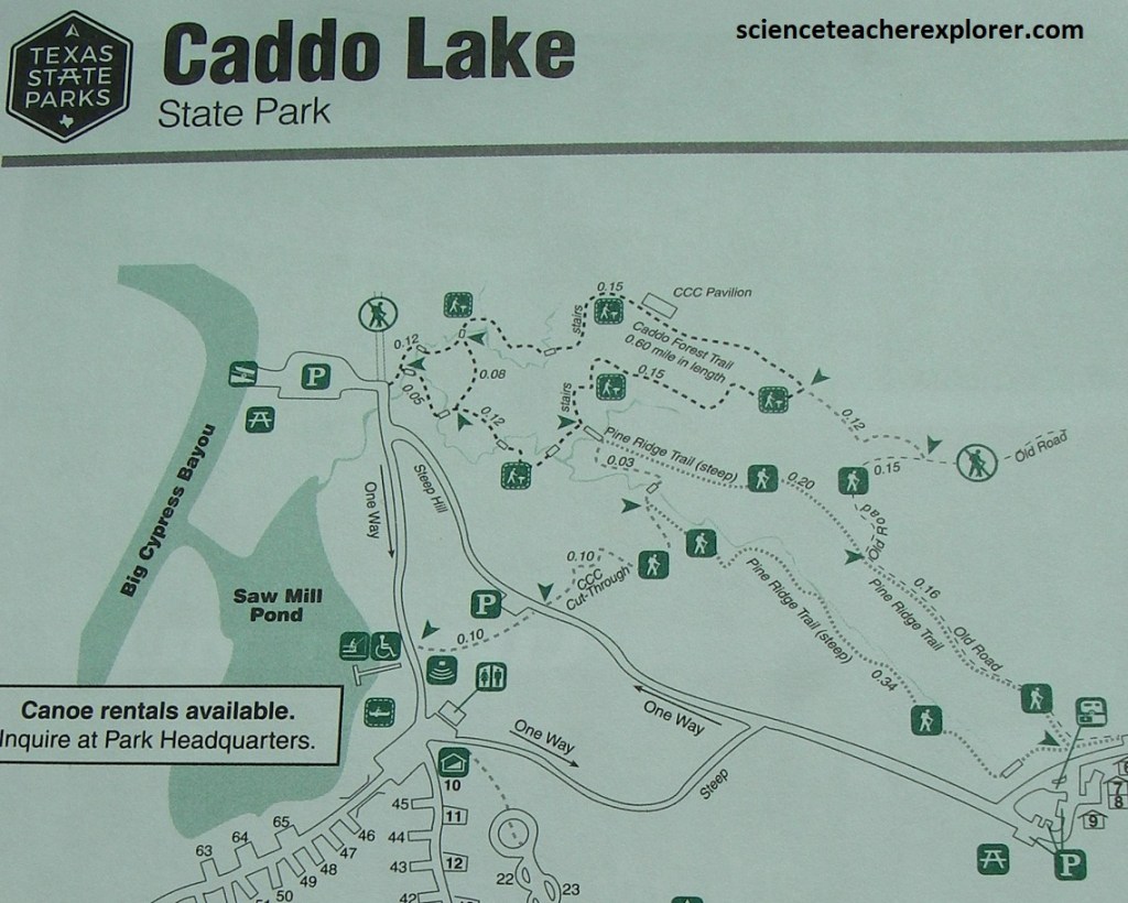
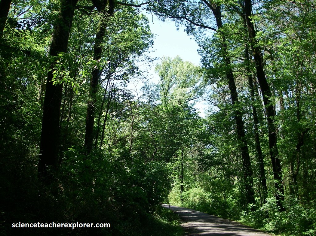
I first stopped at the main visitor center, sitting just east of TX-69 on TX-420. There, I got directions to trek the Kirby Nature Trail, (imaged below).
The Kirby Nature Trail consists of several loops ranging from 2.4-4.0 km. It passes through several plant communities, from a slope forest to cyprss sloughs to the riparian zone along Village Creek.
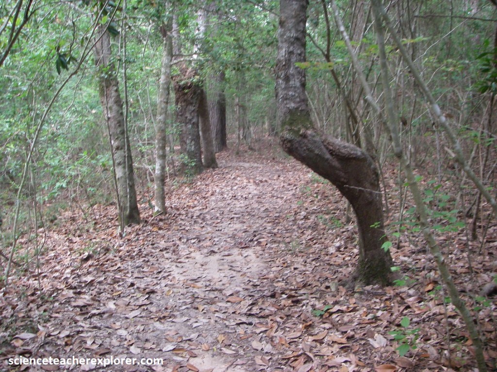
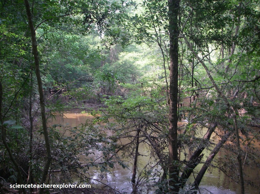
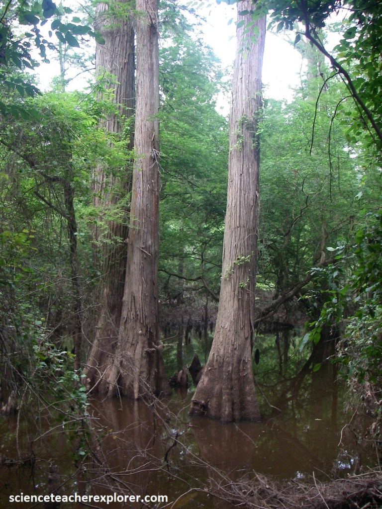
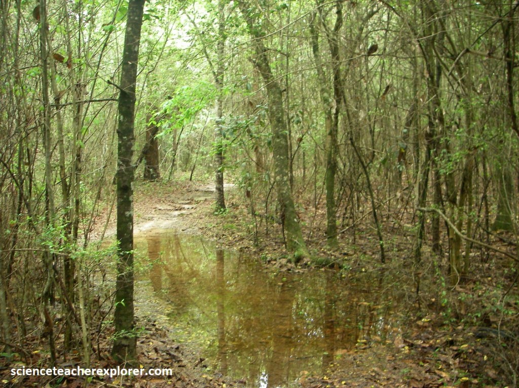
Kirby Trail is mostly a slope forest ecosystem. The slope forest is a mature, closed canopy forest of upland hardwoods on a geologic slope. This slope forest is home to many intermittent streams, cypress tupelo sloughs, and other natural drainages that provide pathways for both terrestrial and aquatic animals into this dense habitat, (pictured below).
The Neches River is the primary drainage of Big Thicket National Preserve, capturing the majority of water from precipitation and overland flow. There are numerous streams and creeks within the Big Thicket region and several, such as Turkey Creek, Menard Creek and Village Creek, serve as main corridors of the Big Thicket National Preserve. These water bodies and others provide an invaluable resource to the biota of the Big Thicket region and local communities rely on water from these areas for various needs.
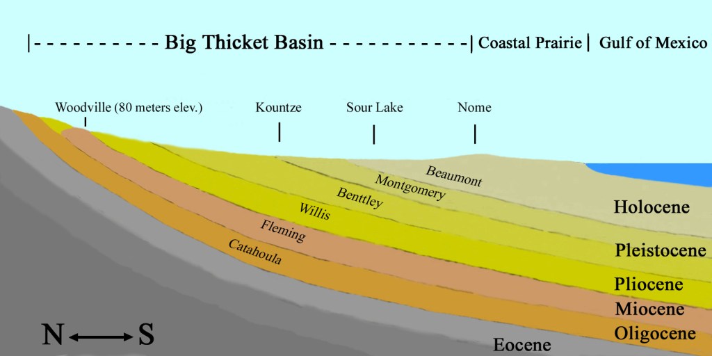
The Big Thicket is situated in the Coastal Plain physiographic province of southeast Texas, a region underlain by a thick accumulation of hydrocarbon-rich strata dating back to the Triassic Period approximately 250 million years ago. The geology of the Big Thicket is comprised of much younger, Cenozoic sedimentary strata, with the oldest bedrock consisting of the Miocene (23 to 5.3 million years ago) Fleming Formation that occurs in the upper reaches of the Neches River and Big Sandy Creek within the preserve.
Much of the species diversity of the Big Thicket is due to the rising and receding of sea levels during the last ice Age. Although the glaciers did not reach this for south, the formation and melting of the glaciers impacted sea-levels. As ice is stored in glaciers sea levels are lower. When the glaciers melt, their water is released back into the ocean, causing sea levels to rise once again.
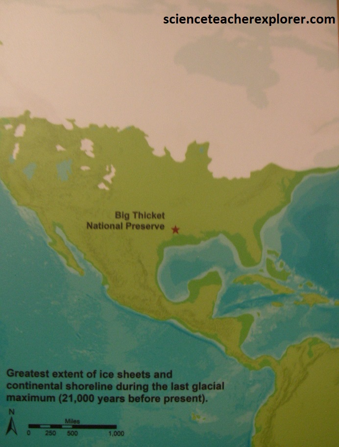
As the Gulf of Mexico’s waters fluctuated, this caused episodes of removal and buildup of debris such as sand and stones. Nutrient-rich alluvial deposits, or layers of sediment transported by water, allowed plant communities to flourish, drawing animals into the region for food, and continued providing living space during dry periods.
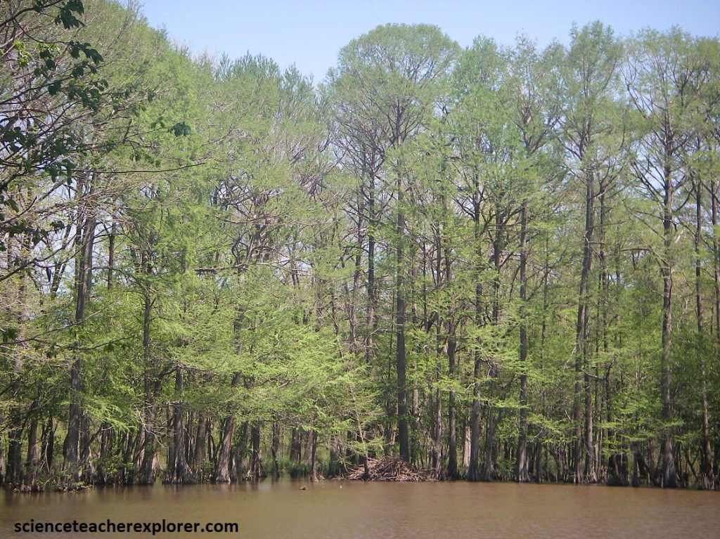
The rise and fall of the river sets the beat of the bottomlands dance. Plants and animals that live here have adapted to routine floods and rhythm of soaking and drying out. Pictured below, bottomland hardwoods within the Kirby Nature Trail are broad flatlands adjacent to rivers and streams.
Water moves quickly in and out of the bottomlands forests, scouring the forest floor and leaving a sparse understory. The closed canopy filters sunlight, further discouraging groundcover growth and creating a strange green light.
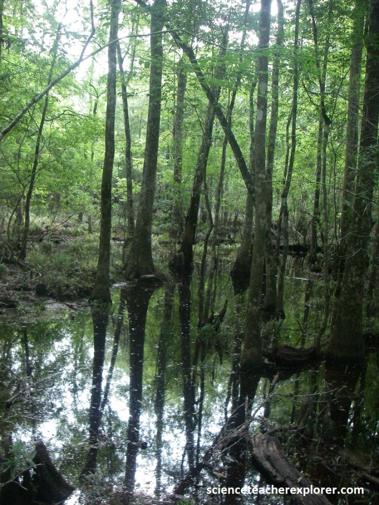
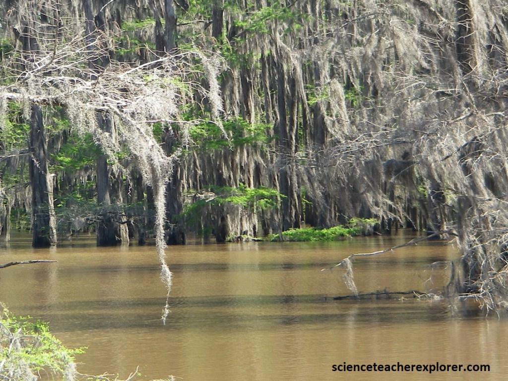
Pictured above, baygalls & cypress sloughs form when water collects in the bottom of a closed, poorly drained depression. Debris from surrounding vegetation steeps in the water, causing the water to lose oxygen and become highly acidic. The water is dark, but clear, adding to the baygall’s mysterious image.
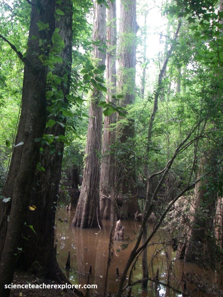
Pictured above, floods from the nearby streams and rivers turn this forest of cypress and tupelo trees into the perfect home for alligators and water moccasins. Regular flooding flushes away organic debris preventing cypress sloughs from becoming too acidic, like baygalls.
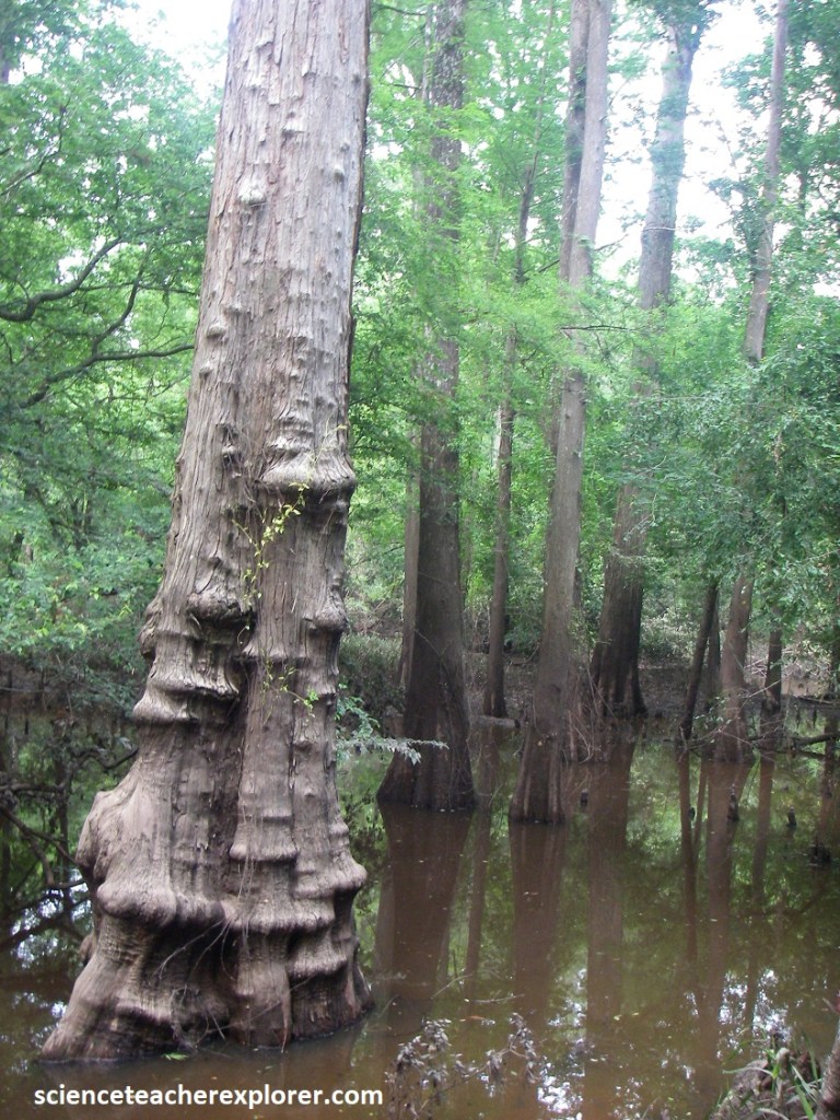
Pictured above, the thick-buttressed trunk of the black swamp tupelo keeps it from toppling over in the mushy soil, while the bald cypress is kept upright by the knobs, or “knees”, around it. The “knees” may also transfer oxygen to the tree’s submerged roots.
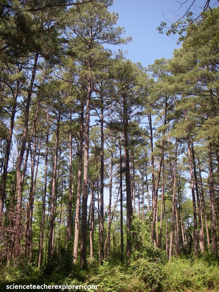
Pictured above, a cathedral-like setting is created when beech, magnolia, and loblolly pine tree trunks rise like columns to support a canopy through which rays of sunlight streak to the open forest floor. I drove further north to Woodville to trek the Beech Woods Trail within the Big Thicket, (picture below).
The Big Thicket forms the southwestern limit of the range of the American beech tree, which extends from southeast Texas to the northeastern United States and Atlantic Canada. Follow the Beech Woods Trail to see magnificent beech trees, along with magnolia and loblolly pine, (pictured below).
Other trees in the area included sweetgum, blackgum, holly, elm, dogwood, and hickory. American hornbeam, and horse sugar were the common shrubs in the area, (pictured below). Ferns are common in wet areas.
Nearly all of East Texas was once covered by this semitropical wilderness, (a tangle of woodlands, swamps, bayons, and bogs that few dared to enter. In time, however, Big Thicket was tamed as farmers and lumbermen moved in. Today only scattered fragments of the original wilds are protected in the Big Thicket National Preserve, yet each separate unit is pleasantly evocative of the region’s original appearance.
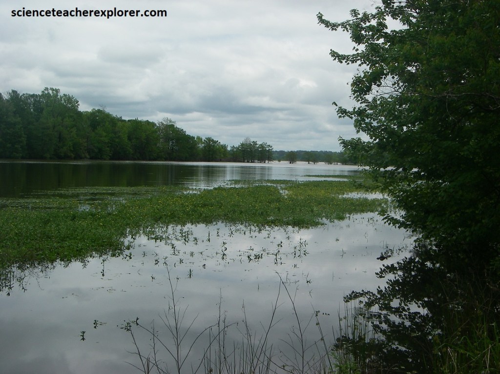
I returned to Woodville to drive north on US-69. There, I made a brief stop at the Rush Creek Unit of the Martin Dies Jr. State Park. Pictured above, this park sits on the northern edge of the Big Thicket, and just south of where the Angelina and Neches rivers meet. As a result, an extraordinary web of life exists there, (especially birds).
After exploring north on US-69, the drive winds through rolling countryside to TX-147 at Zavalla and the Sam Rayburn Reservoir. For about 3.2 km, the highway skimmed right across the man-made lake of the Neches River, which was hemmed in by Angelina national Forest, part of what Texans call the Piney Woods. The reservoir borders the remains of an early mill and wends beneath towering longleaf pines, oaks, sweet gums, and beeches, (a reminder of East Texas as it was before the advent of large-scale logging).
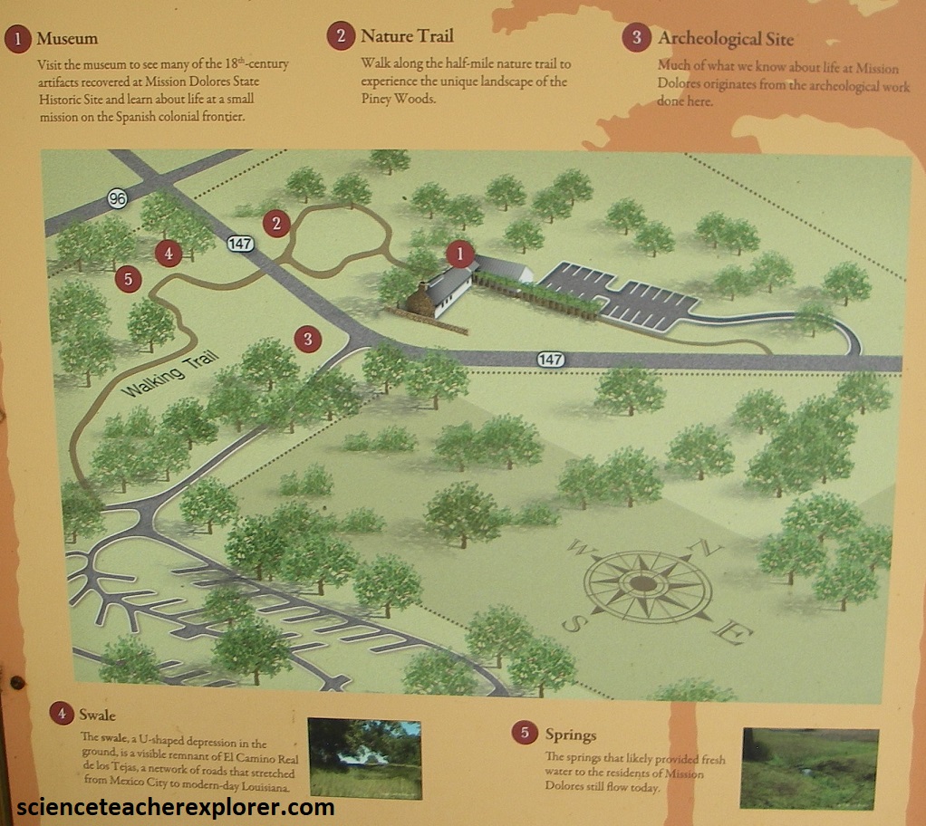
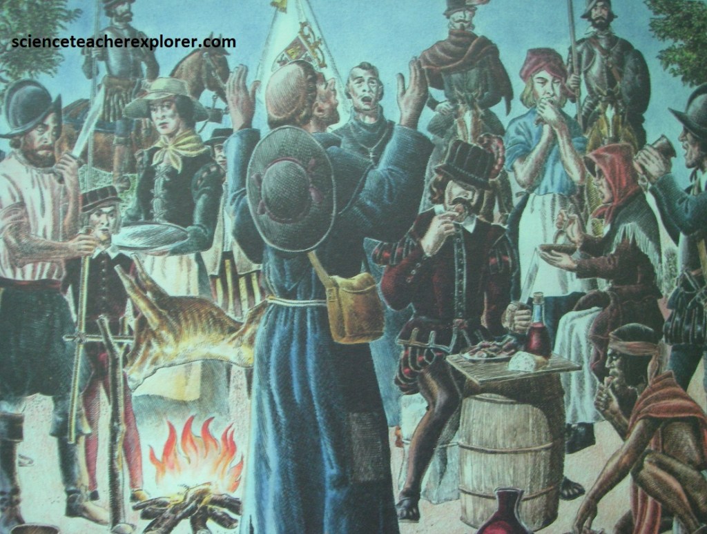
TX-147 soon swept into San Augustine, a town that took root as a Spanish mission in 1716. Mission Dolores was a Spanish mission at the far eastern frontier of New Spain. It was founded in 1717 by Franciscan missionaries to convert the local indigenous people, the Ais, to Roman Catholicism. The Spanish government supported Mission Dolores and the five other East Texas missions as a way to claim Texas as Spanish land and prevent the French from moving into the territory.

Overall, the Franciscans at Mission Dolores were not successful at converting the Ais to Roman Catholicism or convincing them to live at the mission. The Ais lived in several well-established villages nearby, where they were accomplished farmers with their own lifeway and culture. They would trade with the mission and work with the missionaries in exchange for food or other goods, but they did not live there permanently. The few documented baptisms that did occur were administered just before death.
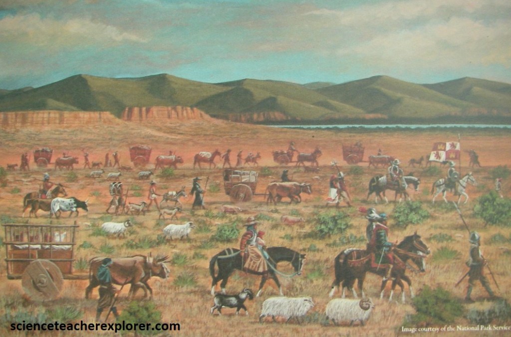
Imaged above, trade and transportation shaped Mission Dolores. The mission cmplex was built along “El Canimo Real de los Tejas”, a road network that extended from Mexico City to the far eastern edge of New Spain, in modern-day Louisiana. Official Spanish caravans, messengers, soldiers, and French and indigenous traders all would have passed by Mission Dolores as they traveled along the Camino Real.
For most of Mission Dolores’s existence, two Franciscan missionaries lived there, along with two Spanish soldiers and their families. Far from areas with more Spanish settlement, life was difficult. The nearest major Spanish town was hundreds of kilometers away. Supply caravans were often delayed by floods and bad weather. While nearby springs and Ayish Bayou gave plenty of fresh water, the banks of the bayou were too steep for irrigation, so the residents of Mission Dolores watered their garden plots by hand. In 1773, the East Texas missions were abandoned. Inspections from Spanish military officials and Franciscan priests showed the Spanish border outposts were too distant from Spanish strongholds. They lacked the resource for adequate defense and for spreading Roman Catholicism to Native American nations.
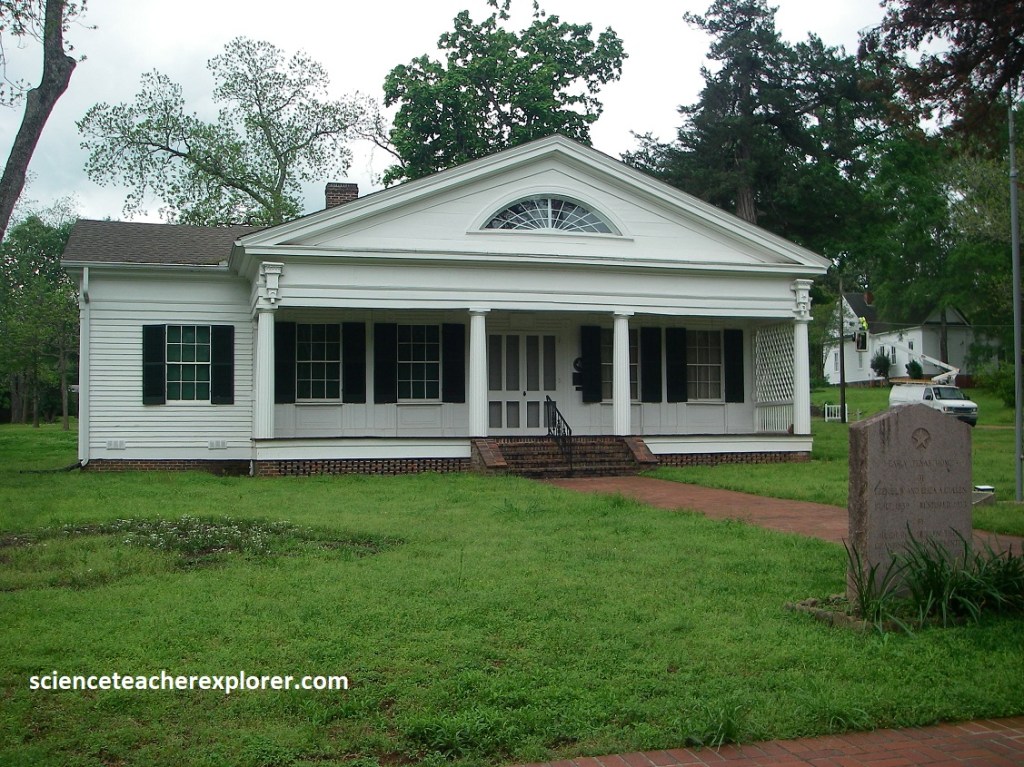
More than a century later, Sam Houston, the man of boundless bravery who led Texas in its fight for independence from Mexico, could be seen striding down the streets in San Augustine, Texas. Pictured above, is a 1839 mansion, called the “Ezekiel Cullen Home”, is a sampling of that spirited, glamorous era.
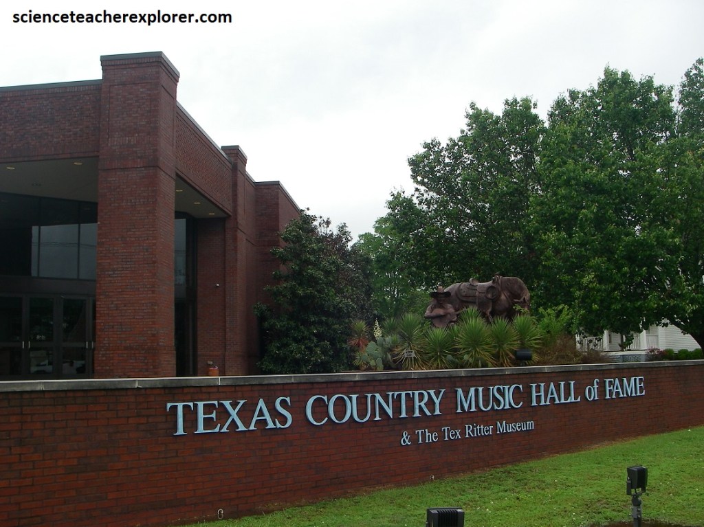
I drove north from San Augustine on US-96 to Tenaha, and then on US-59 through Carthage, Texas. In Carthage, the Texas Country Music Hall of Fame resides. It was initiated in 1998 to celebrate the contributions of Texans to the country music profession. The project highlights those individuals, living or dead, who are recognized nationally as outstanding in their field.
{Images of the Caddo Native Americans are taken from interpretive signs, on-site in 2024}
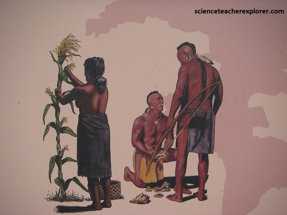
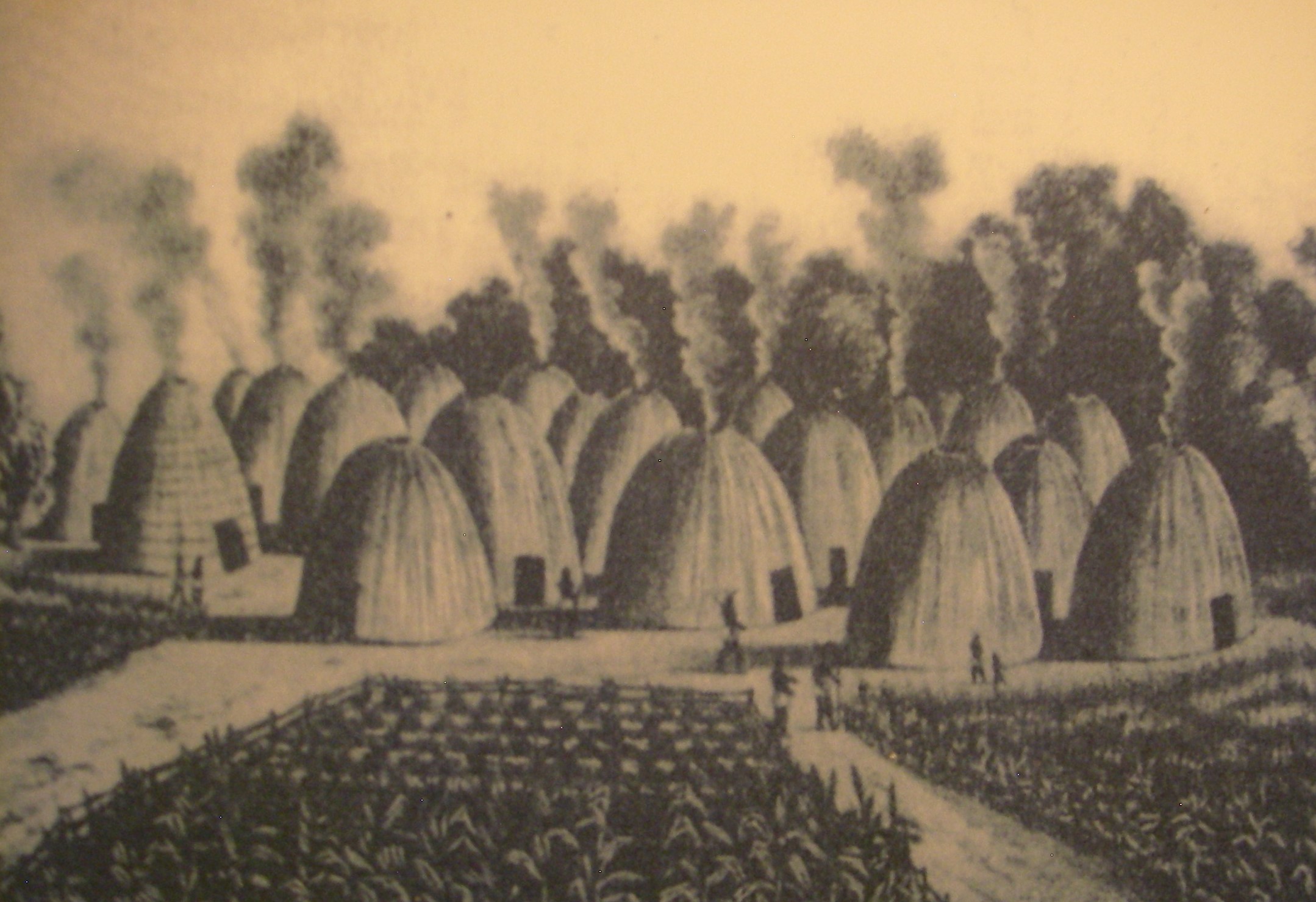
Heading north from Carthage, US-59 crosses the Sabine River on the way to Marshall. This is the homeland of the Caddo Native Americans. Imaged above, when first encountered by French and Spanish explorers, the Caddo were a semisedentary agricultural people. They lived in conical dwellings constructed of poles covered with a thatch of grass; these were grouped around ceremonial centers of temple mounds. The Caddo were skillful potters and basket makers. At the height of their culture, around 1100 A.D., the Caddo Natives built elaborate fish traps and backwater weirs in the sloughs and bayous of the area. However, in 1836, Texas gained it’s independence , and the Angle Texans began a policy of “Indian Removal”. The Caddo were not welcome in Texas and most moved to the Indian Territory north of Marshall in Oklahoma.
From Marshall, I drove northeast on TX-43 to explore the Caddo Lake State Park. Caddo Lake was created as a result of the Madrid earthquake, which formed a natural dam on a bayou. The Caddo Natives, according to legend, were forewarned of the earthquake by the Great Spirit.
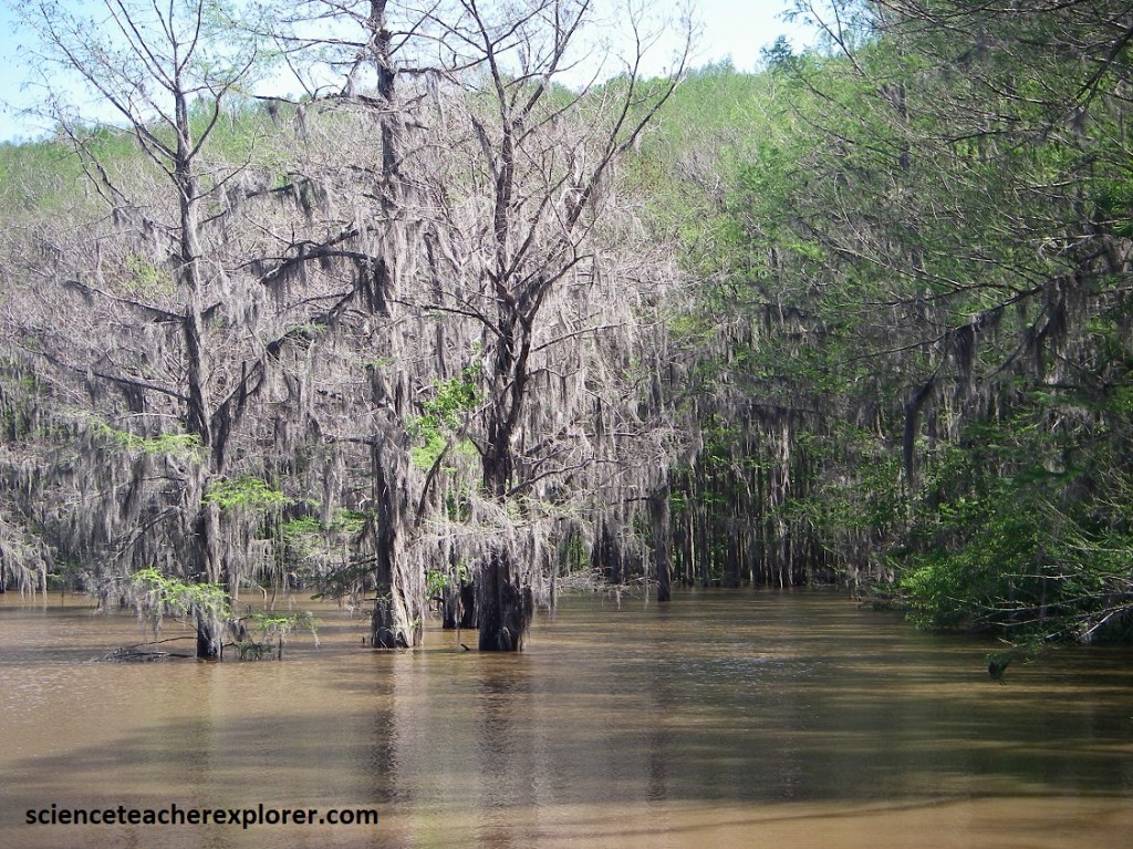
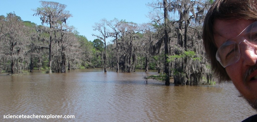
Pictured above, draped with wispy strands of Spanish Moss, bald cypresses tower above the water of Caddo Lake. Kilometers of “boat routes” lead down channels in this watery wilderness, where anglers in search of bass and catfish might hear the drumming of the pileated wood-pecker or the curious “Who-cooks-for-you?” call of the barred owl. Flooded bald-cypress forest, draped with Spanish moss, give Caddo Lake its’ air of beauty and mystery. Caddo Lake is home to one of the largest areas of cypress swamp left in Texas. Some of the bald-cypress trees here are over 350 years old. Many types of plants and animals rely on the swamp for food and shelter. However, beyond the breathtaking scenery lies a lake shrouded in urban legends, ghostly encounters, and unsolved mysteries.
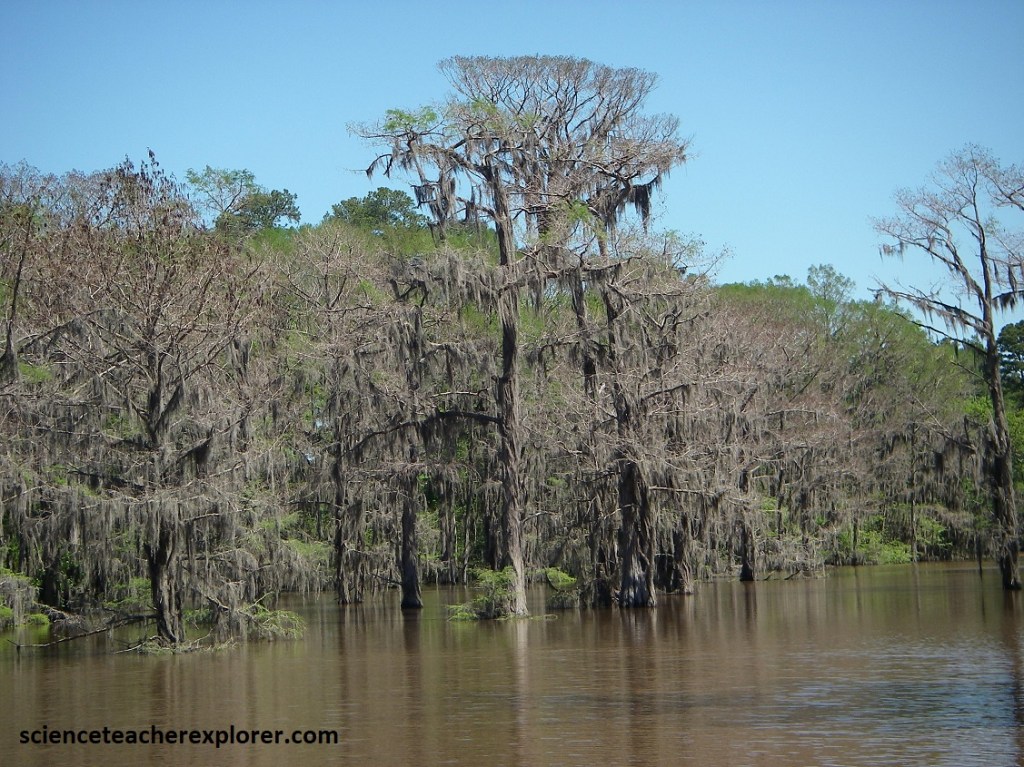
Pictured above, Caddo Lake’s dense forests and labyrinth-like channels are not just difficult to navigate, they’re the source of disturbing stories about people vanishing without a trace. Over the years, locals have told tales of individuals who wandered too far into the swamps or strayed from the marked paths, only to disappear. Of course, it doesn’t help when locals are occasionally seeing a giant creature called Cypress Cindy. This creature is described as a massive, serpent-like beast, measuring up to 60m in length, with only it’s dark-colored back and head occasionally visible above the surface of the water.
Additionally, in 1869, the “Mittie Stephens Steamboat” caught fire while traveling on Caddo Lake, resulting in the deaths of 64 people. According to local accounts, many of those who perished continue to haunt the lake’s waters, their spirits forever tied to the place where they lost their lives.
Then there are many visitors to the lake that claim to have seen a ghostly figure on the water’s edge, crying out her sorrowful pleas through the dense forest late at night with an occasional scare of a reflected image of her in the lake that disappears instantly. With all this, this makes this spot a spooky place to explore. Now there is even a scary movie that came out on 2024.
What’s the difference between a swamp and a marsh? Swamps have woody plants like trees, while marshes have soft plants like grasses, rushes, and sedges. Marshes are under water at least part of the year. Young fish, frogs and other animals hide in the dense plant life until they are grown. Marshes are home to an amazing number of insects. Insects are the main food for many birds, frogs, fish, mammals, and dragonflies. In turn predators such as birds, fish and humans eat the creatures that eat the insects.

If you could peer into the murky waters of Caddo Lake, you would find more species of fish than in any other Texas lake. Many birds such as bald eagles rely on the fish for food. Prehistoric-looking creatures such as the paddlefish and alligator snapping turtles also lurk in Caddo Lake. Water in the lake averages about 2 to 3m, with the deep water in the bayou reaching about 9m.
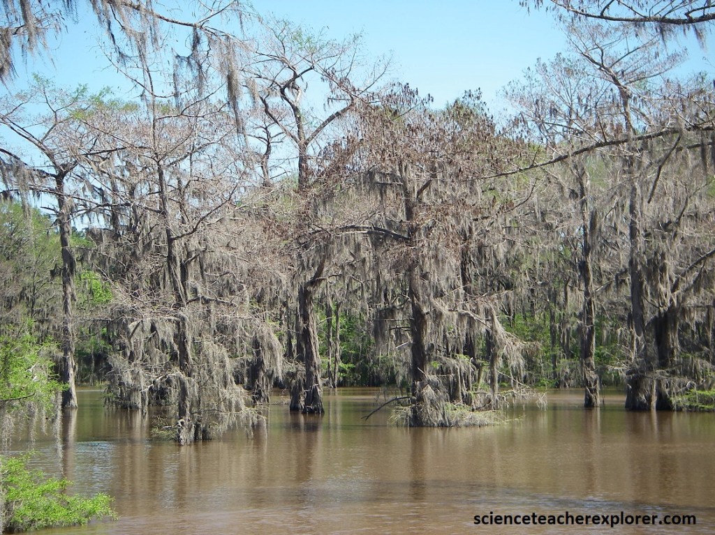
Pictured above, Bottomland hardwoods are one of the most important and endangered types of forest for wildlife, especially birds. During winter and spring, heavy rains flood the lowland forests. In summer and fall the water slowly dries. Plants adapted to this seasonal soaking and drying cycle flourish. Hardwood trees such as oaks, gums and hickories, form cavities that provide homes for birds and animals. Only about 2% of Big Cypress Bayou watershed is bottomland hardwood forest. Less than one fourth of Texas’ original floodplain forests remain.
Picture above, it’s all downhill from the Upland Forest! Nutrients and rainwater from the Upland Forests flow downhill toward Caddo Lake. Here in the dry Upland Forest, the shortleaf, loblolly pine, oak and dogwood trees spread leaves to shade the woodland floor and protect light-sensitive creatures below. Many animals live or rest in these trees. They eat the leaves, nuts and other matter that grows on or beneath the canopy. Migrating birds also find refuge here on their long journeys.
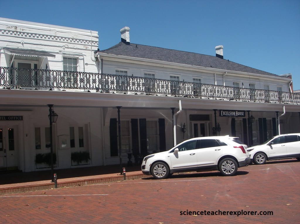
Returning to US-59, and driving north to Jefferson, Texas. Few spots in Texas can match Jefferson’s nostalgic charm. Pictured above, among its many restored structures is the Excelsior House Hotel, where the guests have included such notables as Ulysses S. Grant, Rutherford B. Hayes, John Jacob Astor, and Oscar Wilde.
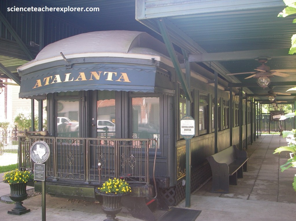
Another patron connected to Jefferson was the New York railroad baron Jay Gould, whose private railcar rests just a few steps from the Excelsior House Hotel. Local lore says that Gould prophesied the town’s doom when its citizens refused to let his railroad pass through. And Jefferson did in fact undergo a decline, but its lack of progress places it as a tourist attraction. The location looks the same as it did 100 years ago.
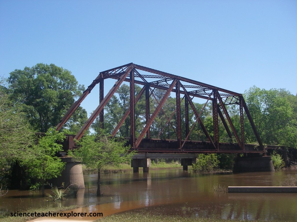
In the mid-1800s, Jefferson was regarded as the steamboat entry port into Texas, when the Army Corps of Engineers cleared the Red River Raft, the water level near Jefferson fell and steamboats could no longer reach the town year round. In 1873, Jefferson was first connected to the National Rail Network, through the Texas and Pacific Railway. In the 1890s, the Sherman, Shreveport and Southern Railway build tracks east from Jefferson to the Texas-Louisiana State Line. The first bridge over Big Cypress Bayou was a wooden trestle, (in 1907 an iron bridge), This bridge allowed for commercial and private trains to cross high above the water. A truss bridge is a load-bearing structure of connected elements usually forming triangular units. Truss bridges are representative of common bridge types of the late 19th and early 20th centuries. William Howe’s Design, (American Architect 1803-1852) is composed of diagonal structural beams that slope towards the center in compression with the vertical web members in tension.