Flint Hills, KS 2024
In the spring of 2024, I found myself driving through central-eastern Kansas, heading north. I happen to be taking some of the small state highways, exploring the countryside.
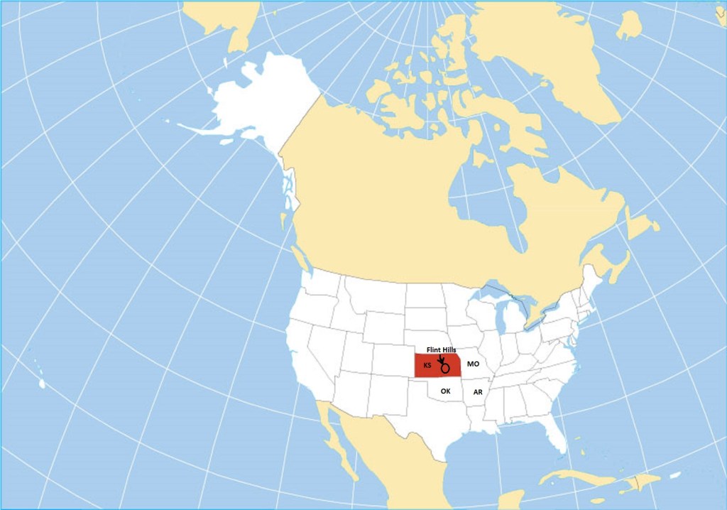
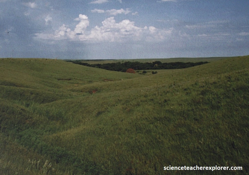
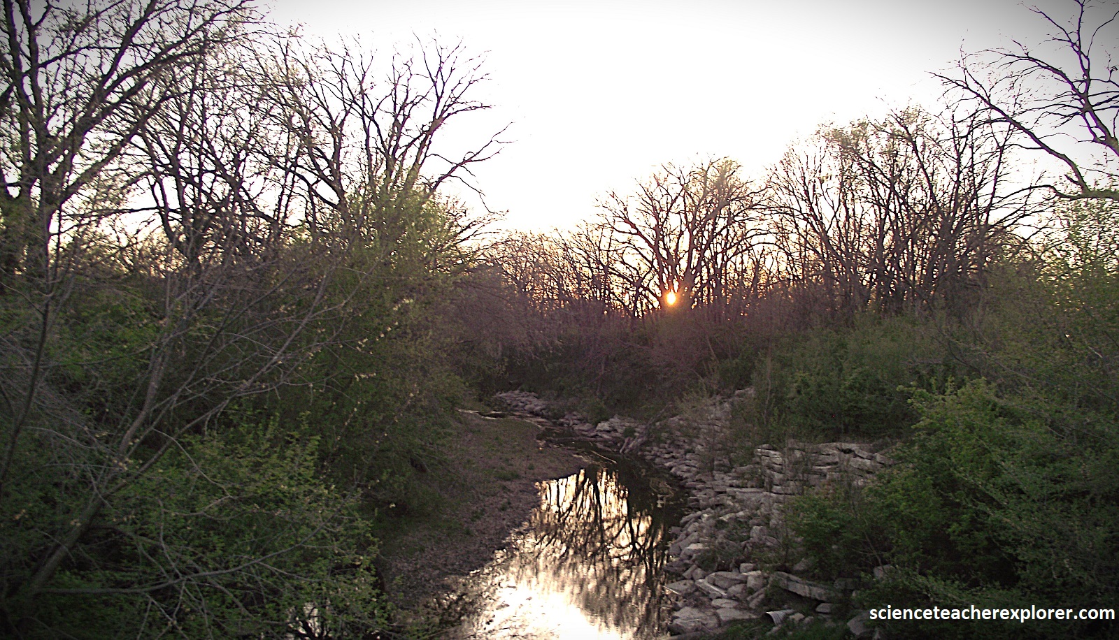
Starting the morning off in El Dorado, Kansas; I drove east on US54, where I met up with KS177 towards north. A lonely, rolling landscape spotted with lakes, the Flint Hills rumple south to north across the prairies of eastern Kansas, (a heartland delight where the pioneer spirit proudly endures).
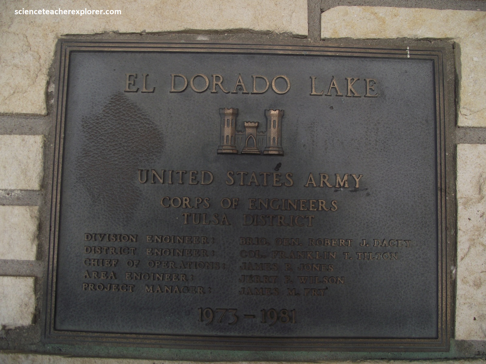
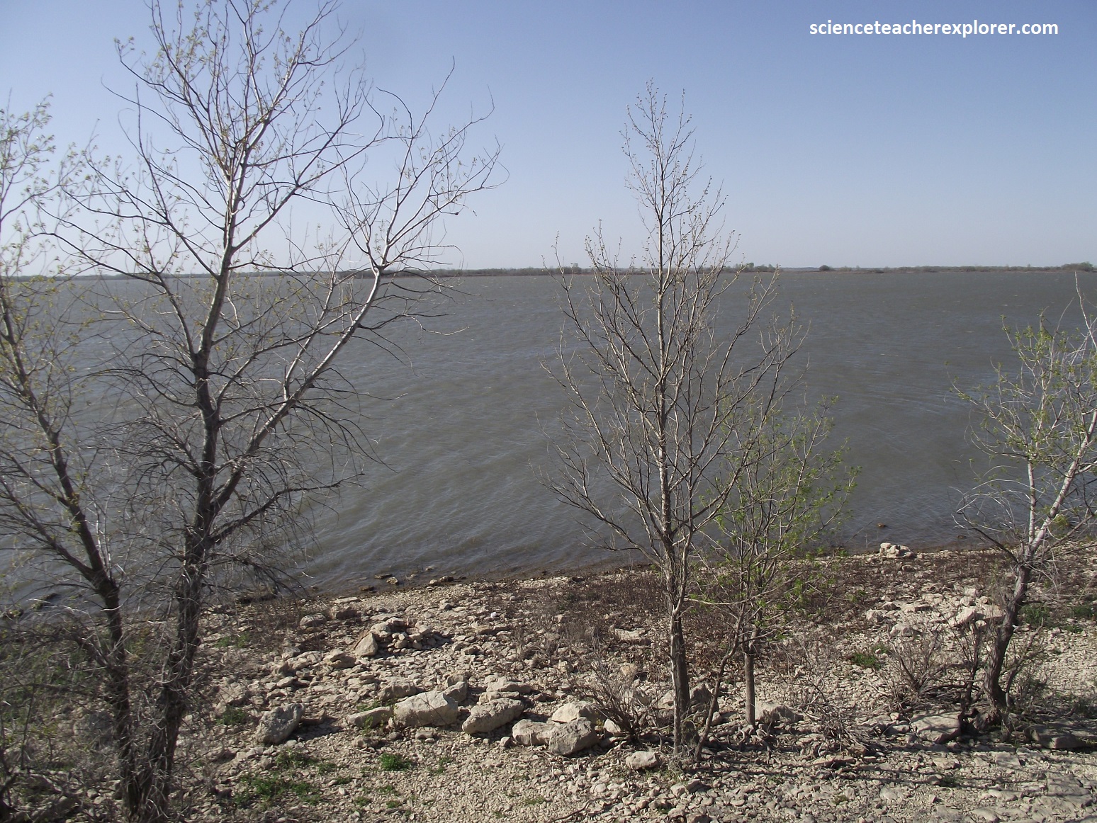
Continuing northward, my drive skimmed the shores of El Dorado Lake, cupped in the prairie, like a glistening blue gem, (pictured below). Another large large reservoir, it was adjoined by a park offering many recreational opportunities.
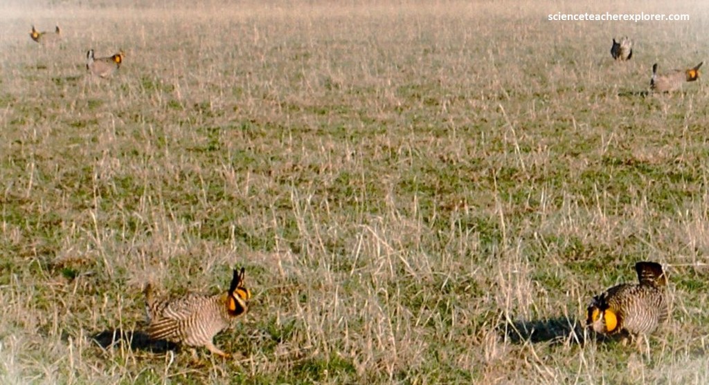
KS177 continues northeast, towards Cassoday, Kansas. Like contestants before a panel of judges, male prairie chickens gather each spring to “dance” for an audience of potential mates. The grasslands around the little town of Cassoday, (the self-styled Prairie Chicken Capital of the World), support a healthy population of these grouses, which have disappeared from much of their former range, (pictured below).
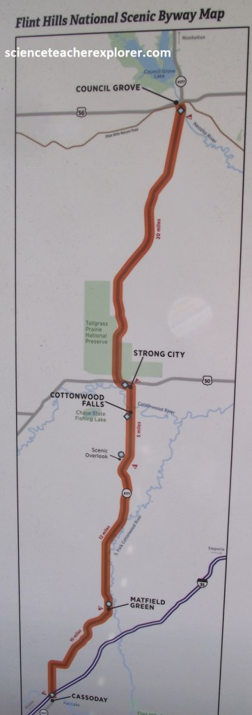
Additionally, Cassody is also considered the beginning point of the “Flint Hills National Scenic Byway”.

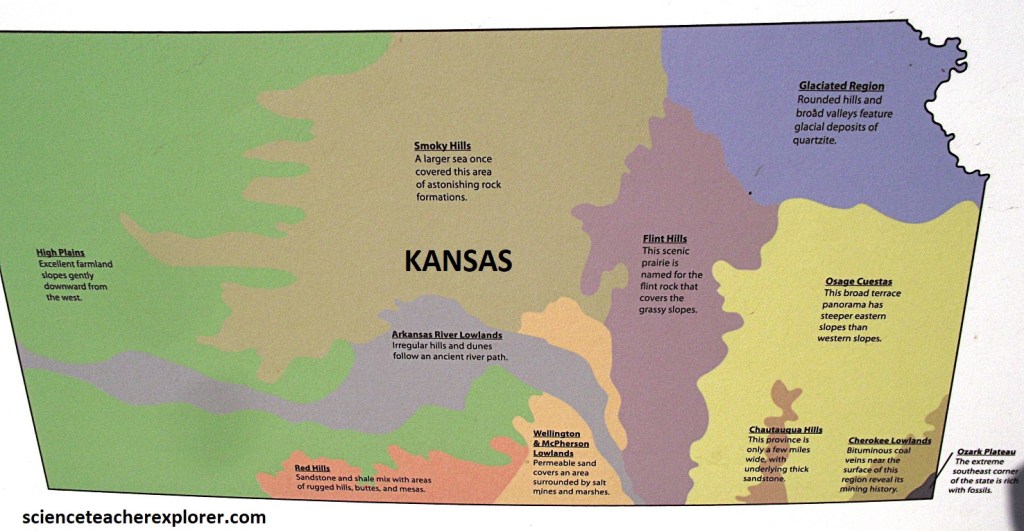
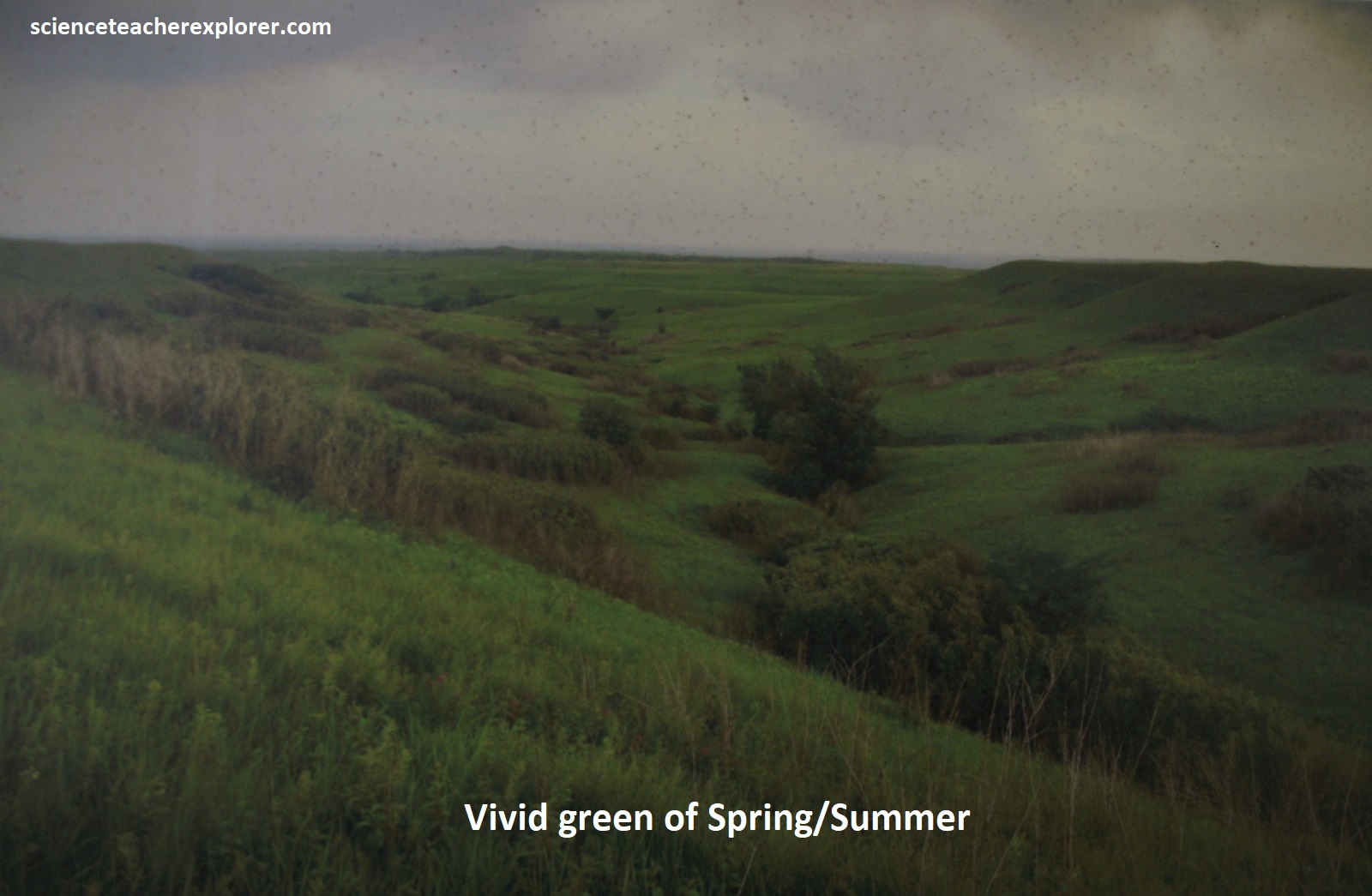
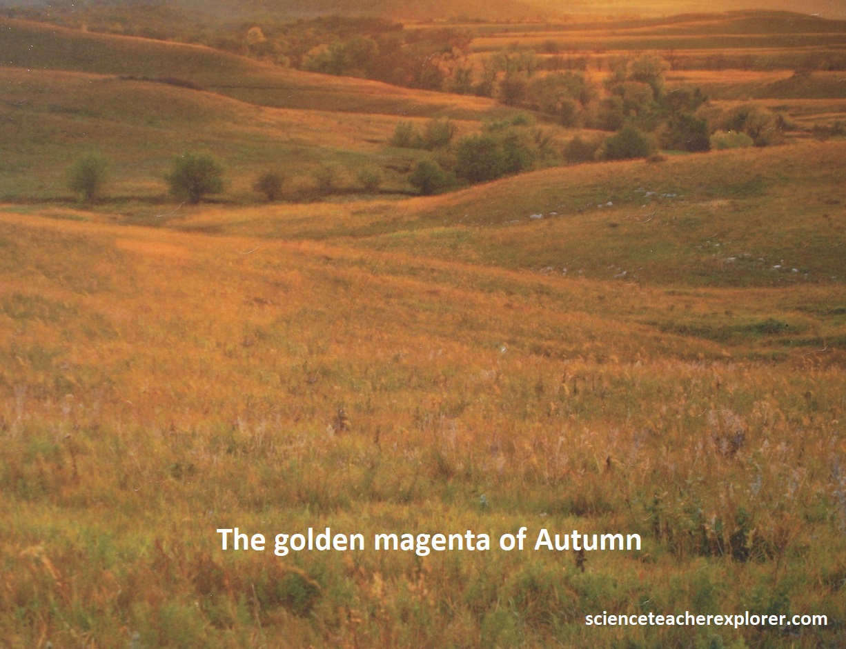
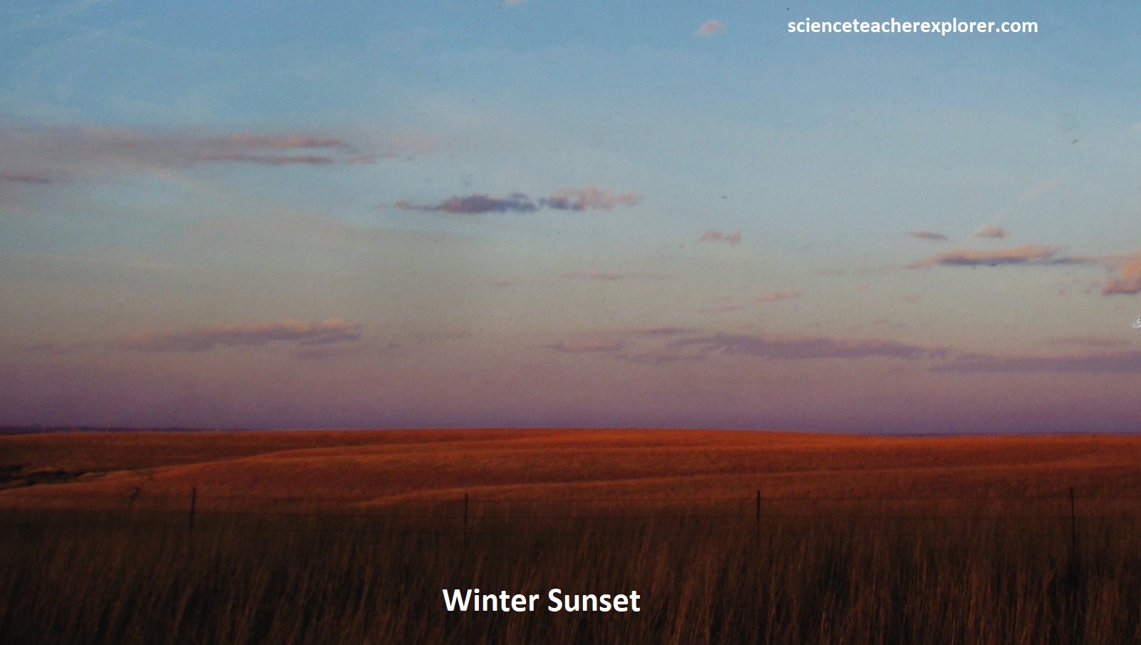
The Flint Hills began as the rocky floor of an inland sea. Many say it still feels this way, (like a living breathing sea with undulating waves of tallgrass prairie). An like the sea, our ocean of prairie and it’s sky change in mood, character, and uniquely in color. From the vivid green of spring through the radiant gold of summer, to the golden magenta of autumn before going dormant for the winter, the Flint Hills vibrantly reflects each season.
However, the Flint Hills spirit is much more than it’s climate, (it encompasses people, culture, values, persistence, and an overall quality that is more easily felt than described in words. The Flint Hills National Scenic Byway, designated by the U.S. Secretary of Transportation as one of America’s National Byways, is a restful and magical part of the earth.
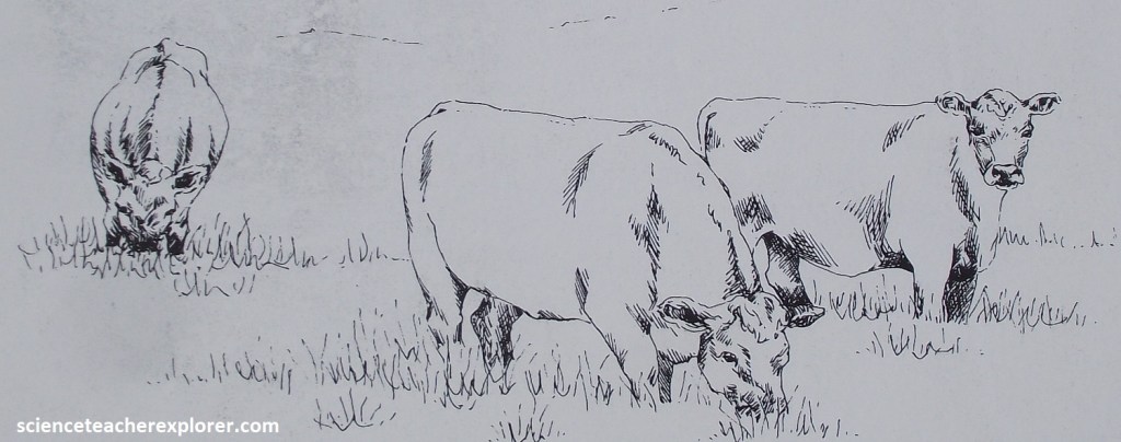
The cattle industry began in Kansas with the rush of Texas longhorns to railheads in Kansas after the Civil War. Ranchers used the prairie to raise and fatten the cattle, which was especially important to the Flint Hills where the flinty soil made row crop production difficult. However, this ranching legacy was not preordained by the soil. Many farmers succeeded in growing crops in the bottomland along rivers while using the upland to graze cattle. However, the abundant and nutritious grasses of the upland continued to be productive through drought, providing an advantage to ranchers. In fact, prairie grasses are such a good source of nutrition that cattle could gain up to two pounds per day. An initial lack of cattle herd laws allowed cattle to graze freely, helping to ensure the dominance of ranching. By the 1920s, Bazaar & Cassoday, Kansas had become the largest cattle exporting line on the Santa Fe Railroad system, with some 400,000 cattle shipped out of the Flint Hills annually, (pictured below).
Presently, many of the cattle in the Flint Hills are temporary, especially during the peak grazing season from May to July. They are brought here by truck from as far away as Texas so they can eat the lush native grasses. Once they arrive in a pasture, the cattle are moved infrequently because, like humans, they lose weight if they exercise.
The Flint Hills National Scenic Byway offers incredible views of the native grasses and flowers of the tallgrass prairie, one of the last remaining such landscapes in America.
Much of the land along the Byway looks as it did thousands of years ago when the Kaw, Osage, and other native tribes lived here. Early settlers traveled the Santa Fe Trail; some stopping to build the towns of Council Grove, Cottonwood Falls, Strong City, Matfield Green, and Cassoday, using local limestone and providing a permanence to these new settlements. On a more somber note: Matfield Green is the site of a historical plane crash that took the life of the legendary Notre Dame football coach, Knute Rockne.
As mentioned above, the lush prairie grasses and flinty soil cemented their place as cattle country, which together with the railroad connected them to the wider nation. Today, the Flint Hills is home to the Tallgrass Prairie National Preserve, historic venues and towns filled with charming shops, restaurants, artwork, and antiques.
The tallgrass prairie once covered 107 million acres of North America, though much of that is now lost. The Flint Hills is unique in that one can still see this endangered ecosystem thanks to the “Land’s Legacy”; which played an integral role in preserving its landscape.
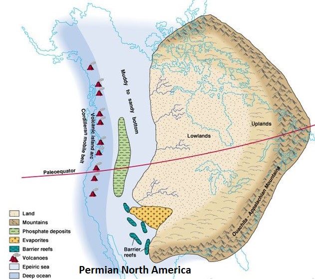
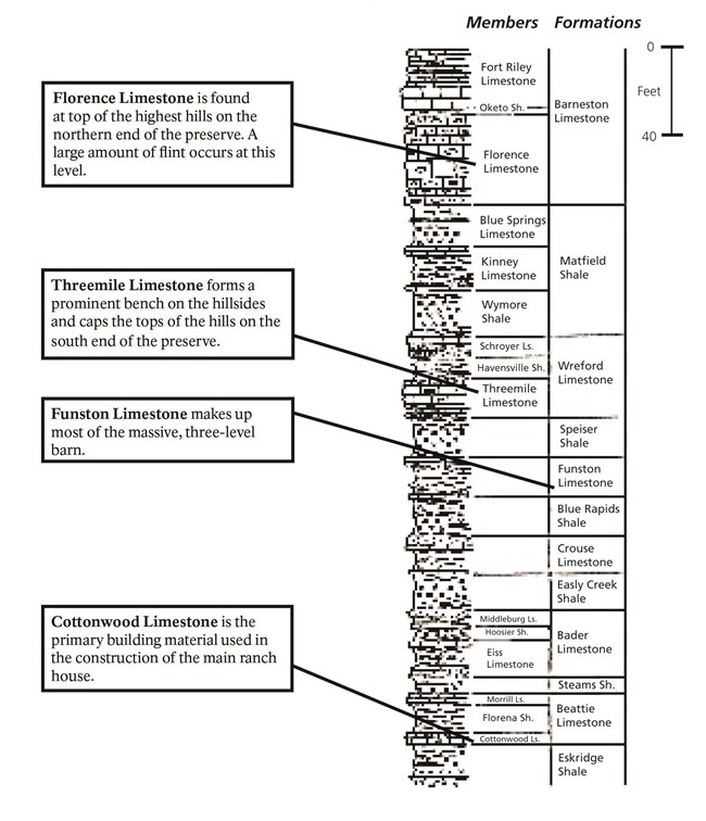
The Flint Hills alternate layers of limestone (with flint) and shale deposited during the Permian Period, around 280 million years ago. A shallow ocean covered the surface nearby, but most of this was a tropical geologic period of warmer climate. As marine organisms rich in calcium fell to the bottom of this ocean their remains became stone (lithification). Clay and mud deposited on the ocean floor lithified into shale.

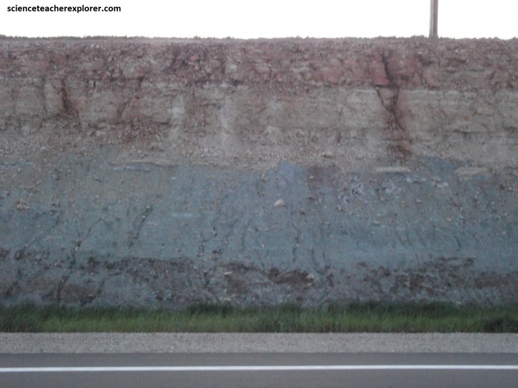
Flint or chert occurs within limestone as roughly spherical concentrations or nodules or as layers. They may have formed from the remains of marine organisms from the Permian time period that are rich in silica and fell to the ocean floor. Then they might of come together as the limestone formed. Additionally, layers of chert may have formed as the silica material recrystallized, chemically replacing the limestone.
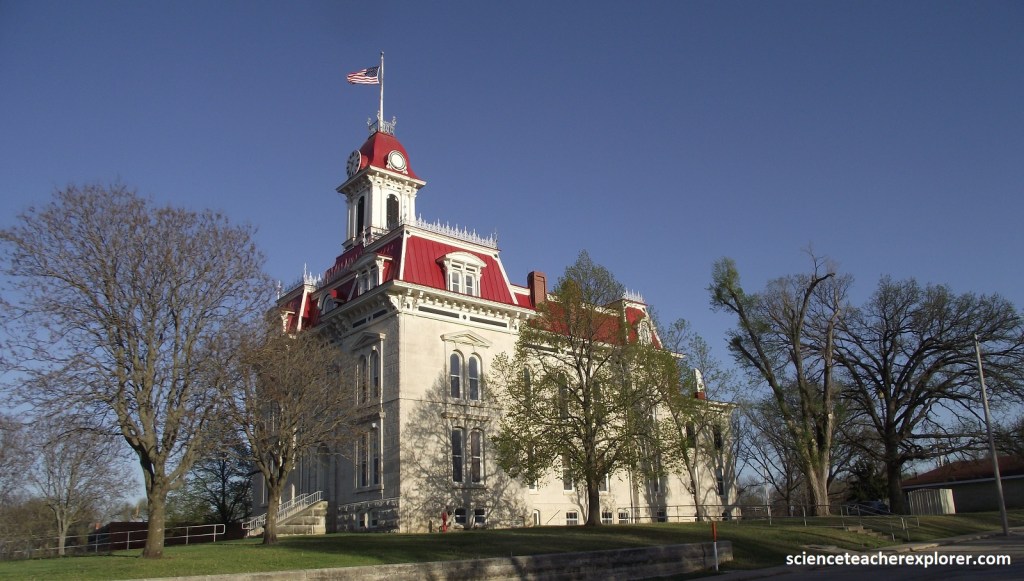
Pictured below, Cottonwood Falls of the Flint Hills has been the Chase county seat since both town and county were established in 1859. The first log cabin courthouse was replaced in 1873 by this stately building of native limestone and walnut, which today is the oldest Kansas courthouse still in use. It was designed in French Renaissance style by John F. Haskell, who, was also the first architect of the statehouse in Topeka.
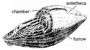
A closer look at the rock Permian Limestones in the Flint Hills reveal many silica- rich fossils, (mentioned above). Most of these marine fossils are invertebrates (animals without backbones) such as corals, clams, snails, bryozoans, sea urchins, crinoids, and brachiopods. Particularly abundant in some limestones are fusulinids, small, one-celled animals shaped like wheat grains, (pictured above). These fossils can be seen in many of the limestone blocks used in the buildings at the preserve, (pictured above).
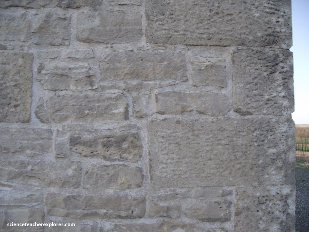
The Cottonwood Limestone, a rock layer that occurs on the Tallgrass Prairie National Preserve near the base of the hills in the Fox Creek valley, is a common building stone in Kansas. It is a thick layer of limestone, nearly white in color, even-textured, durable, and contains numerous fusulinids. Blocks of stone three or more feet thick and several feet in length and width can be taken from a single ledge.
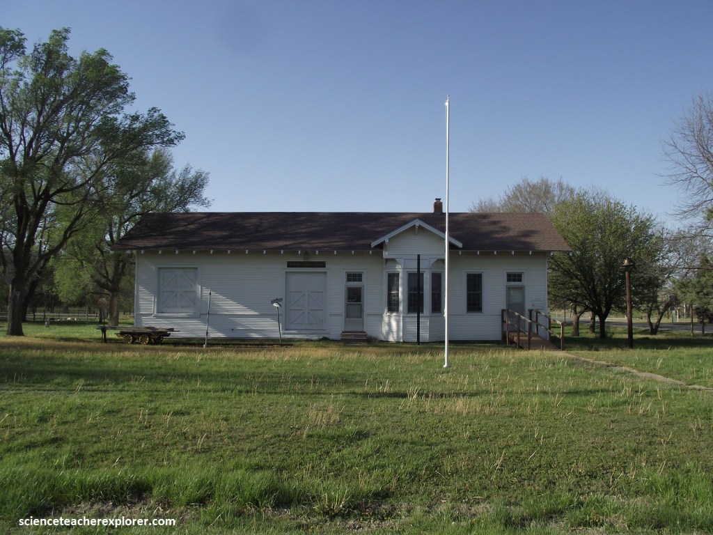
Prospects for Cottonwood Falls received an early setback when it was bypassed by the Santa Fe railroad in 1871. The depot, located 3.2km north, was first called Cottonwood but in 1881 it and the community, which grew-up around it, renamed it Strong City.
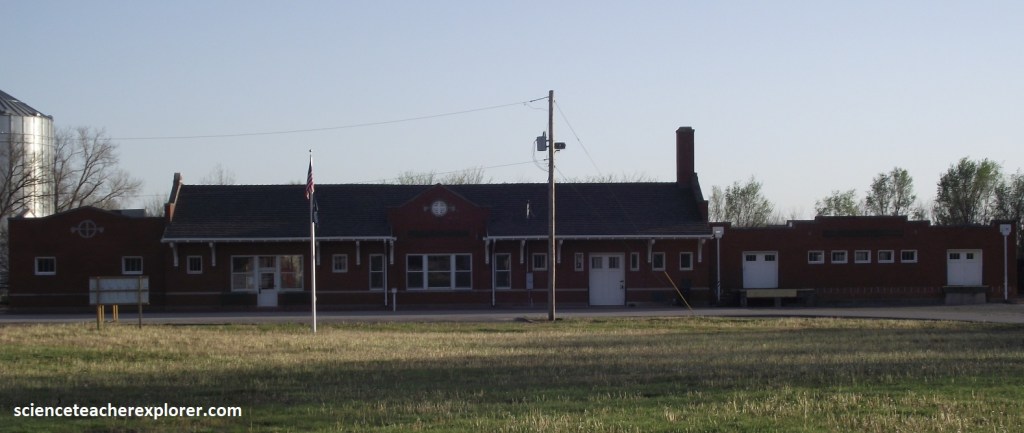
Pictured above, this “twin city” situation led to one of the state’s first inter-urban systems. Horsecar service between the two towns began in 1887 and the courthouse square was the southern terminus of the 3.2km railroad. In 1918 the company converted to a gasoline-powered motor car, but the track that served well for horsecars could not handle the heavier and faster equipment. Improved technology, in this instance, only created difficulty, and in 1919 the inter-urban ceased operations.
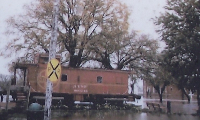
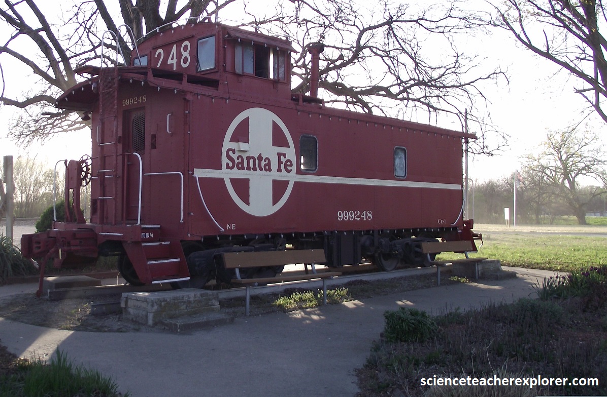
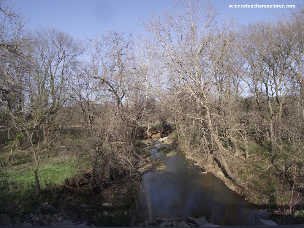
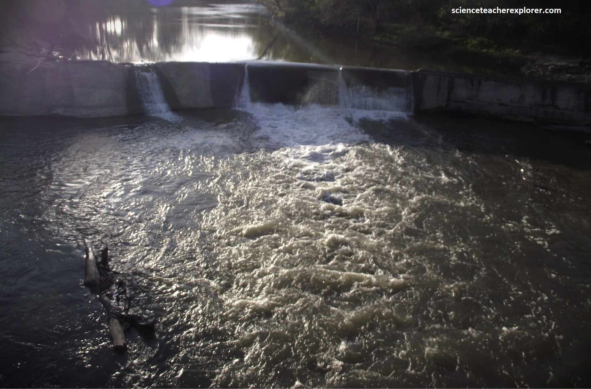
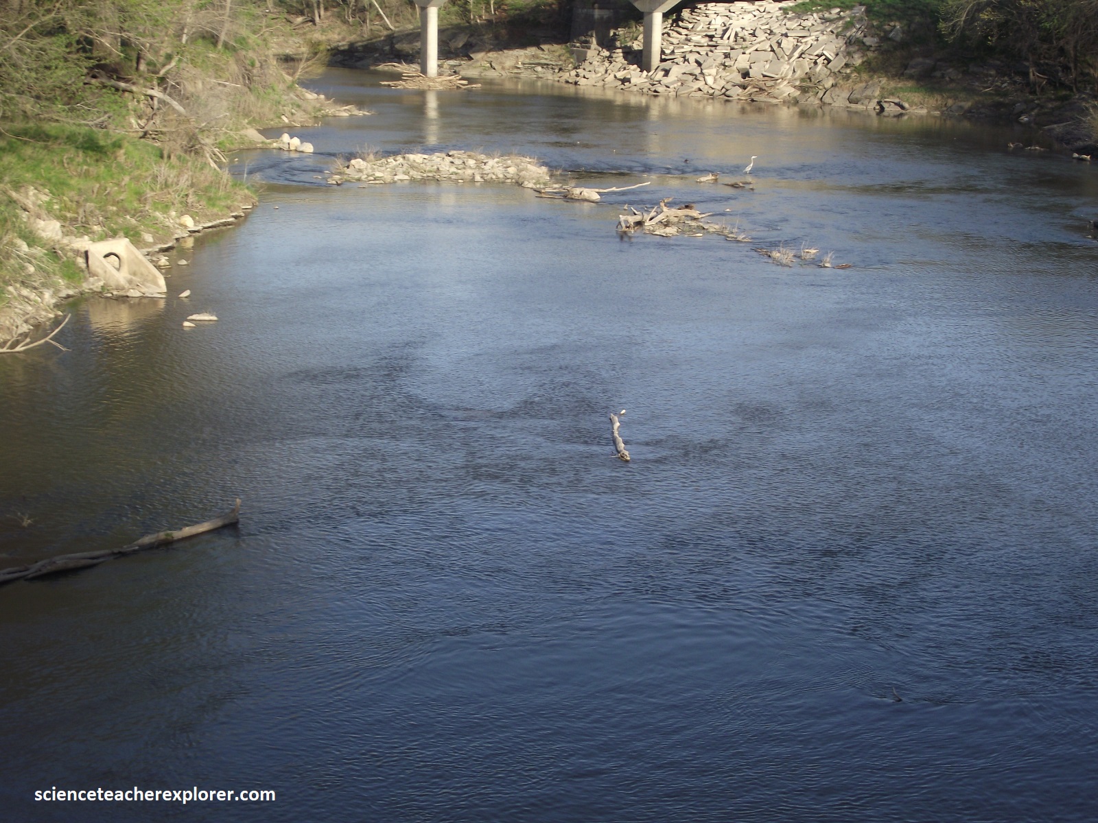
Pictured above, Strong City has flooded many times, as the Cottonwood River and tributaries destroyed homes, crops, livestock, and businesses. The October 1998 flood was known as the “Halloween Flood”. The color photo on the above left shows the flooding around the caboose in the park. I took a photo of the same caboose on the right in 2024. More flooding occurred again in June of 2010. {The photos below are of the infamous Cottonwood Creek that causes flooding in Strong City}
A 1903 flood with a depth of about 1 meter affected homes. Two floods occurred again in June and July of 1904. These floods severely impacted almost all the Strong City businesses with waters 0.3m at the stores and 2m deep inside homes south of the railroad tracks.
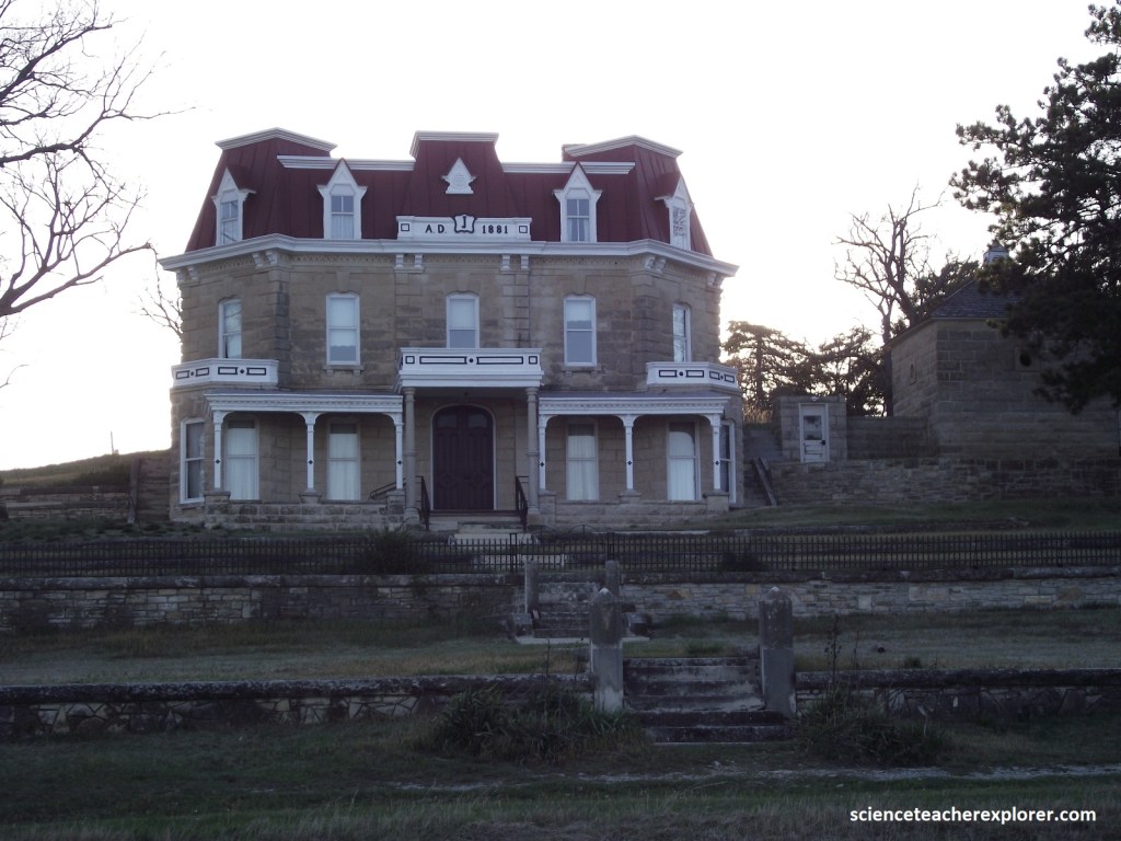
Pictured above, the preserve displays a small portion of the Flint Hills and presents important cultural stories of this landscape, including the transition from open cattle range to enclosed cattle ranches. The preserve is operated in partnership between the National Park Service and the Nature Conservancy. Together they conserve, protect, and interpret the cultural and natural resources of this valuable prairie landscape. Note that Stephen F. Jones built this magnificent house in 1881 using Cottonwood limestone from a nearby quarry, (picture above). The Ranch House (pictured above), portions of the Lower Fox Creek Schoolhouse (picture below) and the Ranch Barn, and many other structures on the preserve were built with the Cottonwood Limestone, as well as numerous buildings in the state, including the Chase County Courthouse in Cottonwood Falls, (mentioned above), and most of the Kansas State Capitol building in Topeka.
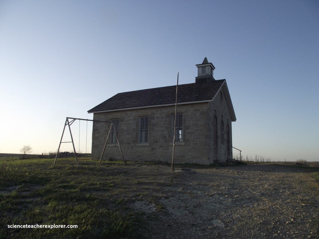
Pictured above, the Fox Creek School provided a basic education for their children in the Flint Hills, and was a high priority to prairie settlers. Classes began here in 1884, and continued until 1930. The school’s basic one-room style, constructed of the same limestone which underlies its knoll, provided a place where the basics were taught, (reading, writing, arithmetic, science and geography). The learning tools the students of the small school would be used throughout their lives. From their little prairie school, local children were introduced to the world. Some of them stayed to inherit family ranches, while others went off to explore the places they had only seen on school maps. Wherever they went though, the memory of growing up in this prairie place probably went with them.
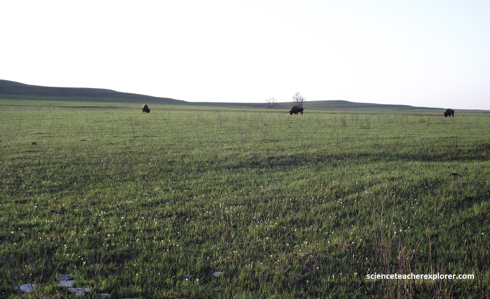
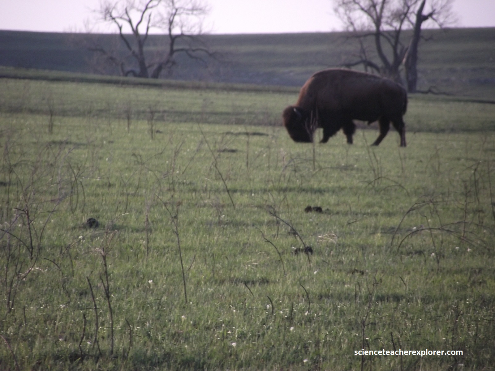
In prehistoric time, large buffalo herds, (like seen above), and other animals grazed and trampled the prairie. While large buffalo herds no longer roam freely, (these were fence off), the prairie is still home to pronghorn antelope, deer, foxes, coyotes, prairie dogs, wild turd]keys, badgers, rabbits, rodents, snakes and insects. Over 200 type of birds have been spotted in the Flint Hills. I saw red-tailed hawks, meadowlarks, grasshopper sparrows and sandpipers on my trip through here.
As the tallgrass prairie has become an increasingly threatened landscape, the type of view that can be seen from the Lower Fox Creek School has become increasingly rare, (pictured above). As part of the Tallgrass Prairie National Preserve, it will continue to be protected so that children of the future can have the opportunity to enjoy, and learn the basics of , the amazing tallgrass prairie. {photos below were taken near the Neosho River near Council Grove}
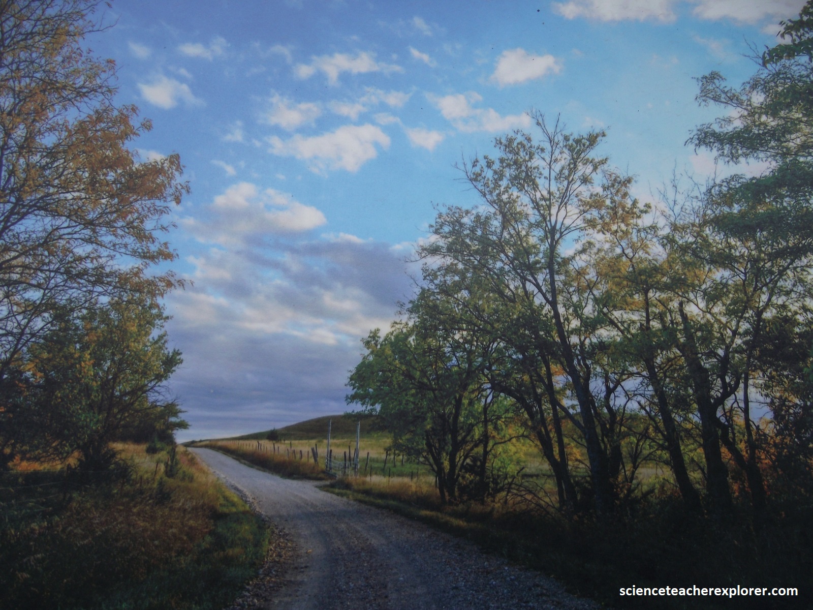
As the drive rolls gently northward along KS177, (with a few side roads picture above), it crests low ridges blanketed with native grasses, (grazing grounds for the region’s large, prosperous cattle ranches). Traveling beneath the vast azure dome of sky, I discover a sense of extraordinary solitude. Except for the thin gray ribbon of the road itself,, one of the few signs of human presence is the long lines of barbed wire fences that disappear over the horizon.
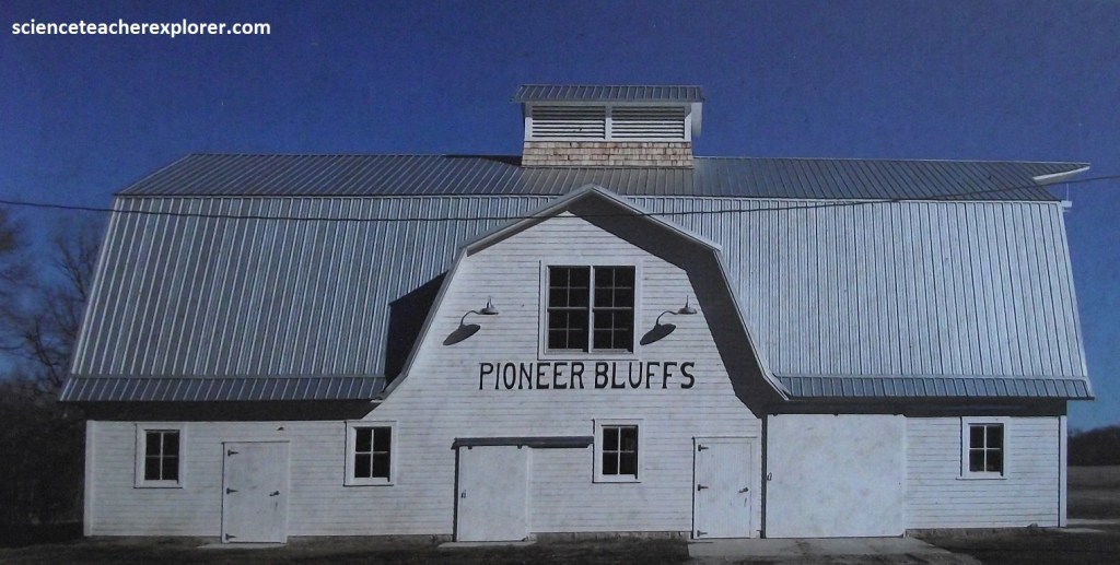
Pictured above, Pioneer Bluffs’ story began in 1859 when Charles Rogler walked from Iowa to claim land in Kansas, choosing a plot where the river met the creek with a mix of landscapes including bottomland, timber, prairie, and a limestone bluff. He expanded this 160-acre homestead to an 1,800-acre farm to meet his family’s needs. His son Henry took over in 1898, naming the homestead “Pioneer Bluffs” and constructing several buildings including a large house with running water, a barn (pictured above), granary, and carriage house. He also expanded the property while transitioning from farming to ranching. Henry’s oldest son Wayne entered the cattle business at the star of the Great Depression, but he persevered and created one of the best-known ranches in the region with 60,000 acres and 15,000 head of cattle. Today it has converted to a history and prairie education center focused on sharing Kansas’ natural and ranching heritage.
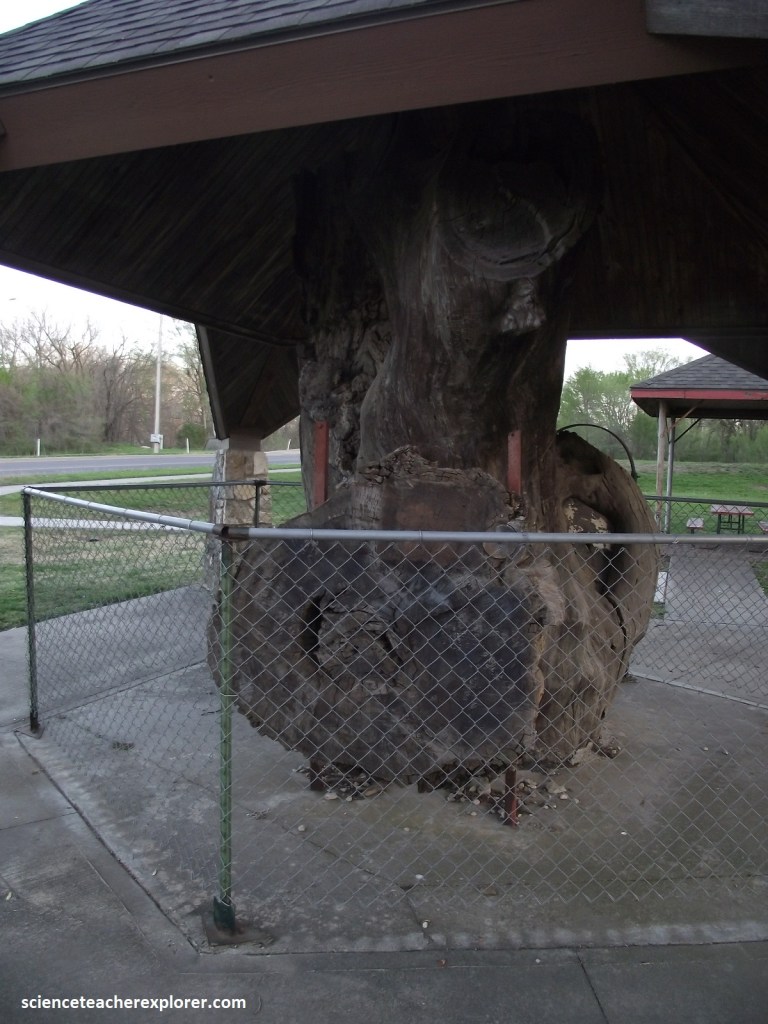
Pictured above, Council Grove played a major role in the growth of the Santa Fe Trail. In 1825, Osage chiefs and negotiators for the U.S. government signed a treaty here that granted settlers safe passage through Native lands. The elm tree beneath which the two groups met survived until a violent windstorm toppled it in 1958, but the city has preserved its stump as a historic shrine. Additionally, General George A. Custer and an element of the 7th Cavalry camped beneath this tree in 1867. The south portion of the park from which it stands is part of a 120-acre farm bought by General Custer and Amos Kimball in 1869.
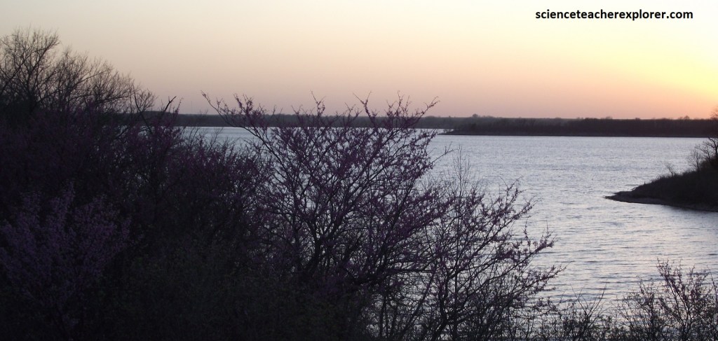
Farther along the Flint Hills Scenic Byway, KS177 parallels the eastern shore of Council Grove Lake, a local favorite for swimming, sailing, and waterskiing. Turnouts let me stretch my legs and enjoy the views at sundown, (pictured above). Just to the south, on the banks of the Neosho river, lies the historic town of Council Grove & it’s ranch, once a supply point along the Santa Fe Trail.
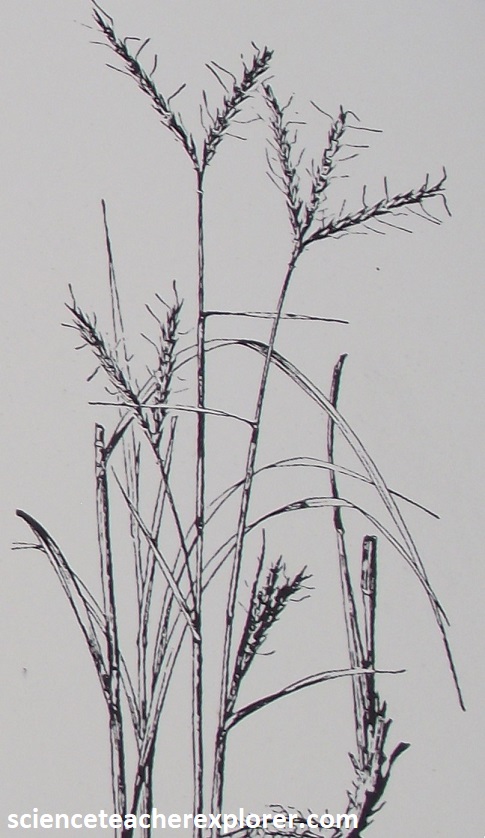
Although most of America’s original tallgrass prairie has been lost to cropland, these rolling hills, stretching on for some 300 km, remain much as they were when the first settlers arrived. Their name hints at the reason: the hills are formed of limestone and chert, a hard, fine-grained rock also known as flint. Rough and difficult to plow, the prairielands here have thus survived largely intact. Pictured above, Konza Prairie was a good place to sample the grassland. The predominant grasses on the prairie are big and little bluestem, along with switchgrass and Indian grass. They are accented in the summer with the golden heads of sunflowers, spikes of liatris, cone-flowers, compass plants and countless other wildflowers. Here and there, bur oak, hackberry, green ash, and honey locust trees add a pleasing vertical note.
