Gila Cliff Dwellings, NM
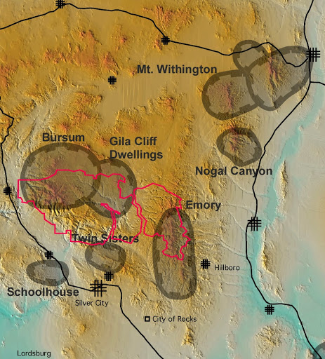
I was on my way back from the McDonald’s Observatory in Texas to Utah, when I veered over to the west-side of Southern New Mexico for exploring the Gila Ruins National Monument. It was in July of 2013. The Gila Cliff Dwellings National Monument is in the Mogollon Mountains approximately 60 km north of Silver City, New Mexico.
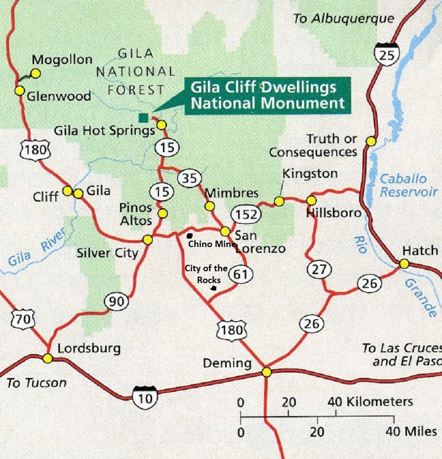
Gila Cliff Dwellings National Monument lies 71 km north of Silver City on state-road 15.

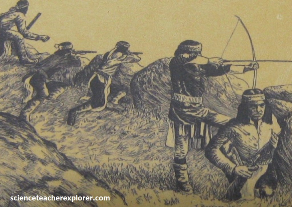
Archeological evidence suggests that many different groups of people have inhabited this area over thousands of years. What motivated Mogollon to build inside the caves between the 1270s and 1300?
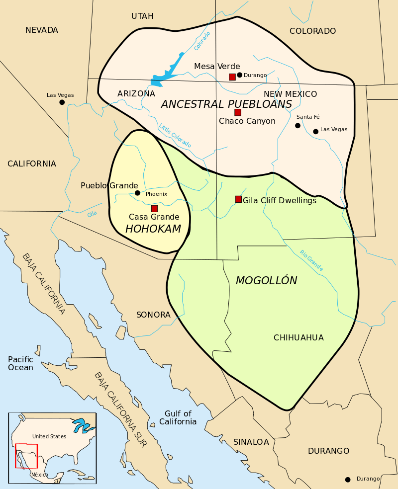
Considered by archaeologists to be on the northernmost portion of the Mogollon People’s sphere of influence between 1275 and into the early 14th century, the Gila Cliff Dwellings National Monument is home to two prominent ruin sites. The Monument landscape ranges in elevation from around 5,700 to 7,300 feet above sea level. The terrain around the ruins is rugged and arid, and contains steep-sided canyons cut by shallow spring rivers and mesas and bluffs forested with Ponderosa pine, Gambel’s oak, Douglas fir, New Mexico juniper and pinon pine.
The area geologic history stems from the Oligocene epoch and volcanic activity that subsequently covered the area with ash. This is because the earth’s crust felt great tension in this area due to the crustal plates shifting and moving to the west. Faulting occurred, and lava welled up through fault fissures. Occasional explosive volcanic outbursts hurled molten blobs of lava and volcanic ash into the air. Falling to earth, the ash became tuff, interlayered in many places with lava flows. Gradually, volcanic cones formed around the most active centers. Successive layers of ash and lava blanketed the region with a mantle ultimately 300-400m thick. For 20-25 million years, sporadic volcanic activity continued. Between active periods, soil and conglomerate formed, only to be destroyed, and the soil bake and reddened, as new lava spread and new ash fell.
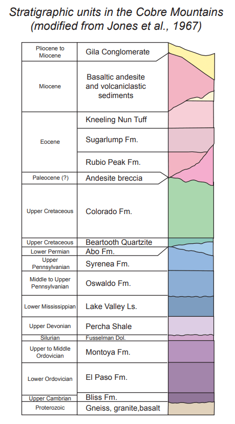
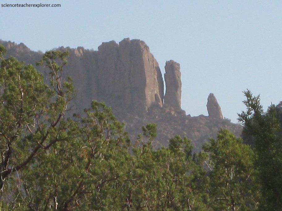
Three rock units can be observed along the hike up to the cliff dwellings. The oldest unit, is Bloodgood Canyon Tuff, which was erupted from the Gila Cliff Dwellings caldera, (pictured below) 28 million years ago. Gila Cliff Dwellings Nation Monument lies on the eastern margin of the caldera. The tuff is overlain by basaltic and andesitic lava flows at are estimated to be 25 to 26 million years old. The Gila Conglomerate, a sedimentary unit that contains pieces of older volcanic rocks, including the Bloodgood Canyon Tuff, caps the sequence.
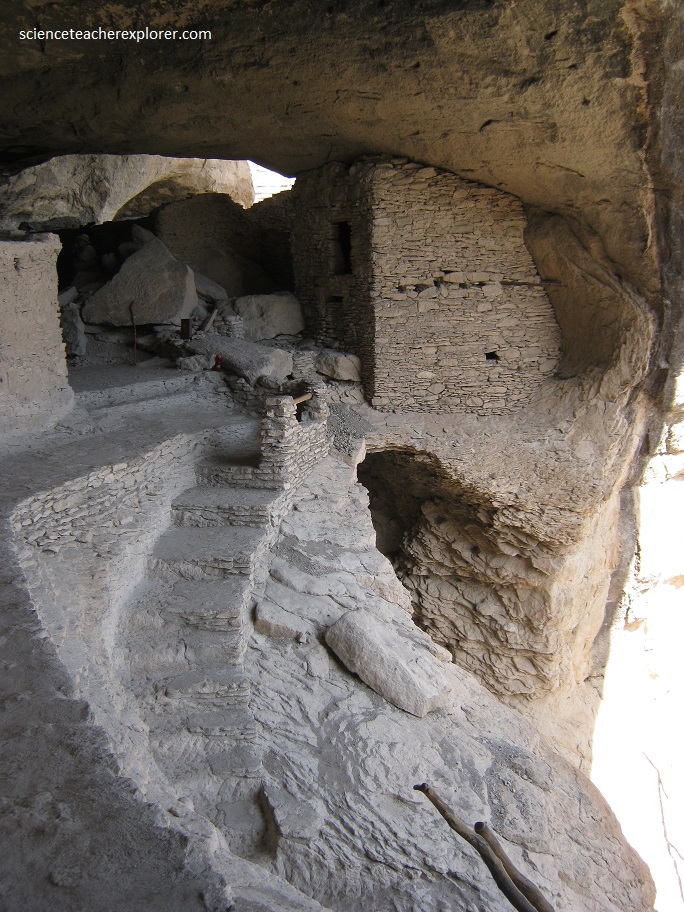
The cliff dwellings are built in shallow caves that formed at about the same stratigraphic level along weak (somewhat less cemented) zones within the Gila Conglomerate. Around 500,000 years ago, the Gila creek carved alcoves into the conglomerate, particularly in places where the conglomerate is soft. Presently, the alcoves are now stranded high and dry above the creek and continues to enlarge by roof collapse. The Gila Conglomerate in the caves displays an unusual feature not typically seen in sedimentary rocks. Closely-spaced exfoliation fractures that cut across the bedding in the conglomerate are aligned roughly parallel the cliff face or the geometry of the cave openings and enlarging them.
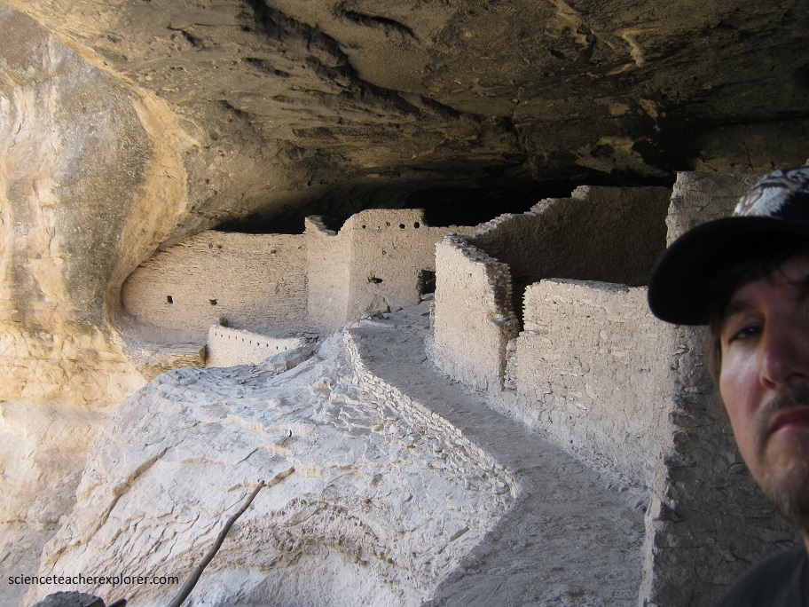
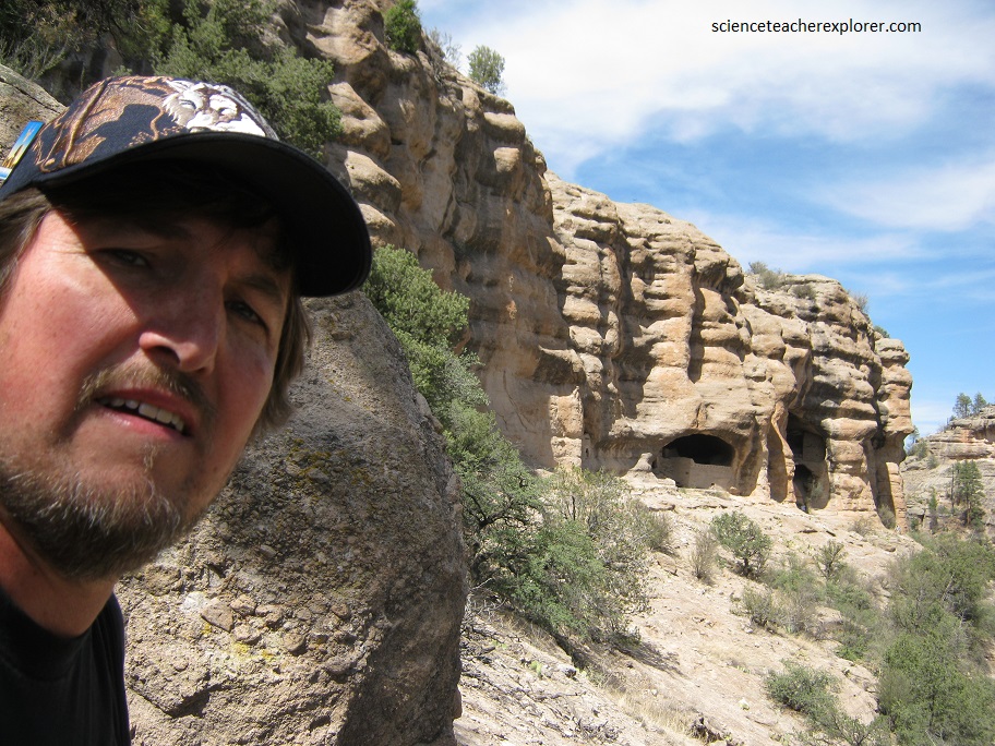
The Mogollon people made use of natural caves to build interlinked dwellings within five cliff alcoves above Cliff Dweller Canyon. Archaeologists have identified 46 rooms in the five caves on Cliff Dweller Canyon, and believed they were occupied by 10 to 15 families.
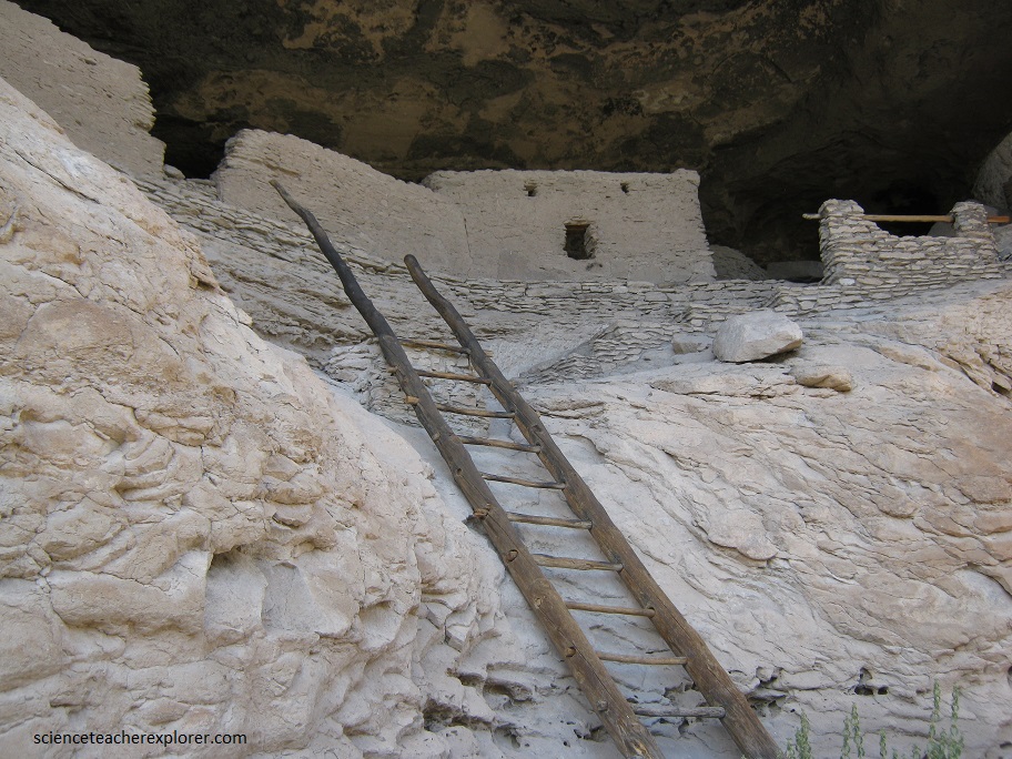
To make the dwellings safer and more comfortable, the Mogollons used fallen rocks from nearby caves to construct some of the 46 rooms, and also incorporated unique wall designs in strategic areas. The walls were built using conglomerate slabs laid in large amounts of mortar, and you can still see evidence of this today — in fact, 40 percent retain their original plaster.

Looking at the marvelous structures within the Gila caves, it is easy to appreciate the culture, innovation, and hard work of the Mogollon people. Originally a hunter-gatherer community occupying the Gila wilderness, they used resources from the surrounding forest for food and to build their homes.
Signs of modern architectural design can also be seen around the dwellings, including a distinct storage room, communal rooms, and habitation rooms. It is easy to see why other cultures learned so much from the Mogollon people’s innovation.

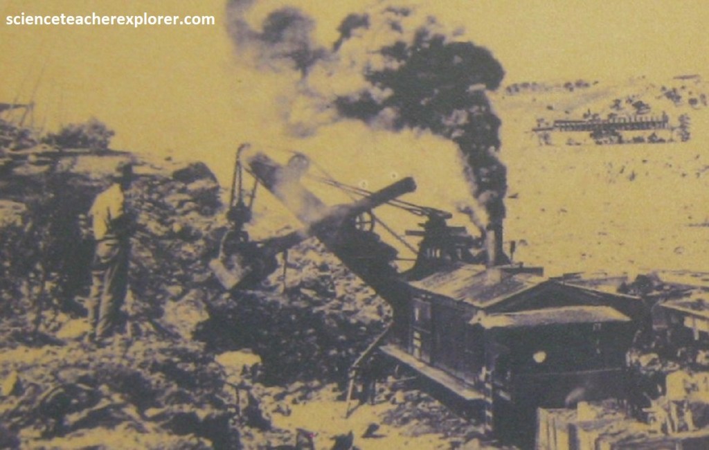
One of the bodies of hot-liquid magma, mentioned above, became the granodiorite of the Santa Rita stock east of Silver City, (72.5km south of Gila Cliff Ruins National Monument). This magma rose toward the Earth’s surface about 58 million years ago until it was only a few kilometers deep. As it cooled and solidified, steam and other gases in the remaining magma built up pressure until it fractured the already solidified rock of the stock and the surrounding country rock. Hot fluids then flowed into the cracks, depositing minerals bearing copper, gold, silver, molybdenum, and platinum group elements, as well as abundant pyrite, (imaged below).
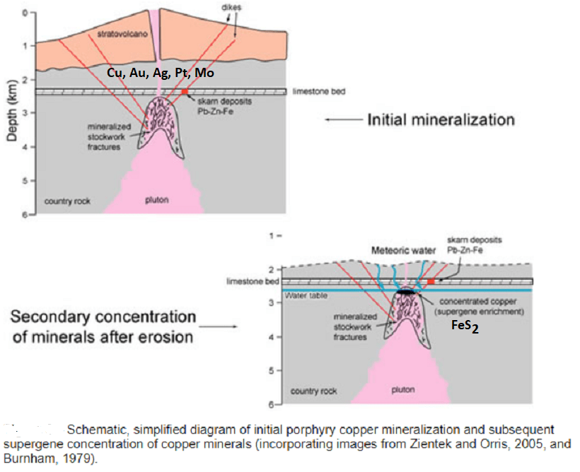
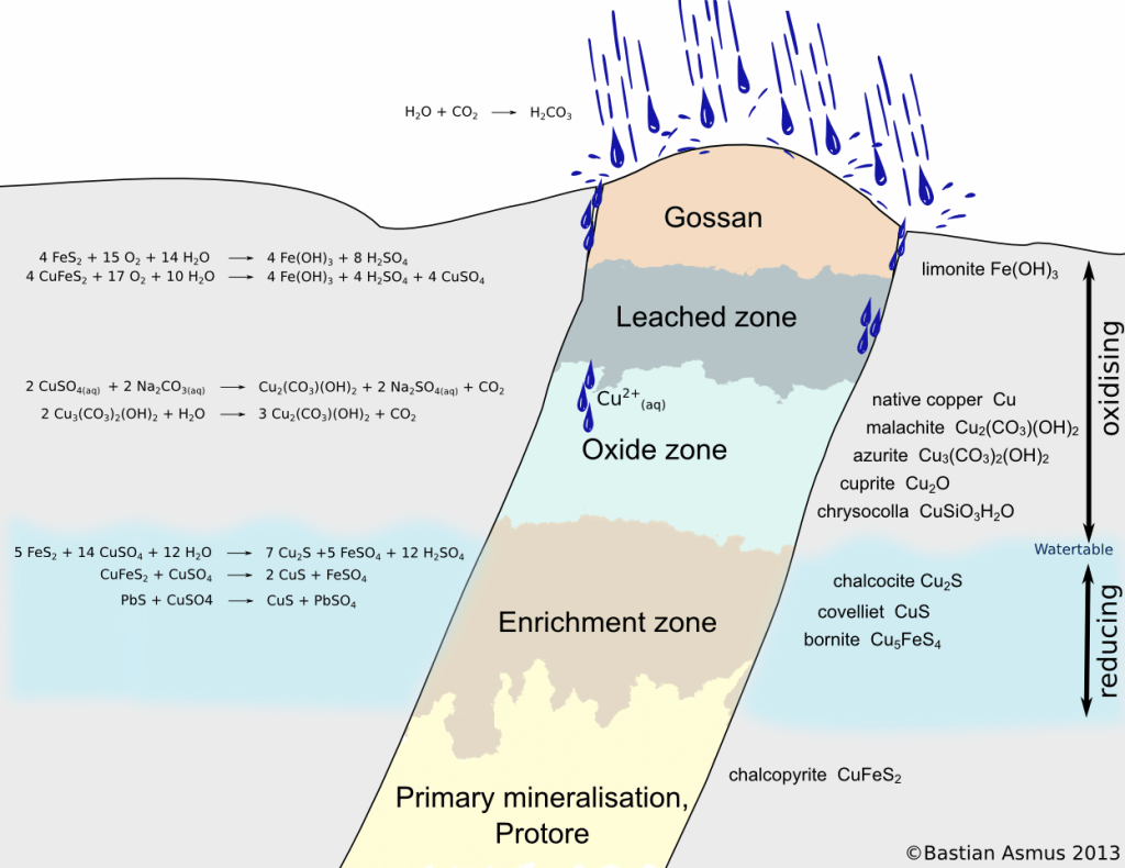
Afterward, groundwater migrating downward from the surface leached some of the copper from the rocks and concentrated it in an enriched zone containing the copper sulfide mineral chalcocite, as well as other ore minerals, including limonite, chrysocolla, cuprite, malachite, azurite, native copper, chalcocite, bornite, chalcopyrite and covellite. This is known as a supergene-enrichment deposition-deposit of a gossan, (imaged below).
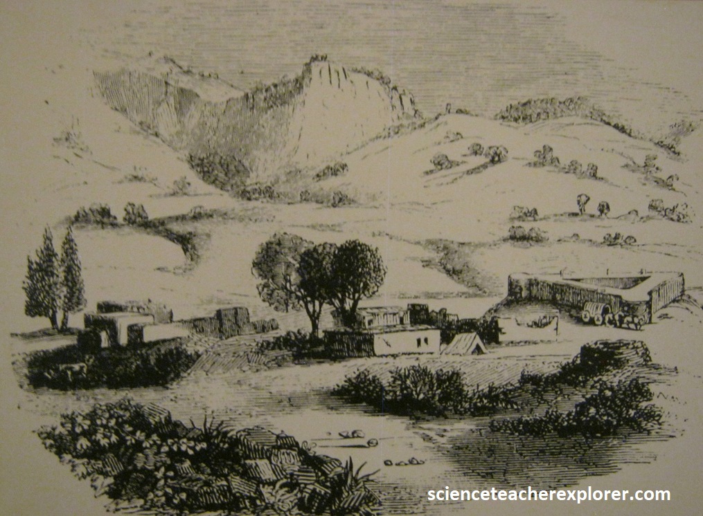
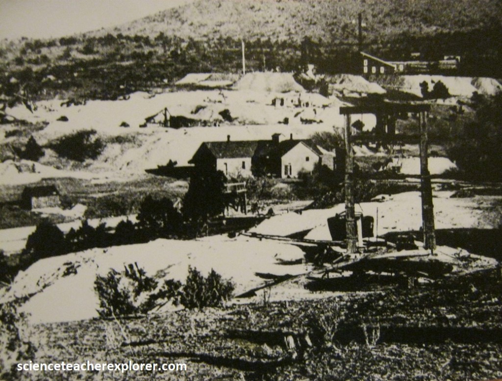
Before the first Europeans set foot on North America, Native Americans collected copper and other minerals from the Chino (Santa Rita) Mine area.
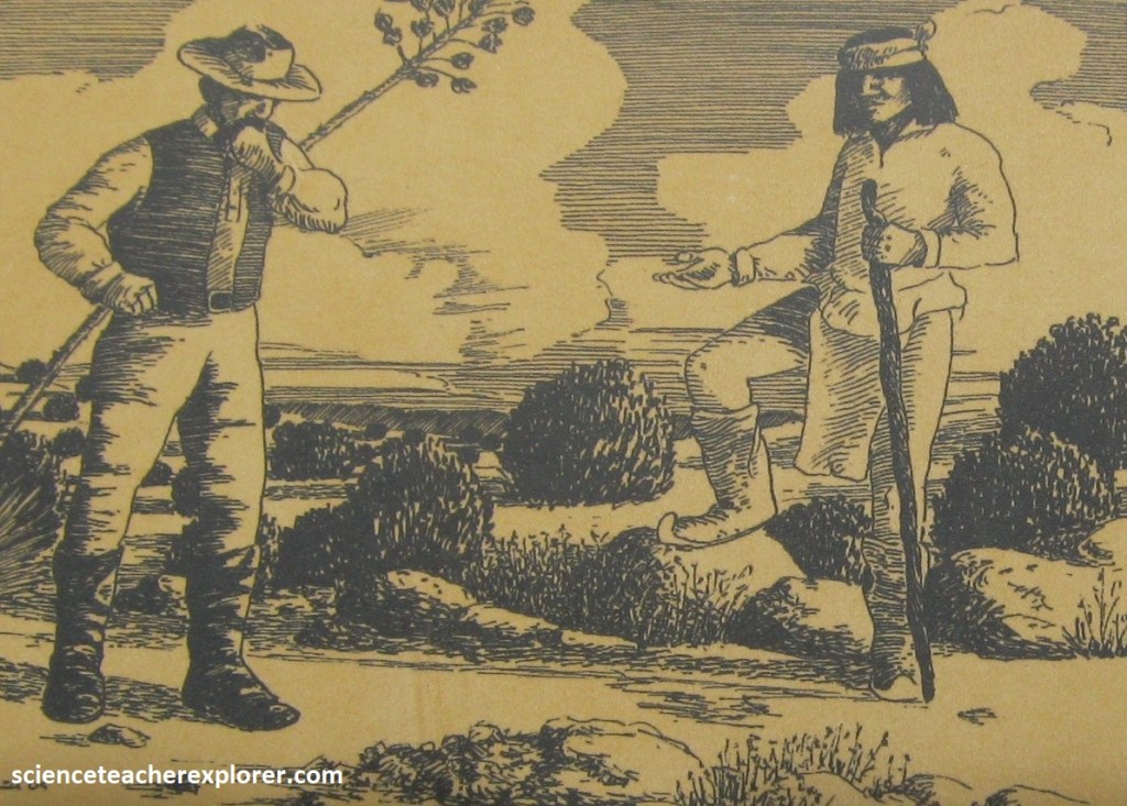
Image above, around 1800, an Apache showed this location to a Spanish military officer. Lacking the finances to develop the mineral deposit, the officer sold the claim to a businessman in Mexico who obtained permission from Spain to establish a mine using convict labor.
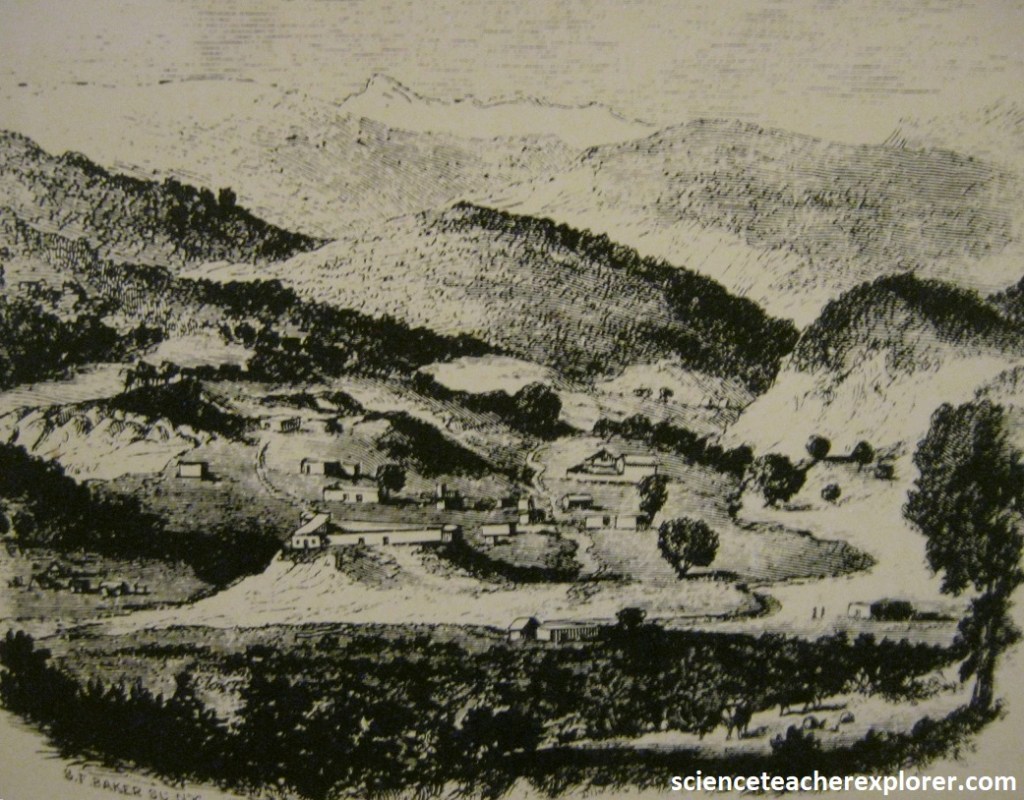
Imaged above, Mining was abandoned around 1840 due to political unrest and the threat of Apache attack.
Imaged above, Santa Rita became part of the United States after the American war with Mexico in 1846. The U.S. and Mexican Boundary commission use the mining camp as their headquarters for ten months. In 1853 Fort Wester was established at Santa Rita and garrisoned for two years by American troops. The soldiers were to protect Californian-bound prospectors from the Apaches.
In 1860 the mines were worked again by lessees, but closed in 1862 because of the American Civil War.
After the American Civil War, mining in the area resumed, with many of the miners living in the town of Santa Rita. In 1881, Joel P. Whitney, purchased the mine from Martin B. Hayes and developed the Santa Rita Copper and Iron Company.
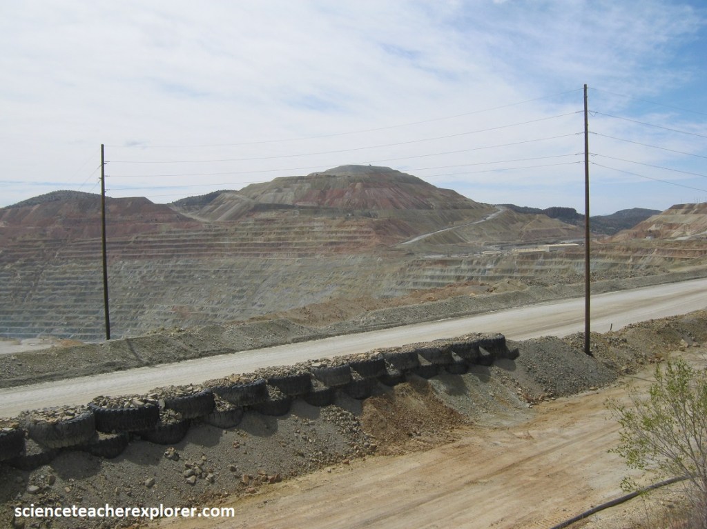
Once the highest-grade ore was depleted by underground mining, open-pit mining began in 1910 to exploit the lower-grade ore around the Santa Ria stock. It took steam, coal, and iron to bring success to Santa Rita.
As mining expanded, the town of Santa Rita was abandoned, and its original location is now floating in the open space of the massive mining pit, (now called the Chino Mine). Mining occurs at the Santa Rita Mine 24-hours a day, 365 days a year. Since 1910, more than two billion tons of material have been moved. Today, the Santa Rita Mine or Chino Mine is more than 2km across and more than 534m deep. It continues to grow as copper-bearing ore is mined.

Higher-grade ore is treated at a “concentrator”. The rock is crushed, ground and processed from its naturally-occurring 0.6% copper to about 25% copper. Surprisingly, copper-containing minerals are recovered from the rock by “floating” them. This copper concentrate is shipped by rail to a smelter in Arizona where the copper is extracted. Currently, Chino produces about 100 million pounds of copper by this method each year.
Pictured below, the Kneeling Nun overlooks Chino Mine and is also located in south-western New Mexico, which is about 32 km east of Silver City. The legend of the Kneeling Nun tells how a local nun nursed an injured Spanish soldier back to health and then, despite her vows, fell in love with him. As a result, she was cast out from her convent and then turned to stone, to spend eternity kneeling atop a mountain in prayer. I’m not sure about the likeness below.
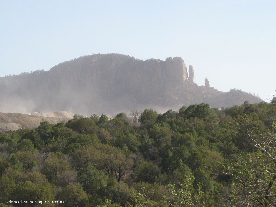
However, the real story starts 35 million years ago, when a volcanic eruption sent a hot flow of pumice, ash and gas surging across this landscape. The volcanic debris hardened into solid rock and then slowly eroded after being uplifted by the formation of the Santa Rita Range. Wind, rain, and winter frosts then eroded the volcanic deposit to reveal this unusual stone monument called the Kneeling Nun, (pictured below).