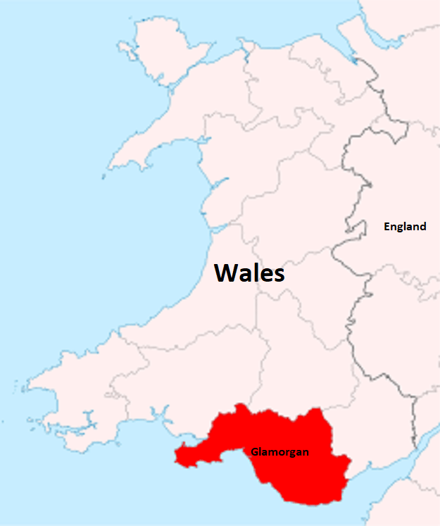
Glamorgan, Wales
In 2025, I had the opportunity to explore Southern Wales in the United Kingdom.
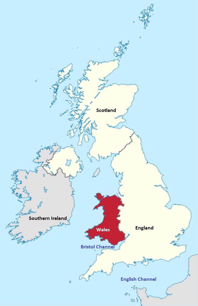
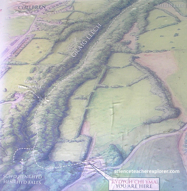
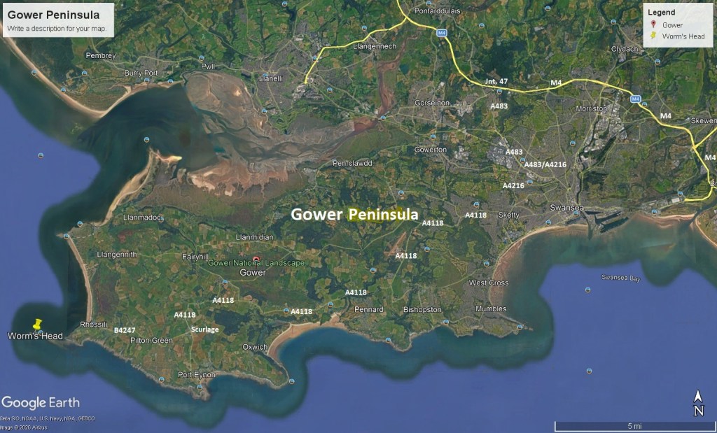
The places of interest for me were three geo-sites found in the region of Glamorgan, (image below).
The three geo-sites I explored, were the Brecon-Beacons National Park, Henrhyd Falls, and Worm’s Head on the Gower Peninsula, (imaged below).
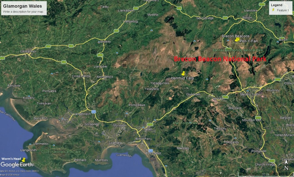
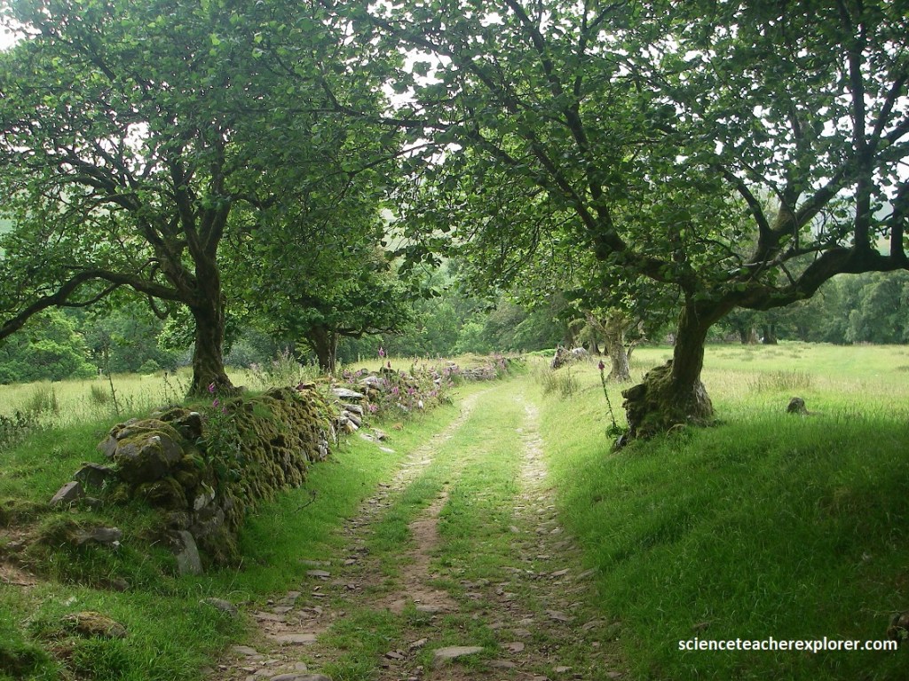
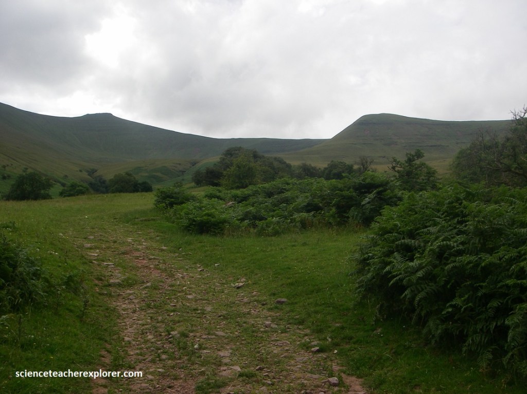
My trekking buddy, (Tracy Davis), and I started with Brecon- Beacons National Park. We came from Hwy. M4 and turned north on A470 and drove to Brecon. From Brecon, we turned east on B4601 to B4602 (Slwch Lane), where we turned right and drove towards Llanfrynach. From there we just followed the graveled road signs to the Cwm Gwdi Parking Lot, (image below).
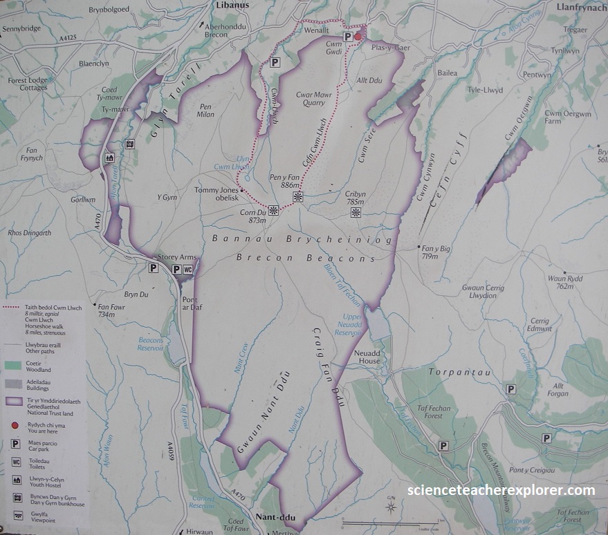
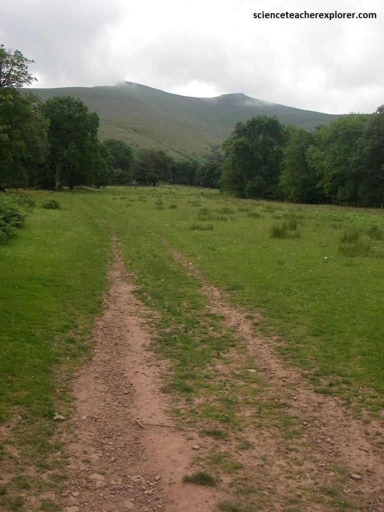
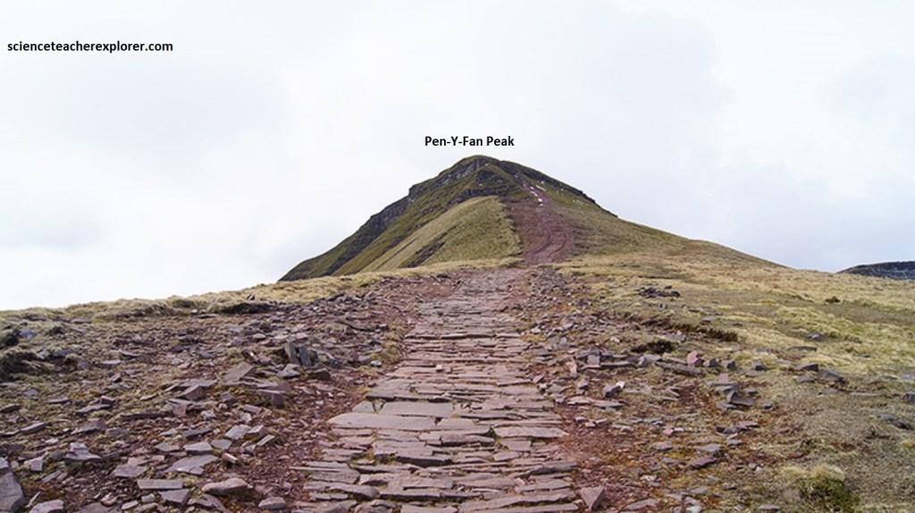
My goal was to trek to the top of the Pen-Y-Fan Peak from the parking lot, using the Cefn Cwm-Llwch trail, (pictured below).
The Brecon Beacons National Park was designated in 1957 and contains some of the southern Britain’s most spectacular upland formations.
The Brecon Beacons are named after the Welsh town of Brecon and the ancient practice of lighting beacons on the mountains to warn of attacks by the English. Nowadays the central Brecon Beacons are a magnet for trekkers like me. The summits of Pen-y-Fan (886m), Corn Du (873m), and Cribyn (785m), make up a beautiful ridge trek known as the Beacons Horeshoe.
The Bannau Brycheiniog National Park extends almost 80km from Llandeilo in the west, to Hay-on-Wye in the east, incorporating the popular tourist attractions of the Black Mountains, along with Black Mountain and Fforest Fawr.
Much of the rock that at the lower elevations were of a carboniferous limestone, with nearby caves and waterfalls. However, the Senni Formation forms the lower slopes and valleys. These sandstones and mudstones were deposited by ancient river systems. This formation gives way to the old red sandstone on the trail.
Much of the higher elevations of the park is composed of the old red sandstone, (it’s distinctive reddish-pink stone can be seen in many of the older buildings toward the east of the region). This Brownstone Formation comprises the bulk of the mountain massifs and the steep, north-facing scarp faces visible from the ridge. These interbedded red sandstones and siltstones were laid down on an ancient alluvial plain.
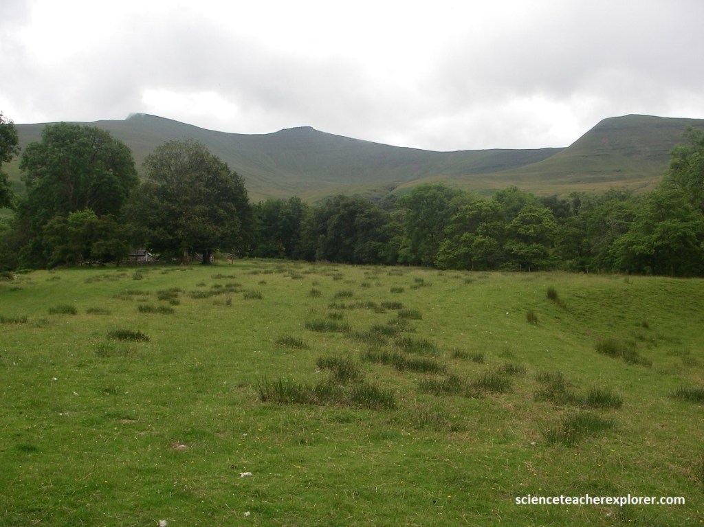
The the center of the park is a range of hills called the Brecon Beacons, including Pen-y-Fan, which is the highest mountain in South Wales and my destination.

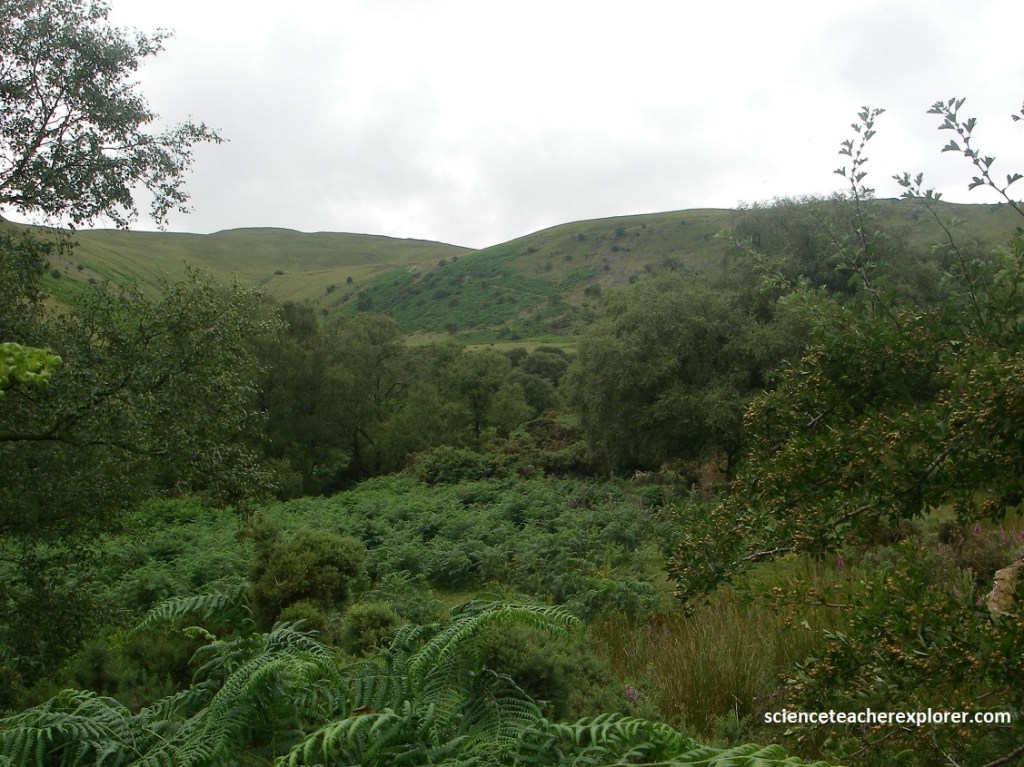
This circular route began on the quieter northern side of the Brecon Beacons, guiding me through a sheltered valley, past waterfalls and the glacial Cwm Llwch lake, before climbing along dramatic ridgelines.
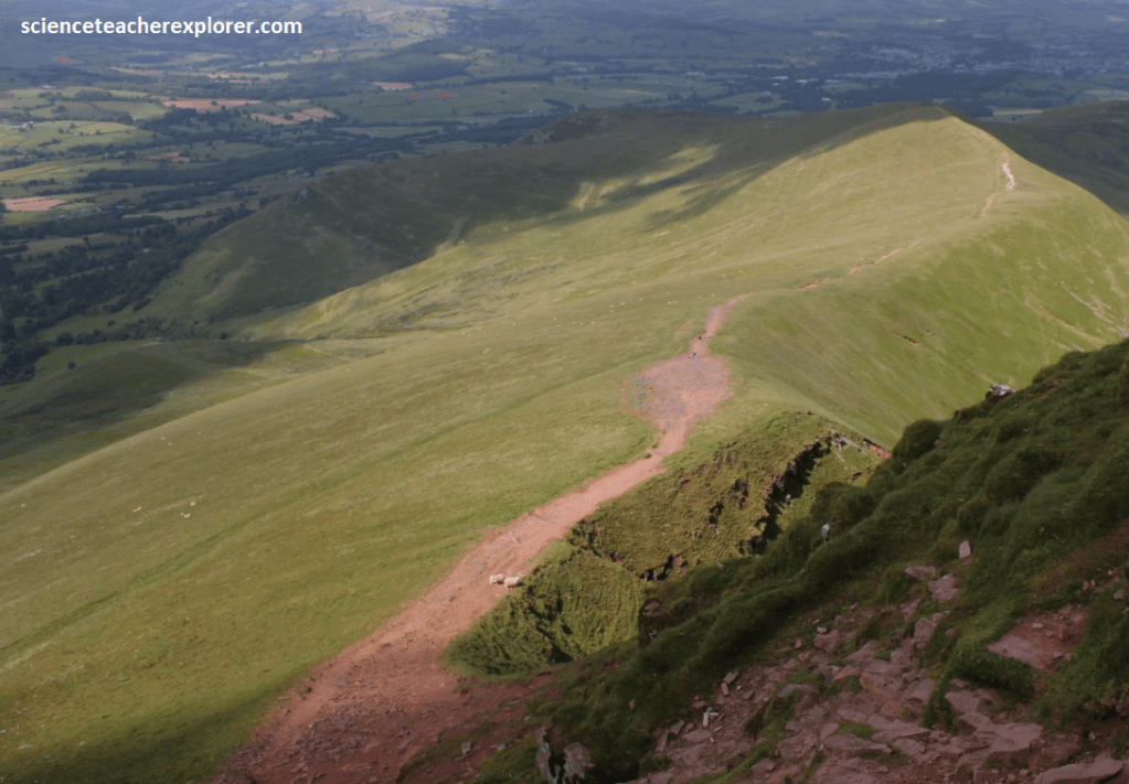
Pictured above, the Cefn Cwm-Llwch trail gets rather steep near the top. The Pen-y-Fan Formation cap the summits of Pen y Fan and Corn Du. They are resistant to erosion, creating the iconic “flat-topped” or anvil-shaped profiles of the peaks. The trail’s bedrock consists entirely of red sedimentary rocks were deposited during the Devonian period (approximately 419 to 359 million years ago). However, the dramatic physical features of the Cefn Cwm-Llwch area were sculpted by glaciers during the Quaternary period, particularly during the last glaciation that ended roughly 11,700 years ago.
Our next geo-site destination, the Henrhyd Falls, was found southwest of the Cefn Cwm-Llwch trailhead. We approached it from Highway M4 via A470 north. We left, A470 at Abercynon and join the A4059 to Aberdare. At the far end of Aberdare, the A4059 became A465. We continued on the A465 to Glynneath. There we changed roads and headed through the town on the A4109. We stayed on A4109 to Banwen Pyrddin, where the road became A4221. After a few minutes, we took a right off the A4221 to Coelbren. There we headed down Dol Henrhyd Road until we turned left and crossed the river. After heading straight for a moment, we saw the Henrhyd Falls car park on our left-hand side.
At the car park, we headed down the slope past the signboard that detailed the history of Henrhyd Falls. The slope was quite steep down to the bottom of the gorge. Here we crossed the river to the other side of the gorge on a wooden bridge.
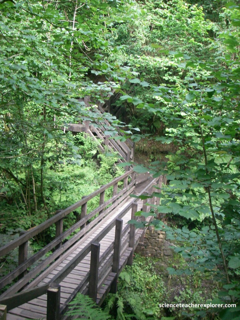
Once we were over the bridge, it’s was straightforward to follow the trail to the Henrhyd Falls. The entire trek took about 15 minutes.
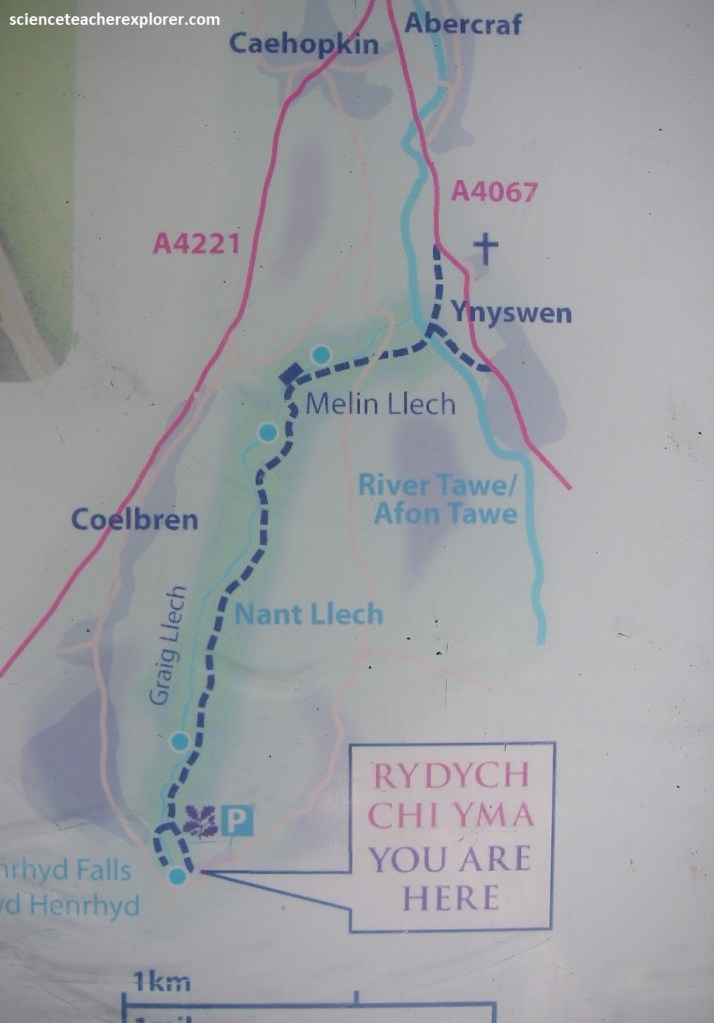
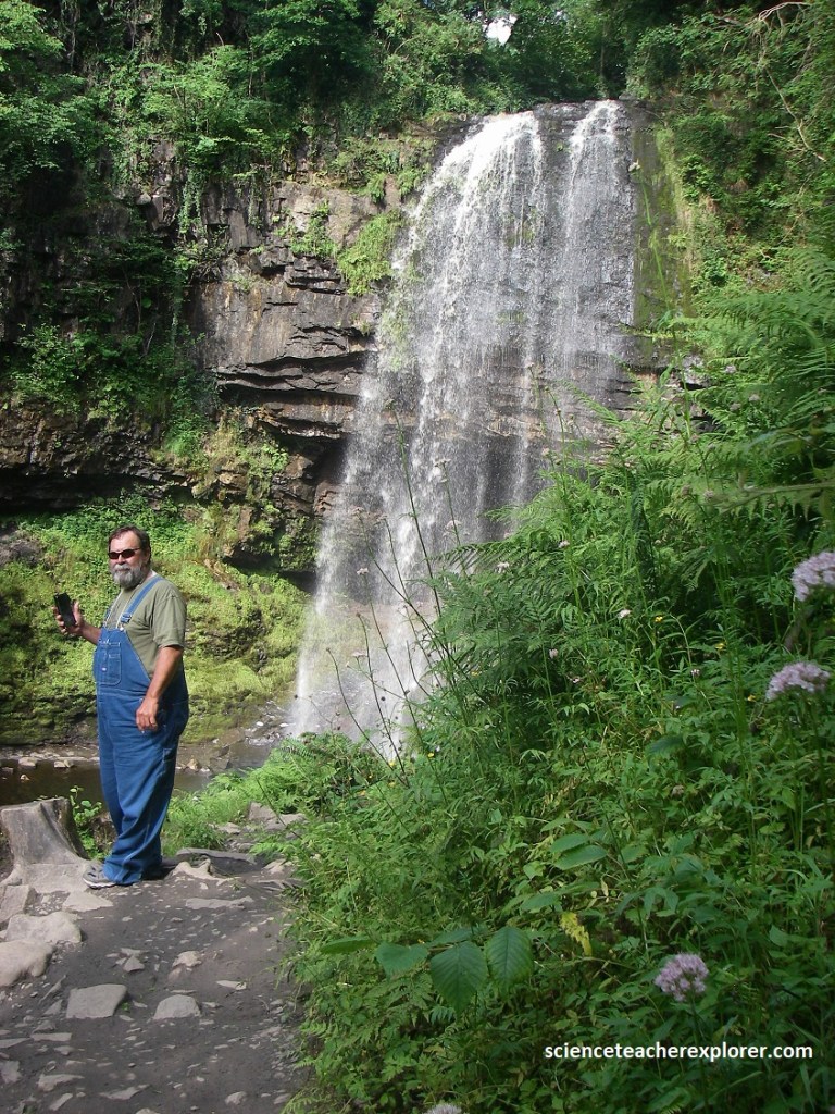
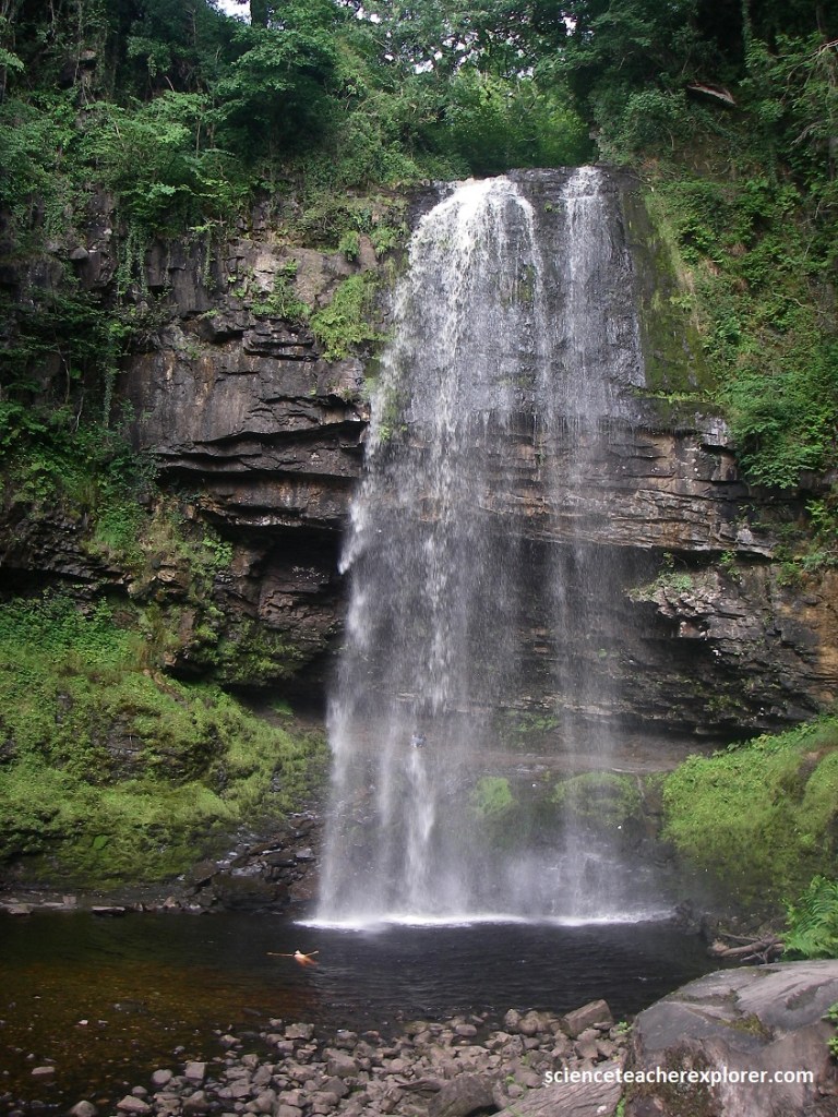
Henrhyd Falls is a beautiful waterfall in a deep wooded gorge, (Graig Llech), on the stream known as Nant Llech at Coelbren in the Swansea Valley.
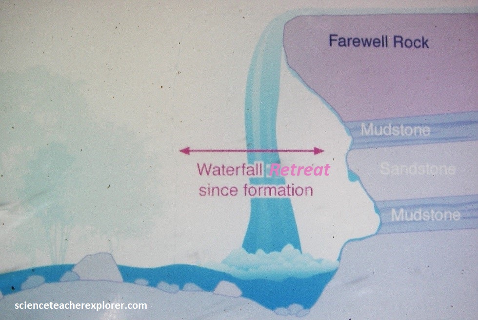
Henrhyd Falls has an unbroden drop of about 28m, making it the highest waterfall in the Brecon Beacons National Park. Pictured above, the top half of the cliff is composed of a hard, resistant, coarse-grained sandstone called the Farewell Formation, which defines the edge of the South Wales Coal Measures. It is part of the Marros Group, formerly known as the Millstone Grit series.
Below the Farewell Rock, the waterfall plunges onto softer strata, specifically the Subcrenatum Sandstone, which contributes to the recessed, undercut nature of the cliff face. The rocks here are of Late Carboniferous (Pennsylvanian) age, roughly 323–299 million years old.
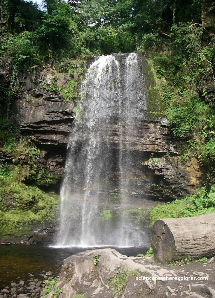
However, the Henrhyd fall’s existence is actually due to the Henrhyd Fault, a geological fracture that created a steep, vertical drop along the Nant Llech river. Located near Coelbren in Powys, the falls have retreated over 50m since the last Ice Age, creating a steep, wooded gorge called the Graig Llech.
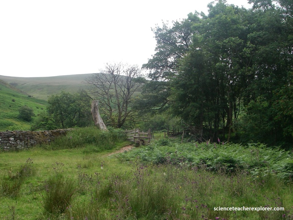
There are many other waterfalls in the south of the national park. The area within a triangle formed by the villages of Hirwaun, Ystradfellte, and Pontneddfechan is often referred to as “Waterfall Country”. Numerous waterfalls are found along the rivers Nedd, Mellte, Hepste, and Pyrddin; the highlight of these being Sgwd-y-Eira on the River Hepste.
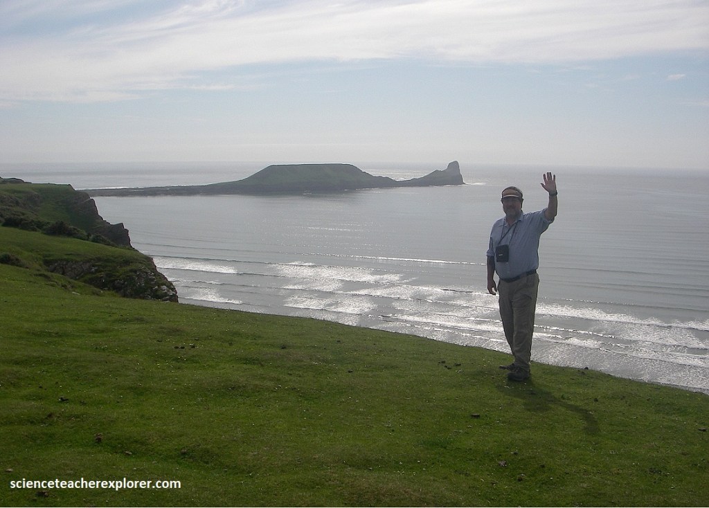
Our next and last destination geo-site was the Gower Peninsula & Worm’s Head. Driving to Worm’s Head in Rhossili, Gower, we took the M4 to Junction 47 (Penllergaer). We then turned south on A483 to junction A483/A4216 and turned right. We followed A4216 (Station Road) to the A4216/Vivien Road Junction and turned onto Vivien Road through Sketty, until Gower Road (A4118). We turned right (east) again and drove all the way to Scurlage at the A4118/B4247 intersection. By turning right onto the B4247, it led us directly to the National Trust car park at Rhossili, (closest to Worm’s Head).
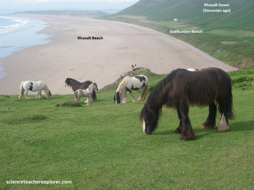
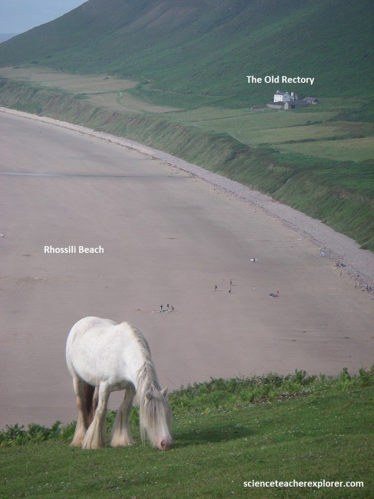
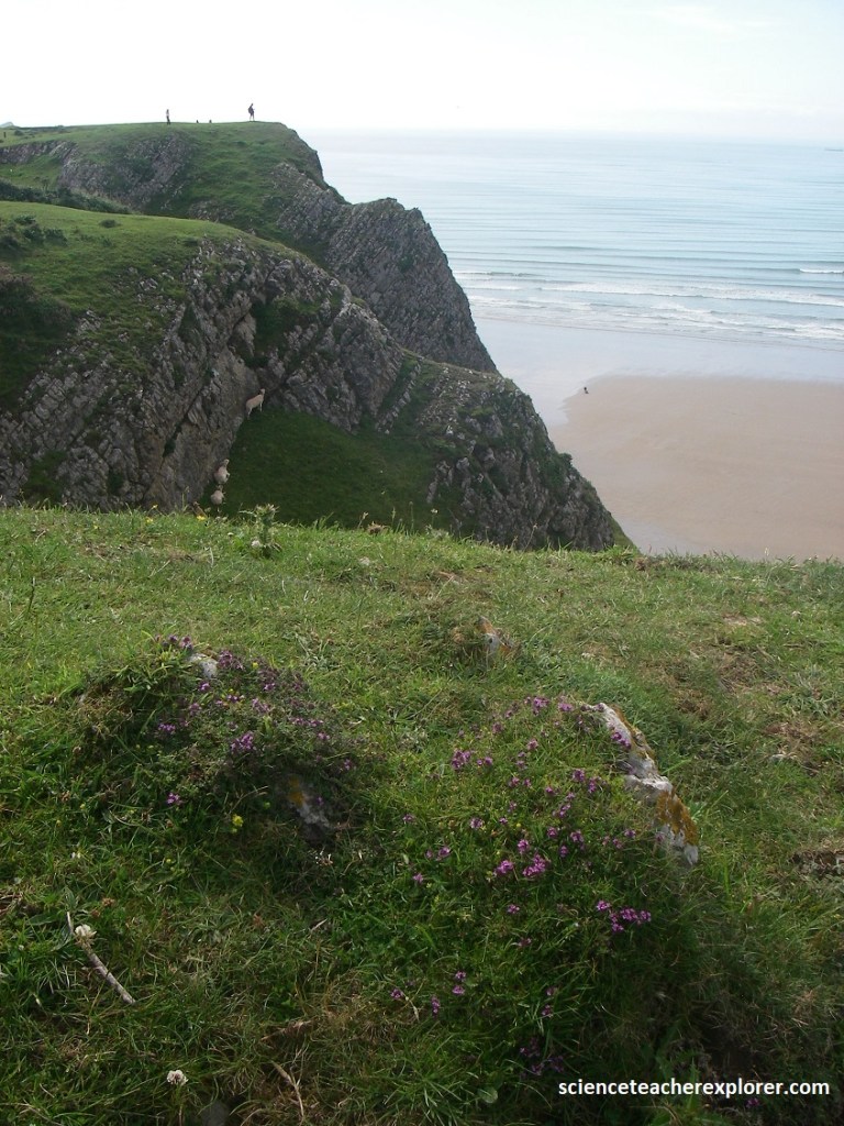
The Gower Peninsula, a designated Area of outstanding Natural Beauty, pushes out into the Bristol Channel between the estuaries of the River Loughor and Tawe. Pictured above, the Rhossili Down (often referred to in the context of the Gower Peninsula) is a prominent, high-elevation ridge located at the western tip of the Gower Peninsula. It is primarily composed of resistant Devonian-aged Old Red Sandstone, specifically quartz conglomerate and sandstone, which forms a prominent ridge rising above the coast. {Note: The pony’s seen above are considered semi-feral or wild. They are sometimes referred to as hardy Gypsy Cobs that can live outside year-round}.
Pictured above, a solifluction bench is seen above the Rhossili Beach, (formed by the sludging of large quantities of surface material down the scarp at the end of the Ice Age). This formed an apron, which the sea has now truncated at the head of the beach, where there is a low cliff of loose material from the Rhossili Down.
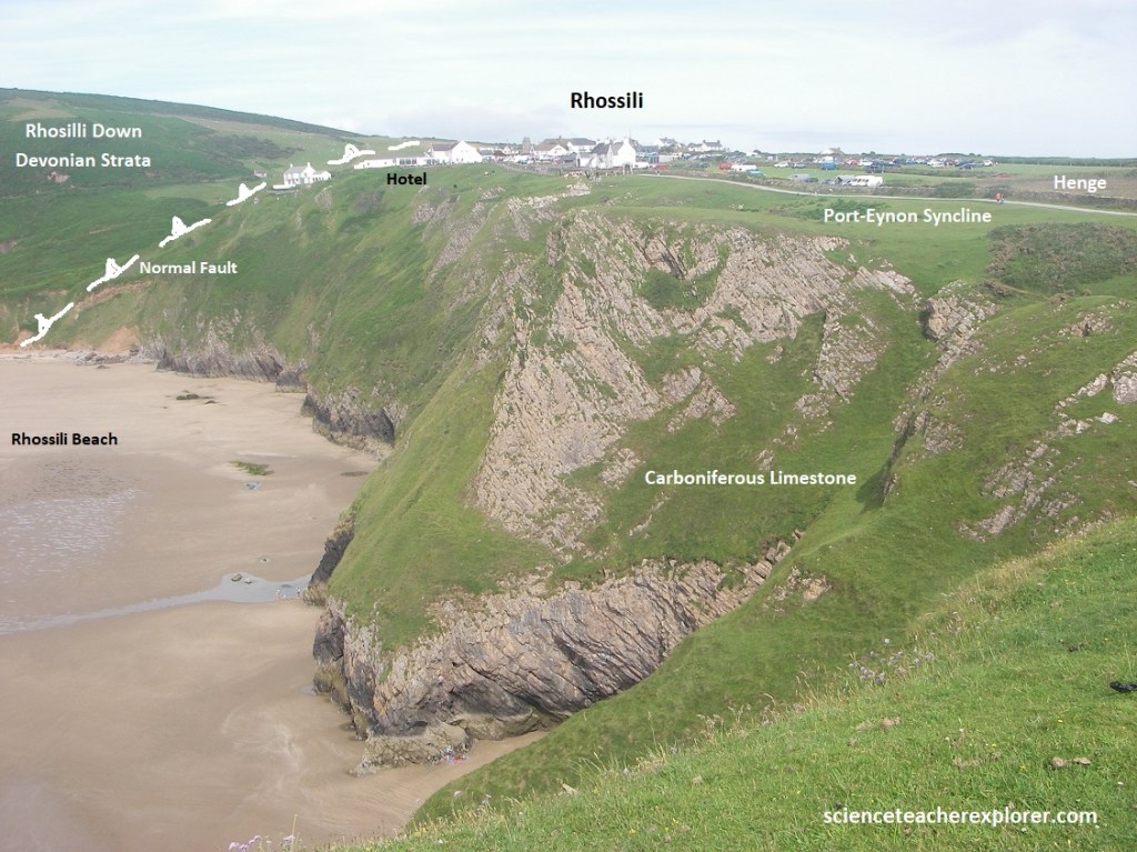
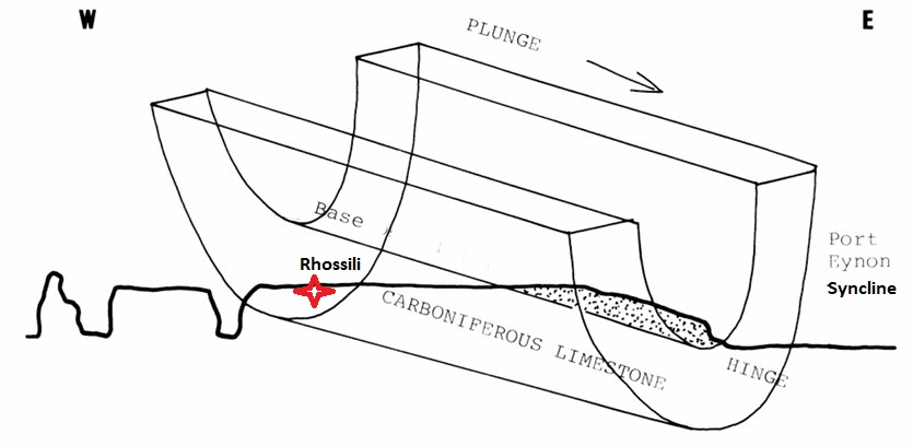
Pictured above, the strata in the Carboniferous Limestone is obvious. However, the dip indicates that a syncline passes somewhere to the south of the settlement of Rhossili, or possibly, underneath. According the image below, it is called the Port-Eynon Syncline.
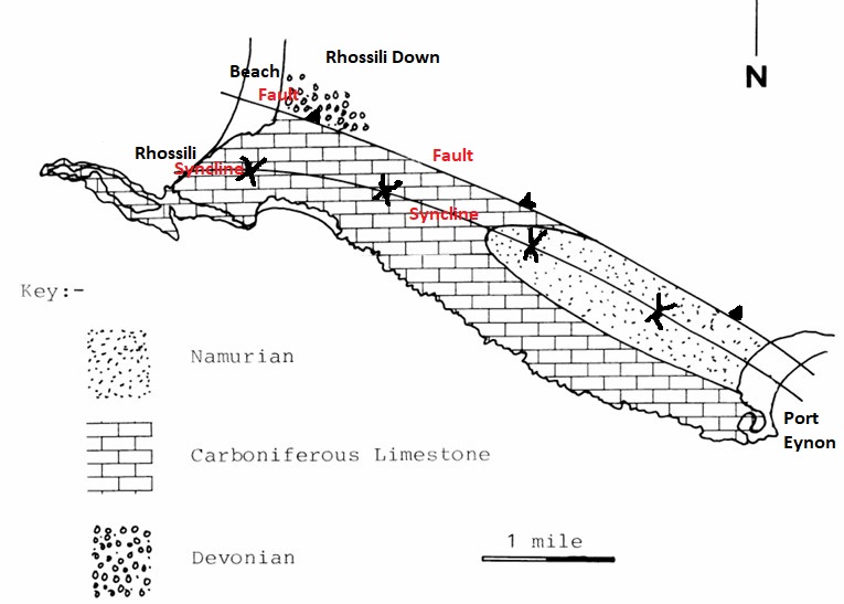
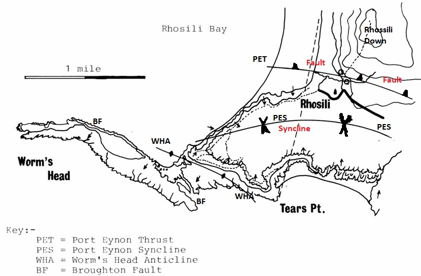
The Port-Eynon Syncline (imaged below) is plunging to the east. The picture above, showed the view of the cliffs eastward towards Rhosili.
This folding and faulting on the Gower Peninsula was primarily caused by intense compressional forces during the Variscan Orogeny, roughly 280 million years ago, during the late Carboniferous to early Permian periods. This mountain-building event caused by continental collision created the eastern-western trending folds, thrust faults, and significant crustal shortening observed in the southern Gower Peninsula.
Pictured above, there is a gradual decrease of dip in the limestones as I got closer to the axis of the syncline, but near the cliffs, I see a steeply dipping strata towards the south. The limestone rock layers were formed roughly 300-350 million years ago, primarily from marine sediments, and later folded into the current structure during the Variscan orogeny, (mentioned above).
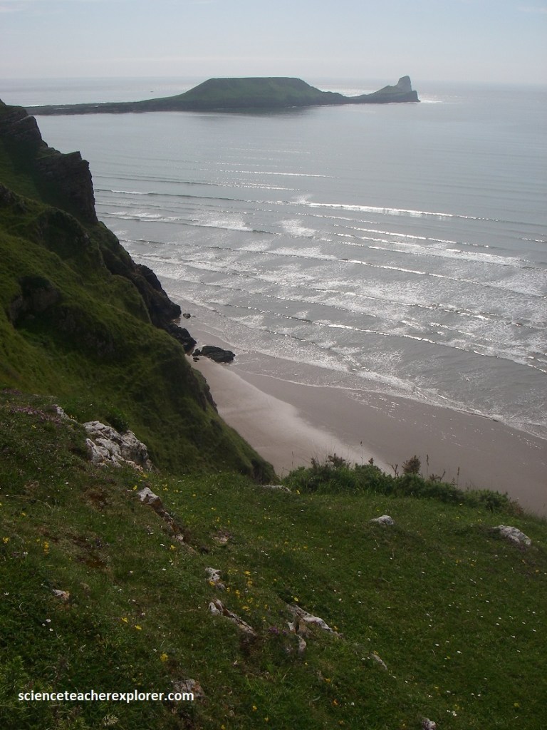
The Worm’s Head island is part of a complex geological structure featuring an anticline (paired with the Port-Eynon Syncline ) and is dominated by hard Carboniferous limestone, with some areas showing softer limestone allowing for rapid erosion. The rocky causeway connecting the island to the mainland is a wave-cut platform that consists of tilted layers of limestone that have been eroded into a treacherous, pock-marked surface with deep gullies, which are submerged at high tide. Located on the Middle Head, this is a natural arch formed by the collapse of a sea cave roof.
Pictured above, the Worm’s Head is a 1.6 km long limestone promontory at the westernmost tip of the Gower Peninsula, (reached by a causeway that is covered by the sea at high tide), but is possible for 2 hours either side of low tide. At high tide, the sea cuts off the Worm and only then does it truly resemble a wurm, the old English word for “dragon” or “serpent”.
