H.E.S.S., NA 2025
In June of 2025; I found myself exploring & trekking the country of Namibia.
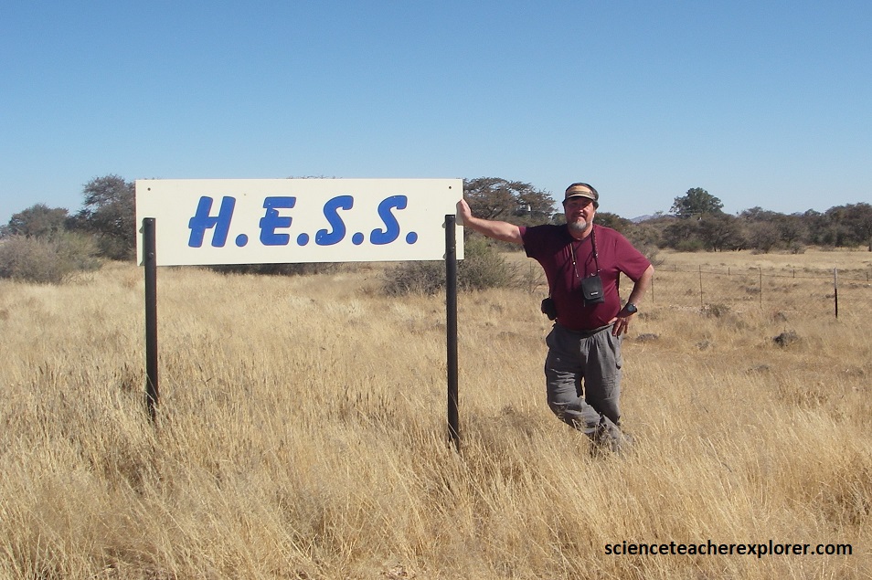
One of my primary scientific-goals was to visit the H.E.S.S. facility in Central Namibia, (southwest of Windhoek).
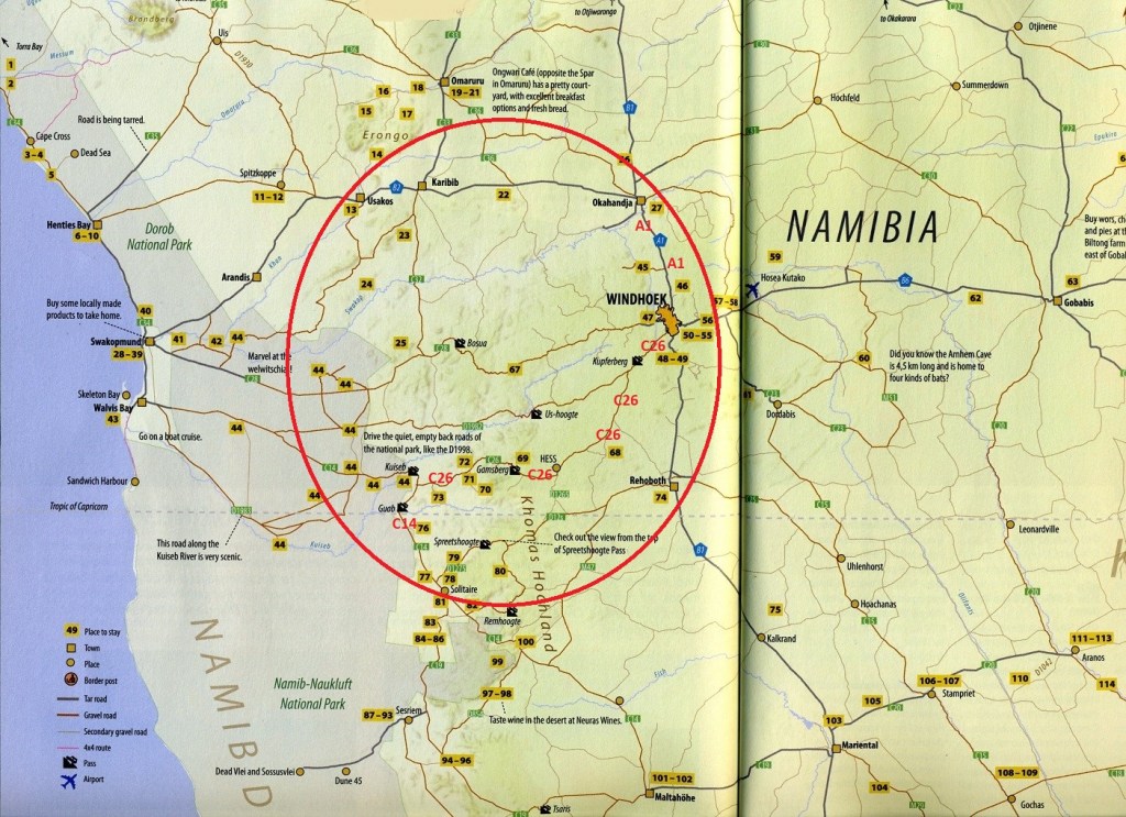
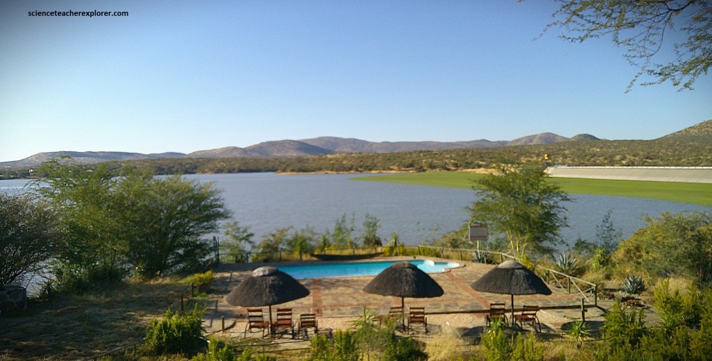
I started the morning at the Von Back Dam, (a few kilometers southeast of Okahandja, Namibia). I was planning to drive from the there to Sesriem, Namibia, in one day, and make a brief stop to visit H.E.S.S., along the way. Most of the trip was graveled road.
From Okahandja, I drove southeast on Highway A1, towards Windhoek. Highway A1 was the only freeway I found Namibia and it seemed to follow a series north/south parallel faults.
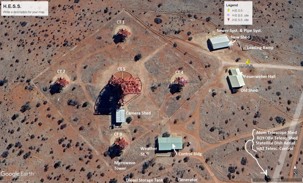
These linear geological structures, can be seen on the “Google Earth” satellite-map below.
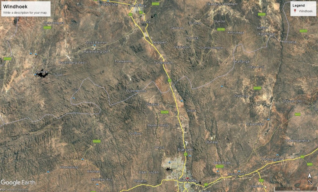
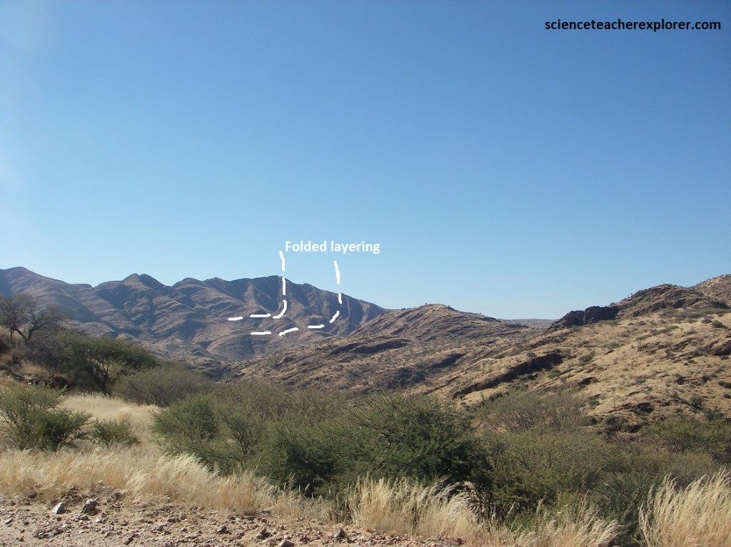
Apparantly, the so-called “Windhoek Graben (rift)” is part of this major geological-fault system. This geological graben developed during the Tertiary period in response to extension processes within the earth’s crust as a consequence of the break-up of the Gondwanaland Continent. Between the deep-reaching north/south trending faults, several blocks of rock were displaced downward, (image below).
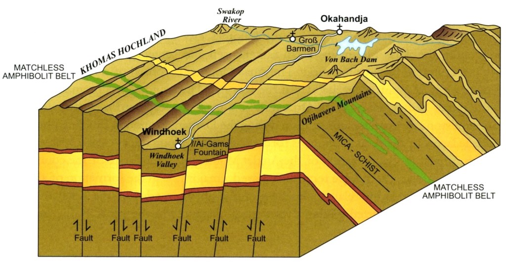
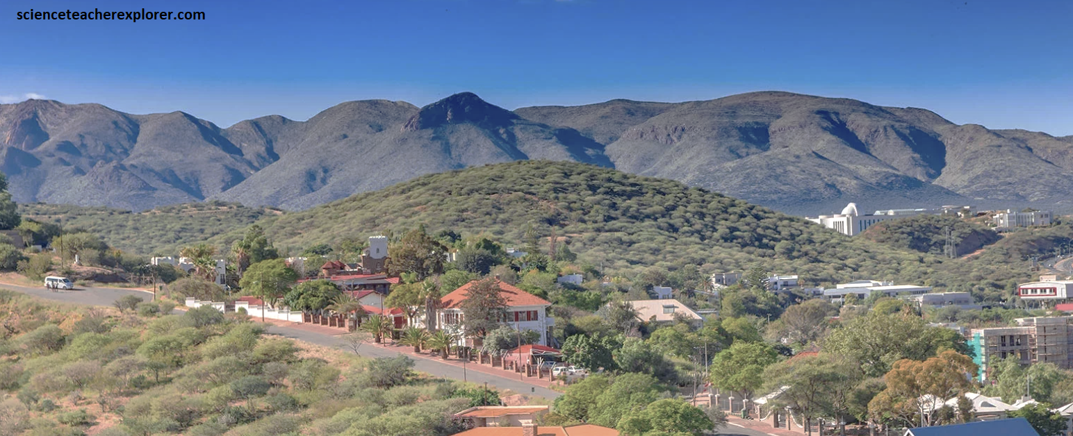
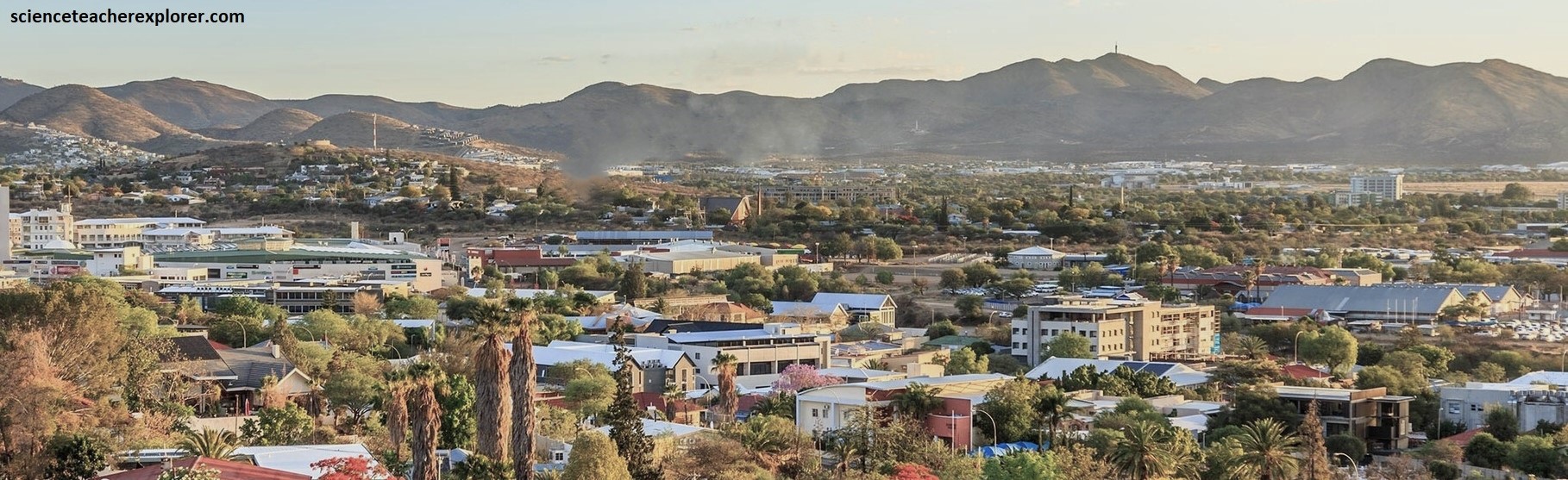
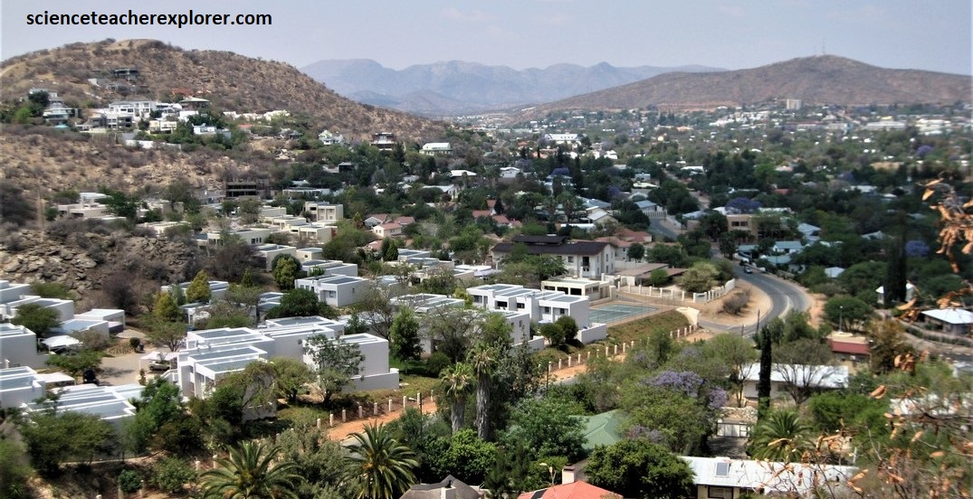
Imaged above, the “Windhoek Graben” structure has dimensions of about 150km in length and 20km wide. The center of Windhoek is situated in the lowest valley and is surrounded by the mountain ranges of the Otjihavera Mountains to the east and the Khomas Hochland to the west, (pictured below in Windhoek). {Note that these deep-seated faults provide a significant amount of thermal-waters & groundwater to the Windhoek City}.
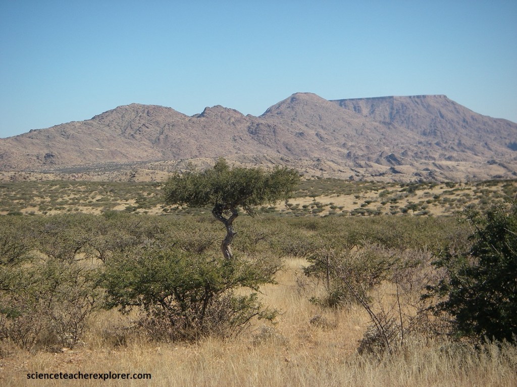
After driving through Windhoek, I turned off onto C26, that headed southwest into and onto the Auas Mountains on the southside of the Windhoek Graben. This graben formation and the associated Tertiary volcanism in the Auas Mountains took place some 35 million years ago, and is associated with the ongoing opening of the Atlantic Ocean.
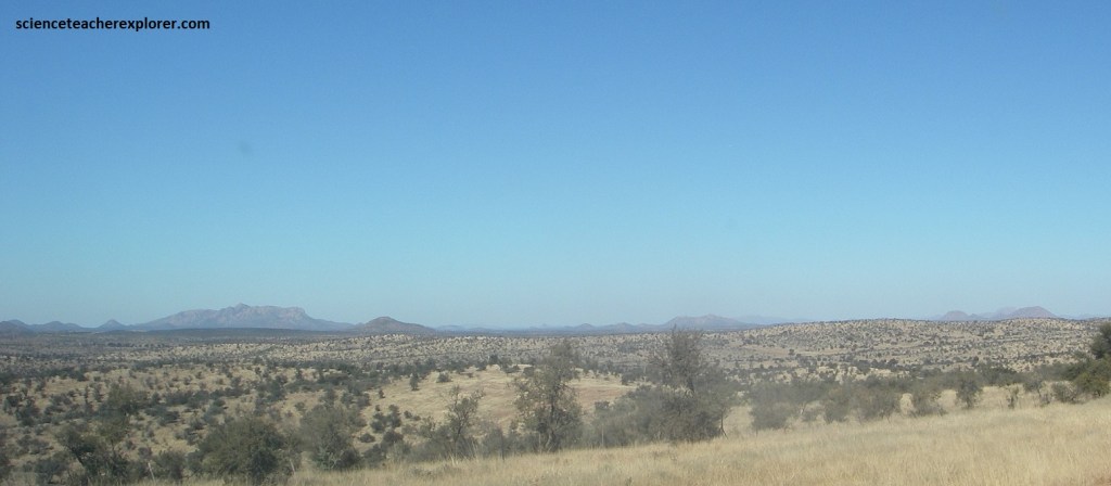
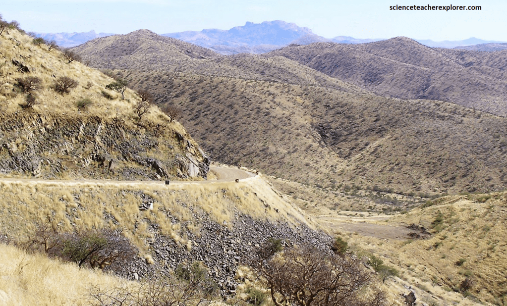
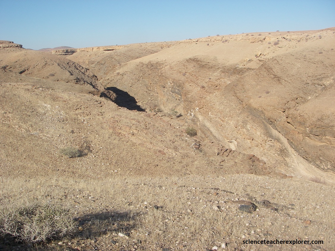
The Auas Mountains, which are cut by the southern extensions of the extension fault zones, (mentioned above), are dissected by numerous volcanic and subvolcanic bodies, (pictured below). These bodies are usually solidified throat fillings of the former fire mountains. Because of their great mechanical hardness, these magmatic vents have formed weathering resistant bodies which can be see from C26. The associated volcanic rocks mainly consist of trachytes (light-colored & feldspar-rich) and phonolites.

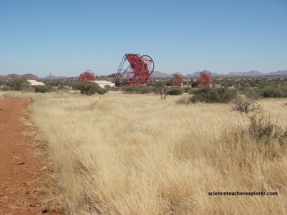
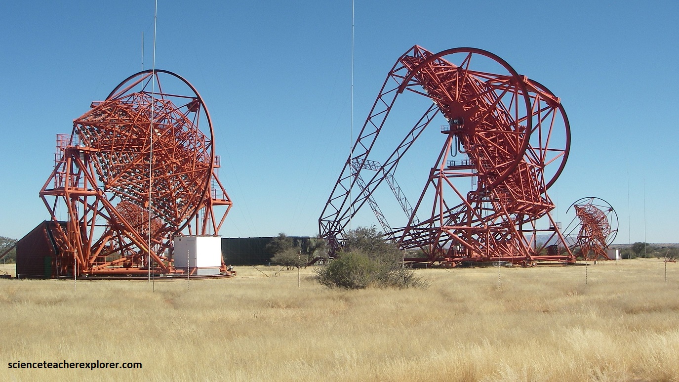
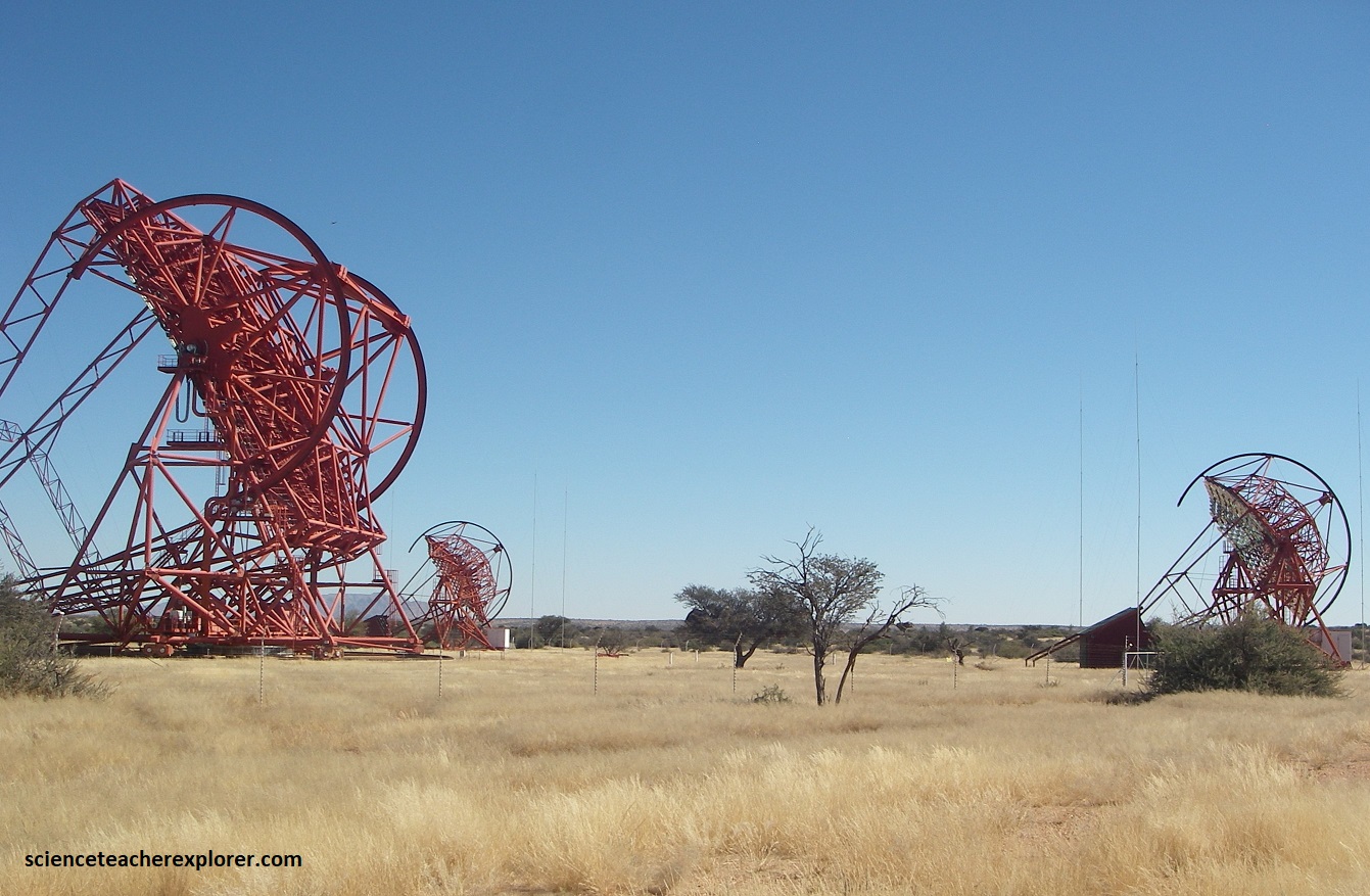
About 111 km southeast of Windhoek on C26 is H.E.S.S.. Because of its crisp, clear skies and because its latitude is well suited to observations of the Galactic Center, the area near the Gamsberg Pass on C26, is home to the world’s largest gamma-ray observatory, the High Energy Stereoscopic System (H.E.S.S.). {The acronym H.E.S.S. honors Victor Hess, who was awarded the Nobel Prize in 1936 for his discovery of cosmic rays in 1912.
The H.E.S.S. observatory has been ranked the 10th most influential observatory in the world, competing with others as famous as the Hubble Space Telescope. Inaugurated in 2004 with 4 telescopes, and extended in 2012 with the addition of a much larger telescope, the H.E.S.S. has operates as a stereoscopic viewing system of atmospheric gamma-ray showers through it’s 5 telescopes of varying sizes.

The 5 telescopes are grouped in a square with 120m sides, with the large 28m diameter telescope in the center of the array. The four smaller telescopes are designed to detect gamma rays that have energies between 100 GeV and 100 TeV. They can view a 50 diameter patch of the sky (10x the moon diameter). The large telescope has a 3.20field of view. It can detect gamma rays with energies above 20GeV. These so-called Cherenkov telescopes work by means of indirect measurements by detecting optical light flashes cause by interactions between the incoming gamma-ray photons and the atmosphere. (The image on the left below was taken from an interpretive sign on-site).
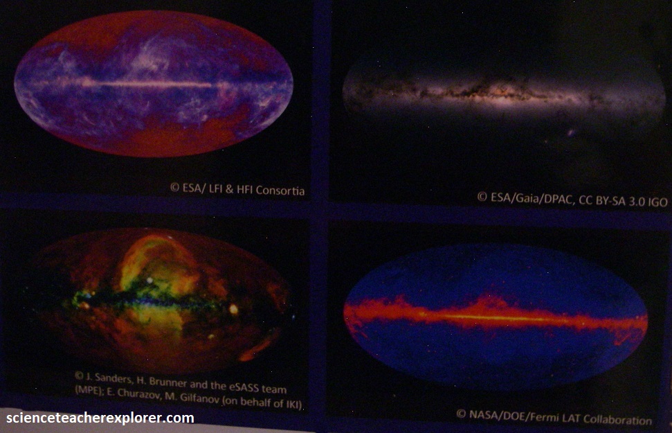
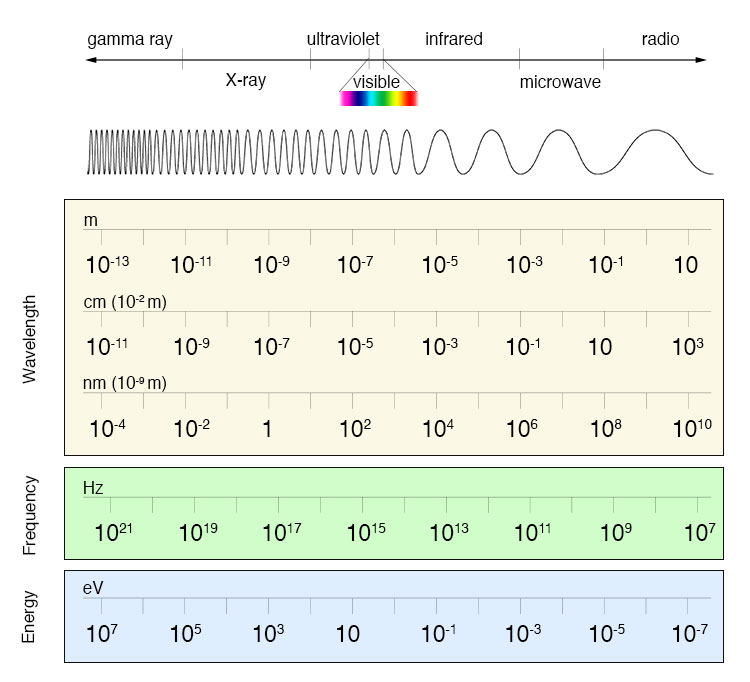
Visible light, which we can see with our own eyes, represents just a tiny fraction of the spectrum of electromagnetic radiation. This whole radiation constantly bombards the Earth and imparts information about the Universe. In the past century, larger and larger portions of the electromagnetic spectrum have become accessible using new observation techniques, each time giving a new picture of the Universe and teaching us more about it’s history and it’s future. (The image below was taken from an interpretive sign on-site).
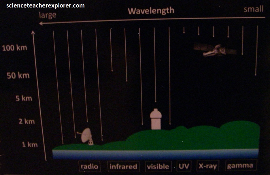
The atmosphere is opaque to most of the electromagnetic spectrum because the radiation is absorbed. This radiation can only be observed by satellites or, (in the case of gamma rays), by detecting secondary particles generated in the atmosphere, known as indirect gamma-ray detection. The most successful technique for indirect gamma-ray detection uses Cherenkov telescopes. (The images below were taken from an interpretive sign on-site).
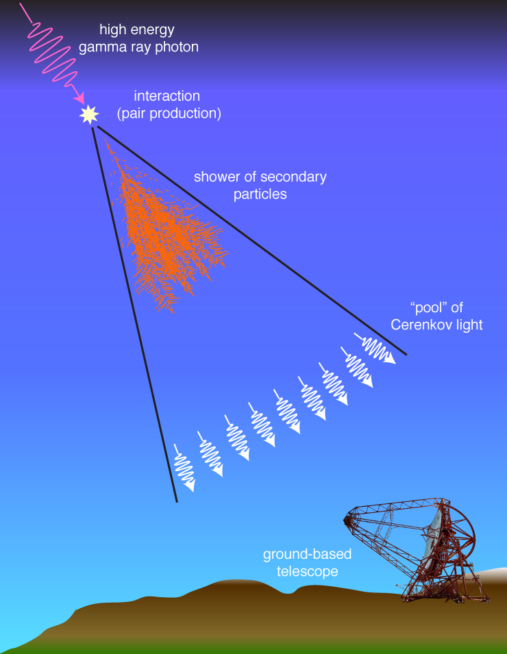

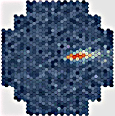
Nothing’s faster than c, the speed of light … in a vacuum. In the atmosphere or water (or glass), the speed of light is slower than c. So what happens when something like a cosmic ray proton – which is moving way faster than the speed of light in the air or water – hits the Earth’s atmosphere? It emits a cone of light, like the sonic boom of a supersonic plane; that light is Cherenkov radiation. Gamma rays are created in extreme environments in the Universe. When these high-energy photons dive into the Earth’s atmosphere, they interact via pair production and create extensive air showers, starting at around 10-20km above the ground. In these showers, charged particles move faster than the local speed of light, which causes the emission of Cherenkov photons, creating a cone of blue light. At ground level, this yields a faint pool of Cherenkov light with a radius of around 100m for a few nanoseconds. Cherenkov telescopes, with their sensitive high-speed cameras and large mirrors, capture part of this fain light flash to create an image of the air shower. From these we can reconstruct the gamma ray’s energy and direction, (from the 5 telescopes). {The image below on the right was taken from an interpretive sign on-site, the other is a camera that is usually seen at the mirror focus}.
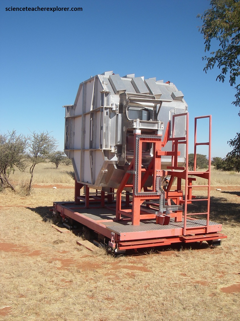
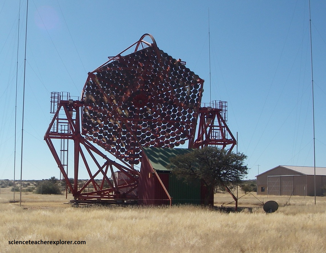
Cherenkov telescopes are similar to optical telescopes. They use a large mirror with 380 facets to collect the Cherenkov light and focus it onto the camera, (pictured above). Each Cherenkov light flash last only for a few nanoseconds (0.000000001 sec) and is very faint (approx. a few 100s of photons per m2). these flashes are too weak and quick for the human eye to detect, but are easily recorded by the Cherenkov camera with 7 Pixel LED.
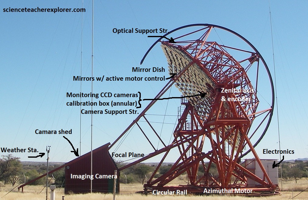
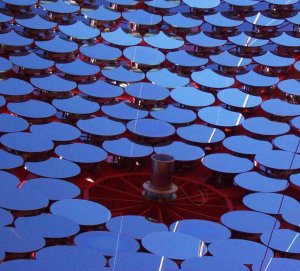
Picture above, Cherenkov telescopes consist of a mirror, which focuses the incident light, and a light detector, (the camera) to record the images. A mount holds the dish, which supports the tesselated mirror with its focal length of 15m. The mount can be rotated on a big circular rail, and also the dish can be rotated allowing the telescopes to point at stars and deep-sky objects, and to track them across the sky. The camera sits at the focal point of the mirror, supported by four camera masts. The mount and dish are sturdy steel structures, designed for high rigidity. The steel structure weighs 60 tonnes. A computer-controlled drive system steer the telescopes. The diameter of the dish is more than 12m, and the mirror area 108m2. Rather than using a single big mirror, which would both be very heavy and very costly, the mirror is composed of 380 round mirror tiles of 60cm diameter. The mirrors consist of ground glass with an aluminized front surface. The 380 mirror tiles need to be aligned relative to each other with high precision. Each tile can be moved under remote control using two motor driven actuators, which provide a precision of a few thousandth of a millimeter. To align the mirrors, the telescope is pointed at a star; a CCD camera in the center of the dish records the resulting image and moves the actuators for best image quality. {Images below were taken from “Universe Today Article: Cherenkov Radiation”, J. Tate, 2009)
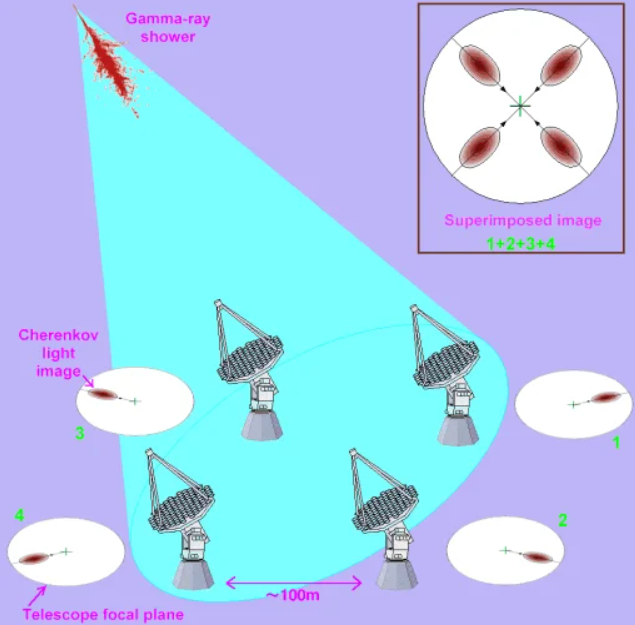
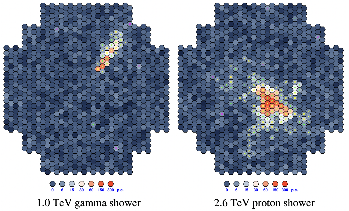
Pictured above, the images seen by the cameras are images of air showers, and not images of the gamma-ray sources in the sky. To generate a sky image, a computer program combines up to 4 images of the air shower and determines its direction, and also the amount of energy deposited in the atmosphere. The origin of the gamma ray is then plotted as point on a map of the sky. Many such points combined provide an image of t gamma ray source, and one can determine the shape of the source, and energy spectrum of the gamma rays (color). Since each high-energy gamma ray carries a lot of energy, (1000 billion quanta of normal light), the are produced at a much lower rate than starlight. To collect enough gamma rays to diagnose what is happening inside a cosmic particle accelerator, one needs to point the telescopes at this source for many hours, (sometimes several 100 hrs.). (The images below were taken from an interpretive sign on-site).
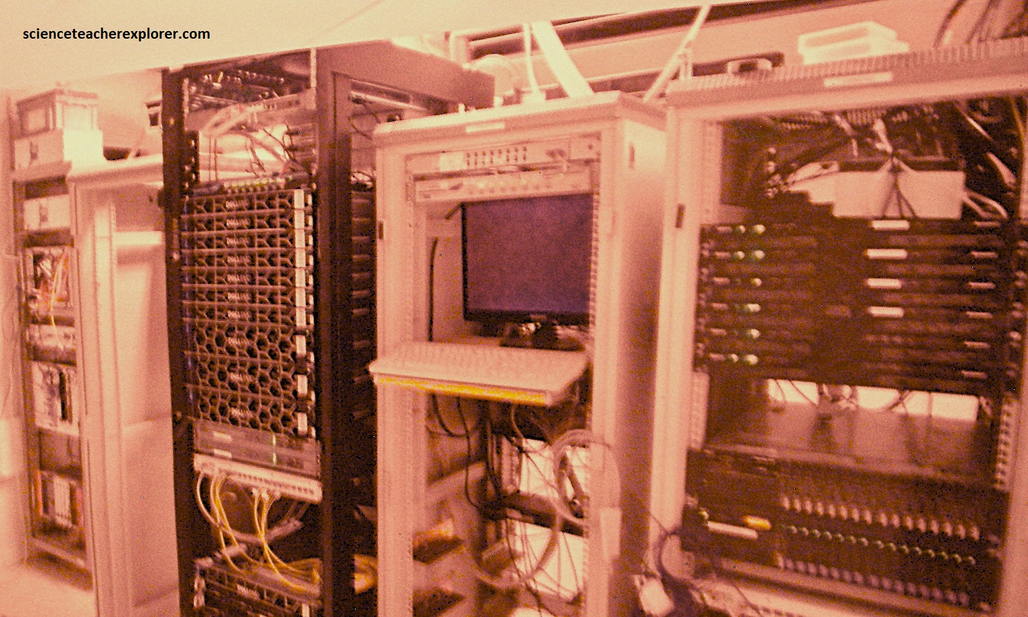
Pictured above, the control computers are able to steer the telescopes and control data acquisition automatically throughout the night, slewing the telescope from one object to the next according to a target list. H.E.S.S. includes and entire server room on site, located in the control building. The job of the computing farm is to process and store the enormous amounts of data taken by the telescope array. Nearly 200 TB of disk space is available for data storage, which is sufficient for a few months of data taking. These powerful computers are all located in the server room. The server room also hosts the central trigger, which looks for the coincident signals between different telescopes, indicating that a gamma ray could have been detected. The central trigger is an important first filter: the telescopes report signals thousands of times a second (kHz), whilst the gamma-ray rate is once every 1 to 1/1000 ths per second (Hz to mHz).
{Images above are taken from the eoportal HESS site & ScienceDirect.com}
Note: The array of telescopes is operated from the Control Room by a set of two or three shifters every night. The shifters guide the operations, organize the observing schedule, (with the help of automated software), and keep an eye of the array. From the main computer, the shifters can control the entire array. Nine additional computer screens show real-time statuses such as camera images and the telescope pointing directions, as well as atmospheric properties such as the sky quality and the weather.
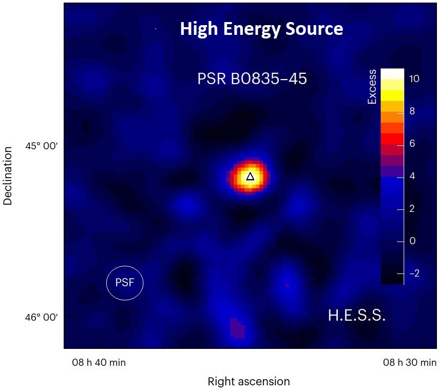
Gamma rays, (the most energetic rays in the universe), are our best way of observing cosmic particle accelerators such as supernova remnants and pulsar wind nebulae, all end products of massive imploding stars. Because of Namibia’s position on the planet, the H.E.S.S. has access to , and can observe the central regions of our galaxy where a great number of cosmic objects are located. such as supernovae, pulsars, active galactic nuclei, dark accelerators, gamma-ray bursts, micro-quasars and black holes. It may even be a great way to explore the mysterious dark-energy.
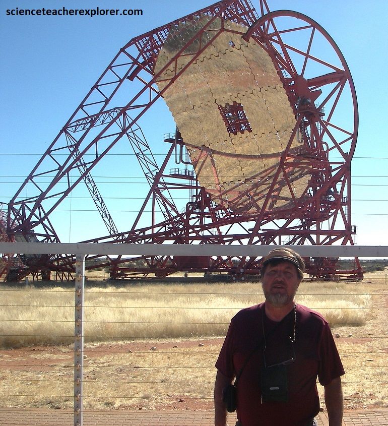
Pictured above, the impressively huge single dish named the ‘HESS II Telescope’ is 32.6m x 24.3m (equivalent to a 28m-diameter circular dish), weighs 58o tonnes and displays a total mirror area of 614m2. The telescope enables unparalleled observation of high-energy processes in the universe.
The H.E.S.S. observatory is operated by a collaboration of more than 260 scientists from some 40 scientific institutions and 13 different countries.
The H.E.S.S. telescopes are located in the Khomas Hochland (Highland) in Namibia, 1800m above sea level. As mentioned above, this position offers exceptional optical conditions, with an incredibly clear sky. The Galactic Center, one of the most exciting places in astronomy is plainly visible. The location is readily accessible and has a mild climate.
Once spending a lunch, exploring H.E.S.S., I continued driving west towards the nearby Gamsberg Pass. The Khomas Hochland extended west of Windhoek to the Great Escarpment. At the Gamsberg Pass, which represents the southwestern boundary, the Hochland drops steeply for about 1,000m to the Namib Desert below. Pictured above, the Gamsberg’s flat top is 2,332 meters above sea level (3rd highest in Namibia), and is the highest point on the escarpment, commanding a grand view over the Namib to the west. It is covered by a hard quartzite layer that protects the mountain from erosion. Beneath its capping, Gamsberg is granite formed from magmatic intrusions some 1.1 billion years ago.
The geological history of the Khomas Hochland and the nearby Auas Mountains began at least 750 million years ago. At this time, parts of southern Africa consisted of two independent mainland areas or cratons; the Congo Craton in the north and the Kalahari Craton in the southeast. They were separated by an elongated narrow branch of sea, the Damara Mobile Belt. In this sea the erosion debris from the cratons accumulated over millions of years and in the deep-sea areas mainly clayey-sandy sediments were deposited.
In this area, 650 million years ago, the marine sediments between the two cratons were piled up into a huge folded mountain chain as a consequence of the plate tectonic collision between these two cratons. The prevailing extreme pressure and temperature conditions at great depth thus transformed the sandy-clayey deep-sea deposits into metamorphic rocks, called mica-schists.
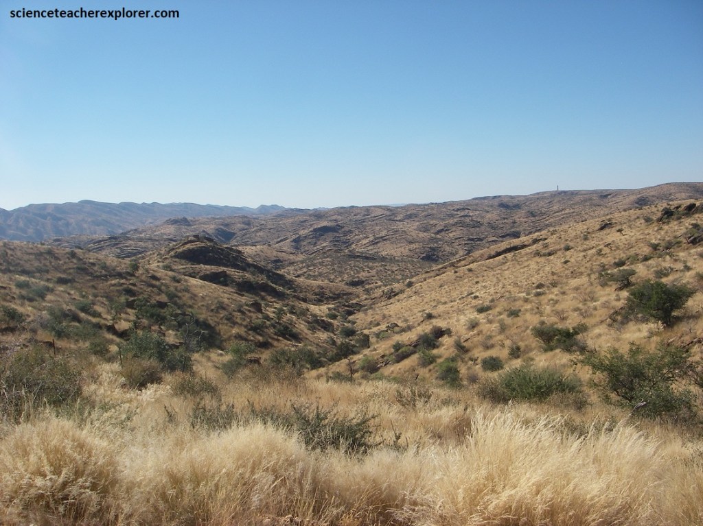
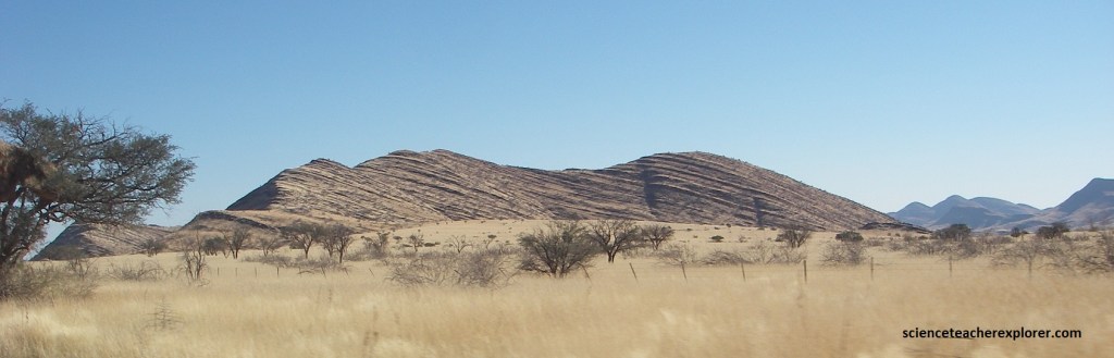
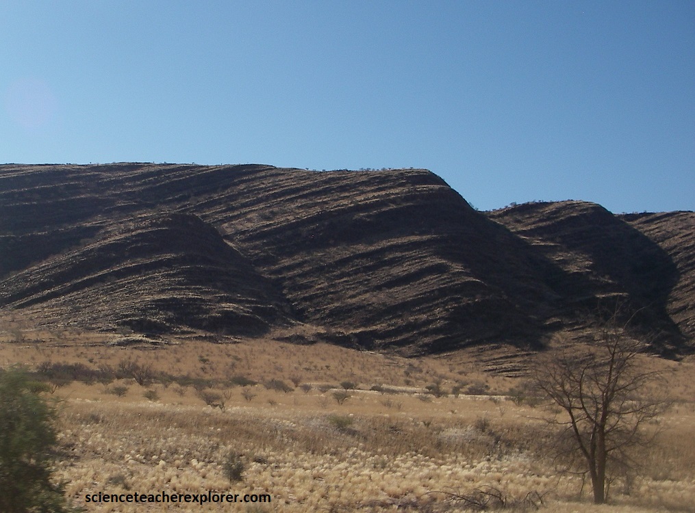
Mica-schists form the present Khomas Hochland. Pictured above shows extensive folding from the ‘Damara Mountain Building’ event. The frequently undulating or folded structures are caused by the tectonic processes during the mountain building period. Over the subsequent millions of years, the newly formed Damara Mountains were subjected to the forces of weathering and erosion. After being heavily leveled approximately 120 million years ago and following the separation of Gondwana, an extensive uplift started. The area of the present Khomas Hochland was pressed up several kilometers by enormous forces within the interior of the earth and forming the Great Namibian Escarpment.
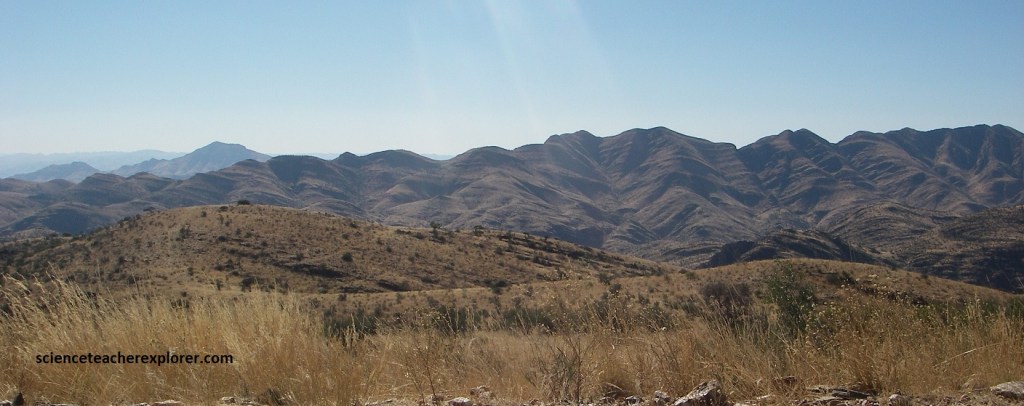
Pictured above, the slopes of Gamsberg Pass exhibit distinct steps, with harder, quartz-vein-reinforced units (slopes of 78°-85°) alternating with weaker, sheared schist units (slopes of 26° to 37°). The Great Namibian Escarpment, which the pass traverses, formed 120 million years ago during the breakup of Gondwanaland, resulting in the steep rise from the Namib Desert.
As I drove off of the ‘Great Namibian Escarpment’ from Gamsberg Pass on C26, the area featured highly sheared, schistose rocks (altered flysch) that created a stepped, steep-slope topography due to alternating quartz-rich and schist units.
Pictured above, the foothills along Namibia’s C26 route was defined by the Great Escarpment, featuring complex Proterozoic metamorphic rocks, Damara-aged folded sediments, and younger granite intrusions. This rugged, arid landscape consisted of steep slopes and canyons, where erosion had exposed a few granite domes, schist, and sedimentary layers that were tilted toward the east from the breakup of Gondwanaland.

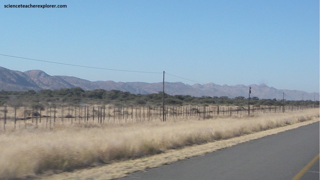
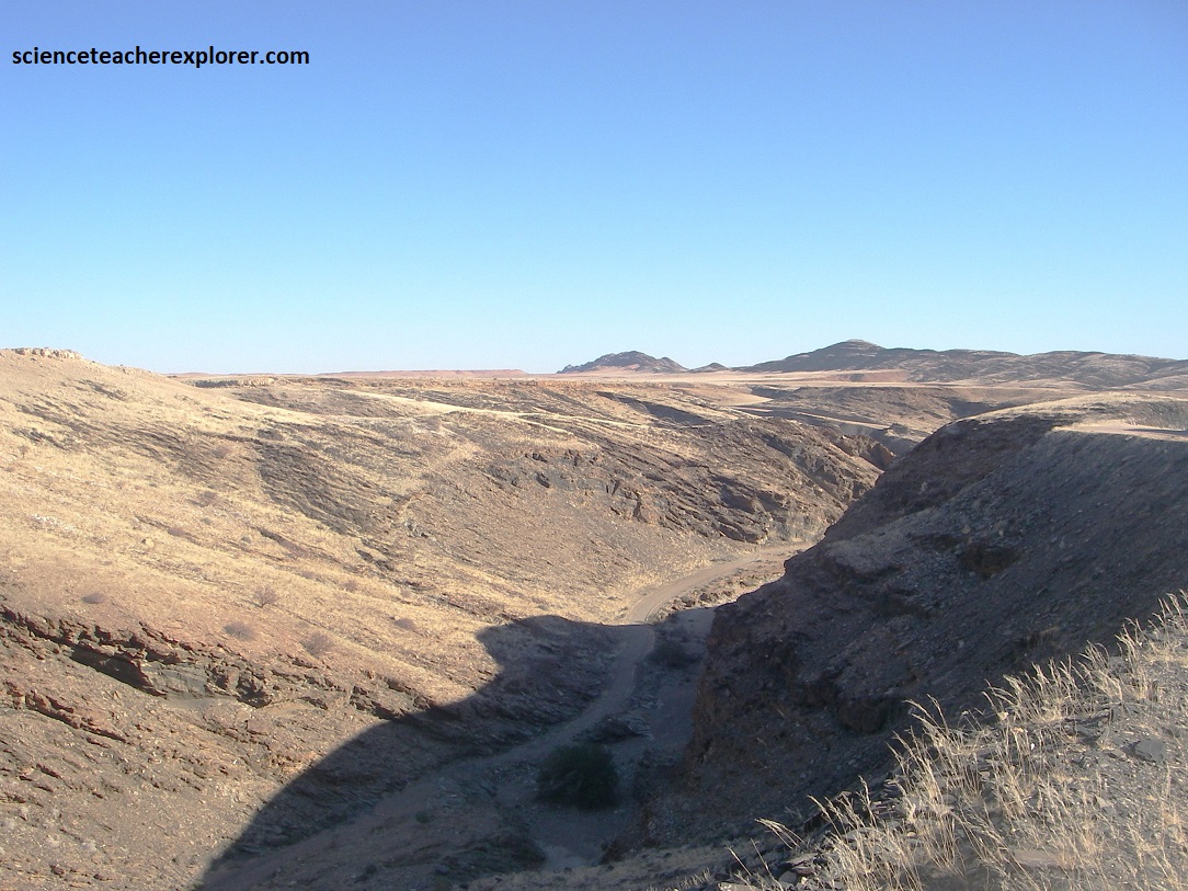
Eventually, the graveled road C26 ended at the C26/C14 junction. I turned left, (south), and drove across some very serious grassland, (pictured above). Deep-reaching weathering processes, combined with strong erosion by the Kuiseb River, levelled the landscape here. The erosion reached its peak after the continental edges had been lifted up by tectonic equilization movements in association with the disintegration of Gondwanaland. This increase the erosive forces of Kuiseb River considerably, as it flowed from a greater height towards the coast. The levelling of the coastal platform was accelerated and the escarpment was pushed further inland by retreating erosion. This coastal platform change on C14 when I approached Gaub Pass, (pictured below).
The C14 road at Gaub Pass in Namibia ran through a rugged, arid landscape characterized by intense geological deformation, featuring greenish Nama Shale and quartzite, alongside the massive Piksteel granodiorite. It had an elevation of 750m above the sea level in the foothills of the Naukluft Mountains. The area is part of the Damara Mountain Building episode that was mentioned above, showcasing the Naukluft nappe complex’s folded & deformed rock structures.
The area at Guab Pass represents a transition between the Namib Desert plains to the west and the mountainous highland edge. I crossed the Gaub Bridge in the dry season and there were not any running water in the Gaub River. However, it appeared that the bridge had been taken out a few times in the past by a recent flash floods. The Gaub River is a tributary of the Kuiseb River.
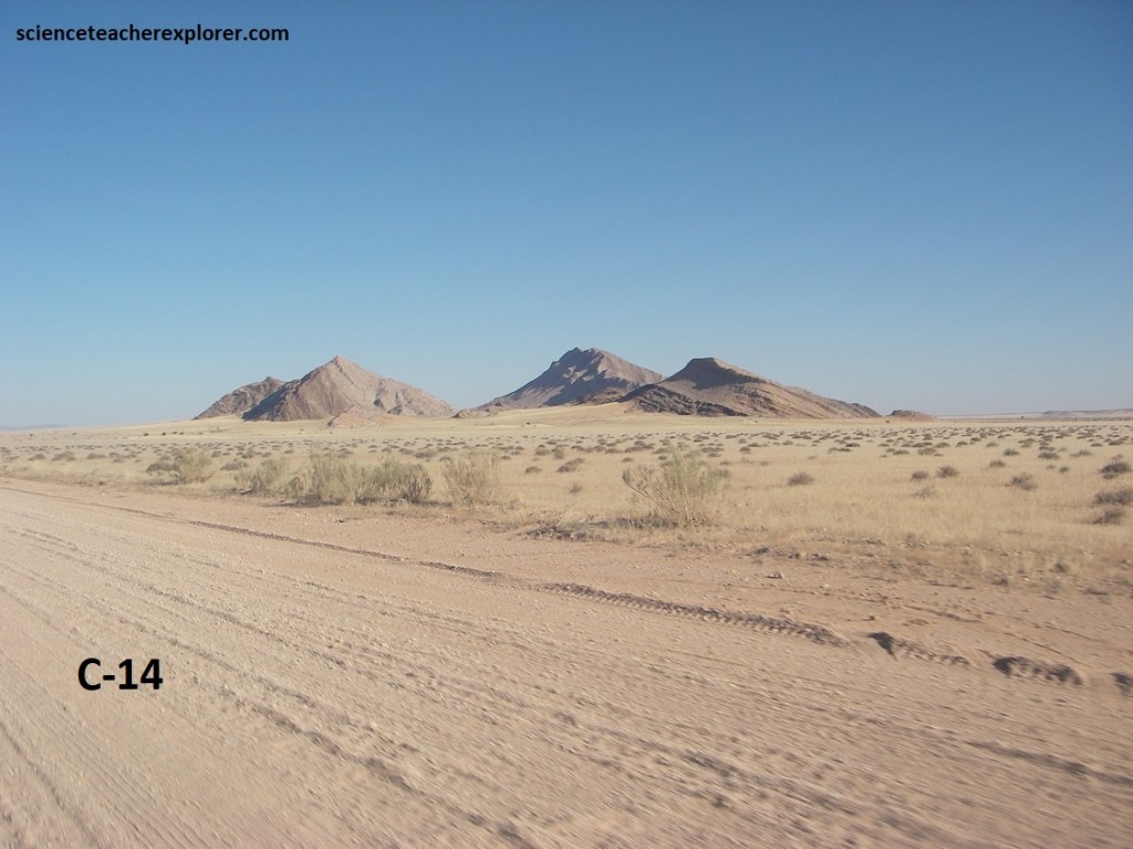
Pictured above and below, the Saagberg Mountain and Tinkie area in Namibia, from C14, features complex geology dominated by Neoproterozoic Damara Belt metasediments and late-stage, post-tectonic igneous activity. The region exhibits evidence of metamorphic basement, folded structures from Gondwana formation, and arid, calcretised landscapes, with white, pink, or grey calcrete covering underlying schist or granite (pictured below). It appears the terrain is dominated by gravel plains, inselbergs (including these mountain ranges like Saagberg), and (closer to the coast), sand dunes.
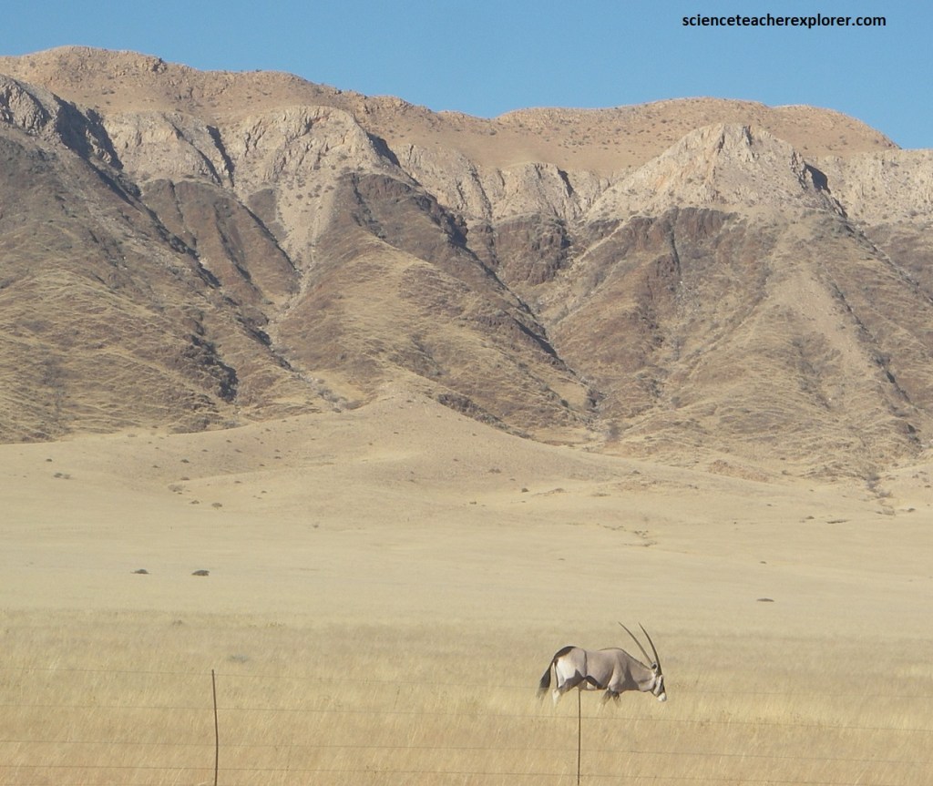
Pictured above, the oryx (or gemsbok) is symbolic of Namibia, appearing on the national coat-of-arms. This unusual desert animal is able to limit its body temperature to below 450C, and that of its brain to less than 420C, thanks to a unique system of blood vessels. Oryx can survive extreme drought, quenching their thirst with dew from desert plants, or humidity from unearthed bulbs and roots.
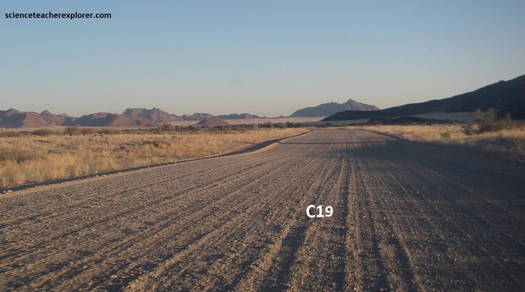
I drove southeast on C14 for another 17 km to Solitaire. There at the junction of C14/C19, I turned right, (south) on the graveled road C19. This road would take me to Sesriem, Namibia in 83km. At this point, I was racing the sun before sun-down in the west. It wasn’t a good idea to be out here in the Namib desert in the dark.

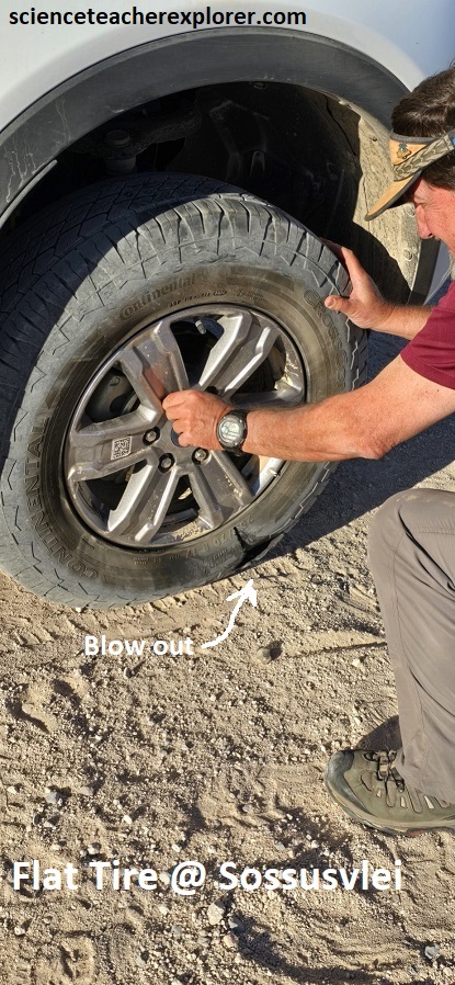
Of course that is exactly what happened. I got a flat tire at the Namib-Naukluft Park border, which caused me to arrive at Sesriem, (near Sossusvlei), in the dark. The unpaved-graveled roads in Namibia were very hard on tires. In Namibia alone, I received 5 flat tires total. However, the day was certainly educational and adventurous.
