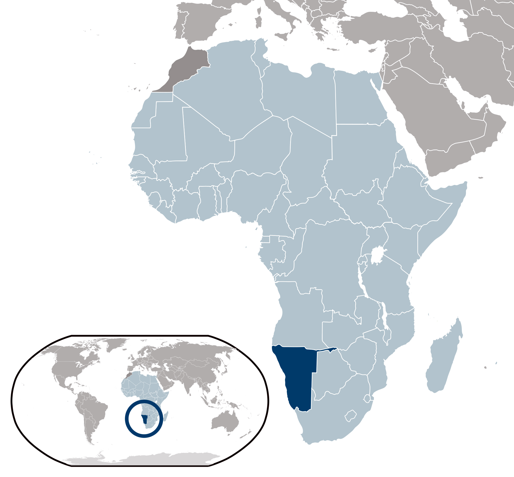
Keetmanshoop, NA
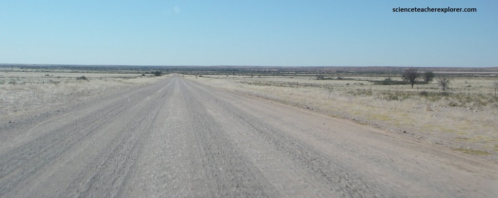
During the summer of 2025, I found myself exploring the southern region of Namibia with a childhood trekking-buddy of mine named Tracy Davis. Our base camp was in the capital of the Karas Region named Keetmanshoop, Namibia. {Images below of Namibia are public domain}. Keetmanshoop is 460km south of Namibia’s capital of Winhoek on B1, (imaged below).

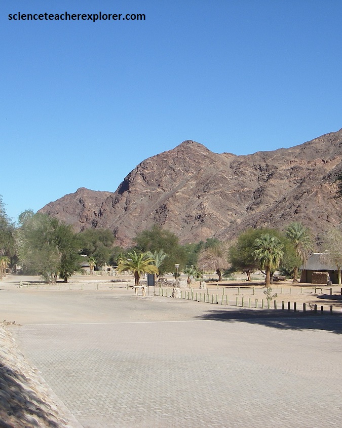
We took daily road-trips from Keetmanshoop to explore the different localized regions. I’ll begin northeast Keetmanshoop, and work towards the southwest, (imaged below).

Our first point of interest was near the Mata-Mata Border Post in the Kalahari Desert, (263km northeast, from Keetmanshoop). To get there, we drove 3 to 4 hours on the graveled roads via the C17 and C15. The route passed through Koës and required a high-clearance vehicle due to the terrain, (we had gotten a flat tire along the way & had it fixed in Koës).
In the eastern part of Namibia, the Kalahari is underlined by a bedrock of molten lava that was laid down about 65 million years ago. For the next 50 million years it was eroded by wind and rain and buried in sand from the coast. The desert, of which 930,000 km2 lies in Botswana, Namibia, Angola, Zambia, Zimbabwe and South Africa. Pictured above, the Kalahari Desert is characterized by undulating plains where low-range dunes form successive waves or hills, (pictured below).

The Kalahari dunes are known for the deep ochre hue of their sand, which appears to be ablaze at sunrise and sunset. In spite of being labelled a desert, the Namibian sector of the Kalahari Desert receives a fair amount of annual rainfall, and has enough ephemeral rivers and aquifers to sustain both a prolific flora and varied wildlife, including mammals, birds and insects, which have all adapted to the relatively arid conditions, (pictured below).
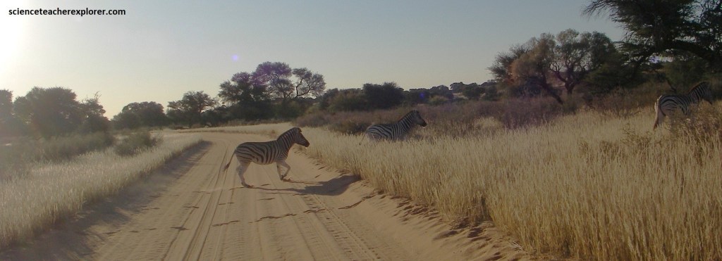
Not least of these is the iconic black-maned Kalahari lion, which roams the ochre crests of the dunes, (pictured below). Although the landscape is harsh and rugged, people came to live in the Kalahari 500,000 years ago. About 25,000 years ago the namadic San people started to live in the desert, and they are still here, the oldest human society in the world today. They share the desert with an abundance of wildlife, including meerkats, (mentioned below), eagles, snake and gemsbok.

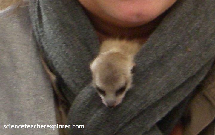
The harsh Kalahari Desert, where temperatures range from 700C (on the sand) during the day to -100C on winter nights, is home to the meerkat. These highly sociable little mammals live in organized societies of 10-30 individuals. While most of the group goes out foraging, others stay behind to babysit new cubs, and appointed sentries stand on top of mounds, watching for predators. Alarm calls quickly bring the band back to their burrows to hide.
While exploring the Kalahari Game Preserve at the Namibian/South African border, we viewed a small water-hole being shared by a den of ‘Bateared Foxes’ and a springbok. These ‘Bateared Foxes’ were small, bushy-tailed foxes with enormous ears, grizzled grey coats and short black legs. Their face was masked in black and the forehead was white. I understand that they are usually active at twilight and after dark, but we were there during their winter and they were out during the day. Apparently, they live in groups of 3-7 consisting of a monogamous pair and their offspring nearby.

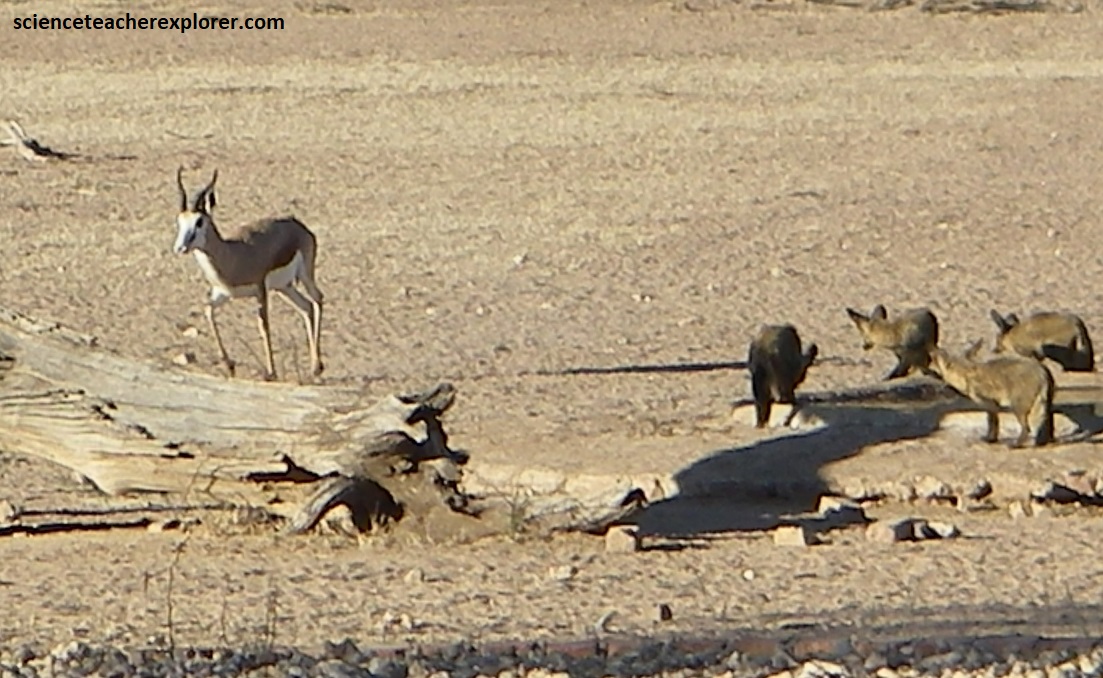
Huge numbers of springbok, (pictured above), once migrated across the Kalahari, on herd estimated to be 210km long and 21km wide. Our next stop is the Mesosaurus Fossil Site, (39-40 km from Keetmanshoop on C17). Again, C17 is mostly graveled road to the site.

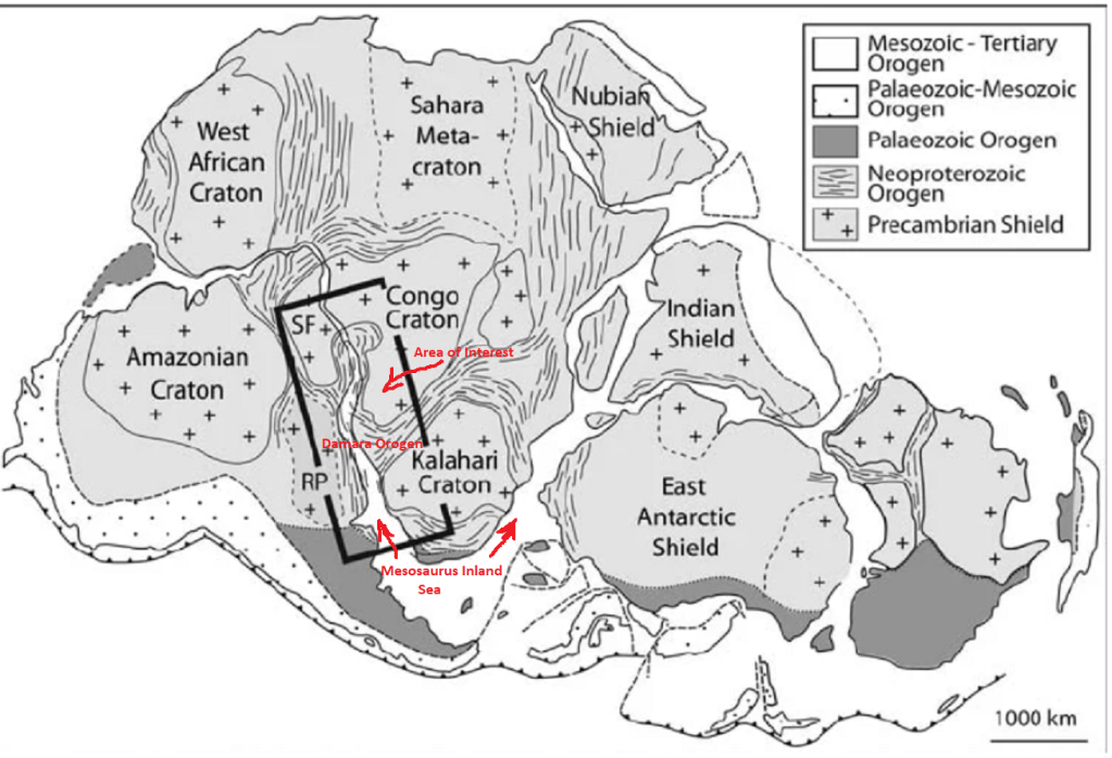
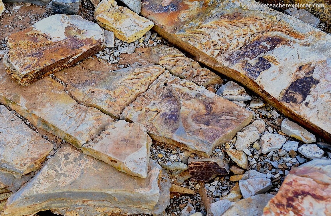
The Mesosaurus Inland Sea formed on the Gondwana continent between what is today the split up of the Congo Craton in the north, the Kalahari Craton in the south, South America and Antarctica. This sea was most probably entirely enclosed or in contact with the world ocean, Panthalassa, through only a few, narrow seaways. If the water of the Mesosaurus Inland Sea was initially saline, it gradually turned brackish before becoming fresh, thanks to the river systems flowing into the restricted basin. {This sea is named after the small swimming vertebrate, ‘Mesosaurus’, that inhabited it for a short time in the early Permian, and existed nowhere else on Earth.
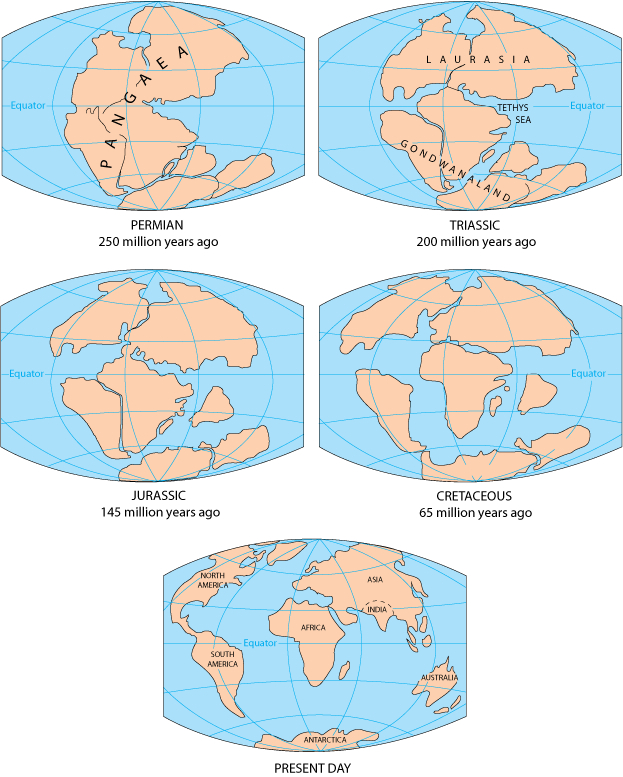
Because fossils of the ‘Mesosaurus’ reptile were found on both sides of the Atlantic Ocean, (in southern Africa and South America), they provided key evidence to support the theory of continental drift, (proposed by geophysicist Alfred Wegener in the first half of the 20th century).
Imaged below, ‘Mesosaurus’ resembled a lizard, with a long, narrow head and its nostrils situated high up on the snout, near the eyes. It therefore had only to break the surface of the water in order to breathe and see. The pointed snout sported long, thin, pin-like teeth on elongated jaws. It can be presumed that these teeth were not strong enough to bite prey, but were rather used to filter algae and soft-bodied organisms or small, krill-like crustaceans from the water. Because it was an aquatic animal, its short forelegs and longer hind legs were most probably equipped with webbed feet. The tail and hind legs propelled the animal through the water, while the forelegs were used of steering. ‘Mesosaurus’ could easily flex from side to side, an adaptation common in water-dwelling vertebrates, (image below).

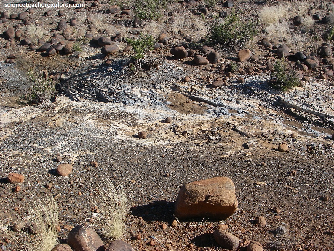
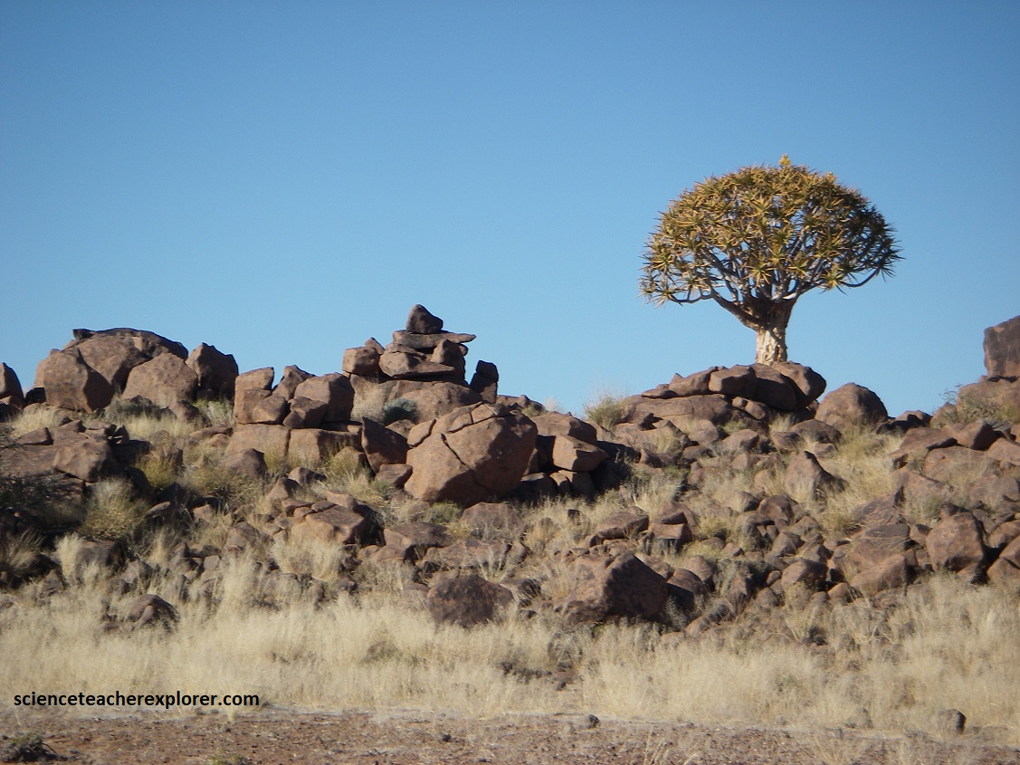
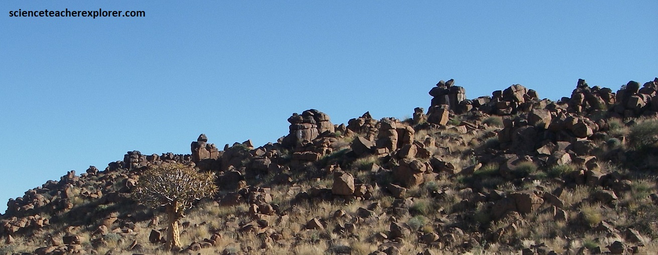
Pictured below, ‘Mesosaurus’ fossils can be seen on the site at the Mesosaurus Fossil Camp, (mentioned above), and Quiver Tree Dolerite Park, which are both about 20 km Northeast of the Giant’s Playground, itself located some 20km northeast of Keetmanshoop on C17.
Pictured above and below, the Mesosaurus Fossil Camp owners Giel and Hendrik Steenkamp takes visitors to explore their fossil wonderland. However, Tracy and I missed the opportunity for this, because we got there at mid-day. Apparently, they’re tours were only done in the early mornings & late evenings, (at twilight). So, we helped ourselves with the photos below. {These fossils were found within the Whitehill Formation, (Early Permian period), a grey, hard, dolomite-bearing shale/limestone, (occasionally referred to locally as Dwyka shale)}.


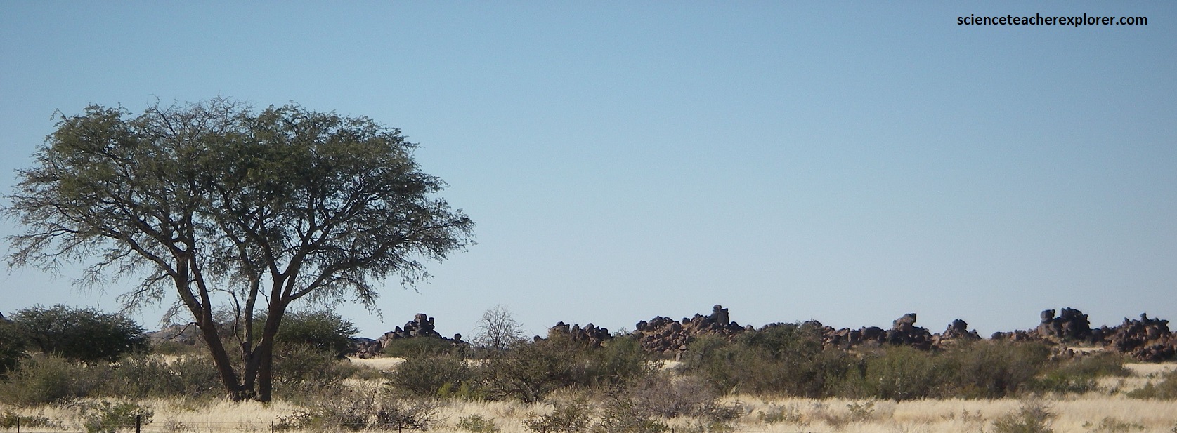
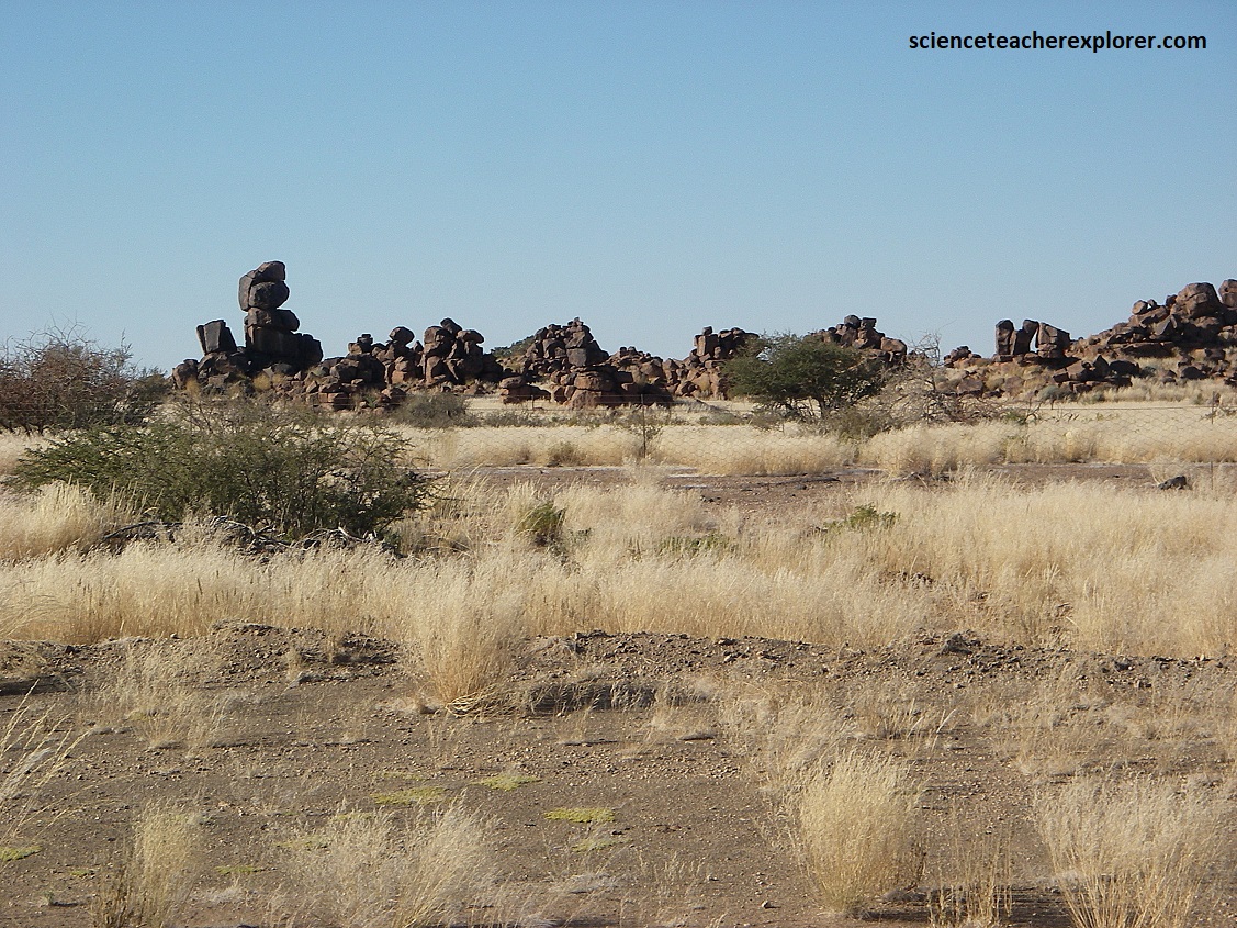
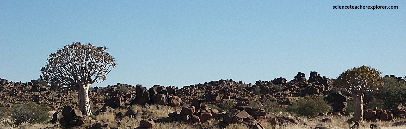
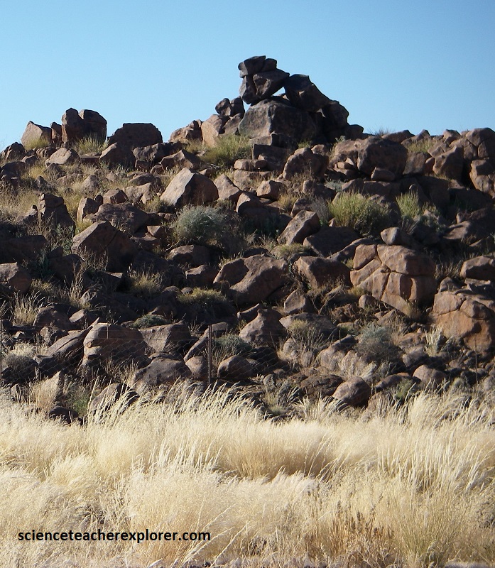
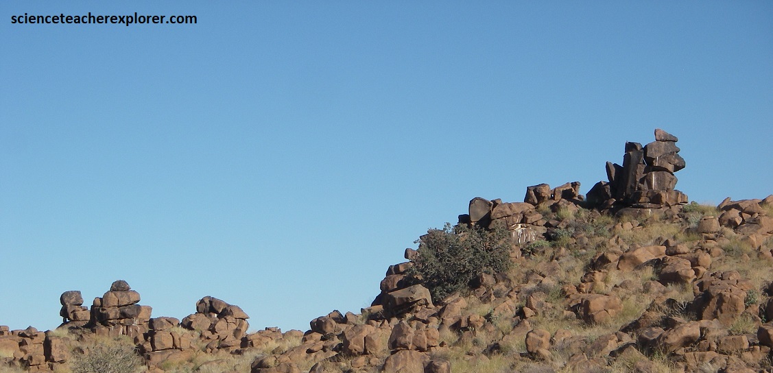
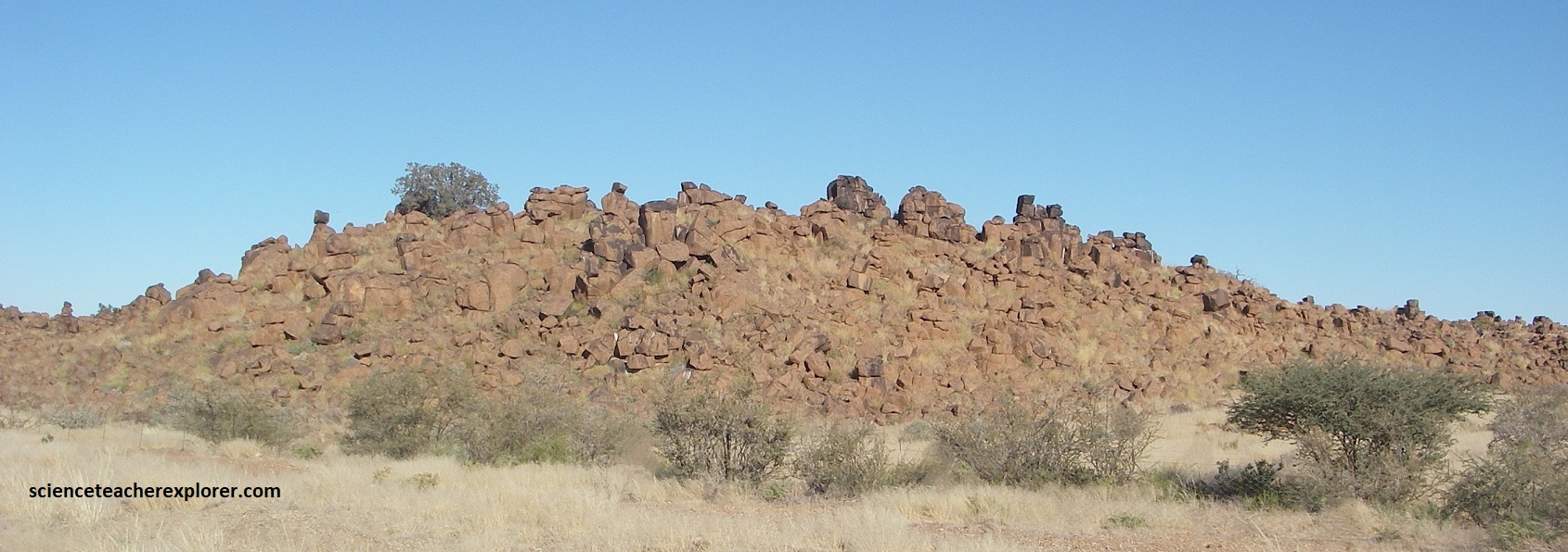
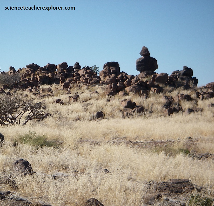
As mentioned above, the Giants Playground consists of many weathered dolerite dikes that belong to the Keetmanshoop Dolerite Complex, (related to the volcanic field see below).
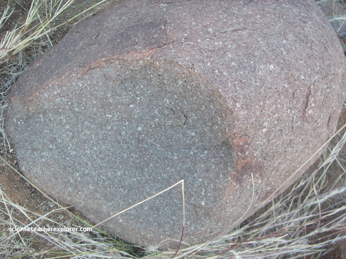
Dolerite is a black grey dike rock that has the same chemical composition of basalt. However, it solidifies below the surface and is a coarser, (bigger crystals), of which is only exposed by weathering processes. Dolerites mostly occur as single dikes. If, however, they crosscut the surrounding rocks in large numbers they are called dolerite swarms, (common in Namibia).
The dolerite swarm near Keetmanshoop, (which covers a surface area of 18,000 km2), penetrated into the upper parts of the earth’s crust about 180 million years ago. It’s formation is connected with the breakup of the eastern Gondwana Continent, which at thest times mainly affected the present South Africa and which started 30 million years earlier than the magmatic event in northwestern Namibia, (within the Damaraland region).
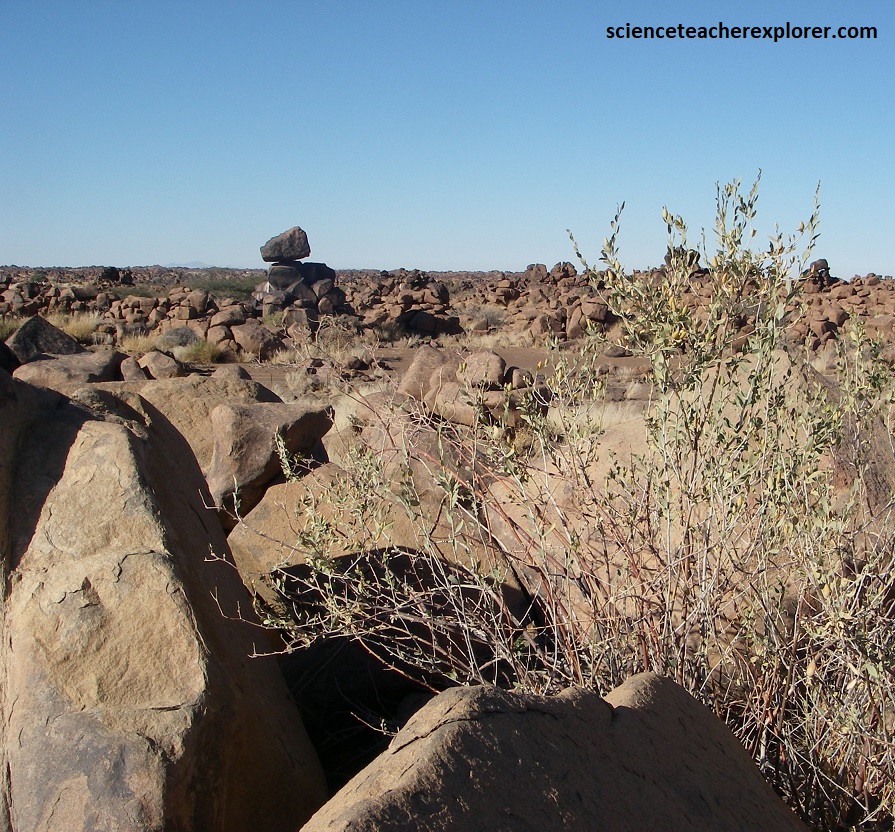

The connected dolerite rocks are dissected into single rounded boulders, known as the ‘woolsacks’ by deep weathering processes. As the dolerite cooled and contracted under ground, it cracked vertically and horizontally into rectangular, block-like pieces, (called temperature weathering). Over millions of years, ground-water seeped into these cracks, rounding the sharp corners of the rectangular dolerite blocks. Wind and water erosion eventually removed the surrounding, softer soil and rock, leaving behind the rounded, stacked dolerite boulders that resemble a “playground” or ‘woolsacks’. The resulting formations in the Giant’s playground, (often appearing as stacked piles or columns), are entirely natural, though their orderly, blocky appearance often gives the impression of being placed by hand or by a giant.

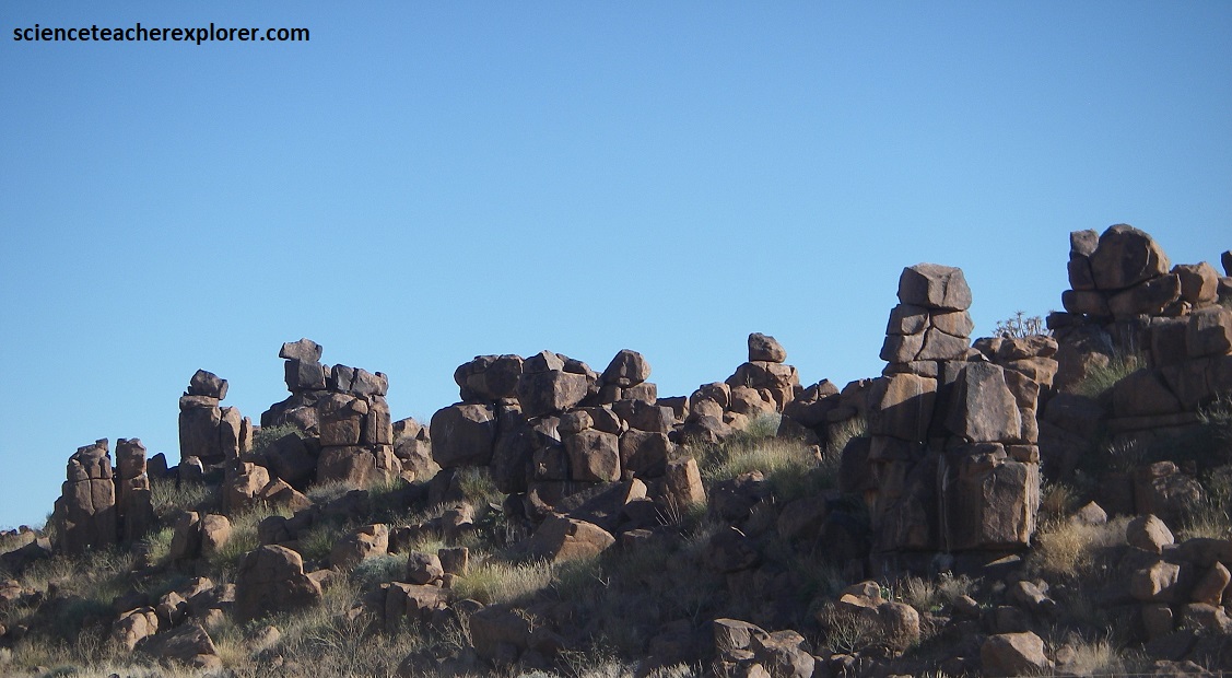

It is also noted that a shiny black thin surface crusts on the dolerites. This desert varnish is formed by a combination of the moistening of the rocks and the subsequent evaporation of this moisture. The moisture penetrates into the outer rock areas and dissolves manganese and iron compounds from within the interior of the rock. By high insolation this enriched rock moisture is sucked out of the rock again and the dissolved chemical compounds precipitate on the rock surface facing the sun. There they react with the atmospheric oxygen to form oxides that cover the rock surfaces with a hard-black shiny varnish. Thus the desert varnish is very resistant to weathering as it protects the rock to a certain degree.

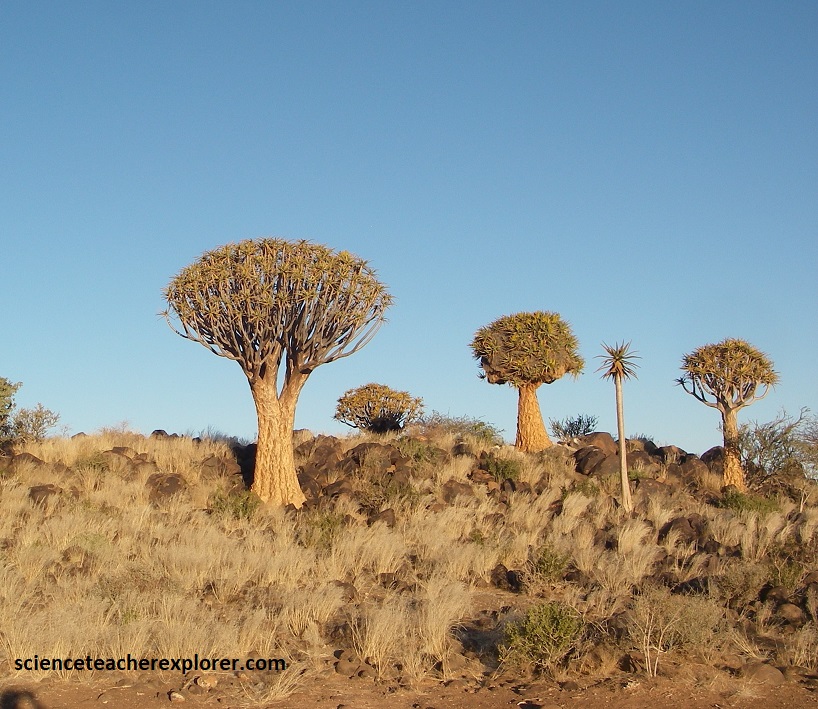
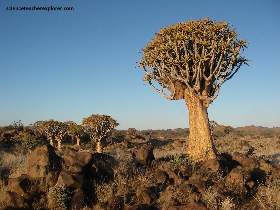
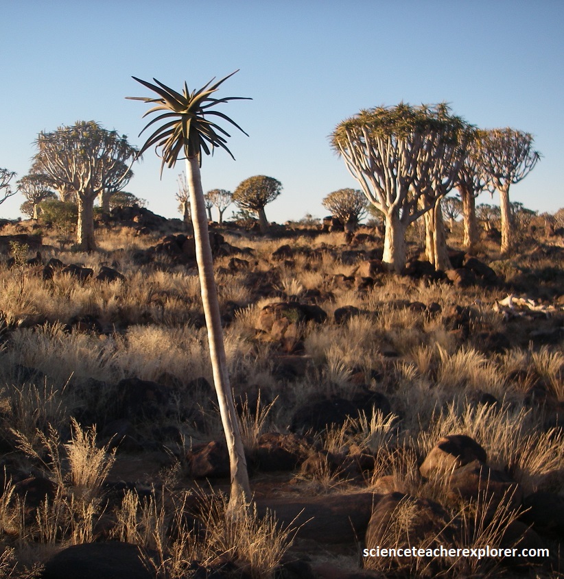
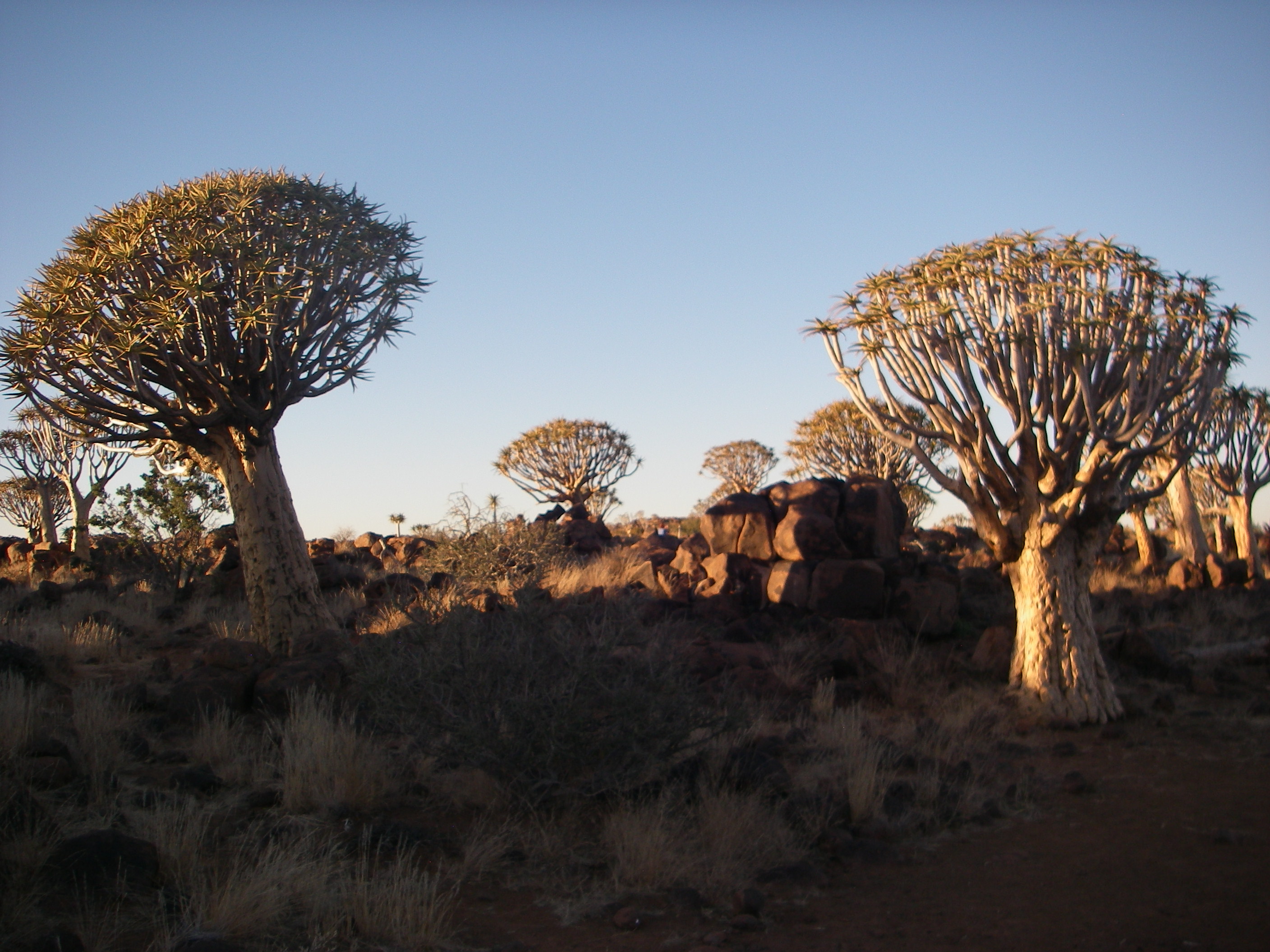
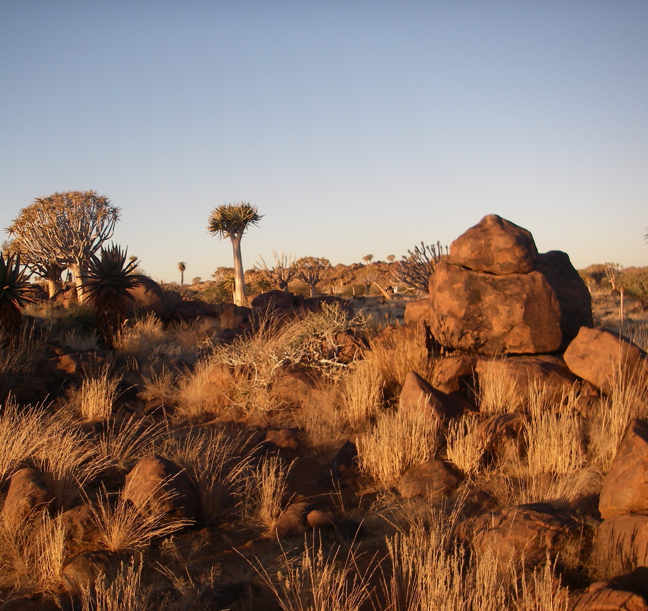
About 14km northwest of Keetmanshoop, on C17, Tracy and I, stopped at the Quiver Tree Forest at sun-down. There we witnessed the local owner feeding two full-grown cheetahs a dead springbok. They were large elegant cats with long legs, grey hound-like frames, with solid black spots and black ‘tear-marks’ between the eyes and mouth. I’ve been told that these cheetahs can travel 112km/hr over short distances. I was amazed and surprised that they meowed, before their feeding.

The Quiver Tree Forest (Kokerboomwoud) near Keetmanshoop, Namibia, is a national monument featuring roughly 250 specimens of Aloidendron dichotomum that are 200-300 years old. Located on Gariganus Farm, this surreal, rocky landscape is a popular photography spot, famous for its unique, alien-like aloe trees that were historically used by the San people to make quivers for their arrows. We arrived at sunset, which was an ideal for photography, offering warm light on the trees, (pictured below). The trees are actually succulents rather than trees, with thick, split bark that grows up to 300 years old. They produce yellow flowers during the June that we were there.
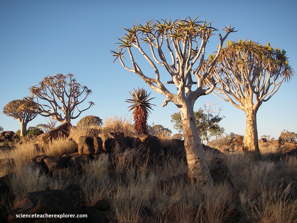


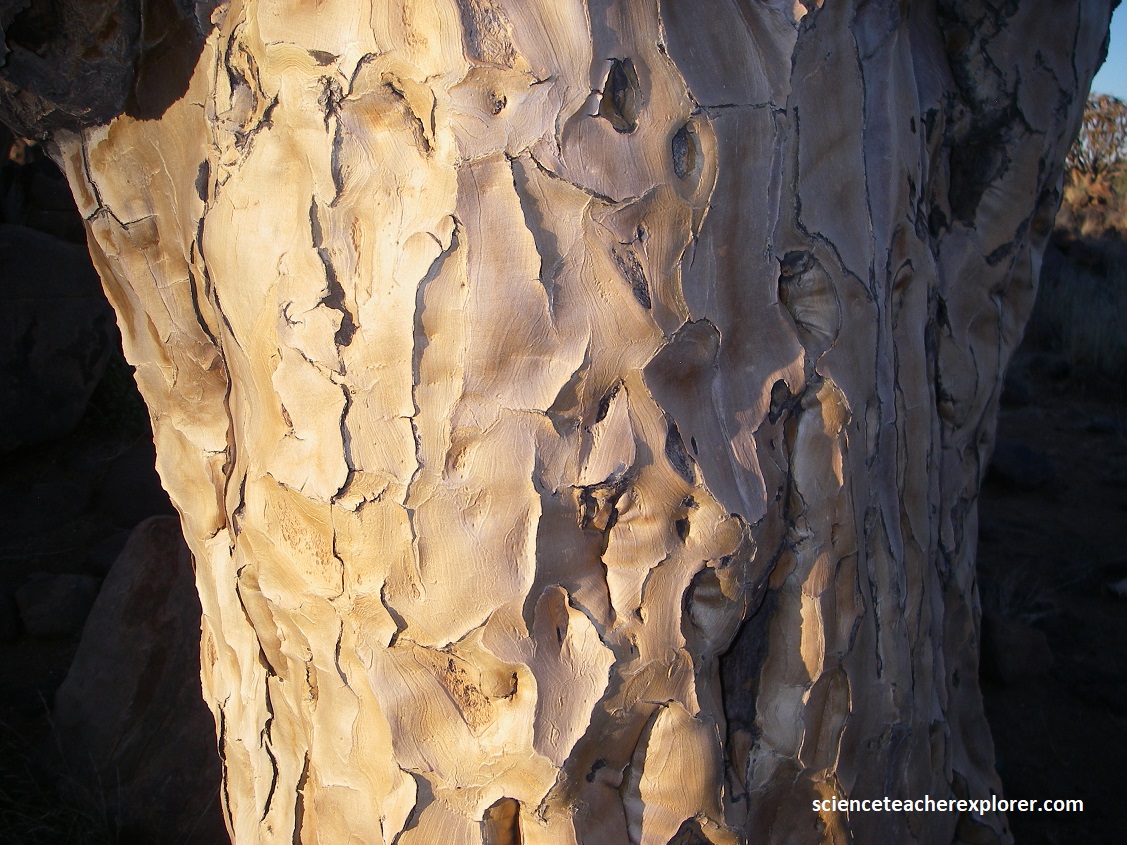


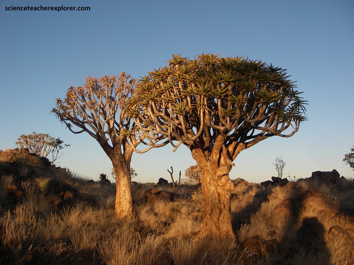
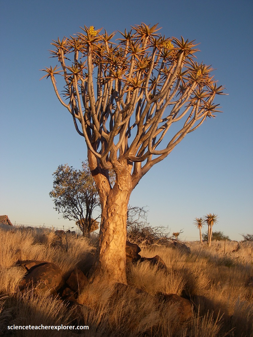

Pictured above, the Quiver Tree Forest has been privately owned by Coenie and Ingrid Nolte since 1990. Traditional medicine uses the plants’ roots to treat both asthma and tuberculosis. The trees are scientifically fascinating, too. Their bark is covered in a white powdery substance that’s used to reflect much of the sun’s heat. The plants are also capable of a rare botanical practice known as self-amputation, which allows them to shed diseased limbs to prevent sudden infections from spreading and remove extra limbs in times of drought.
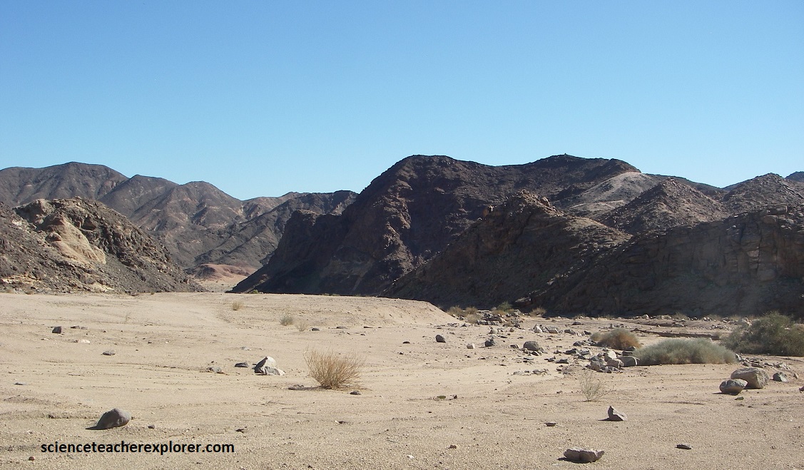
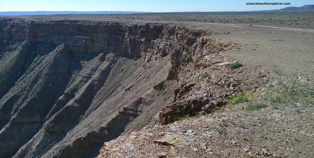
Our next point-of-interest and geo-site to explore was the ‘Fish River Canyon’. The ‘Fish River Canyon’ is without doubt one of the most impressive geological features of Africa. The Fish River flows more than 650km across the Namibian plateau from its source east of the Naukluft Mountains to its confluence with the Orange River at the border with South Africa. From about 100km south of the town of Seeheim, flowing south to Ai-Ais, the Fish River has carved a gorge of itself in the Namibian plateau, cutting down as deep as 550m and as wide as 27km in places over a stretch of some 90km. We decided to start our exploration of the Fish River Canyon by driving to and visiting Ai-Ais.
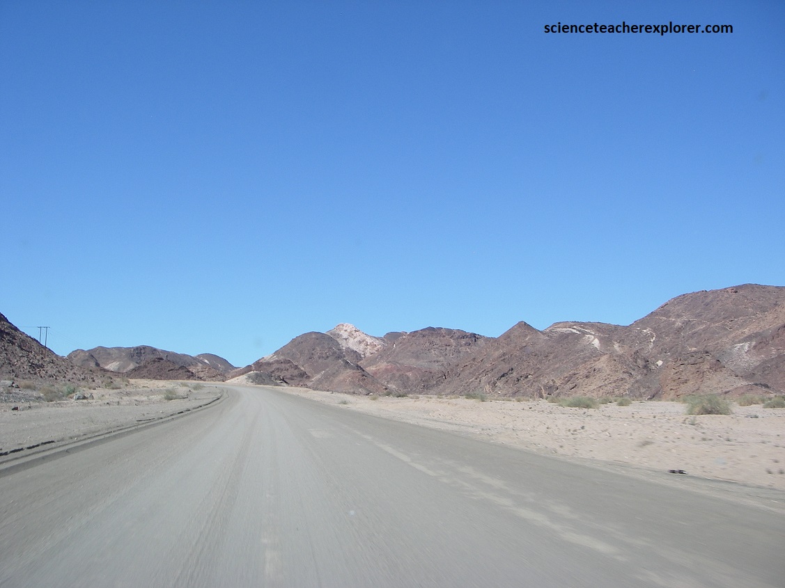
To get there from Keetmanshoop, we drove south on the tarred Highway B1, past Grunau, and then turned right, (west), on the graveled road C10. The total distance was 209km, which only took us 2.75 hours. From Grunau it was about 95km on the C10.
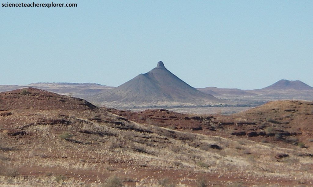
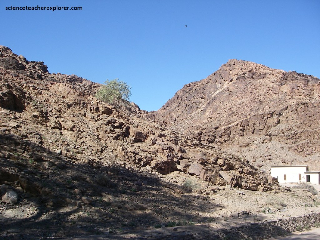
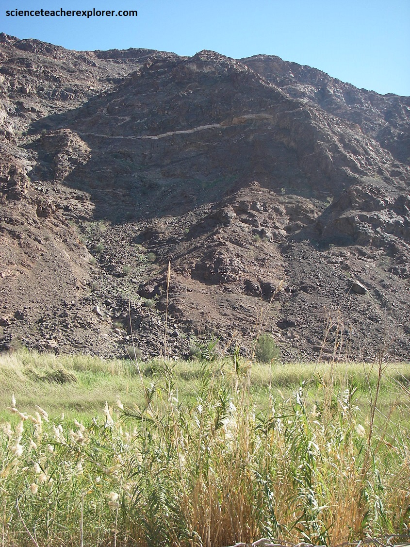
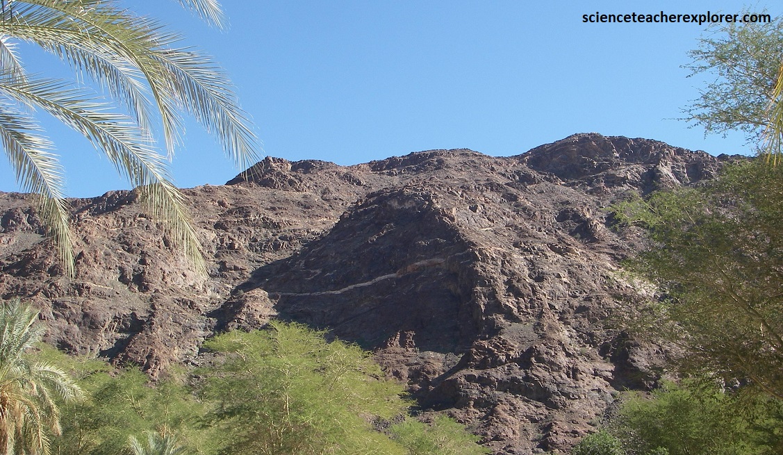
The geology of the park is complex, consisting of many successive geologic events starting with the outflow of lava two billion years ago that formed the oldest rocks in the park today. Pictured above on C10, upon first entering the park from the Sendelingsdrift Gate, we were greeted by almost otherworldly appearing mountains of various colors and dark bands wedged in between, (the result of successive new intrusions of magma between layers of older rock).
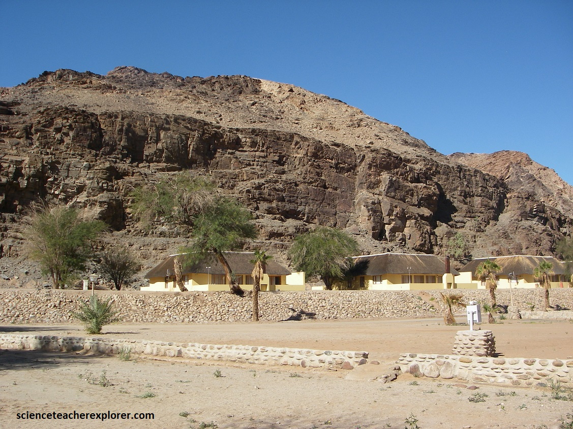
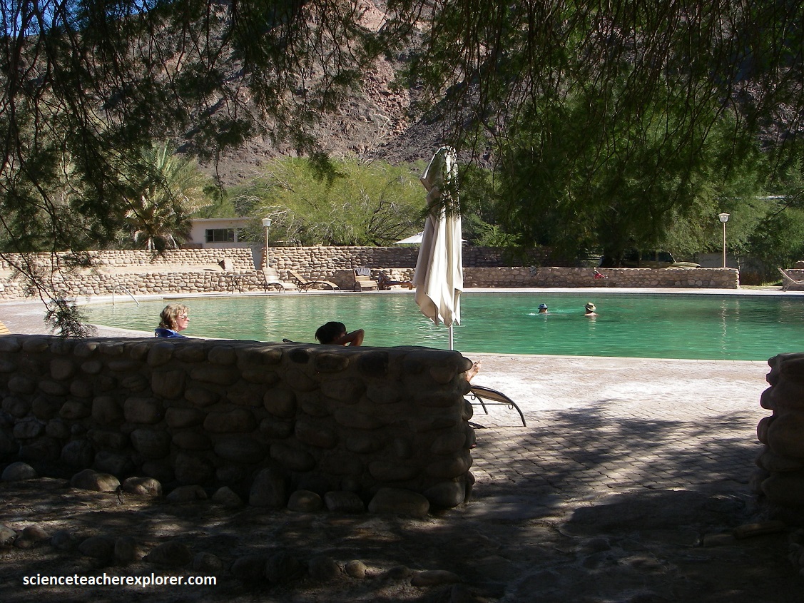
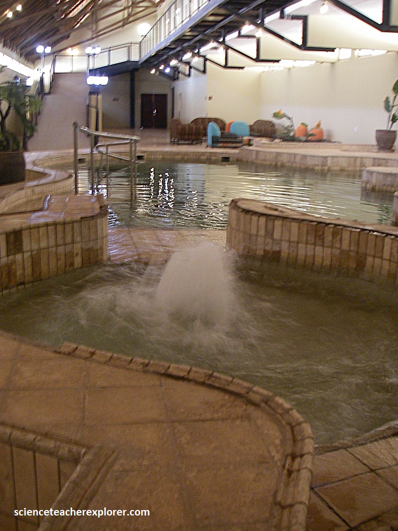
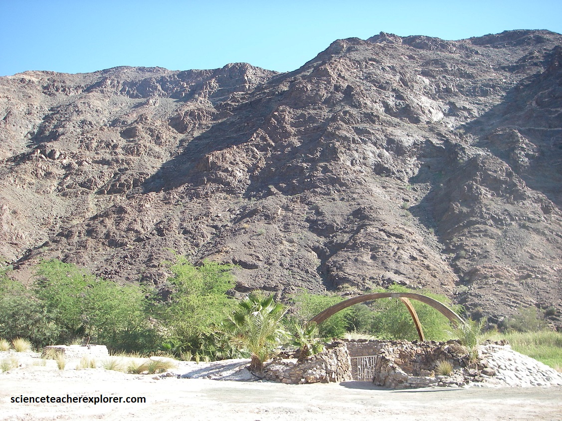
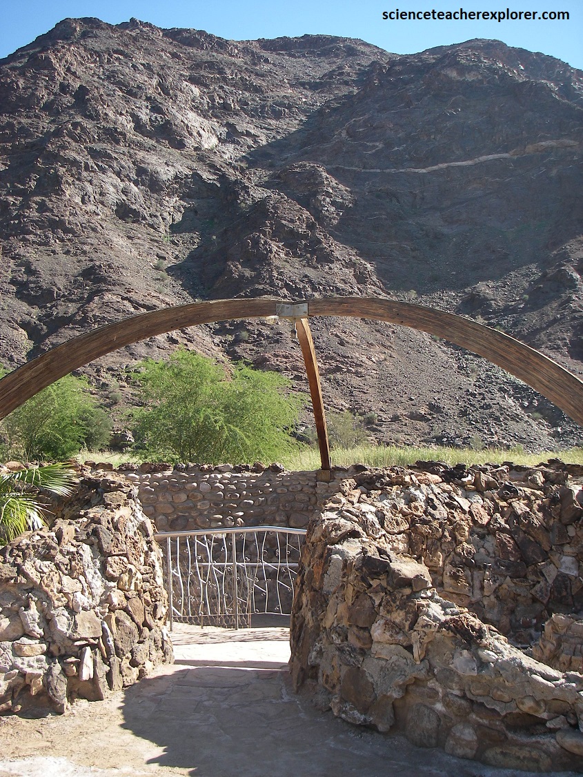
The hot springs of Ai-Ais were discovered in the 19th century by accident from a member of the Nama people whilst herding sheep, (Nama Ai-Ais means “very hot”). Pictured above & below, it is now considered a very popular hot-springs resort, camp-ground & spa.
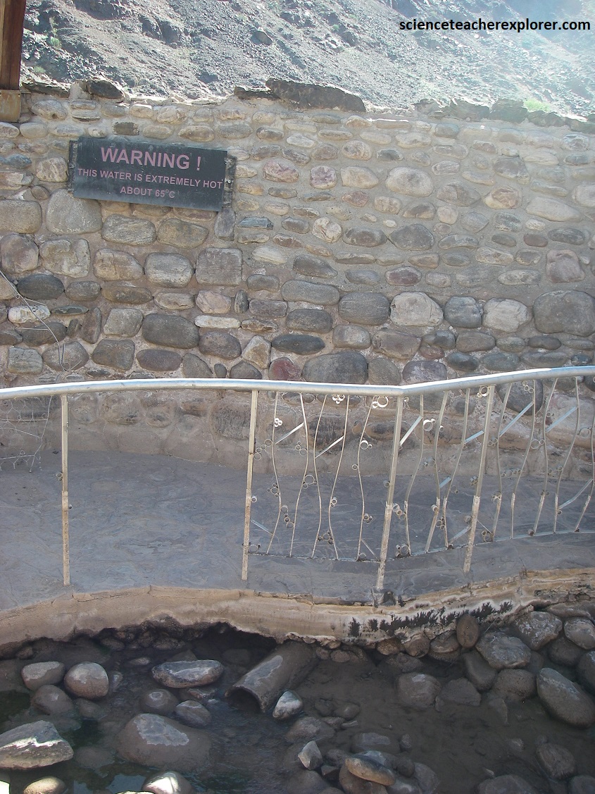
The geological origin of the hot water (600C) has been determined to be related to a deep fault system in the area that cuts through the Fish River by 900. These fault-system weak zones in the earth’s crust, which are responsible for the formation of the tectonic structures and development of the canyon, provide upward passages for the groundwater.
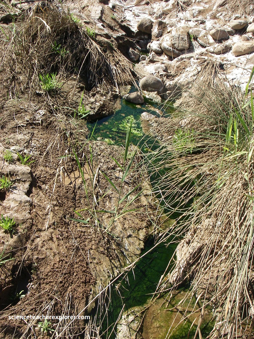
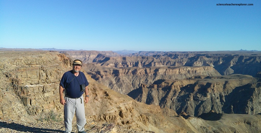
The emerging water, which is of therapeutic value for those suffering from rheumatism, is rich in dissolved mineral salts such as fluorite, sulfates and chlorides. It is assumed that these salts were dissolved from the surrounding rocks, through which the groundwater passes. Pictured below, the actual spring outlet, (the Eye), can be visited close to the outdoor swimming pool. We even visited the natural hot-springs feeding the Fish River, (pictured below). {Note: My traveling buddy, (Tracy Davis), is posing next to ‘the Eye’ of the Ai-Ais hot-spring at the bottom of Fish River Canyon in Namibia 2025}.

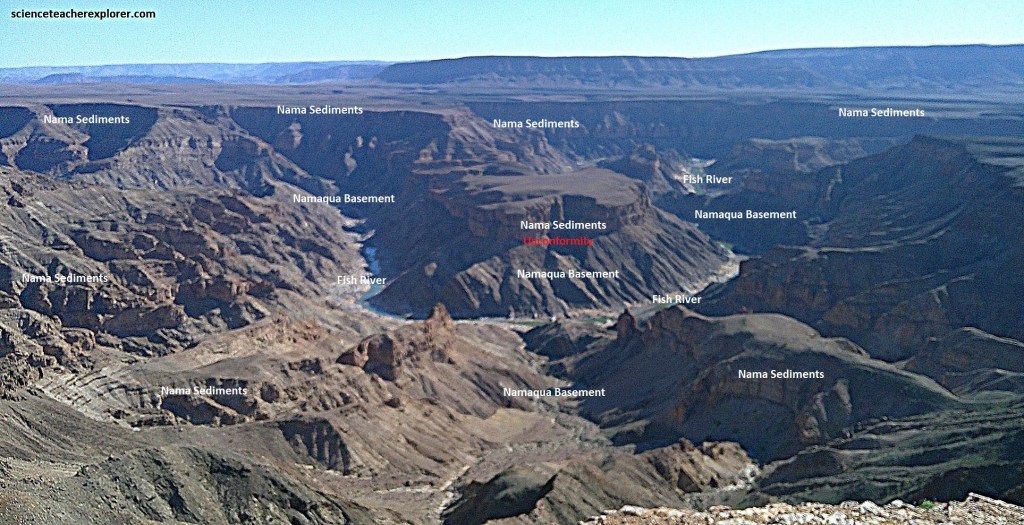
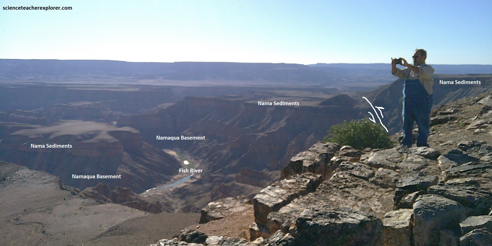
The Fish River Basin is located on the western margin of the Kalahari Craton, a stable granitic-gneissic shield that forms the very nucleus of the southern African subcontinent. Here at Ai-Ais, the Fish River Canyon majestically exposes one of the longest geological timelines of our planet lasting some 1.4 billion years. For instance it exposes the ‘Namaqualand Metamorphic Complex, which formed huge mountains 1.2 billion years ago that was related to the formation of the short-lived Rodinia Continent, (predecessor to Gondwanaland). The banded rocks, (gneiss), of this complex once formed huge mountains in the regions: the Namaqualand Mountains. Pictured below, while trekking around Ai-Ais, we could see enormous gneiss formations with large quartz lenses, dolerite dikes and pegmatites that belong to this ancient formation & time period.
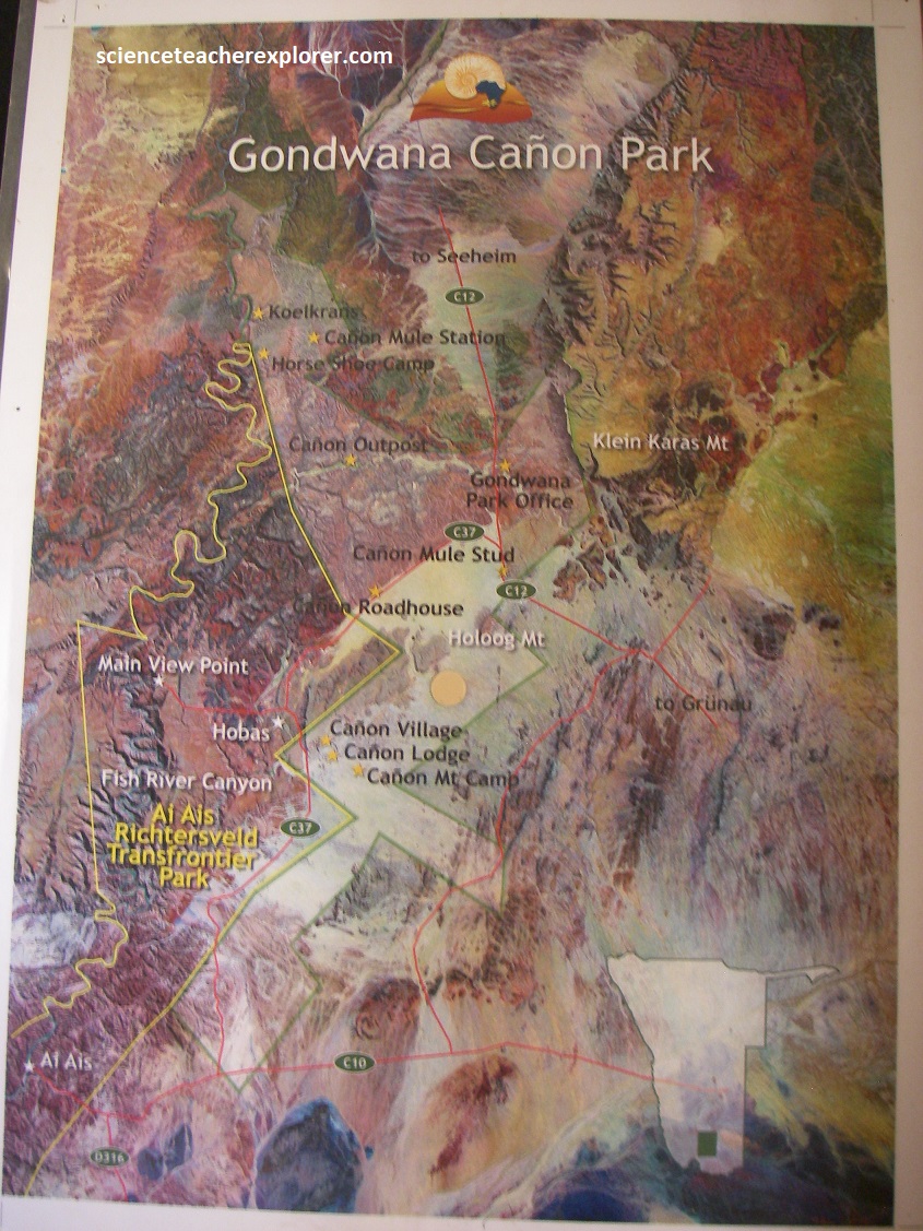
The Fish River flows intermittently, usually flooding in late summer and when it ceases to flow it becomes a chain of long narrow pools on the sandy rock-strewn floor of the chasm where hikers can enjoy the refreshing pools as they hike the famous Fish River Canyon Trek. This trek requires good physical health and should only be undertaken during the cooler winter months (between May and September). A permit must be obtained & the trek is 86 km in length, which takes about 5 days. It starts at the Hobas Camp on the north end of the Fish River Canyon, and ends at Ai-Ais Resort & Spa where there are rooms, chalets and camping available. There is actually a shuttle at the Ai-Ais resort that transports you to the start of the trek, and then allows you to park your vehicle at the end, (Ai-Ais) during the 5 day trek. {Note: The images below are the trekking-maps provided & posted on a interpretive sign at Ai-Ais}. Personally, we didn’t have time to accomplish this adventure.
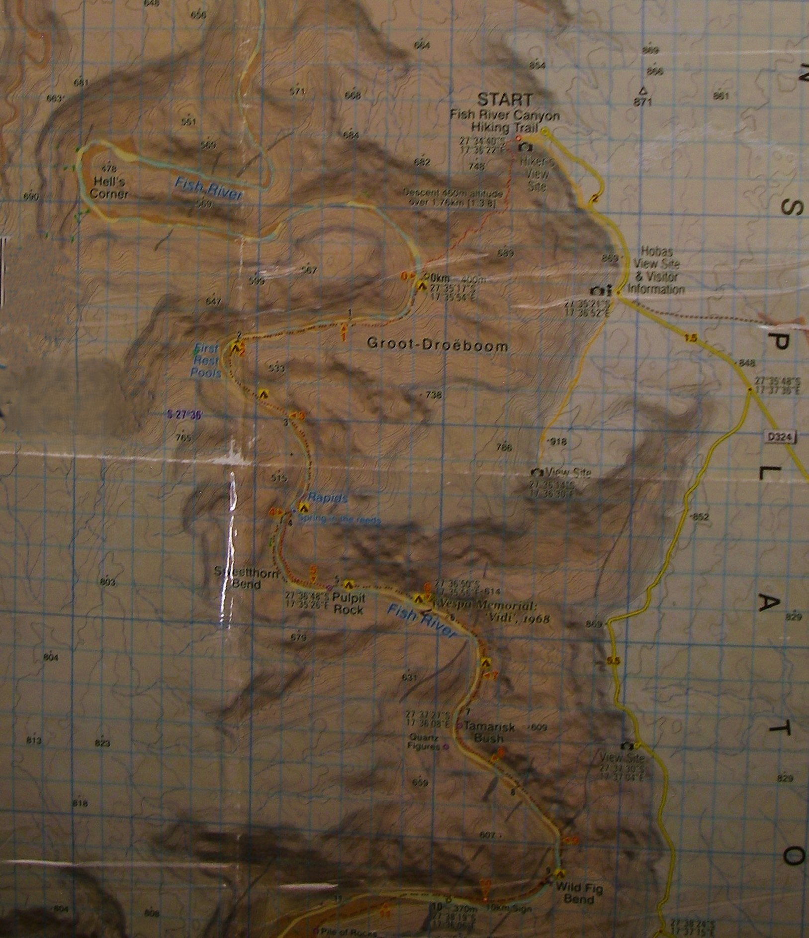
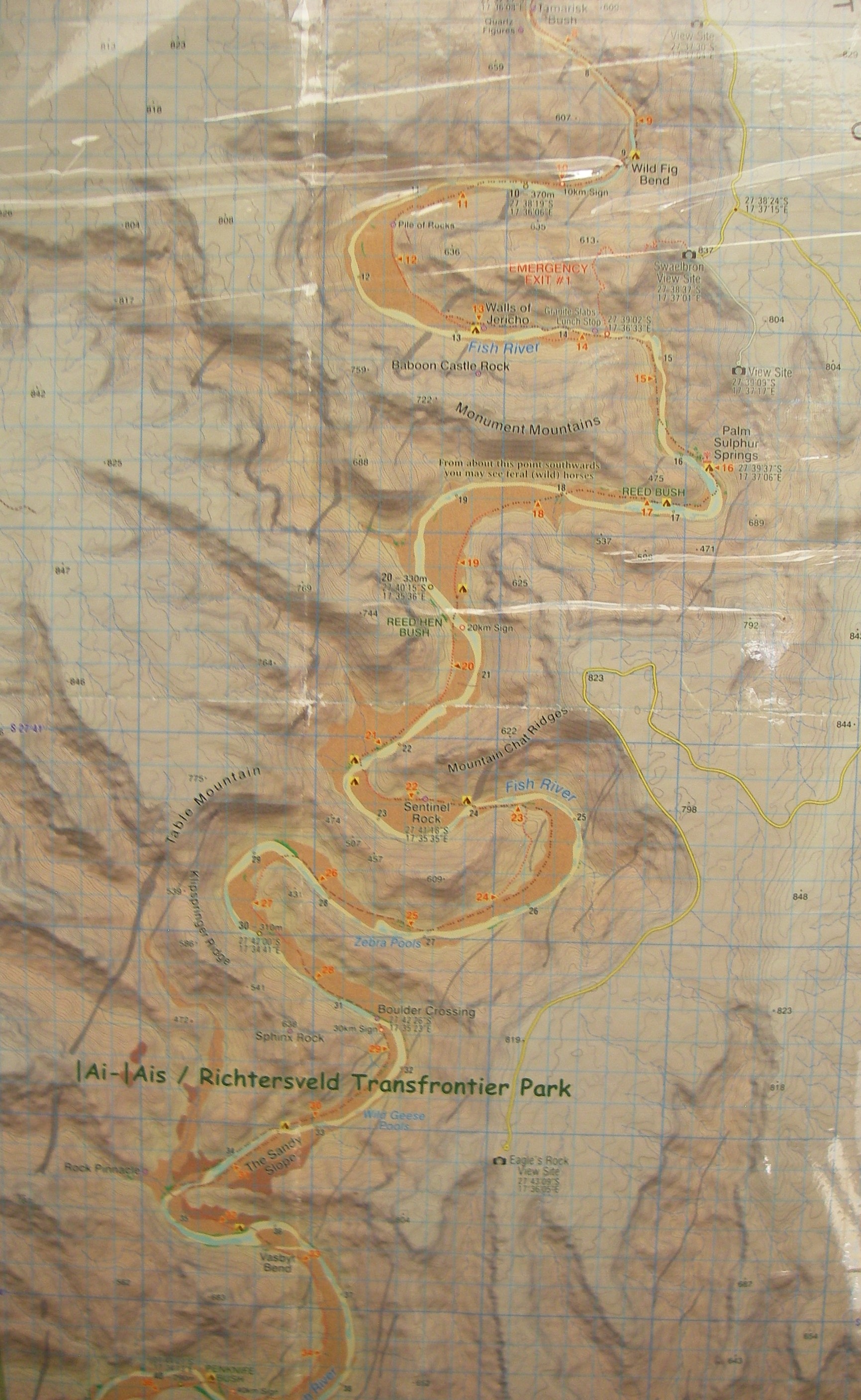
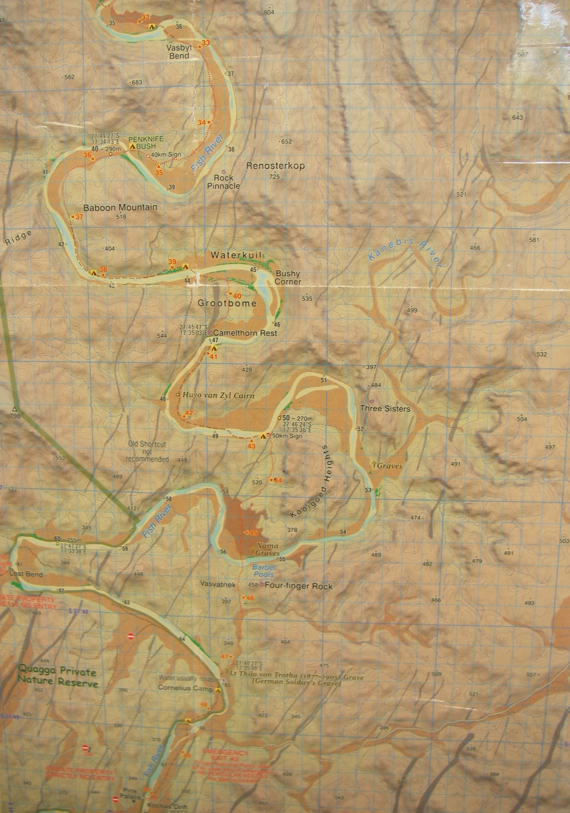
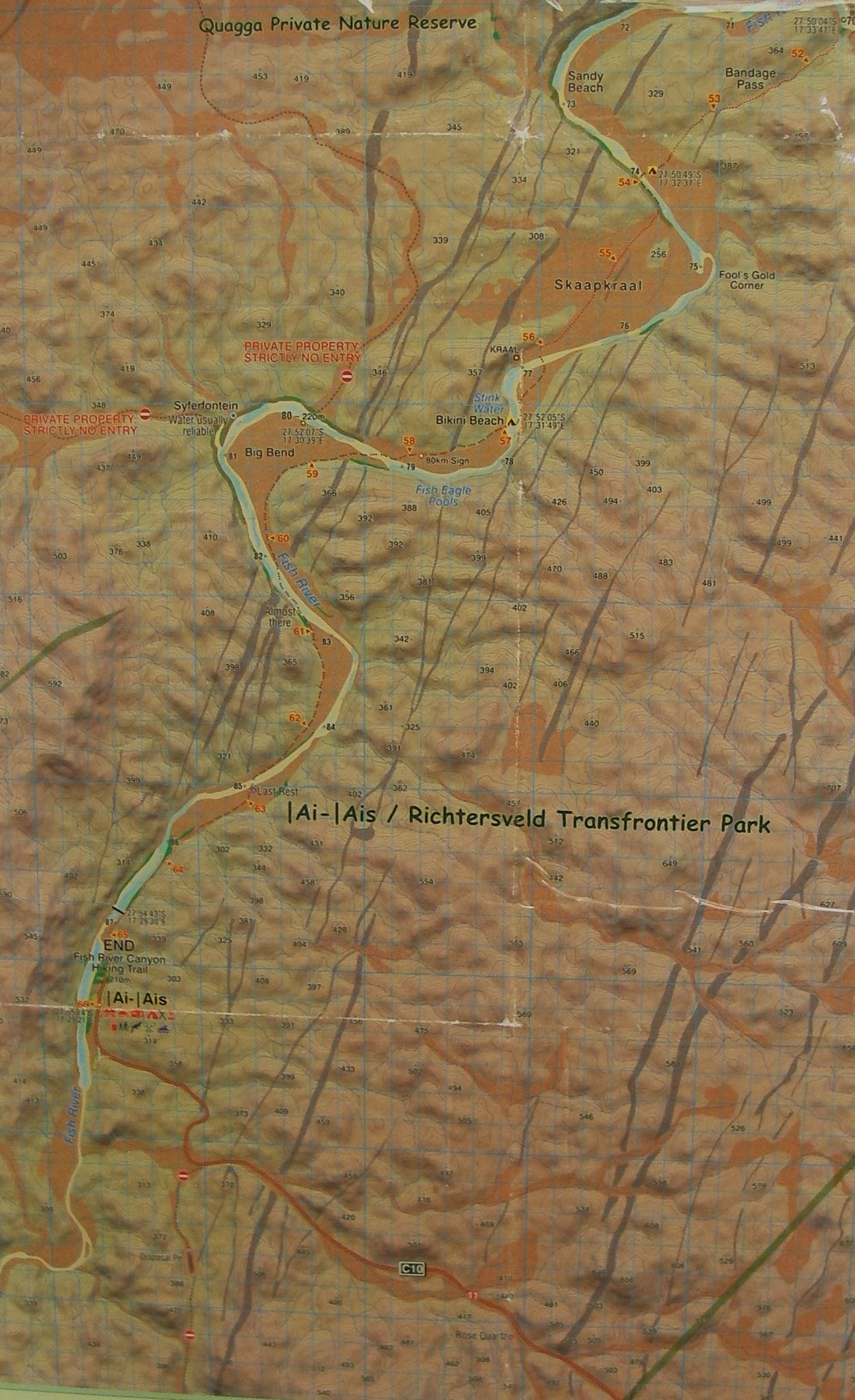
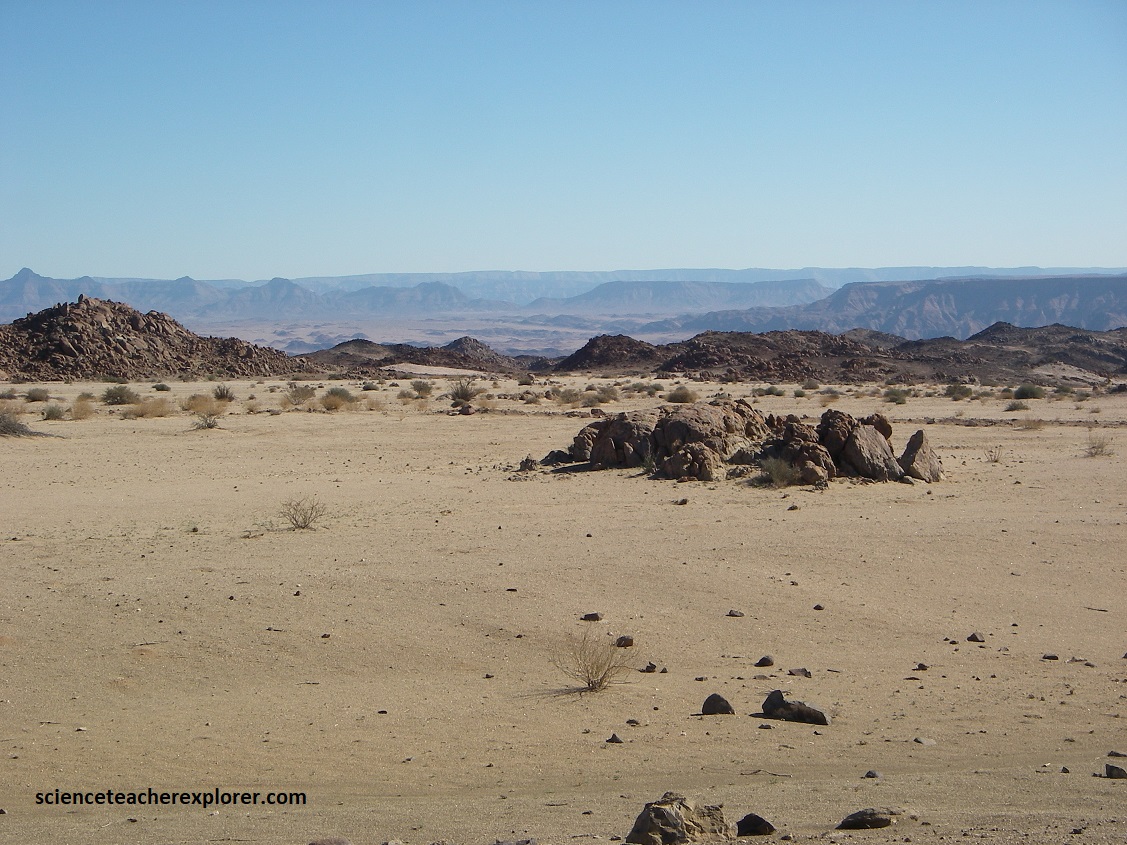
The Fish River Basin cover an extensive area of southern Namibia, draining an area of about 120,000km2. Because it comprises rocks formed during most of the major rock-forming periods known in Namibia, there is much variety among the rock types, fossils, and mineral deposits found here; and the landforms of the basin reflect this variety, as well as the long geomorphological history of the area. Tracy and I drove up to the starting point of the Fish Canyon Trek, and looked over the edge of Hell’s Bend. To do this, we drove back out of Ai-Ais Park on C10 and turned left, (north), on D324 to the Fish River Overlook road at Hobas Camp or Hiker’s Point. This was about 80km or 1.25hrs long. Below are photos I took along the way, looking towards the Fish River Canyon, along with a map of the Ai-Ais & Richtersveld Transfrontier-Park posted on an interpretive sign at the Ai-Ais Resort & Spa .
The Fish River’s erosive action reveals the multiple layers of the Gondwana supercontinent, which formed approximately 550 million years ago, and would later break up into Africa, South America, India, Australia and Antarctica.
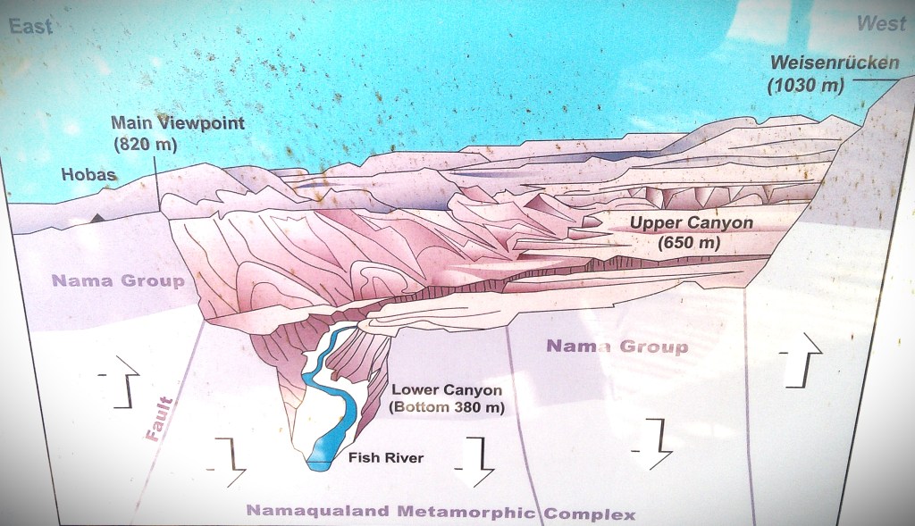
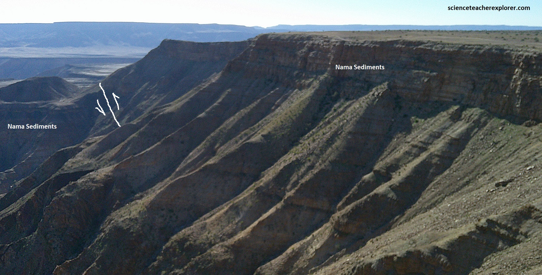
Mentioned above, the Namaqualand Mountains were completely eroded about 650 million years ago. Only a vast plain remained. Continental rifting created an ocean trough and the plain then became the Nama Sea. The remains of the Namaqualand Metamorphic Complex were not at the bottom of an ocean! Marine sediments started to settle, giving rise to what was later to become the Nama Group Sediments. It took 100 million years to completely fill the Nama Sea with sediment. Heat and pressure then turned the sediments into hard metamorphic rock; the quartzite of the Nama Group Sediments. Pictured below, the horizontal layers near the top of the canyon are these former sediment layers, on top of the convoluted gneisses (banded layers of rock) of the former Namaqualand Mountains.
The upper part of Fish River Canyon is actually born of a tectonic event, (not erosion): a huge block of the Earth’s crust subsided along deep-reaching faults, forming a so-called “graben” (trench). One of these faults is clearly visible in the picture with my trekking buddy, (Tracy Davis). {This fault creates an easy axis off the rim into the river below–Hiker’s Point}. It is only at this point that erosion took over in the creation of the canyon. The hard quartzite of the Nama Group prevented the river from easily cutting into the depths, forcing it to cut sideways instead. A leveled plain wa thus created: today’s upper canyon. (The photos below are looking northwest from the rim of the Main Viewpoint).
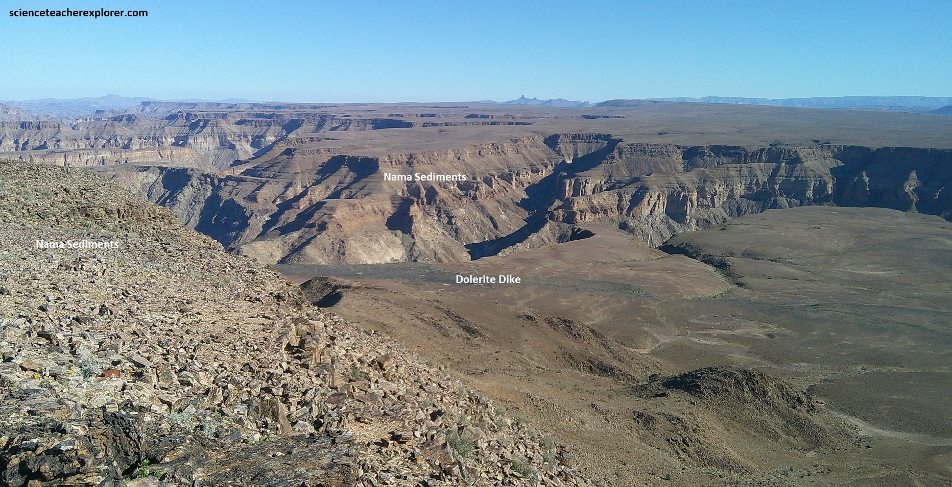
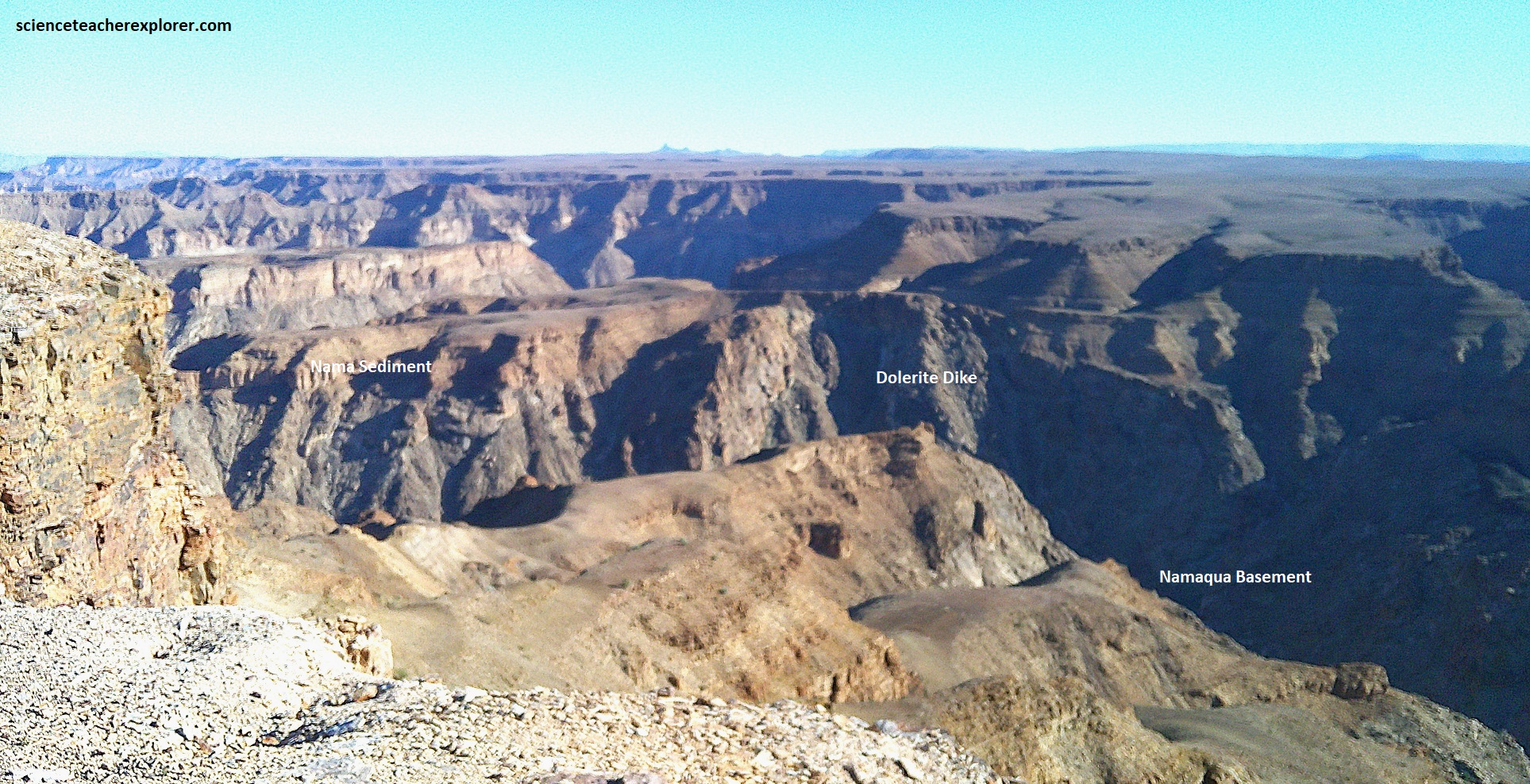
Dikes of dolerite (a volcanic rock cooled below ground), ranged in a north-south directions, up to 100km long and 1.5km wide, are witness to a volcanic episode about 800 million years ago. These structures can be seen to extend south far beyond the Orange River into the Richtersveld. They are also visible in the photos below with the Fish River Canyon. (Photos below are looking southwest from the Main Viewpoint of Fish River Canyon).
Another phenomenon hard to imagine in today’s dry and hot climate then played an important role in the canyon’s formation: the flow of glaciers along the upper canyon. This happened during the Dwyka glaciation about 300-200 million years ago, with the glaciers grinding the canyon down further and it was later impacted by the opening of the South Atlantic Ocean 120 million years ago.
Gondwana started to break up 210 million years ago. Africa and South America were separated 60 million years later. The continental edges rose during this rifting, causing the gradient of the Fish river to increase. The water now flowed faster, increasing it’s erosive power and finally enabling the Fish River to cut into the ancient gneisses of the Namaqualand Metamorphic Complex, creating the lower canyon. The gneisses are visible near the bottom of the canyon & also seen at Ai-Ais.
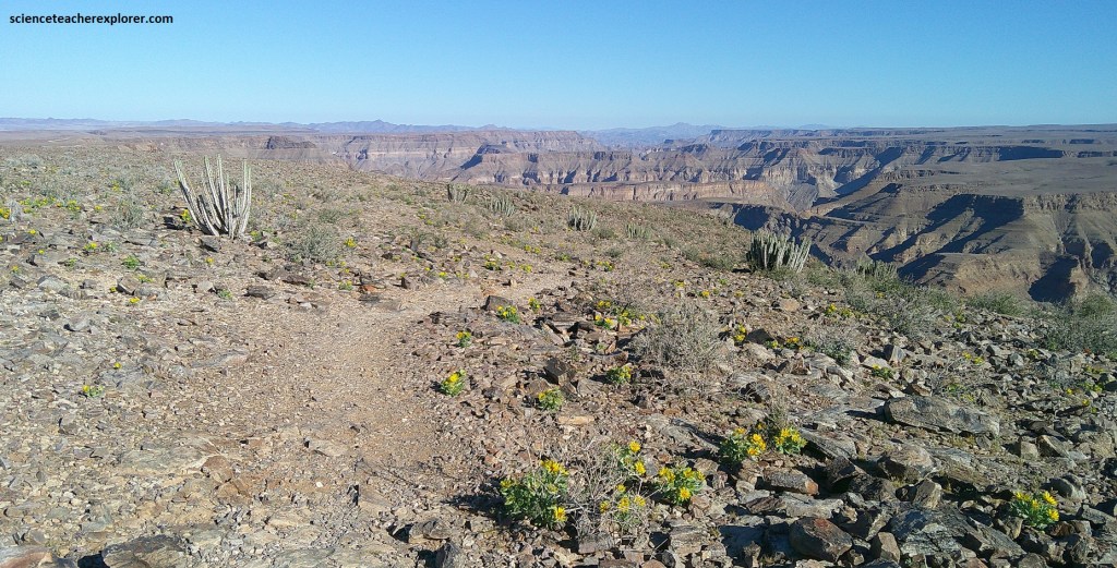
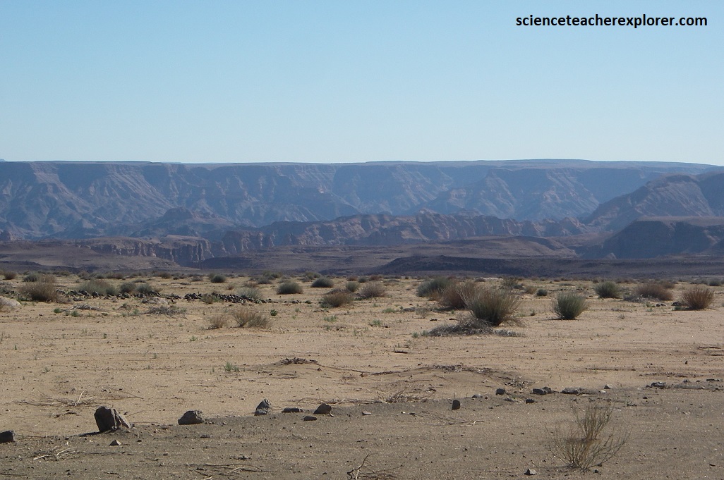
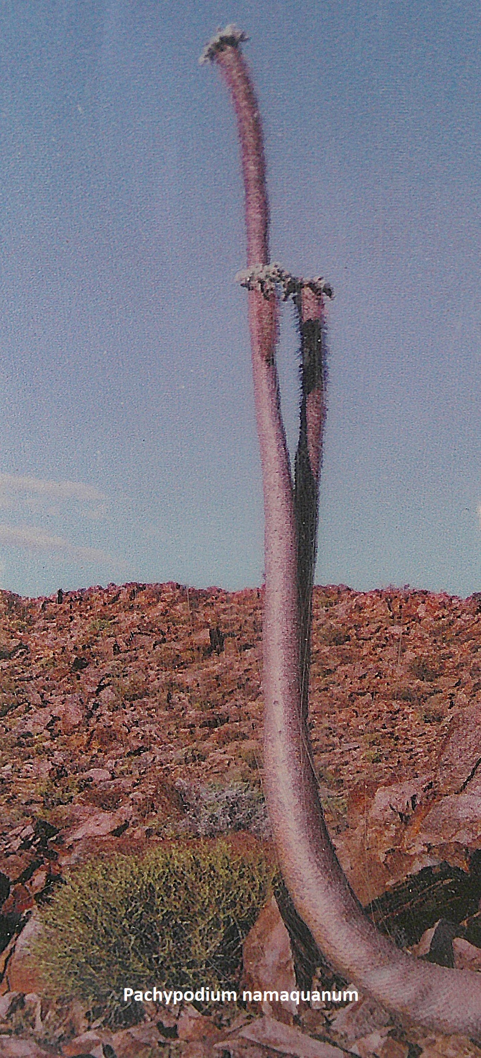
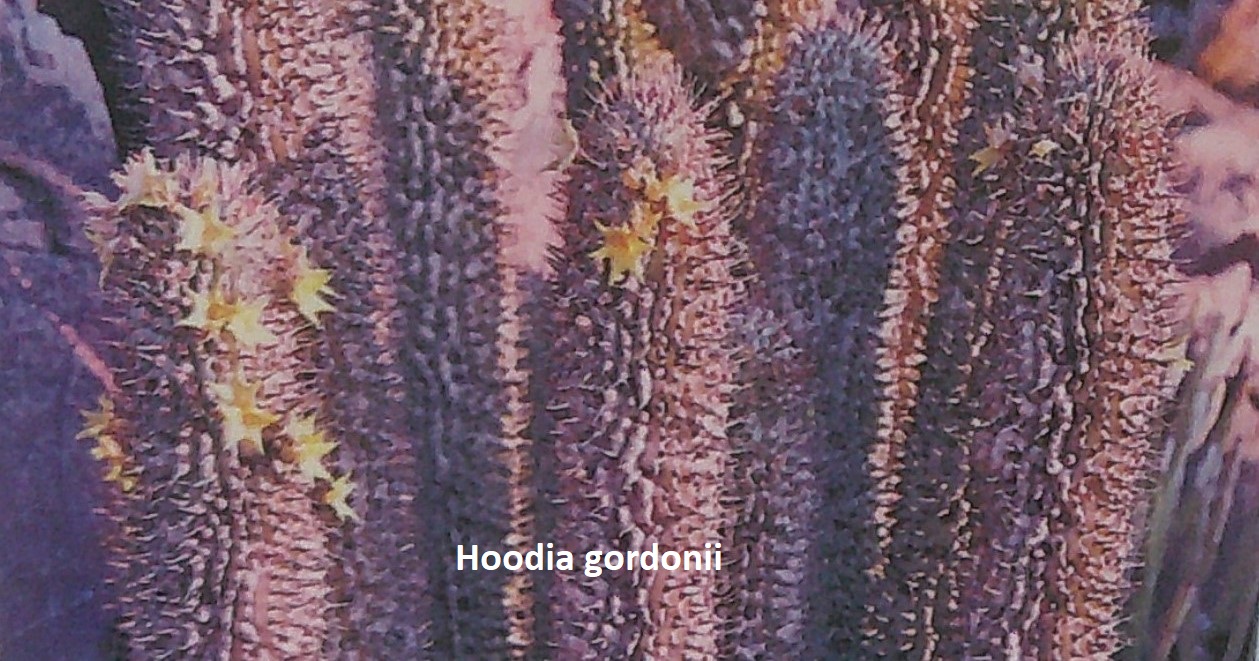
Pictured above, the Fish River Canyon area has a typical semi-desert climate. The average annual rainfall in the canyon area is 100mm. It drops vertically by half a kilometer, out of a flat arid plateau without any warning here. As with most rivers in Namibia the Fish River is generally dry however in the raining season (January to April) the river can become a raging torrent. The park is characterized by two biomes: the Nama Karoo and the Succulent Karoo. The Nam Karoo, located east of the Fish River, is dominated by grassy dwarf shrubland, (pictured above). The Succulent Karoo, west of the river, is of course characterized by succulents. Some of the succulent species for which the park is famous are worthy of individual mention: the iconic quiver tree (Aloe dichotoma) and the “halfmans” (Pachypodium namaquanum or “elephant trunk”) are two of the largest mega-succulents. The Hoodia gordonii is now extremely threatened because it contains the appetite-suppressing molecule P57. The Hoodia gordonii is a leafless, spiny succulent plant that has flowers that smell like rotten meat and are pollinated mainly by flies, (pictured below). {Pictures below were taken from an interpretive sign}.
I should mention, the Fish River Canyon has more recently been impacted by the opening of the East African rift (25-22 million years ago) and the continuing tectonic uplift of the southern African continent, a phenomenon known as the ‘African superswell’.
Over time, through all-these successive ages, the Fish river Canyon has undergone a combination of tectonic events, (from contraction to stretching), or volcanic climatic events and erosional forces that created this geological highlight, one of the greatest sights in Africa.
