Lee’s Ferry, AZ 2024
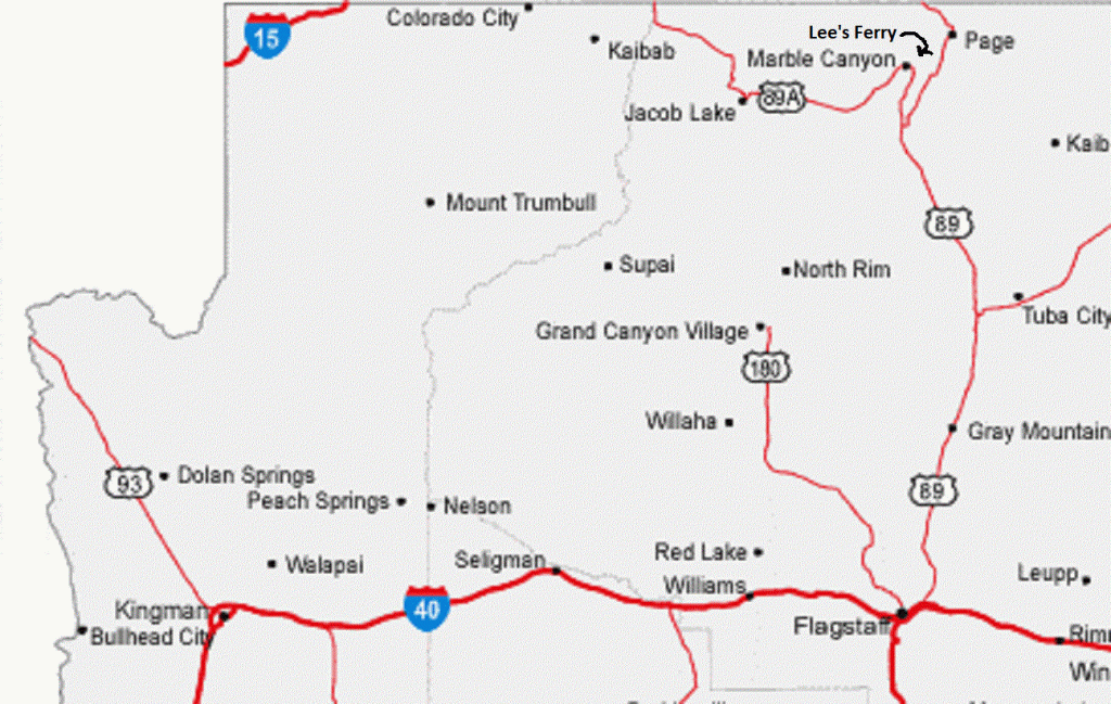
While traveling to the 2024 Total Solar Eclipse in Texas, I passed through southern Utah on US89 to Page, Arizona. After passing through Page on south US89, I turned right on Hwy. 89A. My destination was Lee’s Ferry. Lees Ferry was 61 km from Page via Hwy 89 south and Hwy 89A west. At Bitter Springs, I turned north on 89A.
{The photos below are taken at the Antelope Pass Viewpoint in 2024}
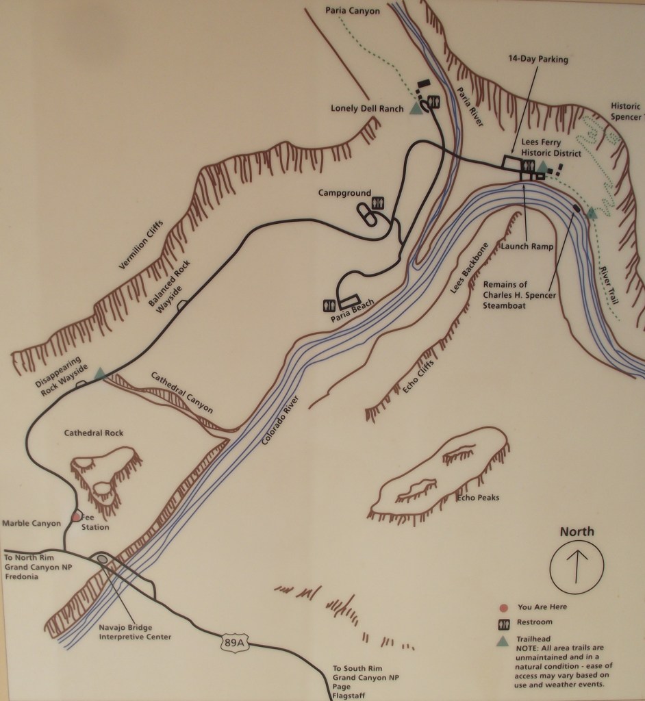
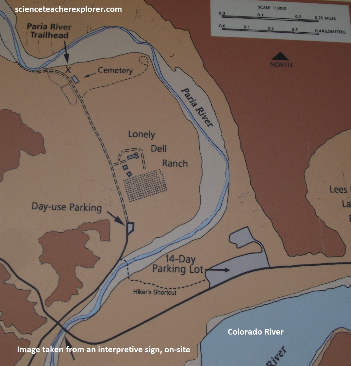
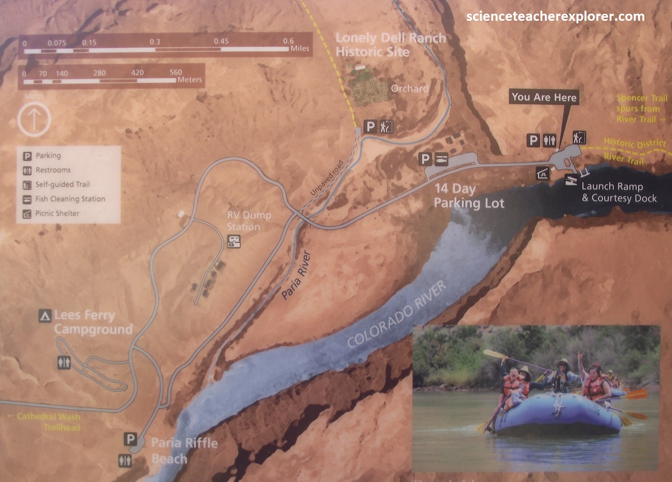
The Lee’s Ferry area includes about 700 square kilometers of sparsely populated semi-arid canyon and plateau country in Coconino County, Arizona. The historic crossing of the Colorado River at Lee’s Ferry is situated in the geographic center of the area above the confluence of the Paria and Colorado Rivers. At Lee’s Ferry the altitude is about 3,100 feet (1,033m); the surrounding high plateaus are form 1,500-2,330 m above sea level.
Imaged above, until the modern construction of bridges and dams, Lee’s Ferry was the only place a person could safely cross the Colorado River in more than 1,170 km of river. Imaged below, Lees Ferry Junction and Park Entrance is in Marble Canyon, just west of Navajo Bridge Interpretive Center. A paved road leads 8 km to the Ferry area.
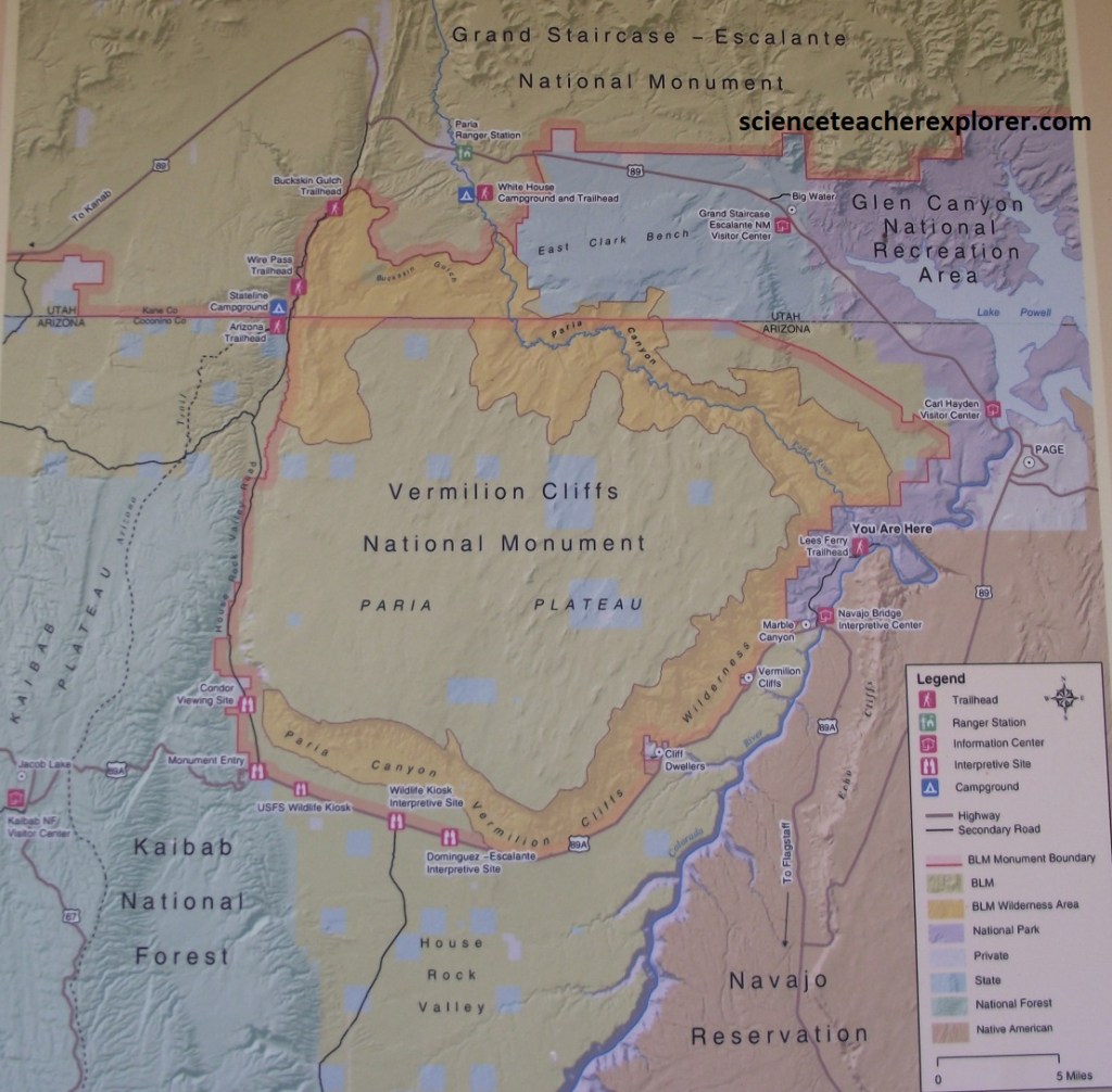
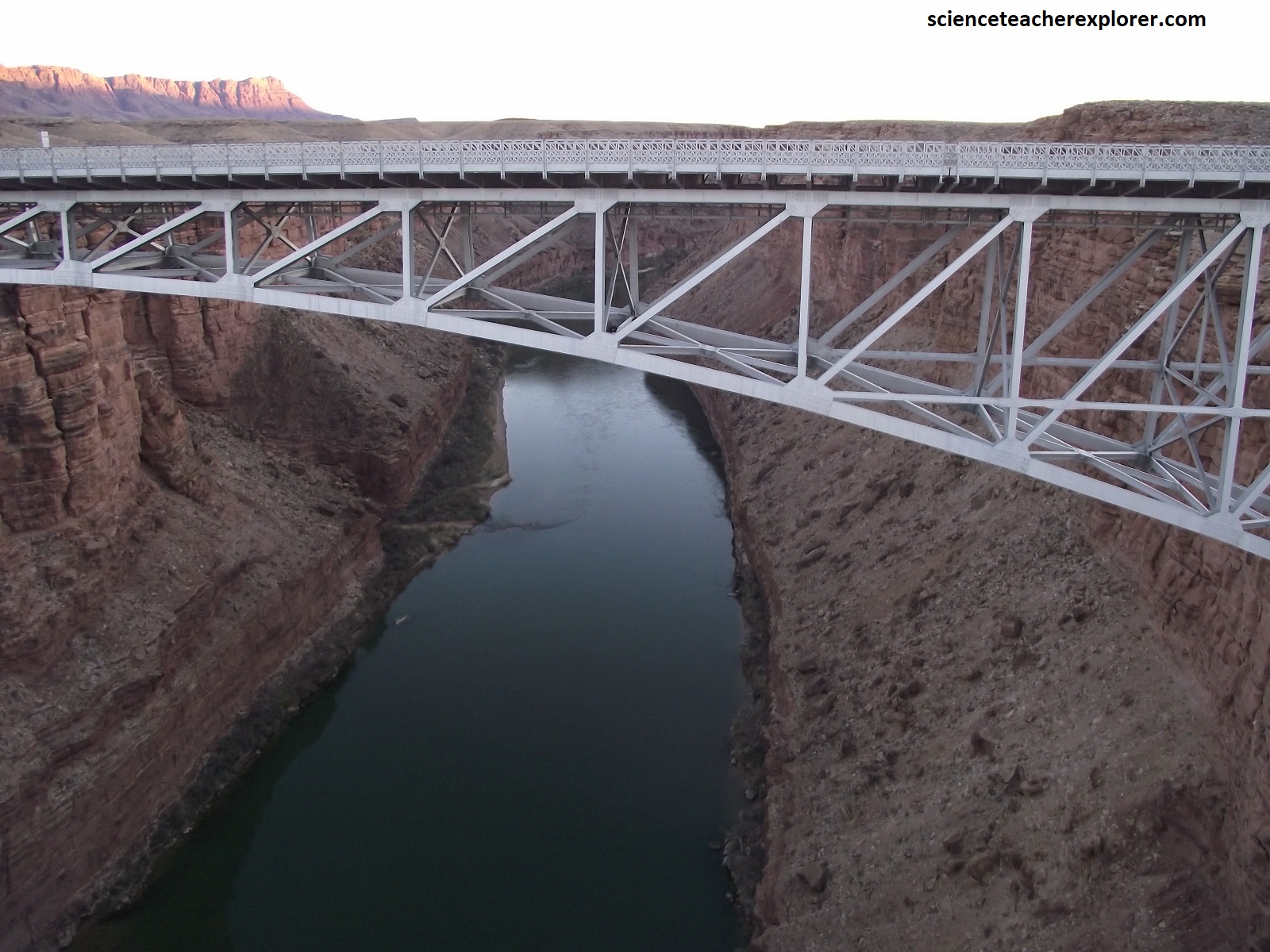
Soaring 156m above the water, the light and airy appearance of Navajo Bridge contrast the depth of its historic importance as the only means of crossing the Colorado River for some 965 km.
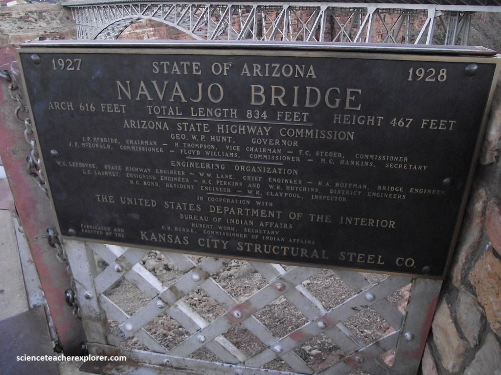
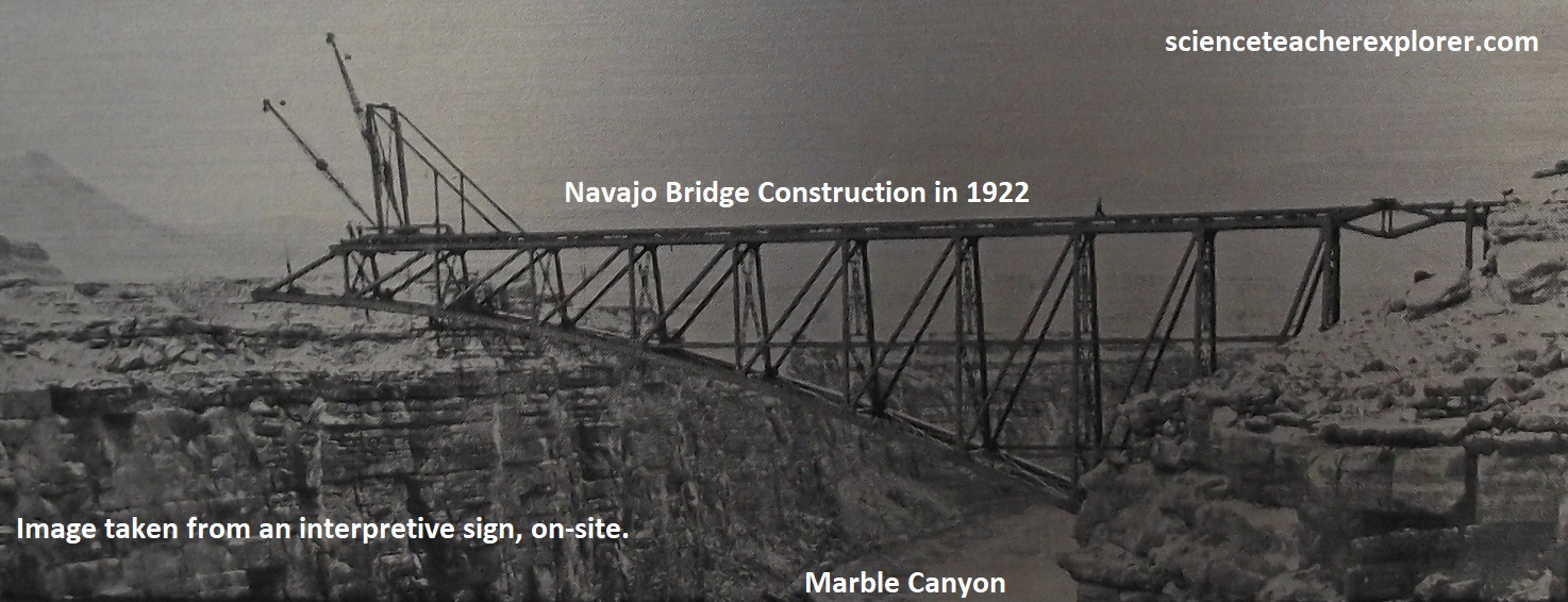
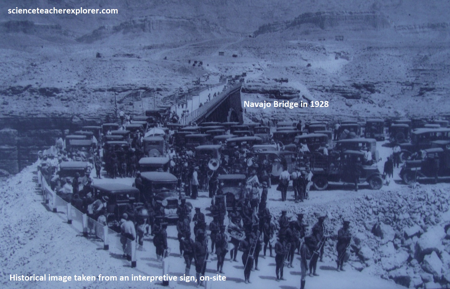
Now a pedestrian path, historic Navajo Bridge was the highest steel arch bridge in the world at the time of its construction in 1928. Canyon walls were blasted to prepare the site, then steel and supplies trucked 201 km up from Flagstaff, Arizona. The bridge was constructed as two cantilevered arch halves, each extending 94m over the Marble Gorge. When the two halves were connected on September 12, 1928, the entire region became connected in a whole new way. No more precarious river crossings on a boat at Lee’s Ferry. Automobile travelers now had safe and direct highway access to and through some of the country’s most magnificent landscapes.
For over half a century, the bridge forged a vital travel link for local residents and commercial interests, as well as road-tripping tourists. But it was never intended to carry the larger, heavier vehicles of today. A new bridge, (wider and stronger than the first), became necessary.
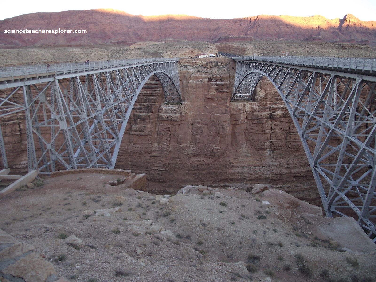
Picture above, the wider and longer modern Navajo Bridge maintains the important travel corridor, while addressing the safety hazards of it’s predecessor. Thou structurally sound, the original’s narrow deck, lack of sidewalks, and sharp curving approach amid spectacular scenery lea to a dangerous mix of car and pedestrian traffic. Still the original bridge engineers got plenty right. Computer modeling and seismic testing found no better bridge location than right alongside the first. The new builders could even take advantage of the extensive blasting and site preparation done in 1927-28.
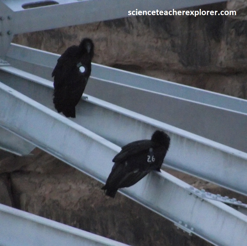
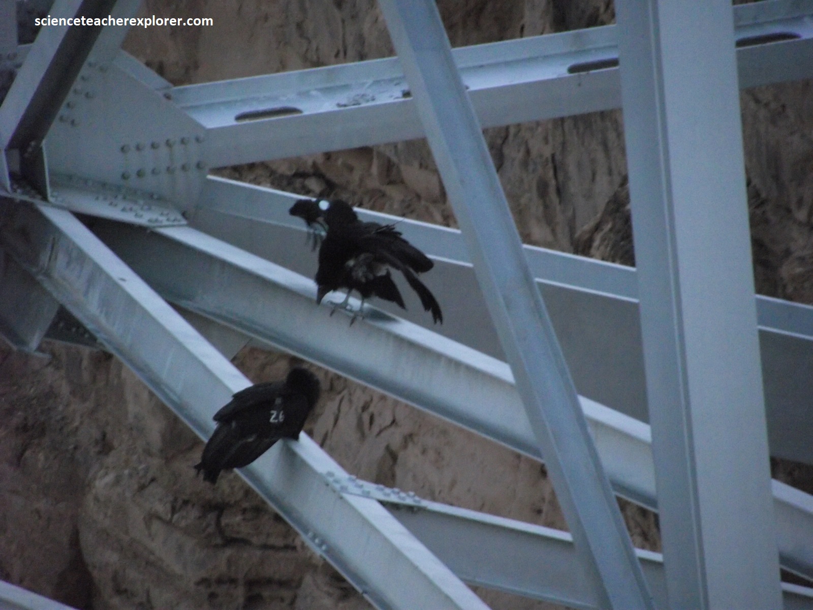
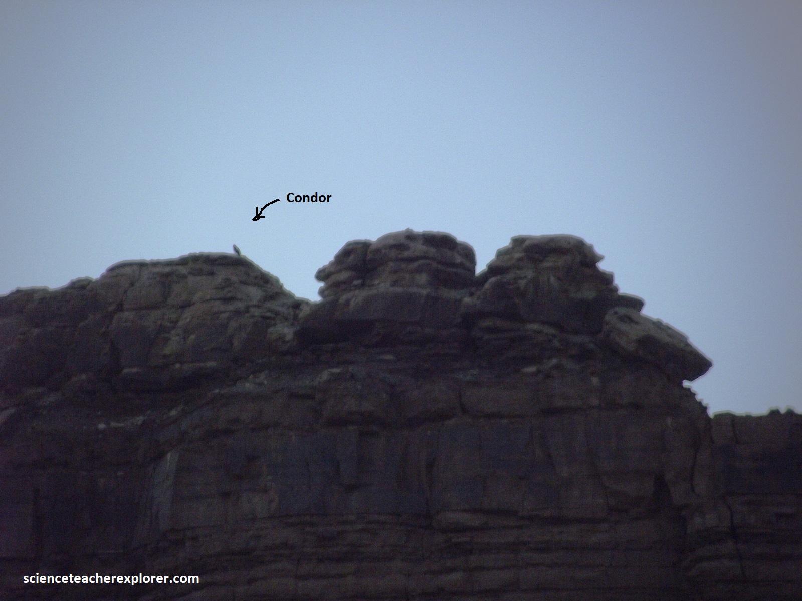
{Within the beams of Navajo Bridge, I spied a group of young California Condors, (nearly extinct), pictured below.
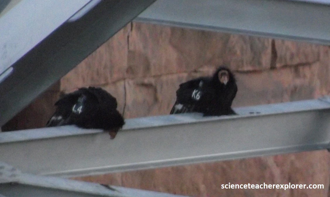
An ancient and hardy species, condors soared over much of North America during the Pleistocene Ice Age, feasting on the remains of mammoths and mastodons. Opportunistic scavengers, (not hunters), condors may travel over 161 km in a day in search of food, ranging over millions of acres in a lifetime.
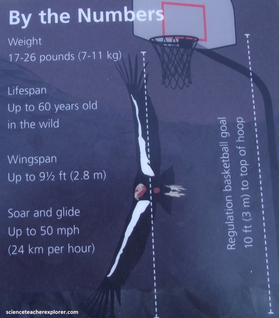
Though California Condors survived ice age extinctions, they were nearly wiped out by unwitting humans. Years of shooting, harmful pesticide use, and especially lead poisoning reduced the entire population to just 22 individuals in the 1980s! To save the species, biologists began a captive breeding program which raises chicks and releases them into the wild, beginning a slow but steady rebound. In 2003, Arizona saw its first wild fledgling in over a hundred years. Now hundreds fly free.
Lead poisoning remains the biggest treat to condors, causing half of all diagnosed condor deaths. Fortunately, many hunters reduce the threat b using non-lead bullets, so the carrion and gut-piles condors feed upon are not contaminated. Human carelessness is preventable and condor conservation is possible.
Pictured above, released birds have a radio transmitter and numbered tags attached to their wings, allowing biologists to identify and track every condor. The Picture on the left is one of the working biologists and the picture on the right is the adult condor watching below at for her young ones from the Vermillion Cliffs, (imaged below).
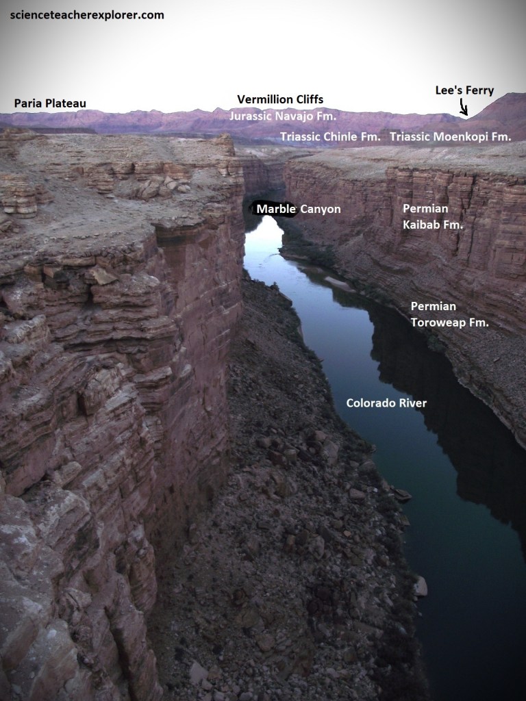
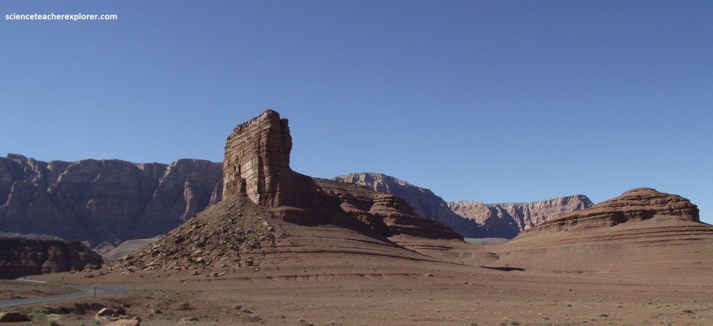
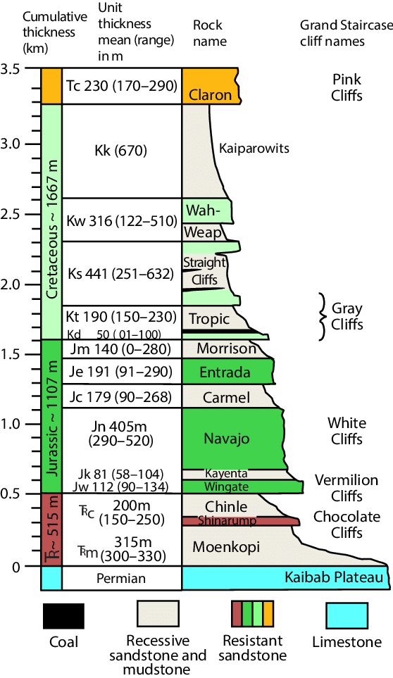
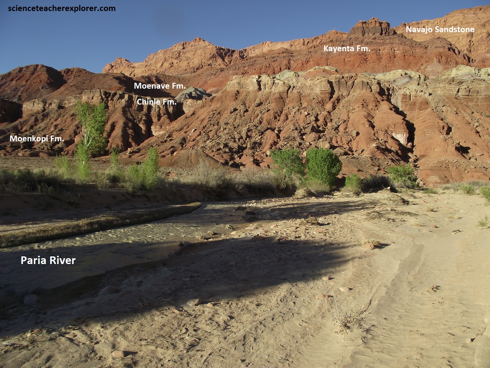
The historical crossing at Lee’s Ferry, was made possible because of the soft, easily eroded nature of rocks that allow direct access to the river. Geologically, Lee’s Ferry is the midpoint in the many layers of sedimentary rock that make up the Colorado Plateau, and it’s rocks mark a transitional time from shallow oceans to forested shorelines and streams, sandy deserts, and shallow lakes.
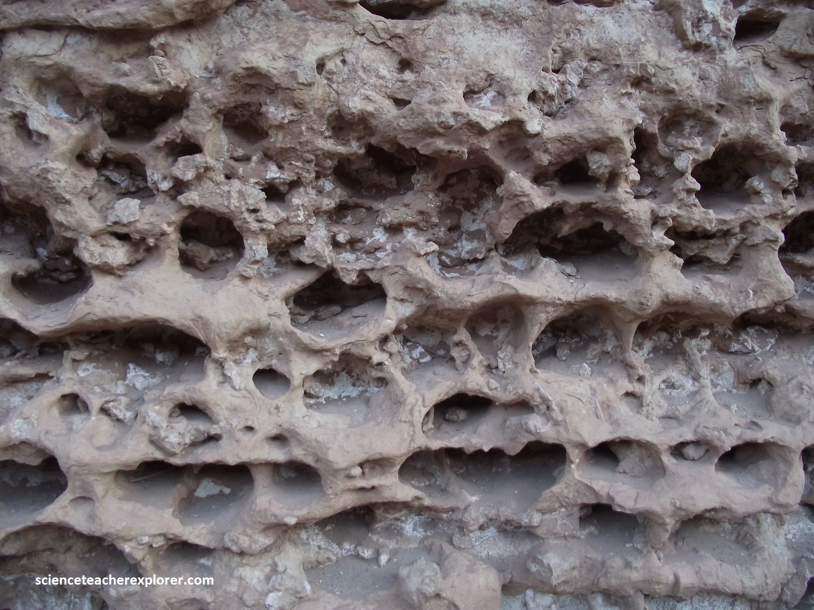
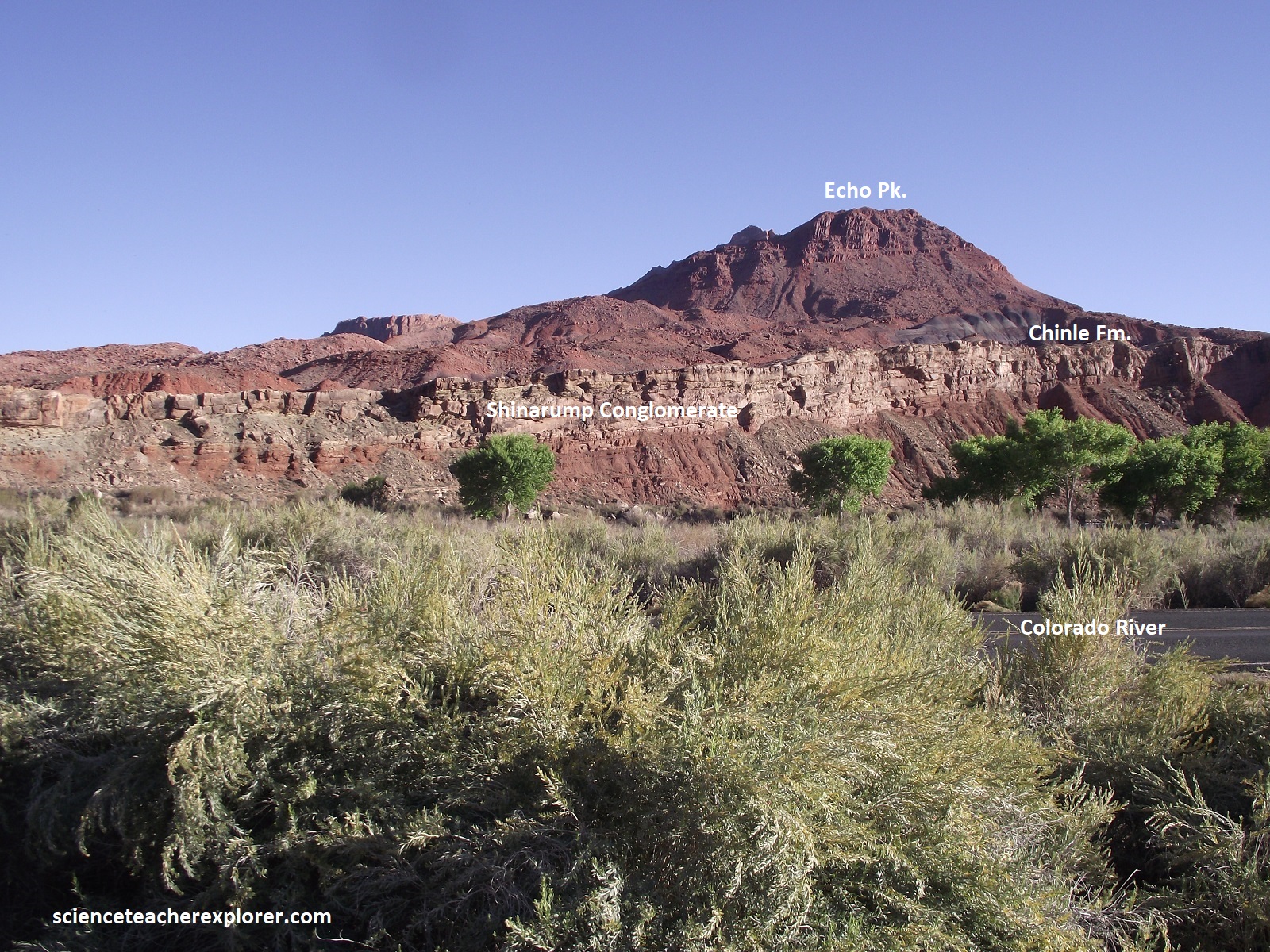
Pictured above is Cathedral Rock near Lee’s Station. It is an erosional remnant composed of red sandstone of the Moenkopi Formation, which was laid down during the Triassic. It is overlain by the resistant Shinarump Conglomerate caprock. The Moenkopi consists of two units, a thick lower unit of light red-brown thin-bedded silty shale and a thin upper unit of chocolate-brown limy shale and dark-brown sandstone; the formation is between 110-180 m thick.
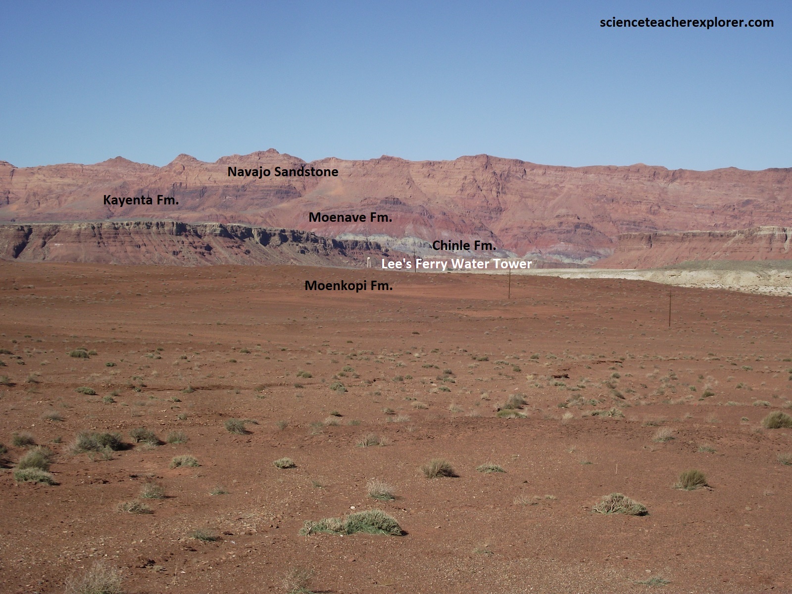
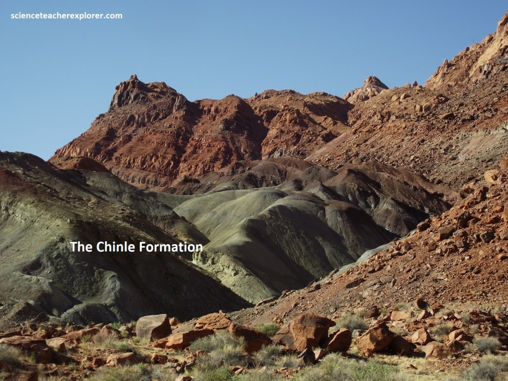
Pictured above, The Chinle formation rests unconformably on the Moenkopi formation and is divided into the conglomeratic Shinarump member at the base, and Petrified Forest sandstone and mudstone unit above the Shinarump member, and a thick unit of mostly vari-colored mudstone that comprises the upper one-half to two-thirds of the formation. The thick mudstone unit has been subdivided into members in other parts of the Colorado Plateau, but for various practical reasons these units were not distinguished in the Lee’s Ferry are. The Chinle formation is between 330 and 380m thick in the Lee’s Ferry area. The cliff-forming Glen Canyon group of Triassic and Jurassic age overlies the Chinle formation and comprises rocks of the Moenave, Kayenta, and Navajo formations. The Moenave formation, unconformable upon the Chinle formations.
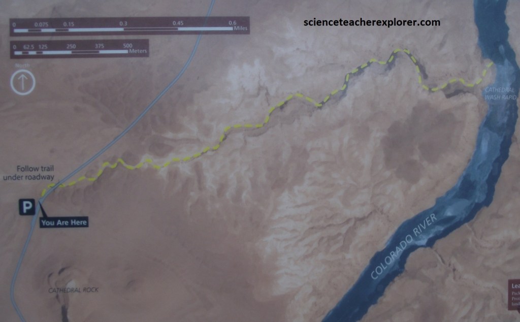
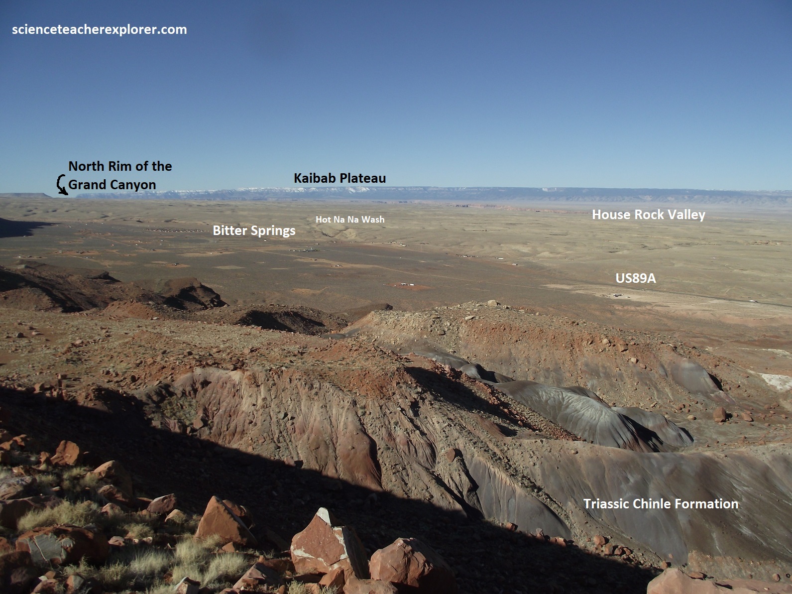
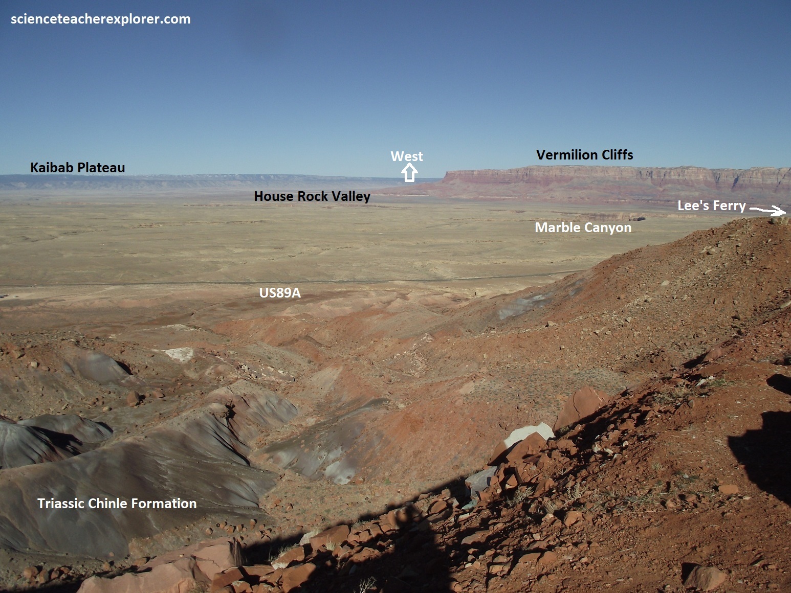
Imaged above, a trek down the dry Cathedral Gulch had no technical chalenges, but scrambling and carful decision-making were needed to choose safe routes over ledges and dropoffs. The small canyon took me deeper and deeper through the Kaibab Limestone and Toroweap Formations until ending at the river, where canyon debris creates the Cathedral Wash Rapid.
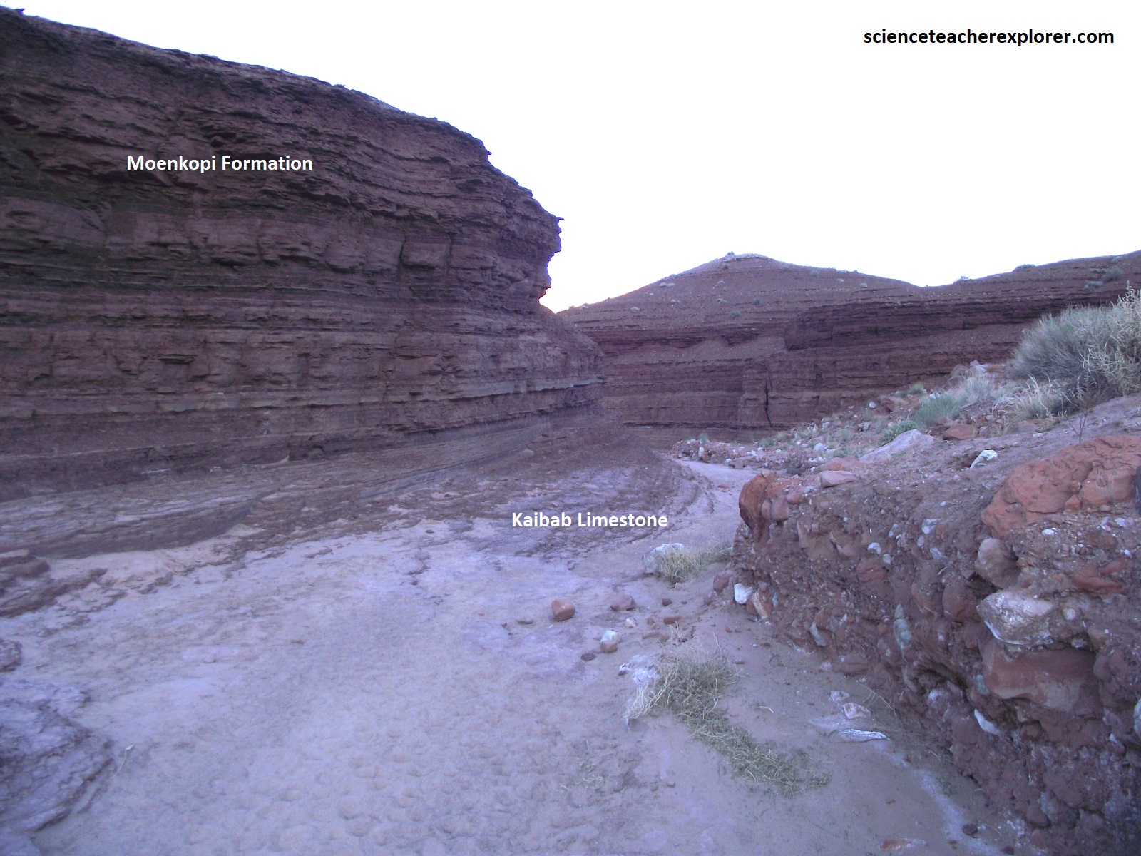
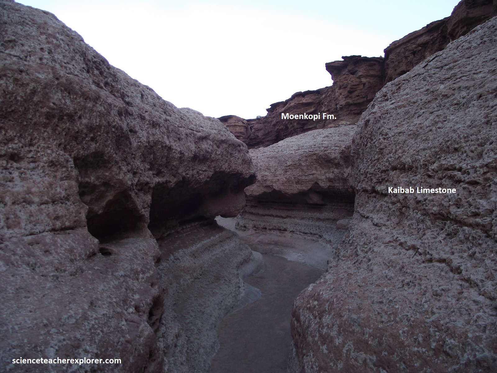
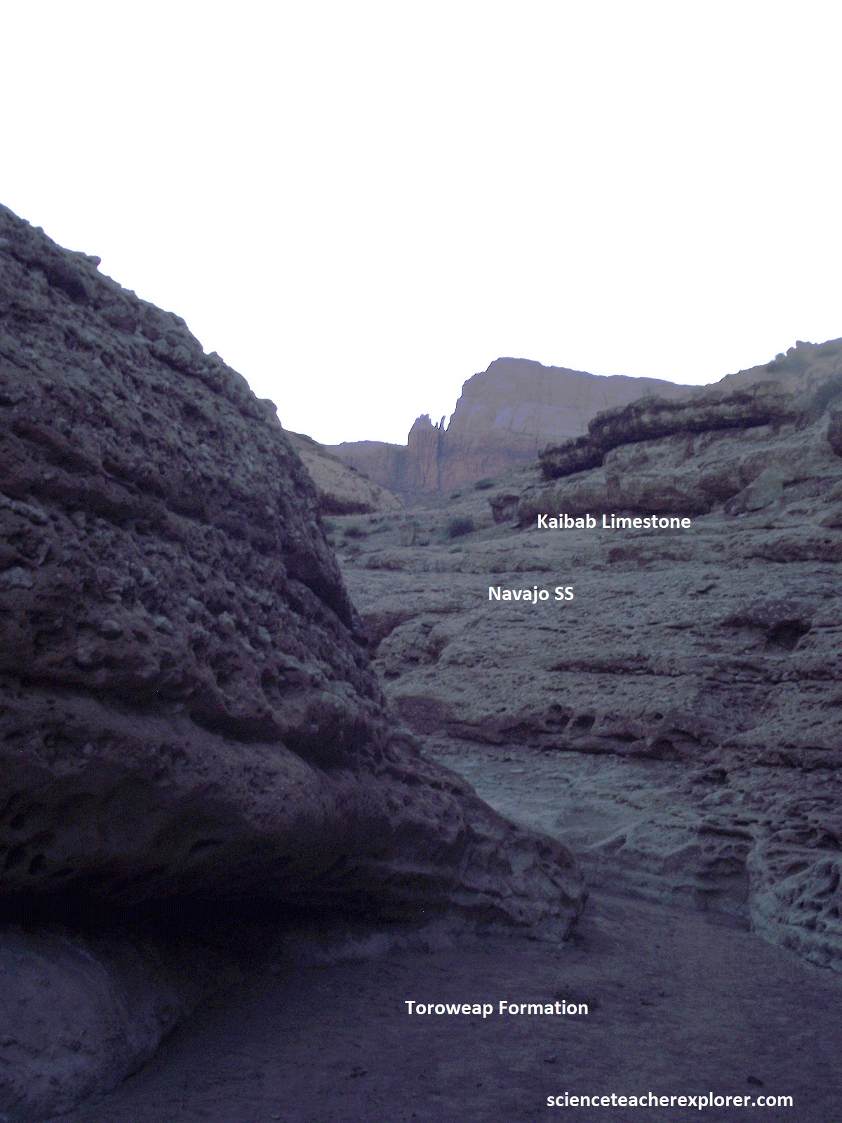
Pictured above, the Toroweap formation is composed largely of shallow-water near-shore deposits and the Kaibab limestone was deposited from the quiescent seas of the Cordilleran geosyncline that finally encroached as far southeastward as northwestern Arizona during Permian time (260 million years ago). The Kaibab limestone forms a widespread resistant surface that is trenched by the nearby Marble Canyon, and even older formations form cliffs or steep slopes on the inner walls of Marble Canyon, (southwest of Lee’s Ferry).
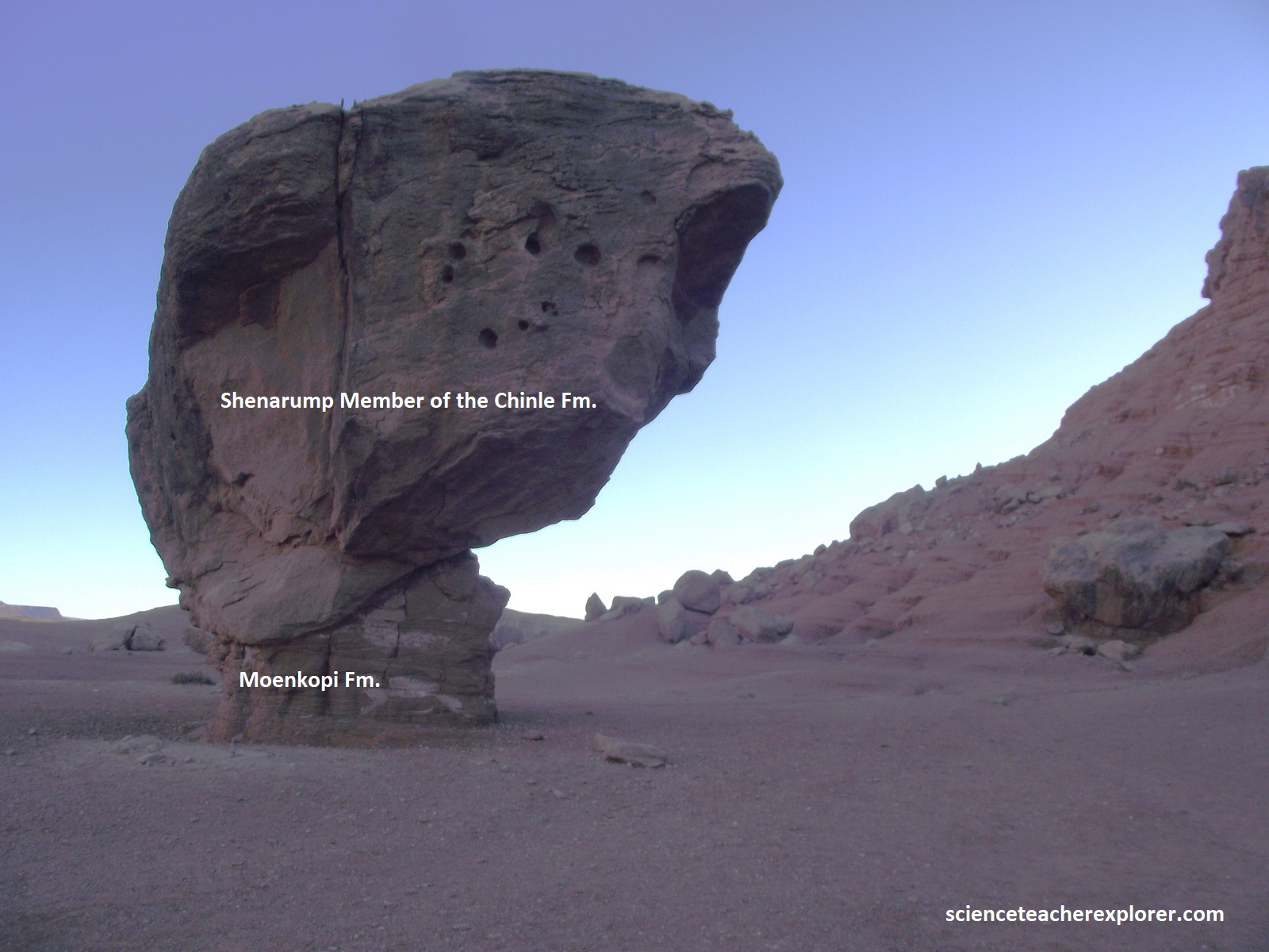
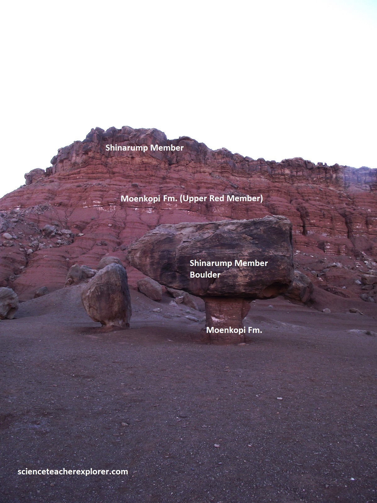
Just north of Cathedral Rock, is this balanced rock. Thousands of years ago a huge rock boulder broke from the cliff above and tumbled to a stop, (picture above). The hard conglomerate boulder compressed the softer dirt directly beneath, making it resistant to erosion. The boulder also acted as a massive umbrella, protecting the stone beneath from years of wind and rain. Over time, at least 2m of the surrounding loose ground was carried away, leaving an ever-growing pedestal with a balanced rock perched on top. The above Shinarump Conglomerate is Middle to Late Triassic, 227-225 million years old. The sands and gravels deposited by slow, meandering rivers then cemented together into highly resistant sandstone and pebble conglomerate, (at that time, Arizona sat near the equator in a tropical environment). The lower Moenkopi Formation is Early to Middle Triassic, 246-235 million years old. Mud and sand deposited on wide-tidal floodplains resulting in poorly cemented, thinly-layered mudstones and sandstones, (at that time, this area sat at the edge of a shallow inland sea covering present-day Utah.
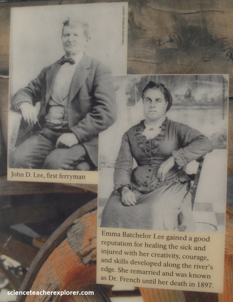
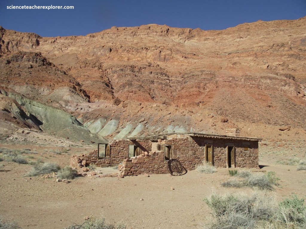
Imaged above, John D. Lee and wife Emma established the Lonely Dell Ranch to support their lives as river ferry operators. While living there, they shuttled wagon trains and travelers across the Colorado river on makeshift ferry boats and skiffs. The crossing became a key rustic outpost as settlers emigrated into Arizona. It also provided a veil over Lee, who arrived at the ranch a fugitive for his involvement in the 1857 Mountain Meadows Massacre. Lee’s frequent absences left Emma and their children as the driving force behind all operations. The law caught up with Lee in 1874 and he was later executed. Warren Johnson arrived with his family in 1875 to assist Emma with the ferry. She continued on at Lonely Dell until 1879, sold the property, and left. [More families would follow, called by the Mormon Church, to maintain the ferry’s crucial link on the emigration trail].
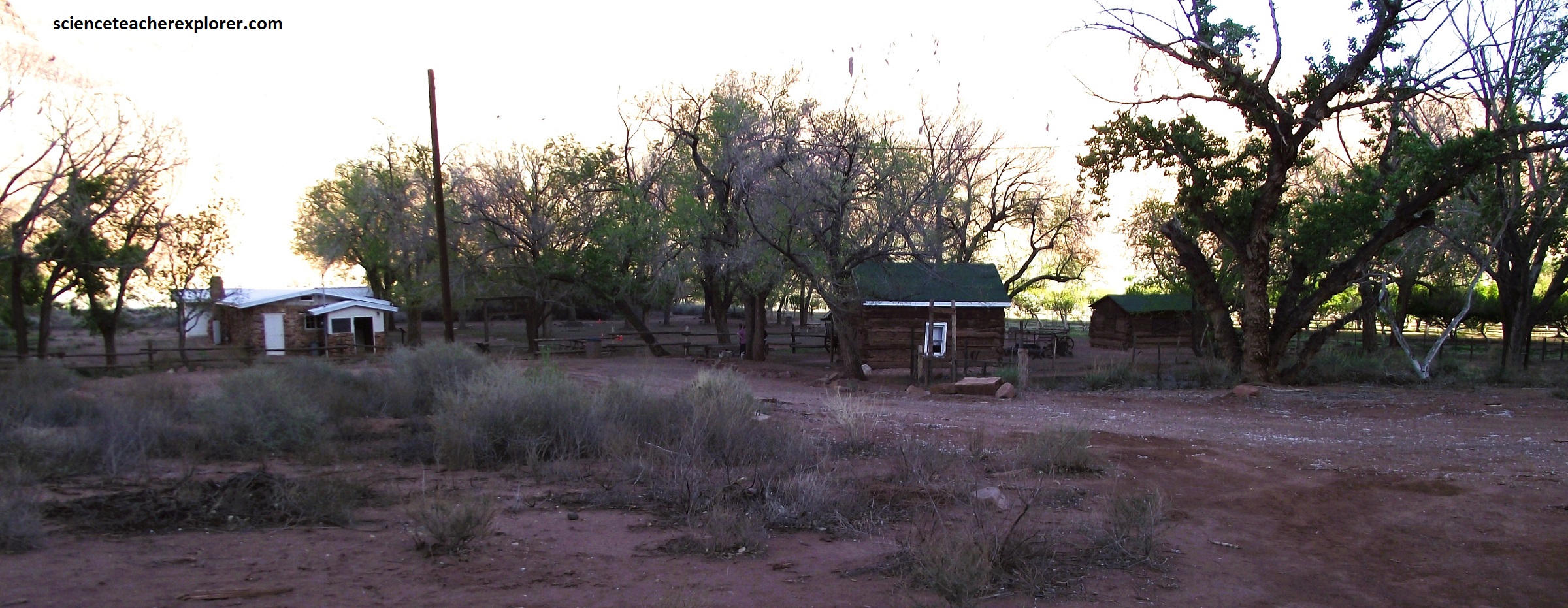
Pictured above, for more than 100 years, Lonely Dell Ranch has meant different things to those who traveled here. To pioneers and missionaries, it was an isolated settlement offering small comfort during a long journey further south. To the families who live here, the ranch was the centerpiece of daily life, requiring constant hard work to tame the rugged yet beautiful desert. For other it offered employment or trade in a hardscrabble setting. And for later owners, it promises a rustic peace and quiet. {The Weaver House was built in 1936 by the Hopi stonemason Poli Hugavi and acted as the main lodge for a dude ranch}.
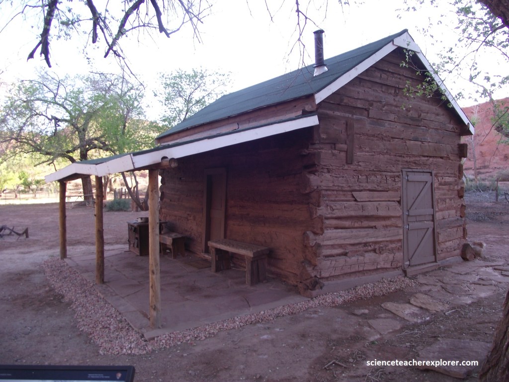
Warren Johnson, who took over operations after the Lees, built this cabin for his second wife Samantha and their young children in 1886. Samantha lived here only a year until the large family home was completed next door. When she moved out, farm-hands moved in. In 1897, the new ferryman James Emett converted the cabin into a school for the children of Lee’s Ferry. Using salvaged parts from a steamboat abandoned along the shore of the Colorado River, Emett extended the walls and improved the floor and roof. Throughout the years, the cabin housed ranch workers and travelers, then reprised its role as a schoolhouse in the 1920s.
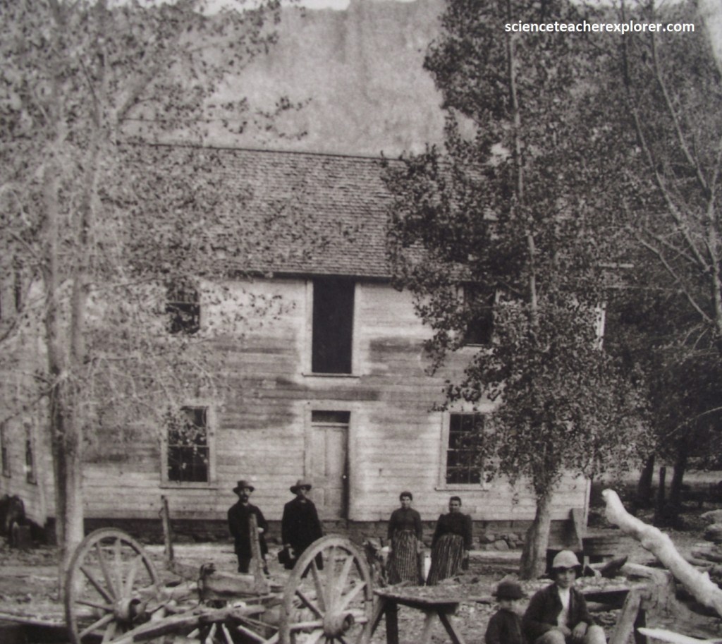
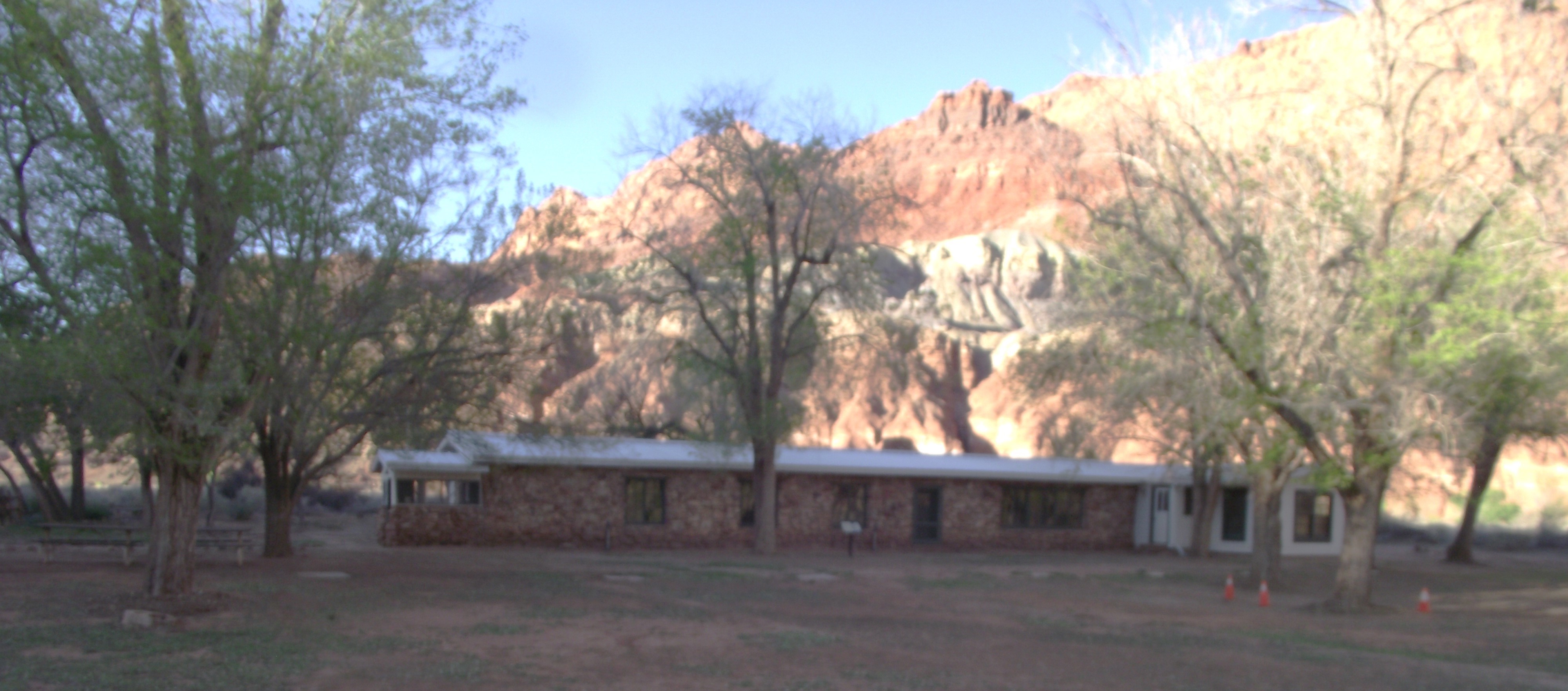
Imaged above, the ferryman Warren Johnson built a two story house for his families using proceeds from the ferry. They tore down Emma Lee’s cabin to make room for the new home, removing the last Lee Family structure at Lonely Dell. In 1897, new lead ferryman James Emett moved in with his family and added a wing to the house. The home continued to be the center of the ranch until consumed by a kitchen fire in 1926. Remaining wood and stone were used in other building.
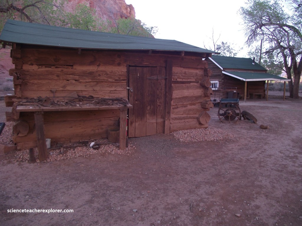
Pictured above, this crooked relic, one of many cabins that once littered the ranch, hold stories from the rotating characters who lived and worked at Lee’s Ferry. Farm hands, bee keepers, hay bailers, and educators all toiled together to support and sustain life on a busy ranch. Native Americans and pioneers of differing faiths shared tales of success and hardship around glowing candle light within these outbuildings and homes.
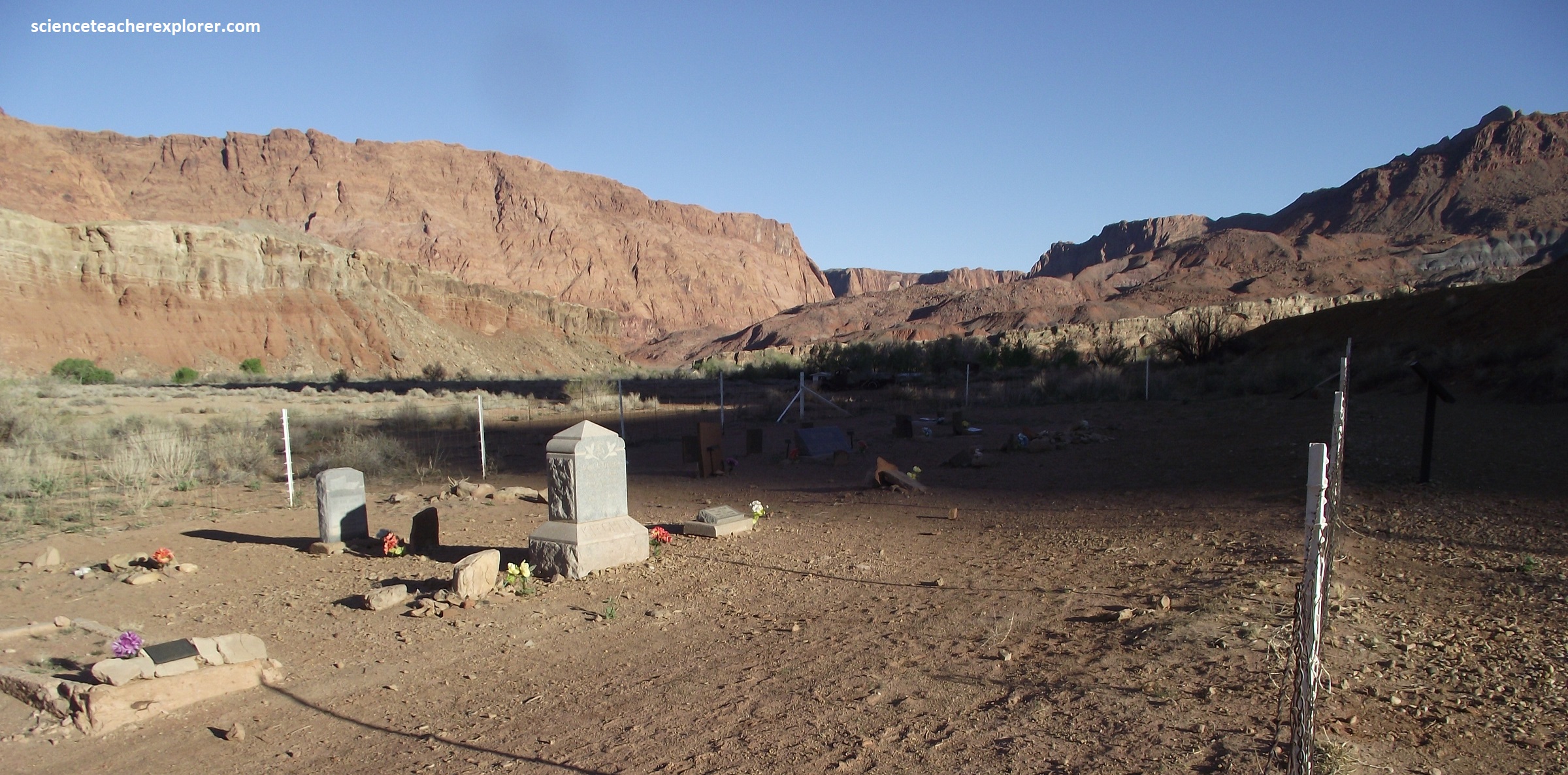
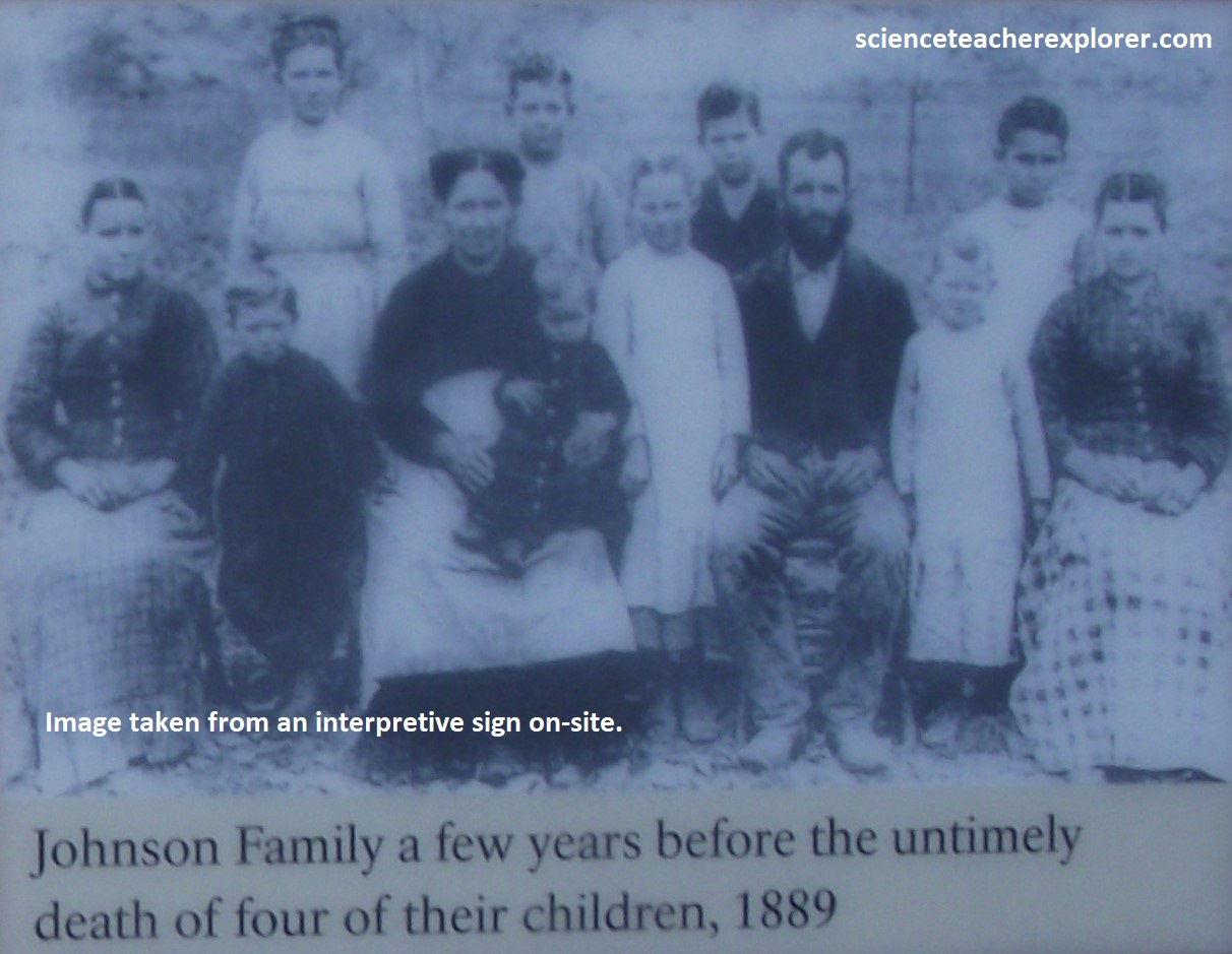
As travelers arrived and departed from the Lonely Dell, they brought more than goods and company. In close quarters with poor sanitation, unrecognized disease spread easily. After giving hospitality to travelers, Warren and Permelia Johnson lost four children with weeks to a mysterious illness, now recognized as diphtheria. Sickness, childbirth, and exposure to the elements claimed many lives in the pioneer movement throughout the area. Descendants of 20 pioneers buried here visit and tend the graves.
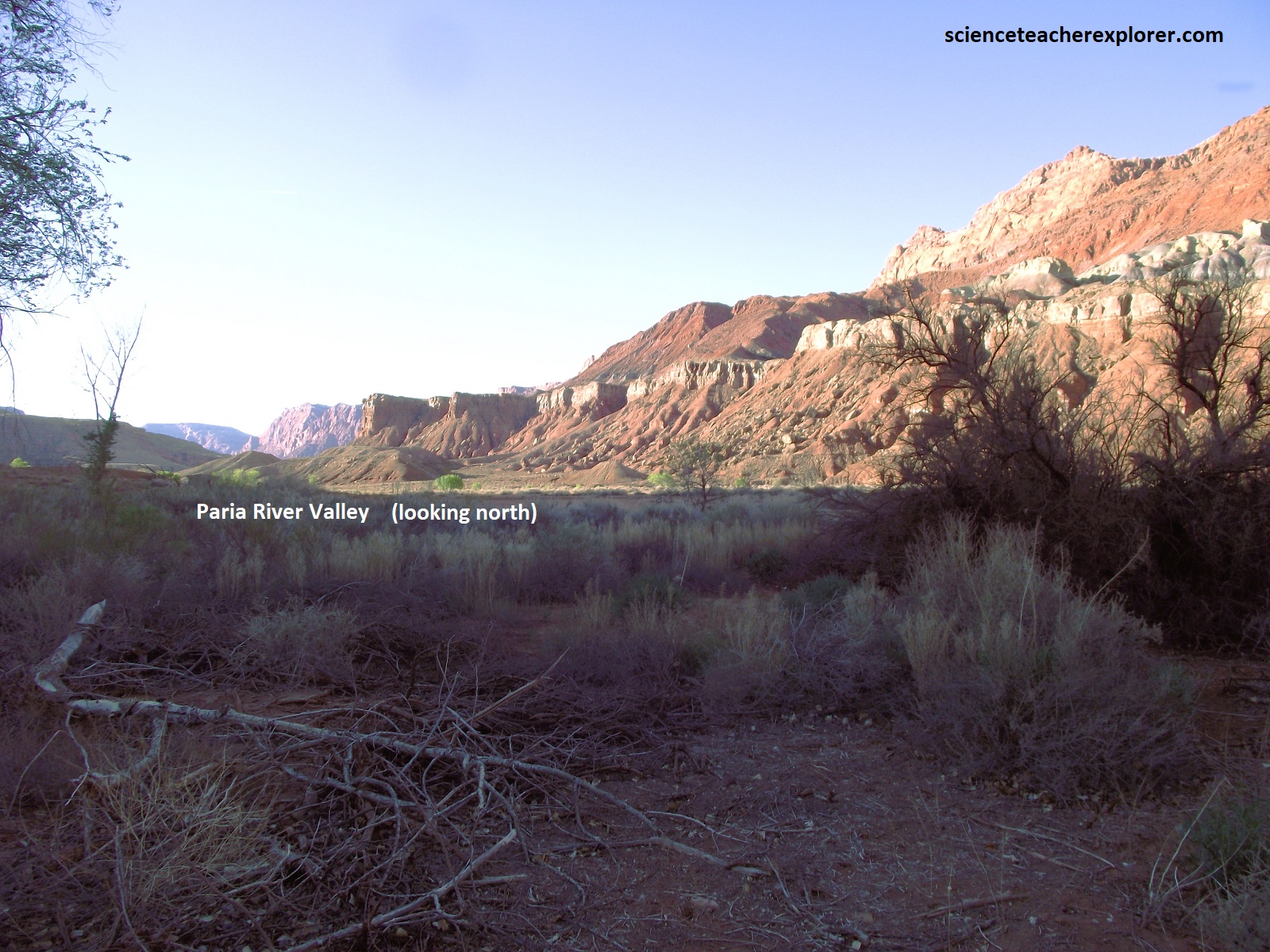
Pictured above, the Paria River drainage is near the middle of the Colorado Plateau, and has at least its share of unique geologic wonders. The Paria begins at Bryce Canyon National Park and Table Cliff Plateau, and ends at Lee’s Ferry on the Colorado River. In between are canyons like Bull Valley Gorge, Round Valley Draw, and Buckskin Gulch, and the Lower Paria River Gorge, {all are places I’ve explored and trekked and are different web-pages I’ve included on this web-site}. Perhaps the most interesting geologic feature of all is “The Cockscomb”.
{Images above are interpretive signs found on-site in 2024}
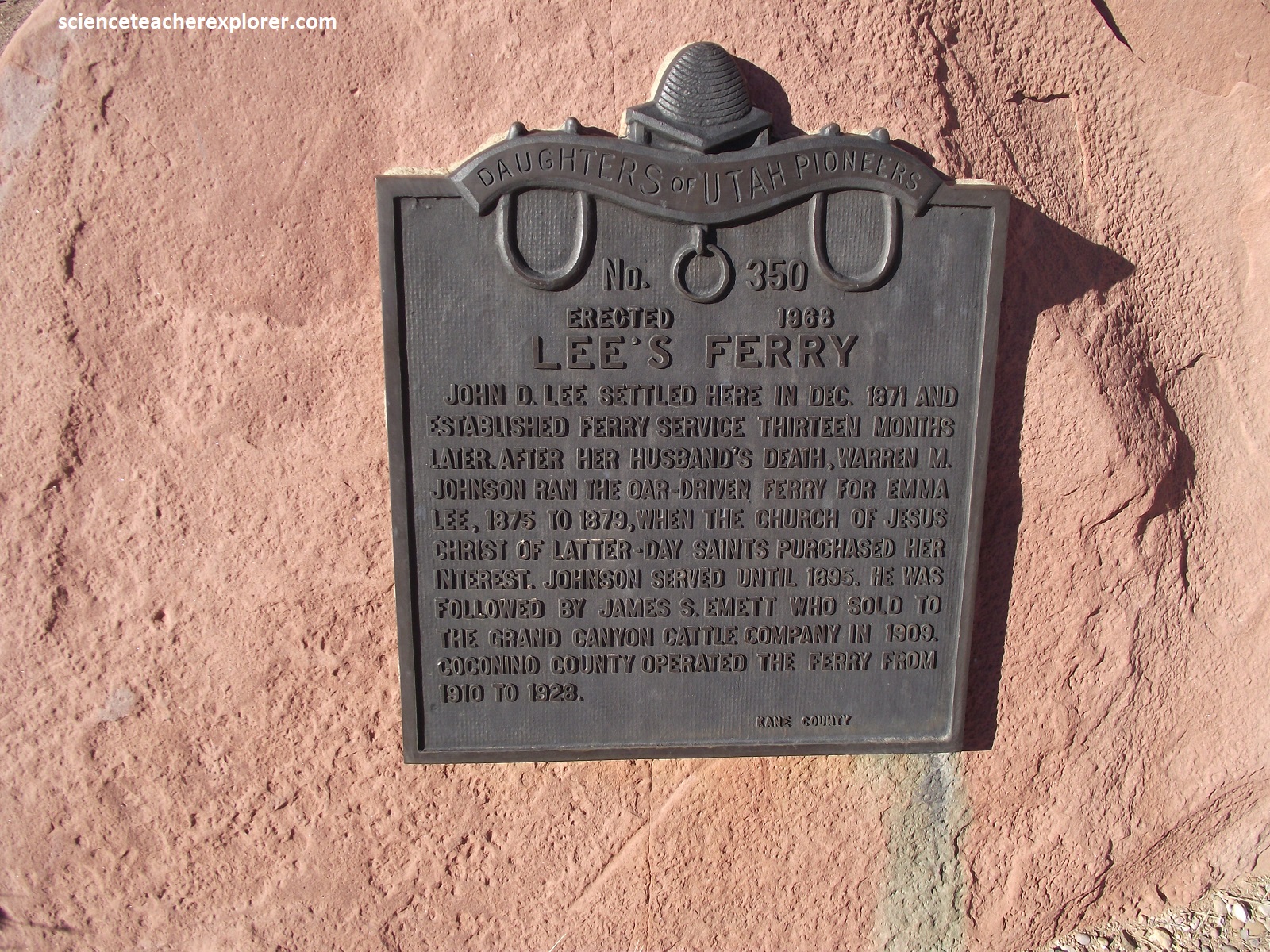
Surrounded by hundreds of kilometers of deep canyons, the Colorado River presents unimaginable barriers to travel. Over thousands of years, American Natives, explorers, and finally late-1800s pioneers found the end of Glen Canyon marked one of the only spots a person (or wagon) could reach the Colorado River from both sides. The Church of Jesus Christ of Latter-Day Saints established a ferry crossing here in 1872. John D. Lee was the first ferryman and namesake of the site. For 55 years, a variety of boats transported a variety of travelers across the Colorado River at Lee’s Ferry.
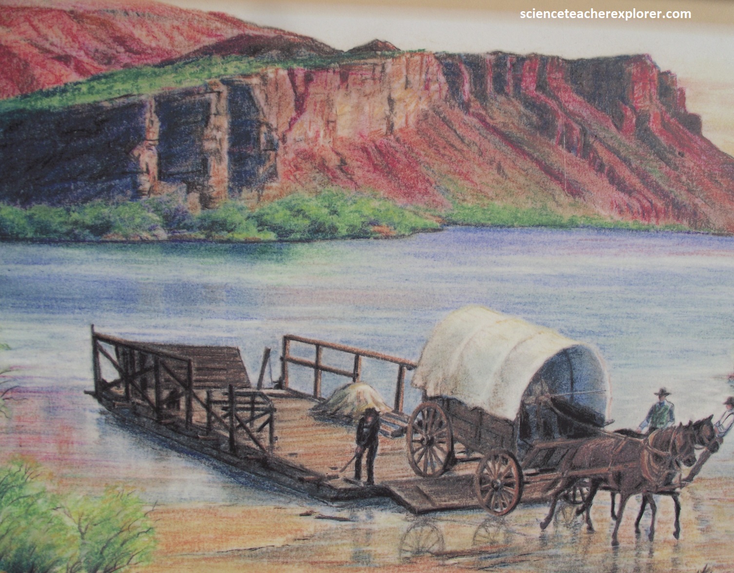
{Image above on the left is artist depiction of Lee’s Ferry that was found on an interpretive sign, on-site}
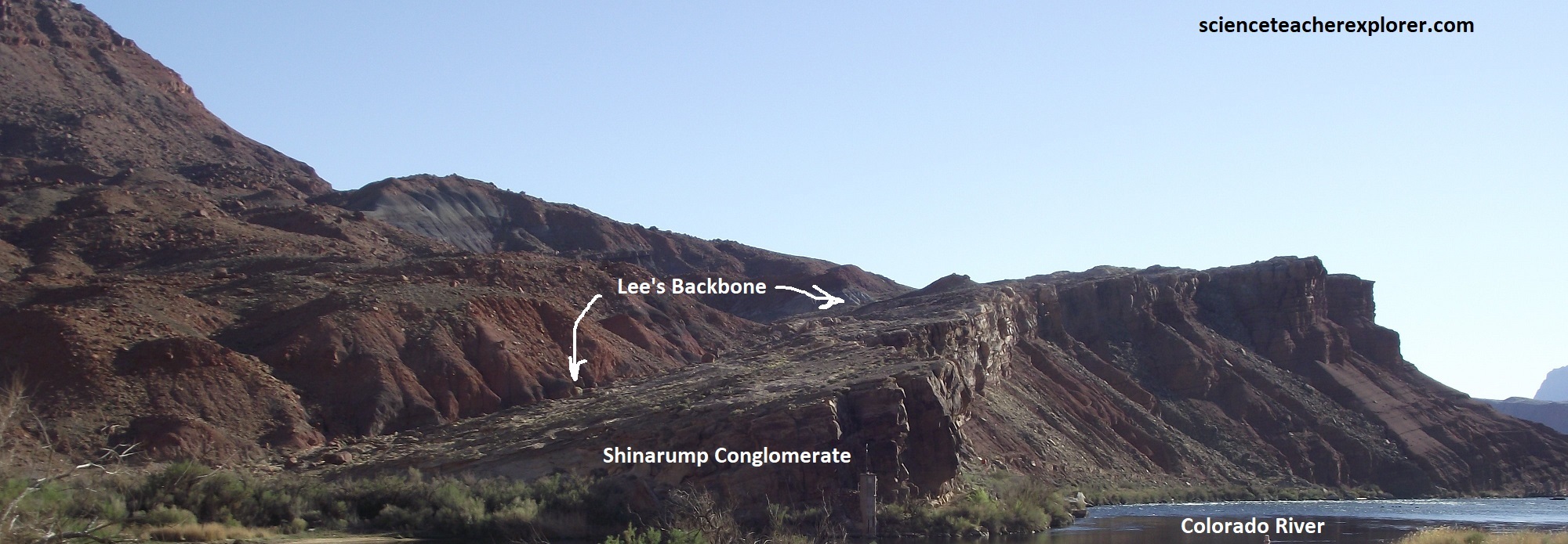
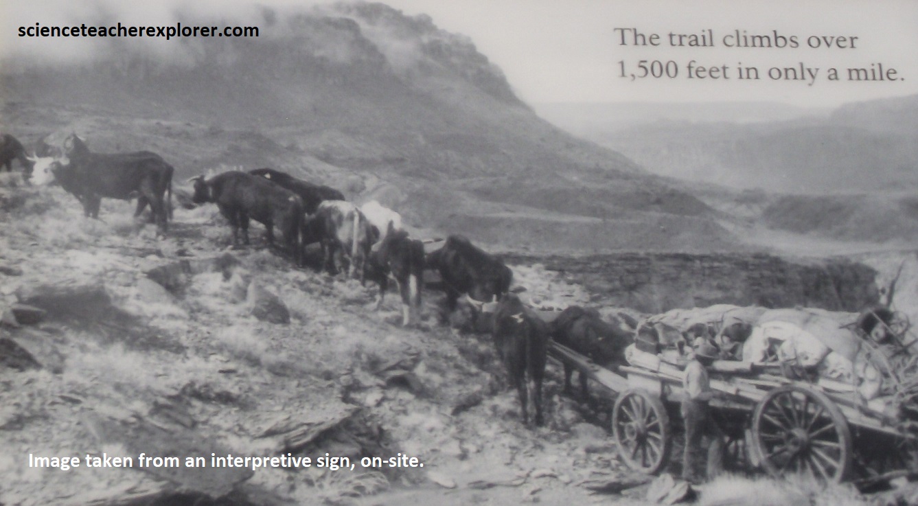
Until 1899, many pioneers crossed the river near the present-day boat dock, necessitating a harrowing wagon ride either up or down the unforgiving rock ledge known as “Lee’s Backbone”, (pictured above & below).
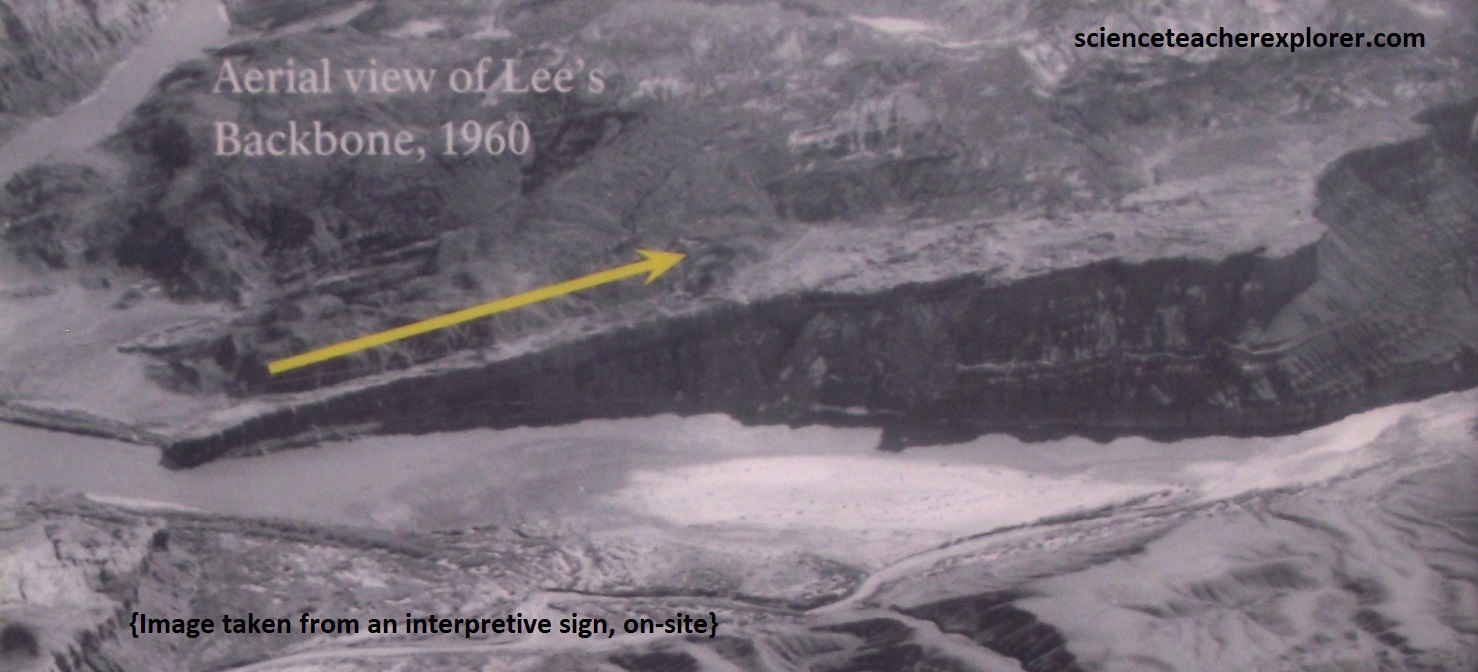
Pictured above, Lee’s Backbone is a rough, angled rock ledge on the opposite or South-side of the river back at Lee’s Ferry. Formed 225 million years ago, during the Late Triassic, a slow, meandering river laid down sand and rocks that were cemented into the hard Shinarump Conglomerate of the Chinle Formation. In most of the area, these oarse sdiments of te Shinarump Conglomerate are highly resistant to erosion, but they are only moderately well cemented by calcite and locally, chalcedony. [Note: A long dugway, or rough-cut road, later allowed travelers to avoid Lee’s Backbone. Pictured above, the road is still-visible across the river].
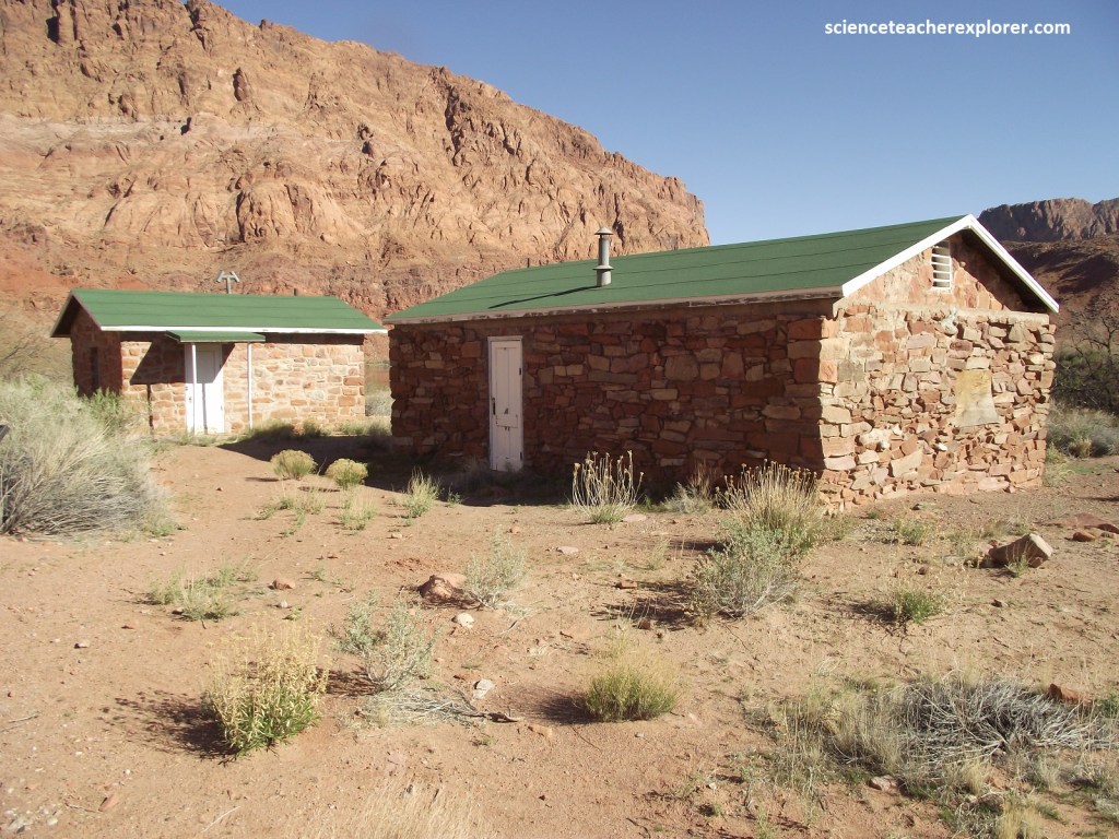
Pictured above, the fort was never attacked, but welcomed travelers as a short-lived trading post. In 1911, miners expanded the building to use briefly as a crew mess hall. Through the 1930s, it mainly served as a home for various ferry families, USGS employees, and passing travelers.
Pictured above, sporadic efforts to mine gold from the bentonitic mudstone in the Chinle formation near Lee’s Ferry were first made by Charles H. Spencer prior to 1913. According mineral-assayer Lawson (1913), samples of the mudstone averaged 2.5 -4 cents per ton of gold, but the metal defied all efforts for economic recovery, probably because it was too fine grained.
Pictured above, prospector Charles H. Spencer made a outsized impact on Lee’s Ferry in his short time there. A better salesman than miner, Spencer never succeeded in extracting minerals the way he succeeded in exciting investors and workers. When he staked his claim at Lee’s Ferry, financial investors and hardworking miners went along for the ride, but never struck it rich with Charlie.
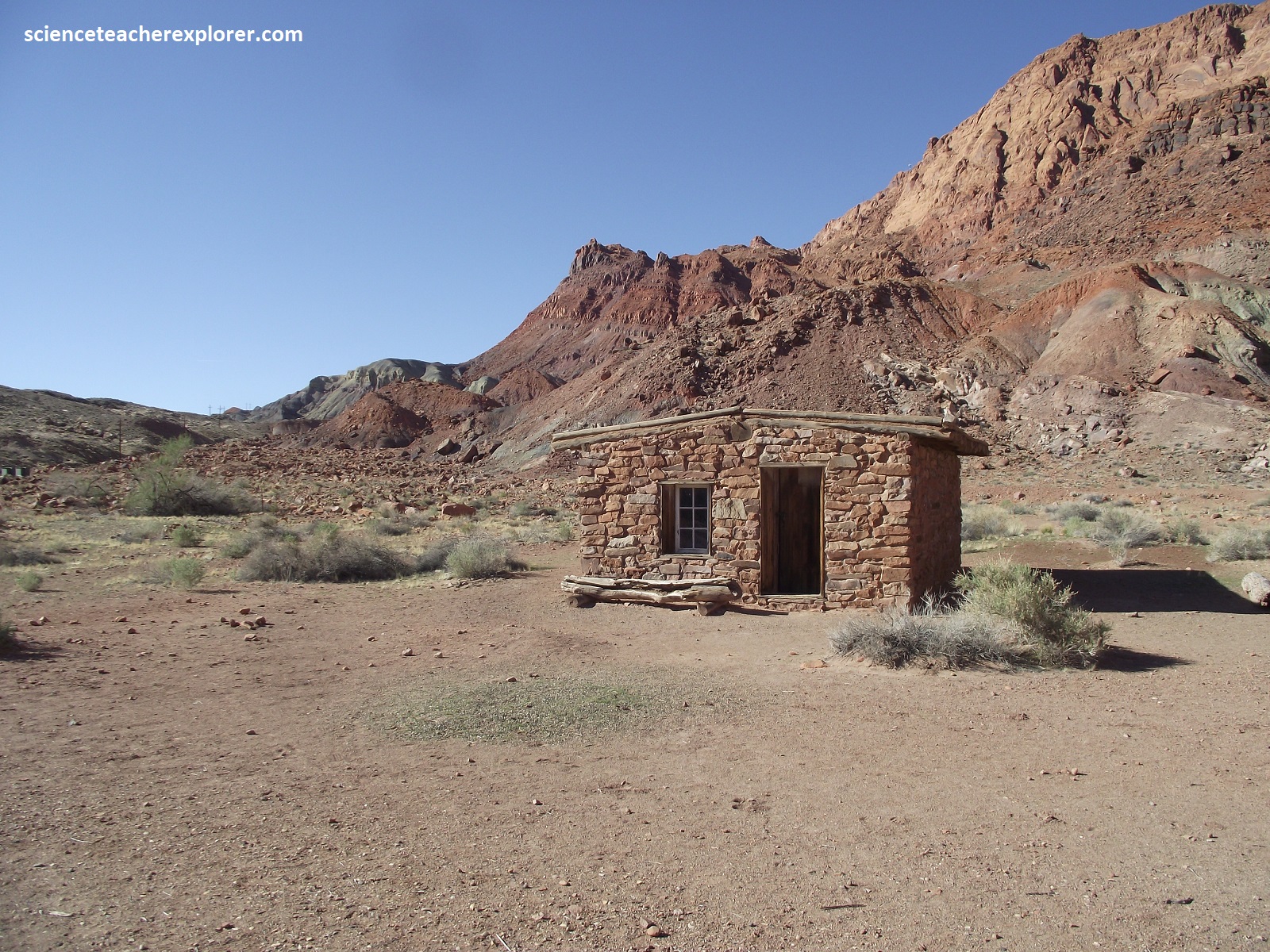
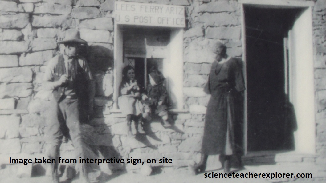
Pictured above, built in 1911, the first of Spencer’s eight stone buildings, was the headquarters of Charles H. Spencer’s gold mining company, (American Placer Corporation Office). Failing to recover gold, Spencer abandoned his mining outpost around 1912. Cowboys, miners, and travelers occasionally camped in the empty building. It briefly functioned as a post office in 1922, though almost no mail was sent or delivered.
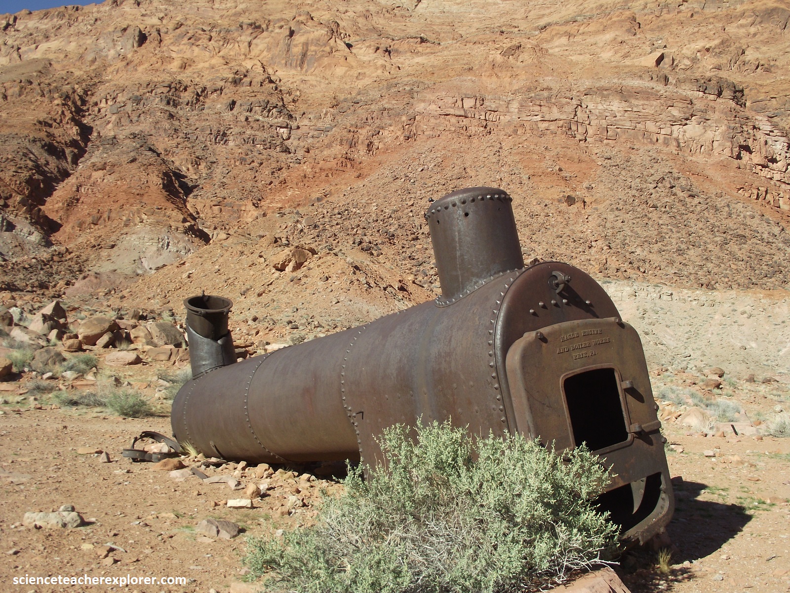
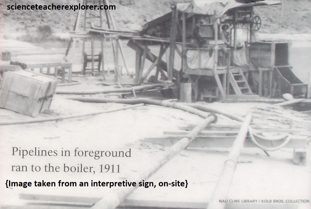
Pictured above, erected in 1910, is the Spencer Boiler the was hauled from Flagstaff, Arizona behind a ox-team. The Spencer Boiler was a Steam engine to pump water for Charles H. Spencer’s mining experiment. In his first attempt to extract gold, Spencer set up a pipe dredge across the river, The boiler produced steam that ran engines to pump water ad air down a pipe into the ground. Theoretically it would force sand and gold up through a casing. Unfortunately for Spencer, the pipe only went down a few feet before hitting rock. The experiment failed.
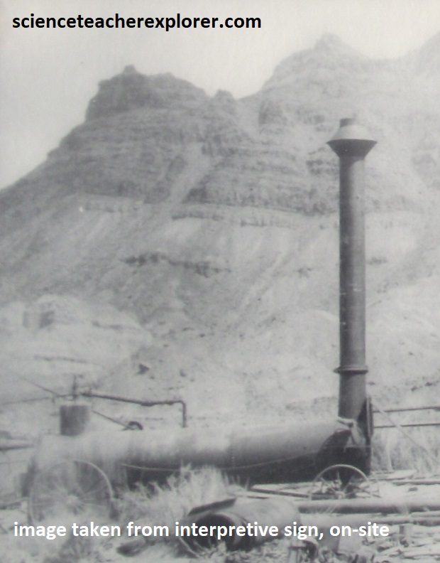
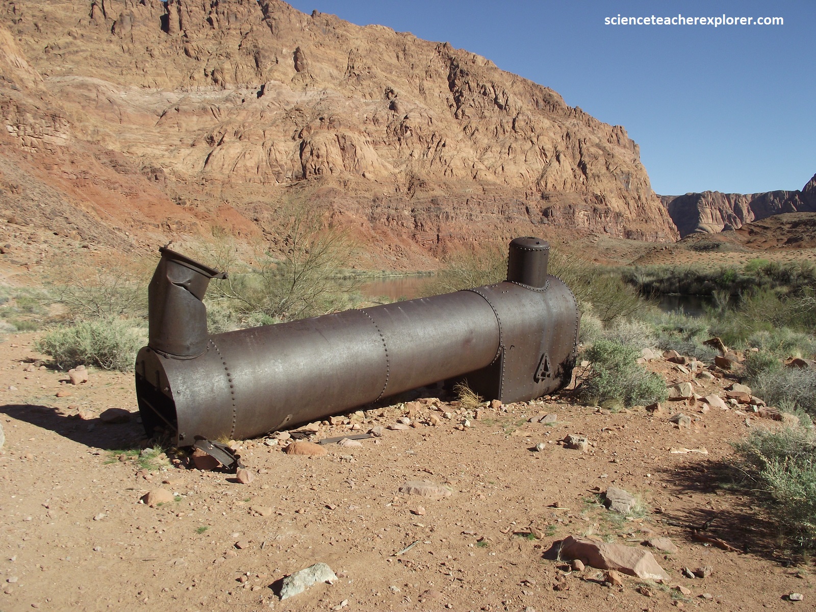
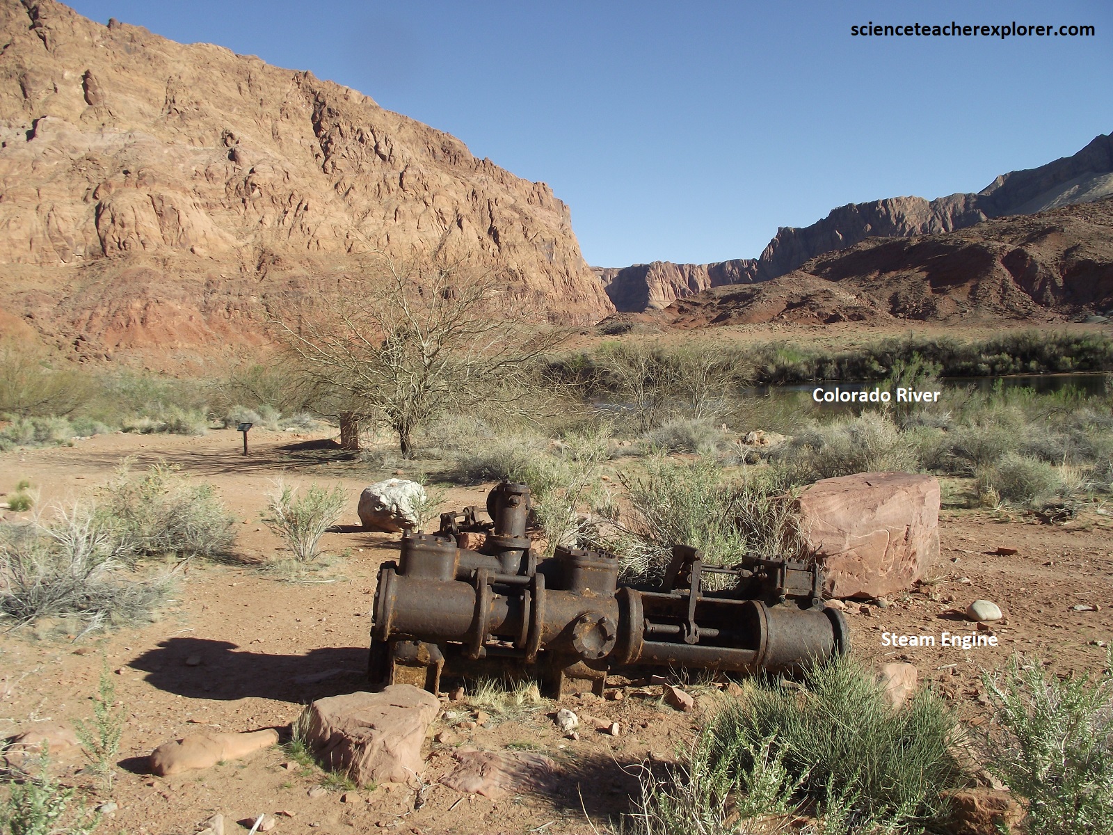
Picture above, Spencer moved the boiler to extract gold from the colorful Chinle Formation hills. He blasted water at the cliffs in high pressure hoses, washing sediments down a wooden flume to an amalgamator. Spencer used and amalgamator reliant on mercury to pull gold from the clay. Tests recovered a little gold, but also some other metal exhausting the mercury supply. In other words, this experiment failed too, as the gold could not be efficiently separated from the clay. Years later the mystery substance was identified as rhenium, (now valuable), useless at the time. [Even today, life at Lee’s Ferry means being self-sufficient, as evidenced by the area’s self-contained water system. Wells proved infeasible here, to the National Park Service draws water directly from the river, just like Spencer did. Of course, the park pump system is far more advanced and includes a water treatment plant for sanitation].
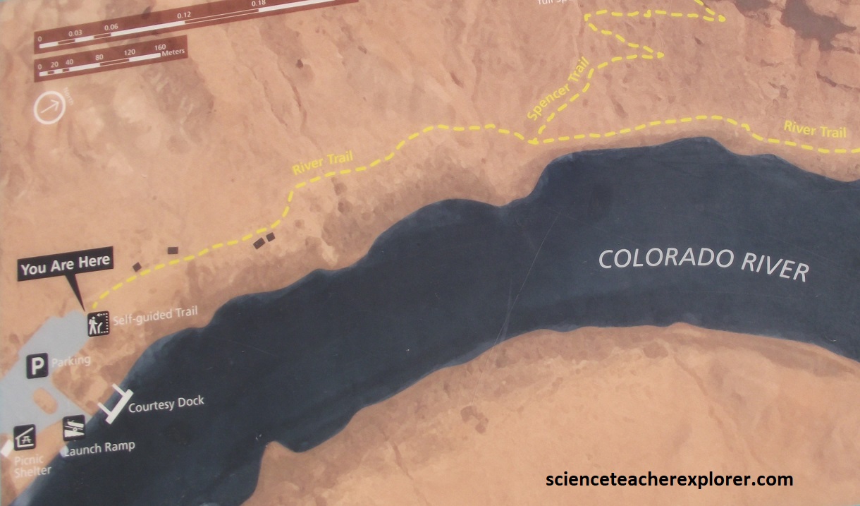
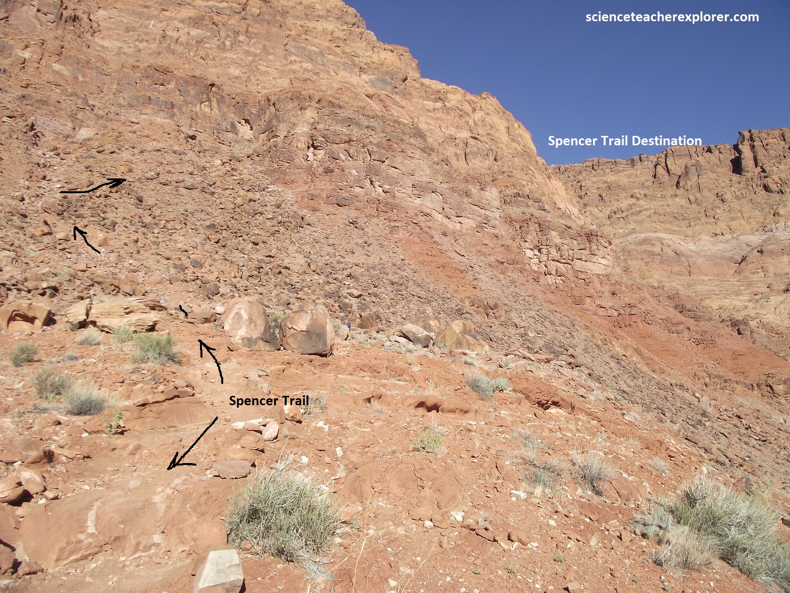
Pictured above, the Spencer Trail was built in 1910 for hauling Charles H. Spencer’s gold mining supplies. Spencer’s mining machinery needed fuel. As the rest of the miners hauled equipment to Lee’s Ferry, two men spent the fall of 1910 building a trail up this sheer cliff to a coalmine at Warm Creek Canyon, 48 km away. Pack mules carried several loads of coal down the trail later that year.
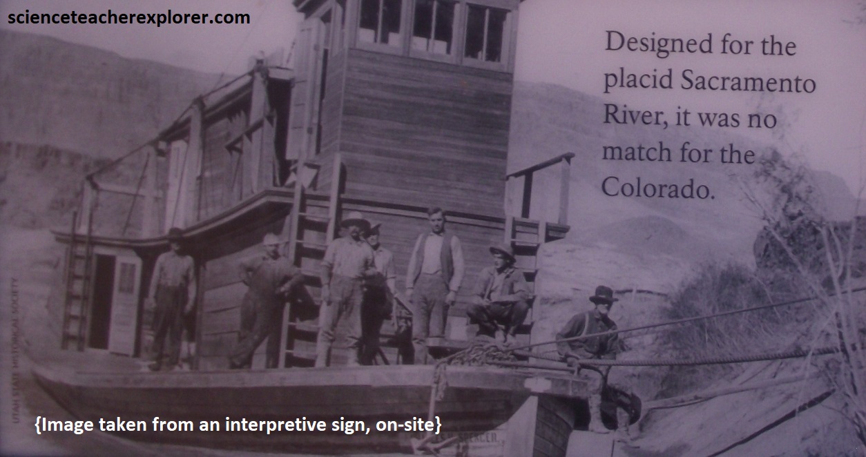
Pictured above, the Spencer Steamboat, launched in 1912, was built for transporting coal from Warm Creek Canyon. Unaware of the difficulties in navigating the Colorado River, Spencer’s investors thought a boat would serve better than a mule train for carrying coal. The Spencer Steamboat was hauled in pieces from San Francisco and constructed at the Warm Creek Mine. However, the boat proved too unwieldy, plus it burned all the coal it could haul. It was abandoned ashore after only a few runs.
Pictured above, ferryman Jerry Johnson turned the last of Charles H. Spencer’s crew bunkhouses into a school in 1921-25. In 1947, the USGS remodeled it as a residence, then a silt laboratory.
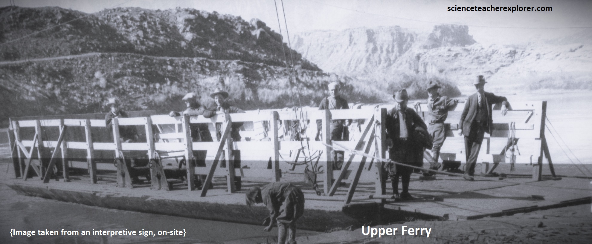
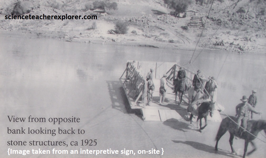
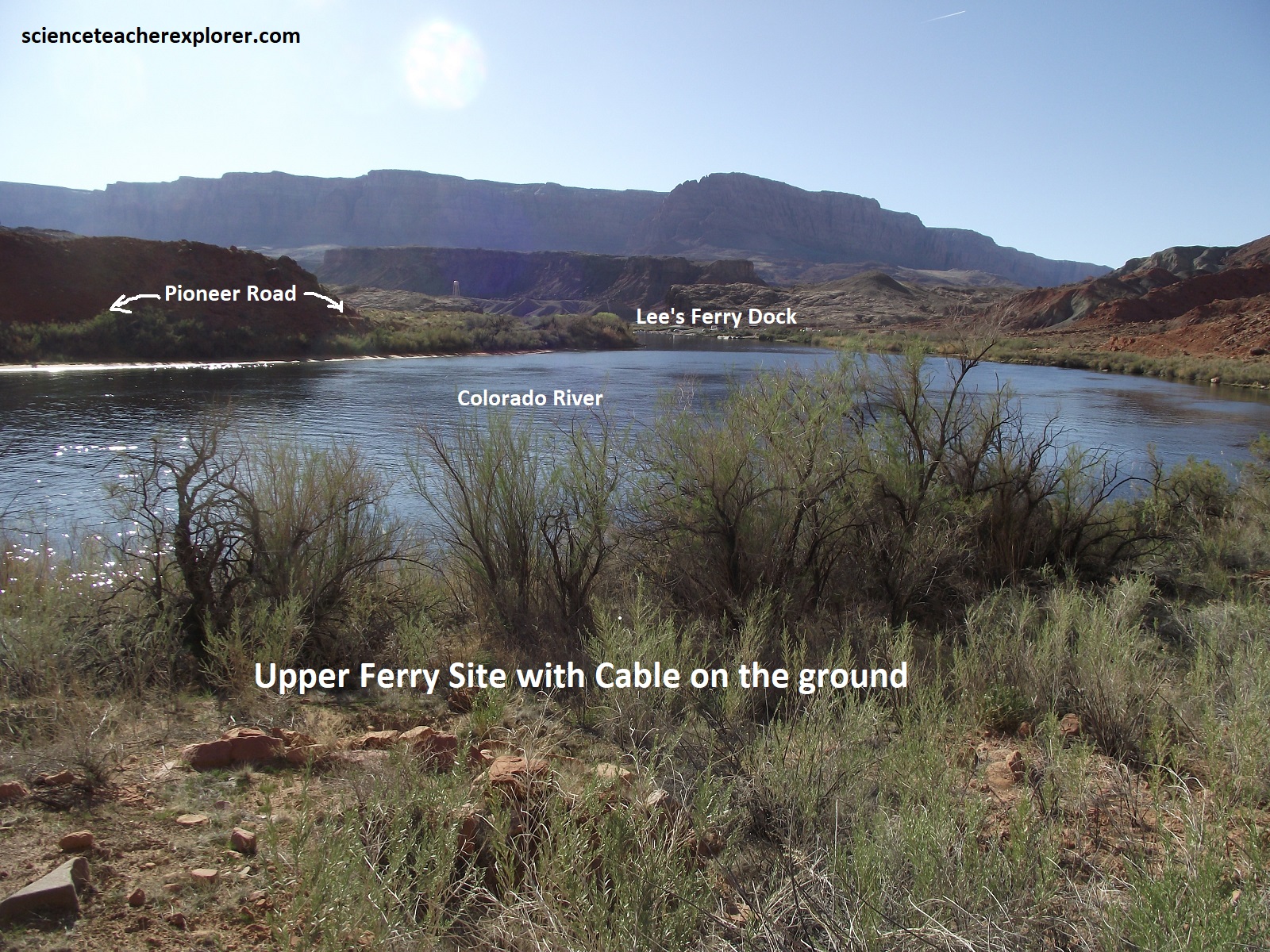
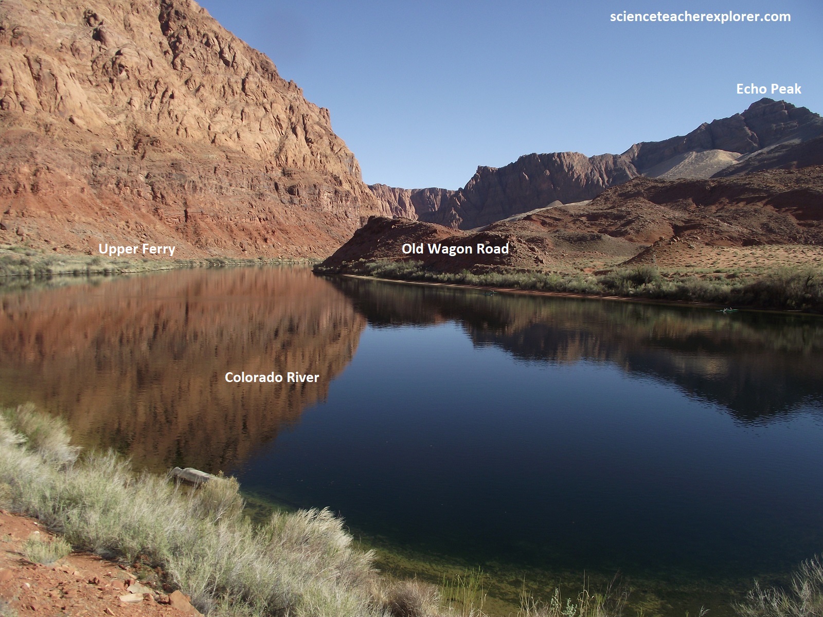
Pictured above, is the Upper Ferry Site that was completed in 1899. James Emett took over as lead ferryman in 1896 and requested major changes. Previous operators fought their way upstream rowing boats across the river, but the new cable system let the river current do much of the work. Improvements included a new ferry launch site, new ferry boat mounted on a permanent track cable, and a new road on the other side. The cable was anchored in a log tower filled with stones.
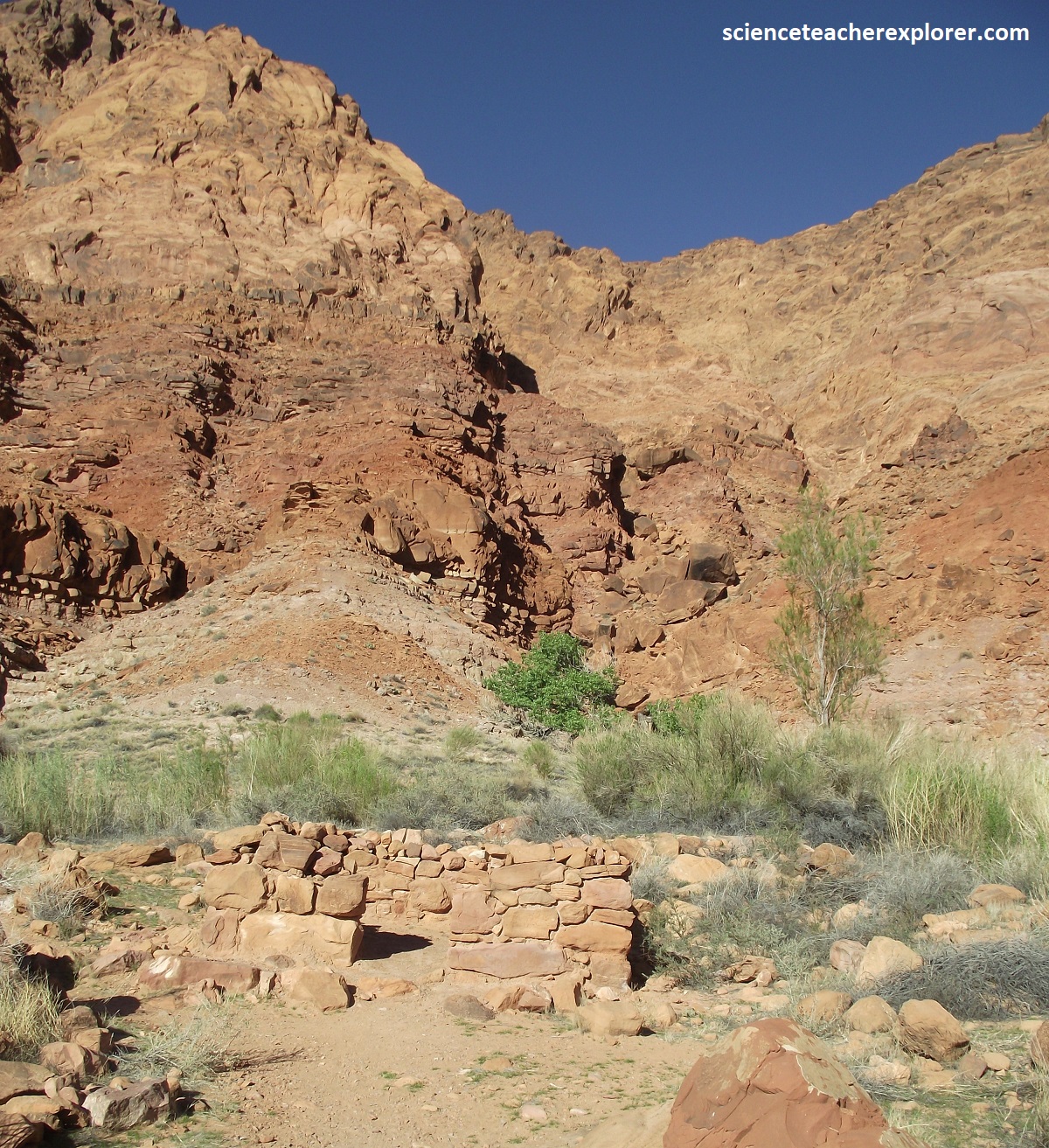
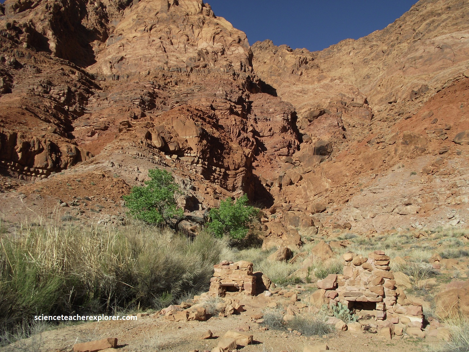
Pictured above, the Johnson Cabin & Louse House were dwelling remnant sites, (built in the winter of 1913/14}, for ferry customers and operators. {Pictures were taken in 2024}. Only a ruin remains of the small stone cabins available to travelers staying overnight. The ruin with two stone fireplaces was home to Ferryman Frank Johnson, son of a previous ferryman.
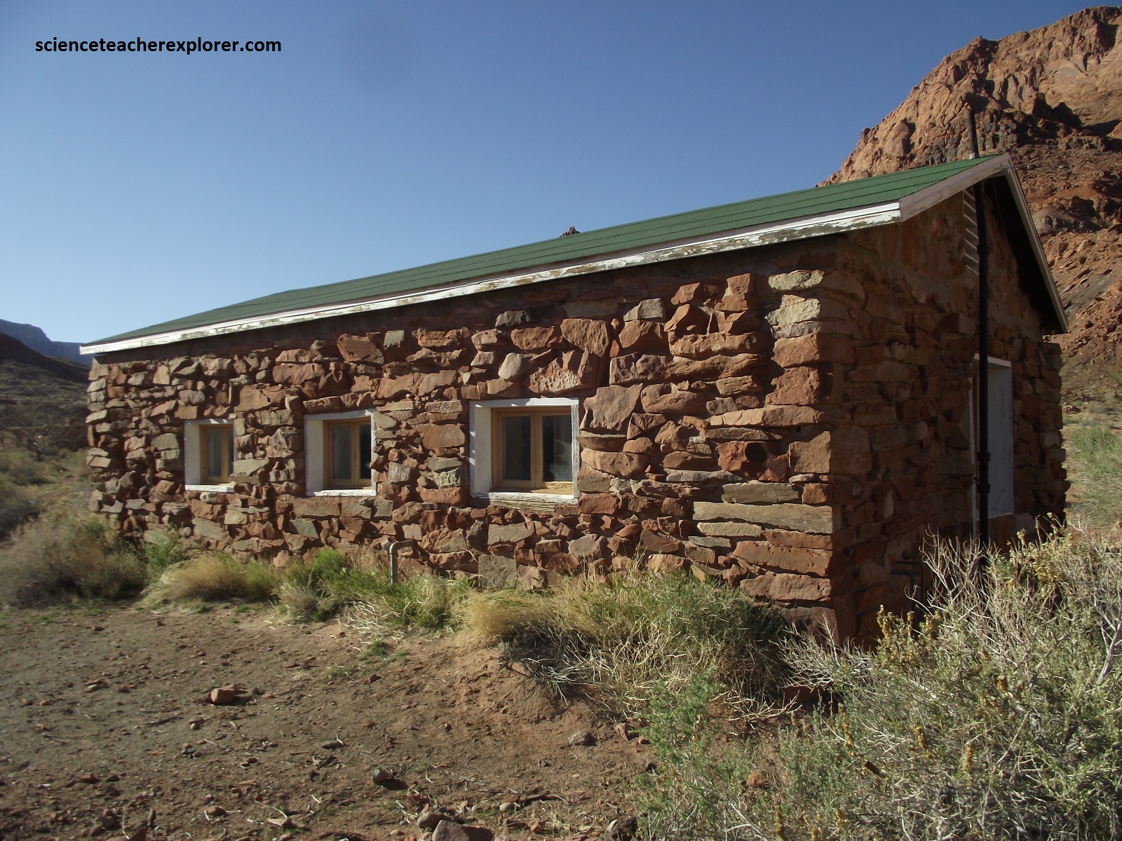
Pictured above is the United States Geological Survey (USGS) Guesthouse, built in 1950. The USGS established a presence at Lee’s Ferry as part of the Colorado River Compact, a 1922 water rights agreement. Using a cable car to measure the river’s flow, they ensured proper water sharing between neighboring states, The USGS constructed the guesthouse using stone from demolished Spencer buildings.
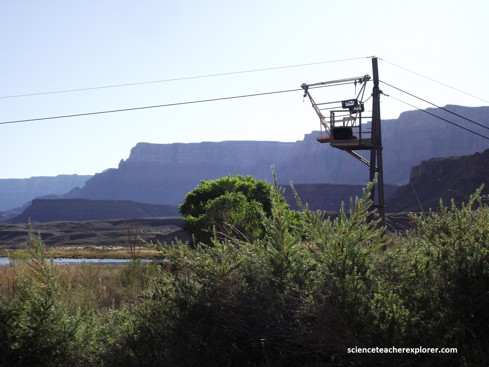
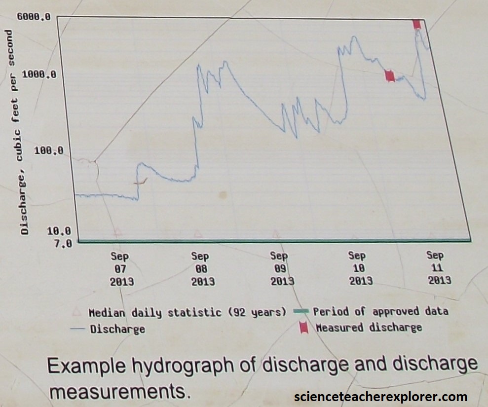
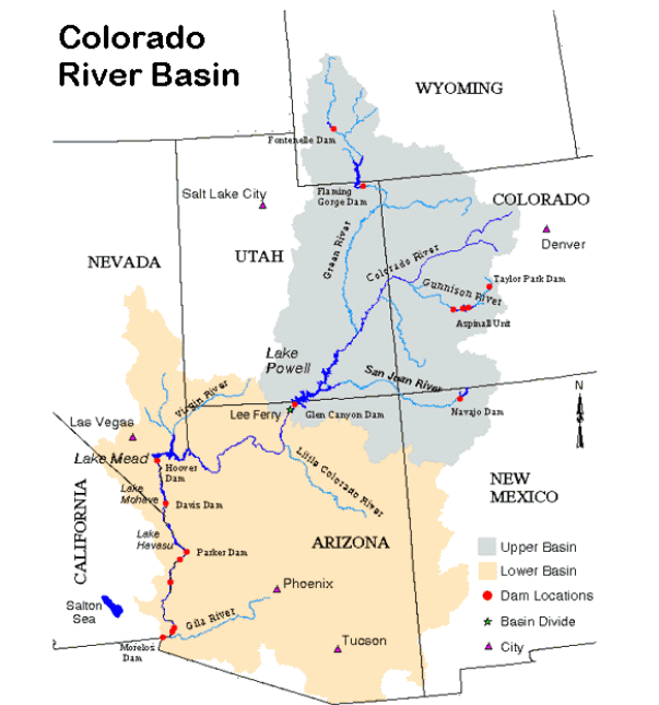
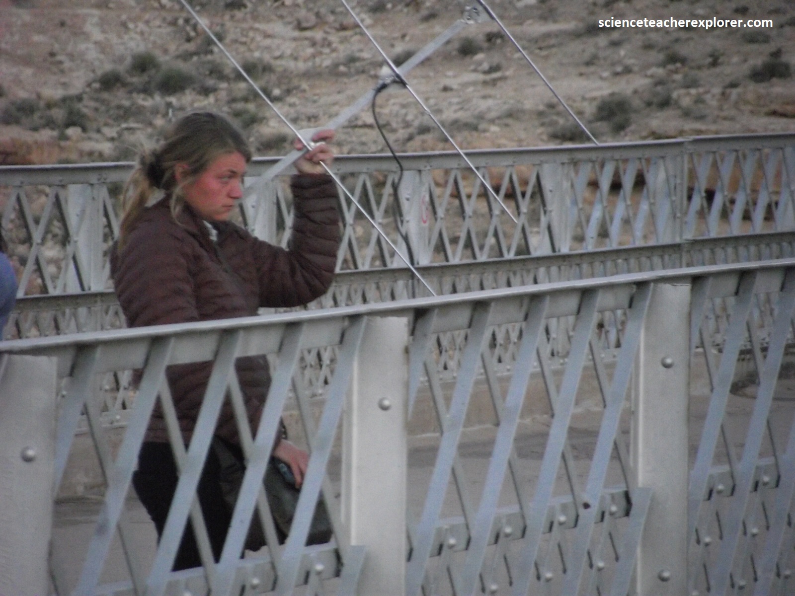
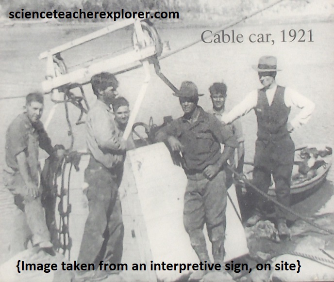
Since 1921, the USGS has measured streamflow and water chemistry of the Colorado River using the Lee’s Ferry gauging station and cableway. For a Colorado River hydrologist, Lee’s Ferry is a line in the sand. It marks the legal boundary between the Upper and Lower River Basins, established by the 1922 Colorado river Compact. Since the Colorado River provides water for over 40 million people, this invisible line has fare reaching effects, extending to what you eat and drink. Water has always challenged people living in the arid Southwest. In the 1900s, California’s booming population led other states to fear priority water rights would go to the thirst Golden State. To ensure growing populations had a steady water supply, especially for agriculture, the seven Colorado river Basin states negotiated a deal. Each basin would receive 7.5 million acre-feet of water a year. [Note the cable stretching across the river to a gauging station, possibly the most important one on the whole river]. Continuous reading from that station determine dam operations nd uphold the Law of the River with stadia measurements. [Note: When the flow is too swift or dangerous for wading, hydrographers use the cableway system to make discharge measurements]. The particular system is an unmanned cableway which increases safety by allowing hydrographers to remain on the stream bank rather than place them directly over the water in a cable car. Discharge measurement data, and gage height data, collected at a streamflow gaging station, are use to define a rating for the river. A rating is the relationship between the continuously measure gage height and the regular measurement of discharge and ca be used to determine the discharge for any given gage height. Discharge data provides information for a variety of uses including water supply, flood warning, recreation, research, infrastructure design, and dam operation upstream.
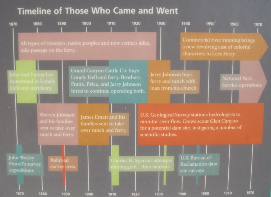
In conclusion, throughout the 1800s and 1900s, Lee’s Ferry was the backdrop to a mix of Westward expansion dreams and failed schemes. Because of its strategic location along the Colorado River, unlikely groups overlapped on these shores. Miners, traders, U.S. government scientists, Church elders, and the occasional outlaw shared the trials of frontier life here.
