Makgadikgadi, BW
I trekked and explored Botswana, Africa in 2025, with a childhood buddy of mine, named Tracy Davis.
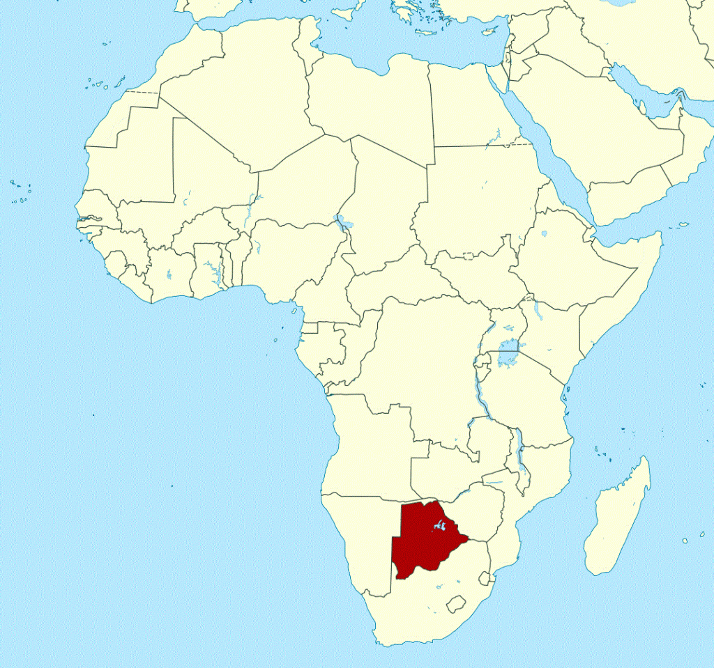
We entered Botswana through the Martin’s Drift Border Gate with a rented 4×4 pickup truck. From there, we drove directly north to Maun, Botswana. Maun acted as our base camp while we explored the surrounding area.
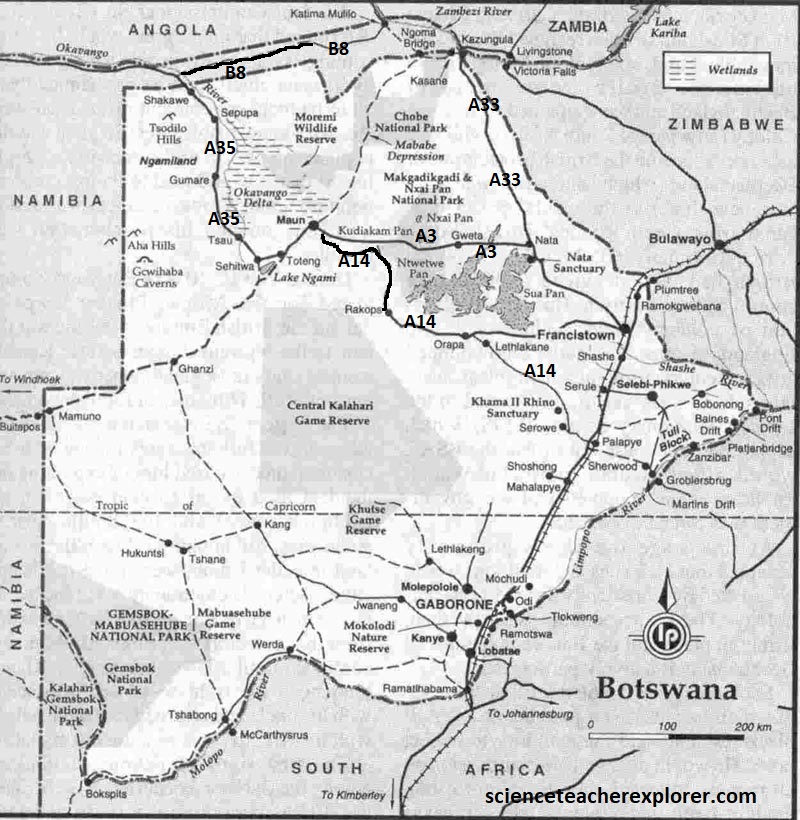
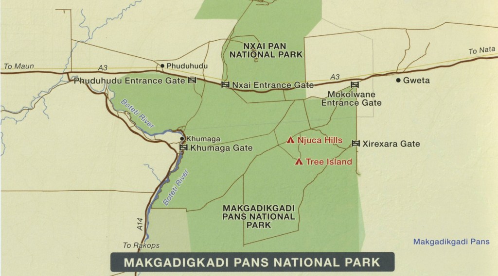
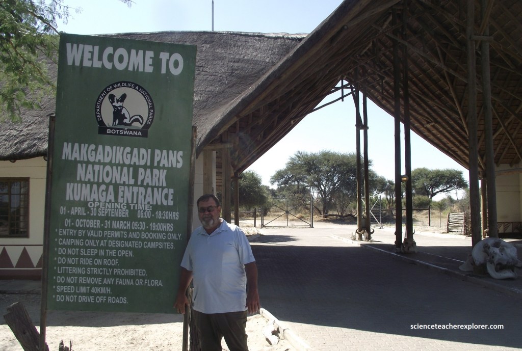
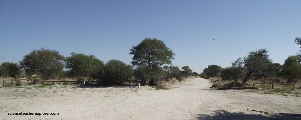
Our primary destination in this region was the Makgadikgadi Pans National Park, (140km southwest of Maun). To get there from Maun, we drove east on A3 for 82km, then turned right onto A14 for another 9km to the Khumaga Gate, (imaged below). Getting to the Khumaga Gate required us to pass through the Khumaga Village by following the signs.
As one of Botswana’s least visited parks, the Makgadikgadi has distinctive scenery and varied species worth exploring. Not only were we likely to encounter fewer vehicles, we was rewarded with some spectacular sightings, including one of Africa’s largest zebra migrations.
The Makgadikgadi Pans National Park can be viewed as two distinct ecosystems. In the west, the landscape is dominated by riverine woodland spilling over the steep banks of the meandering seasonal Boteti River, (which is where we spent most of our time). In contrast, the east boasts palm tree-lined grasslands sprinkled with a smattering of salt pans. The game viewing in both fluctuates tremendously depending on the season. In the dry season, (when we were there), the wildlife tends to congregate around the permanent water of the Boteti River in the west. In contrast, after the rains, the game (specifically the zebra and wildebeest herds) disperses towards the salt pans in the east of the park. We were there in the dry season so we stuck to the Boteti River.
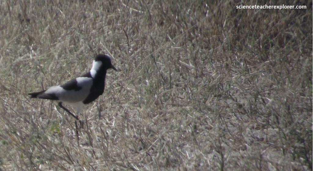
Just past the Khumaga Gate, we headed north and came across this blacksmith plover, (pictured above). In Botswana they are most numerous in the mesic grassland regions. Blacksmith plovers are very boldly patterned in black, grey and white, possibly warning colors to predators.
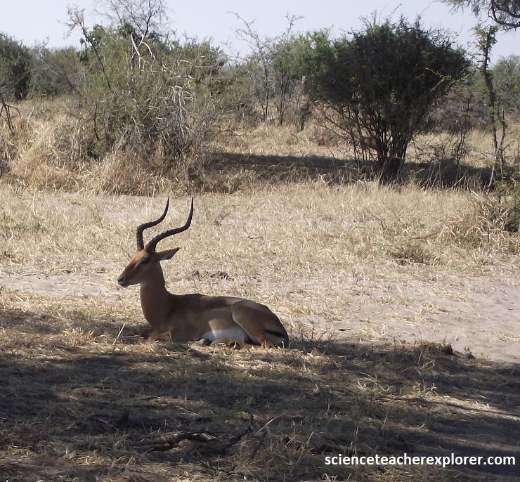
Additionally, we found this lone-male Impala laying down in the shade. Lightly built, the impala stands 75-100 cm high at the shoulder. It has a golden to reddish brown coat, white underparts, a vertical black stripe on each thigh, and a black tuft behind each hind foot. The male has long, lyre-shaped horns, (as pictured above). They are usually seen in herds and are quite abundant in southeast Africa.
The short drive north from the Khumaga Gate was lined with camel thorns and black thorns, sickle bushes and Kalahari apple-leaf trees. The former are typical of riverine habitats and the latter a classic indication of the sandy soils underneath. We noticed two vultures high nesting high in the trees above us.
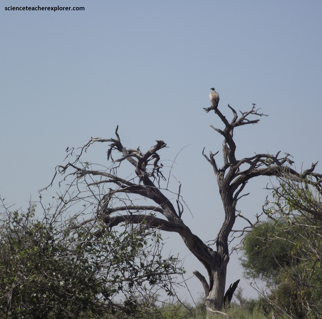
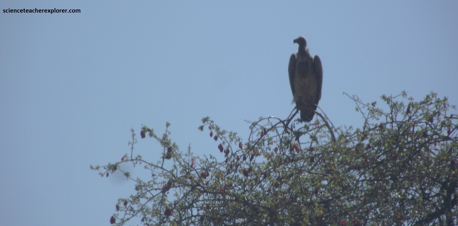
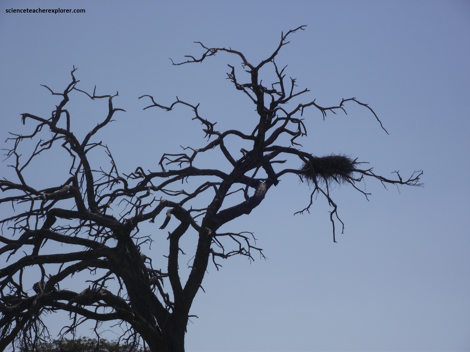
Pictured above are two Cape vultures (Gyps coprotheres), also known as Cape griffon and Kolbe’s vulture. They are endemic to southern Africa and lives mainly in South Africa, Lesotho, & Botswana. It usually nests on cliffs, (but in this case a large dead tree) and lays one egg per year. This large vulture is of a creamy-buff color, with contrasting dark flight and tail feathers. The head and neck are near-naked. The bill is black and the average length of adult vultures is about 96–115 cm with a wingspan of 2.26–2.6 m. We noticed two prominent bare skin patches at the base of the neck, and believed that they were used as temperature sensors and detecting the presence of thermals.
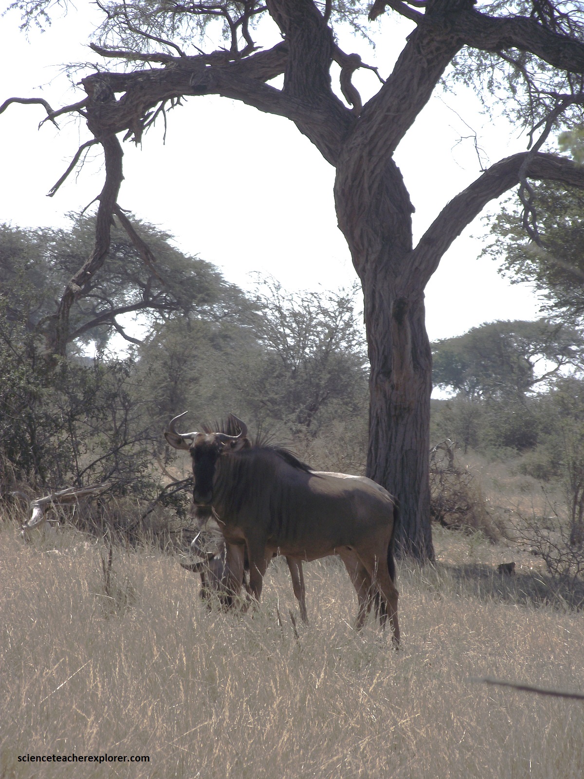
The road network in the west of the Makgadikgadi Pans National Park, rarely strays far from the Boteti River, making the navigation straightforward. The main challenge is the deep sand, which can be as thick as syrup at the end of the dry season and almost as difficult to drive through. The highlight is undoubtedly watching herds of Kudu, zebra and wildebeest kick up clouds of dust as they clamber down the cliffs to drink. However, we found these animals laying around near the woodland areas of the Khumaga Gate, (pictured above).
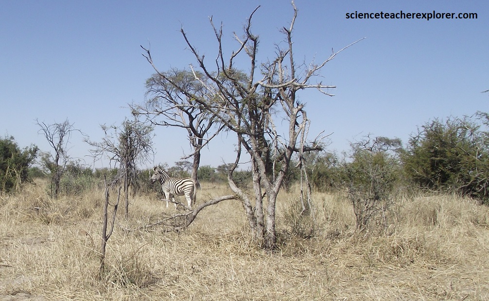
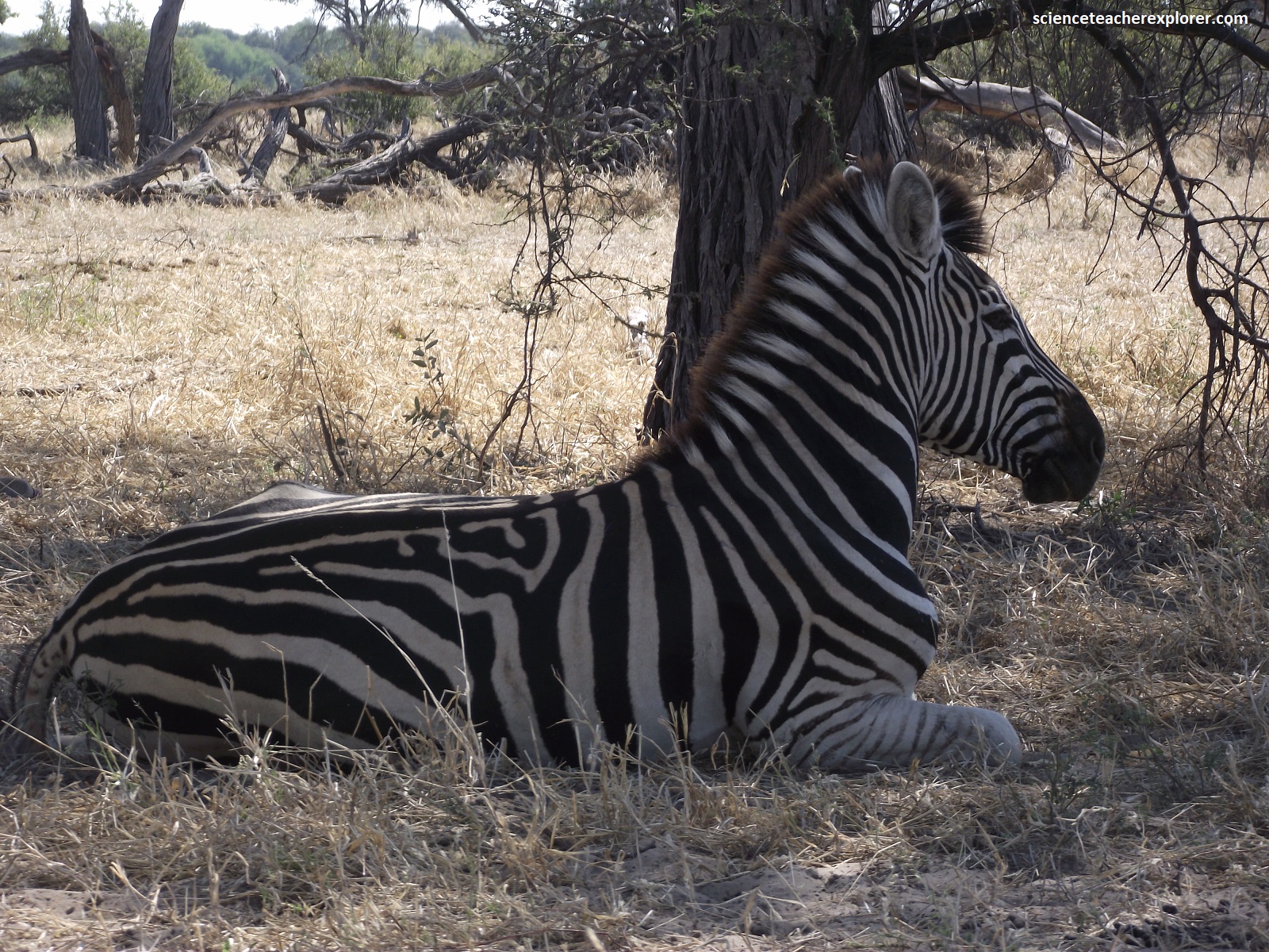
The first clue to the imminent change in the landscape came from beneath us as we started to climb a sandy, corrugated stretch around 4 km along the road. This rise is the first of several fossilized dunes that mark what was the edge of the ancient megalake Makgadikgadi. {The last time the lake held water was 8,000 years ago, giving the vegetation plenty of time to sprawl over the dunes since, transforming them into low grass-covered, sandy mounds}. Pictured above, the landscape gradually opened up as the deep sand belt gave way to the lacustrine clay soils deposited by the ancient lake. The tall shade-trees become less prevalent and replaced by scrub acacias scattered across the grassland. We spotted a herd of zebra trudging back towards the Boteti River from their foraging expeditions.
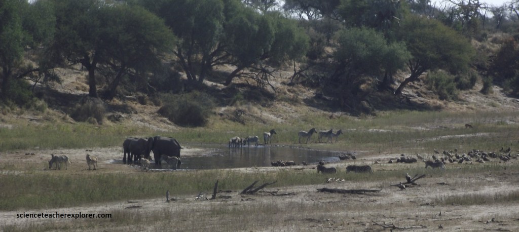
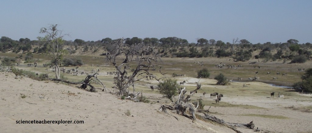
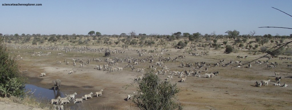
Pictured above, we were finally rewarded with a view of the waterway. Several natural waterholes have formed in the Boteti riverbed below, which, when the river is not flowing, can sometimes attract big herds of zebra and bull elephants. Historically, the Boteti River was a pivotal watercourse flowing through Rakops as the primary inflow in the great mega-lake Makgadikgadi, the largest lake in Africa 8,000 years ago.
Amazingly, at its driest, the zebra would trek up to 35km away from the water in search of food, forcing them to drink at most only once every 3 days. It is estimated there are now over 20,000 zebra that eke out an existence in the Boteti region in the dry season. A smaller population of wildebeest joins these, and the sight of them all clambering down the steep bands of the river, kicking up clouds of dust as rush to drink, is one of Botswana’s greatest spectacles.
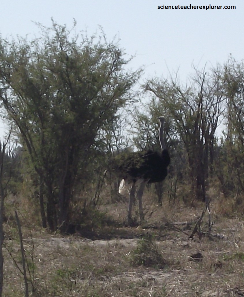
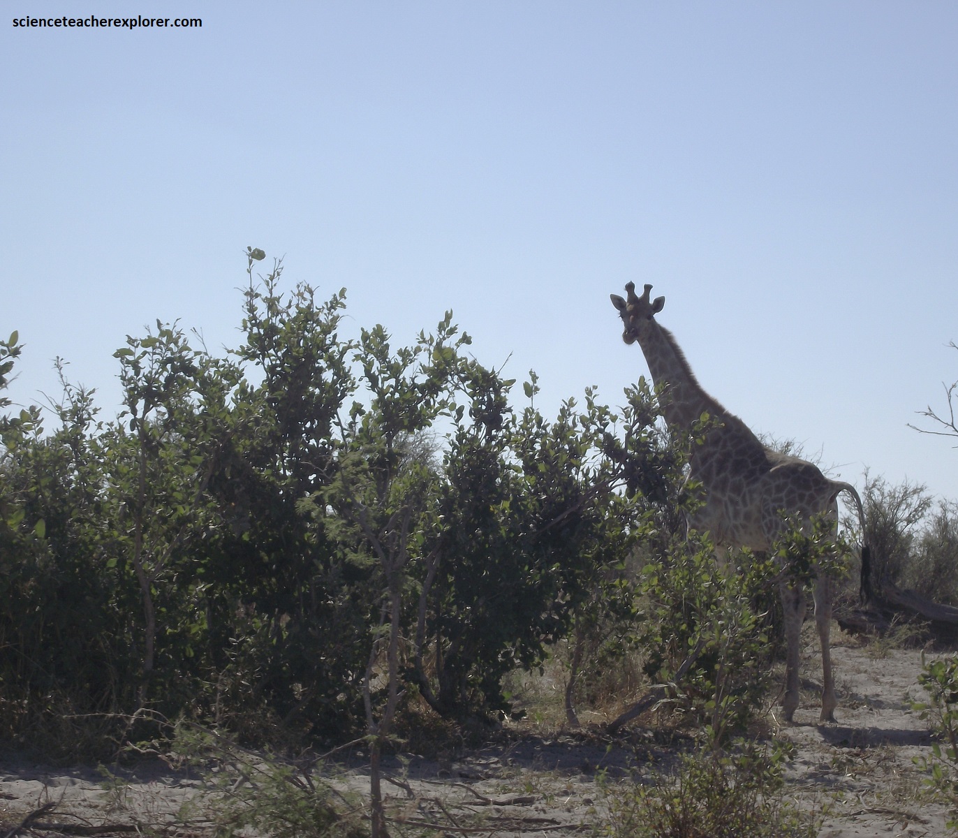
Pictured above, the main road continues along the top of the cliffs, tracking a parallel course to the waterway, though veering up to 200m away from the river at times. There, we caught an ostrich & a giraffe, waiting for their turn to walk down a take a drink.
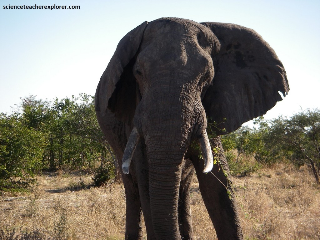
The Boteti River was dry for almost 30 years before successive heavy flood years finally restored the ancient riverbed to its former glory in 2009. Th change on the environment and it’s inhabitants was dramatic, helping to boost population numbers and enticing breeding herds of elephant. Previously, the Boteti was the domain of elephant bulls only.
The lack of flooding in recent years have threatened to plunge the Boteti River back into arid hibernation, which would leave the wildlife once again reliant upon a handful of soon-to-be pumped waterholes in the empty riverbed. The river’s fate currently hangs in the balance, but the zebra herds will feel it most acutely if it does completely dry up.
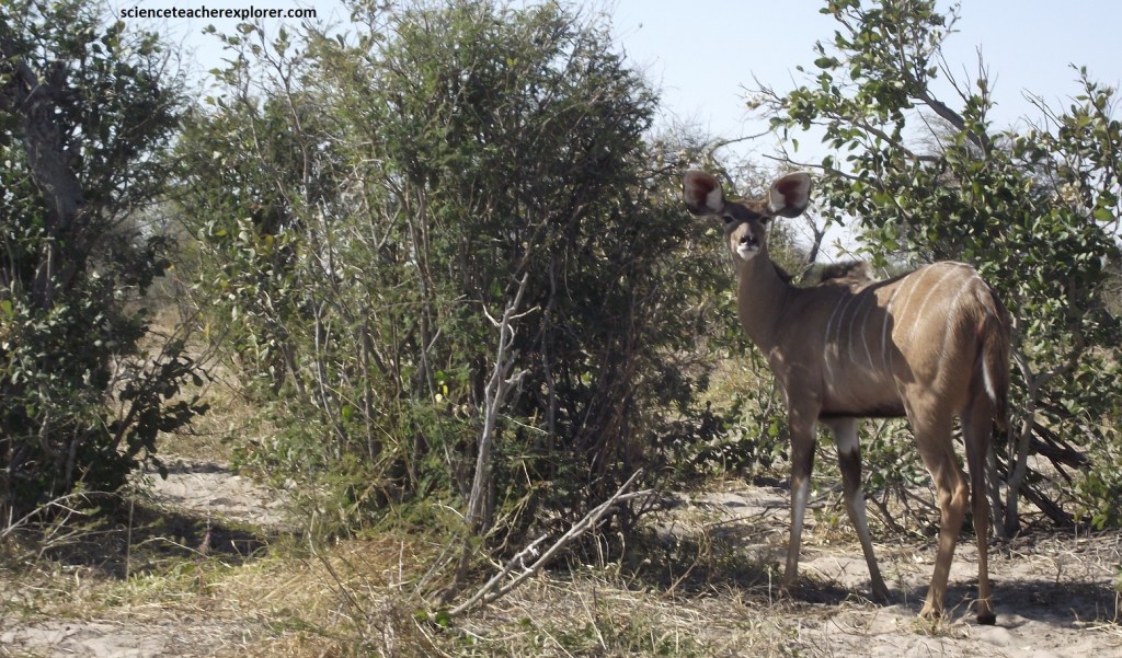
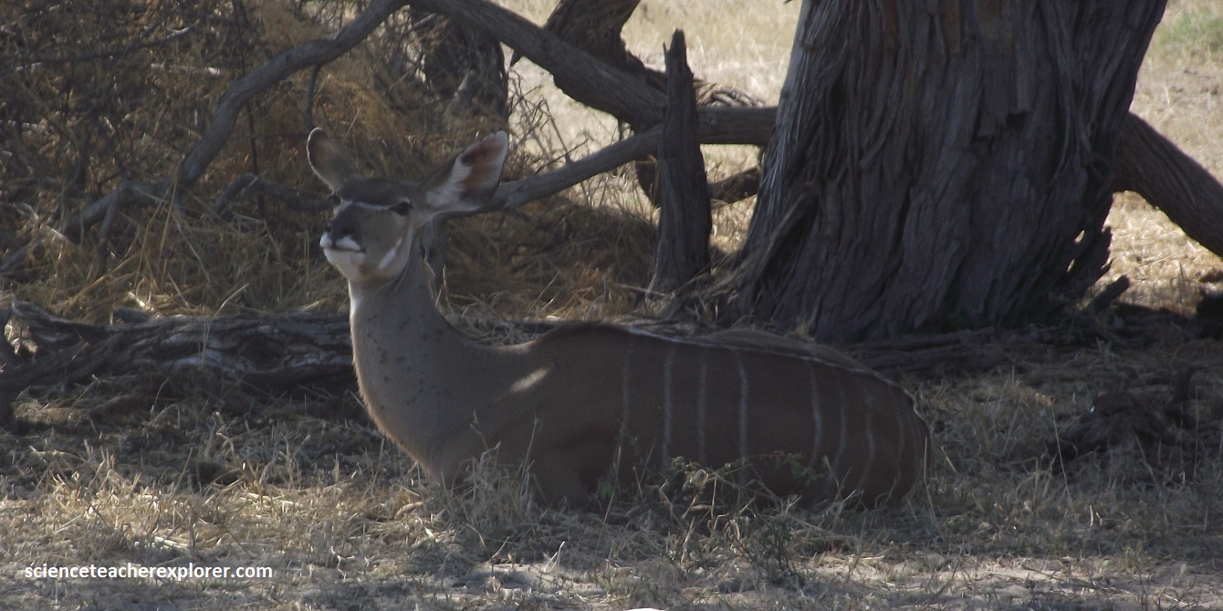
We continued to follow the primary game drive road, tracking the Boteti River, and weaving through mixed riverine vegetation and rarely straying far from its banks. Camel thorns were the most prevalent species, but black thorns and silver cluster-leaf terminalia are plentiful, interspersed with the occasional sausage tree and sycamore fig. Amongst the brush, we caught the occasional Kudu foraging, (pictured above). Kudu are generally browsers but do eat new grass, seed pods and berries. However, Kudu live in woodlands where often their vision is obscured by trees and bushes – making it necessary to have good hearing. With large pinnae (ears) the ‘reception’ is greater allowing for excellent hearing.
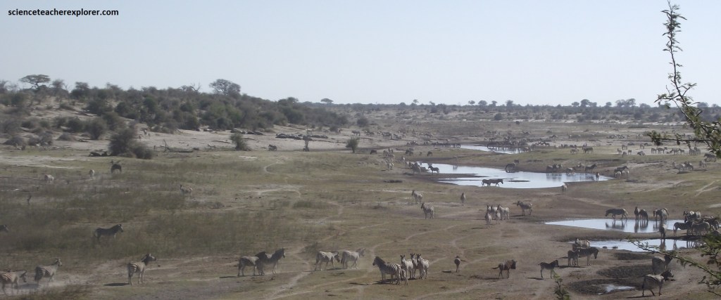
Pictured above, several natural waterholes have formed in the riverbed below, which, when the river is not flowing, can sometimes hold water for several months after the rains have ended, attracting big herds of zebra, giraffe and the occasional bull elephant, (pictured below).
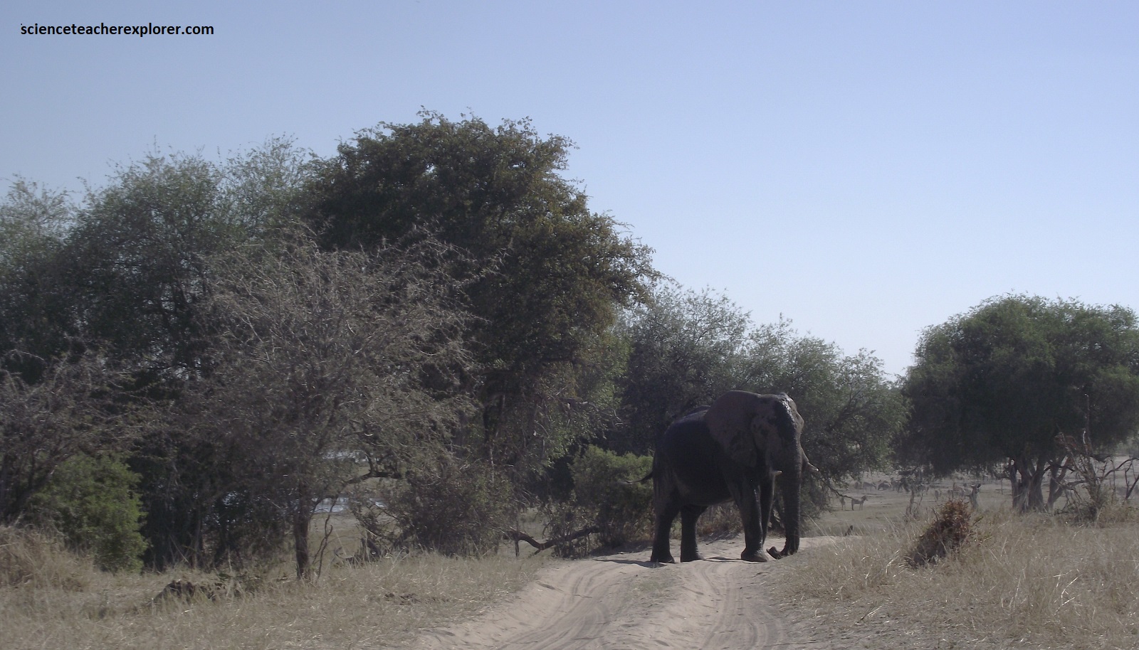
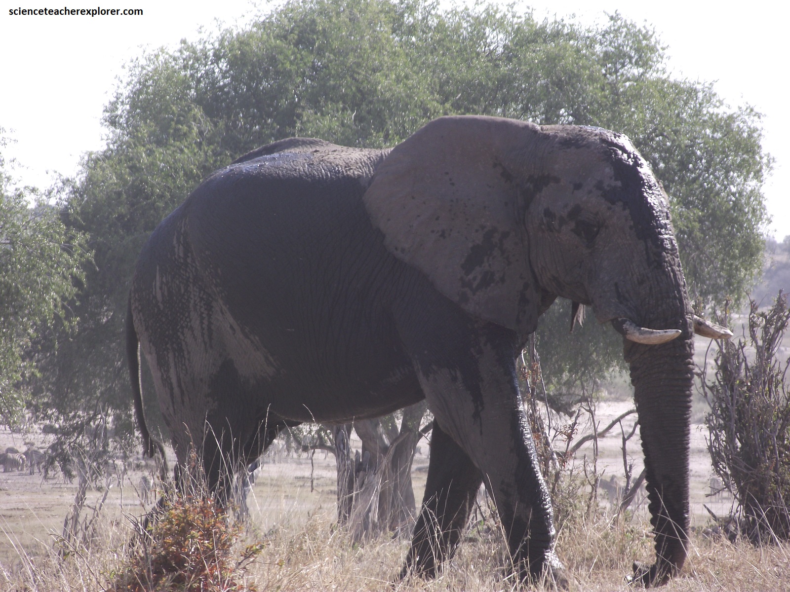
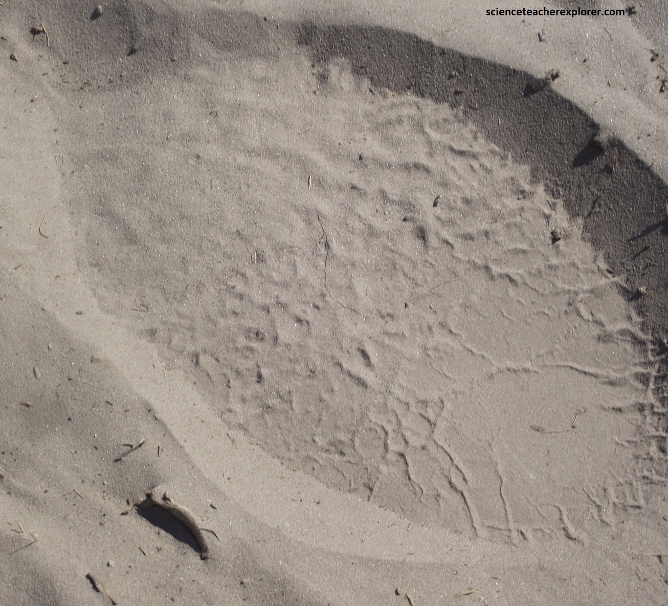
Pictured above are a couple of bull elephants leaving the waterholes below. The main diet of the African elephant is herbivorous and various according to its habitat. Adult males usually live alone and the herds are typically made up of related females and their young. The Boteti River has a large number of bulls live out their lives. Even during the dry season when water is at a premium the bulls will be there. Nobody knows for certain why Boteti is favored by the Elephant bulls. {Note the elephant track pictured above}.
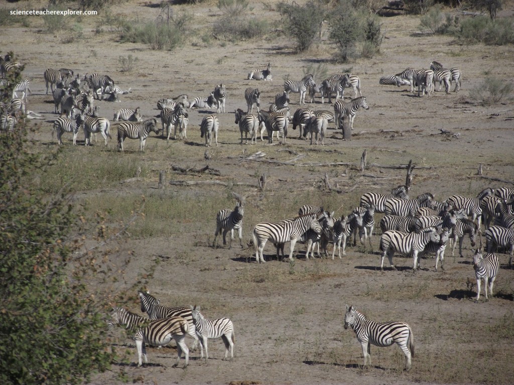
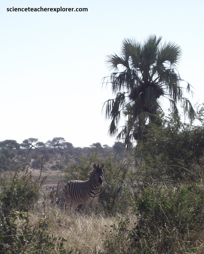
In Botswana only the “Burchell’s zebra” occurs. The zebra is the national animal of Botswana. The migration of note is to and from the Makgadikgadi Pans after the rains. This migration has been the source of much debate recently between the conservation authorities and the local farmers. The Boteti River provided a natural barrier between the two in the past but with the drying up of the Boteti wildlife and cattle were competing for the same limited water sources. Each individual zebra has unique patterning, (i.e. no two animals are the same). The patterning works along the lines of fingerprinting in humans. When a zebra is born, the mother keeps it hidden from other zebras until her patterns have imprinted on the foals memory.
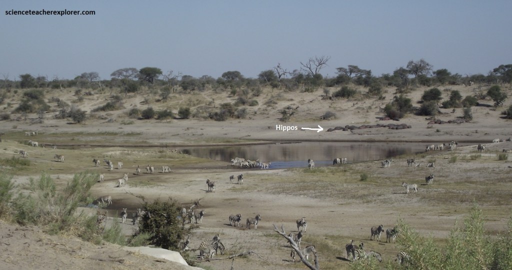
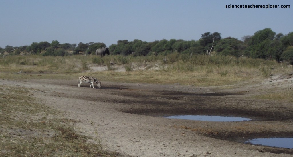
When the Boteti River is flowing, the resident hippos tend to relocate regularly along its course depending upon water levels, making their location difficult to predict. However, in the years before the Boteti’s resurgence, the kink in the riverbed known as ‘Hippo Pools’ was their only haven. Know that the river is drying out again, they again returned here, illustrating this semi-aquatic mammal’s remarkable resilience, (pictured above).
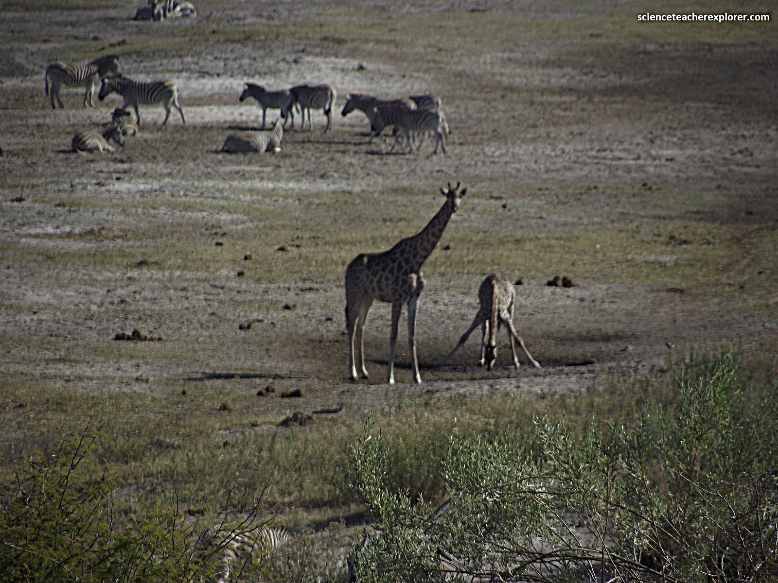
The picture above shows the view of the Boteti River from across the way of the ‘Hippo Pools’, looking north. We were lucky enough to watch a couple of giraffes strolling up to a small mud-hole and taking a drink. Exactly, how does a giraffe drink? Apparently, the giraffe’s lips form one valve of the “pump” while the animal’s epiglottis, located at the back of the mouth, is the other. To start, the giraffe sinks its puckered lips into the water and then pulls back its jaw, allowing water to rush into the mouth, all the while keeping the epiglottis “valve” closed. Next, the giraffe clenches its lips and relaxes the epiglottis, then pumps its jaw so that the captured water is pushed into esophagus. The cycle repeats, moving more and more water into the esophagus. At some point, the giraffe lifts its neck, and the water sluices into its stomach, thanks to gravity and the wave-like muscular contractions known as peristalsis.
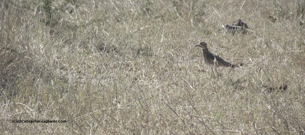
Meanwhile, up on the bench & viewing area, of the Boteti River, we saw this ‘Spotted Thick-Knee’, (pictured above). The coloration of its face through me off, but I do believe it was a ‘Spotted Thick-Knee’, with it’s yellow-black bill, large yellow eyes, and cryptic plumage.
Around 2km west of this drinking spot, (pictured above), the waterside road rejoins the main road at the junction with the old fence. The latter was erected before the river returned to reduce competition for water and grazing between the zebra population and villagers’ cattle outside the park’s boundary. This fence actually enables the zebra population to thrive. Simultaneously, it protects the local cattle from lion attacks, which in turn, helps to protect the lions from revenge persecution by farmers. {Even though we didn’t see the lions, they were probably present, shading themselves from the heat of the sun}.
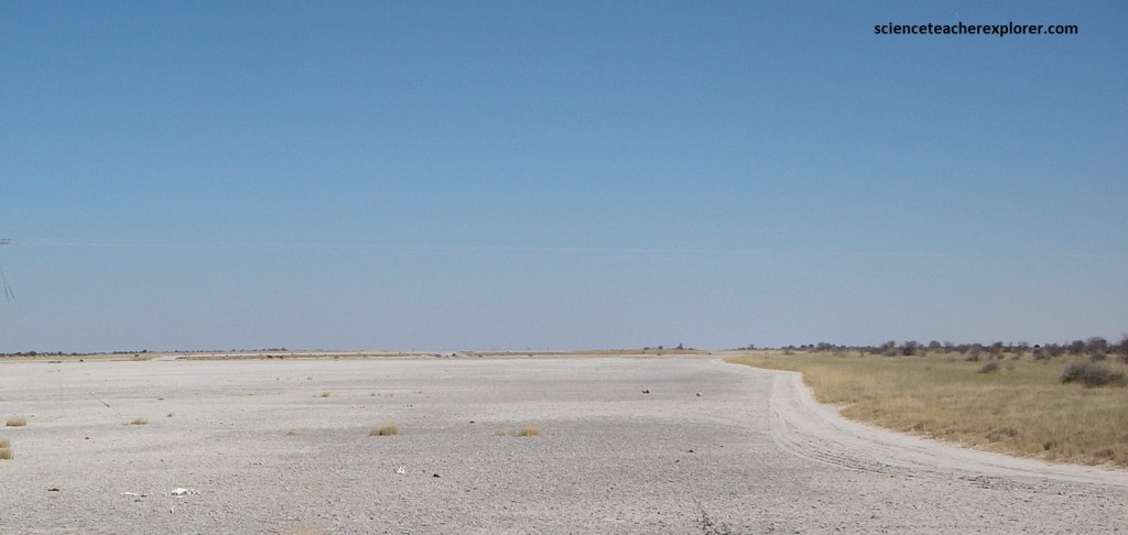
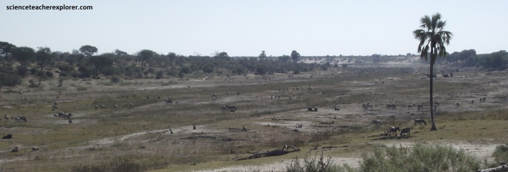
Most of Botswana is cover by a mantle of wind-blown Kalahari sand that is over 100m thick in places. It forms the world’s largest continuous sand surface covering 12,000 km2. The sand was leveled by the wind, but as the climate became wetter, plants stabilized it. As a consequence, many areas have no slope so water cannot run off. Where the Nata River (which rises in southwest Zimbabwe) runs into the Sua Pan, the river flows over soda-saline beds. When the water entering the area evaporates, this results in vast soda flats, such as the Makgadikgadi Pans between Maun and Nata, (pictured above). During the rainy season the pans become a shallow lake, no more than 1.0 m deep.
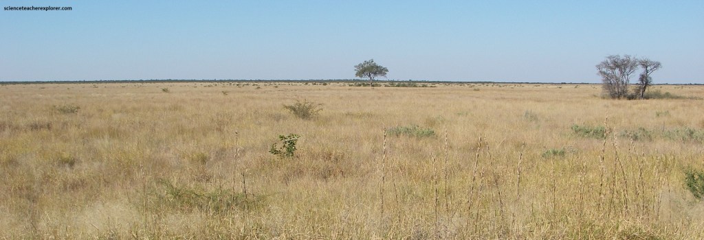
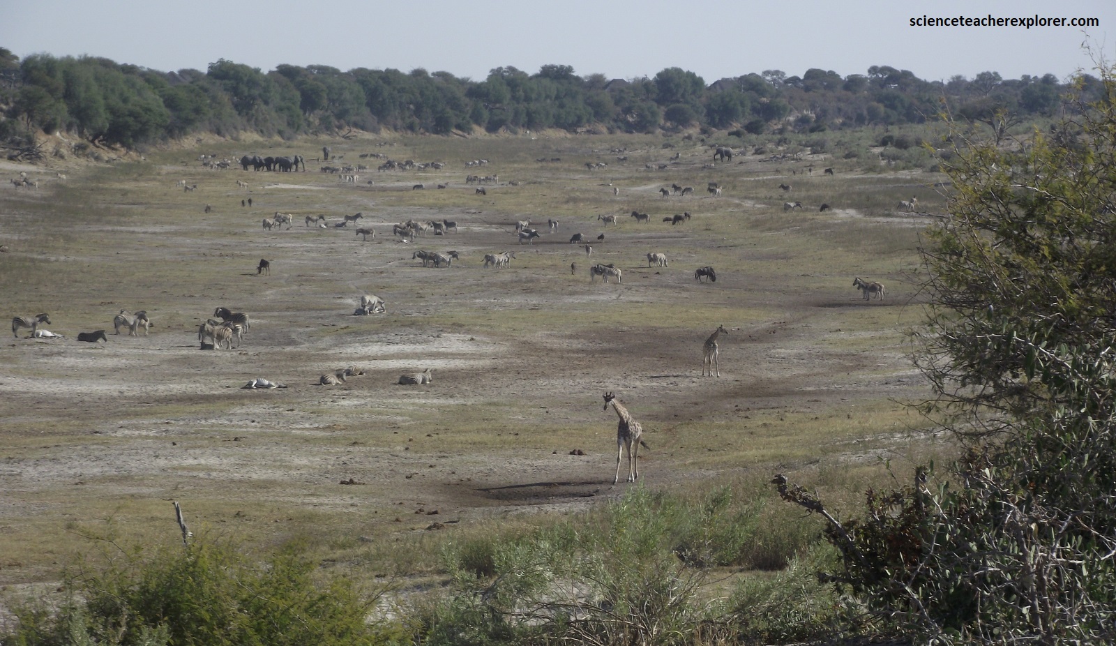
Pictured above, the surrounding grass cover, which is only 1.0m higher than the soda flats, attracts herd of the Burchell’s zebra and hartebeest. It had already had attracted this Bull elephant seen below.
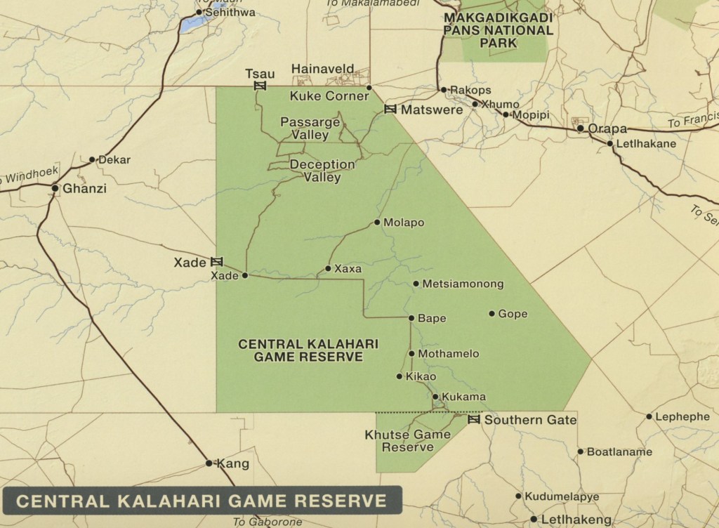
Tracy and I, crossed the northern part of the Central Kalahari region from east to west, and found a series of deep flat-floored valleys. At first glance, these appeared to be river valleys in a semi-arid environment; where there were not enough rain to cause water to run, let alone erode a huge valley. Pictured below, ‘Deception Valley is, in fact, a “fossil” valley.
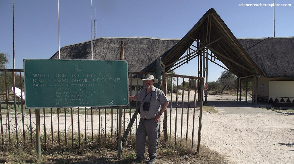
We drove into the Central Kalahari Game Reserve from Muan, Botswana by driving south on A14 to Rakops (115km). Then we turned right onto a 4WD dirt road, and drove another 45km west, into the Deception Valley by way of the Matswere Gate of the Central Kalahari Game Reserve. This took us half of a day. To return back to Maun, we really didn’t have time to explore.
Deception Valley was formed by river erosion as a broad steep-sided river valley, before sand was blown in. The sand converted its V-shaped into a much shallower valley with a flat floor, now covered with typical Kalahari scrub vegetation. This, coupled with occasional shallow pans that form at the time of the rains, attract huge herd of antelope such as springbok and gemsbok, and the predators that prey on them. {Of course we didn’t really see any of these do to our time-constraint of getting back to Maun. However, it was a nice drive}.
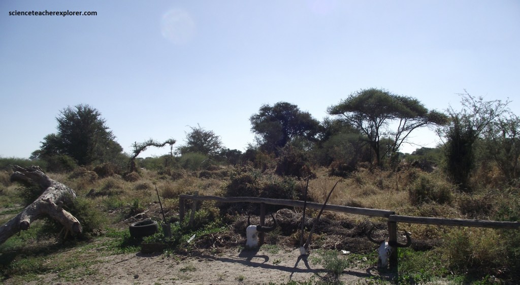
The rocks of the original valley were visible along the sides of the valley and road. There were actual places where the Stone Age inhabitants gathered to make stone implements. Stone chips are commonly scattered along the floor of the valley.
Deception Valley was name by a De Beers mapping group in 1961: the team thought it was actually another valley farther south, as it did not appear on any of the maps at the time.
