Makhonjwa, S. Afr. 2025
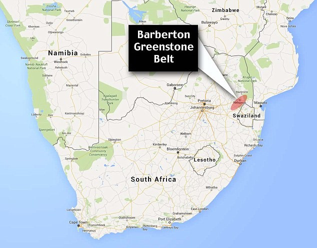
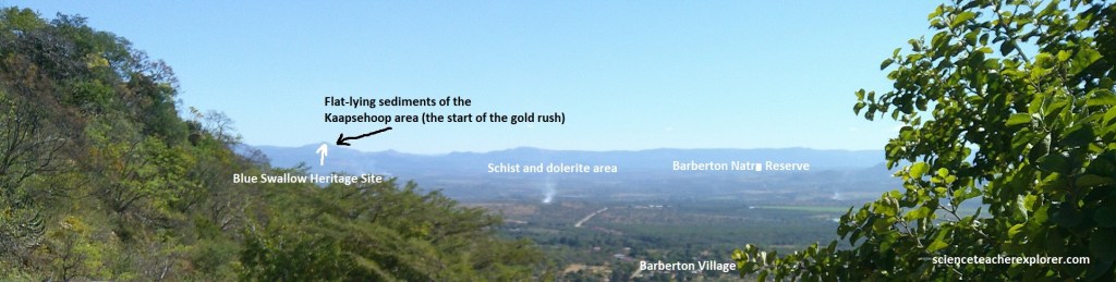
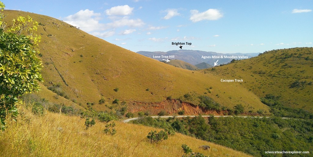
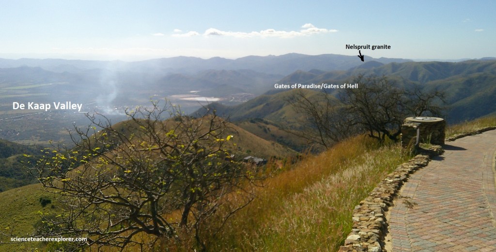
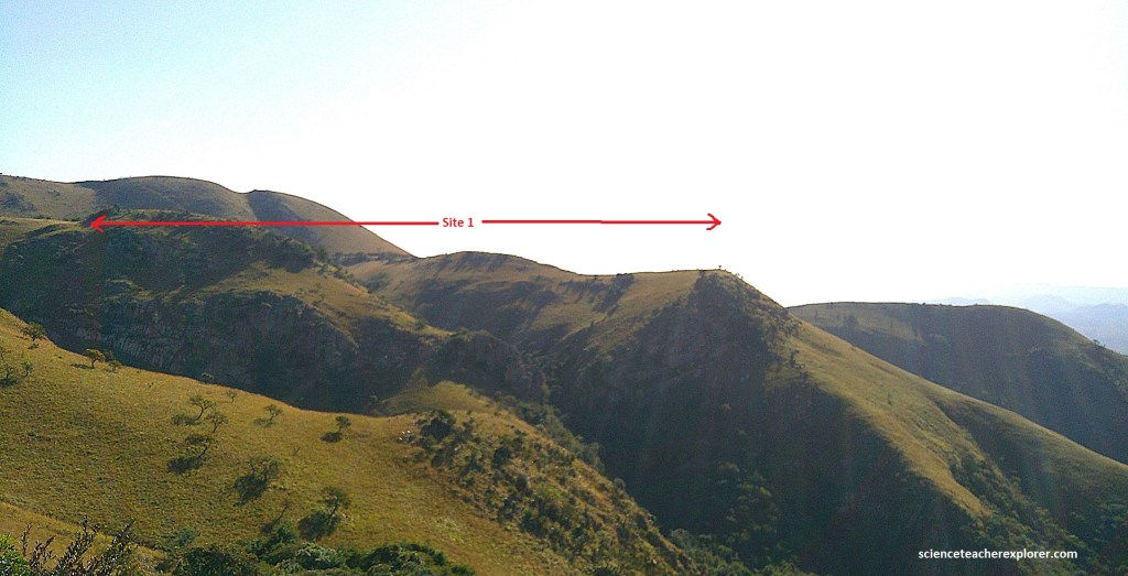
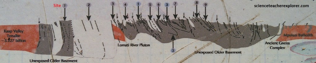
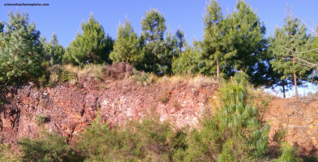
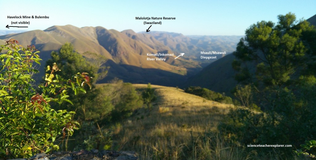
In June of 2025, I had the opportunity to explore the Makhonjwa Mountains, (Barberton Mountain Land). The Makhonjwa Mountains is a world-famous geological terrain with the most studied area of Archaean geology on Earth. It is found east of the Great Escarpment and close to the Swaziland border, (imaged below). Our trek will be part of the unrivalled Barberton Greenstone Belt that is 140km long and up to 40km wide, (imaged below).
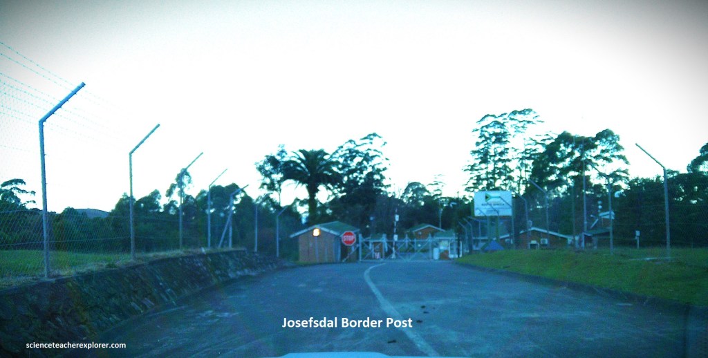
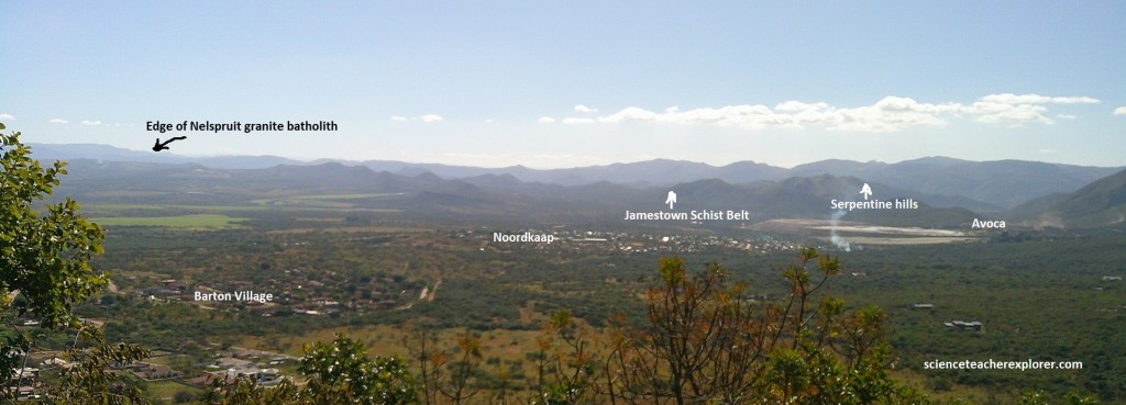
My trekking buddy, Tracy Davis and I, approached the area by road R40 from Nelspruit (Mbombela) to Barberton. A geotrail route continues on R40 from Barberton to the Swaziland border at Bulembu, (imaged below).
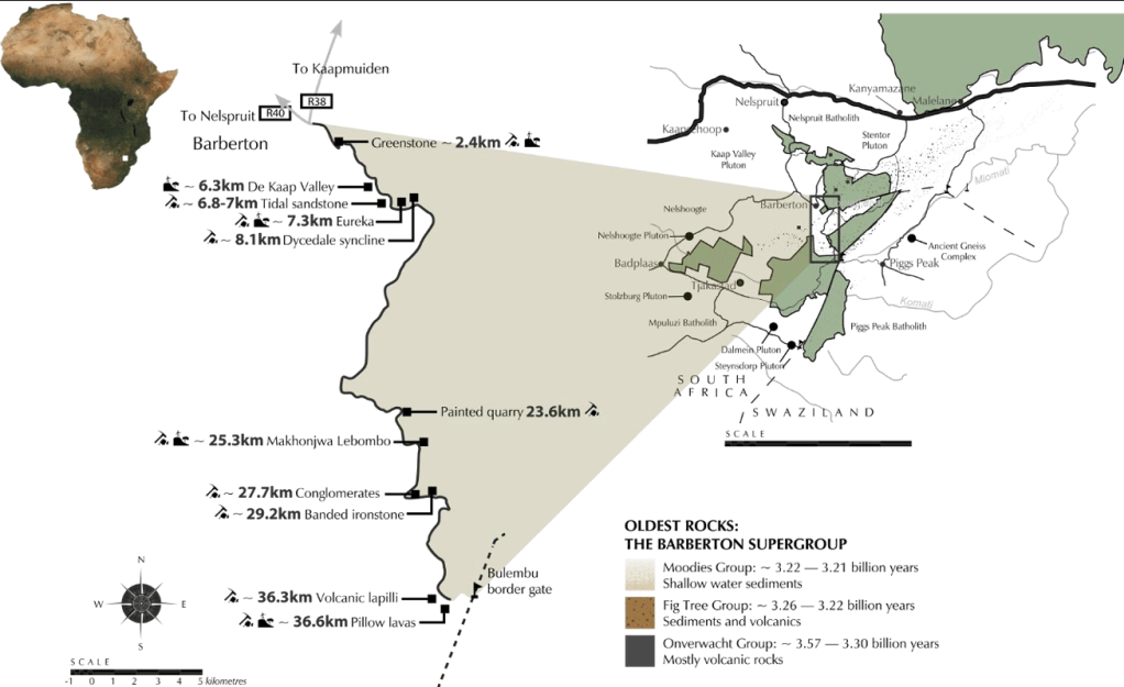
Our route on N40, followed a scenic, 37km-long, undulating and winding mountain road between Barberton and the border at Bulembu. It comprised of 11 demarcated and described geosites, with spectacular viewpoints. At each geosite there were parking and vandal-proof, (but not weather-proof), interpretive signs presenting geological information and concepts of science. Unfortunately, during the time of our visit, (2025), these signs were highly damaged due to the extreme conditions in weather there. Additionally, there was suppose to be a travel manual that we were unable to get our hands on in Barberton. But we did our best to interpret the geosites with our geological background.
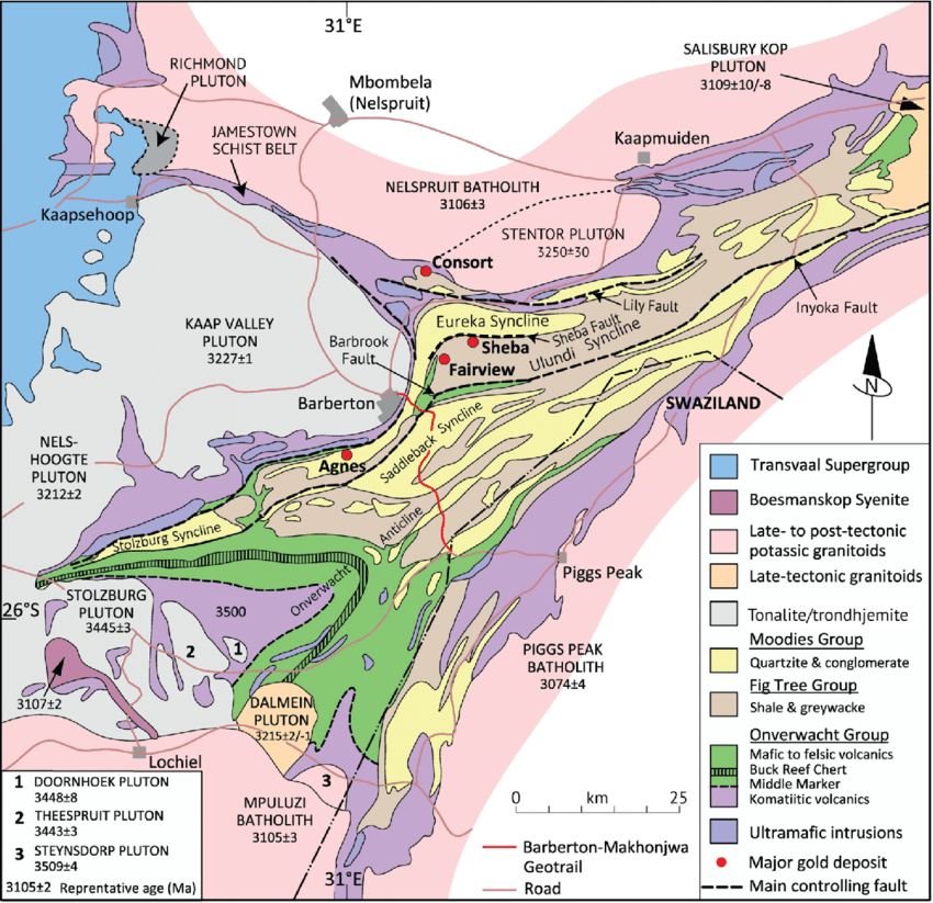
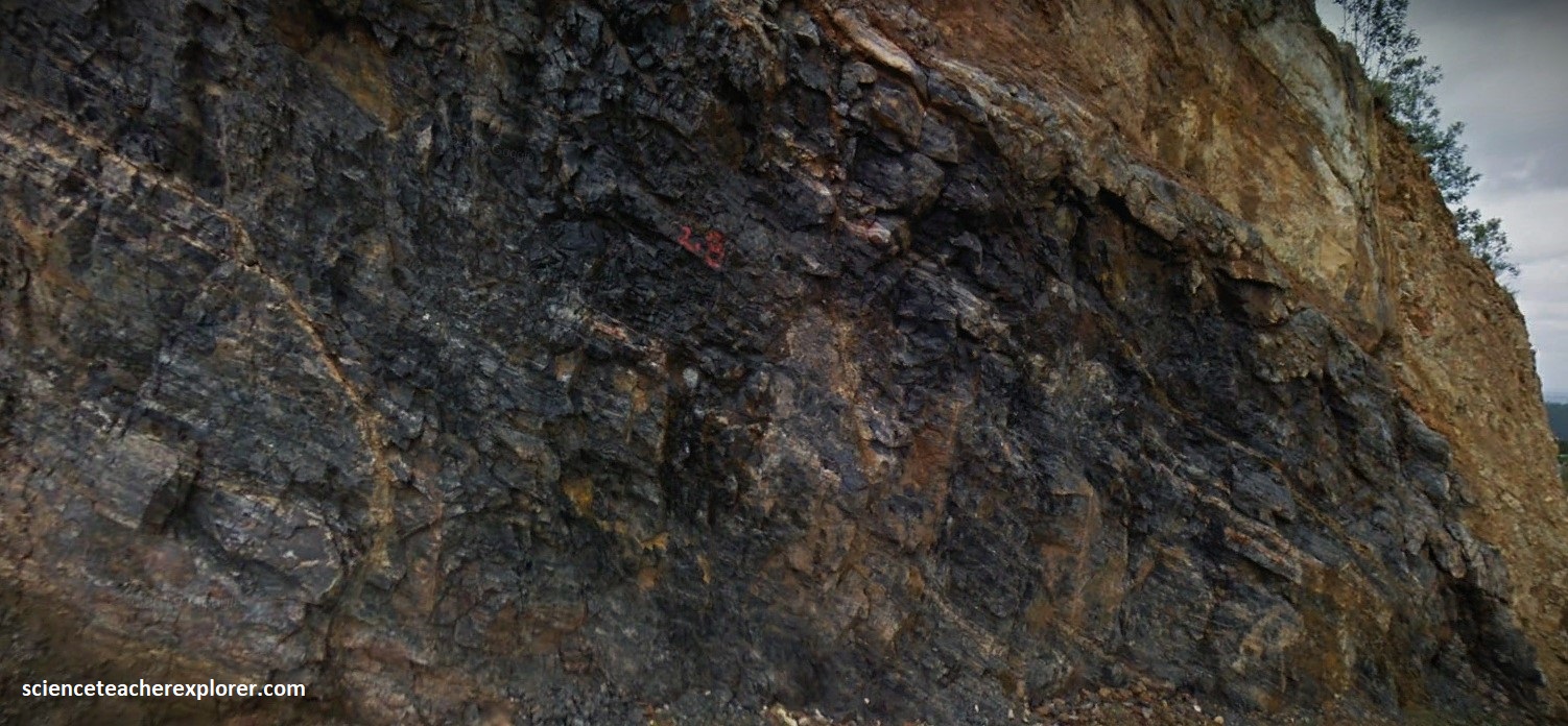
The rock formations we found along the Barberton Route, showed the diverse geological and life-forming processes that were taking place 3.5-3.1 billion years ago, and as on of the Earth’s earliest micro-continents that were being formed at the time. It would eventually become part of the Kaapvaal Craton. As seen above, these Archaean rock formations are strongly faulted and tightly folded into steep synclines and anticlines, resulting in a high degree of structural complexity, and entirely surrounded by large batholiths and plutons of Archaean granitic rocks.
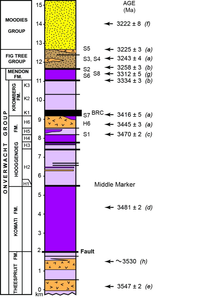
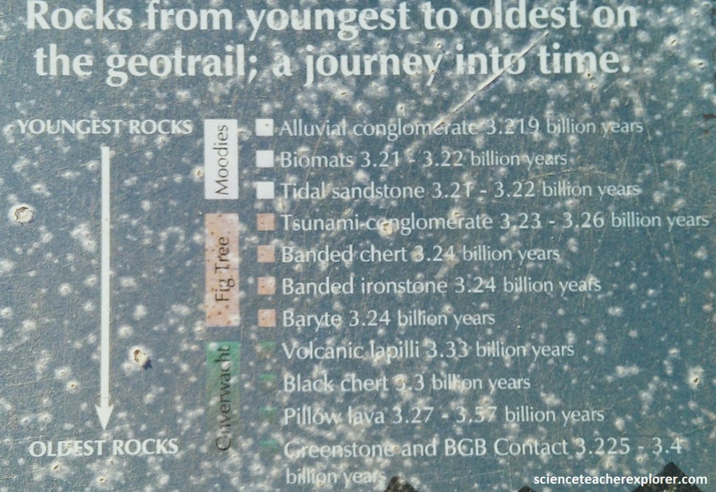
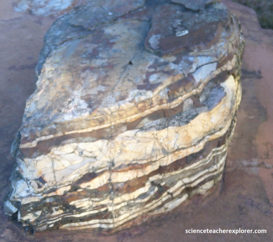
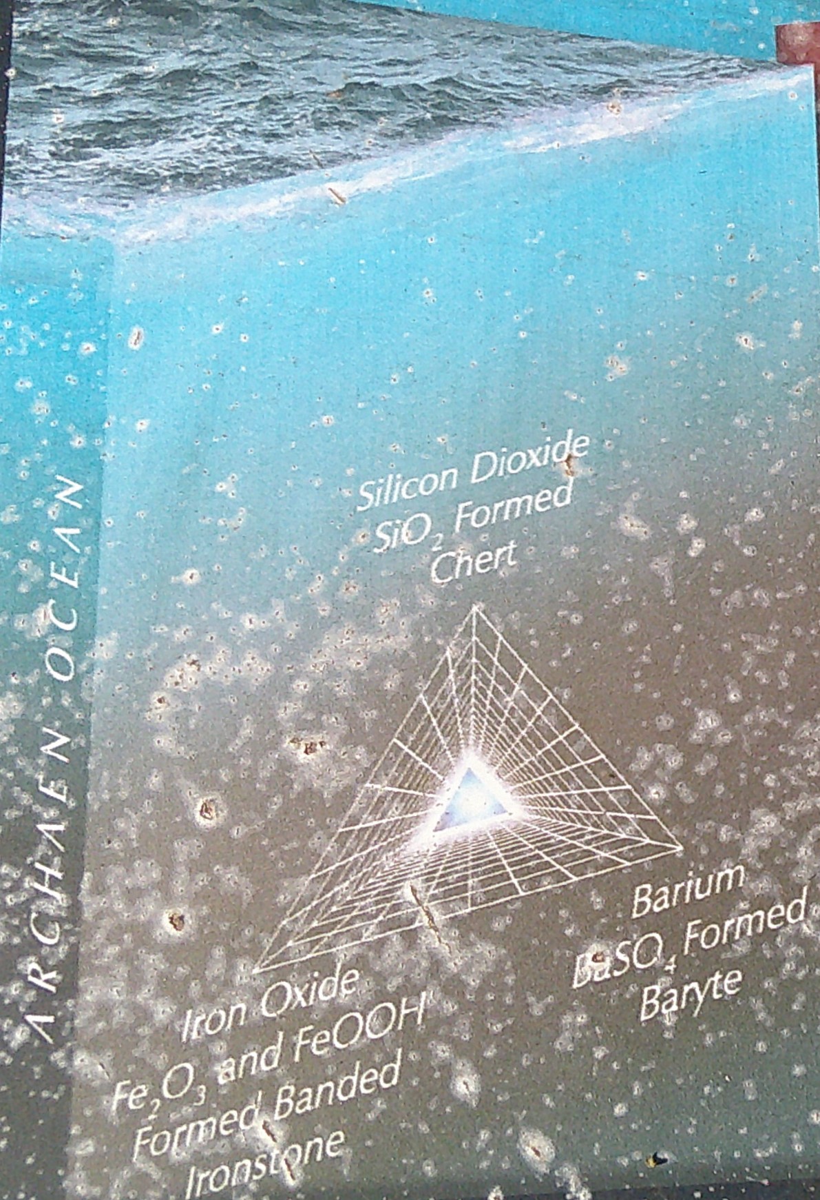
Imaged above and below; the full geological sequence that akes up the Barberton Supergroup comprises, from oldest to youngest: Onverwacht Group: (3.57-3.26 billion years ago)-comprising mainly ultramafic (komatiite) and basaltic lavas in various forms;
Fig Tree Goup: (3.255-3.225 billion years ago)-mainly sedimentary rocks such as impure shale and sandstone derived from eroding island arcs and sediments such as banded ironstone and cherts that were deposited in deep water;
Moodies Group: (3.225-3.215 billion years ago)-mainly coarser sandstones and conglomerates and minor shales, deposited under shallow-water conditions, such as tidal shorelines and deltas, as the mini-craton evolved and stabilized.
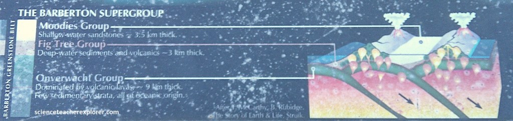
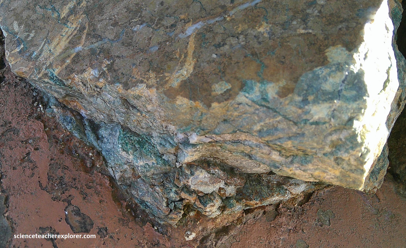
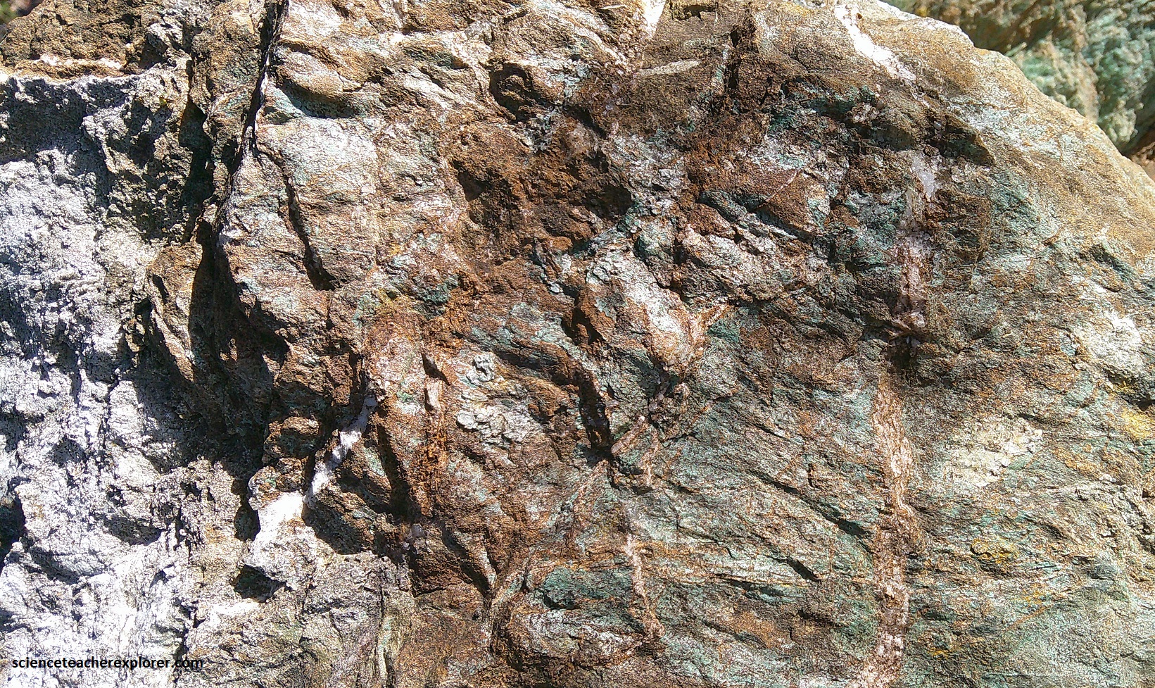
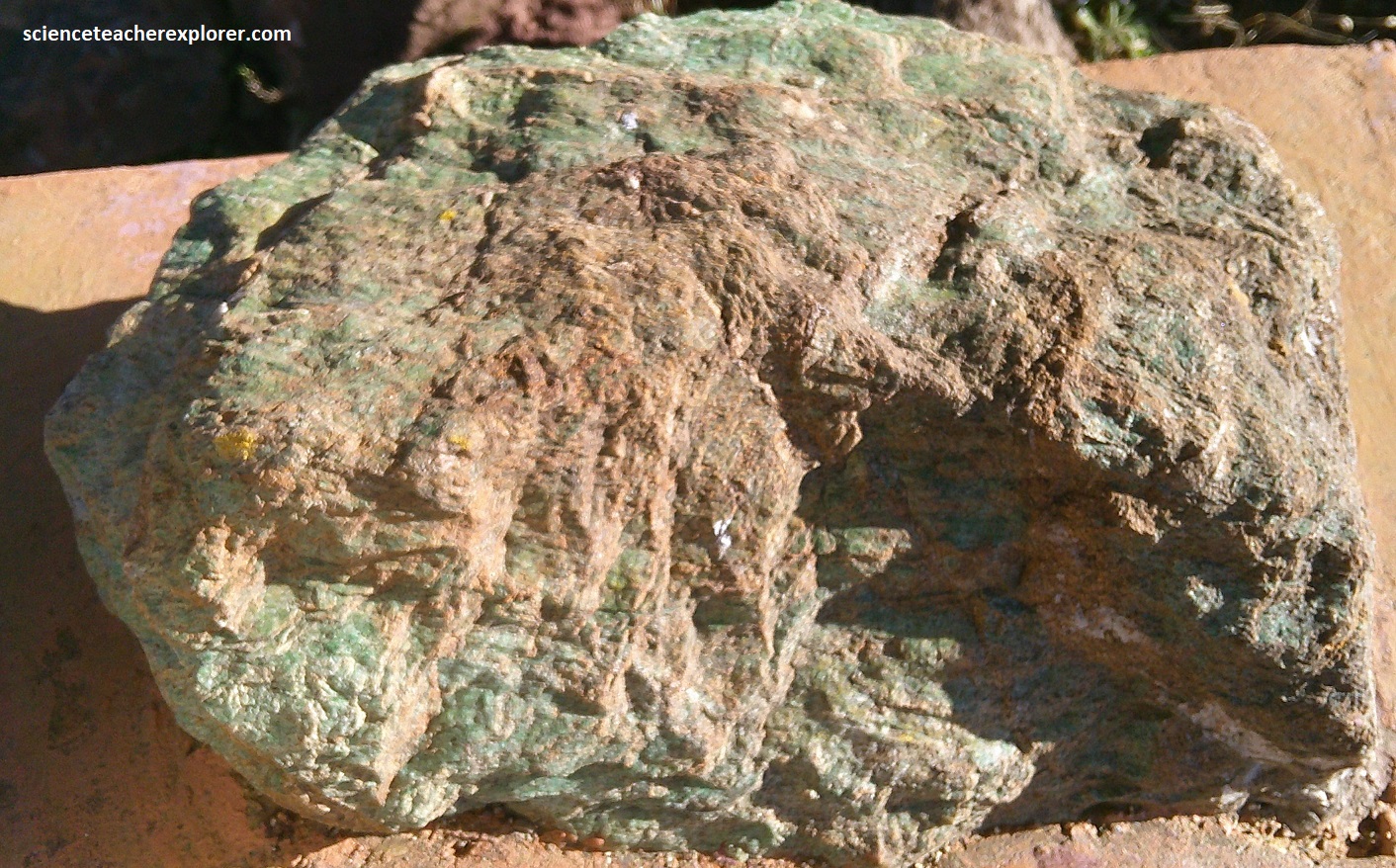
These rocks tell an adventure story taking us onto a journey through time to the Earth more than 3 billion years ago. The rocks in the Barberton Greenstone Belt, (some are colored green by minerals in the rock), preserve a 350 million year slice of early Earth and some of the earliest known fossils of life.
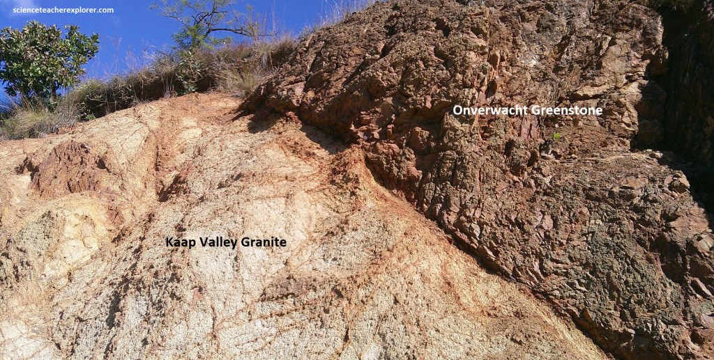
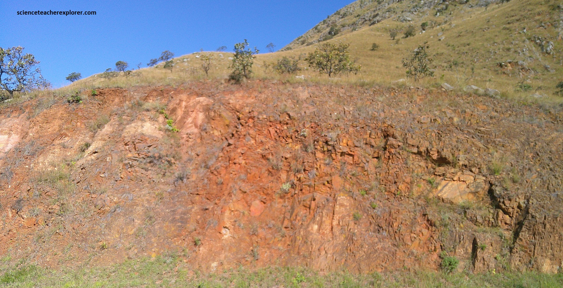
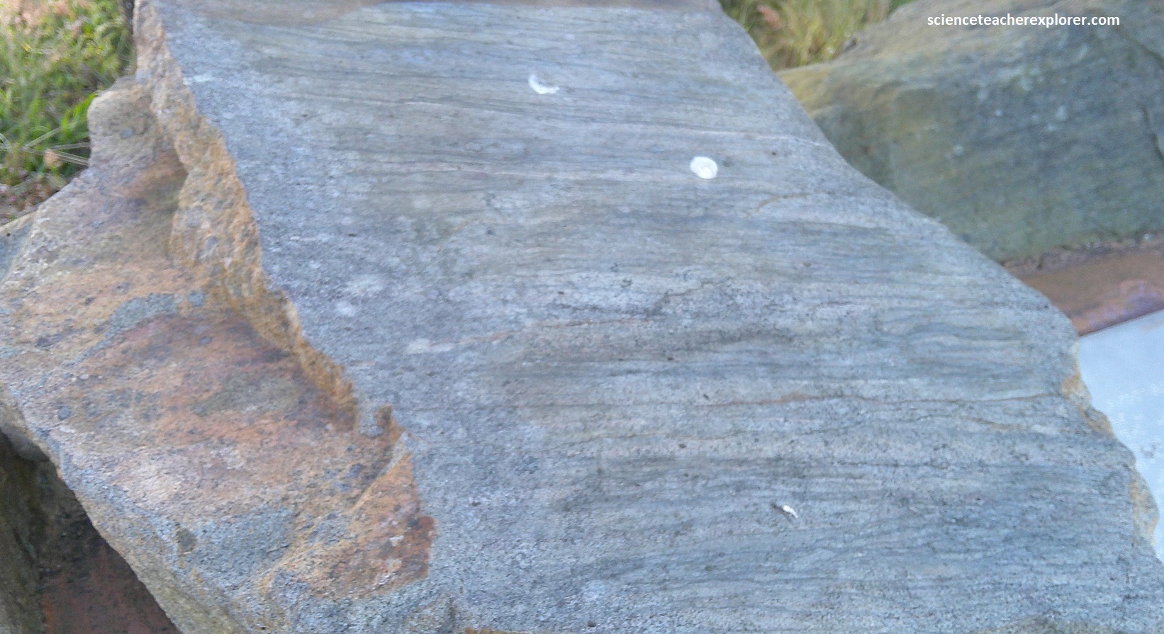
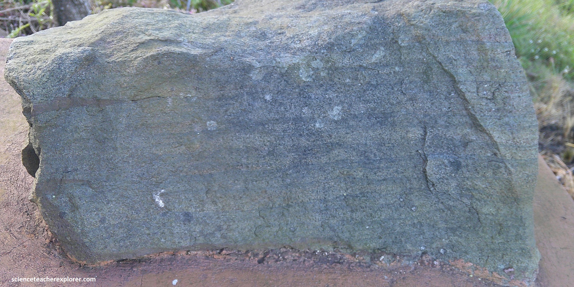
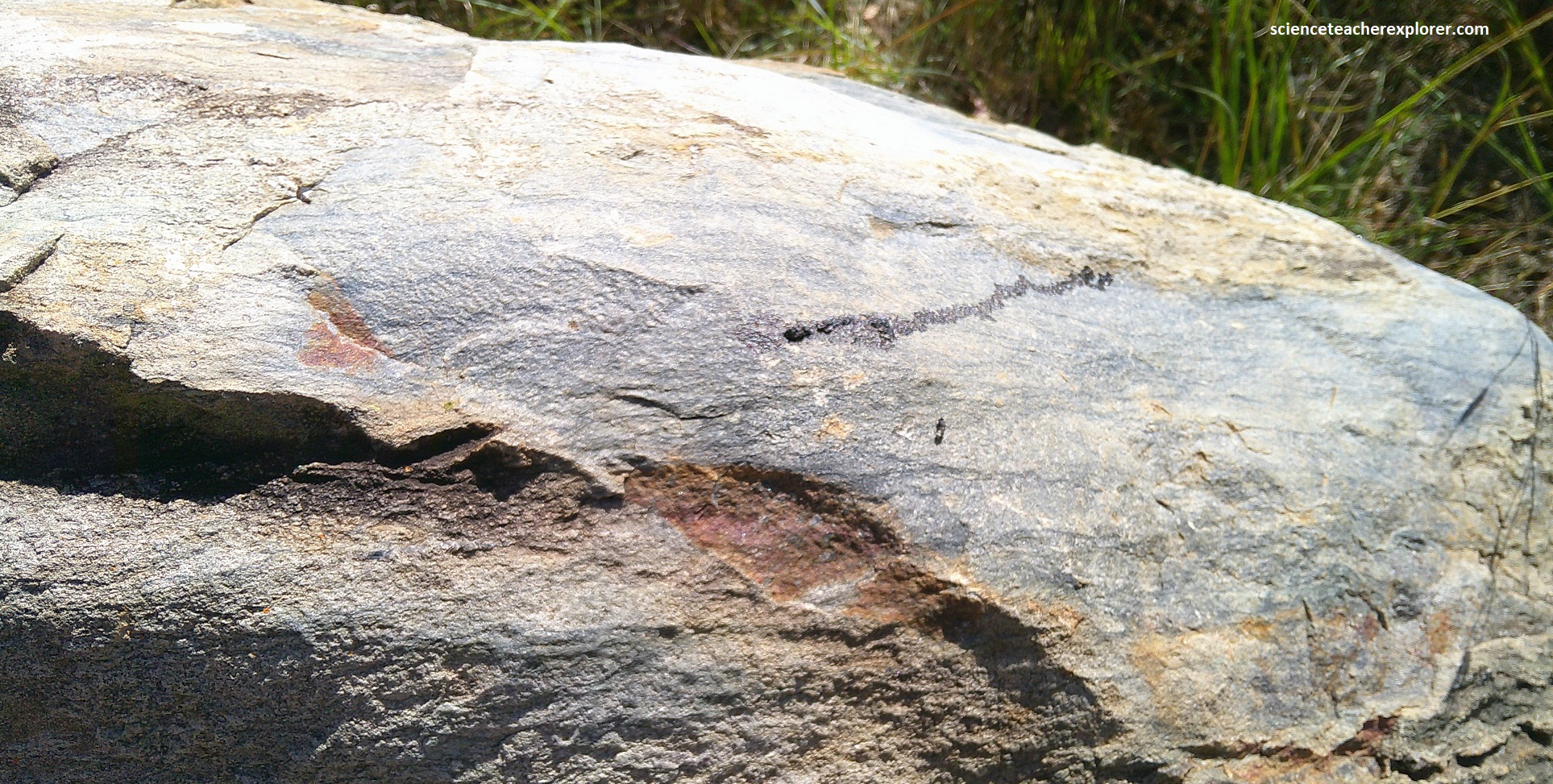
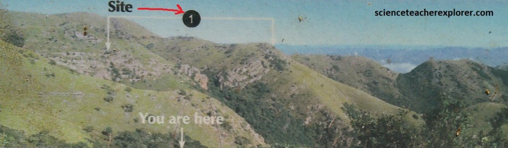
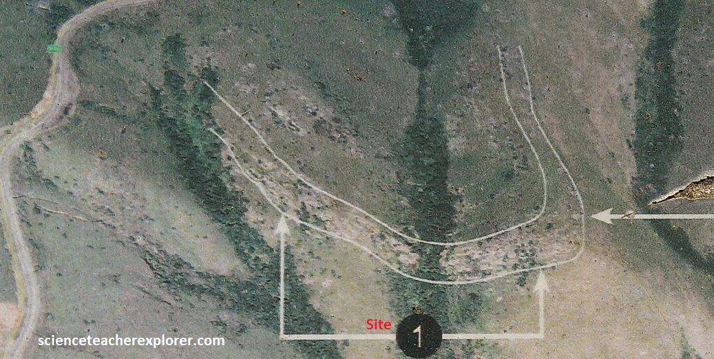
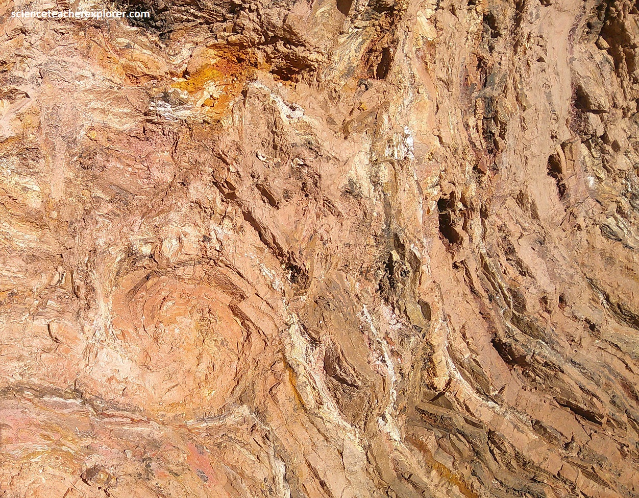
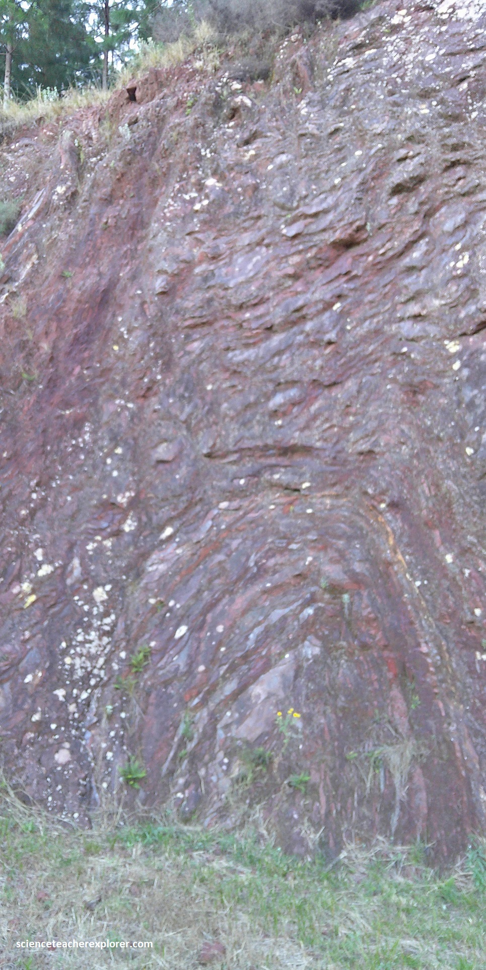
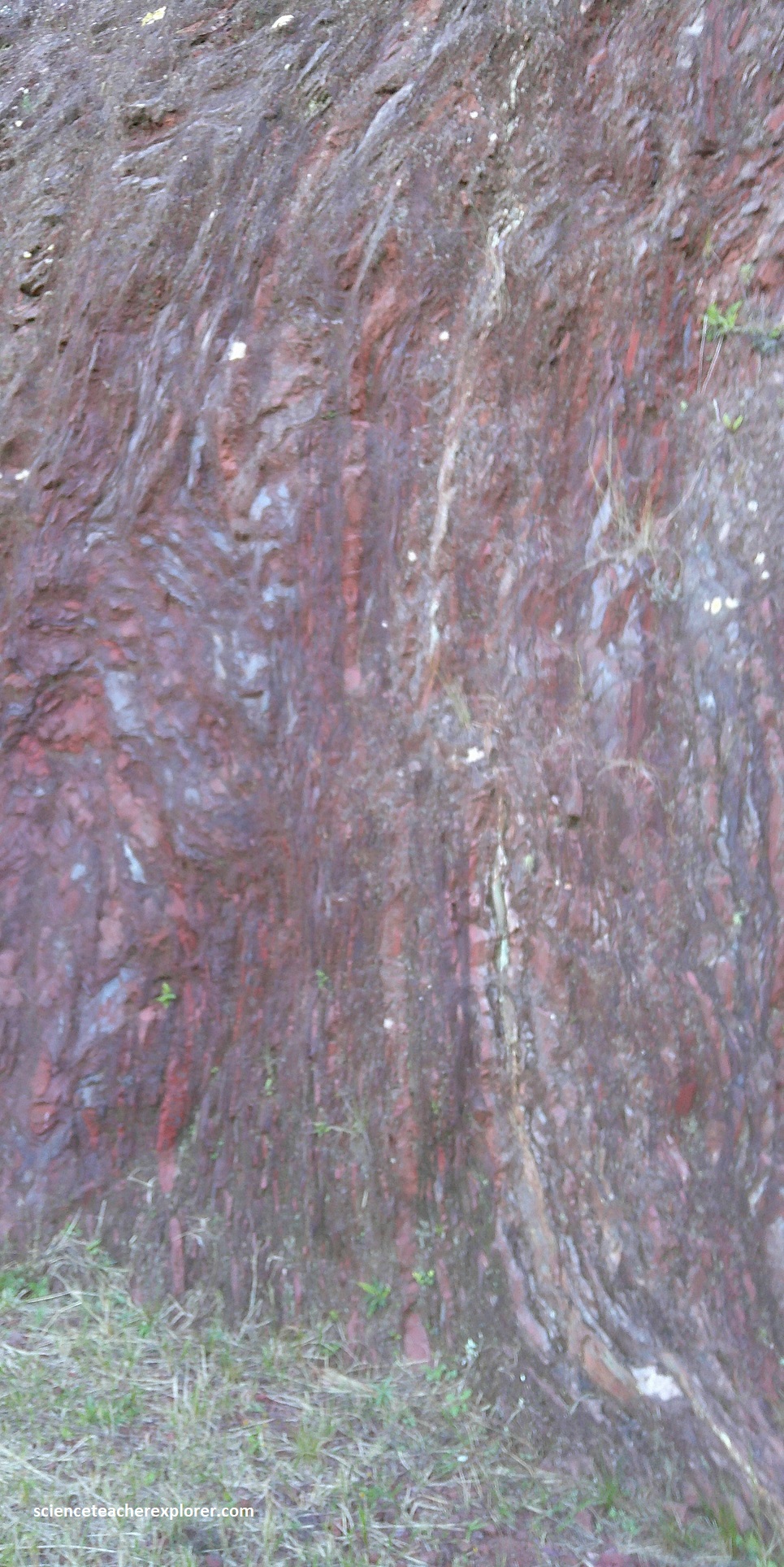
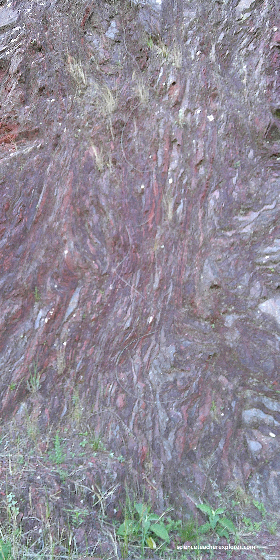
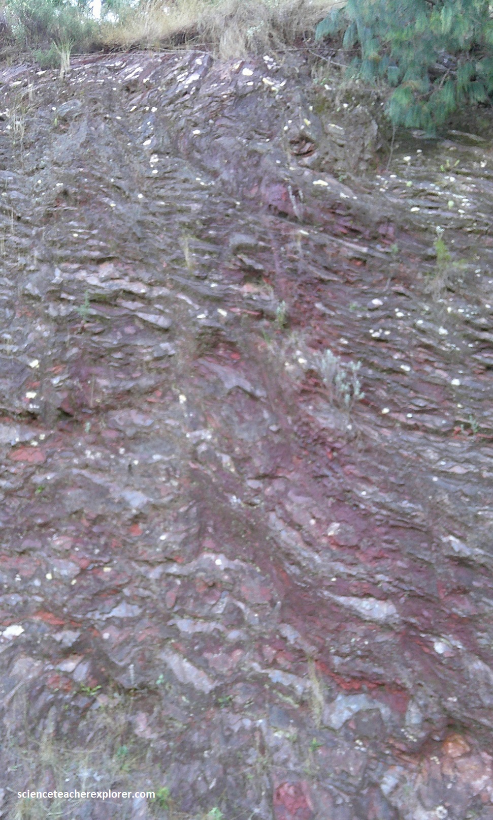
As we started our trek, south from Barberton, we came across Site #1 Greenstone View in 2.4 km. This site was considered the Barberton Greenstone Belt Boundary and we could see a faulted boundary between the Kaap Valley granite and Onverwacht greenstone.
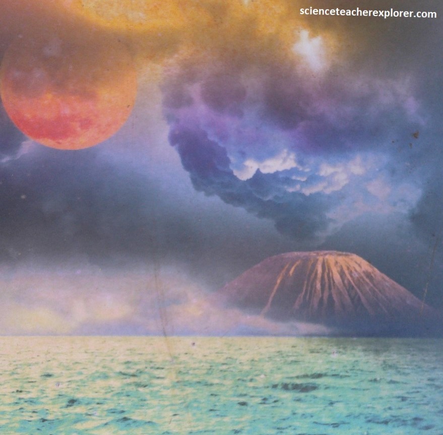
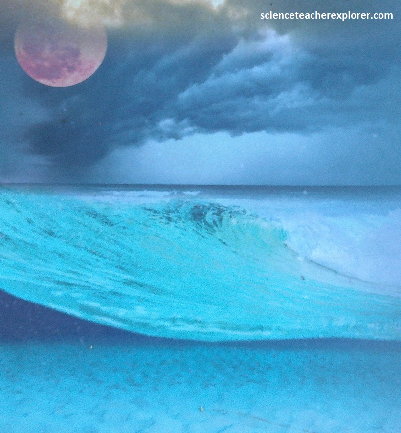
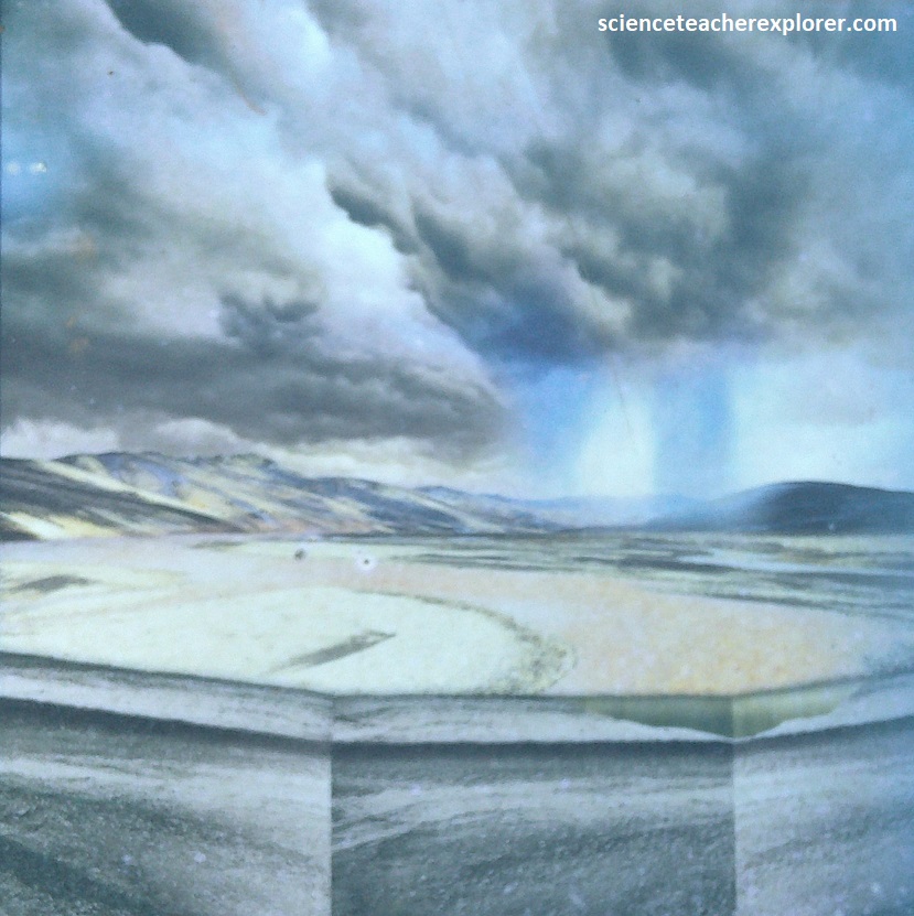
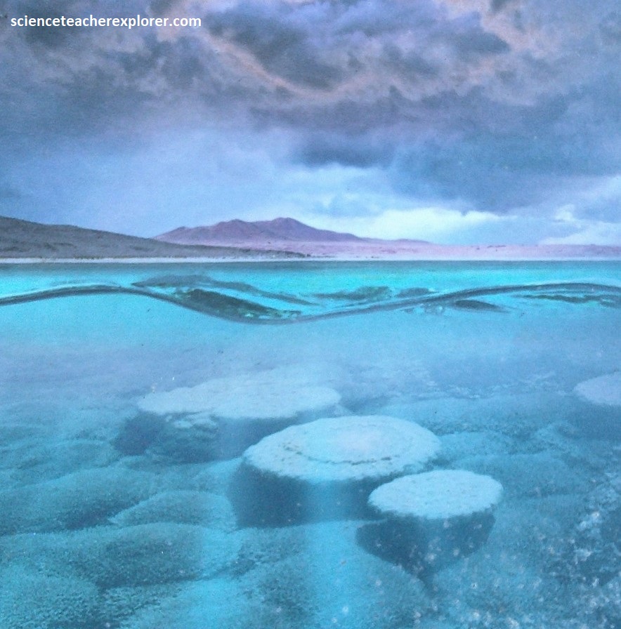
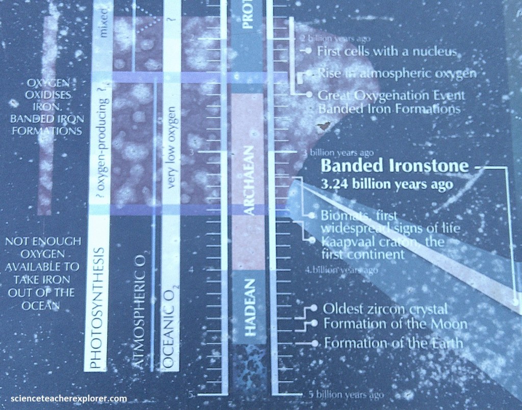
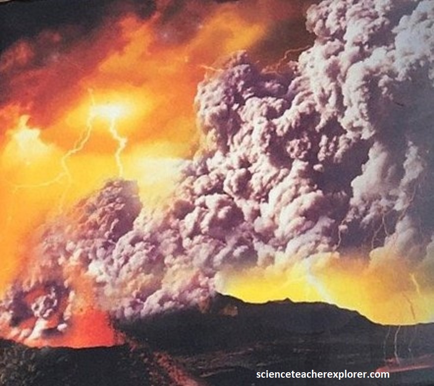
Around 3 billion years ago, the Earth had cooled from it’s fiery birth and was covered by a deep, warm ocean green because of dissolved iron. The atmosphere would have been poisonous to animals. Most scientists believe it was chiefly carbon dioxide, nitrogen and water vapor, with methane and other gases. The sky may have been filled with dark clouds of volcanic ash. The sun was young and weak and meteorites peppered the planet, (imaged below).
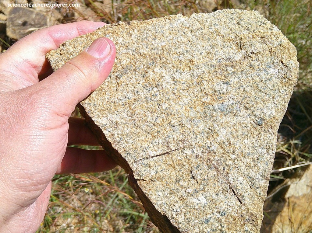
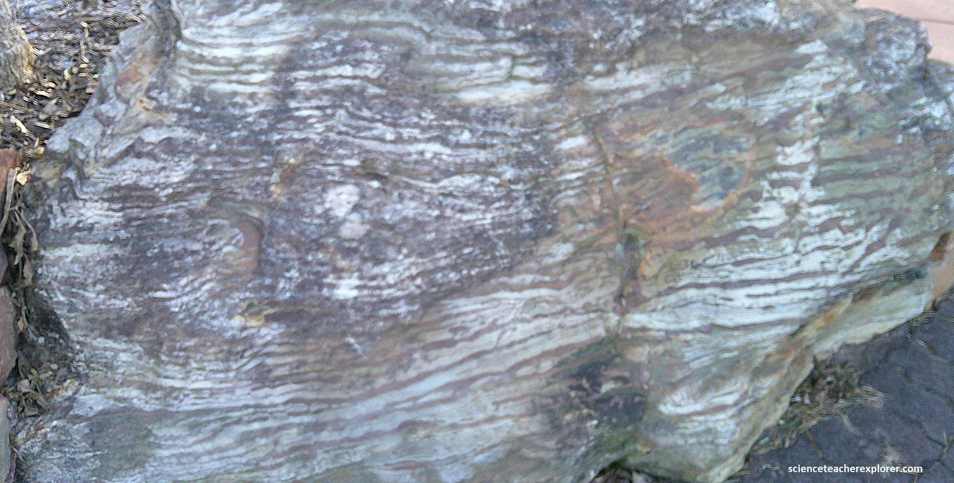
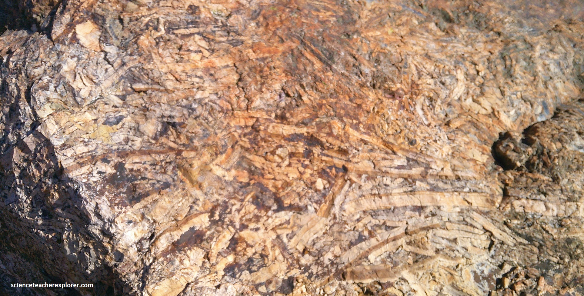
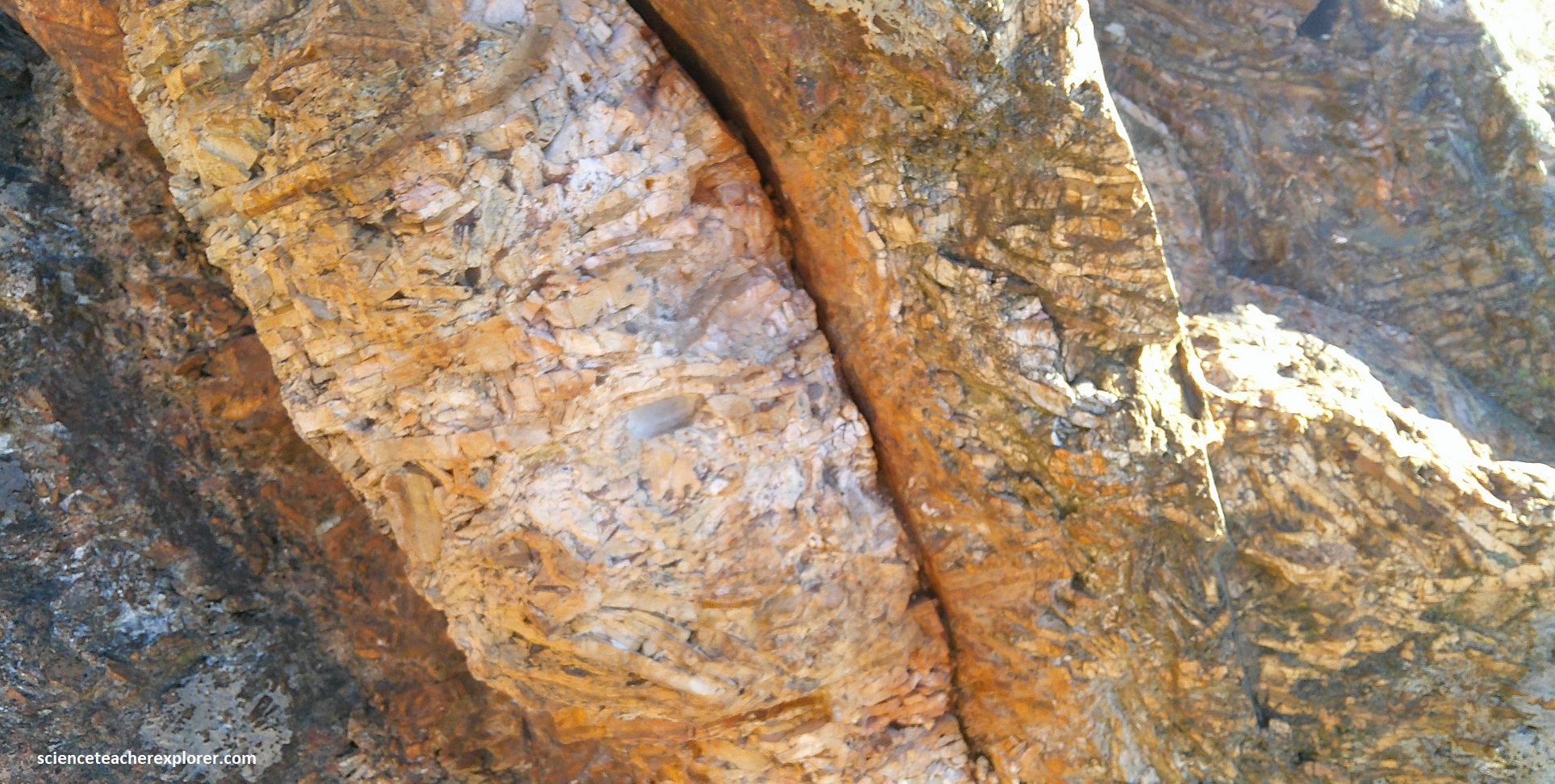
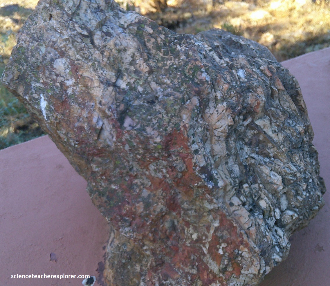
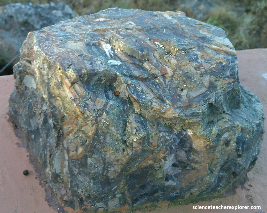
Greenstone belts were formed by large bodies of granitoid rocks that squeezed and folded volcanic and sedimentary rocks. hey are called “greenstone belts” because the metamorphosed volcanic rocks are often colored green by chlorite and other minerals. These greenstone rocks are fragments of volcanic islands and crust which collided and helped build the Kaapvaal Craton, (the first continent). Studying these rocks, (picture below), can tell us about the surface conditions of the early Earth. (The pictures below were taken at Site #1).
The first gold strike here was a small alluvial gold deposit on the far western side of the valley, (pictured below), in the Noordkaap River, made in 1883 by Ingram James, Magnus Jefferies and Auguste “French Bob” Robert. Before the Witwatersrand discovery, the Barberton Greenstone Belt was an important gold producer.
Tom Mclacalan found the first traces of alluvial gold in the Ngwenyama River in 1874 but it was not a payable strike. Alluvial gold is eroded out of quartz reefs and washed away by streams and rivers. Gold is heavy so it sinks to the riverbed where the current flows slowly, or is trapped in fissures in the bedrock. By panning upstream, a prospector may eventually find the source.
Although the De Kaap Valley, (seen above), is sometimes called a crater, it is a case of mistaken identity. It is neither a meteorite nor a volcanic crater. It is a basin formed as a result of erosion by rain and rivers, of the giant bubble (pluton) of coarse-grained granite (tonalite), and ancient shallow-sea sediments that once buried it. Erosion has revealed the shape of the pluton and the circular collar of rocks it pushed aside when it rose in the Earth.
Pictured above, the De Kaap Valley is a patchwork of bushveld and farms, crossed by winding streams. A variety of crops and livestock prosper here: sugar cane, sub-tropical fruits, macadamia nuts, vegetables and cattle. The serpentine soils of some of the schist ridges, (seen above), are high in heavy metals such as nickel and chromium, and so are toxic to many plants. These soils have there own unique species, some of which are endemic.
We continued to drive on R40 for another 3.9km to Geosite #2. It was considered the De Kaap Valley View-site. The entire, we were driving within the Kaap Valley tonalite pluton. At the Geosite #2, the road cut showed a great outcrop of De Kaap Valley Granite. This is an Archaean age granite (tonalite) that weathers and erodes relatively easily and are typified by the landscape of the lower terrain around Barberton Mountain Land.
Immense forces 3.2 billion years ago, forced super-heated water at over 3000C and under tremendous pressure, through pores and cracks in the rocks. The water dissolved silica and gold, carrying the minerals upwards from the pluton, along fissures and faults. As the solution cooled & mixed with surface water, deep underground, the dissolved silica combined with oxygen to form quartz veins in the fissures, and within the quartz was gold.
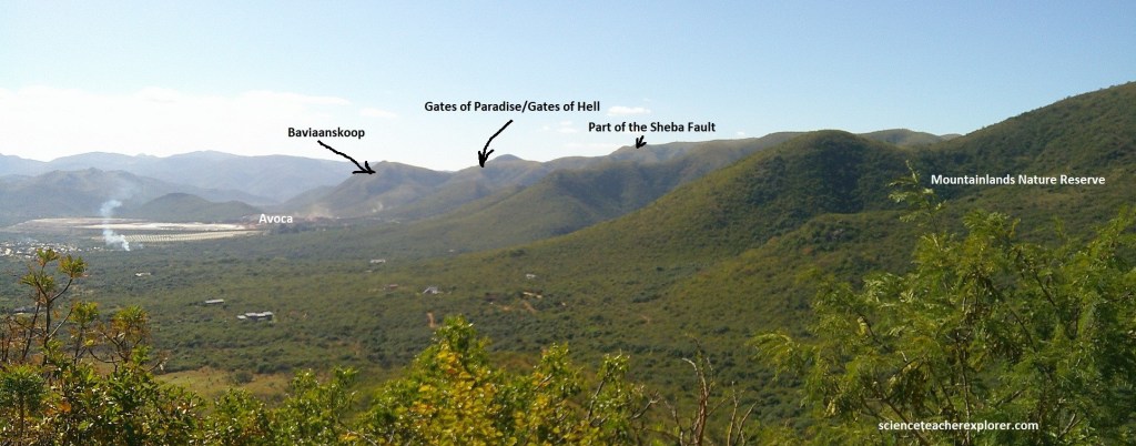
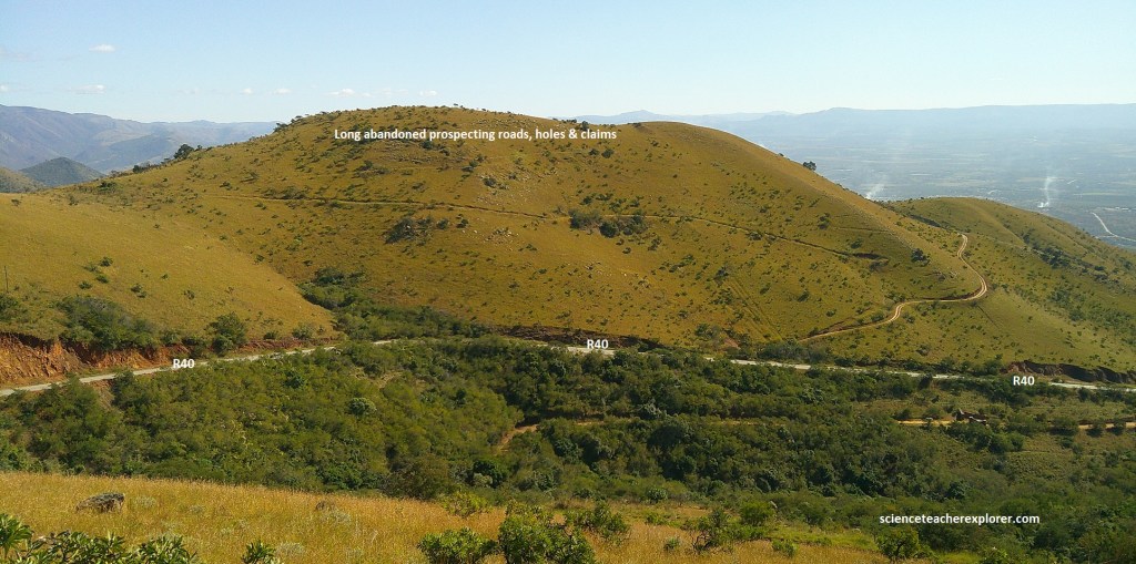
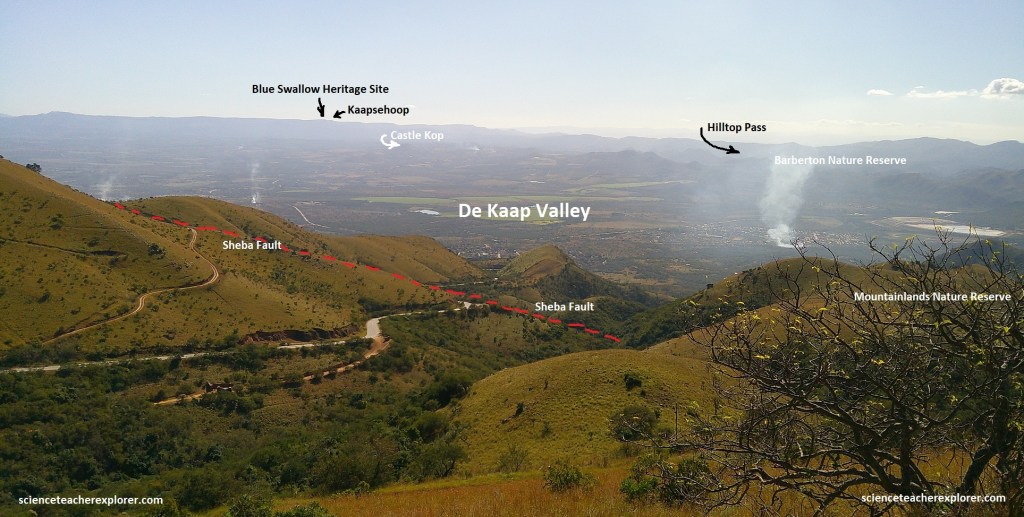
The geological features that are today celebrated and protected , also attracted the miners of old. Signs of past prospecting and mining can still be seen whilst abandoned trenches and adits are being rehabilitated. About the center of the view, (pictured below), is part of the Sheba Fault, (host to some of Barberton’s most famous gold-bearing reefs and its colorful history).
The fabulous Golden Quarry of the Sheba Mine was discovered, not by the Queen of Sheba, but by Edwin Bray in 1885, when on a whim, so the fairy tale tells us, he hammered off a chunk of projecting rock along a pathway, (the broken face glistened in the sun), launching one of the world’s richest gold strikes.
The rush for gold at Barberton is a legendary event in South African history. In 1882 alluvial gold was found in the De Kaap Valley, and some diggers moved on to hills on Moodies Estate. There Auguste Robert found alluvial gold in Concession Creek and in June 1883 he traced it to the Pioneer Reef, (the first payable gold reef in the Barberton area). Soon at least 1,000 diggers had joined the gold rush, working on their claims and living in hastily set-up camps. In the same hills further to the northeast, the Barber and Rimer brothers found more rich gold reefs and this led to the establishment of boom-town Barberton in June 1884. But it was the Sheba Creek find in May of 1885 that put the Barberton goldfield known worldwide.
More than 350 gold-mining operations and prospects were eventually recorded but most production has come from five mine: Sheba, Fairview, New Consort, Agnes and Barbrook, all still operating. However, in 1886 the Barberton mines were eclipsed by the new Witwatersrand goldfield. The estimated total gold production from the Barberton mines is about 345 tons, (11 million ounces).
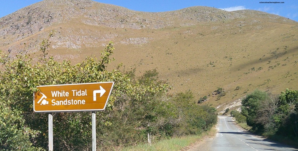
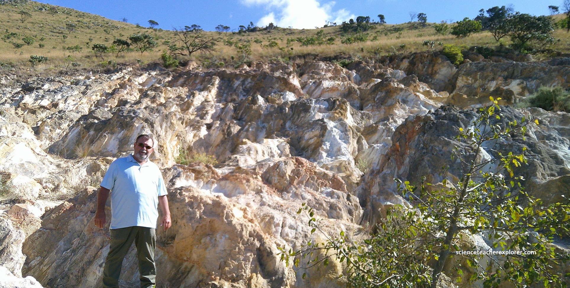
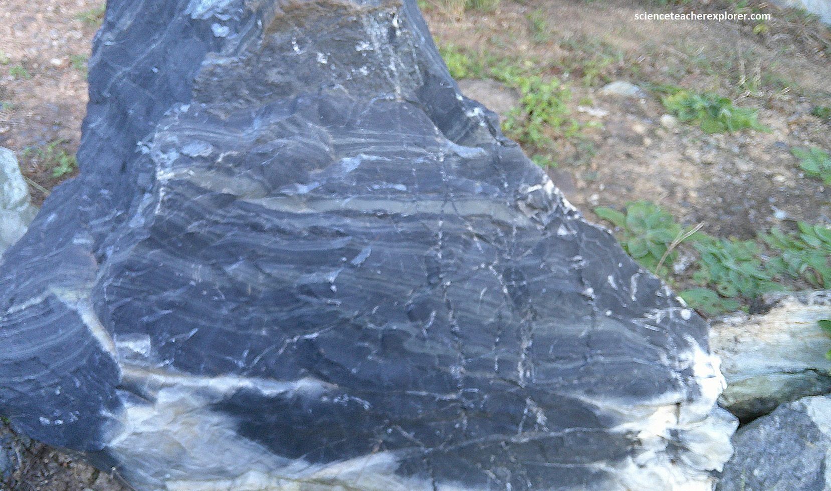
Driving another 0.7km, south on R40, we approached Geosite #3, (Tidal Sandstone Site). {Picture below is my trekking buddy, Tracy Davis, standing within the Moodies sandstone}. It is a white clay-rich sandstone, that shows a great number of shallow-water sedimentary-structures.
No one is quite sure where all the water in the ocean came from. Some scientists think it came from within the Earth during volcanic eruptions. Others think it may have been brought from outer space in comets and meteorites. However, it appeared, at first, the early Earth was an ocean planet. Later, volcanoes appeared. Erosion of the slopes of these volcanoes formed shallows and sandbanks on the shorelines.
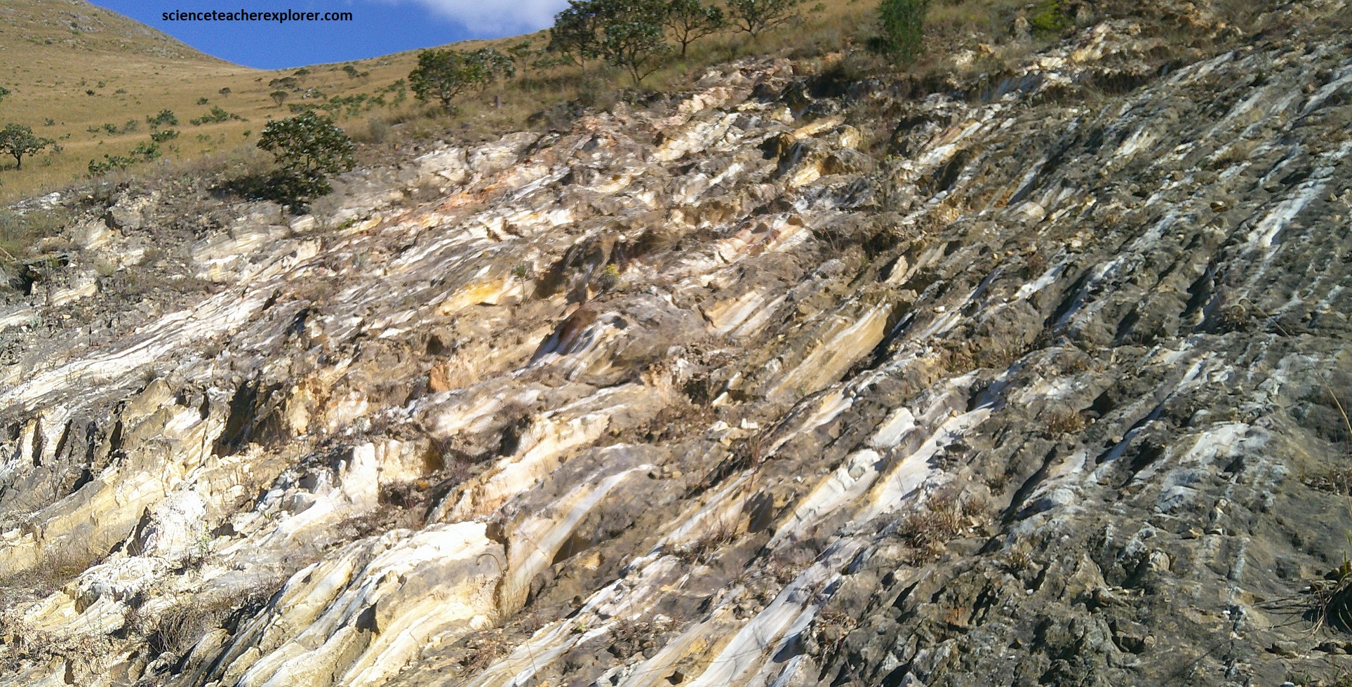
The Moon was much closer to the Earth, (70% closer) than now, tides were much higher and more frequent, and the months shorter because the Earth spun faster, {Earth’s day was 13 hours}. These findings come from analyzing ancient tidal deposits from these sandstone layers, where the rhythm and thickness of layers reveal past tidal currents and their relation to Earth’s rotation and the Moon’s orbit. We know this because these sandstone rocks hold a record of the back-an-forth tides as herringbone pattern called “cross-bedding”. Where bands are closer together, they may have formed at neap tides, where further apart, at spring tides. This may be a way to estimated the length of a month in the Archaean time.
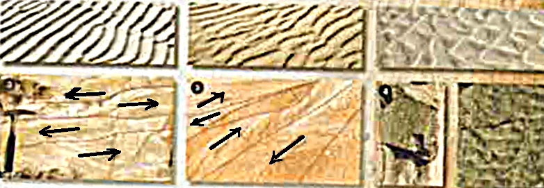
Within these rock formations are “tidal bundles,” which are layers formed by migrating sand dunes and ripples under tidal currents. By analyzing the thickness and variations in these layers, scientists used frequency analysis to determine the periodicity of past tidal cycles. This tidal information is fed into computer models that use physics to calculate the past Earth-Moon distance and the length of Earth’s day. [Note: The Moon’s gravitational pull on Earth’s oceans creates tidal bulges. The friction between these bulges and the rotating Earth slows the planet’s rotation over time. To conserve the angular momentum of the Earth-Moon system, the Moon is pushed into a higher, larger orbit as the Earth’s rotation slows to today’s period. The Moon is currently receding from Earth at about 3.8 cm / year. This gradual process explains why the Moon was much closer and the tides were much stronger in the past, (like 3.2 billion years ago.]
The photos below are images of the Moodies Group sandstone rocks from Geosite #3. Note the cross-bedding pictured below.
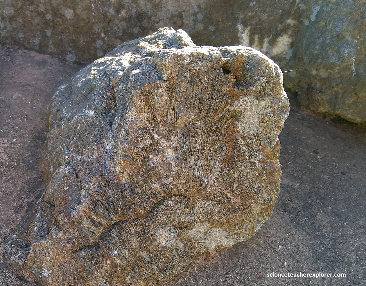
We continued to drive another 0.3km, South on R40, which brought us to Geosite #4, (the Eureka View). This was the top of Saddleback Pass and where we came across a very large Moodies conglomerate boulder, (pictured below). From Barberton, at an elevation of around 850m, the road R40 climbed to 1,350m at Saddleback Pass.
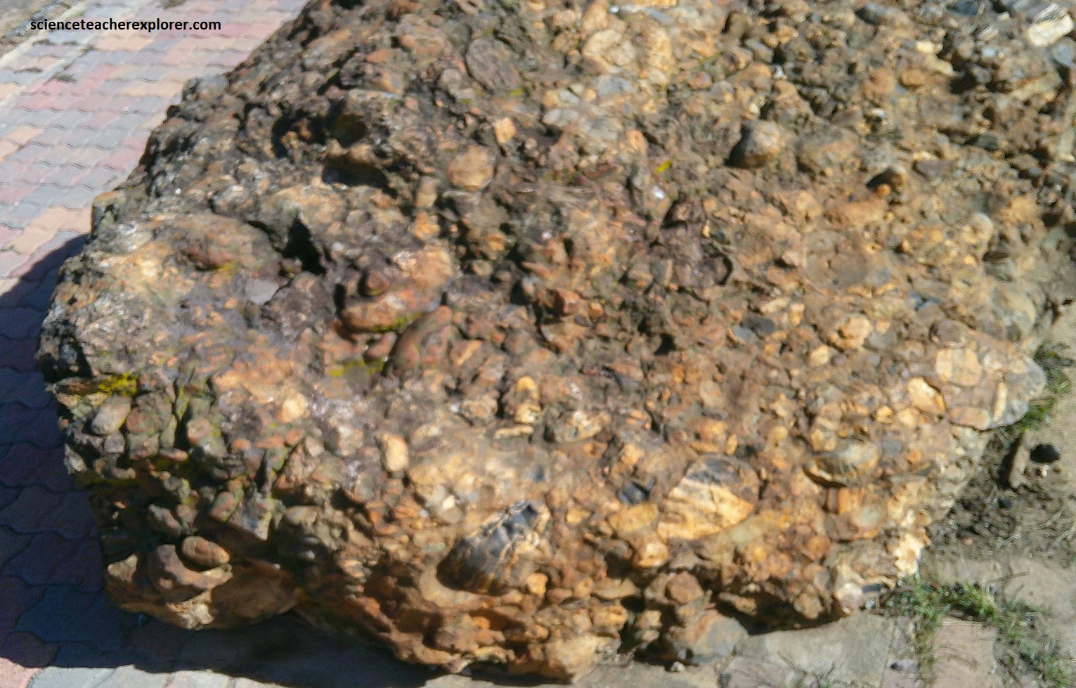
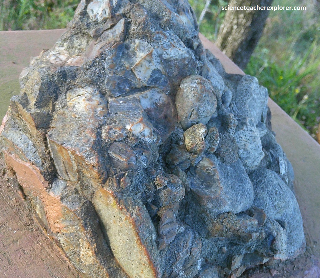
Apparently, at the Geosite #4, (Eureka View-site), this large boulder of Moodies Group conglomerate had moved about 100m down the steep hill, (picture above). Note that most of it’s cherty pebbles originally came from the older Onverwacht Group, plus some older Fig Tree Group volcanic rocks, (pictured below).
This conglomerate rock belongs to the Moodies Group, the youngest unit in the Barberton Greenstone Belt. It was/is formed from rounded pebbles and gravel rolled along by shallow streams and flash floods from mountains that once stood to the north. These mountains have long been eroded away.
The gravel and pebbles were deposited in alluvial fans and broad rivers nearby and they tell us about geologic time even older than this conglomerate. The pebbles and rock fragments are chemically cemented together by sand and fine material. Conglomerates can be deposited very quickly because the fast-flowing water which transports them often does not flow for very long. A single flash flood can, overnight, deposit pebbles, gravel and sand many meters deep.
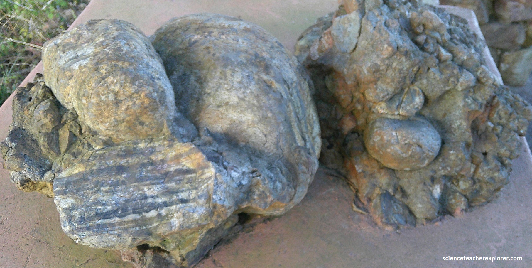
Just west of Geosite #4, is a alluvial fan remnant. The conglomerate was initially deposited as a wedge in an alluvial fan. The strata tilted and a new conglomerate, (from with the boulder came from), was laid down on its top.
Imaged above, all the strata were tilted more steeply when the greenstone belt was folded during a series of earth movements about 3.2 billion years ago. In other words, this boulder & conglomerate found near R40, formed from deposits of stones and gravel in an alluvial fan that was raised high into these mountains by folding of the Barberton Greenstone Belt.
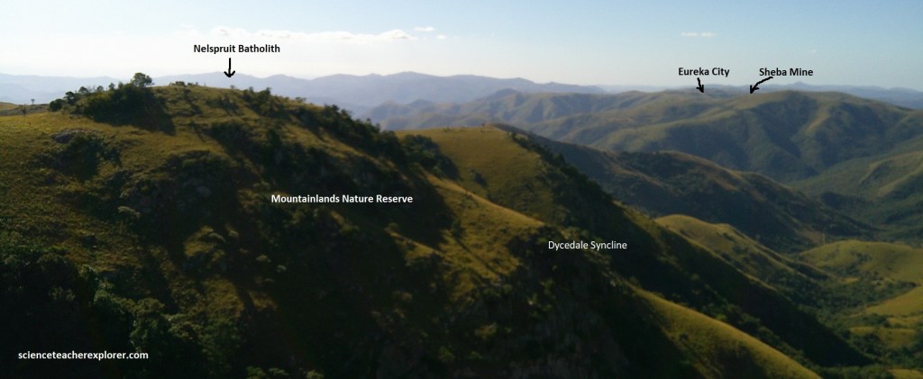
Pictured above in the far distance, Eureka City was once a thriving gold-mining community of over 700 people seeking respite from the malaria ridden De Kaap Valley, it had hotels, bars and even a racecourse. It was abandoned in the early 20th century. {Note the beginnings of the Dycedale Syncline}.
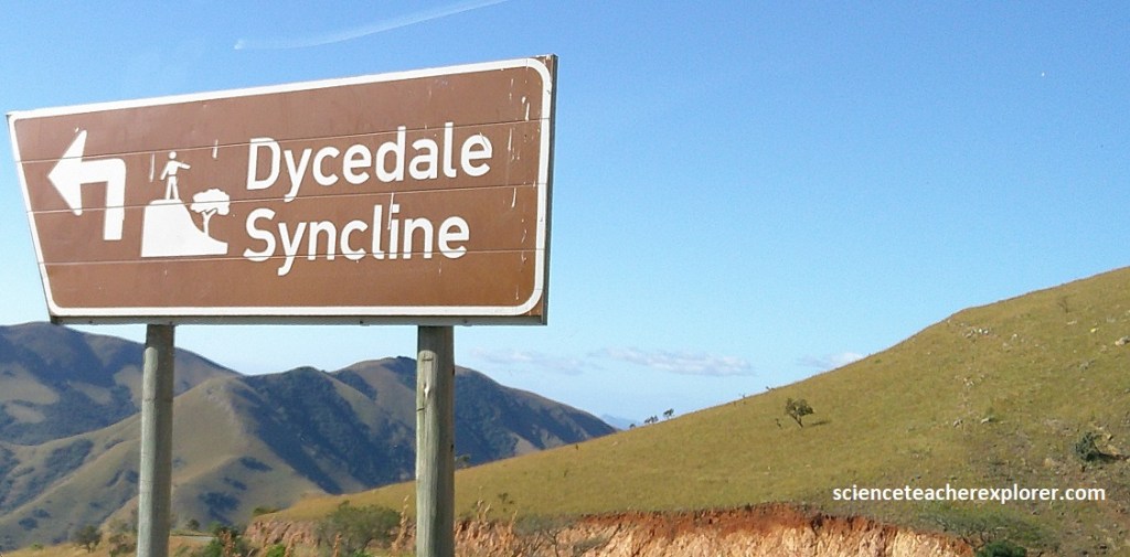
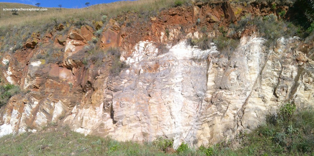
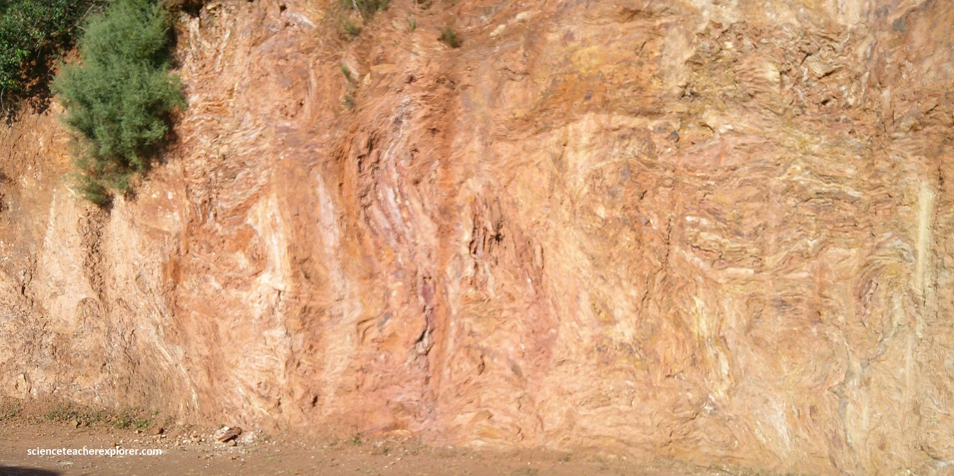
Driving further along R40 for 0.9km, we approached Geosite #5, (Dycedale Syncline). We immediately noticed that the rock within the road-cuts changed to a white (clay)-grayish look to them, (pictured below).
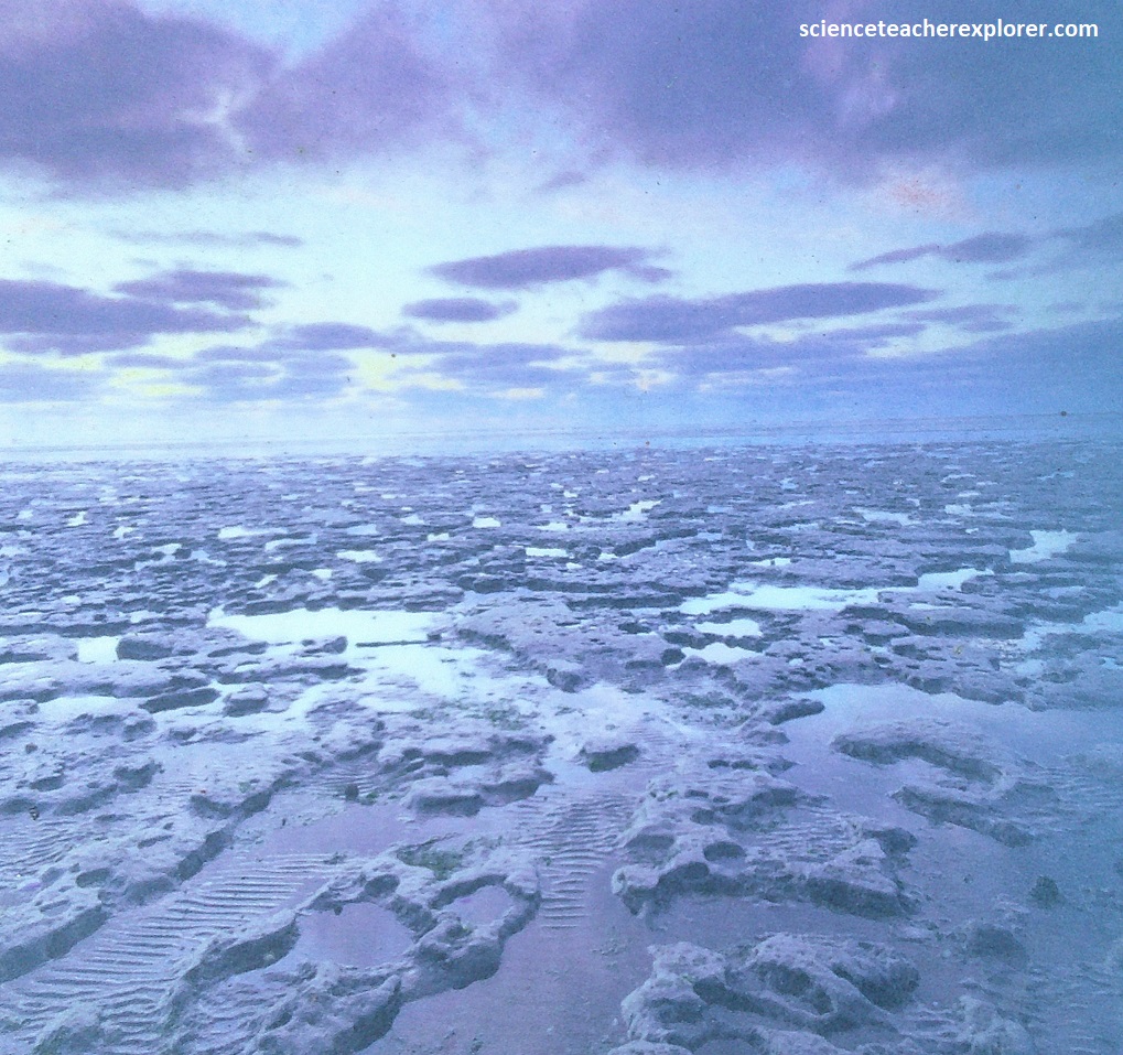
Around 3.2 billion years ago, where we stood at Geosite #5, were tidal flats, sandy in places, muddy in others, with shallow water, pools and small islands. Tides may have swept for tens of kilometers over these flats.
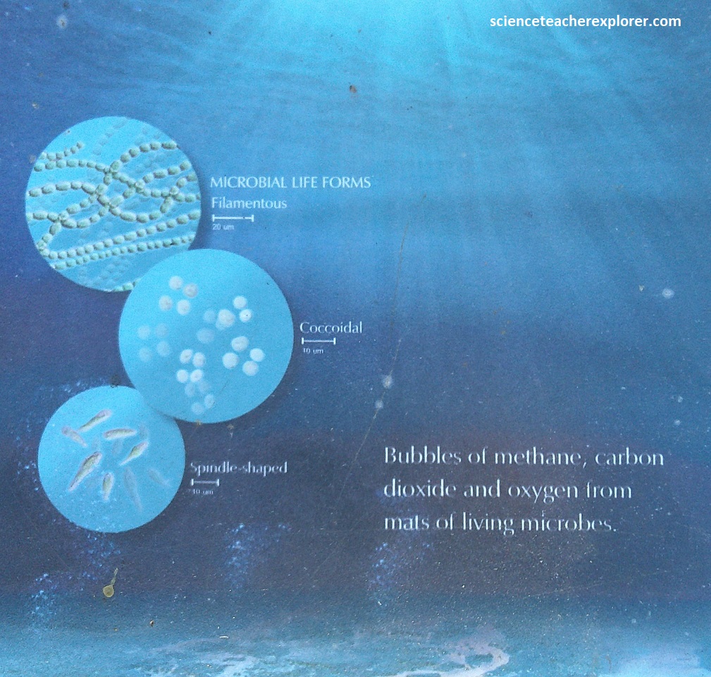
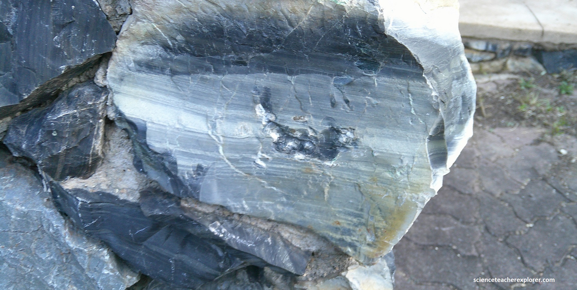
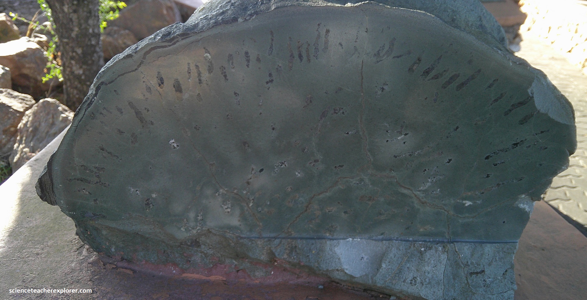
The Earth’s thick (130m) sediments of the Dycedale Syncline tell a story. They record a change in ocean level. They first record the flash floods that washed thick layers of gravel from the mountains to the sea. Then, they tell of a time when the Moon was much closer to the Earth, so tides were higher and may have flooded and exposed vast areas of sand and mud flats several times a day. On these current-swept, sandy expanses, crinkly layers of bacterial mats grew over the sediment, stabilizing sand and mud and helping to build the land. {Note: the pictures below are of rocks found at Geosite #5, representing biomats that are 3.2 billion years old.}
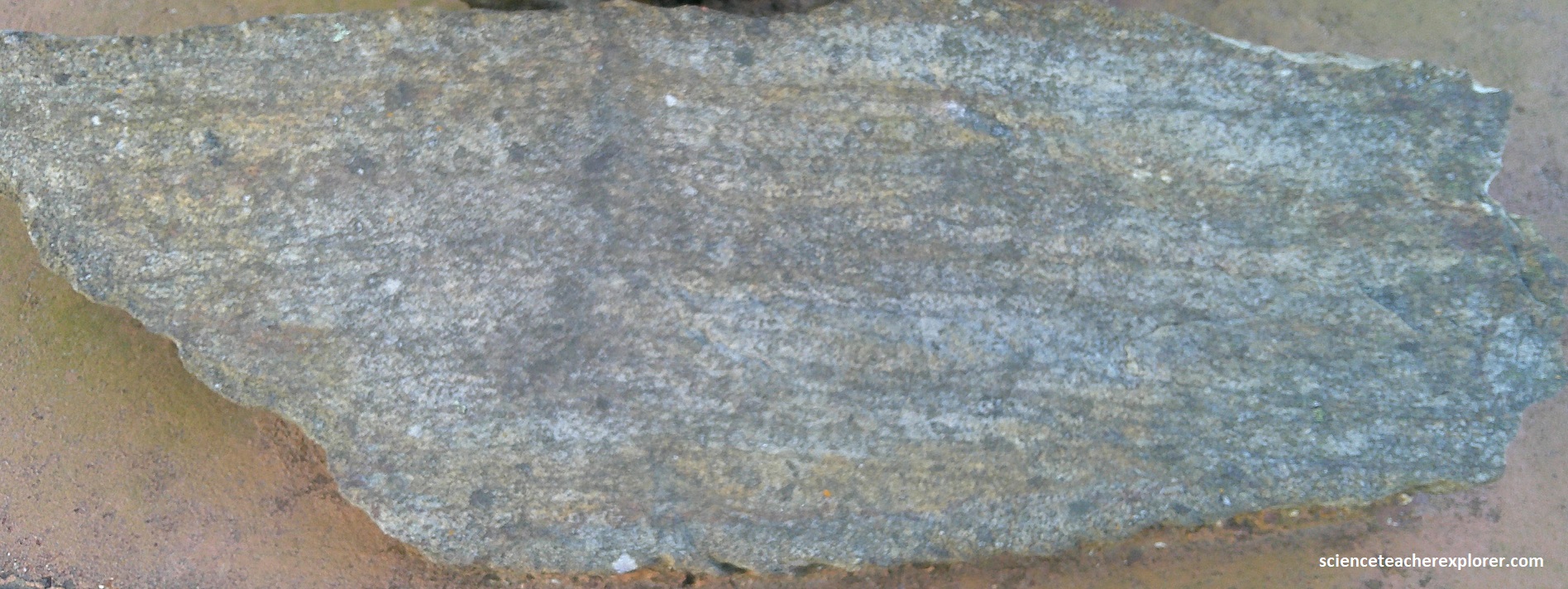
Picture above on the Geosite #5 rocks, the crinkly dark lines are fossilized biomats, formed by tangled threads of single-celled organisms. This shallow-water life is some of the earliest found on Earth. the mats withstood radiation, currents, moving sand grains, and drying-out. We are sure how they functioned, but it is reasonable to think that they used light for energy, just like today’s plants. This process produces oxygen which may have caused the bulbous dome in the biomats. They extend more than 11km through these rocks, indicating that these shorelines were extensively colonized by living organisms. [Note: The process of photosynthesis, by which green plants use light to produce sugar for energy and give off oxygen is considered to be the single most significant event in creating conditions for life as we know it].
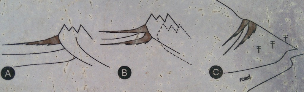
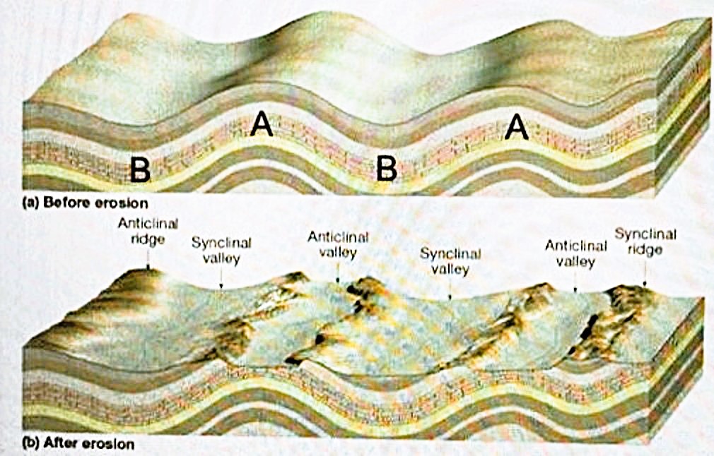
Around 3.22 billion years ago, enormous drifting land-masses collided, folding the volcanic rocks and sediments into a mountain range we call the Barberton Greenstone Belt. The Dycedale Syncline clearly shows the shape of this folding. Synclines and anticlines are large folds that show just how much these ancient rocks have been deformed. Faults are places where the pressure became too great; the layers broke and the parts slid apart. {Image below are images of Site 1, (the Dycedale Syncline), found on an interpretive sign on-site}.
The photo below is of an aerial image of the Dycedale Syncline:
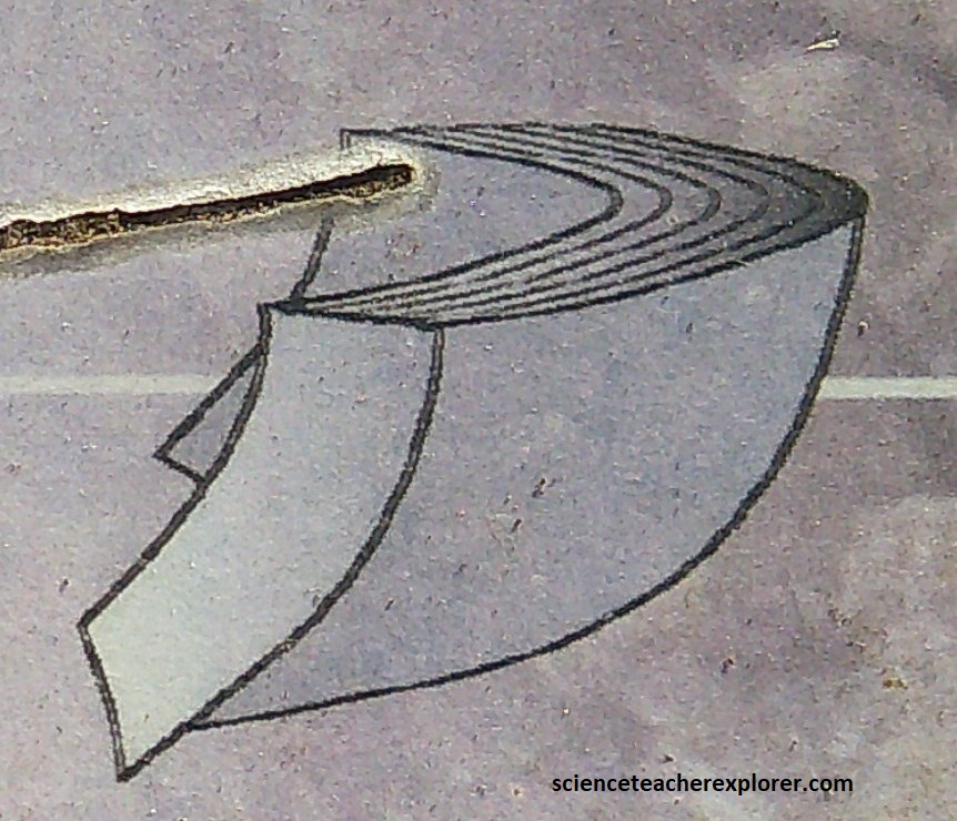
The beauty of the syncline is that it is neatly folded, like a tightly folded stack of papers into a U-shape. Geologic force first folded the layers and later tilted them almost vertically.
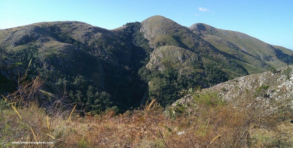
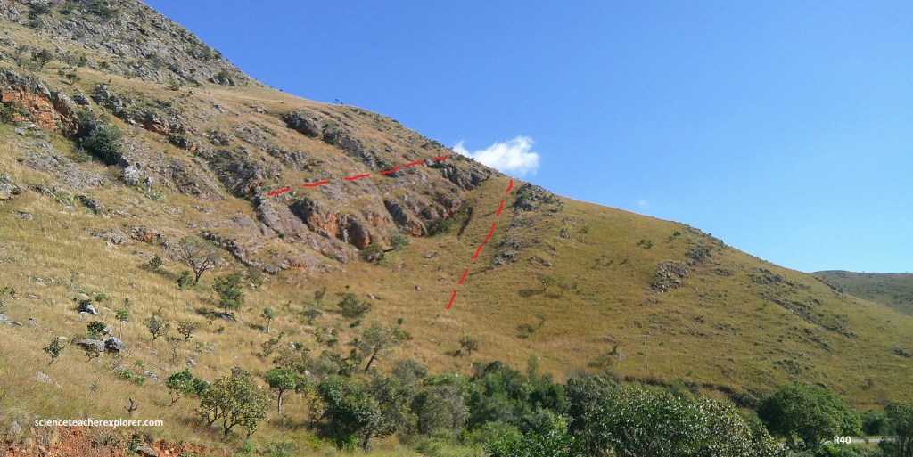
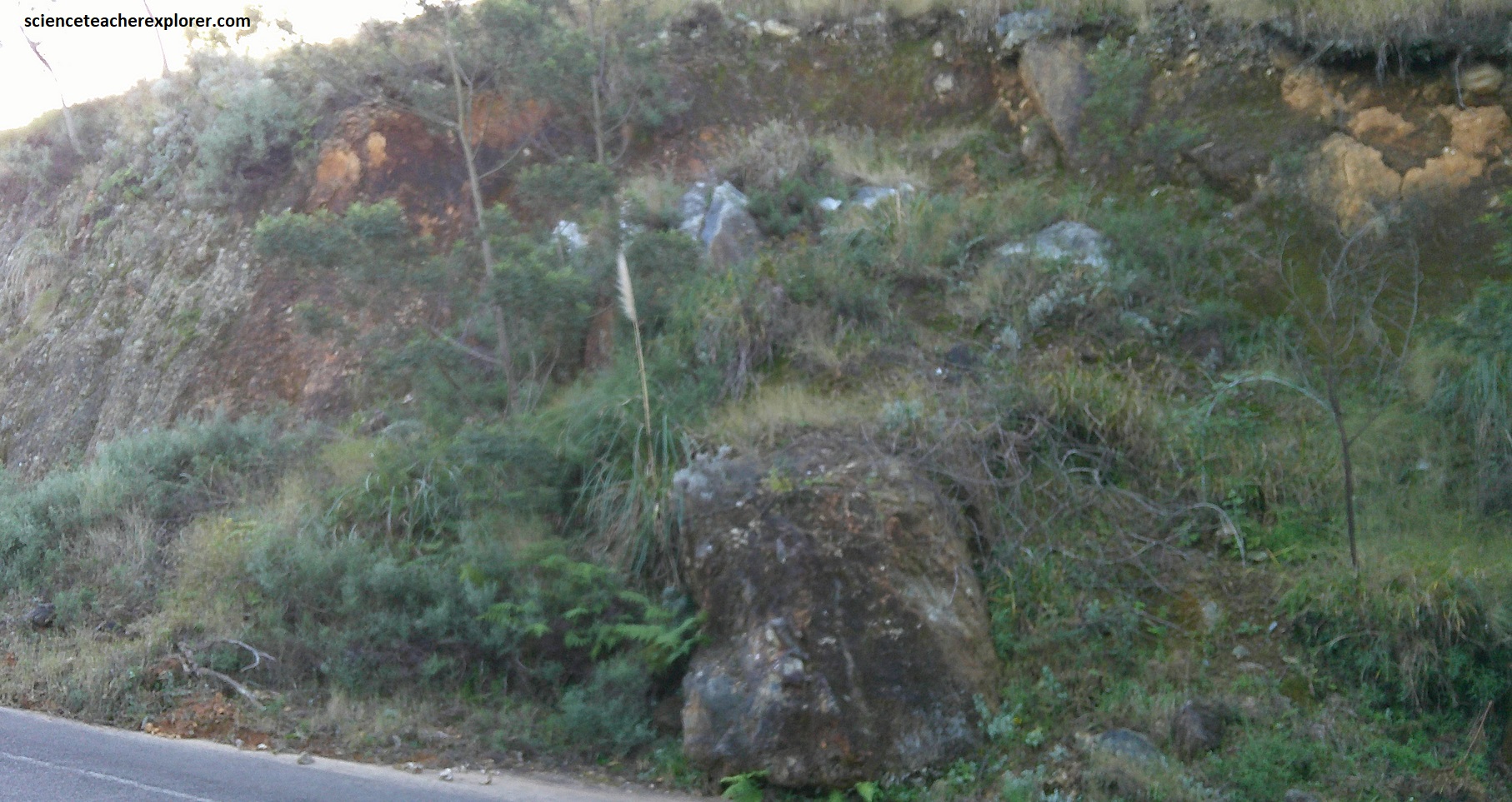
From Geosite #5, we continued driving south on R40 to Geosite #6, (the Painted Quarry), 15.4km away. Along the way, we passed the axis of the Saddleback Syncline and the axis of the Onverwacht Anticline, (pictured above). The Onverwacht Anticline is a vertically-plunging anticline that is the dominant structural feature of the Barberton Greenstone Belt. In the Onverwacht Anticline, the limbs dip away from this axis to the north and south. Pictured above is the anticlinal valley that formed when the surface of the Earth erodes along the crest of the anticline. (Refer to the diagram below). Note the oldest rocks are found near this Anticline axis.
More than four billion years ago during the Hadean, the Earth’s boiling ocean cooled. During the Archaean, the temperature may have fallen to around 350C. Today, the average is 200C. The chemistry of the ocean is rally the story of life; life forms both responded to, and also caused, changes in the chemistry of the ocean and the atmosphere by producing oxygen. {Note: Carbon dioxide from the atmosphere made the Archaean ocean a weak acid with little or no oxygen. This caused the dissolved chemicals in the ocean of the Archaean age to be different to present.}
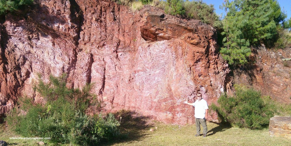
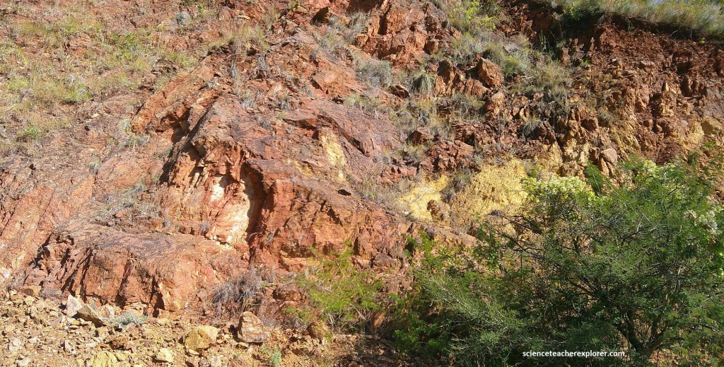
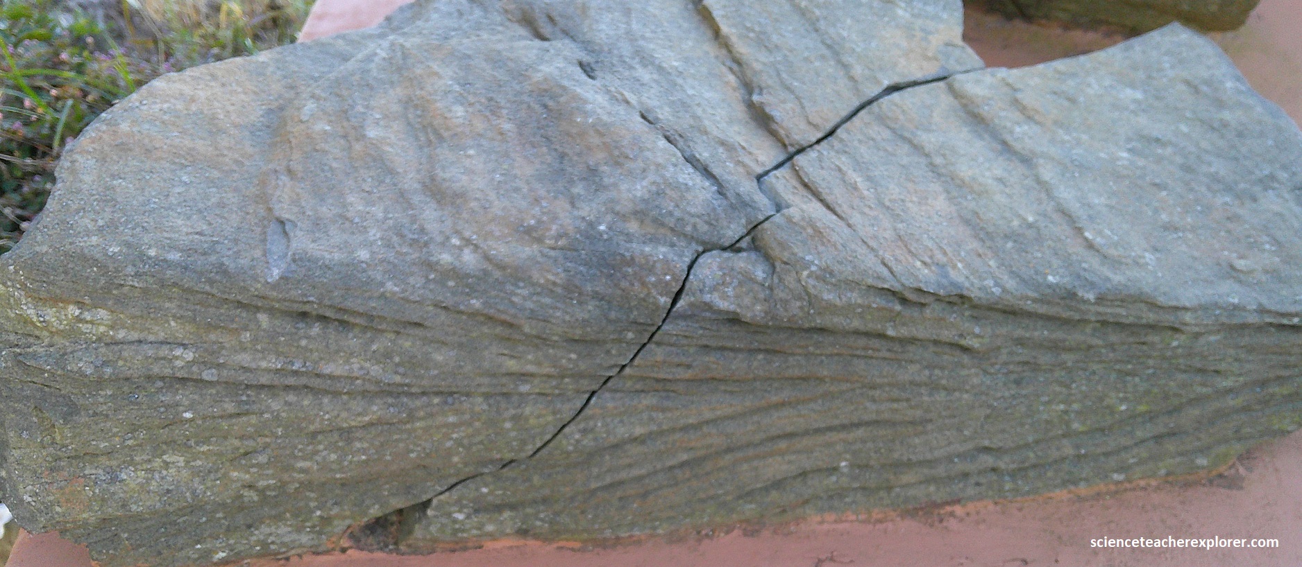
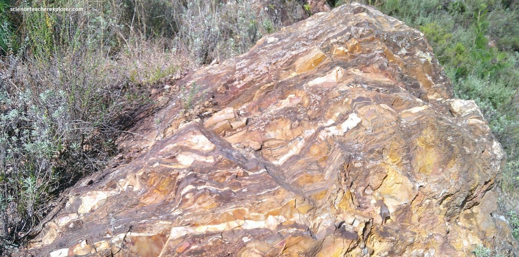
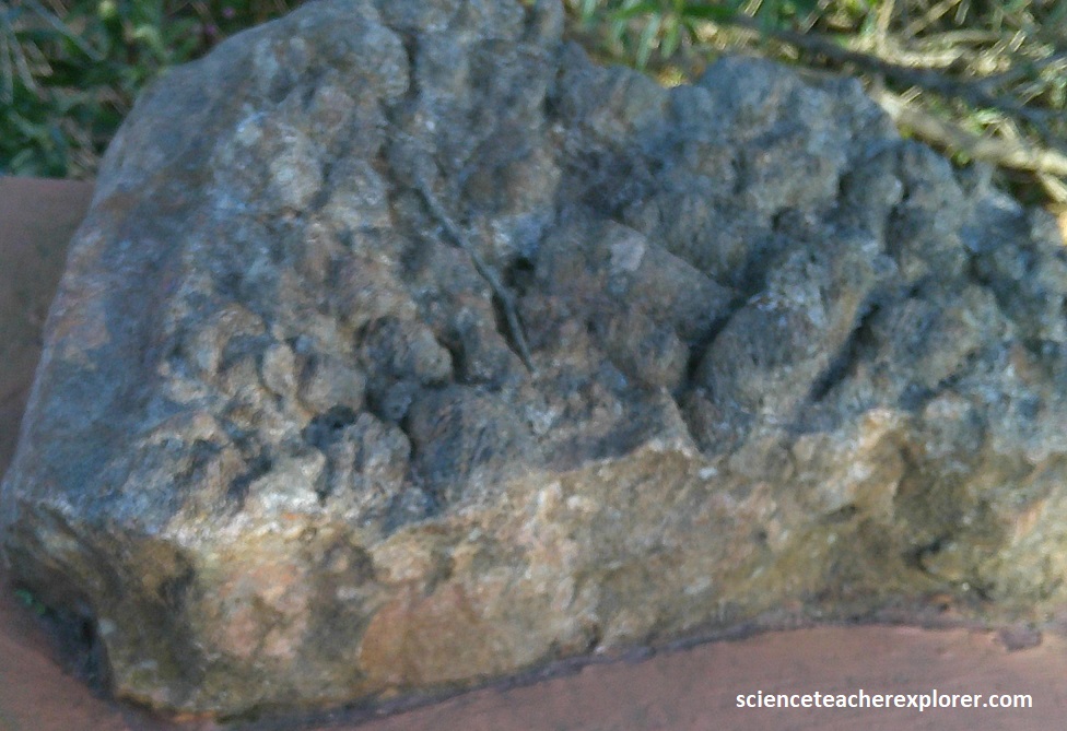
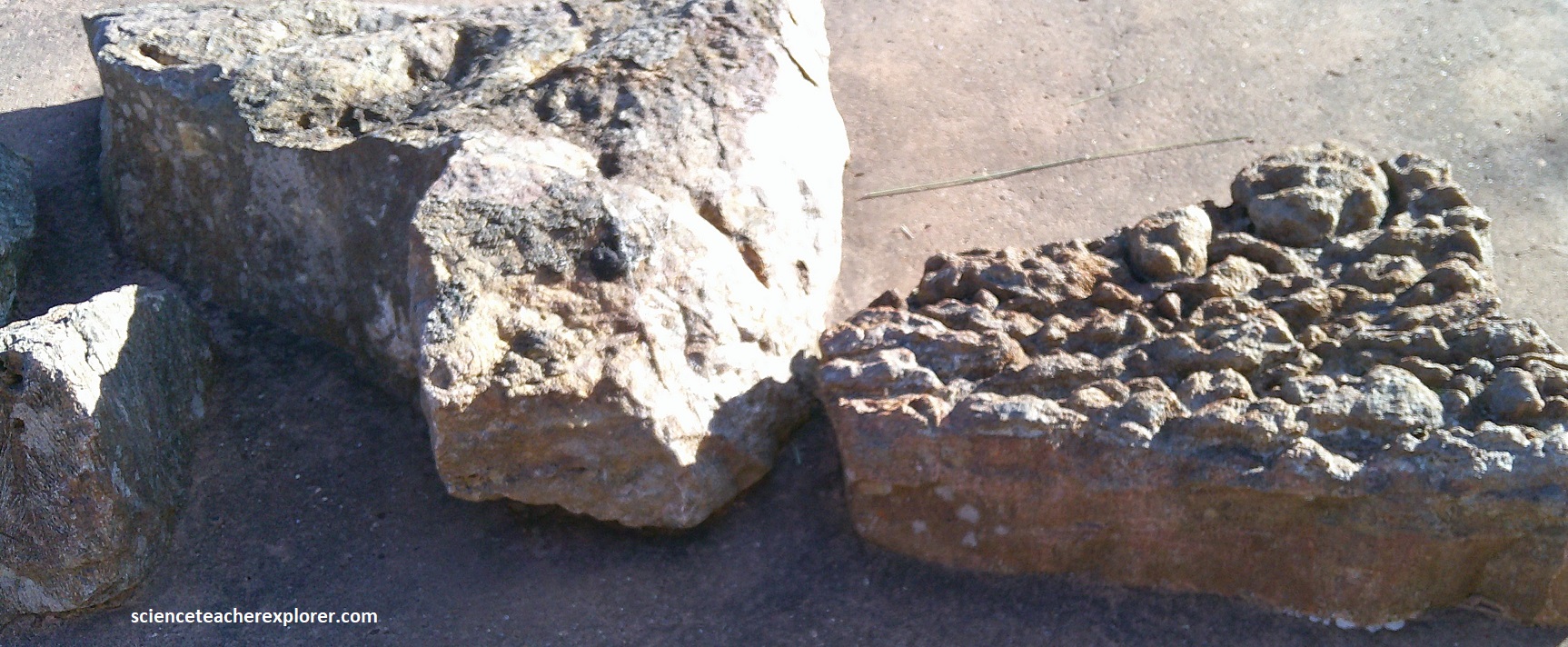
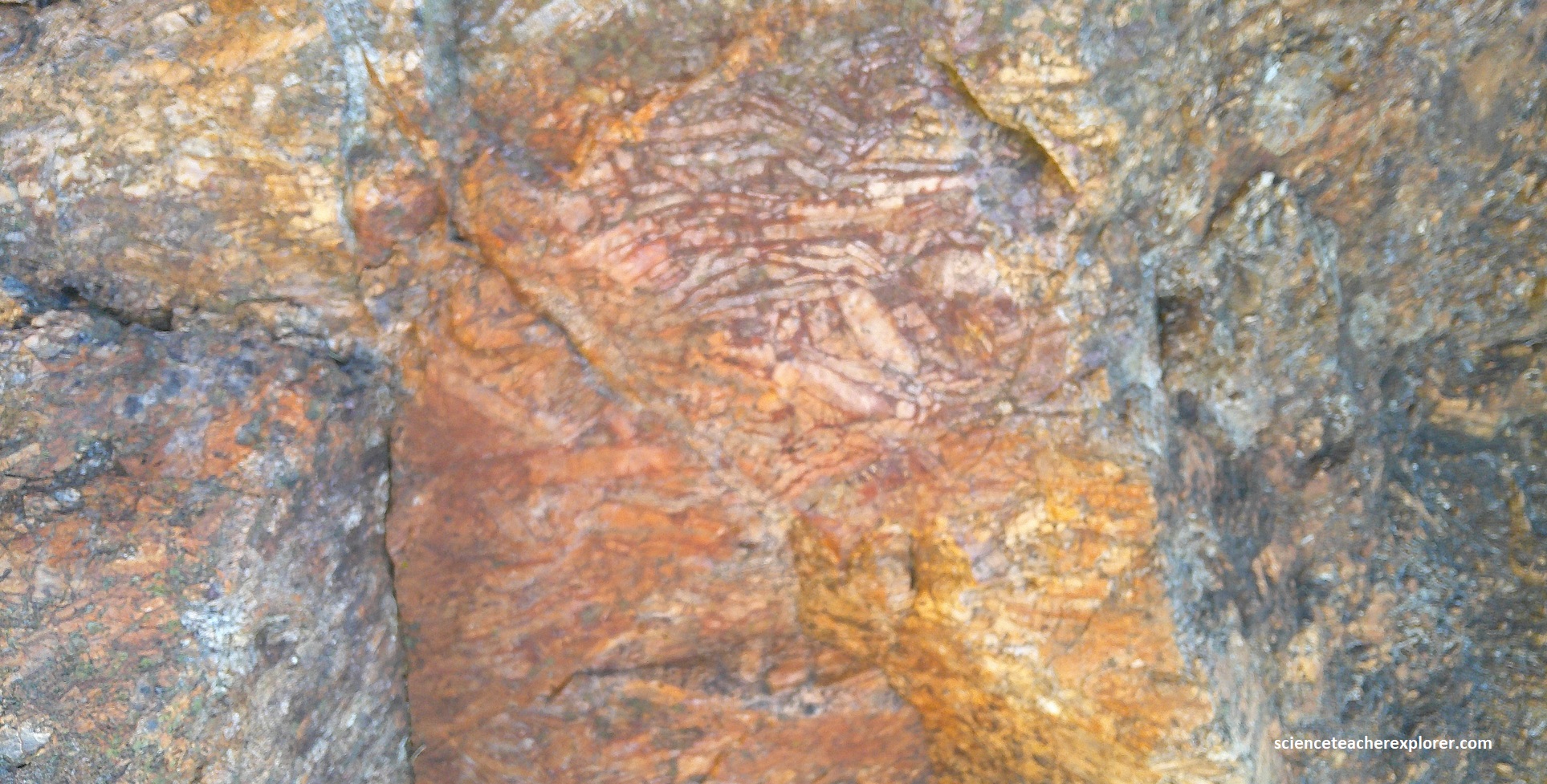
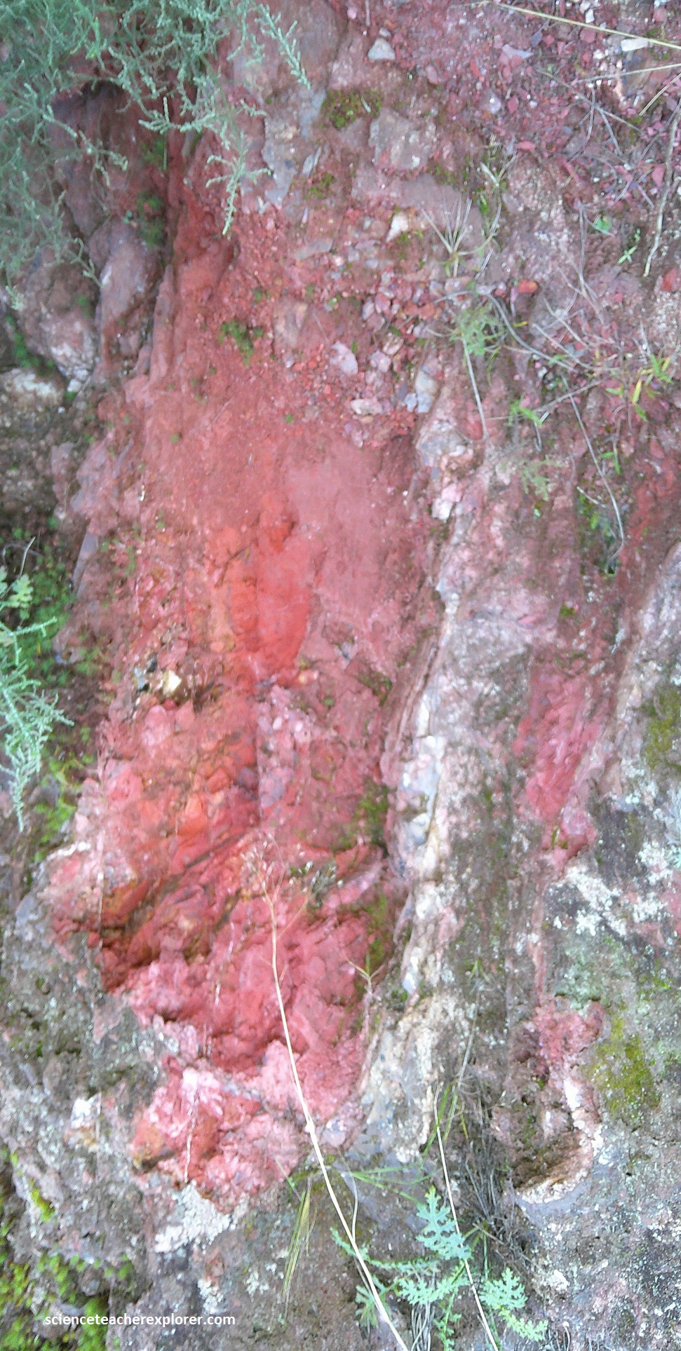
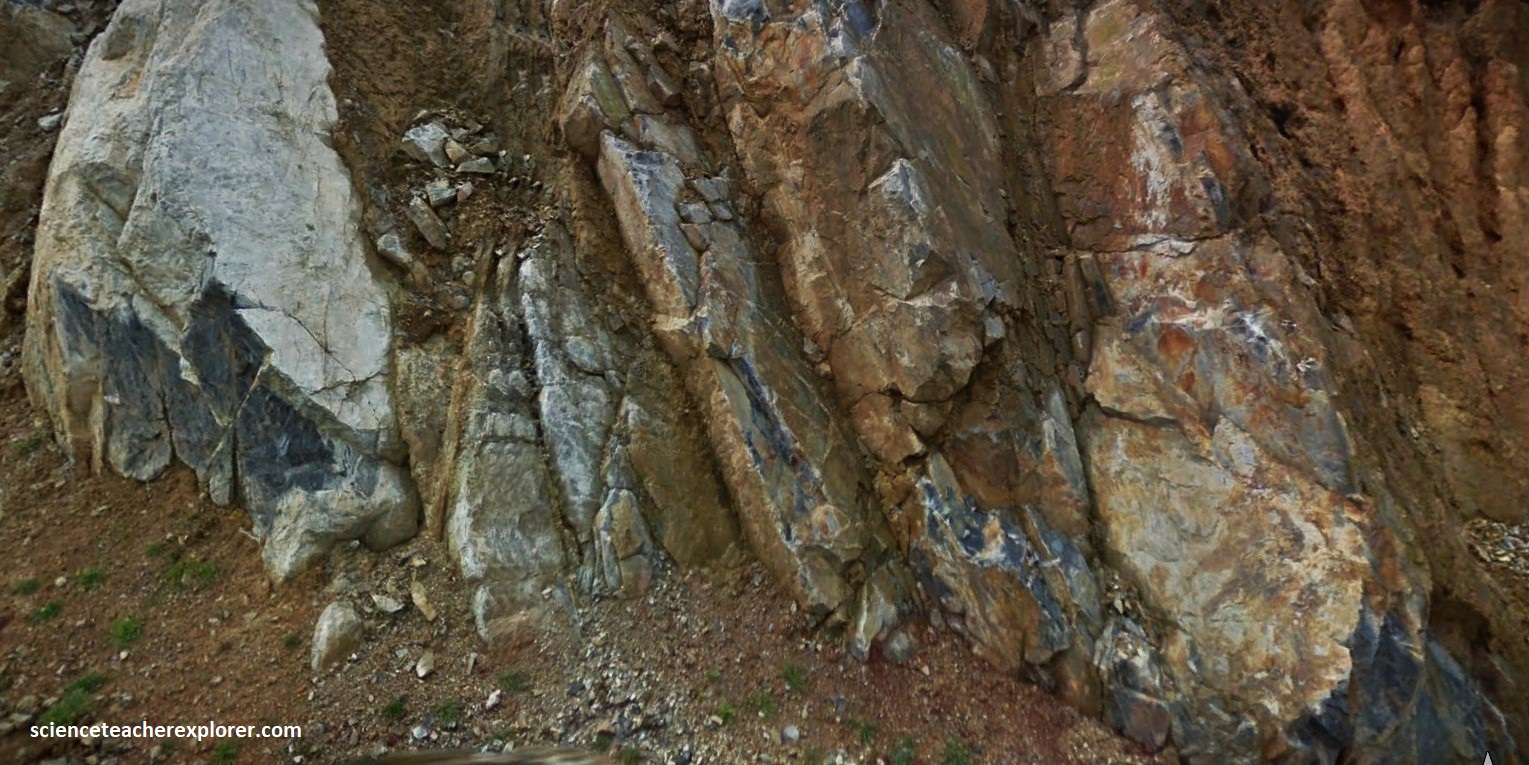
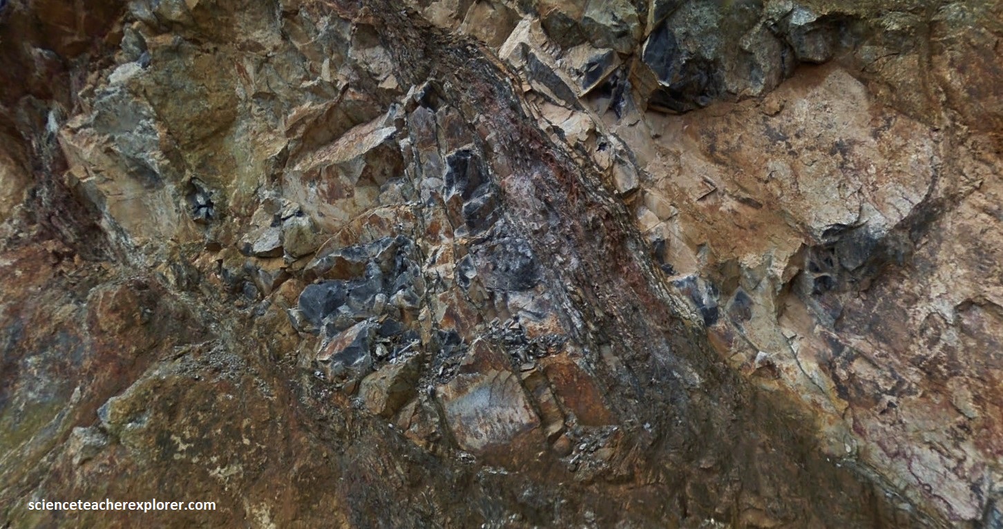
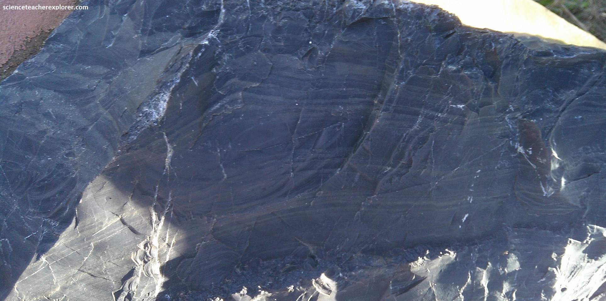
At Geosite #6, the Painted Quarry contained tightly folded & banded, colored, ferruginous Fig Tree chert, formed as a chemical precipitate in deep water.
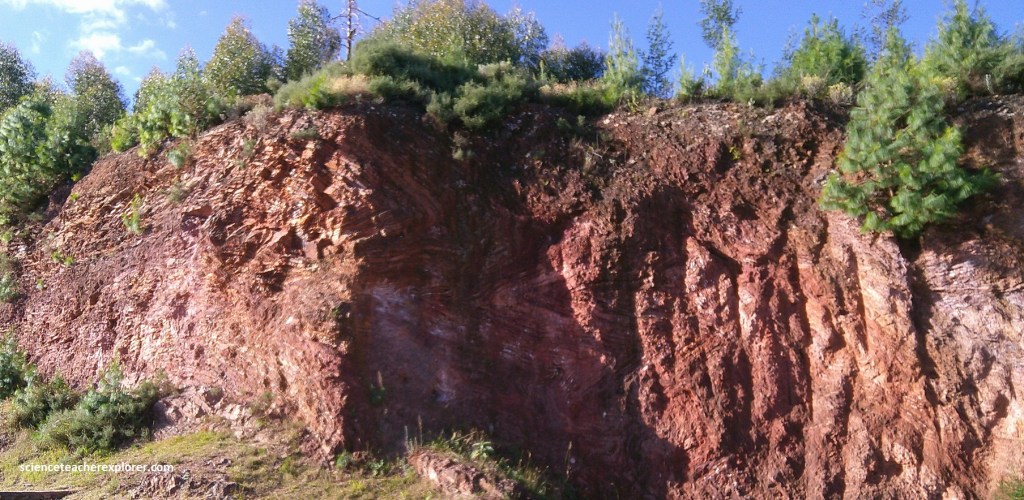
This rock is a layered mix of chert, volcanic ash and shale sediment, some stained red by iron. It formed on the floor of an ancient ocean more than 3 billion years ago.
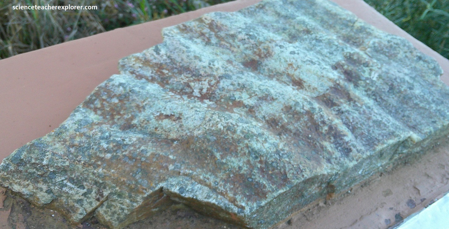
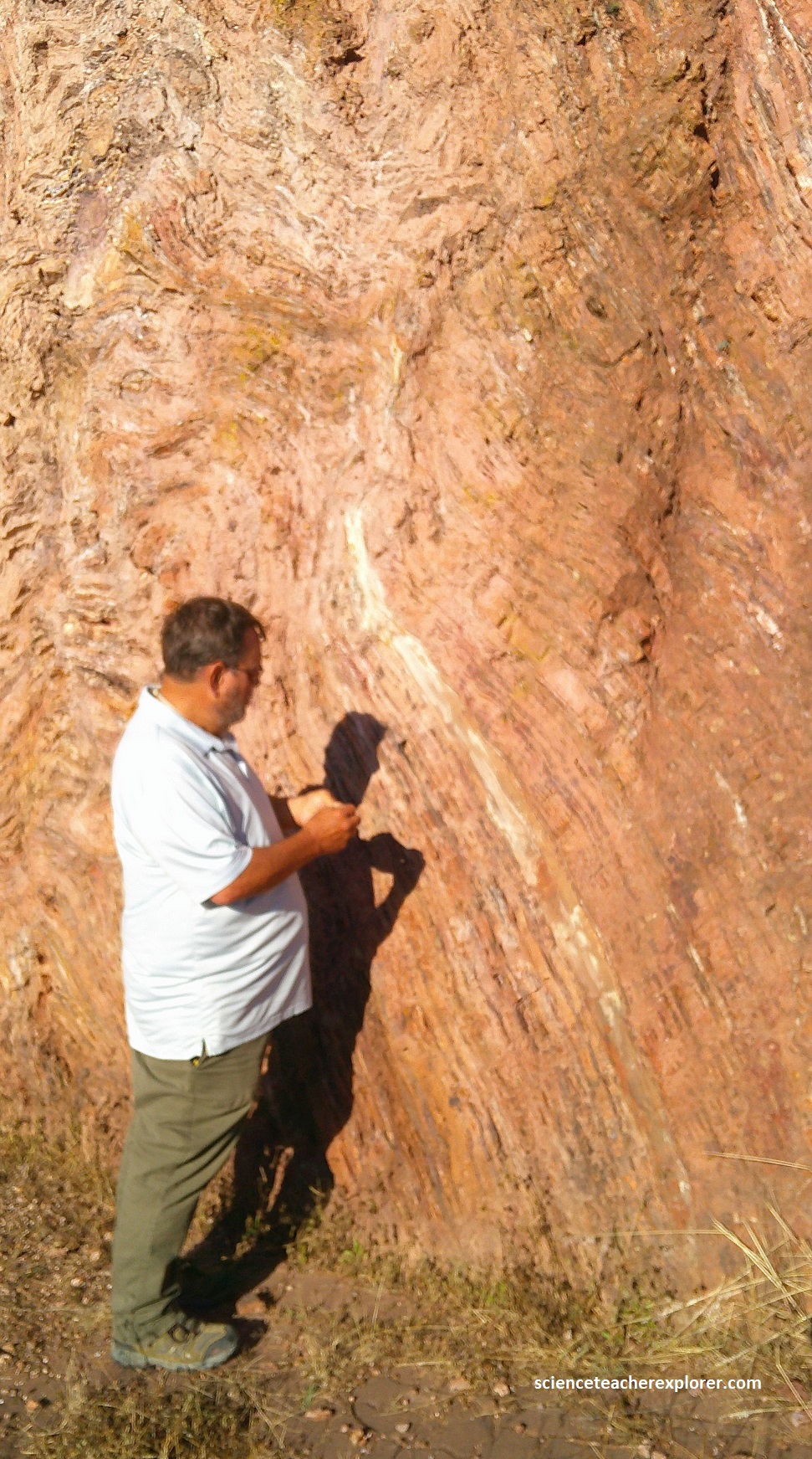
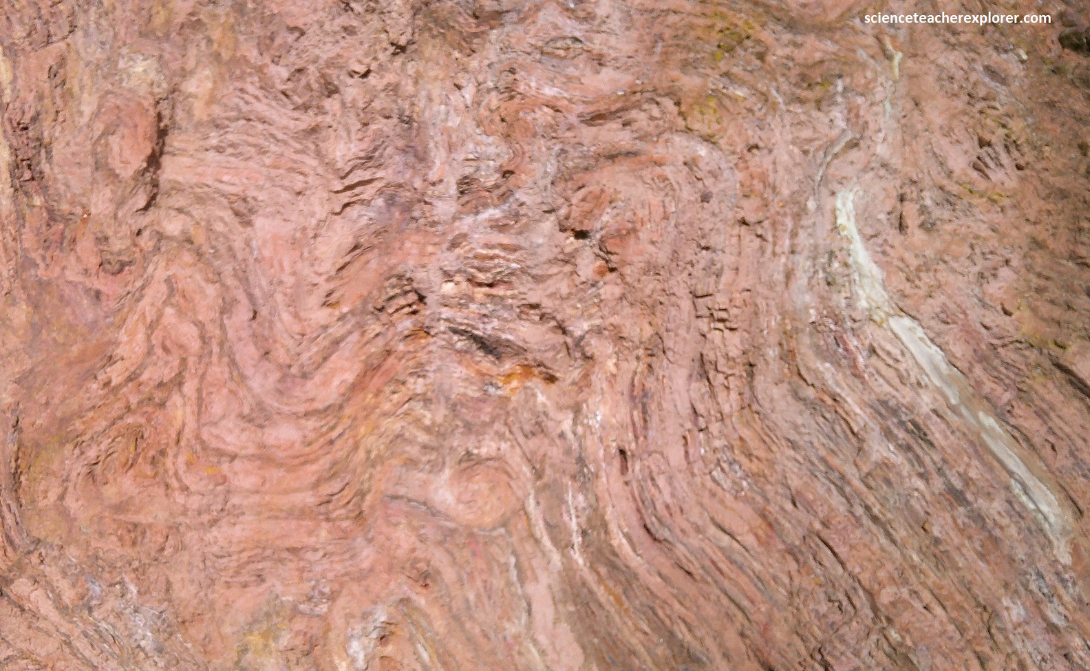
The tight folds in the rock-face at the Geosite #6 were made possible because they formed very slowly when the rock was hot and pliable like thick toffee. Some rocks, like the sandstone boulder pictured below, are made of tiny grains that slowly become compacted as they are buried; but tiny pore spaces and interconnected channels between them remain. Water can flow through these space and be held there. The rock is like a giant sponge.
Picture above, the patterns on this boulder were created by seasonal fluctuation in the water table, causing fluid in the rocks to move up and down very slowly over tens of vertical meters. These warm fluids contained a lot of substances such as iron, manganese, calcium, barium and potassium that combined with carbonate or sulphate. They were deposited around the grains and along fractures when the fluid cooled or receded. In some rocks when this process is repeated many tiny, beautiful patterns called “Liesegang rings”. {The Painted Rock boulder and rock pictured above, are found at the Painted Quarry 2025}.
Pictured above, Baryte forms blade-like crystals when it leaves and forms a solid. Baryte in the Barberton Greenstone Belt formed about 3.24 billion years ago. Dissolved barium seeping through cracks in the floor of the Archaean ocean probably combined with the volcanic sulphate from the atmosphere.
Imaged above, just as salt crystals grow in salt water, the barium crystallized and formed blade-like crystals that grew into crystal lawns and cauliflower-like masses. Over time, these were broken by wave action, became buried in sand and mixed with other grains. {Note Baryte is immensely heavy and amongst many other industrial uses, it is used to weight drilling muds in the oil industry in order to prevent blow-outs}. [The photos below are of Baryte rocks found onsite at the Painted Quarry].
Pictured above, crystals of baryte grow in layer on the sea floor forming these baryte rock samples. Baryte forms with different kinds of crystals; crystal blades, (of which this rock was made), desert rose, and sometimes, when trapped in a gas pocket, beautiful individual crystal specimens. Note that Baryte is opaque to X-rays and so is used to show the digestive system tissue, which does not normally show in X-rays.
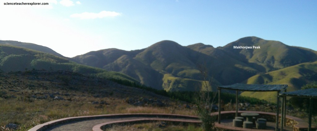
Our next stop was 1.7km further down the road of R40 called the Makhonjwa/Lebombo view, (Geosite #7). It was a spectacular view-site with additional rock-specimens occurring all along the Geotrail. We were now in the midst of the Makhonjwa Mountains, (named for Makhonjwa peak, “The mountain one must not point at”, for it would bring bad luck), running roughly north-east to south-west in four ranges, (paralleling the Onverwacht Anticline axis).
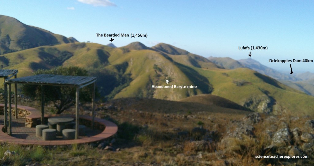
The Makhonjwa Mountains is known as the Barberton Center of Plant Endemium, one of only a few such centers in South Africa. More than 70 plant species that occur nowhere else have been found here. These plant grow on serpentine soils rich in mineral toxic to plant. The many nature reserves and heritage site in the area protect these species. The Bearded Man is a mountain situated on the border between South Africa and the country of Eswatini (formerly Swaziland). Driekoppies Dam is an earth-fill dam on the Lomati River in Mpumalanga, South Africa, constructed in 1998 primarily for irrigation, with some of its reservoir extending into Eswatini/Swaziland.
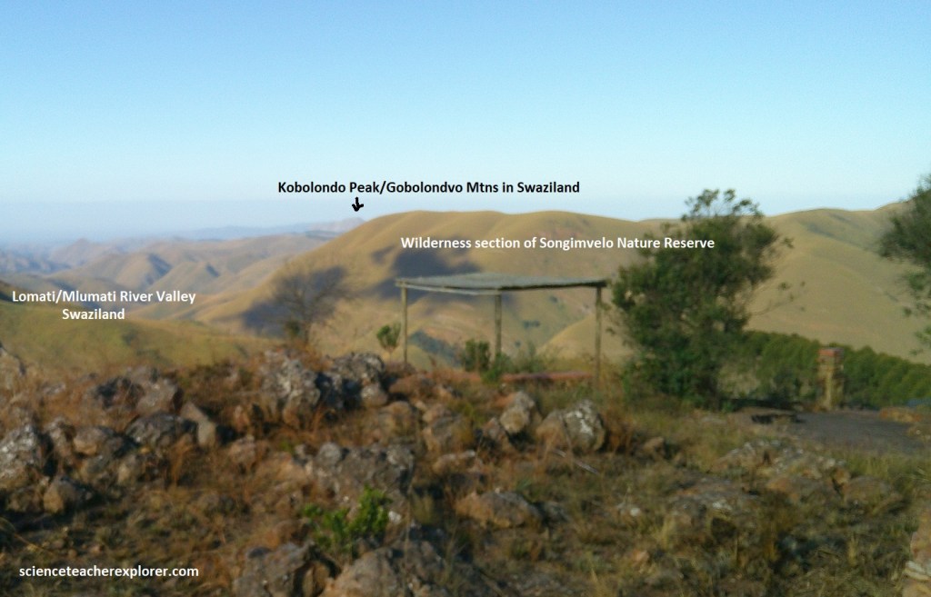
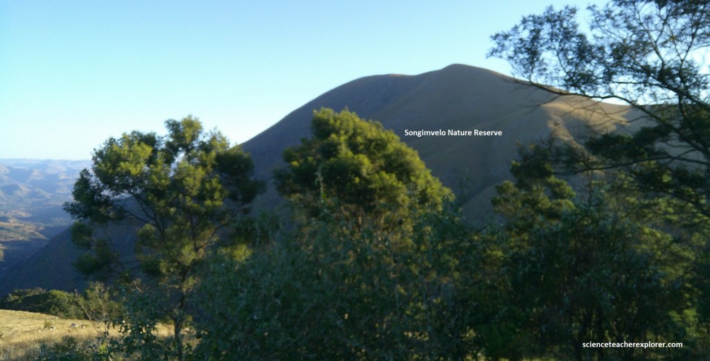
The Songimvelo Nature Reserve is approximately 490 km squared, in size. Which makes it the largest Provincial Reserve in South Africa. The broken landscape, several Waterfalls and spectacular Gorges of the Komati, Msoli and Lomati Rivers makes this Reserve one of the most diverse and aesthetically attractive wilderness Areas in the Country. Since it was proclaimed in 1983, more than 20 species of large herbivores have been re-introduced to Songimvelo. The Reserve provides an extensive Habitat for Elephant, White Rhino and the largest population of Buffalo! In addition to the above, 23 fish species, 50 reptile and amphibians and 330 bird species have been recorded in the Reserve, including some Endangered species! Songimvelo Game Reserve is considered to be the Area with the highest recorded plant diversity in Mpumulanga with more than 1440 species already identified.
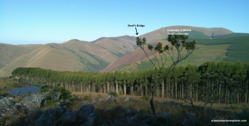
The Devils Bridge is a 3m wide natural rock pass on the old bridle trail between Swaziland and South Africa. In keeping with the wild times of the period, in the early 1900s, two prospectors fought a gunfight on the bridge to resolve a 10 year-long feud. The cause of the feud is unknown but both men died as a result of the shoot-out.
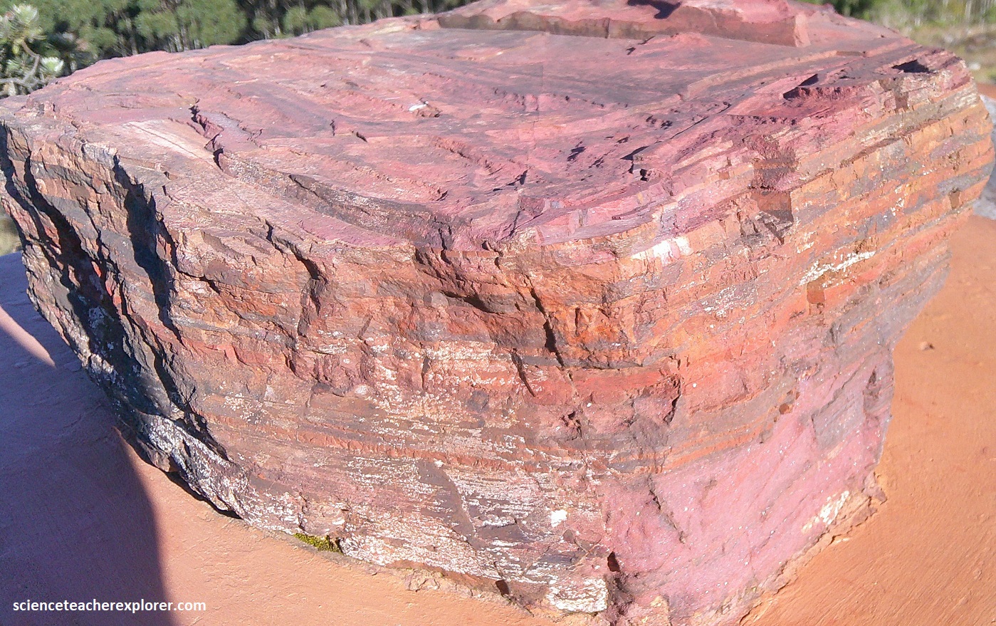
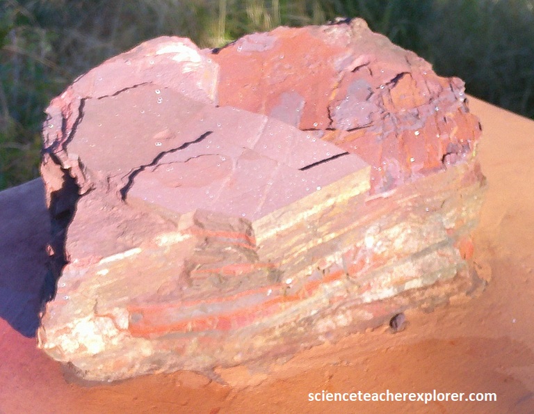
Continuing onto to Geosite #8, (Tsunami Conglomerate). {The pictures above were taken at Geosite #8 with my trekking buddy, Tracy Davis, in 2025} This site of consists of Fig Tree pink shale, banded chert and reddish iron oxide in an angular conglomerate. The tight folds were possible because the rock was still soft and pliable when the Earth’s forces folded the layers.
Pictured above, banded ferrugious chert varies from thin, tightly-folded strata to thick, and rigid plates. The bands are layers of iron-oxide-stained sediment, chert and volcanic ash. The chert here varies in color from white/cream, red, grey and black.
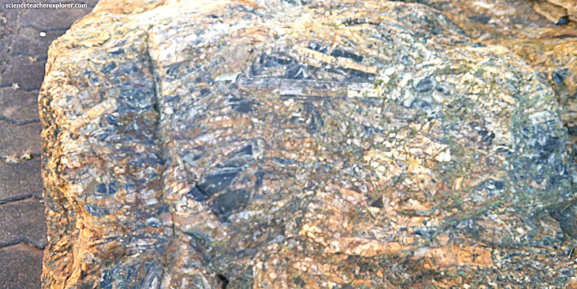
Pictured above, this rock type is a conglomerate, a sedimentary rock formed from rock fragments (clasts) cemented together by a much finer rock. The story of this rock formation & boulder, begins when a bed of chert, which had formed in a thin layer on the sea floor, was shattered by a violent event such as an earthquake, volcanic explosion or perhaps a meteorite impact. This event caused an immensely powerful, deep water current that swept the fragments hundreds, or perhaps thousand of meters into a sea-floor depression. The debris settled in layers into the ooze in the bottom of the depression, where large fragments are at the bottom and small fragments at the top. Over time these were compressed and cemented into this deposit & boulder found at Geosite #8.
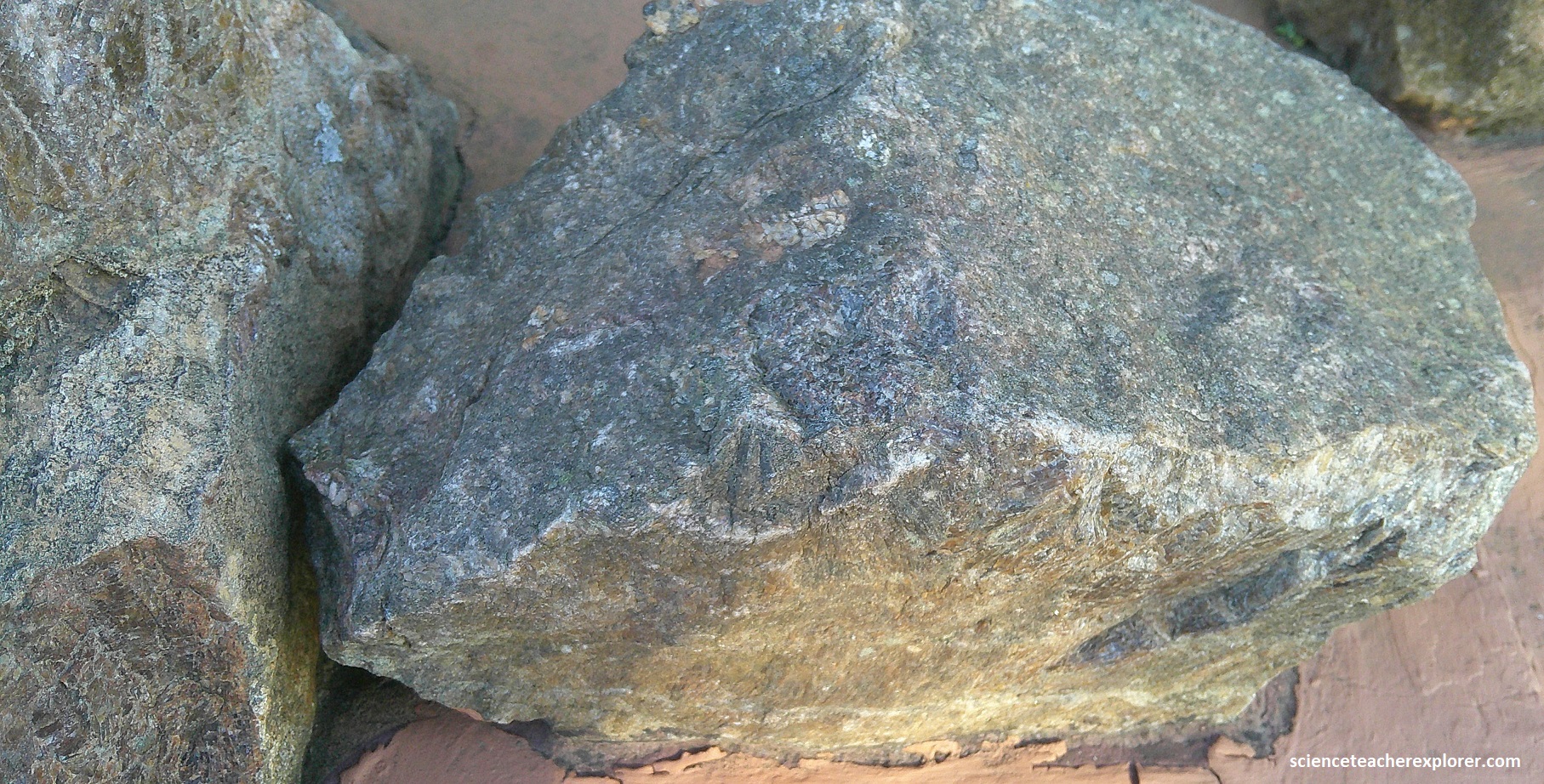
We continued 1.5km onto Site #9, (the Banded Ironstone site). Picture above are the Jasper-rich Fig Tree banded iron formation road cut, with minor chert and volcanic tuff present. Around 3 billion years ago, there was no breathable oxygen in the air and none in the warm ocean. Because of this, great quantities of iron were dissolved in the water.
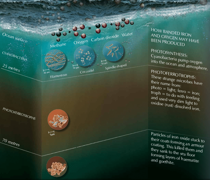
We are not sure how oxygen appeared in the ocean. It may have had a volcanic origin, or perhaps UV radiation produced oxygen in the atmosphere. Perhaps cyanobacteria near the surface produced it by photosynthesis, just as green plants do today, or maybe specialized floating microbes used sunlight to take oxygen from other molecules. It may have been a combination of these processes. However it was produced, oxygen combined with dissolved iron to form iron oxide (rust). Innumerable tiny red flakes floated down to form layers on the sea floor creating the banded iron formations. {The pictures below are two rock samples of Banded Ironstones found at Geosite #9 in 2025}.
Pictured above, the banding in the ironstone may have been caused by periodic change in temperature. Bacteria were active when it was warm and so oxidized lots of iron. When it was cold they slowed down or even switched to feed on other dead bacteria drifting down into the depths. When this happened, silica-rich chert was laid down. This was repeated over and over as the climate changed.
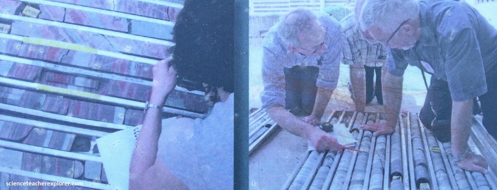
How banded iron layers form is hotly debated. Picture above, to obtain fresh and continuous rock, a drill-hole more than 500m deep was made a few hundred meters from Geosite #9 in 2011. As scientists study the distribution of minerals and elements in these strata in detail, they will learn more about the early ocean, atmosphere and life on our planet.
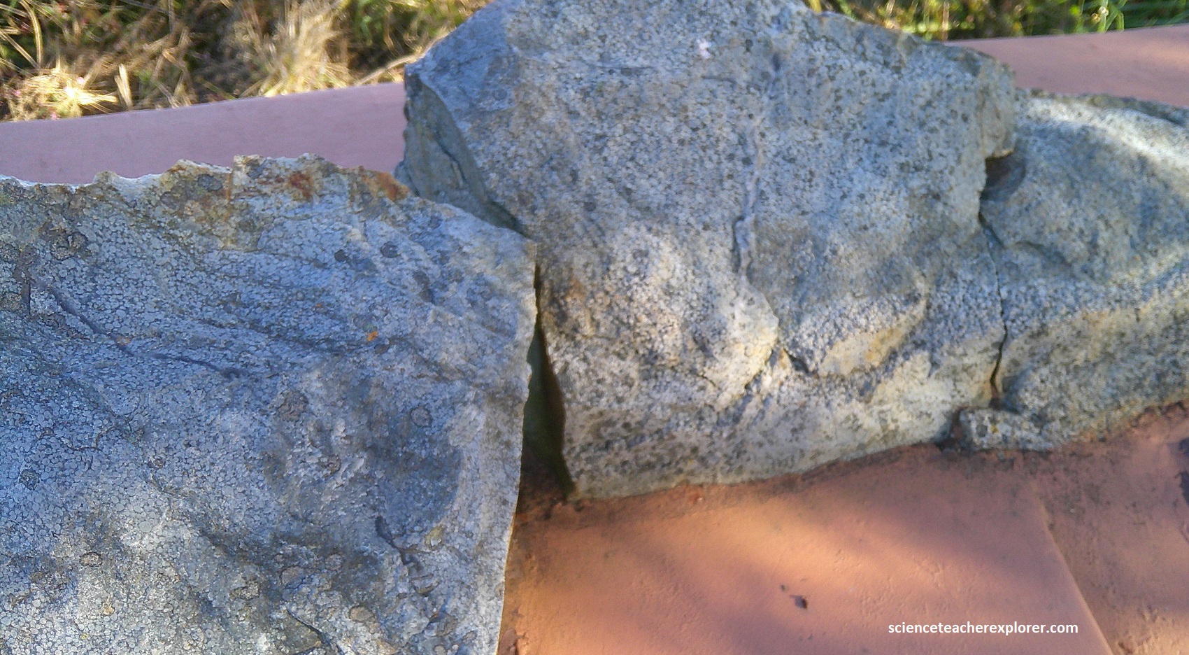
Geosite #10 was another 7.1km away to the south. It was call the Volcanic Lapilli and Black Chert site. There we found a road cut with Onverwacht rocks showing grey chert with small volcanic ‘hailstones’. We also found banded black-chert that contained the fossil kerogen.
Life evolved from tiny individual cells. Imagine them as primitive, living machines that absorbed energy from their environment to produce cell material that grows and multiplies in a controlled way. There was little competition and new life forms could spread very quickly.
This black chert, found at Geosite #10, is about 3.3 billion years old. It is a sedimentary rock formed in shallow water from silica and carbon-rich mud. It’s color comes from “kerogen”, a mixture of different kinds of carbon including the remains of dead microbes that floated gently to the sea floor as marine snow. Imaged above, microscopic fossils in this black chert, shaped as spheres, long threads or spindles, may be among Earth’s earliest preserved life forms. Almost all significantly older fossils if they ever existed, have been destroyed by heat and folding. {The first three pictures below are closer views of the Banded Black Chert found at Geosite #10}.
Also found at Geosite #10, are rock samples of ocean sediment that contain “Volcanic Lapilli”, (pictured below). [Note that Volcanoes that push above the surface of the ocean and erupt explosively into the air are called “stratovolcanoes”. They may blast cubic kilometers of solids into the air; from blocks as large as a car to a very fine, abrasive ash]. Particles found 2mm and 64mm in size are called “lapilli”, (Latin for “little pebbles”). These are formed when wet ash particles in a volcano’s turbulent ash cloud stick together to form spheres that fall to Earth. These fell into the ancient ocean and were preserved in ocean sediment, (found in the rocks pictured below). {Note: The volcano image seen below was taken from an interpretive sign on-site}.
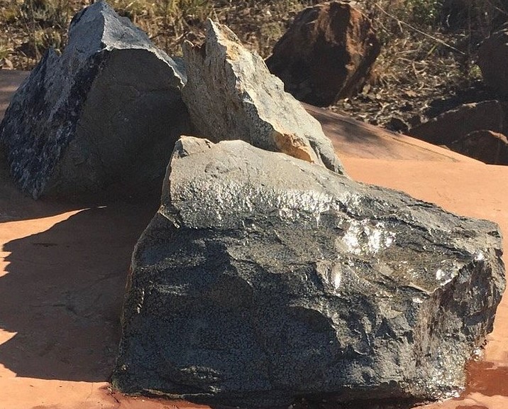
Another 0.3 km down the road on R40, brought us to Geosite #11, (Msauli/Bulembu View). This place had two roadcuts that contained “Pillow Lavas”. My photos were a bit too dark, so I used two better-photos from an earlier-view on “Google Earth”, (pictured below).
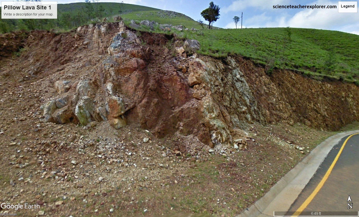
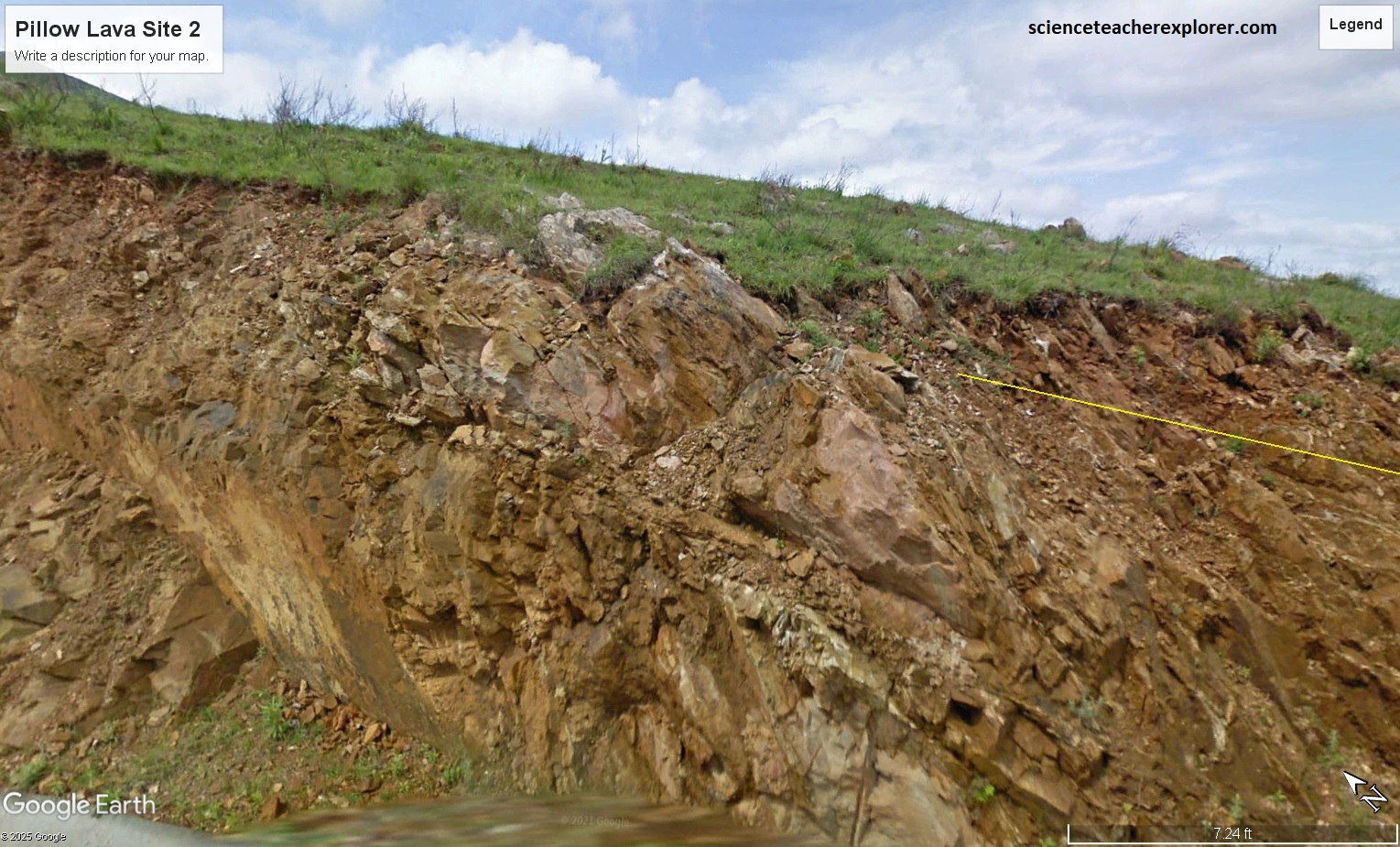
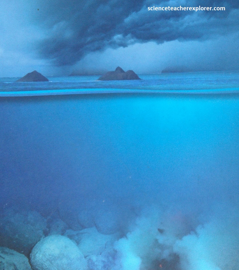
Pillow lavas were formed under the sea when red-hot molten lave flowed out of the ocean floor. The water, perhaps 1,0000C cooler than the molten rock, froze a glassy crust around the lava which grew into a balloon of molten rock. The lava balloon grew as more lava poured into it. It may have split and healed many times. Finally, when the lava flow stopped or found another outlet, the balloon cooled to form a rounded pillow, (pictured below). Pillow lavas may form stacks that are kilometers thick. The process continues on the ocean floor today where the plates of the crust are moving apart. {Note that the artist’s depiction of the formation of “Pillow Lava”, was taken from an interpretive sign on-site.}
Also at Geosite #11 is the spectacular Msauli/Bulembu Viewpoint. Pictured below, this viewpoint is found along the Bulembu Pass and within the Msauli Valley region.
Pictured above, two asbestos mines, Msauli Mine in the Komati/Inkomazi River valley, and the nearby Havelock mine in Swaziland, were in production from 1941-1999, and from 1939-2001 respectively. Two hundred kg loads of asbestos were carried in aerial cocopans from Havelock to the railway at Barberton via the 20 km cableway seen from them to time on our drive along the geotrail. Lion Cavern at Ngwenya Mine in Swaziland, and Dumaneni/Dvumaneni Mine south of Malelane, (similar age), and are considered the oldest known ochre mines. Lion Cavern was mined by the San Batfwa for ochre and sparkling specularite (hematite) for ritual and beautification more than 43,000 years ago.
There is another ancient ochre mine nearby in Songimvelo Nature Reserve. When Bantu people arrived in the area about 400 A.D. , they began mining for iron. Songimvelo Nature Reserve is littered with stone tools that were used about 1 million to 20,000 years ago. The area has extensive ruins, terraces and circular structures of uncertain origin. Most researchers believe these to have been built by the Bakoni people who live today in the Limpopo Province, but others have suggested a link with Indian traders in search of gold perhaps more than 1,000 years ago. Links to these traders are reflected in the Swazi language.